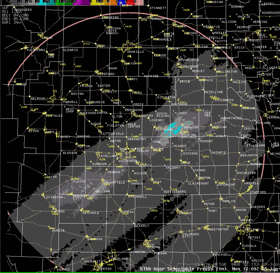
After a very warm start to 2009, a cold Canadian air mass moved into West Texas early on the 4th (Sunday). High temperatures plunged from widespread 70s the first three days of the new year to 30s and lower 40s on the 4th. Though the cold air that invaded was extremely dry, an approaching storm system induced strong southerly winds above the cold dome of air at ground level by late on the 4th and into the 5th (Monday). The strengthening southerly winds eventually began to draw just enough moisture into the region aloft that rain and freezing rain showers developed over the Trans Pecos and southeast New Mexico by late Sunday night. These showers persisted through most of the overnight hours as they raced northeastward over the southeast two thirds of the South Plains, the extreme southeast portion of the Texas Panhandle and much of the Rolling Plains. The below image displays the 24-hour radar-estimated precipitation ending at 6 am on Monday the 5th.
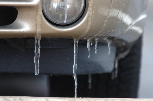
The precipitation that fell was on the light side, primarily due to the limited amounts of moisture available for the approaching storm system to work with and the fast movement of the showers. Most locations only recorded a trace to a hundredth or two of liquid water equivalent. However, one heavier stretch did impact areas roughly from Brownfield to Lubbock to Matador where around five hundredths of an inch was observed, with locally up to a tenth of an inch. Normally these light amounts of precipitation would be little more than a nuisance, but the vertical temperature profile throughout the atmosphere on this morning was just right to produce widespread sleet. Specifically, there was a layer of air slightly above freezing aloft, with temperatures only in the lower to middle 20s at ground level. This caused the snow falling from well up in the cloud to melt, at least partially, as it fell through the warm layer, then generally refreeze in the colder air near ground level before hitting the ground, resulting in sleet. The sleet also mixed with some light freezing rain and snow at times. Initially, the quick shot of sleet, freezing rain and snow produced some damp roadway with scattered slick spots, but with temperatures only in the 20s, it quickly froze resulting in icy conditions for the Monday morning commute. The wintry driving conditions contributed to at least 85 automobile accidents in the Lubbock area alone Monday morning. Thankfully, temperatures rose above freezing by around noon and travel conditions improved dramatically as the ice melted away. |

