Tulia Tornado Damage Survey Findings
(From 21 April 2007 Thunderstorm)
29 Jan, 2009 Update: A 2008 research paper by Blair, et al., examines wind and pressure observations within the tornado vortex. To view this paper, please click HERE.
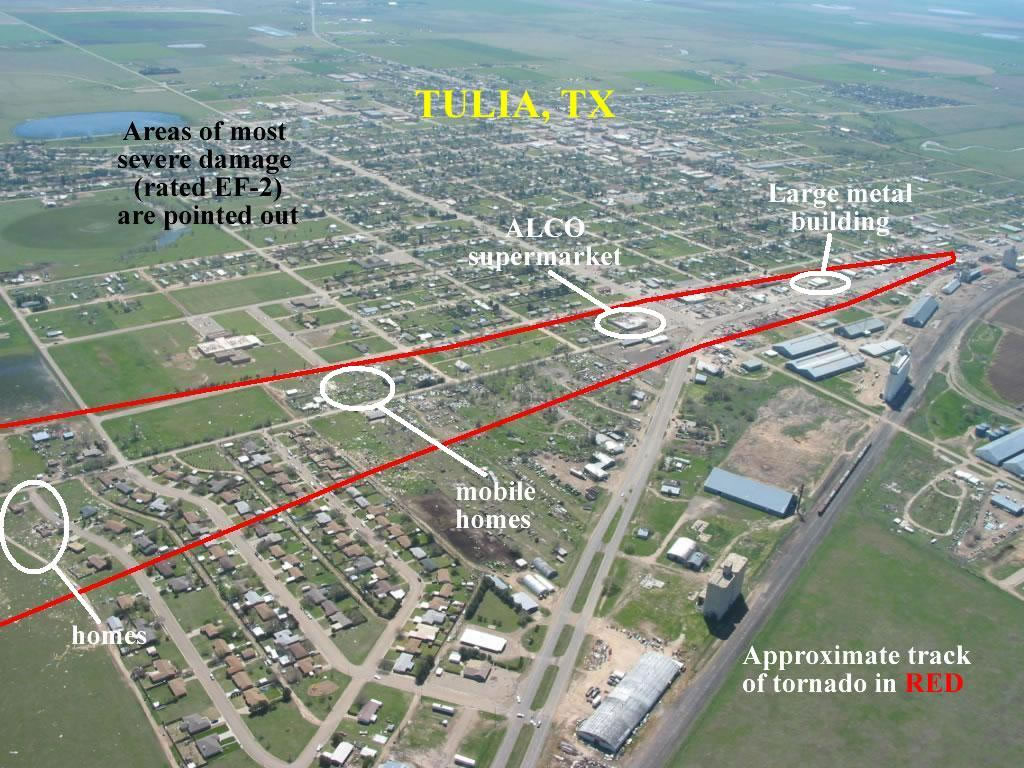
Tornado #3: Tulia tornado
Rated: EF-2 (max winds 125-135 mph)
Path length: 3.5 miles
Max width: 200 yards
Tornado began at 7:57 p.m. and ended at 8:01 p.m. With zero fatalities/3 injuries.
 |
 |
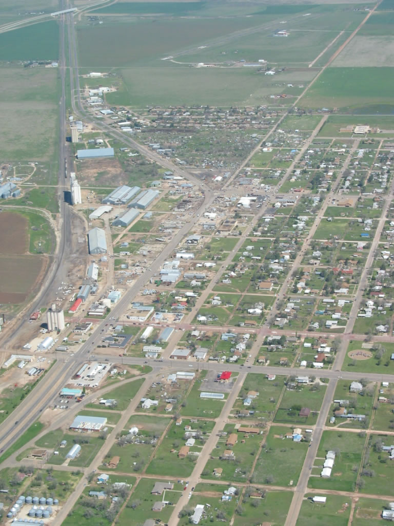 |
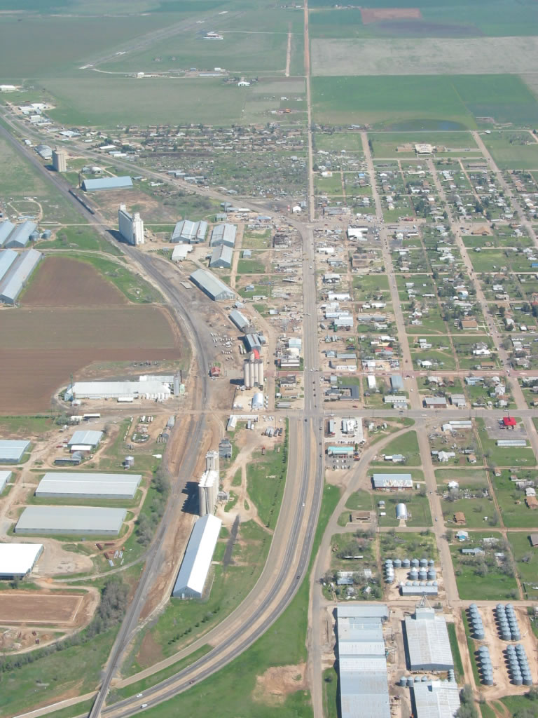
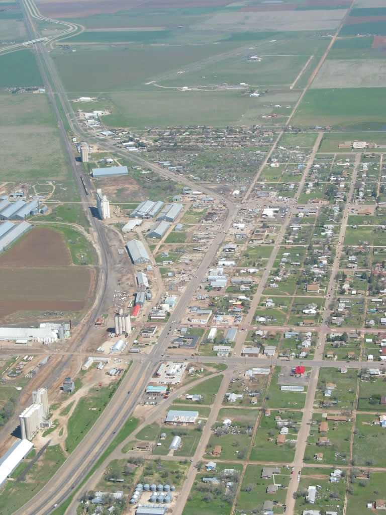
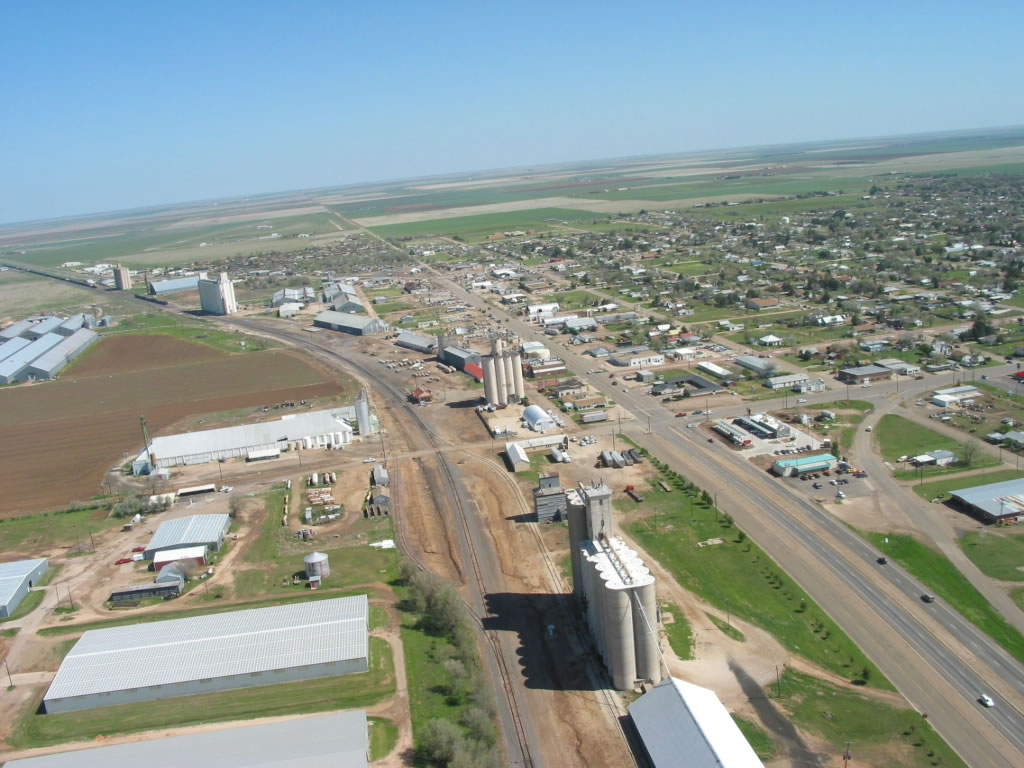
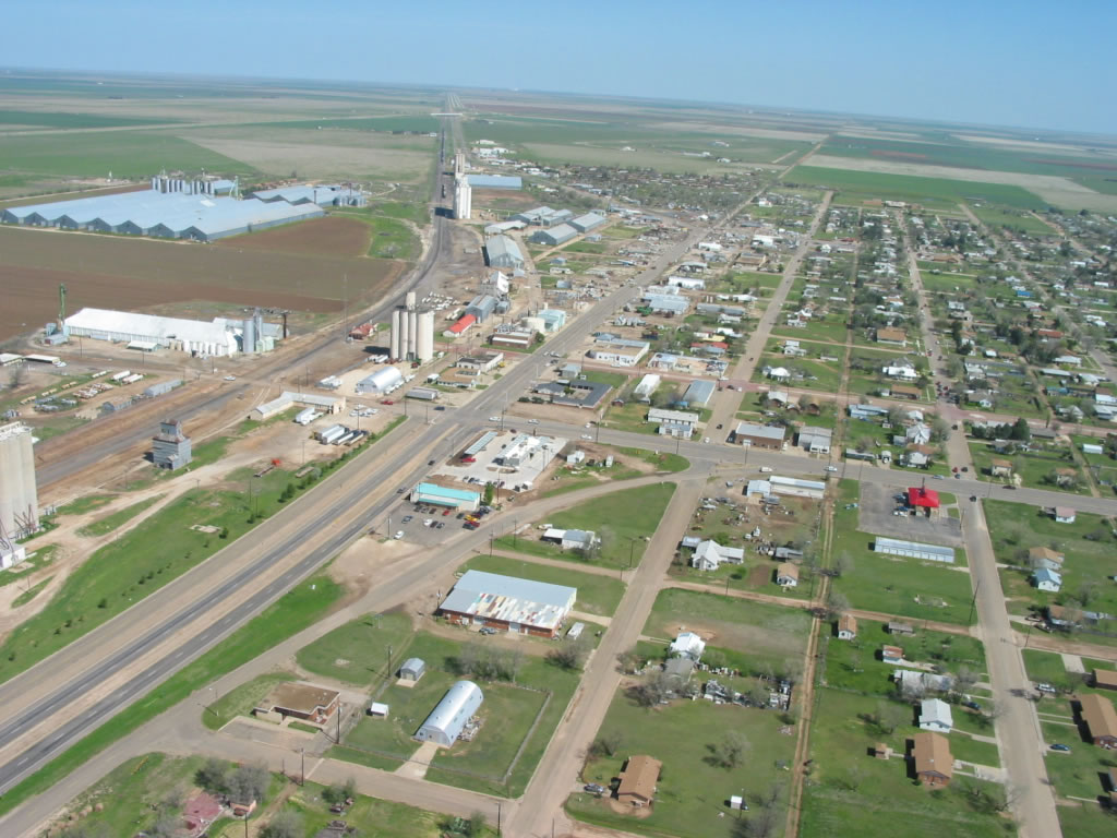
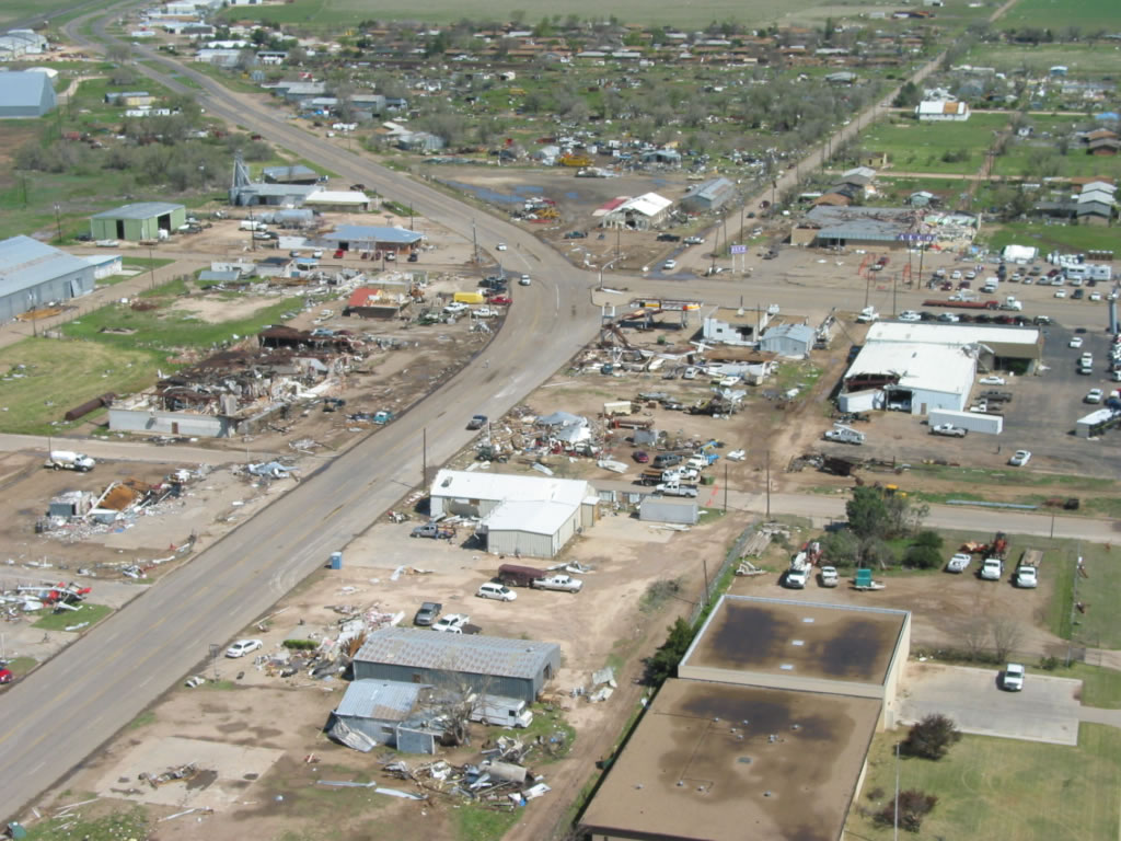
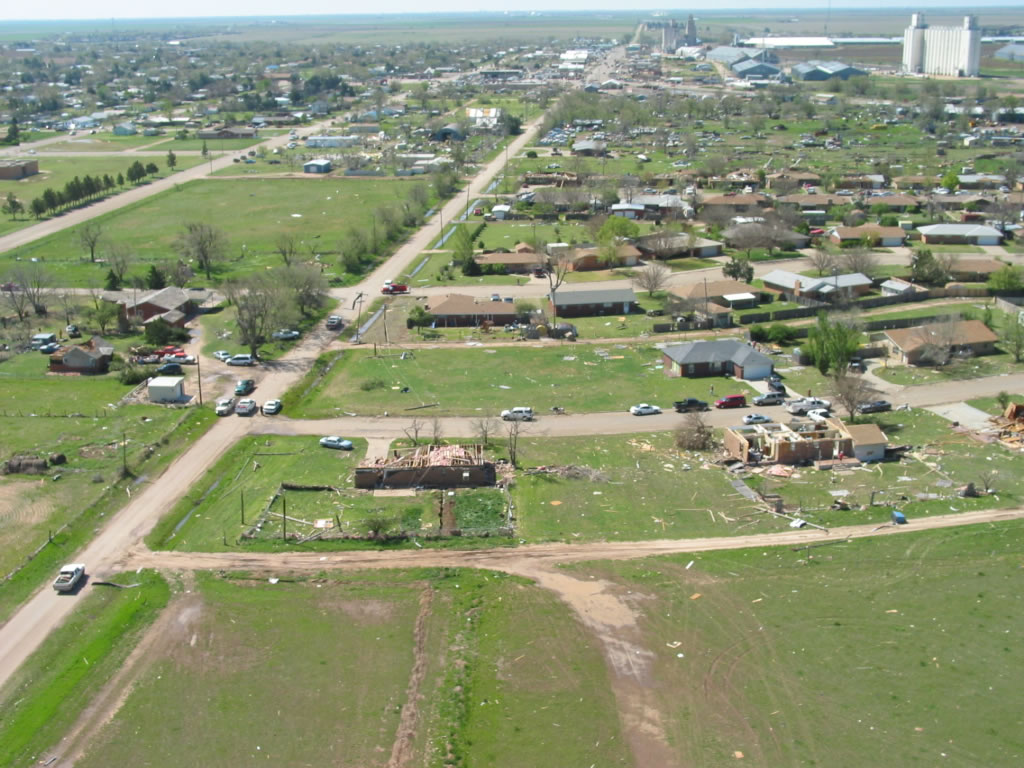
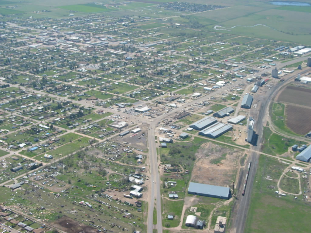
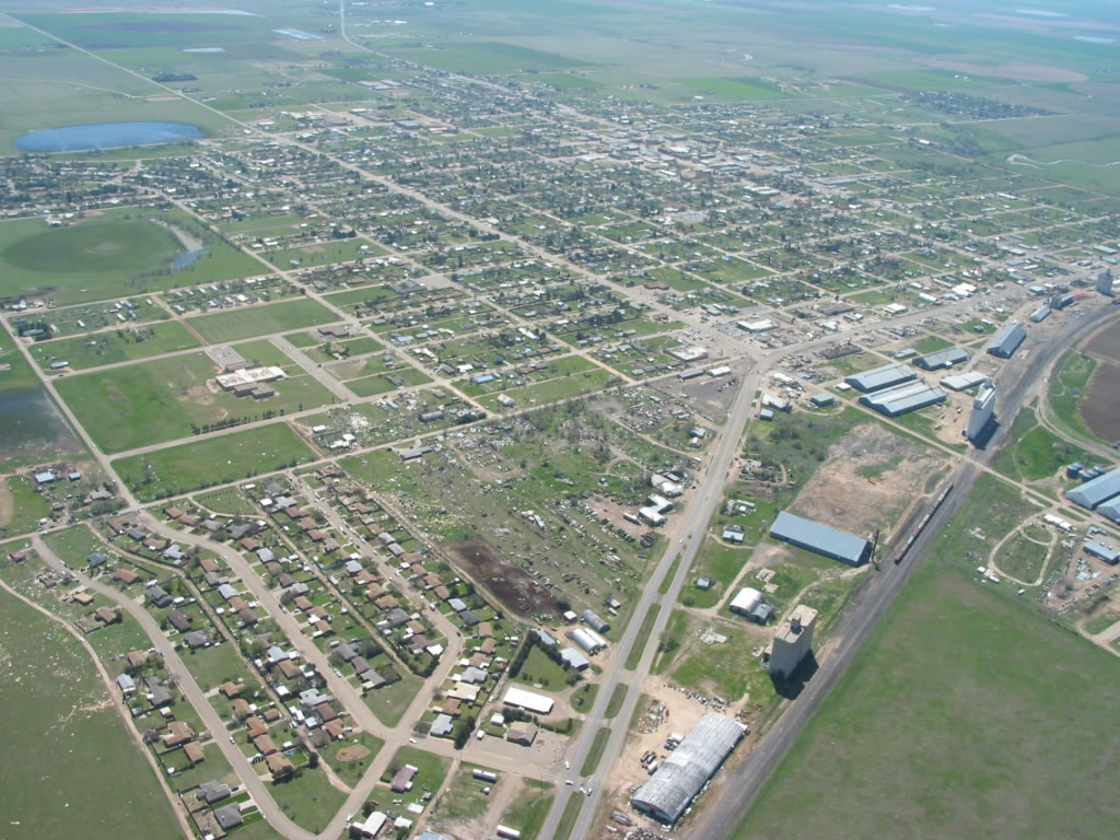
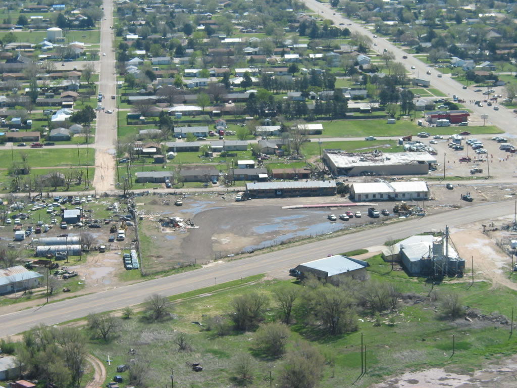
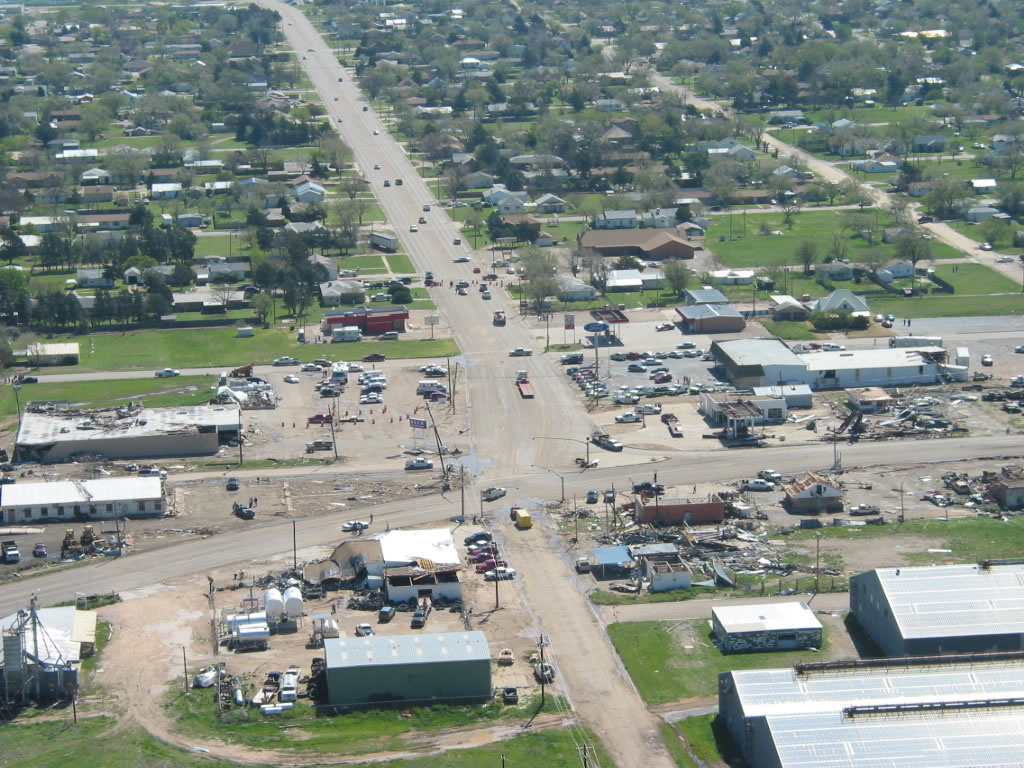
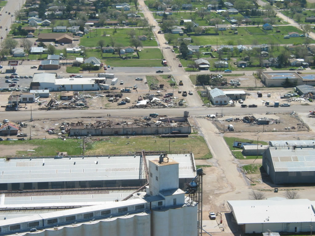
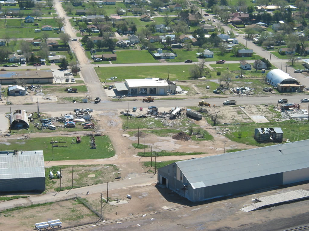
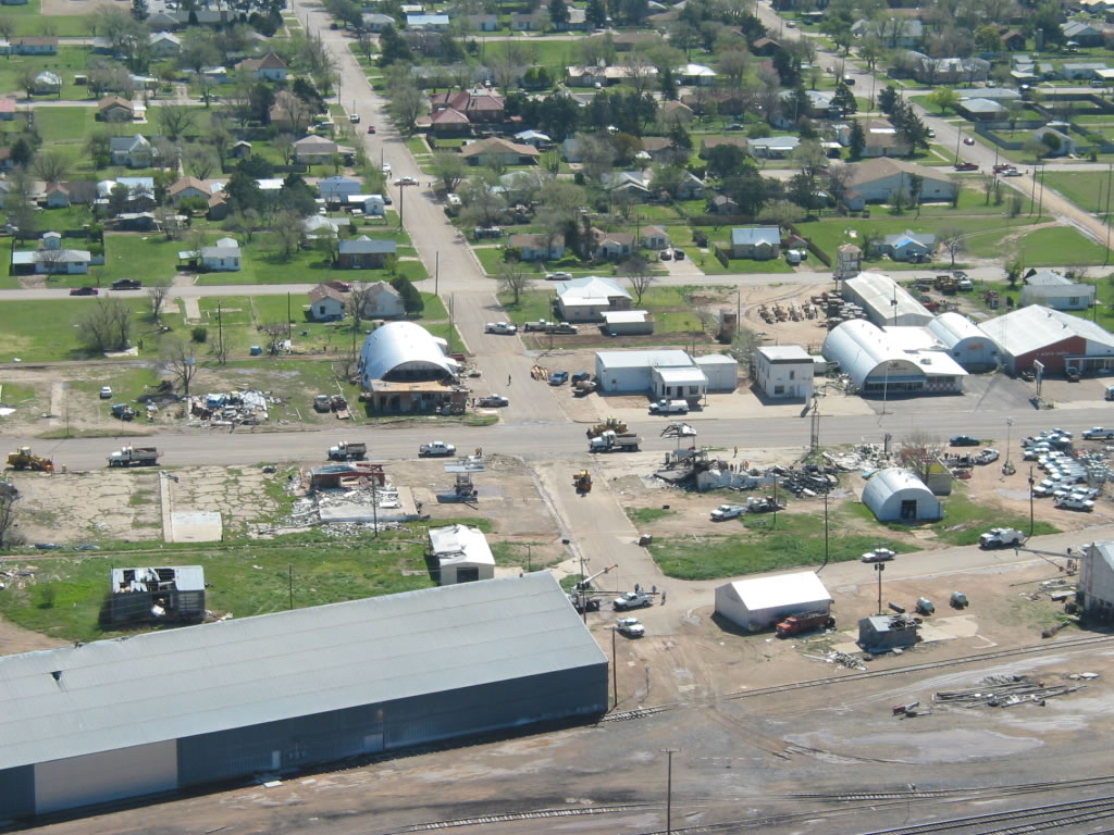
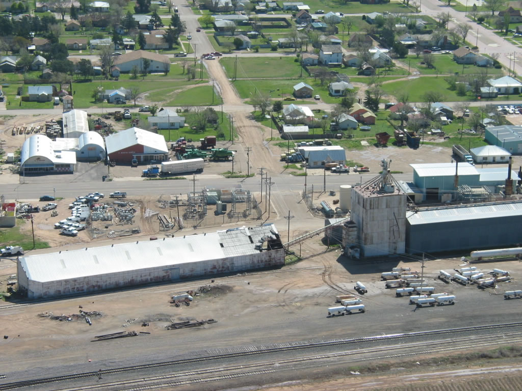
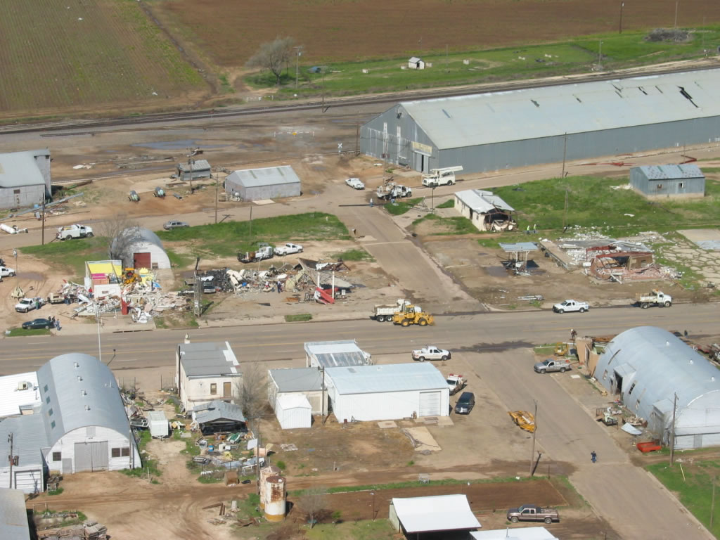
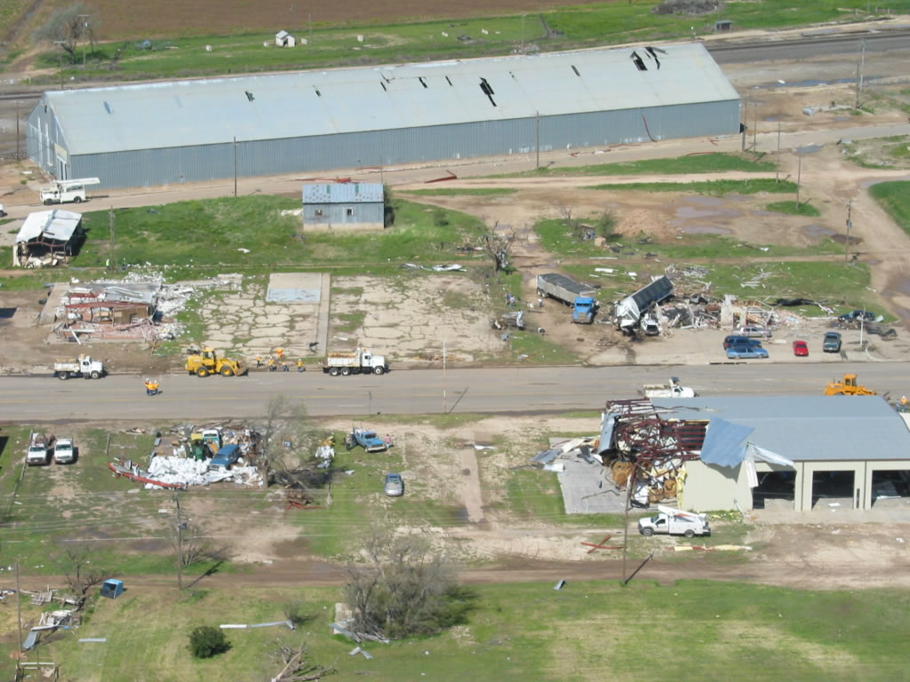
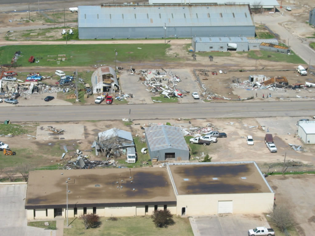
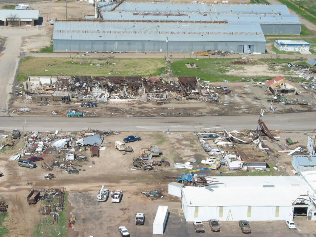
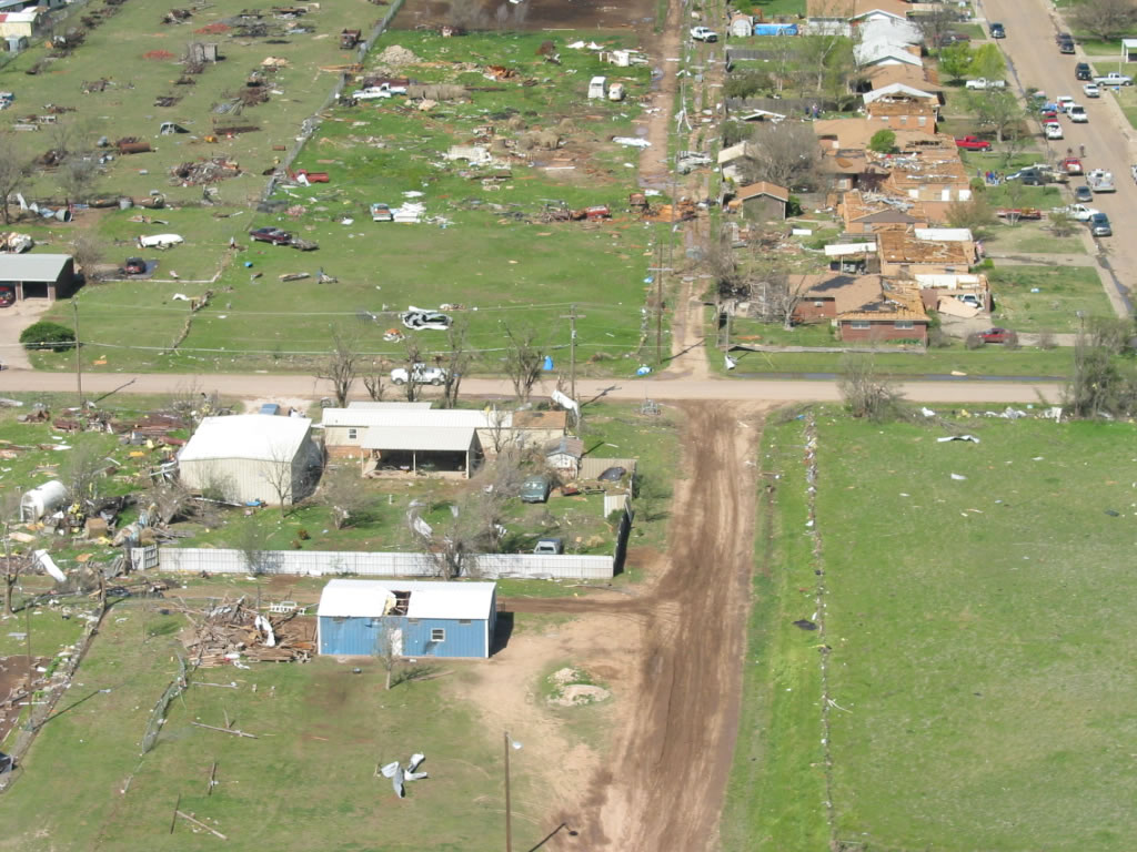
| Aerial photographs of damage in Tulia after the tornado that occurred on 21 April 2007. All views are looking northward along U.S. Highway 87. Click on the individual image for a larger view. The photos were taken on 22 April 2007 by Darrin Davis and Zane Price. | ||
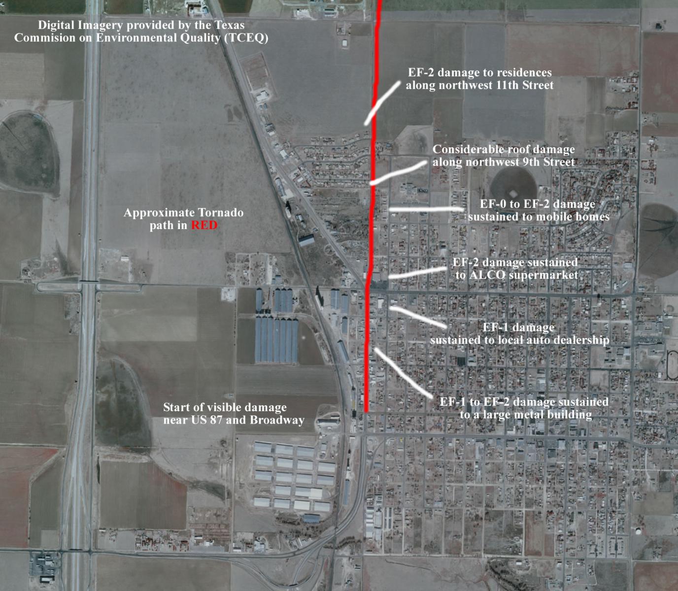
The tornado originated near the power plant at the intersection of Broadway and U.S. 87
and continued north across the west side of Tulia before dissipating just northeast of the
Tulia/Swisher County Municipal Airport.
 |
 |
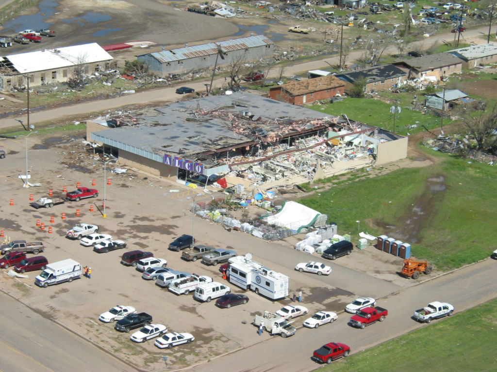 |
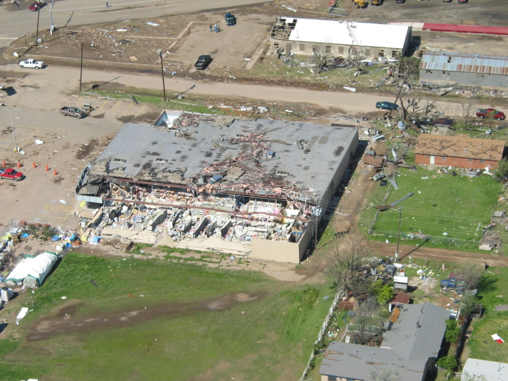
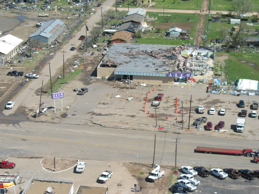
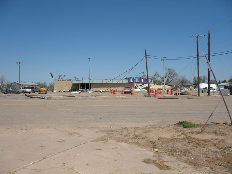
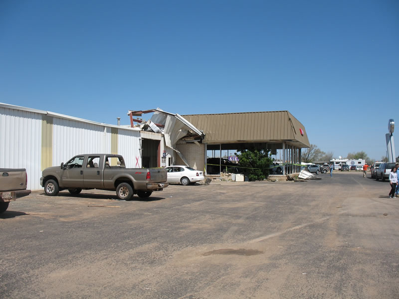
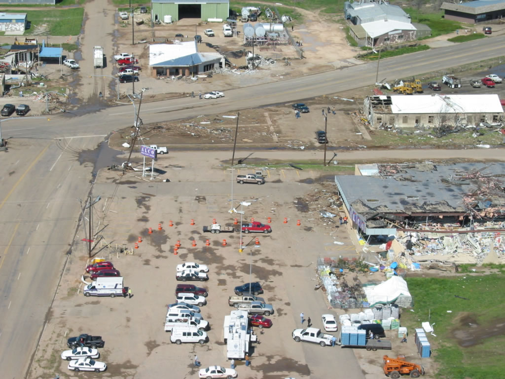
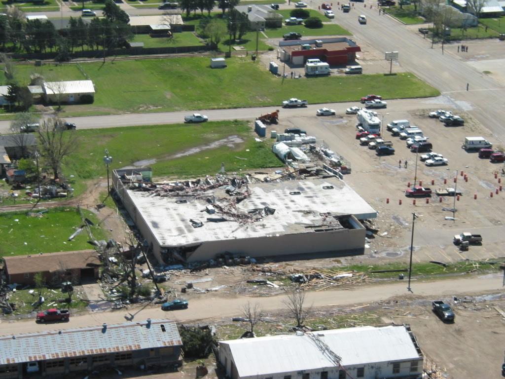
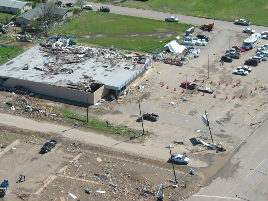
| Aerial photographs of damage in Tulia after the tornado that occurred on 21 April 2007. These photos are focused on damage to an ALCO store. Click on the individual image for a larger view. The photos were taken on 22 April 2007 by Darrin Davis and Zane Price. | ||
 |
 |
 |
 |
 |
|
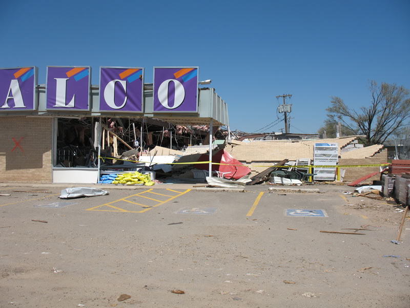
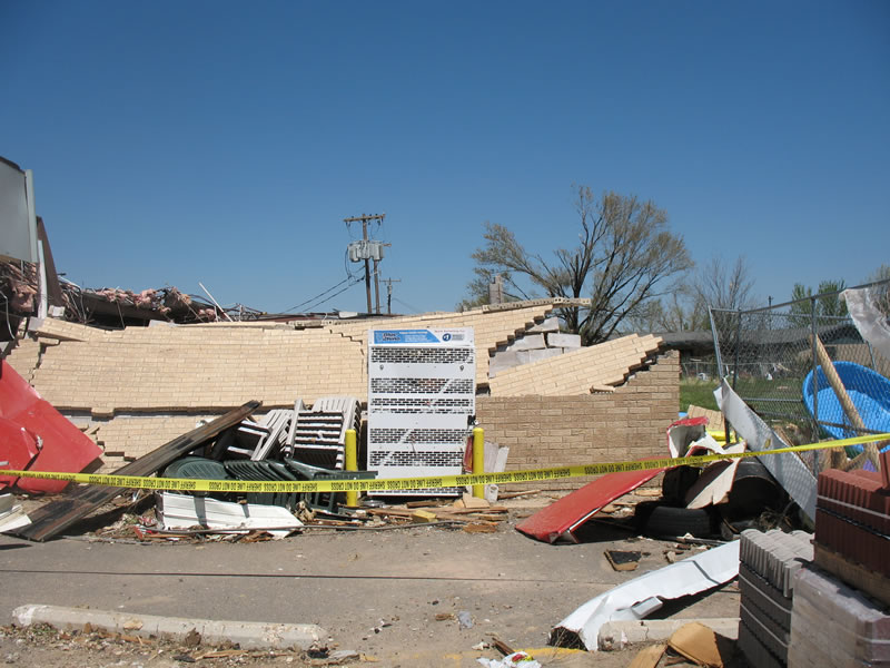
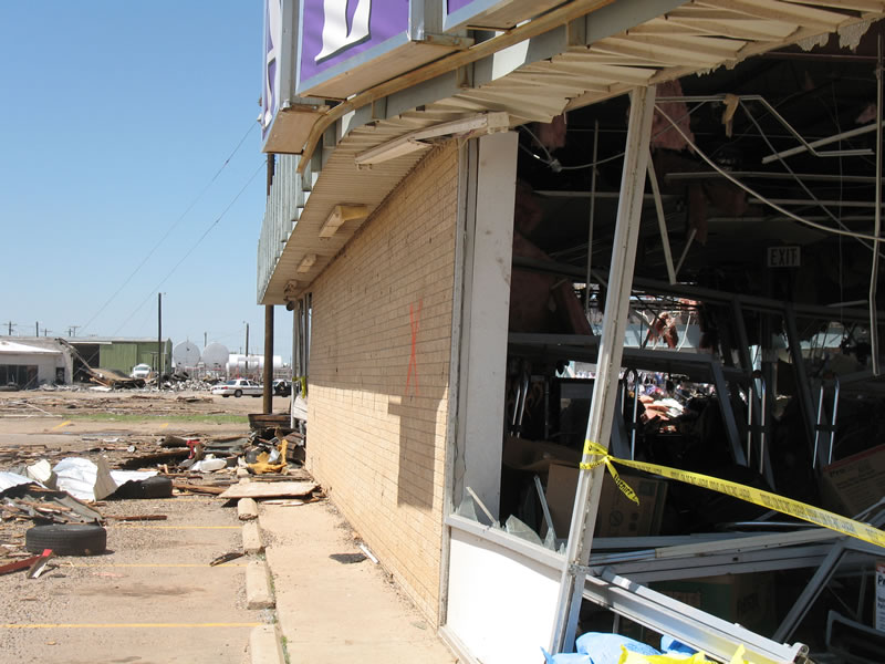
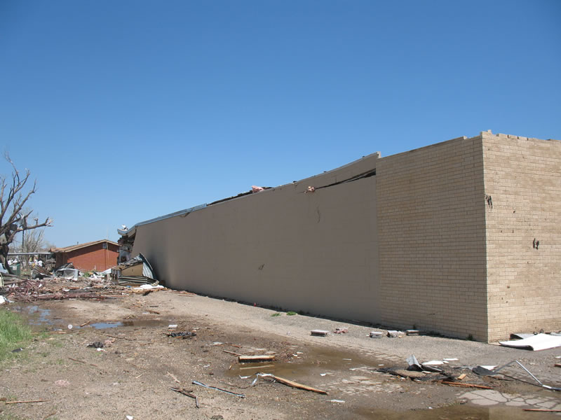
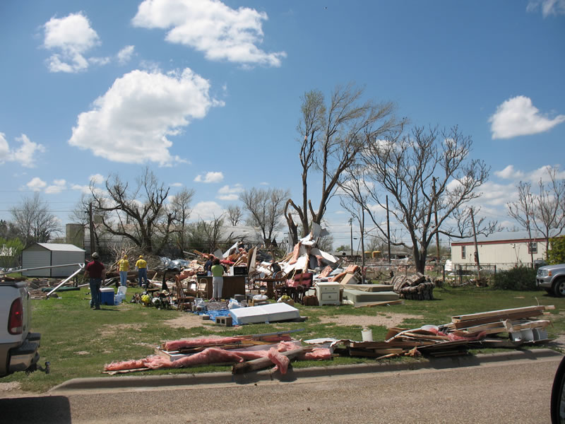
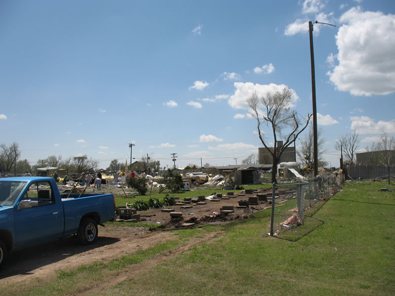
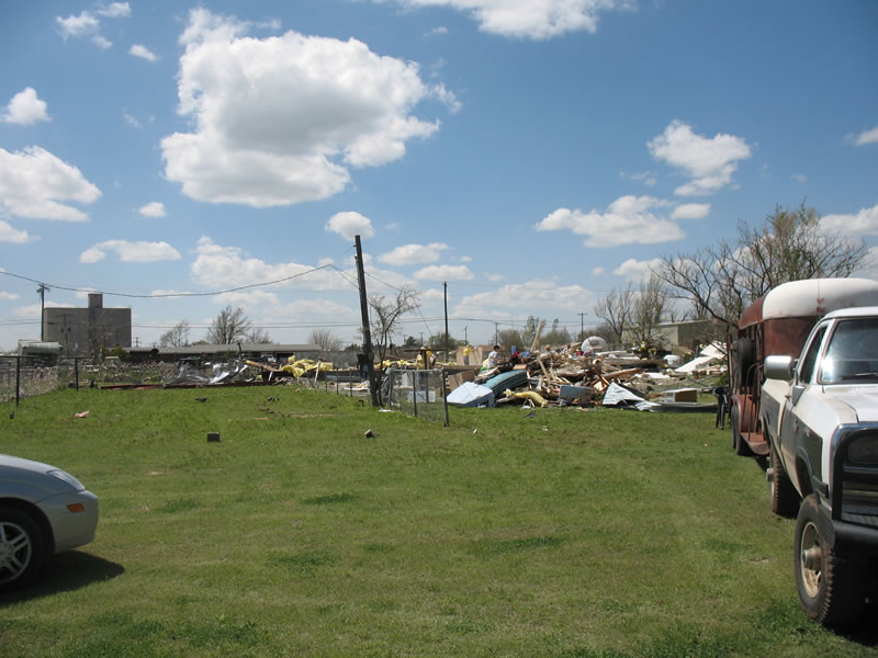
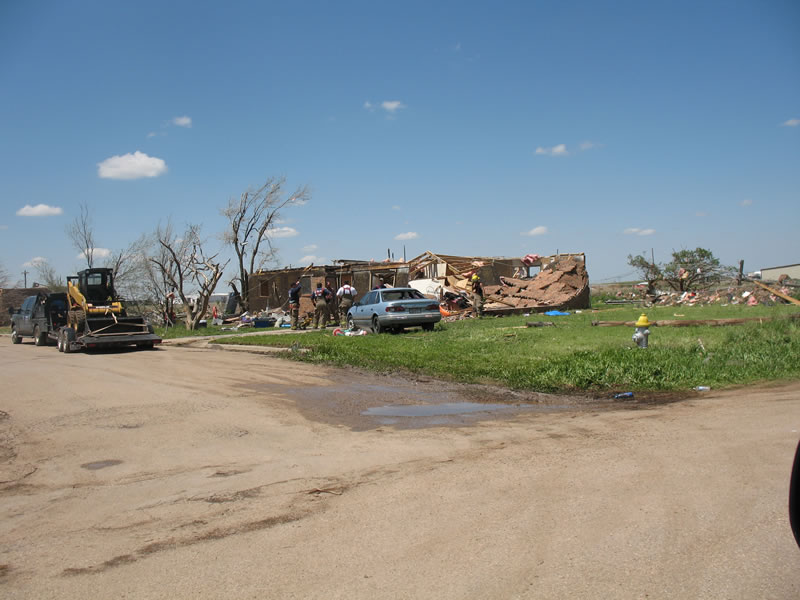
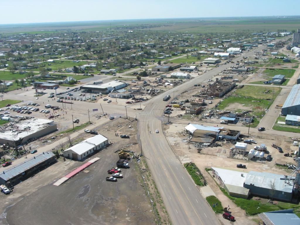
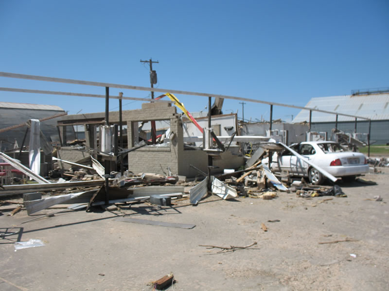
| Photographs of damage in Tulia after the tornado that occurred on 21 April 2007. These photos are focused on damage to an ALCO store. Click on the individual image for a larger view. Pictures taken by SOO Steve Cobb and WCM Brian LaMarre. | ||
Significant damage was observed along U.S. 87 with numerous impacts to businesses. The
most significant damage occurred at a local supermarket at the intersection of U.S. 87 and
6th Street. A large portion of the roof was removed on the east side of the structure...with
one exterior wall collapsed inward. A portion of the roof corner on the southwest side of the
building had collapsed. In addition...a portion of the northwest exterior wall had collapsed.

This damage was consistent with wind speeds of 125 to 135 mph.
 |
 |
 |
 |
 |
|
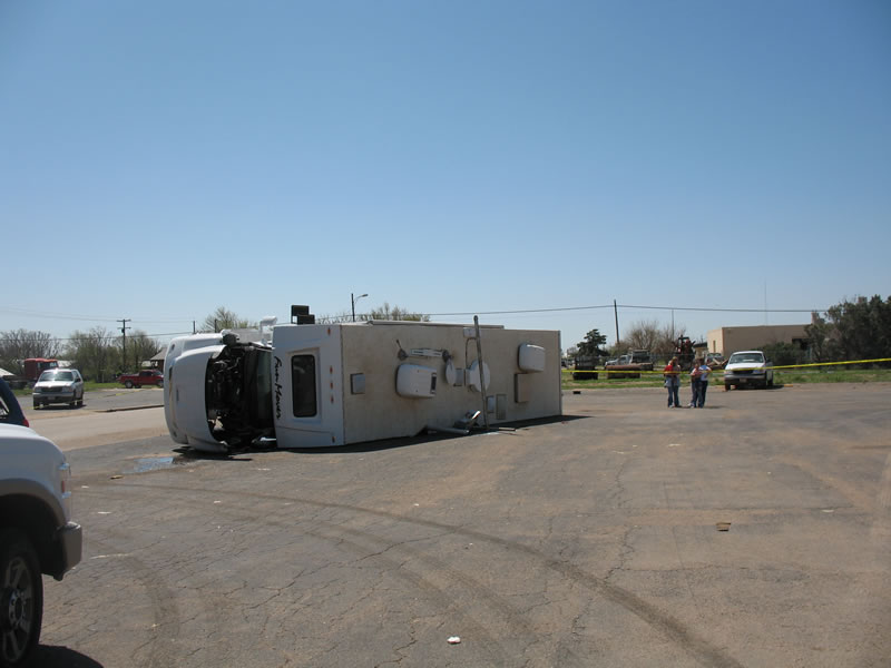
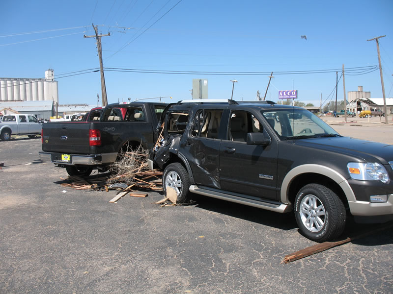
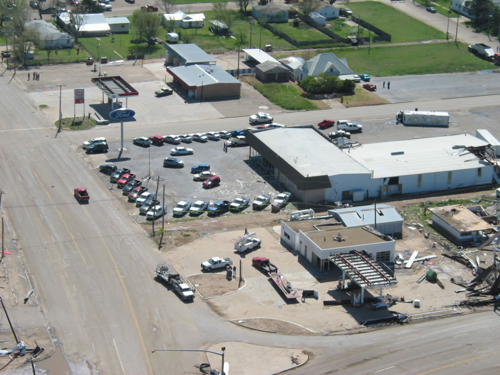
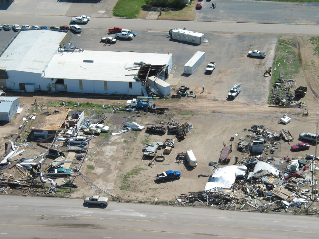
| Photographs of damage in Tulia after the tornado that occurred on 21 April 2007. These photos are focused on damage in and around the Ford Dealership. Click on the individual image for a larger view. Pictures taken by SOO Steve Cobb and WCM Brian LaMarre. | ||
The local auto dealership...located to the south of the supermarket...sustained a large
amount of damage. Forty-one vehicles received damage mainly from flying debris. A motor
home on the property was overturned from southeast to northwest. A large overhead door
on the east side failed resulting in additional failure to the west wall. A large storage
container was blown into the southwest corner of the building collapsing a portion of
the roof.

The damage was consistent with wind speeds of 95 to 105 mph.
 |
 |
 |
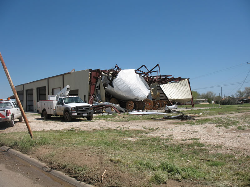
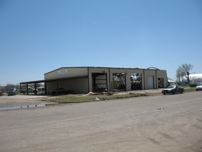
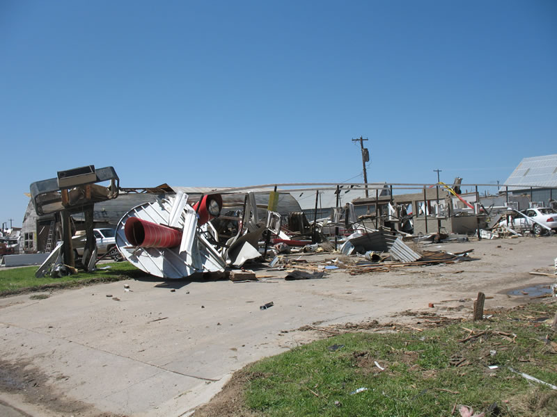
| Photographs of damage in Tulia after the tornado that occurred on 21 April 2007. The two left-most photos are focused on damage to a large metal building. Click on the individual image for a larger view. Pictures taken by SOO Steve Cobb and WCM Brian LaMarre. | ||
A large metal building also sustained major damage with the failure of four large overhead
doors and buckling of roof purlins on the south side of the building.

The damage was consistent with wind speeds of 110 to 120 mph.
 |
 |
 |
 |
 |
|
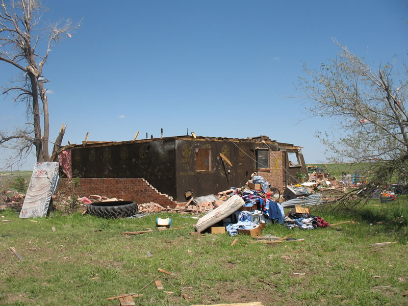
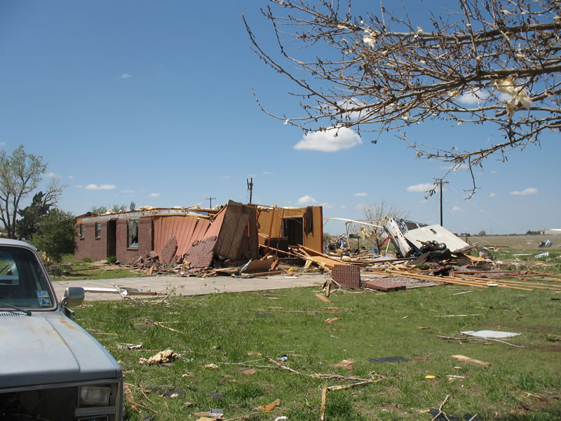
| Photographs of damage in Tulia after the tornado that occurred on 21 April 2007. These photos are focused on damage to trailer homes on the north side of town. Click on the individual image for a larger view. Pictures taken by SOO Steve Cobb and WCM Brian LaMarre. | ||
Moderate damage was observed to the north and northeast of the supermarket entering a
residential portion of town. Damage occurred to a mobile home community between
8th and 9th Streets just west of Highland Elementary School. A total of five mobile homes
were impacted...two of which were completely destroyed.  The walls and roofs separated
with the undercarriage separated and twisted. Debris was blown to the west northwest
toward the center of the tornado circulation.

The damage was consistent with wind speeds of 85 to 95 mph for the damaged mobile
homes...and 105 to 125 mph for the destroyed mobile homes.
 |
 |
 |
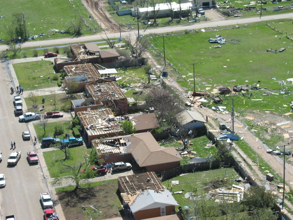
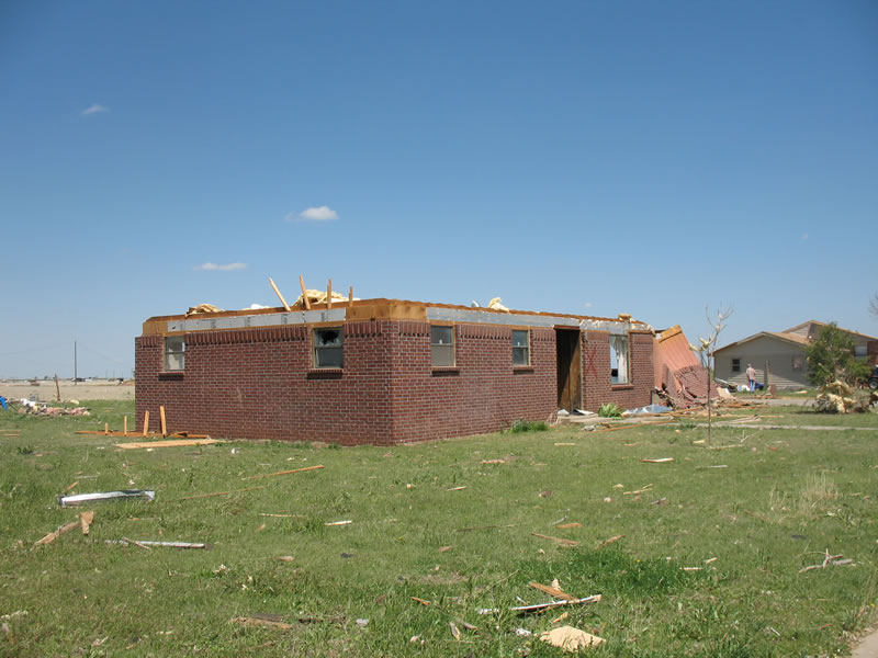
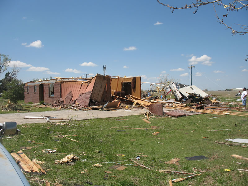
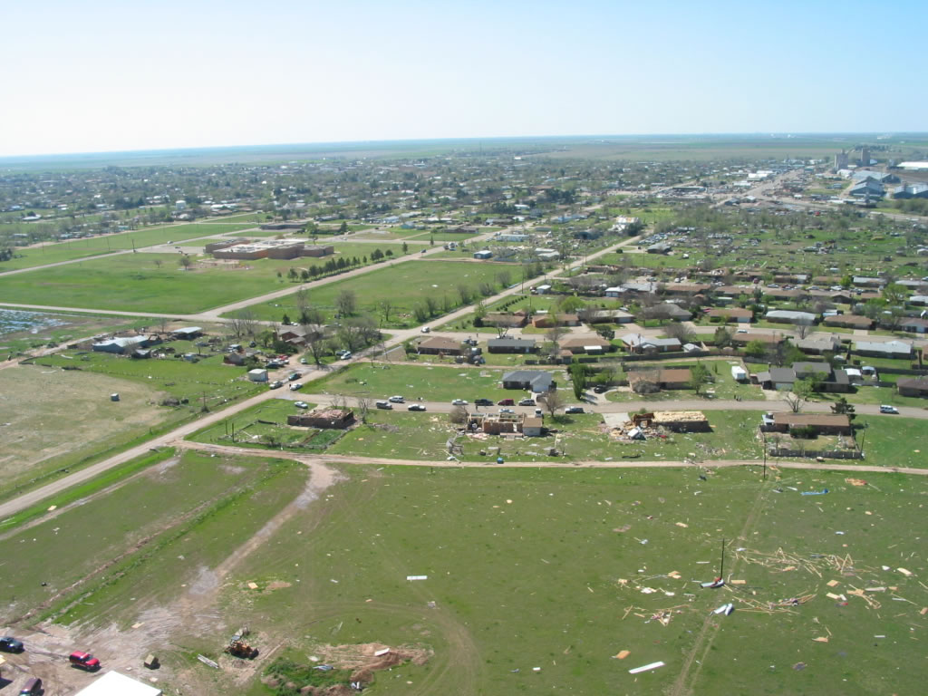
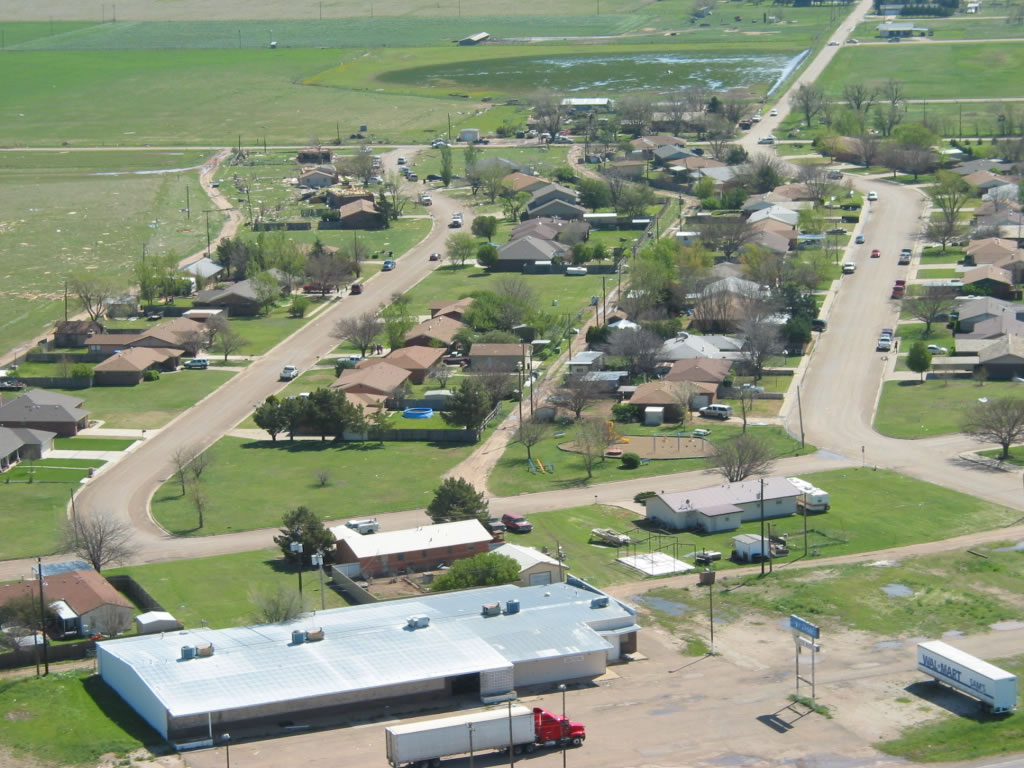
| Aerial photographs of damage in Tulia after the tornado that occurred on 21 April 2007. These photos are focused on damage to several homes toward the north side of Tulia (along NW 9th Street). Click on the individual image for a larger view. The photos were taken on 22 April 2007 by Darrin Davis and Zane Price. | ||
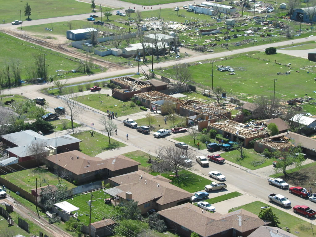
The most significant residential damage occurred in a subdivision along Northwest 9th
through Northwest 11 Streets. Across this area along Northwest 9th Street...the northerly
circulation around the tornado penetrated the garage doors on several homes forcing
the observed roof damage. The debris from these homes was scattered to the south
in an adjacent field.
 |
 |
 |
| Aerial photographs of damage in Tulia after the tornado that occurred on 21 April 2007. These photos are focused on damage to several homes on the north side of Tulia (along NW 11th Street). Click on the individual image for a larger view. The photos were taken on 22 April 2007 by Darrin Davis and Zane Price. | ||
 |
 |
 |
 |
 |
 |
 |
 |
|
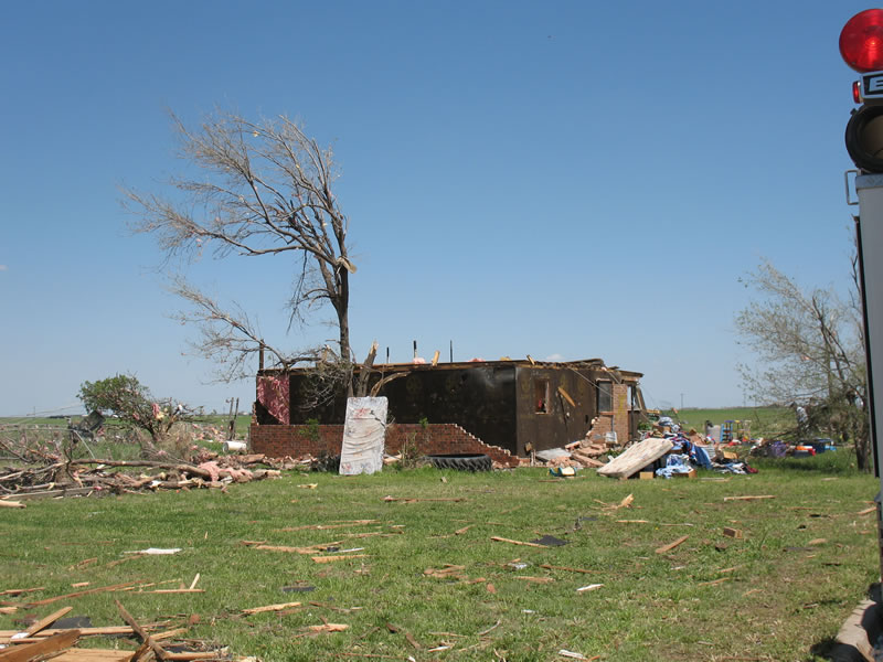
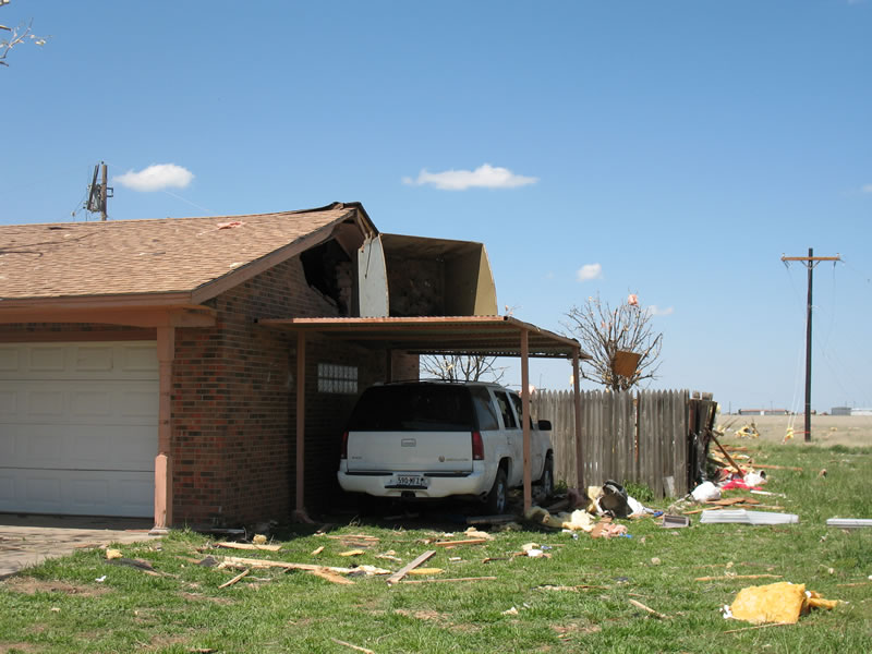
| Photographs of damage in Tulia after the tornado that occurred on 21 April 2007. These photos are focused on damage to several homes on the north side of Tulia (along NW 11th Street). Click on the individual image for a larger view. Pictures taken by SOO Steve Cobb and WCM Brian LaMarre. | ||
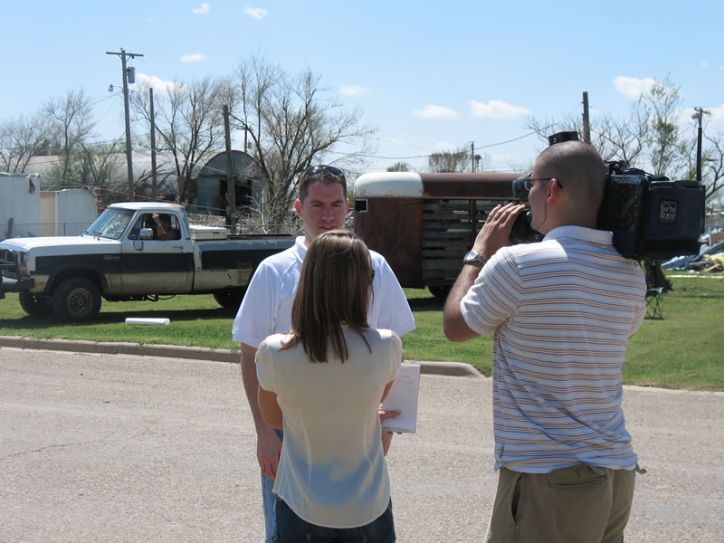
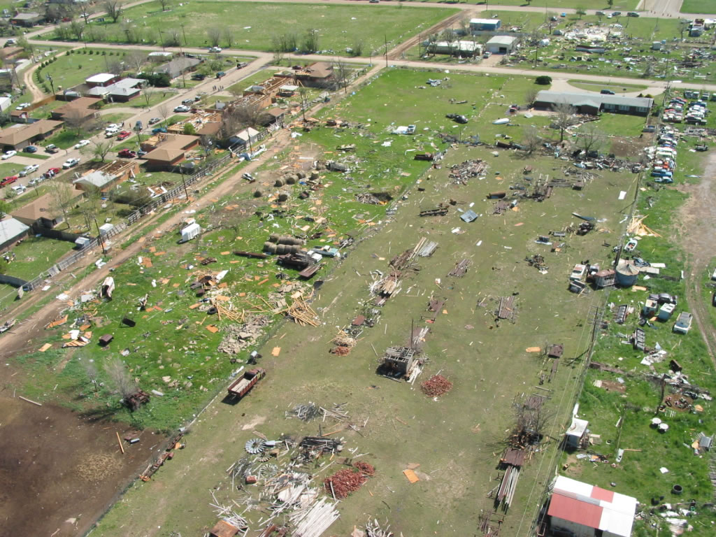
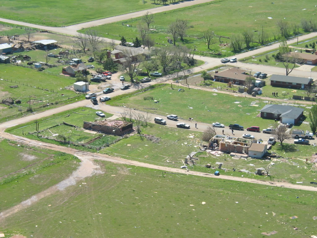
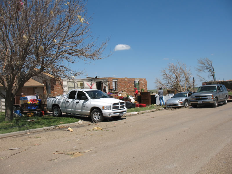
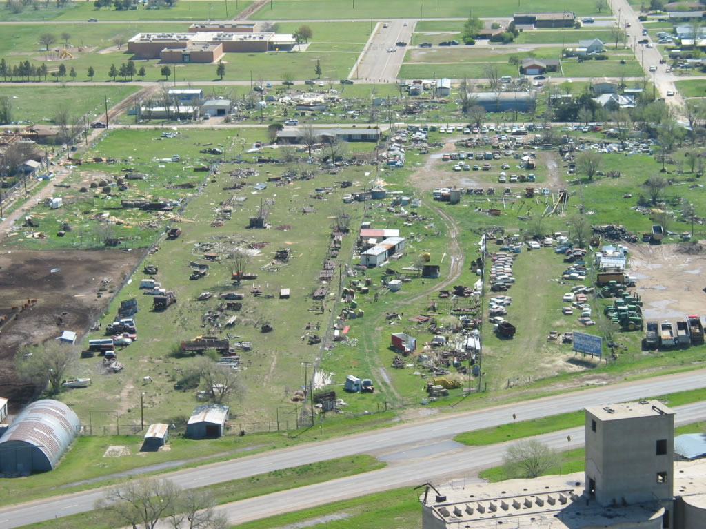
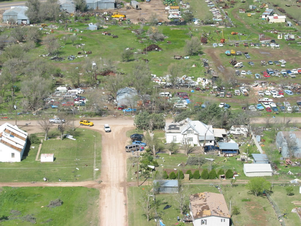
The tornado damage north of this area...along Northwest 10th Street...was sporadic as
the circulation patterns within the tornado fluctuated. The damage became more
significant and pronounced along Northwest 11th Street just west of airport road. Several
homes were damaged along 11th Streett...with significant roofs torn off and failure to
some exterior walls noted the first three residences. Debris from these homes  was
scattered to the north and northwest in an adjacent field.

The damage was consistent with wind speeds ranging from 100 to 110 mph to the
moderately damaged homes...and ranging from 125 to 135 mph on the significantly
damaged homes closer to airport road.

As the tornado progressed to the north and northeast from this area...reports indicated
the tornado became larger. Weak to moderate damage was noted to farm houses on
CR13...as well as center pivots and storage structures to the east and northeast of the
Tulia/Swisher County Municipal Airport.

The damage was consistent with wind speeds of 95 to 105 mph.

The National Weather Service in Lubbock would like to thank all of those involved
in providing detailed information to the NWS survey team.  The assessment would not
have been complete without the efforts of local emergency response officials...media...
and the residents of Olton and Tulia.

In addition...the NWS damage survey benefited from collaboration with a Texas Tech
University civil engineering professor.  The professor is a leading expert who served
as a developer of the Enhanced Fujita Scale for rating tornado damage.

Below are additional aerial and ground based pictures taken from the Tulia area on
22 April 2007.
 |
 |
 |
 |
||
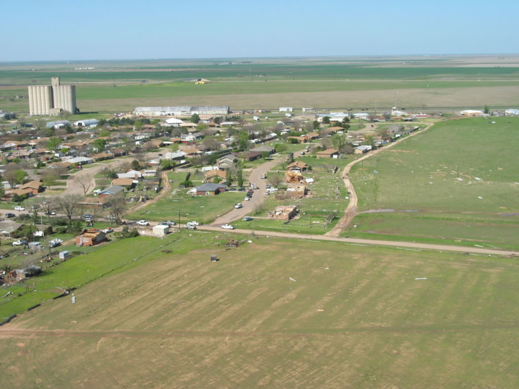
| Aerial photographs of damage in Tulia after the tornado that occurred on 21 April 2007. All views are looking northward along U.S. Highway 87. Click on the individual image for a larger view. The photos were taken on 22 April 2007 by Darrin Davis and Zane Price. | ||
 |
 |
 |
 |
 |
 |
 |
 |
 |
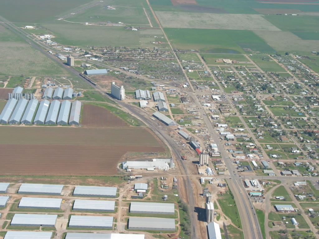
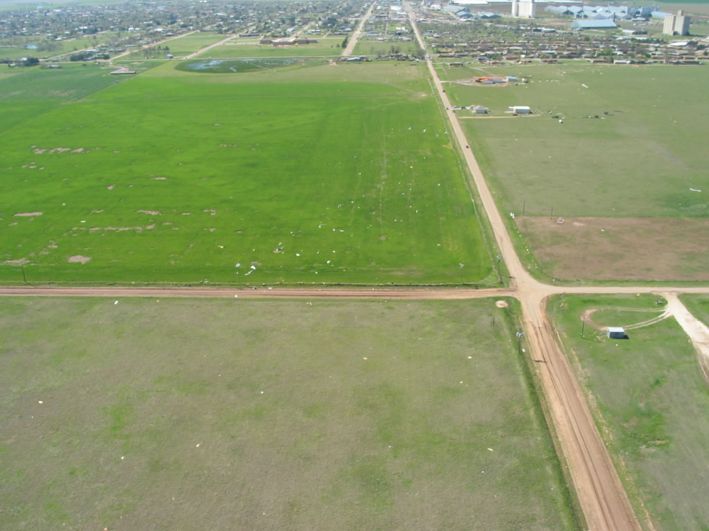
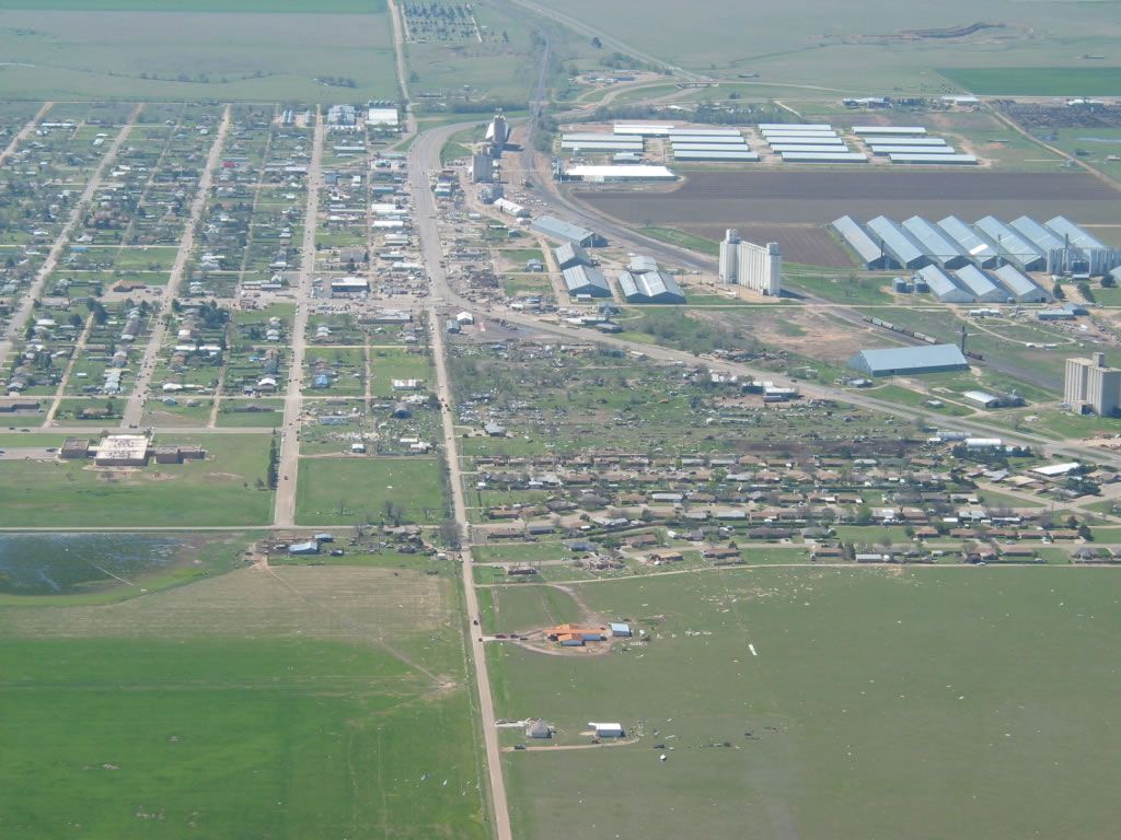
| Aerial photographs of damage in Tulia after the tornado that occurred on 21 April 2007. All views are looking south or southeastward down CR 13 and/or U.S. Highway 87. Click on the individual image for a larger view. The photos were taken on 22 April 2007 by Darrin Davis and Zane Price. | ||
 |
 |
 |
 |
 |
 |
 |
 |
 |
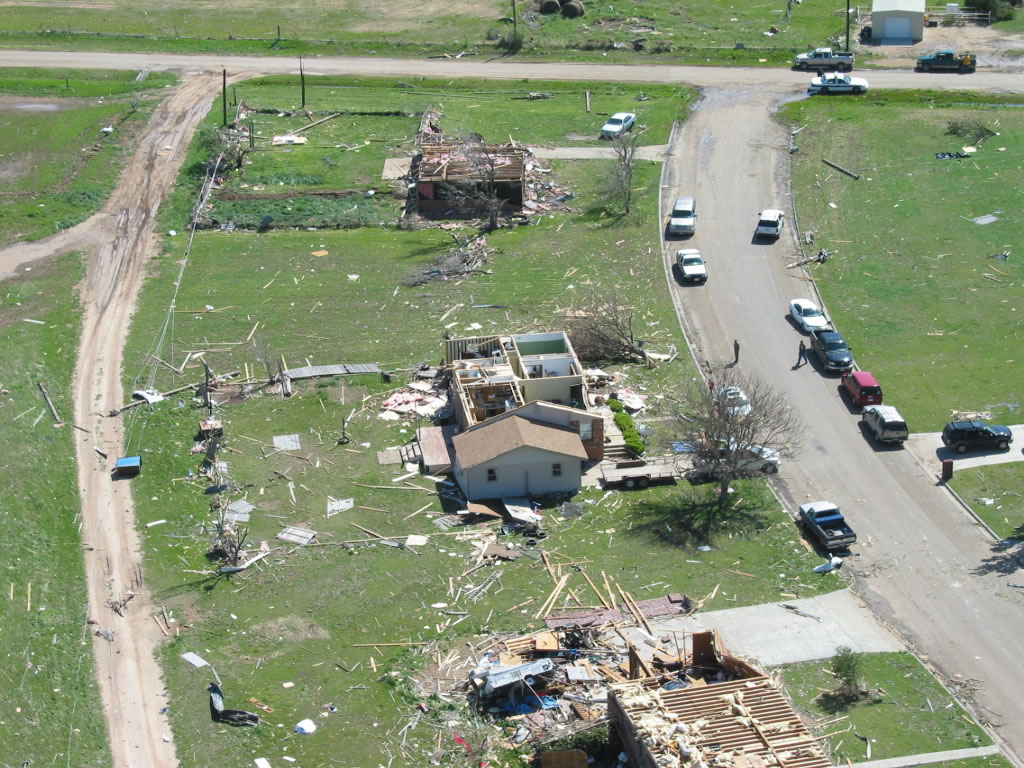
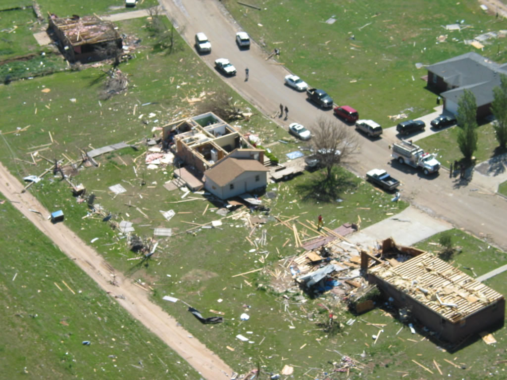
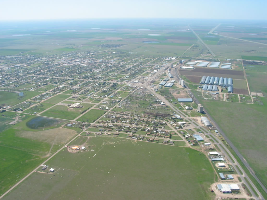
| Aerial photographs of damage in Tulia after the tornado that occurred on 21 April 2007. These photos are in sequence (from left to right, top to bottom) progressing from the north to the south along CR13/Airport Road, and then U.S. Highway 87. All views are looking eastward. Click on the individual image for a larger view. The photos were taken on 22 April 2007 by Darrin Davis and Zane Price. | ||
 |
 |
 |
 |
 |
 |
 |
 |
 |
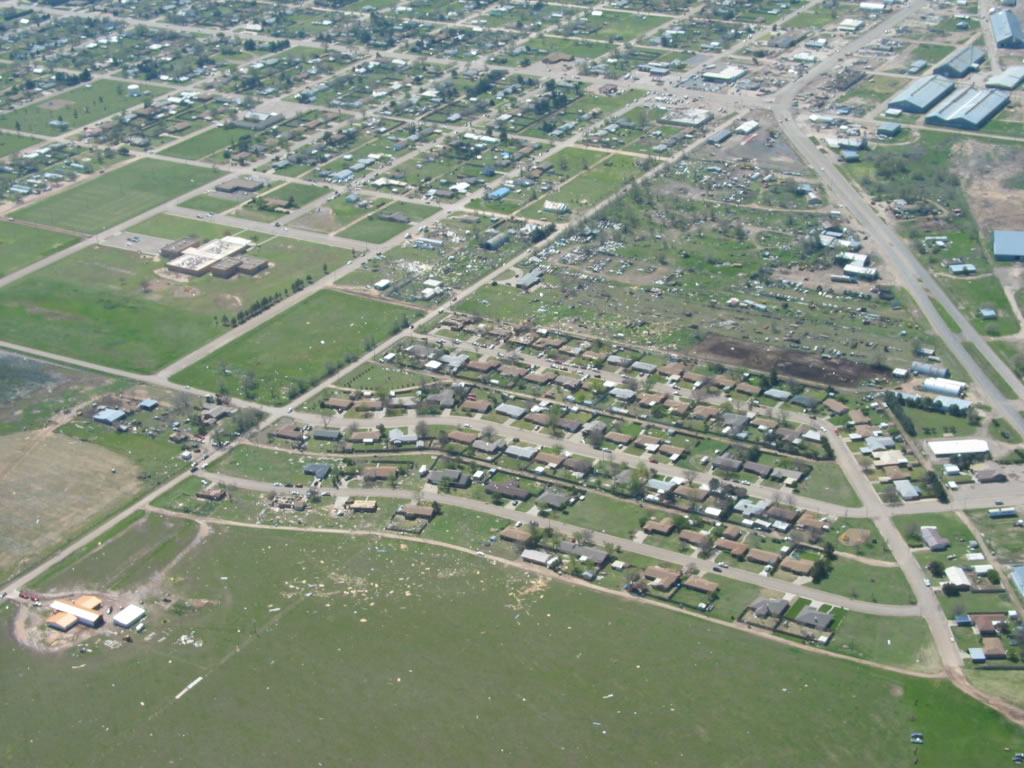
| Aerial photographs of damage in Tulia after the tornado that occurred on 21 April 2007. These photos are in sequence (from left to right, top to bottom) progressing from the south to the north along U.S. Highway 87, and then CR13/Airport Road. All views are looking westward. Click on the individual image for a larger view. The photos were taken on 22 April 2007 by Darrin Davis and Zane Price. | ||
 |
 |
 |
 |
||
| Aerial photographs of damage in Tulia after the tornado that occurred on 21 April 2007. These photos are in sequence (from left to right, top to bottom) progressing from the north to the south along CR13/Airport Road, and then U.S. Highway 87. All views are looking eastward. Click on the individual image for a larger view. The photos were taken on 22 April 2007 by Darrin Davis and Zane Price. | ||
 |
 |
 |
| Photographs of damage in Tulia after the tornado that occurred on 21 April 2007. The two left-most photos are focused on damage to a recently closed Sonic. Click on the individual image for a larger view. Pictures taken by SOO Steve Cobb and WCM Brian LaMarre. | ||

