|
Powerful Storm Brings High Winds,
|
||||
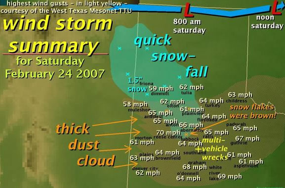
| Above is an image displaying the maximum wind gusts recorded, approximate area of snowfall, and primary location of the thickest dust on Saturday, 24 February 2007 (image created by Ron McQueen). | ||||
|
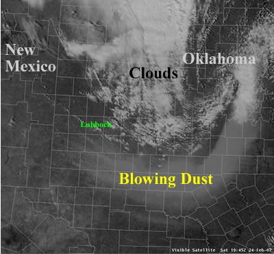
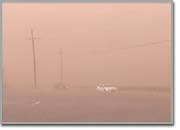
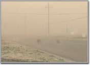
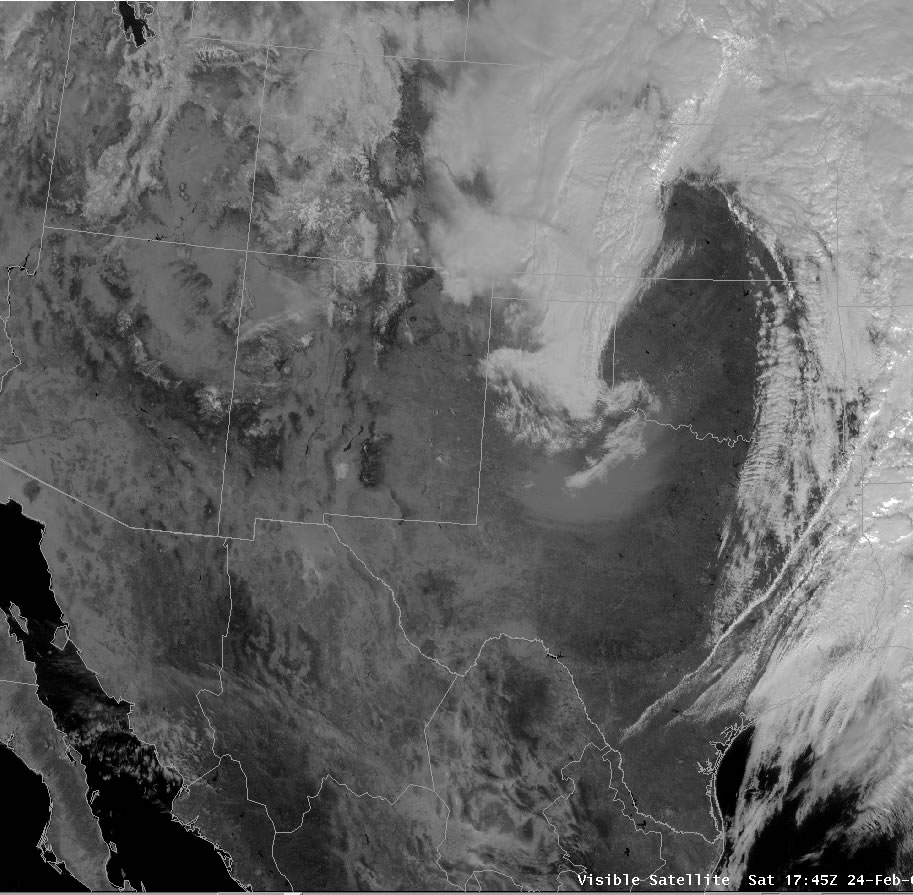
To add insult to injury, the strong winds kicked up a thick cloud of top-soil, which abruptly lowered visibilities below one mile across much of the region my mid-morning. At times visibilities dropped below a quarter of a mile during the late morning and early afternoon, which darkened the sky to an erie orange. At least three multiple vehicle accidents were reported along U.S. highway 84 between Southland and Post in northwest Garza County from 9 am to noon, where visibilities dropped to near zero. One non-life threatening injury was reported with the wrecks, and the stretch of road was temporarily closed due to the extremely poor conditions. The image below shows a satellite snapshot of the dust plume in the afternoon after it had begun to advance into central Texas and Oklahoma.
In addition, a band of snow swept across the southern Texas Panhandle and northern South Plains during the morning. Snow accumulations around one to one and half inches quickly accumulated across the southwest Texas Panhandle near Friona. Brown snow flakes and mud drops even mixed in with the thick dust at times over the central South Plains and northern Rolling Plains between 10 and 11 am. Below are a couple of photos taken in Muleshoe by Jack Rennels, a Co-op observer (click on each image to see a larger version).
A detailed compilation of wind reports assembled by the Lubbock NWS Office can be found HERE. To view the preliminary local storm reports for the day click HERE. |
| Below is a series of visible satellite images taken once an hour between 11:45 am and 4:45 pm on 24 February 2007. The earliest image is in the upper left, with time increasing from left to right and top to bottom. The images show the evolution of the strong storm as it progresses east across the area. Note that the bright white regions are clouds. However, the darker white/gray swath across the central part of the image is a large dust plume that developed. See how the dust plume, which starts in West Texas, advances east all the way into eastern Oklahoma and northeast Texas by the end of the series. Click on each image for a larger view. |
|
|
| Below is an visible satellite image taken at 1:45 pm on 24 February 2007. Note the source region for the dust just south of Lubbock. |
 |
| Below are a couple of pictures taken around the region on 24 February 2007. (Photos courtesy of KCBD) |
  |


