|
Another Autumn Soaker across West Texas (October 14-16, 2006)
|
 |
|
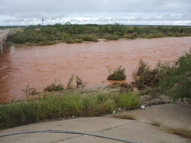
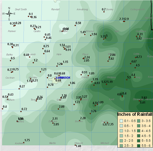
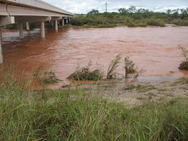
| A strong storm system moved across West Texas the weekend of October 14th-16th and brought widespread rainfall. Many locations across the Rolling Plains reported four to five inches of rain. Rainfall was much lighter on the Caprock, generally under one inch. The storm system moved slowly from southern California into New Mexico Friday and Saturday - and this allowed rich moisture from the Gulf of Mexico to be drawn into West Texas. On Sunday, as the upper-level storm system moved closer to West Texas, it brought cool air aloft and jet stream energy. This destabilized the atmosphere across the area, creating an environment favorable for strong thunderstorms. One of the thunderstorms became severe Sunday afternoon as it moved across Hale County. This storm produced very heavy rain that caused some flooding along Interstate 27 between Plainview and Hale Center - causing at least one vehicle to be abandoned at a underpass. It also brought strong winds with gusts up to 65 mph in Plainview. Otherwise, rainfall was the main story. Numerous roads became flooded from around the Post area throughout much of the Rolling Plains Sunday night, included portions of U.S. Highways 83 and 84. Finally, the storm system passed east of the area Monday morning. The map below shows how rainfall ranged from just a few tenths out near the New Mexico border to almost six inches in Stonewall County. Click HERE for the public information statement that contains the latest rainfall reports. |
 |
|
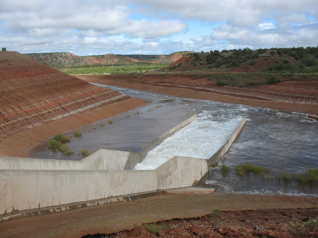
| On Monday, Two NWS Lubbock office employees traveled along U.S. 84 from Post to Lake Alan Henry to examine the state of the South Fork of the Double Mountain Fork of the Brazos River and Lake Alan Henry. Excess water was flowing over the concrete spillway at Lake Alan Henry. For a more detailed report and an interesting comparison with Lake Meredith, please click HERE. |
 |
|
 |
|
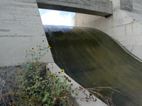 |
| Click on the image above to open a short movie showing the tremendous flow of water down the Lake Alan Henry spillway (video clip is 4 MB and may take a while to load. It is in .AVI format - video taken by John Lipe and Marty Mullen, NWS Lubbock) ) ** Note: The video has been removed due to space considerations - please contact our office for further information. |
|
Flash Flooding is the nation's number one weather-related killer! When approaching a flooded road remember "TURN AROUND DON'T DROWN"
|

