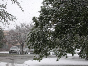
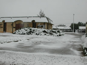
Season's First Snowfall
Tuesday, November 2, 2004, a powerful upper level storm system passed through West Texas. As a result, the season's first measurable snowfall occurred across West Texas mainly along and west of the Caprock. Locally heavy snow fell over the southwest portions of the Panhandle and northwest South Plains with 8 to 12 inches of snow reported across Parmer, Castro, and Lamb Counties including the cities of Friona, Dimmitt, and Littlefield. Lubbock generally received from 3 to 5 inches of snow. The heavy wet snow caused roadways to became snow packed and icy in many locations. Additionally, the heavy wet snow accumulating on trees (many which still had their leaves) resulted in many branches down. Some of the downed branches fell on power lines causing power outages.
For Lubbock, the earliest measurable snowfall was in October 1976, when four inches of snow fell on the 28th. This is the first measurable snow that Lubbock has had in November, since November 7th 2000 when we had 4 inches.
Above is a visible satellite image taken at 1245 pm on Wednesday afternoon (11/3/2004). The image shows the snow on the ground (in white) that extends across the southern Texas Panhandle as well as over much of the western and central South Plains. NOTE: The white over the eastern one third of the image is cloud cover and not snow. Click on the above image for a larger version of the image, with towns overlaid.
Below is a image with the snowfall totals for the event. The snowfall totals are approximate. Snow depths were especially difficult to determine with this storm since both air and ground temperatures remained relatively warm, causing the snow to melt both as it fell and while accumulating on the ground. Also, due to the wet nature of the snow, the snow significantly compacted as additional heavy wet snow fell on top of earlier snow.

Click on the below links to view the Special Weather Statements issued throughout the winter storm event. The statements contain relevant information as the storm evolved, including snowfall totals at the time of issuance.
952 am November 3, 2004 Special Weather Statement
229 pm November 2, 2004 Special Weather Statement
906 am November 2, 2004 Special Weather Statement
910 pm November 1, 2004 Special Weather Statement
400 pm October 31, 2004 Special Weather Statement
Located below are some pictures taken of the snowfall in Lubbock on Tuesday morning (11/2/2004). Click on the images for larger versions.
 |
 |
 |
 |
 |
 |
 |
 |