National Weather Service United States Department of Commerce
Click a location below for detailed forecast.

Last Map Update: Thu, Apr 24, 2025 at 11:54:15 am MDT

Another round of precipitation will impact the region through tonight. Elevations below 6000 feet will see mostly rain, but some wet snow will fall to as low as 3500 feet in Carter and Powder River.
Another round of snow will impact the mountains and foothills through Thursday night. Plan your travel and outdoor activities accordingly. Rain and wet snow will impact far southeast Montana tonight and Thursday. Some of the higher hills, especially in Carter County, could see some slushy accumulation. Be prepared if you are planning to travel on US-212 or S-323.
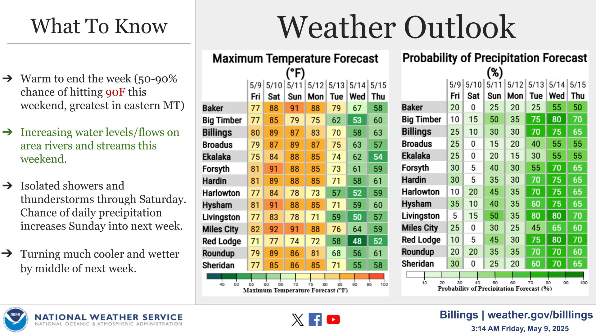
A storm system will affect the area Sunday through Monday, before tapering off Monday night into Tuesday. Heavy rainfall is possible with this system along with a few thunderstorms. The chances for rainfall amounts greater than an inch range from 40 to 60 percent, with the highest chances from Billings south and over the Beartooth/Red Lodge Foothills. Watch for ponding of water in low lying areas with possible stream rises. Also be aware of heavy rainfall producing flooding on burn scars. There is still a lot of uncertainty regarding this storm system so please monitor the forecast for changes!


Text Product Selector (Selected product opens in current window)