Welcome to our "virtual tour" of the National Weather Service Forecast Office located in Wilmington, Ohio!
Click through the tabs below for information about our office & how we serve southwestern Ohio, northern Kentucky, and southeastern Indiana
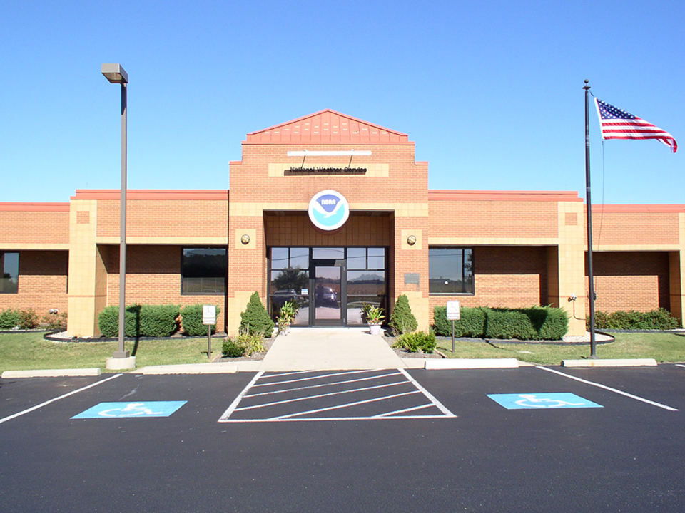
Weather Forecast Office - Wilmington, Ohio
 |
 |
 |
 |
 |
 |
|
The National Weather Service in Wilmington has been watching the skies over southeastern Indiana, southwestern Ohio, and northern Kentucky since February 1994. |
||
 |
 |
 |
|
Operations is the heartbeat of any NWS office. The mission of the NWS has always been to provide weather, hydrologic, and climate forecasts and warnings for the United States, its territories, adjacent waters and ocean areas, for the protection of life and property and the enhancement of the national economy. NWS data and products form a national information database and infrastructure which can be used by other governmental agencies, the private sector, the public, and the global community. |
||
|
Routine operations at NWS Wilmington, Ohio consist of four main focus areas: Public, Aviation, Fire Weather and Data Acquisition. During normal operations, the operational staff includes a lead forecaster who has overall responsibility for the shift, a journeyman forecaster, and the HMT or Met Intern who performs data collection and quality control and ensures the NOAA All Hazards Radio programming is running smoothly. Without quality data, preparation of any forecast would be impossible. Although more and more data acquisition is becoming automated, the NWS still relies on people to make sure all equipment is working properly. In addition to the electronics staff, the NWS also uses an Information Technology Officer (ITO) to ensure that all of the various computer systems operate in unison. |
||
Office Management and Administrative Team:
Meteorologist in Charge (MIC) oversees all office activities and operations.
Warning Coordination Meteorologist (WCM) is the primary liaison between the NWS office and the external customer community, such as county officials and emergency managers.
Science & Operations Officer (SOO) provides ongoing training to the staff and works with the latest technology and scientific research advances.
Electronic Systems Analyst (ESA) is responsible for all the electronics and electronics systems in the office and ensuring that the hardware of all computer components work together.
Information Technology Officer (ITO) is responsible for making all computer programs and software work on different operating platforms.
Observing Program Leader (OPL) is responsible for the cooperative observer (COOP) program, data acquisition from all sources, and quality control of such data.
Administrative Support Assistant (ASA) makes sure all the administrative aspects of a government office are taken care of and are in proper working order..
Operations Team:
Forecasters prepare all public forecast and warning products, aviation forecast products, and fire weather forecast products. Forecasters also monitor incoming meteorological and hydrological data, including river and stream gage information. Forecasters work rotating shifts, ensuring a continuous weather watch twenty-four hours a day, seven days a week, three hundred and sixty five (or six) days a year.
Electronic Technicians (ETs) provide the daily maintenance on all equipment including the WSR-88D radar and Automated Surface Observing Systems.
Early Beginnings (Late 1800s)
 |
 |
 |
|
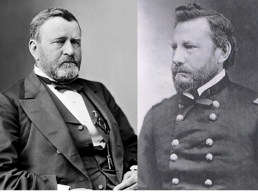
On February 9, 1870, Congress established the U.S. Weather Bureau and inaugurated the use of daily weather forecasts. Left: President Ulysses S. Grant, who signed a joint resolution of Congress into law, establishing the first federal agency for providing weather observations and warnings. Right: Brigadier General Albert J. Myer, the first Chief Signal Officer of the weather division of the U.S. Army Signal Corps. |
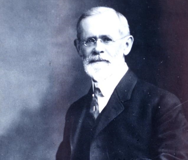
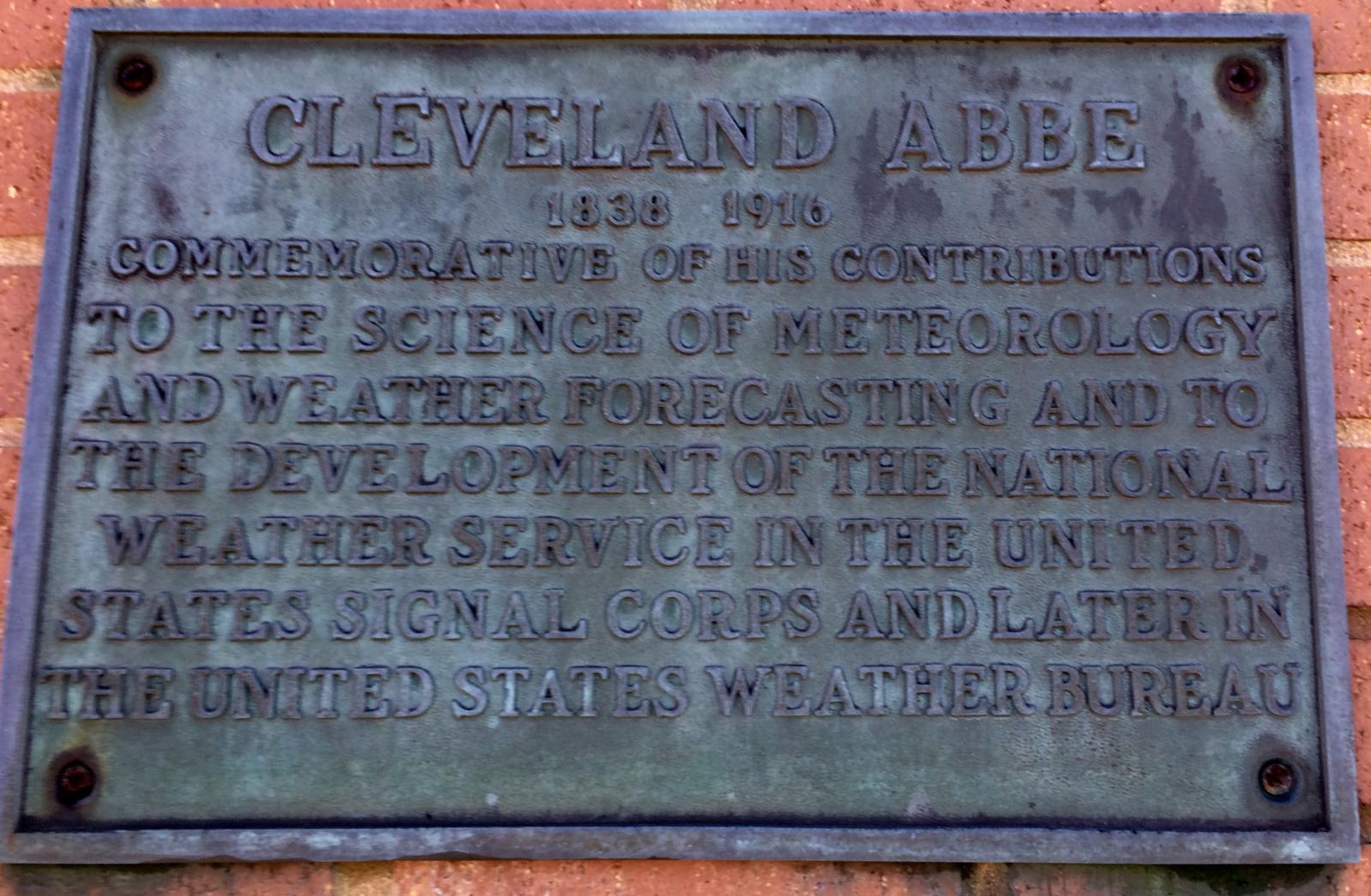
In 1871, Cleveland Abbe joined the U.S. Government’s brand new weather agency as Special Assistant to the Chief Signal Officer (essentially the agency's first chief meteorologist). Abbe was the only individual in the country with any practical experience in weather forecasting based on scientific principles. Among his first tasks were setting up a systematic observing system, developing criteria and a system for training new personnel, and directing the scientific activities of the new bureau. Until he was able to train forecasters, Abbe was the sole source of forecasts, or as he called them “probabilities.” He soon became known as “Old Probabilities” (a nickname that stuck with him for the rest of his life) and remained with the agency for the next 45 years. More than any other individual, Cleveland Abbe, one-time director of the Cincinnati observatory, built the foundation of the modern National Weather Service. |
In February of 1871, Abbe personally gave the first official weather report. Abbe ensured that every forecast covered four main meteorological elements: weather (clouds and precipitation), temperature, wind direction, and barometric pressure. By 1872, Abbe regularly sent over 500 sets of daily maps and bulletins oversees in exchange for European meteorological data. Cleveland Abbe gambled when he joined U.S. Army’s new weather service in 1871, but his tireless efforts to improve the organization and advance theoretical meteorolgy built the foundation of what was to later become NOAA’s National Weather Service. |
 |
 |
 |
|
The U.S. Signal Service began its observations in Cincinnati in November 1870, at the Pike's Opera House Building, which was located at 4th and Vine Streets. This began the official first weather observations in Cincinnati. |
The first recorded weather observations in the Columbus area began on July 1, 1878 at Irving House, located on E. Broad Street between Third and Fourth. Observations were soon moved to the Huntington Bank Building on July 15, 1878. Image courtesy of the Columbus Metropolitan Library, Columbus in Historic Photographs Collection. |
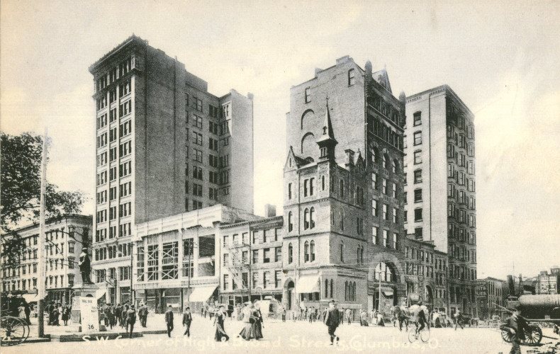
Columbus weather observations were relocated to a more permanent location on the 4th floor of the Huntington Bank Building (far right in this photograph), located on the southwest corner of Broad and High Streets, on July 15, 1878 and continued there until the first official Columbus weather office opened at the Board of Trade Building in May 1889. Image courtesy of the Columbus Metropolitan Library, Columbus in Historic Photographs Collection. |
 |
 |
 |
|
The Cincinnati Weather Office moved to the U.S. Custom House (located on 5th St. between Walnut and Main St.) in 1885 and remained there until 1936. The U.S. Weather Bureau took over duties in 1891. |
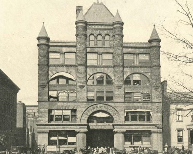
The Board of Trade Building, located just across from the Ohio Statehouse at 40 E. Broad Street (and a half block east from where observations had previously been taken), housed the first U.S. Army Signal Service weather office in Columbus from May 1, 1889 until February 1, 1893. Image courtesy of the Columbus Metropolitan Library, Columbus in Historic Photographs Collection. |
The weather service is first identified as a civilian agency when Congress, at the request of President Benjamin Harrison, passes an act transferring the meteorological responsibilities of the U.S. Army Signal Service to the newly-created U.S. Weather Bureau in the Department of Agriculture. The transfer officially took place July 1, 1891. |
 |
 |
 |
|
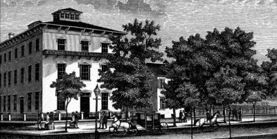
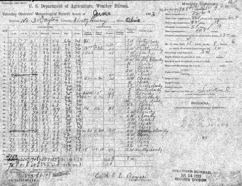
The earliest weather observations on record in Dayton began in October 1844 at Cooper Seminary (located on First Street between Perry and Wilkinson) and continued there until March 1873. However, these early records were intermittent and sometimes incomplete. Dayton climate records officially began on June 1, 1893 thanks to Mrs. Edith E. L. Boyer, a dedicated cooperative observer who submitted her daily weather observations (taken at her home near 4th and Findlay Streets) to the U.S. Weather Bureau for over 40 years! |
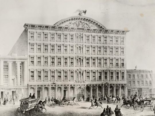
The Wheeler Building (the tall building just right of center), located at 5 W. Broad Street, housed the Columbus Weather Bureau office from February 1893 until November 1894. This new site was just one block west of the office's previous Board of Trade Building site (1889-1893) and adjacent to where weather observations had previously been taken at the Huntington Bank Building (center building in this image, located on the southwest corner of Broad and High Streets) from 1878-1889. Image courtesy of the Columbus Metropolitan Library, Columbus Memory Collection. |
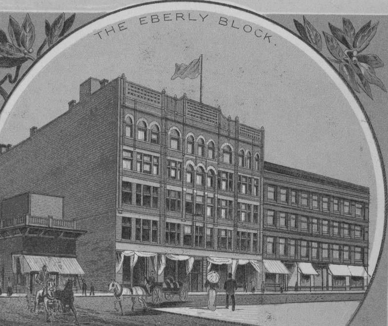
The Eberly Building, located at 215 S. High Street, housed the Columbus Weather Bureau office from November 1894 until June 1902. Image courtesy of the Columbus Metropolitan Library, Columbus in Historic Photographs Collection. |
Early 1900s
 |
 |
 |
|
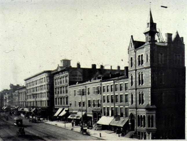
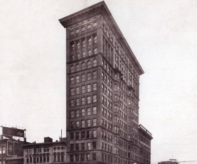
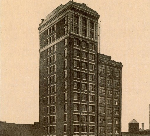
The New Hayden Building (second tallest in this image), located at 16 E. Broad Street, housed the Columbus Weather Bureau office from June 1902 until July 1930. |
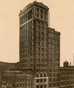
The 14th floor of the United Brethren Building (northeast corner of Main and 4th Streets) housed the Dayton Weather Bureau office from July 1911 until July 1923. Photo courtesy of the Dayton Metro Library's Lutzenberger Picture Collection. |
The U.S. Weather Bureau built a weather observatory on Lafayette Circle, which opened in 1915. It was named after former observer Cleveland Abbe (see separate timeline story), and was the only weather station with a commemorative name. Weather instruments were located on the roof, and the chief meteorologist of the station lived in the house. Ownership of the building was transferred from the Weather Bureau to the University of Cincinnati in 1965. Today it serves as a private residence. |
 |
 |
 |
|
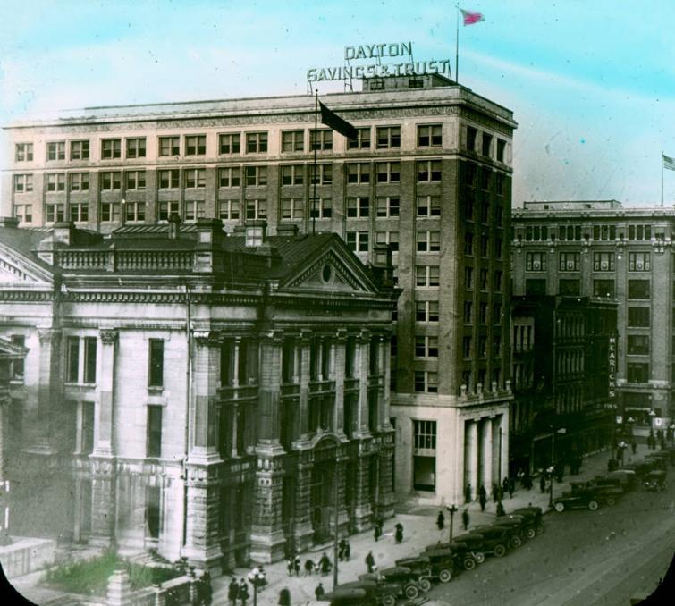
The eighth floor of the Dayton Savings & Trust Building, located at 25 N. Main Street, housed the Dayton Weather Bureau office from July 1923 to July 1933. Photo courtesy of the Dayton Metro Library's Montgomery County Historic Lantern Slides Collection. |
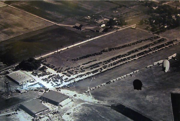
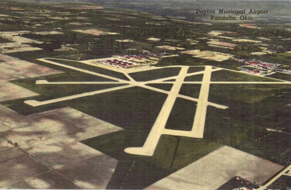
A Weather Bureau Airport Station (WBAS) was opened at the Dayton Airport near Vandalia, Ohio in May 1930. This airport later became the Dayton Municipal Airport in 1936. Image courtesy of the Historical Society of Vandalia-Butler. |
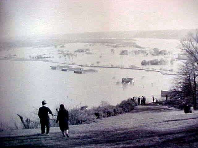
A weather observing station was operated by the Weather Bureau at Lunken Airport from 1930 to 1949. Floods on the nearby Ohio and Little Miami Rivers interrupted observations in 1937 and 1945. |
 |
 |
 |
|
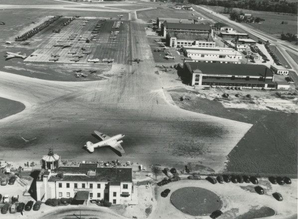
The Administration Building (foreground in this photo) housed the Weather Bureau Airport Station at the Port Columbus Airport from May 1930 until October 1958. Image courtesy of the Columbus Metropolitan Library, Columbus in Historic Photographs Collection. |
The Capitol Trust Building (tallest in this image), located at 8 E. Broad Street, housed the Columbus Weather Bureau office from July 1930 until February 1935. Image courtesy of the Columbus Metropolitan Library, Columbus Memory Collection. |
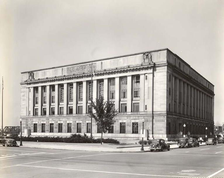
In 1935 the Columbus Weather Bureau office moved into the newly constructed Post Office and Court House Building, located at 85 Marconi Boulevard. The office was largely relocated to the airport in July 1955, but a residual office remained at the post office location through April 1973. |
 |
 |
 |
|
The Dayton Post Office and Federal Building (188 W. Third Street) housed the Weather Bureau office in Room 202 from February 1935 until April 1938. Image courtesy of the Dayton Metro Library's Montgomery County Picture File. |
The Cincinnati Weather Bureau office moves to the Faller Building on the northeast corner of 8th and Walnut Streets. This was a temporary location during construction of a new Federal Building. |
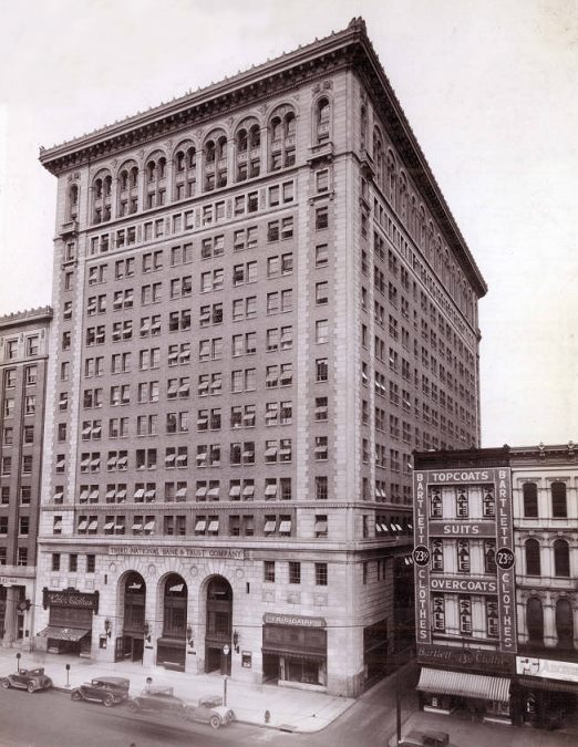
In 1938 the Dayton Weather Bureau office moved to the Third National Bank & Trust Company Building, located at 32 N. Main Street. The office occupied Room 1309 of the building until it merged with an airport station on June 15, 1943. Image courtesy of the Dayton Metro Library's Lutzenberger Picture Collection. |
Mid 20th Century
 |
 |
 |
|
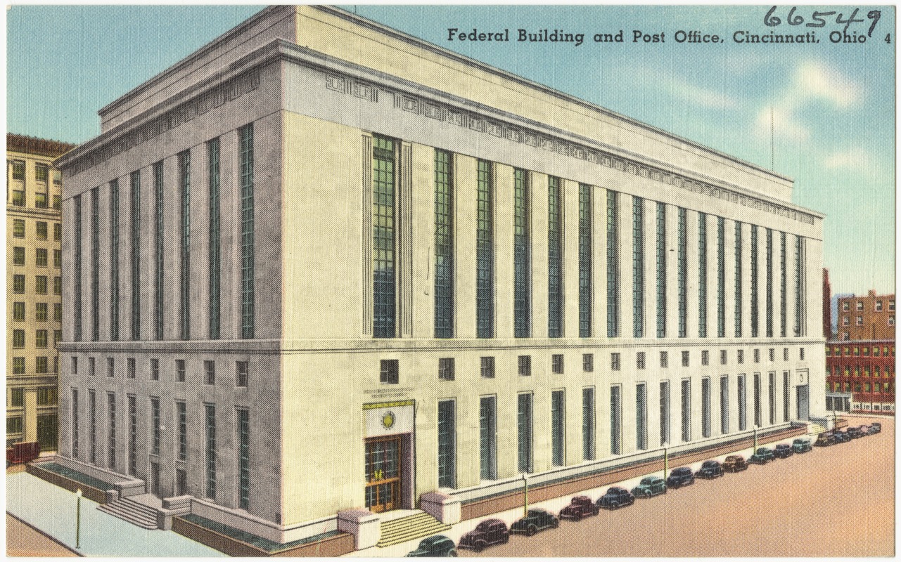
The Cincinnati Weather Bureau office moved into the Federal Building on 5th Street, between Walnut and Main Streets, in 1939. It remained here until 1971, when operations were consolidated to the Greater Cincinnati-Northern Kentucky International Airport. A River Forecast Center opened in the Federal Building in 1946 (which would also relocate to the Wilmington office in the 1990s). |
As part of a government reorganization plan, President Franklin D. Roosevelt advocated transferring the Weather Bureau from the Department of Agriculture to the Department of Commerce: "The importance of the Weather Bureau's functions to the Nation's commerce has also led to the decision to transfer this Bureau to the Department of Commerce. The development of the aviation industry has imposed upon the Weather Bureau a major responsibility in the field of air transportation. The transfer to the Department of Commerce, as provided in this plan, will permit better coordination of Government activities relating to aviation and to commerce generally, without in any way lessening the Bureau's contribution to agriculture." |
The downtown Dayton Weather Bureau office merged with the Weather Bureau Airport Station in June 1943. This new Weather Bureau office was housed in the South Administration Building of the Dayton Municipal Airport. Image courtesy of the Dayton Metro Library's Dayton Postcard Collection. |
|
|
 |
|
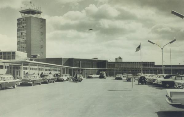
The Weather Bureau established a Weather Bureau Airport Station at the new Cincinnati-Northern Kentucky Airport in 1947. This station replaced the Weather Bureau station at Lunken Airport. The Cincinnati city office of the Weather Bureau/National Weather Service remained in downtown Cincinnati until being relocated here in 1971. The new consolidated operations became Weather Service Office (WSO) Cincinnati. |
A U.S. Weather Bureau office briefly opened up in Portsmouth, Ohio in 1953, but was closed just 2 years later in 1955. |
The new terminal building at the Port Columbus Airport, completed in 1958, housed the Weather Bureau Airport Station (later WSO Columbus) office from October 1958 until July 1981. Photo courtesy of the Columbus Metropolitan Library, Columbus in Historic Photographs Collection. |
 |
 |
 |
|
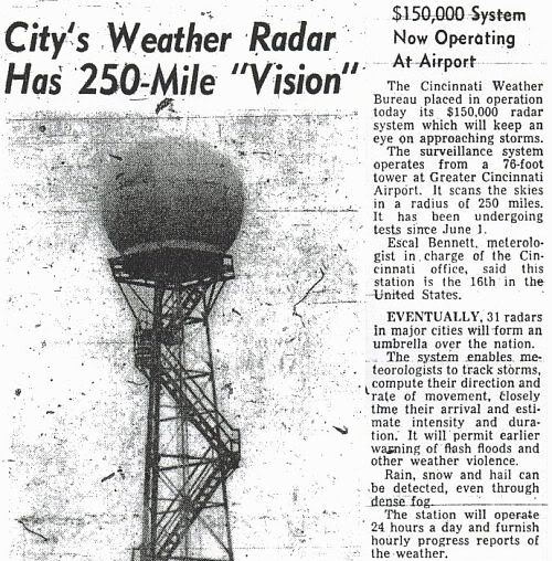
A WSR-57 (Weather Surveillance Radar - 1957) was installed by the Weather Bureau at the Greater Cincinnati Airport. Testing began in June 1960. The radar operated until June 21, 1996, when it was decommissioned in favor of the new WSR-88 in Wilmington. |
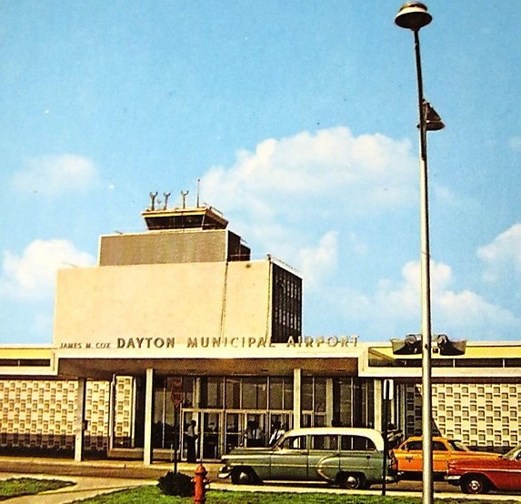
The Dayton Weather Bureau office moved into the newly constructed terminal building of the James M. Cox Dayton Municipal Airport on December 6, 1961. The office remained in this building until February 4, 1974. |
In a July 1970 statement to Congress, President Nixon proposed creating NOAA to serve a national need "for better protection of life and property from natural hazards...[and] for a better understanding of the total environment." On October 3, NOAA was established under the Department of Commerce. The U.S. Weather Bureau was assigned to NOAA and was subsequently renamed the National Weather Service. |
Modern NWS
 |
 |
 |
|
One of the National Weather Service's second generation radars (WSR-74) was commissioned for Columbus on June 9, 1977 to replace the old WSR-3 radar that had been decommissioned on January 19, 1977. This WSR-74C was eventually decommissioned on December 1, 1995. |
WSO Columbus moved from the Terminal Building of the Port Columbus International Airport to a new location by the airport, 4600 Bridgeway Avenue, on July 1, 1981. The office remained at this location until it closed in 1996, with the new NWS Wilmington office taking over warning and forecast responsibilities for the area. |
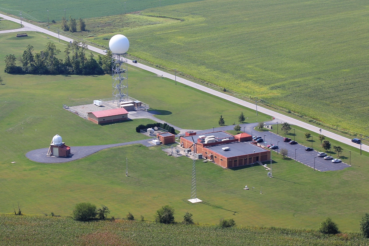
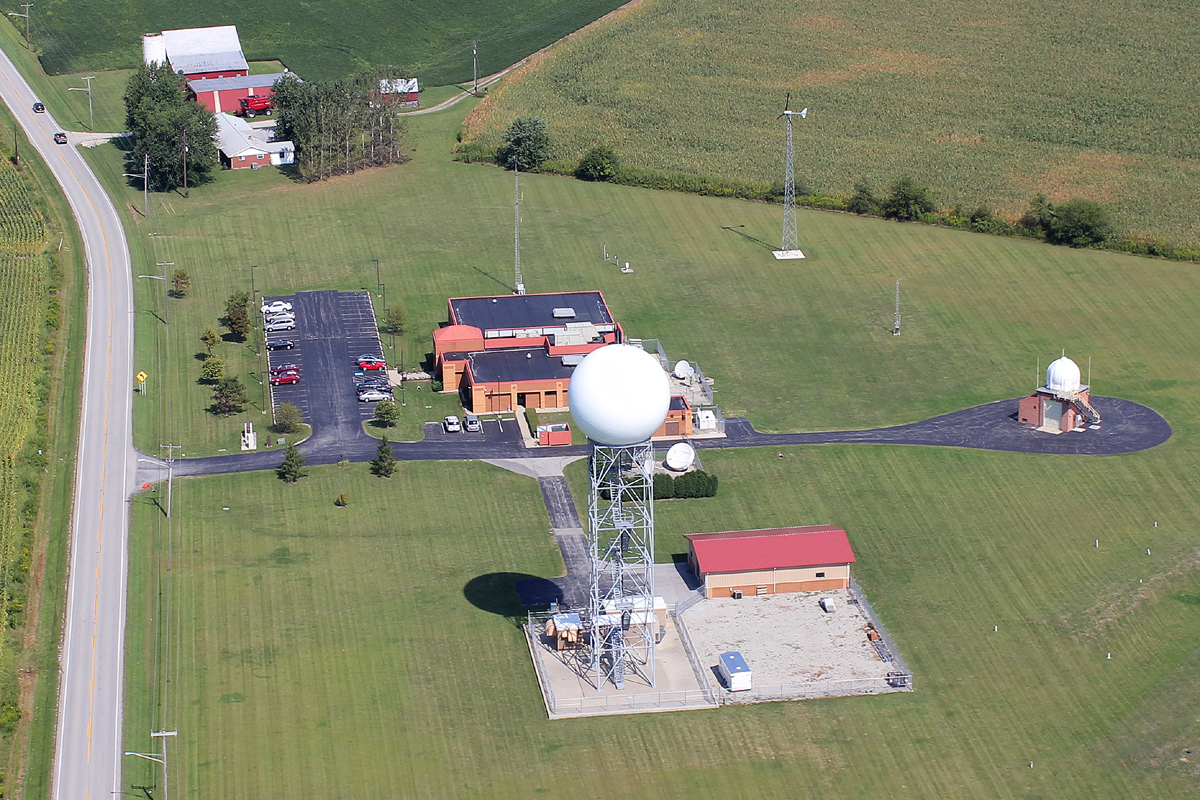
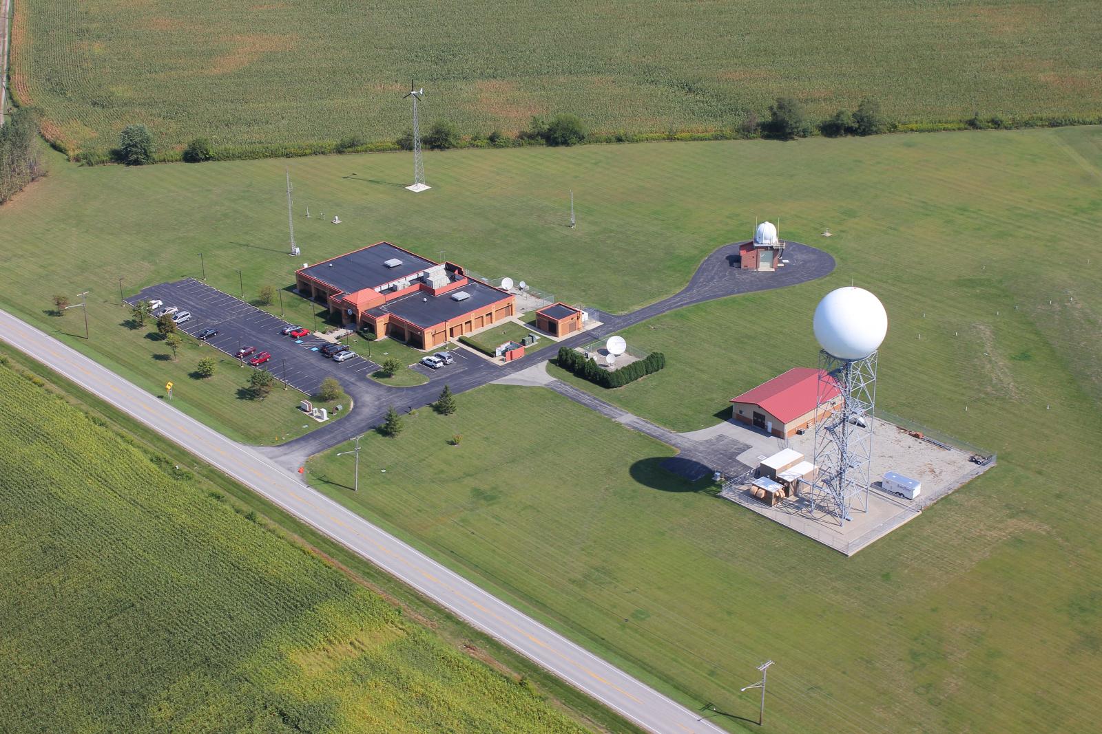
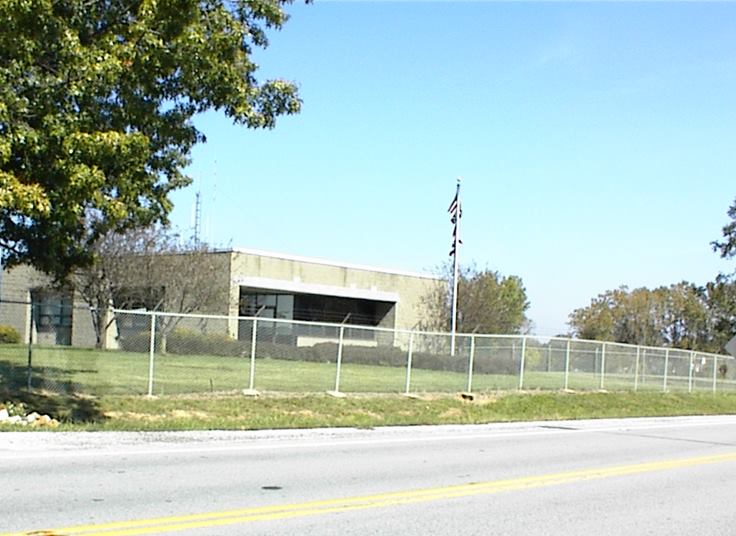
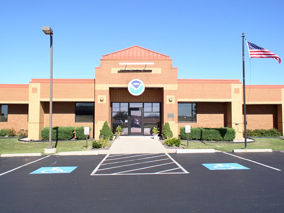
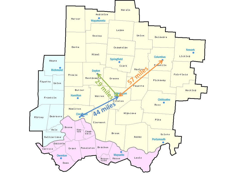
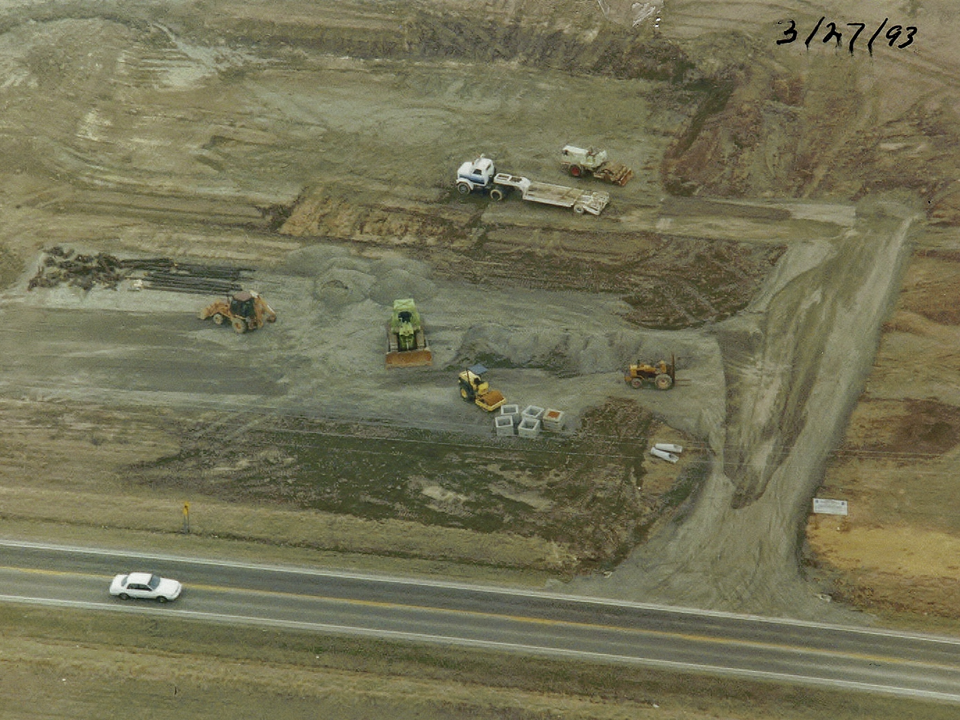
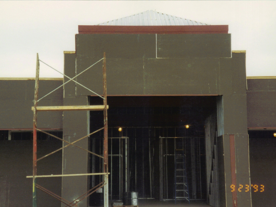
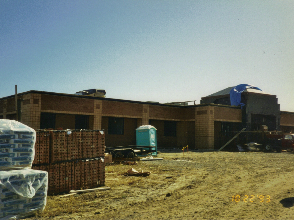
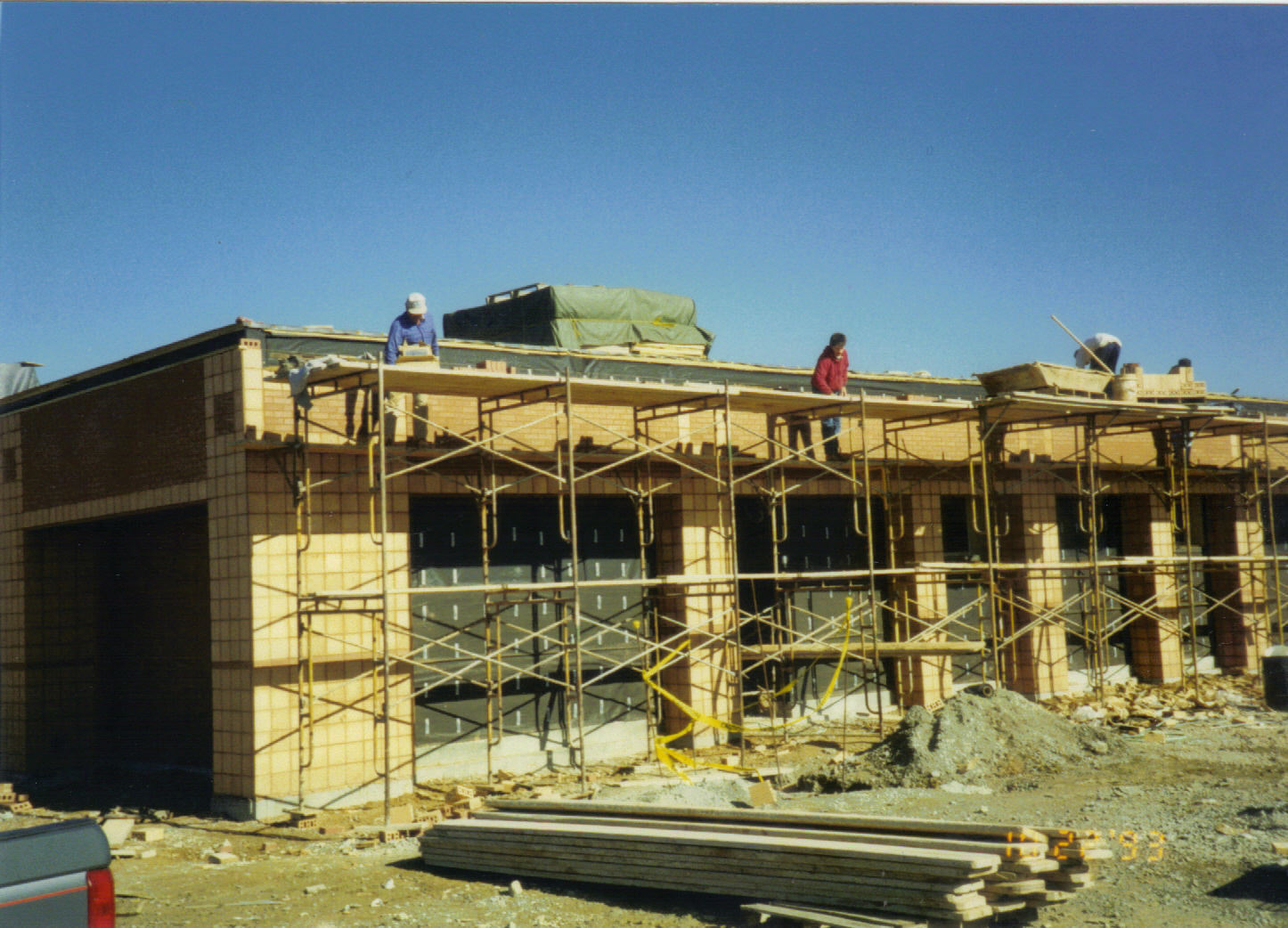
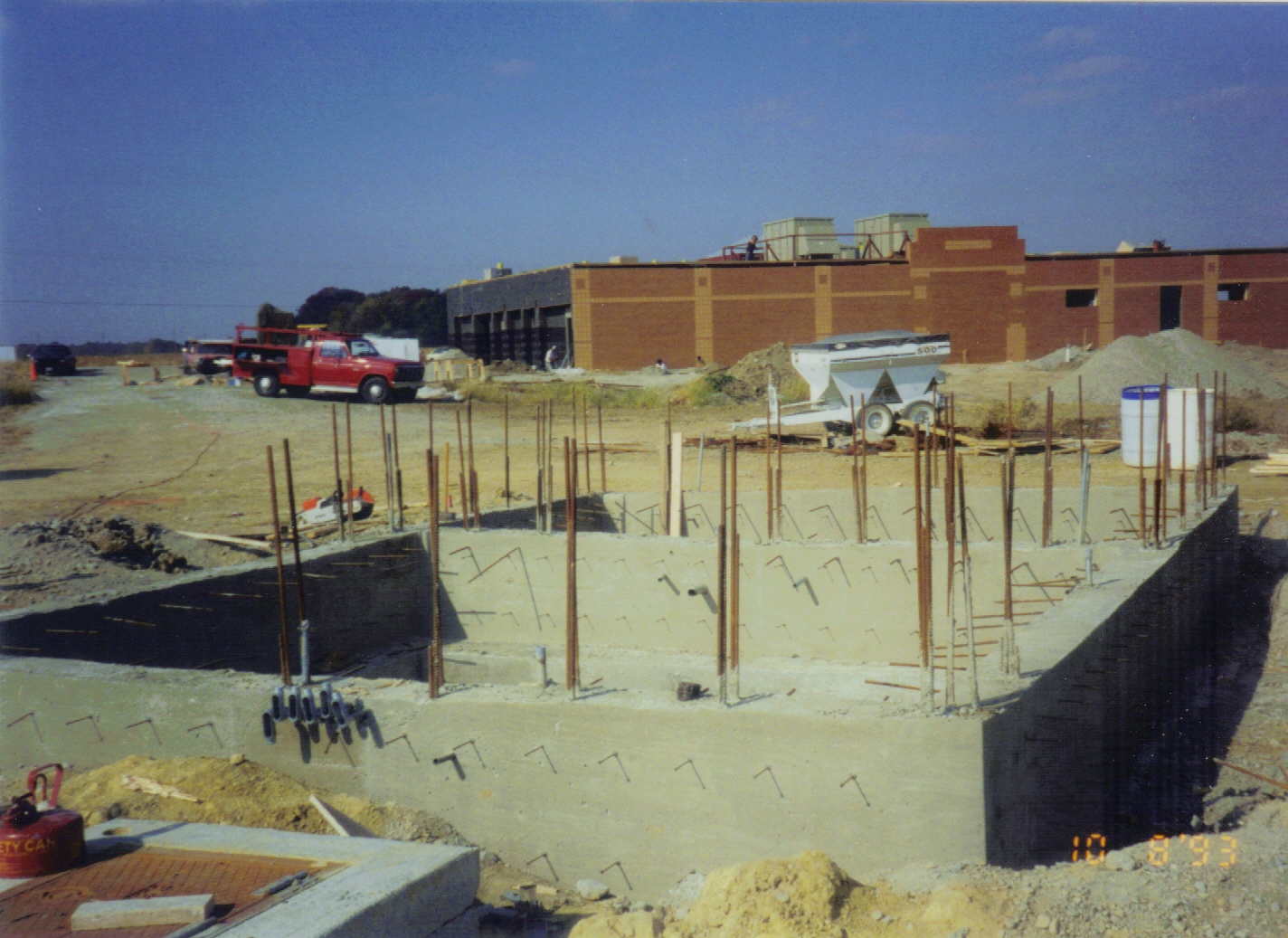
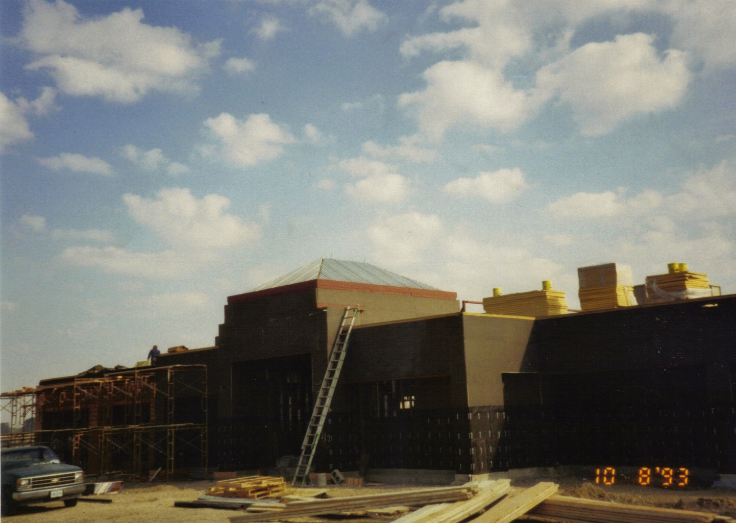
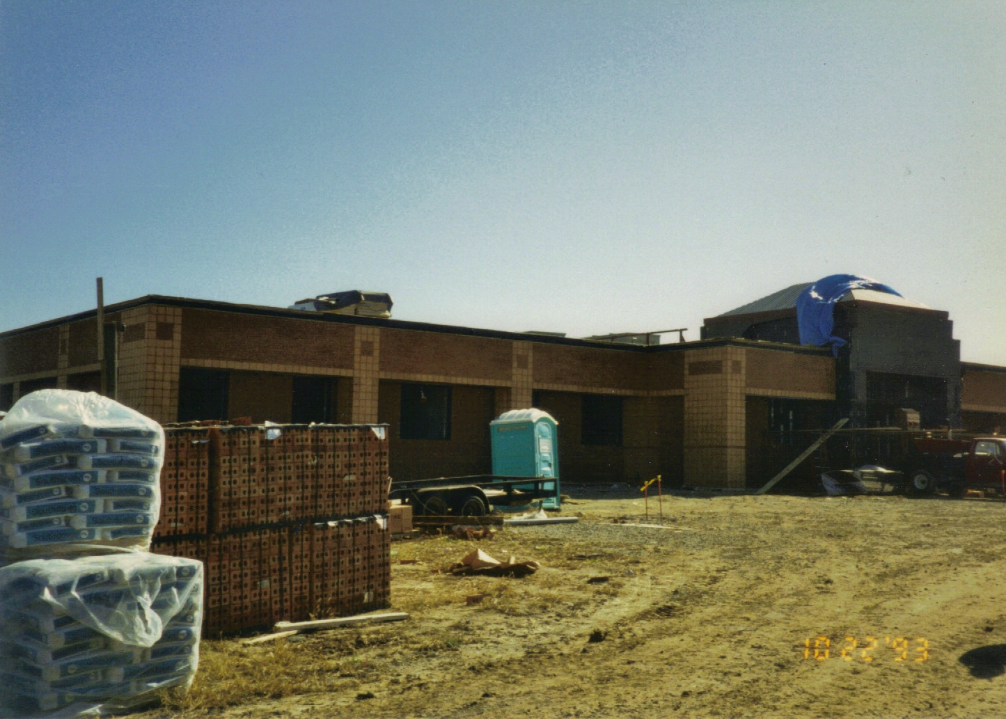
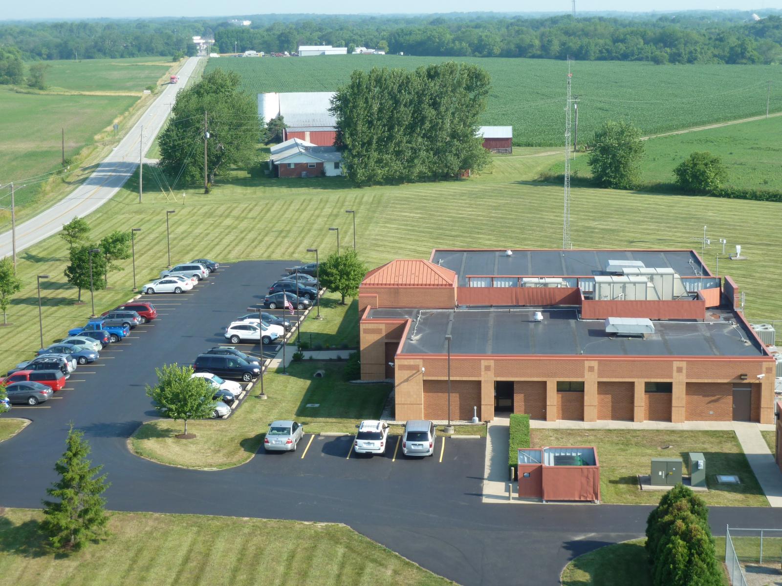
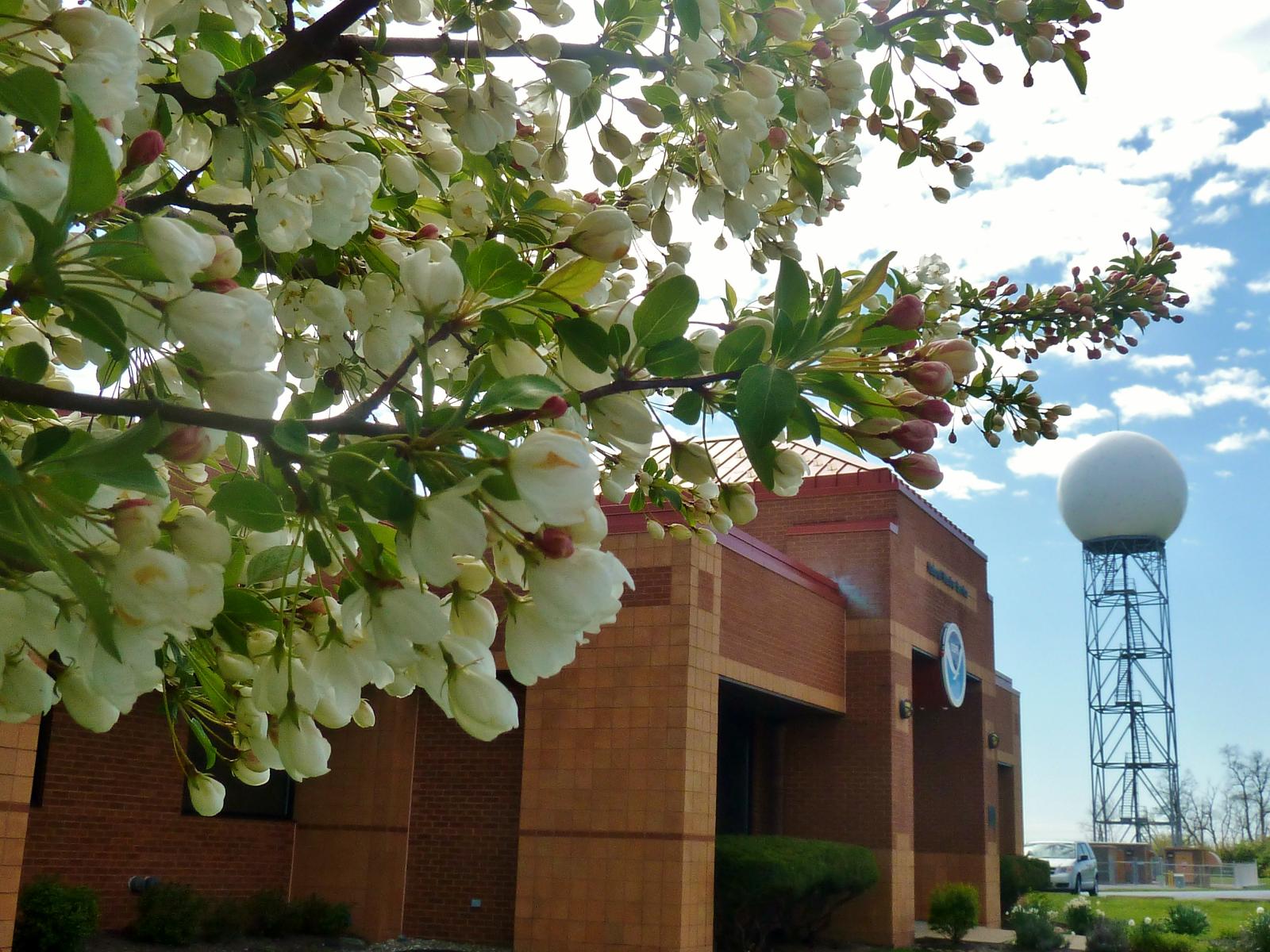
The Weather Forecast Office (WFO) in Wilmington was built in 1993 to replace the Weather Service Offices (WSOs) in Cincinnati, Columbus, and Dayton. Wilmington was viewed as an ideal central location to handle the forecast and warning responsibilities for the three metropolitan areas. |
The National Weather Service decided to place a weather forecast office in Wilmington, Ohio because of its centrally-located position between three major metropolitan areas in the Ohio Valley (Cincinnati, Columbus, Dayton). Additionally, placing a radar in Wilmington would offer good coverage and resolution for the skies over the three big cities.
 |
 |
 |
|
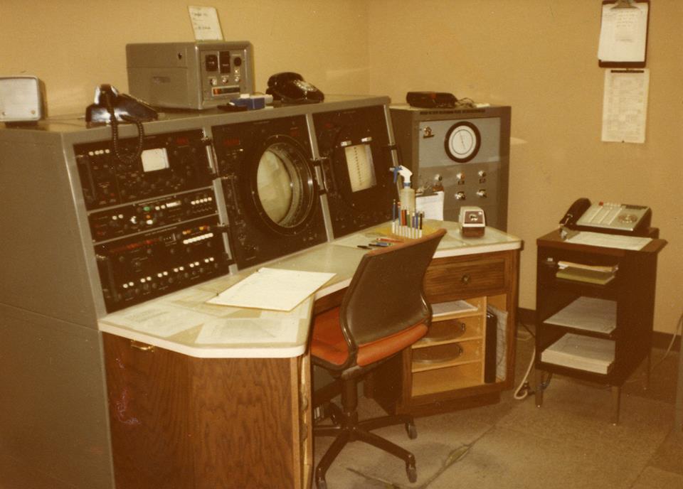
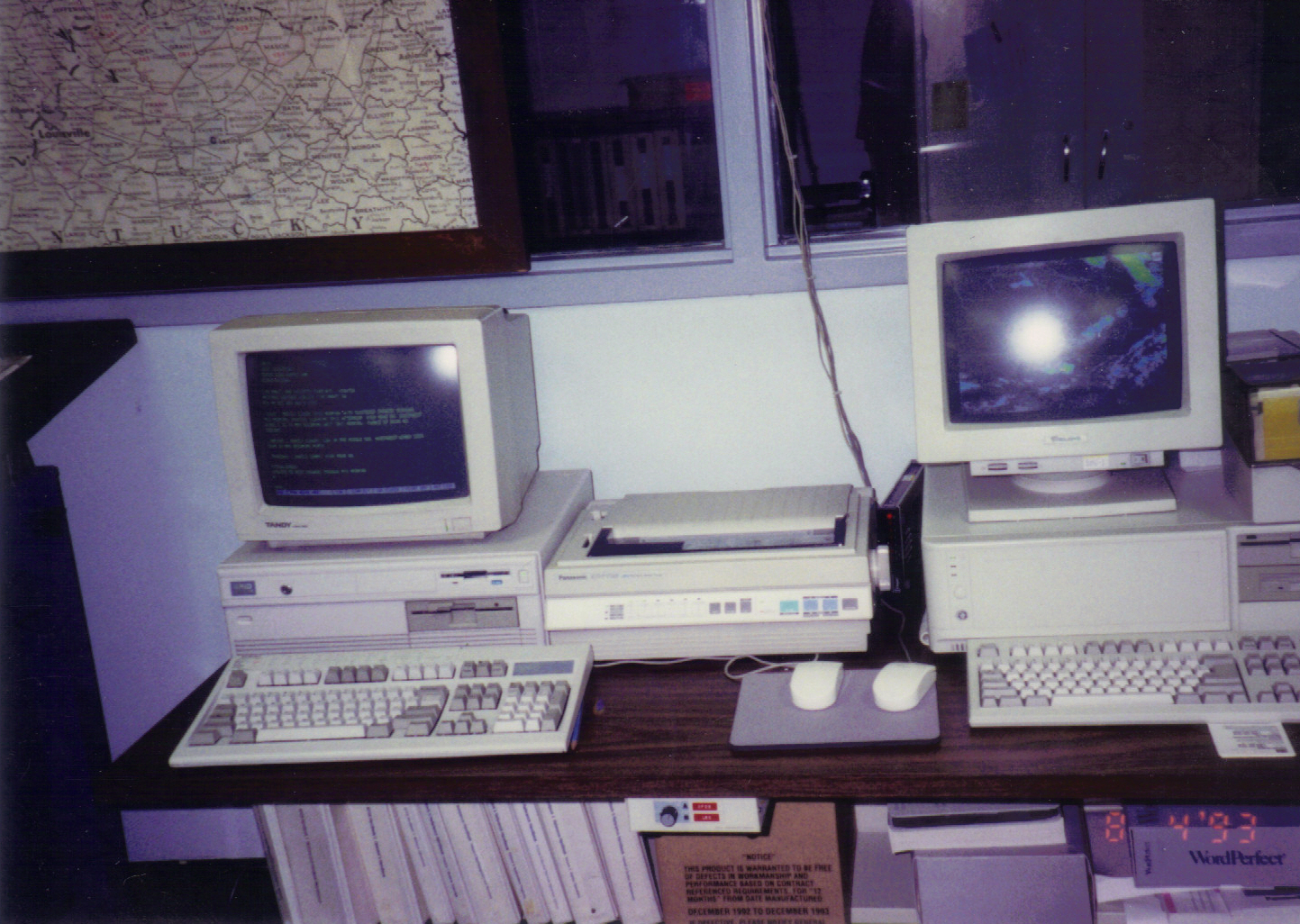
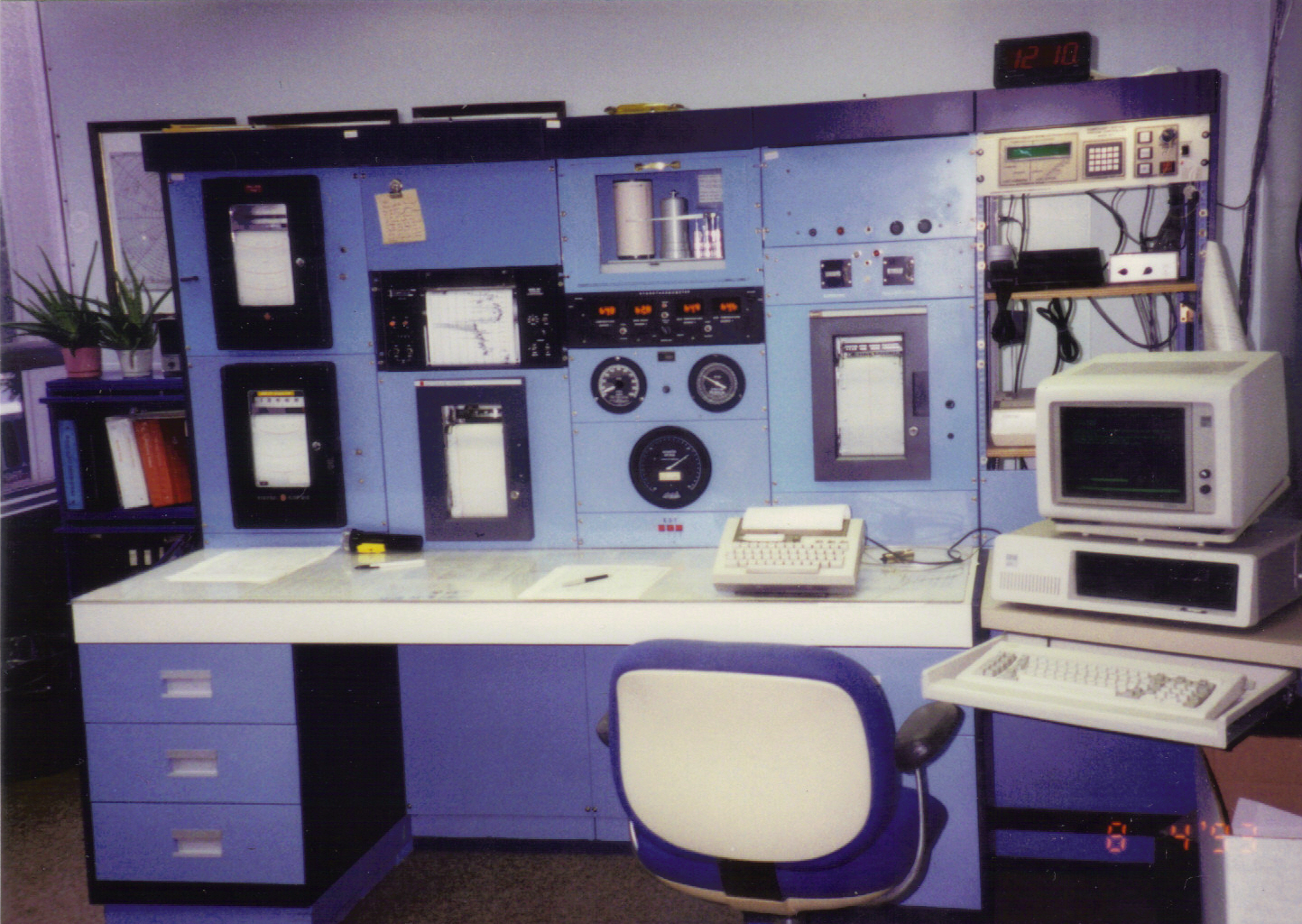
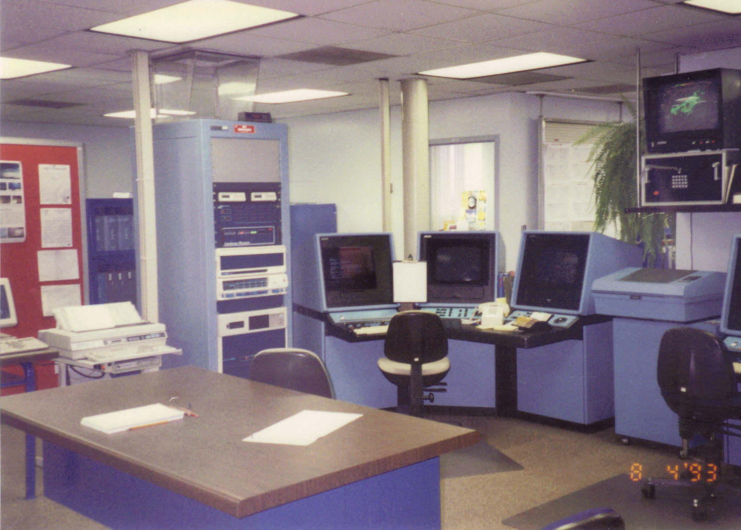
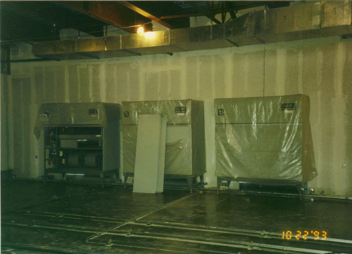
These select pictures were taken inside the decommissioned Cincinnati Weather Service Office (WSO) in the early 1990s. |
||
 |
|
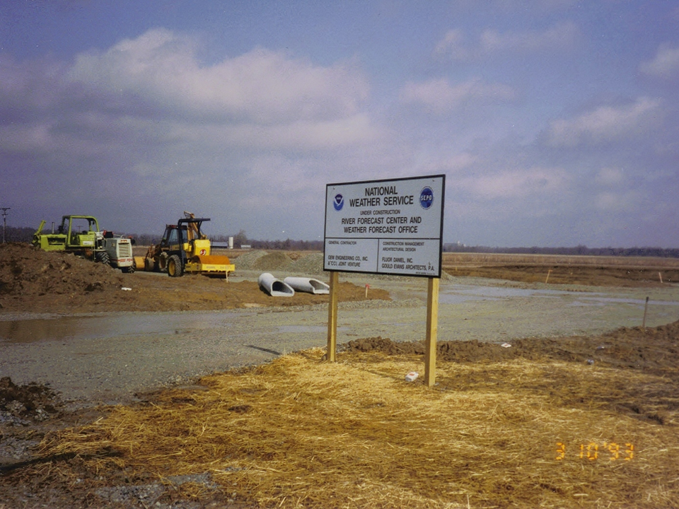
NWS Wilmington, Ohio opened its doors for the first time in February of 1994 as part of a national reorganization and consolidation effort of the NWS. The Weather Forecast Office (WFO) in Wilmington was built in 1993 to replace the Weather Service Offices (WSOs) in Cincinnati, Columbus, and Dayton. Wilmington was viewed as an ideal central location to handle the forecast and warning responsibilities for the three metropolitan areas. The WSO in Cincinnati closed the same year WFO Wilmington began operations. WSO Dayton closed a year later, while WSO Columbus closed in 1996. The closure of WSO Columbus marked completion of the transition process between the WSOs and the new WFO Wilmington, Ohio. |
Construction on the new Weather Forecast Office near Wilmington, Ohio took place from 1993 through early 1994, and the office was officially commissioned in February of 1994.
 |
 |
 |
 |
 |
 |
 |
 |
 |
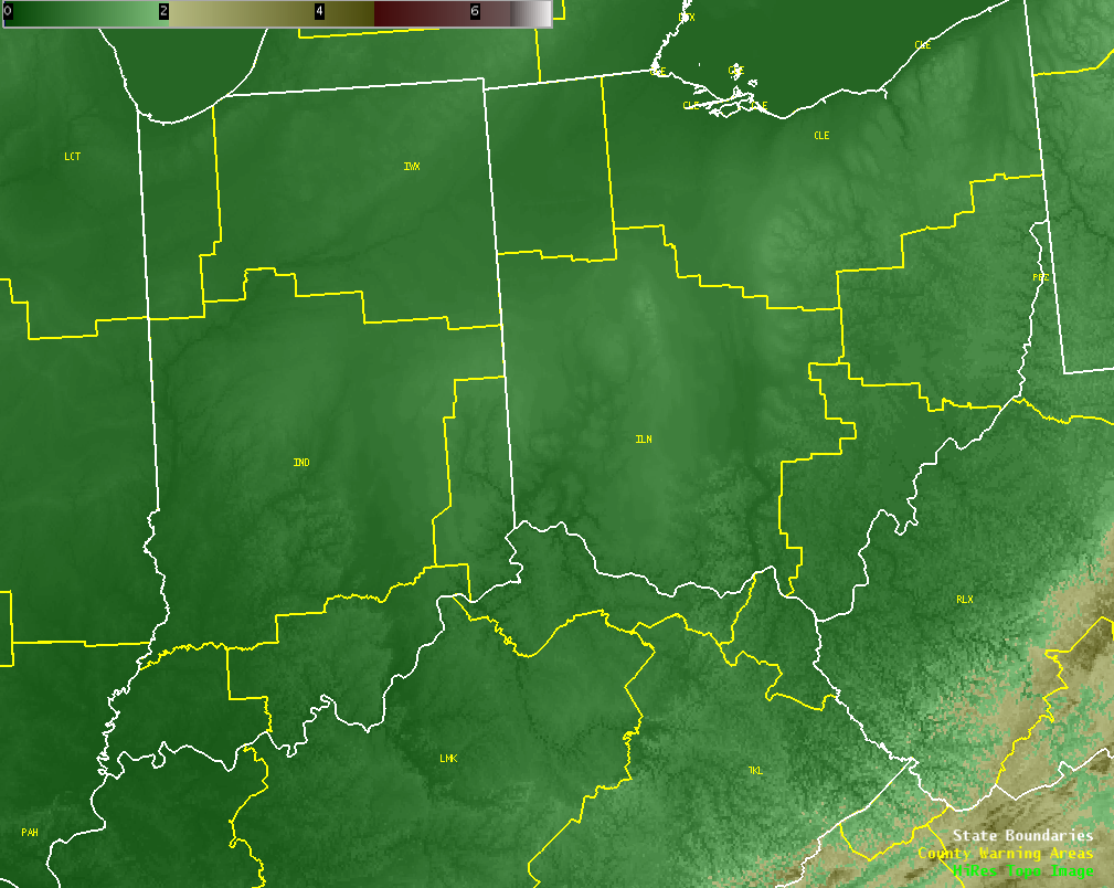
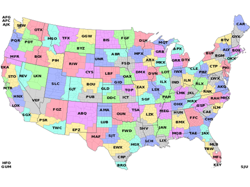
NWS Wilmington, Ohio has forecast and warning responsibility for 52 counties across southeastern Indiana, southwestern Ohio, and northern Kentucky. Our county warning area, or CWA, shares borders with CWAs from WFOs Indianapolis, Syracuse (IN), Cleveland, Pittsburgh, Charleston (WV), Jackson (KY) and Louisville. There are 122 NWS WFOs nationwide.
 |
 |
|
Each office is responsible for forecasts, warnings, and observations within their respective county warning area (CWA). |
|
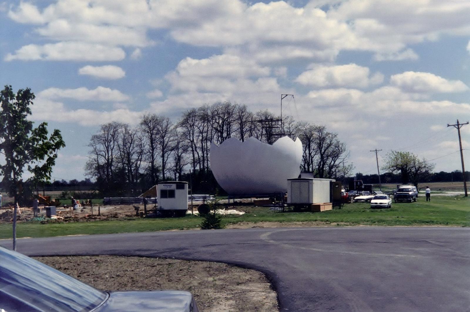
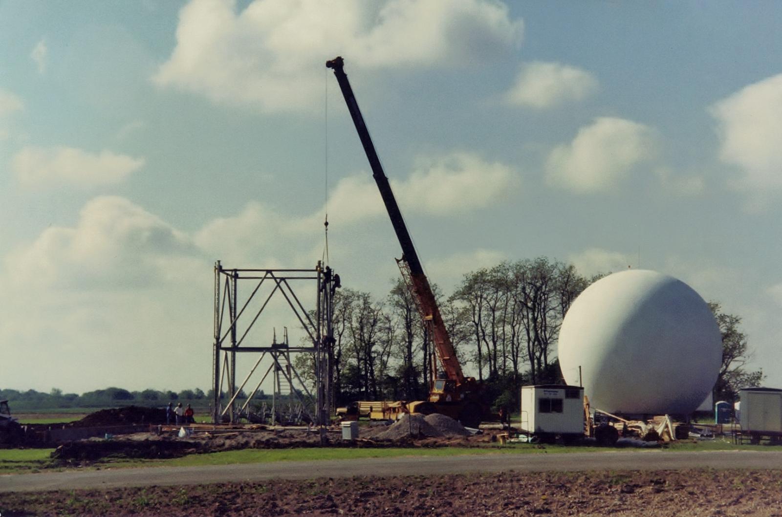
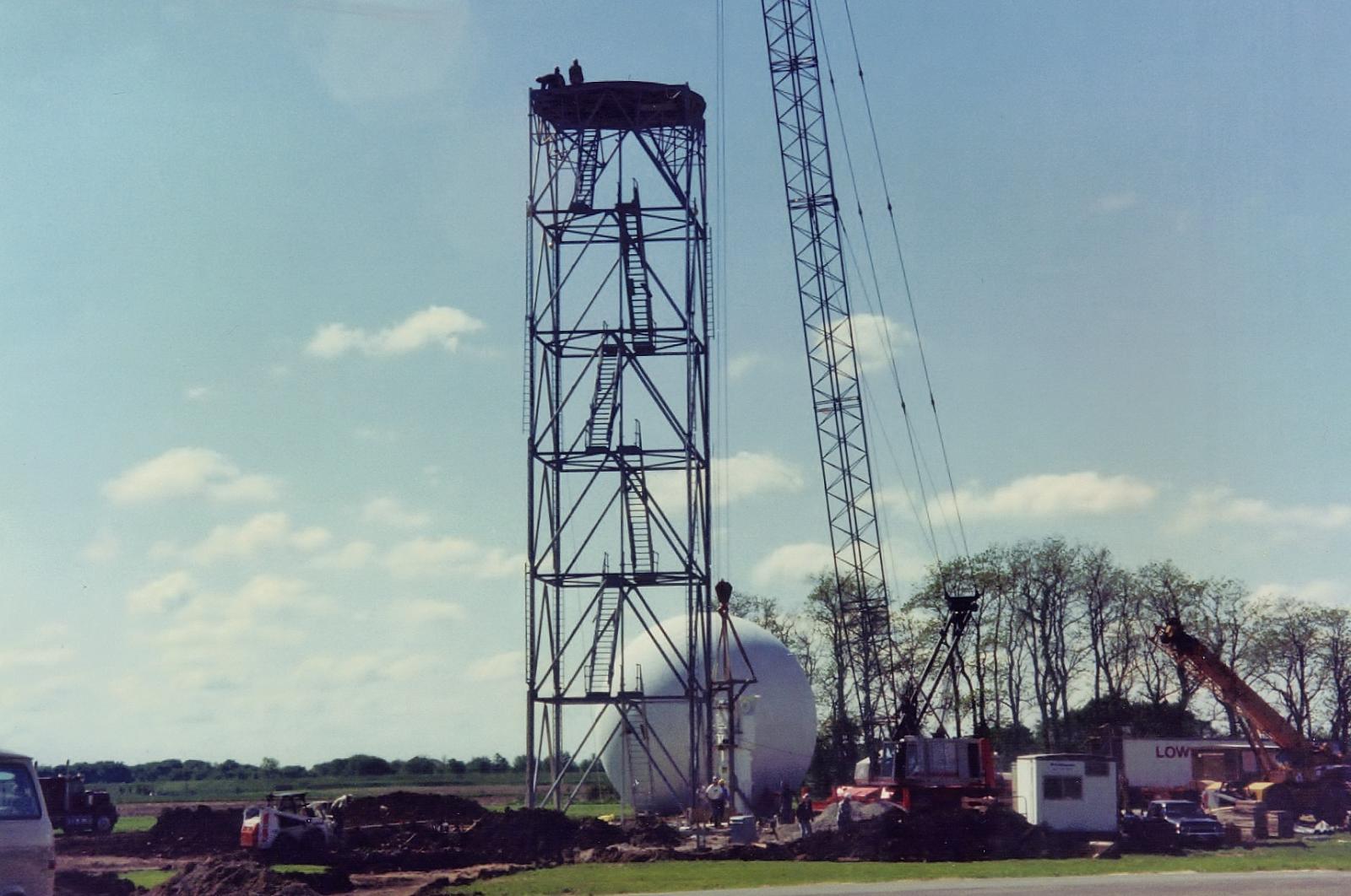
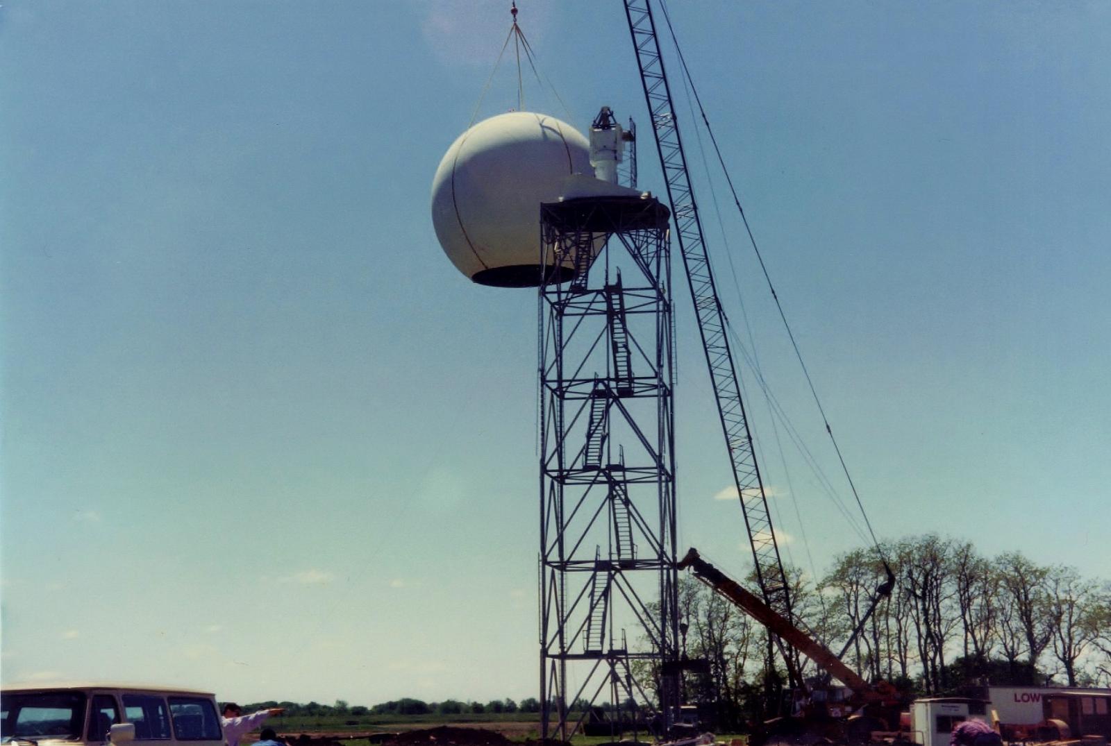
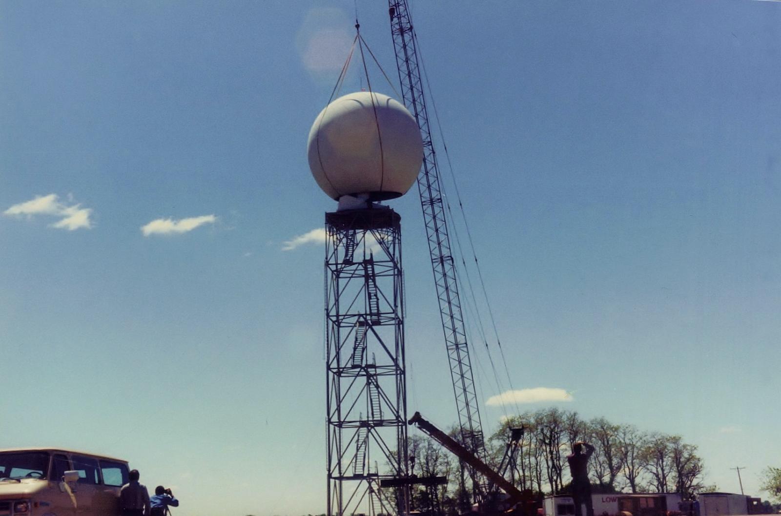
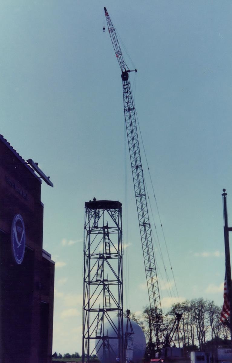
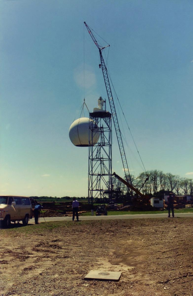
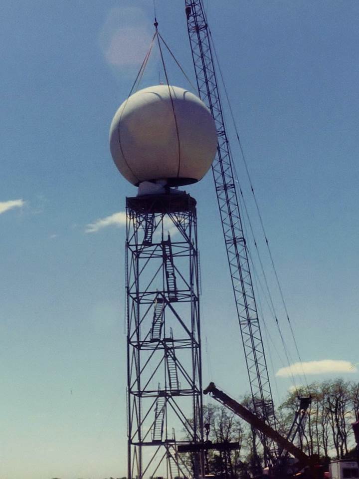
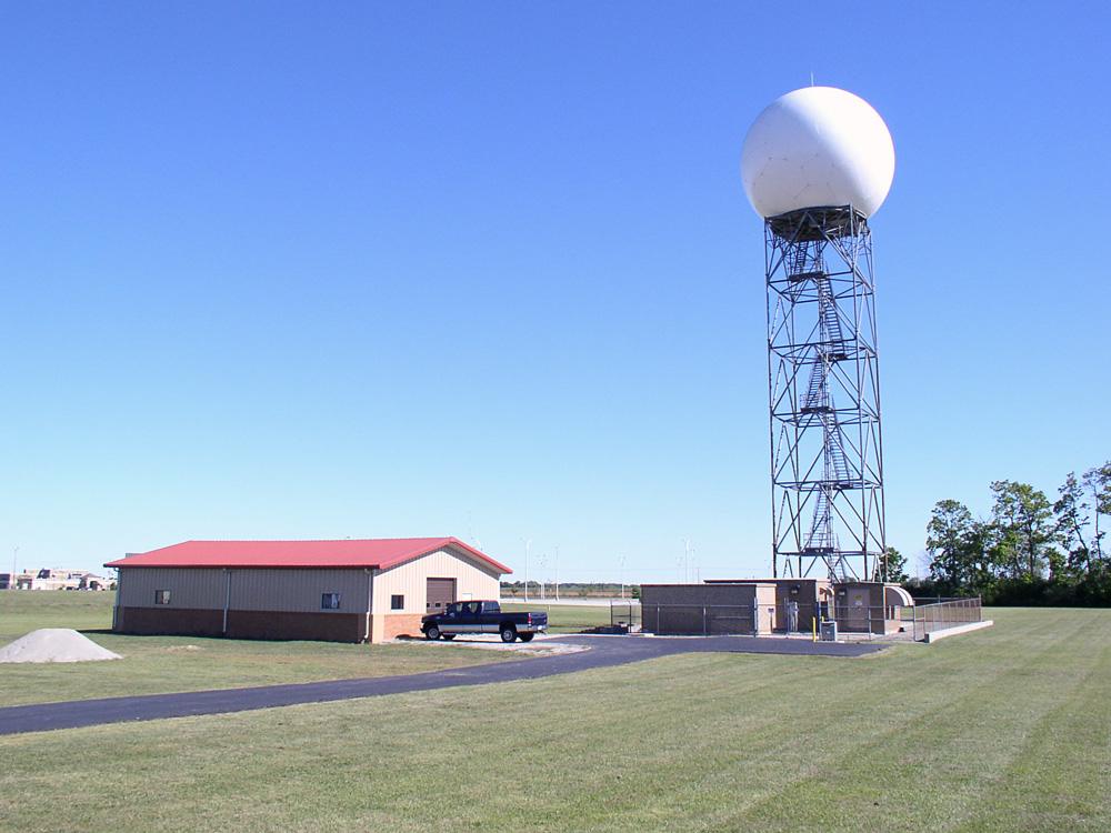
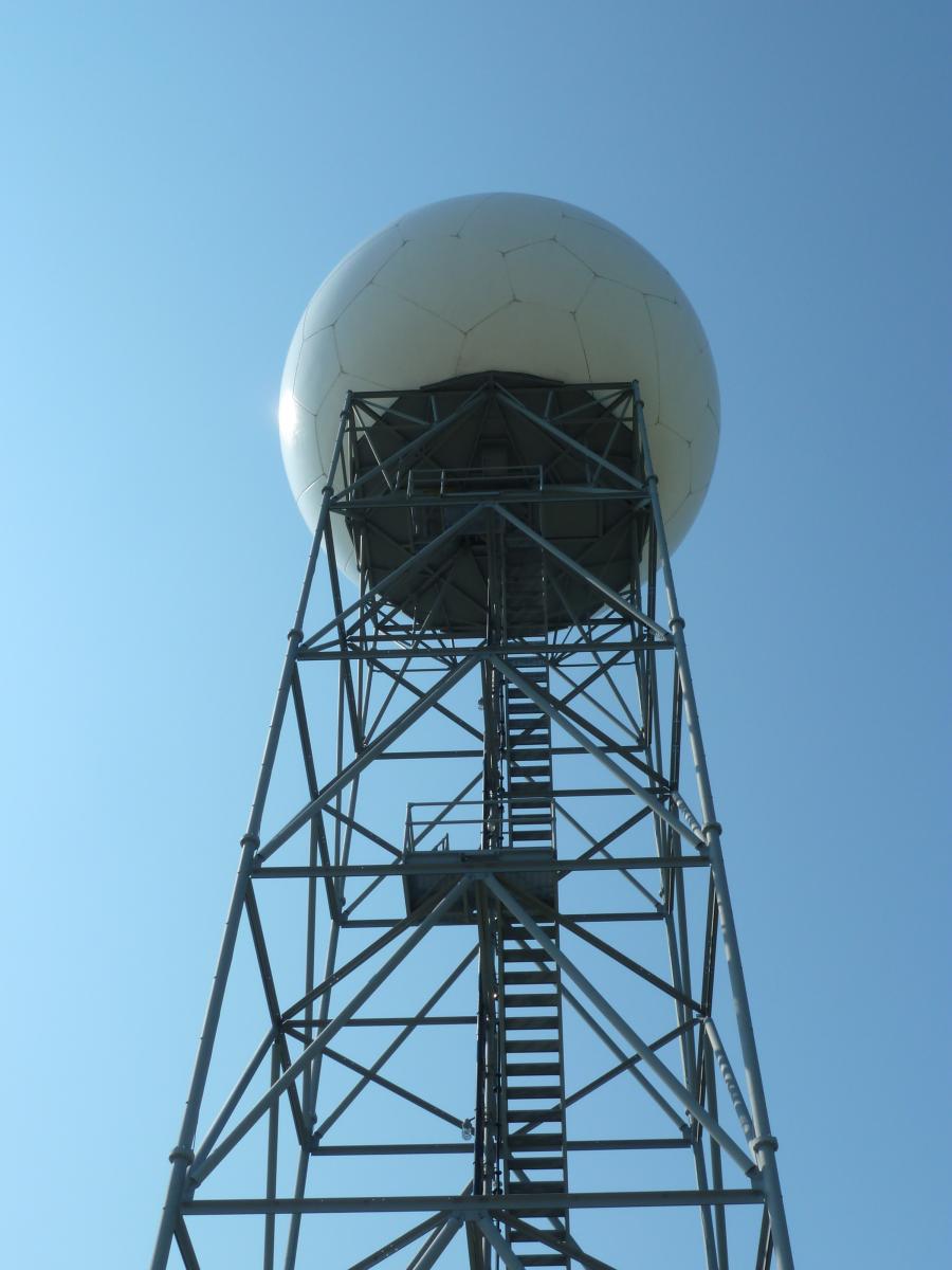
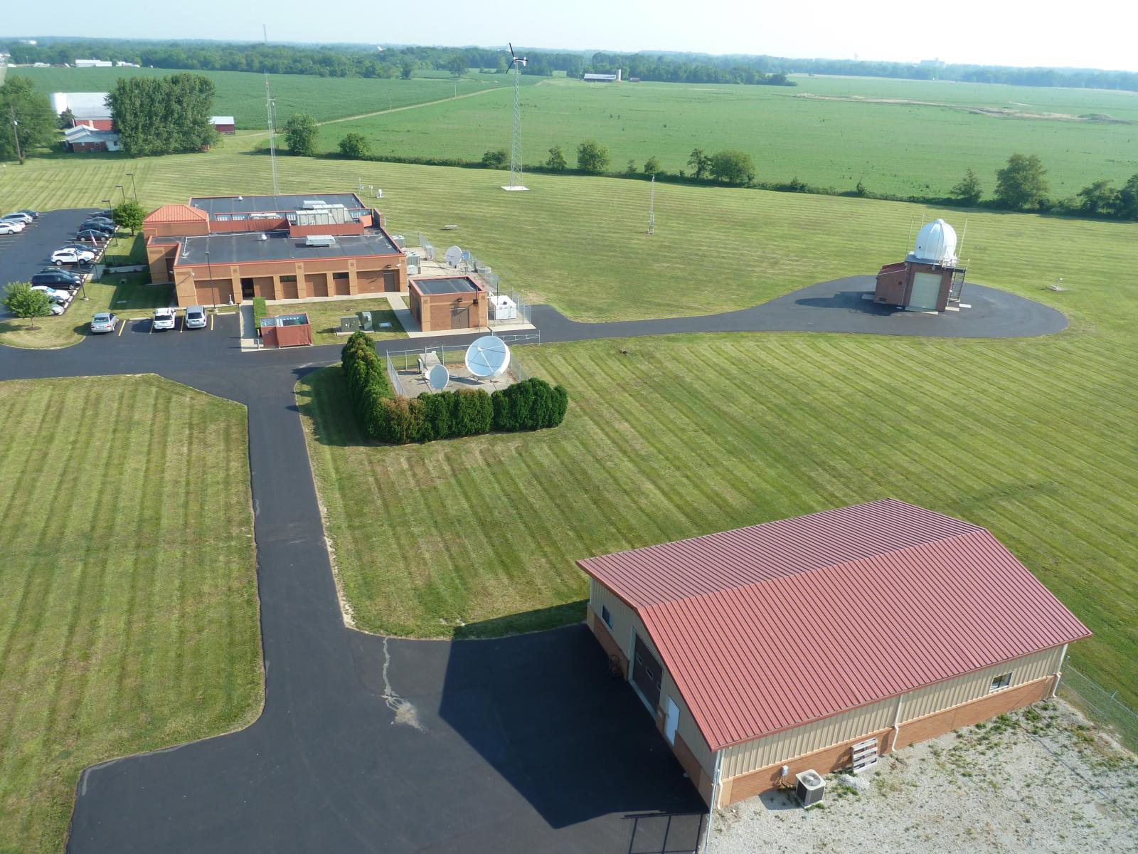
One of the most appealing aspects of locating a WFO in Wilmington was the fact that installing a WSR-88 radar next to the office would offer good scanning resolution over the three main metropolitan areas across central and southwestern Ohio. The on-site WSR-88D tower stands more than 150 feet tall. Pictures of construction/assembly of the WSR-88 can be seen below.
 |
 |
 |
 |
 |
 |
 |
 |
 |
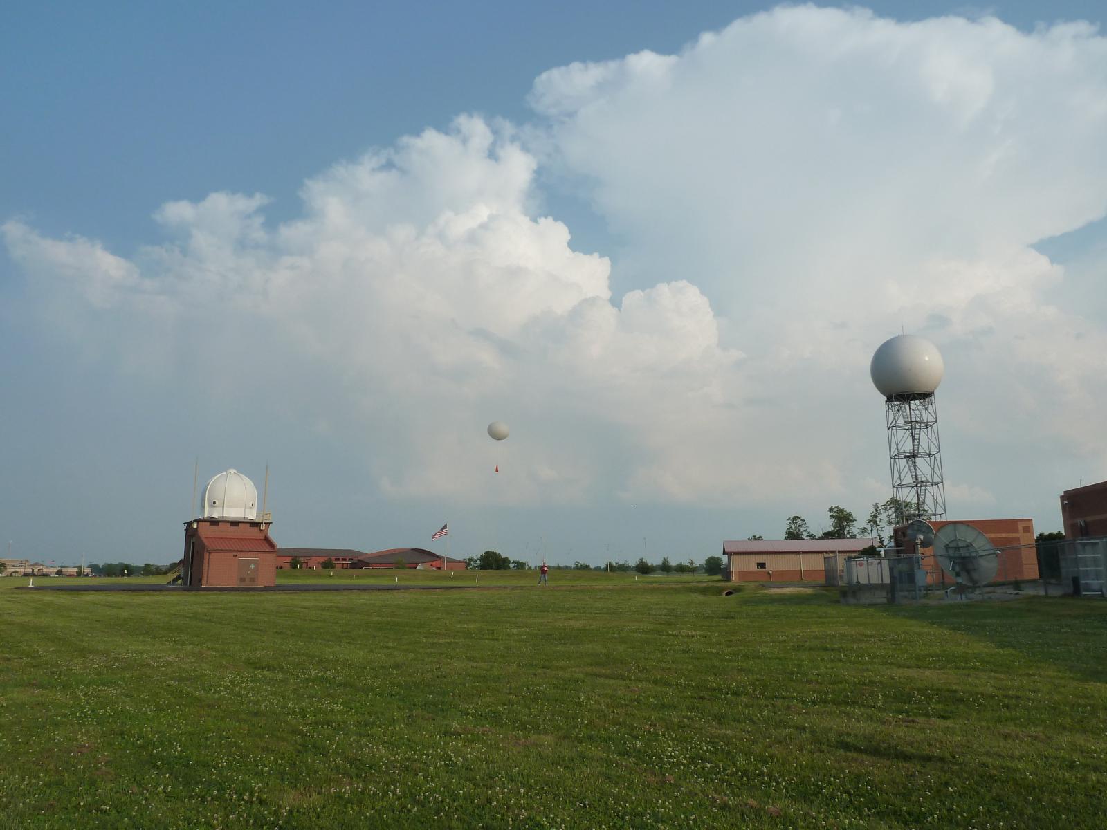
NWS Wilmington is part of a national/worldwide network of sites that conduct upper-air observations. Upper-air observations obtain critical data through the depth of the atmosphere that is vital for both human and model forecasts alike.
 |
 |
 |
|
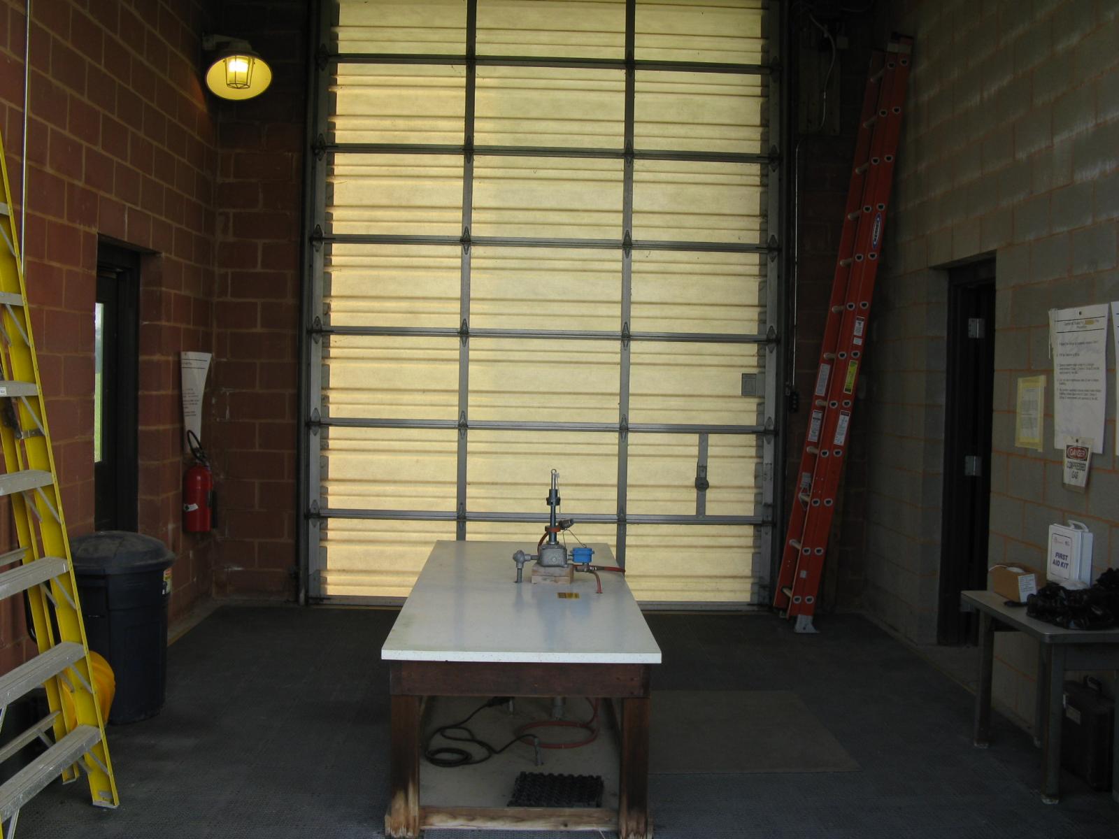
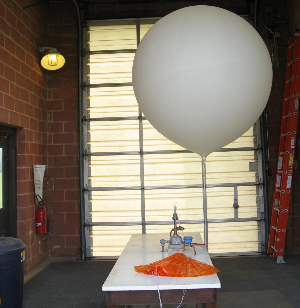
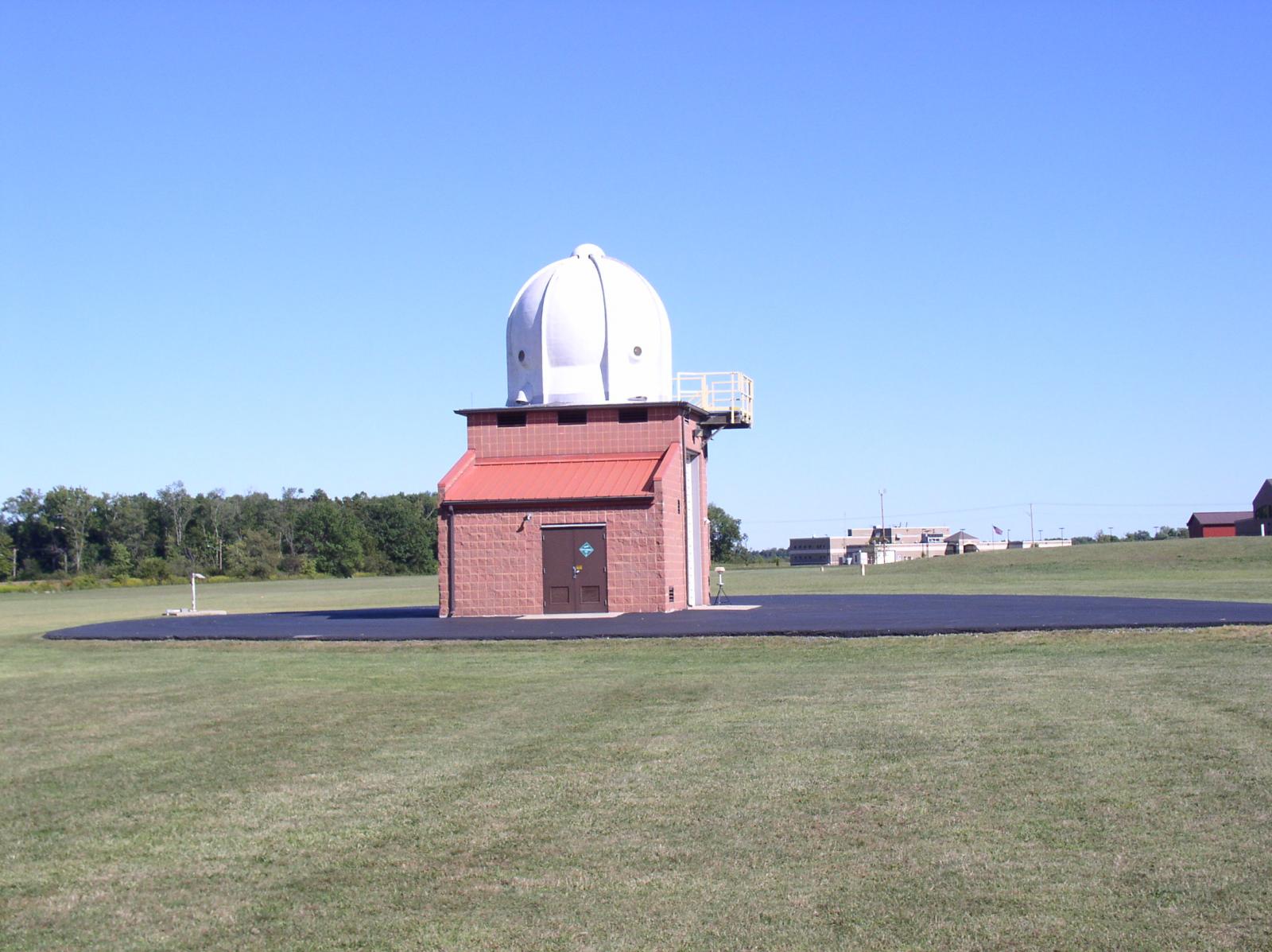
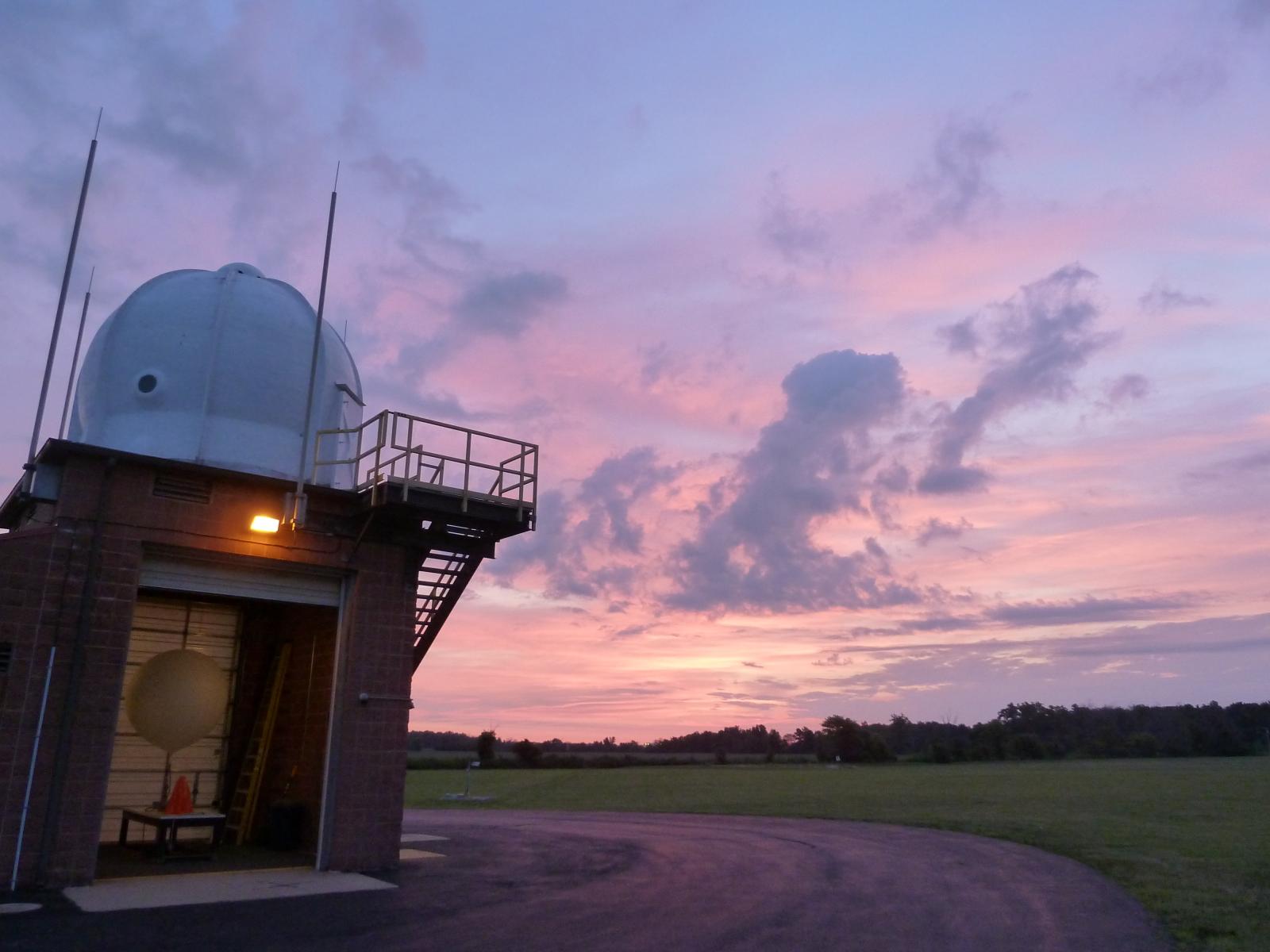
A brick garage-like structure houses the weather balloon inflation equipment and systems. All inflations of the weather balloon occur within this structure while launches of the balloons occur on the surrounding pavement. |
||
 |
 |
 |
|
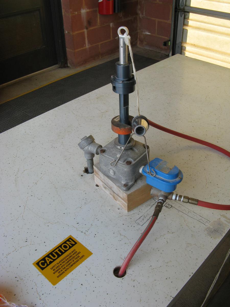
Our equipment enables observers to fill the weather balloons with either hydrogen or helium. Hydrogen, while lighter and less expensive, is flammable. Helium, however, is a more stable alternative that can be used in place of hydrogen during very windy conditions (in situations where the balloon may be more prone to bursting before launch). |
||
 |
 |
 |
|
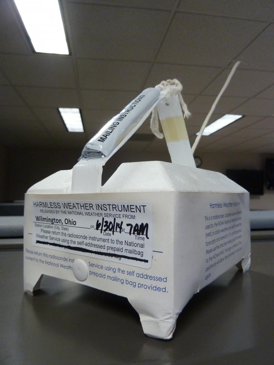
Observers attach an instrument, called a radiosonde, to the weather balloon. This instrument takes measurements on temperature, humidity, pressure, and wind speed and direction through the entirety of the depth of the atmosphere. |
||
 |
 |
 |
|
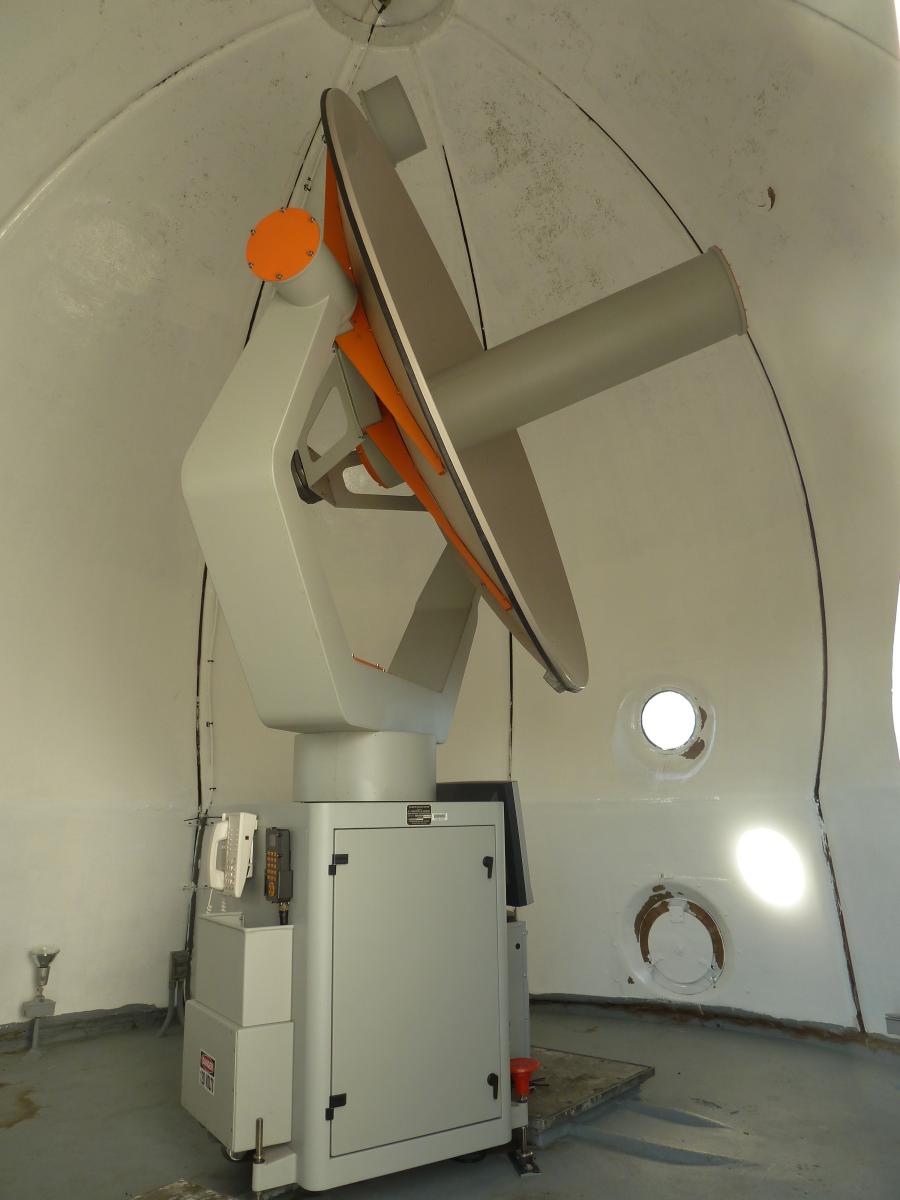
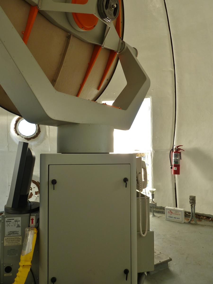
The radiosonde sends back a signal with encoded data to the office through a telemetry receiving system. This satellite dish, which is located above the inflation shelter, stays in constant communication with the radiosonde through the flight. Once the signal is locked on, the "dish" will move as the instrument signal moves. The TRS can be controlled through a computer located inside the office. All incoming data is monitored from this workstation. |
||
 |
 |
 |
|
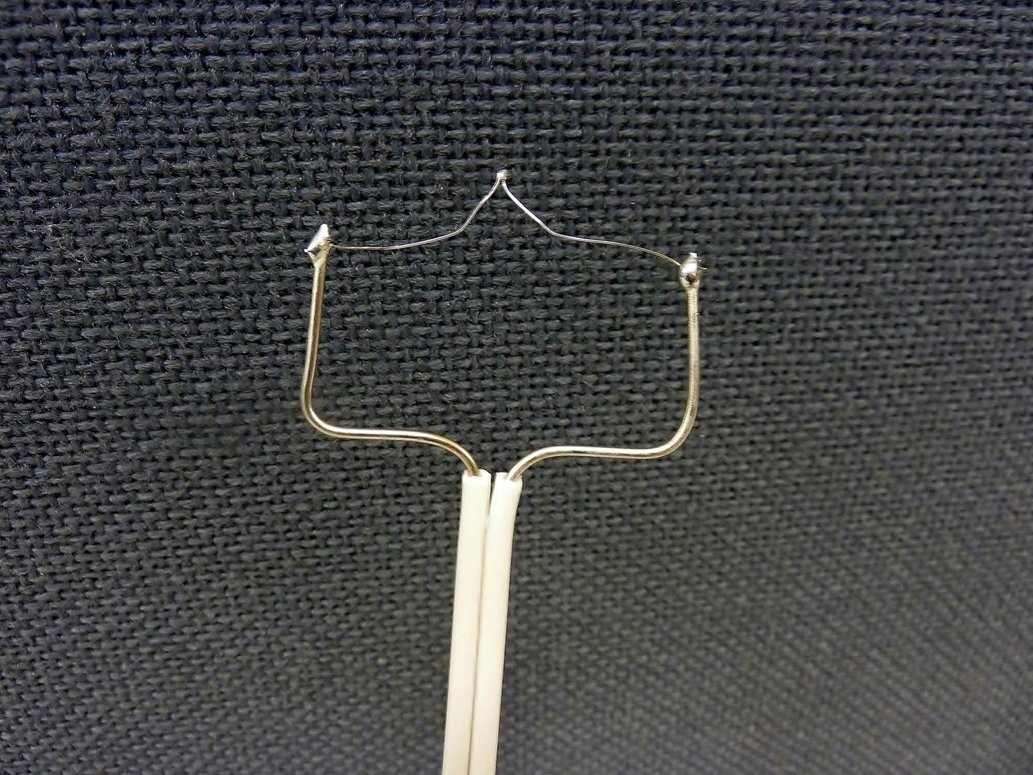
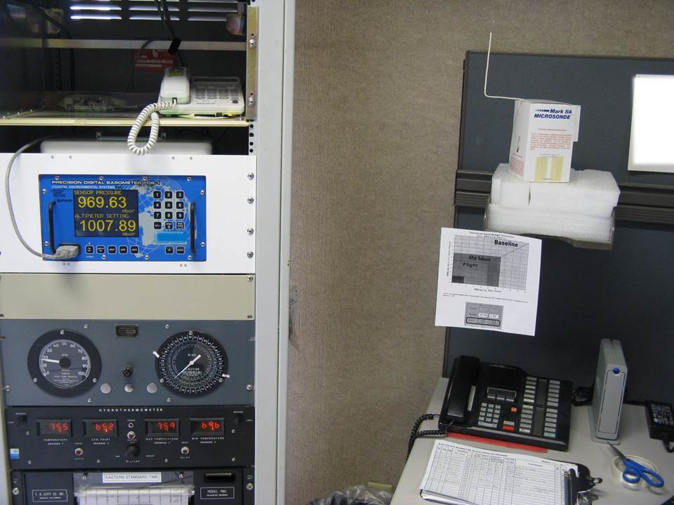
Observers must test (or baseline) the radiosonde before attaching to the weather balloon by comparing measurements from the instrument to ambient environmental conditions. Each office has a similar baseline setup as well as extra supplies to ensure that no flight is missed. |
||
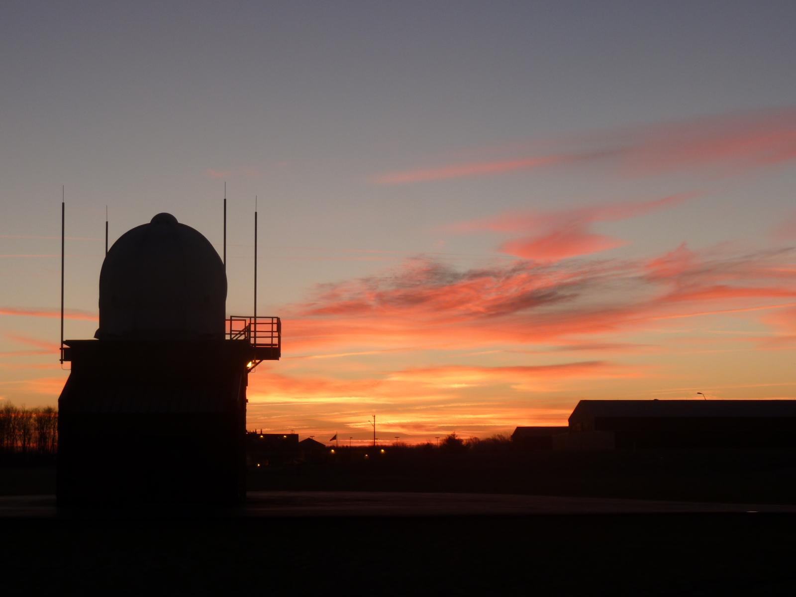
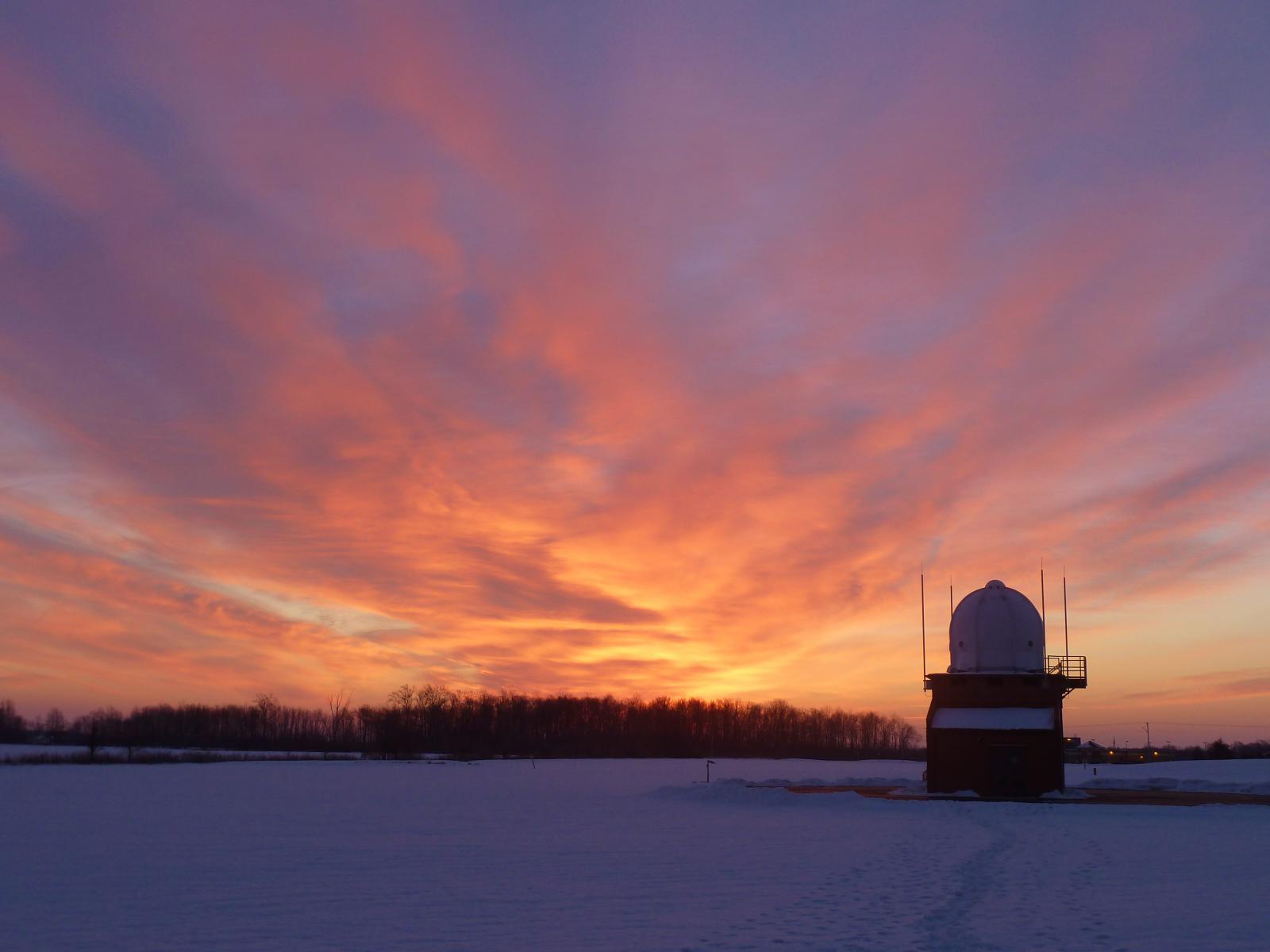
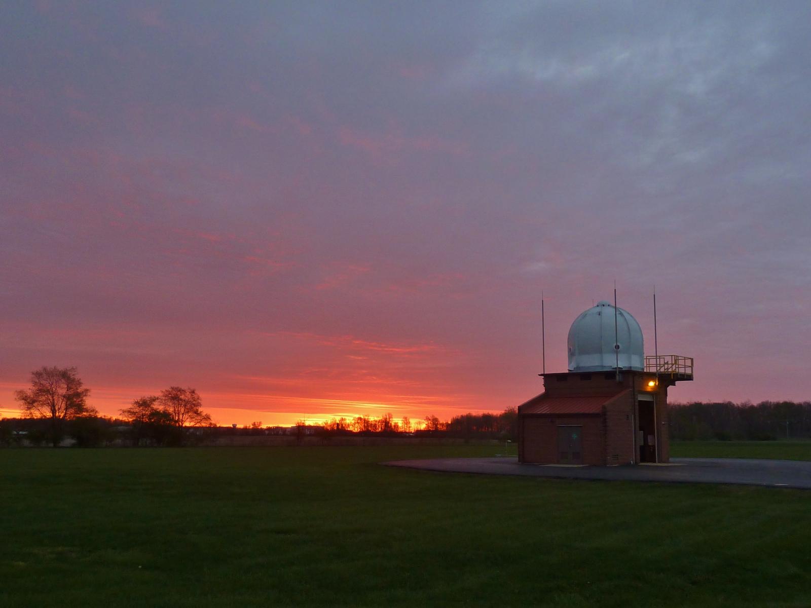
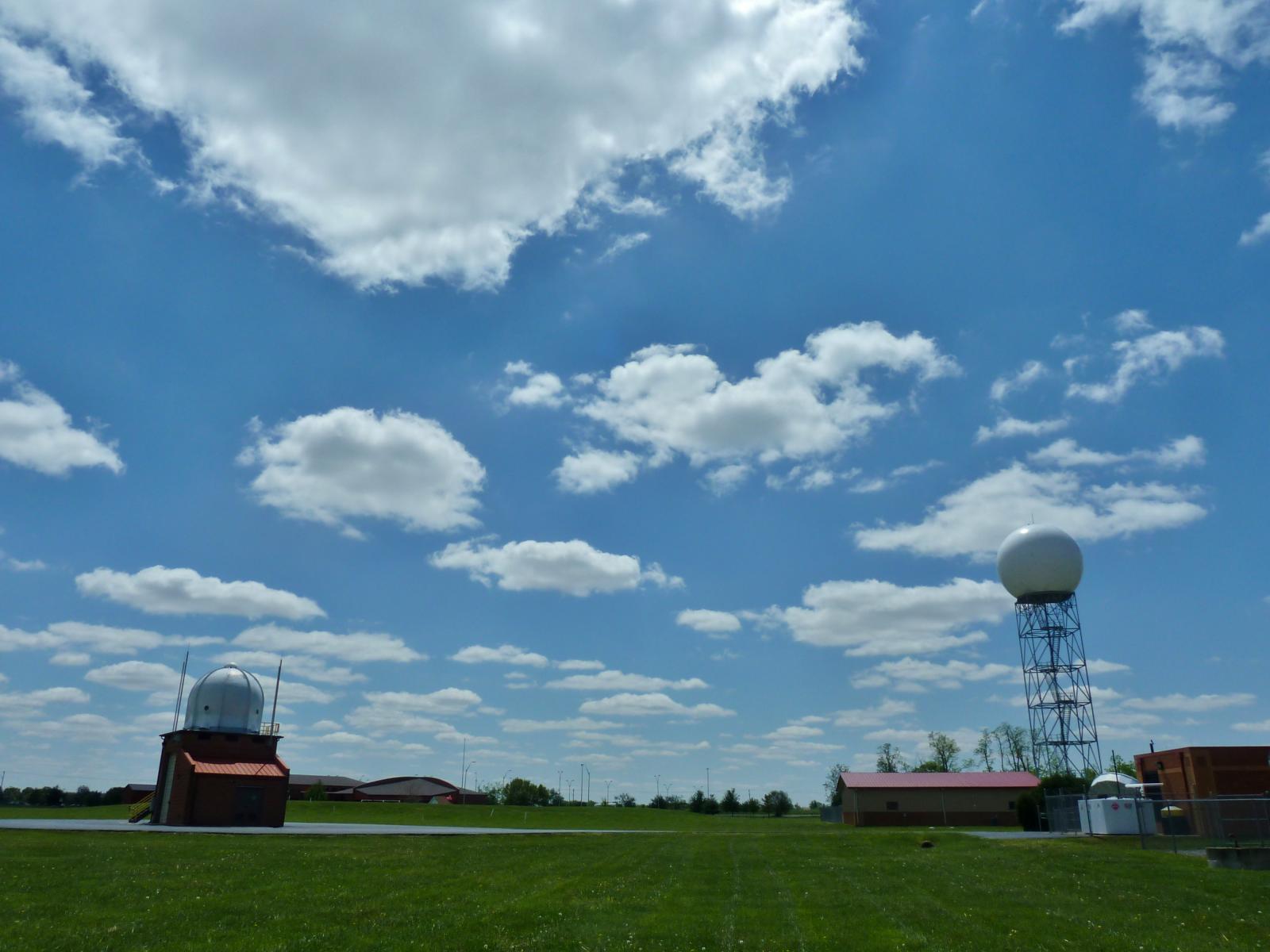
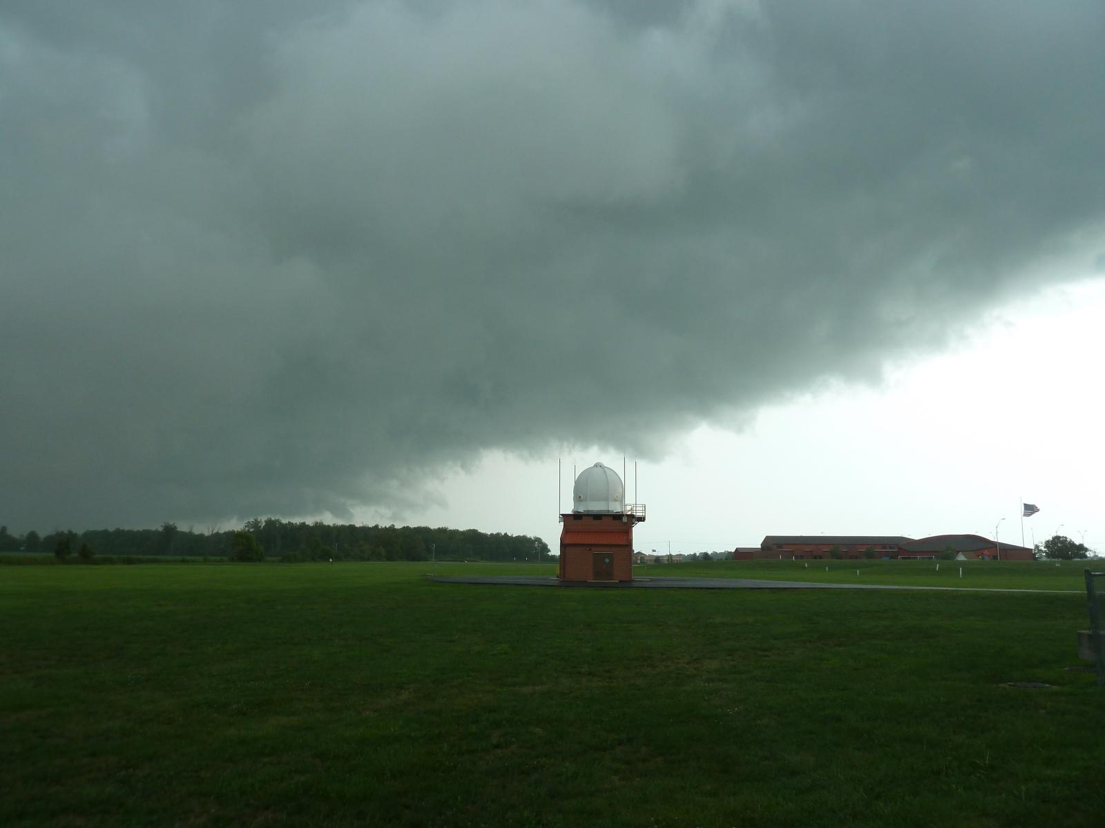
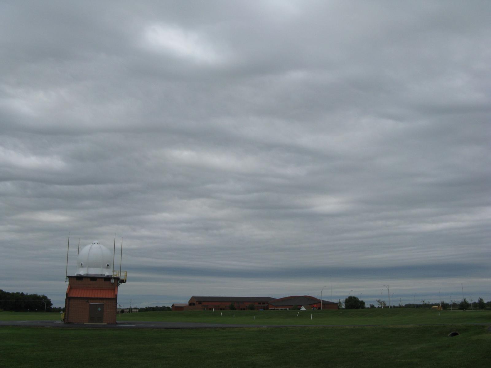
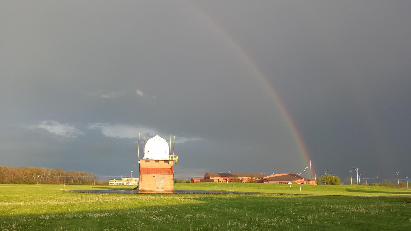
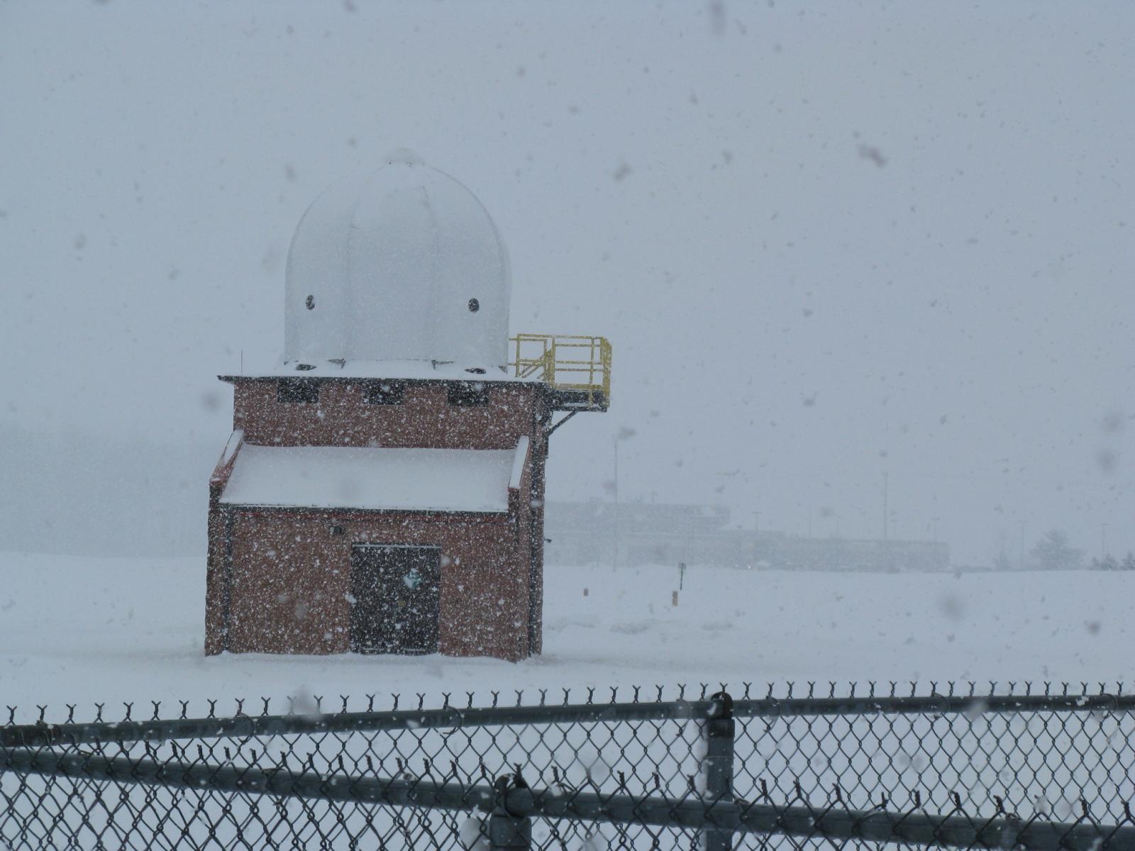
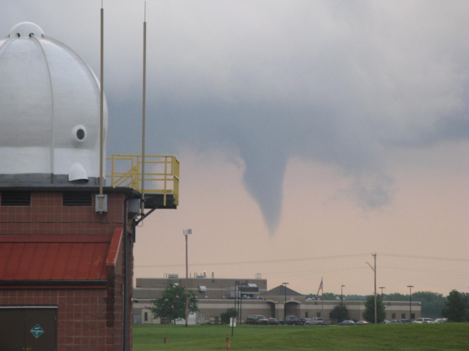
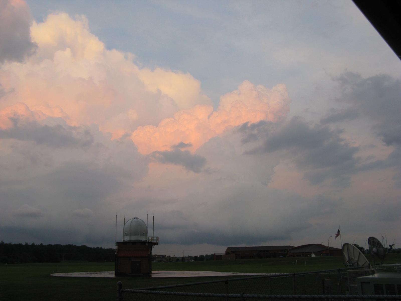
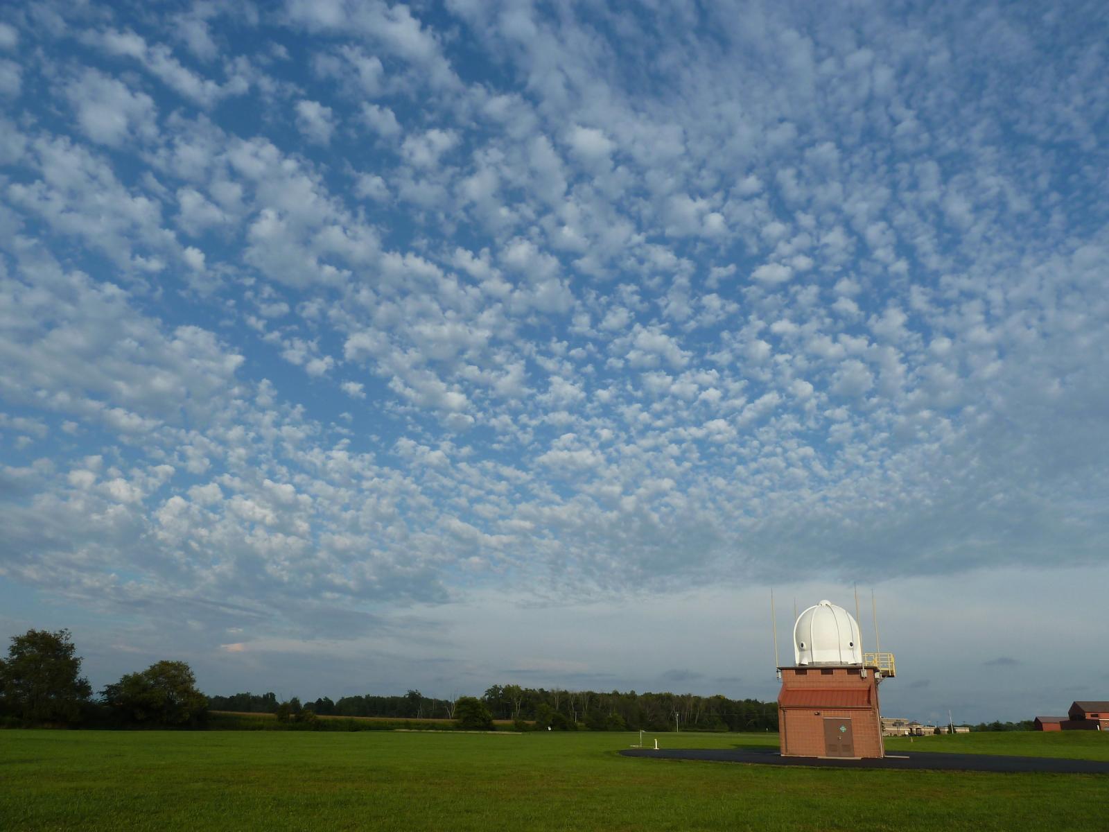
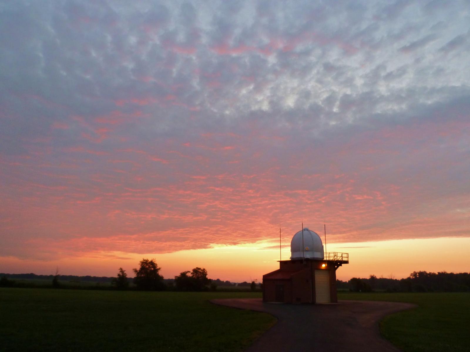
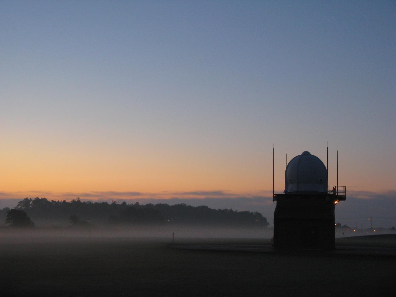
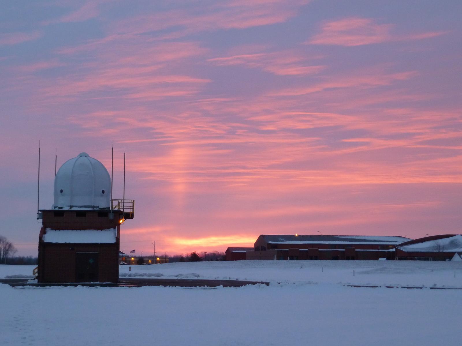
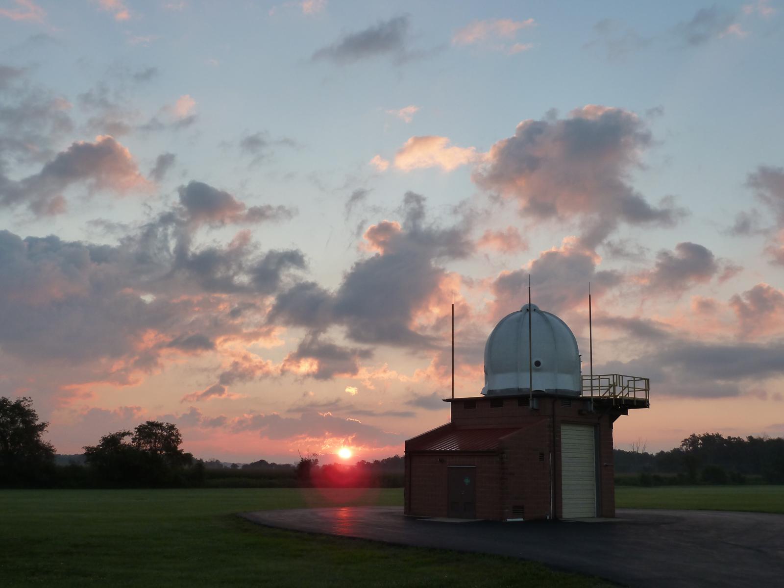
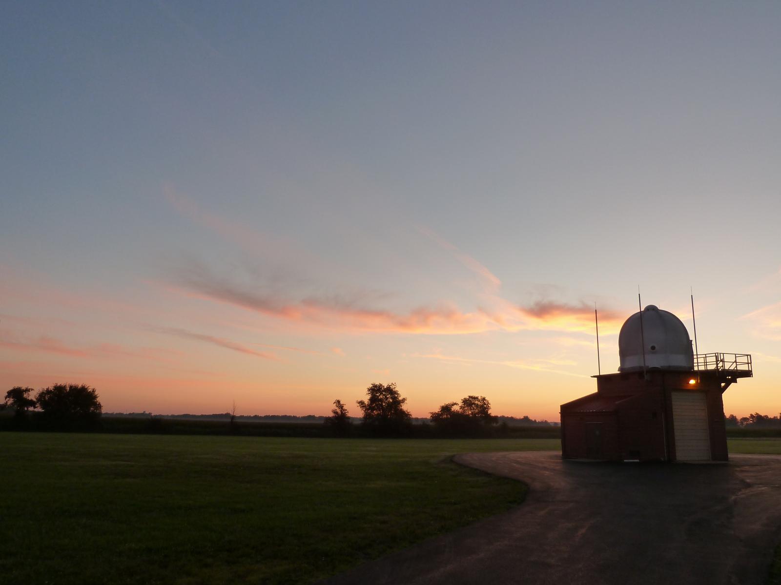
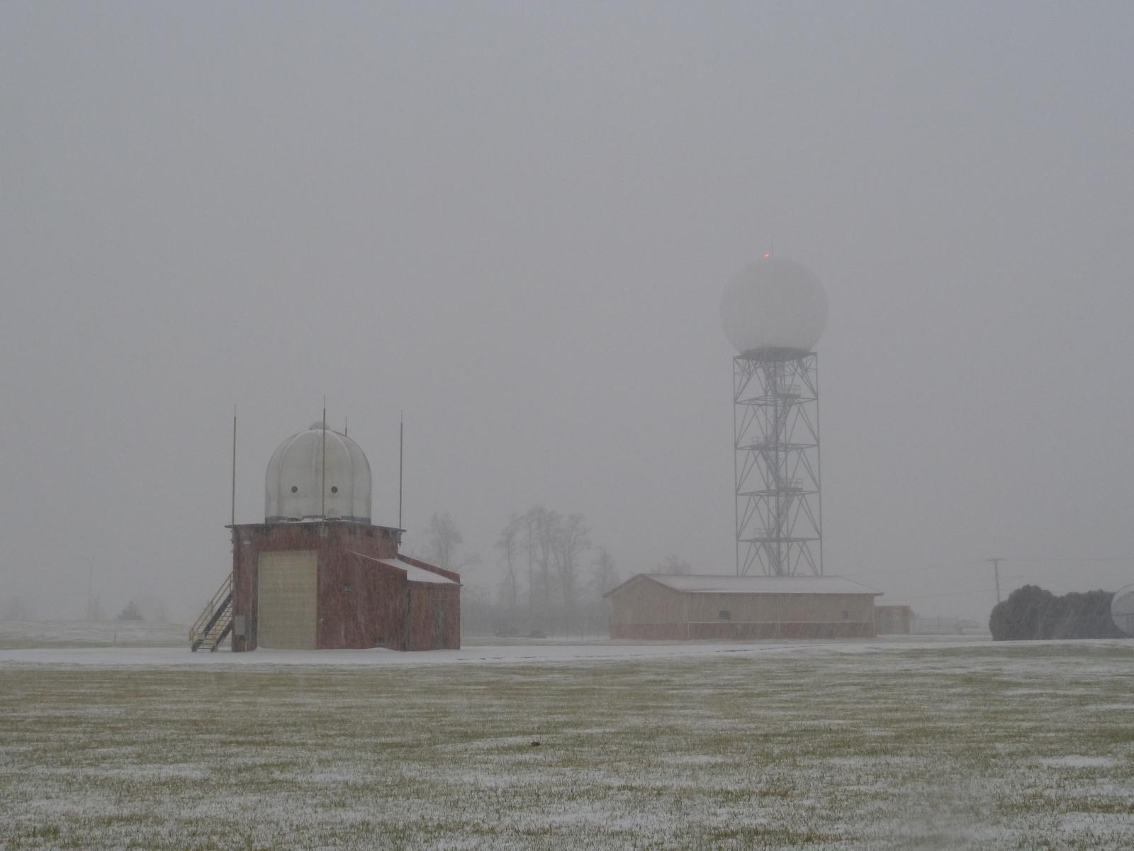
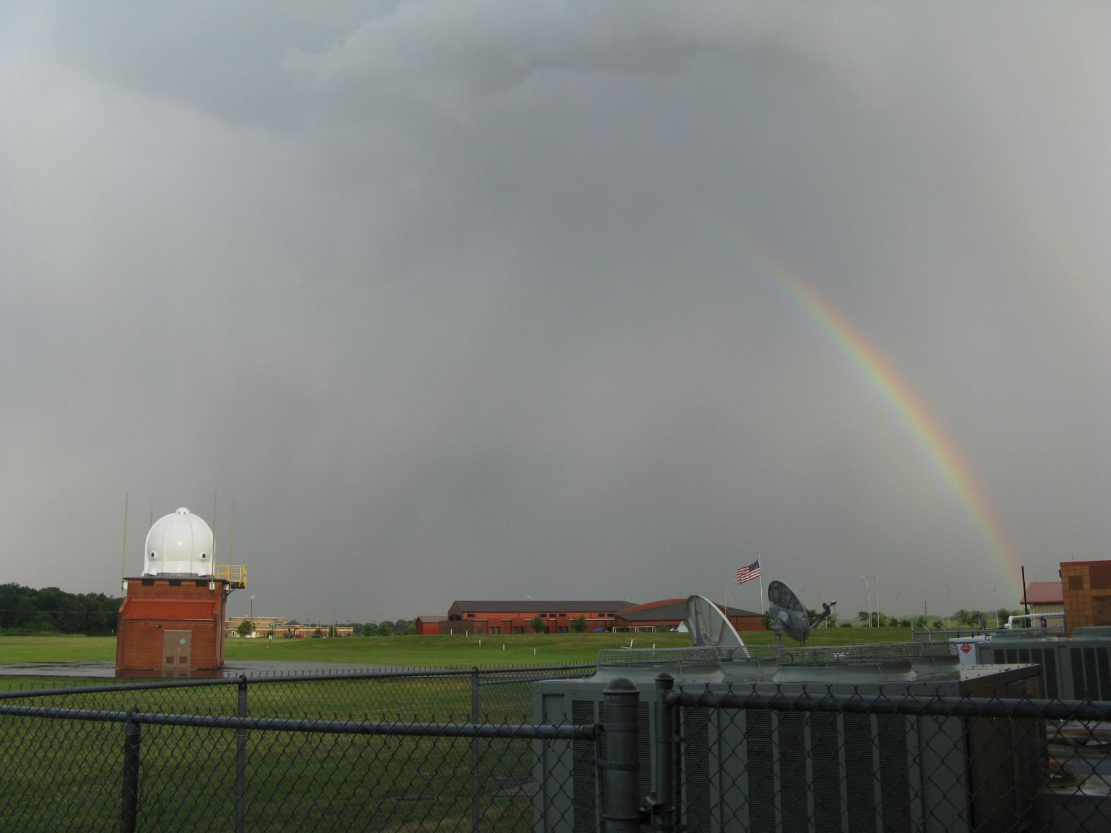
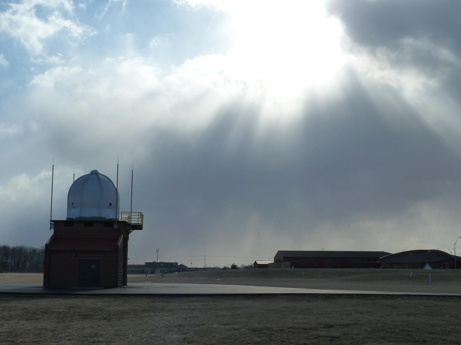
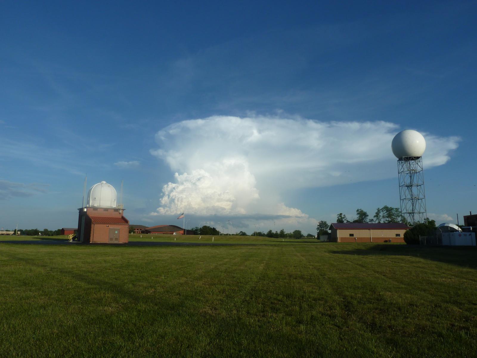
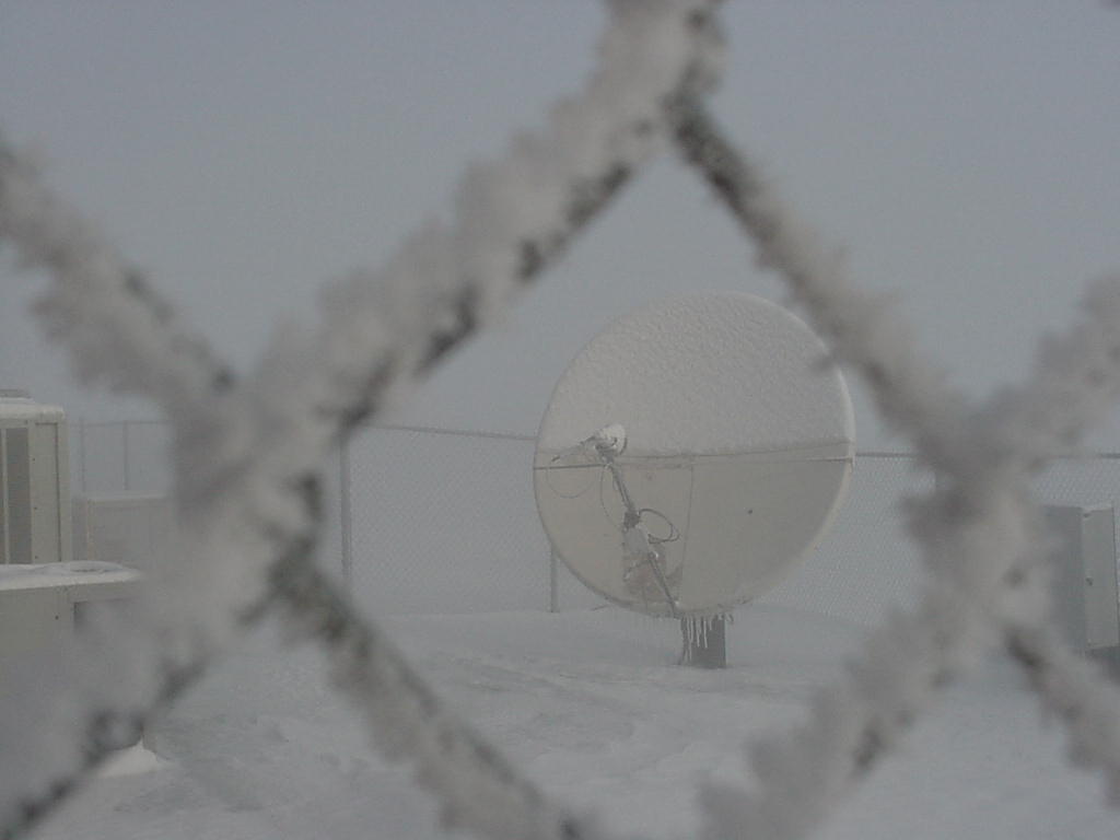
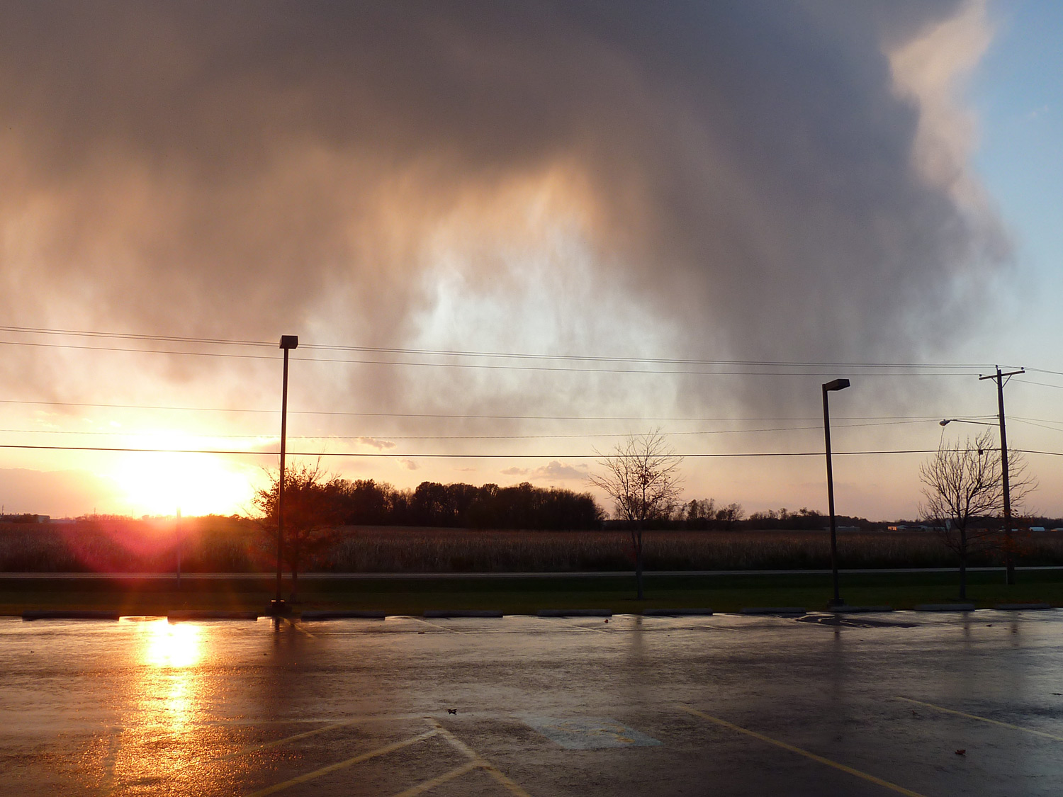
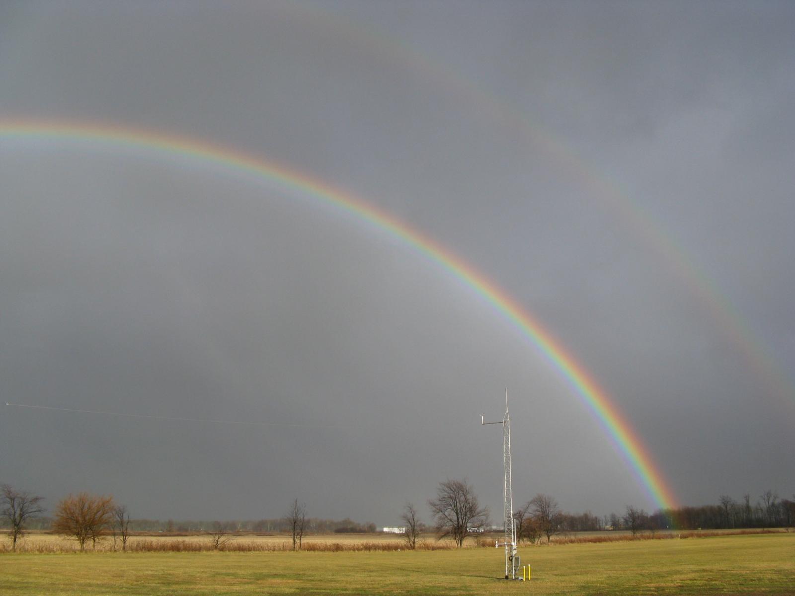
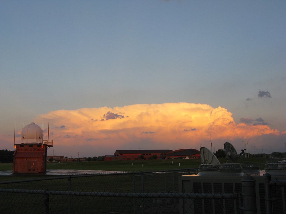
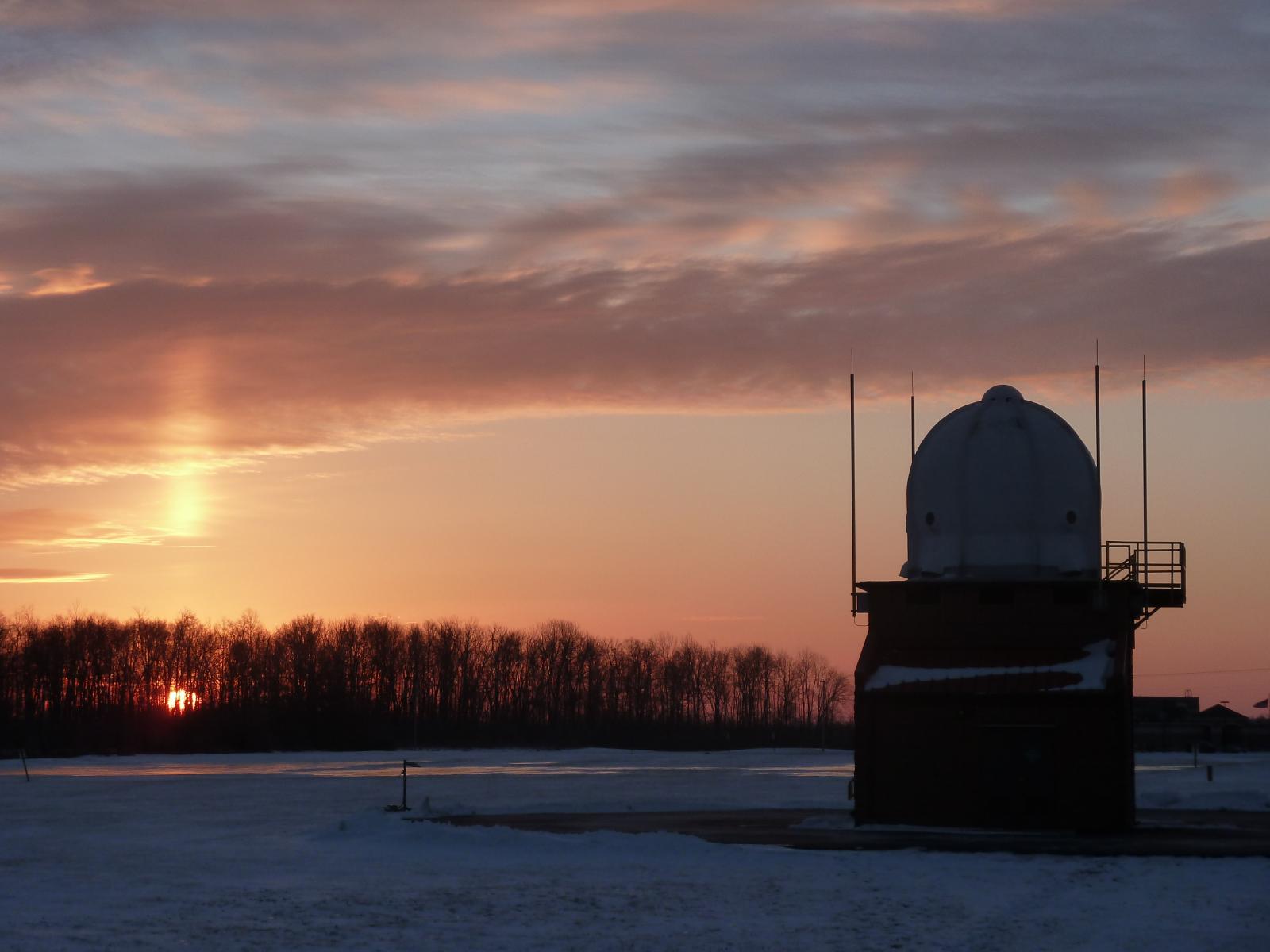
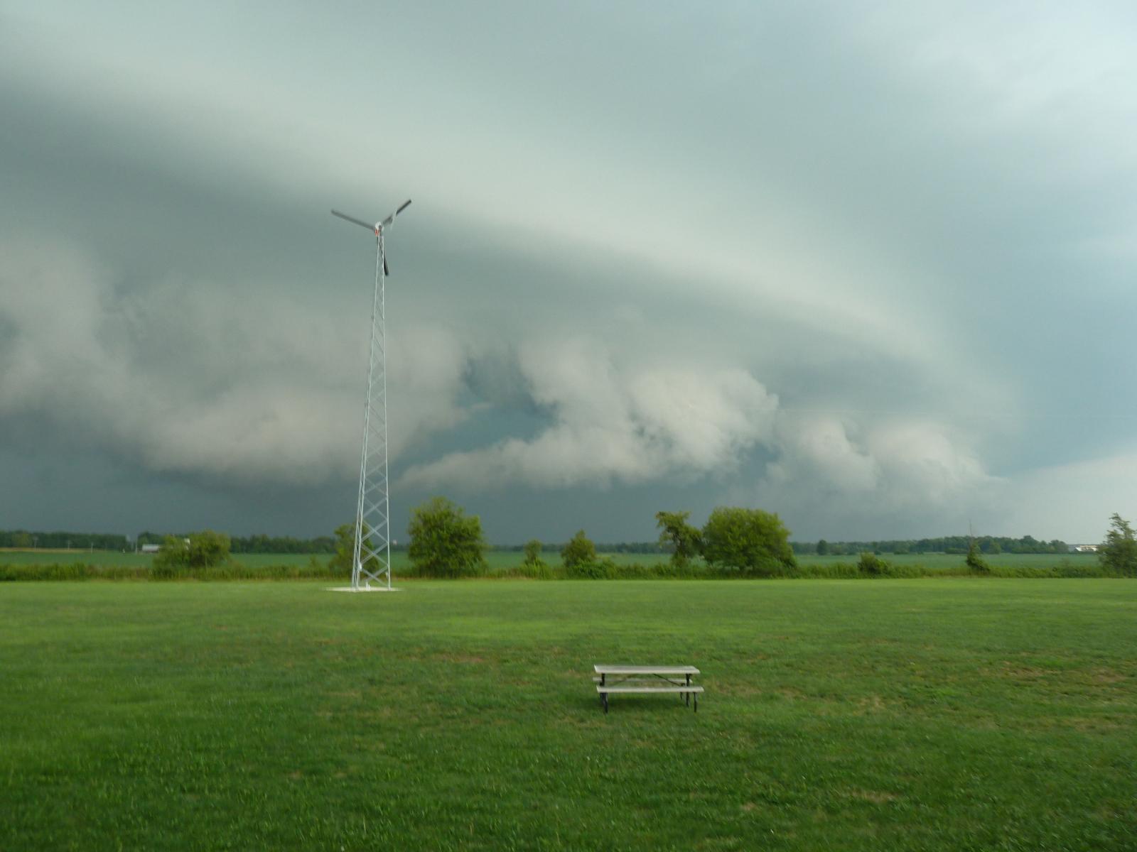
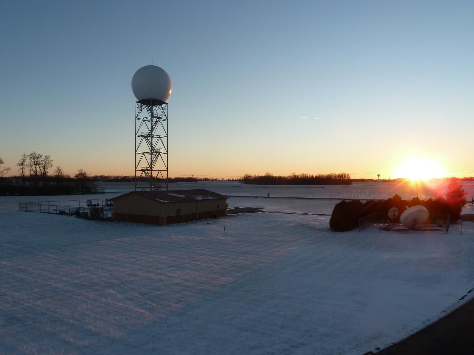
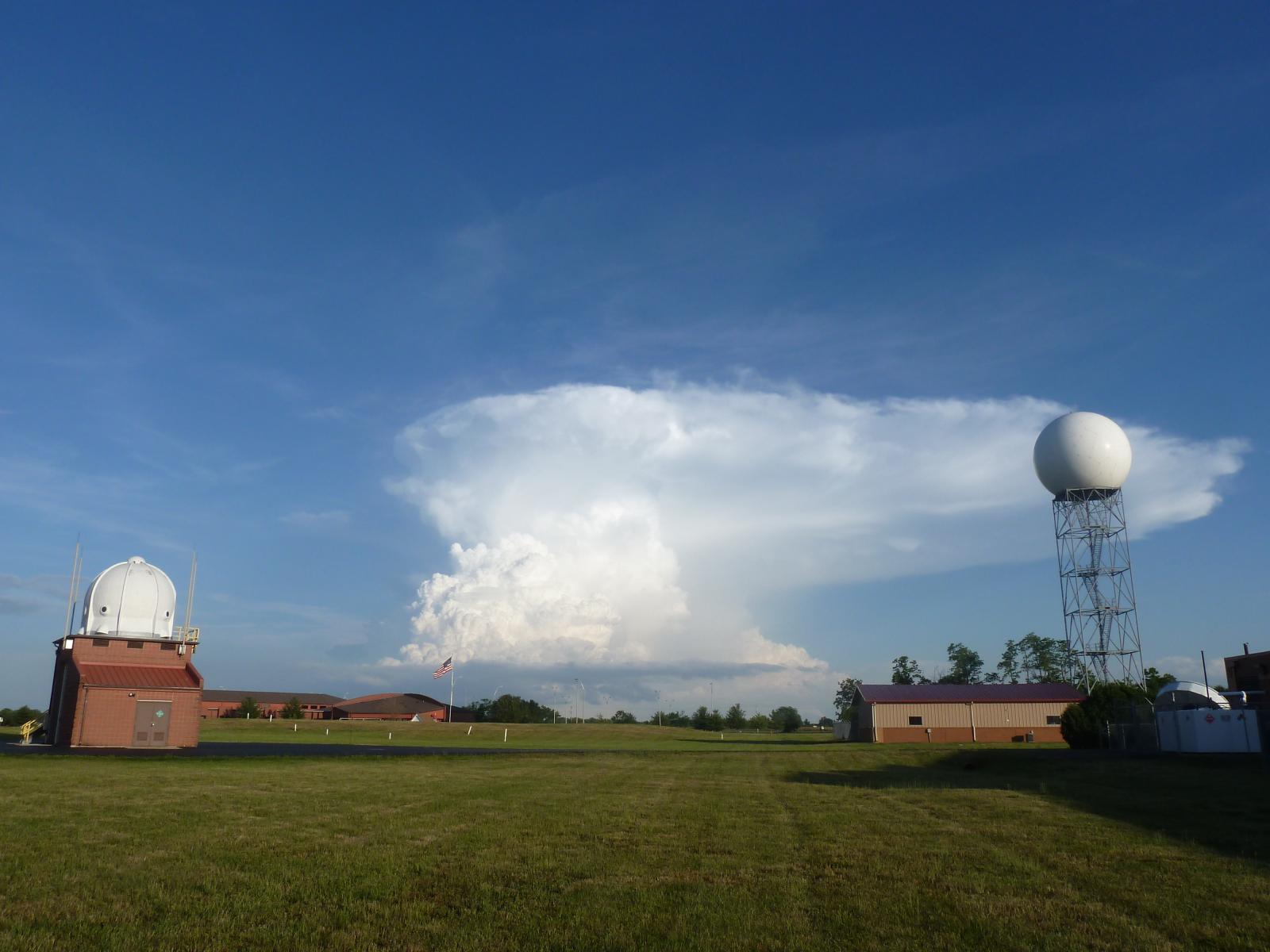
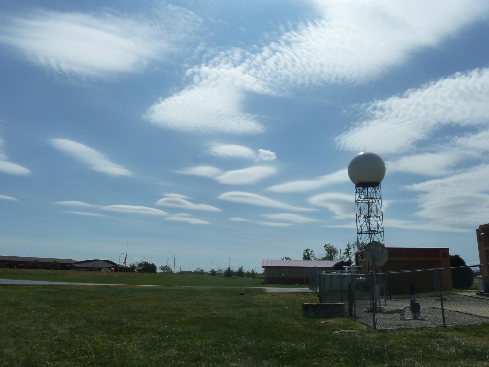
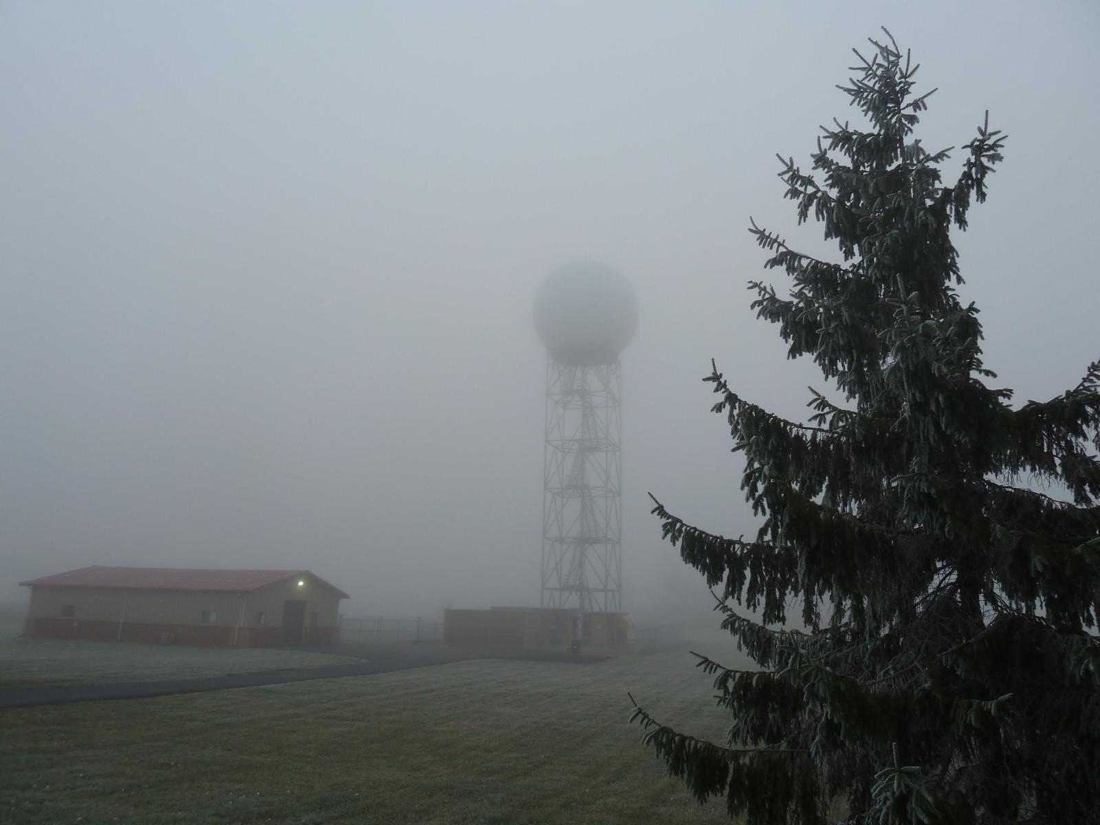
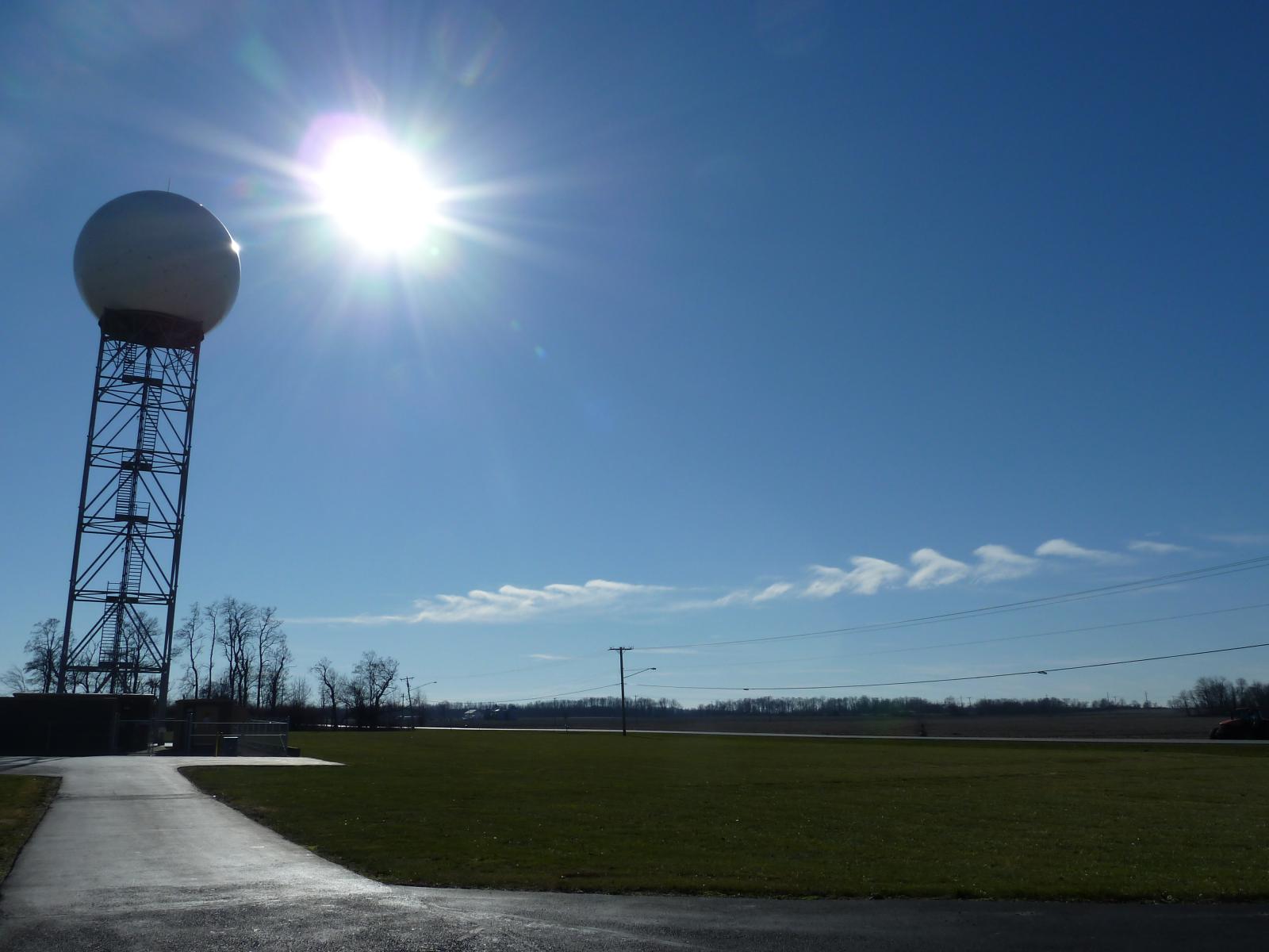
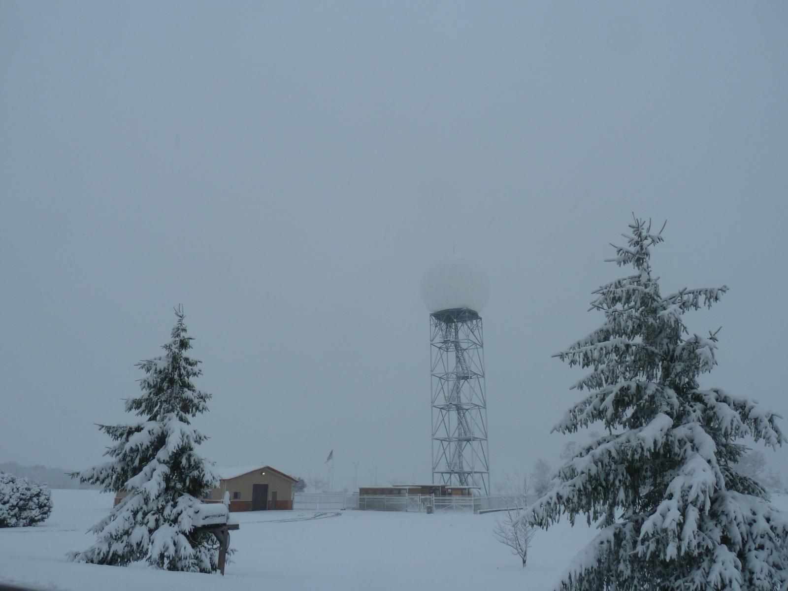
Observers launch weather balloons in ALL weather conditions EXCEPT lightning/a thunderstorm. This has allowed for many picturesque scenes over the years, both during launches and at other times. Our upper air shelter has served as a focal point for a variety of interesting weather scenes that have evolved here at NWS Wilmington, Ohio.
 |
 |
 |
 |
 |
 |
 |
 |
 |
 |
 |
 |
 |
 |
 |
 |
 |
 |
 |
 |
 |
 |
 |
 |
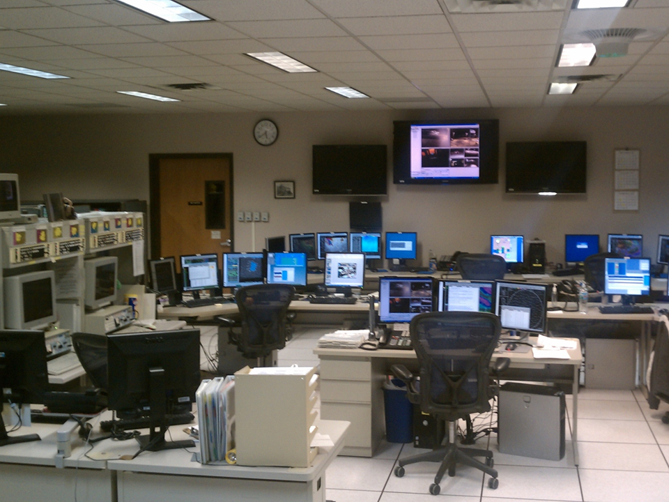
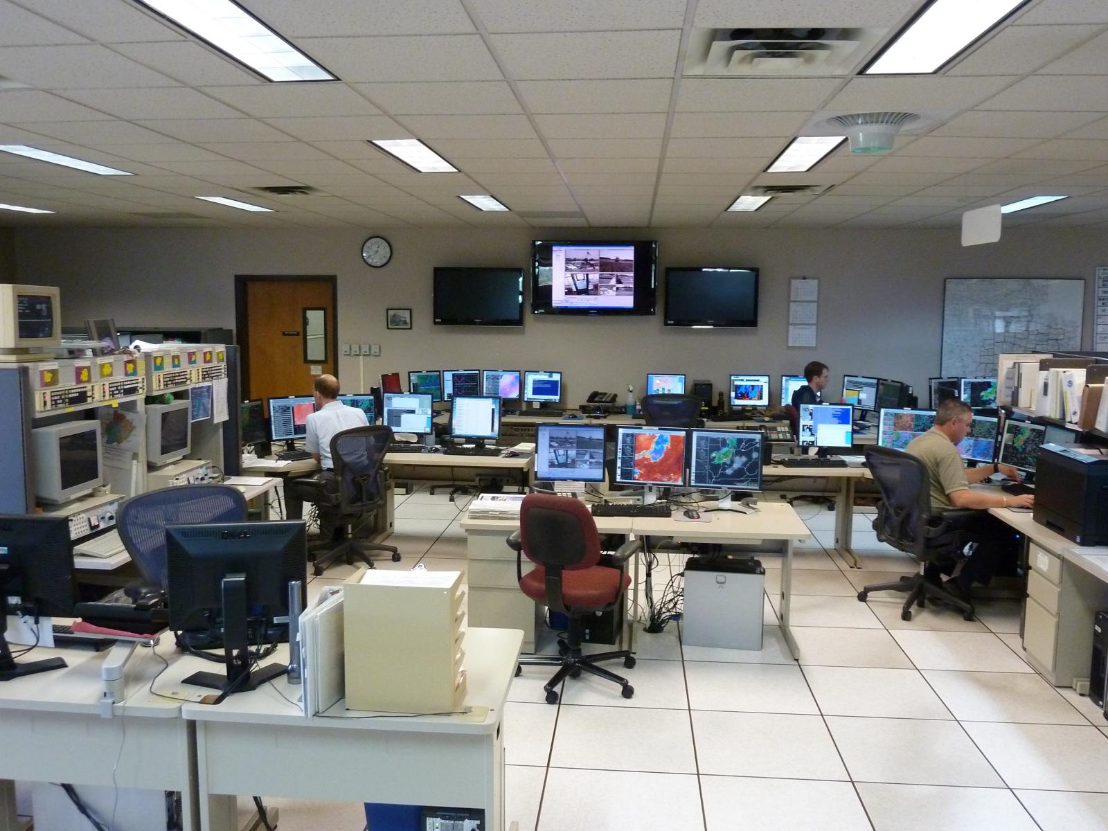
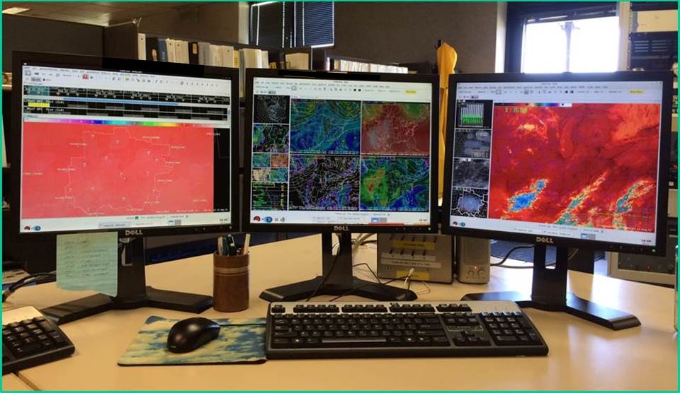
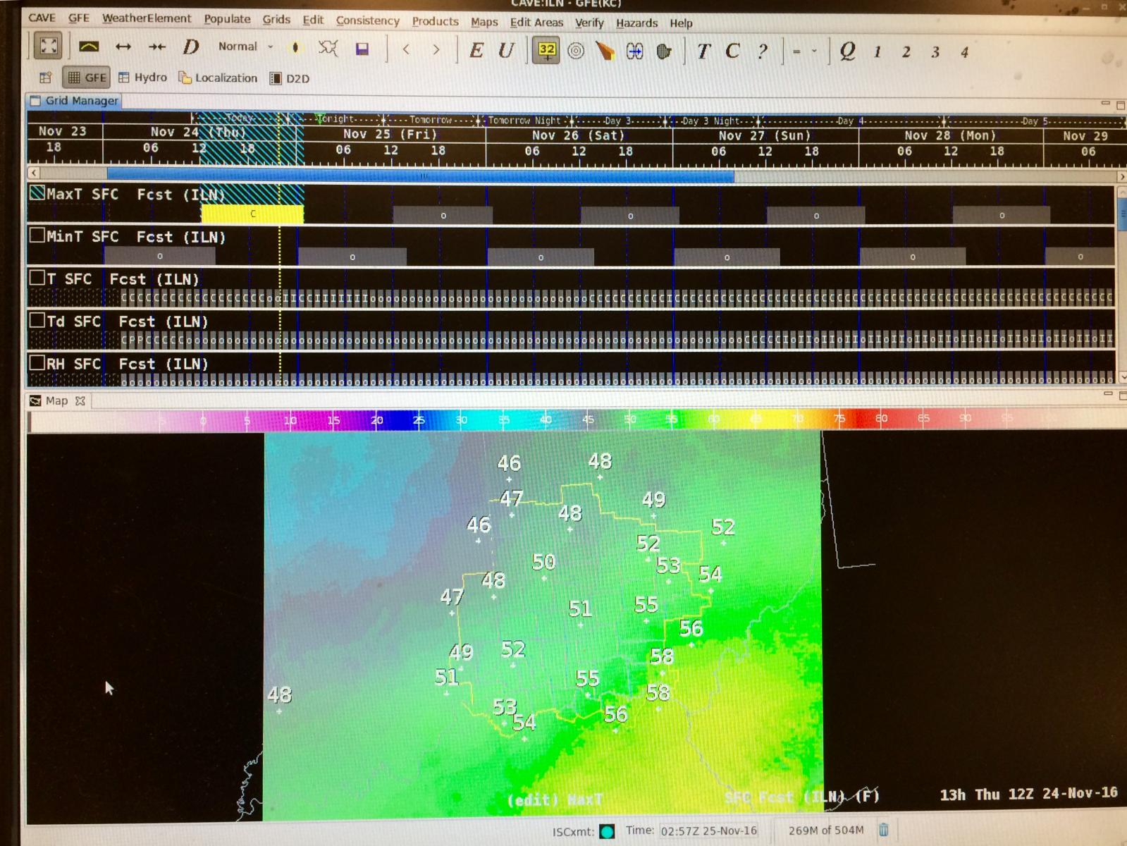
The Advanced Weather Interactive Processing System II, or AWIPS II, is a technologically-advanced information processing, display, and telecommunications system used by the National Weather Service. AWIPS I was deployed throughout the NWS as part of the modernization in the mid to late 1990s, while AWIPS II was deployed from 2013 through 2015. Forecasters use this system to view multiple meteorological datasets simultaneously. The system allows forecasters to compare observations, satellite, and radar data to computer model forecast data, in order to produce more accurate forecasts.
 |
 |
|
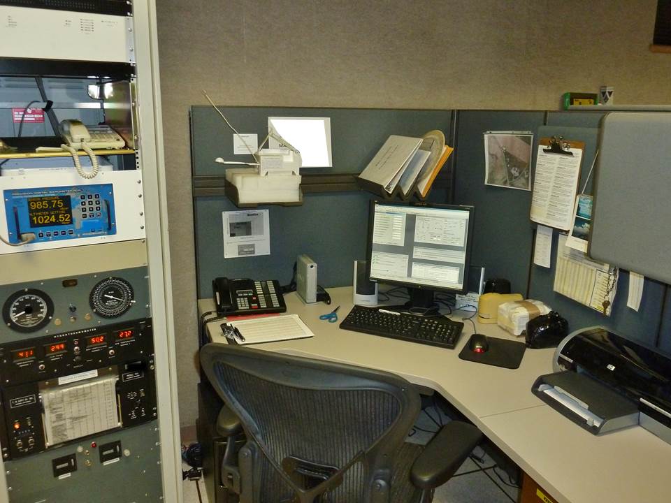
The computer processors used by AWIPS and the 88D Radar take up an entire room. The processors handle billions of bits of data per second. The AWIPS workstation is where the meteorologist can study atmospheric models, observational data, satellite data, and other tools of the science to determine the forecast. AWIPS is also the tool used to monitor radar images and issue severe weather warnings. Forecasters use GFE (Graphical Forecast Editor) to construct a forecast for the entire county warning area (CWA). |
|
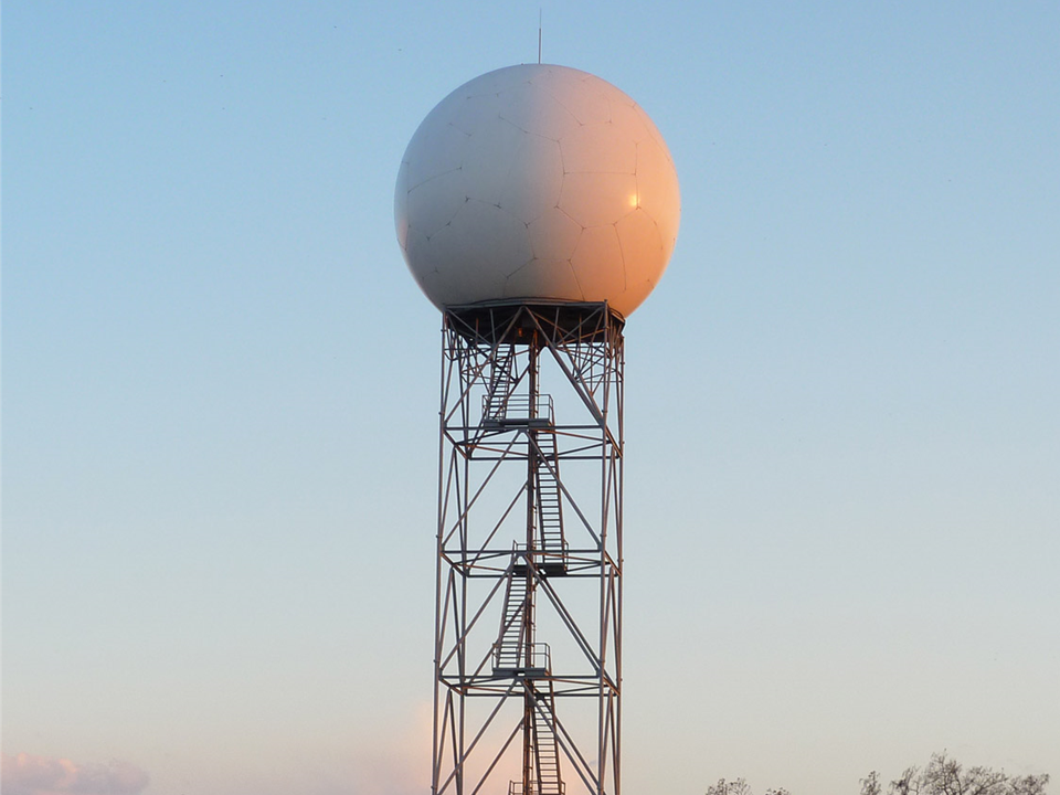
The WSR-88D Dual Polarization Radar is used to warn the citizens of the United States about dangerous weather and its location. There are 160 WSR-88D radar systems deployed throughout the United States and at selected overseas locations. The maximum range of the WSR-88D radar is approximately 250 nautical miles. The WSR-88D network is an invaluable tool for severe weather and flash flood warnings, air traffic safety, flow control for air traffic, resource protection at military bases, and management of water, agriculture, forest, and snow removal.
 |
 |
 |
|
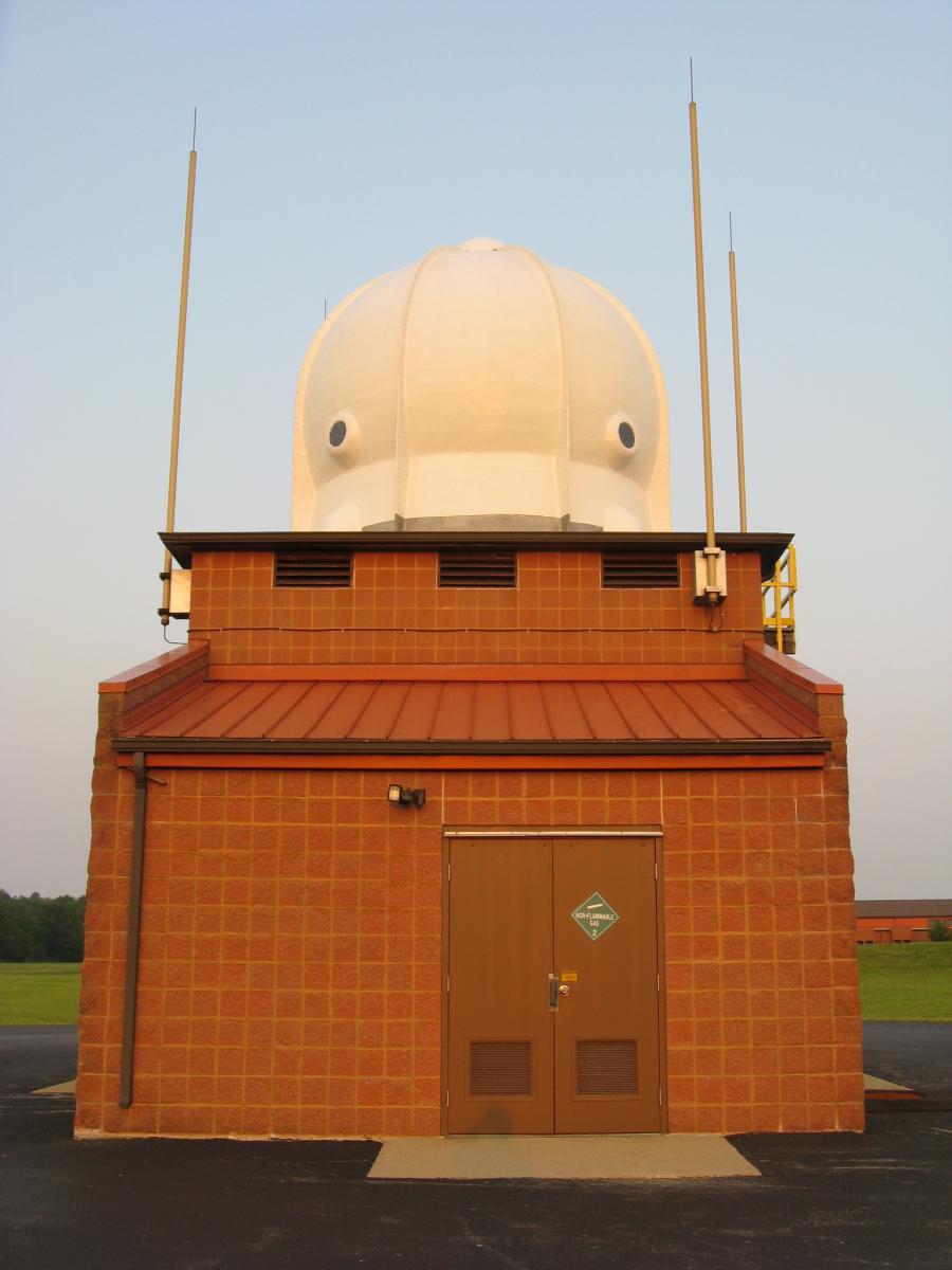
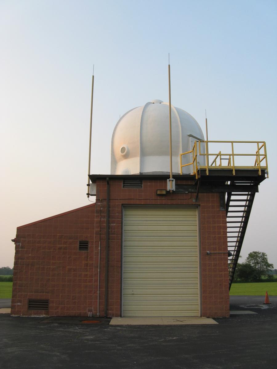
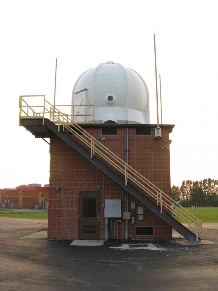
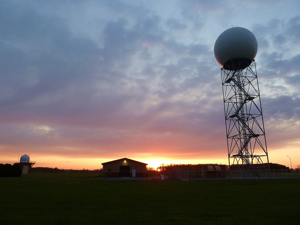
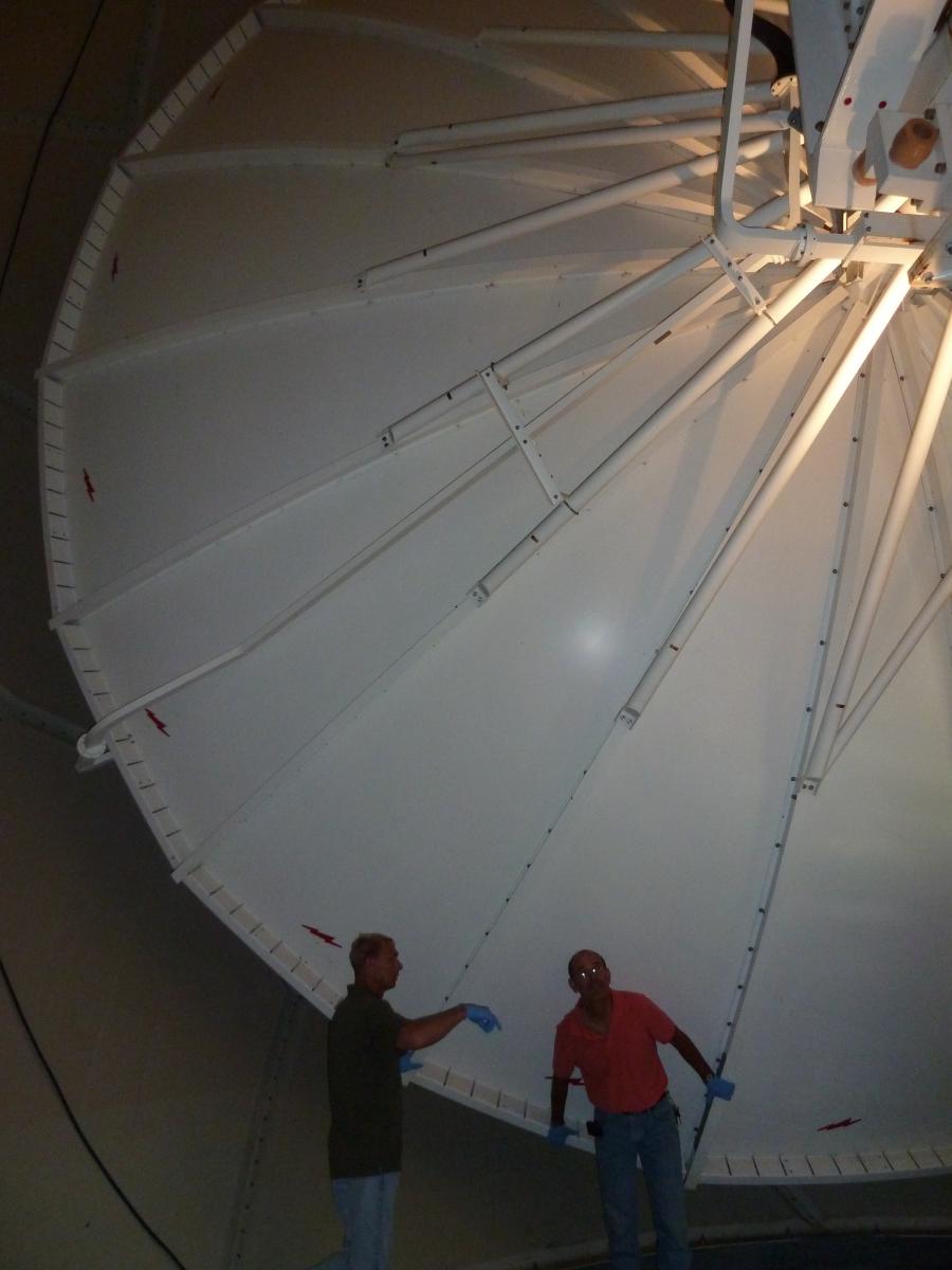
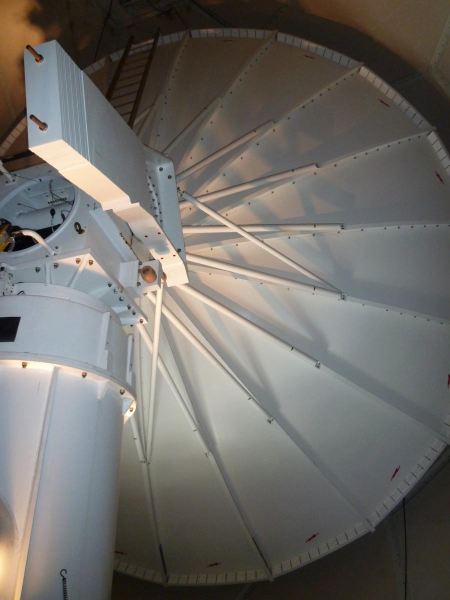
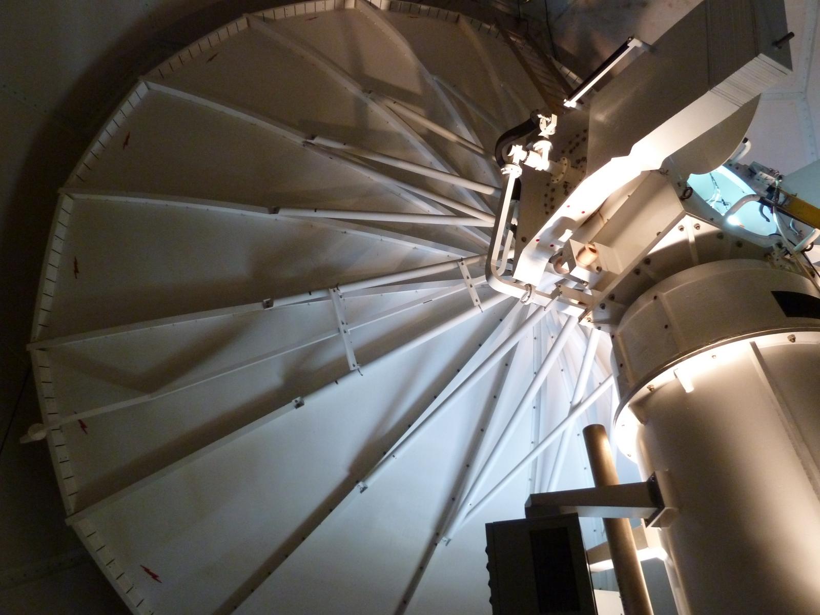
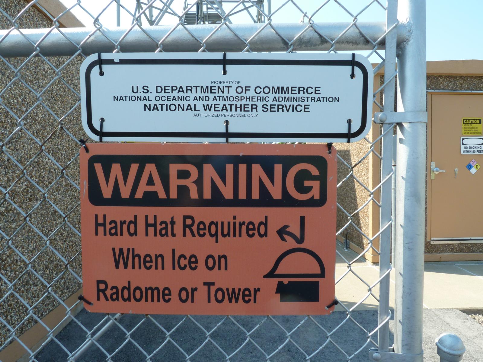
There is an on-site WSR-88D (Dual Polarization) Weather Radar located next to our office in Wilmington, Ohio. This radar (KILN) scans the skies 24/7/365. The building below the dome houses the necessary computer processors which control operation of the radar data. The WSR-88D shows the location, intensity, and movement of precipitation, ranging from light snow flurries to very heavy rain and large hail. From movement of precipitation, the WSR-88D also can sense motion (i.e., velocity) in the atmosphere directed toward and away from the radar. Velocity data helps in assessing atmospheric wind fields, as well as severe weather velocity signatures from thunderstorms. The WSR-88D system contains various software algorithms as well that produce a number of other radar products and alarms when threshold values of certain parameters are met. The WSR-88D greatly enhances the ability of NWS forecasters to issue short-term forecasts for any weather situation, as well as timely and accurate warnings during severe thunderstorm events. Forecasters undergo in-depth training in order to become highly proficient with the radar and to properly interpret severe weather radar signatures. Data available from the WSR-88D allows NWS meteorologists to thoroughly dissect and evaluate thunderstorms and their trends, all of which are extremely helpful in the warning decision process. Accurate spotter reports are also critical in the analysis process and to verify radar signatures. As technology advances, the ability of the radar is updated with new software algorithms. |
||
 |
 |
 |
 |
 |
 |
 |
 |
 |
|
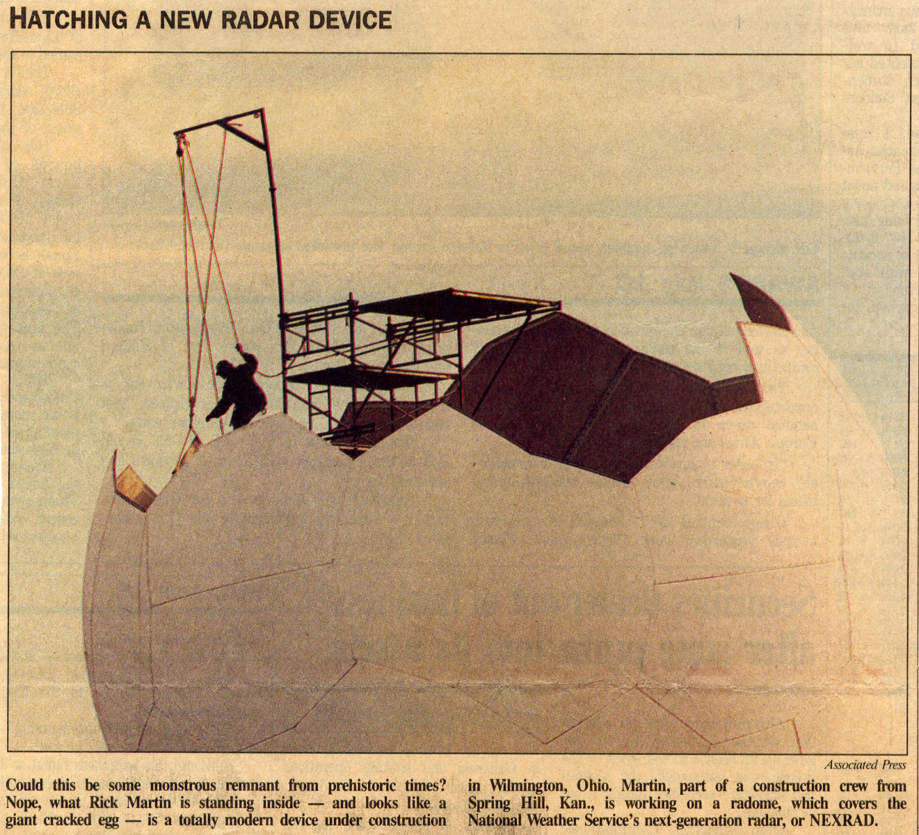
The "golf ball" exterior offers protection for the equipment inside the spherical structure. Inside, a large dish rotates and sends out pulses of energy. These pulses of energy encounter objects (such as raindrops, hailstones, and even bugs and birds) and the energy bounces back toward the radar. The energy returned to the radar enables the processing system to determine the size and location of the object. These returns are processed into the radar images we are accustomed to seeing. |
||
NOAA Weather Radio All-Hazards (NWR) is the "voice of the National Weather Service" and serves as the agency's primary means of communicating around-the-clock weather information to the public.
 |
 |
 |
 |
|
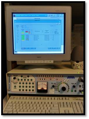
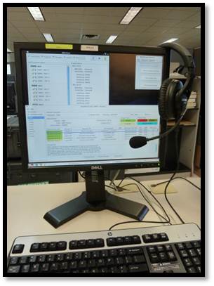
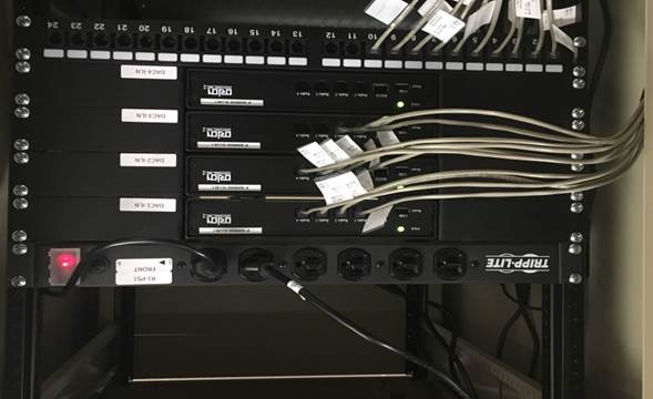
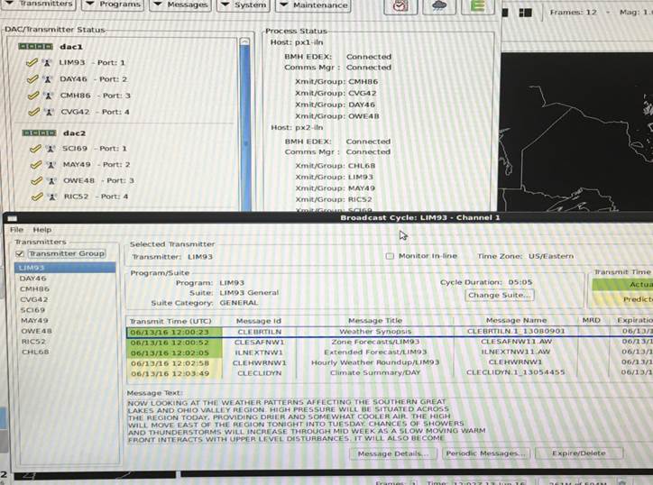
Pioneered in the mid-1990s, the Console Replacement System (CRS) replaced an outdated system in which broadcasts were previously recorded with human voices digitally for each transmitter. The CRS introduced synthesized voices (Sven, Tom, and Donna) and provided the first automated broadcasts that saved time and increased efficiency for meteorologists. In 2016, CRS was replaced by a state-of-the-art system called the Broadcast Message Handler (BMH). The new system interface allows meteorologists to control the broadcasts from AWIPS instead of from a separate computer altogether (like what was done with CRS). Operators can record messages, monitor the cycles, and interrupt the broadcast from their primary workstations. |
|
|
Warnings for severe weather serve no purpose if people are unaware that they have been issued. NOAA Weather Radio broadcasts began in the 1950s when the old Weather Bureau started broadcasting aviation weather on two stations. In the 1960s, stations were added for the marine community, and by the late 1970s, the system included more than 300 stations serving the general public and mariners. A White House policy statement issued in January 1975, which was partially driven by the Ohio Valley tornado outbreak of April 3, 1974, designated NOAA Weather Radio as the sole government-operated radio system to provide direct warnings into private homes for both natural disasters and nuclear attack. |
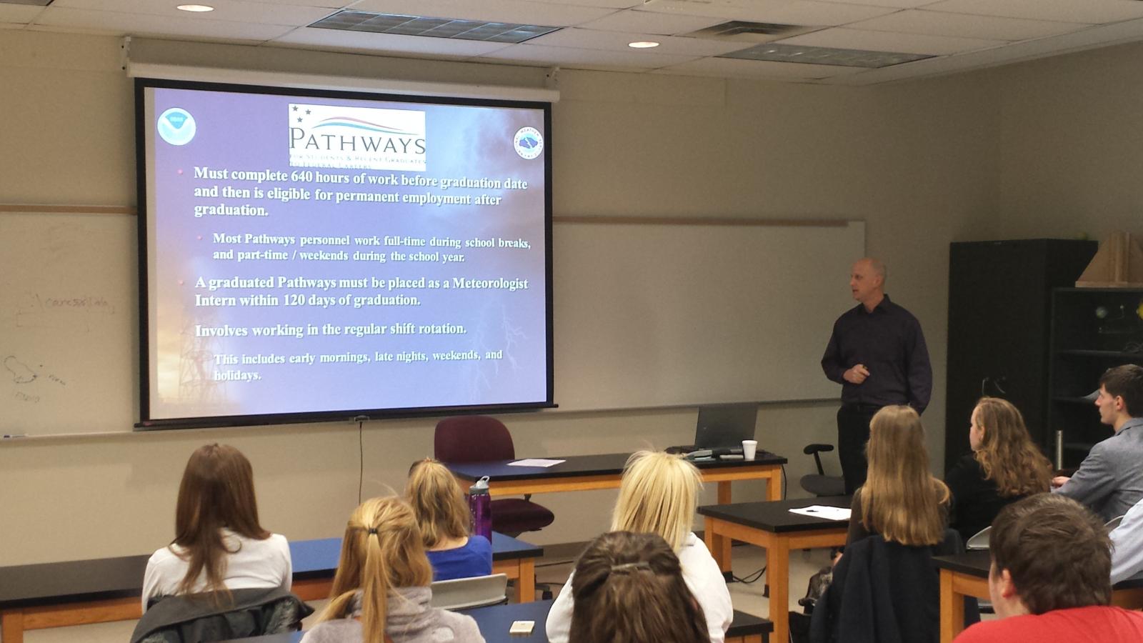
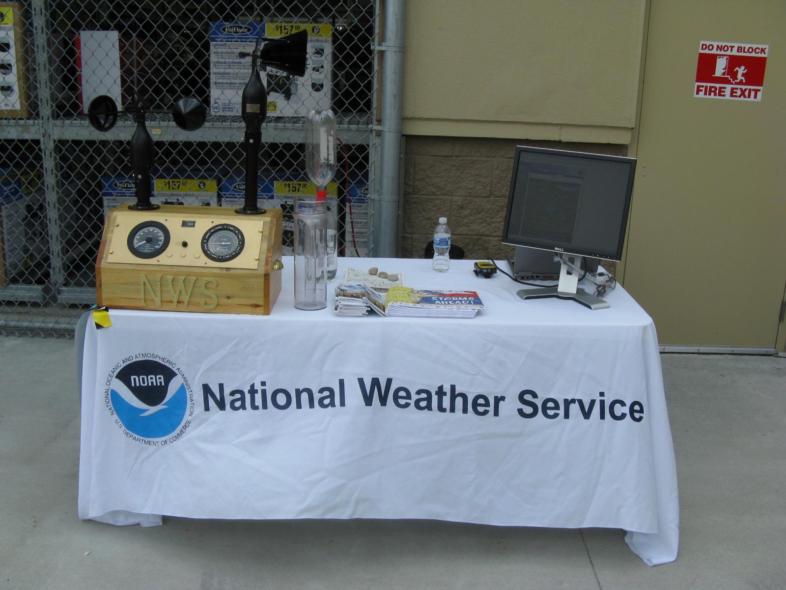
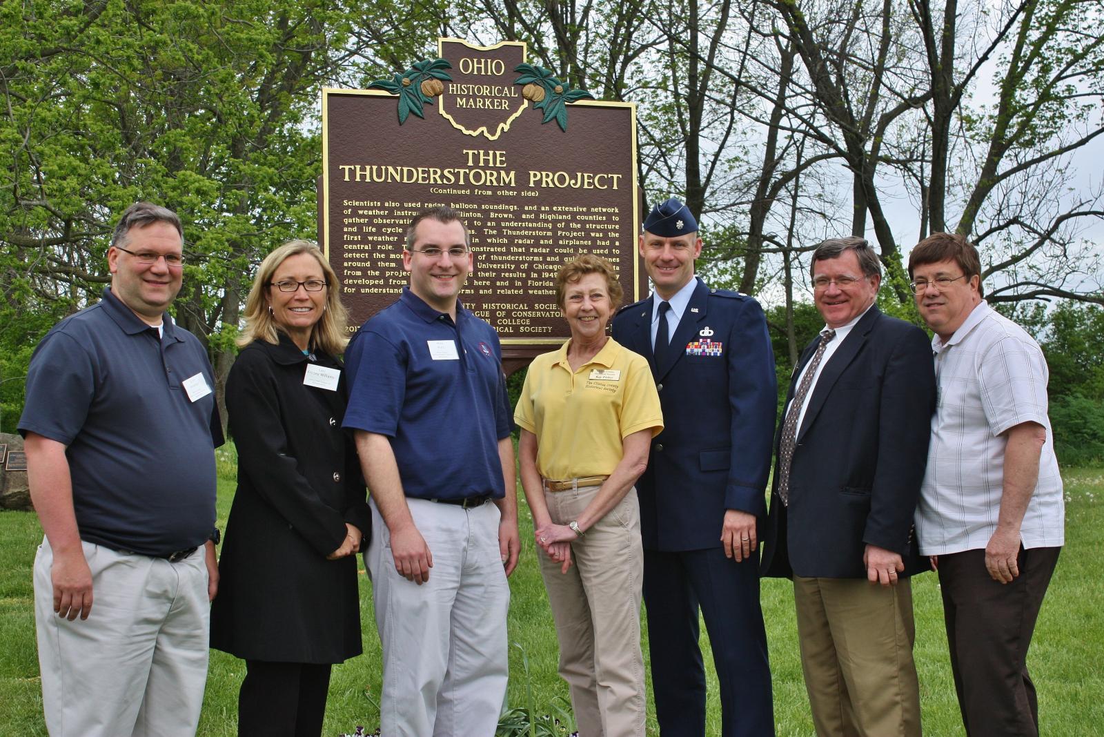
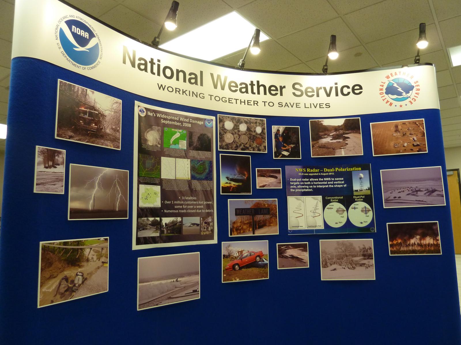
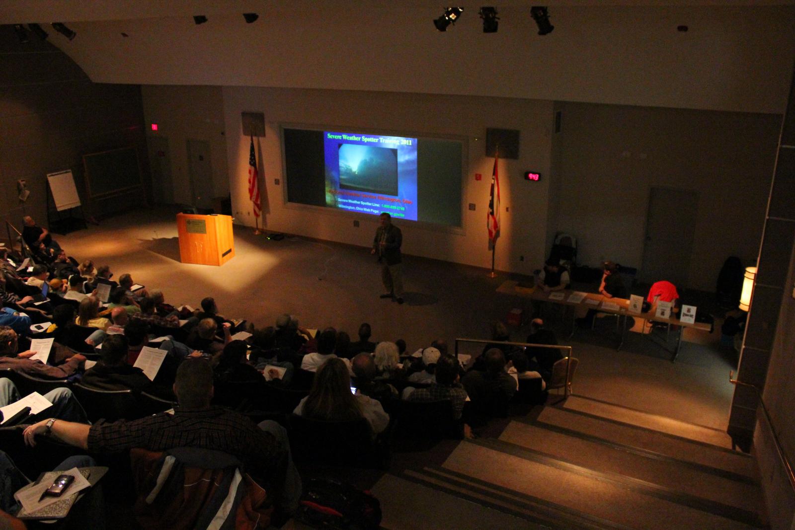
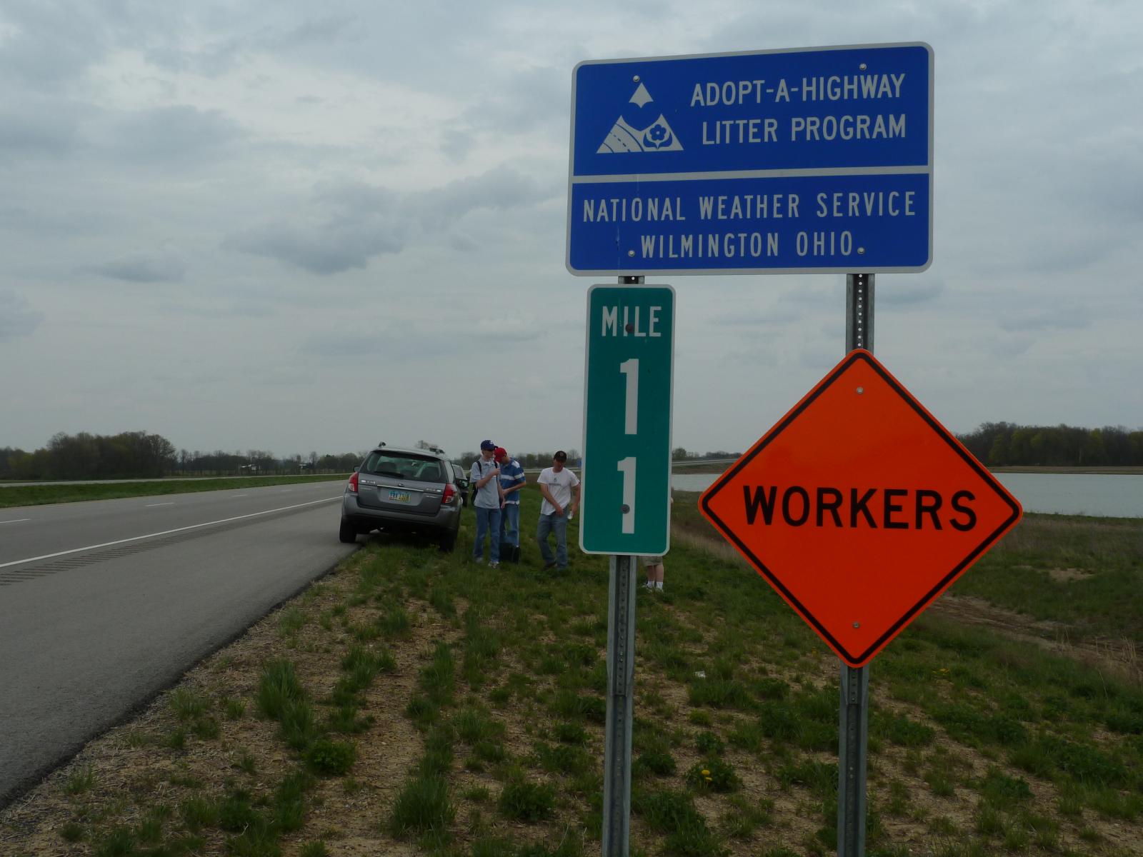
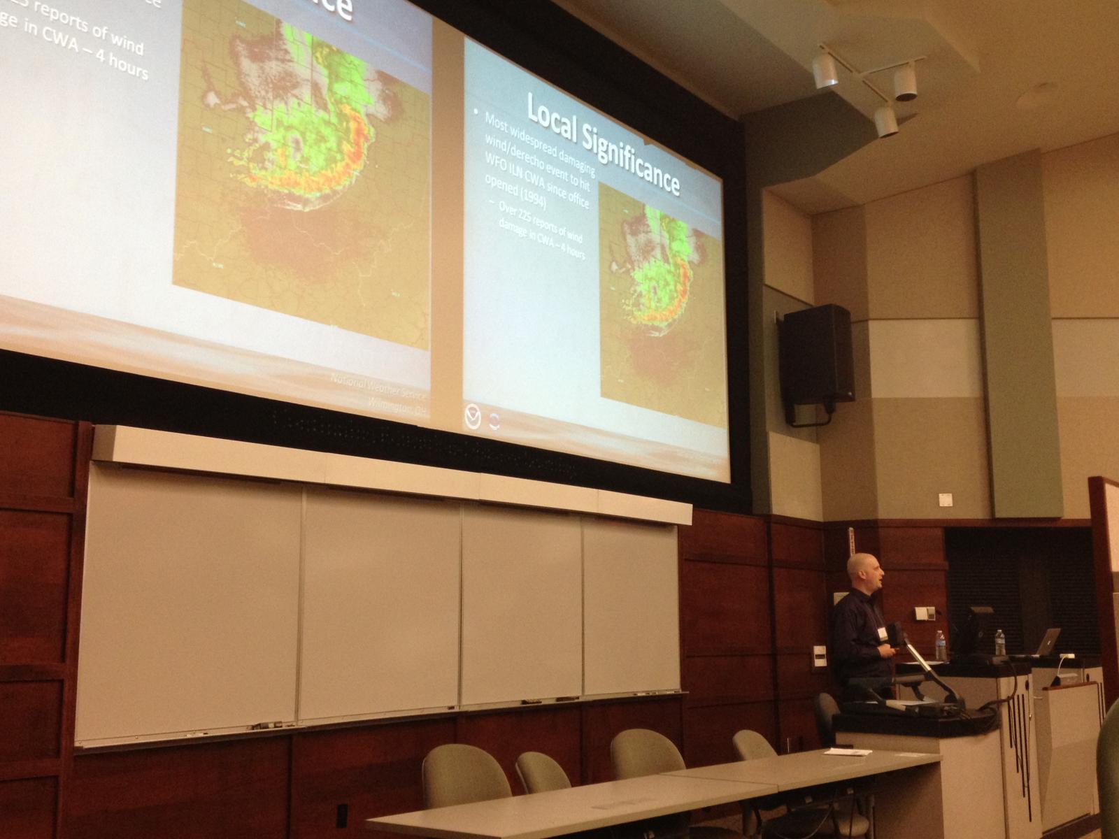
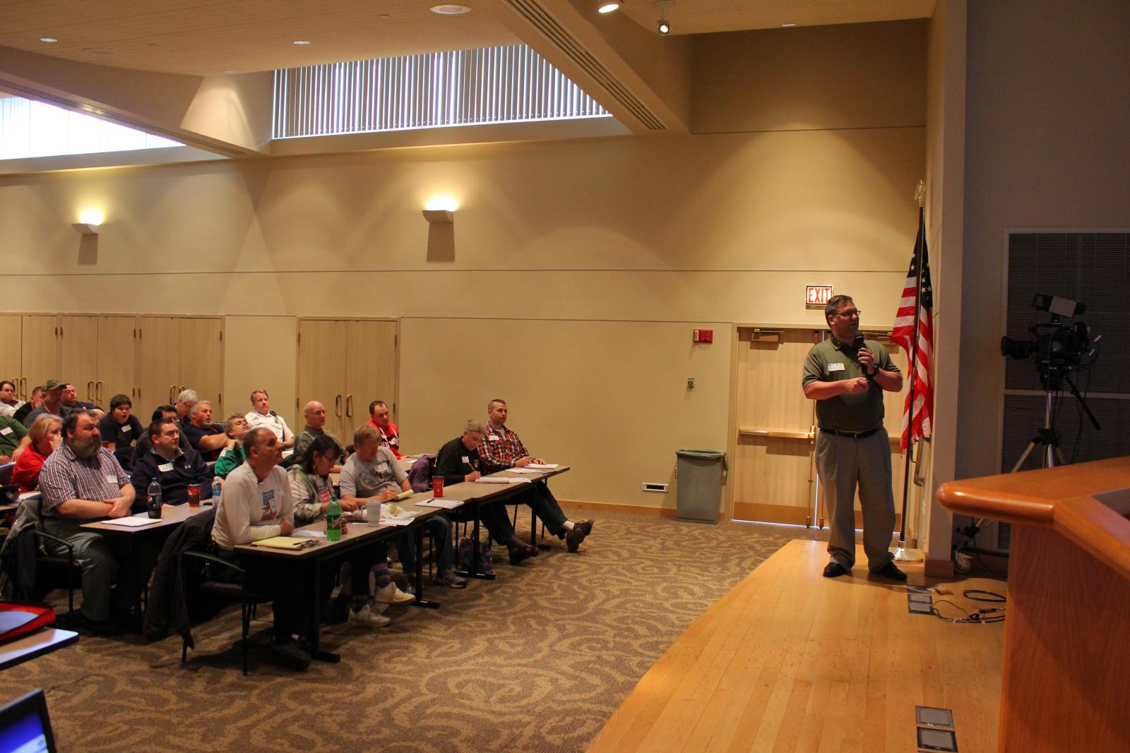
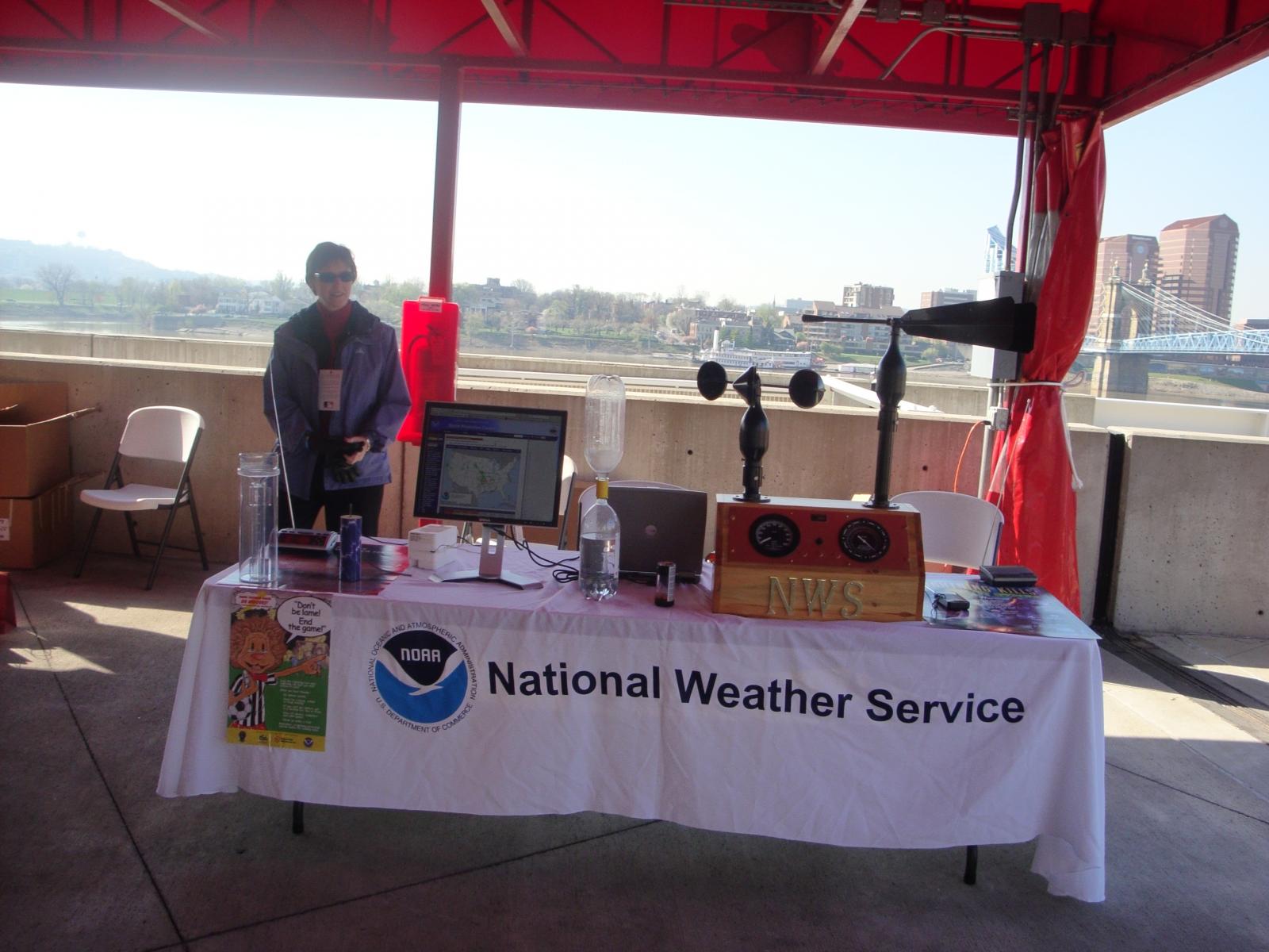
Outreach and connecting with the local communities is a very important aspect of our operations here at NWS Wilmington, Ohio. Meteorologists from our office participate in/lead many school talks, science fairs, and other local gatherings about weather and weather safety. From staffing a booth, to leading storm spotter training courses, to organizing a tour of our office, involvement in the local communities remains one of our top priorities!
 |
 |
 |
 |
 |
 |
 |
 |
 |
|
These select pictures detail a few examples of our involvement in spotter training courses, symposiums with local universities, and maintaining booths at regional science gatherings for young children. We do offer guided tours of our office in Wilmington, Ohio during the "cool" season between September and March. |
||
***Due to the COVID pandemic, all tours have been suspended indefintely.***
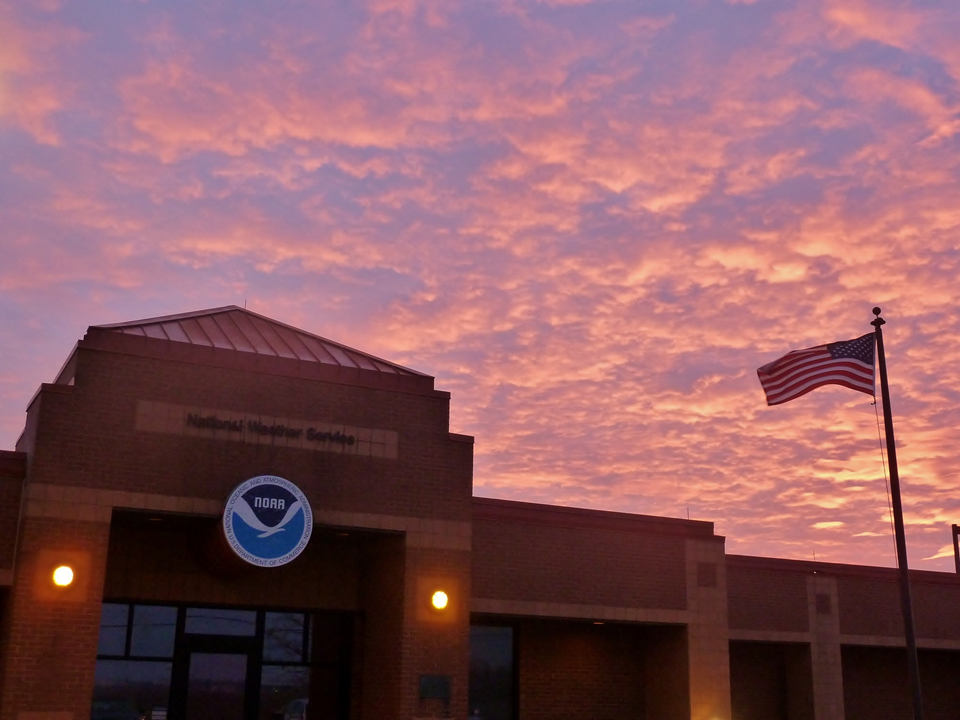
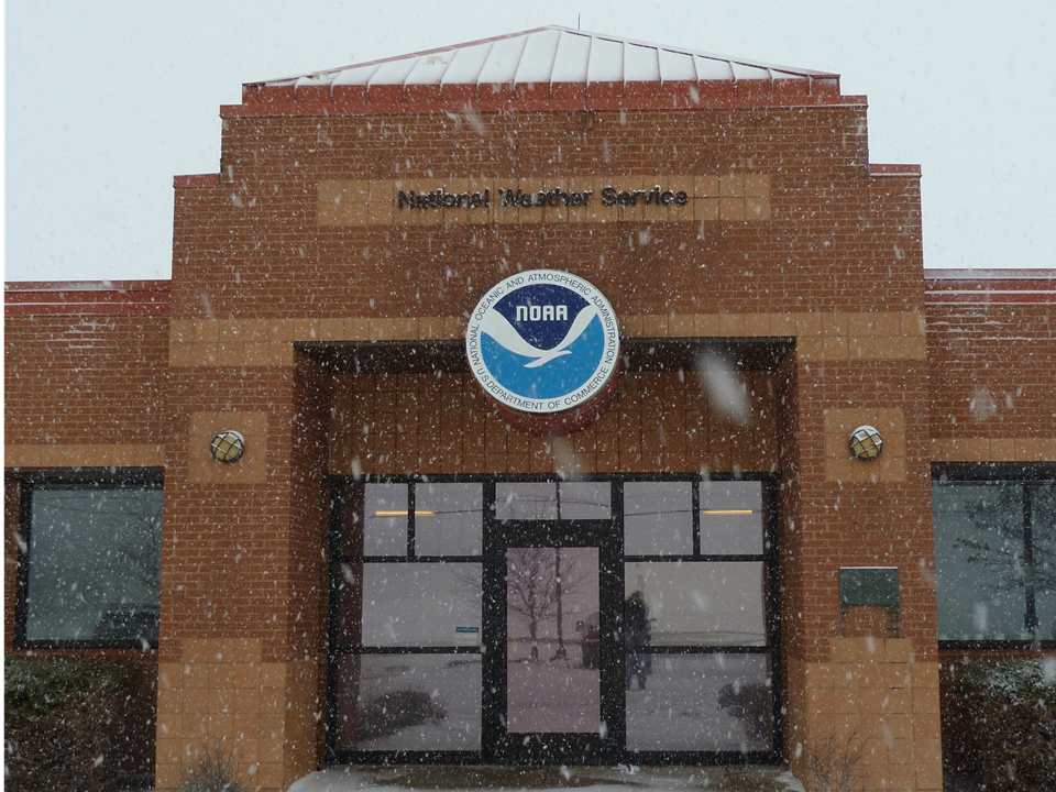
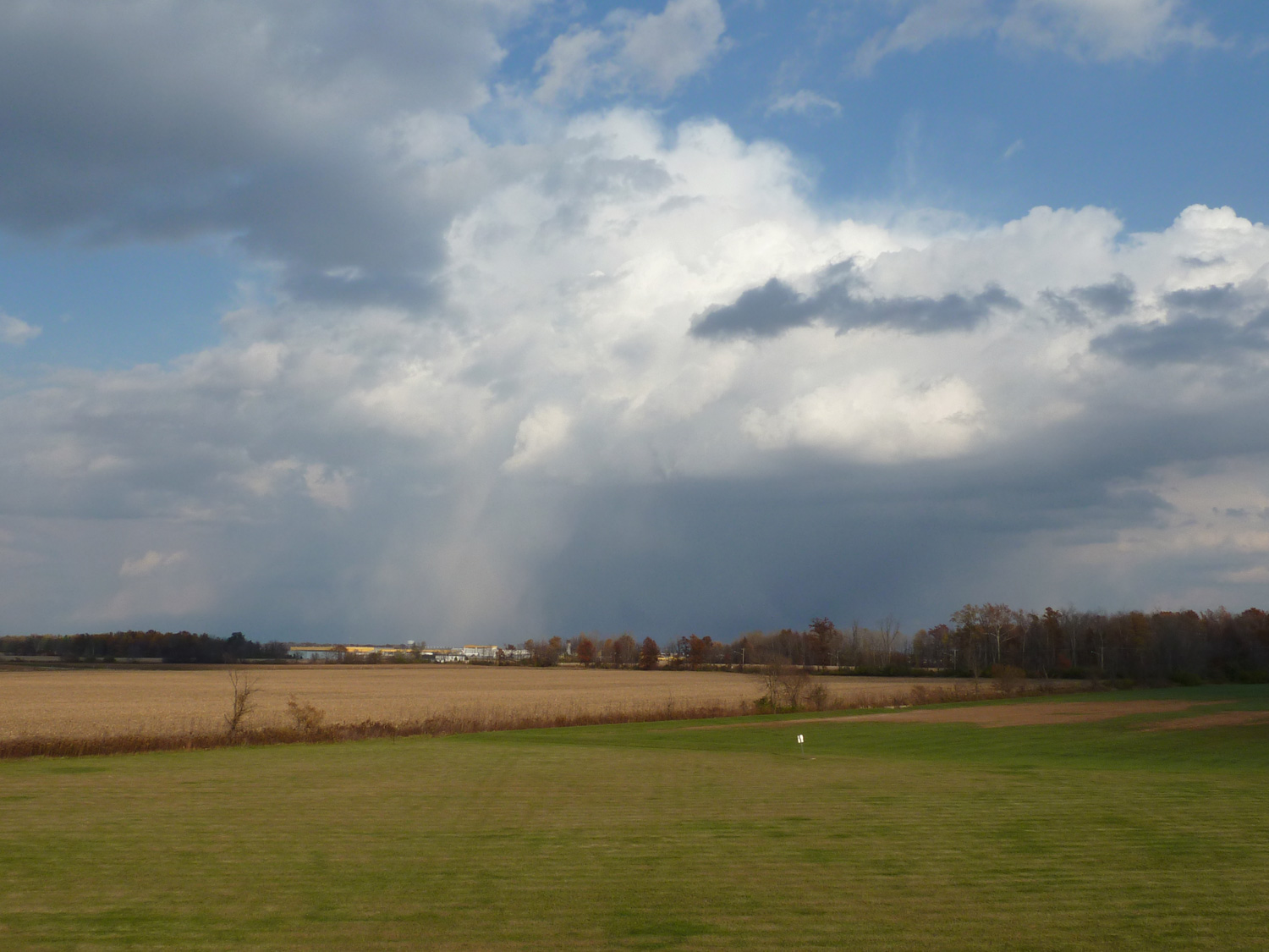
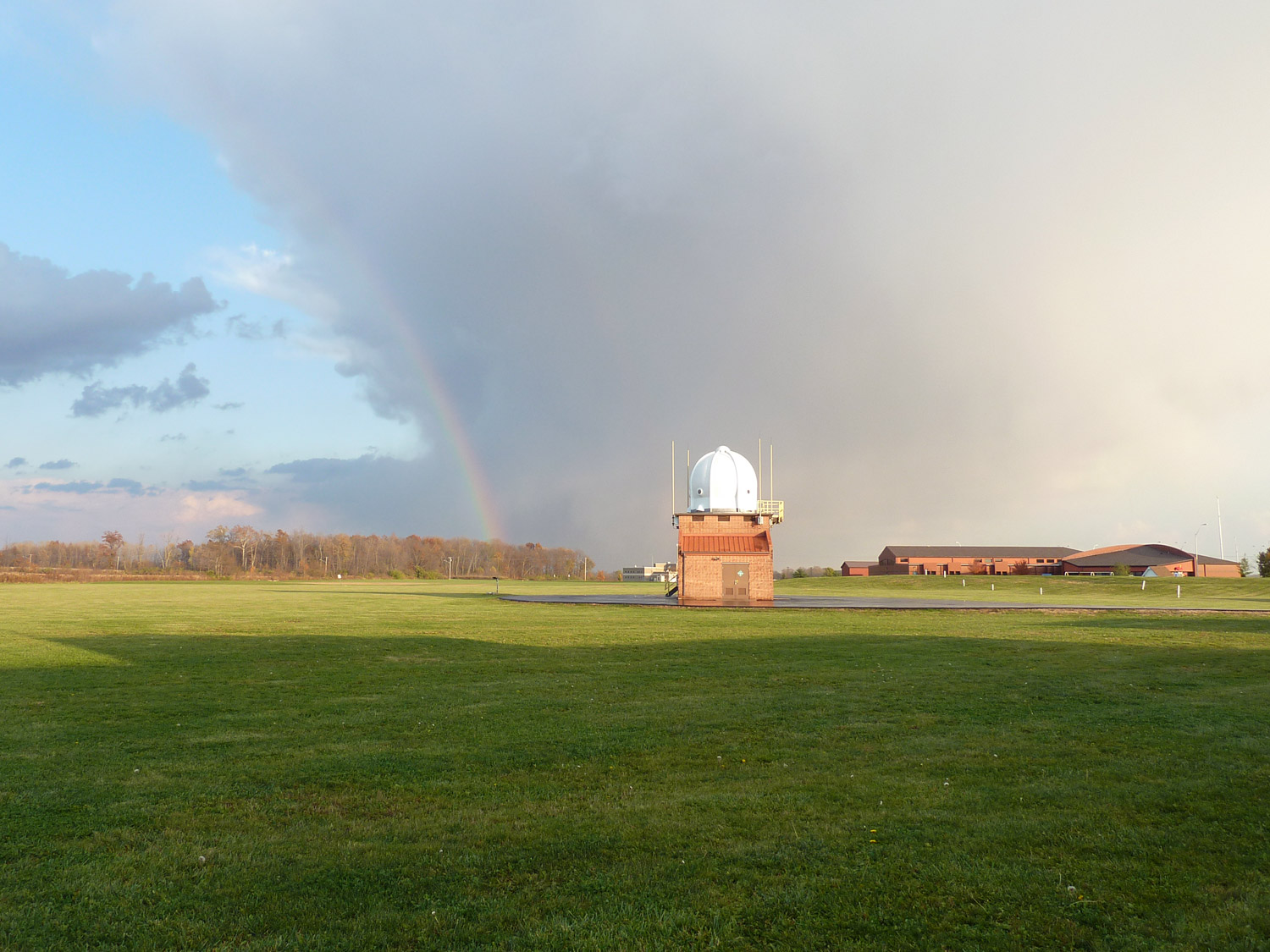
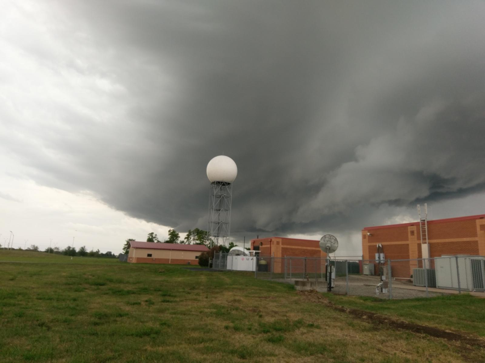
With our building occupied/staffed 24/7/365, we have had numerous opportunities to capture some of the beautiful scenes and scenery that the weather delivers on a daily basis.
 |
 |
 |
 |
 |
 |
 |
 |
 |
 |
 |
 |
 |
 |
 |
 |
 |
 |

