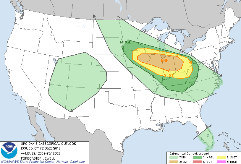
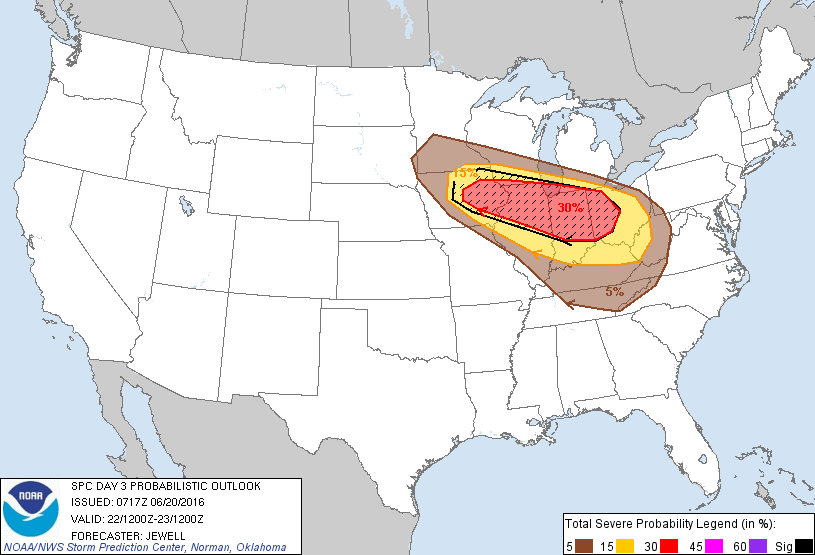
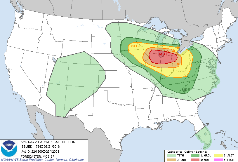
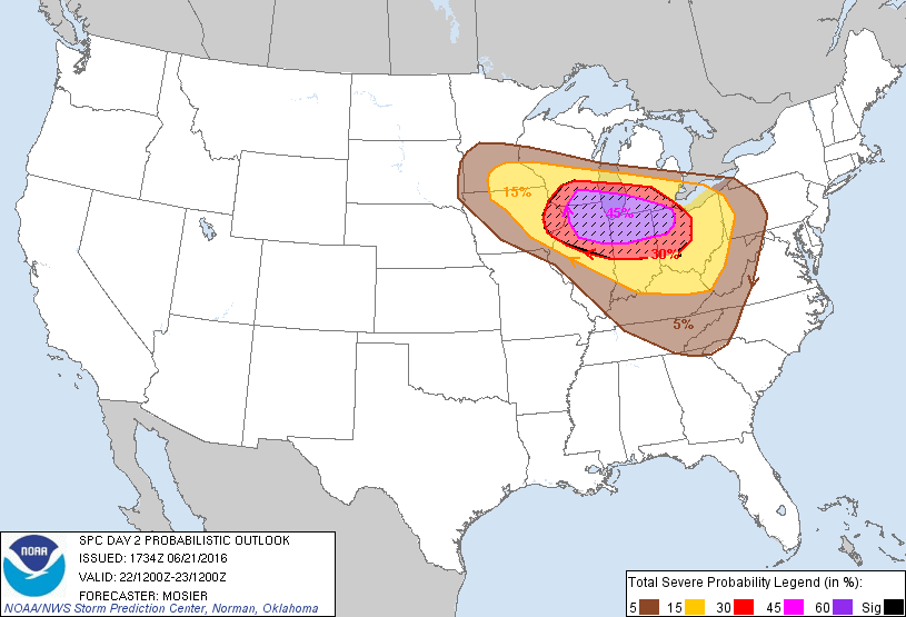
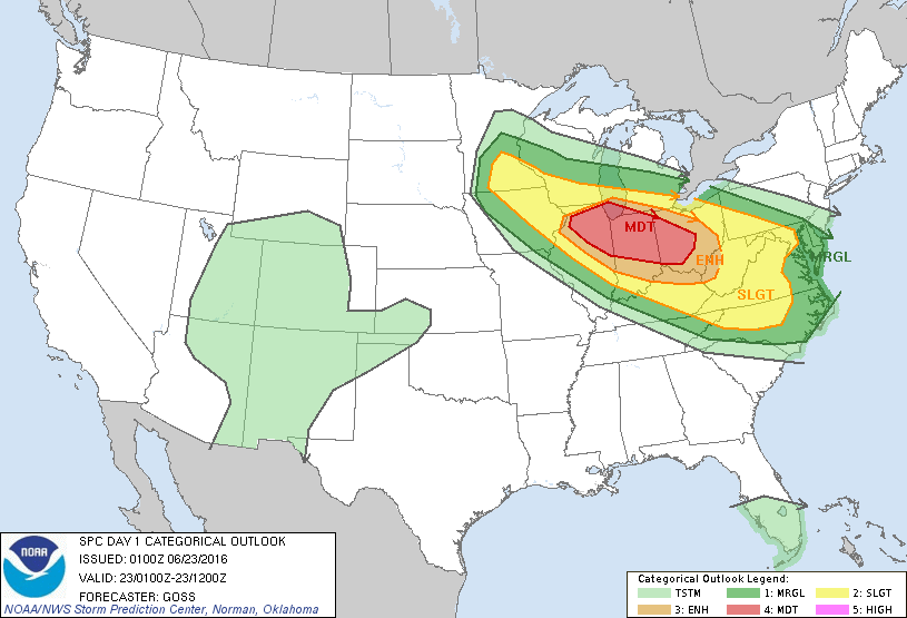
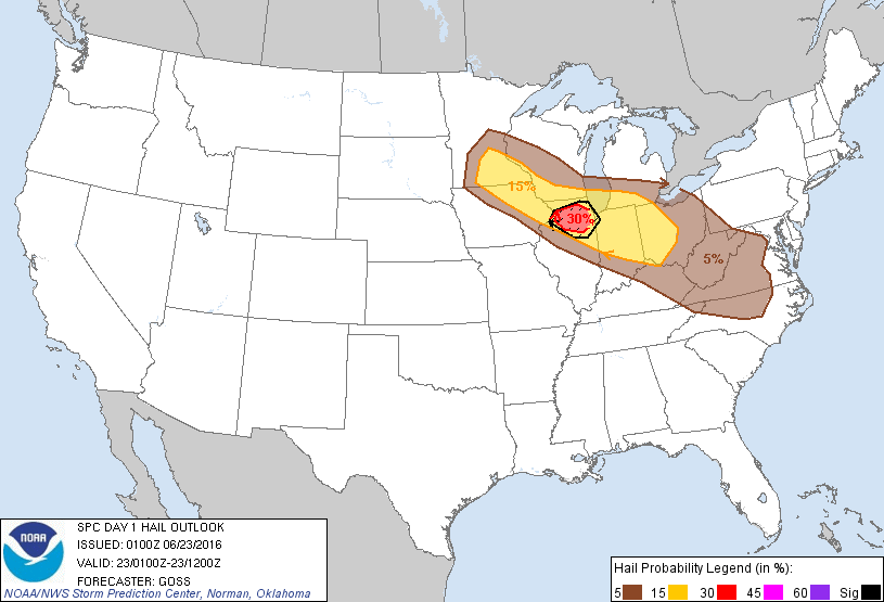
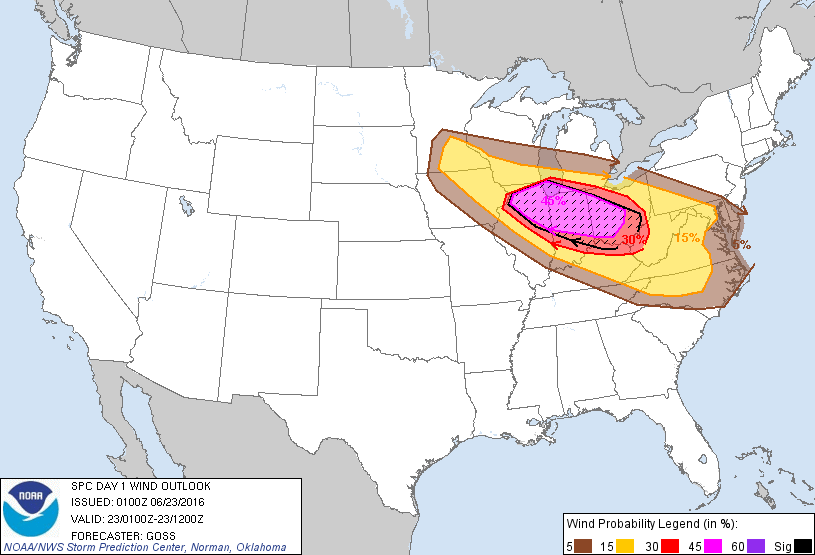
Overview
|
[ENTER BRIEF EVENT SUMMARY HERE] |
 Radar Loop for [ENTER DATE HERE] |
Storm Reports/PNS
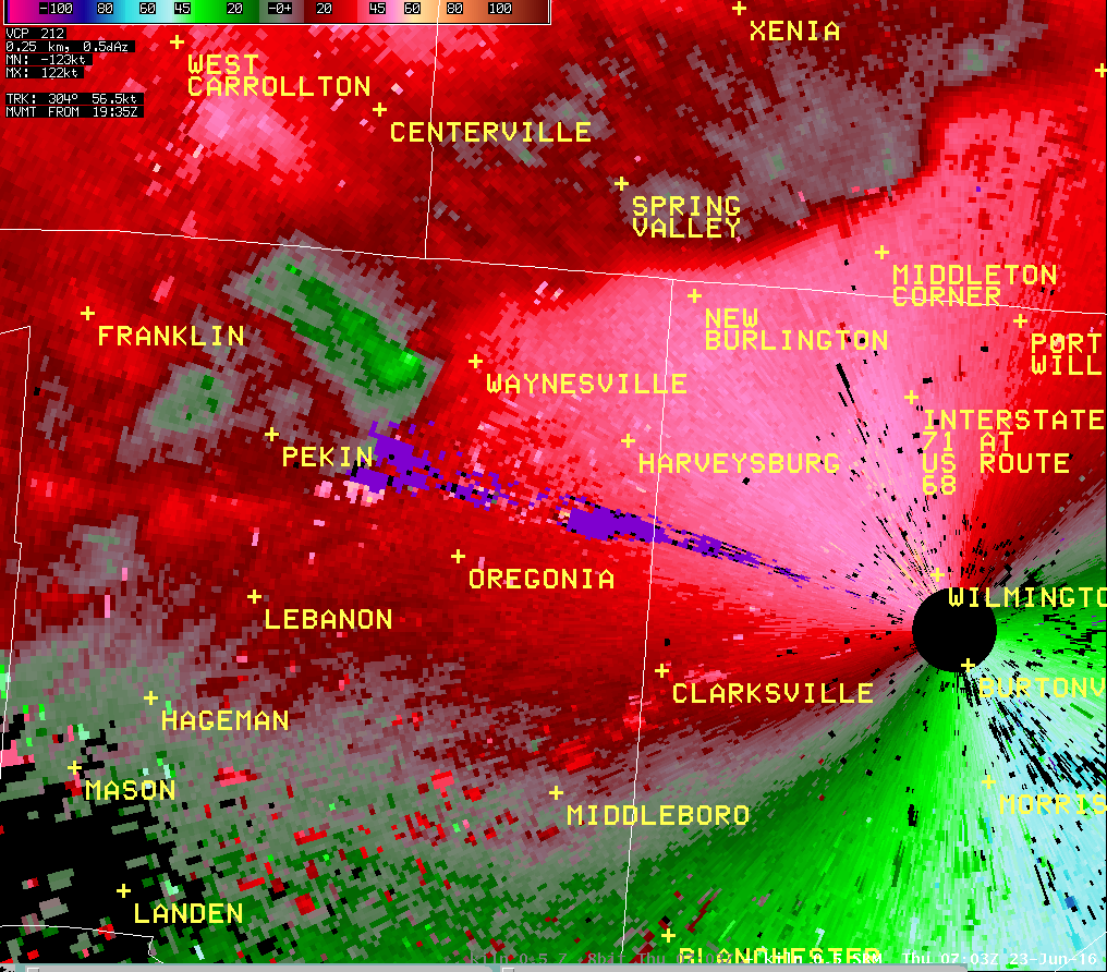
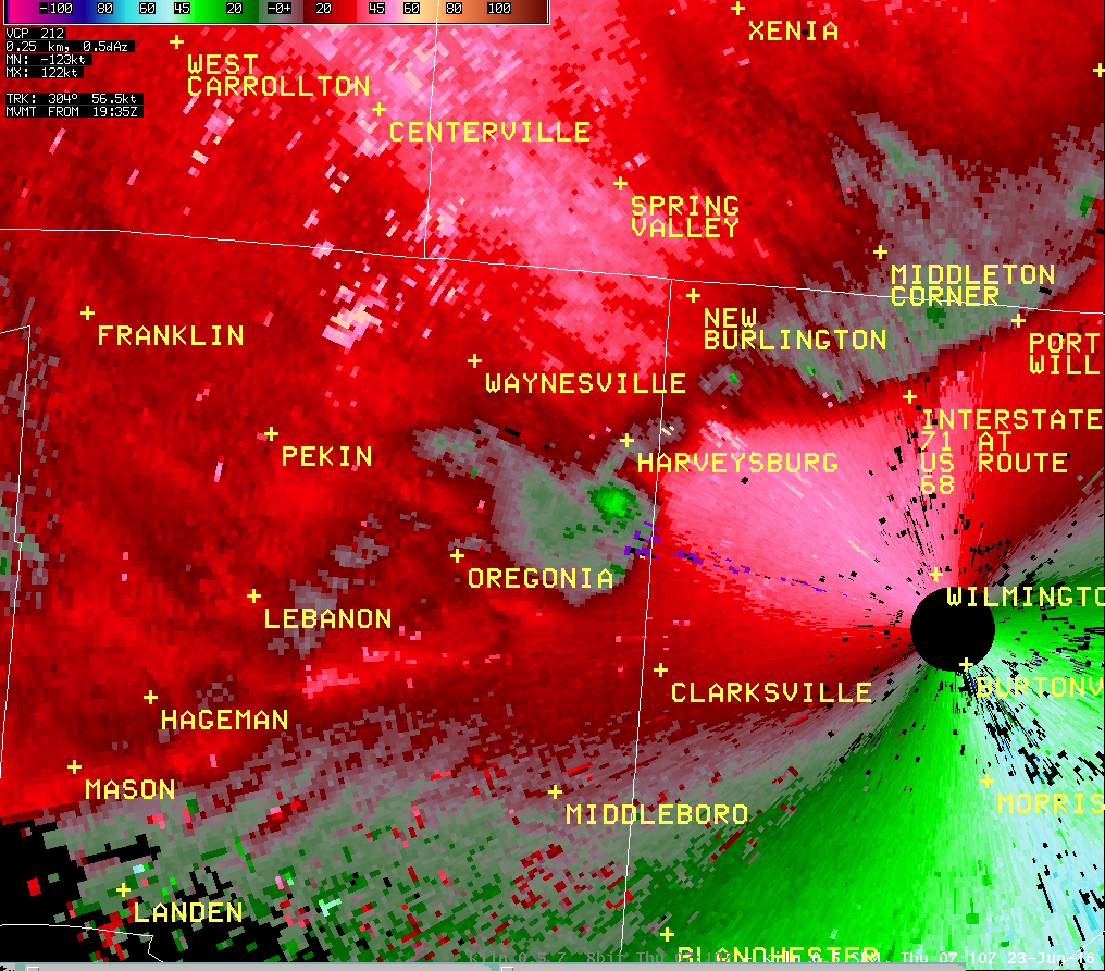
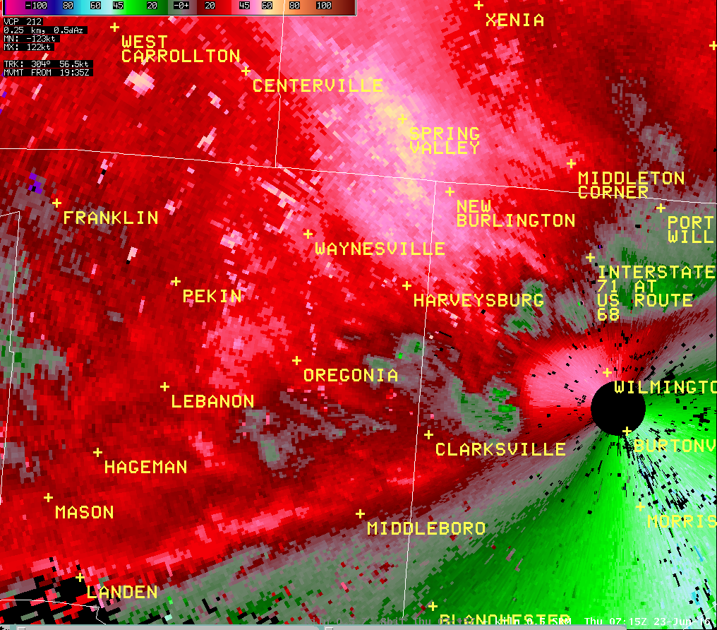
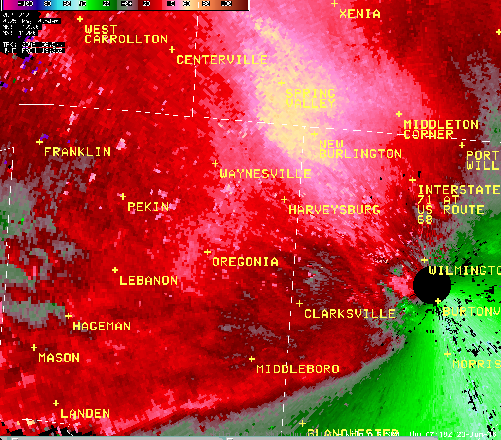
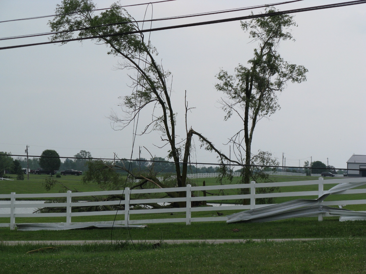
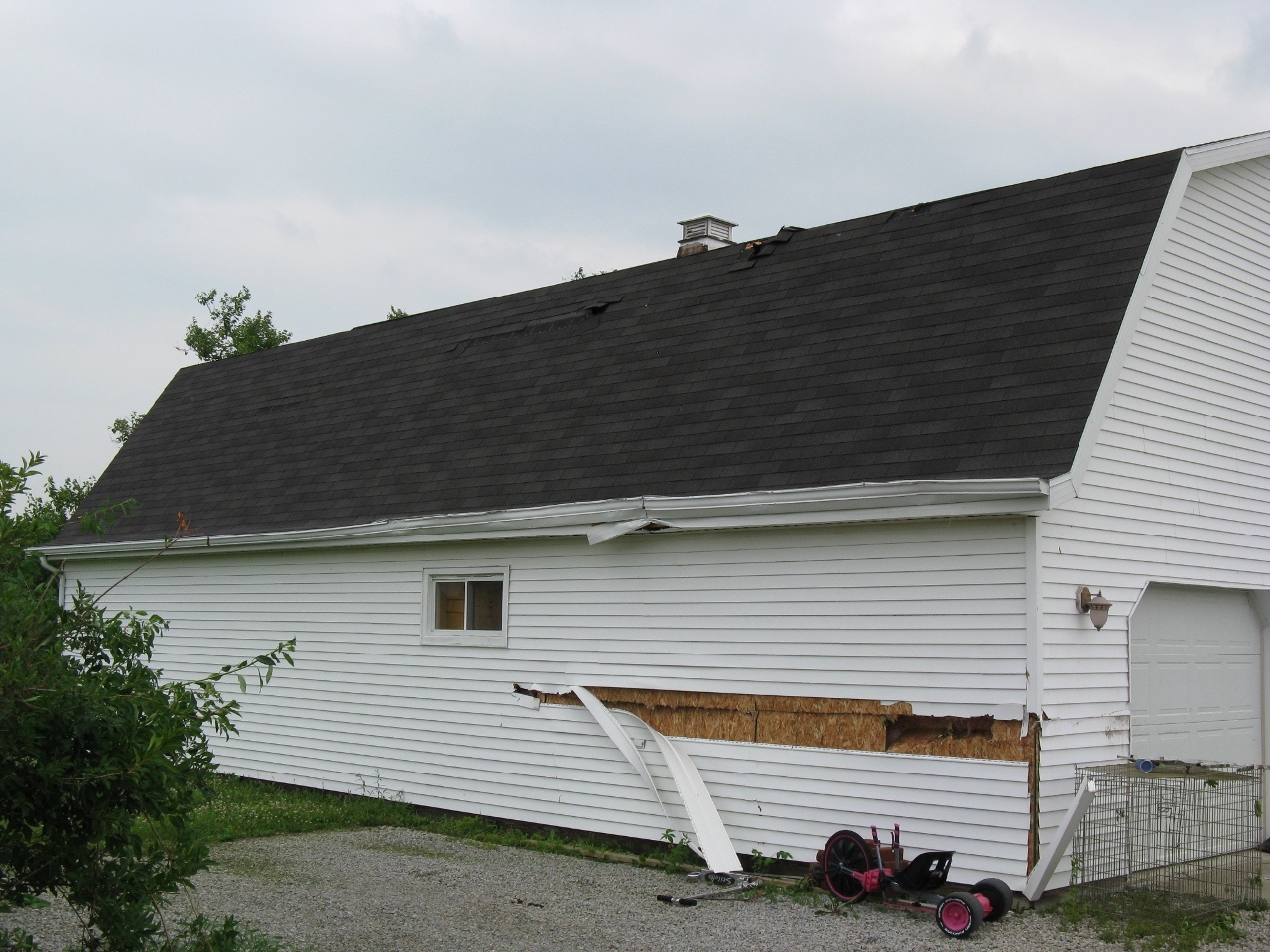
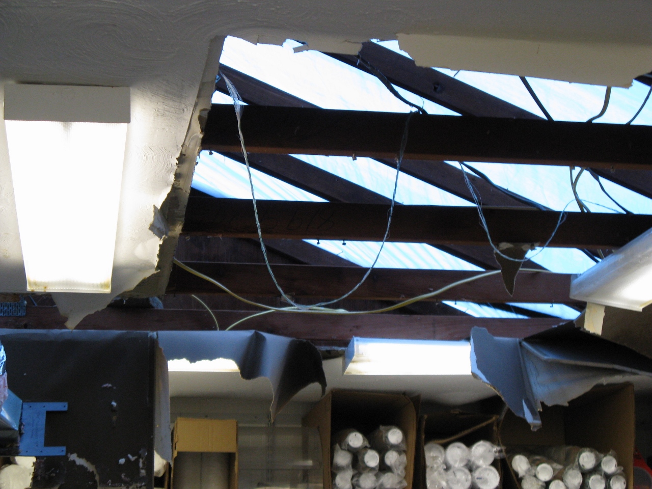
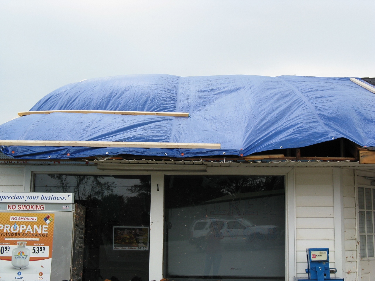
Public Information Statement...CORRECTED
National Weather Service Wilmington OH
515 PM EDT FRI JUN 24 2016

...Tornado confirmed from near Waynesville to Wilmington in
Warren and Clinton Counties in Ohio...

Location...Waynesville to Wilmington in Warren and Clinton
Counties in Ohio

Date...June 23, 2016
Estimated Time...303 AM EDT to 321 AM EDT
Maximum EF-Scale Rating...EF1
Estimated Maximum Wind Speed...105 MPH
Maximum Path Width...250 Yards
Path Length...20.70 Miles
Beginning Lat/Lon...39.534628 N /84.114072 W
Ending Lat/Lon...39.367044 N / 83.792961 W
* Fatalities...0
* Injuries...0

* The information in this statement is preliminary and subject to
  change pending final review of the event and publication in NWS
  Storm Data.

...Summary...
The National Weather Service in Wilmington, Ohio has confirmed a
tornado from near Waynesville to Wilmington in Warren and Clinton
Counties in Ohio on June 22, 2016. Previous public information
statements had listed this as separate tornadoes, however
additional information has led to the conclusion that a single
tornado occurred from near Waynesville to near Wilmington.
Although there were subtle indications that the tornado may have
lifted at times during the path, any indications of this are short
lived.

The tornado first touched down at a campground on State Route 73
near Waynesville. Trees were snapped, platform tents were damaged,
mattresses were thrown, and there was evidence of a tornadic
circulation in the grass. Evidence of the path continued southeast
across U.S. Route 42 south of Waynesville with snapped trees.
Barn damage occurred at a residence off of North Clarksville Road.
Large sections of metal roofing were uplifted. Barn doors also
were blown in. Trees were snapped and were facing in a convergent
pattern. Tree damage continued on further down North Clarksville
Road. Additional trees were snapped near Caesar Creek Lake south
of Harveysburg and also on Harveysburg Road.

Southeast of Interstate 71 on Doster Road two homes sustained
damage. There was loss of roofing material and also the winds had
made one side of the house bulge outwards. Debris splatter was
present on several sides of a home. Trees were uprooted and
snapped in this area. The brick wall of a barn collapsed. Sections
of roof were uplifted from barns.

Further southeast tree damage occurred along Hadley Road and South
Clarksville Road. In the Ogden area off of Ogden Road, several
trees were snapped. A tree also fell on a home in this area. There
was again evidence of a tornadic signature with leaf debris on all
sides of a barn.

Trees and power lines were down along the path on Linkhart Road.
Off of State Route 730 damage occurred to mobile homes. There
were several trees snapped in this area and an uprooted tree. In
addition, there was a convenience store that sustained loss of
roofing materials with only some of the wooden beams remaining on
part of the structure. Insulation was plastered to all sides of
the building. A house lost portions of the metal roof in this
vicinity. Damage to siding occurred on a barn.

Multiple homes sustained damaged on Mcguinn Road. One home had
extensive siding damage and partial loss of a wall. The roof also
sustained damage at this house. Insulation was plastered against
several sides of the building. A small shed was destroyed. Debris
was tossed into a nearby field. The foundation of one garage was
shifted slightly. The garage door was pushed in at a residence and
there was also collapse of the attached garage. Two of the three
sides of the garage were gone with the garage door pushed in and
collapsed on a third side. There were some subtle indications
that damage continued into the crops in the field. A large shed
lost half of the roof in this area. Fence damage occurred to a
nearby property.

Trees and power poles were damaged along U.S. Route 68 south of
Wilmington. Tree damage continued on East Dalton Road, Cuba Road,
Ireland Road, and Berlin Road. Also on Berlin Road a house lost a
portion of the roof and a garage door was pushed inward. Damage
occurred to another home on Leslie Drive. There was partial loss
of the roof and insulation was plastered against the house on all
sides. On Brown Road a tree was uprooted and part of the roof of a
barn was uplifted.

On State Route 134 a shed was blown and tossed off of the
foundation. Items from this location were tossed far into a field. At
another residence there was evidence of tornadic circulation in
the grass. Multiple barns sustained damage including damage to
the roofs and walls. Silos were also tossed into a field. The
house had glass that was broken sticking into an interior wall of
the house. Damage was sustained to part of the roof. Trees were
also snapped at this location.

At the end of the path off of Crouse Road a barn was destroyed and a
silo was damaged. Tree damage was observed in a field.

This information can also be found on our website at
weather.gov/iln.

For reference...the Enhanced Fujita Scale classifies tornadoes
into the following categories:

EF0...wind speeds 65 to 85 mph.
EF1...wind speeds 86 to 110 mph.
EF2...wind speeds 111 to 135 mph.
EF3...wind speeds 136 to 165 mph.
EF4...wind speeds 166 to 200 mph.
EF5...wind speeds greater than 200 mph.

$$

Novak
Storm Reports/PNS
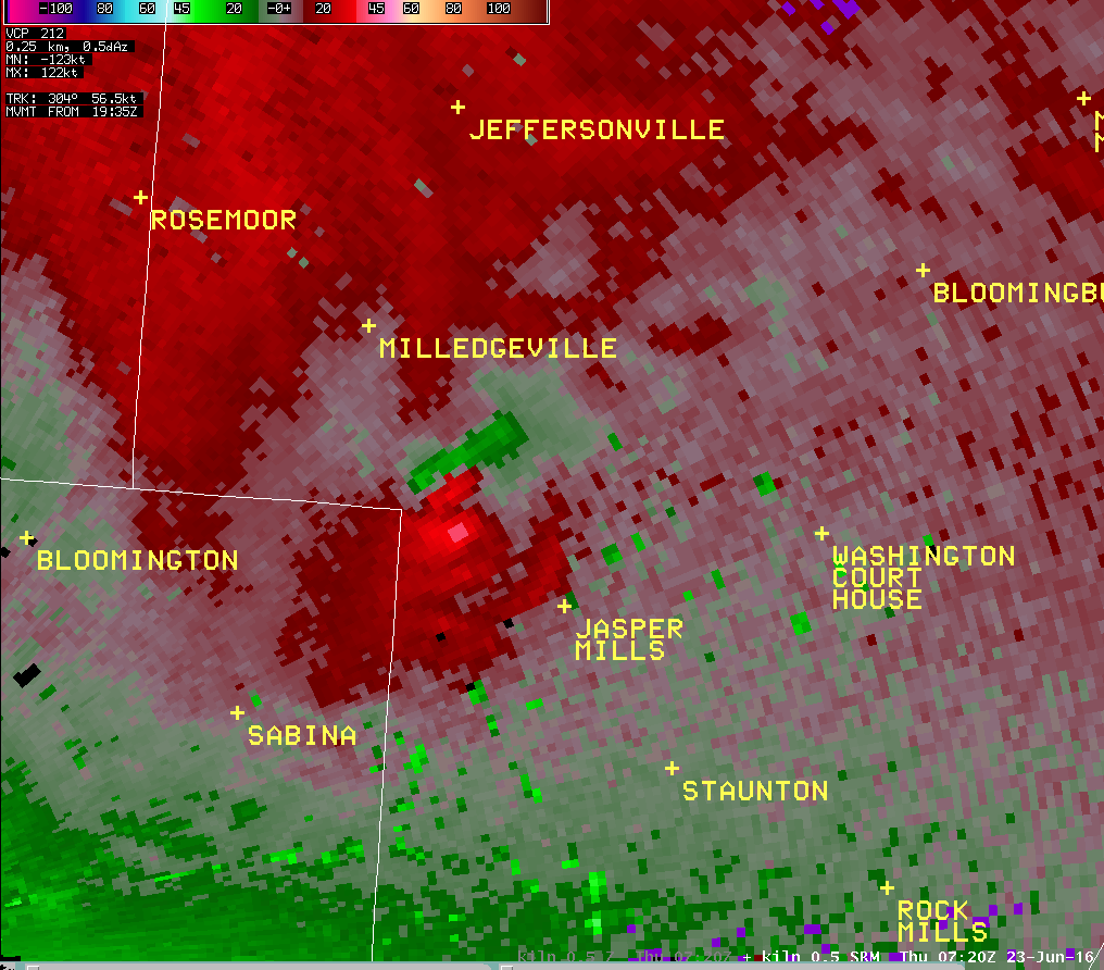
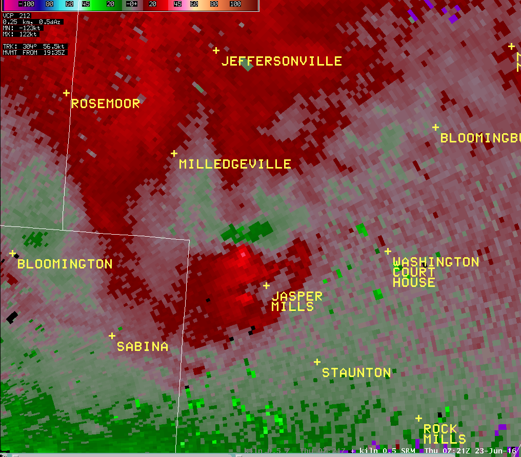
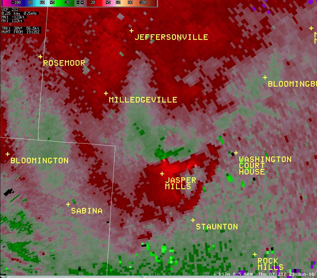
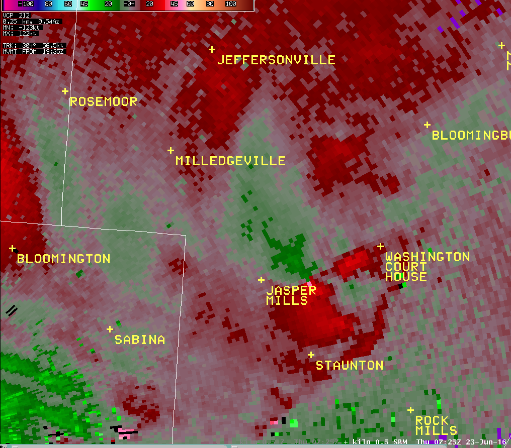
...Tornado Confirmed West of Washington Court House in
Fayette County Ohio...

Location...West of Washington Court House in Fayette County
Ohio
Date...06/23/2016
Estimated Time...3:20 AM EDT to 3:22 AM EDT
Maximum EF-Scale Rating...EF1
Estimated Maximum Wind Speed...100 MPH
Maximum Path Width...300 Yards
Path Length...3.8 Miles
Beginning Lat/Lon...39.5518N / 83.5538 W
Ending lat/Lon...39.5197 N / 83.4990 W
* Fatalities...0
* Injuries...0

* The information in this statement is preliminary and subject to
change pending final review of the event(s) and publication in
NWS Storm Data.

...Summary...
The National Weather Service in Wilmington OH has confirmed a
tornado West of Washington Court House in Fayette County Ohio
on 06/23/2016.

2 homes along the 3700 Block of U.S. Route 22 sustained the most
significant structural damage, with one of the homes having
significant roof damage. This damage combined with tree damage
and evidence of rotation within debris confirm a tornado. Damage
in this area has been determined to be of EF1 strength.

Additional tornadic damage was observed to the northwest of
the 3700 Block of U.S. Route 22. More details will be forthcoming,
and final survey information will be available early this evening.

The National Weather Service extends thanks to Fayette County OH
Emergency Management, Fayette County Sheriff's Office and the
affected homeowners for their assistance with this damage survey.

This information can also be found on our website at
weather.gov/iln.

For reference...the Enhanced Fujita Scale classifies tornadoes
into the following categories:

EF0...wind speeds 65 to 85 mph.
EF1...wind speeds 86 to 110 mph.
EF2...wind speeds 111 to 135 mph.
EF3...wind speeds 136 to 165 mph.
EF4...wind speeds 166 to 200 mph.
EF5...wind speeds greater than 200 mph.

$$

Peloquin
Storm Reports/PNS
Public Information Statement
National Weather Service Wilmington OH
931 PM EDT THU JUN 23 2016

...Microburst with straight line wind damage has been confirmed near
Springboro in Warren County Ohio...

Location...Springboro in Warren County Ohio
Date...06/23/2016
Estimated Time...2:55 AM EDT - 3:05 AM EDT
Estimated Maximum Wind Speed...80 MPH

* The information in this statement is preliminary and subject to
change pending final review of the event(s) and publication in
NWS Storm Data.

A damage survey conducted by the National Weather Service in
collaboration with Warren County Emergency Management determined
that thunderstorm wind damage which occurred during the morning
of Wednesday 23 June 2016 was caused by a microburst with straight
line winds.

A swath of damage was observed in the Settlers Walk neighborhood
including Settlers Walk Blvd., Stolle Drive, and Remick Blvd. The
damage also extended to the southeast toward Five Points and
Lytle. Maximum winds associated with the microburst occurred within
this area, and are estimated to be up to 80 mph.

Multiple hardwood trees were knocked down and were pointing in
the same direction. A few softwood trees were also uprooted.

The National Weather Service extends thanks to Warren County
Emergency Management for their assistance with this storm damage
survey.

This information can also be found on our website at
weather.gov/iln.

For reference...
A microburst is a convective downdraft with an affected outflow
area of less than 2 1/2 miles wide and peak winds lasting less
than 5 minutes. Microbursts may induce dangerous horizontal and
vertical wind shears...which can adversely affect aircraft
performance and cause property damage. Straight-line winds are
generally any wind that is not associated with rotation...used
mainly to differentiate them from tornadic winds.

$$

Peloquin/Butner
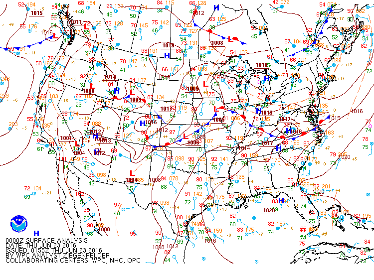
Environment
 |
 |
 |
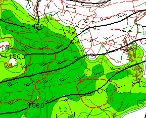
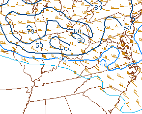
| Figure 1: Surface analysis shows a warm front lifting northeast through the Ohio Valley during the late evening hours of the 22nd and early morning hours of the 23rd | Figure 2: 04z (12 AM EDT) analysis showed very moist air at 850mb advecting into the area due to strong 30-40kt winds | Figure 3: 06z (2 AM EDT) analysis of instability shows the axis of the instability gradient to be oriented NW to SE across the area (with higher instability to the SW and lower instability to the NE) |
 |
 |
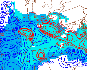 |
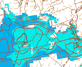
| Figure 4: 04z (12 AM EDT) analysis showed the 0-6km shear vector to be quite strong across the region | Figure 5: By 06z (2 AM EDT), the instability had increased dramatically across the area, with MLCAPE values between 1500-2000j/kg across the region | Figure 6: The change in MLCAPE from 03-06z was quite pronounced across the area. Given the time of day, this increase in instability was relatively uncommon |
Tornadoes:
|
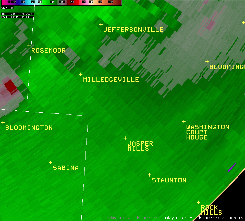
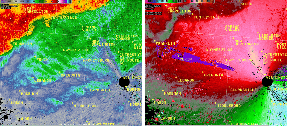
Tornado #1 - Waynesville to Wilmington - 3:03 AM EDT
Track Map  
|
||||||||||||||||
|
||||||||||||||||
|
Tornado #2 - West of Washington C.H., Ohio - 3:20 AM EDT
Track Map
|
||||||||||||||||
|
||||||||||||||||
The Enhanced Fujita (EF) Scale classifies tornadoes into the following categories:
| EF0 Weak 65-85 mph |
EF1 Moderate 86-110 mph |
EF2 Significant 111-135 mph |
EF3 Severe 136-165 mph |
EF4 Extreme 166-200 mph |
EF5 Catastrophic 200+ mph |
 |
|||||
Additional Information
The Forecast
Warnings
| Type of Warning | # Issued |
| Number of Severe Thunderstorm Warnings | 18 |
| Number of Tornado Warnings | 4 |
| Number of Flash Flood Warnings | 4 |
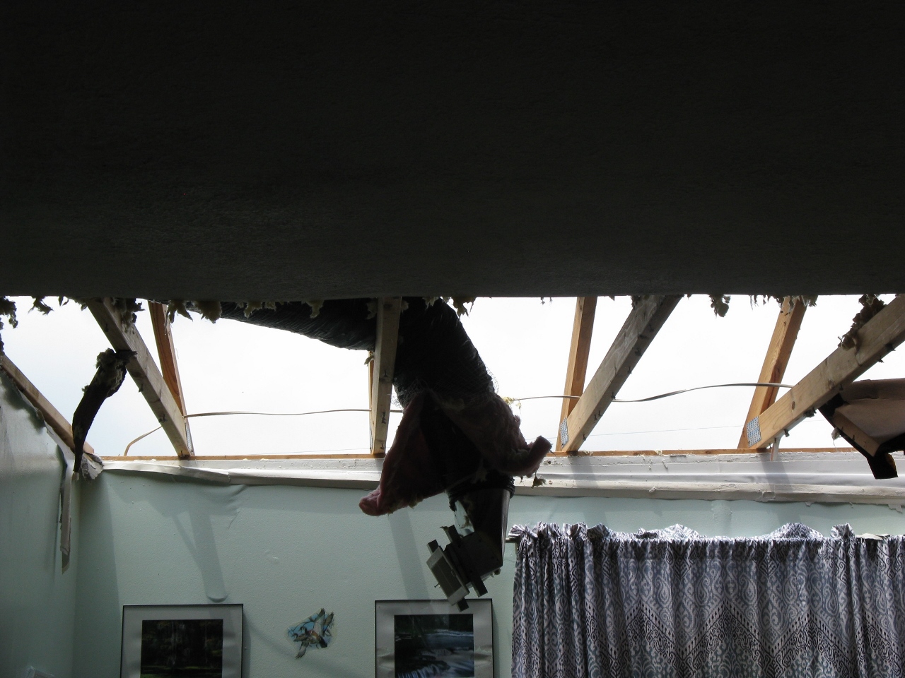
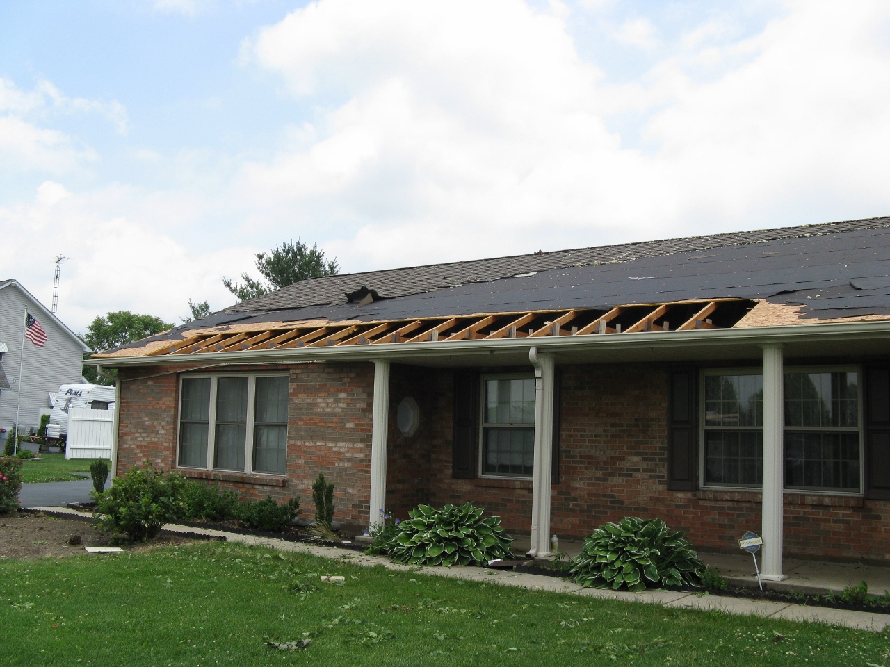
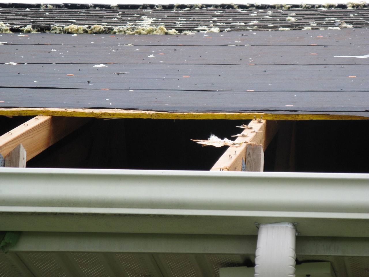
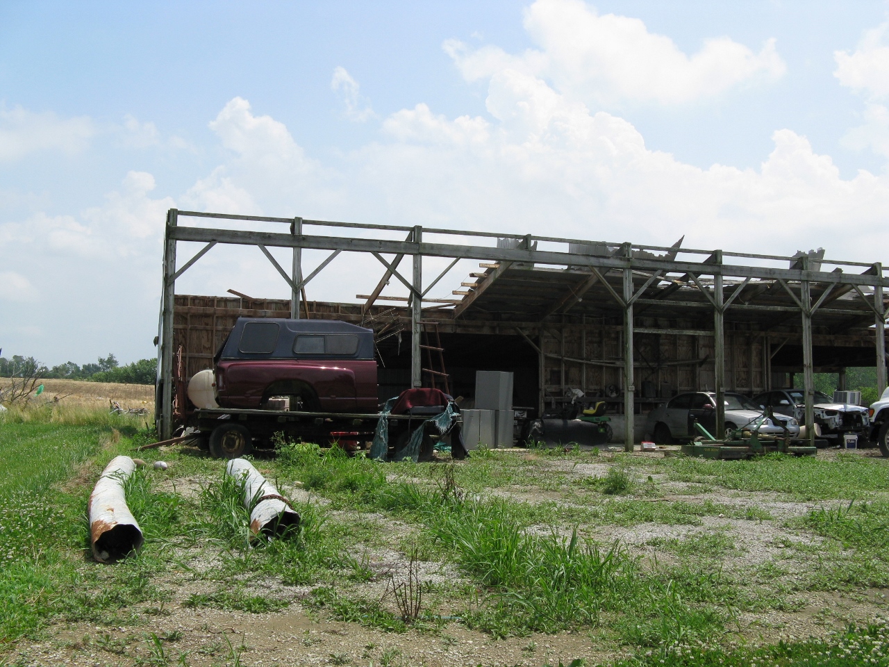
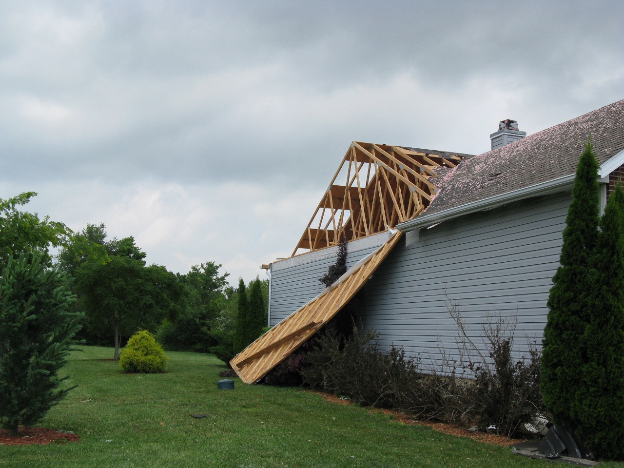
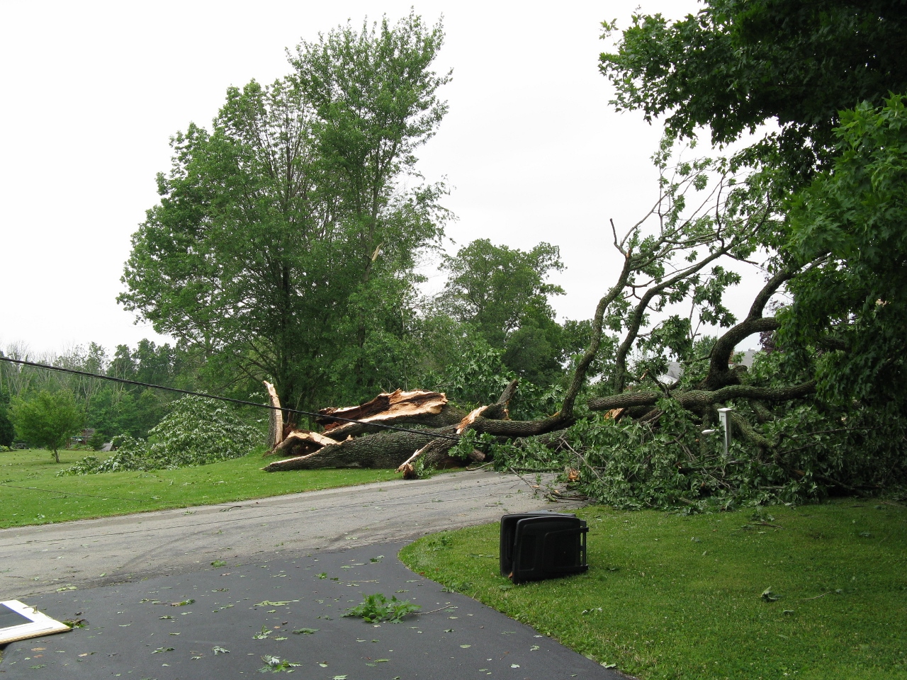
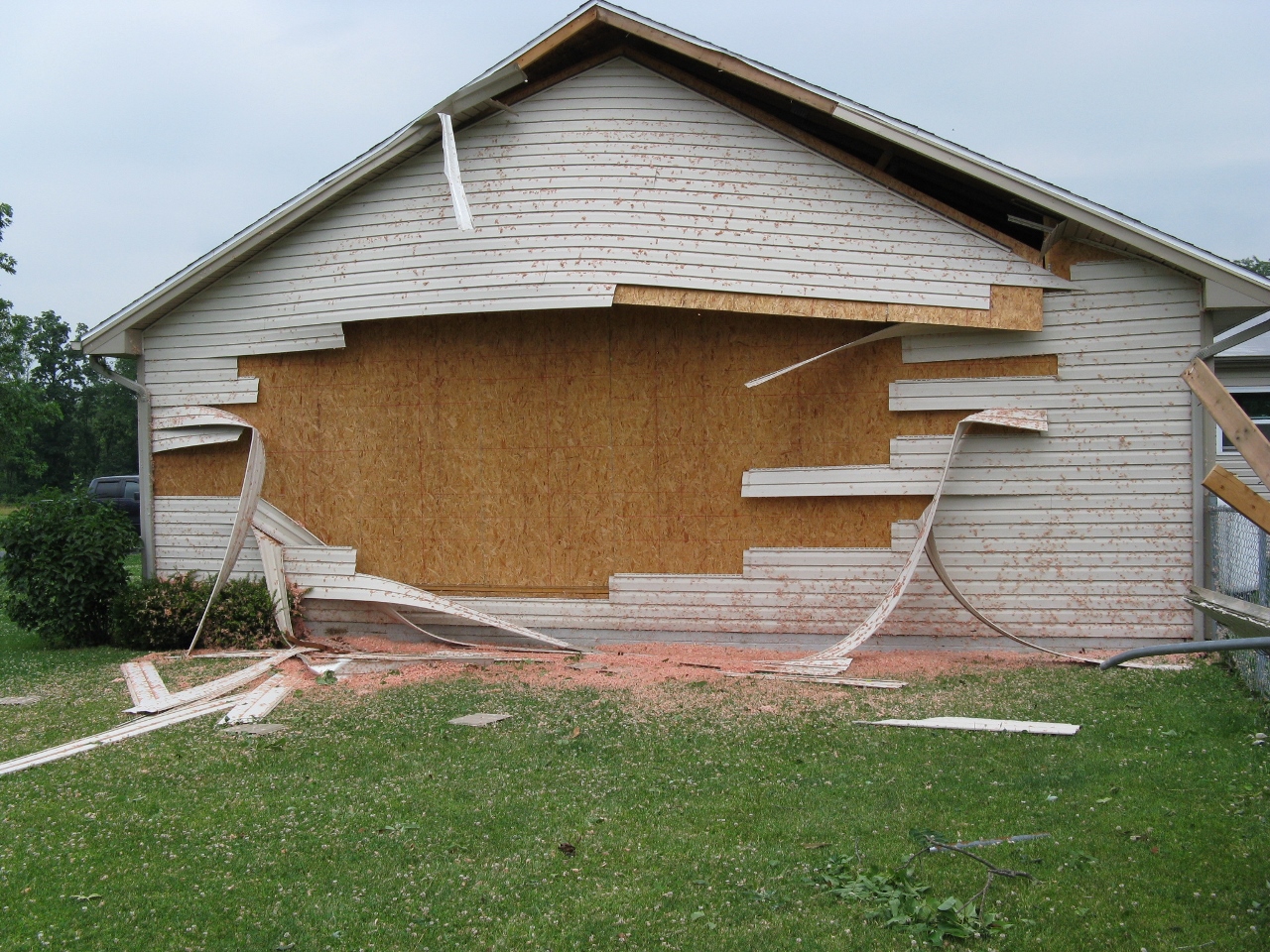
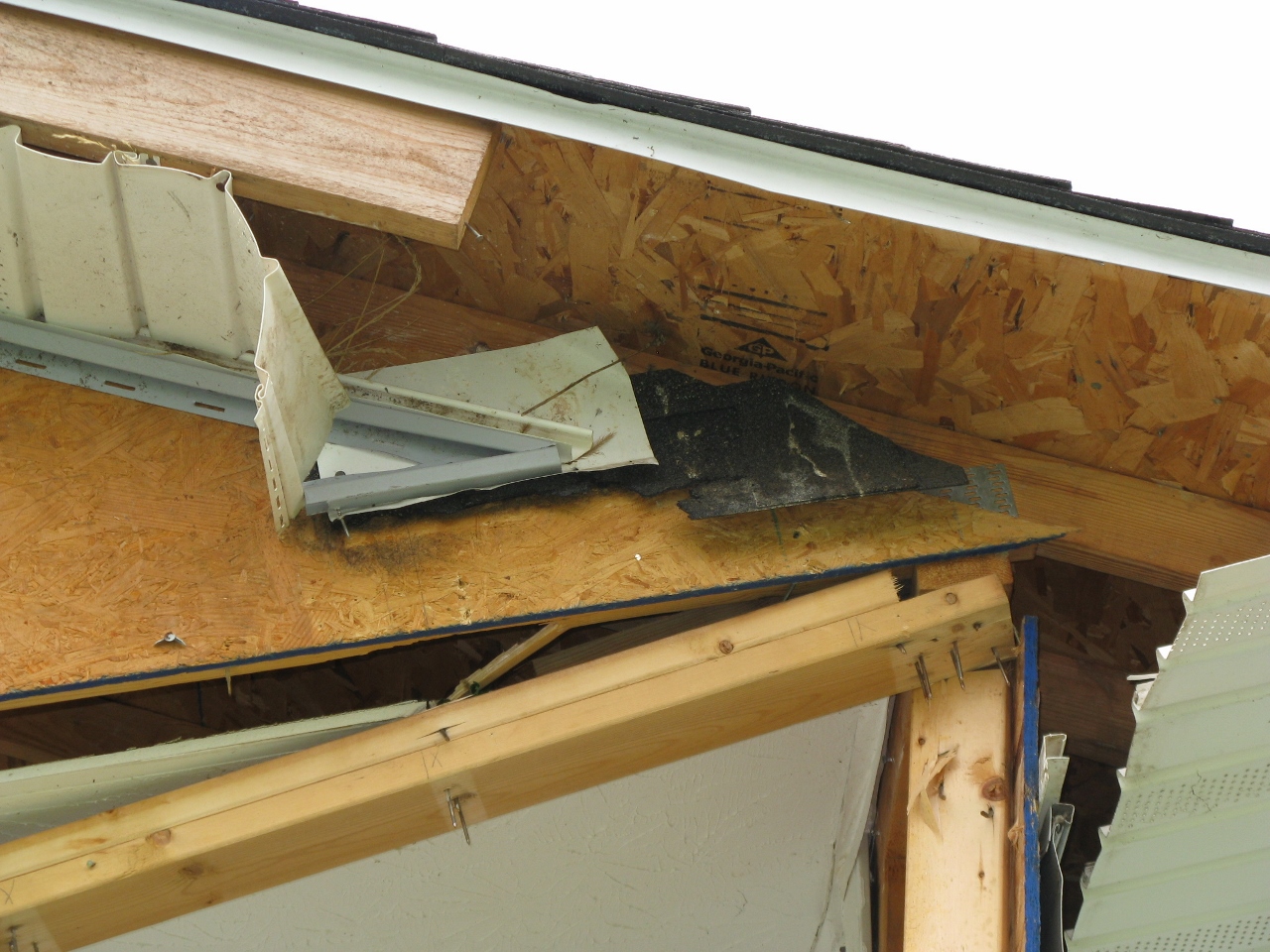
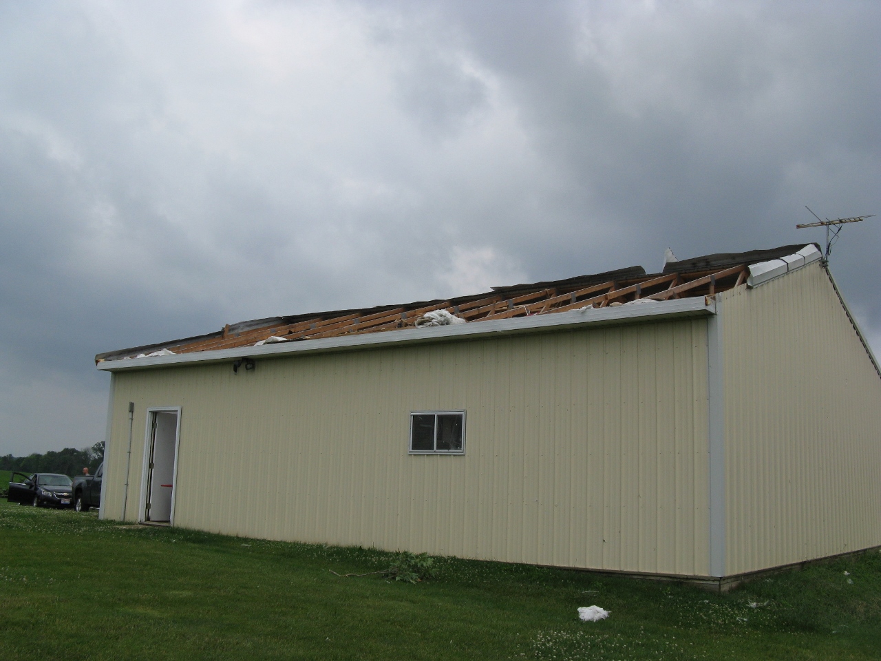
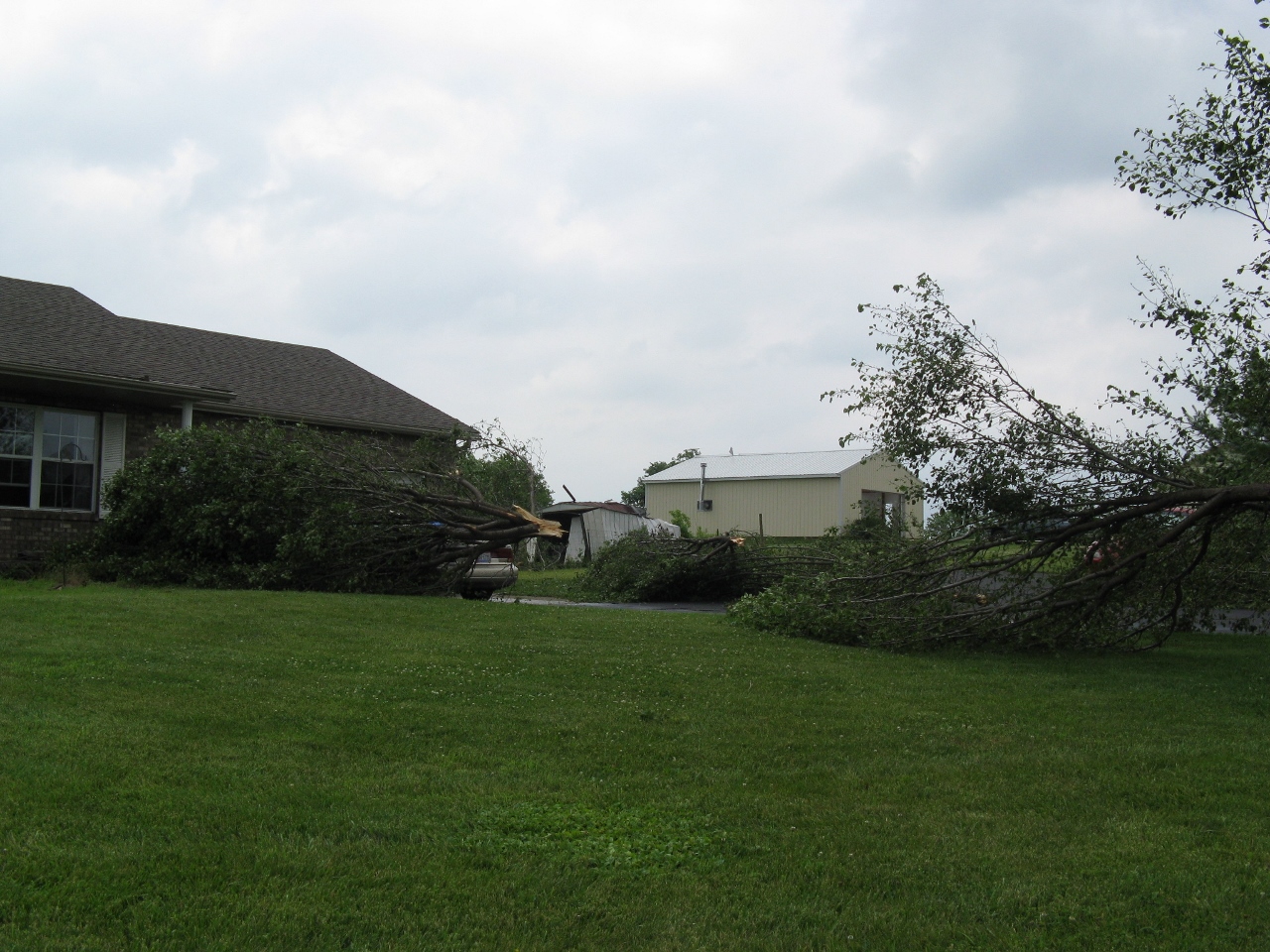
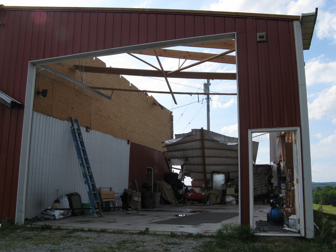
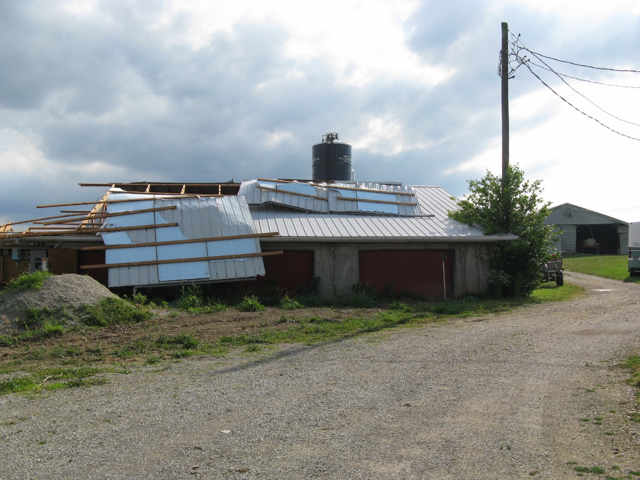
Storm Pictures/Survey Pictures
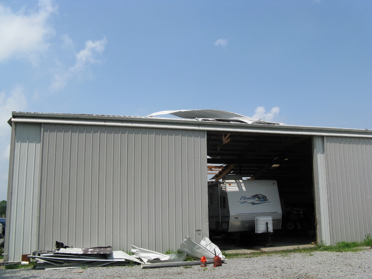
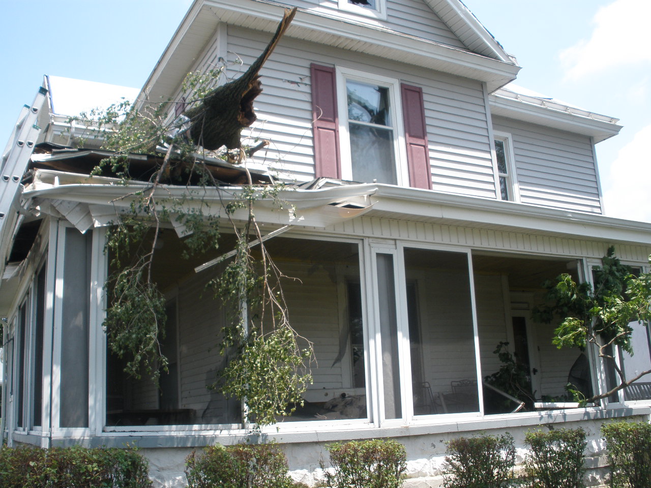
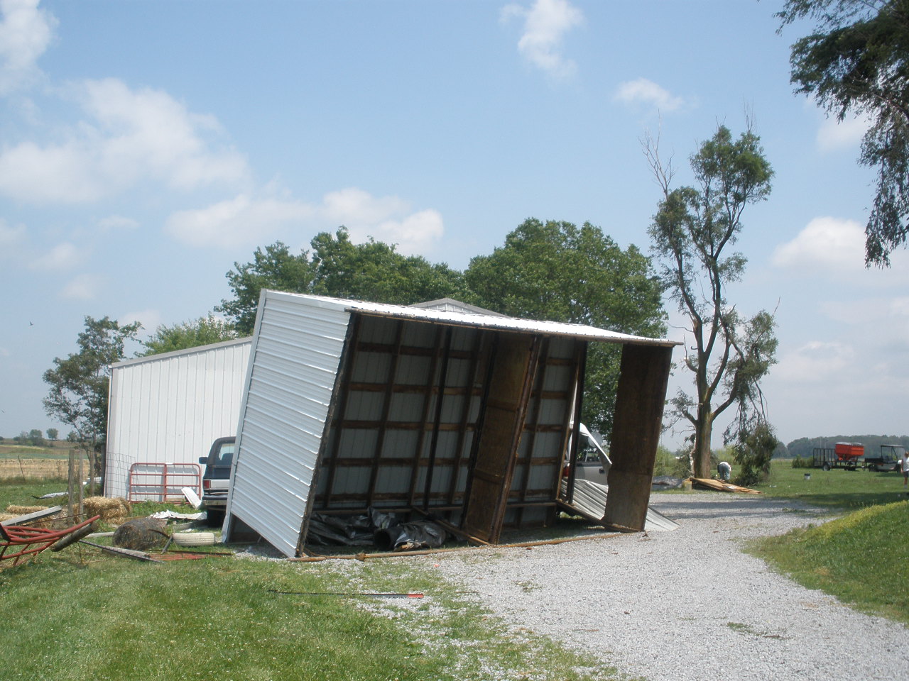
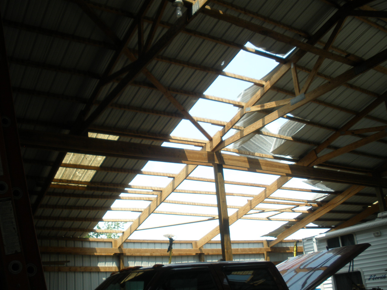
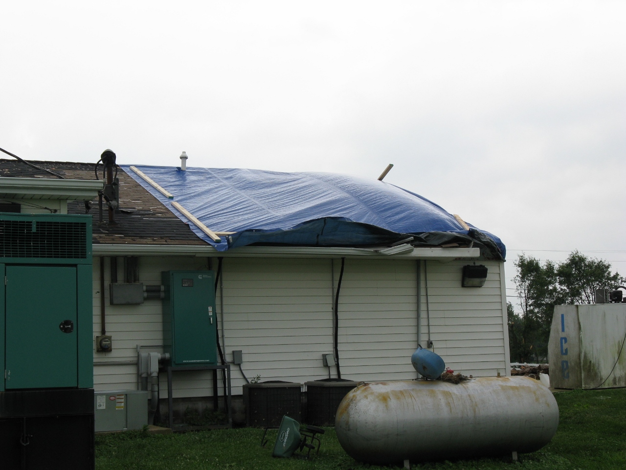
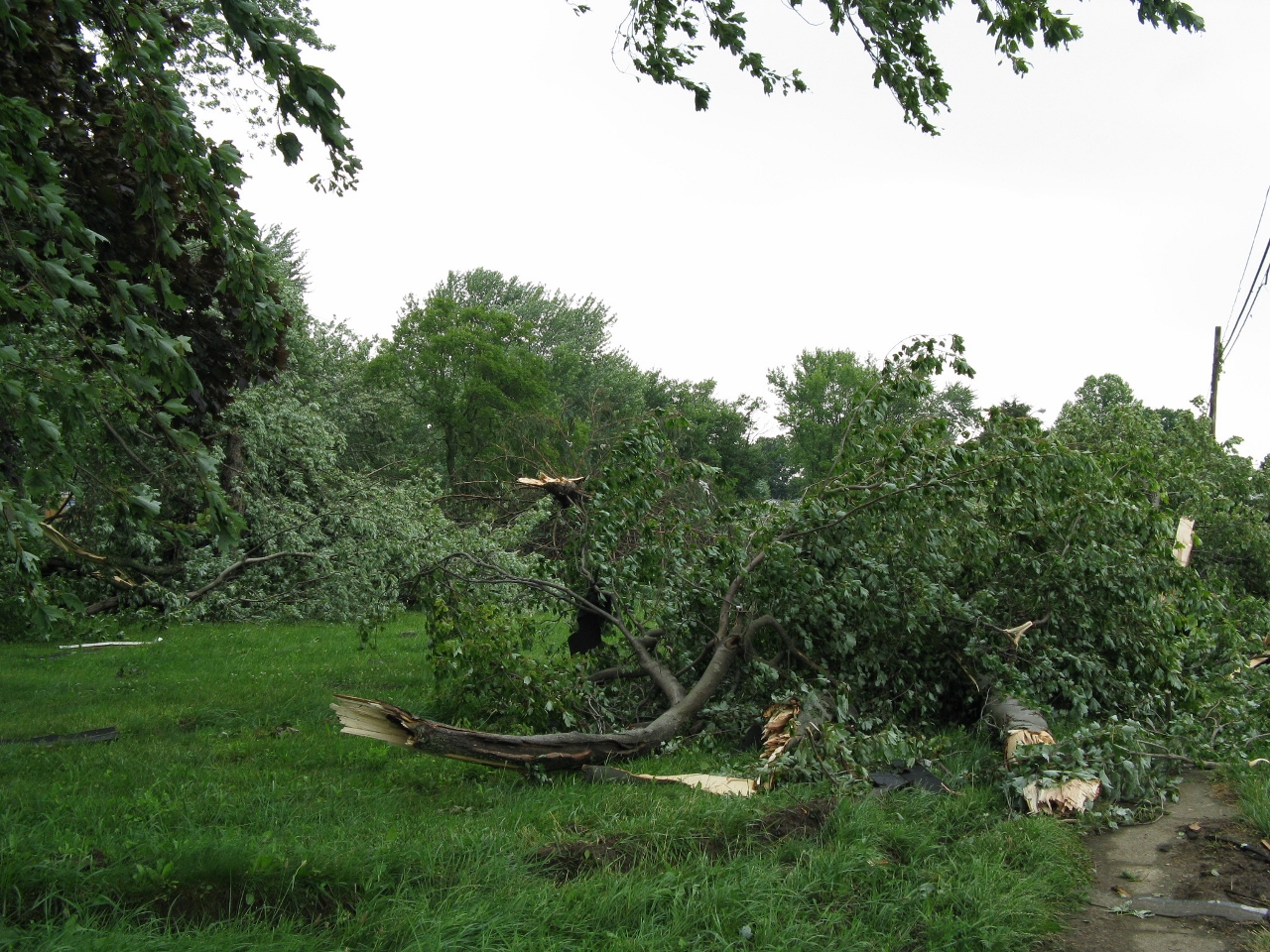
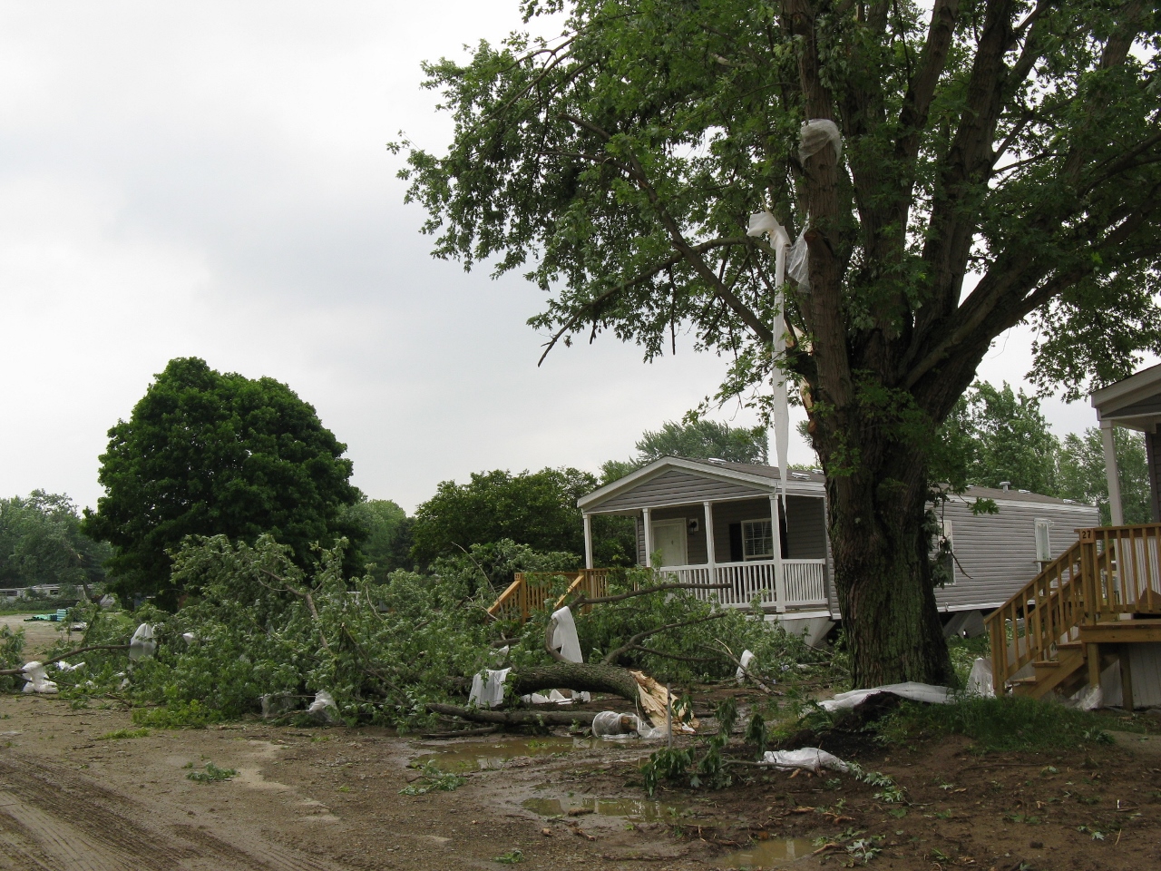
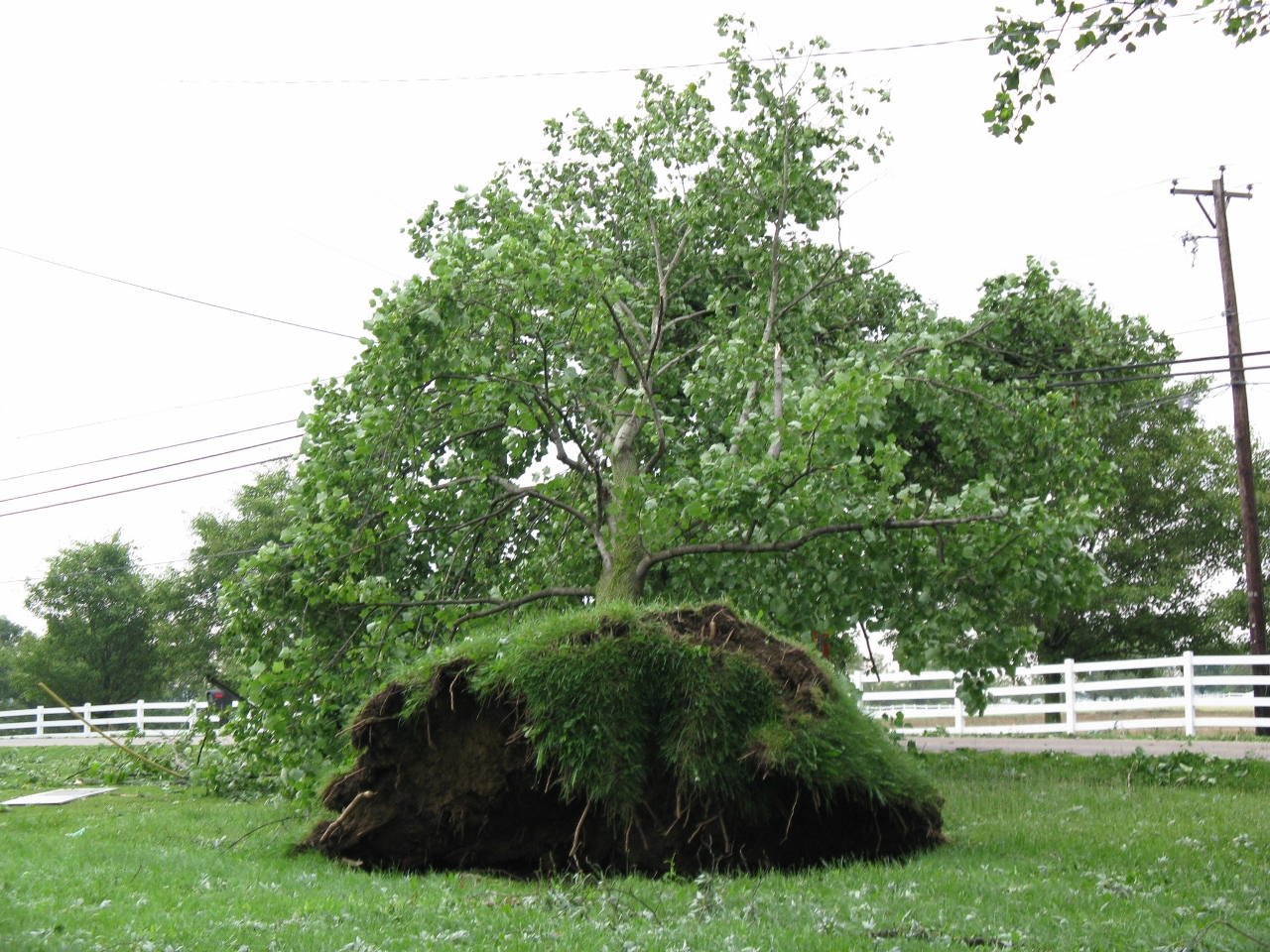
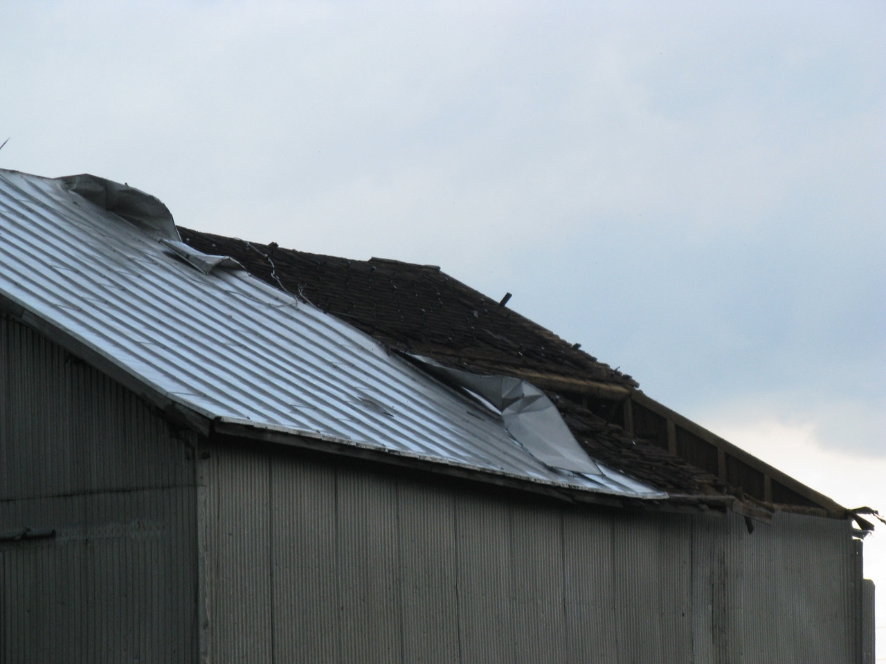
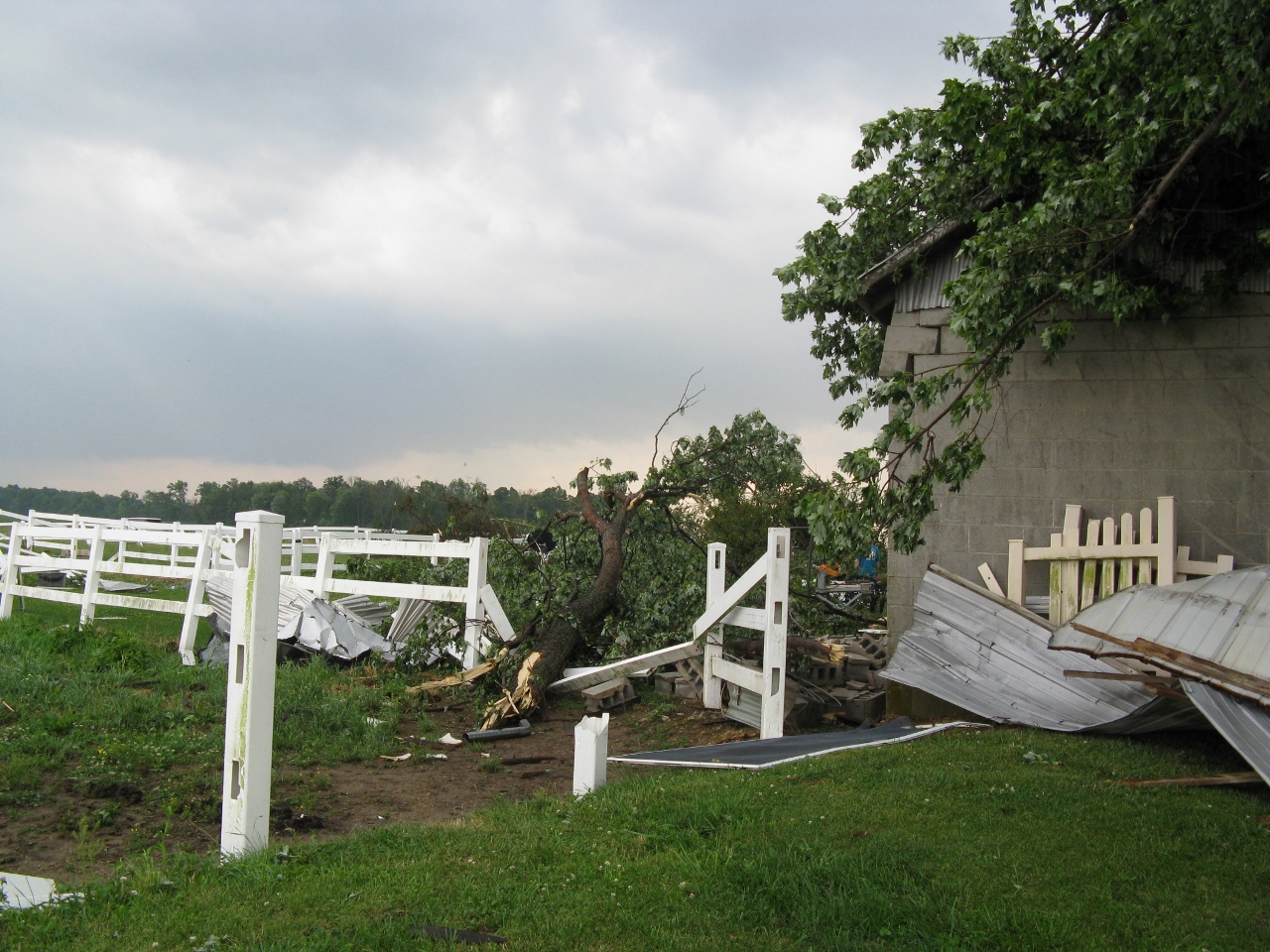
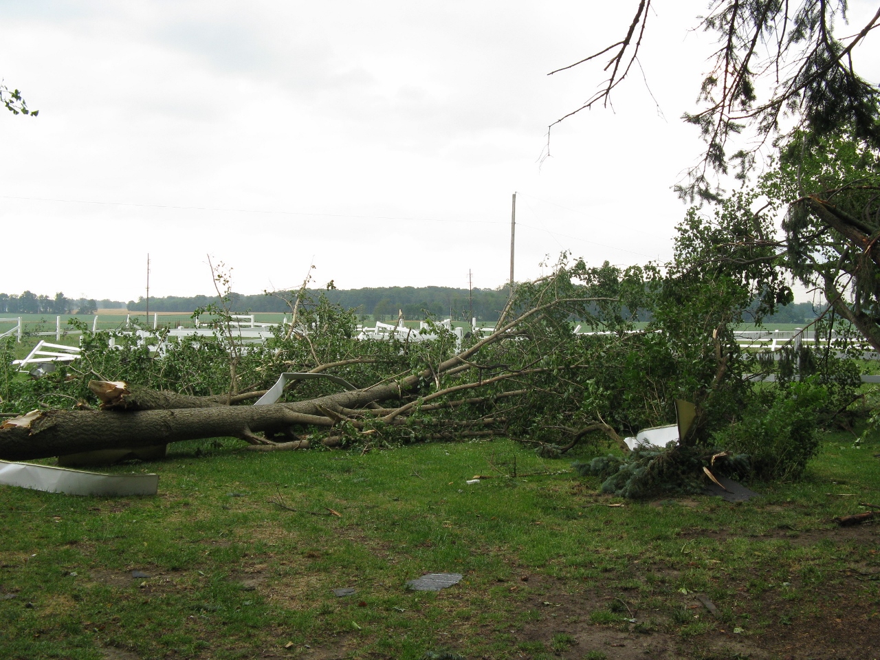
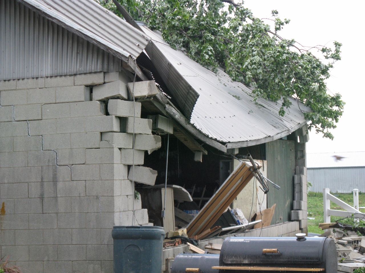
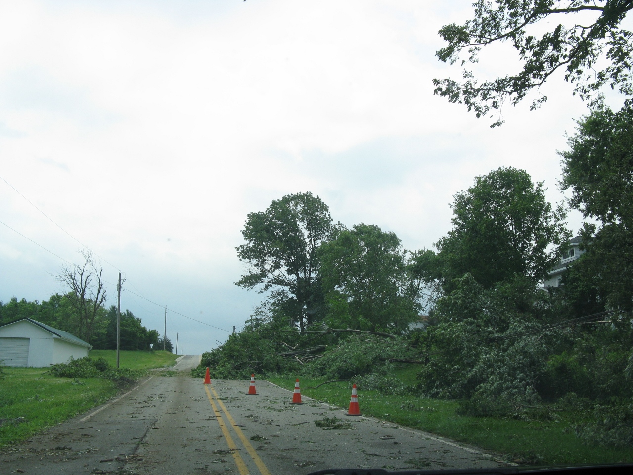
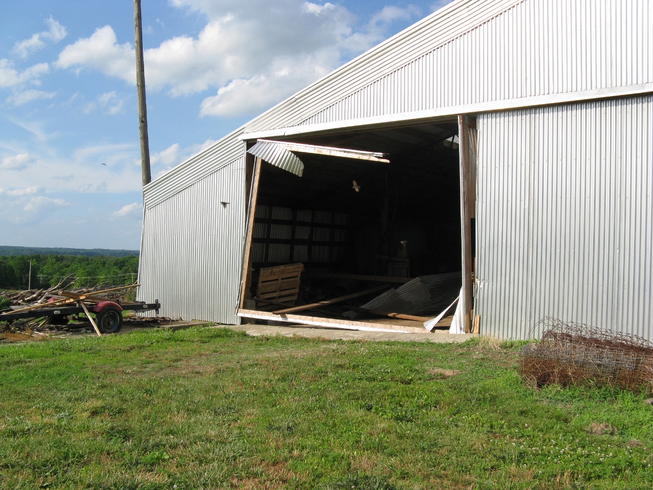
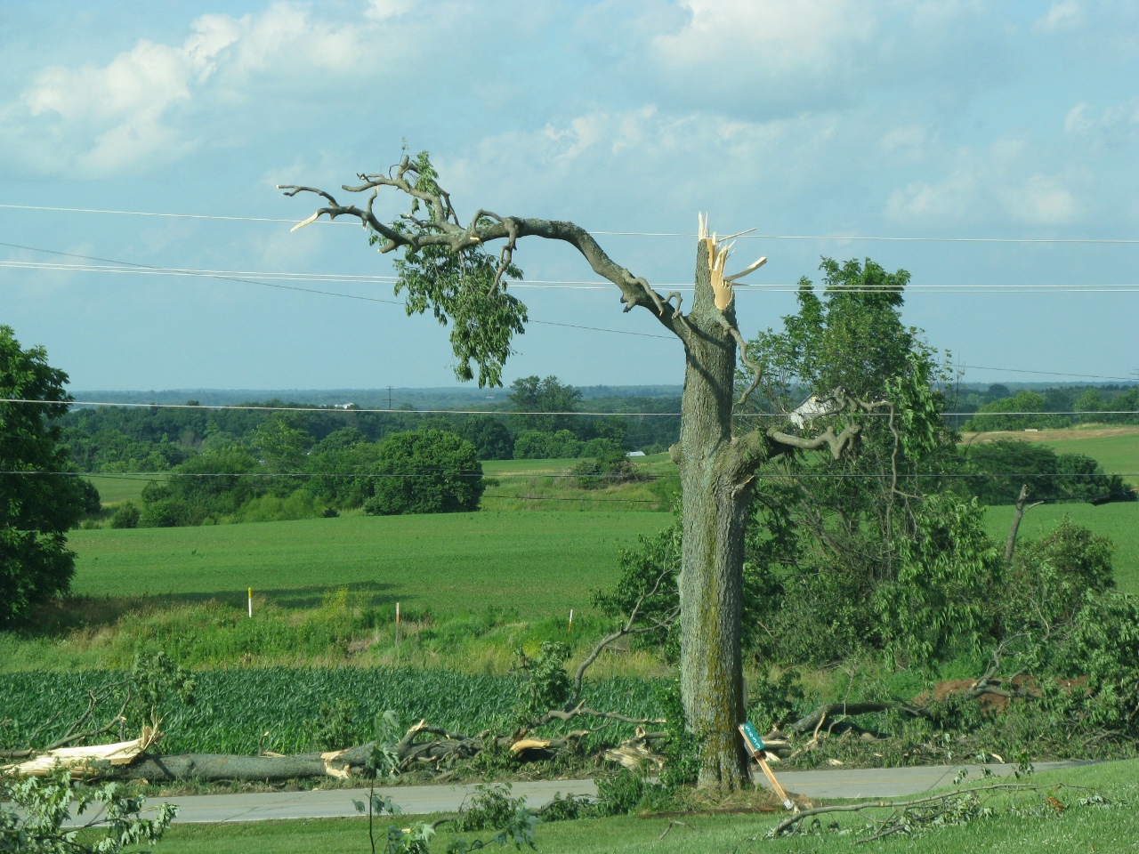
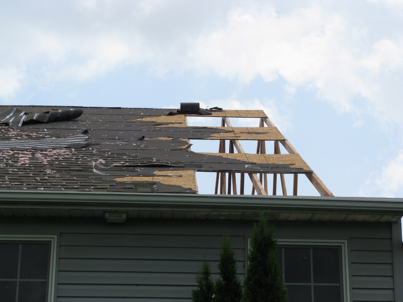
These select survey pictures were taken by NWS Wilmington, Ohio employees during a storm survey conducted on June 23, 2016:
 |
 |
 |
 |
 |
 |
 |
 |
 |
 |
 |
 |
 |
 |
 |
 |
 |
 |
 |
 |
 |
 |
 |
 |
 |
 |
 |
 |
 |
 |
 |
 |
 |
 |
 |
 |
 |
 |
 |
 |
 |
 |
 |
 |
 |
 |
 |
 |
 |
 |
 |
 |
 |
 |
 |
 |
 |
 |
 |
 |
 |
 |
 |
 |
 |
 |
 |
 |
Summaries from other NWS Offices [IF ANY]
Radar Pictures/Animations
Overview
 Radar Loop of Fayette County Circulation from TDWR Dayton (TDAY) |
Radar loop of event from WSR-88D in Wilmington, Ohio (KILN) |
 Radar Loop of Warren/Clinton County Circulation from WSR-88D Wilmington, Ohio (KILN) |
Storm Reports
 |
Media use of NWS Web News Stories is encouraged! Please acknowledge the NWS as the source of any news information accessed from this site. |
|