PUBLIC INFORMATION STATEMENT
National Weather Service Wilmington OH
955 PM EDT Mon May 20 2019
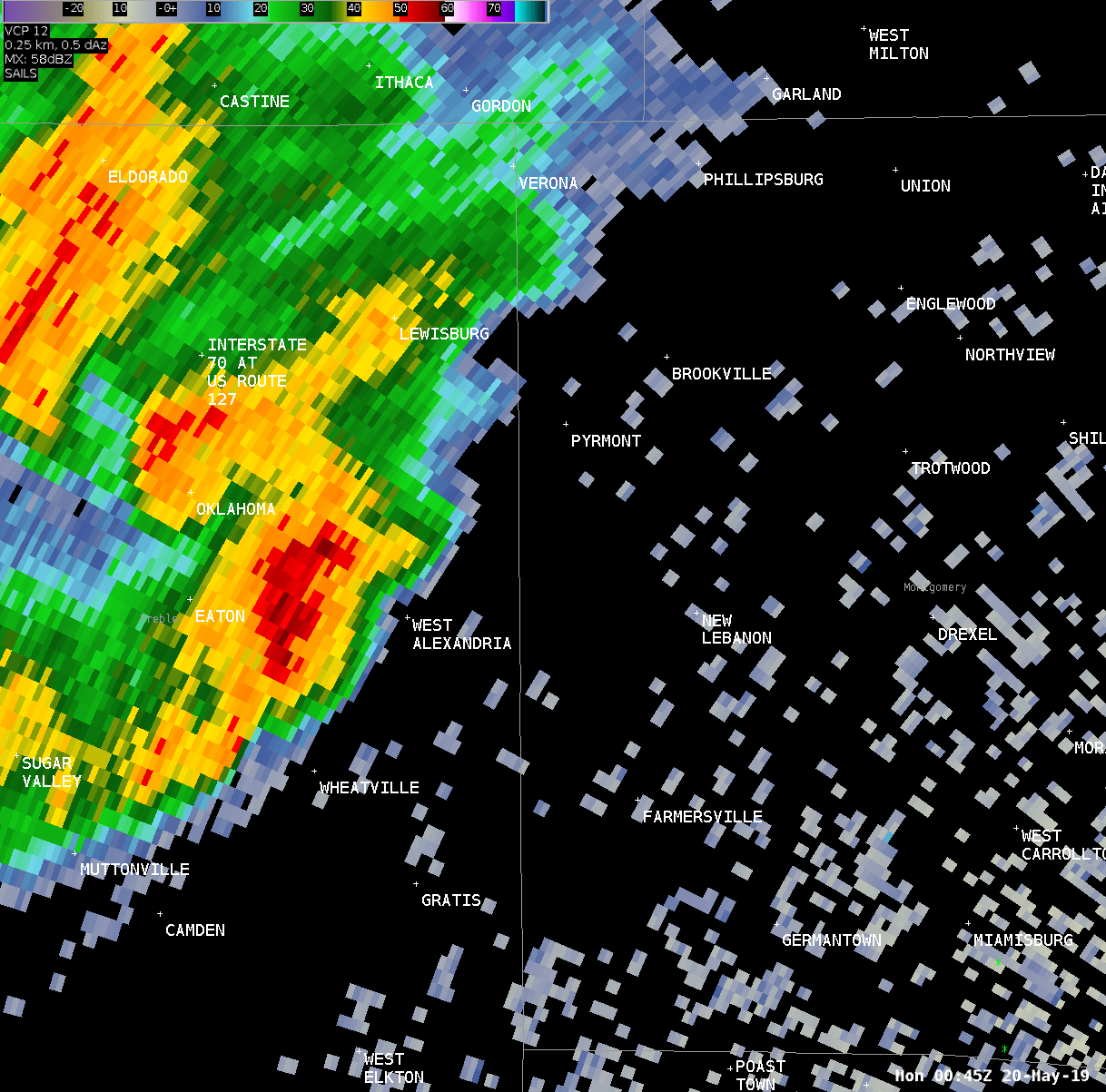
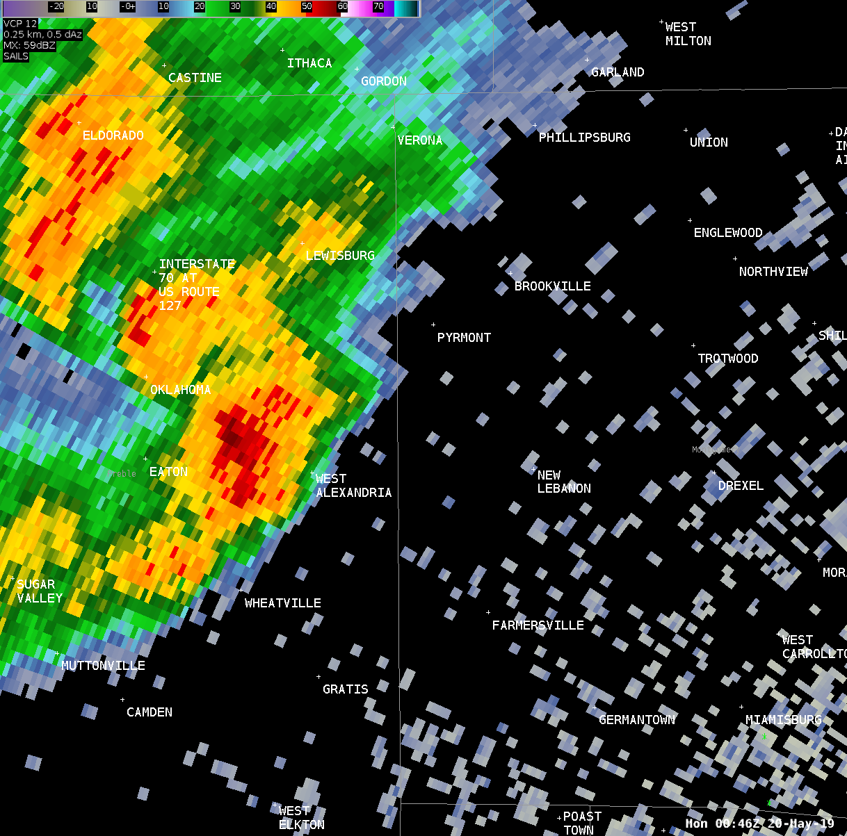
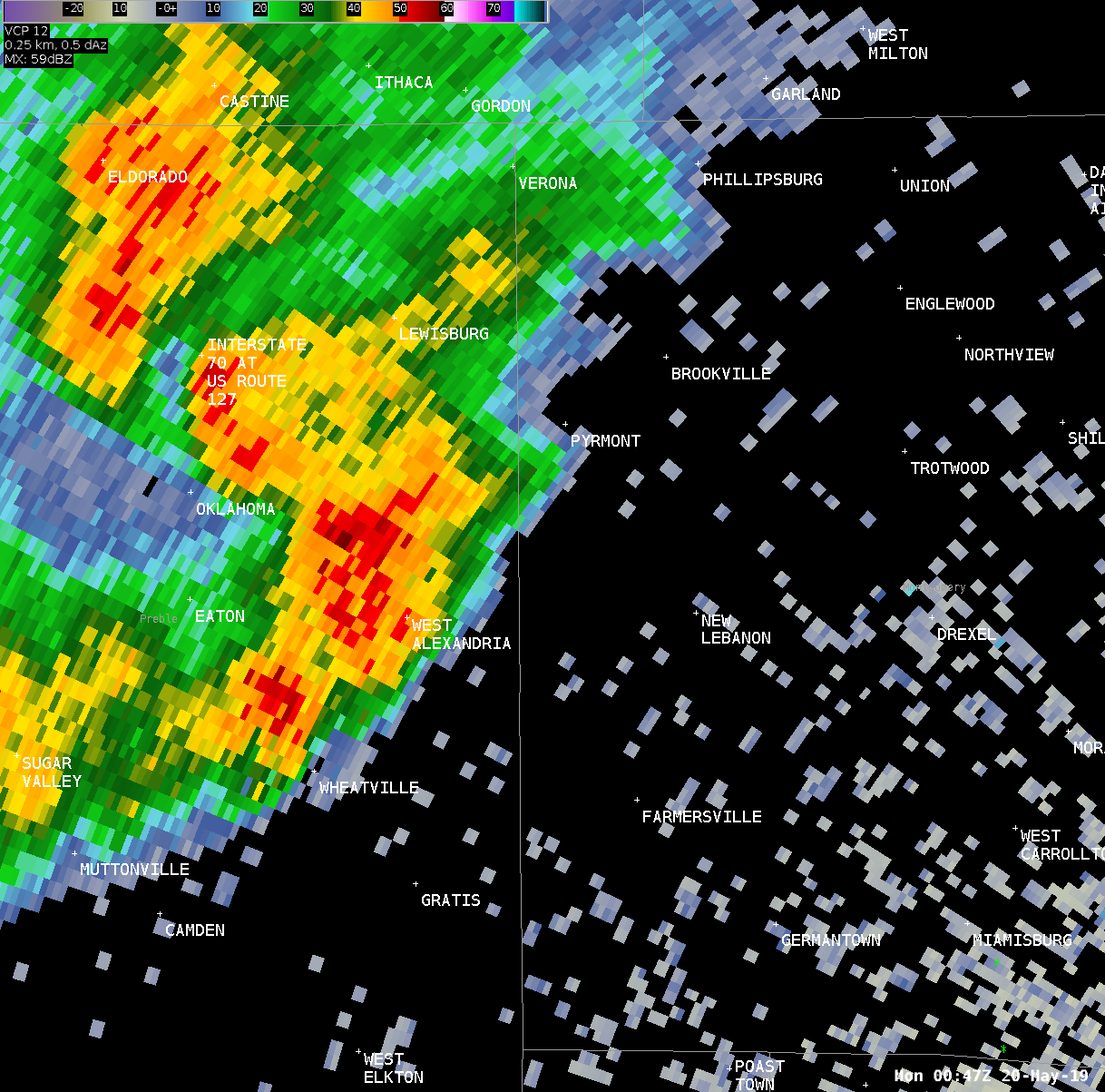
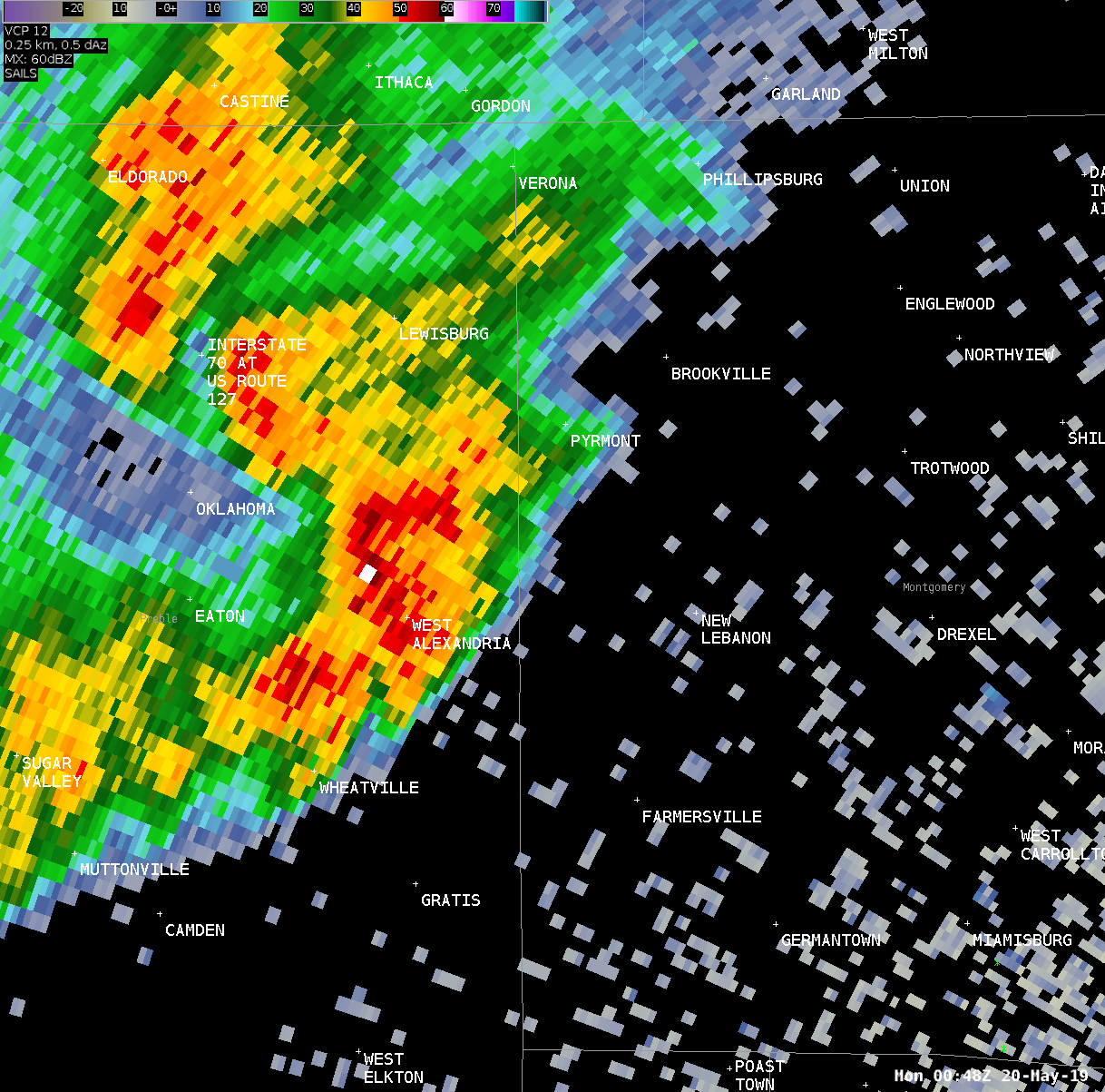
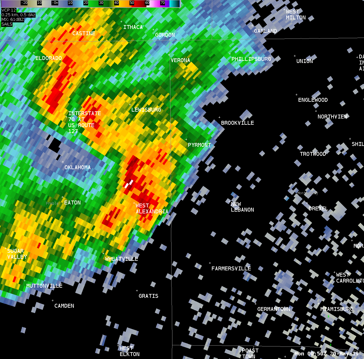
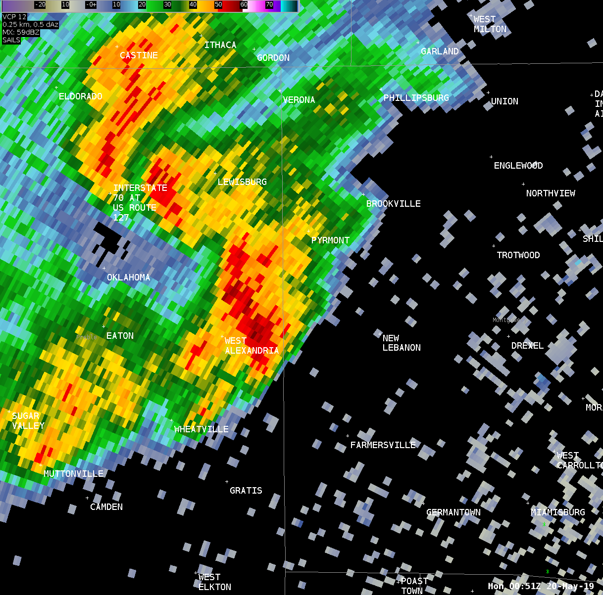
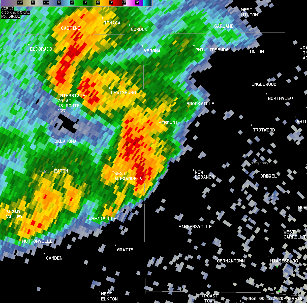
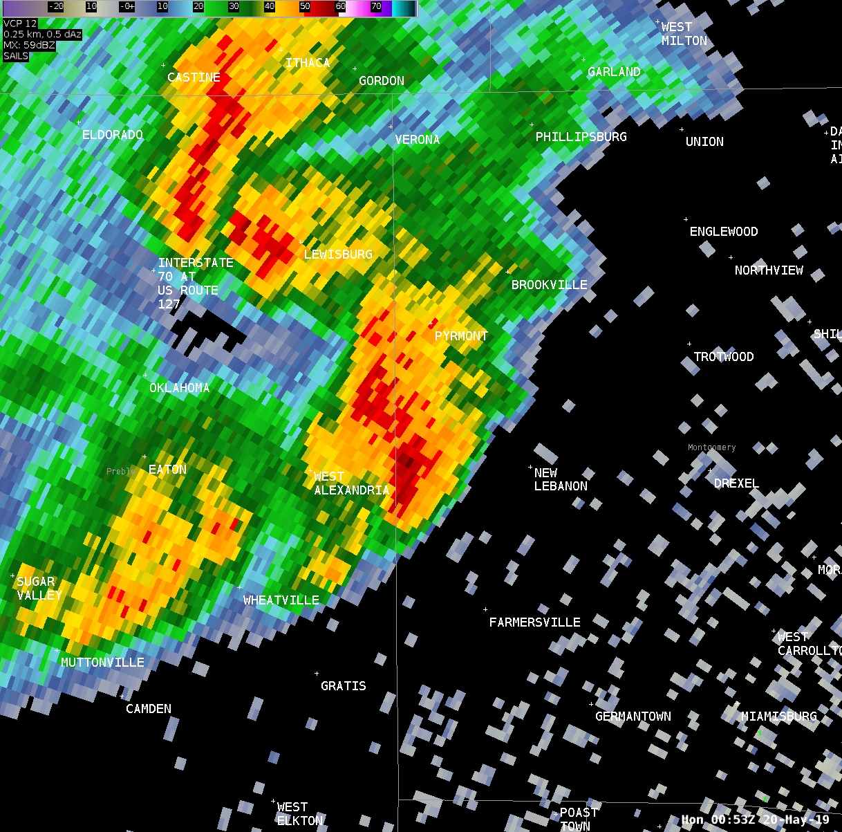
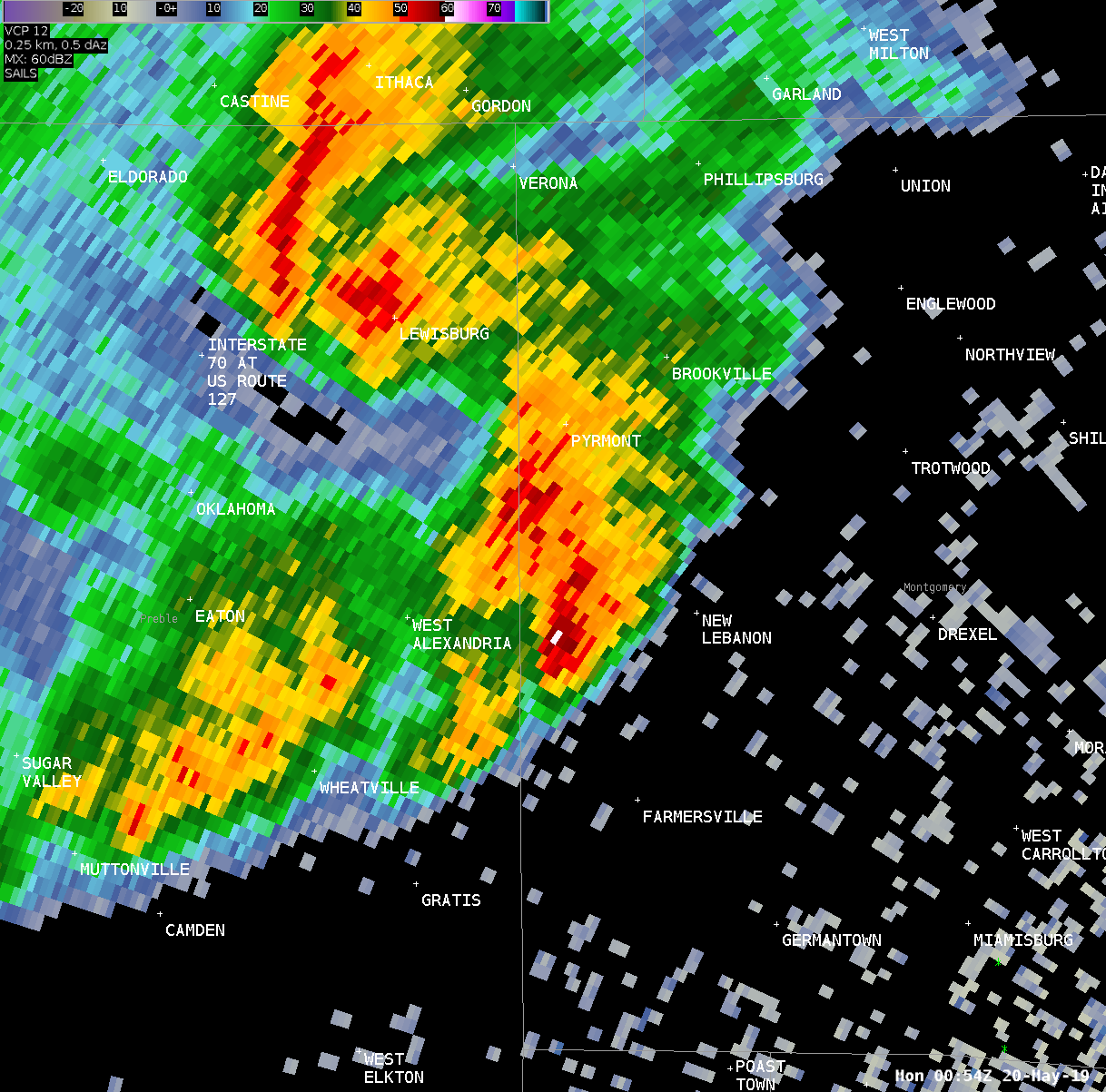
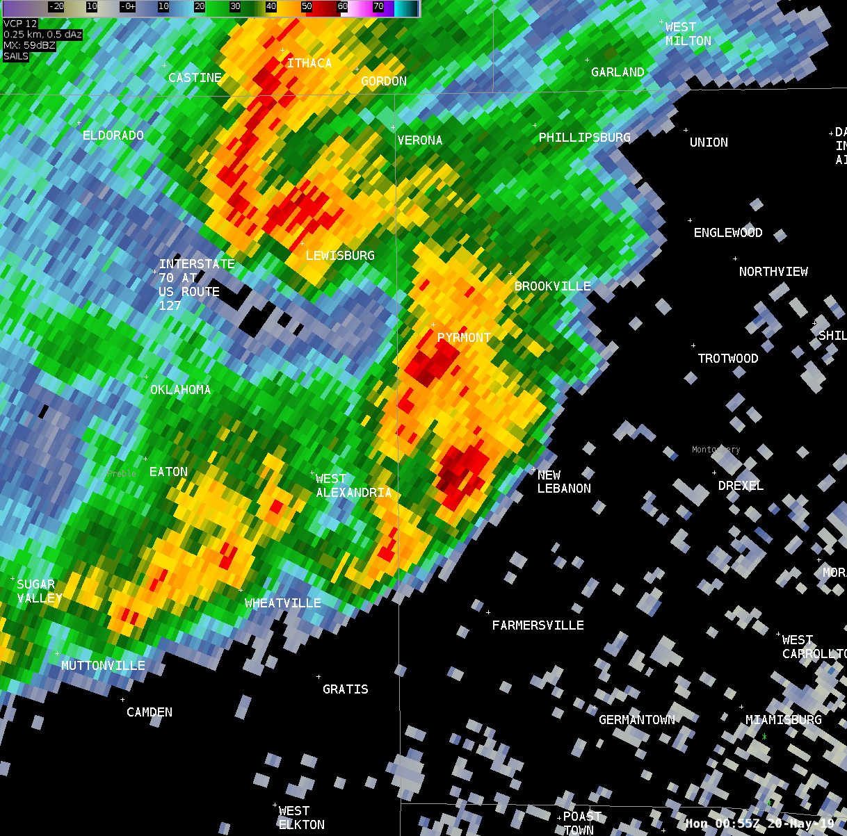
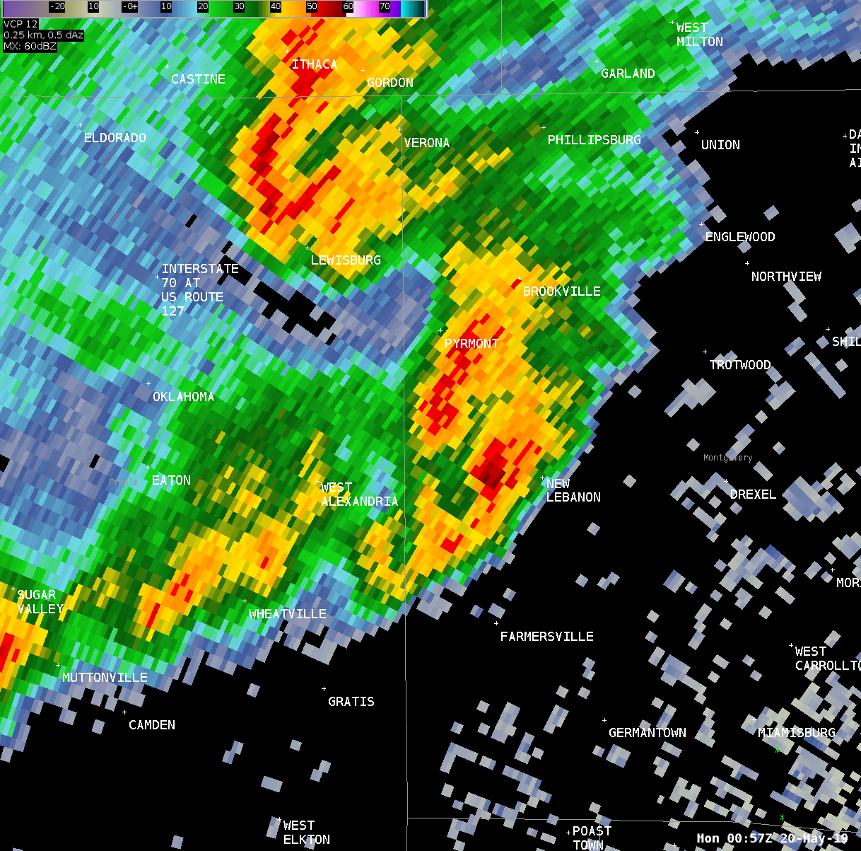
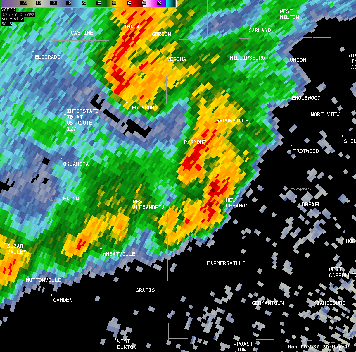
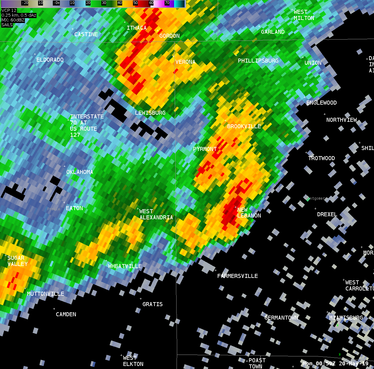
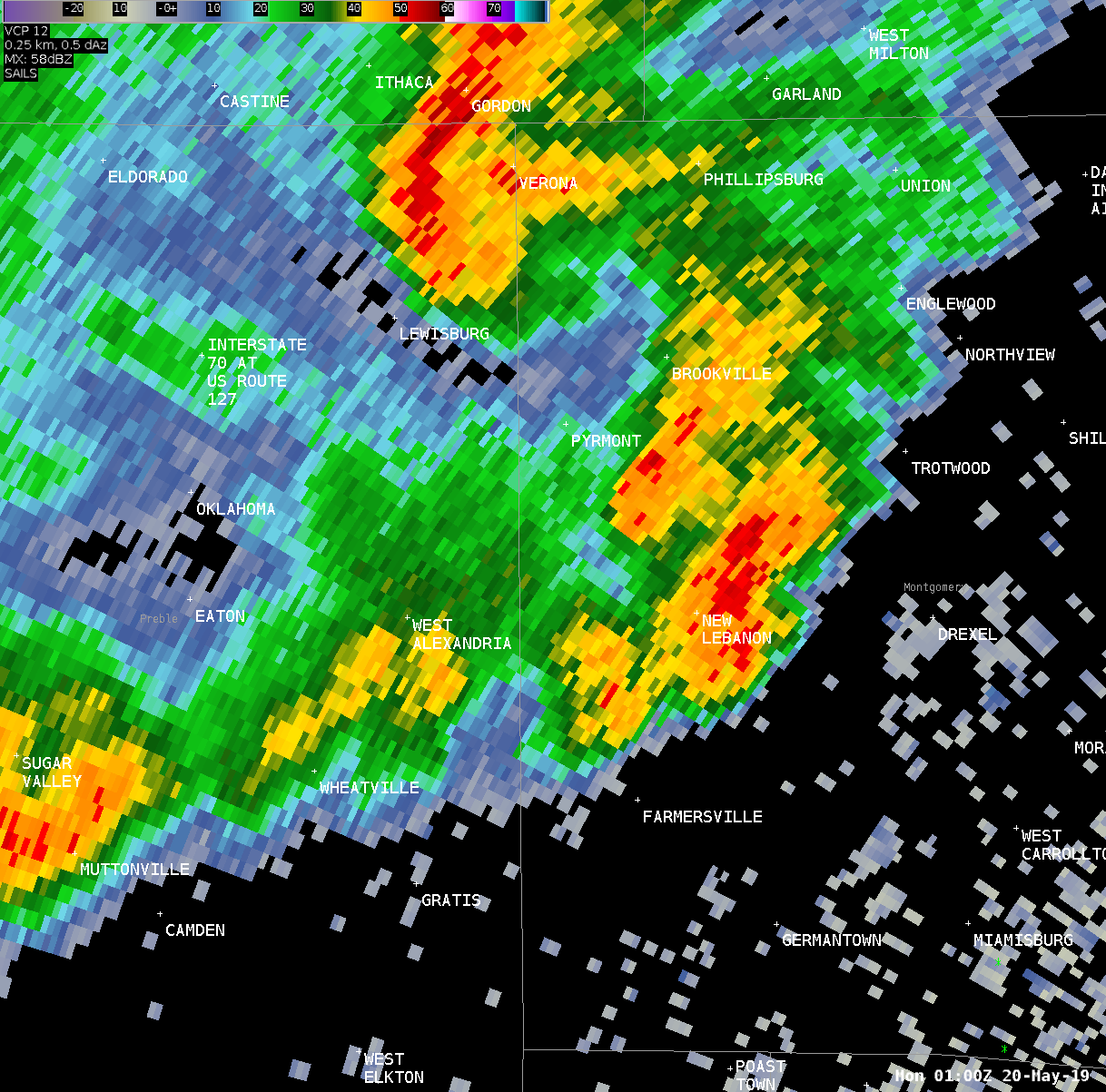
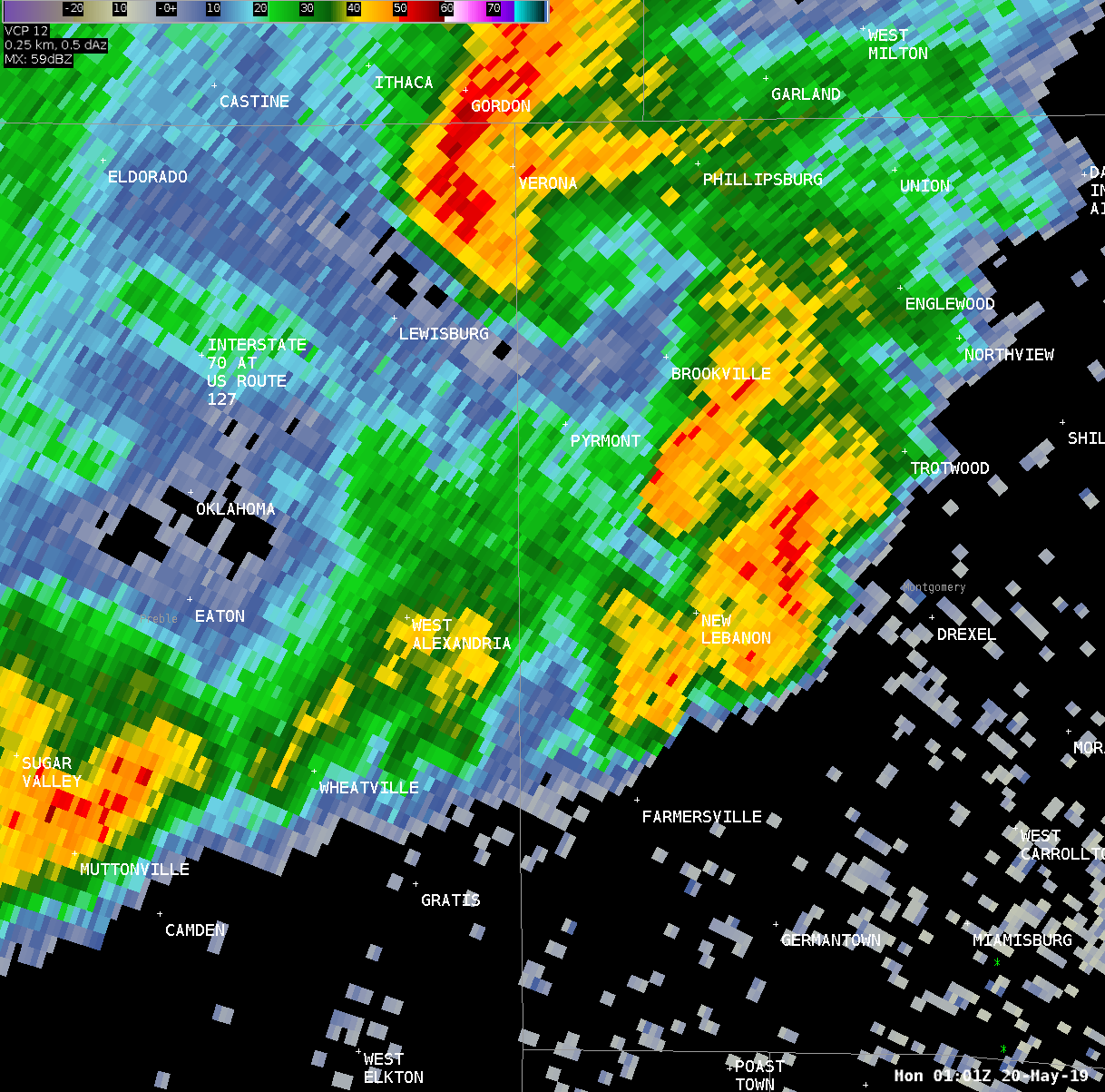
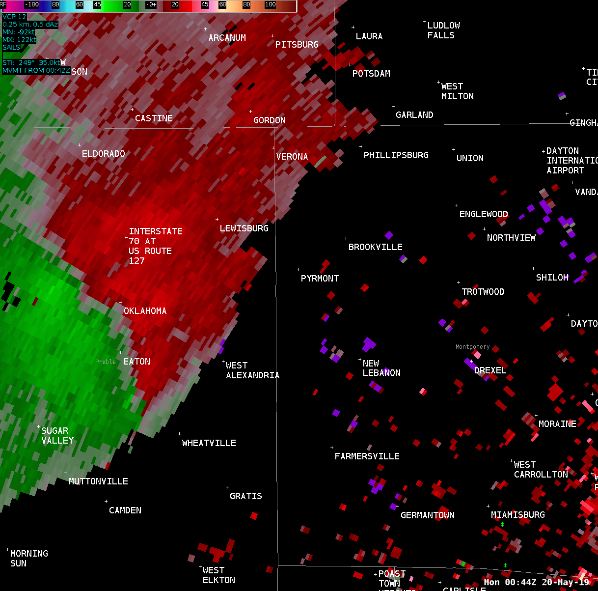
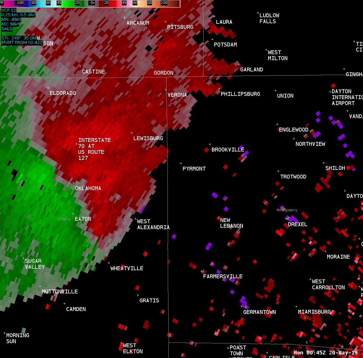
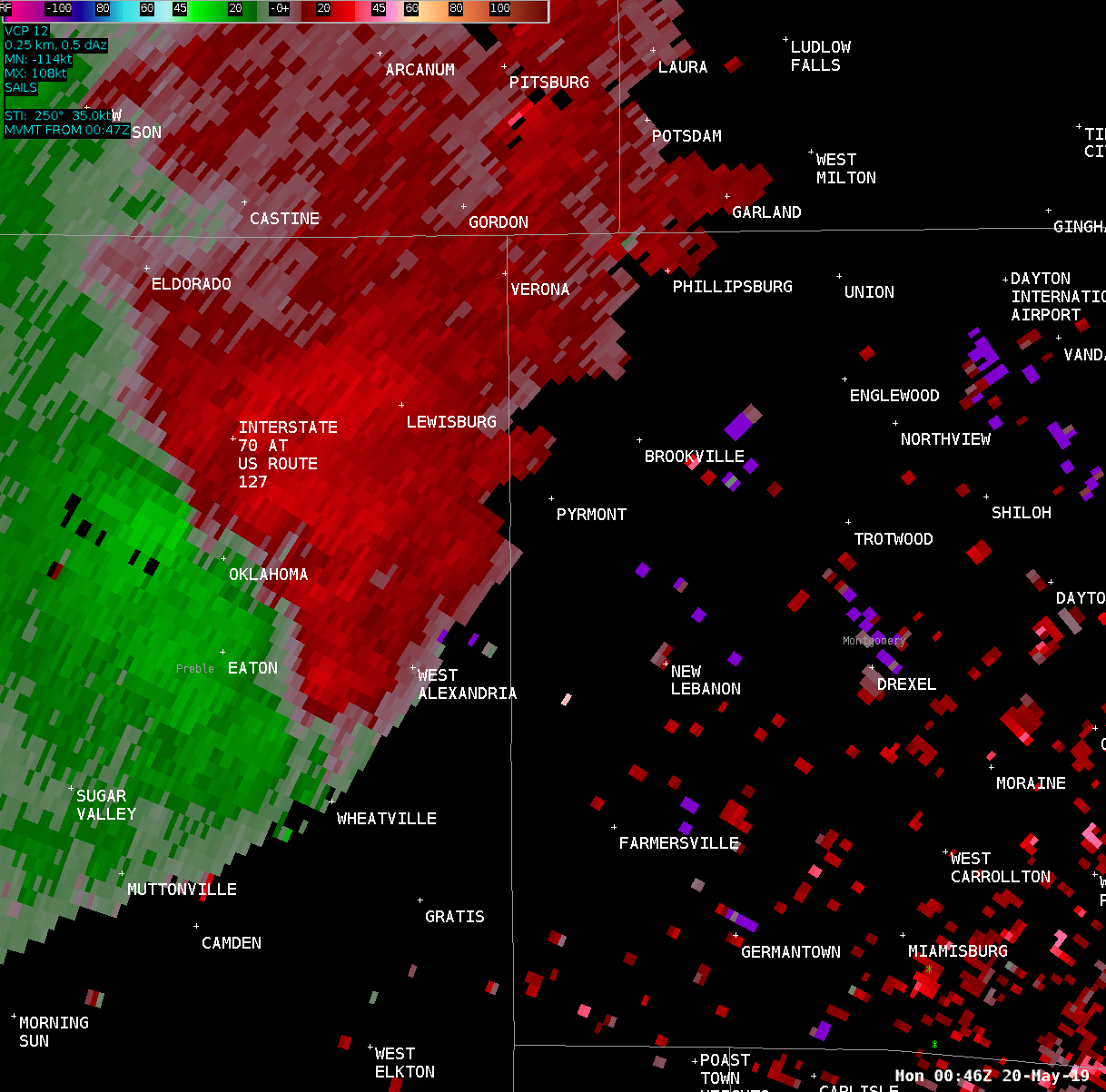
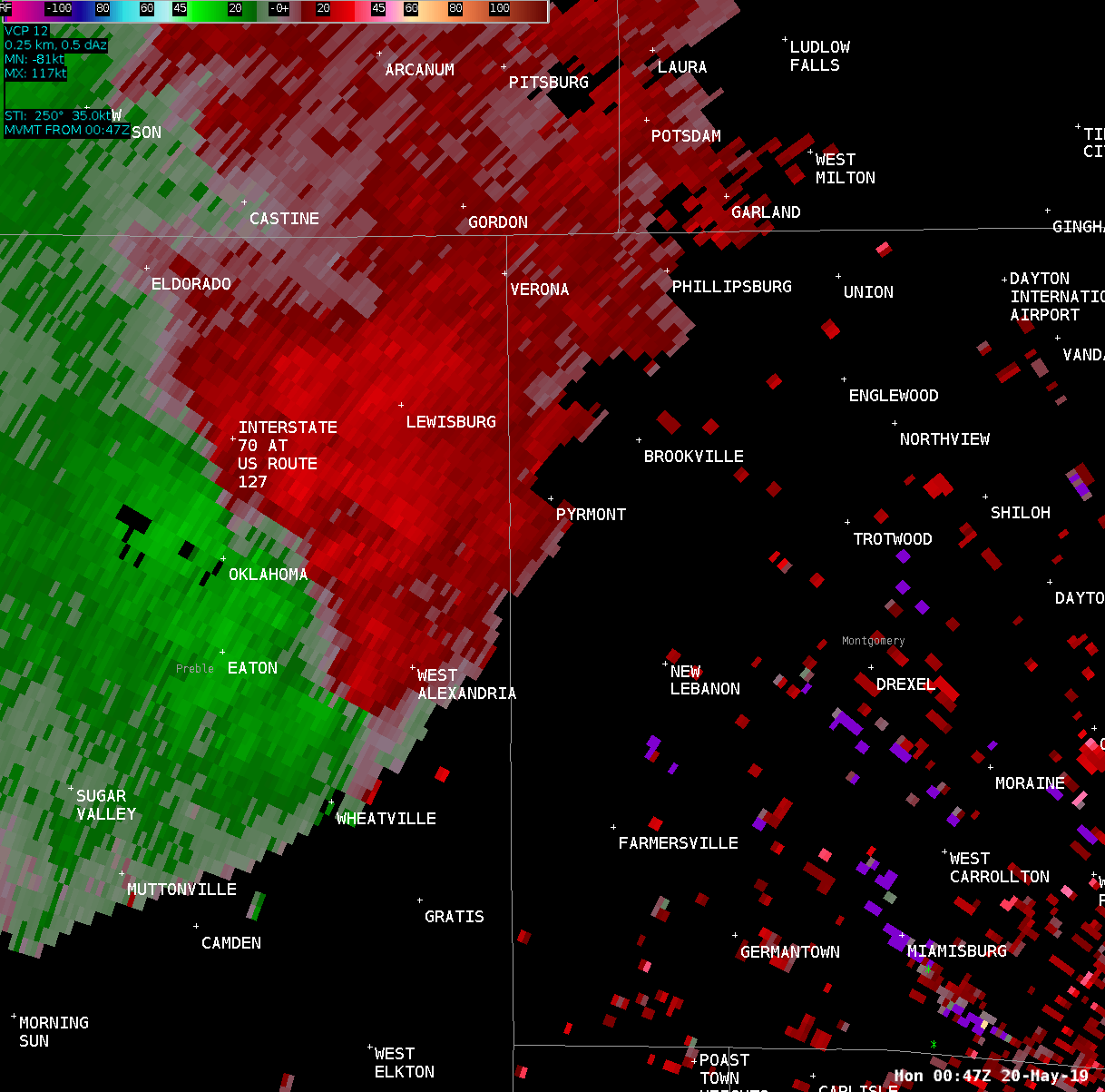
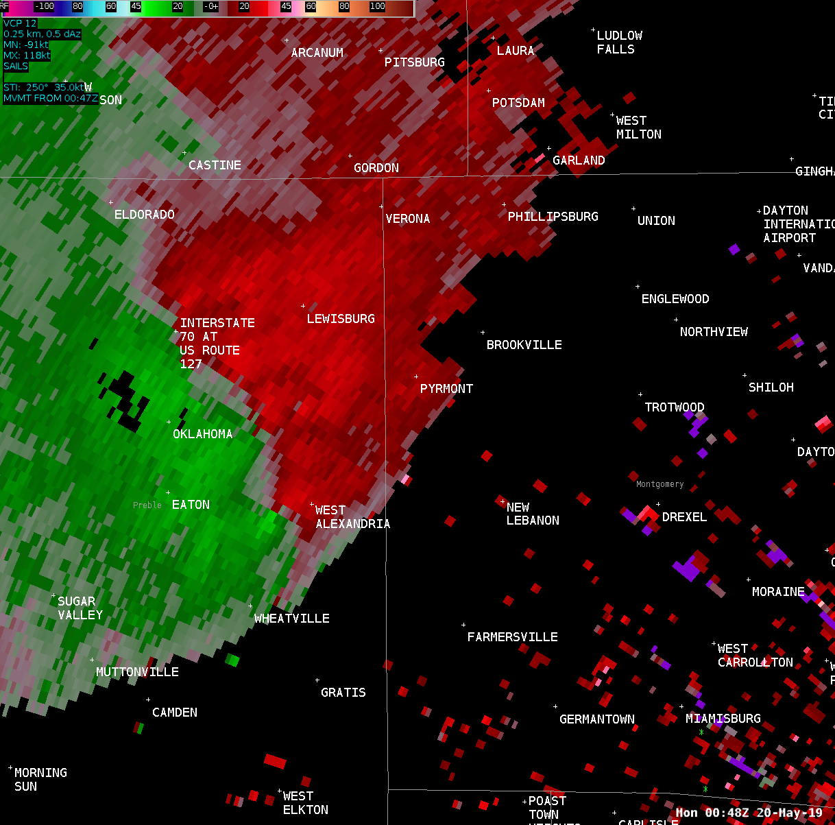
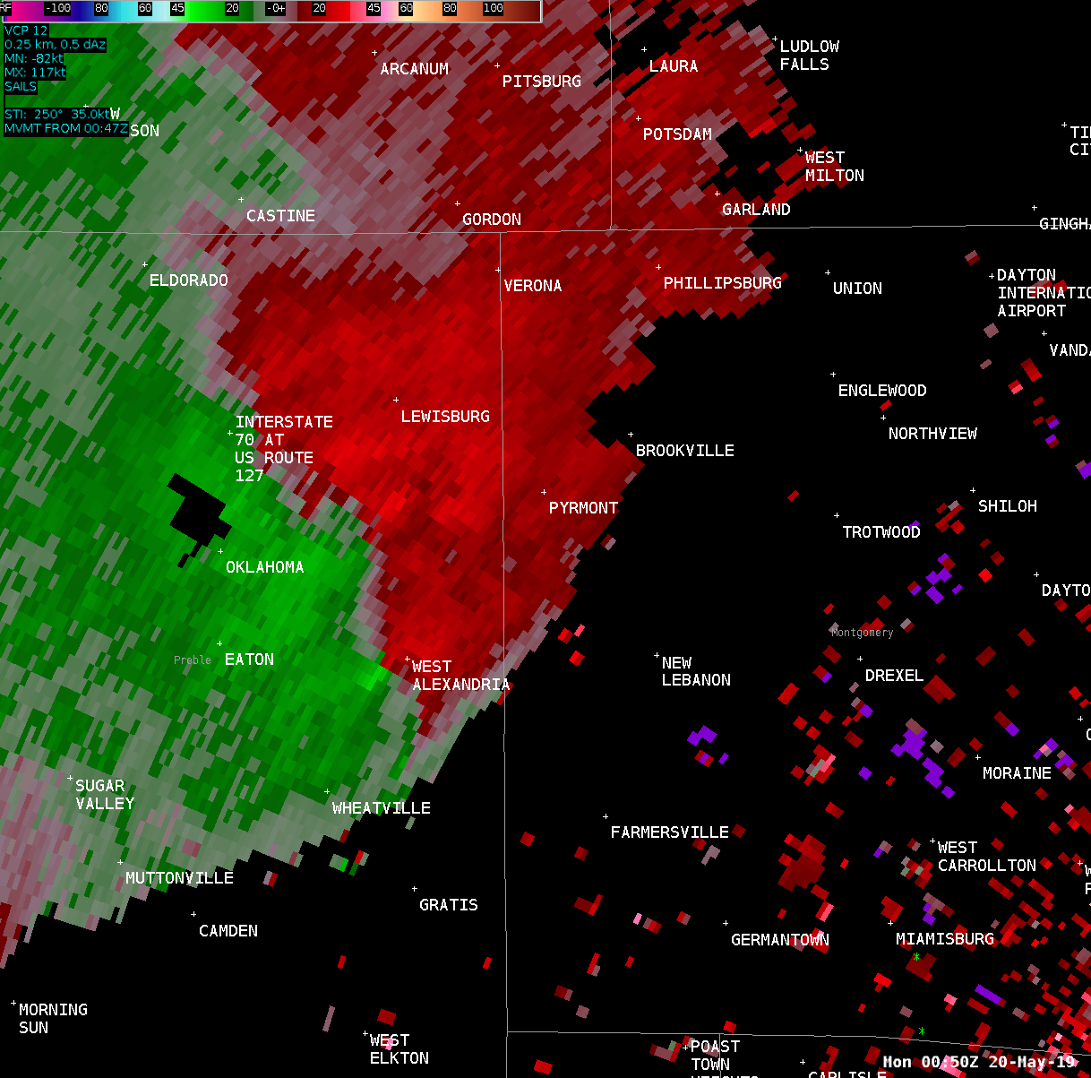
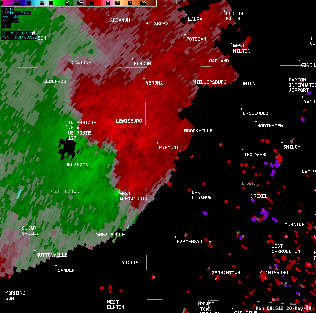
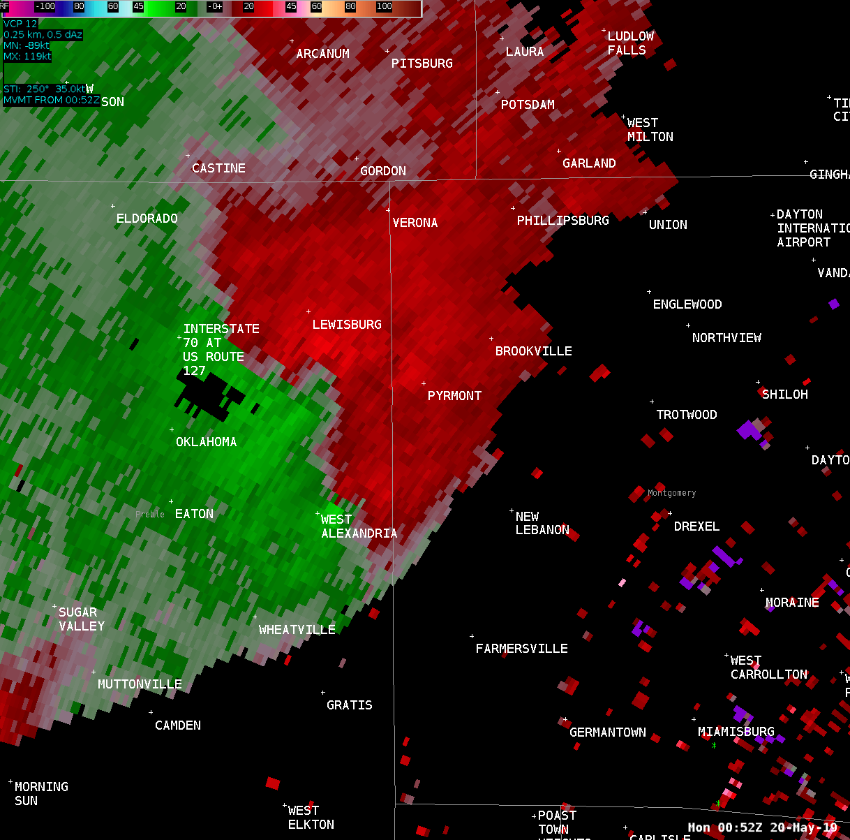
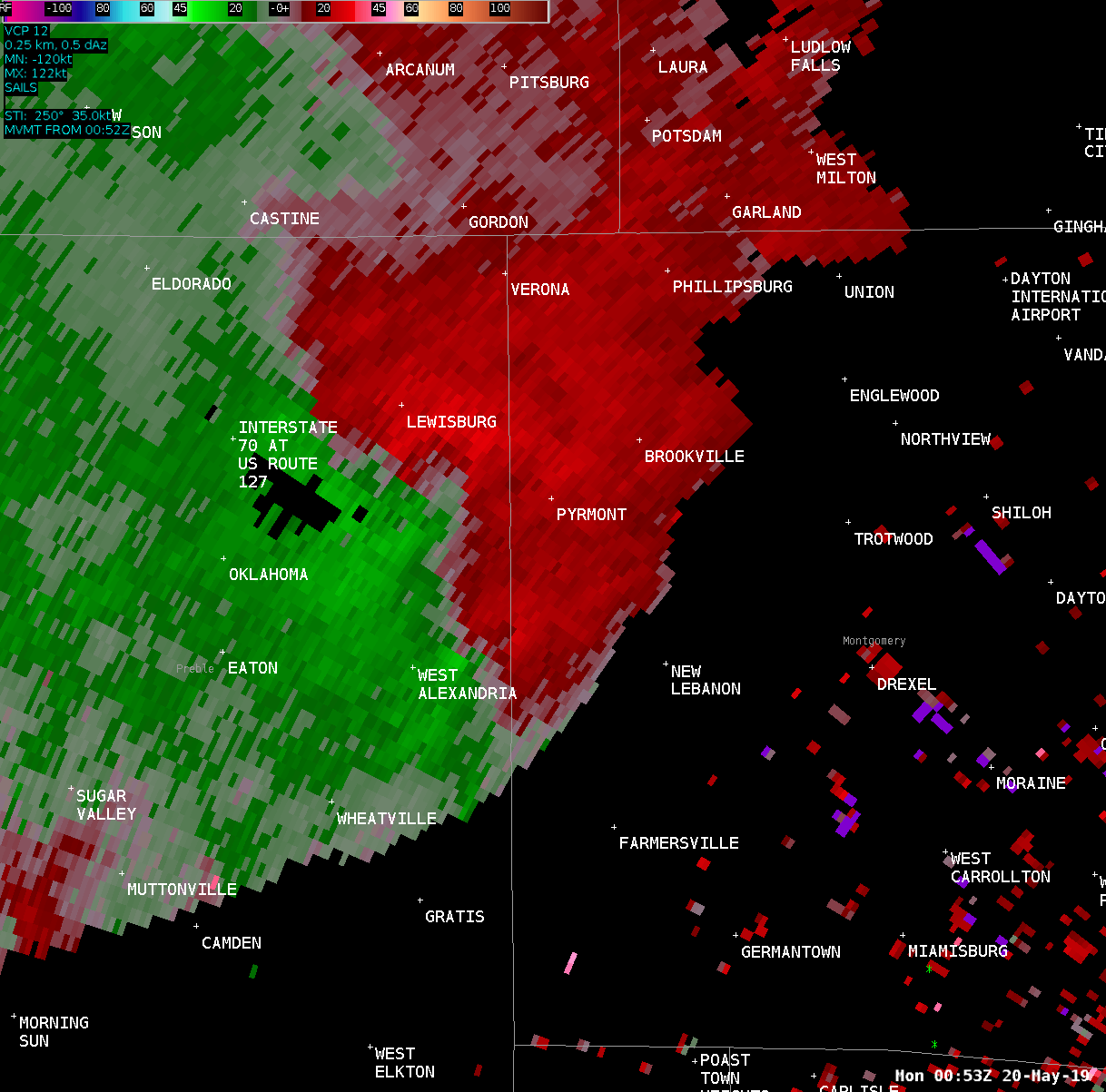
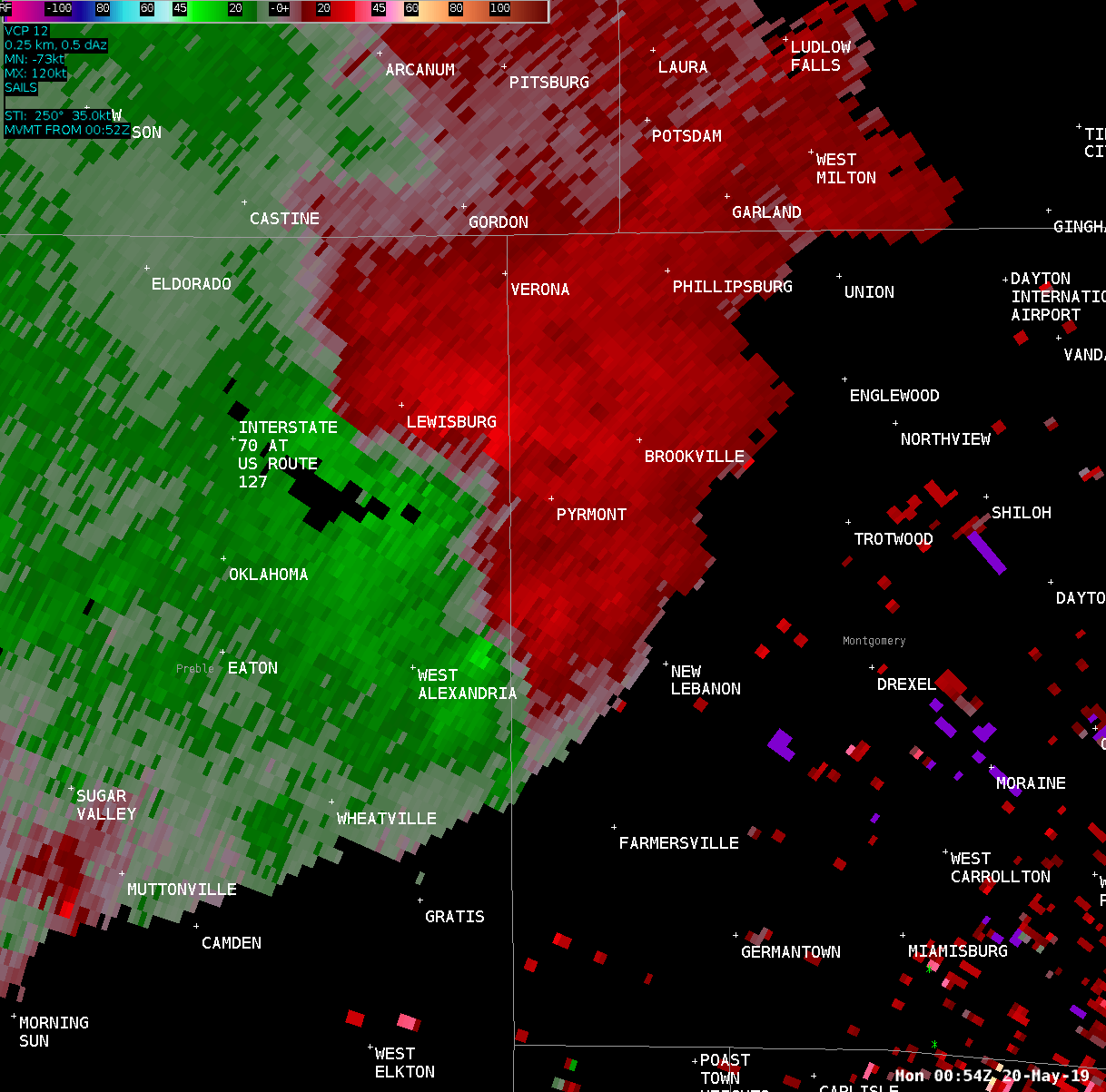
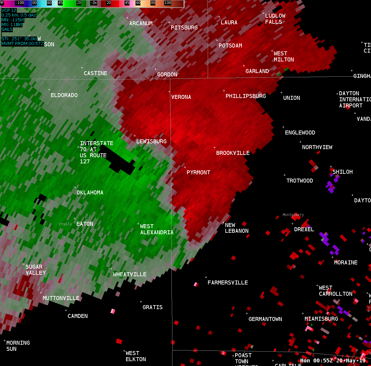
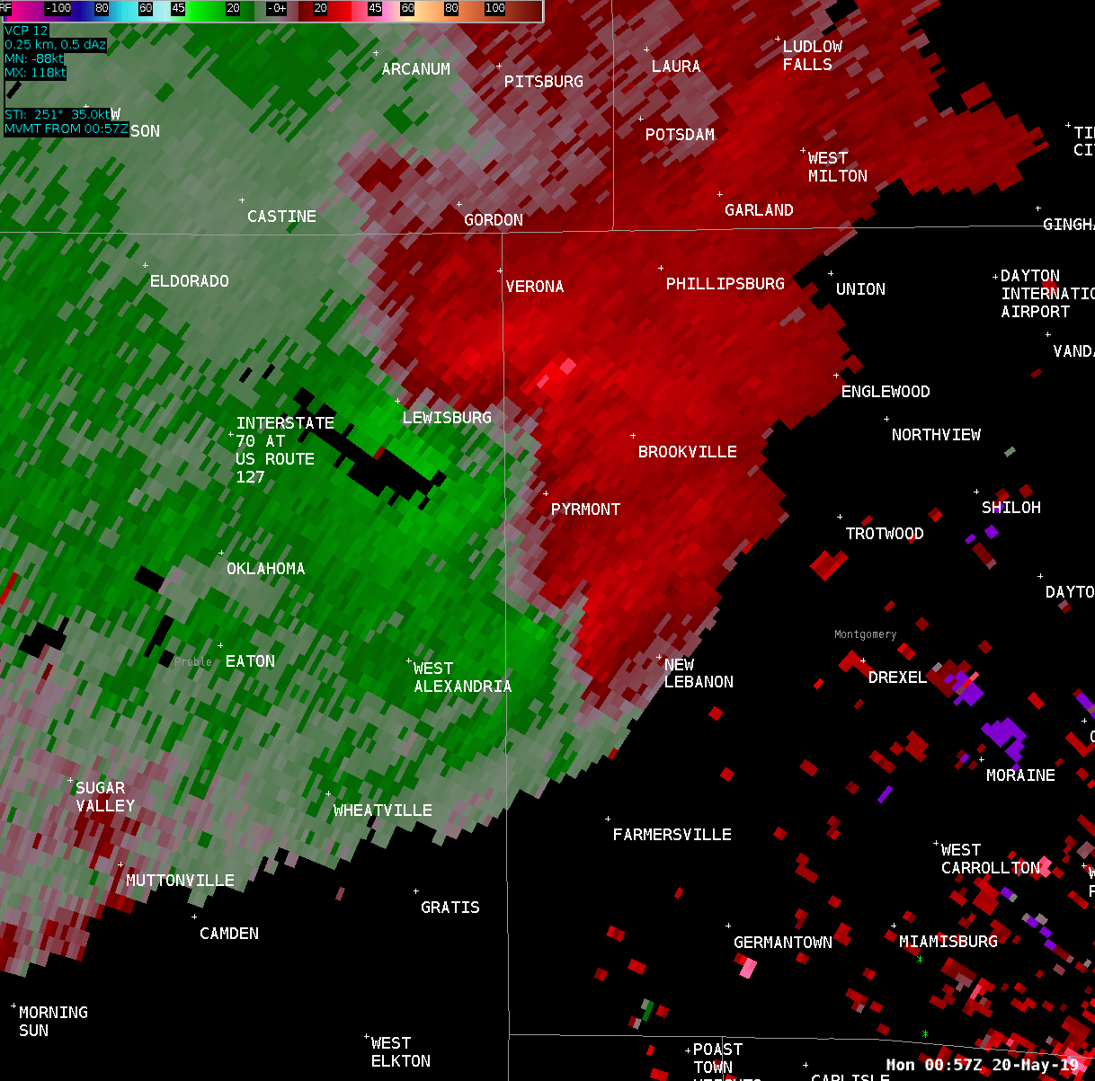
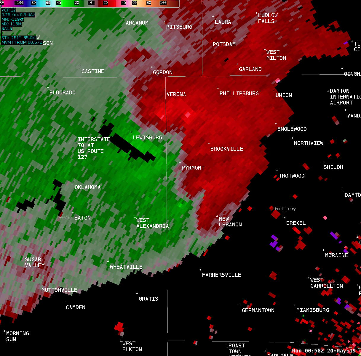
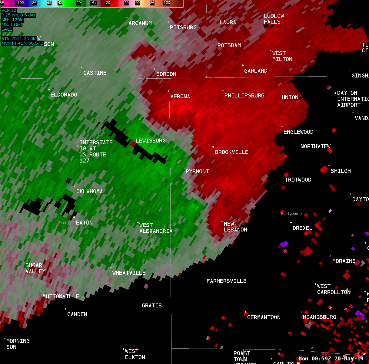
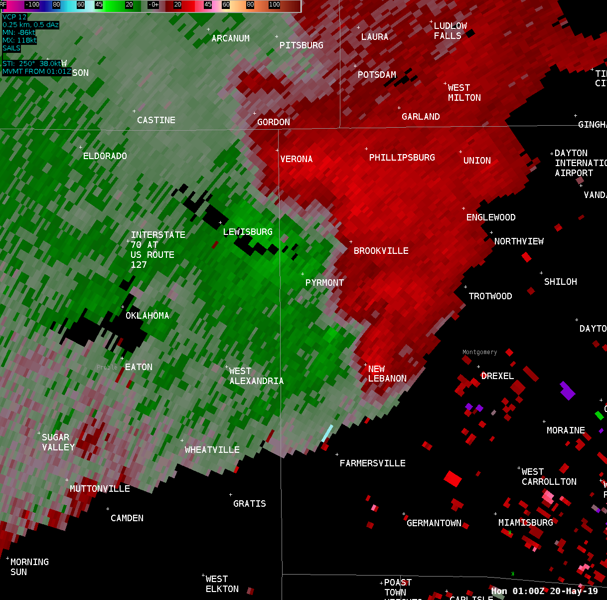
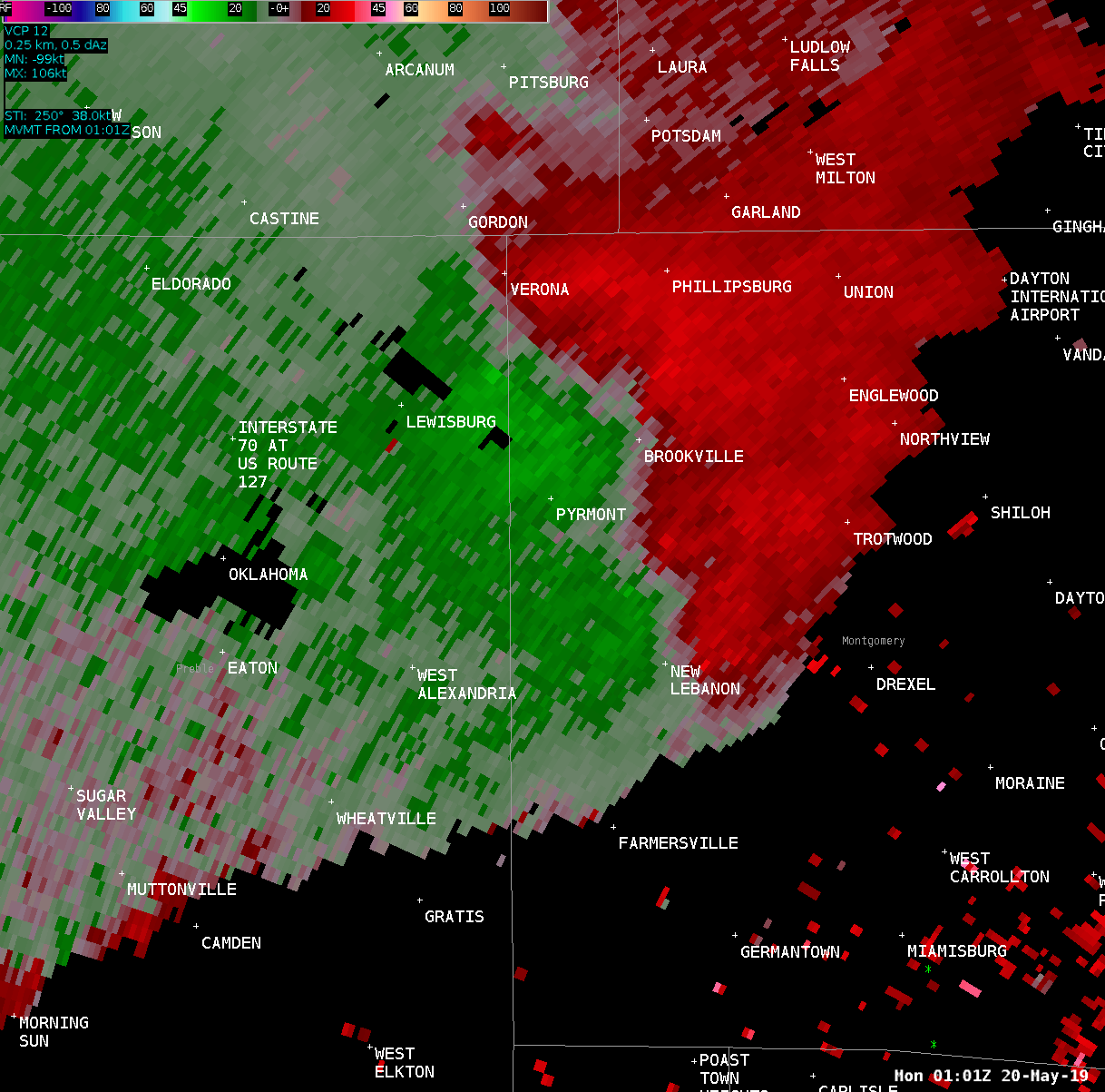
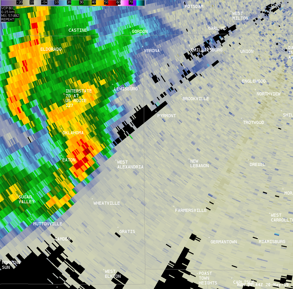
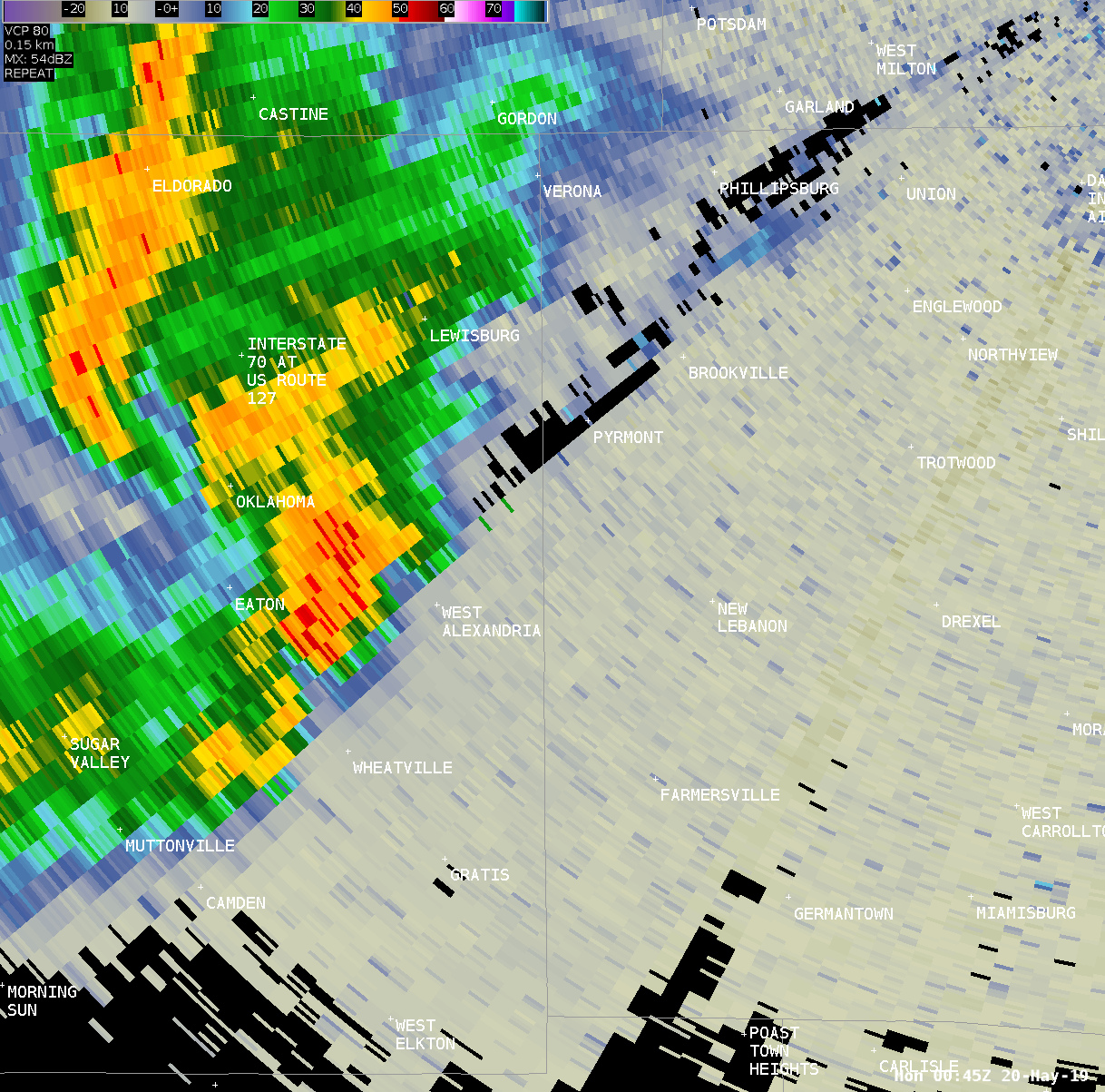
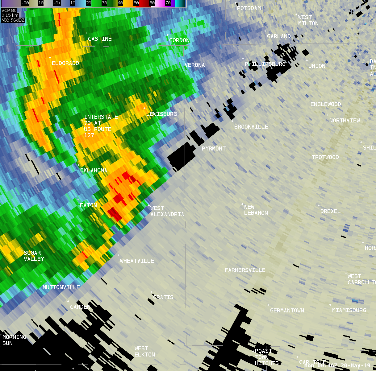
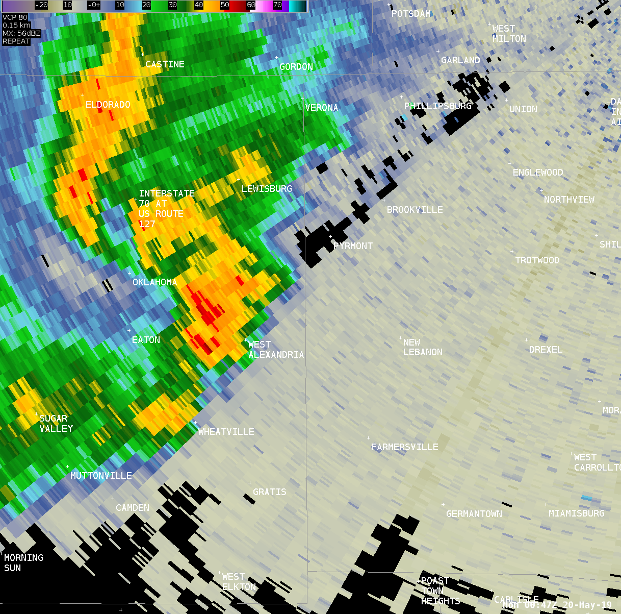
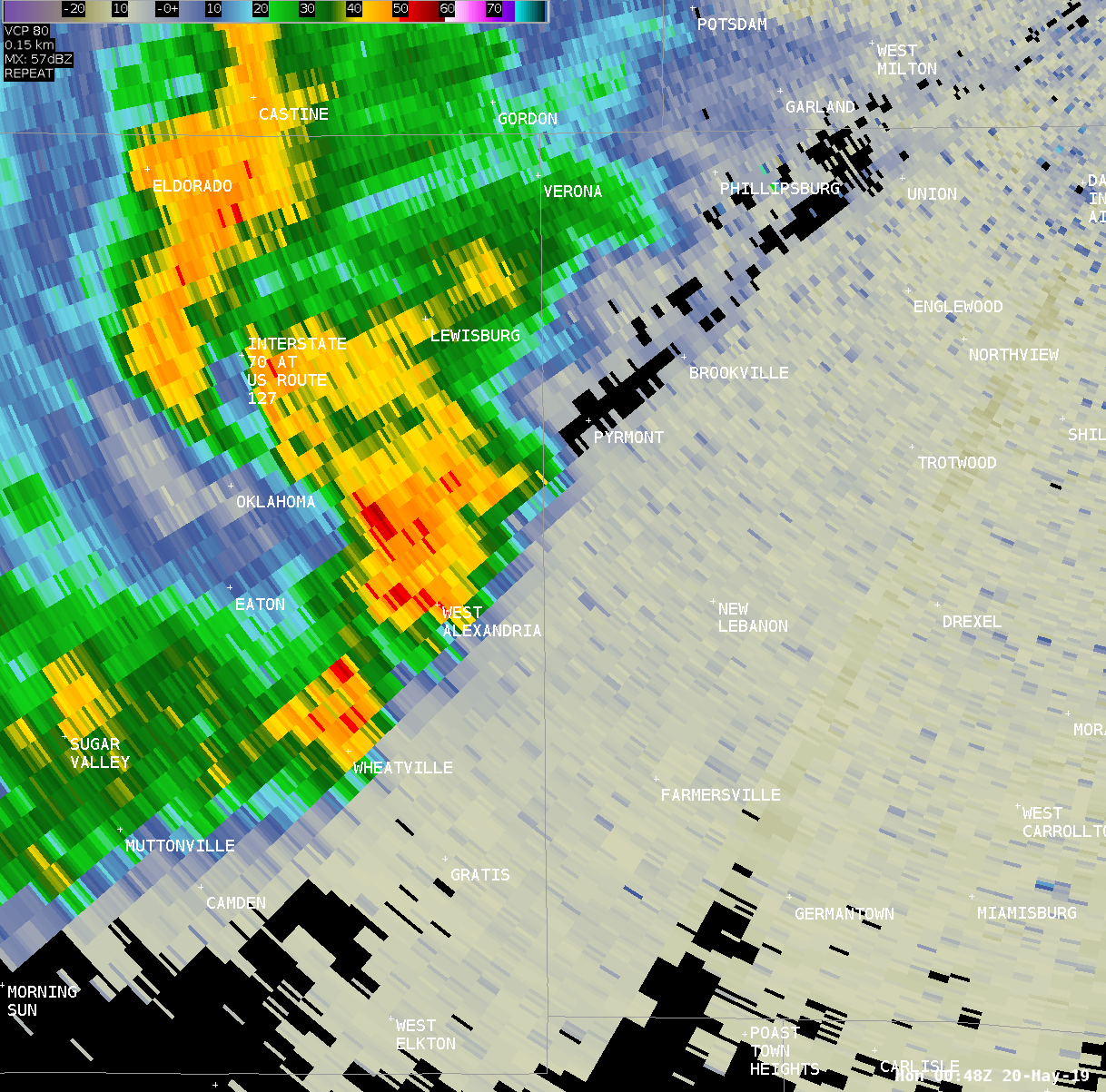
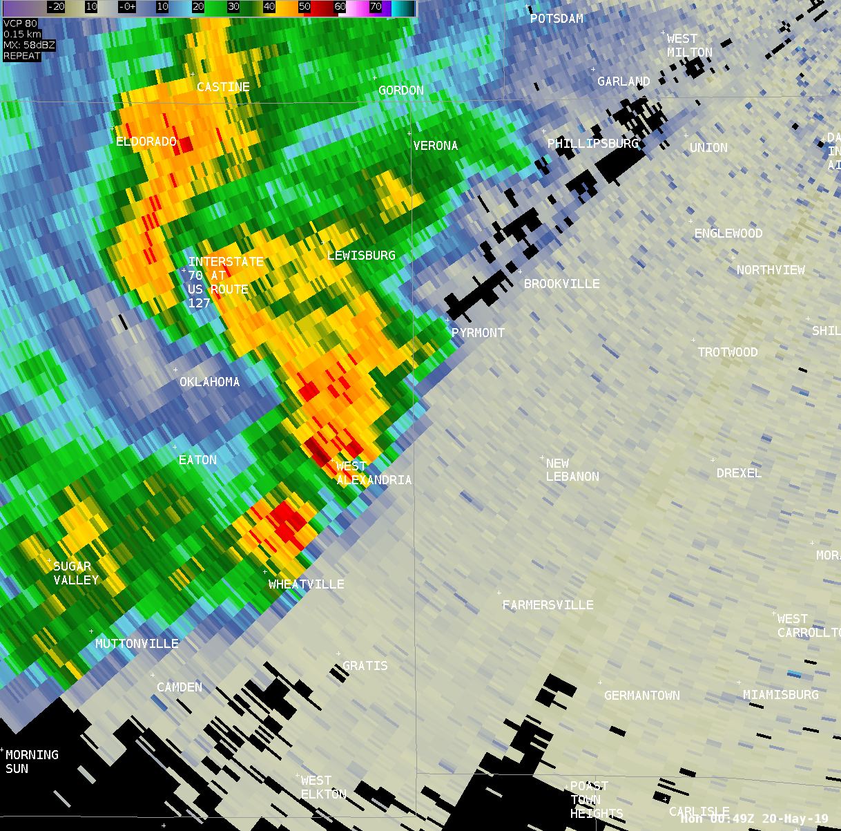
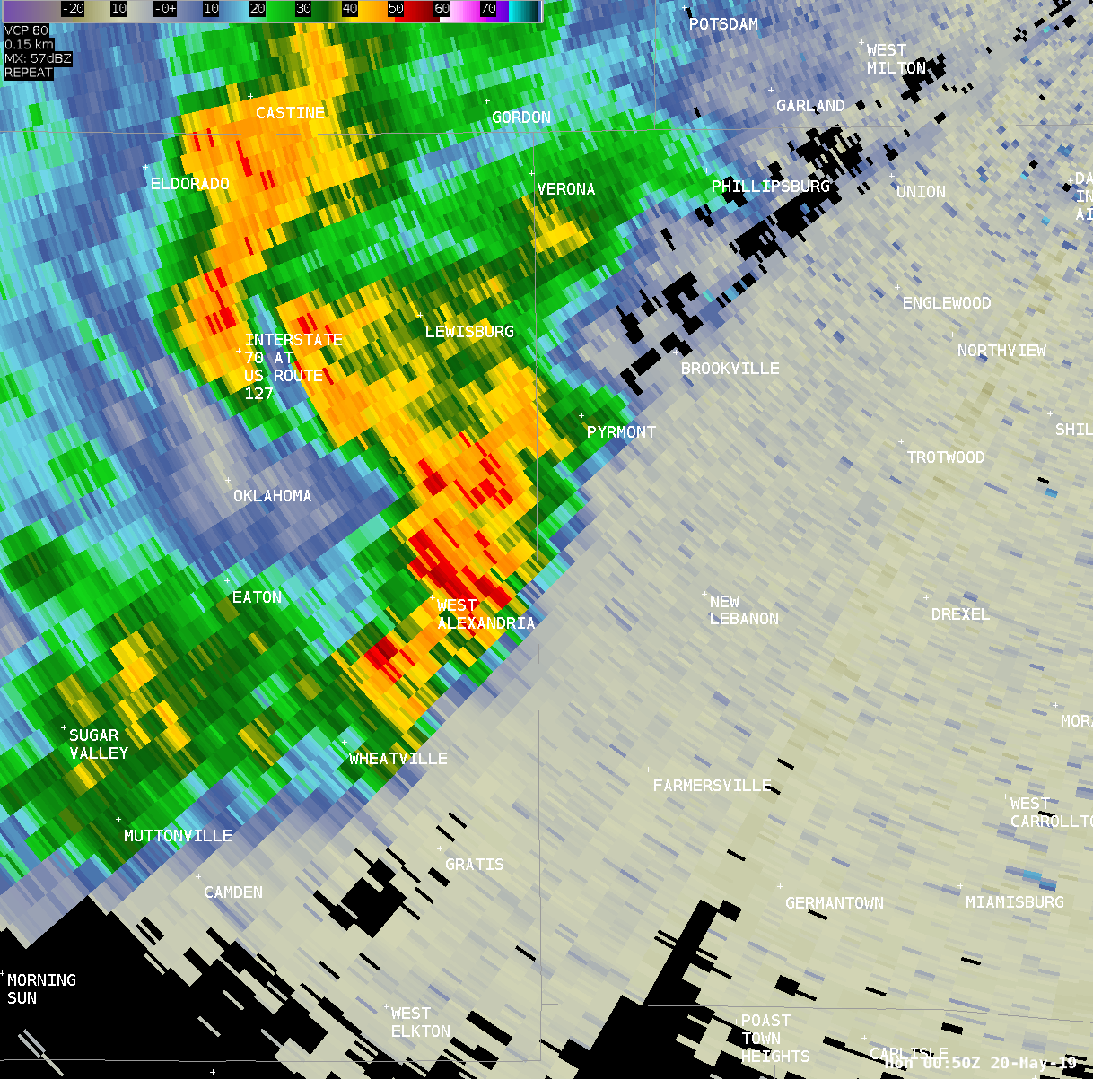
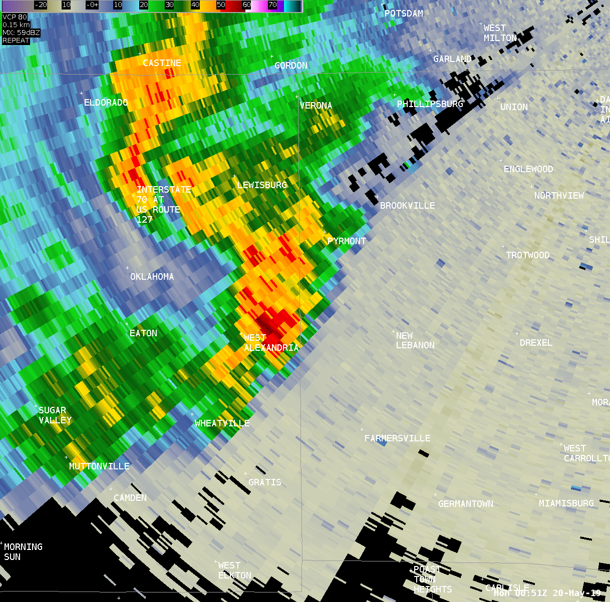
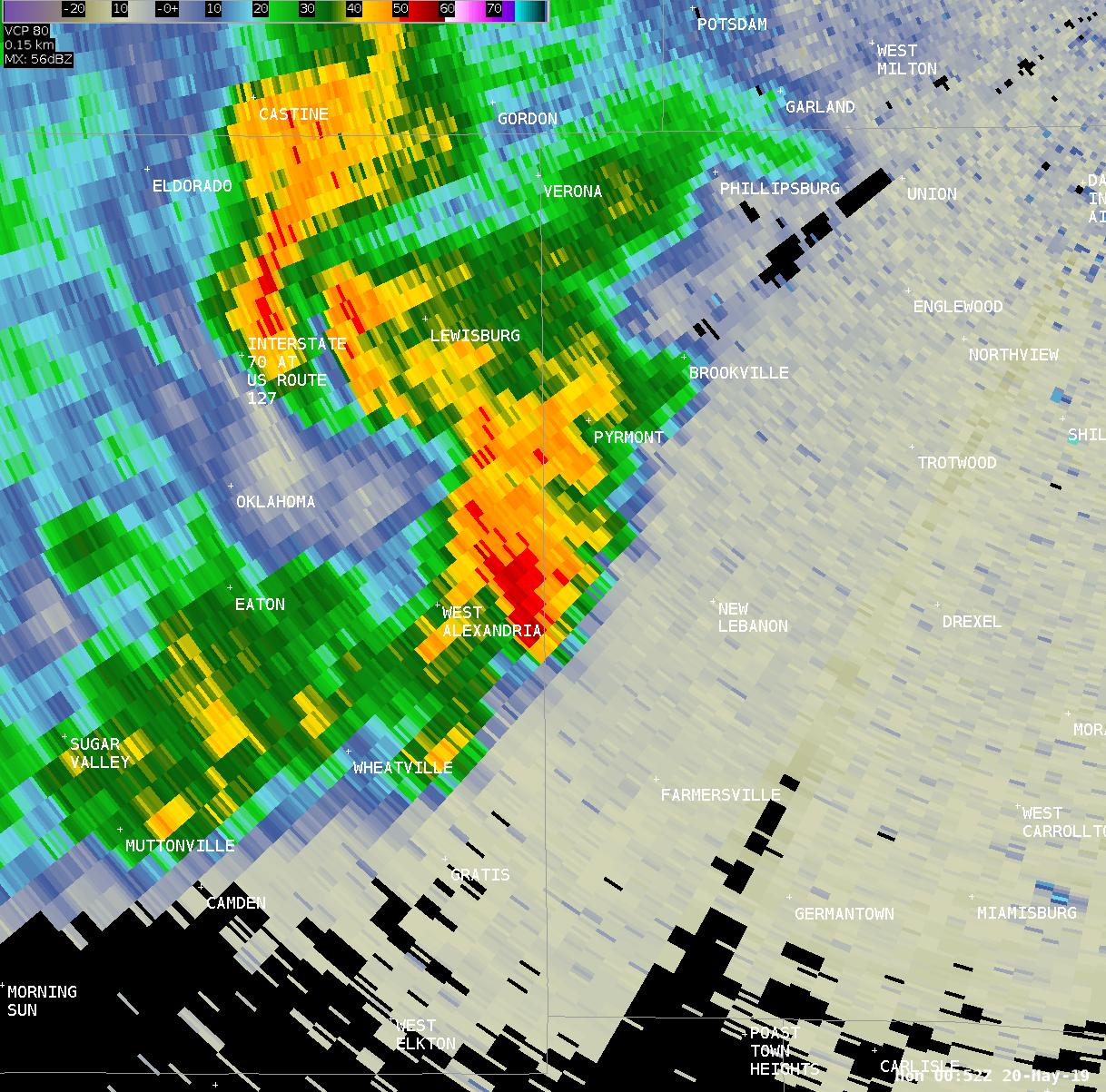
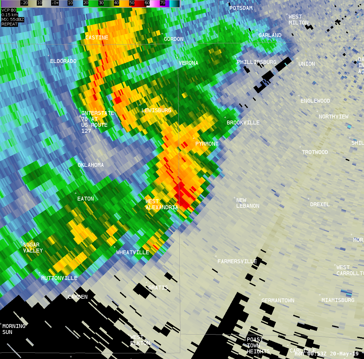
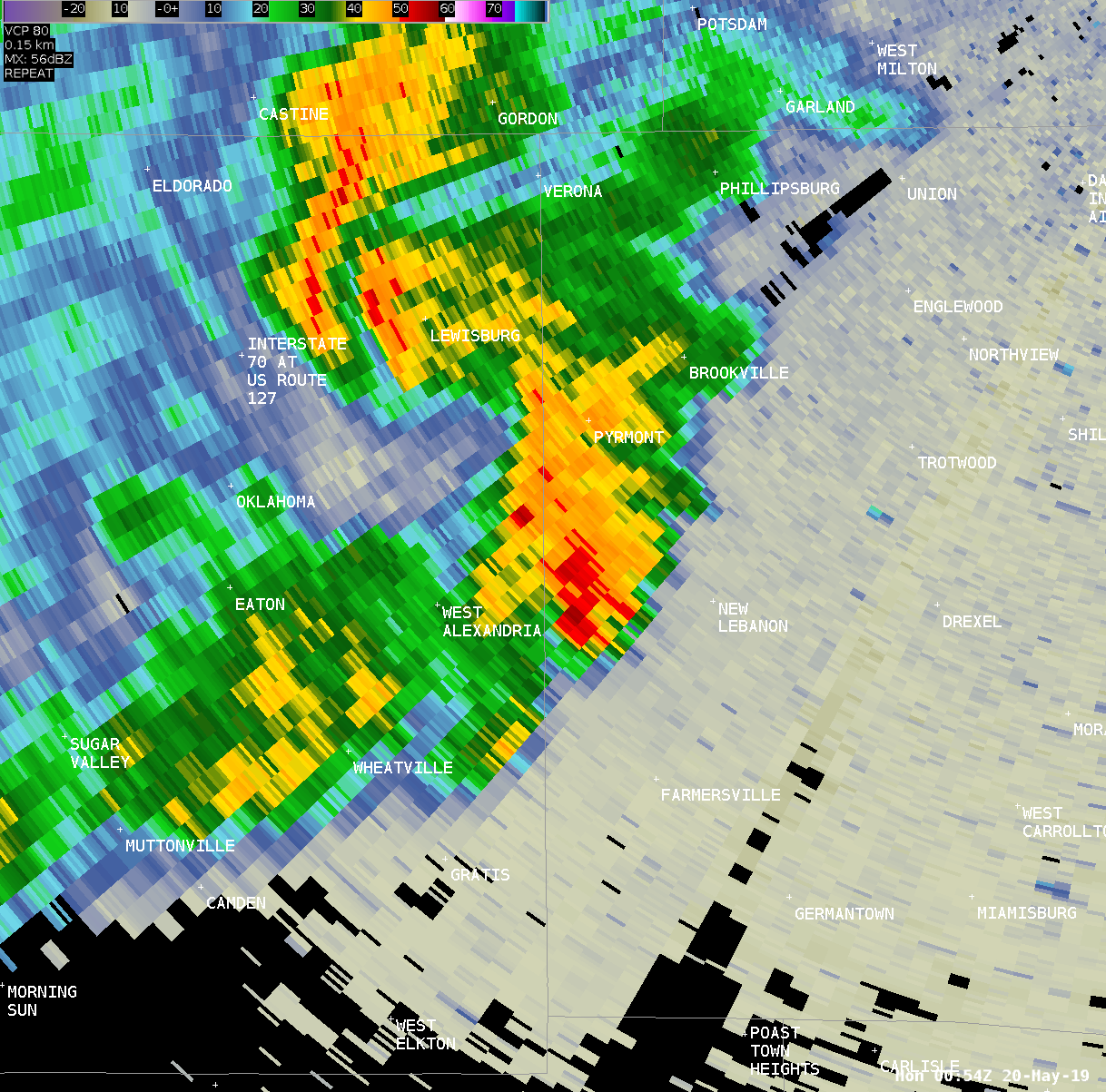
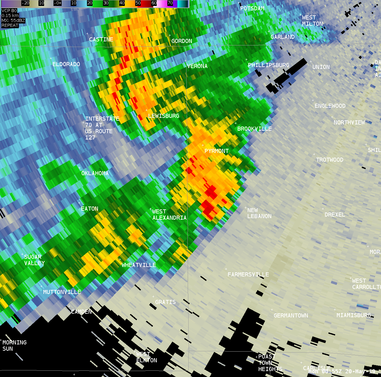
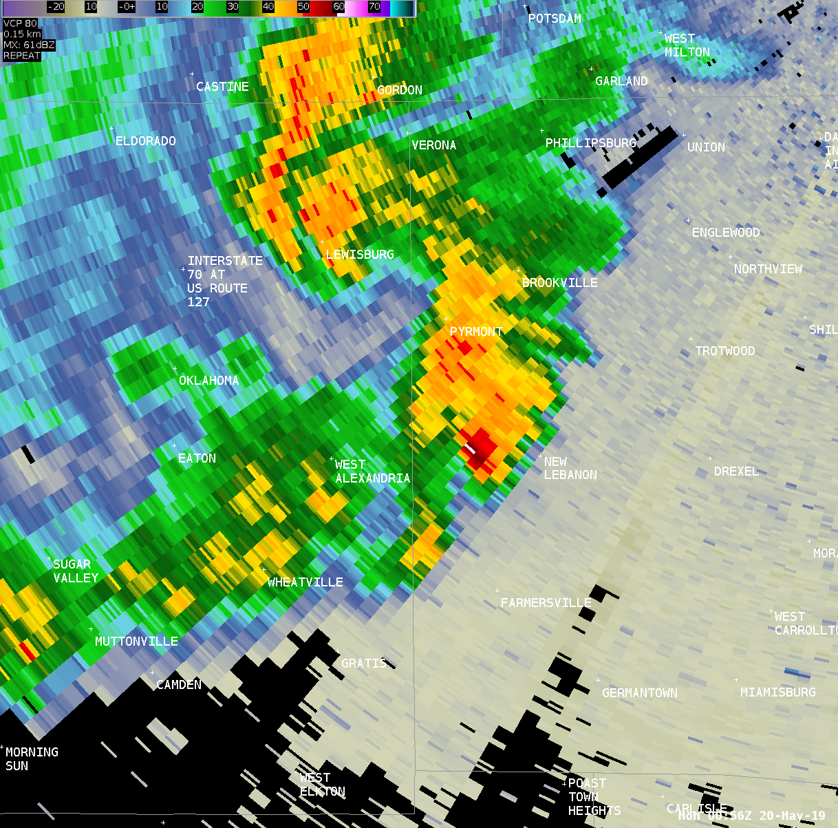
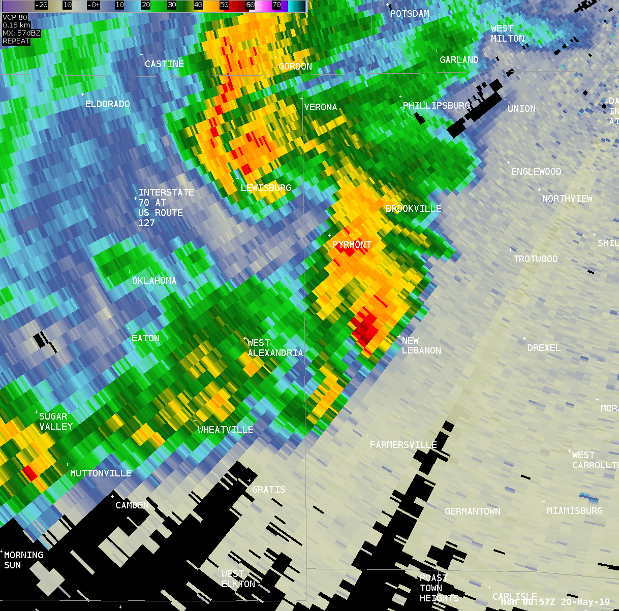
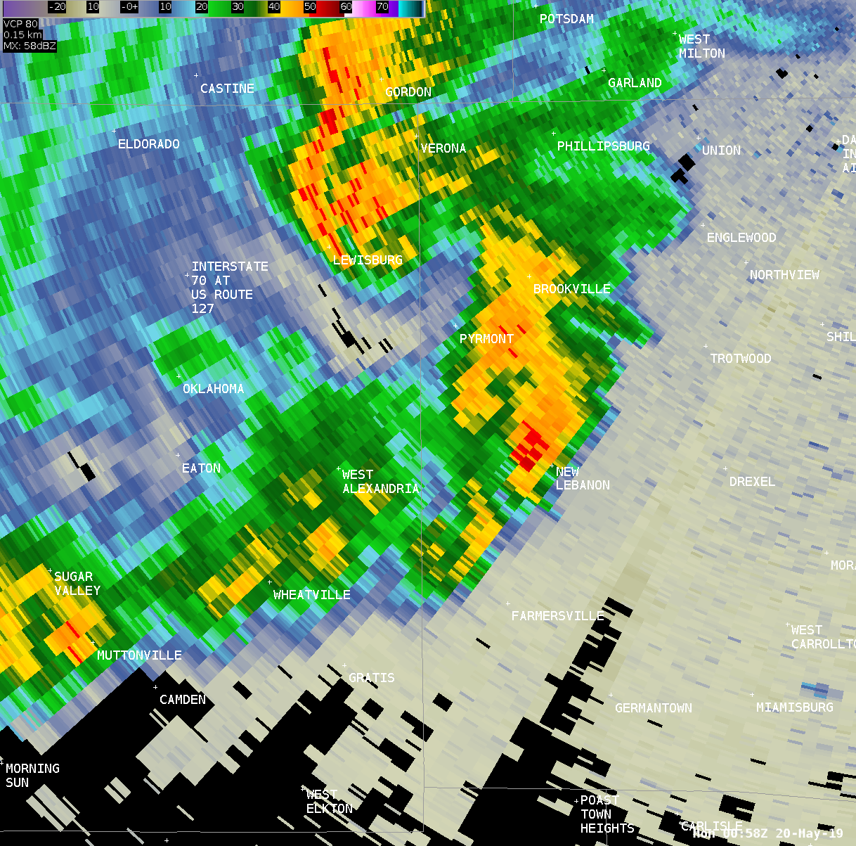
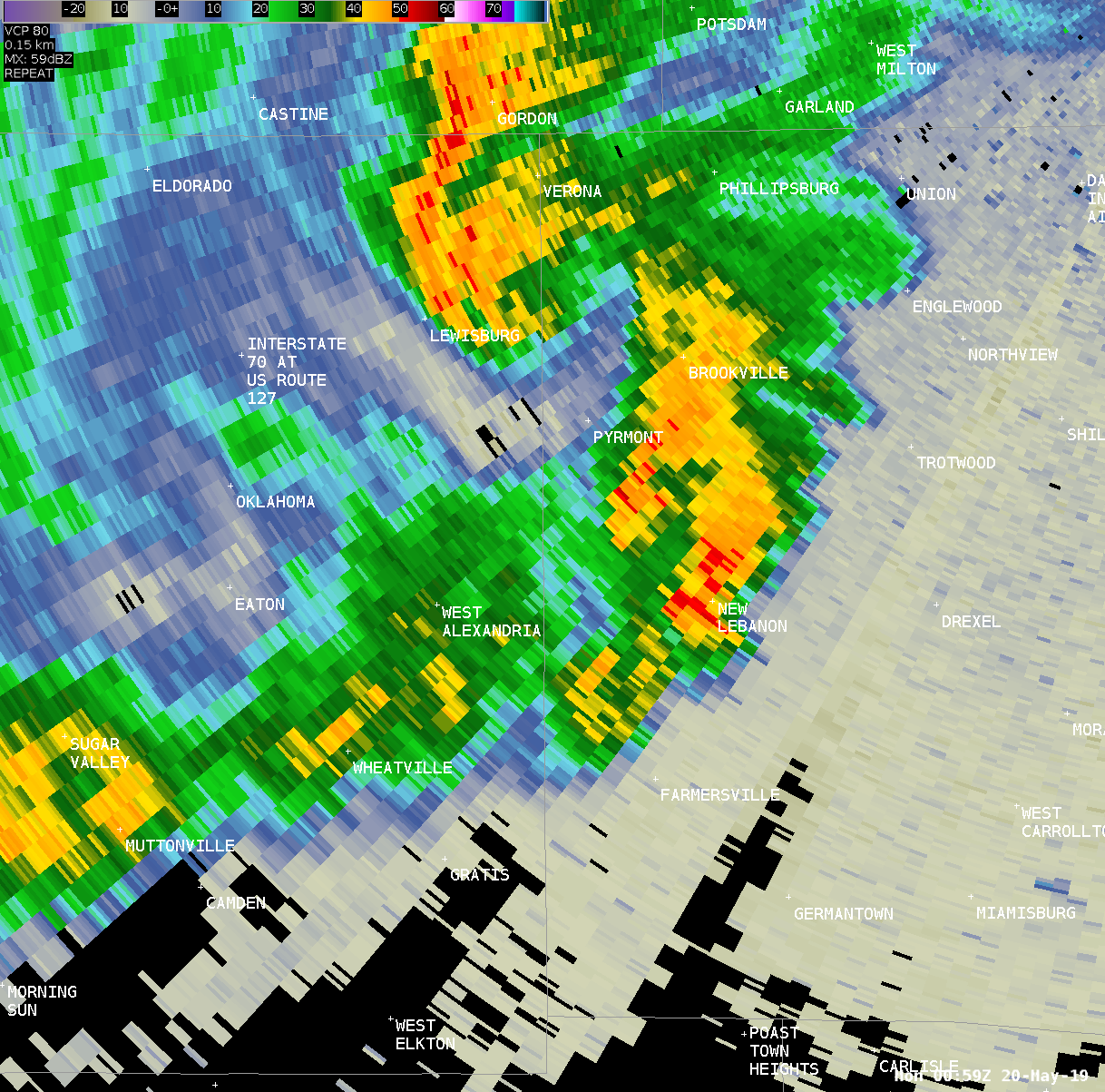
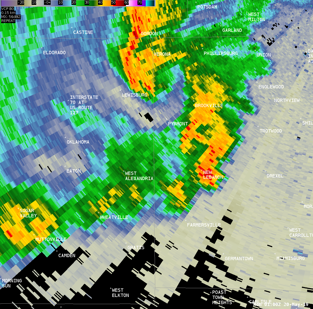
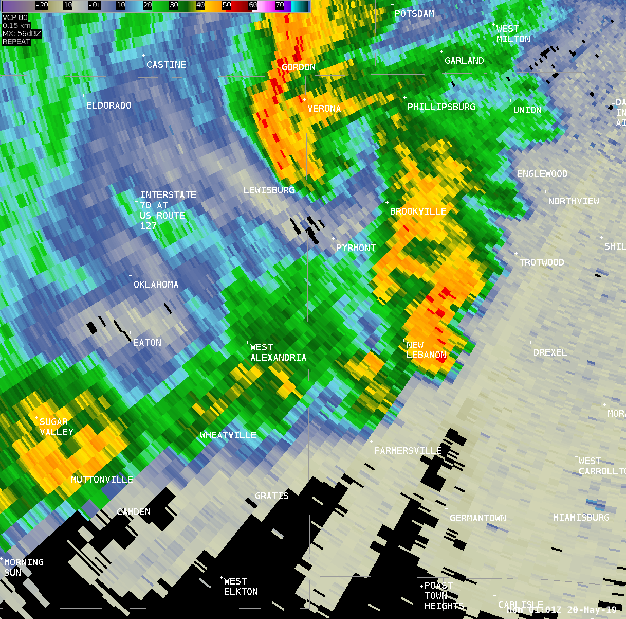
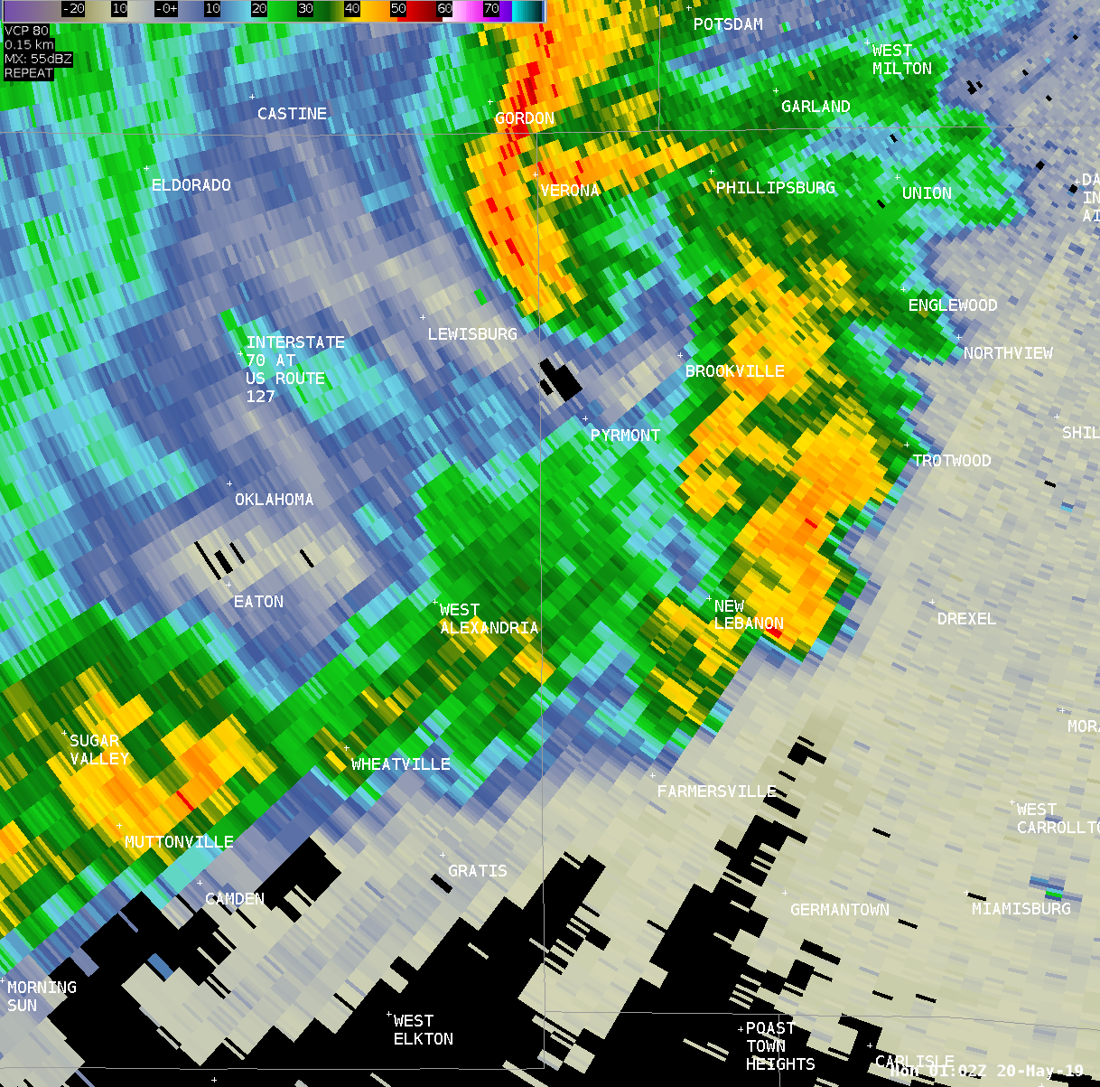
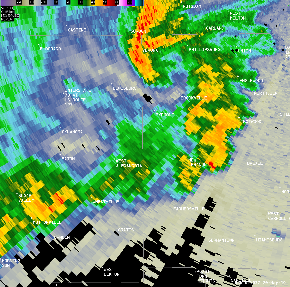
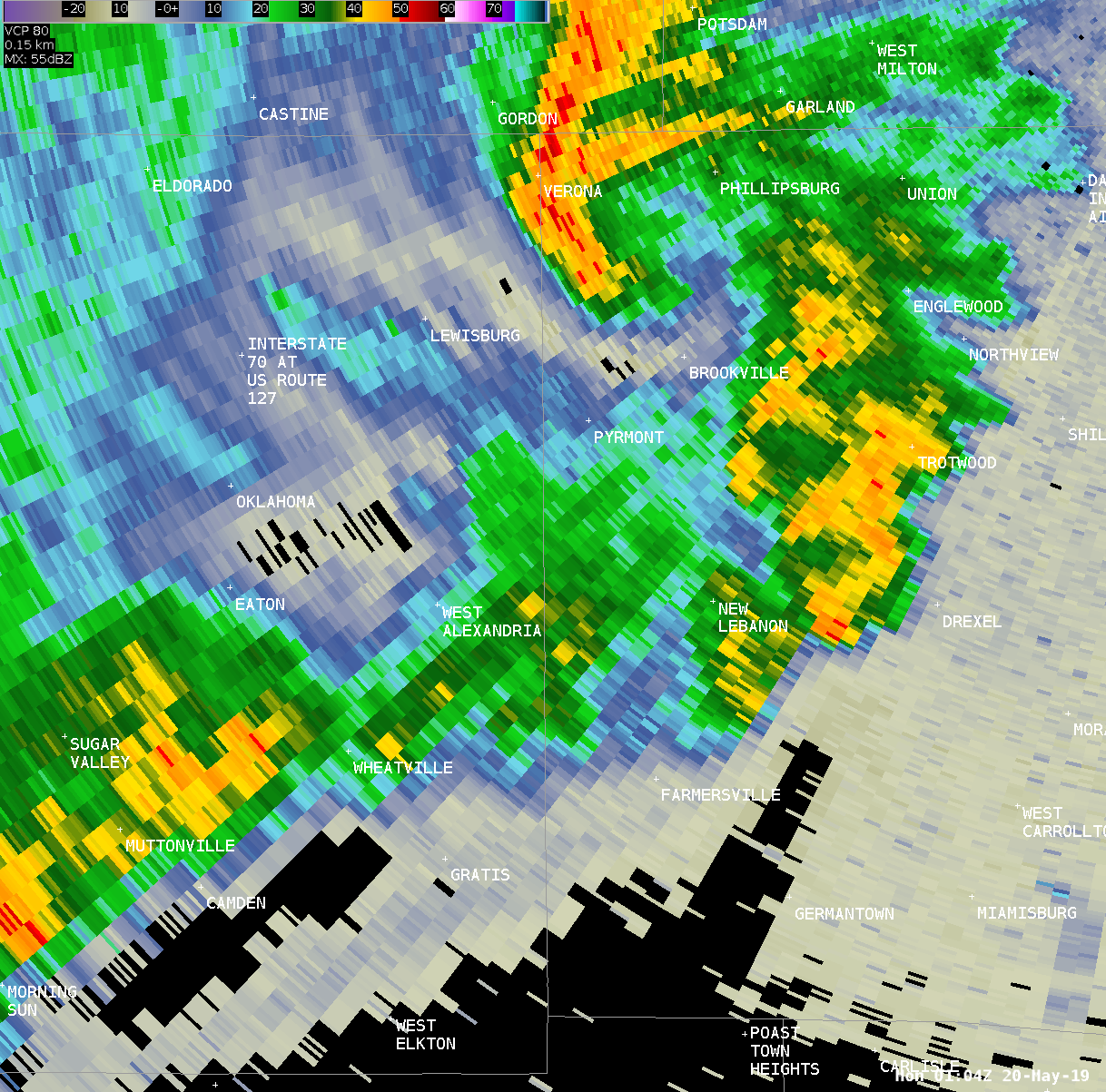
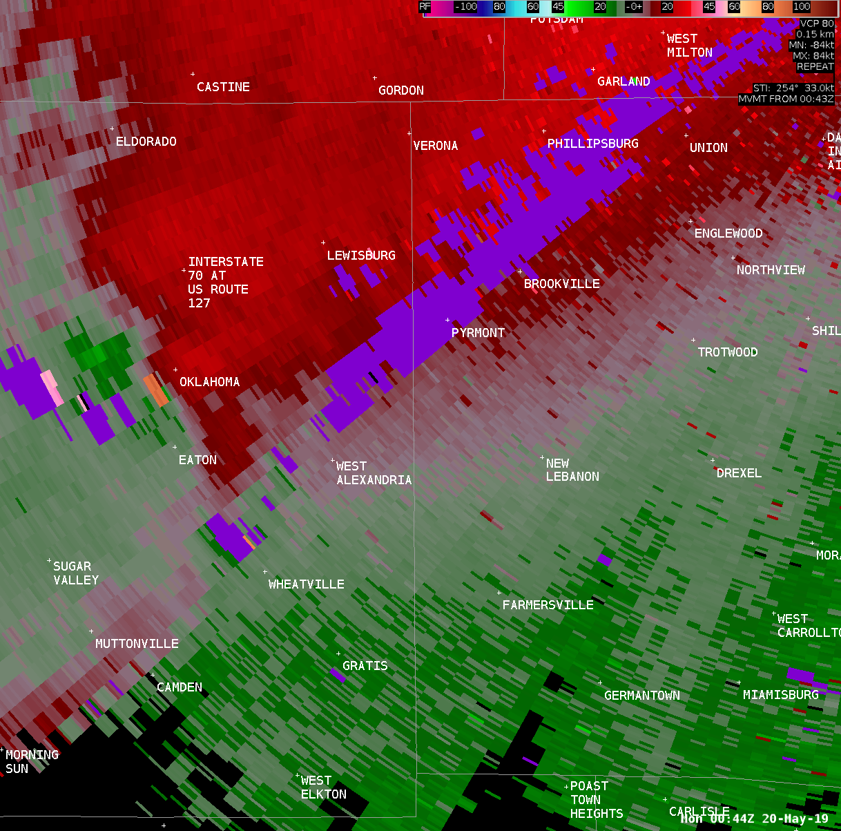
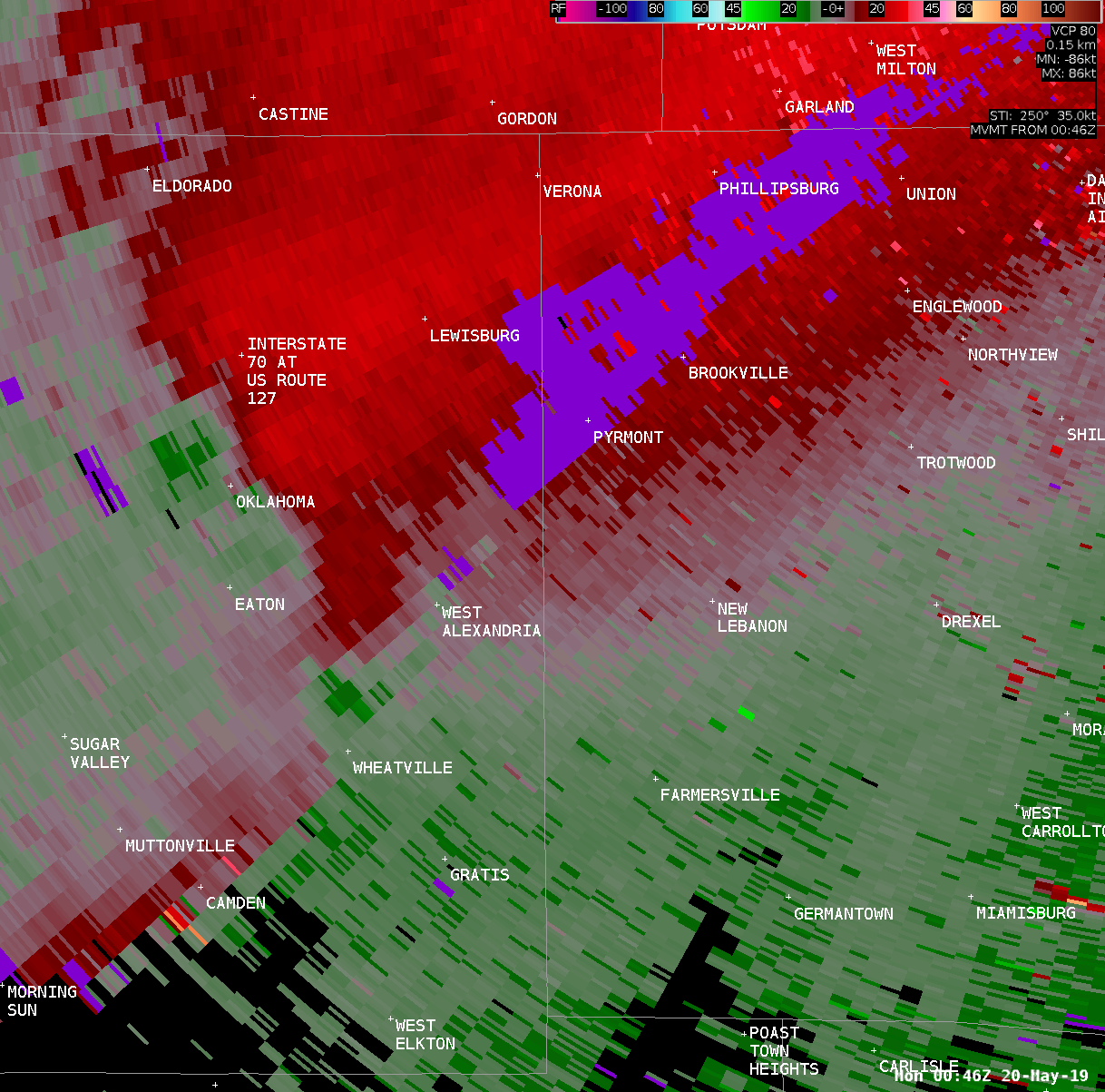
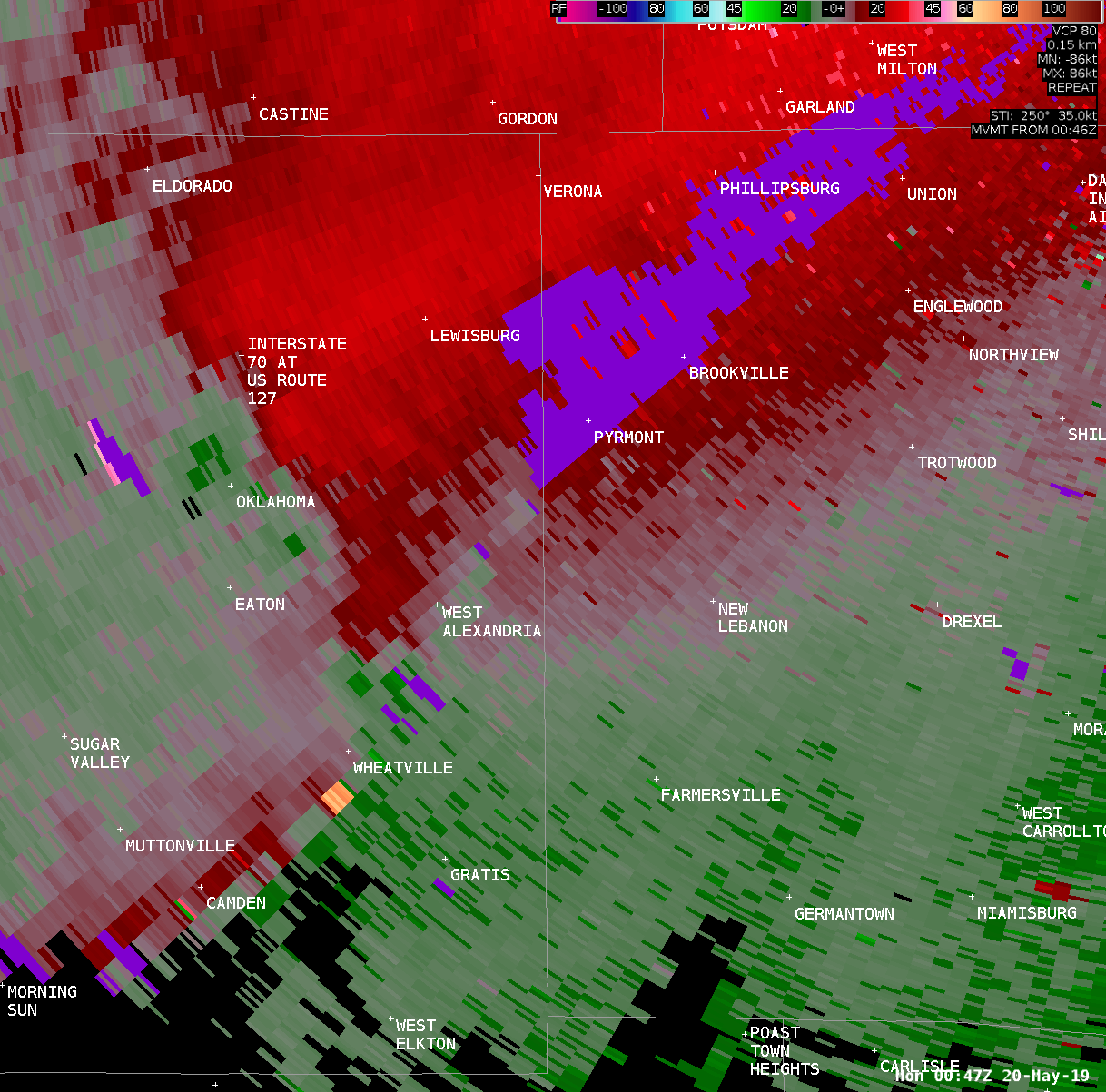
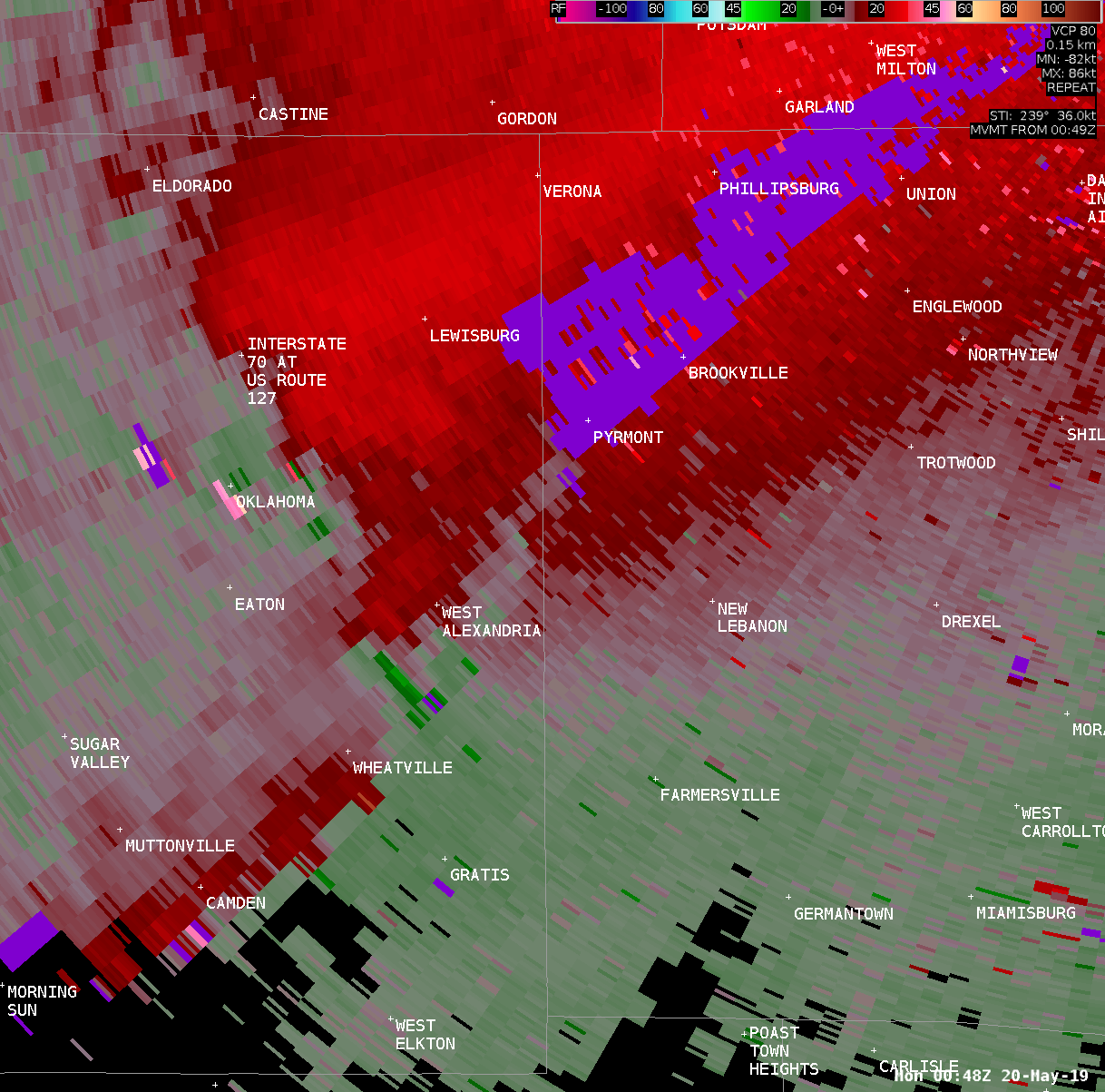
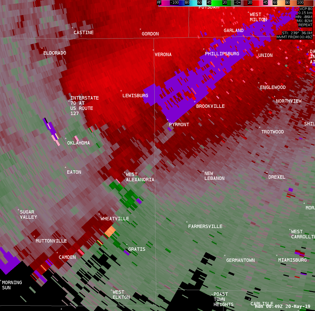
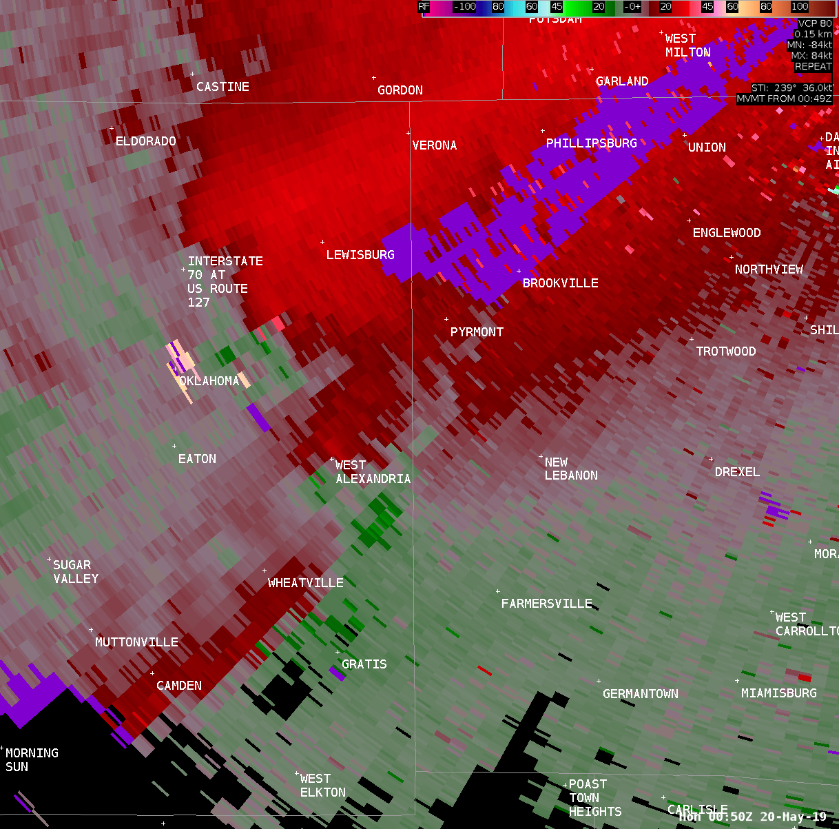
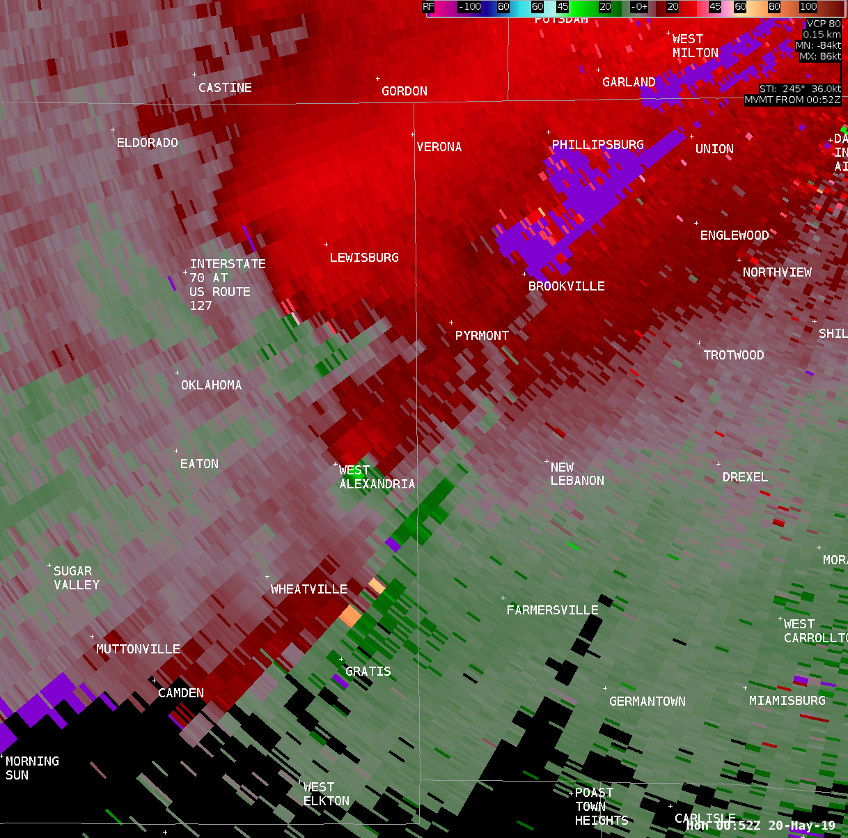
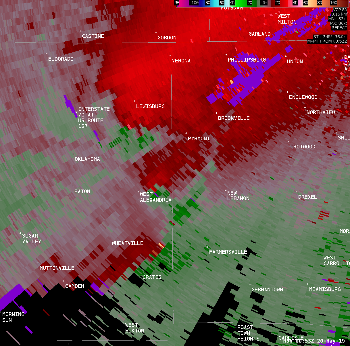
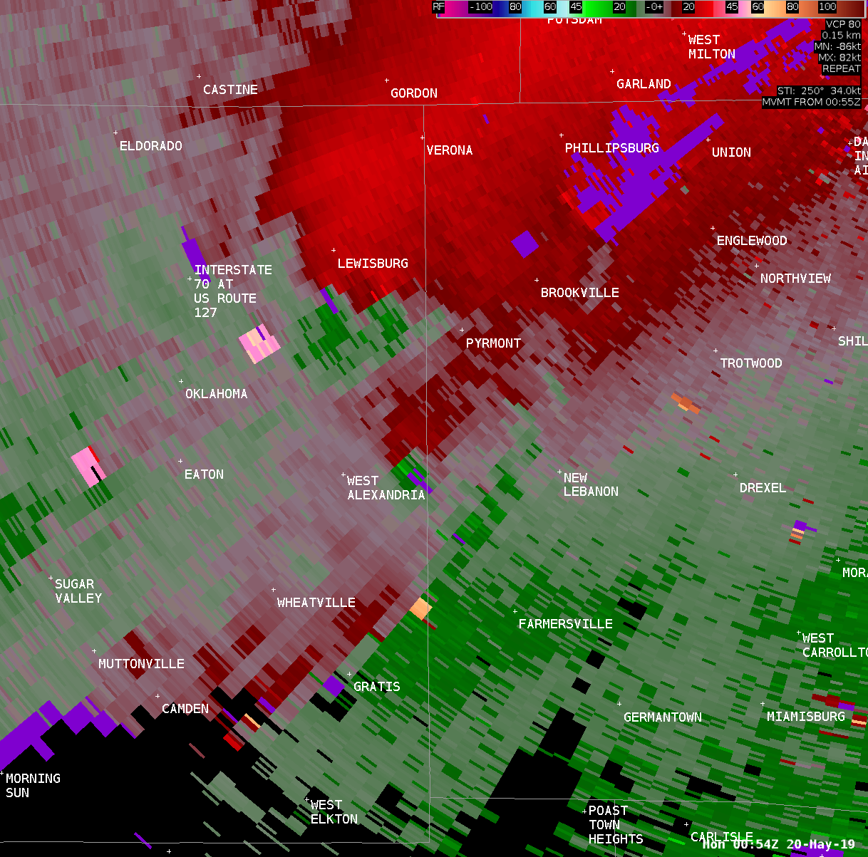
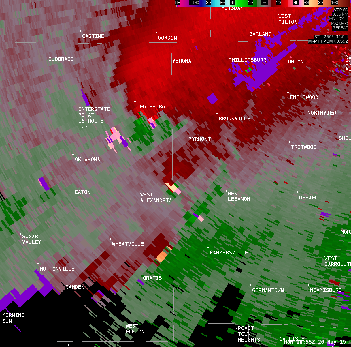
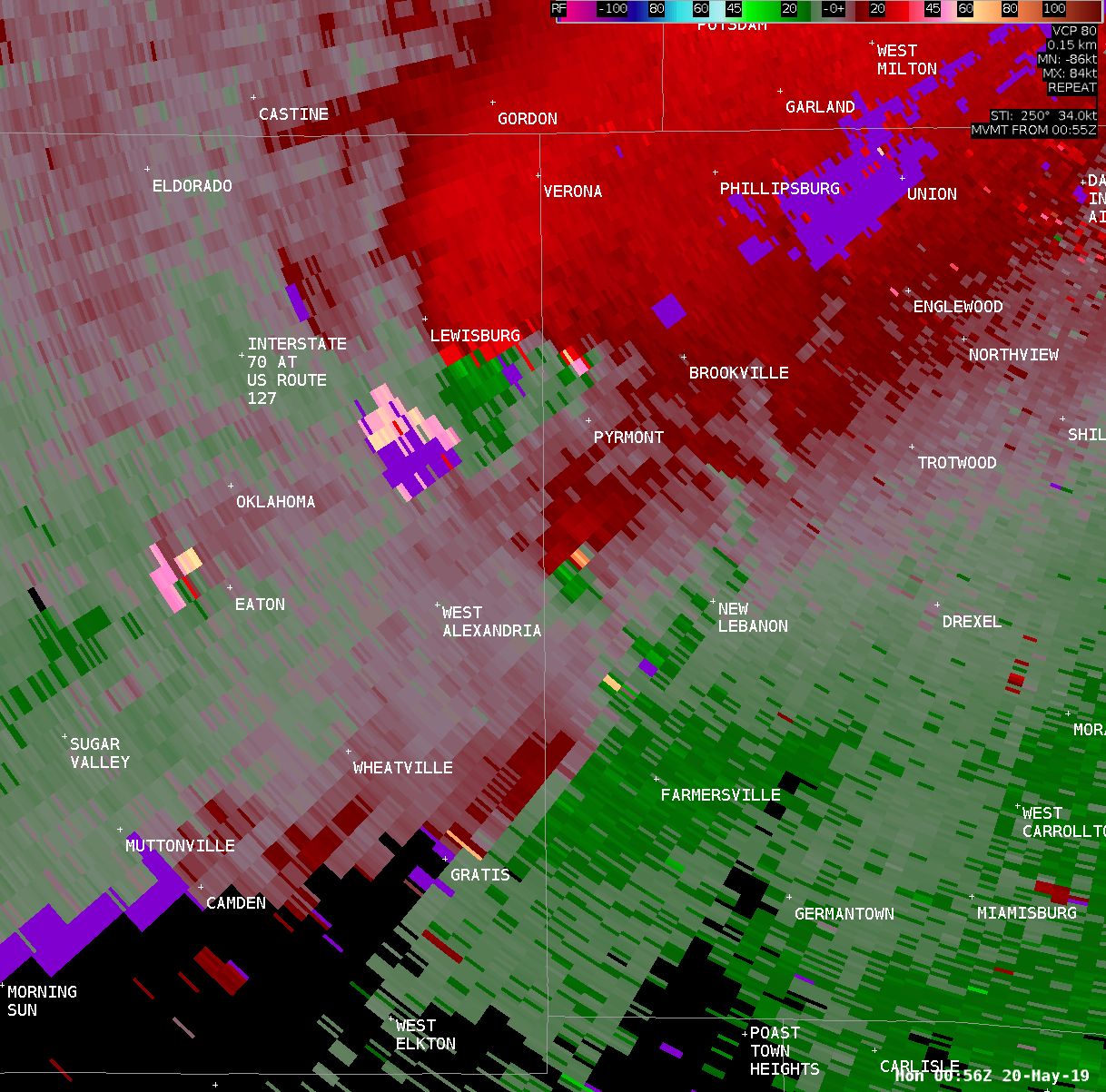
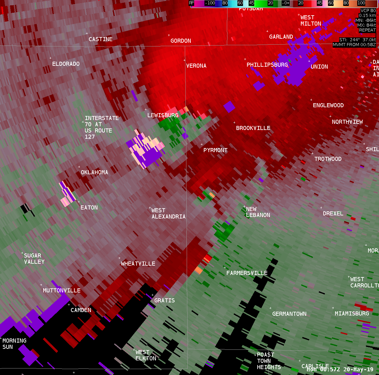
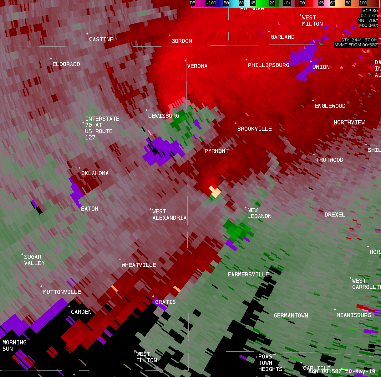
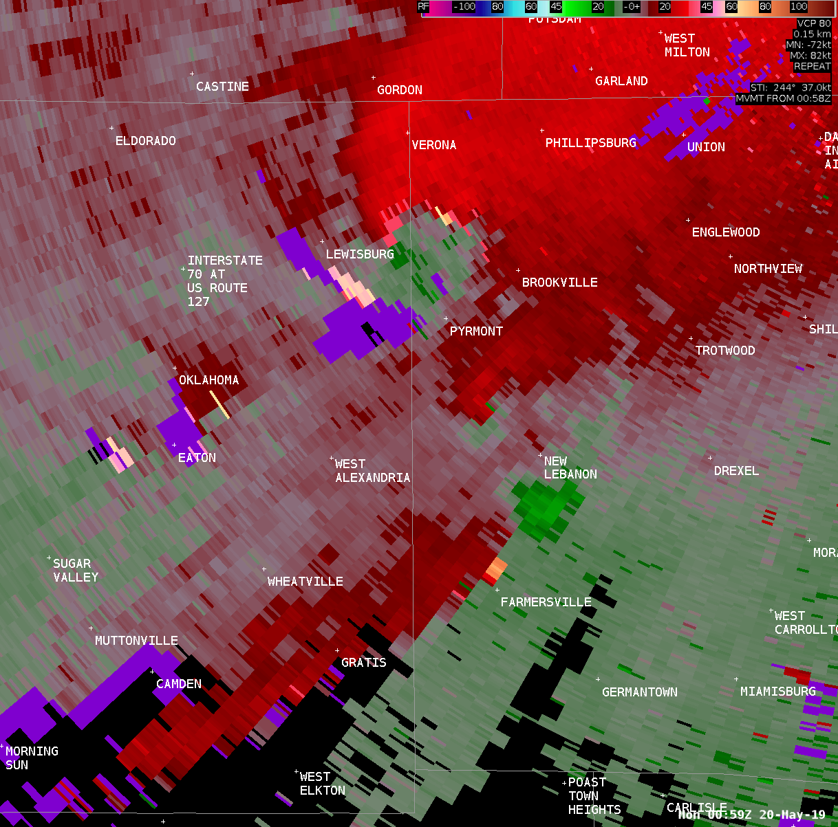
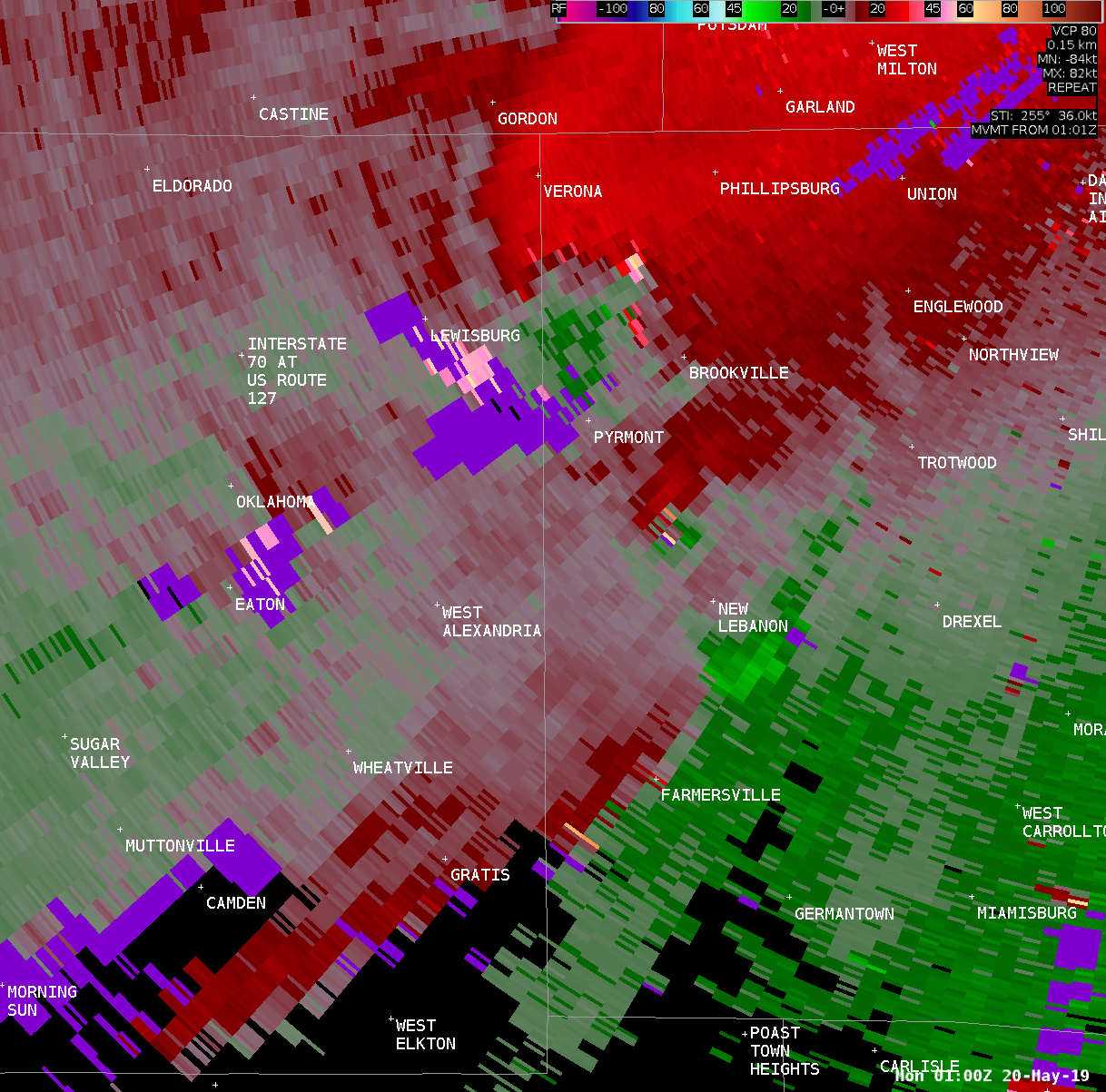
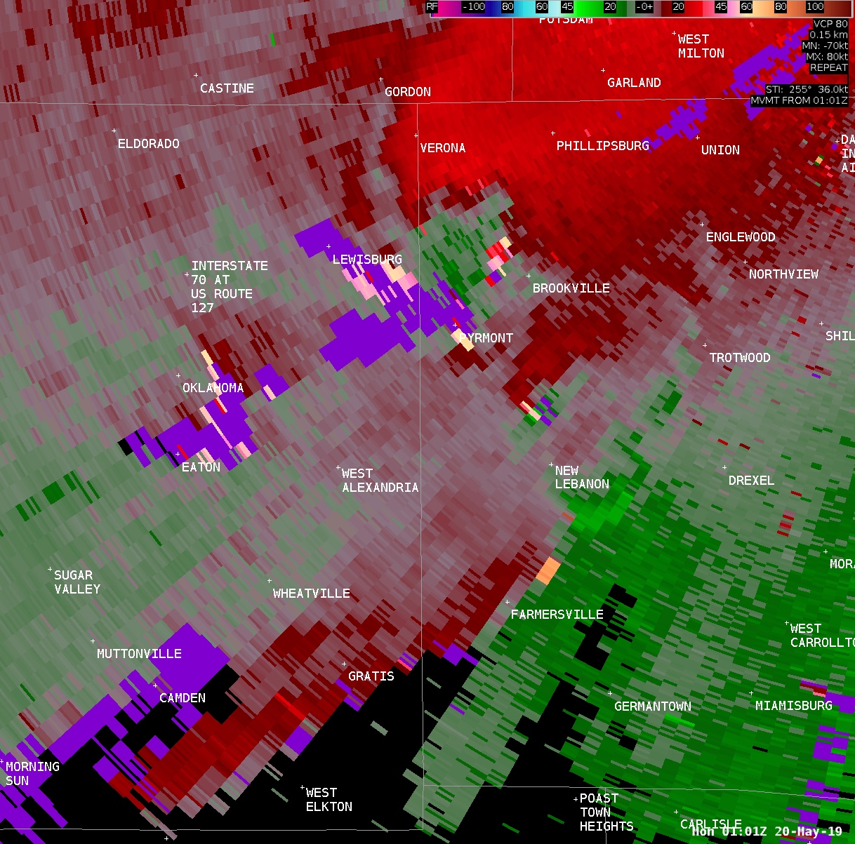
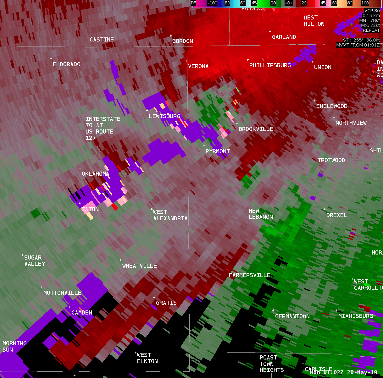
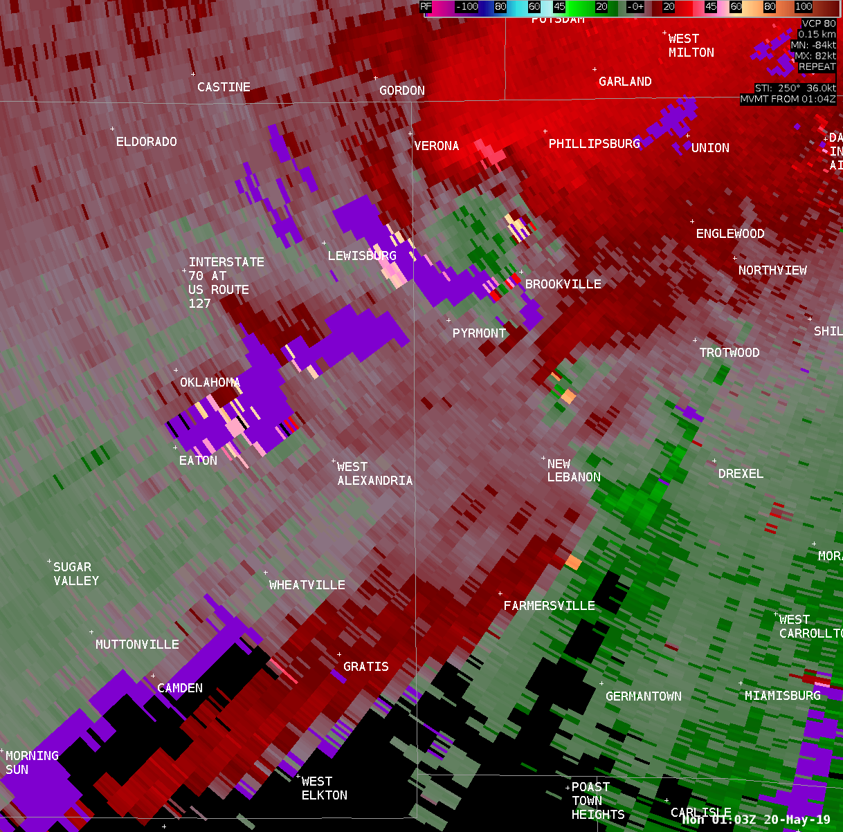
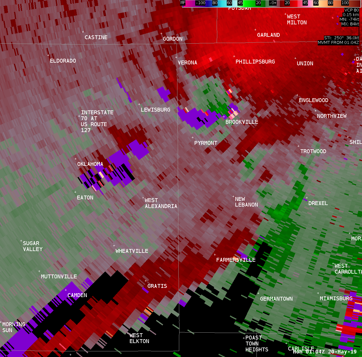
...EF1 TORNADO CONFIRMED IN WEST ALEXANDRIA OHIO...
Location...near West Alexandria in Preble / Montgomery Counties OH
Date...........................May 19 2019
Start Time.....................850 PM EDT
End Time.......................901 PM EDT
Maximum EF-Scale Rating........EF1
Estimated Maximum Wind Speed...95 MPH
Maximum Path Width.............120 yards
Path Length....................7.6 miles
Beginning Lat/Lon...39.7349N / 84.5450W
Ending Lat/Lon......39.7774N / 84.4131W
* Fatalities...0
* Injuries.....0
...Summary...
The National Weather Service in Wilmington Ohio has confirmed an
EF1 tornado in West Alexandria in Preble County, Ohio, continuing
east into Montgomery County, Ohio.
The beginning of the observed damage was at the northeast corner
of Leon Drive, where one tree was downed. Damage became more
significant in a park on Dorsey Akers Drive, where numerous large
trees were completely uprooted. Minor damage was observed in a
residential area in the southeast quadrant of West Alexandria,
with a few trees downed and one outbuilding losing a portion of
its roof.
Damage was more significant at an industrial facility just south
of US-35 on the east side of West Alexandria. An old masonry
building suffered partial roof loss and the collapse of most of
the east-facing wall. Numerous trees were also downed at this
property, with minor roofing and facade damage to a modern
industrial building, and a dumpster lofted and moved about 100
feet to the north of its original location.
On the north side of US-35 near Twin Creek, tree damage was
observed at a private residence, with a very large and very old
oak tree snapped low on its 3-to-4-foot diameter trunk. Several
other residential properties on the north side of US-35 had minor
structural and tree damage, and one outbuilding of poor
construction about 1400 feet west of Jordan Road was completely
demolished. Sheet metal from this outbuilding was carried at least
a half mile downstream. Tree damage was noted along Jordan Road
and Preble County Line Road, with several large trees uprooted. A
residence on the west side of Preble County Line Road suffered the
loss of a porch overhang and an ornamental column near the front
entry.
Two properties on the southwest corner of Sheep Road and Old
Dayton Road had damage that was observed to be among the more
significant caused by this tornado. At the Old Dayton Road
property, a barn had half of its roof completely removed, with
failure to the doors and damage to the walls. A thick metal fence
surrounding a pool was also blown over, and several large trees
were downed. At the Sheep Road property, wooden fencing was blown
down from the north and from the east, with some damage to the
roof of a house, including a small section of roof removal. The
street sign at the corner of Old Dayton Road and Sheep Road was
blown approximately 500 feet into the field to the northeast. A
third property on the north side of Old Dayton Road had shingle
damage to the roof of a home, in addition to extensive tree
damage.
On North Sulfur Springs Road, two properties suffered extensive
tree damage. A property on the east side of the road also had two
outbuildings damaged, with one suffering the loss of some roofing
material, and the other having a section of the main door flipped
and bent over the top of the roof. Further east, a few trees were
damaged at a residence on the east side of Crawford Road.
Several properties along Little Richmond Road, near and east of
Johnsville-Brookville Road, were also affected by tree damage. One
property just south of Little Richmond Road had a large swing set
moved into an adjacent yard by the tornado. The end of the
observed damage was to several trees along a tree line about 1000
feet north of Little Richmond Road.
Based on the damage to the masonry building east of West
Alexandria, and the damage to the properties near the intersection
of Sheep Road and Old Dayton Road, an EF1 rating was assigned,
with an estimated maximum wind speed of 95 MPH.
The National Weather Service would like to thank Preble County
Emergency Management, Montgomery County Emergency Management, and
the New Lebanon Fire Department for their assistance in the storm
survey.
EF Scale: The Enhanced Fujita Scale classifies tornadoes into the
following categories:
EF0...Weak......65 to 85 mph
EF1...Weak......86 to 110 mph
EF2...Strong....111 to 135 mph
EF3...Strong....136 to 165 mph
EF4...Violent...166 to 200 mph
EF5...Violent...>200 mph
* The information in this statement is preliminary and subject to
change pending final review of the event and publication in NWS
Storm Data.
$$
HATZOS/FRANKS
|

