|
EF0 Tornado Confirmed 7 Miles West of Greenville, Ohio |
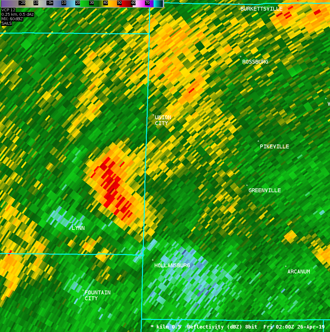
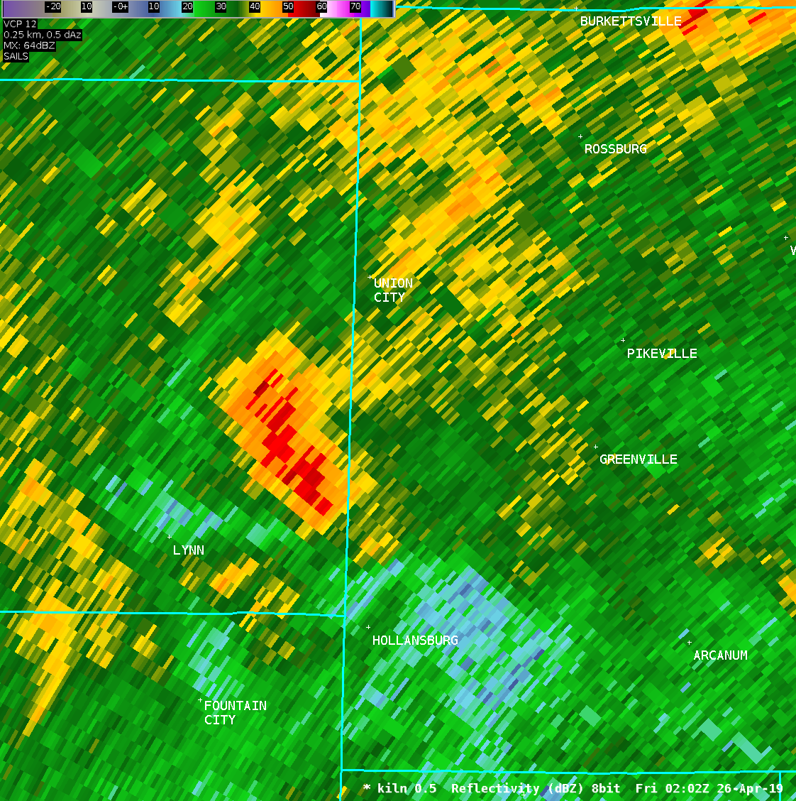
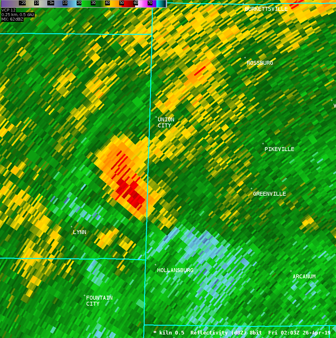
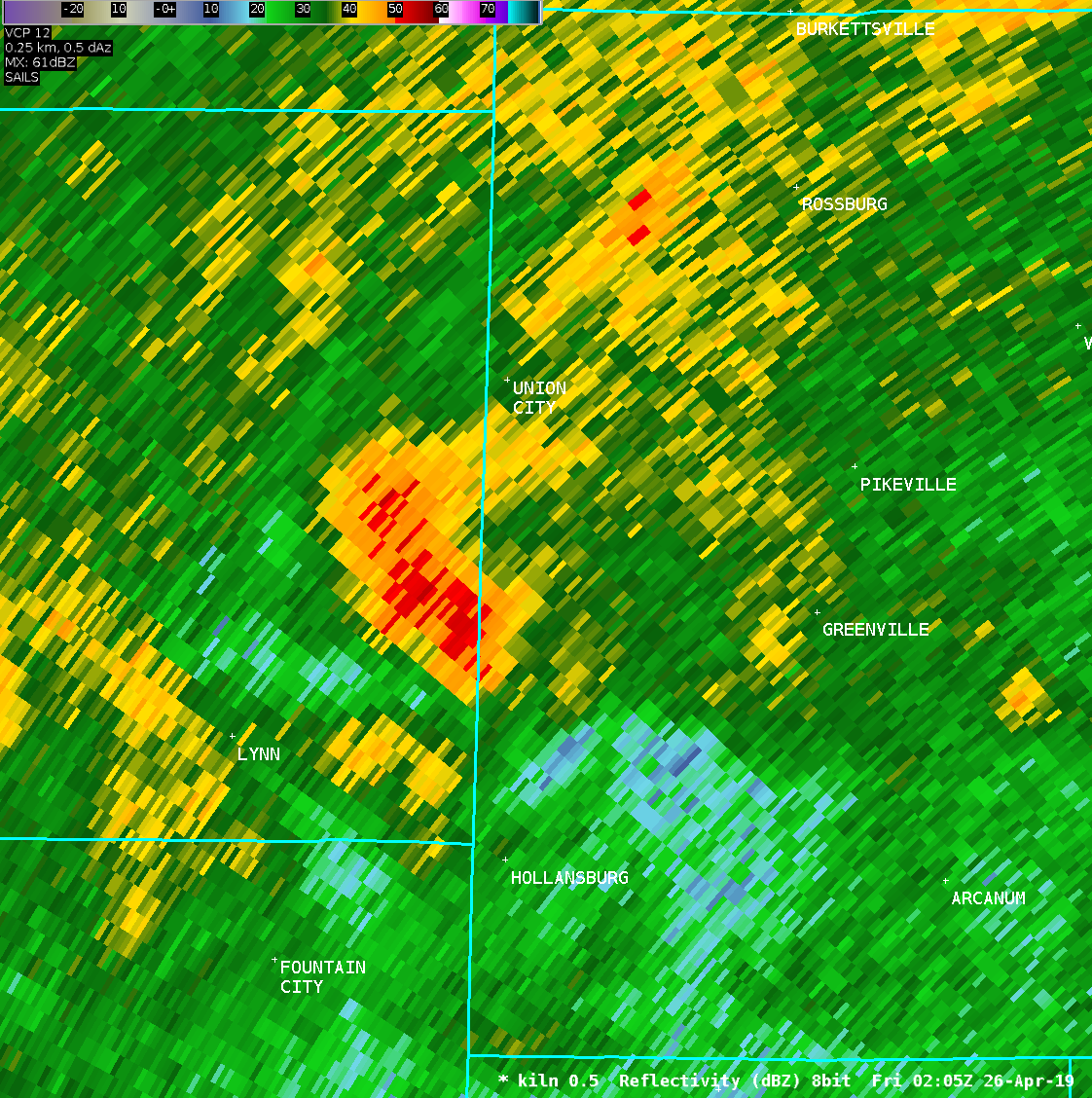
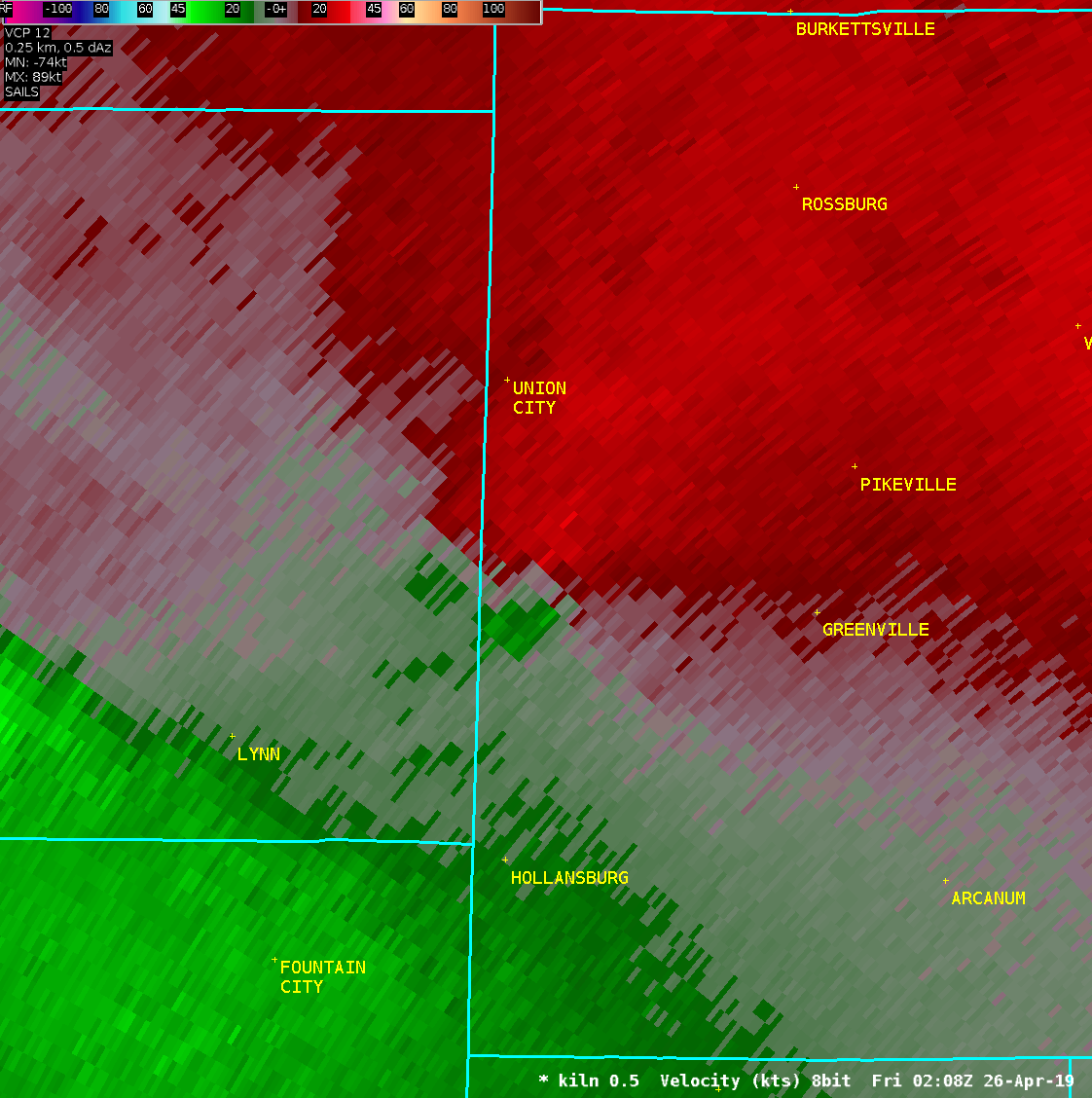
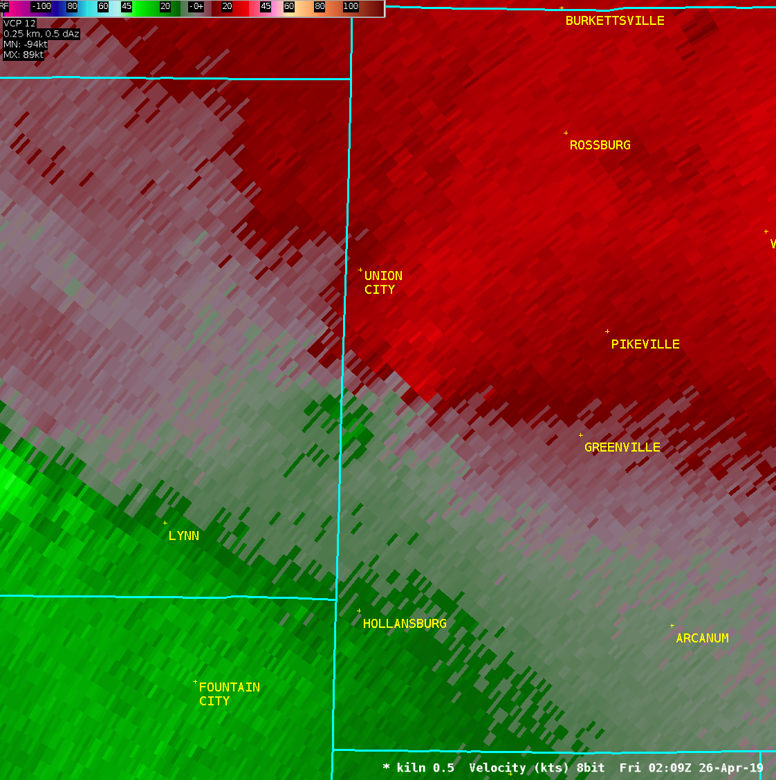
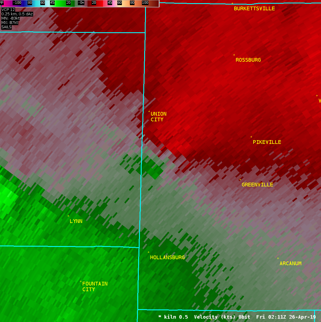
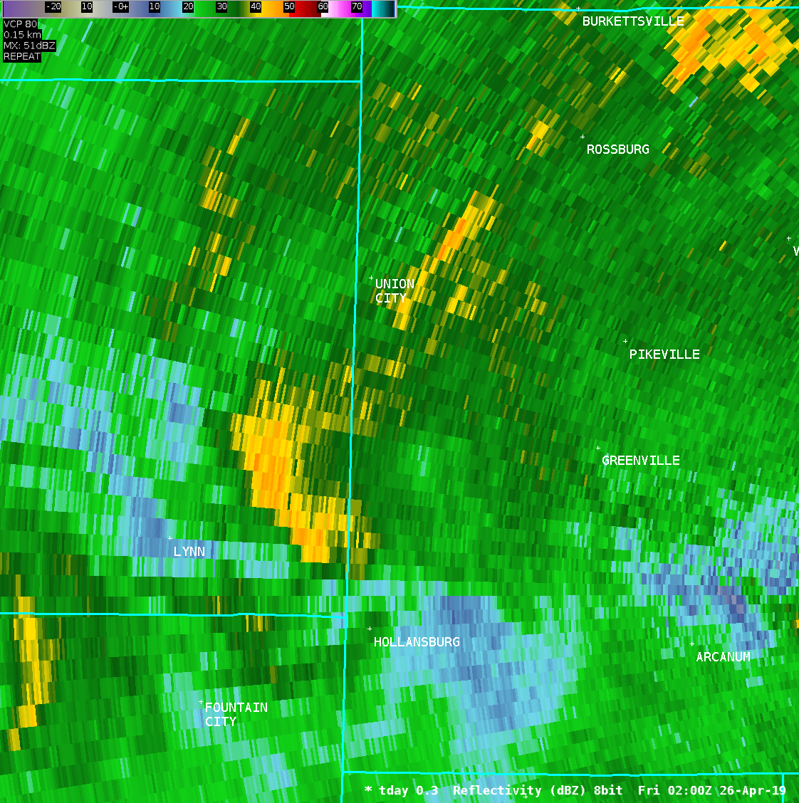
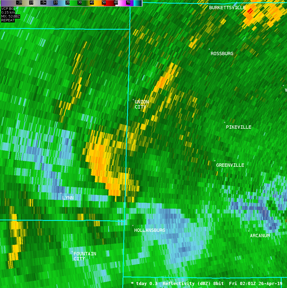
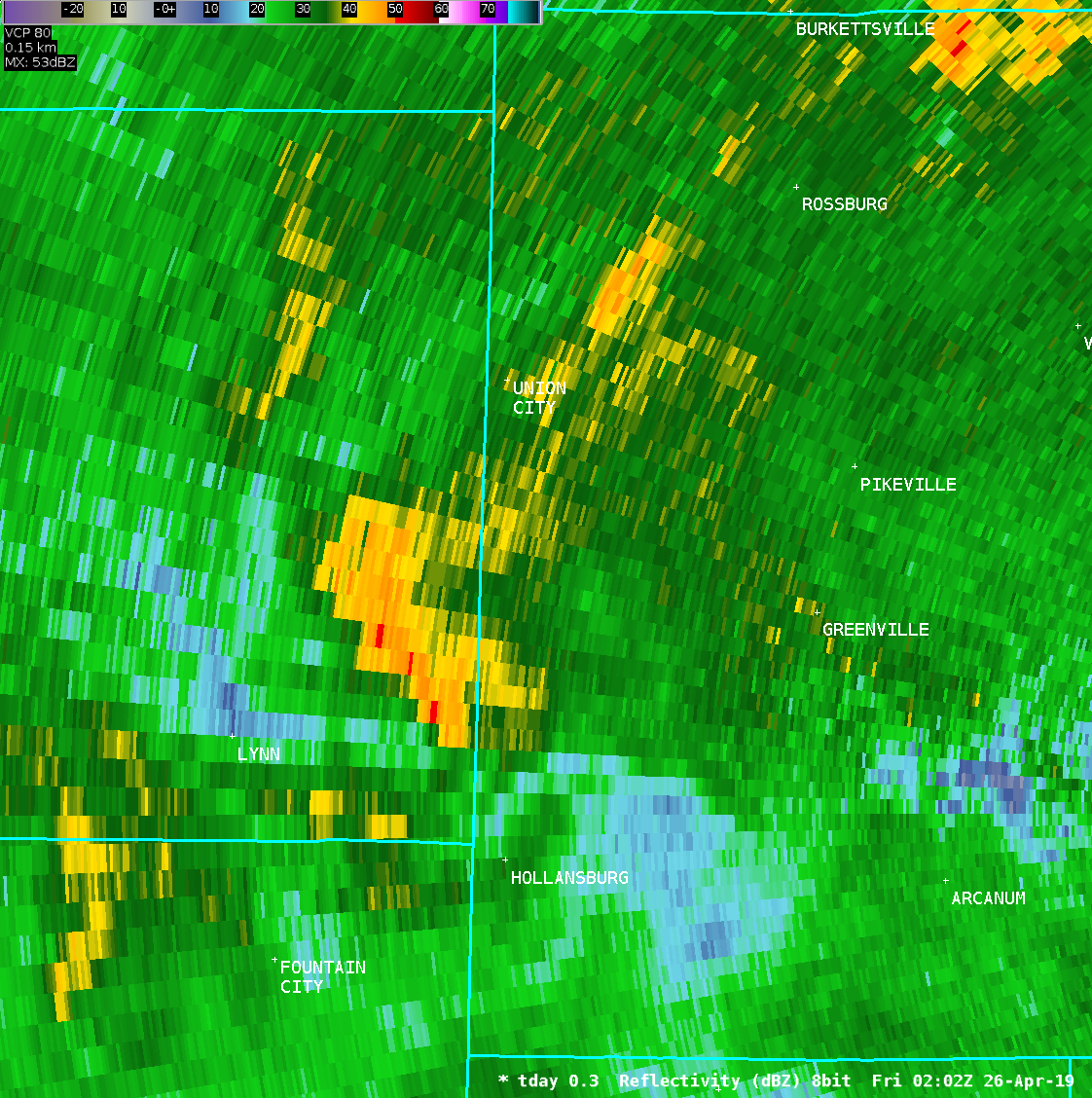
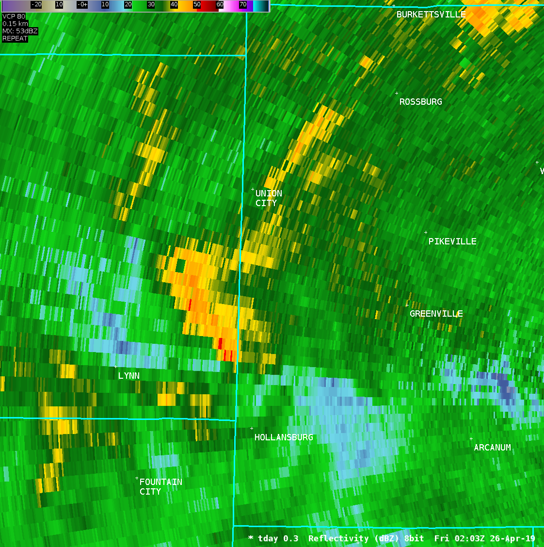
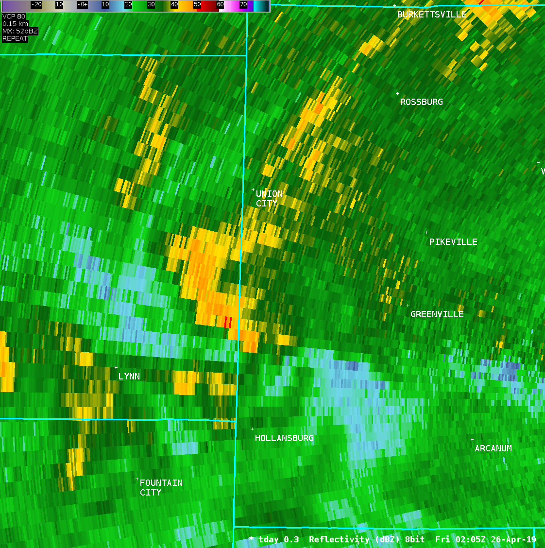
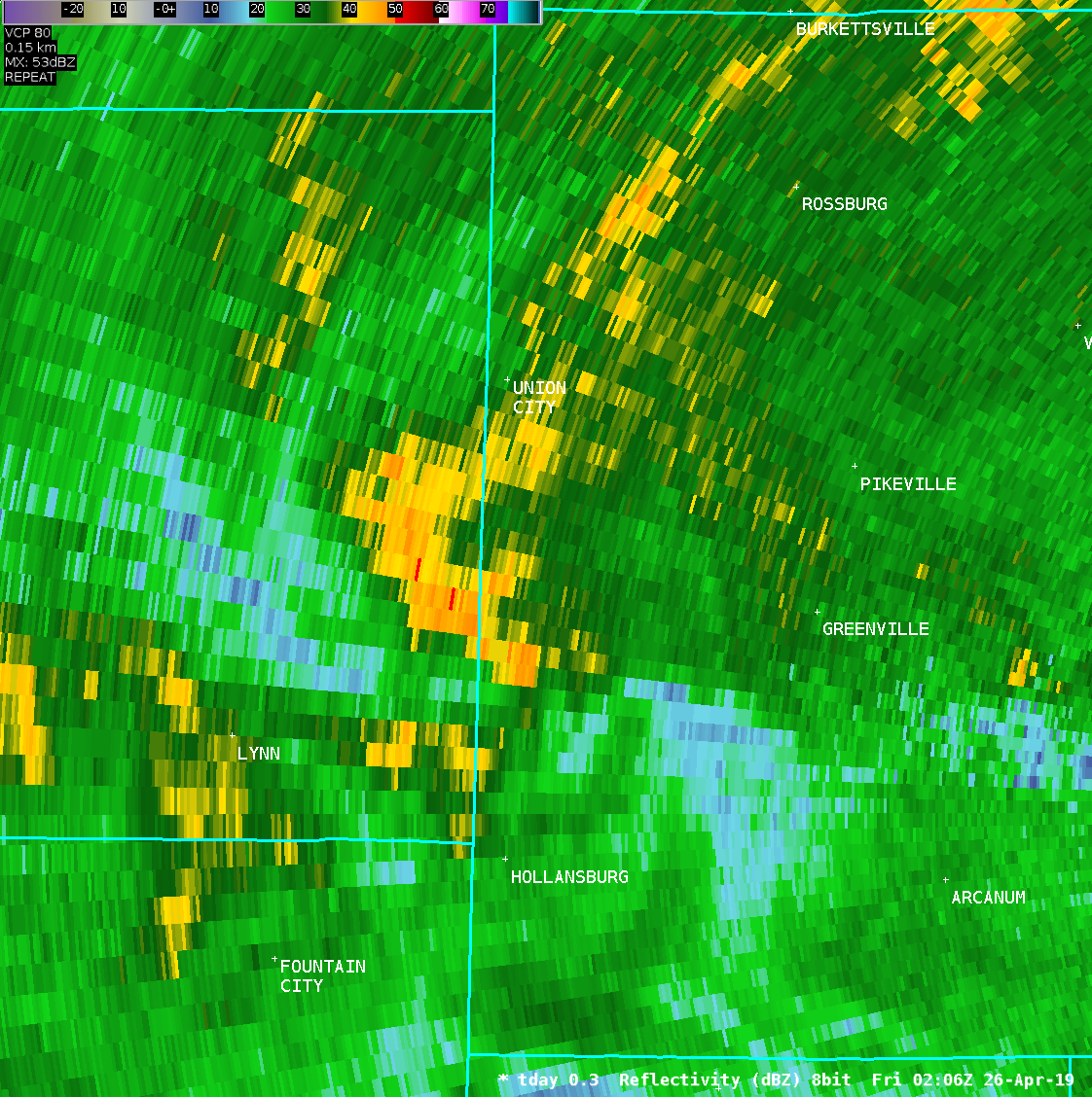
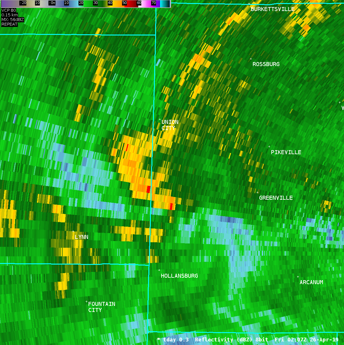
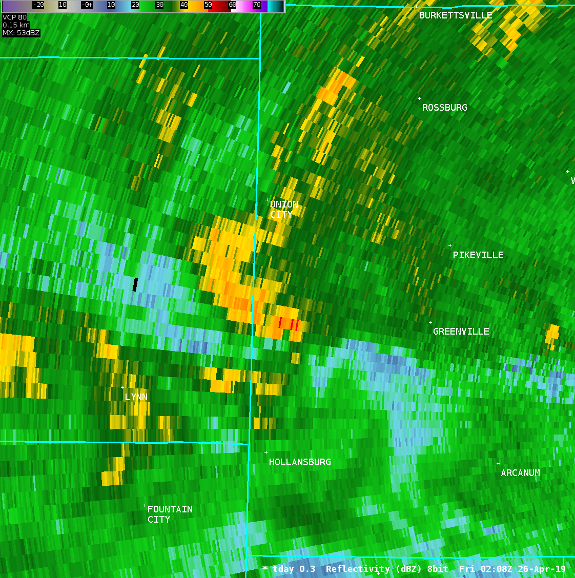
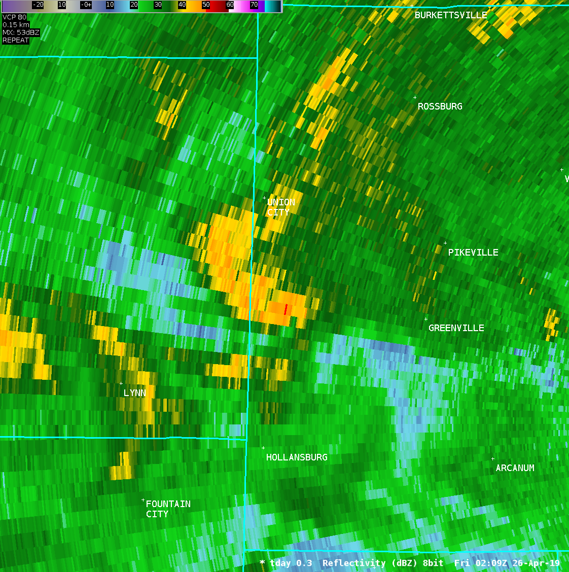
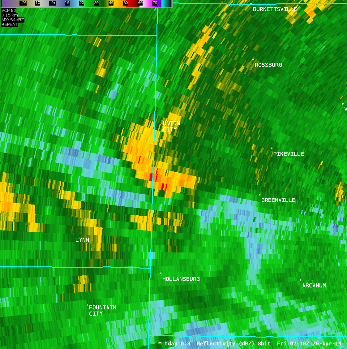
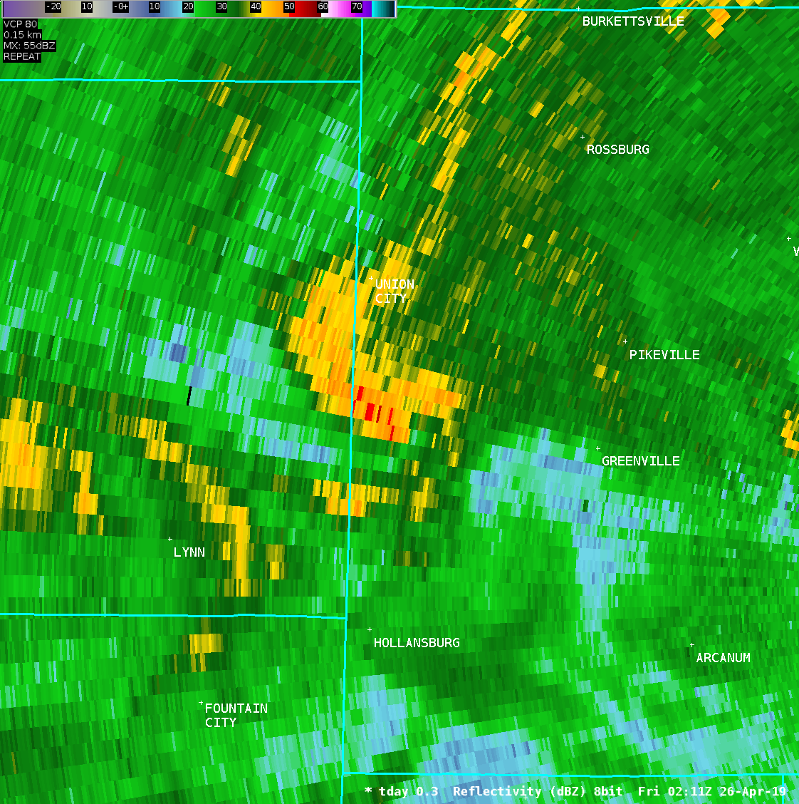
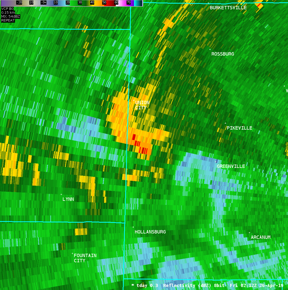
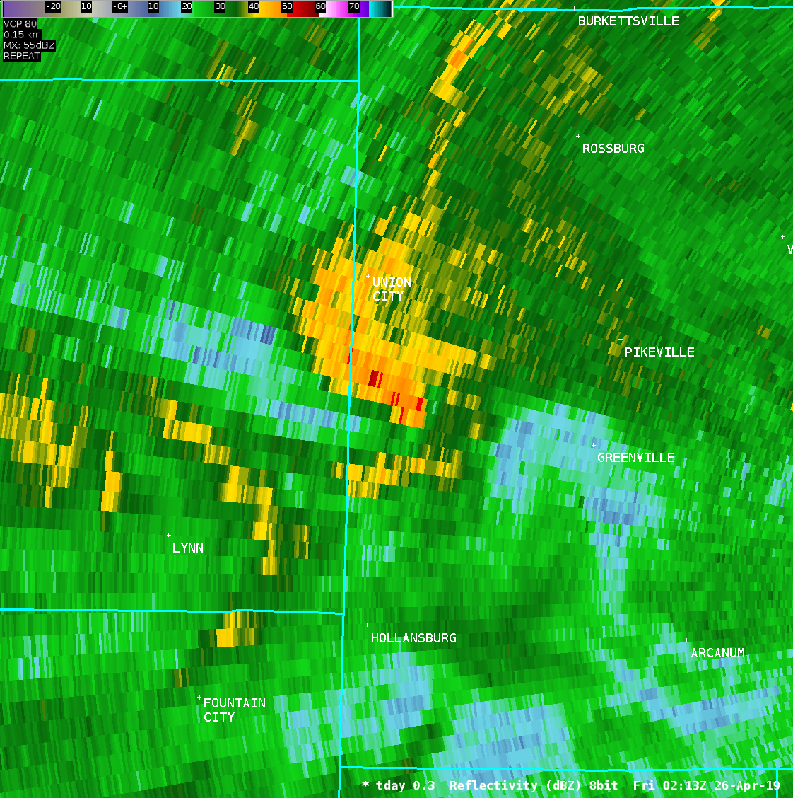
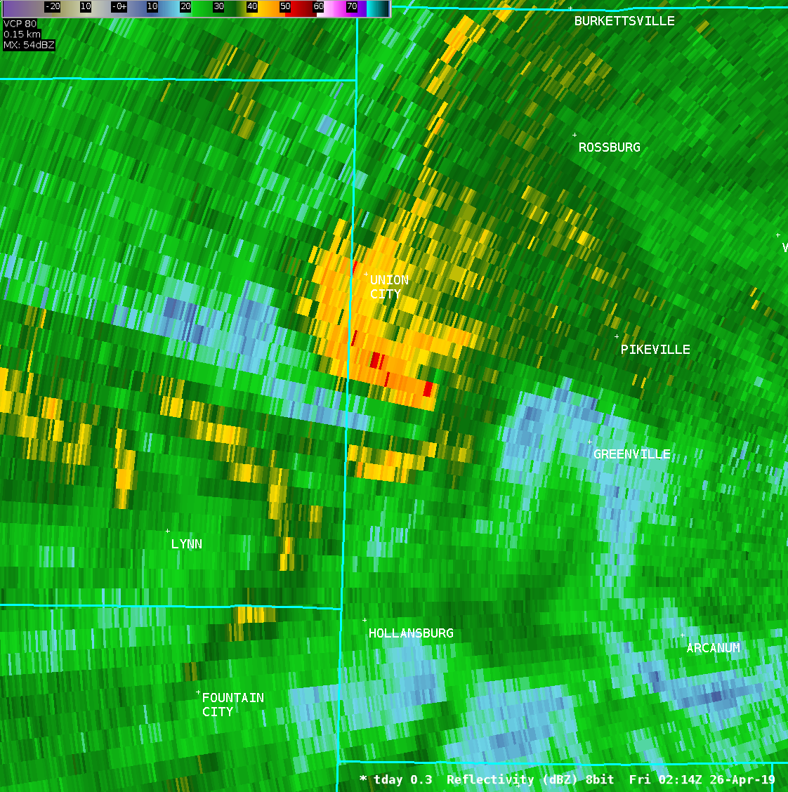
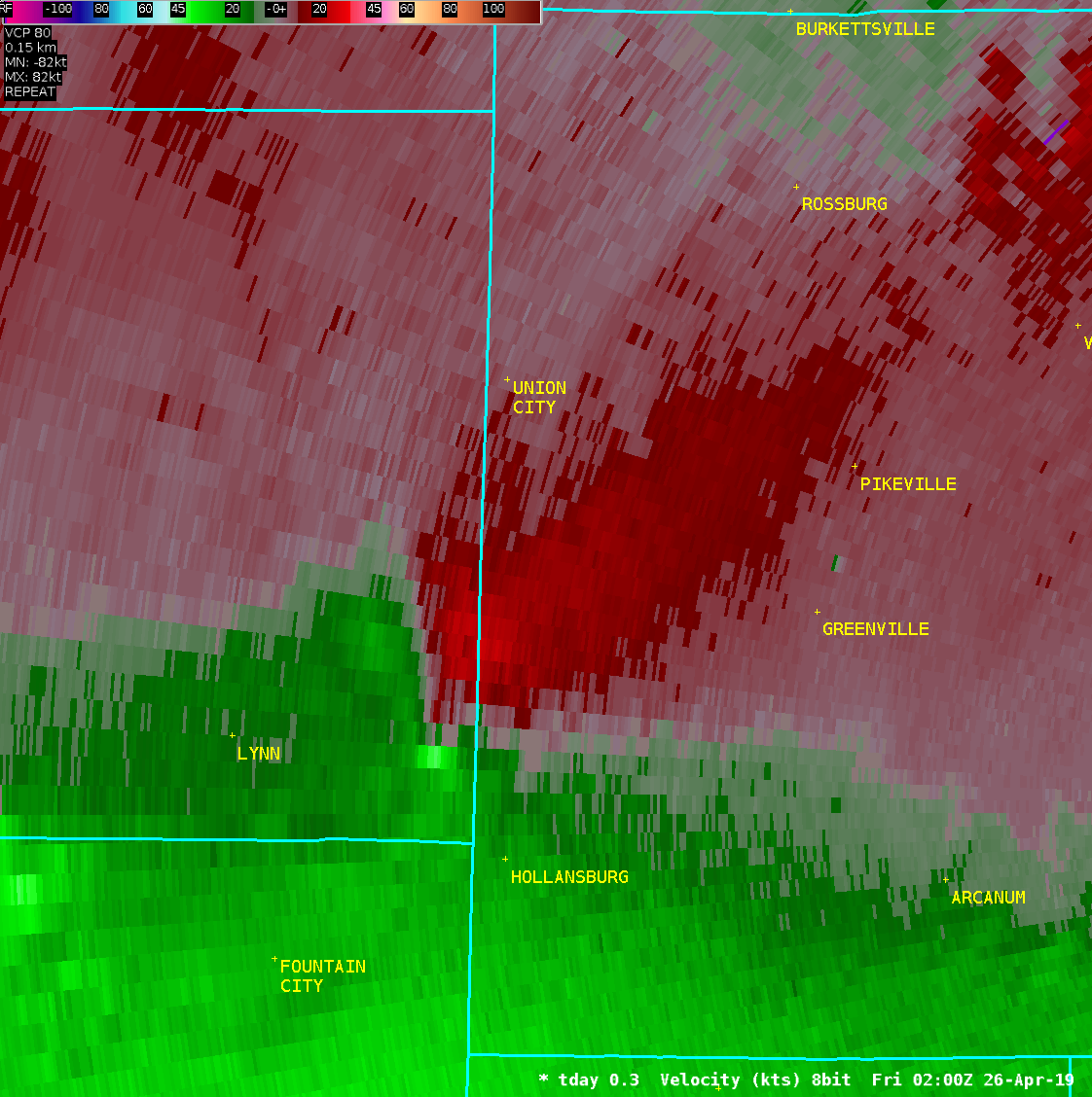
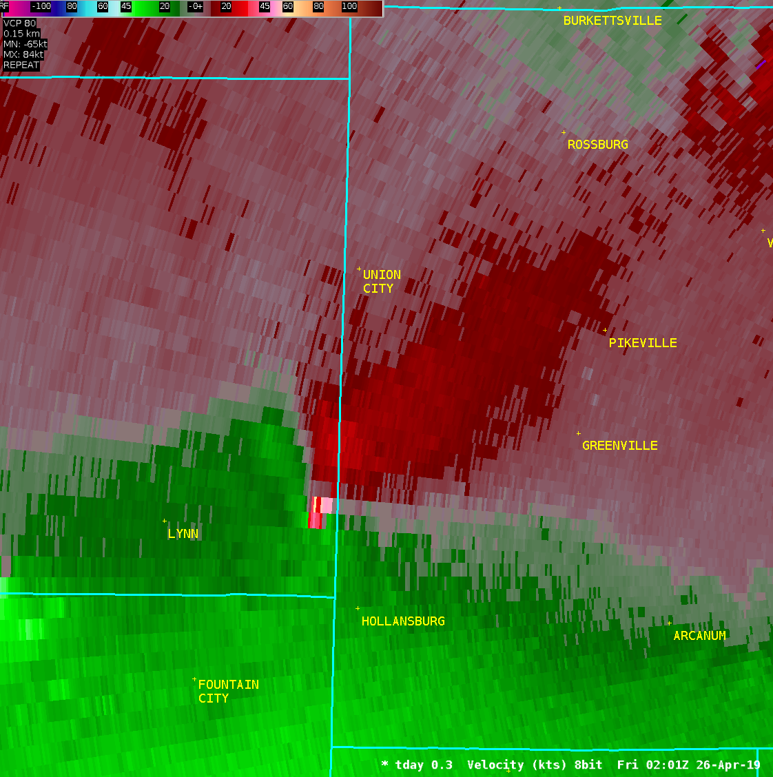
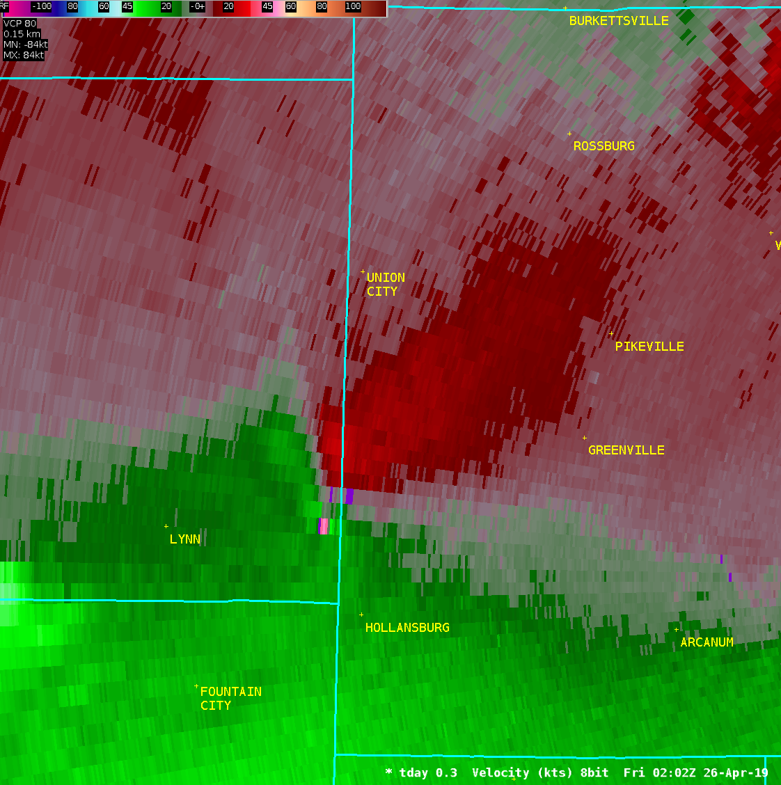
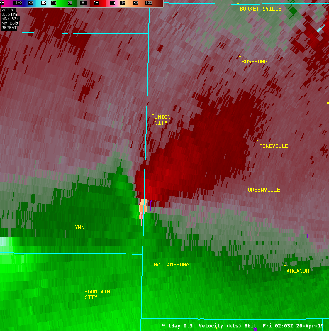
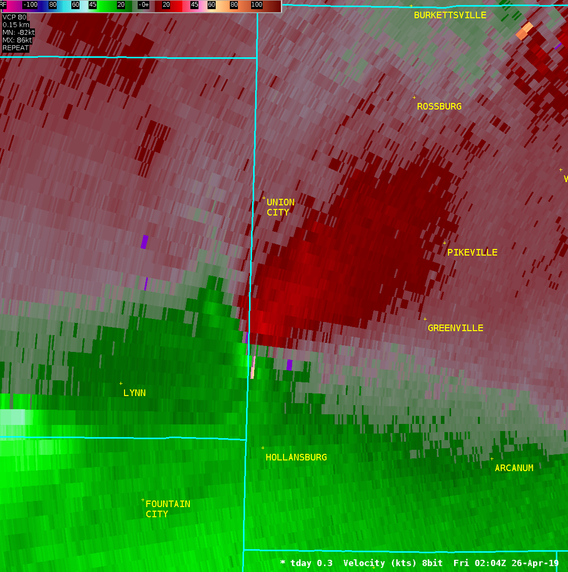
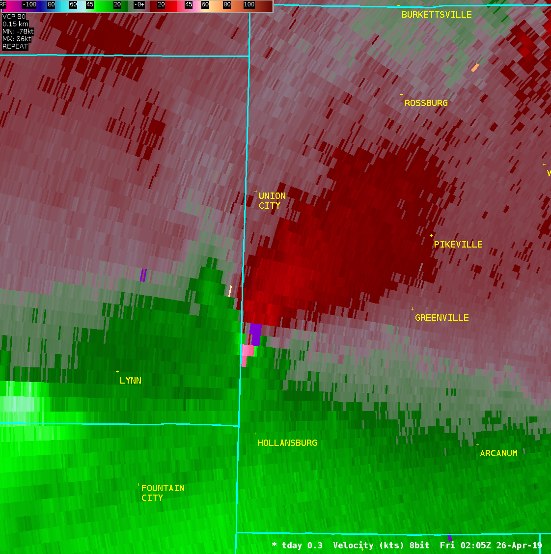
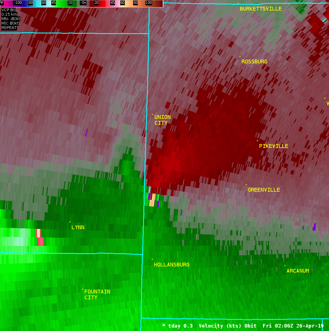
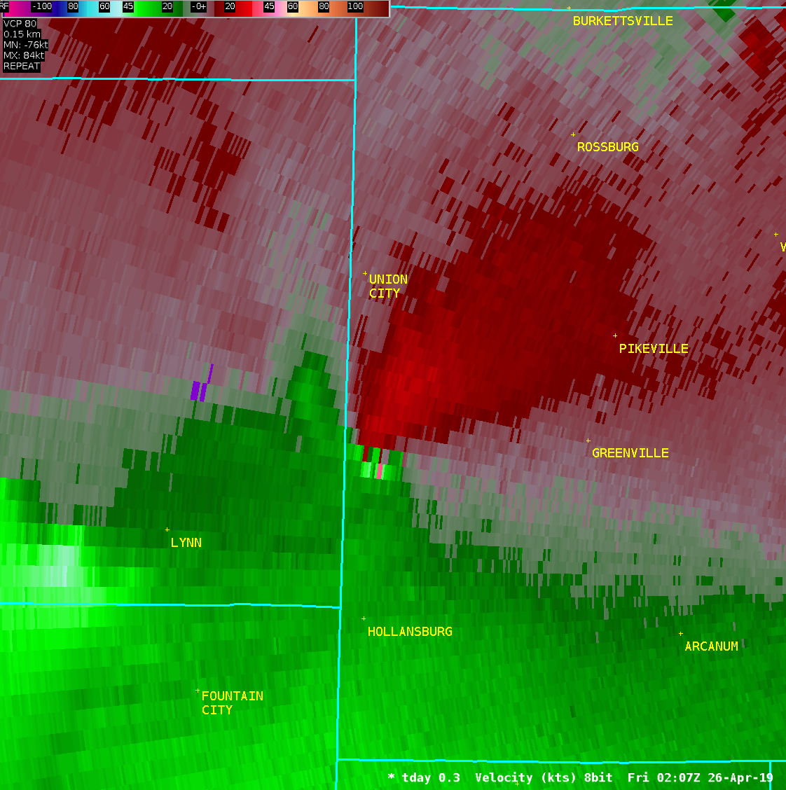
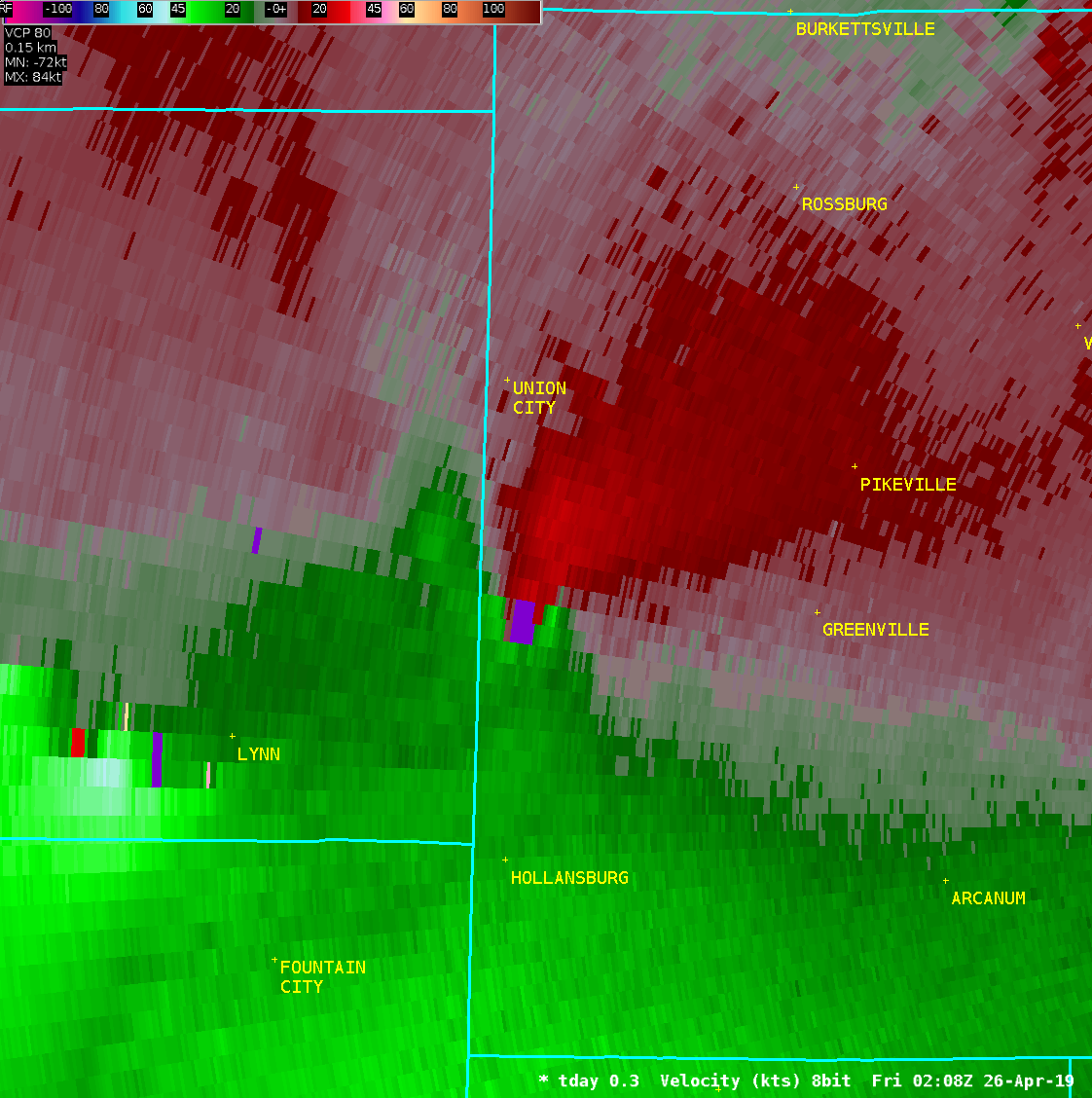
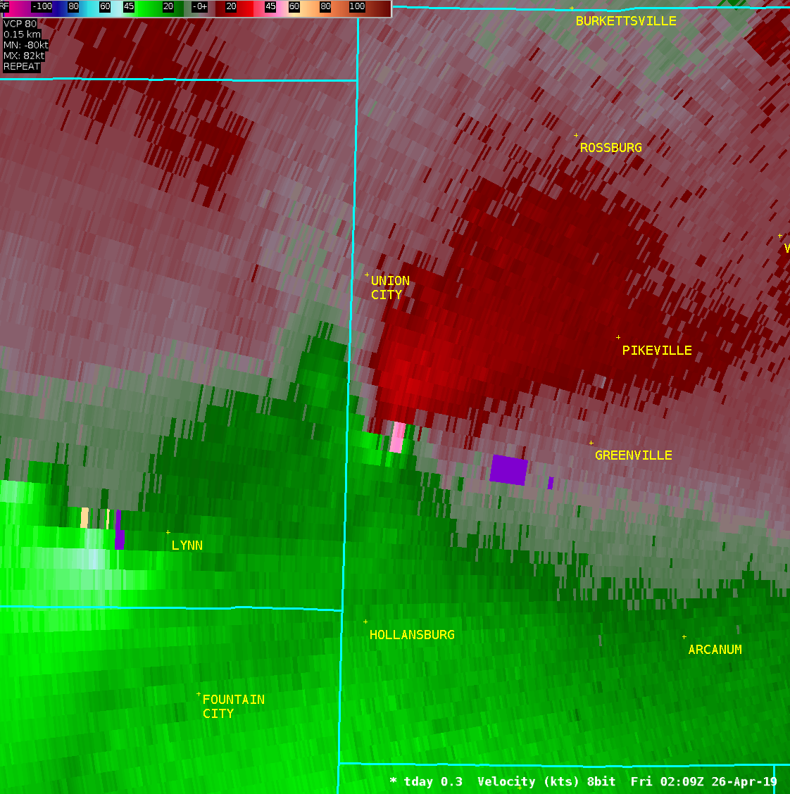
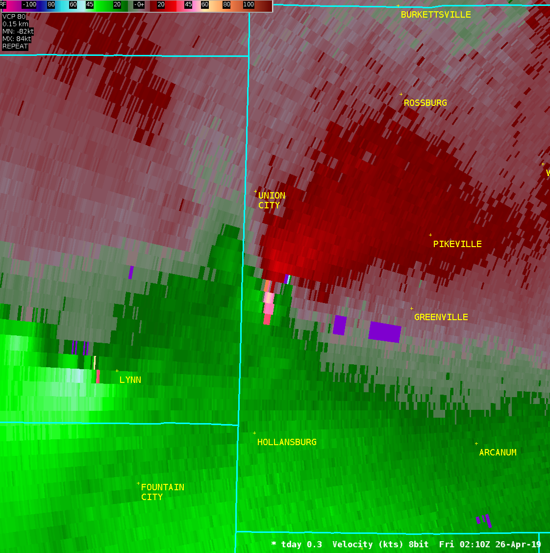
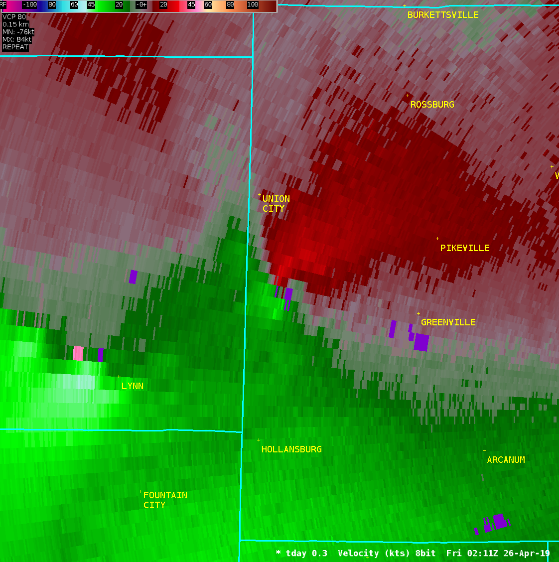
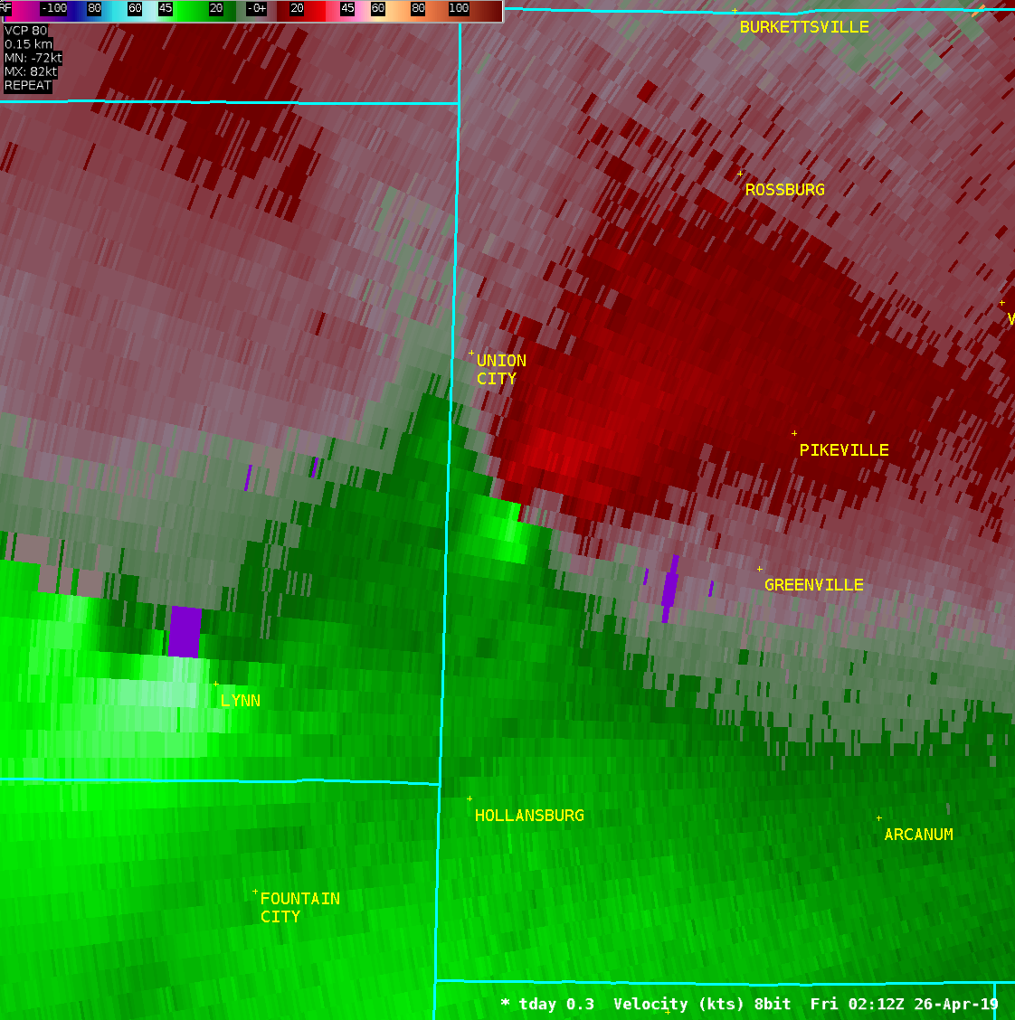
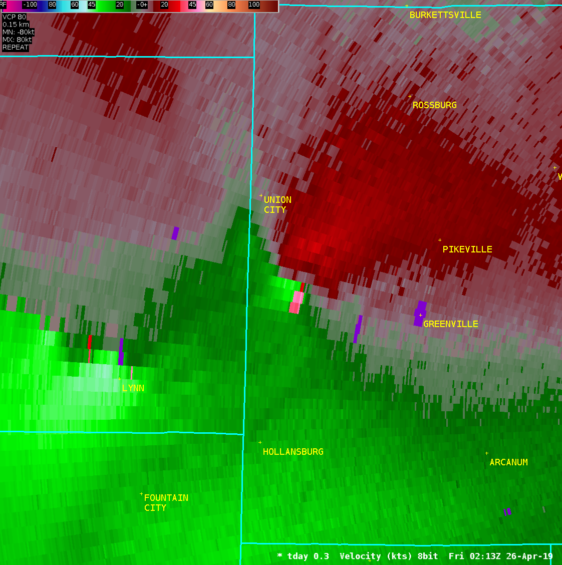
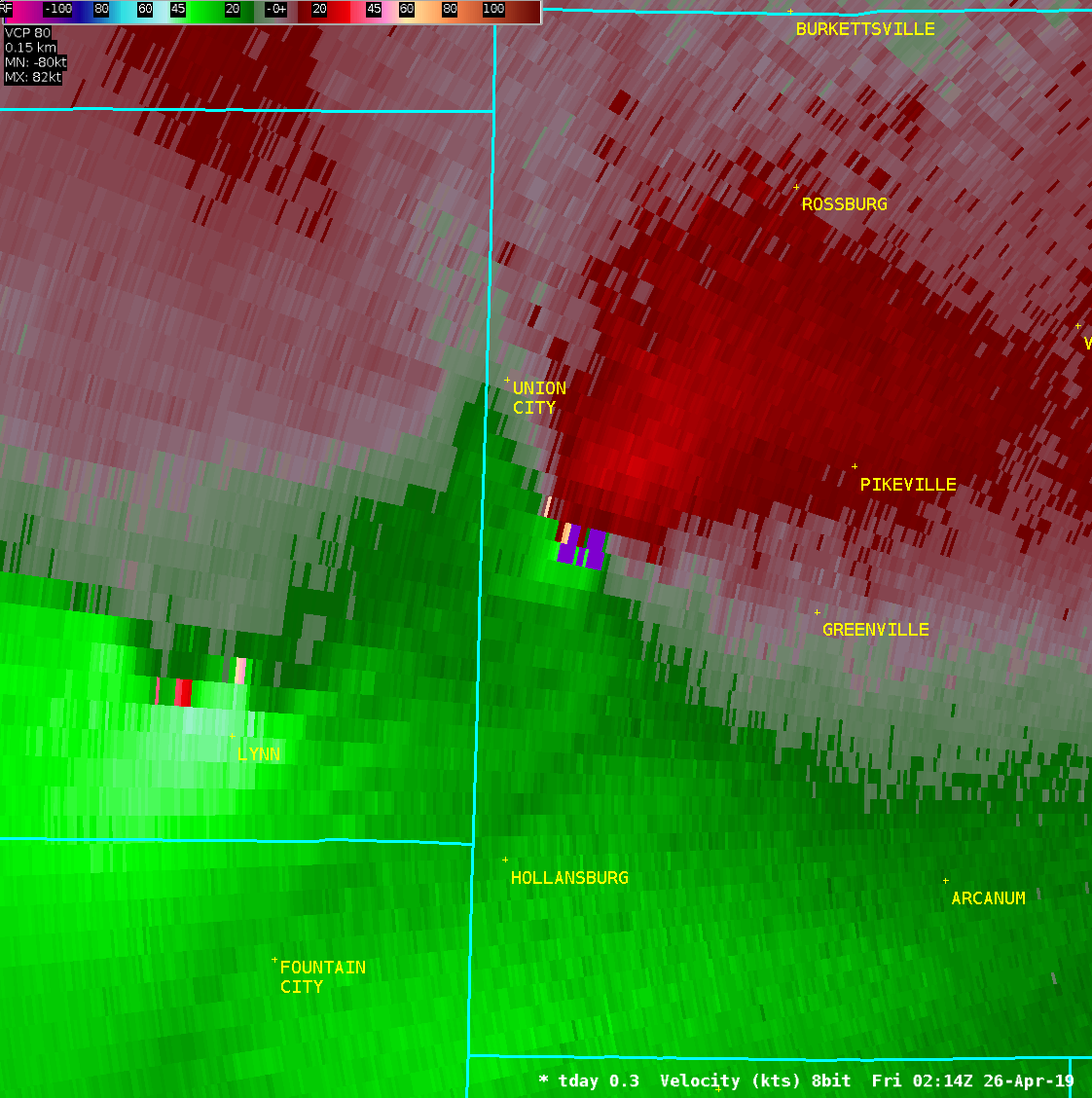
PUBLIC INFORMATION STATEMENT National Weather Service Wilmington OH 418 PM EDT Fri Apr 26 2019 ...EF0 TORNADO CONFIRMED IN WEST CENTRAL DARKE COUNTY OHIO... Location...7 miles west of Greenville in Darke County OH Date...........................April 25 2019 Start Time.....................1007 PM End Time.......................1009 PM Maximum EF-Scale Rating........EF0 Estimated Maximum Wind Speed...70 mph Maximum Path Width.............80 yards Path Length....................1 mile Beginning Lat/Lon..............40.0945 / -84.7771 Ending Lat/Lon.................40.1067 / -84.7673 * Fatalities...0 * Injuries.....0 The National Weather Service office in Wilmington OH has confirmed that an EF0 tornado with estimated wind speeds of 70 mph touched down yesterday April 25 2019 in west central Darke County Ohio, 7 miles west of Greenville. The first evidence of a touchdown was observed at a residence just northwest of the intersection of Greenville-Nashville Road and Hillgrove-Southern Road. A wood and siding covering over the south- facing porch was lifted over the house and strewn for approximately 150 yards to the northeast. Roof damage also occurred, most likely resulting from the debris coming into contact with the roof. No debris spatter was observed on the opposite side of the house, but the debris remained confined to a narrow path approximately 75 yards wide. The uplift and convergence of the wood and siding porch debris was deemed consistent with damage caused by a 70 mph EF0 tornado. The tornado then appeared to lift, before causing very minor tree damage along Hillgrove-Southern Road between Greenville-Nashville Road and State Route 502. This damage was likely caused by low-end EF0 winds of no more than 65 mph. The tornado then lifted again, with evidence of an additional touchdown just east of the State Route 502 and Hillgrove-Southern Road intersection. Two Locust trees approximately 18 inches in diameter were snapped, and one pine tree approximately 30 feet tall was uprooted. Minor roof damage also occurred on the nearby house and outbuildings. The Locust trees were not completely solid, with some rot in the center of both trees. This damage was deemed consistent with 65-70 mph winds of an EF0 tornado. The NWS in Wilmington Ohio would like to thank the Darke County EMA for their assistance with this damage survey. EF Scale: The Enhanced Fujita Scale classifies tornadoes into the following categories: EF0...Weak......65 to 85 mph EF1...Weak......86 to 110 mph EF2...Strong....111 to 135 mph EF3...Strong....136 to 165 mph EF4...Violent...166 to 200 mph EF5...Violent...>200 mph * The information in this statement is preliminary and subject to change pending final review of the event and publication in NWS Storm Data. $$ shobe2 |
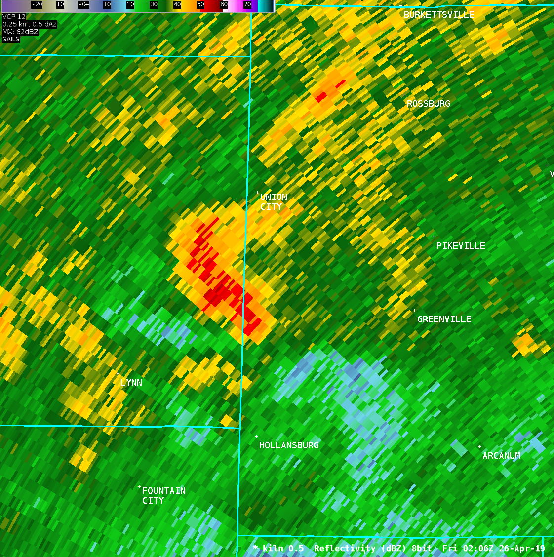
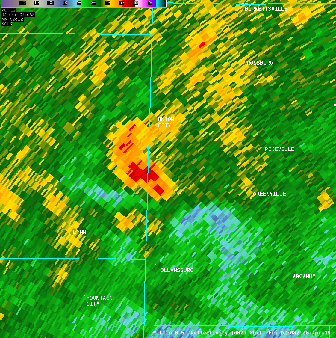
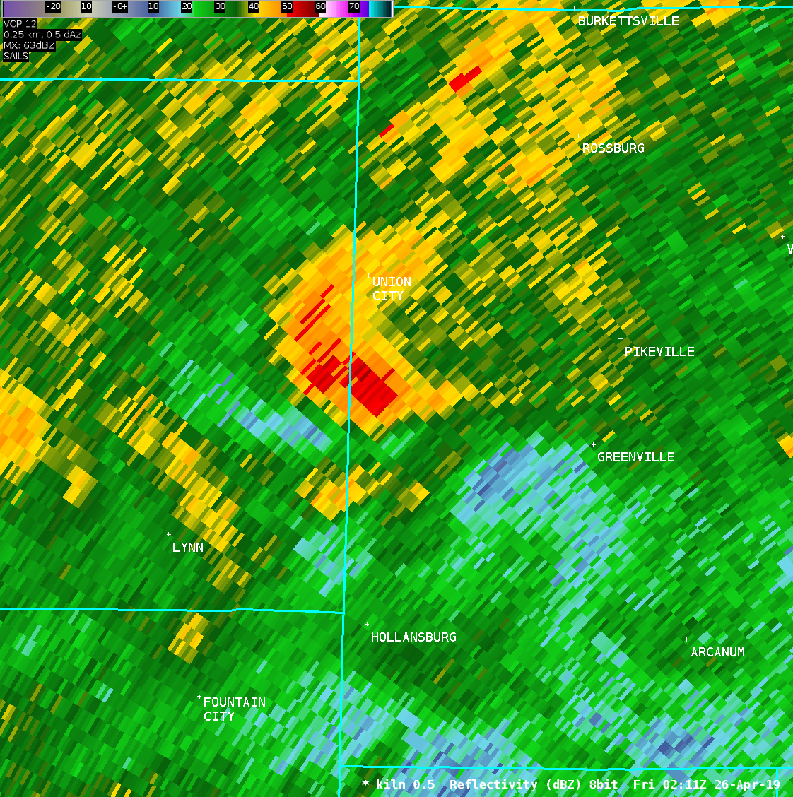
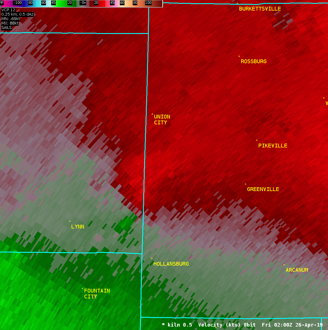
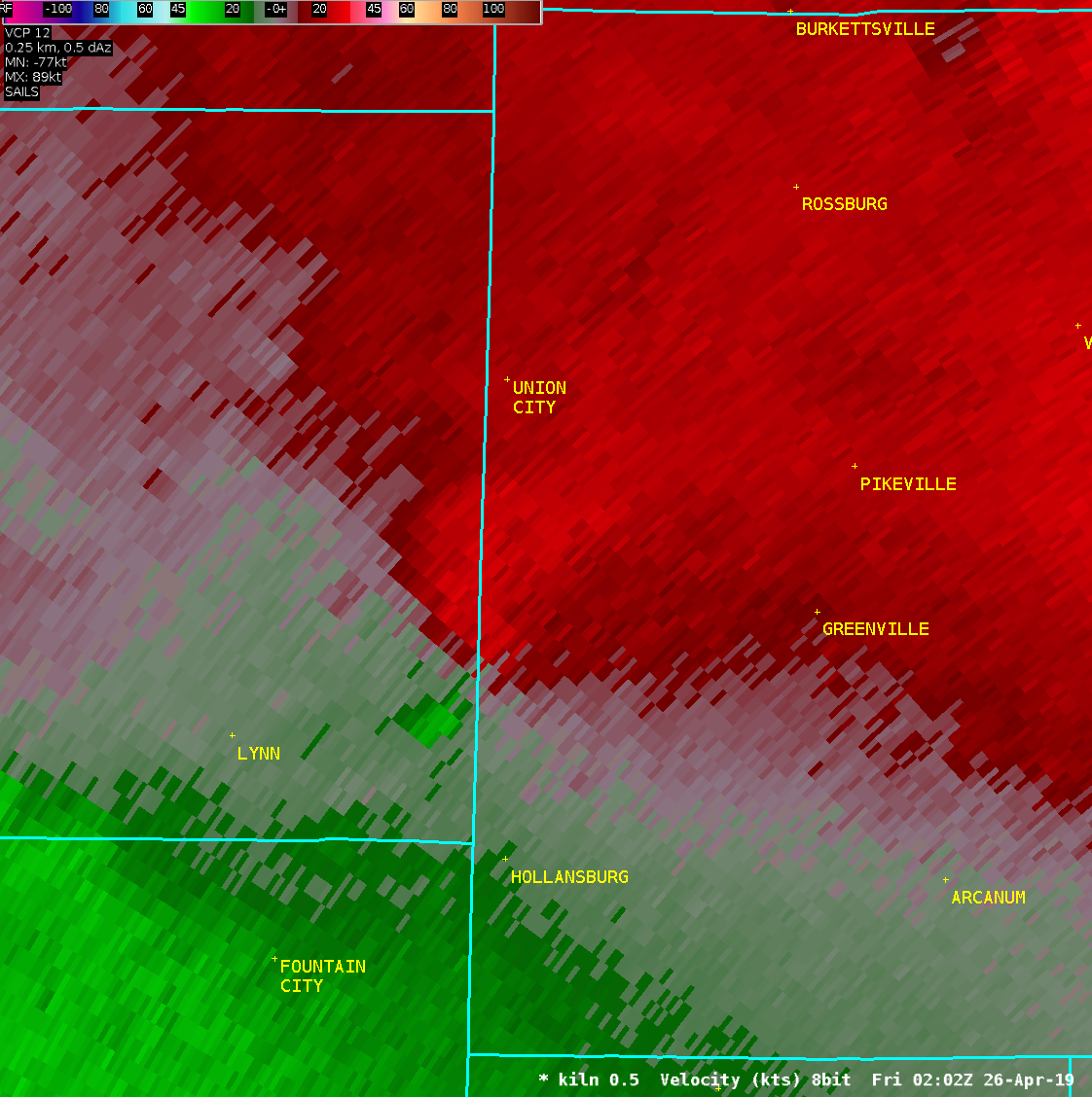
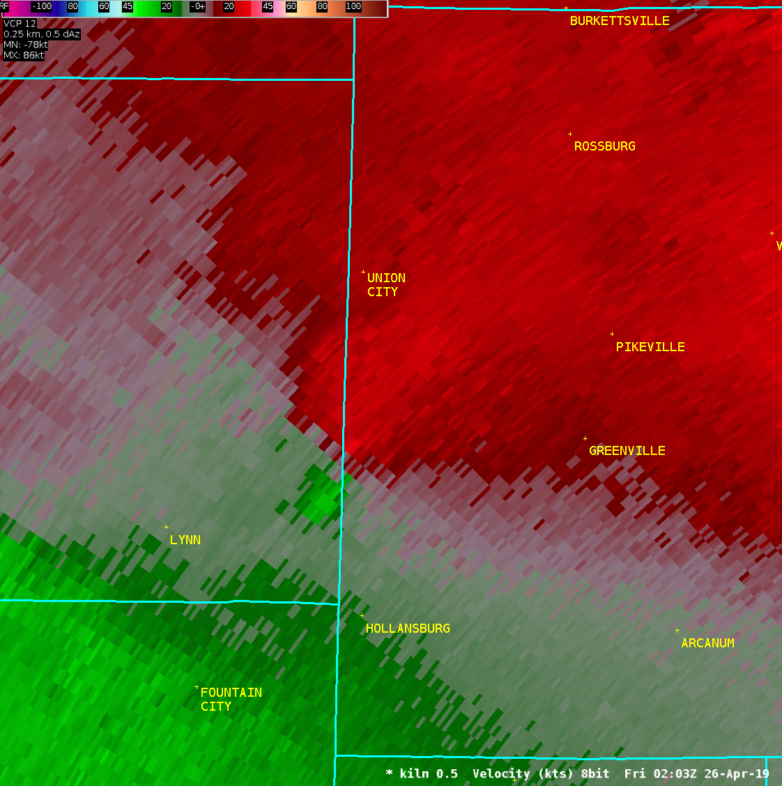
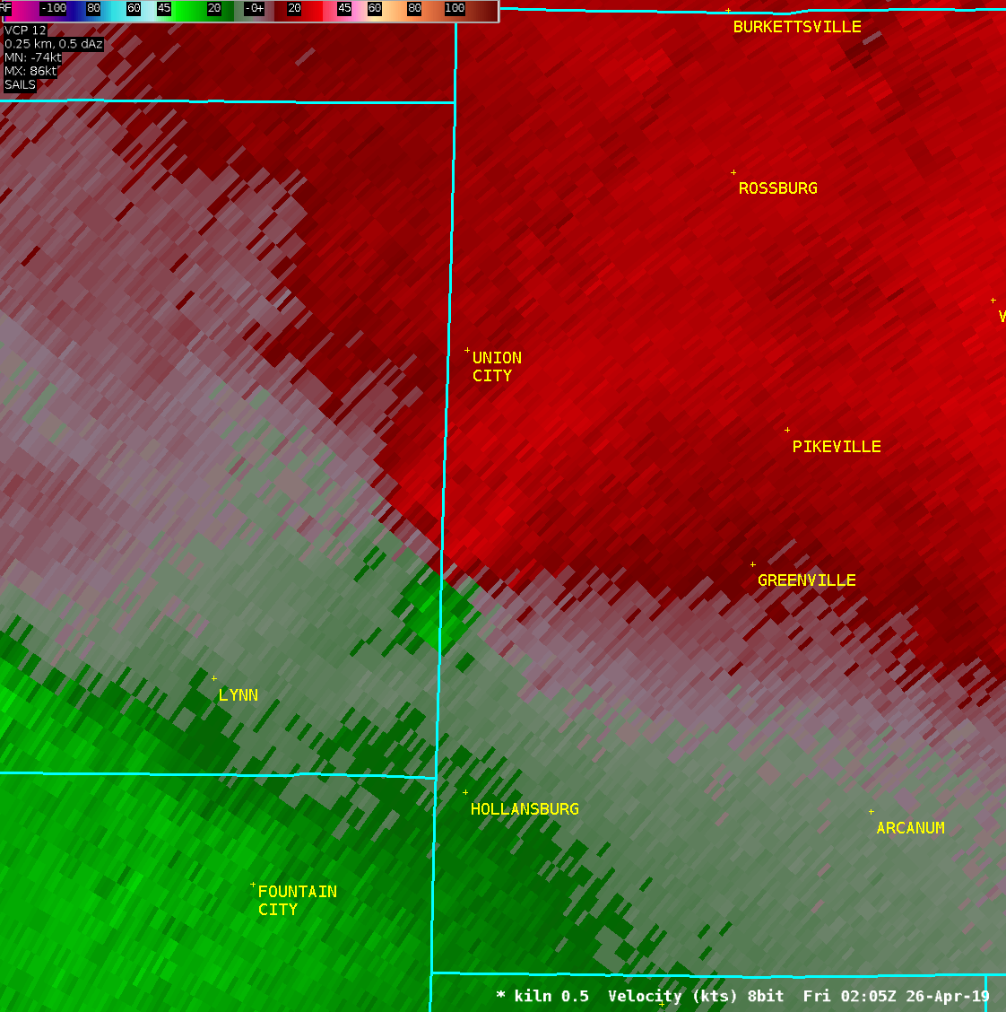
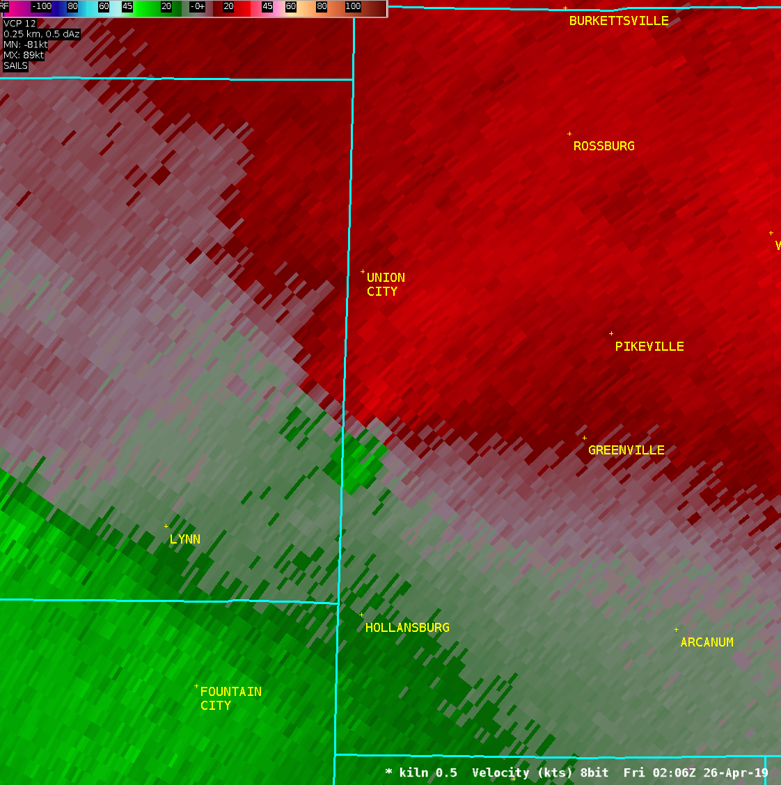
| Radar Loops | ||
| KILN 0.5° Reflectivity | KILN 0.5° Velocity | |
| 1 2 3 4 5 6 7 8 | 1 2 3 4 5 6 7 8 | |
| TDAY 0.3° Reflectivity | TDAY 0.3° Velocity | |
| 1 2 3 4 5 6 7 8 9 10 11 12 13 14 15 | Anim1 Anim2 | 1 2 3 4 5 6 7 8 9 10 11 12 13 14 15 | Anim1 Anim2 | |

