|
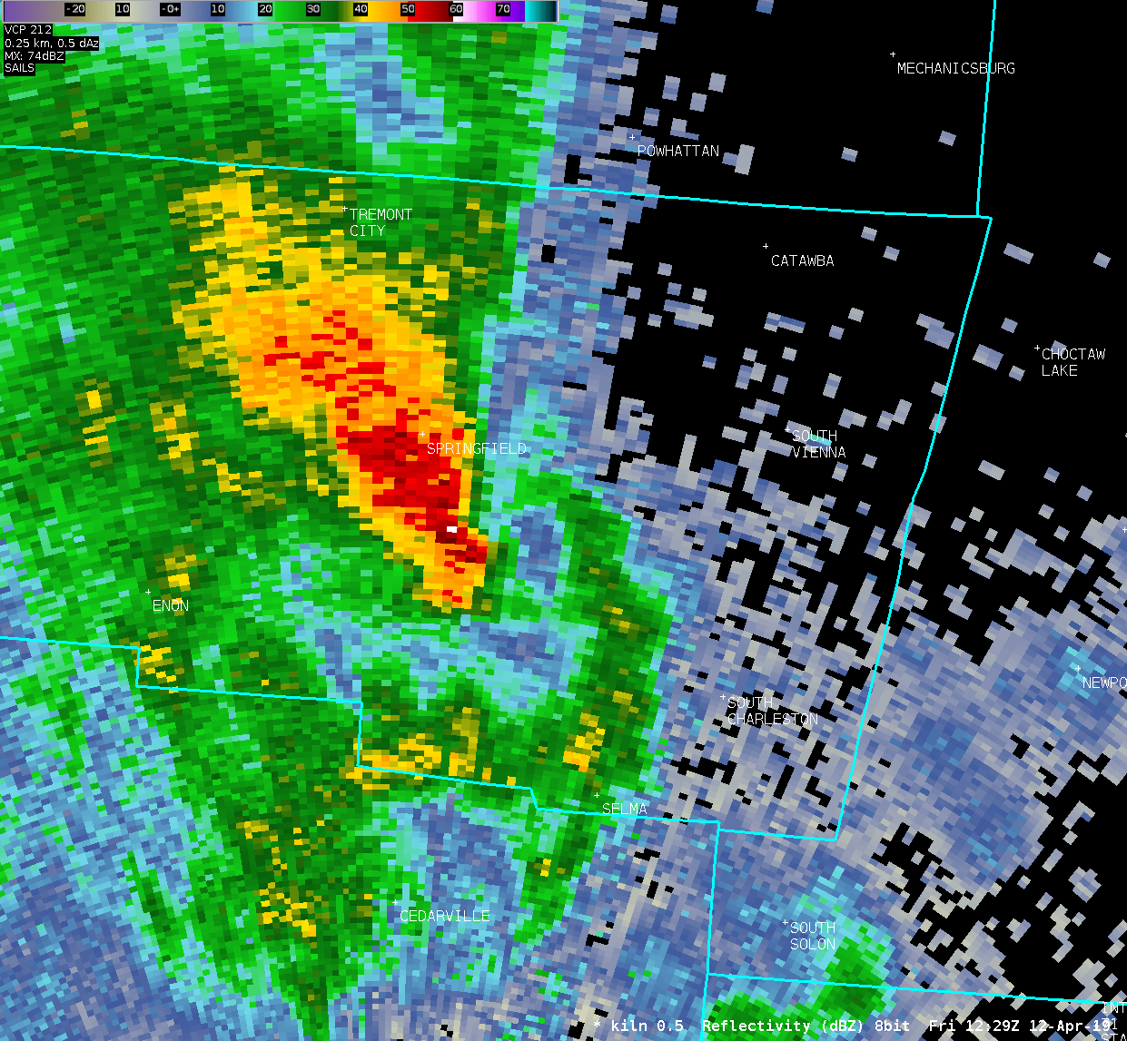
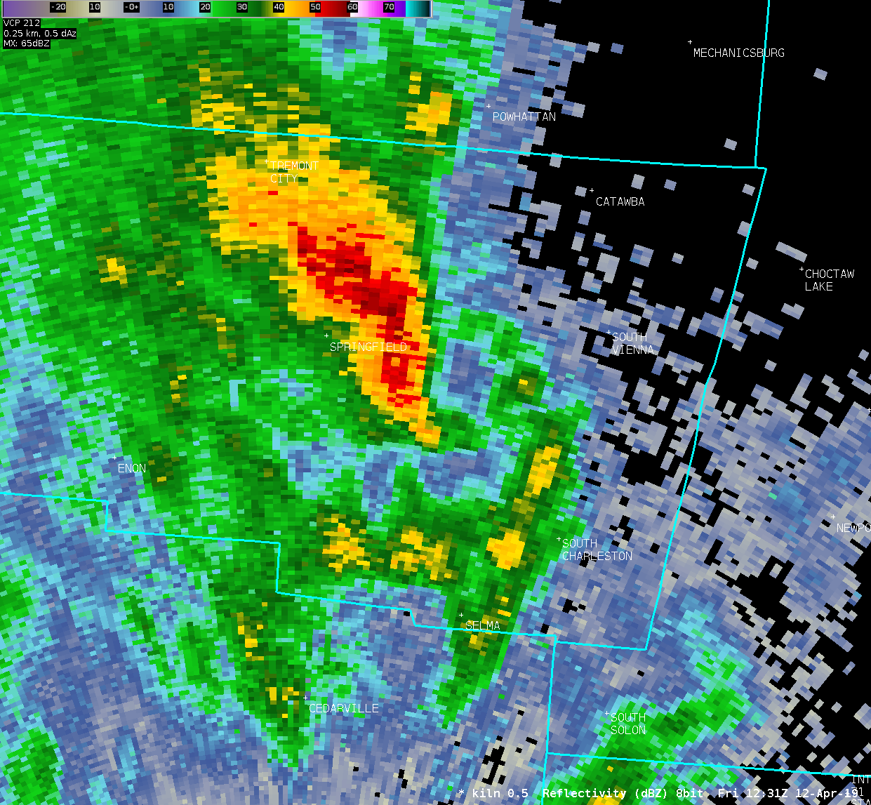
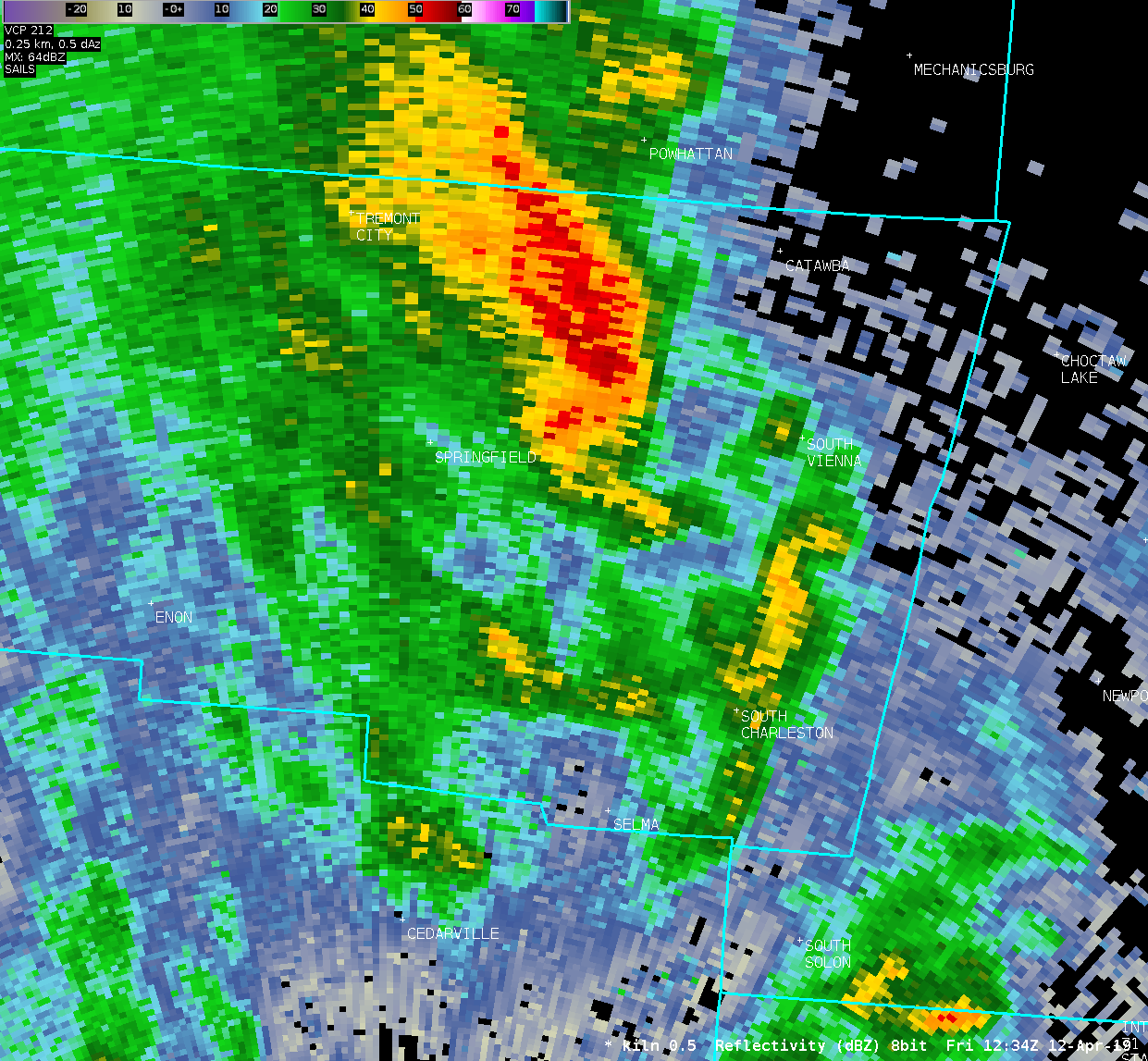
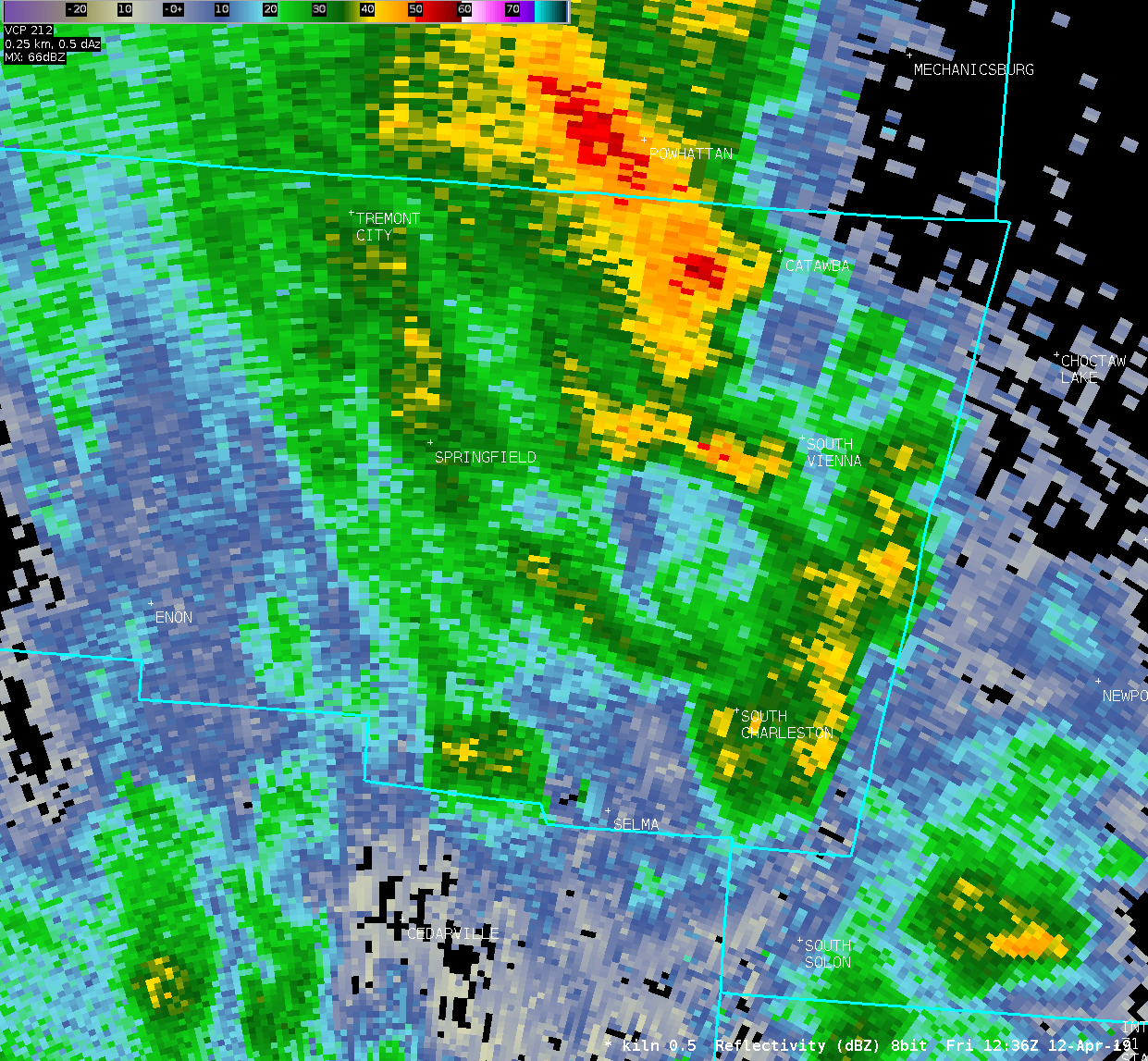
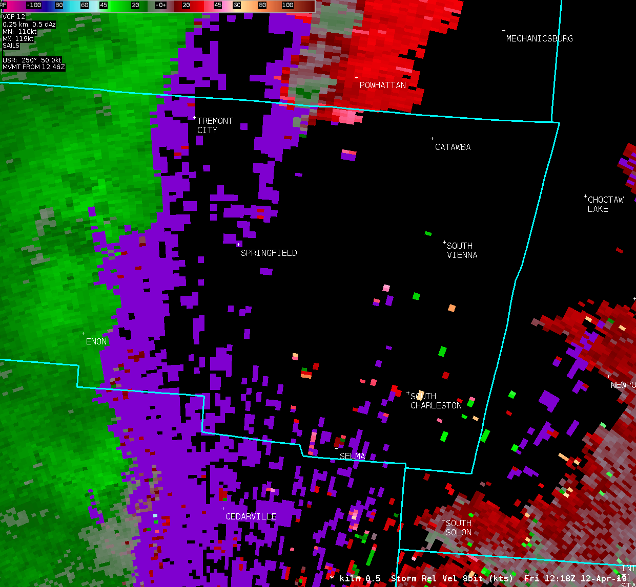
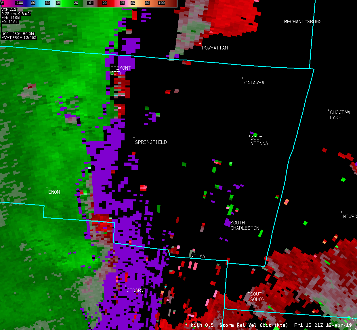
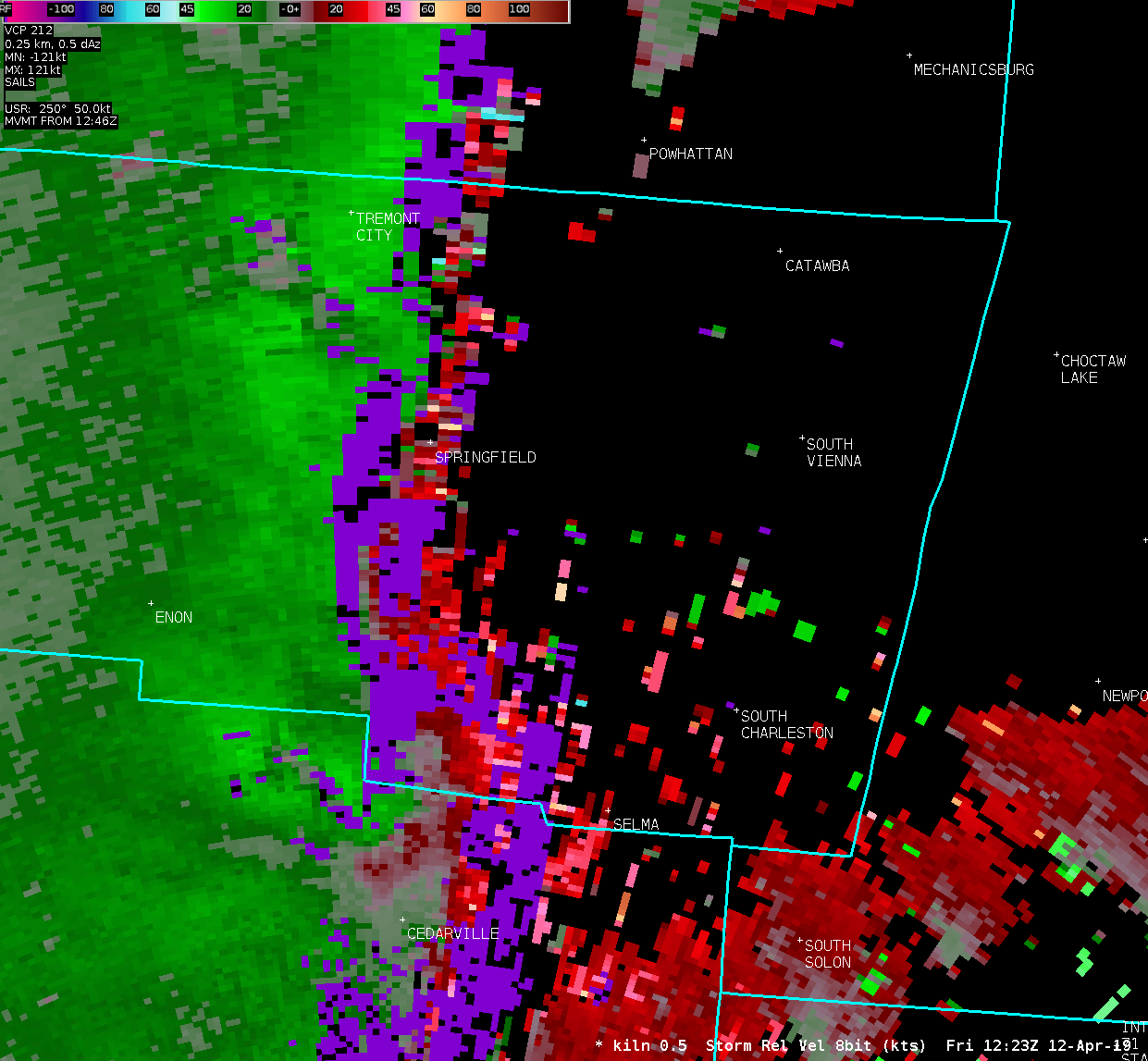
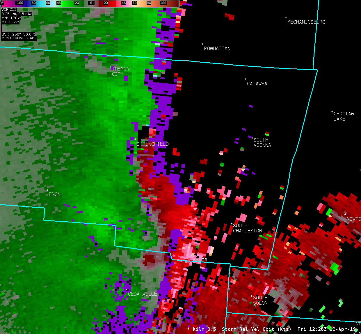
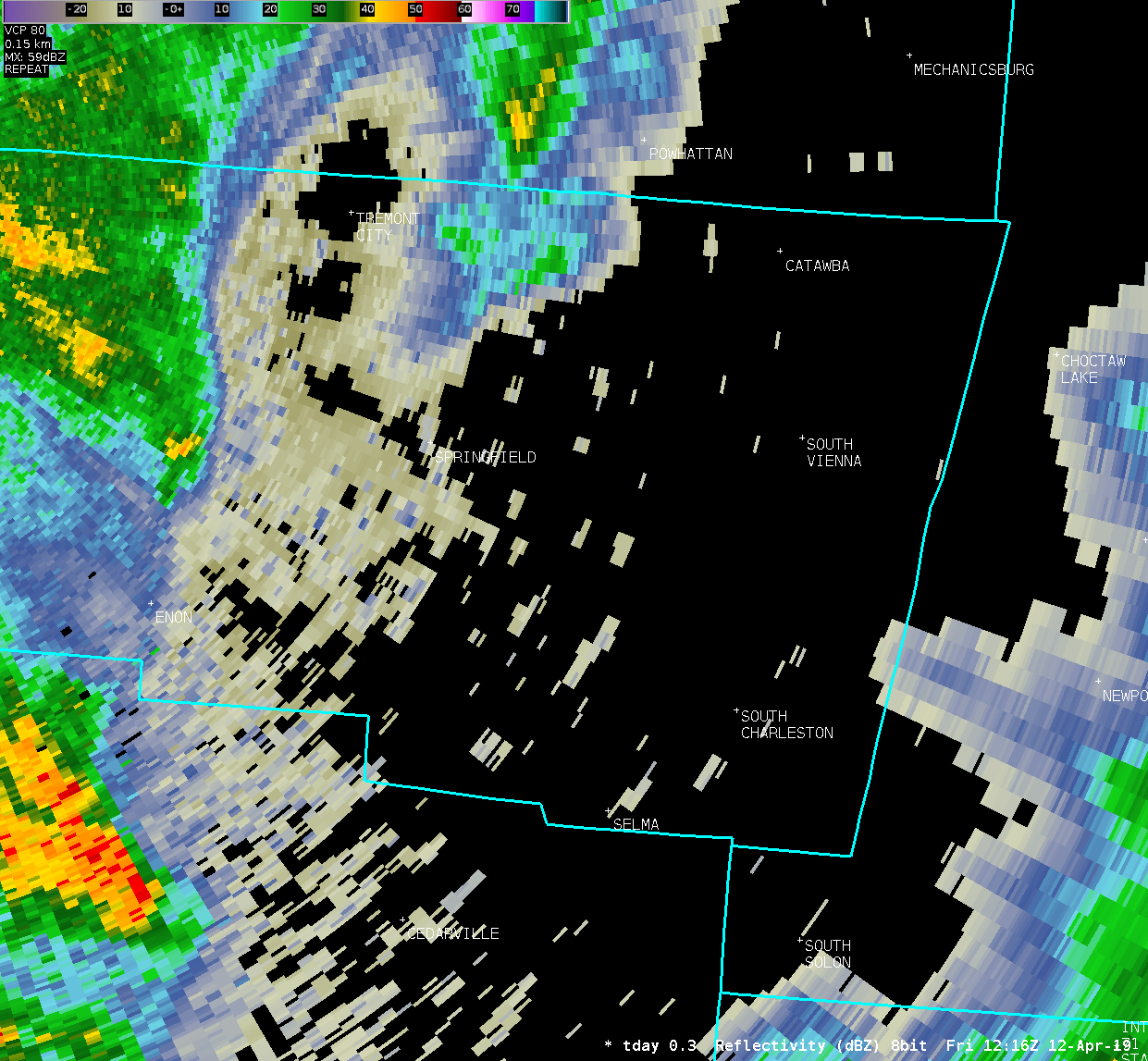
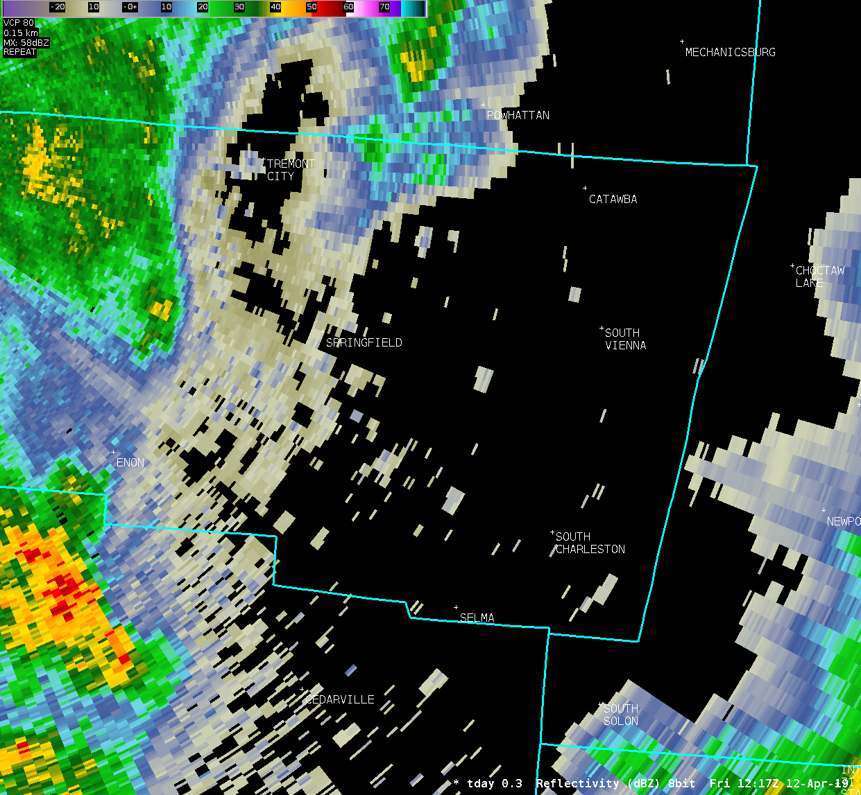
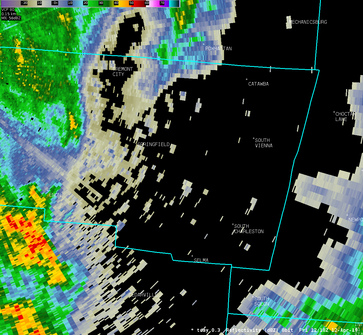
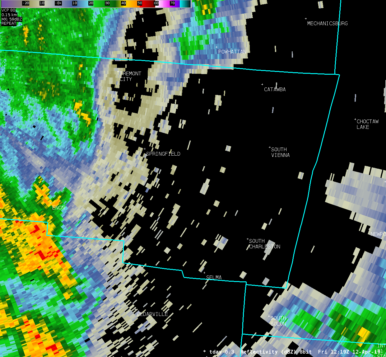
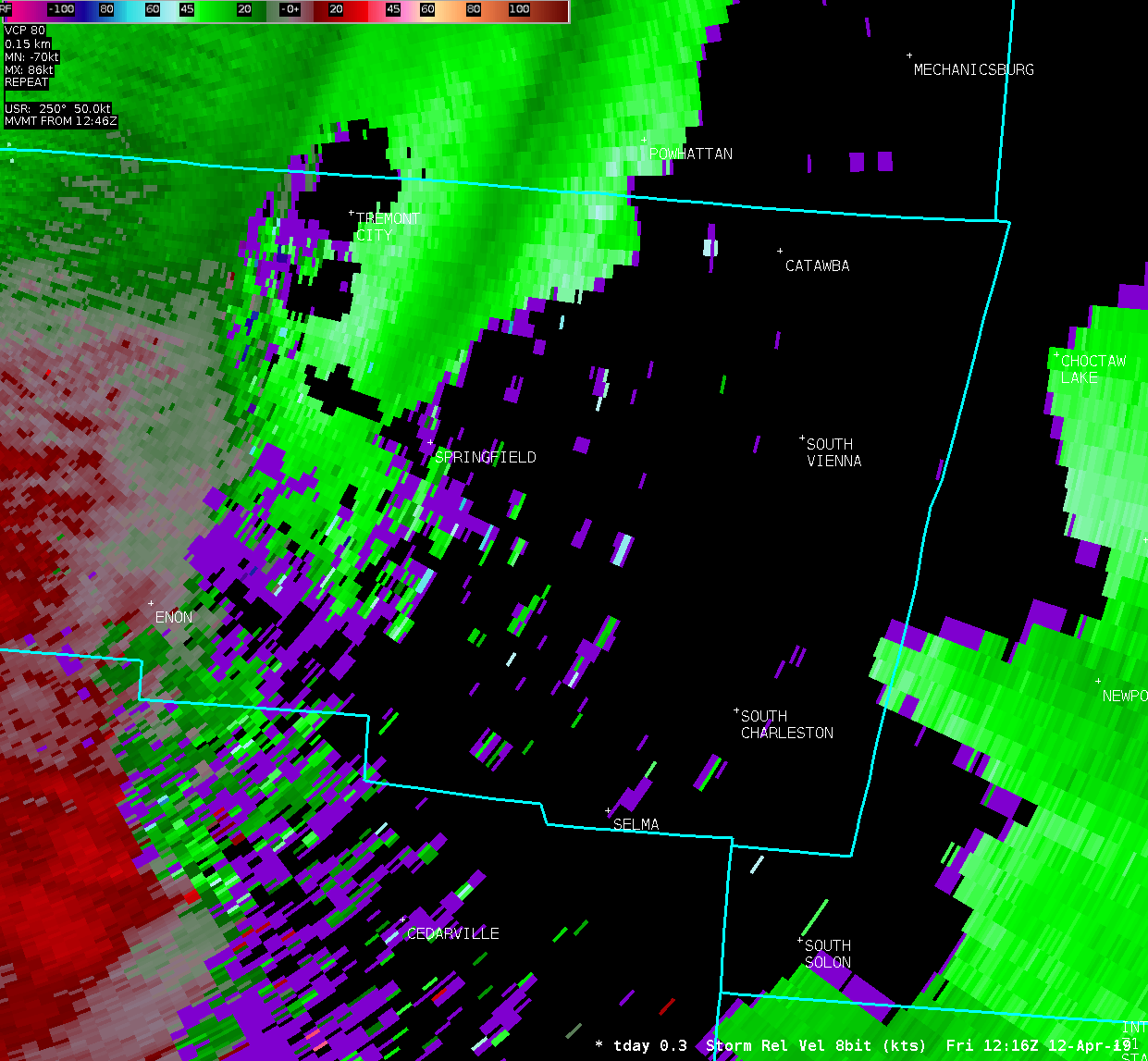
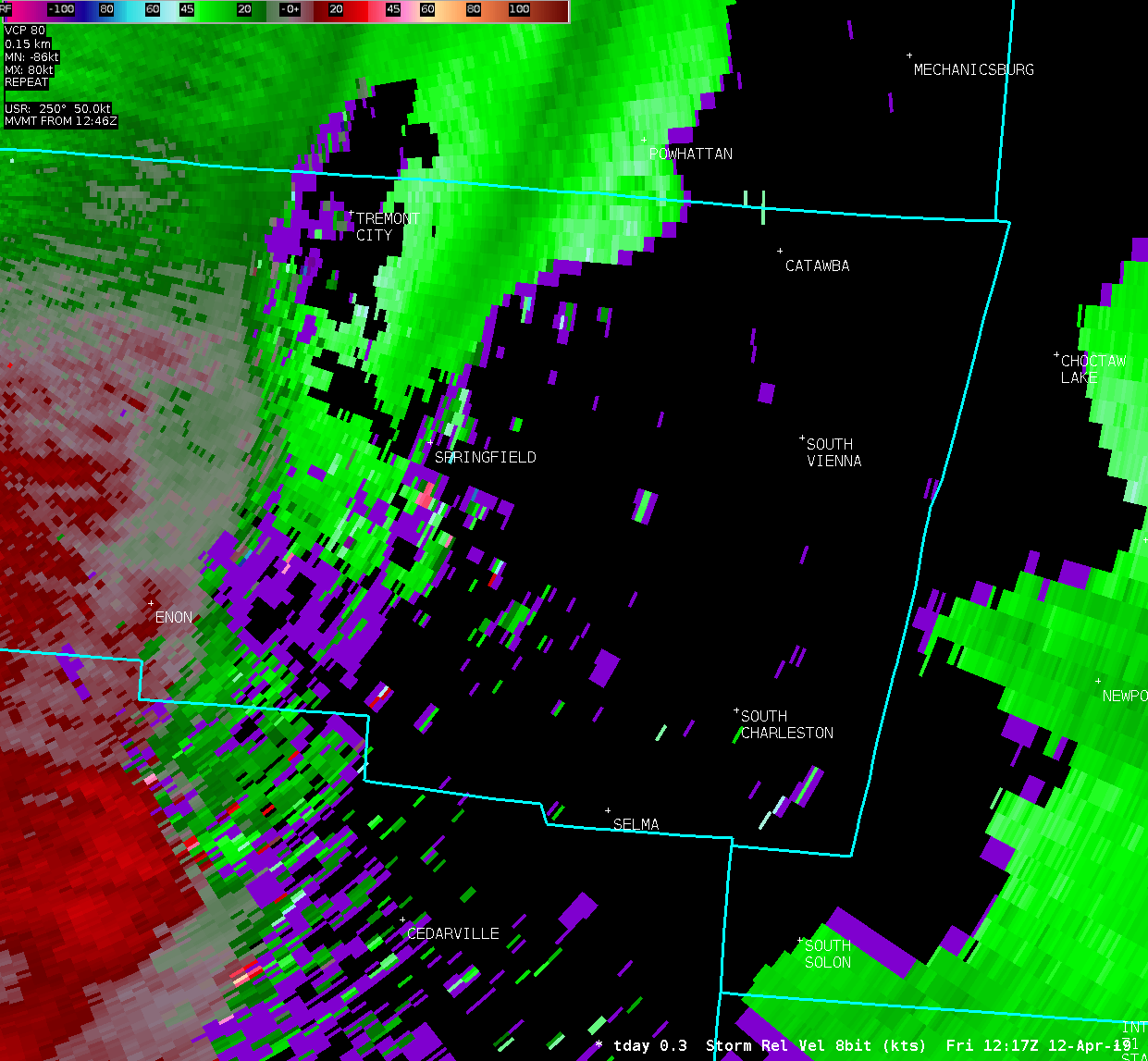
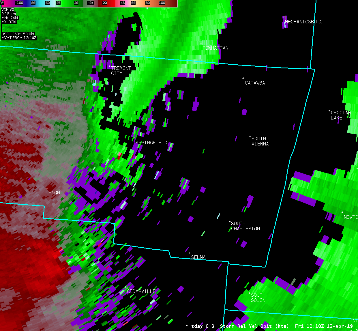
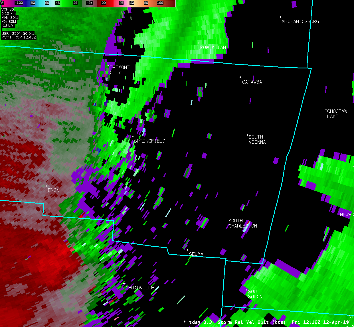
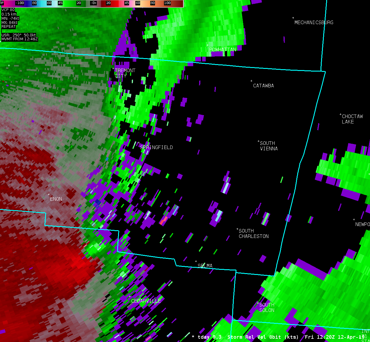
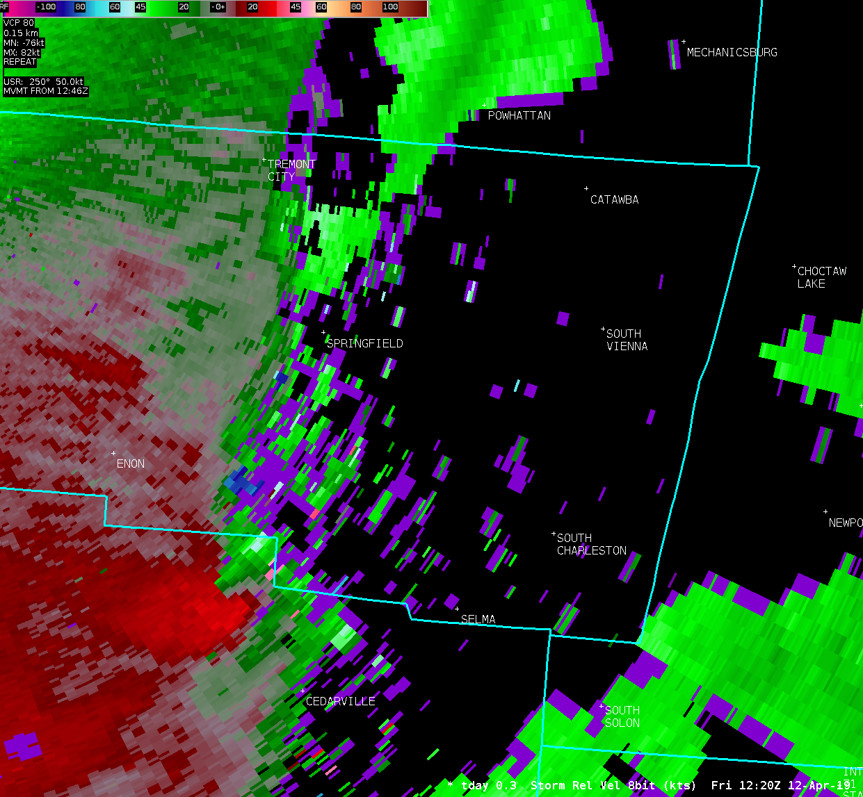
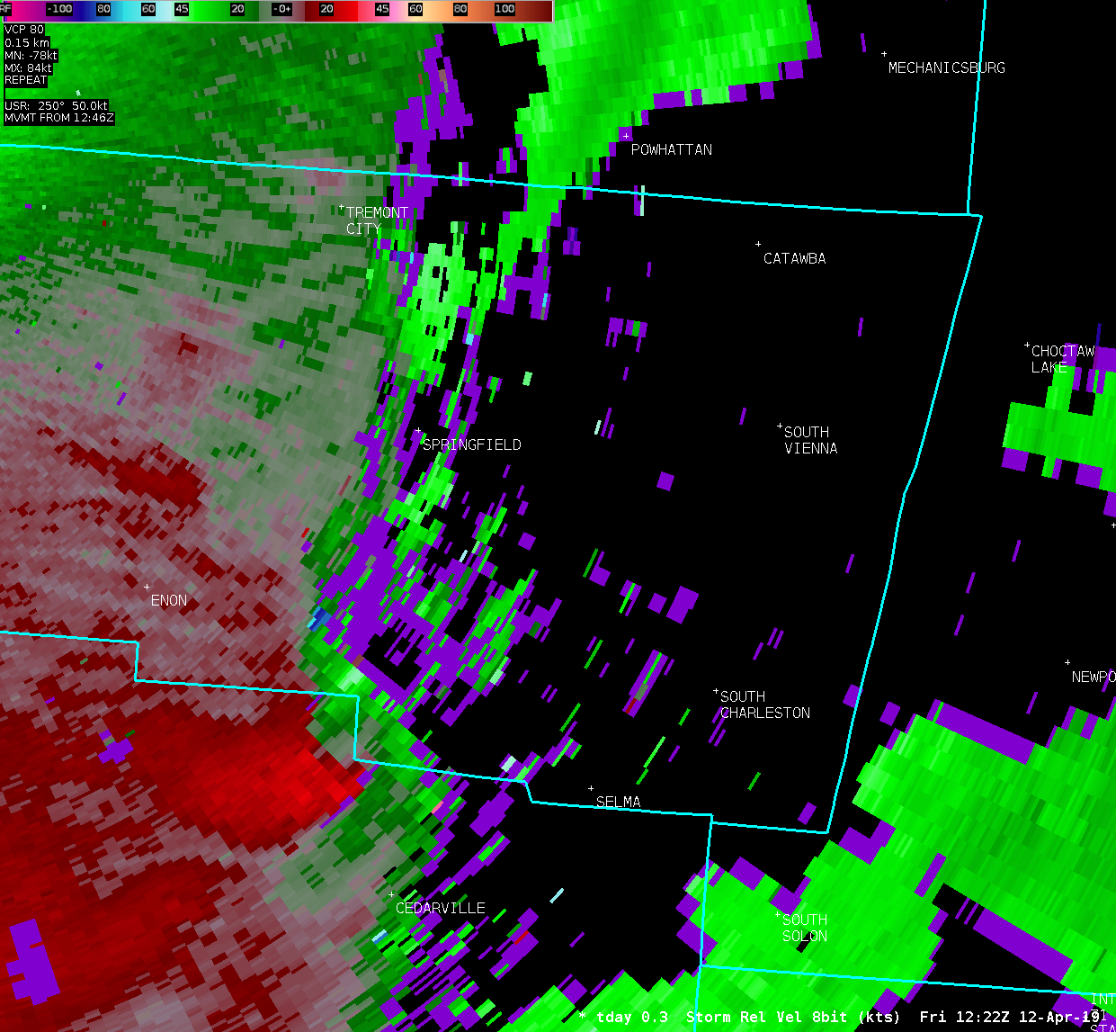
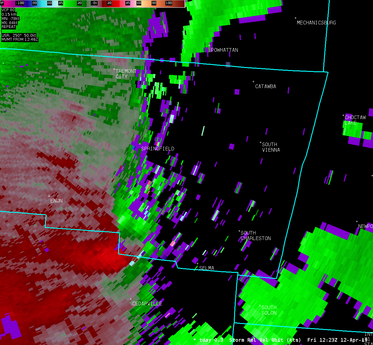
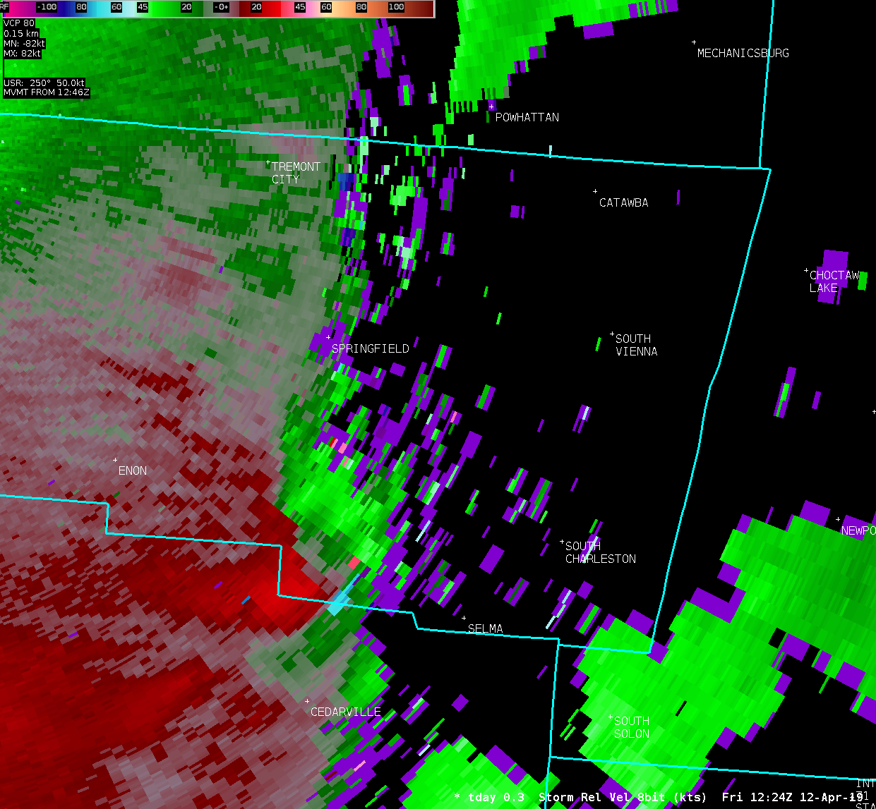
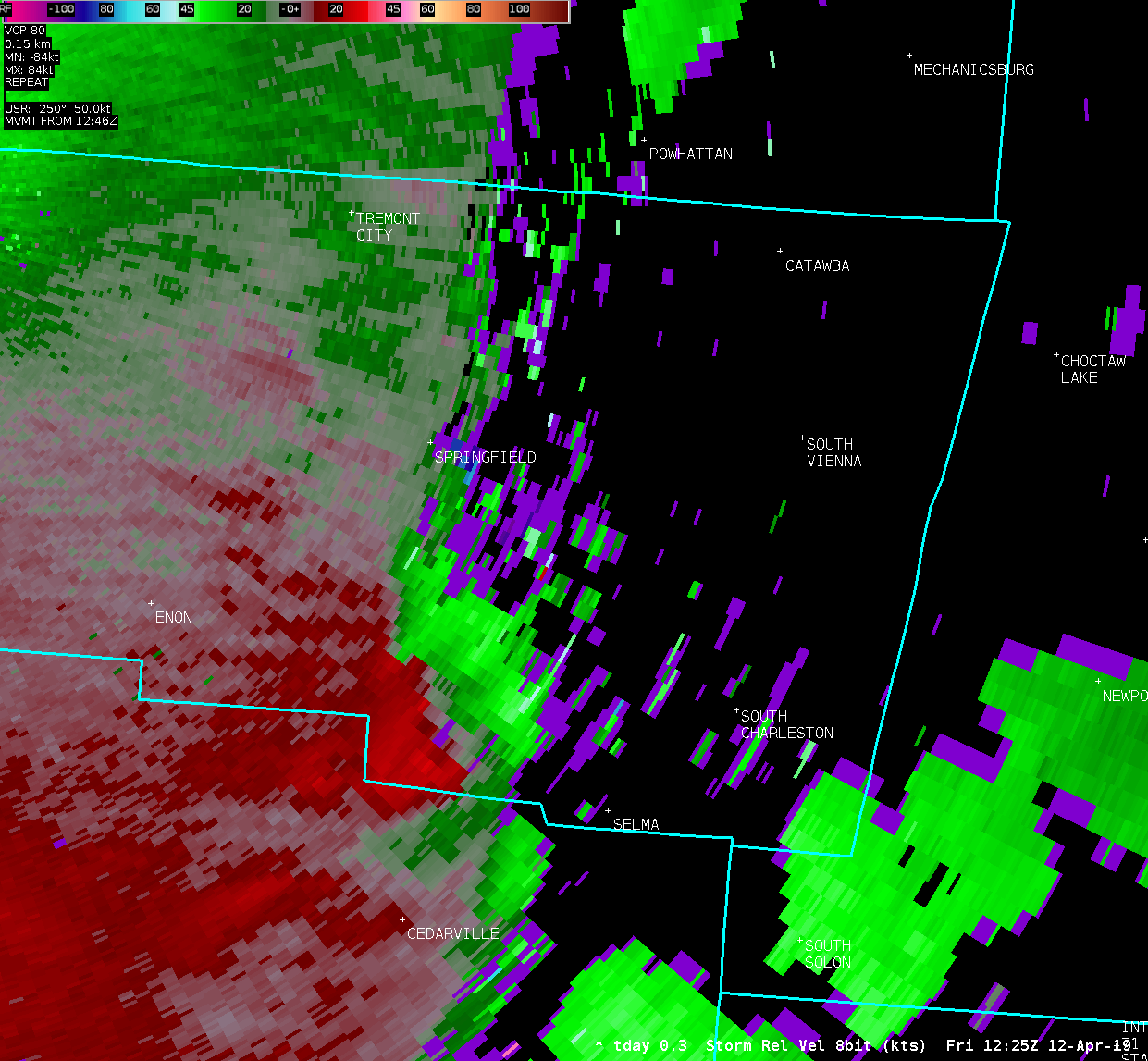
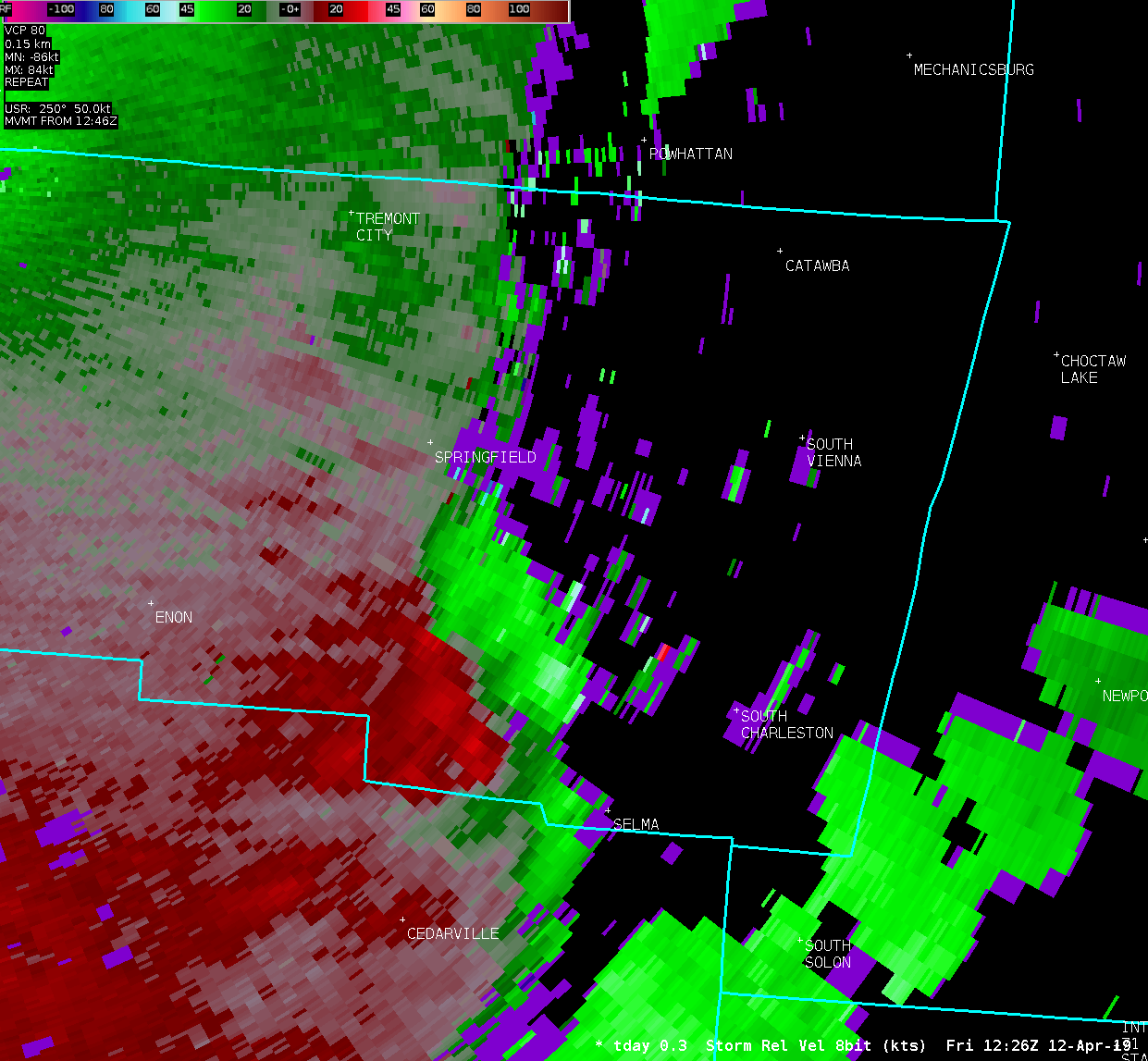
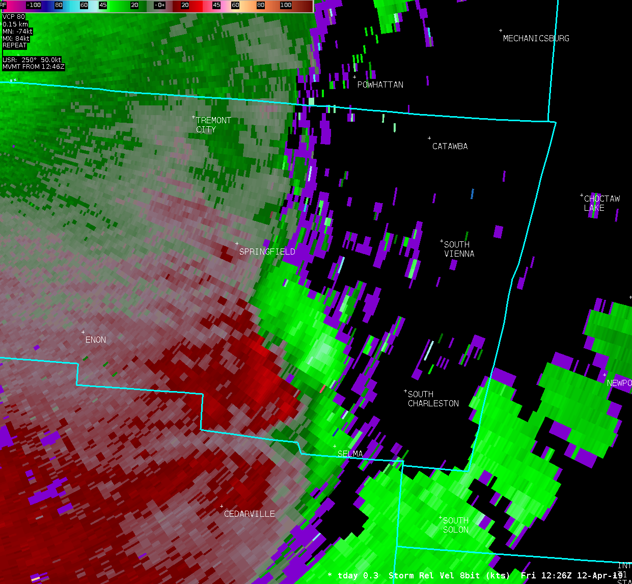
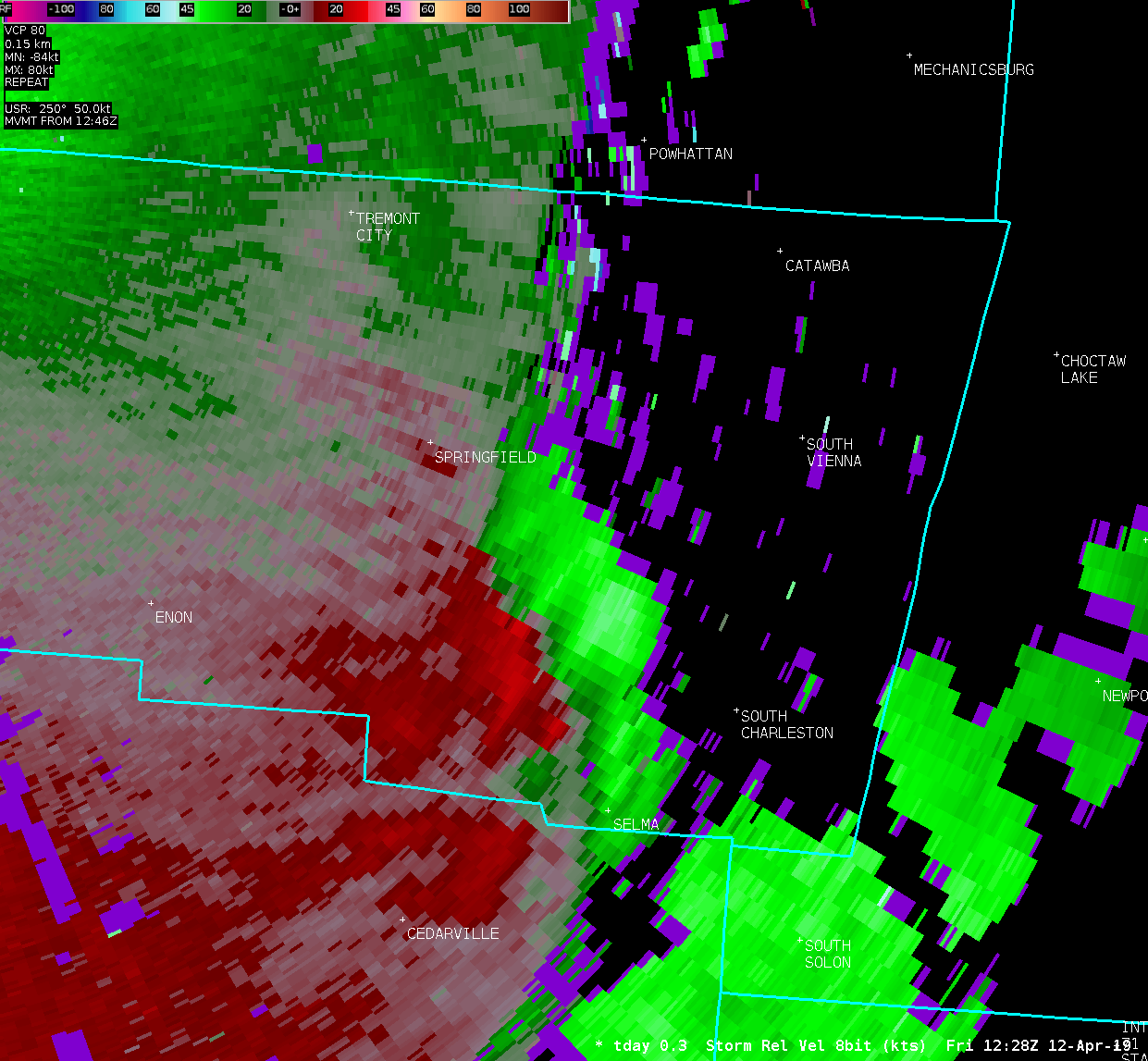
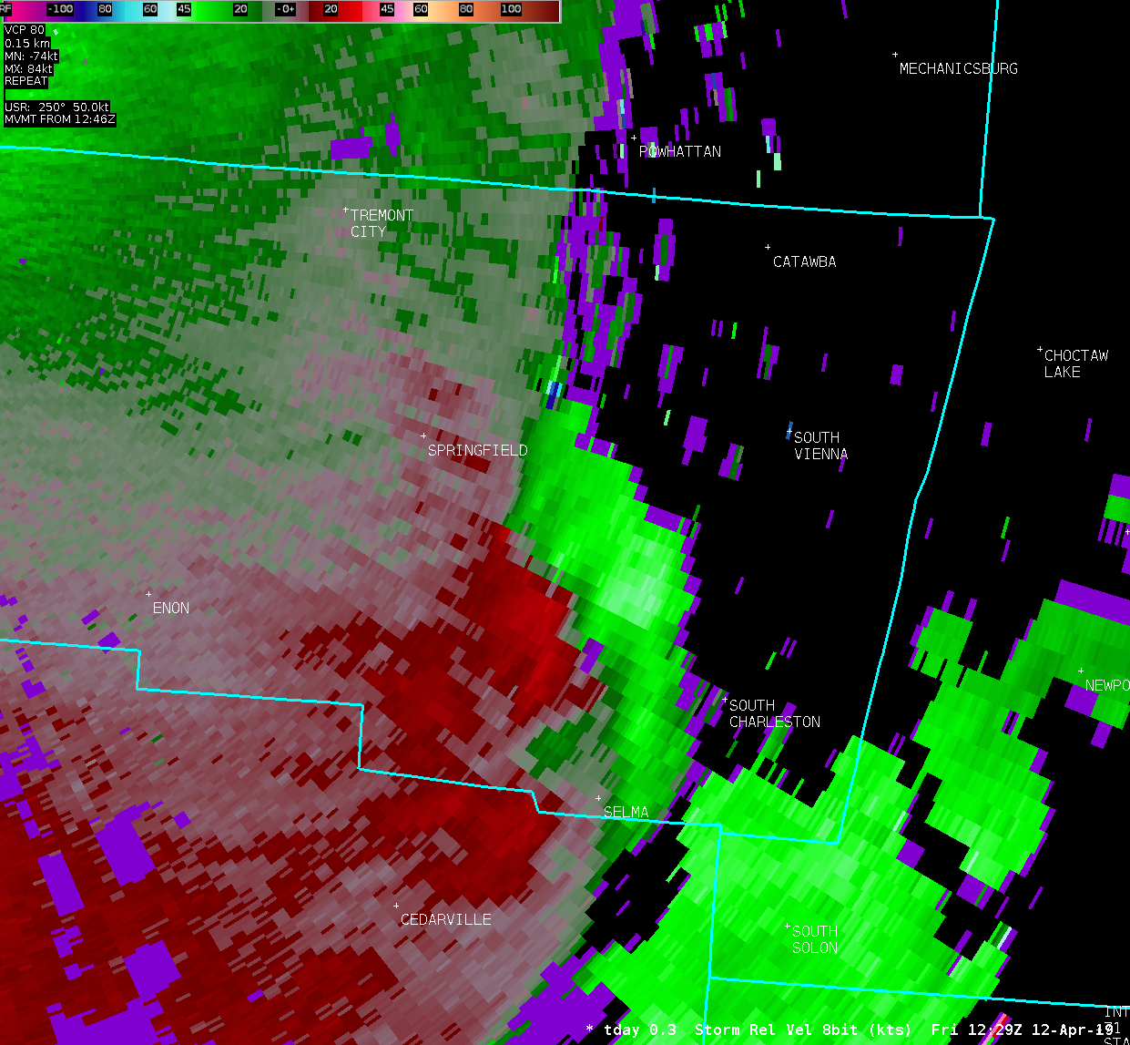
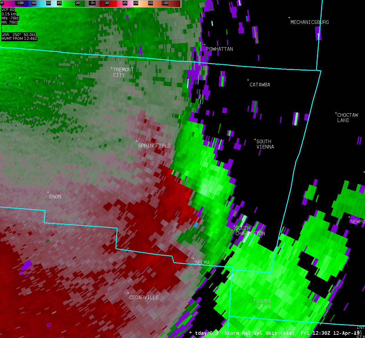
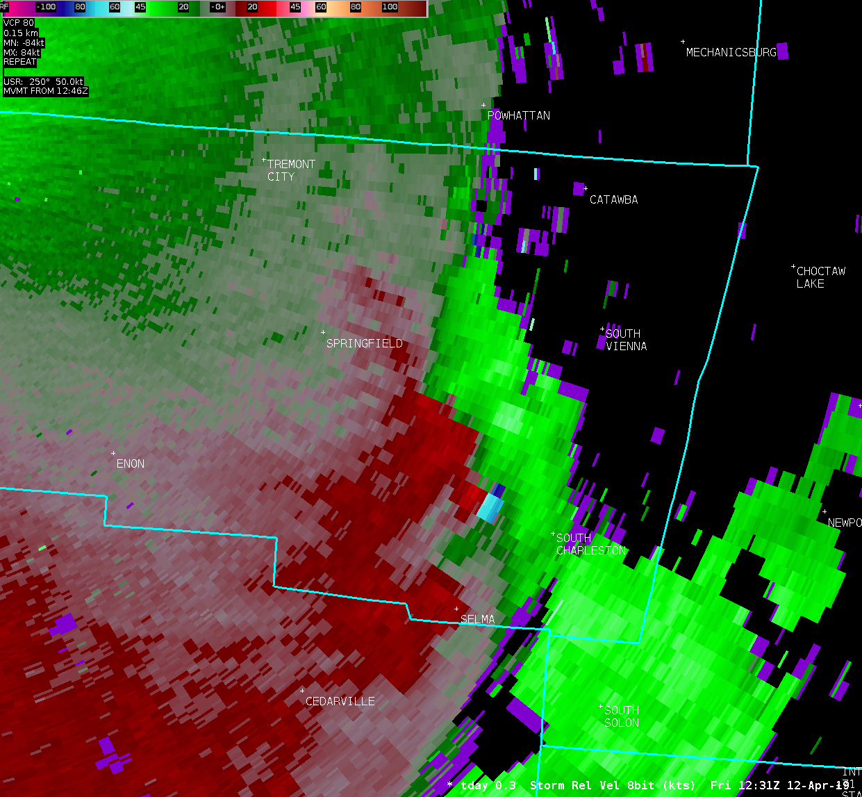
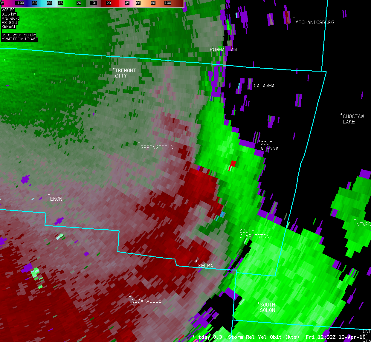
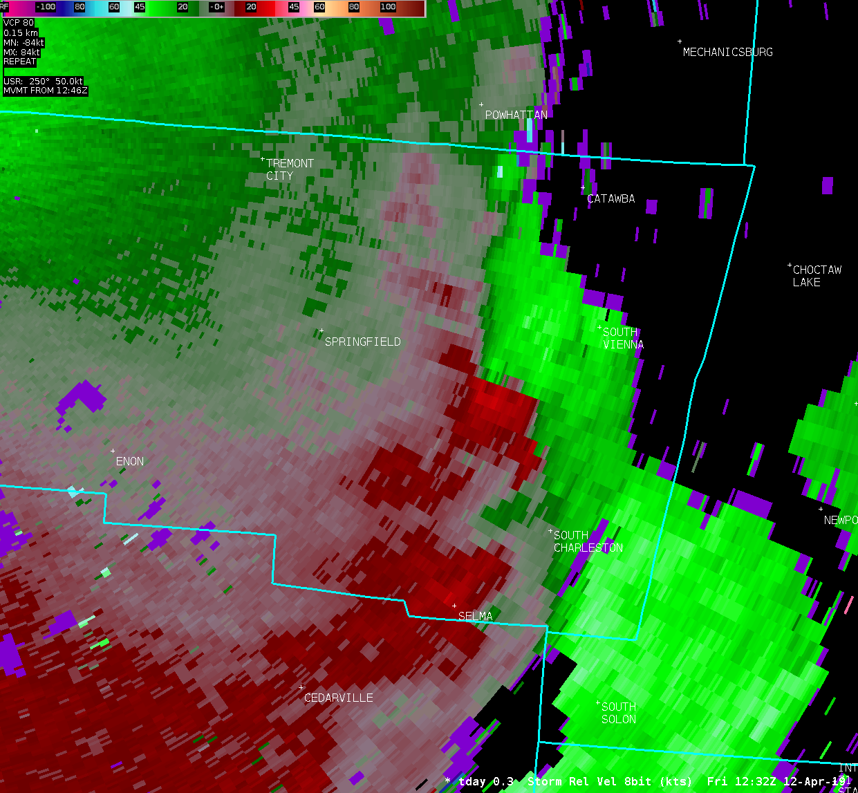
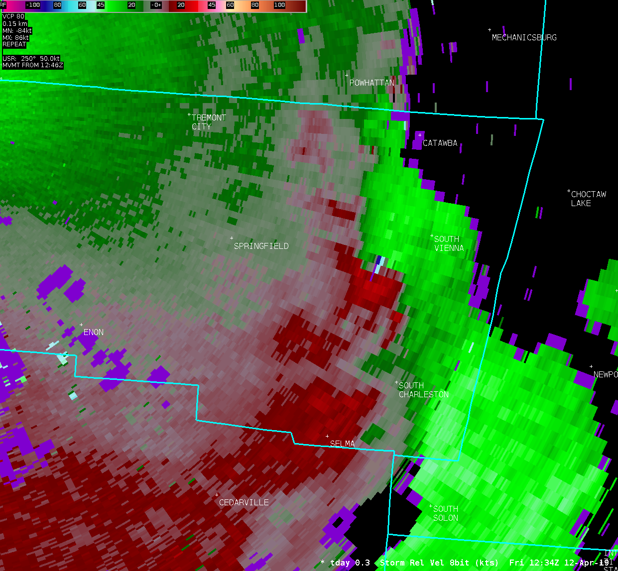
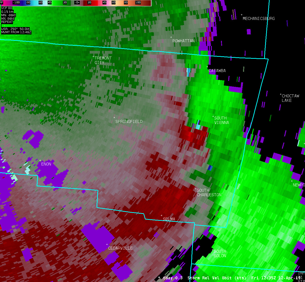
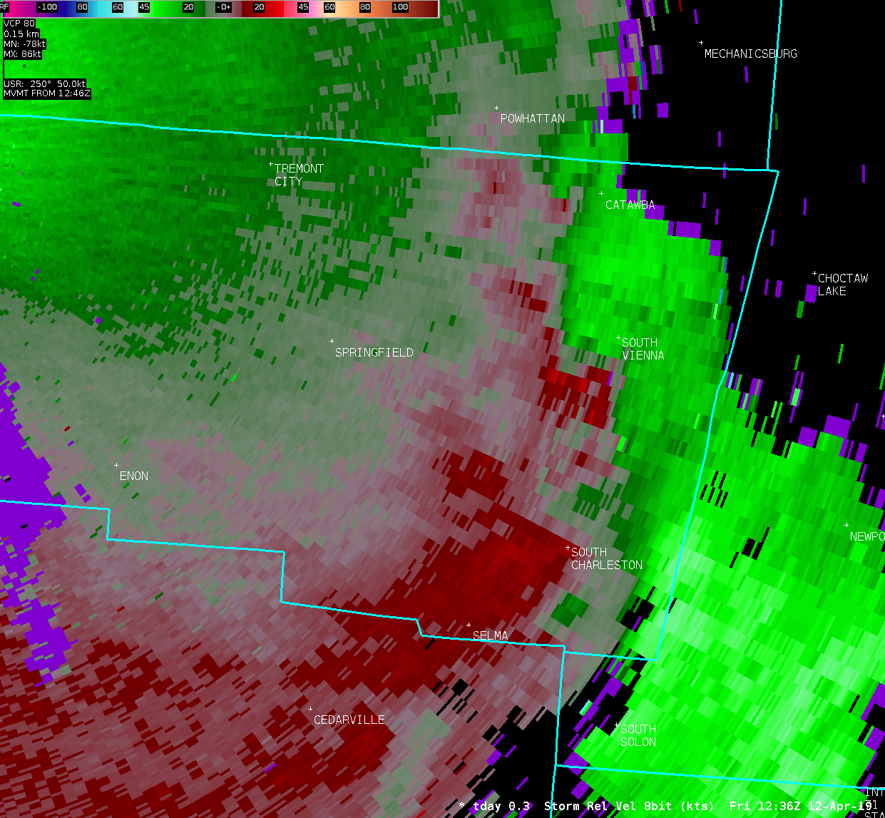
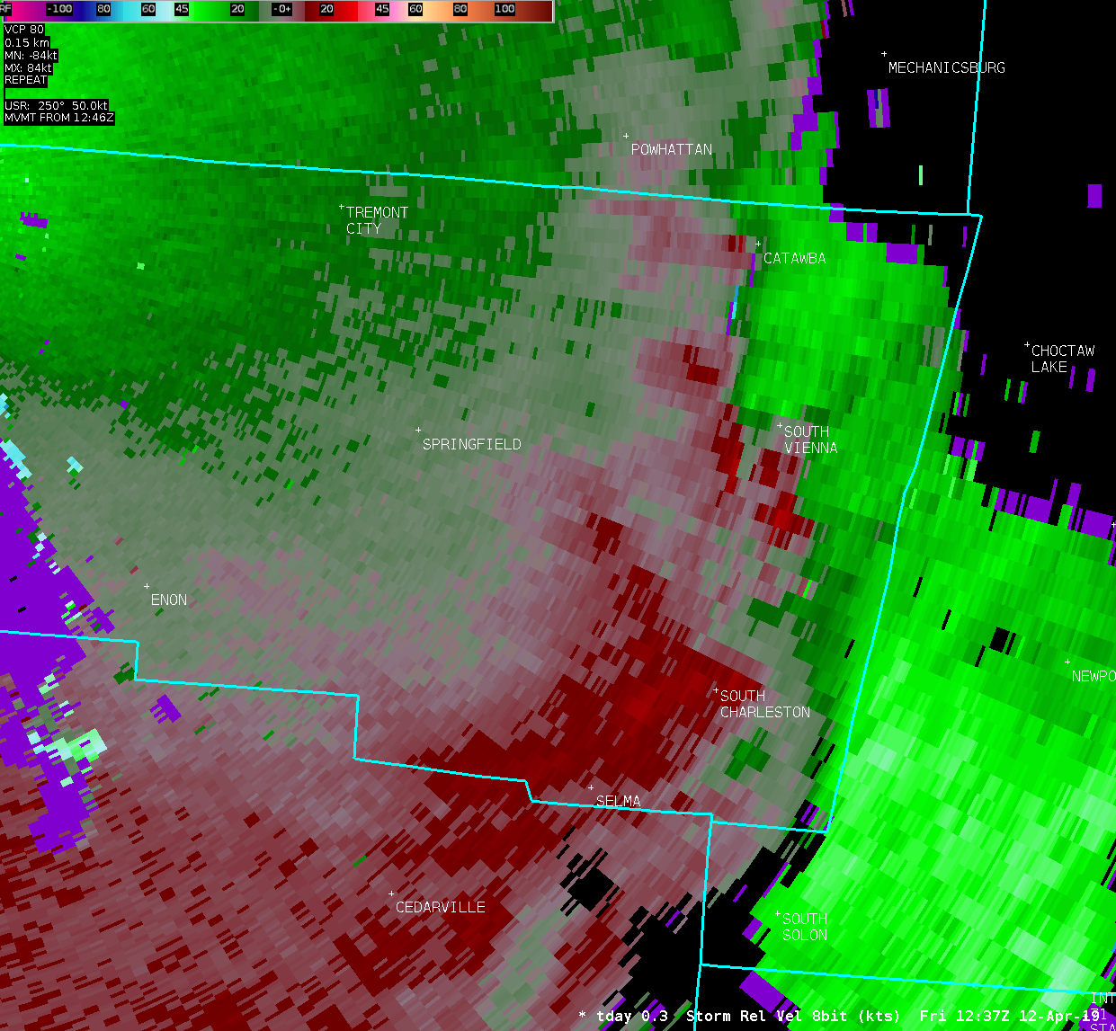
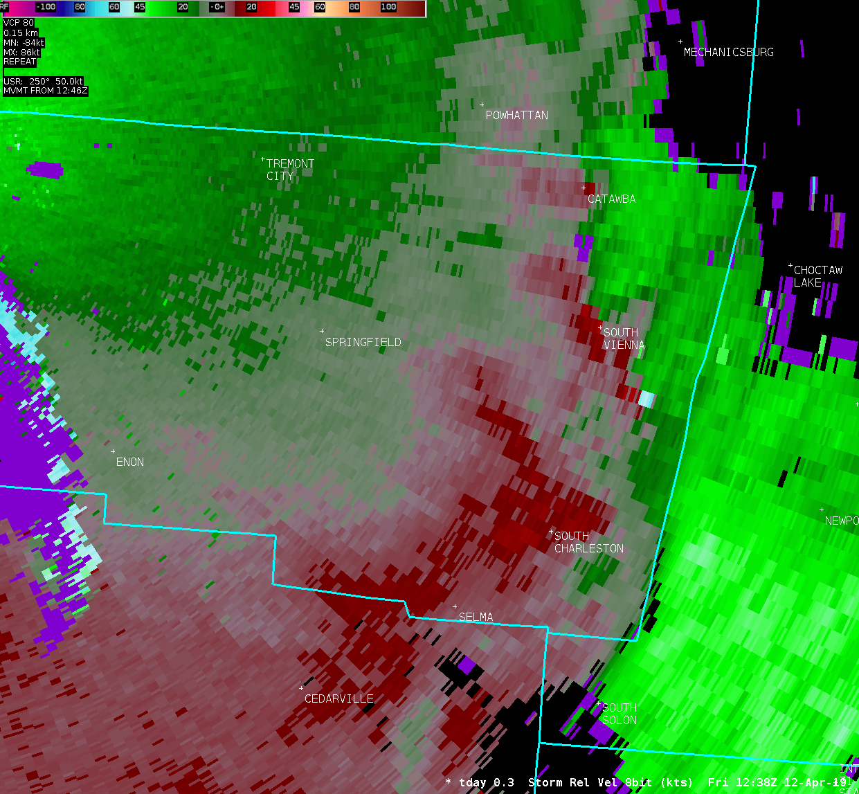
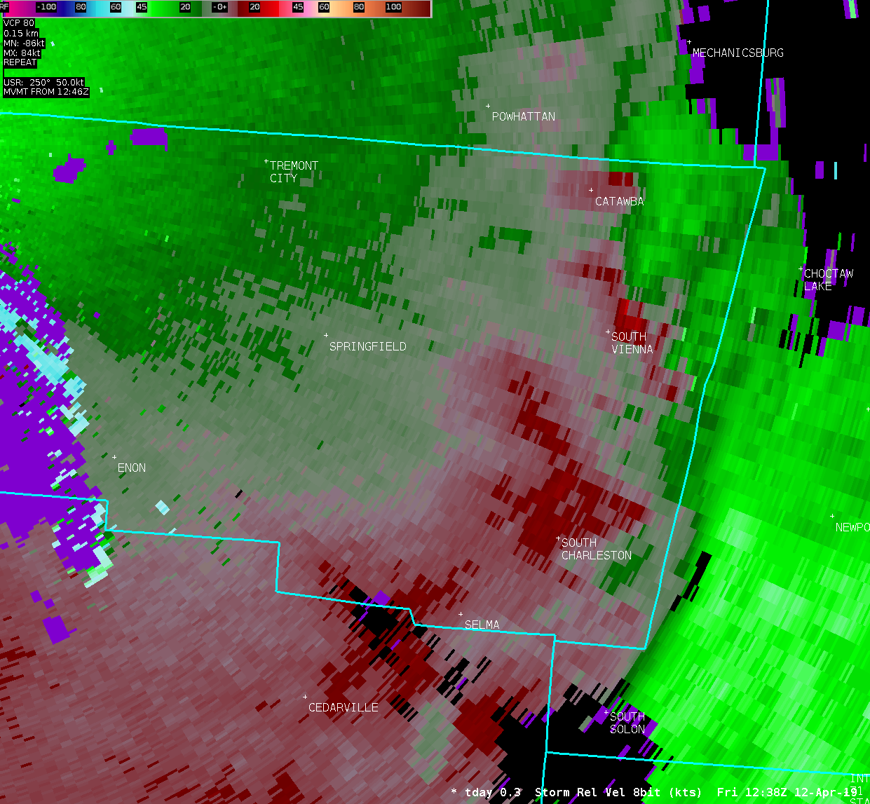
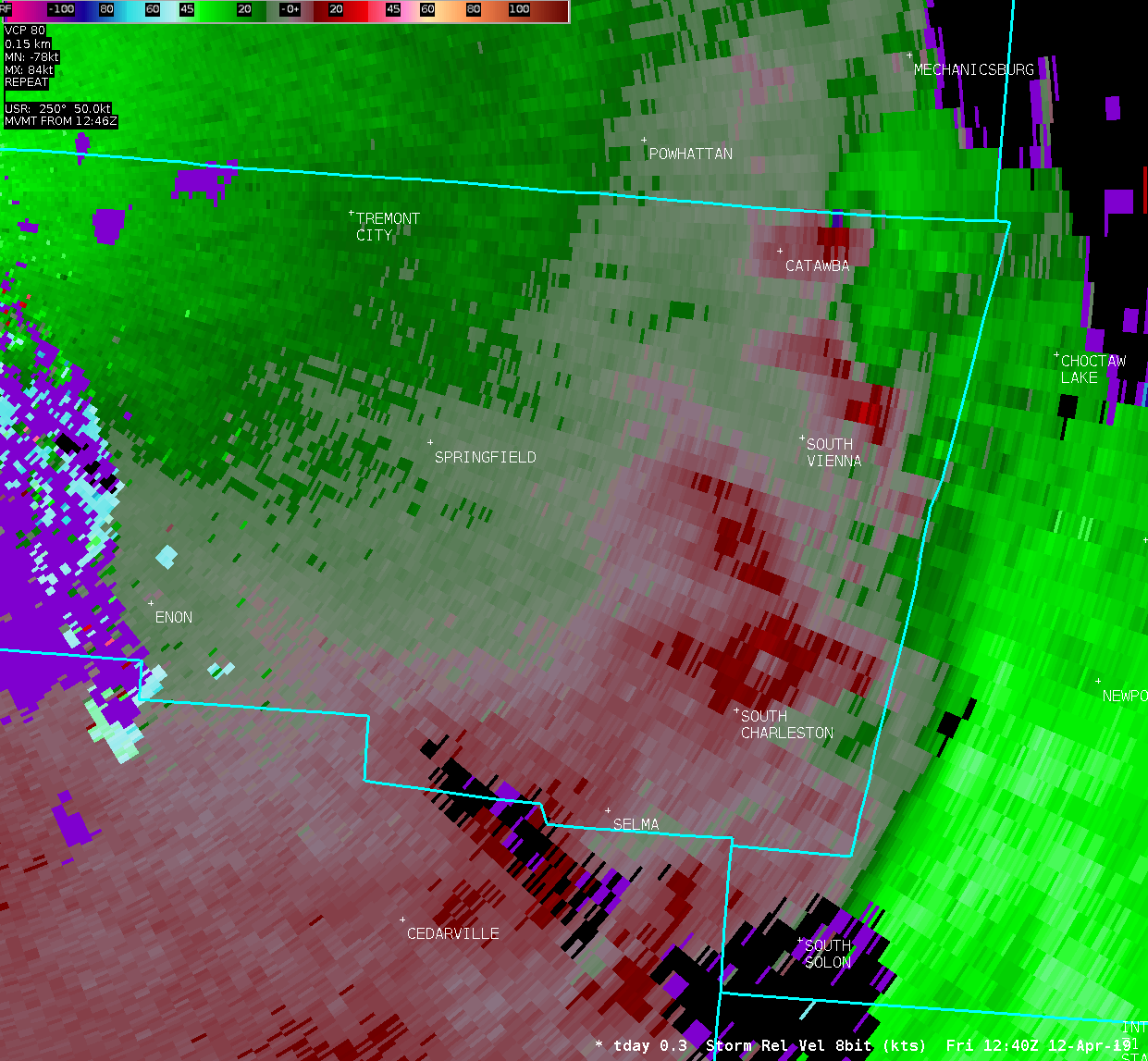
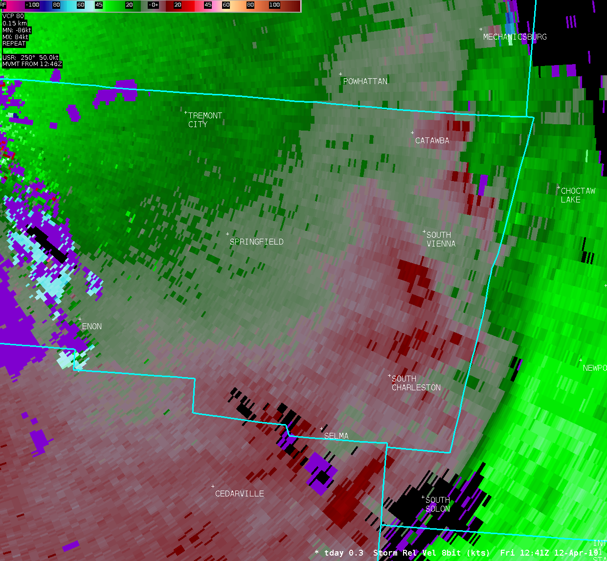
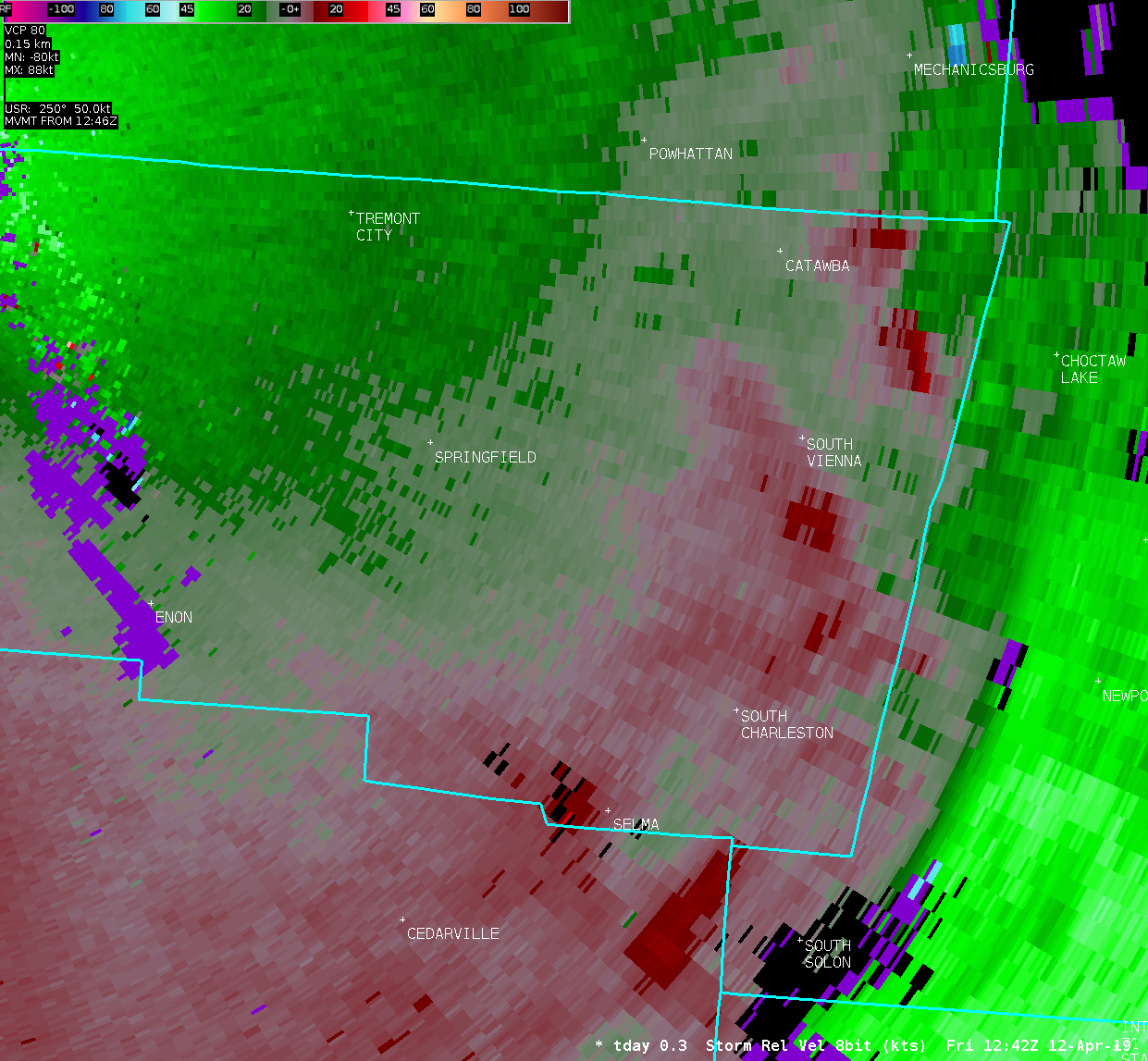
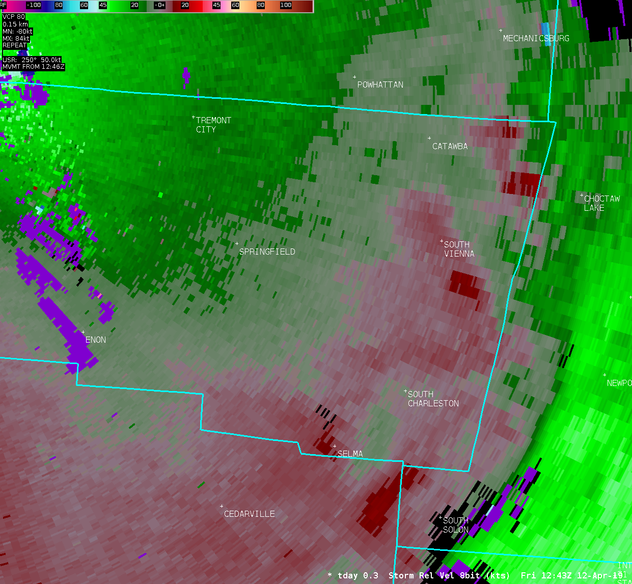
Tornado near South Vienna in Clark County, OH |
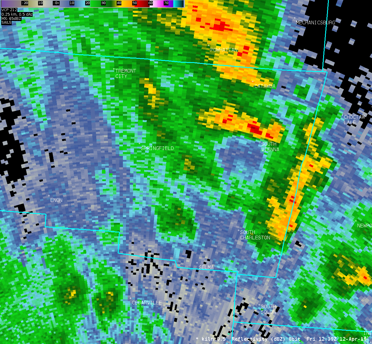
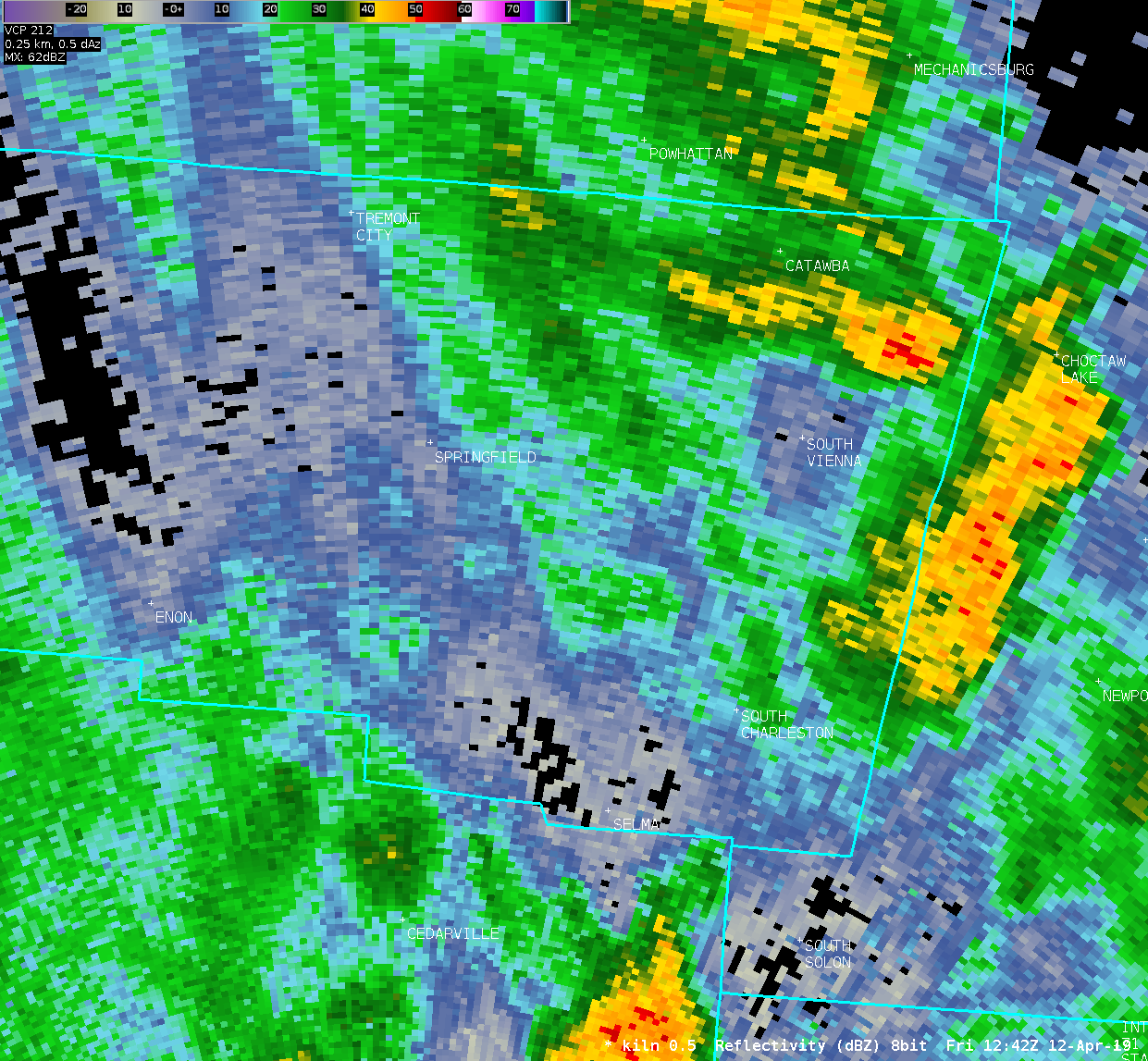
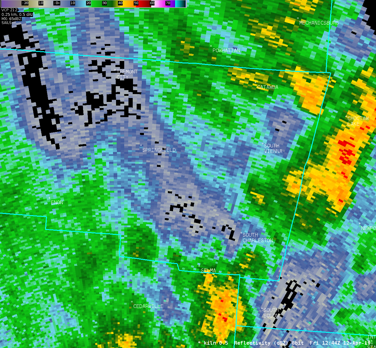
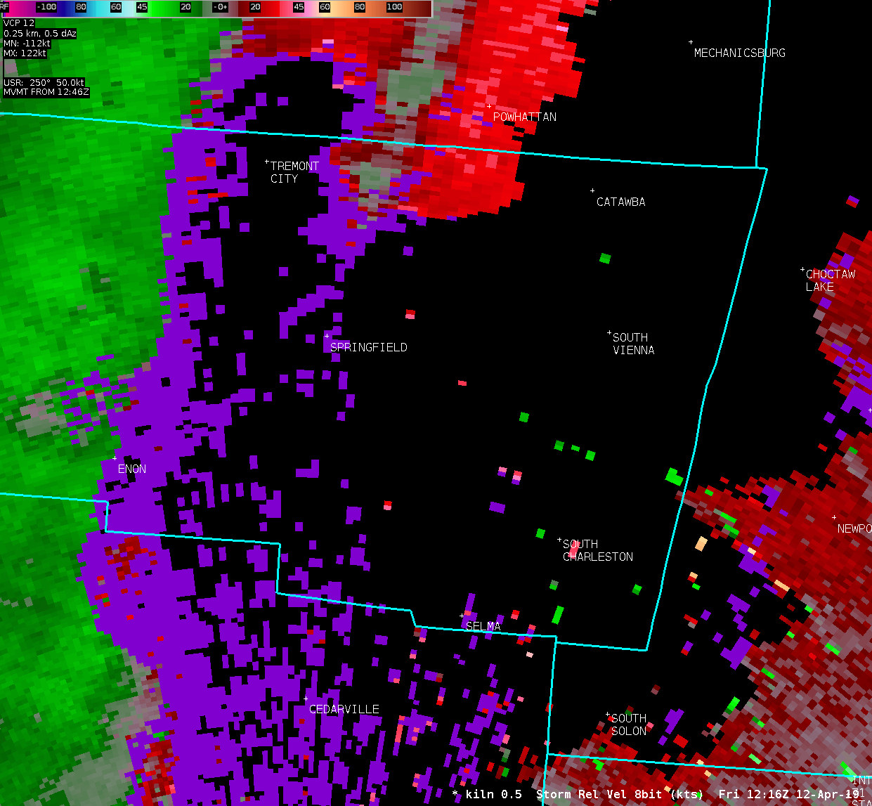
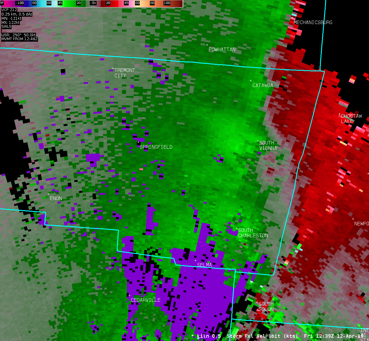
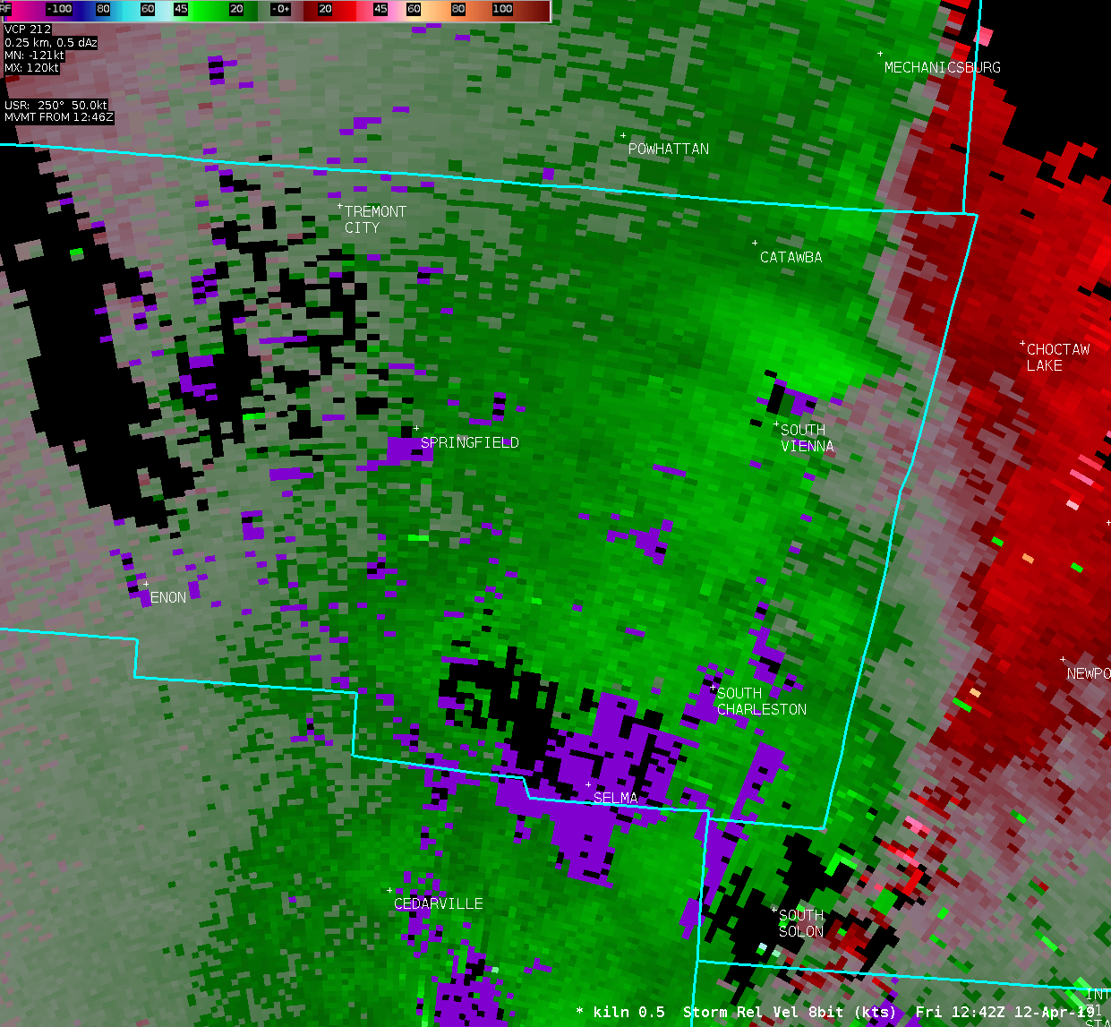
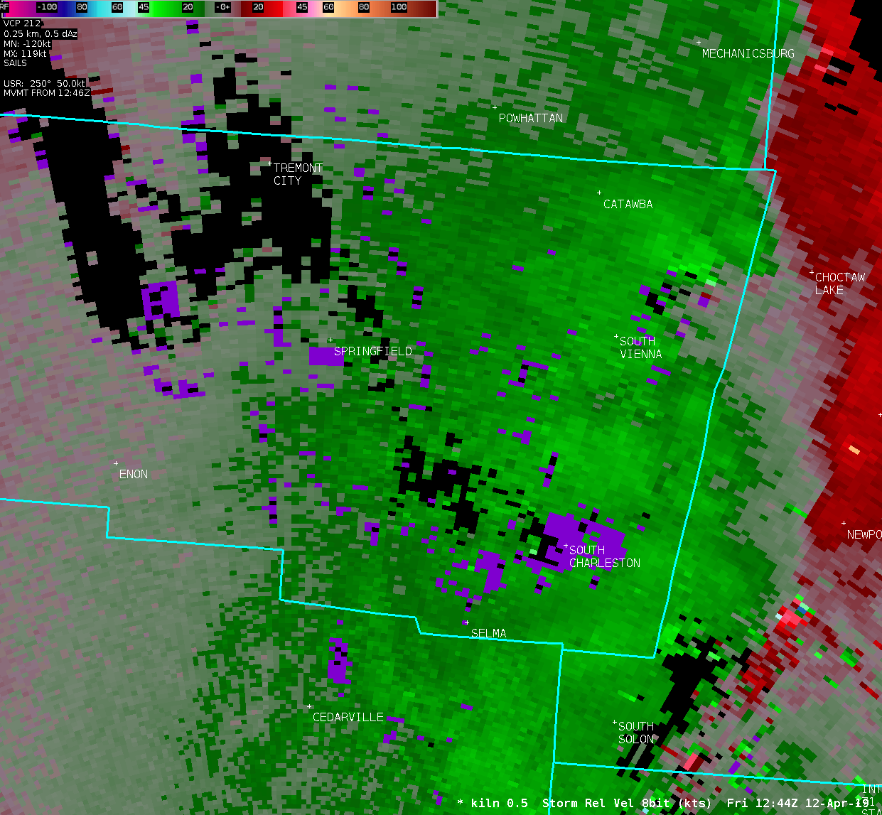
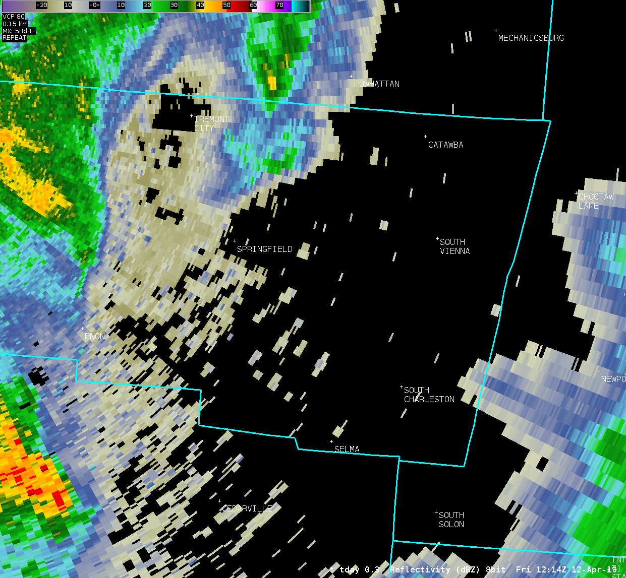
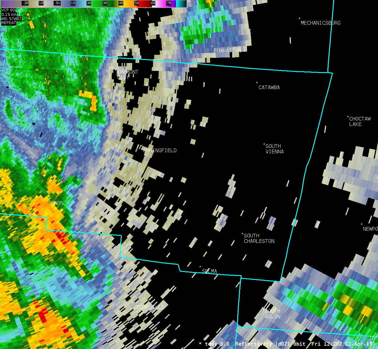
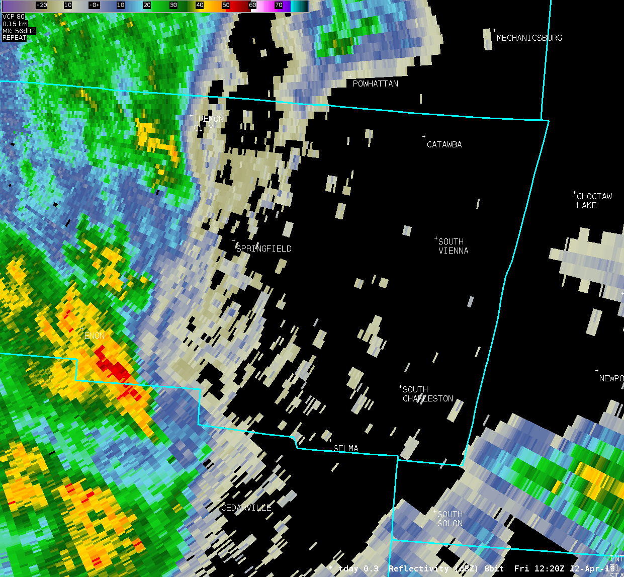
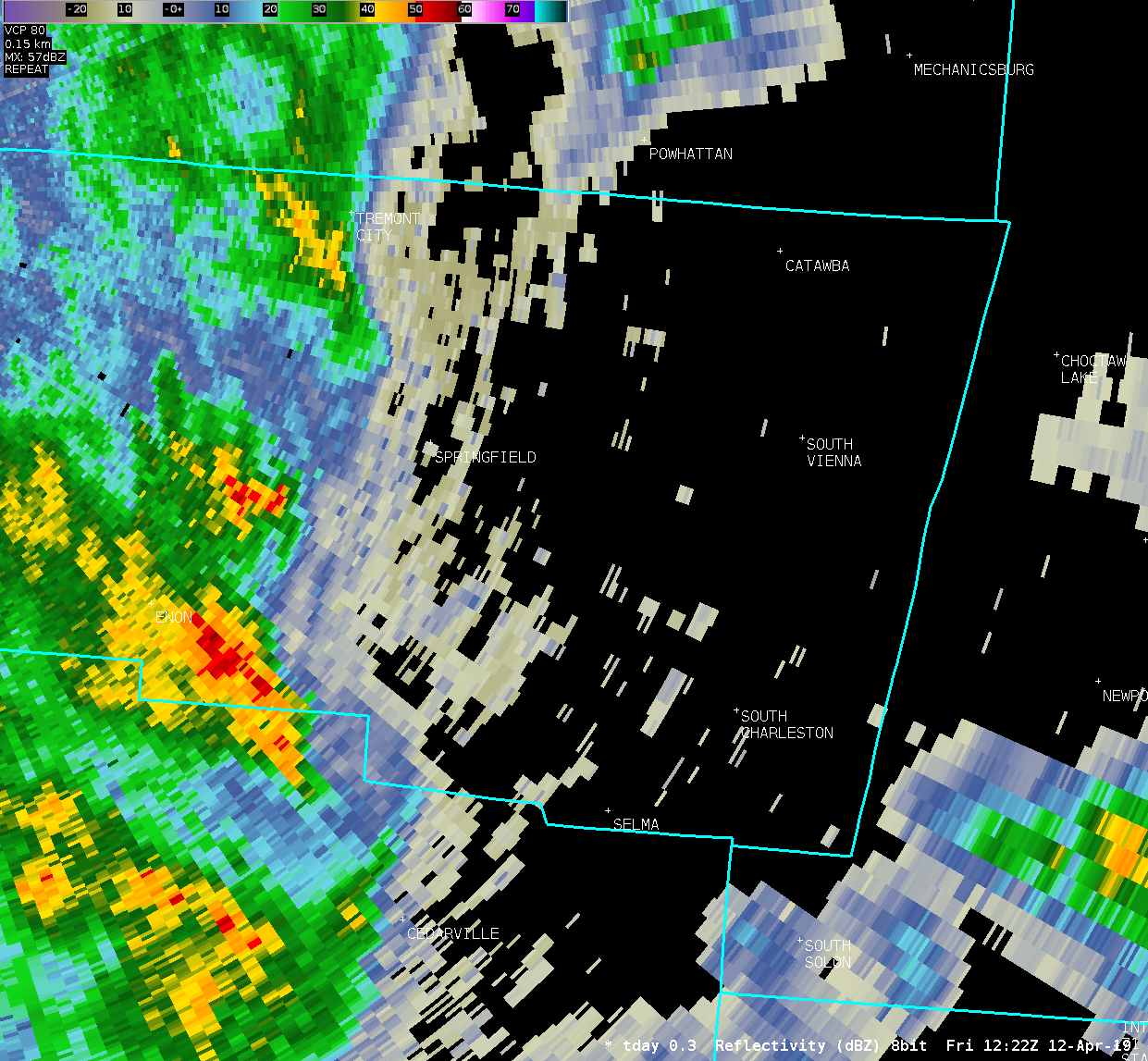
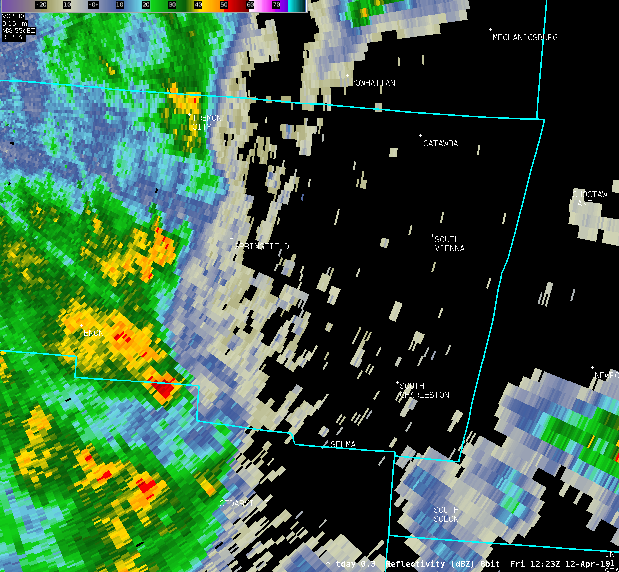
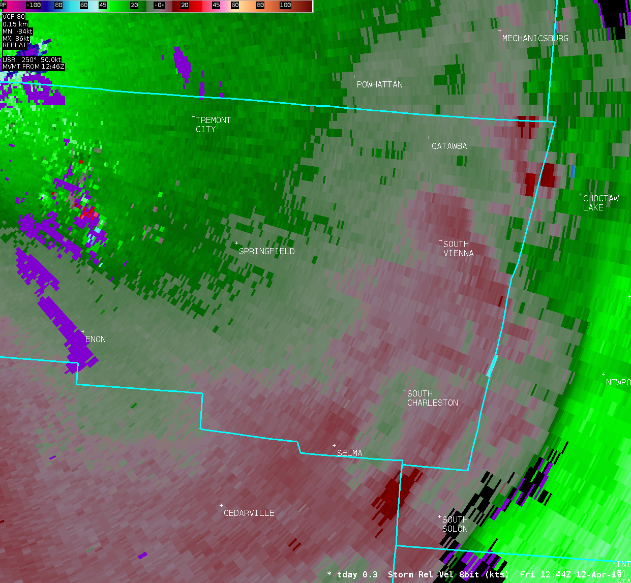
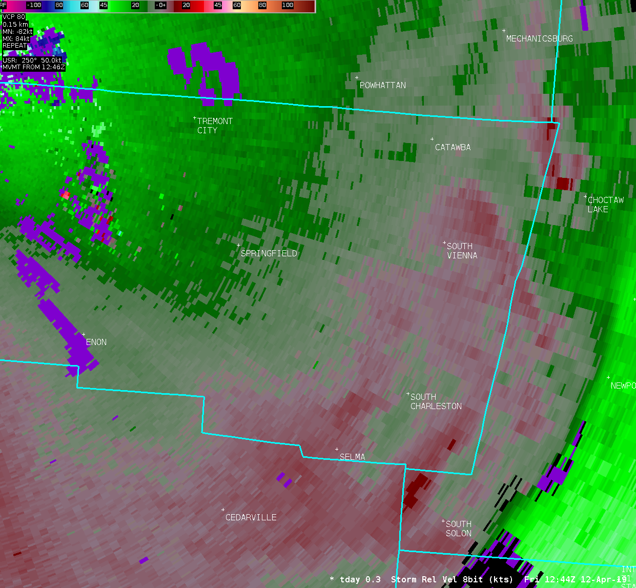
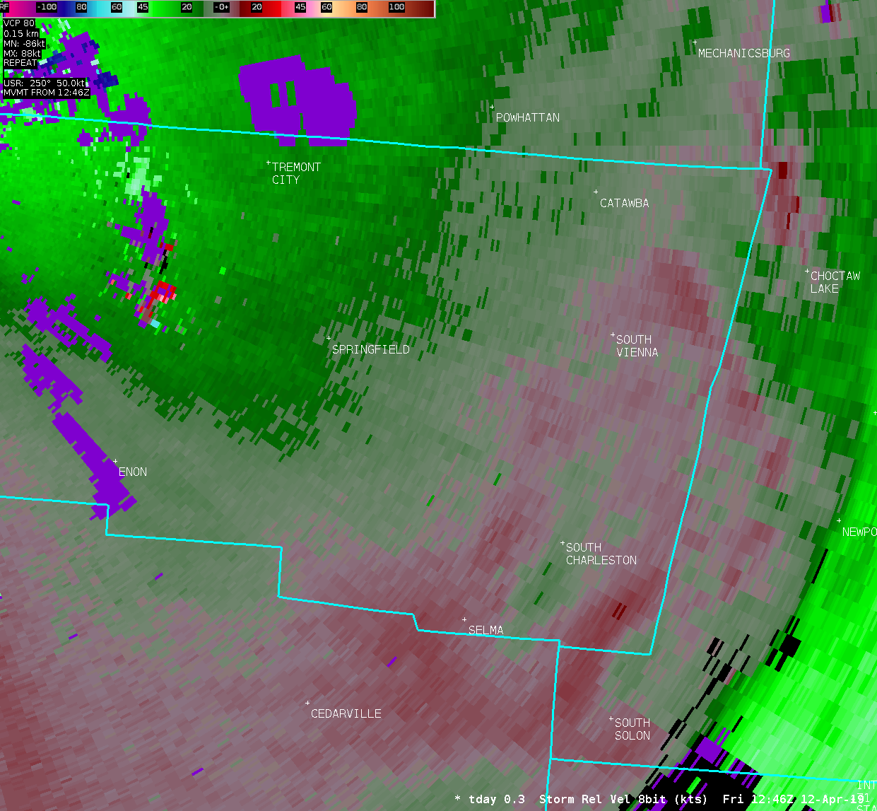
PUBLIC INFORMATION STATEMENT National Weather Service Wilmington OH 550 PM EDT Fri Apr 12 2019 ...PRELIMINARY TORNADO REPORT FOR APRIL 12 2019... Location...1 SW South Vienna in Clark County Ohio Date...April 12 2019 Estimated Start Time...834 am EDT Estimated End Time...836 am EDT Maximum EF-Scale Rating...EFU Estimated Maximum Wind Speed...Unknown Maximum Path Width...Unknown Path Length...1 mile Beginning Lat/Lon...39.9074/-83.6299 Ending Lat/Lon...39.9198/-83.6219 * Fatalities...0 * Injuries...0 ...Summary... This tornado stayed over open fields and caused no damage. It is based on video and eyewitness accounts. EF Scale: The Enhanced Fujita Scale classifies tornadoes into the following categories: EF0...Weak......65 to 85 mph EF1...Weak......86 to 110 mph EF2...Strong....111 to 135 mph EF3...Strong....136 to 165 mph EF4...Violent...166 to 200 mph EF5...Violent...>200 mph * The information in this statement is preliminary and subject to change pending final review of the event and publication in NWS Storm Data. $$ |
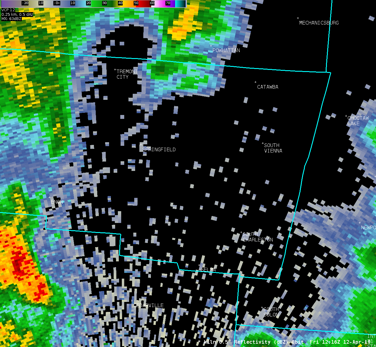
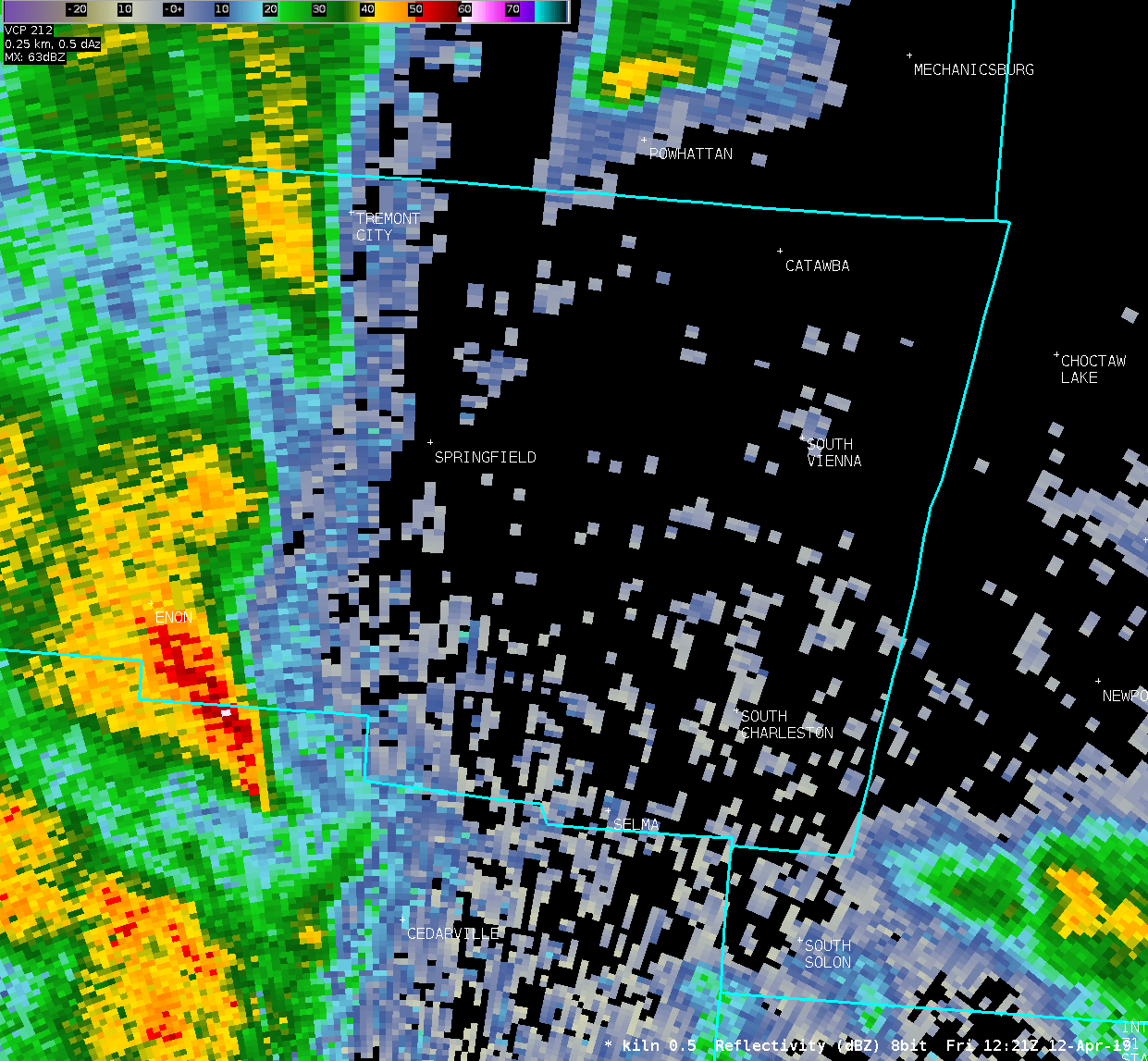
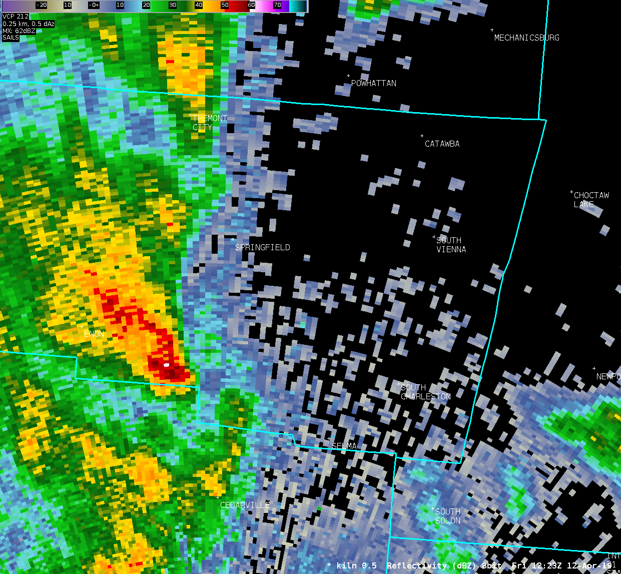
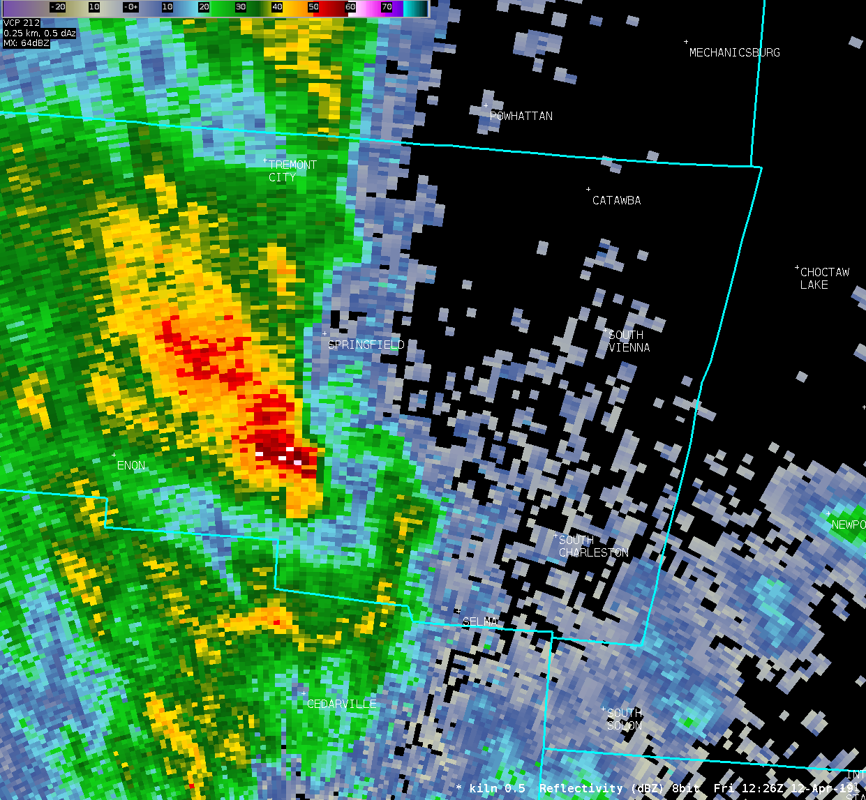
| Radar Loops | ||
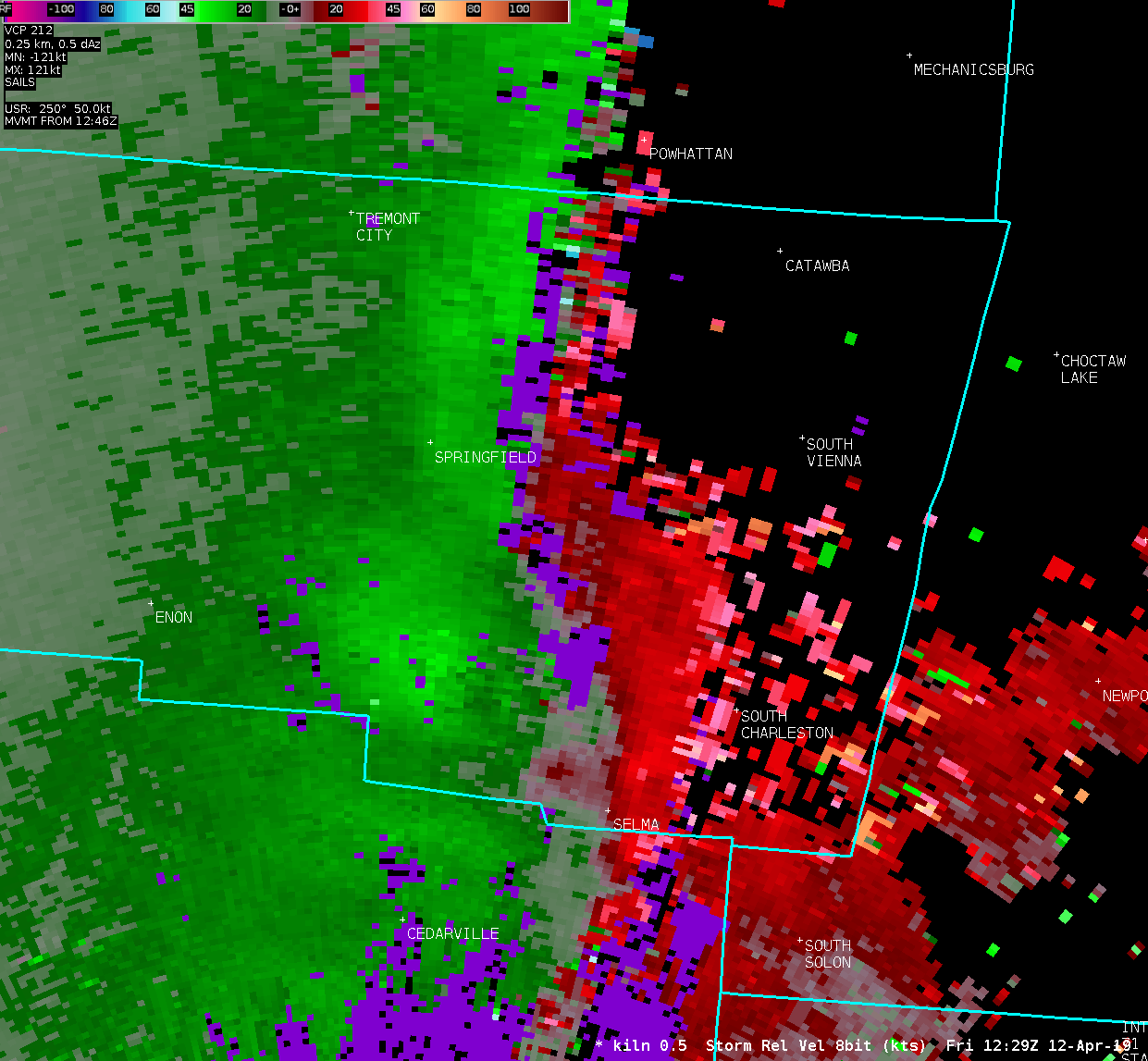
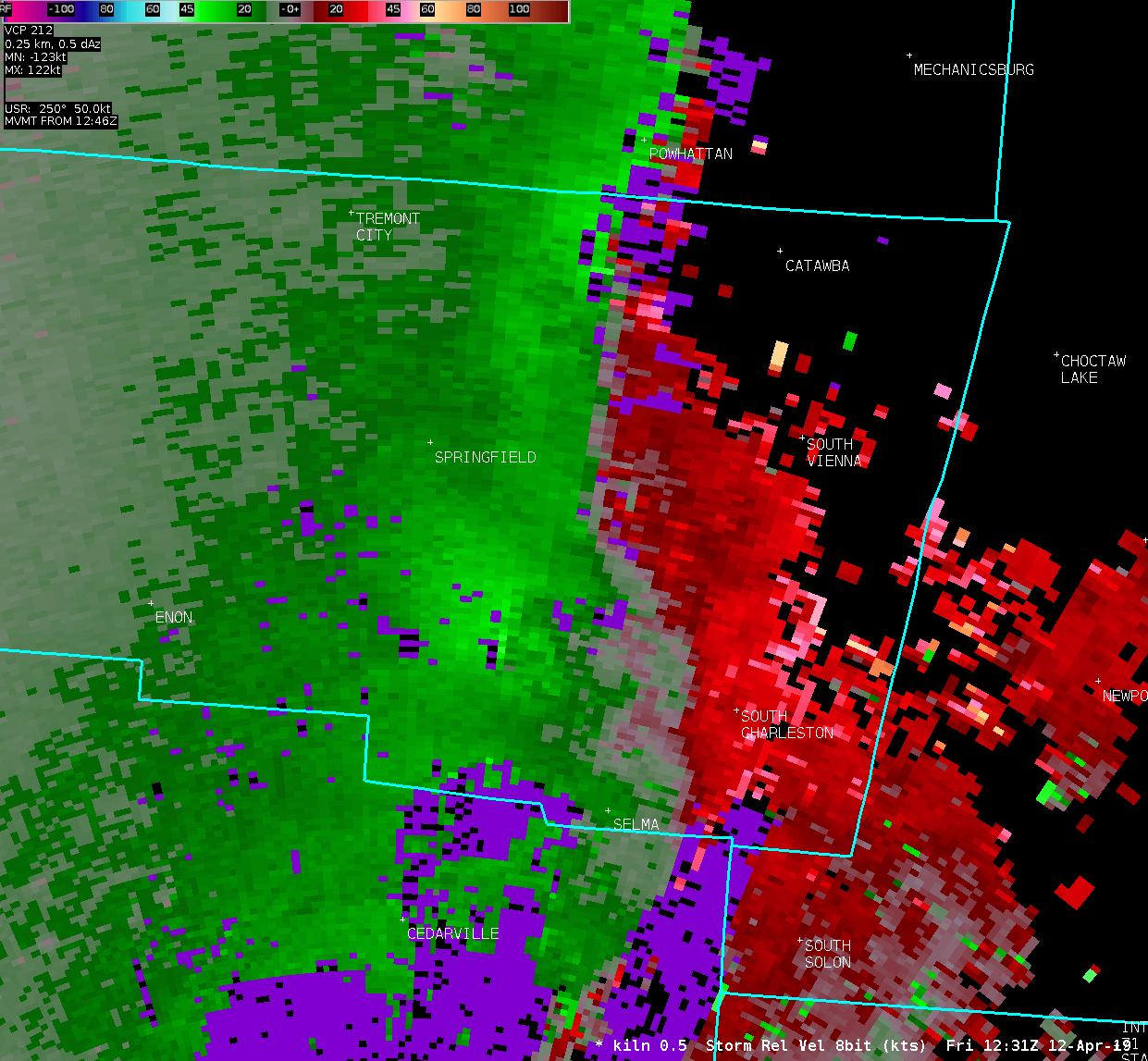
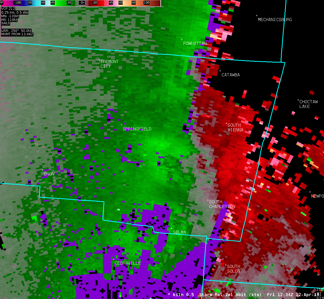
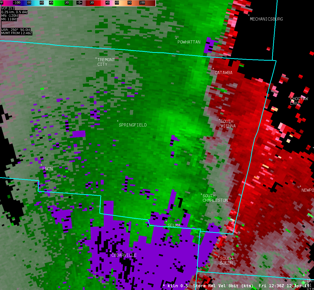
| KILN 0.5° Reflectivity | KILN 0.5° Storm-Relative Motion | |
| 1 2 3 4 5 6 7 8 9 10 11 12 | 1 2 3 4 5 6 7 8 9 10 11 12 | |
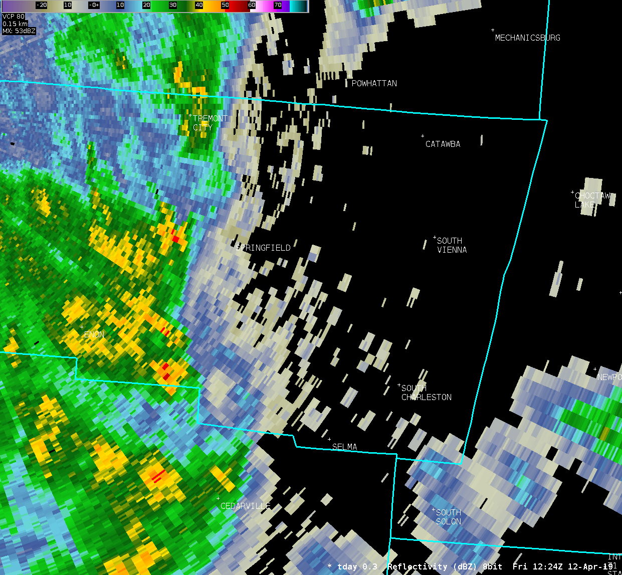
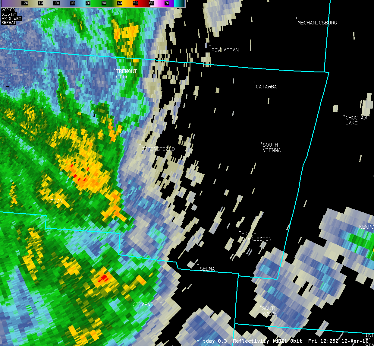
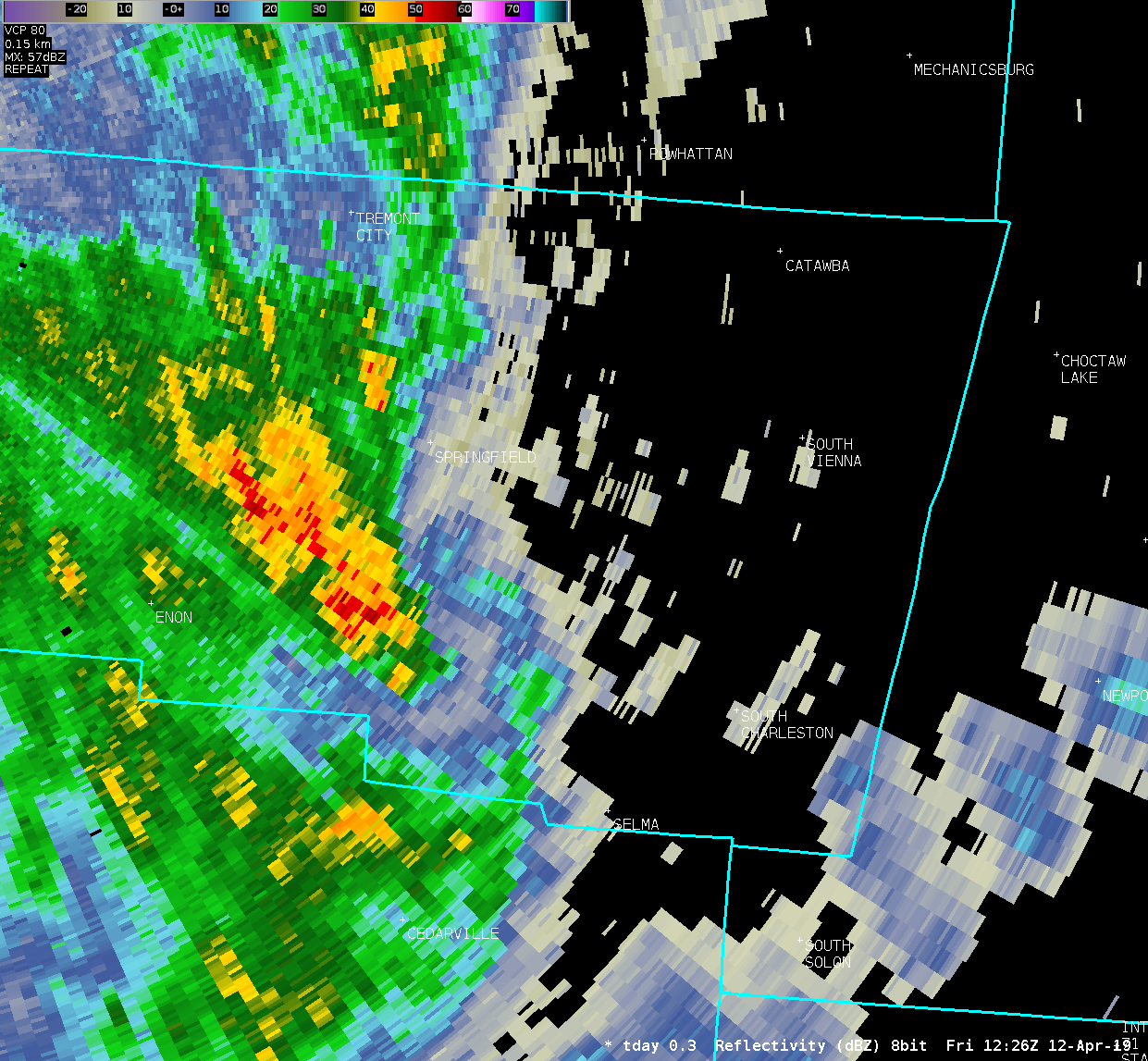
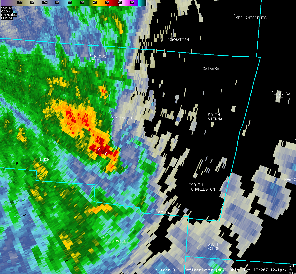
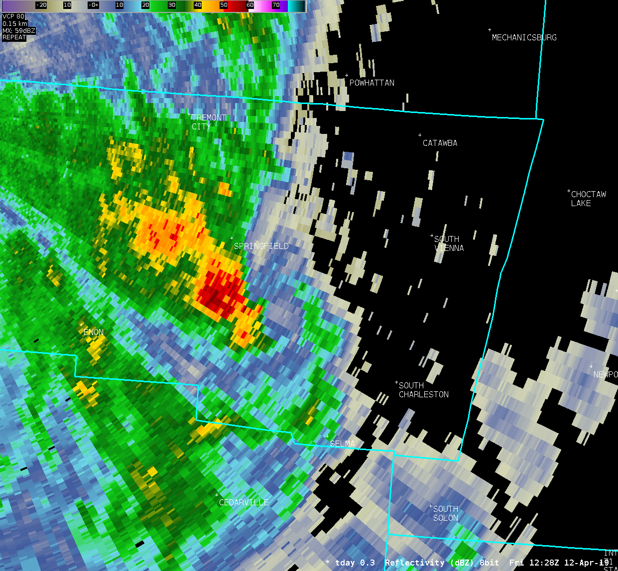
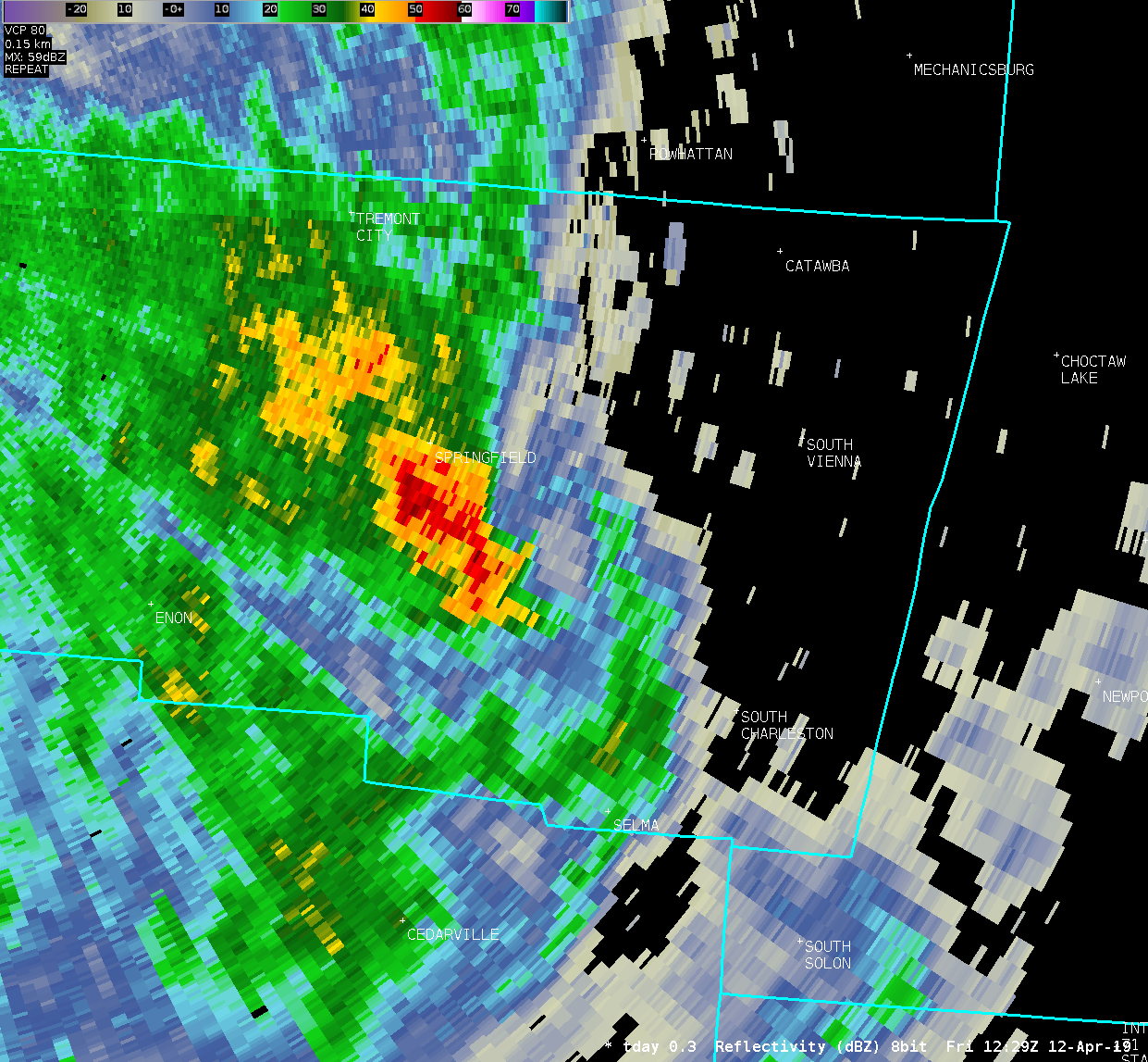
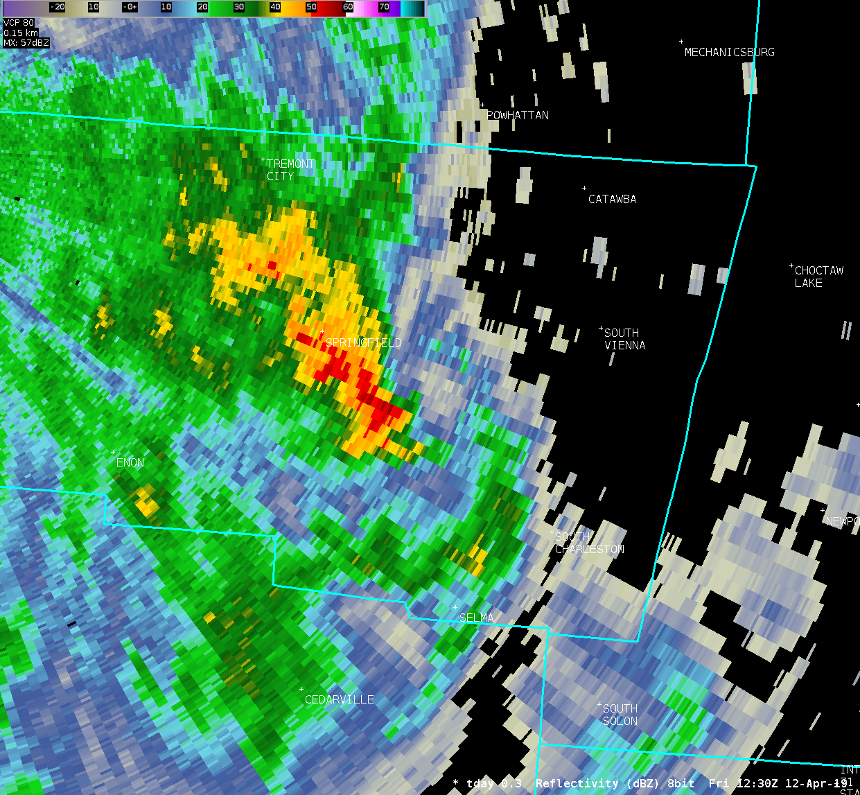
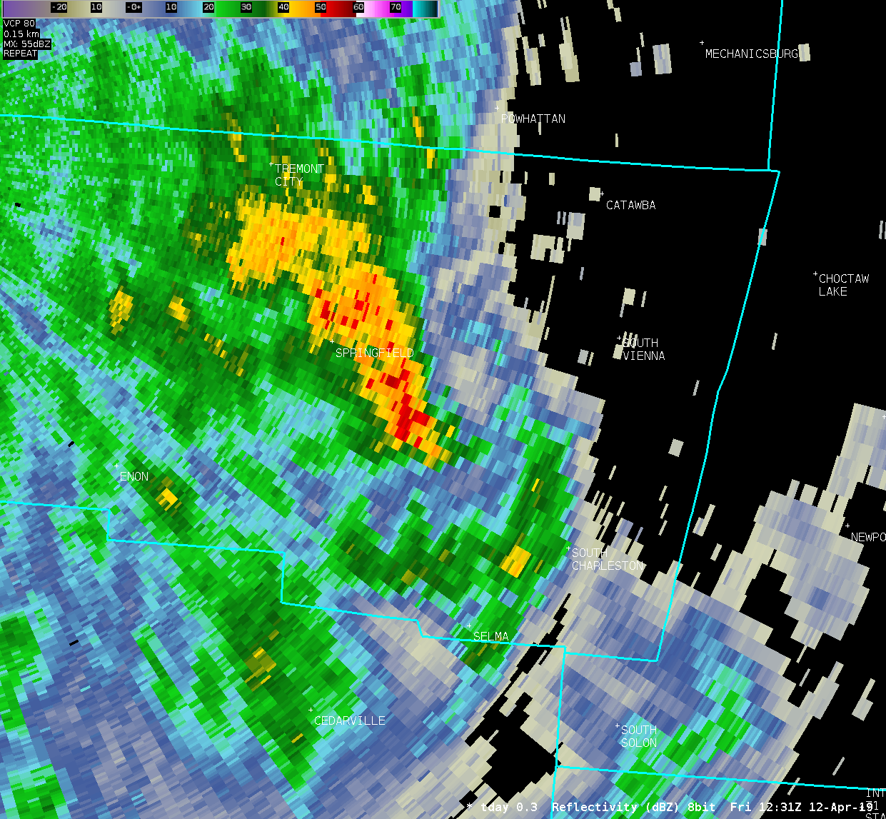
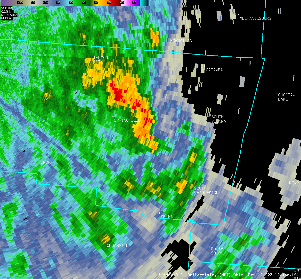
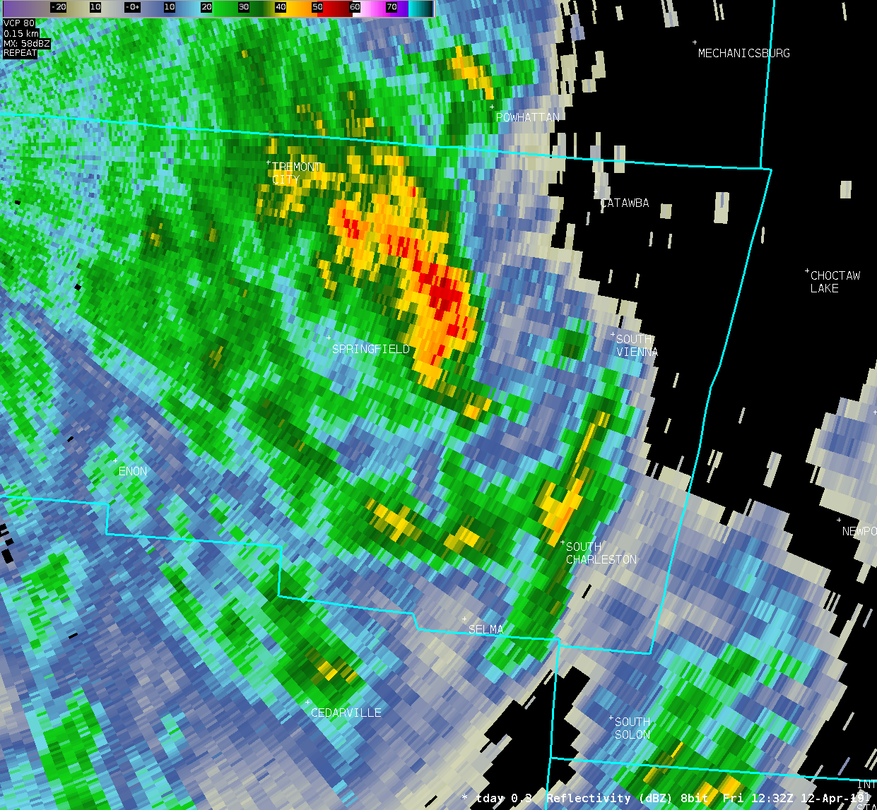
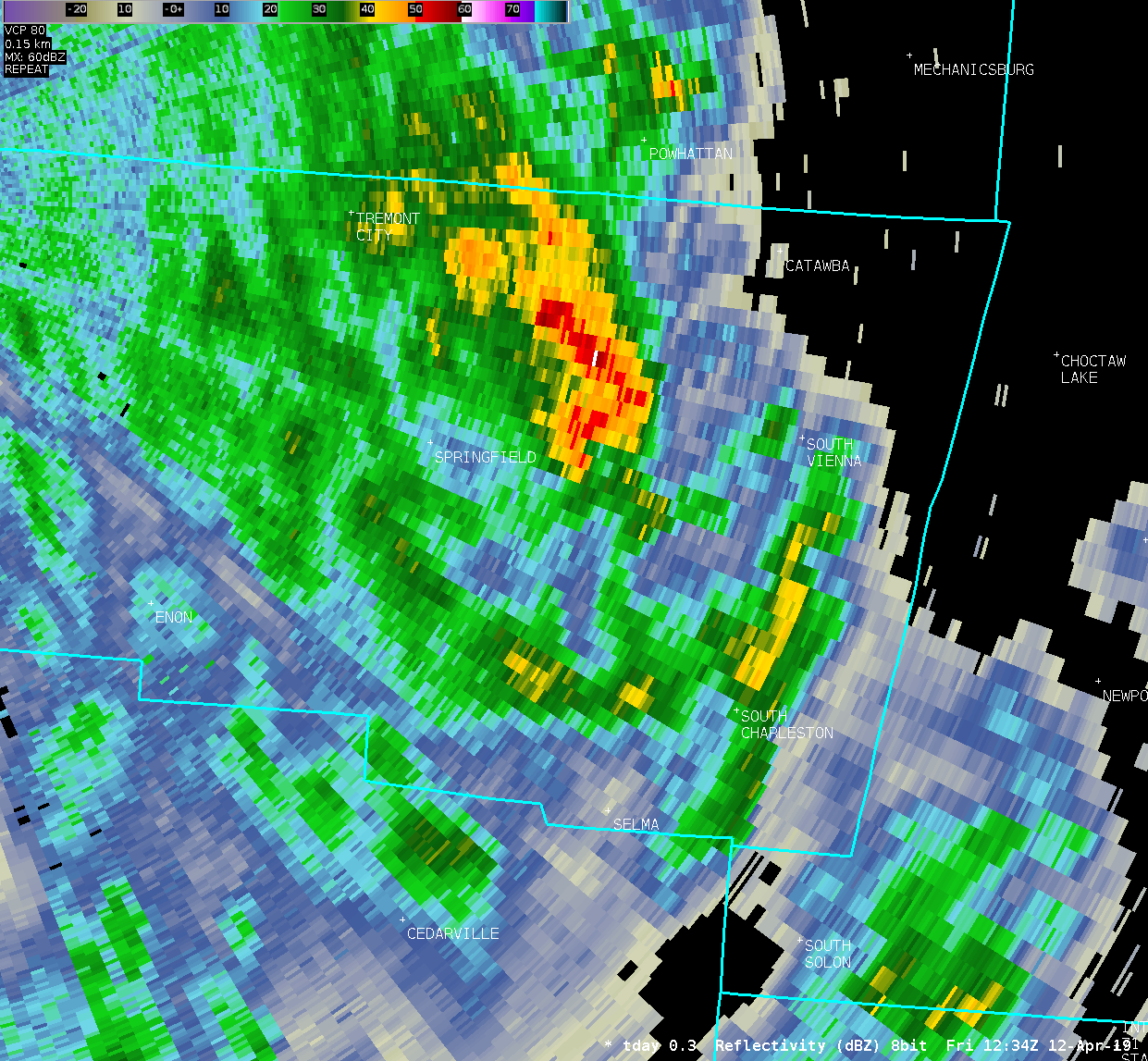
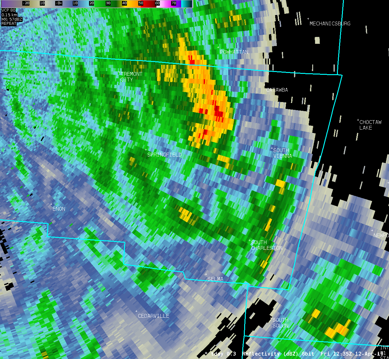
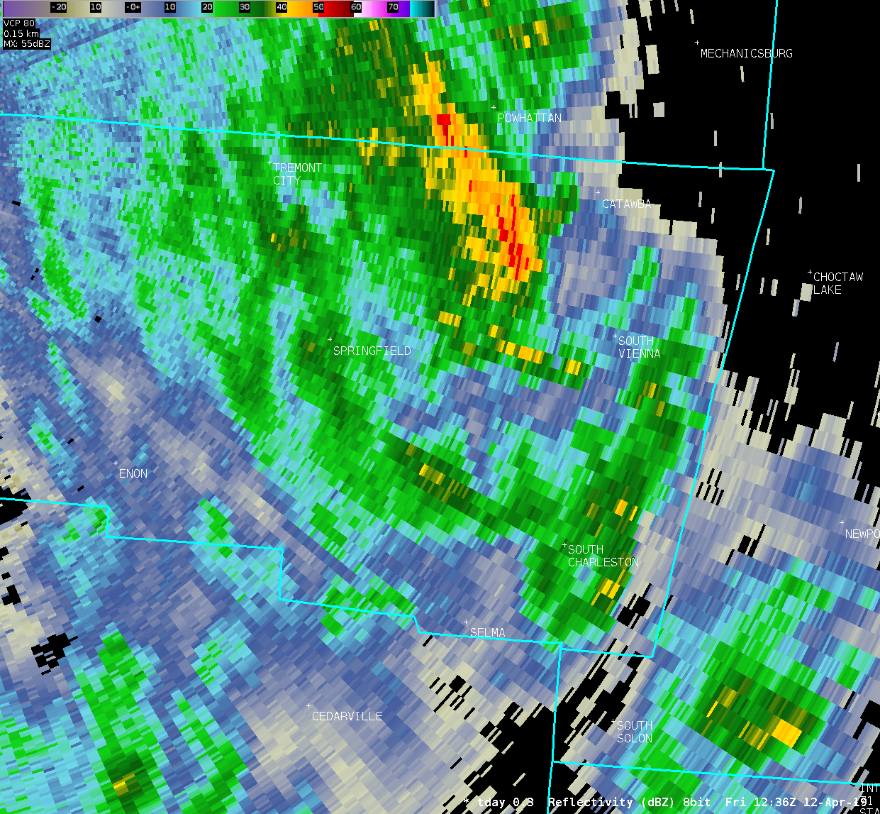
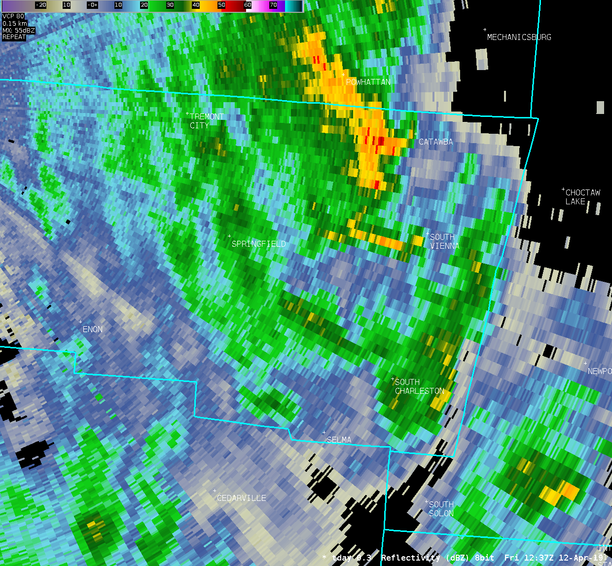
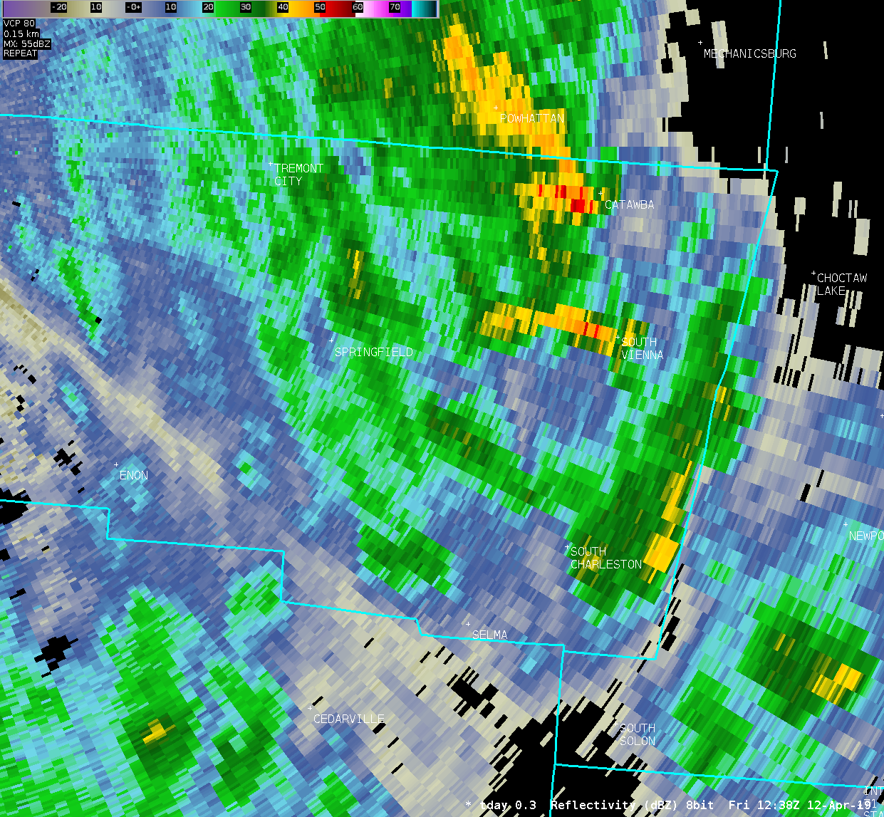
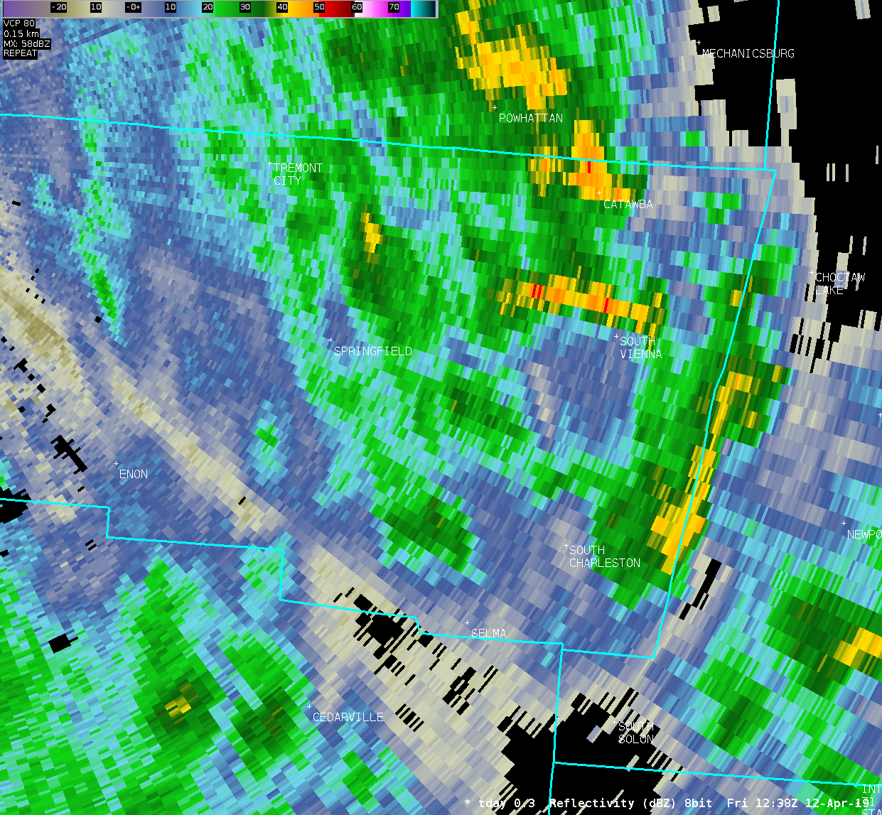
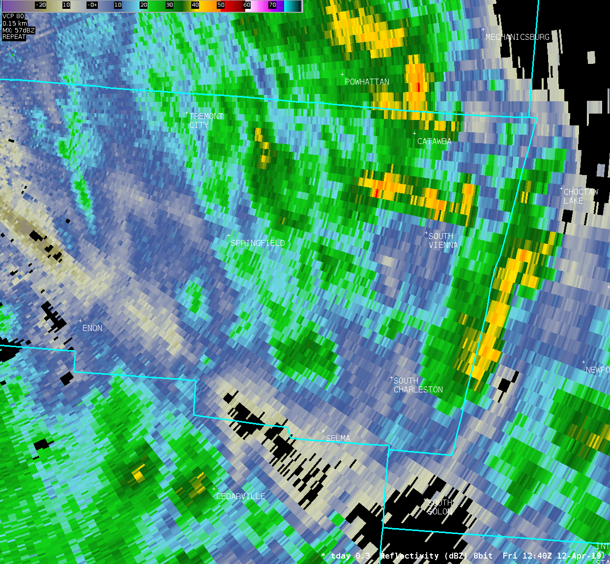
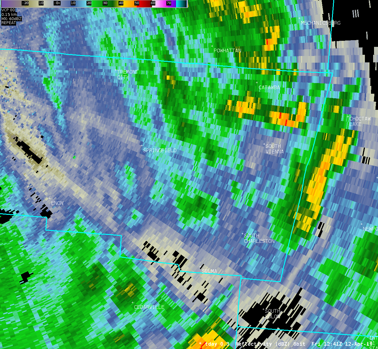
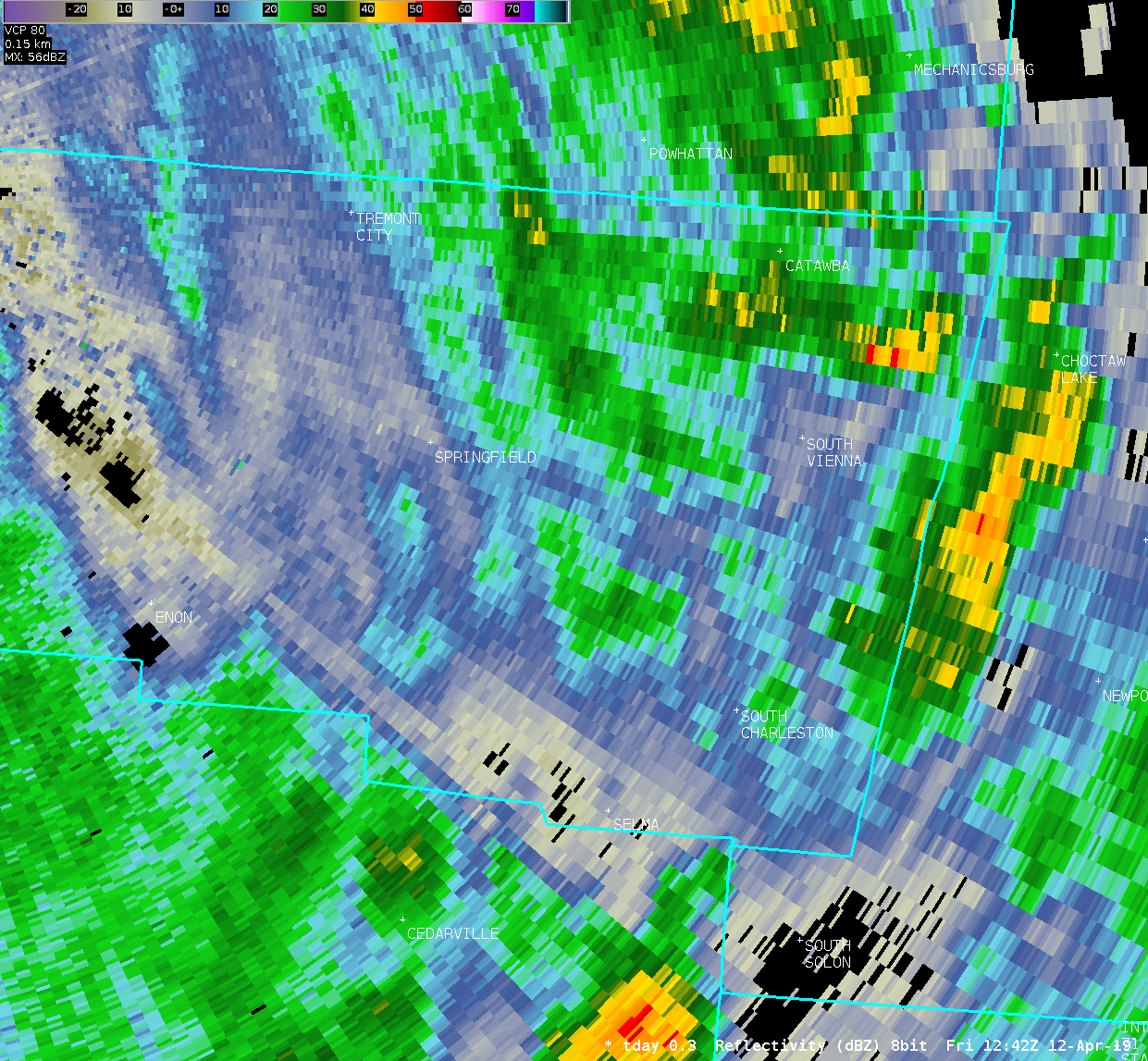
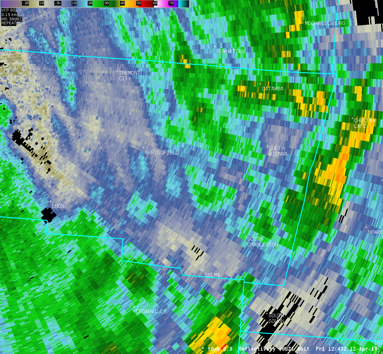
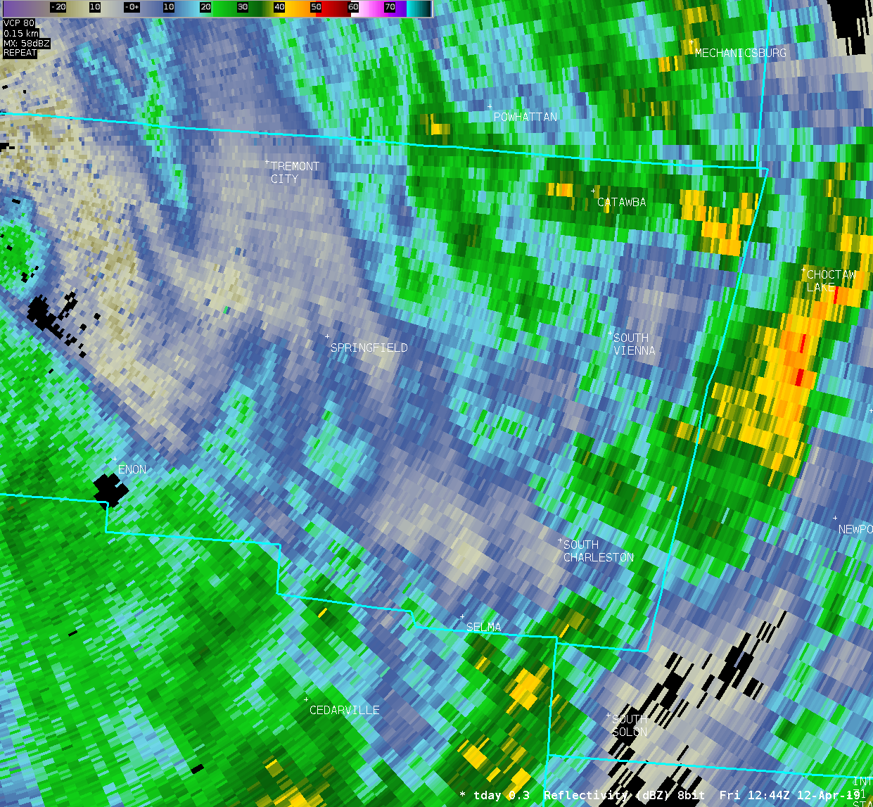
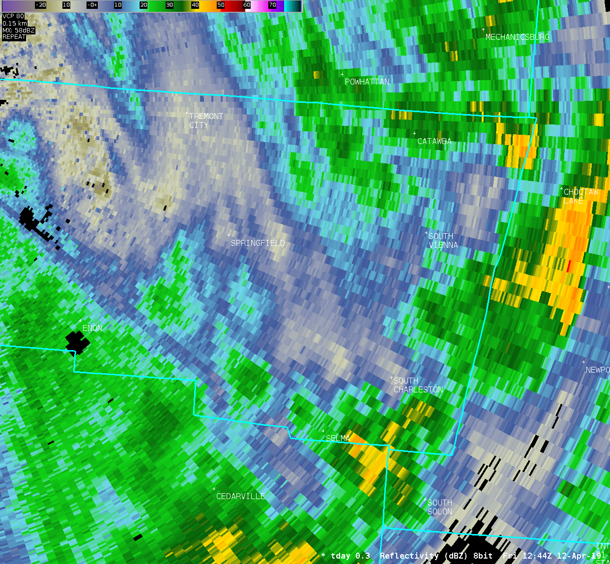
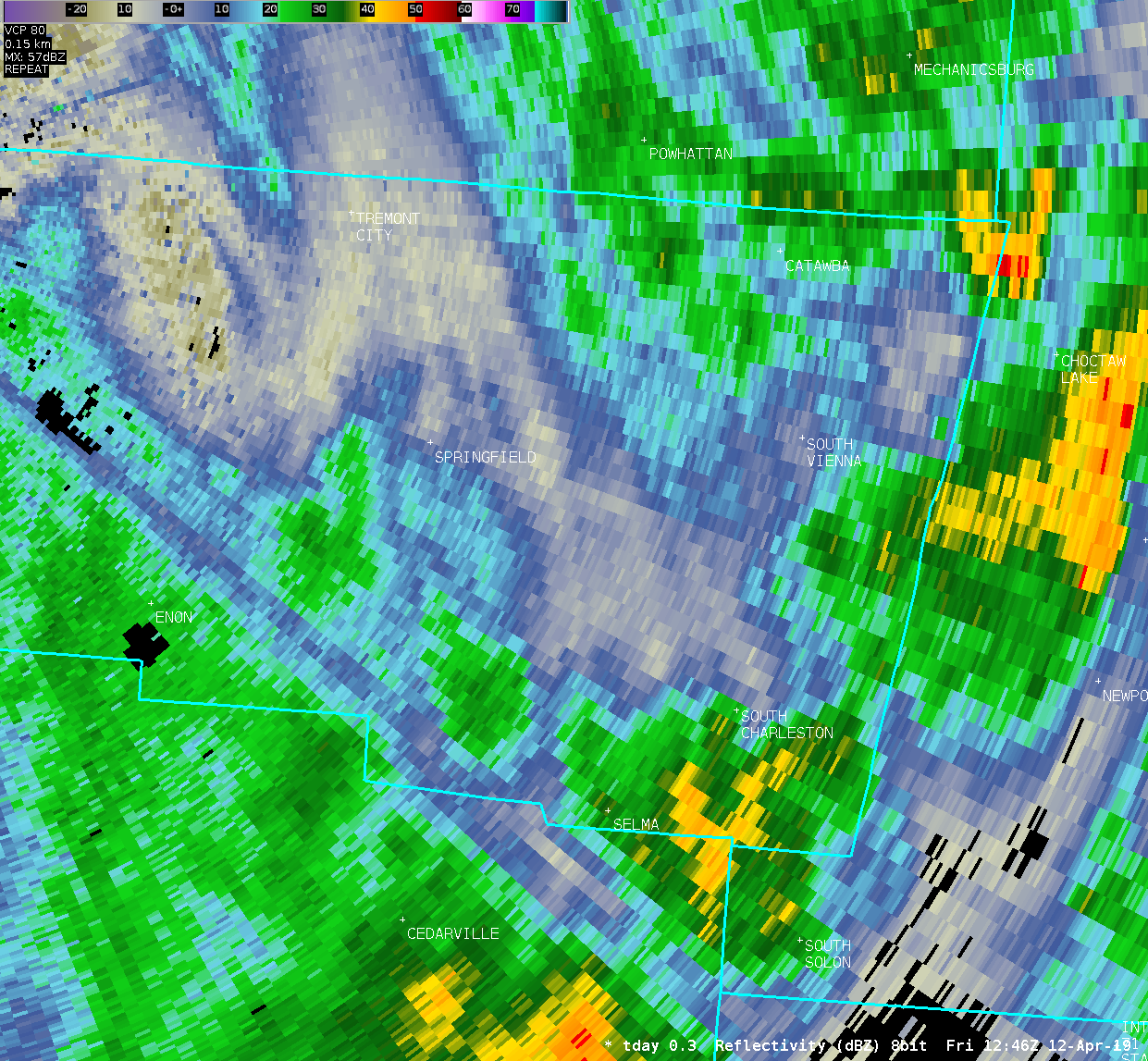
| TDAY 0.3° Reflectivity | ||
| 1 2 3 4 5 6 7 8 9 10 11 12 13 14 15 16 17 18 19 20 21 22 23 24 25 26 27 28 29 30 31 32 | ||
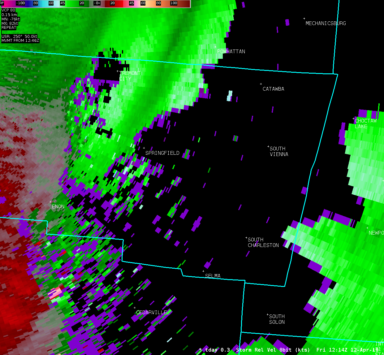
| TDAY 0.3° Storm-Relative Motion | ||
| 1 2 3 4 5 6 7 8 9 10 11 12 13 14 15 16 17 18 19 20 21 22 23 24 25 26 27 28 29 30 31 32 | ||

