PUBLIC INFORMATION STATEMENT
National Weather Service Wilmington OH
637 PM EDT Fri Apr 12 2019
...UPDATED DAMAGE SURVEY SUMMARY FOR APRIL 12 2019 EVENT...
A National Weather Service Storm Survey team has determined that
damage in Kenton County Kentucky, Switzerland County Indiana, and
Gallatin County Kentucky was caused by straight-line thunderstorm
winds.
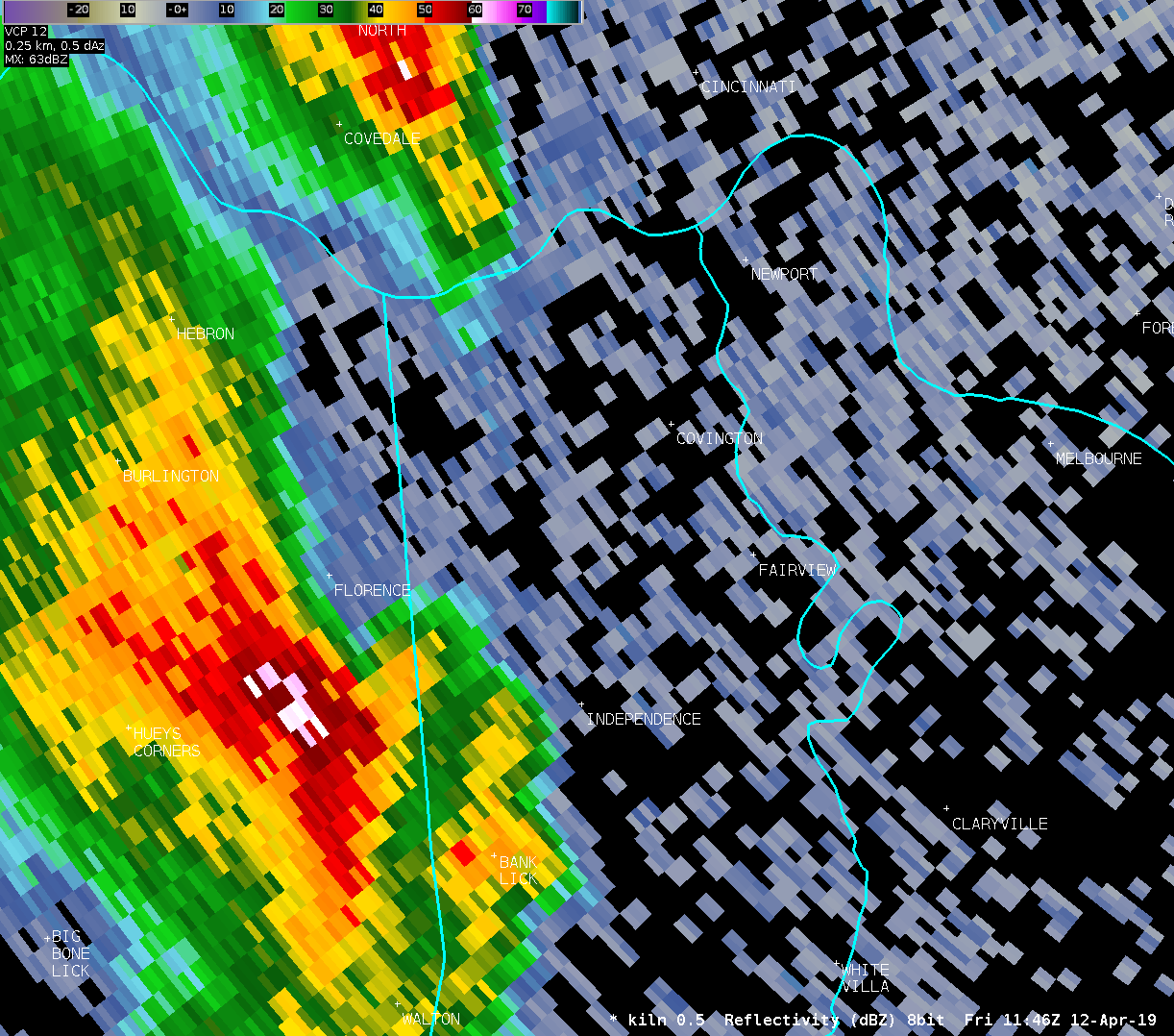
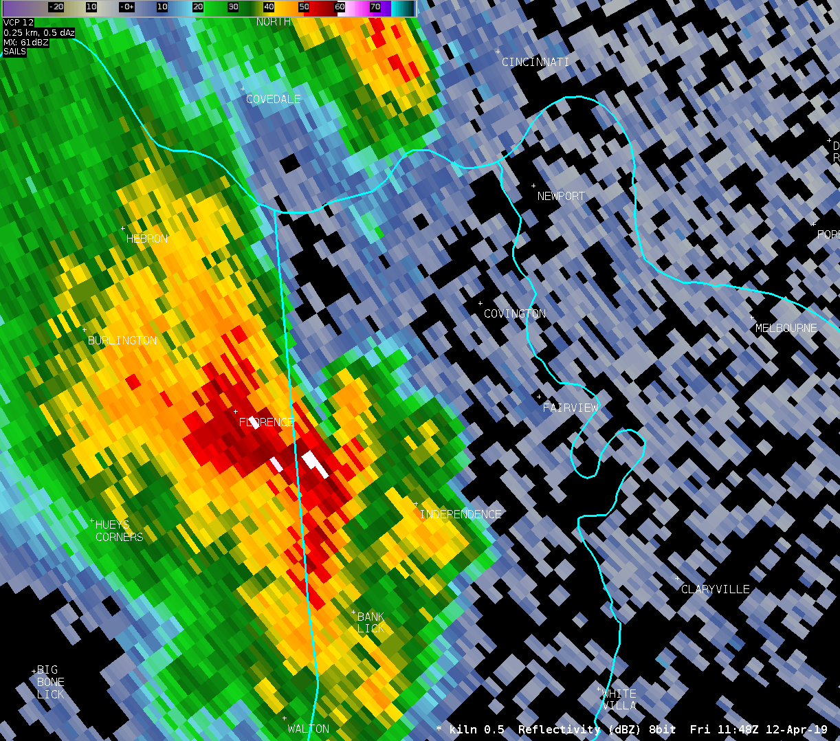
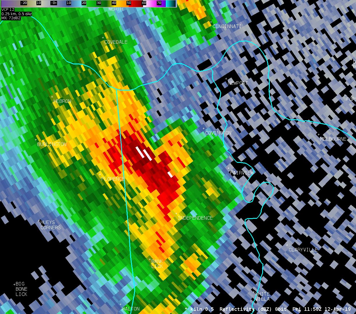
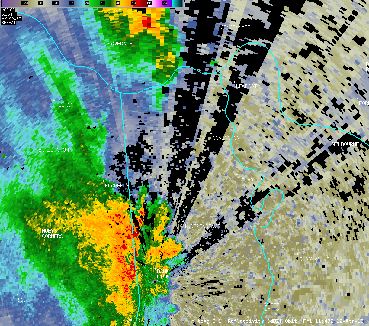
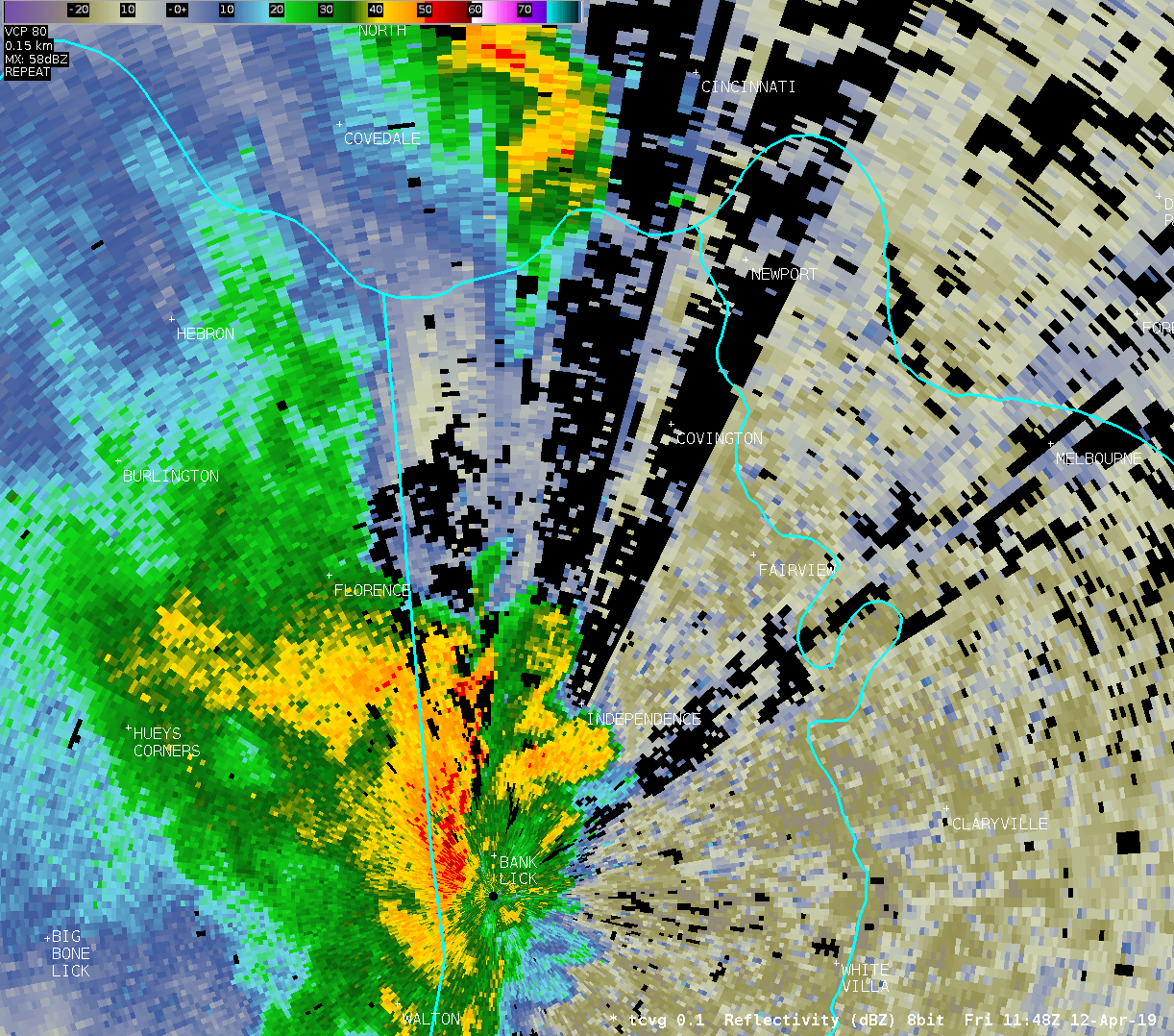
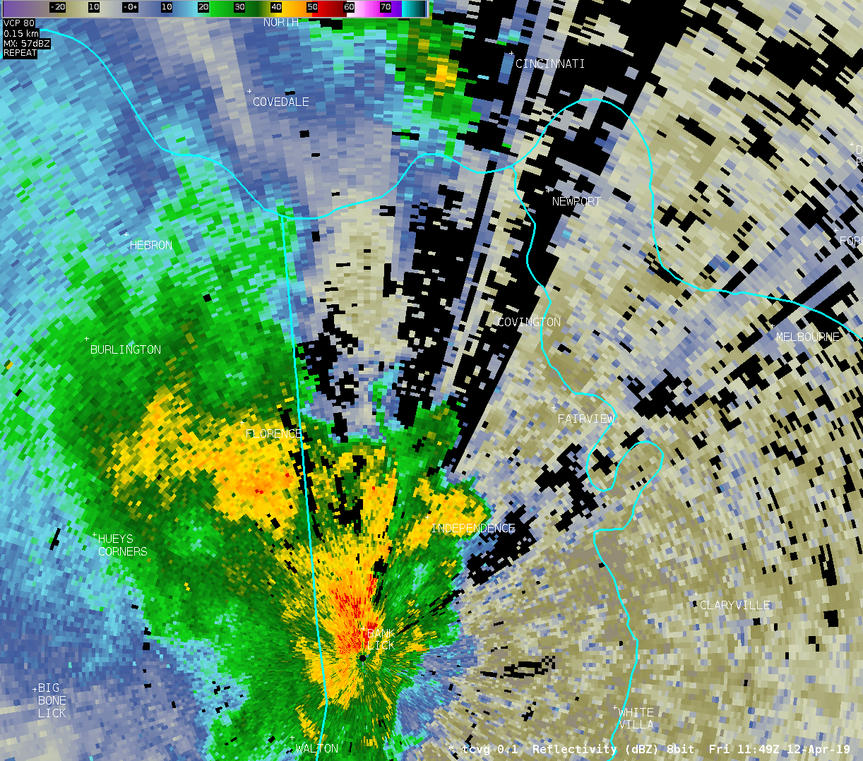
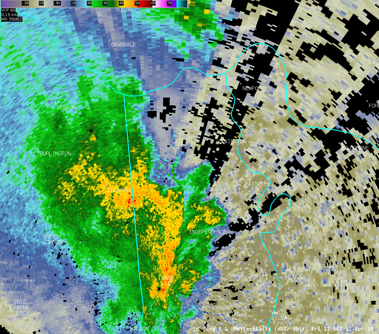
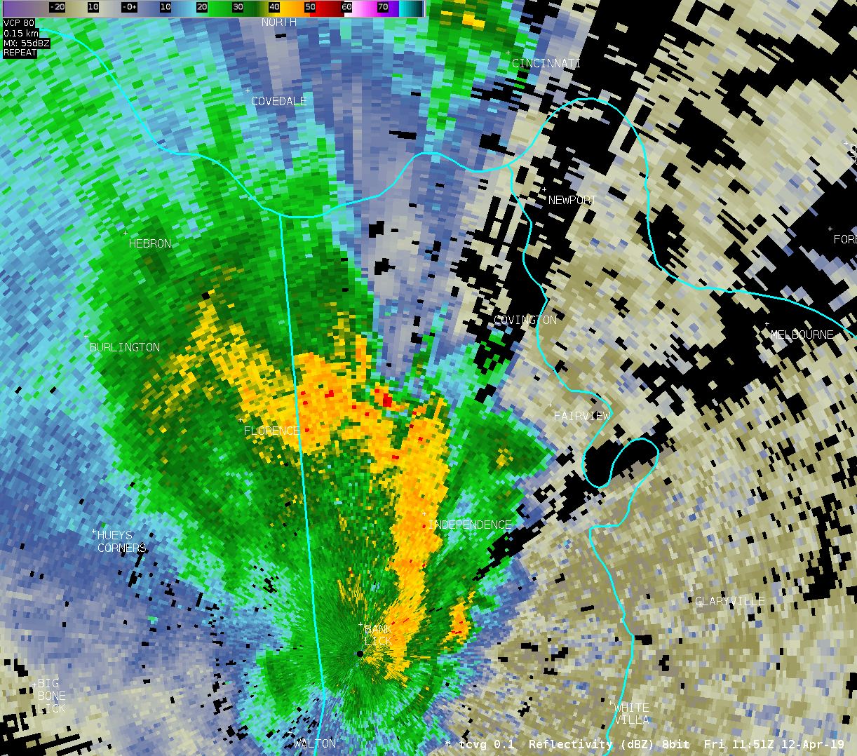
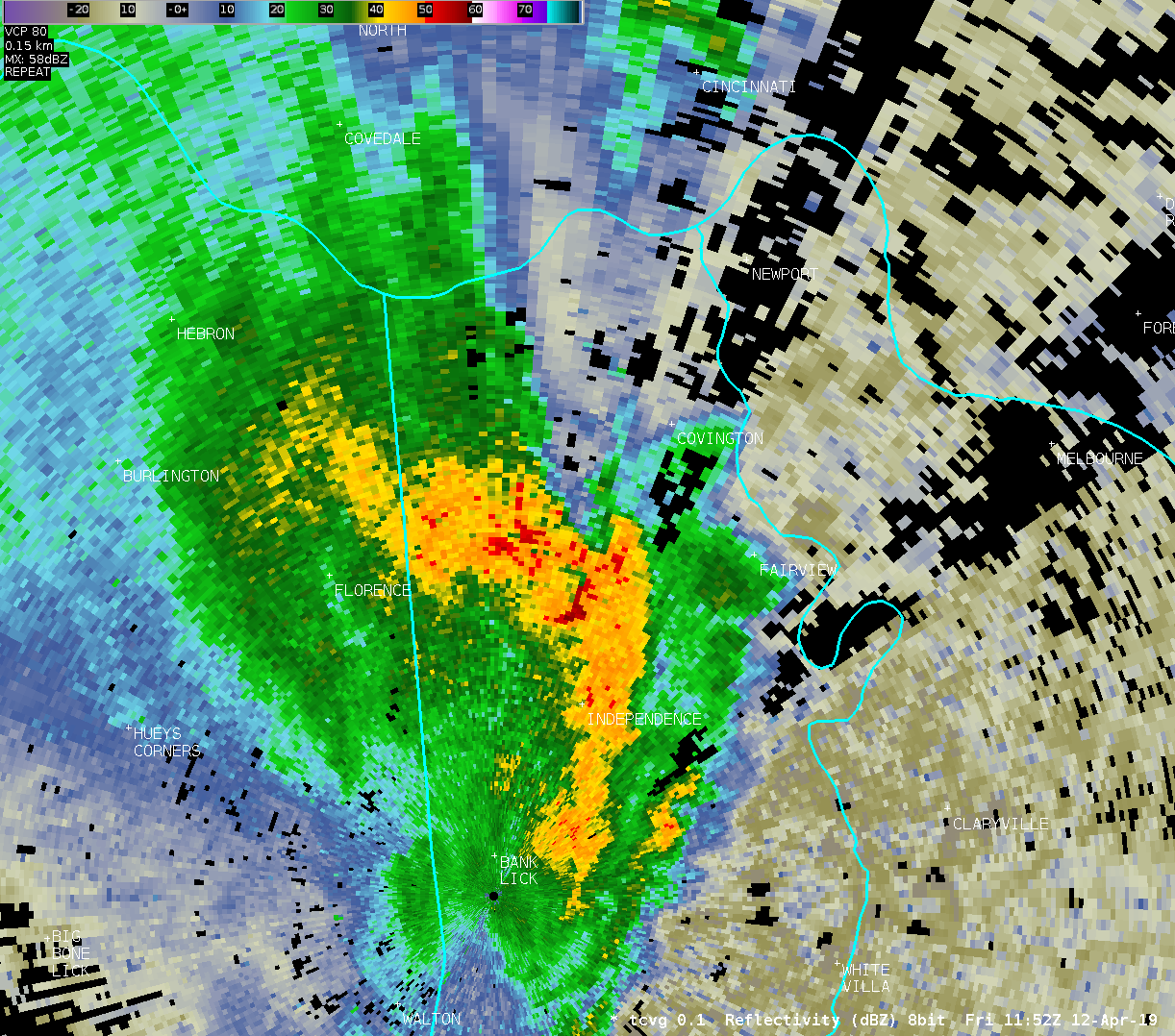
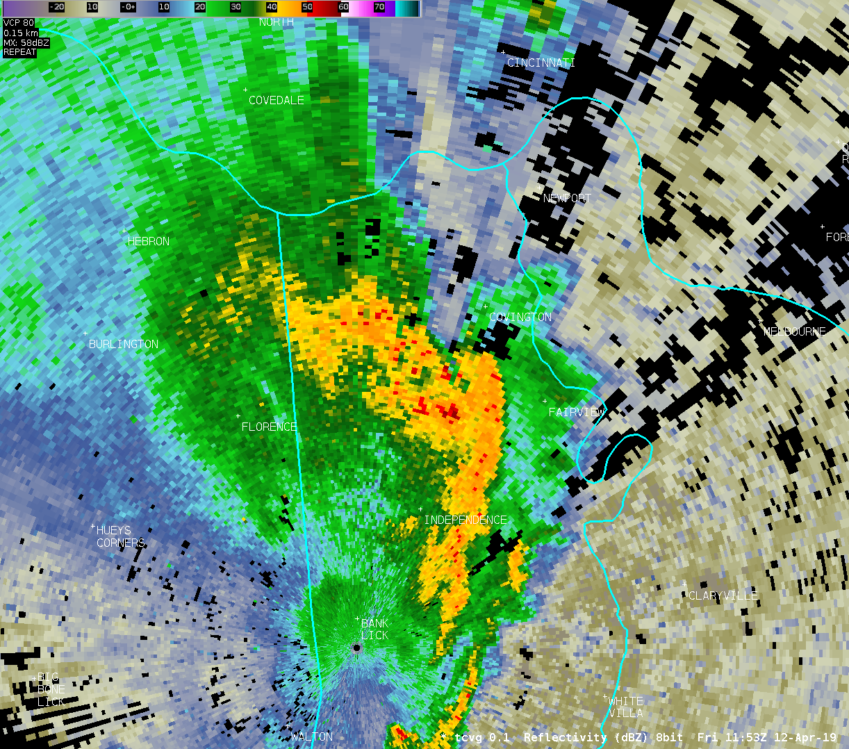
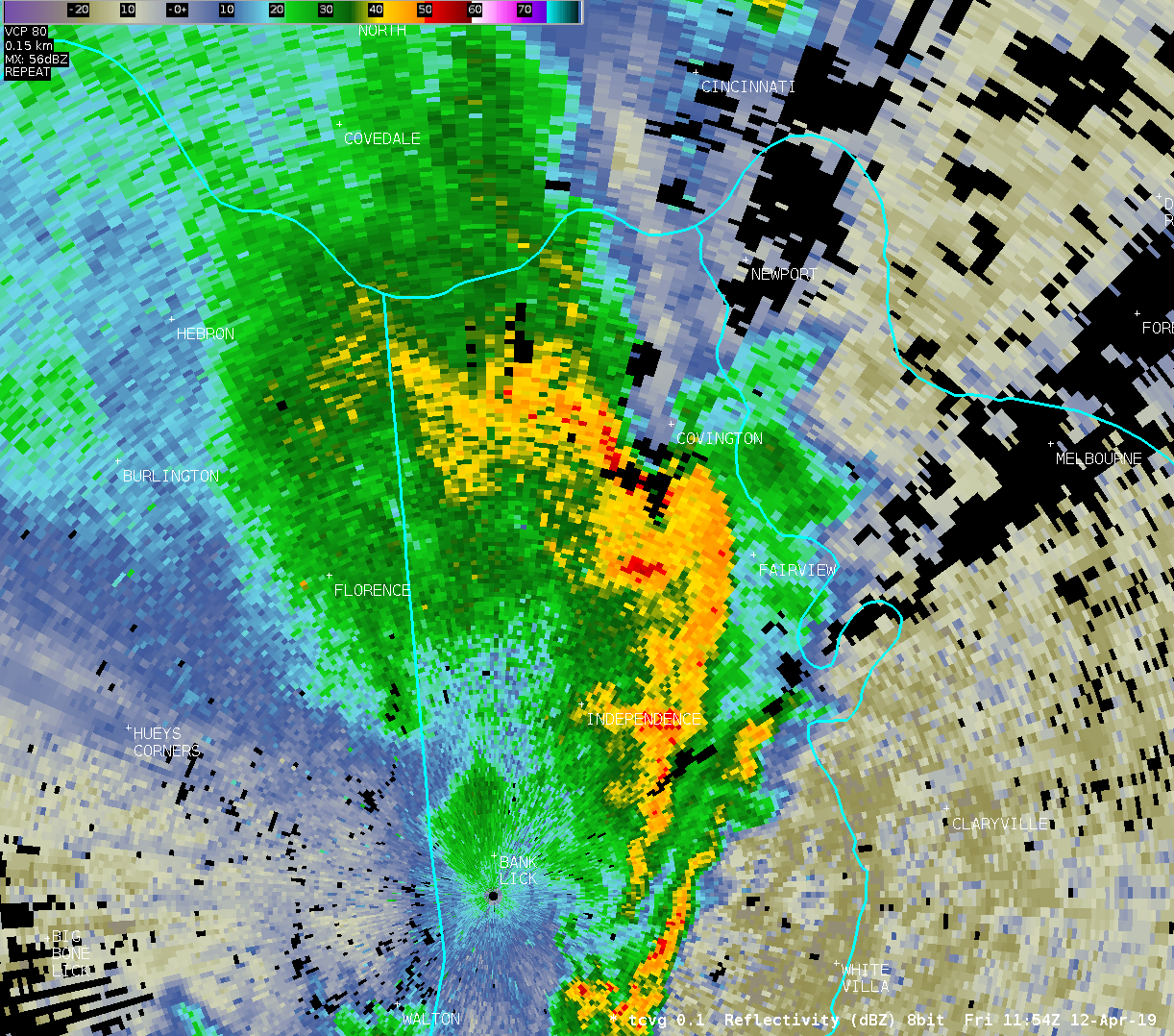
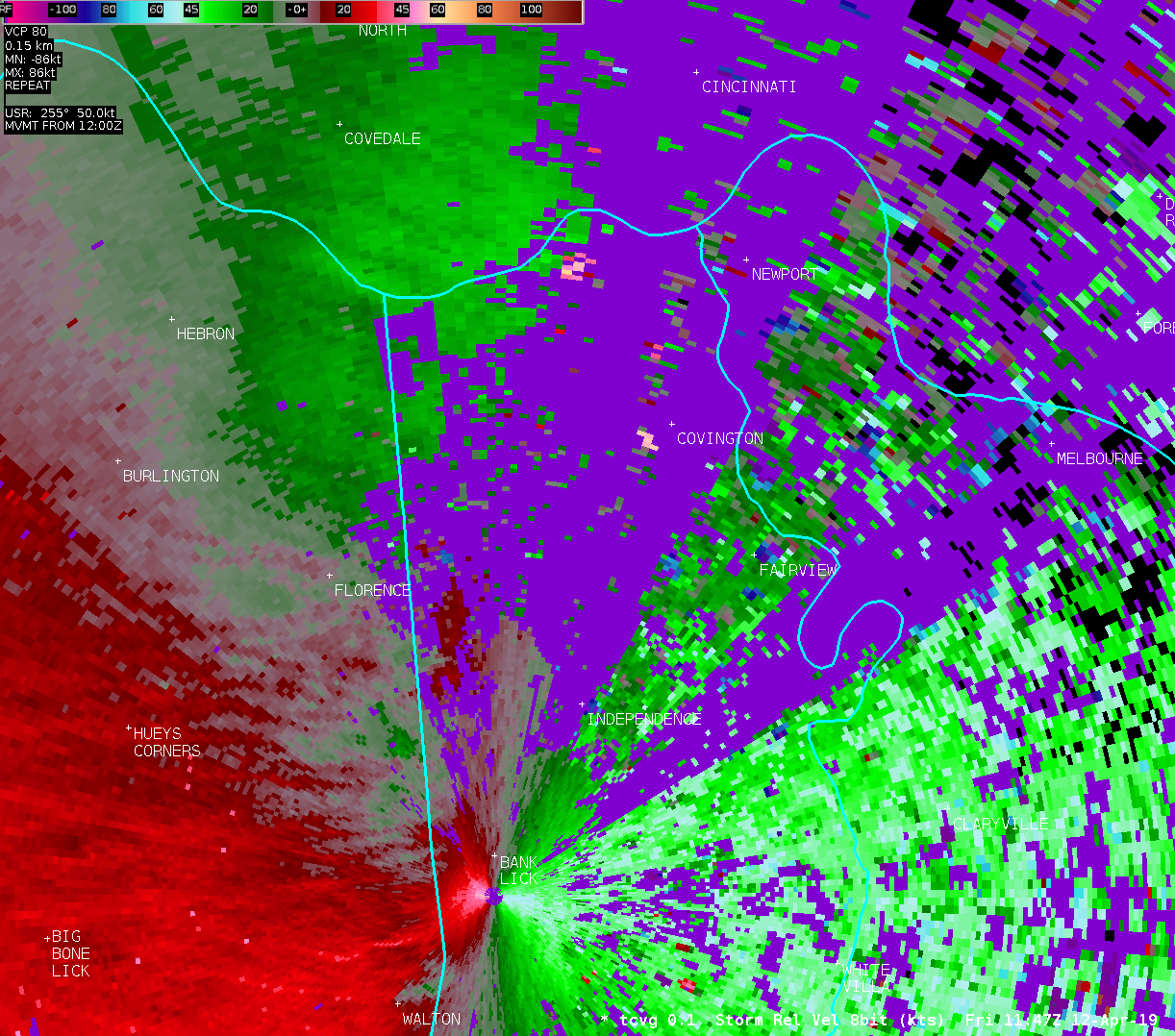
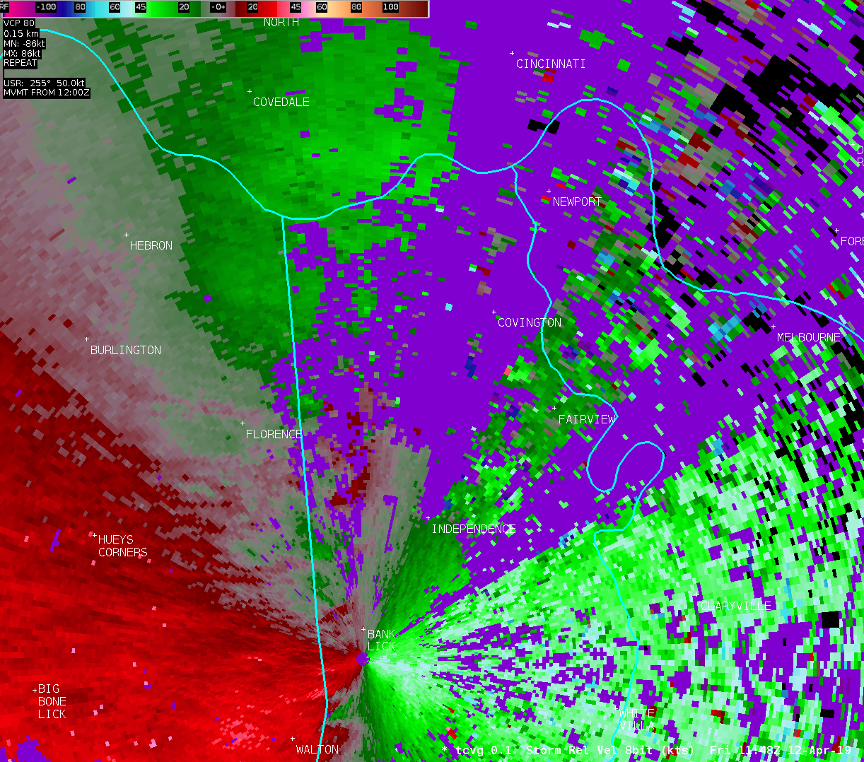
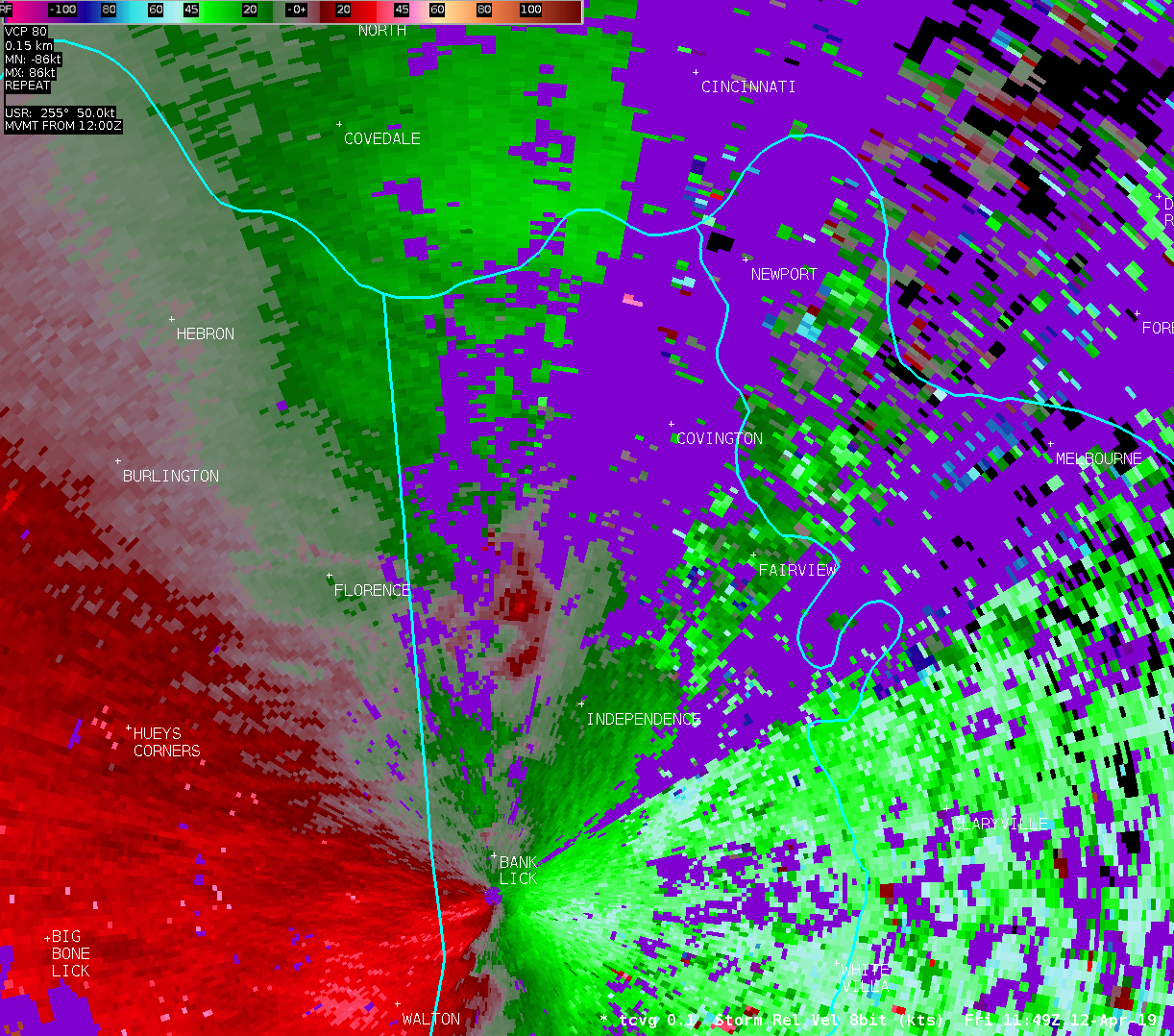
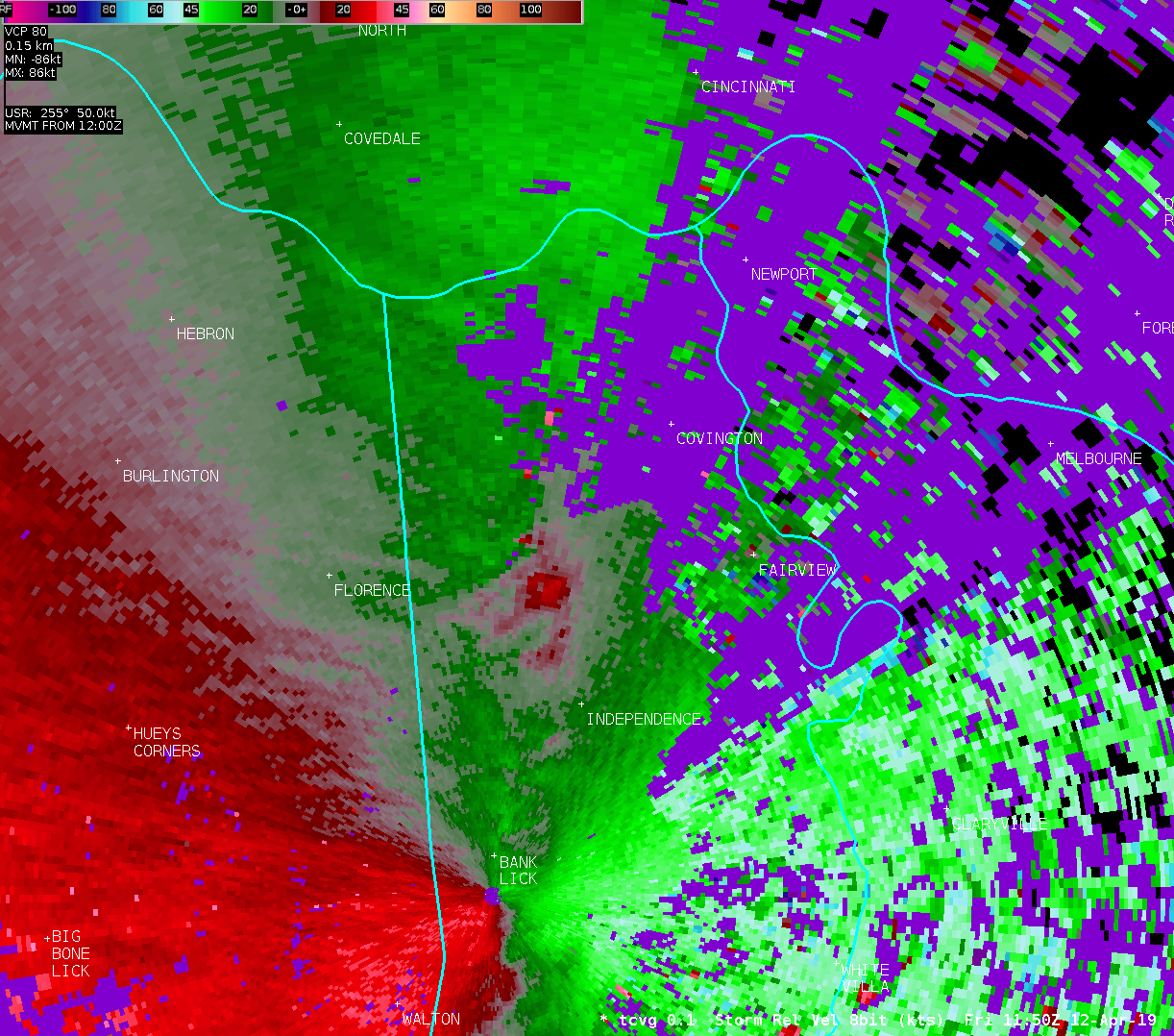
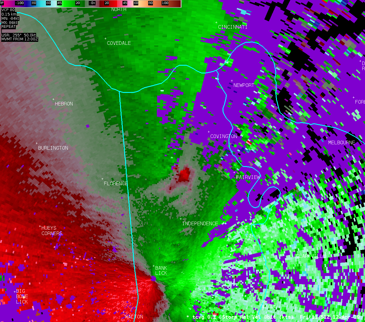
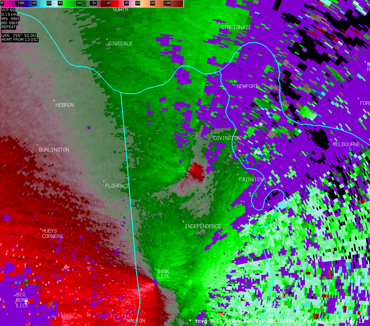
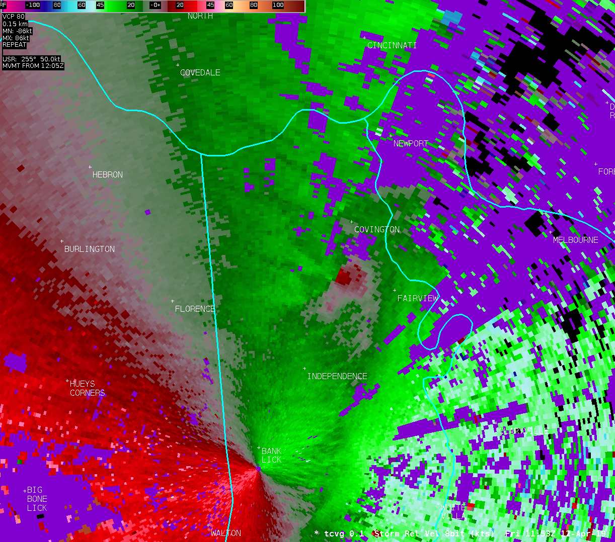
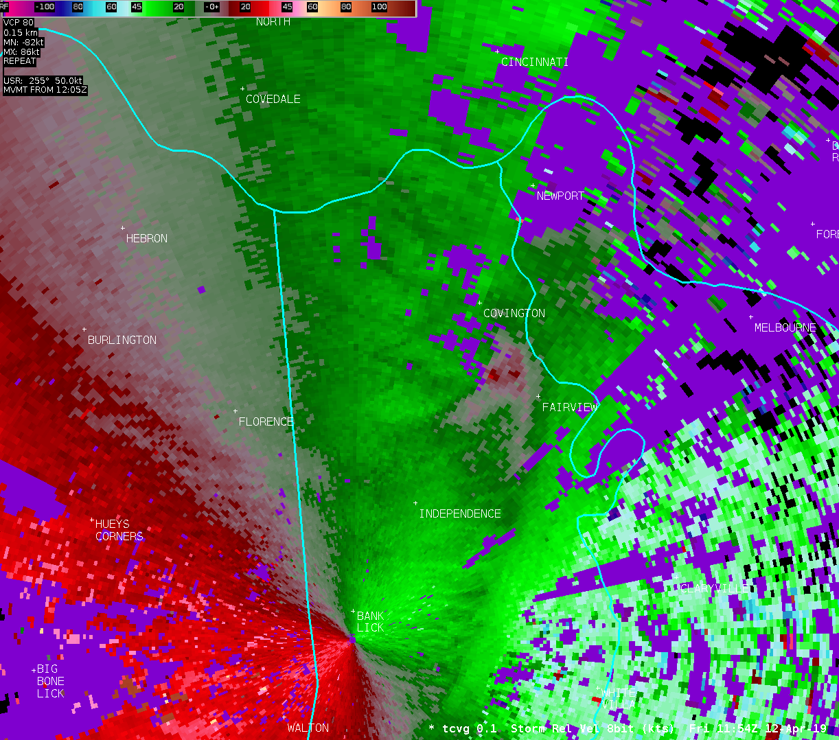
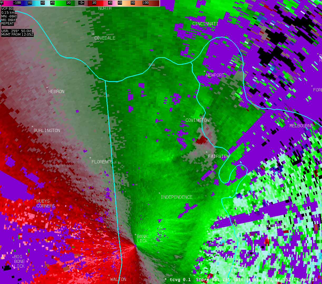
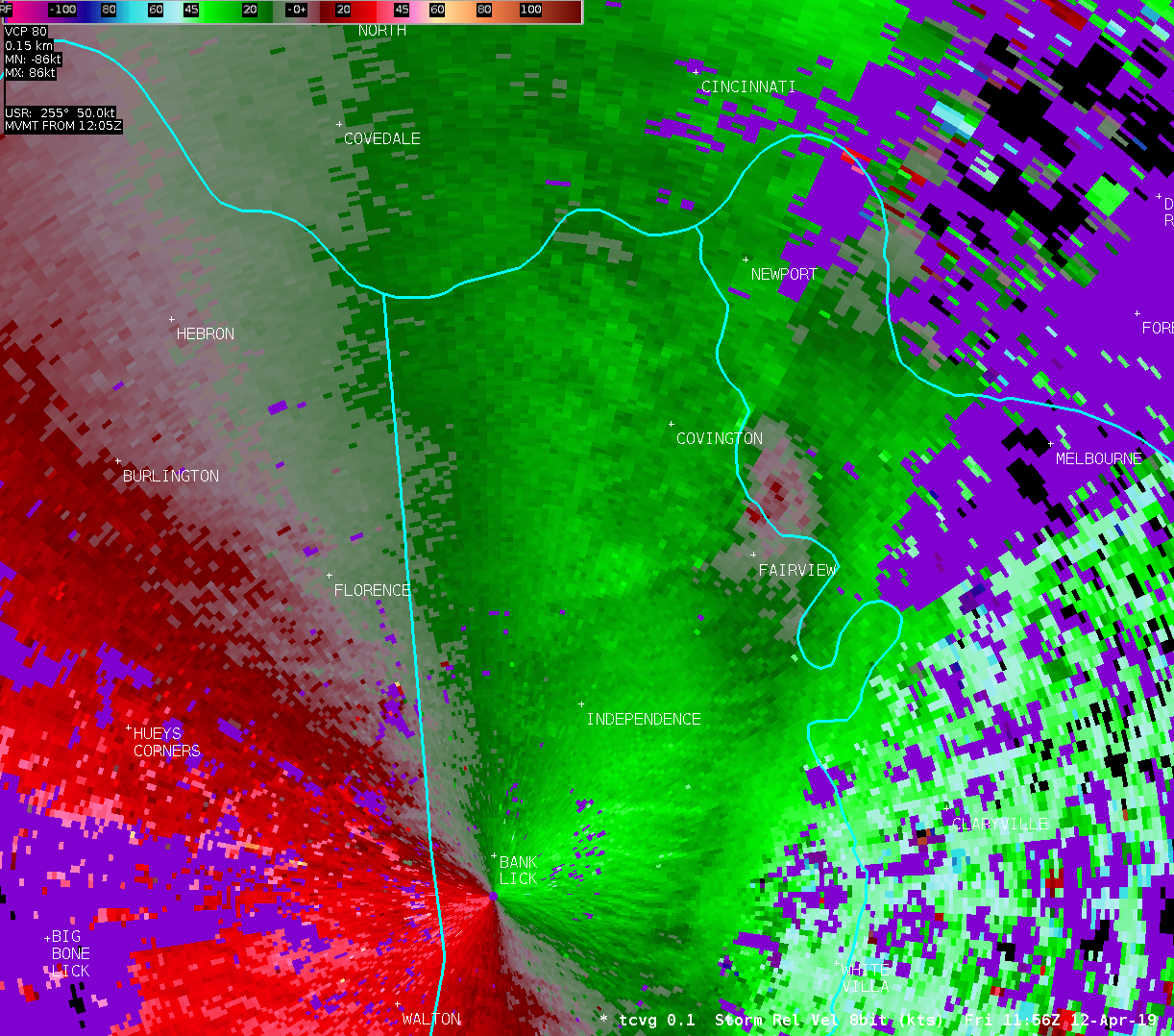
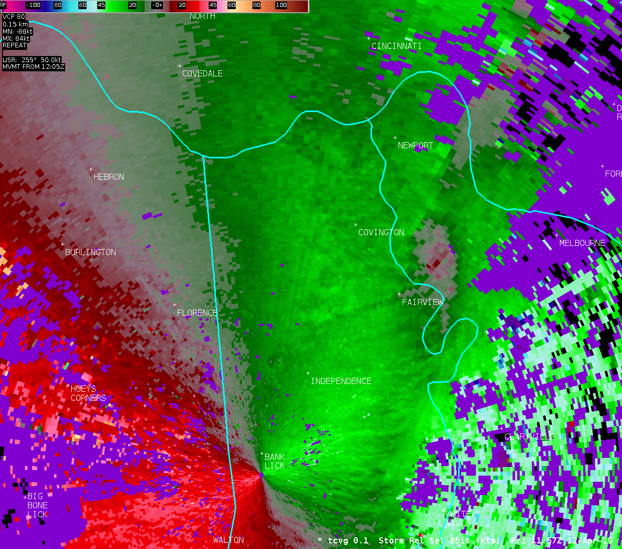
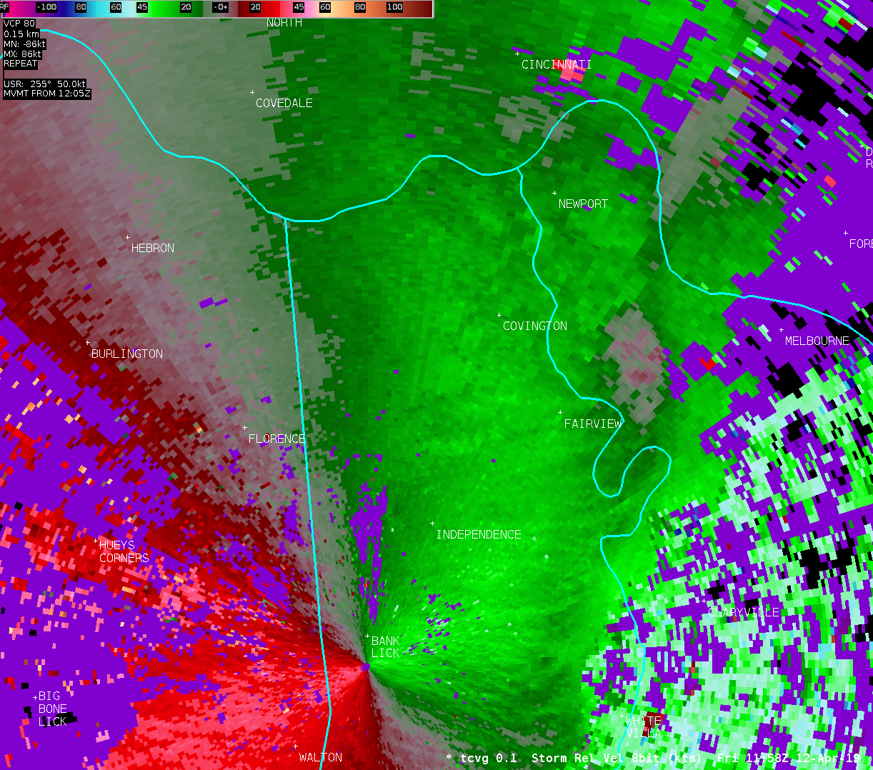
Location...Erlanger and Edgewood in Kenton County Kentucky
Date...April 12 2019
Estimated Time...752 am EDT
Estimated Maximum Wind Speed...60 to 70 mph.
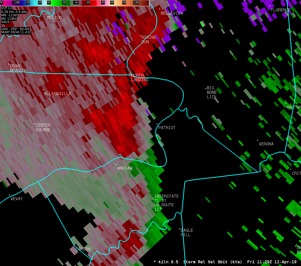
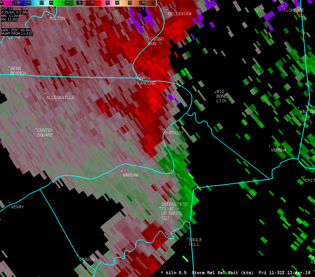
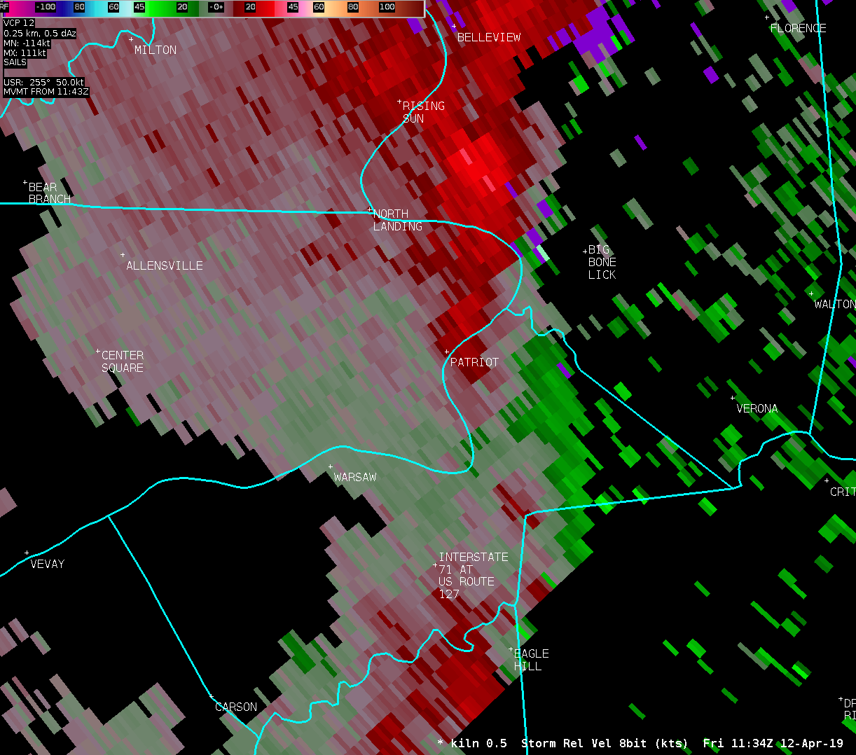
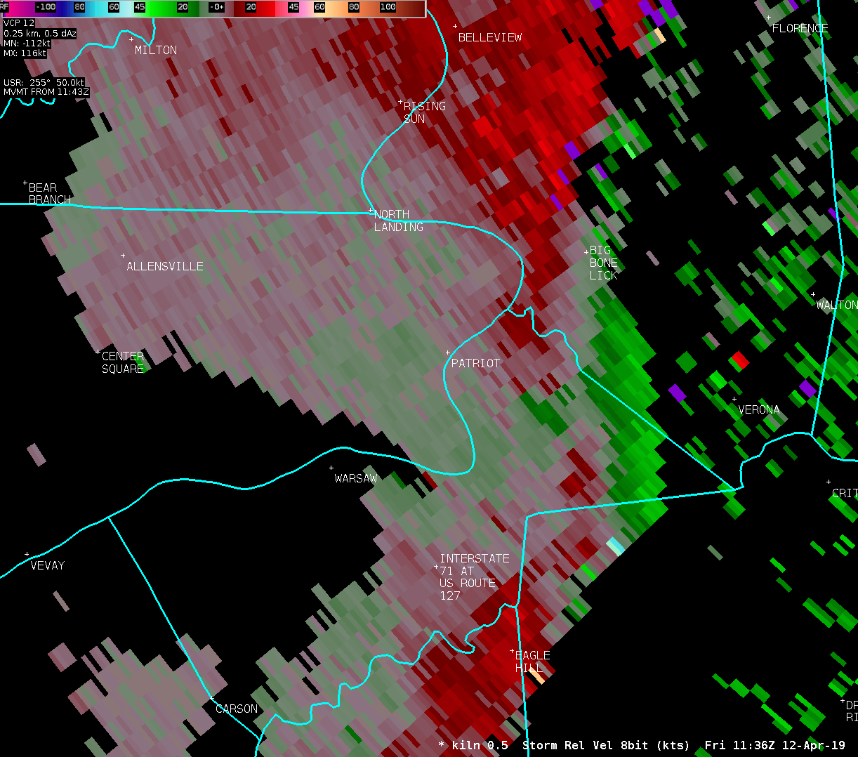
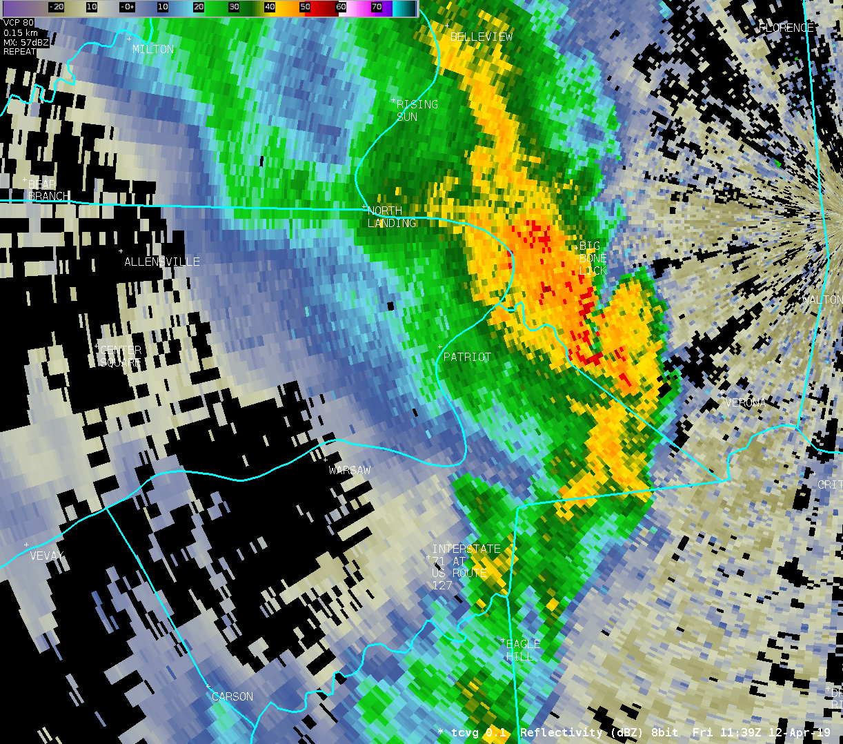
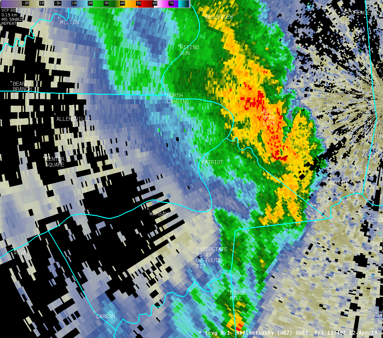
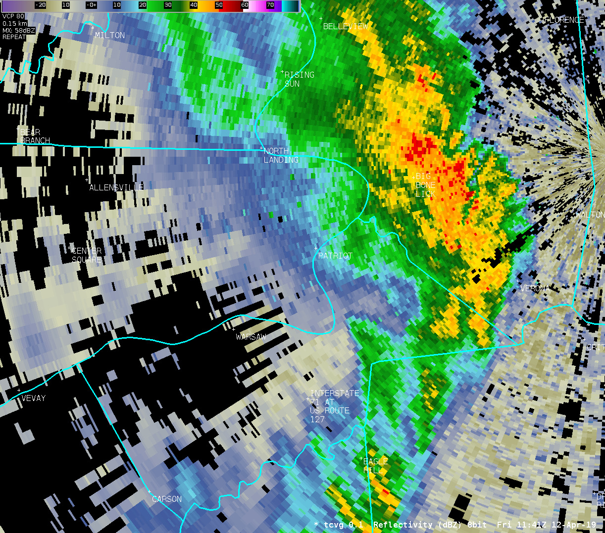
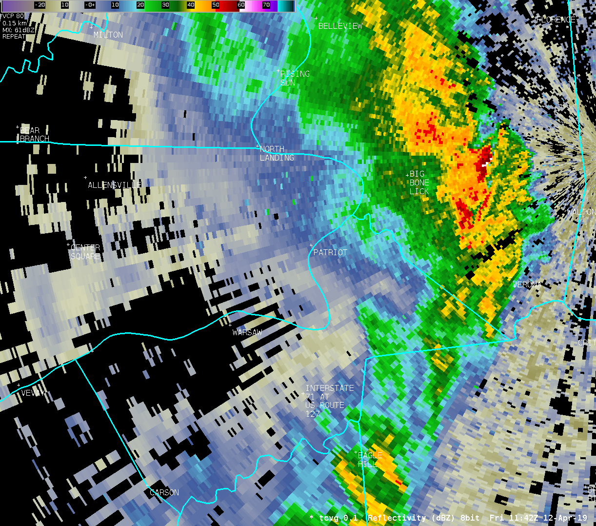
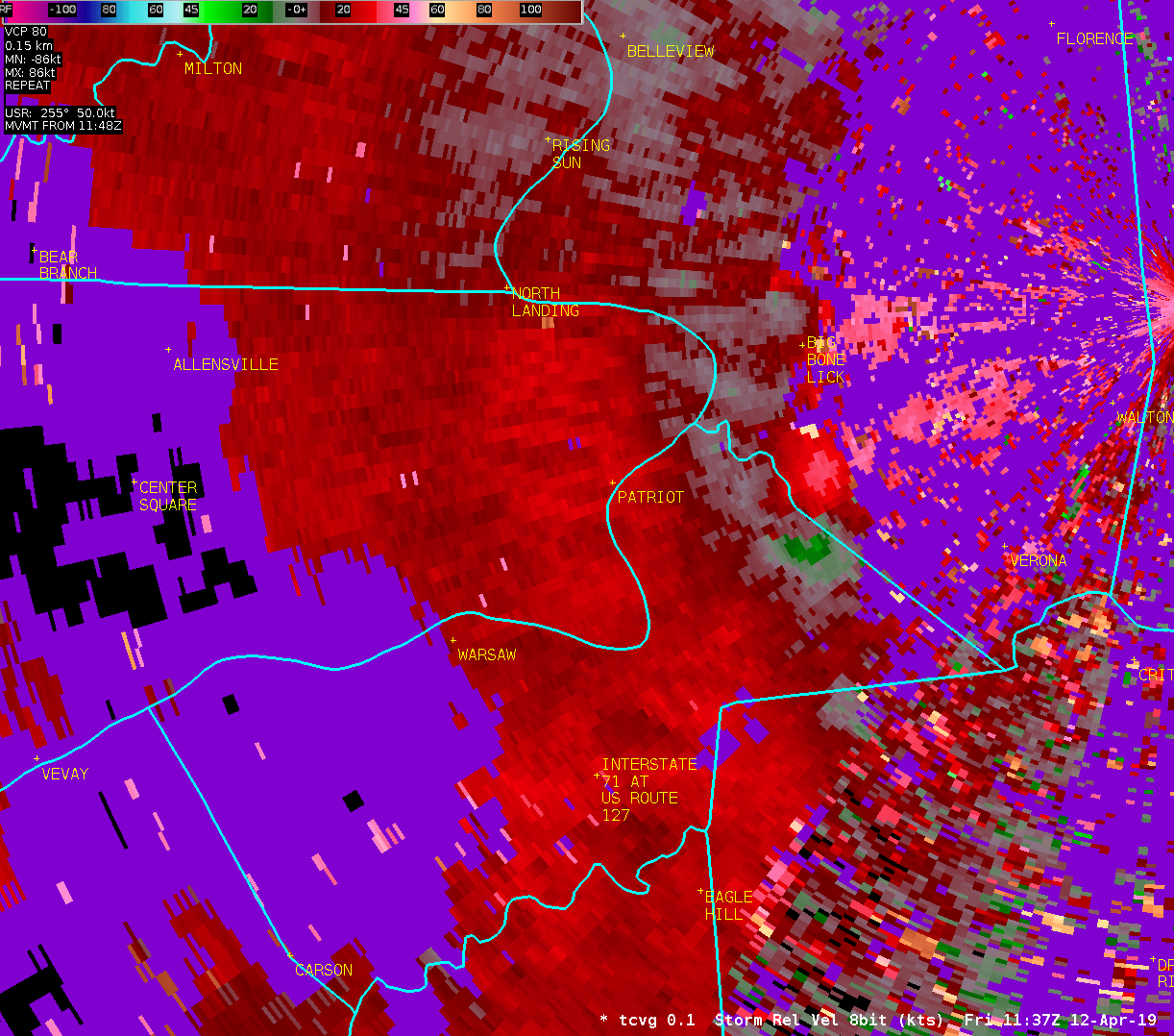
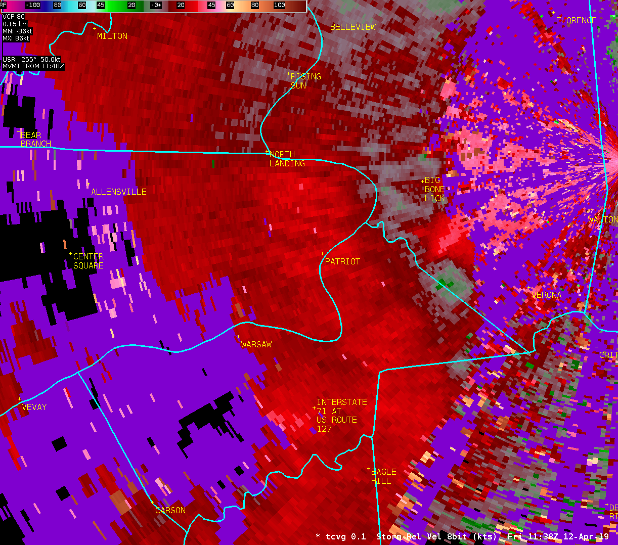
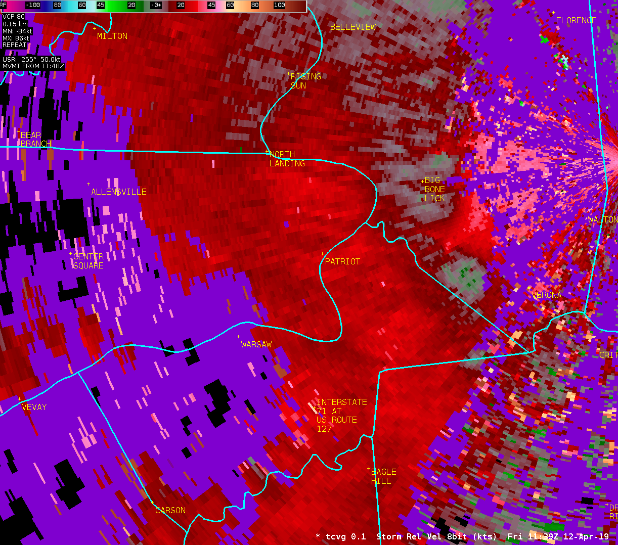
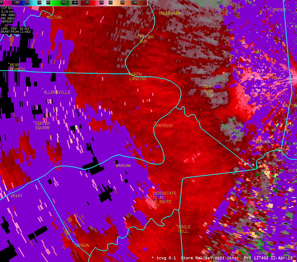
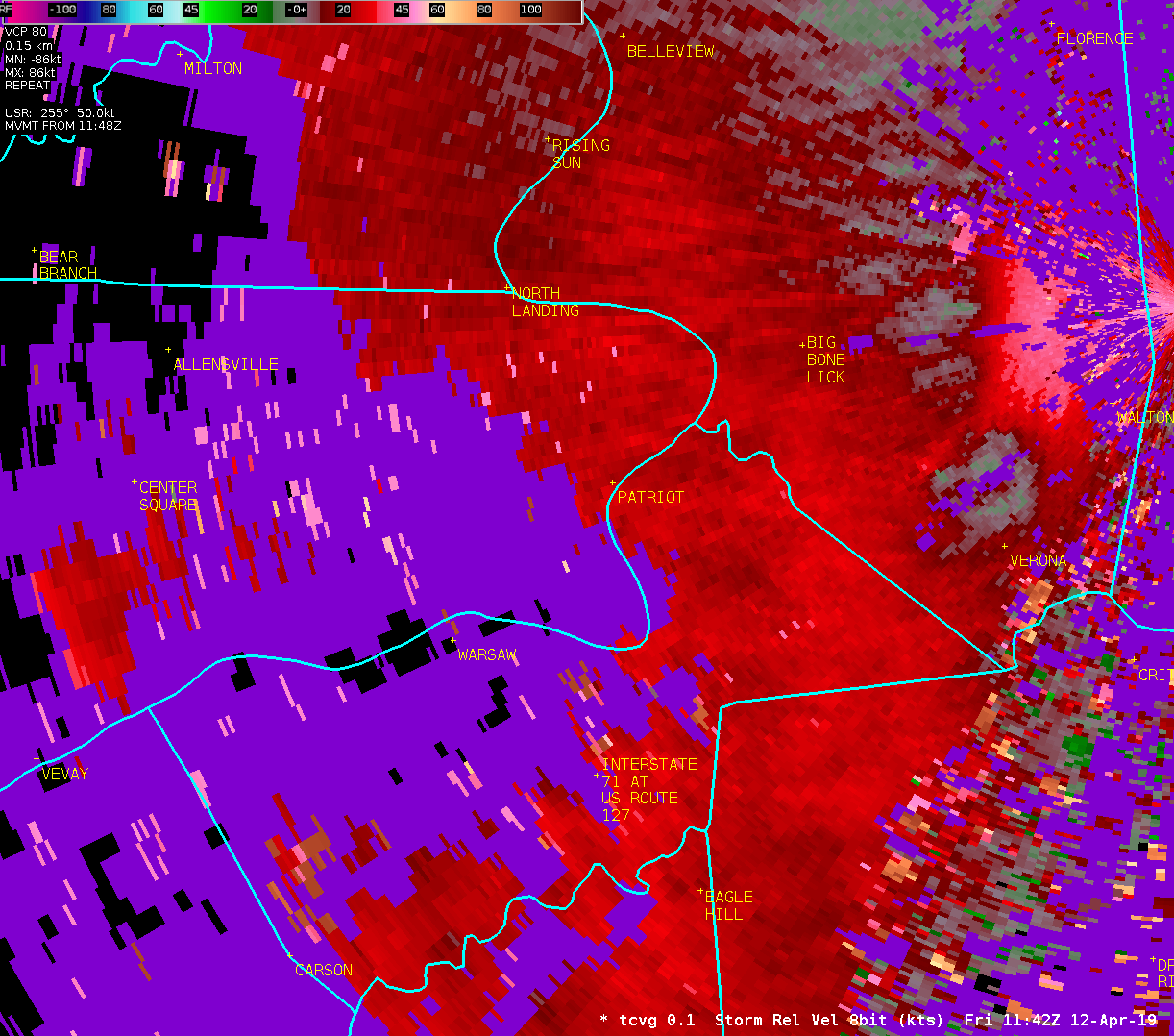
Location...South of Patriot in Switzerland County Indiana
Date...April 12 2019
Estimated Time...735 am EDT
Estimated Maximum Wind Speed...70 to 80 mph.
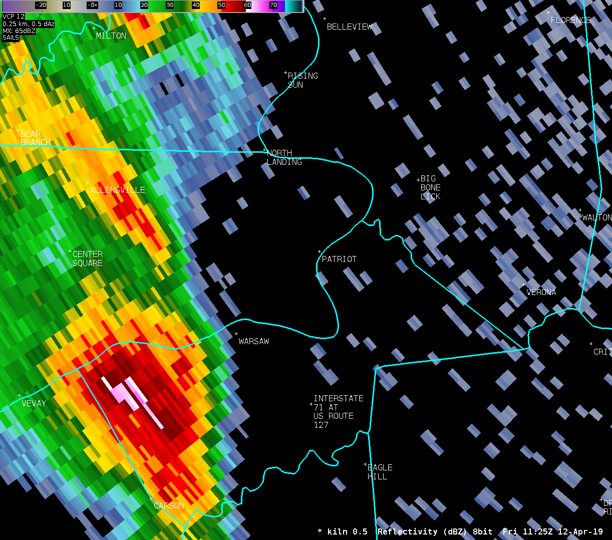
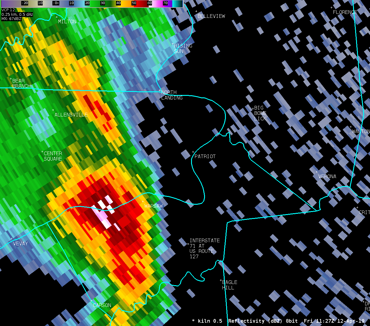
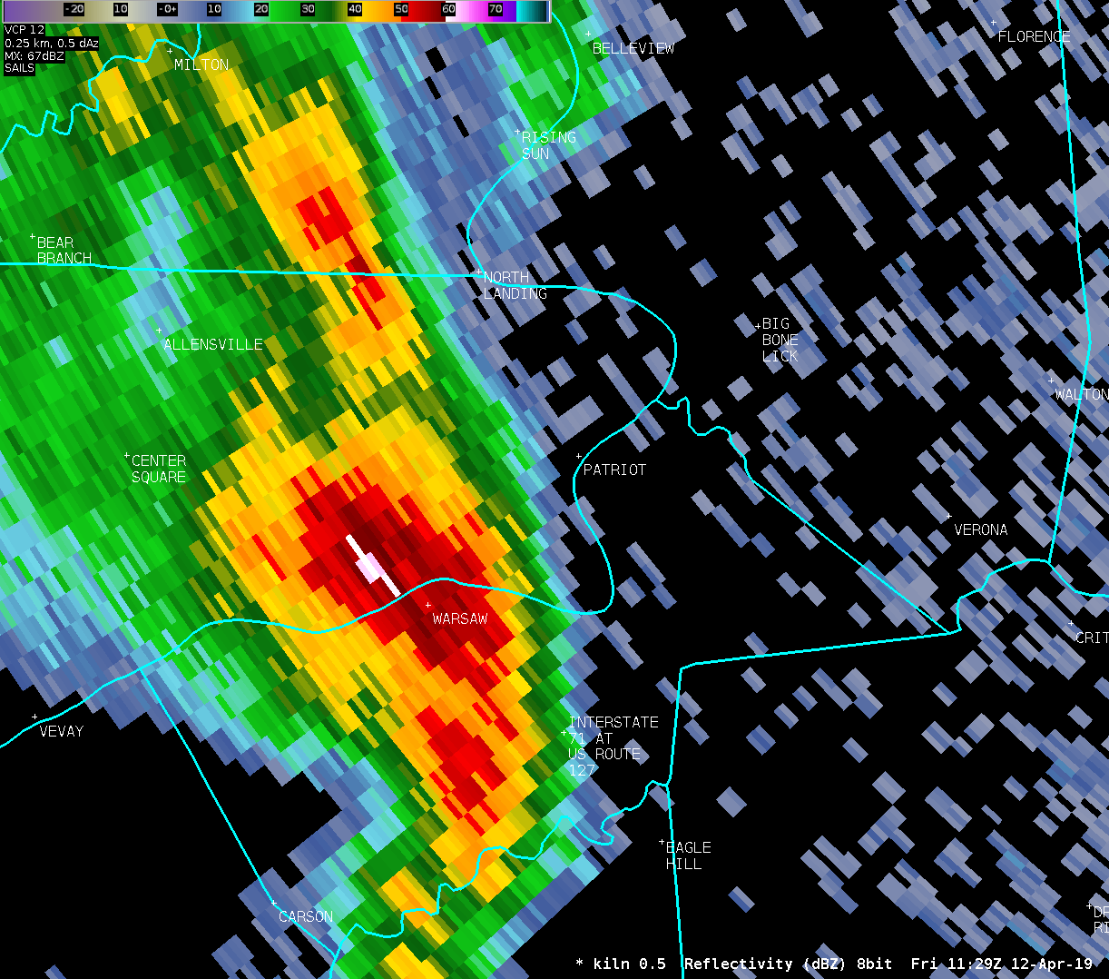
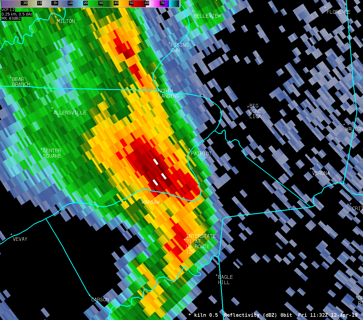
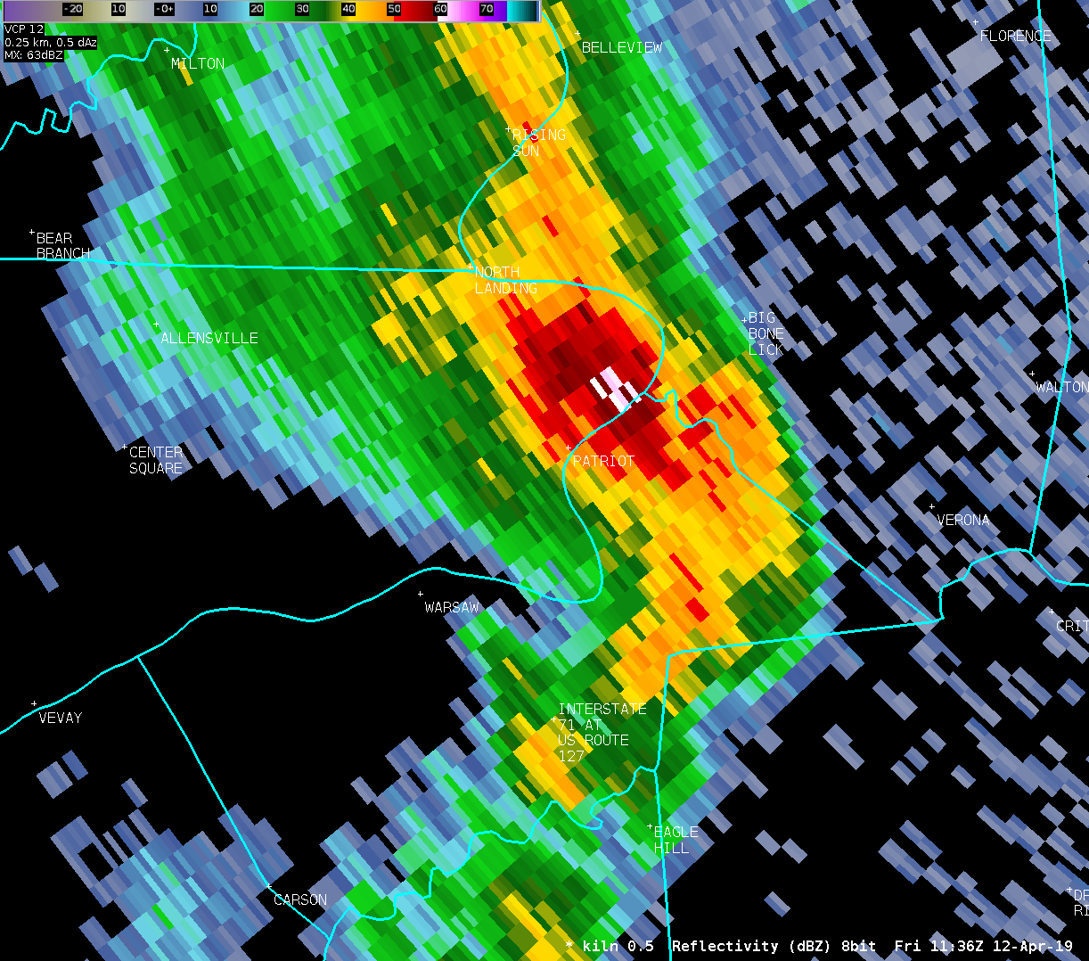
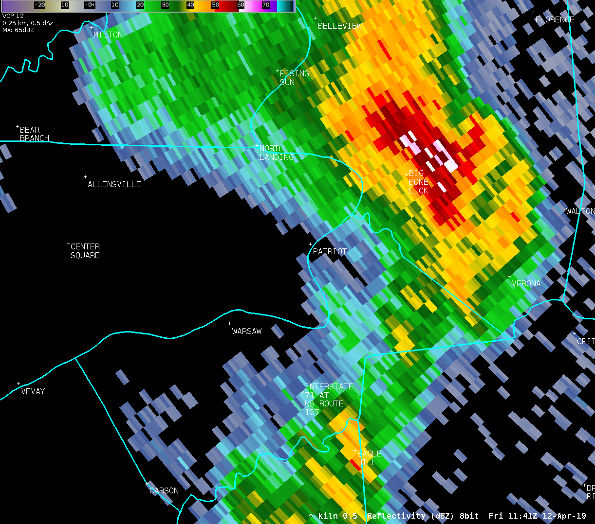
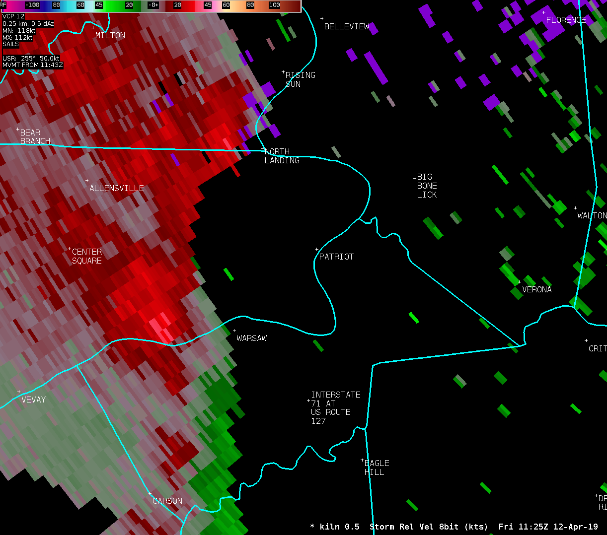
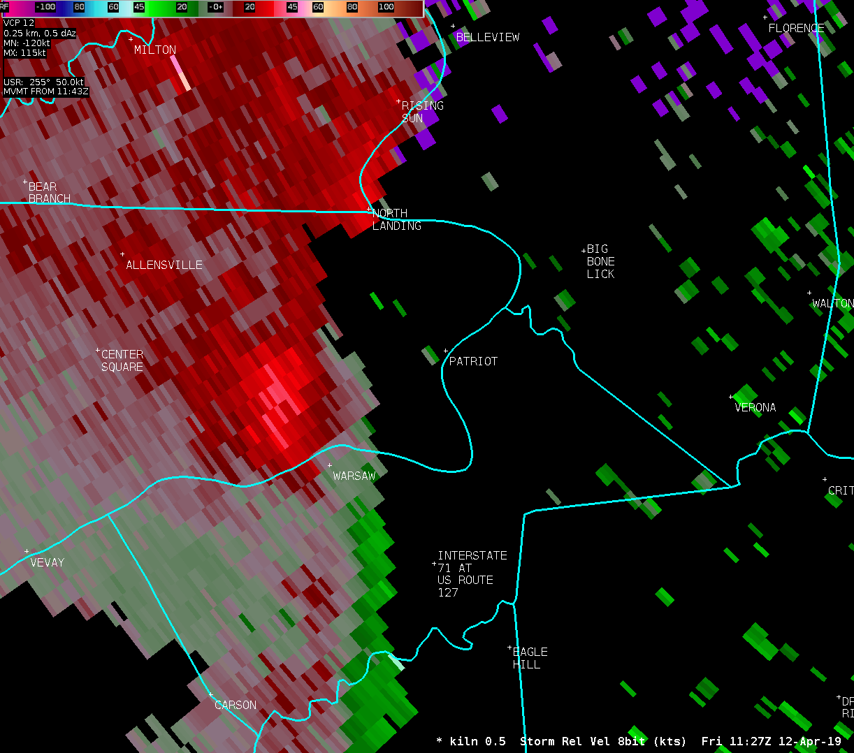
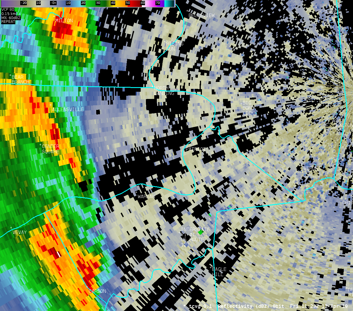
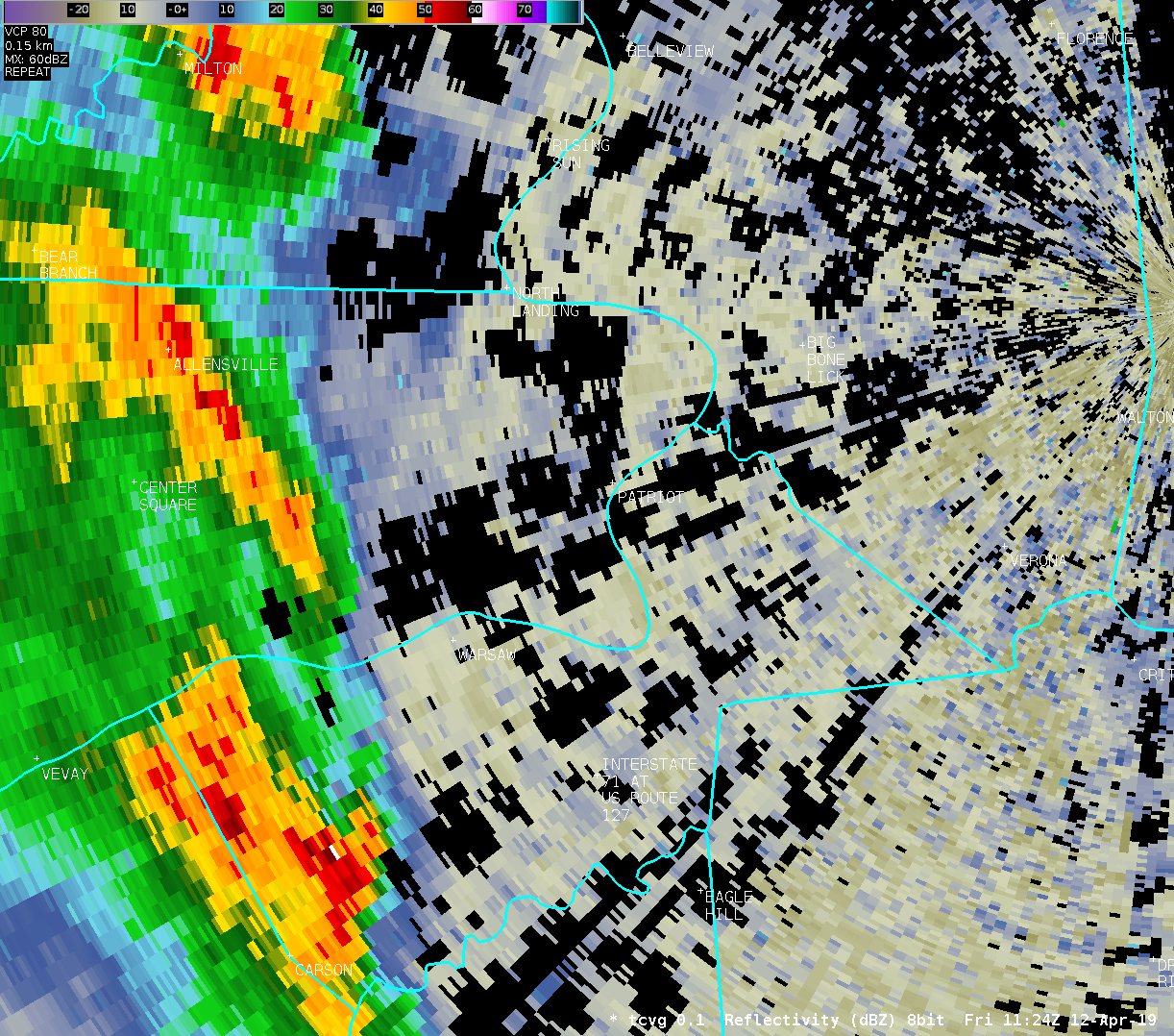
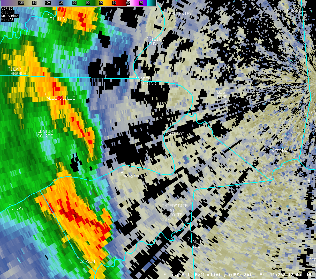
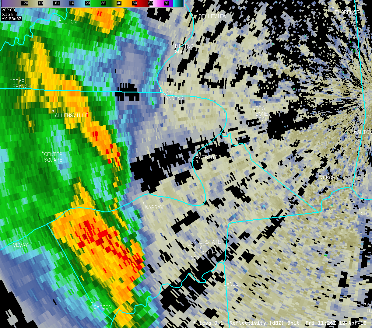
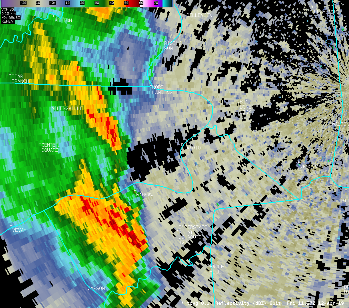
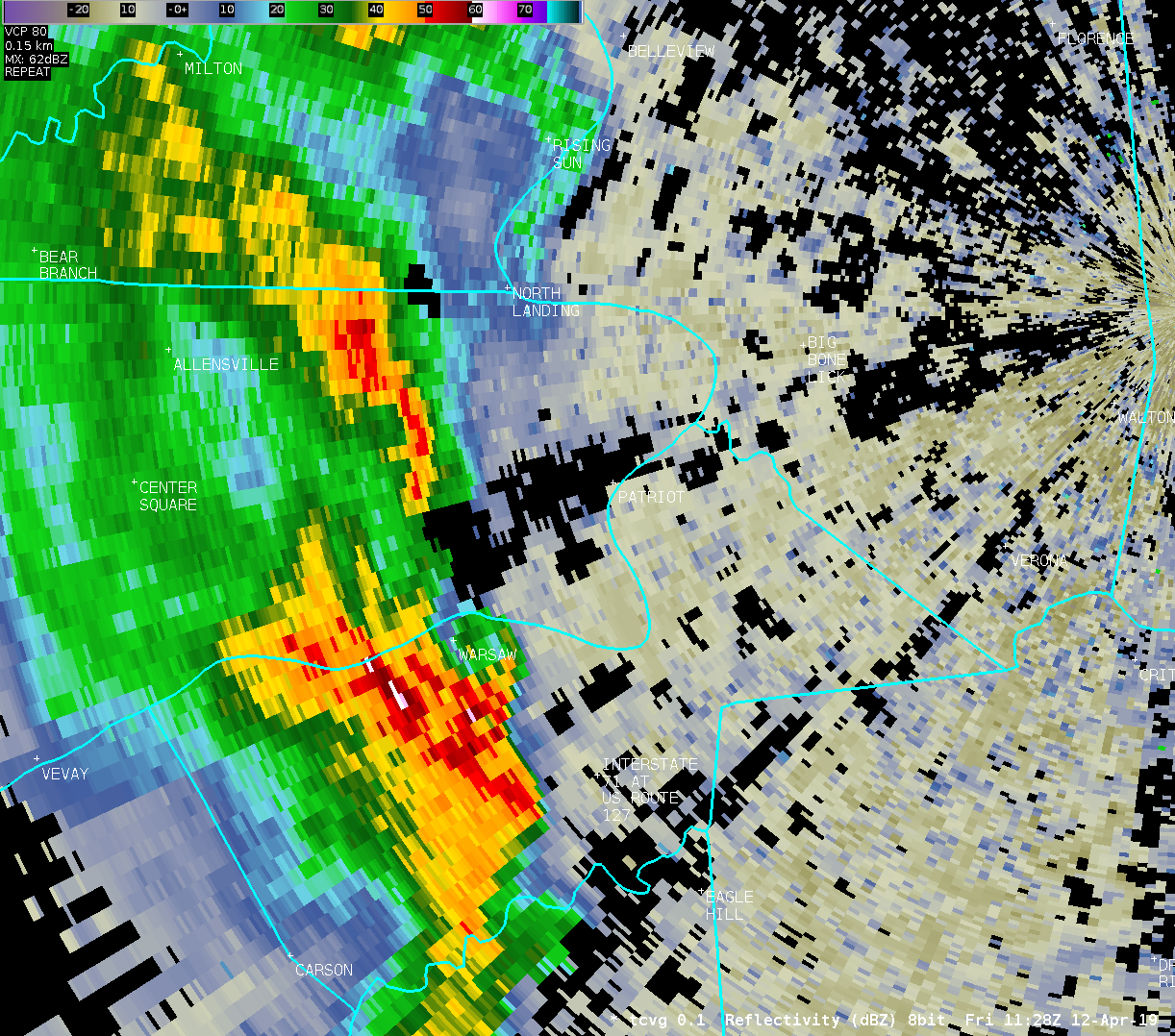
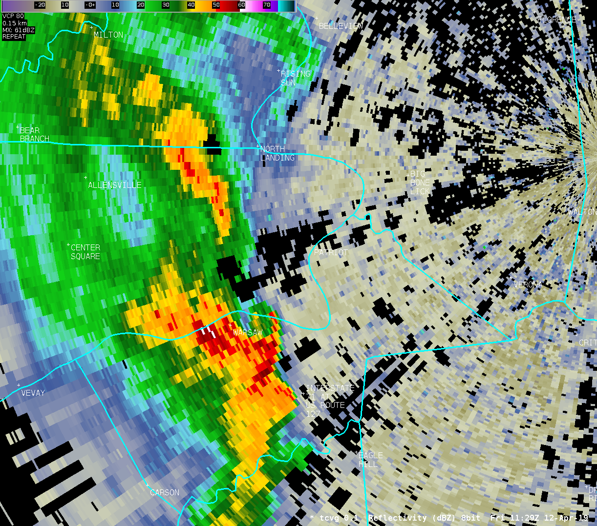
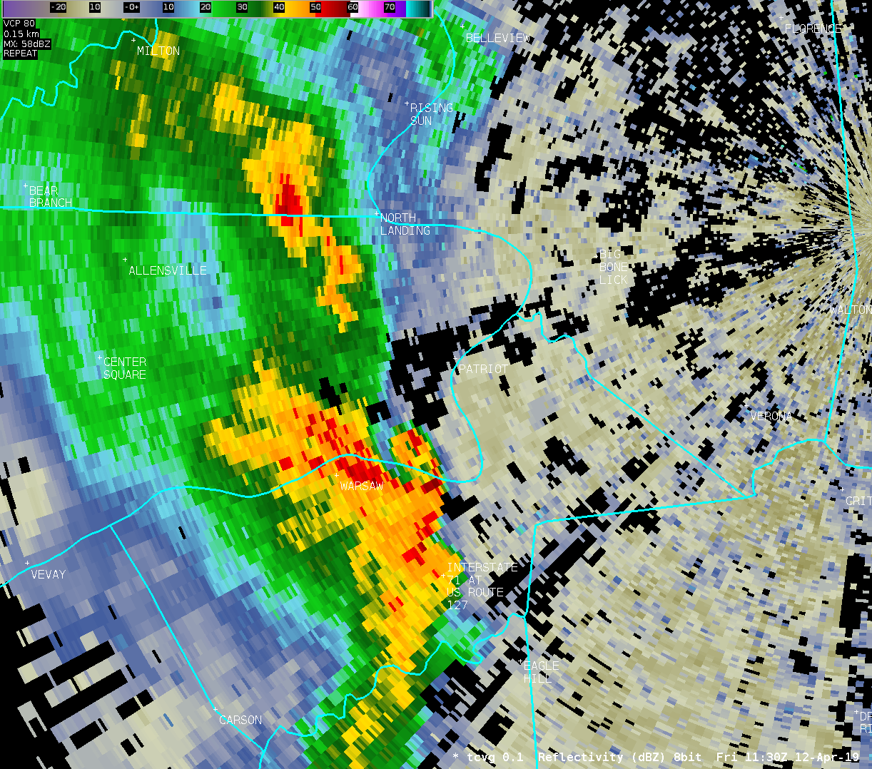
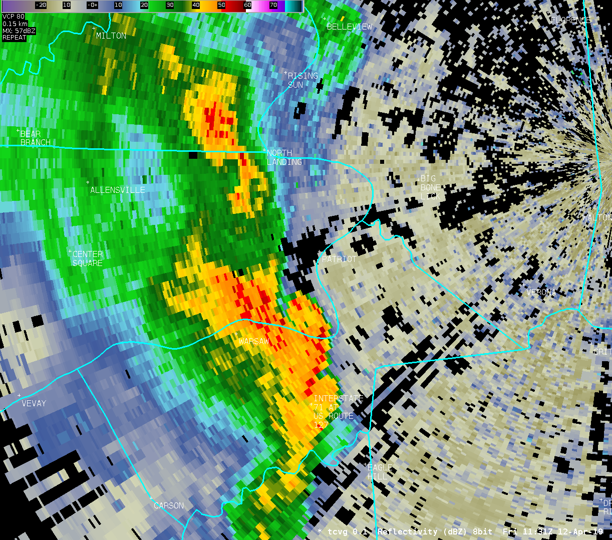
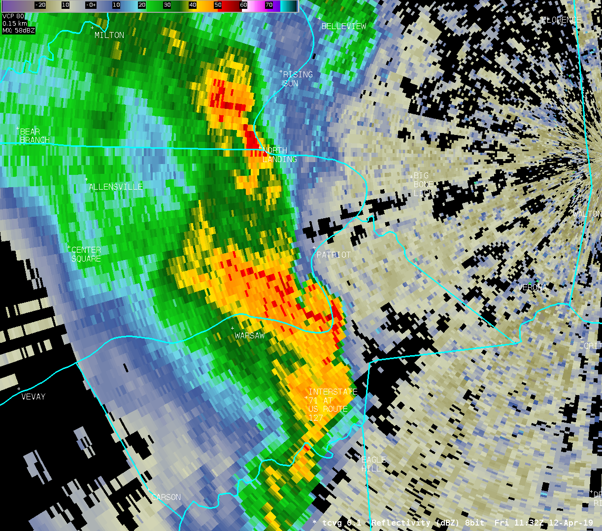
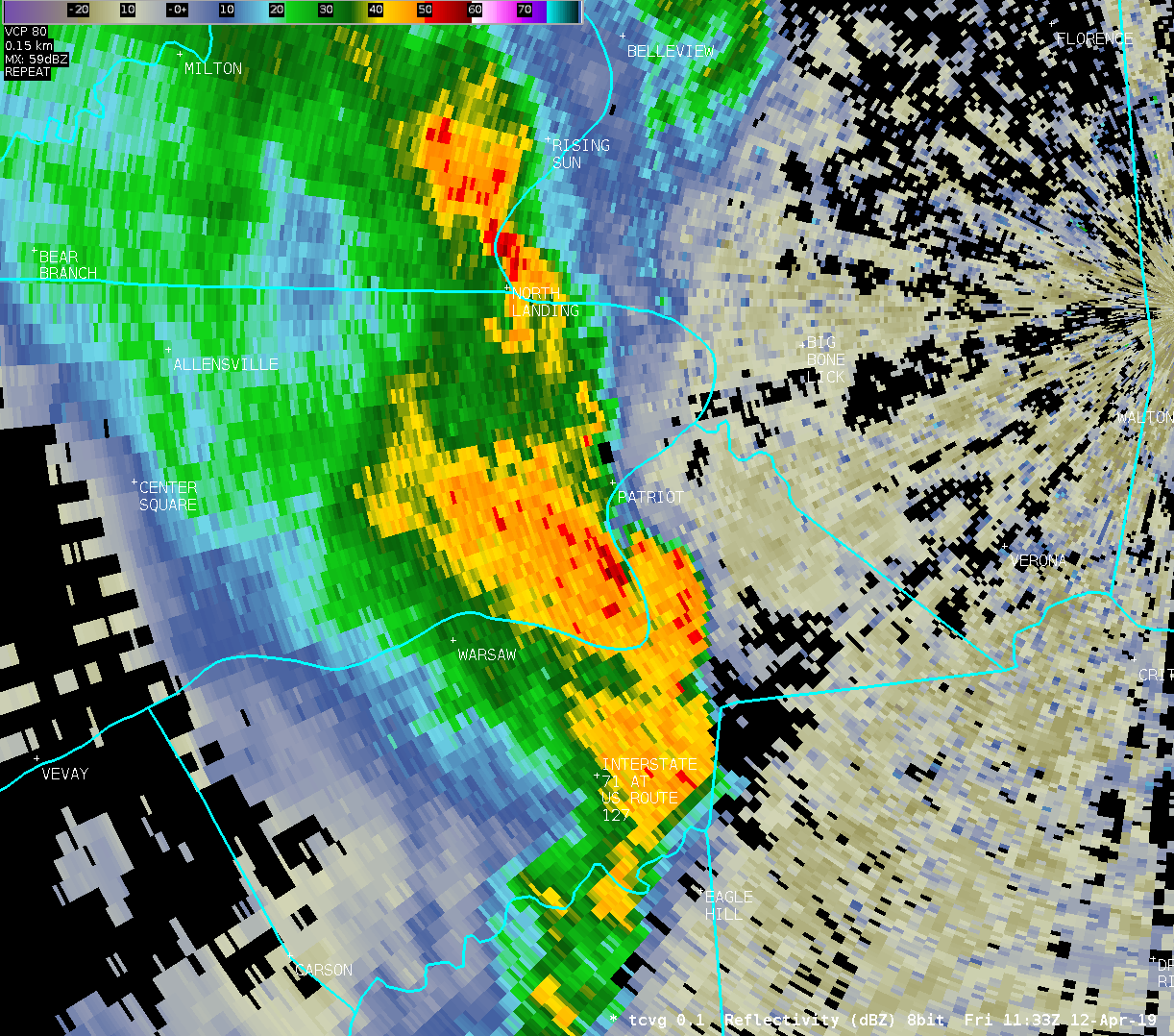
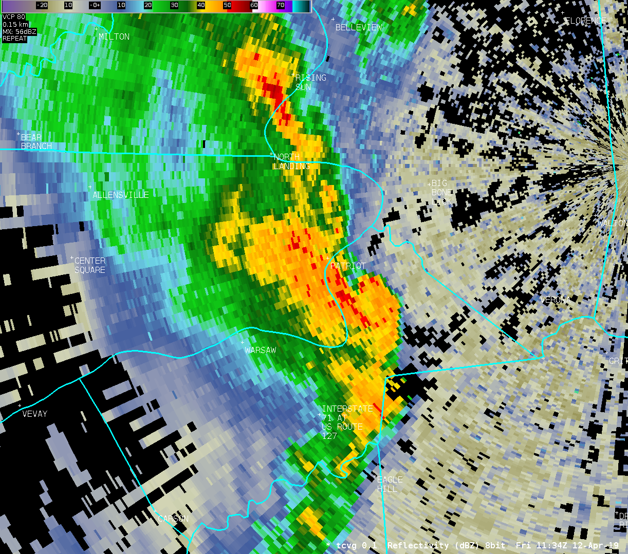
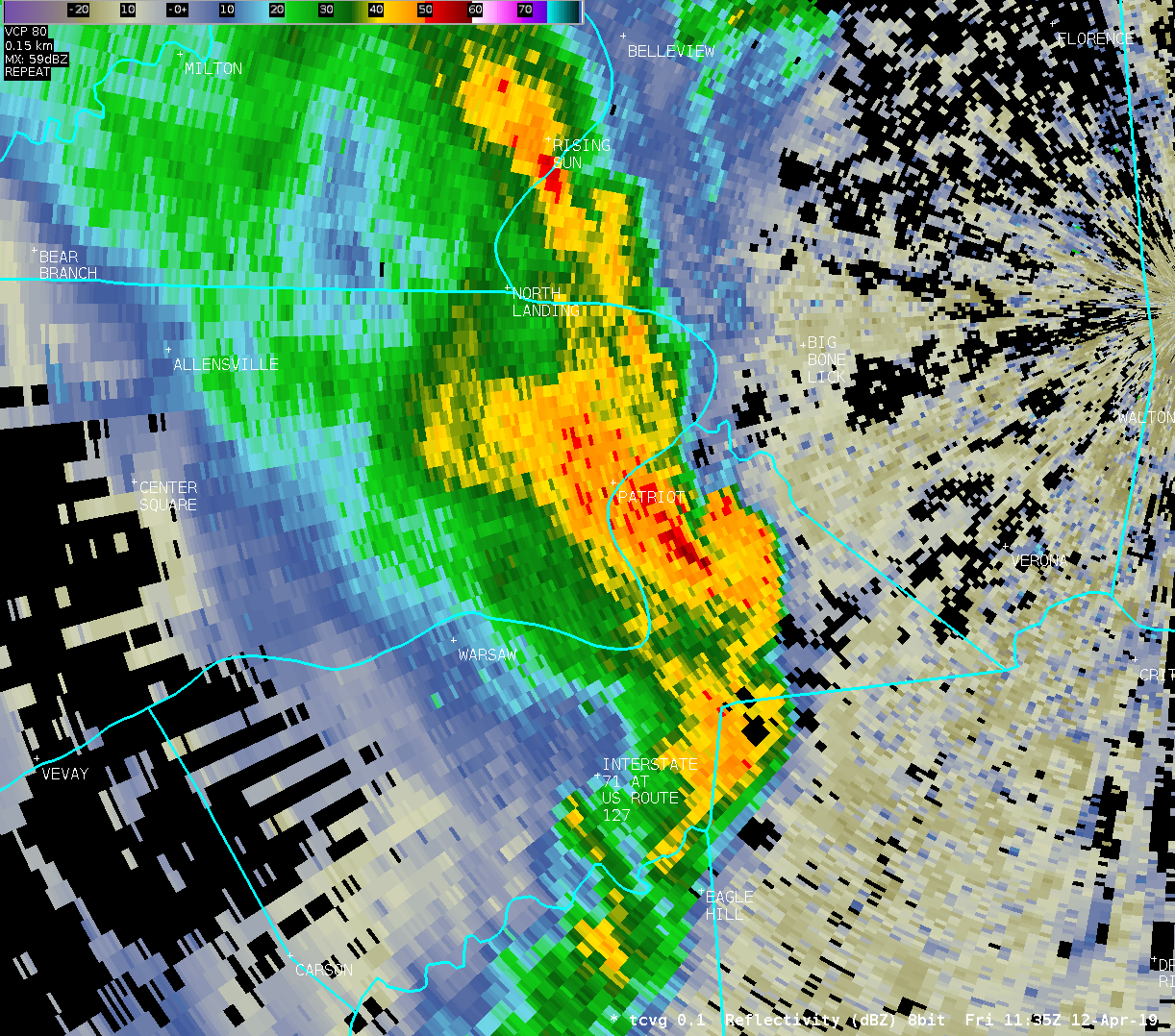
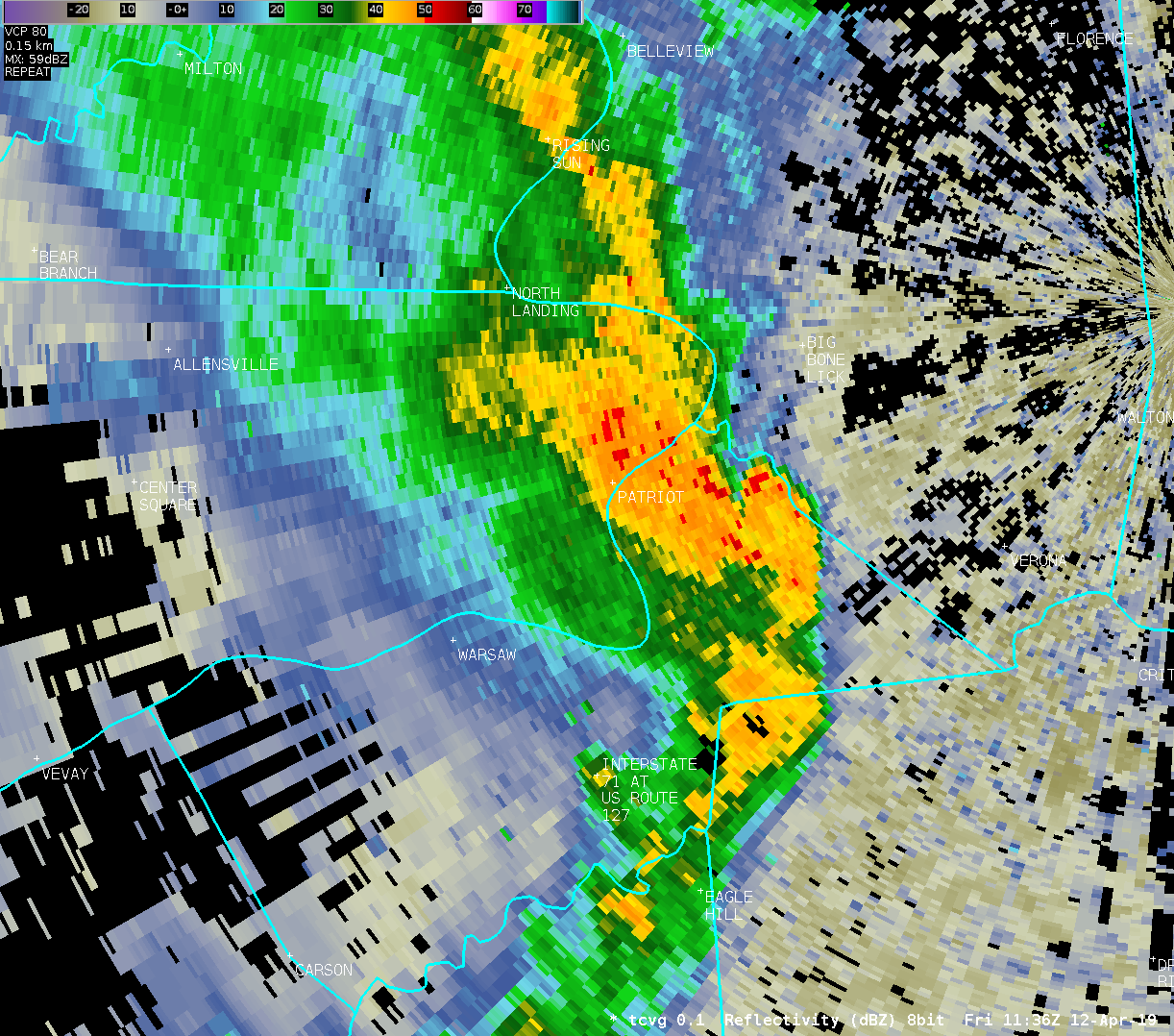
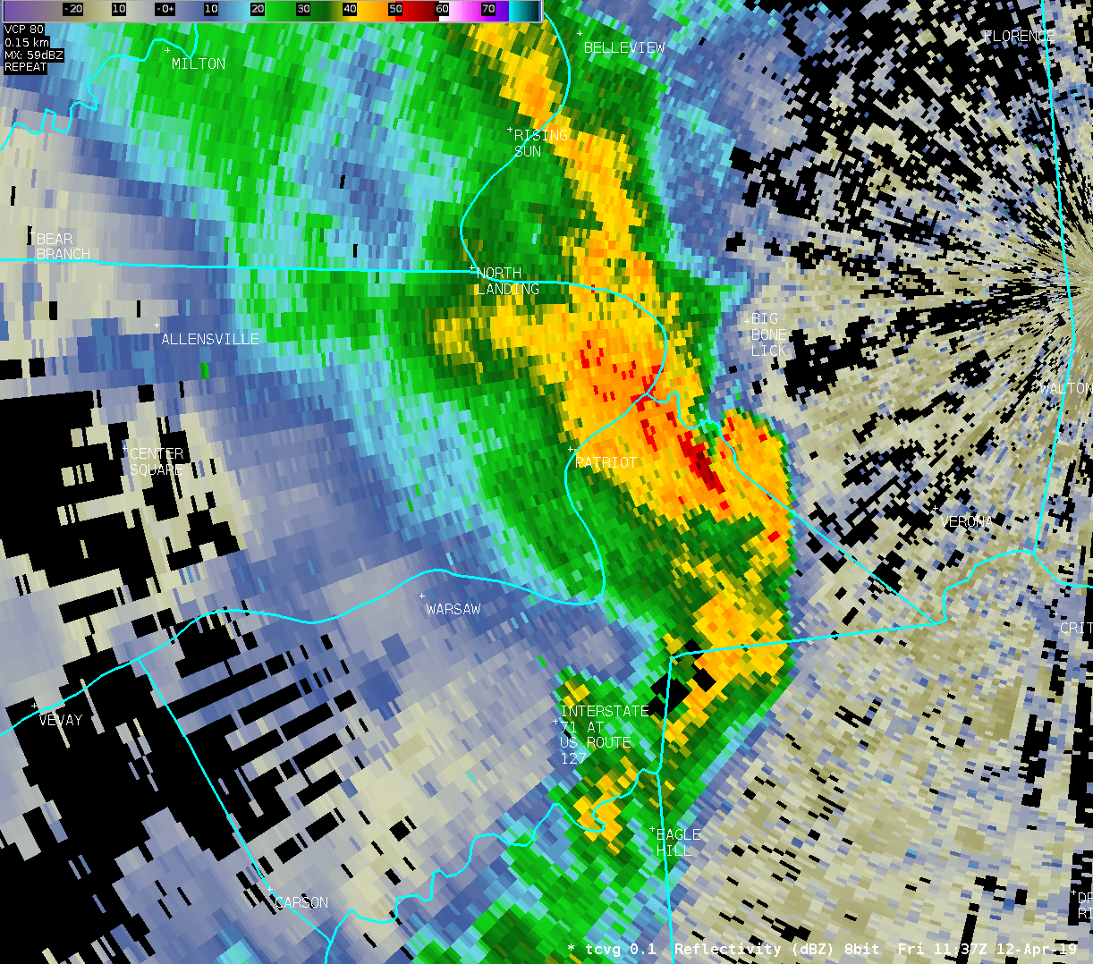
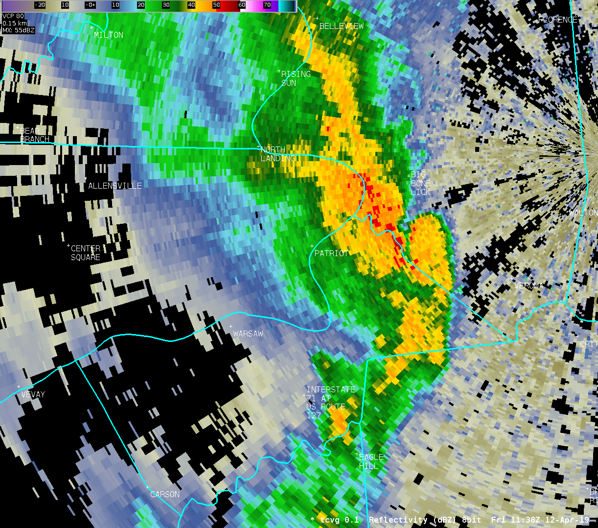
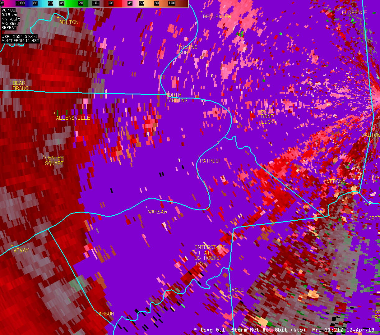
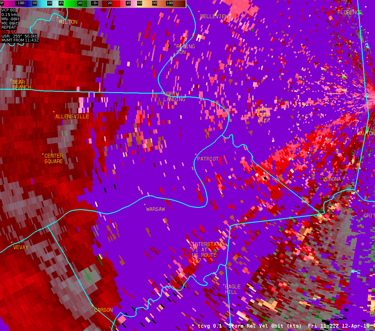
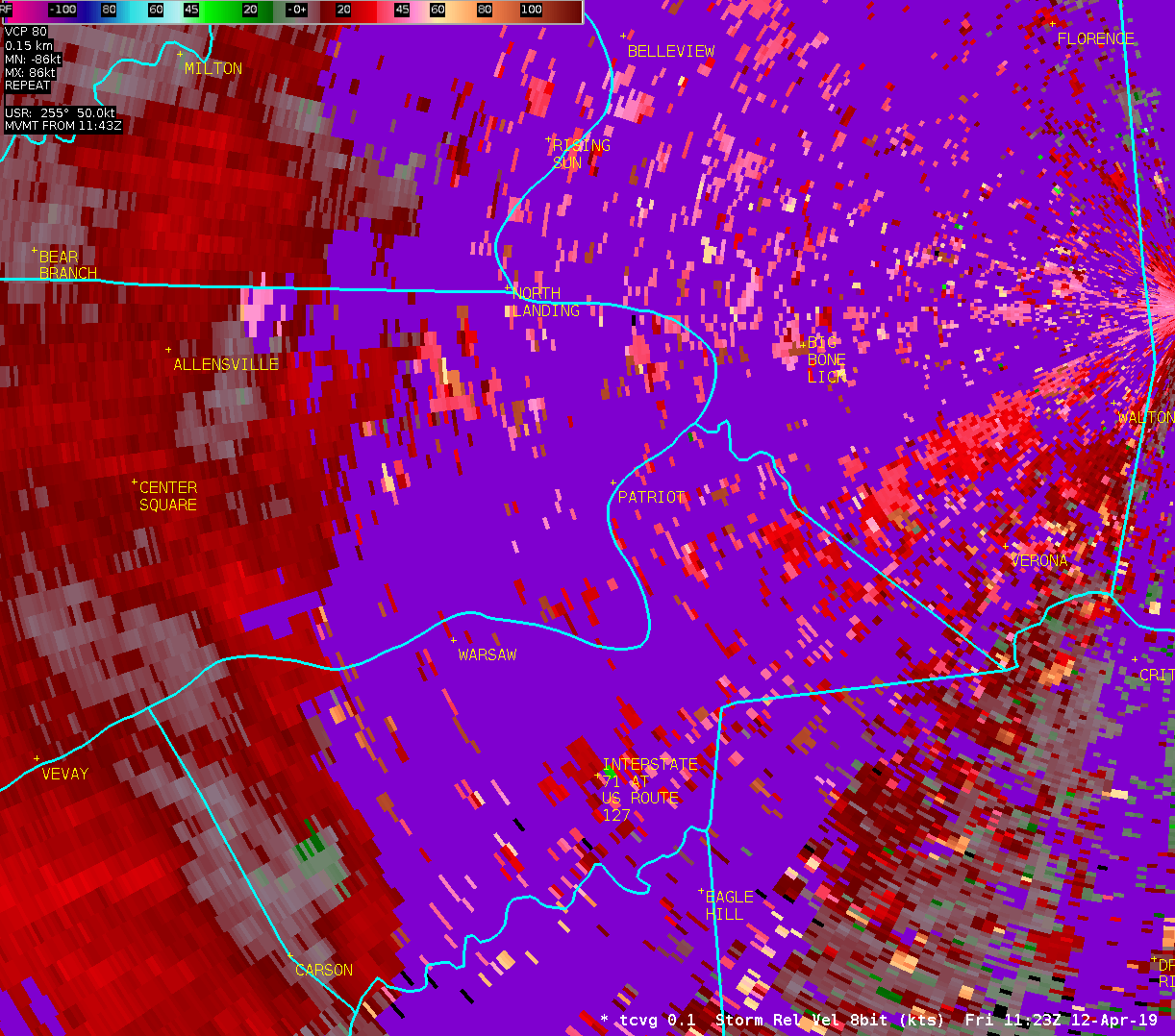
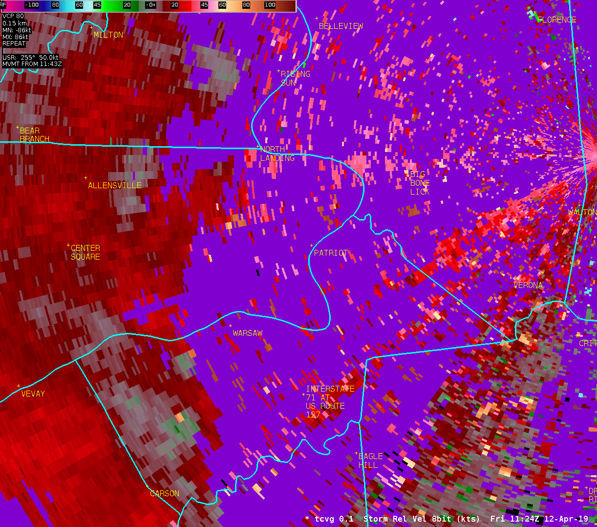
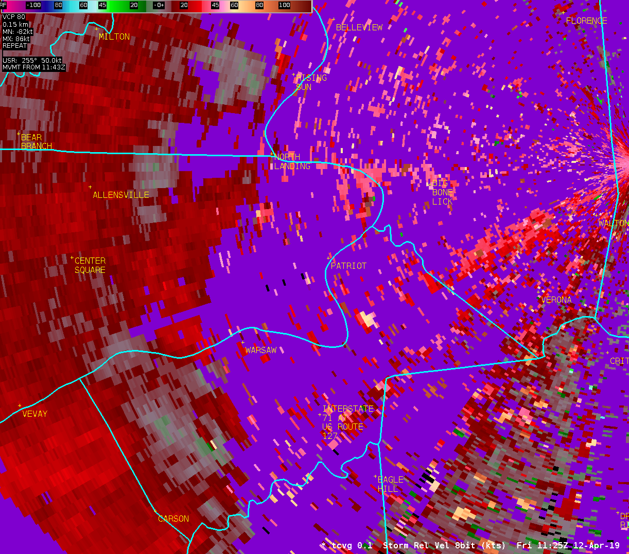
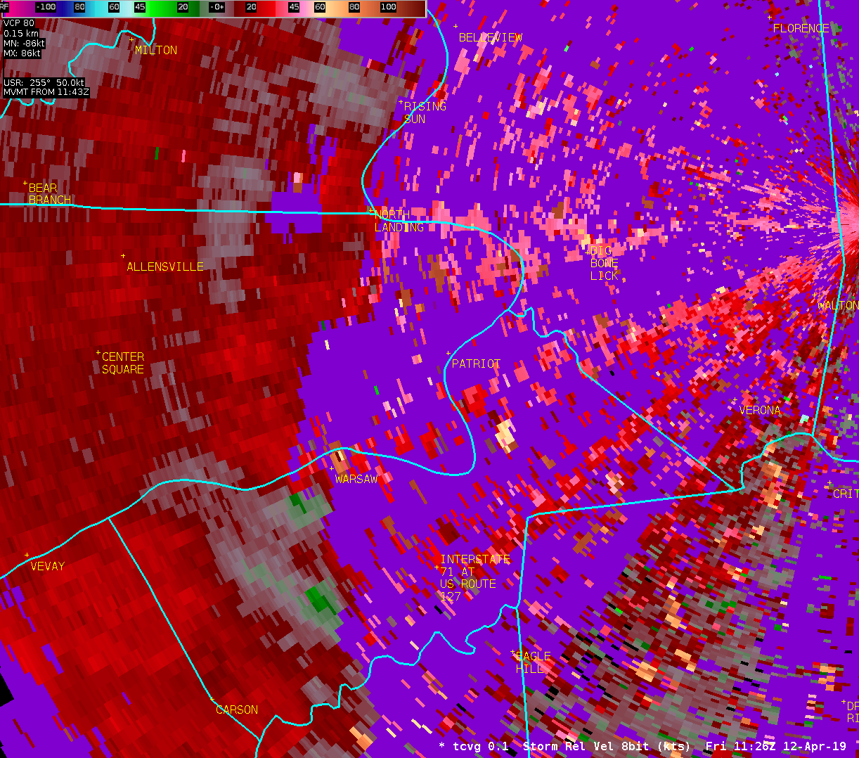
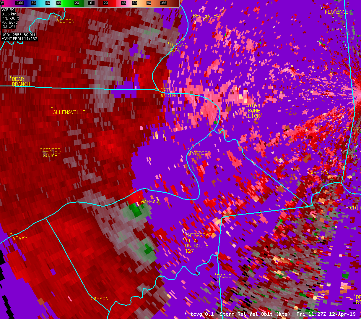
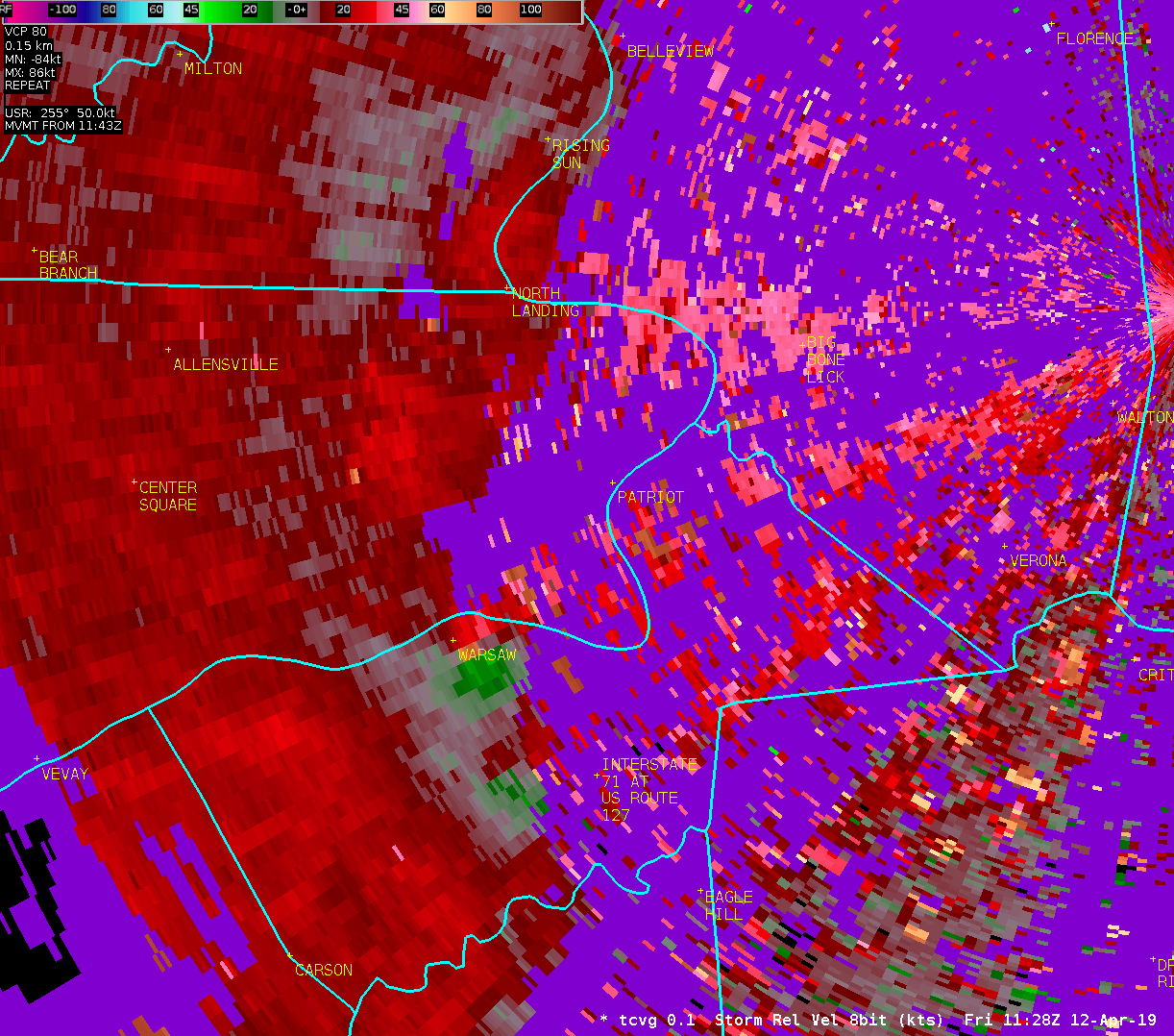
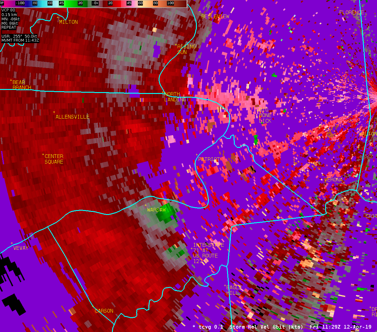
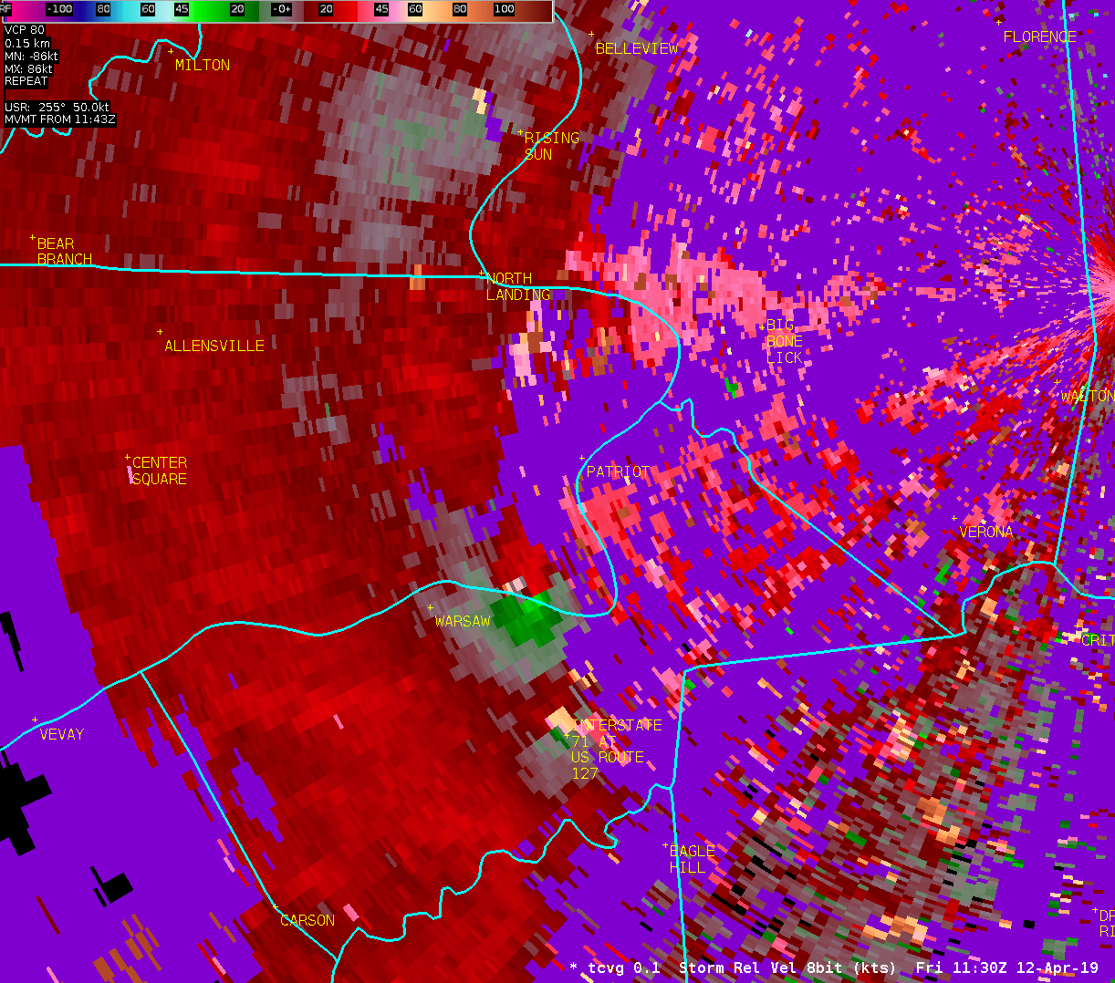
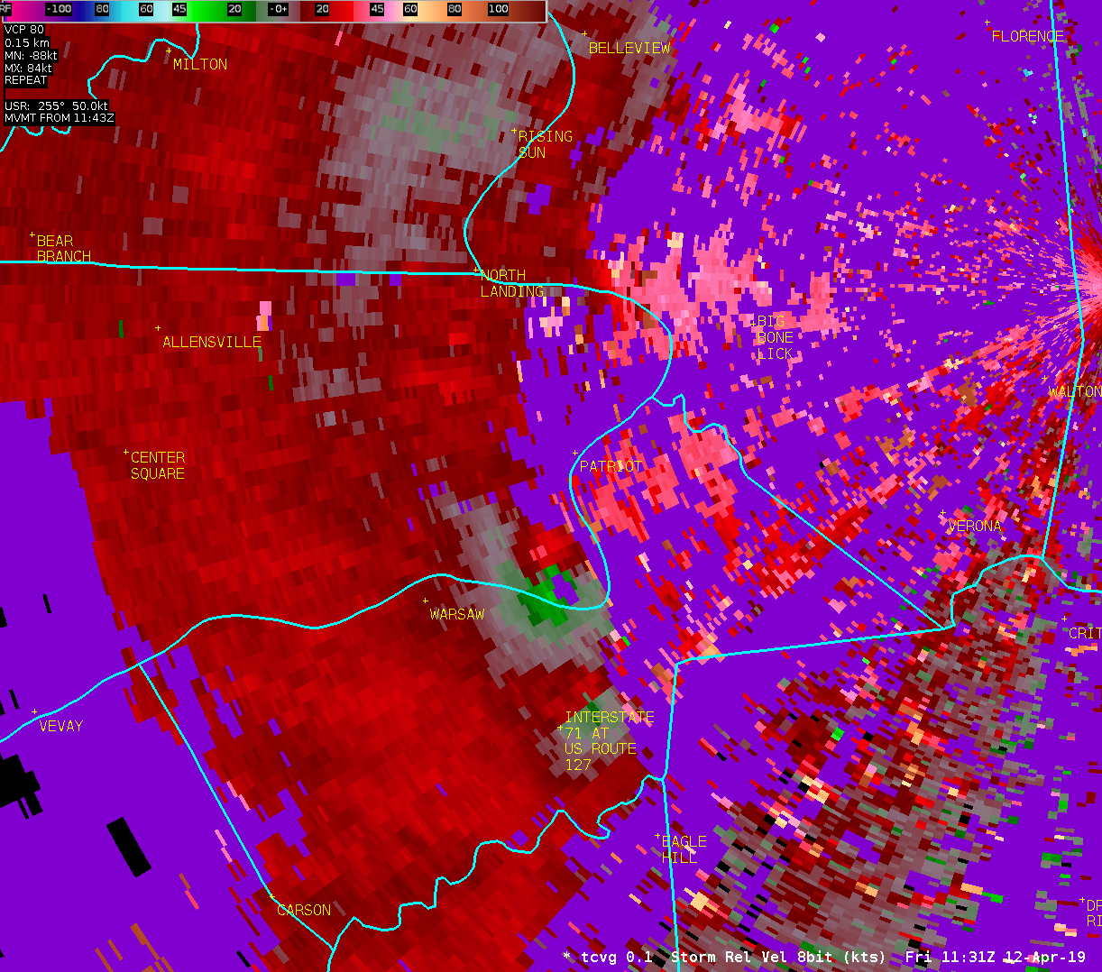
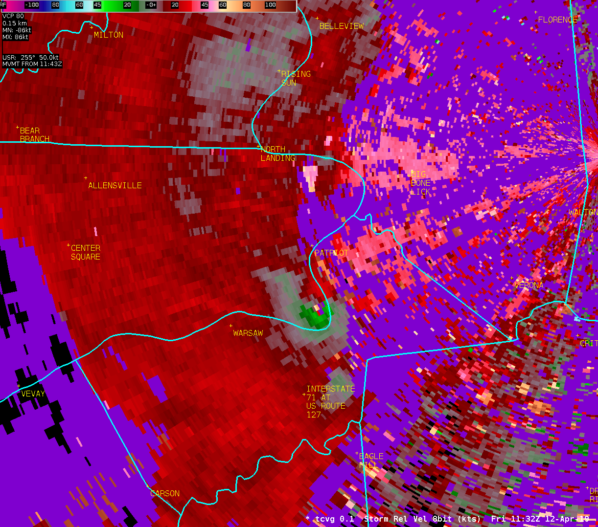
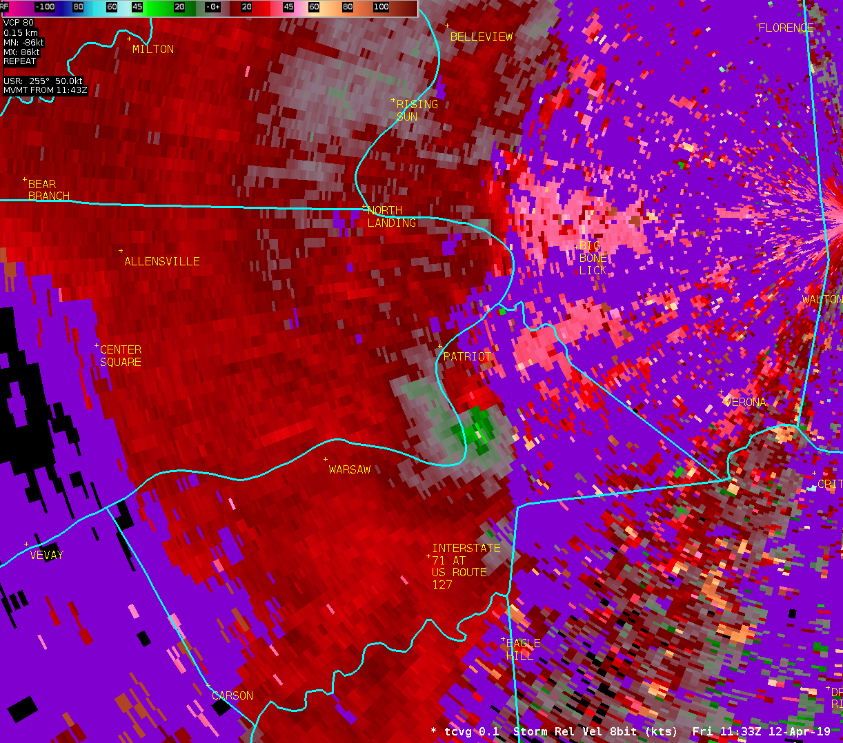
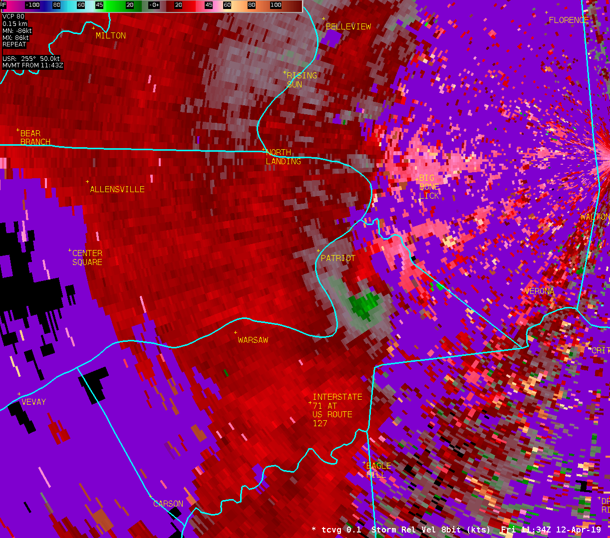
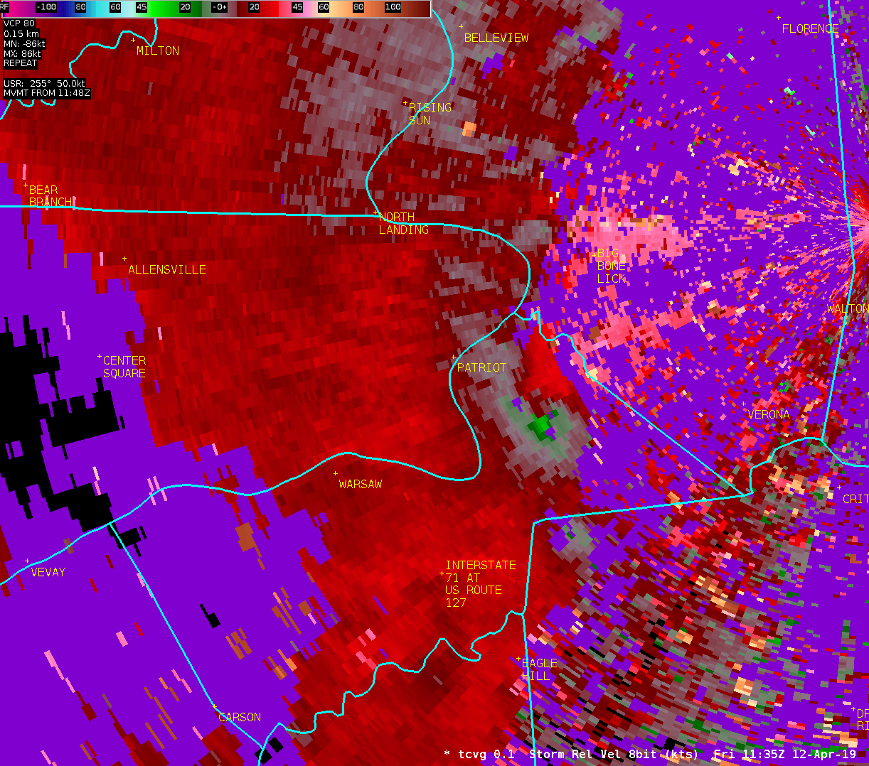
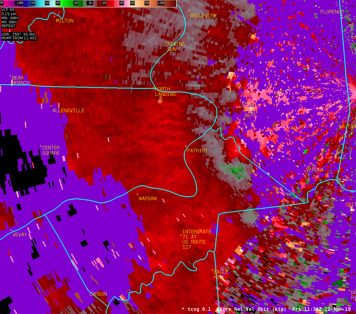
Location...Warsaw in Gallatin County Kentucky
Date...April 12 2019
Estimated Time...727 am EDT
Estimated Maximum Wind Speed...70 to 80 mph.
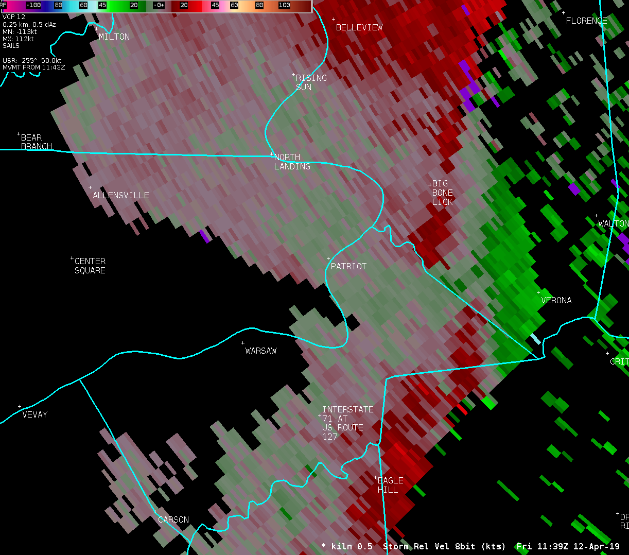
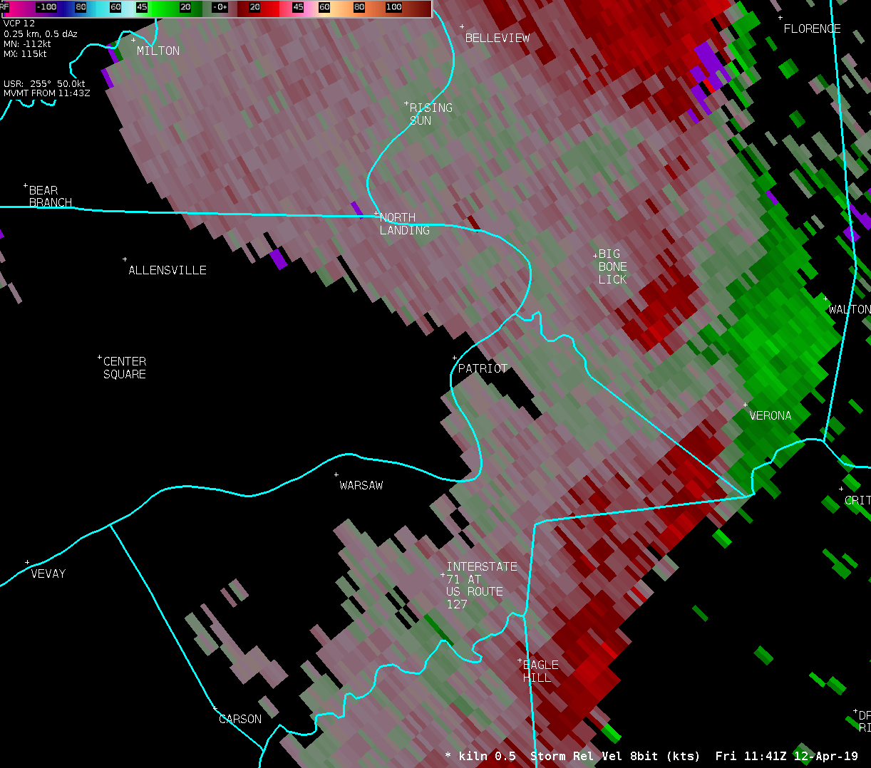
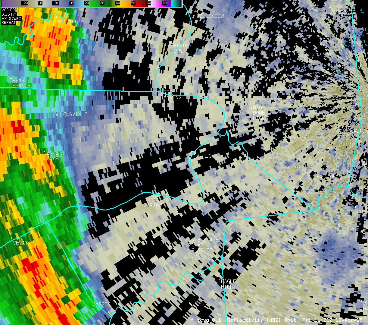
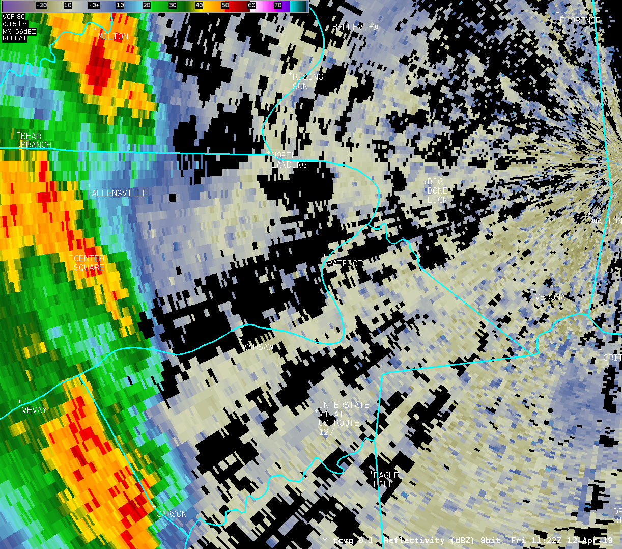
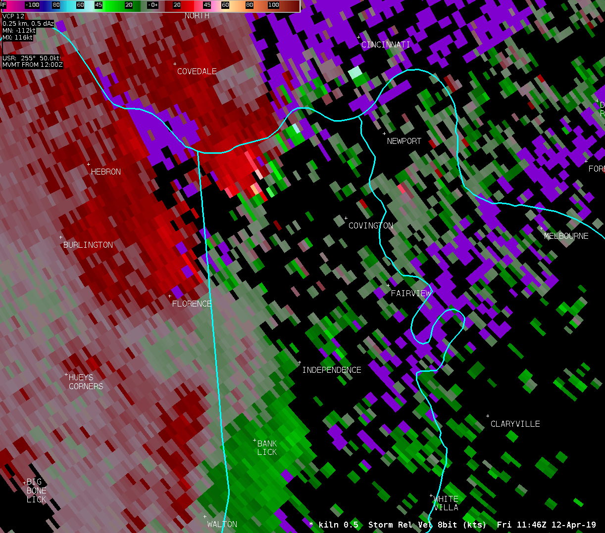
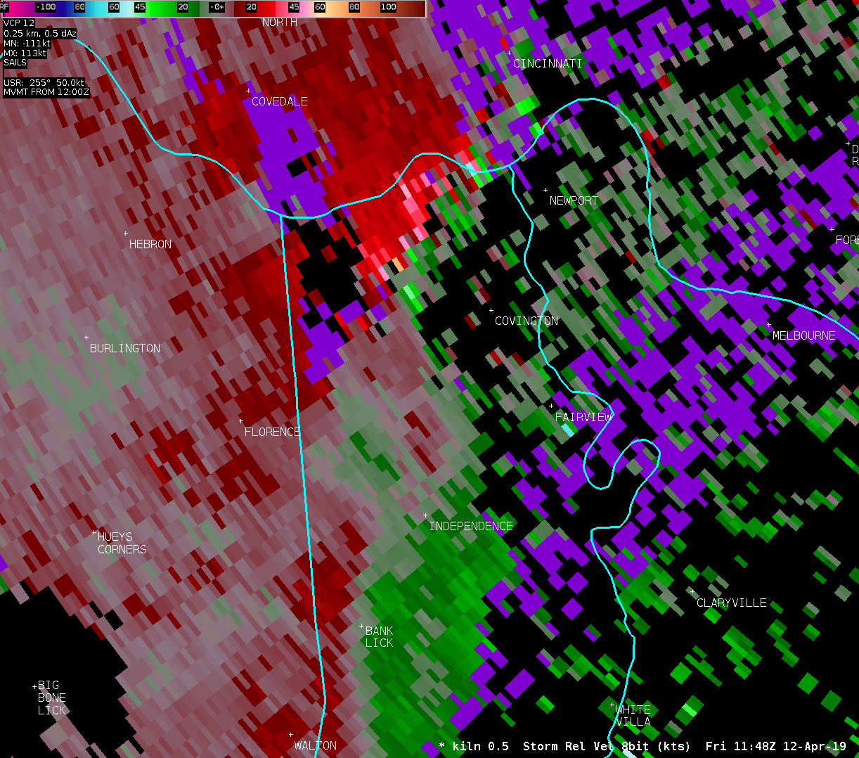
The survey team focused on two areas of damage.
The first area began a couple miles west of Warsaw and continued
east northeast through the town of Warsaw, then across the Ohio
River into extreme southeast Switzerland County south of Patriot.
This area of damage consisted of mainly tree damage, a barn which
was collapsed, several outbuildings which were damaged, boat docks
tipped over, minor residential roof damage including shingles and
tin material removal, and numerous tree limbs snapped up with a few
trees uprooted. Much of the tree damage was to softwoods including
Bradford Pear trees, and pine trees. A few recreational vehicles
/boats and RVs/ were also tipped over. The damage was determined to
be non-tornadic along the length of the survey, being broad
laterally without defined lateral bounds, and not showing any
convergence or cross-axis component to the debris field. Also,
damage was sporadic along the path. There were no indications of
significant debris uplift along the length of the path beyond
traditional light roofing material which is easily lofted in both
tornadic and non-tornadic situations, or indications of debris
spatter. Most roofing material was pushed downwind, and not lifted
substantially and thrown to a substantial degree in a cross-axis
component. The damage path did not have the choppy/blended
appearance of previously surveyed weak tornadoes in this wind speed
range. Damage along the path is consistent with winds of 60 to 70
mph, although a few very isolated locations had damage indicators
suggesting winds from 70 to 80 mph.
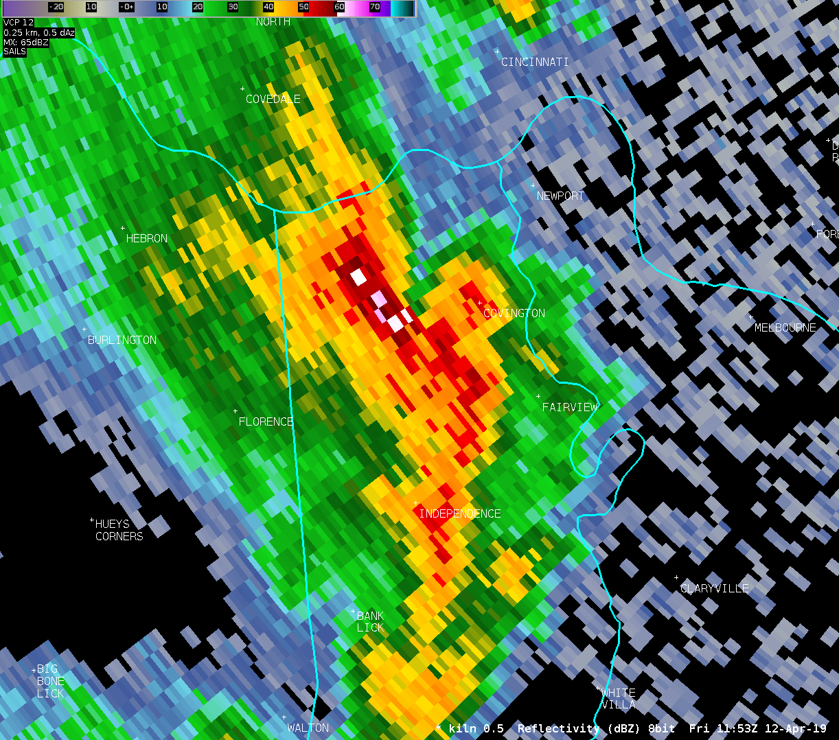
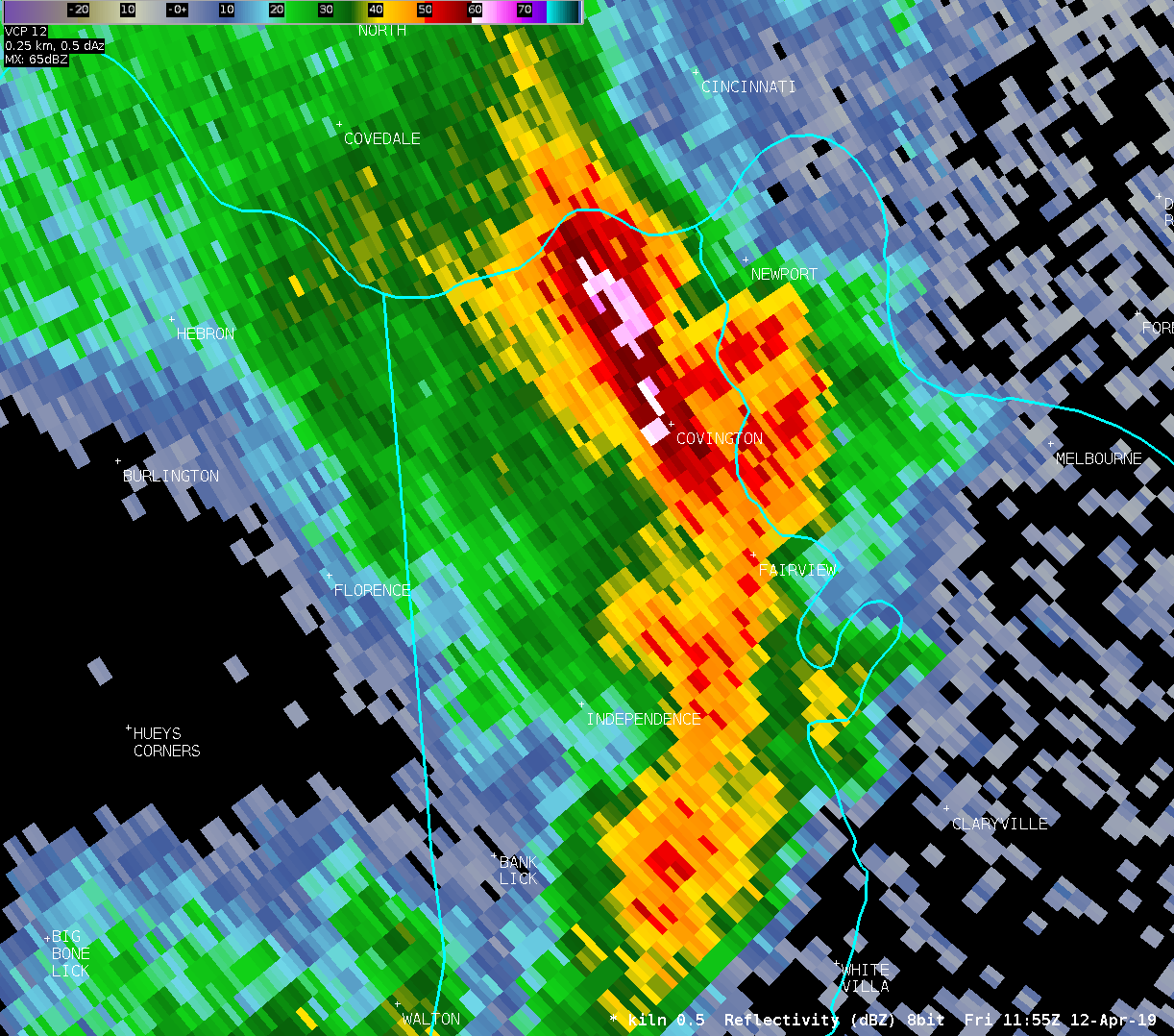
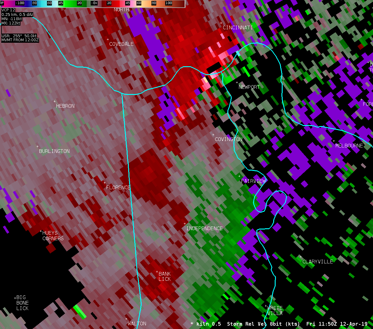
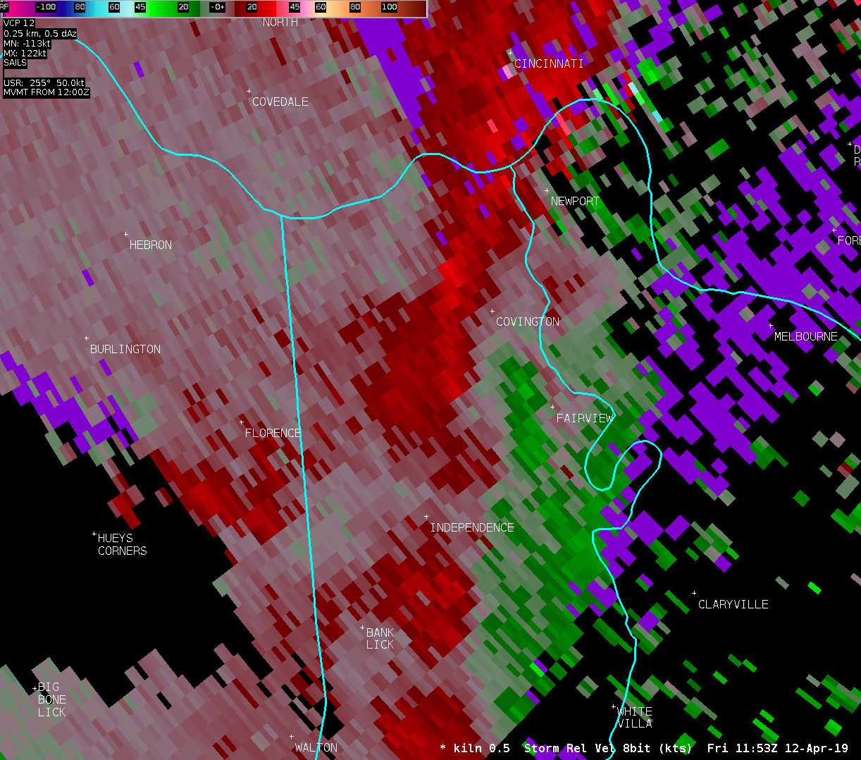
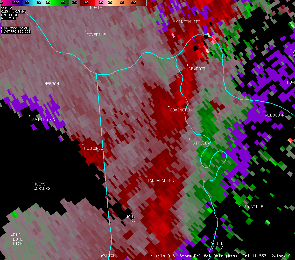
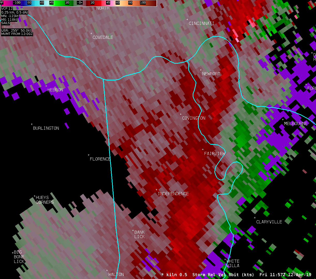
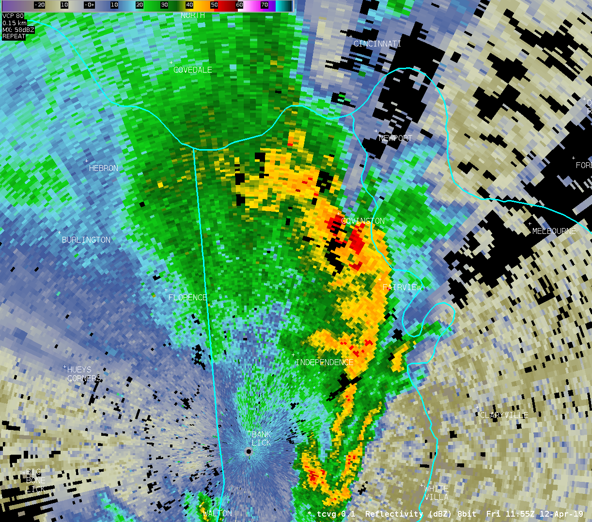
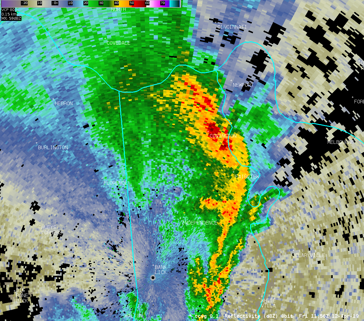
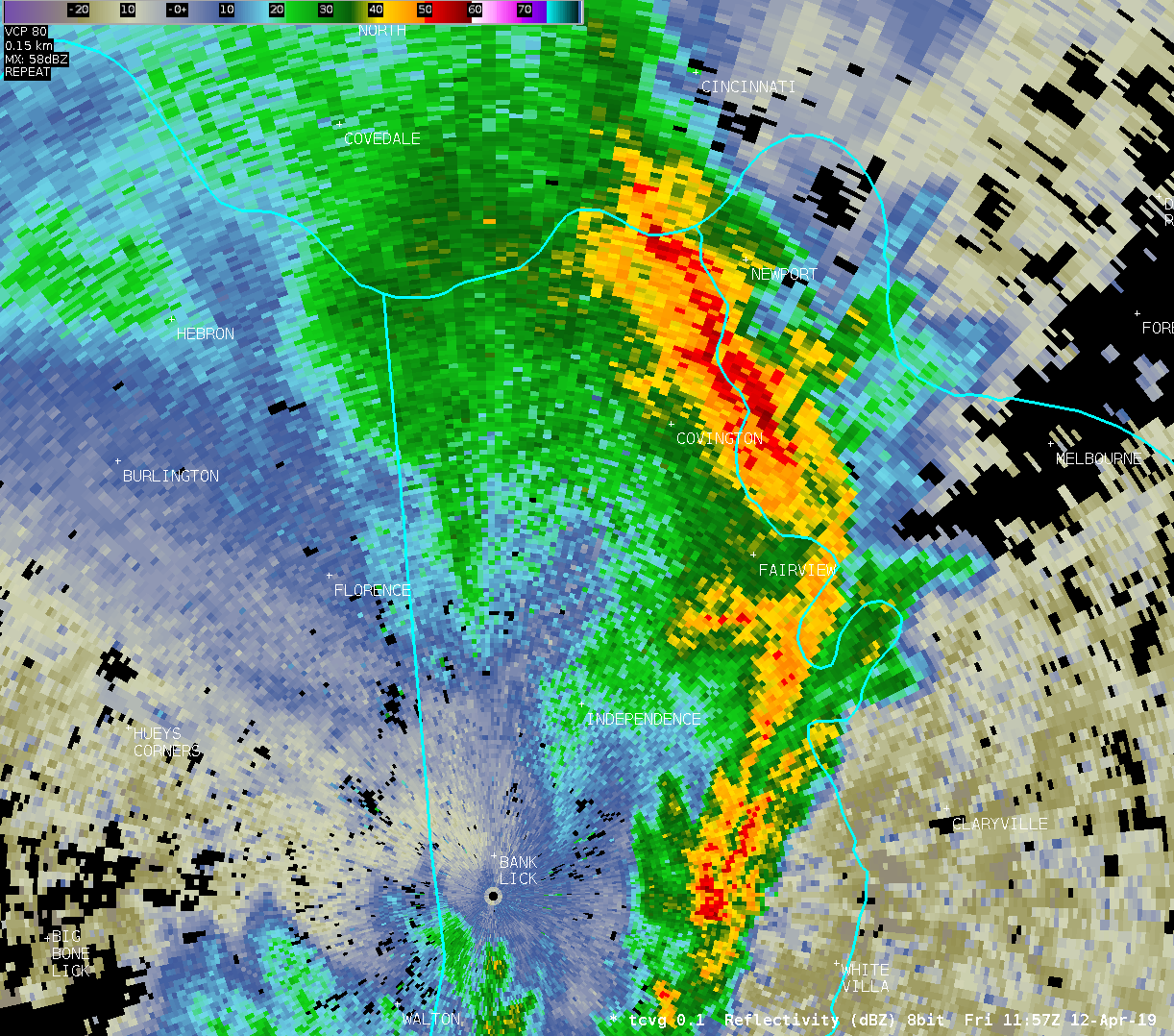
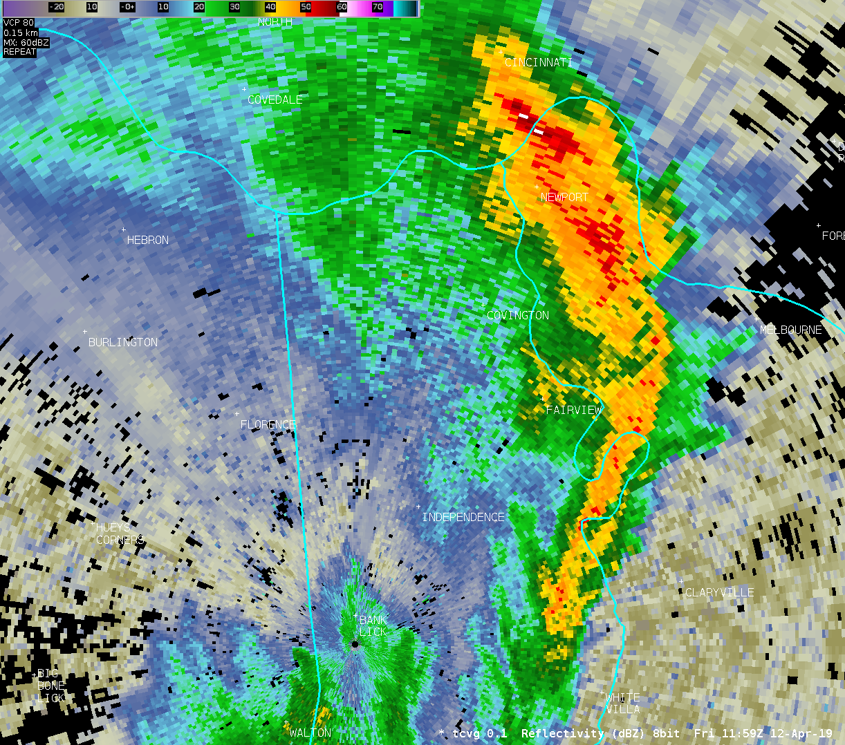
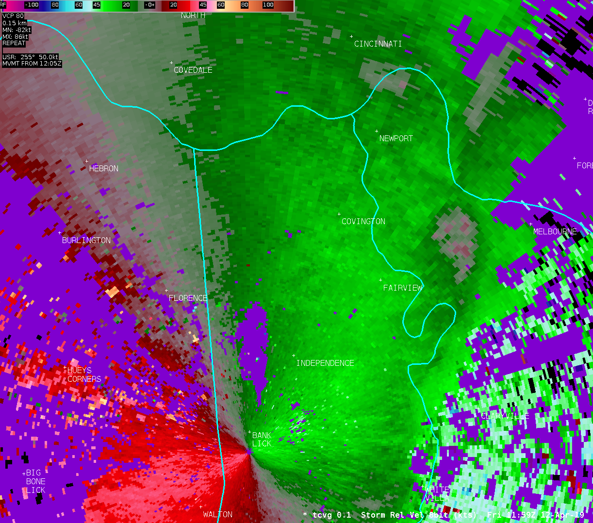
The second area of damage surveyed was in Kenton County near
Erlanger and Edgewood. There were several areas surveyed, including
Royal Oak Court, Larkspur Court, Woodlyn Hills, and White Oak.
Damage in these areas consisted of a garage roof which had been
removed with wall collapse, and numerous homes with
shingle/soffit/fascia/chimney damage and some tree damage. Damage
in these areas was also non-tornadic in nature, with no defined
lateral bounds to the damage, nor any convergent damage pattern
seen. Damage here was also rather sporadic in nature, and also
confined to mostly homes on higher ridges. The damage in this area
was consistent with wind speeds from 60 to 70 mph.
The National Weather Service would like to thank the Switzerland
County Emergency Management Agency, the Gallatin County Emergency
Management Agency, and the Kenton County Emergency Management Agency
for considerable assistance and support during this survey.
* The information in this statement is preliminary and subject to
change pending final review of the events and publication in NWS
Storm Data.
$$
Binau/Franks
|

