Public Information Statement
National Weather Service Wilmington OH
257 PM EST Mon Feb 26 2018
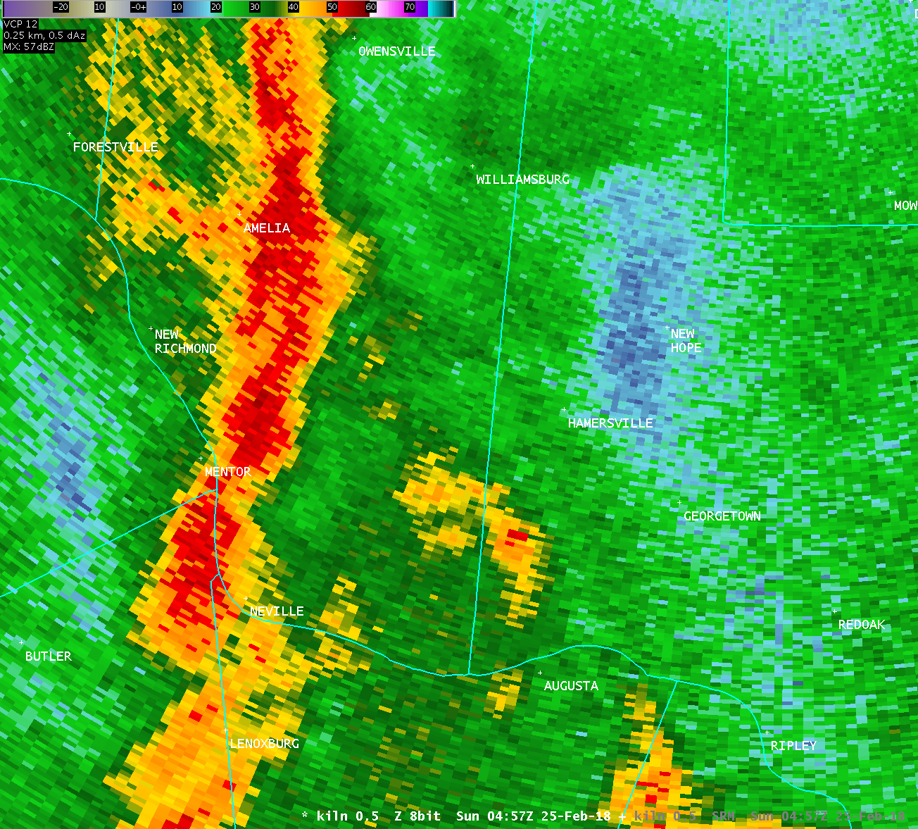
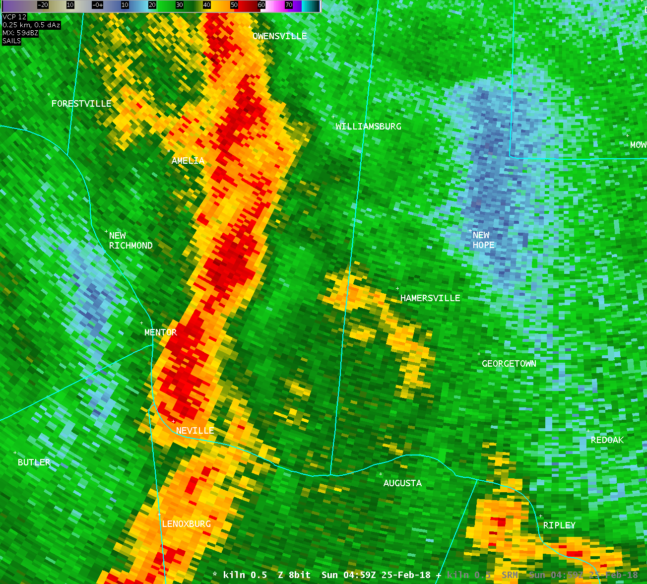
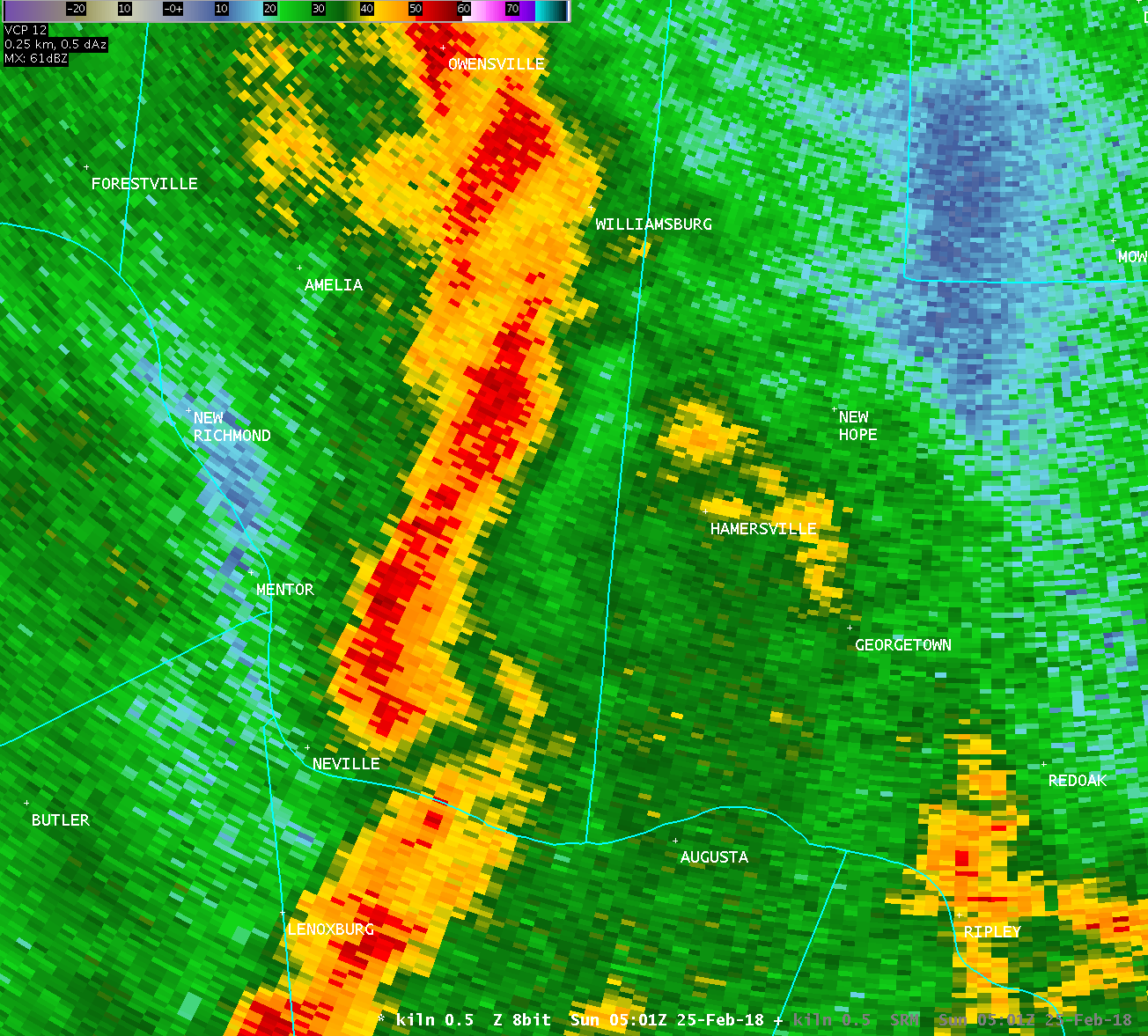
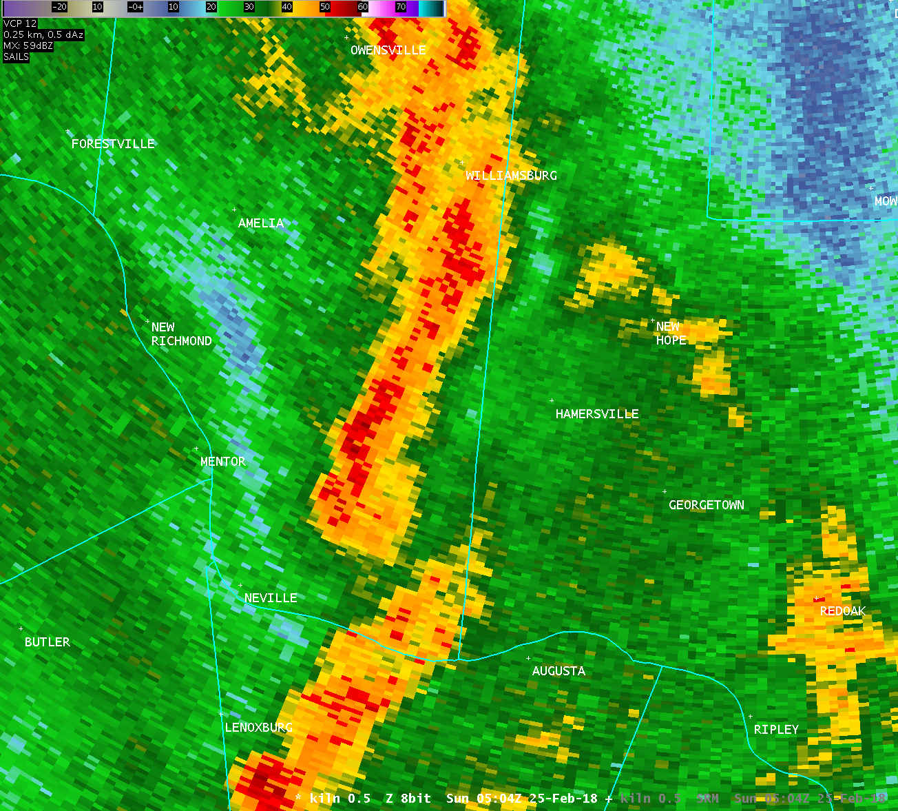
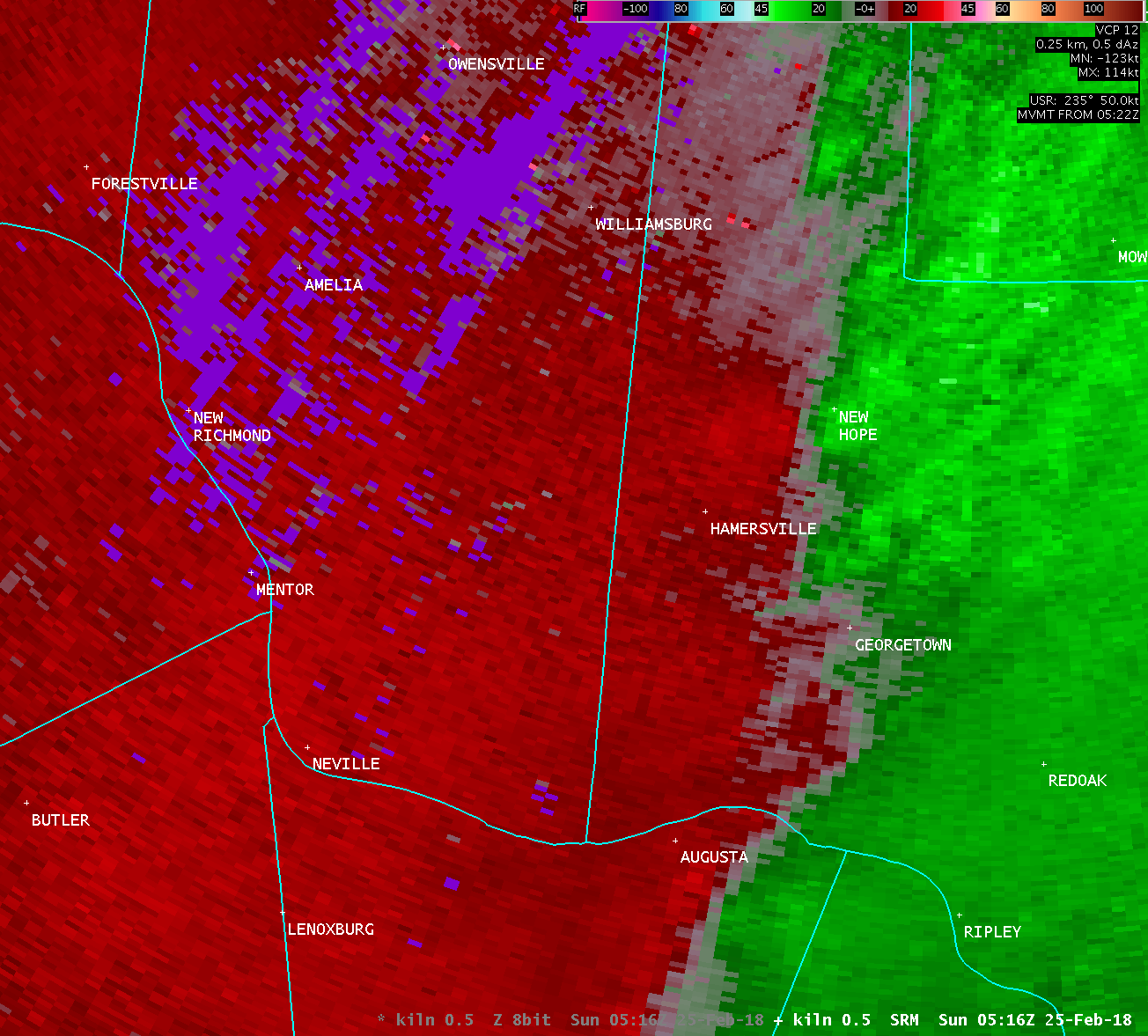
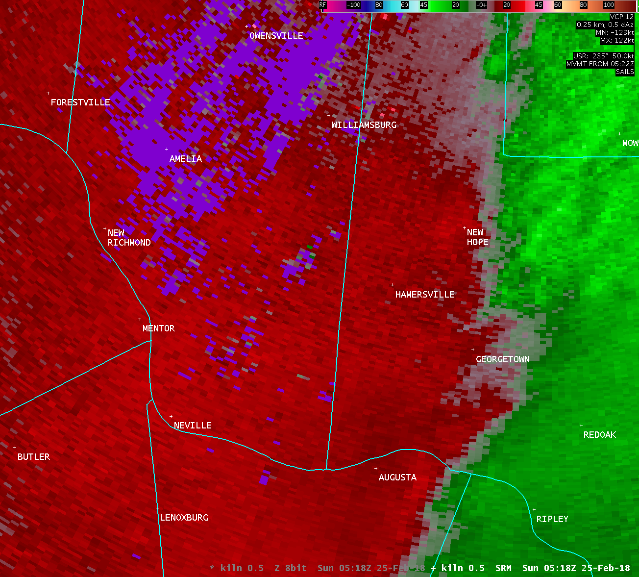
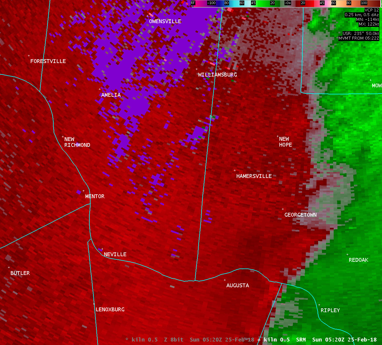
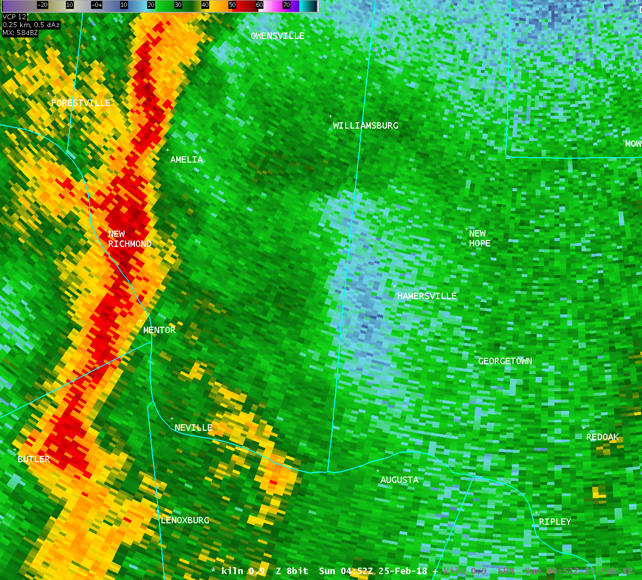
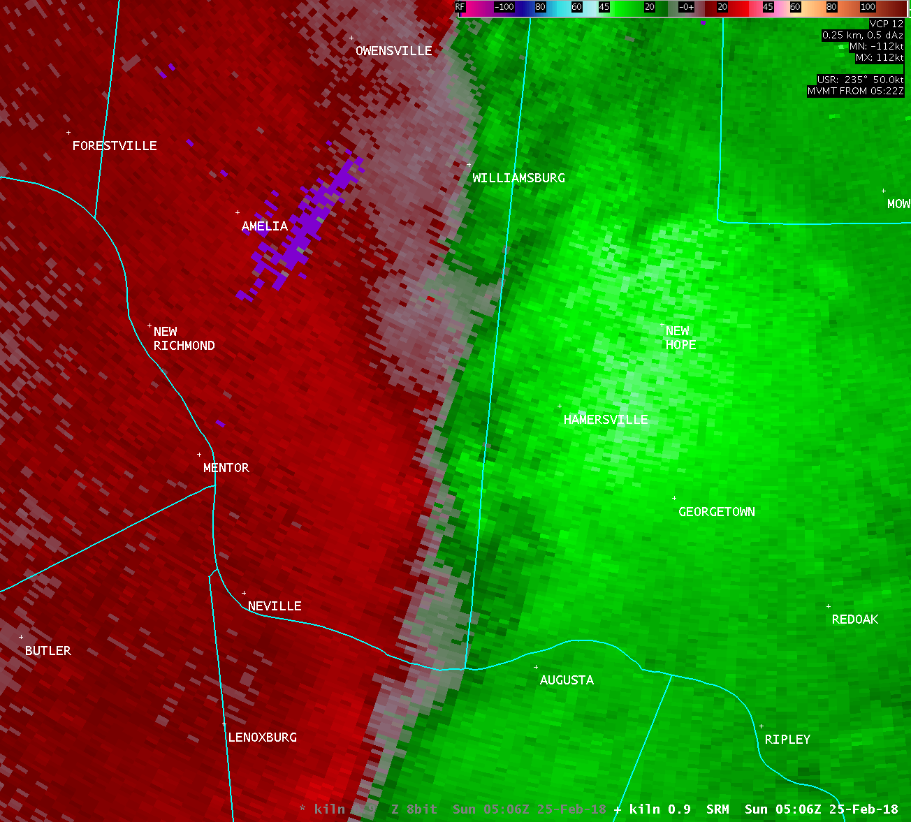
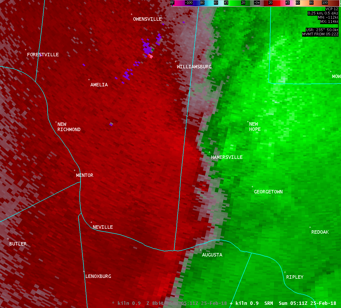
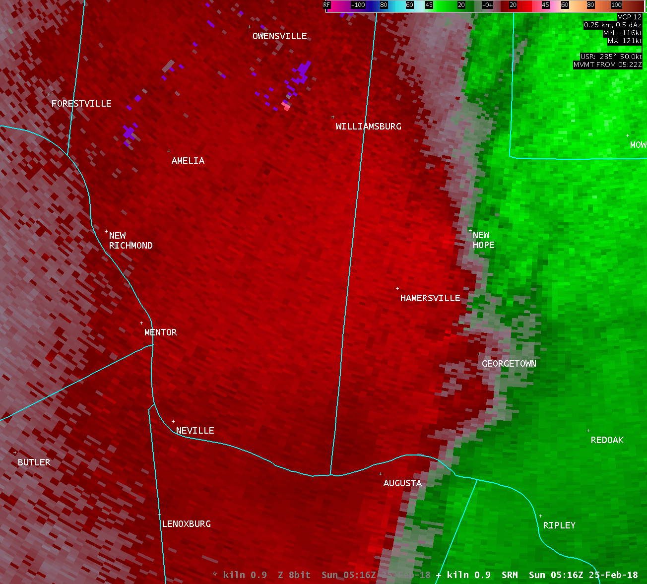
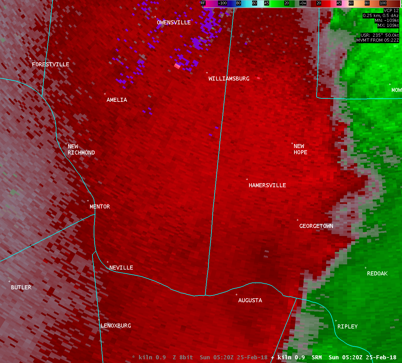
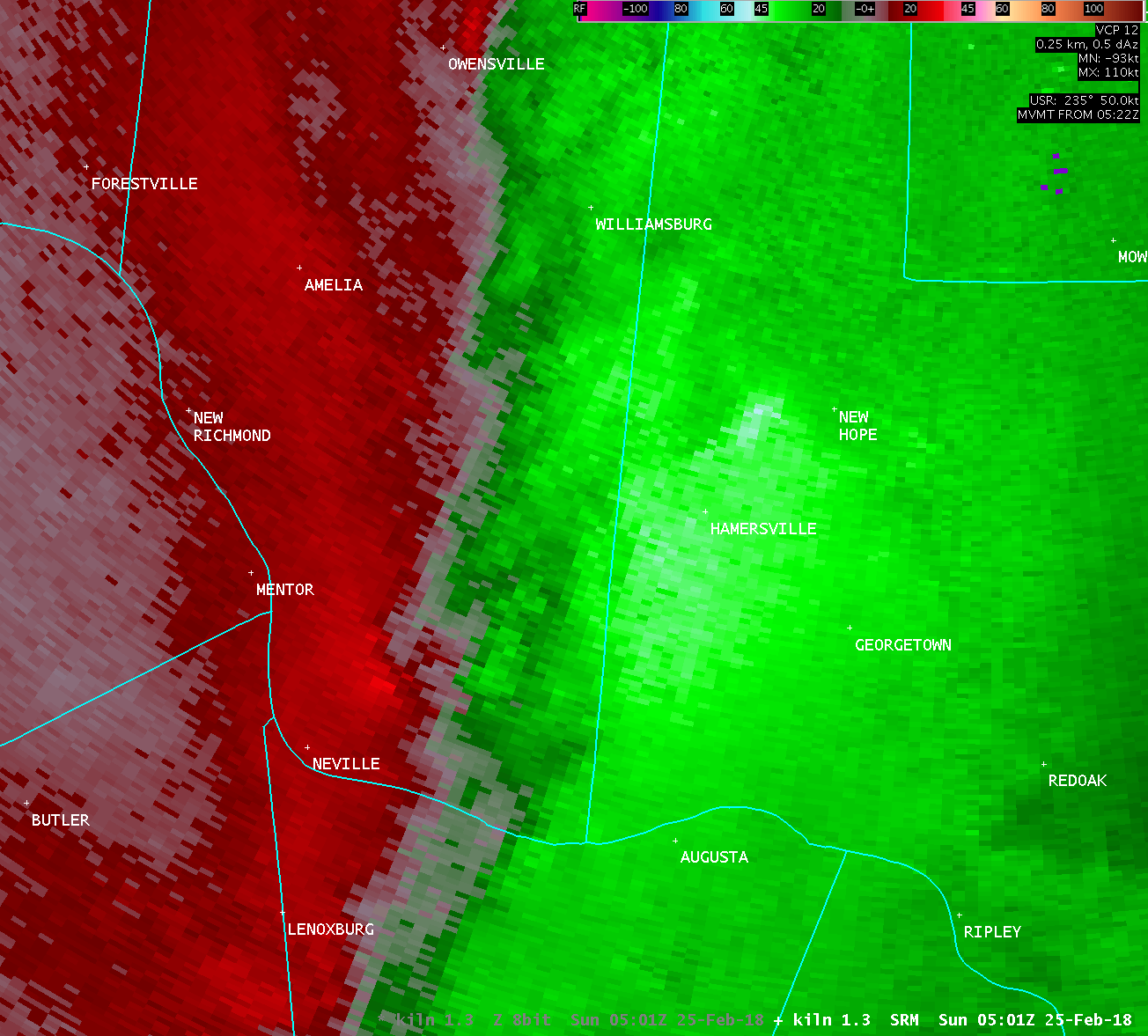
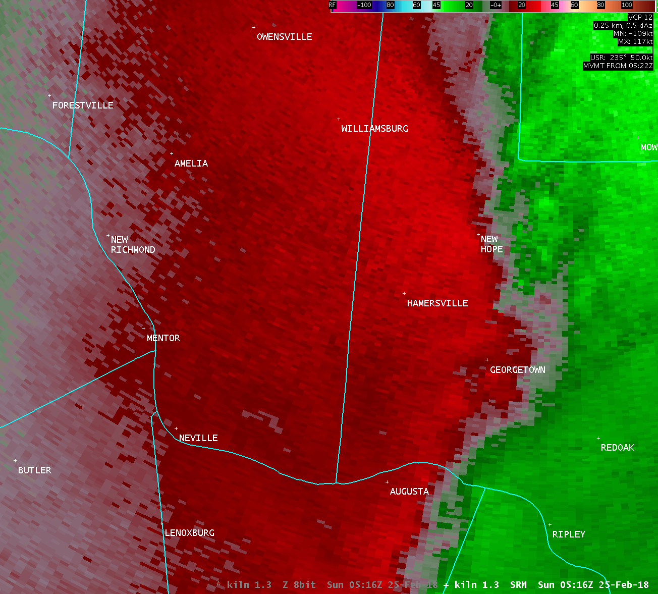
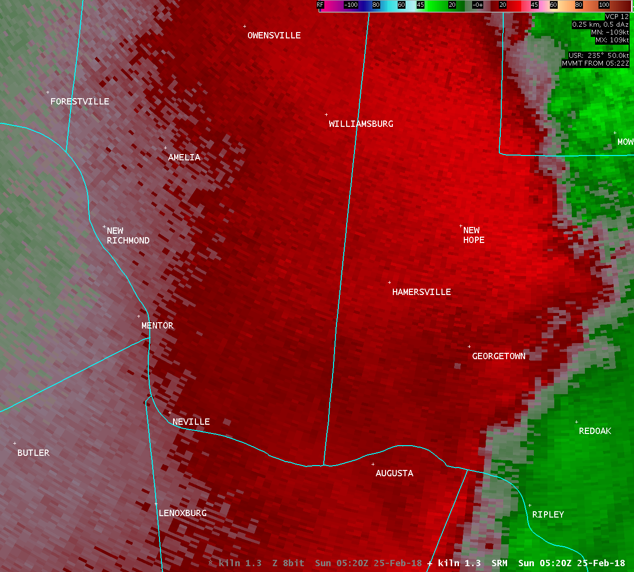
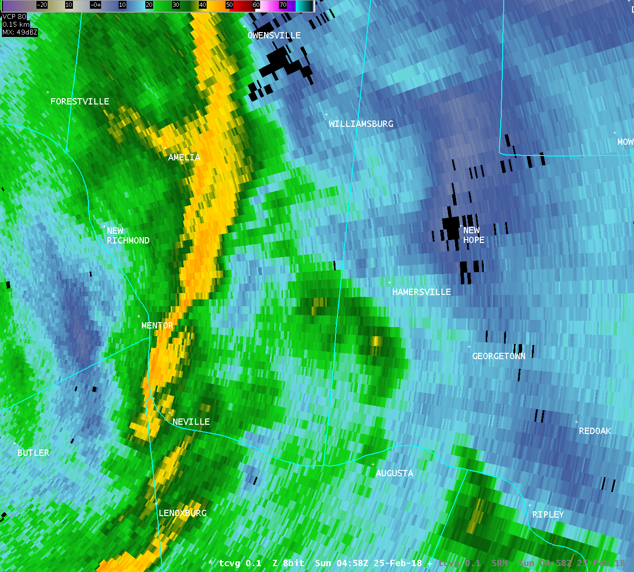
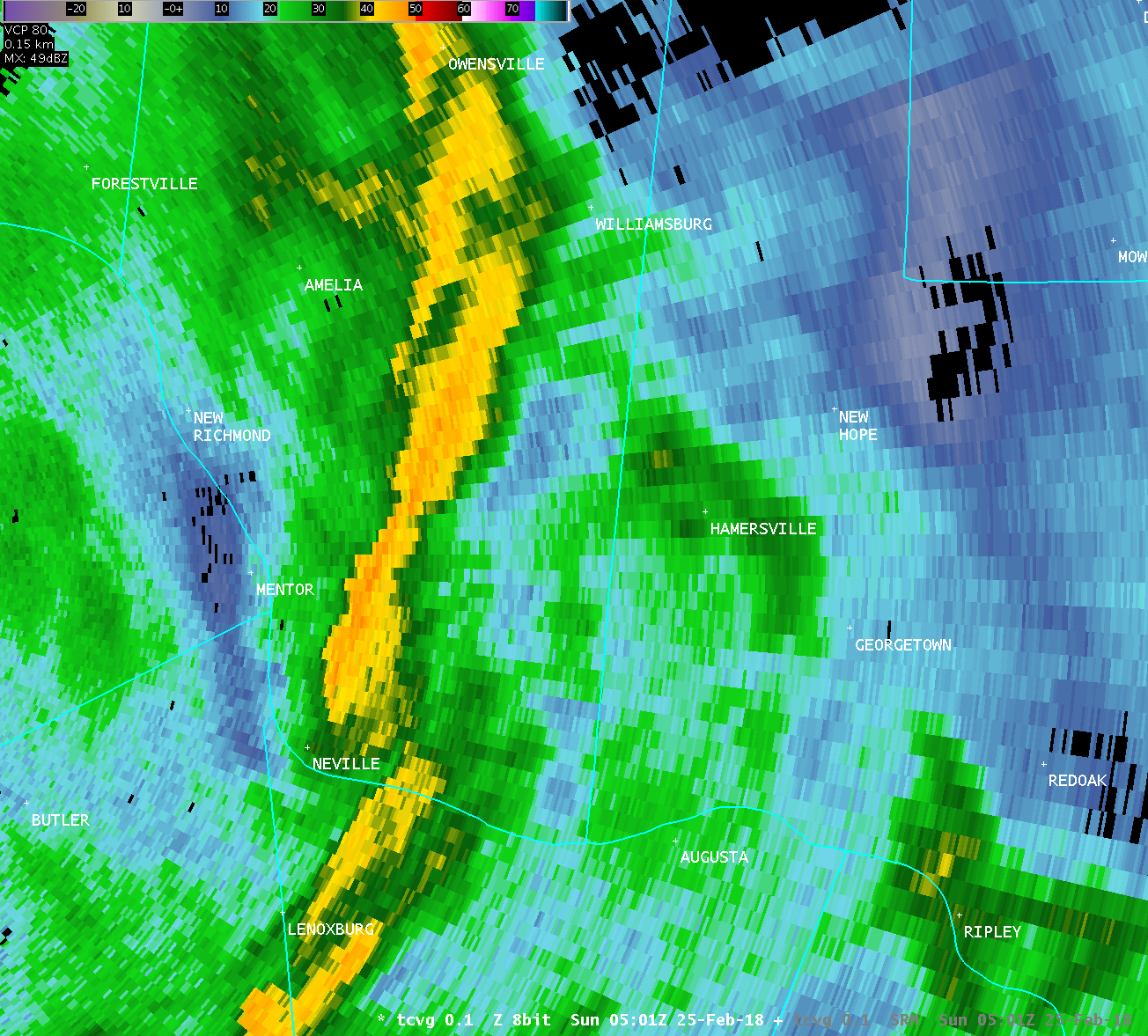
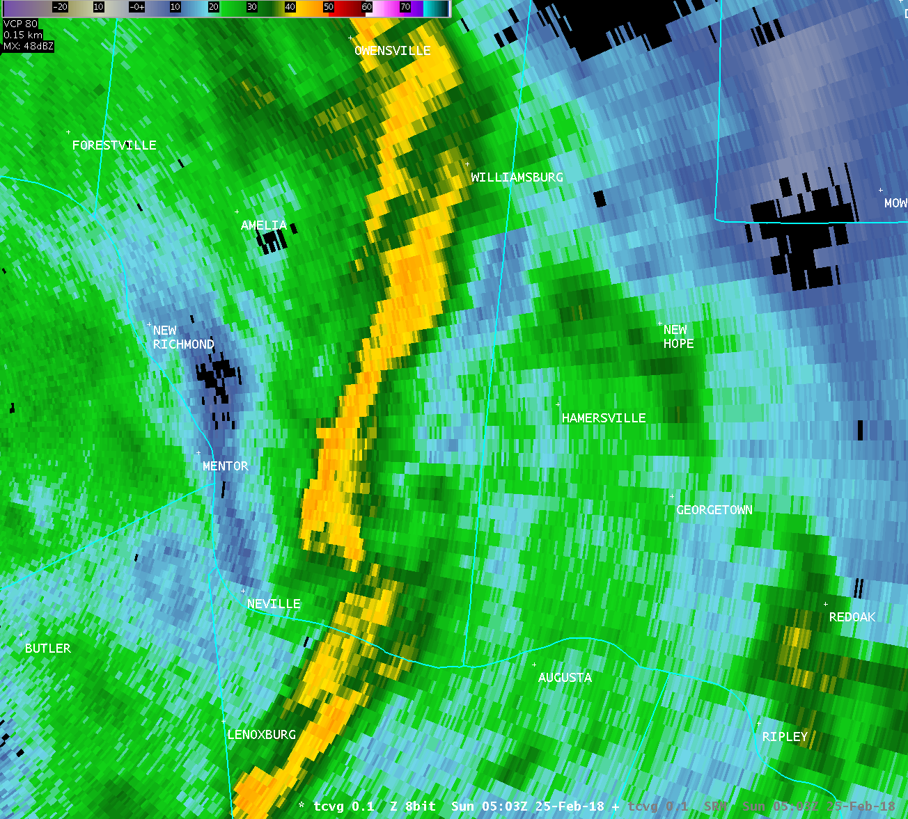
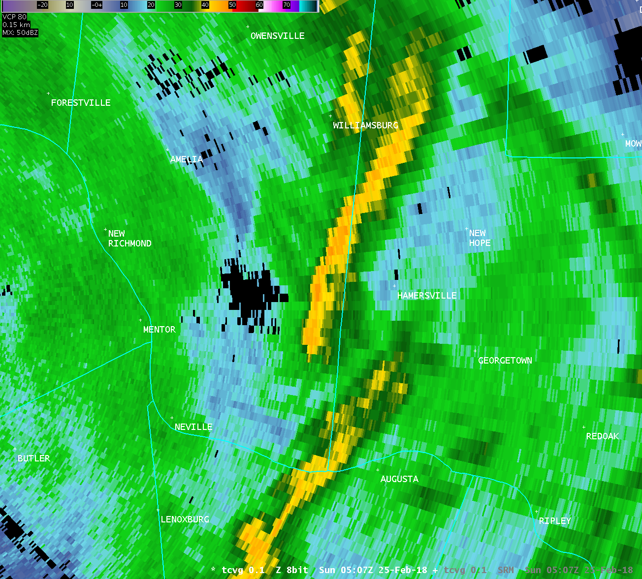
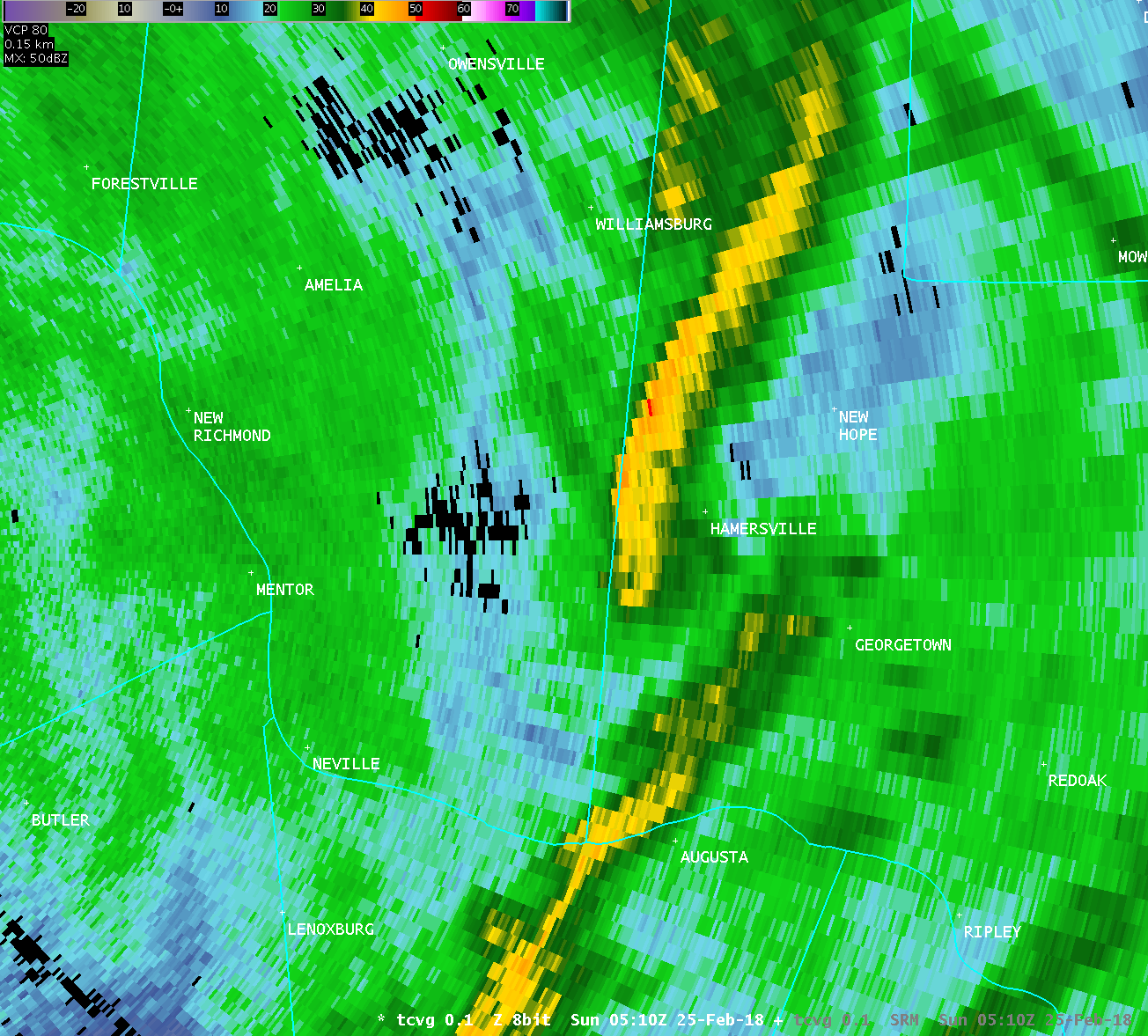
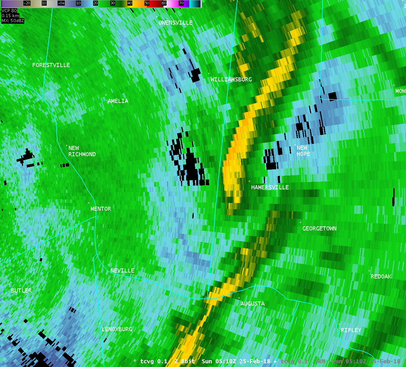
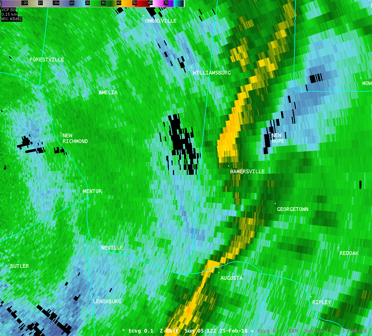
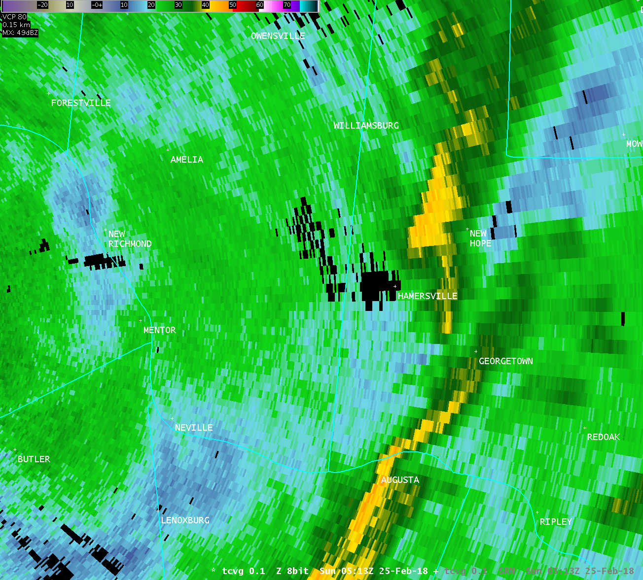
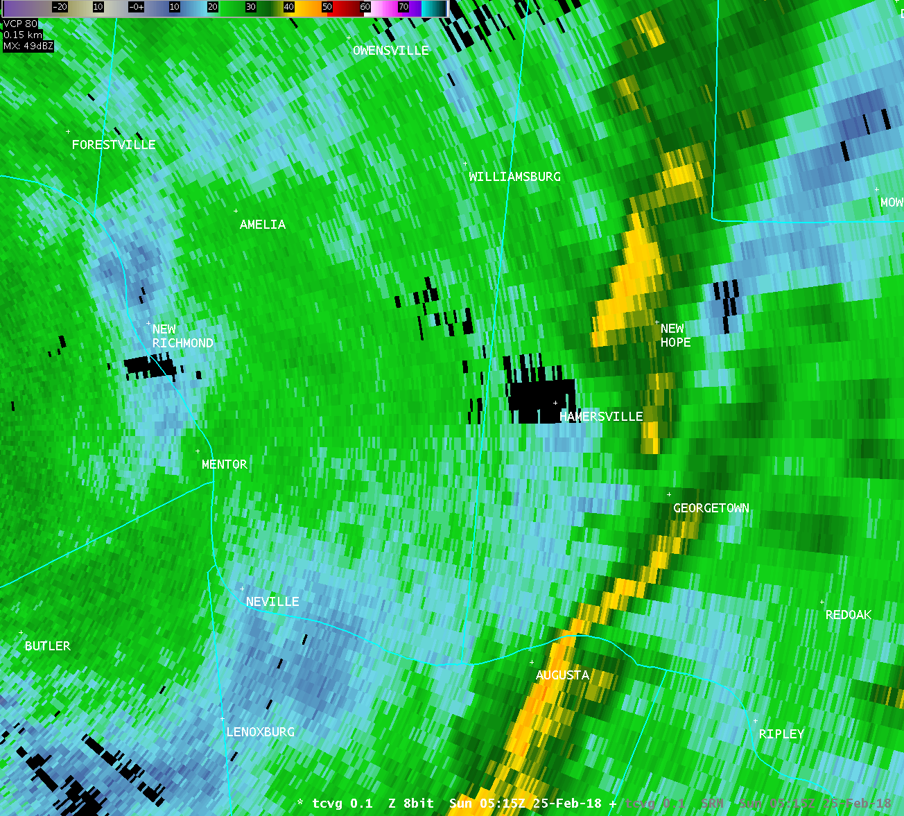
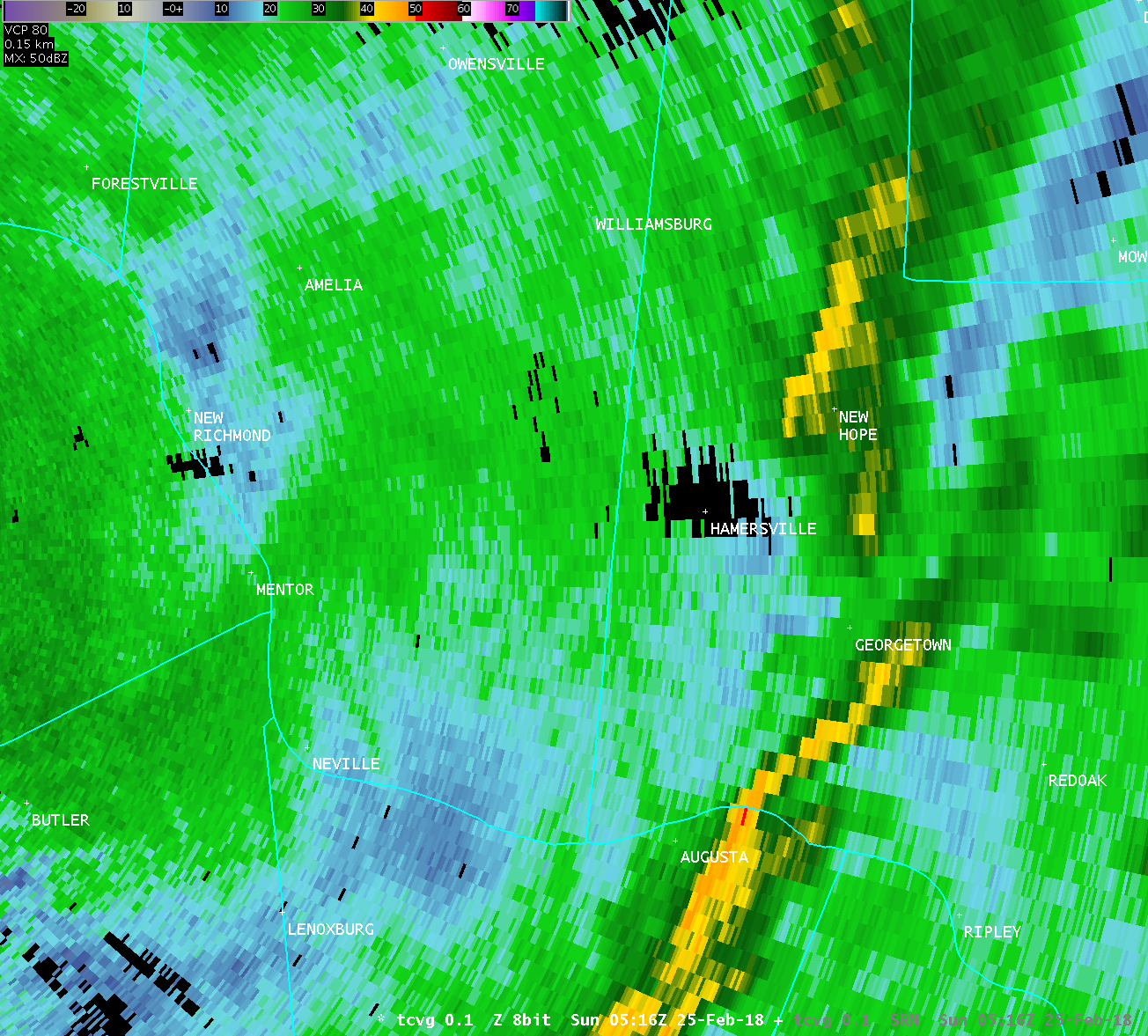
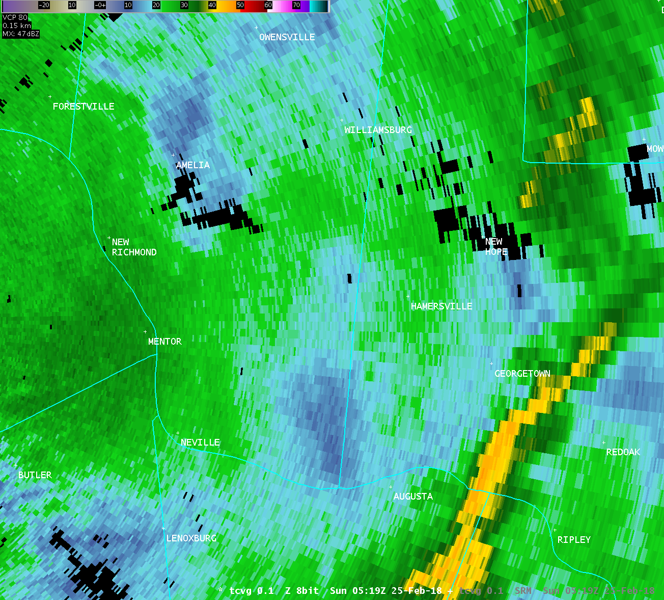
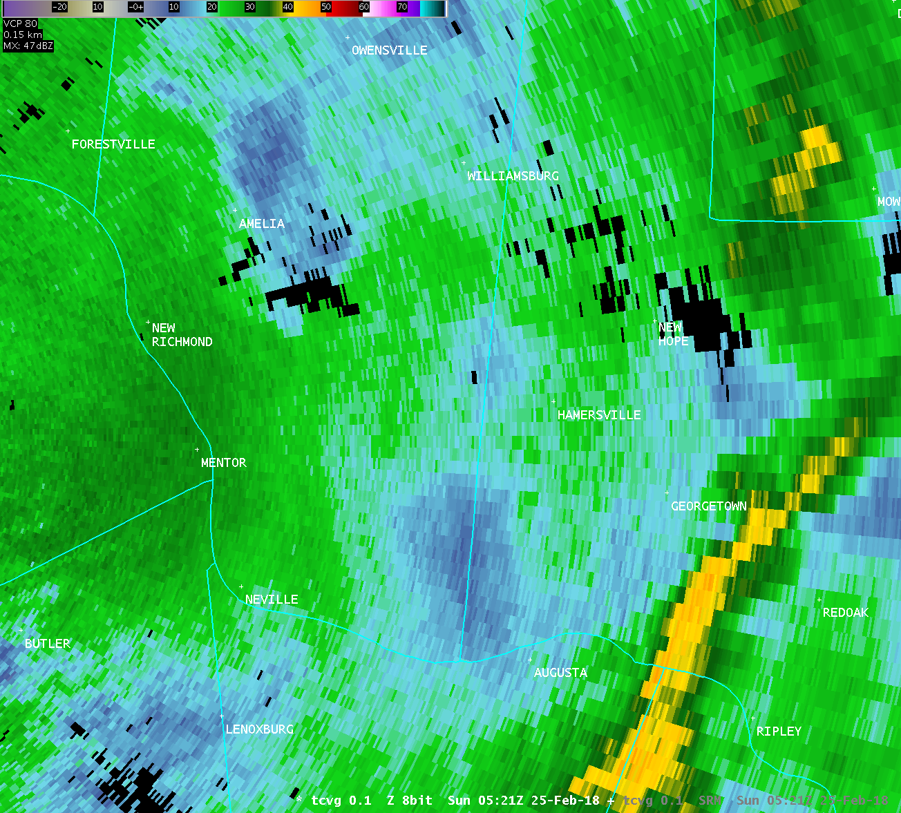
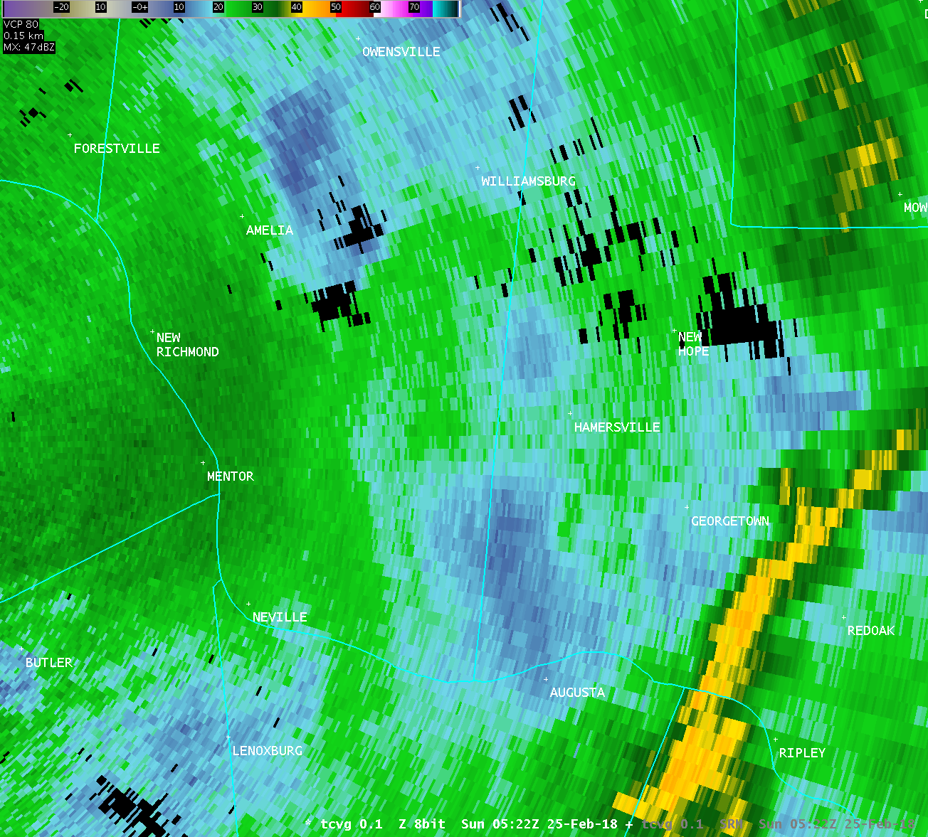
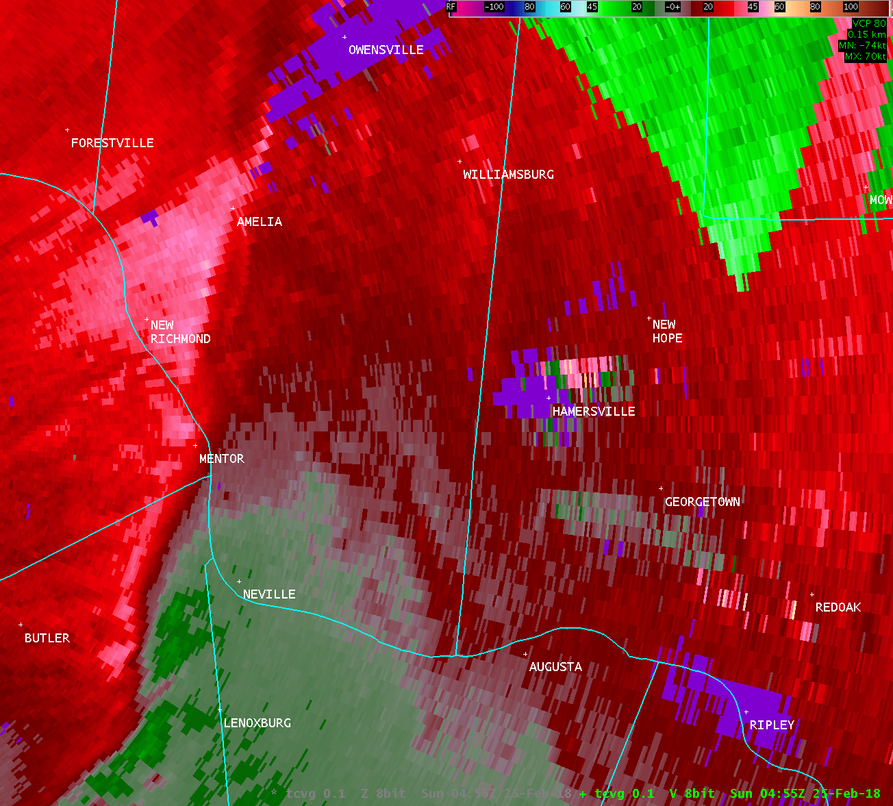
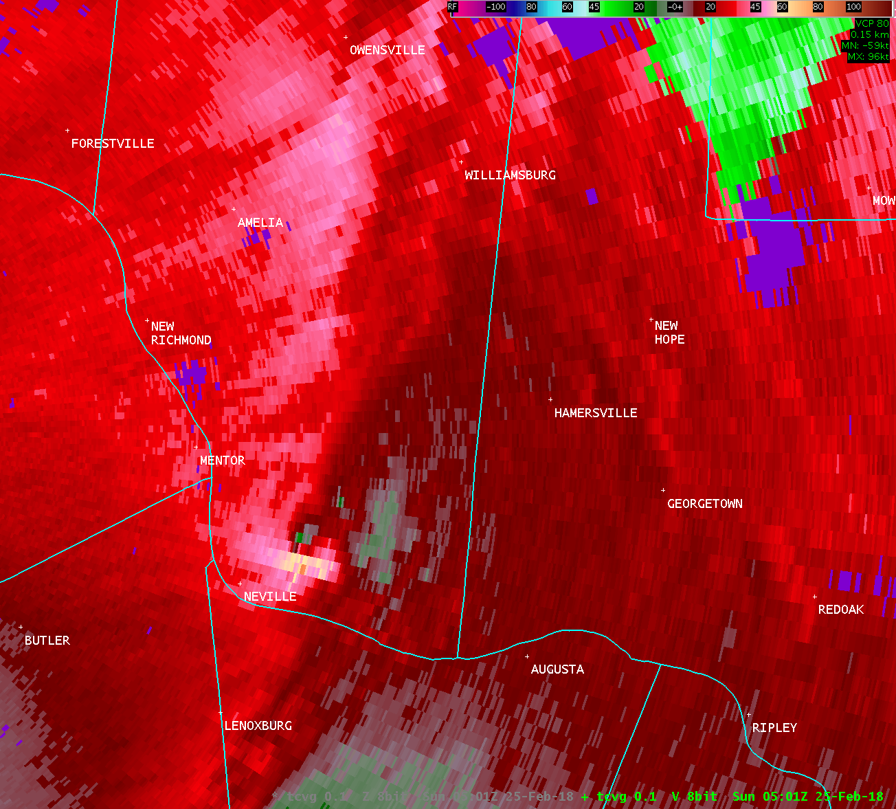
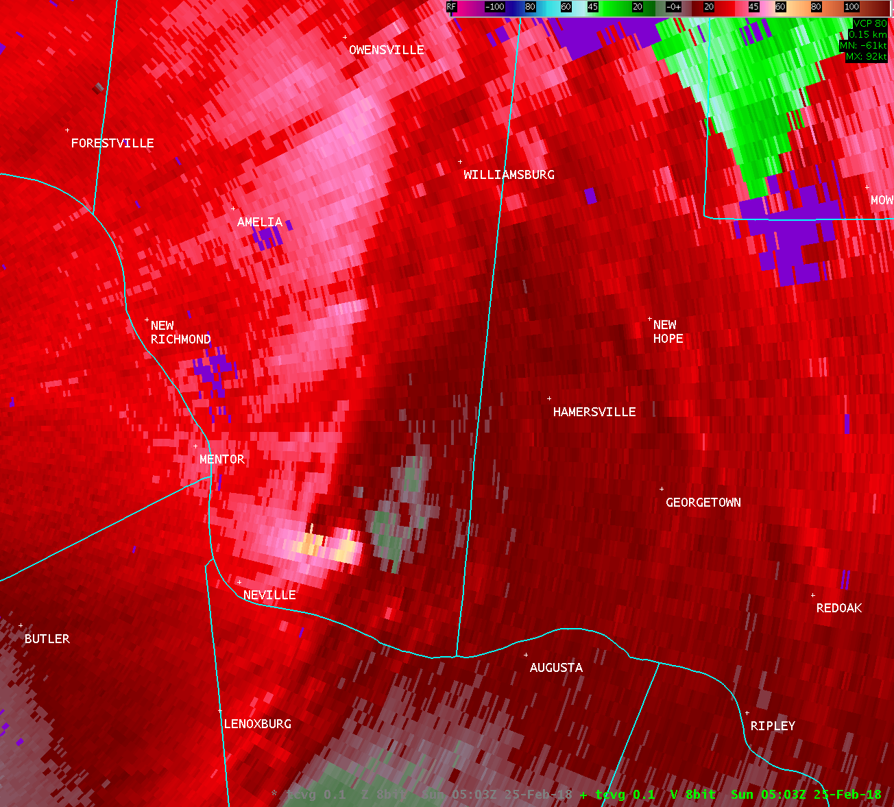
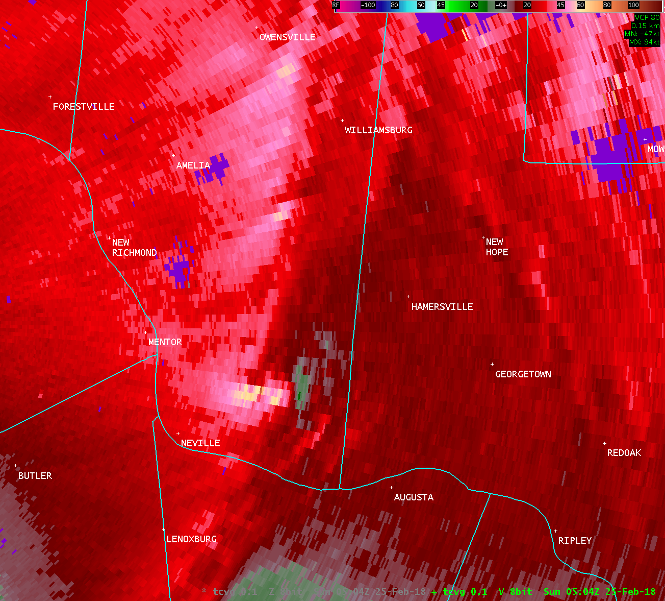
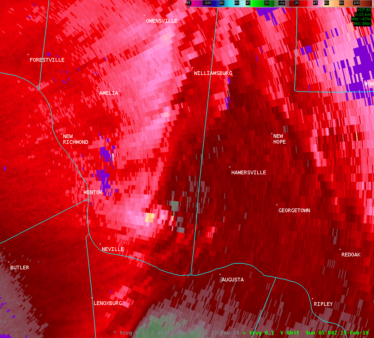
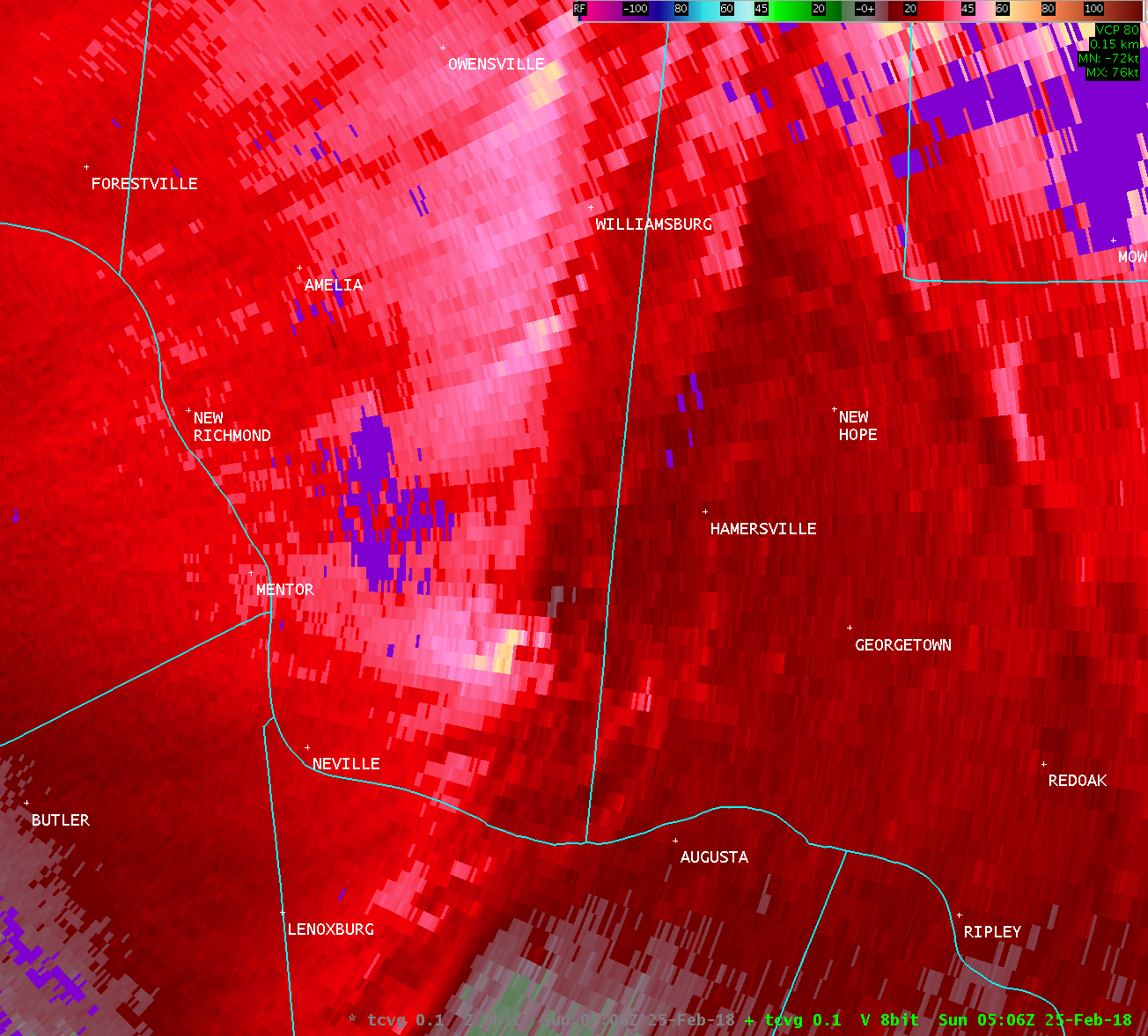
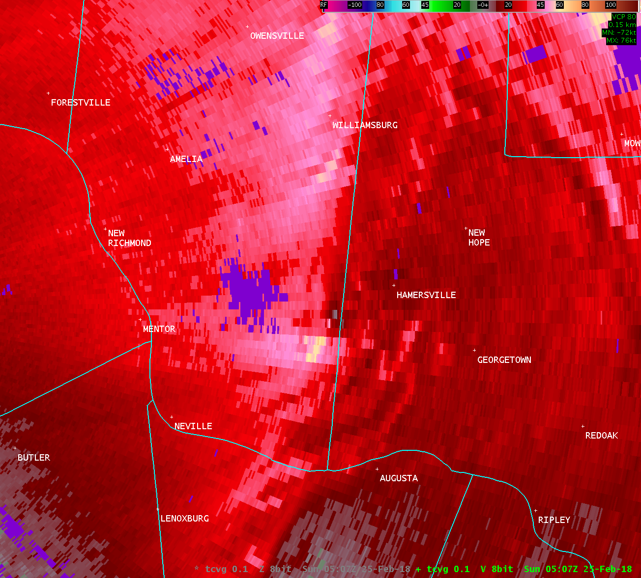
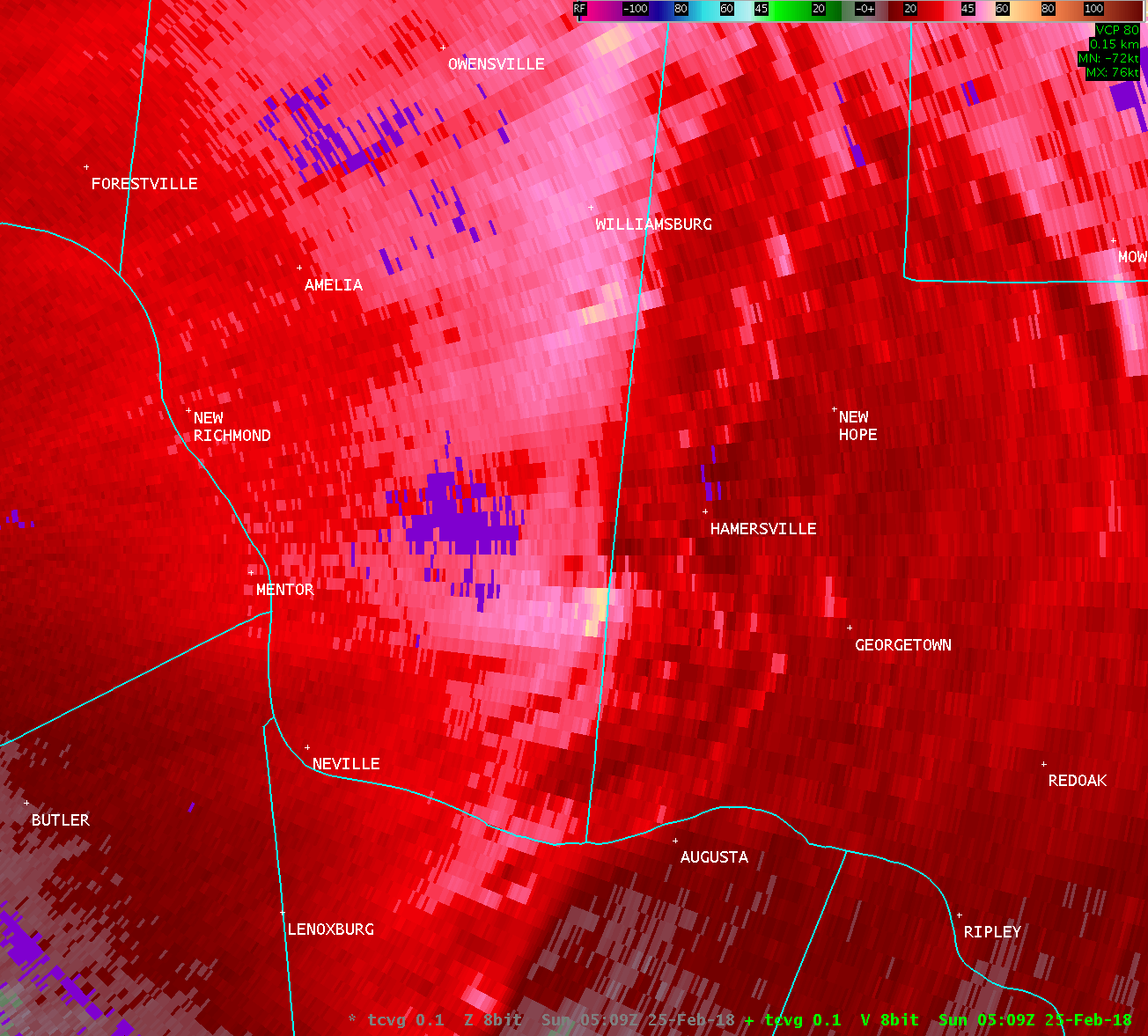
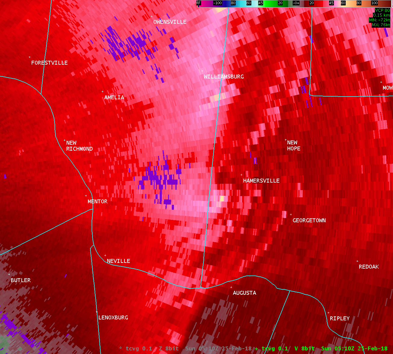
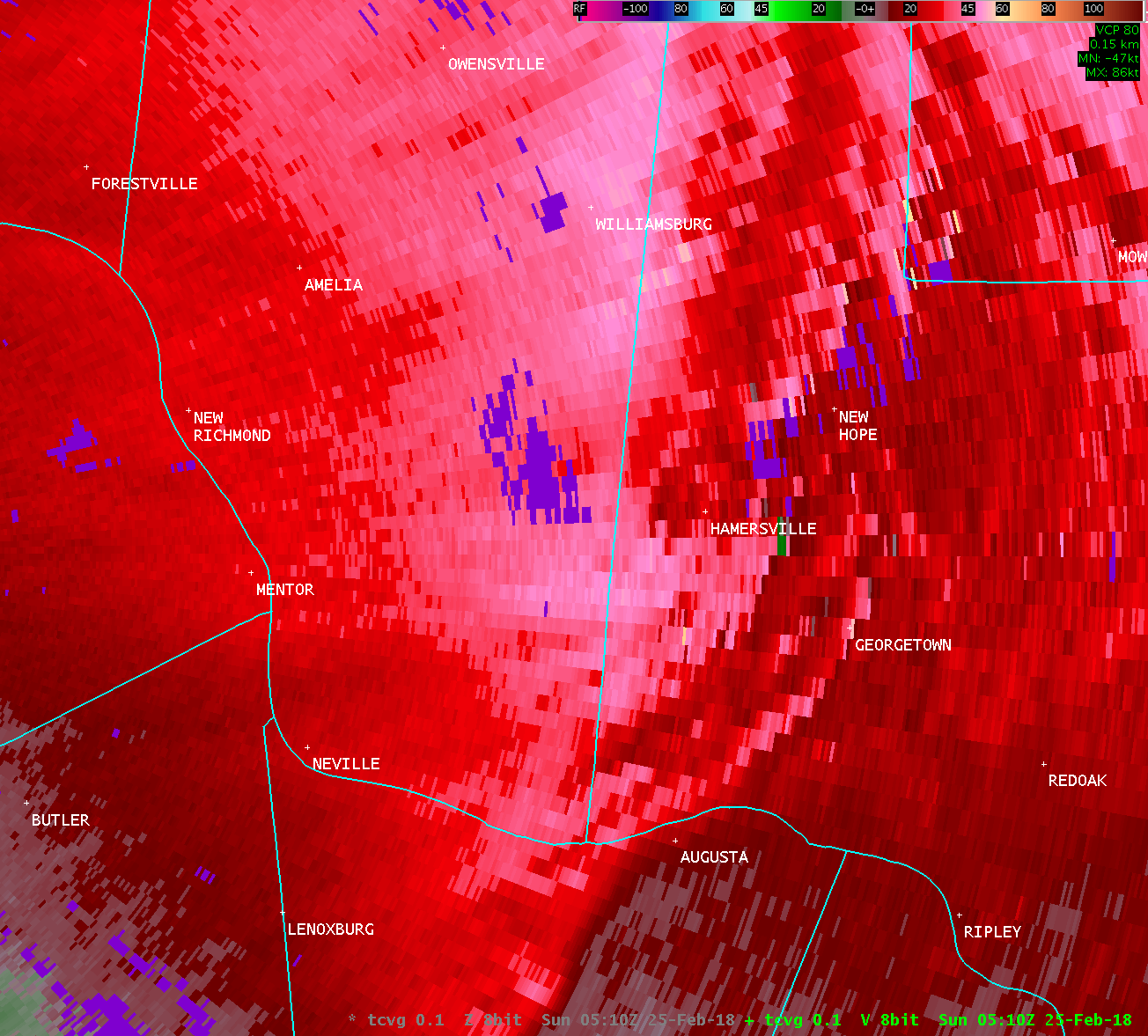
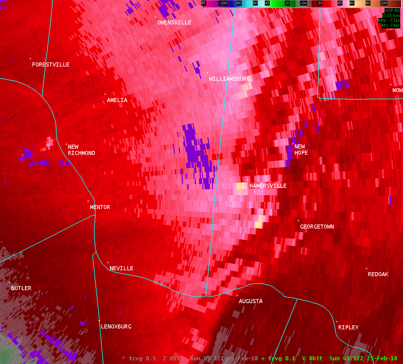
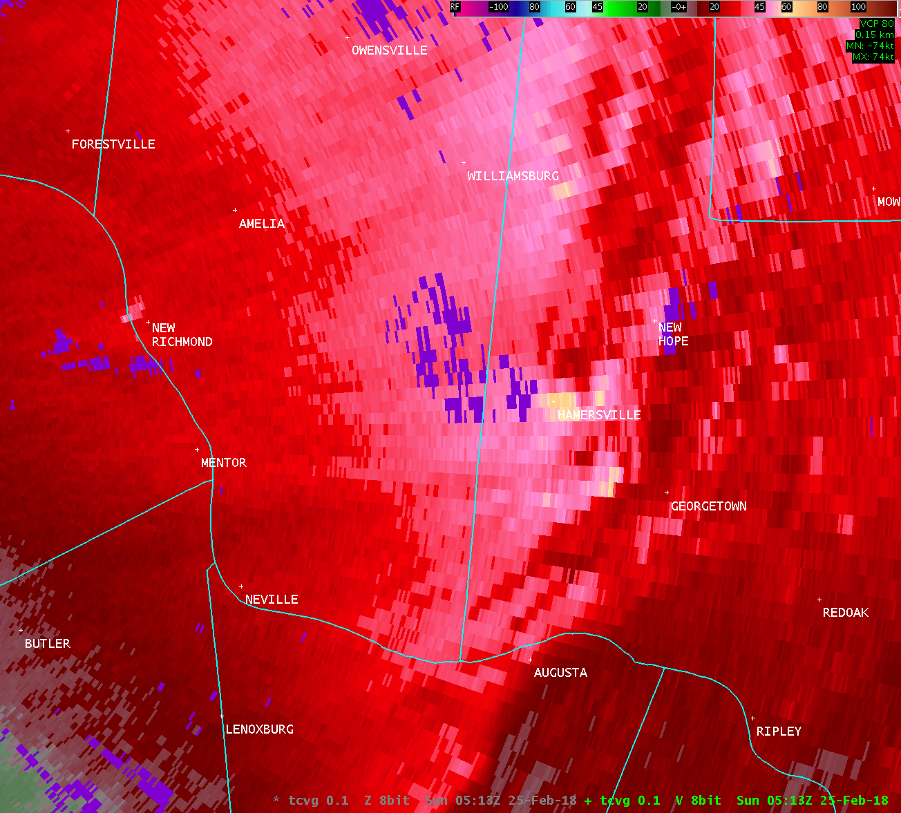
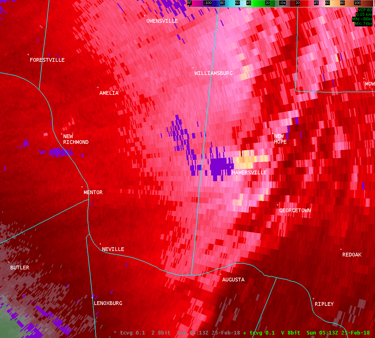
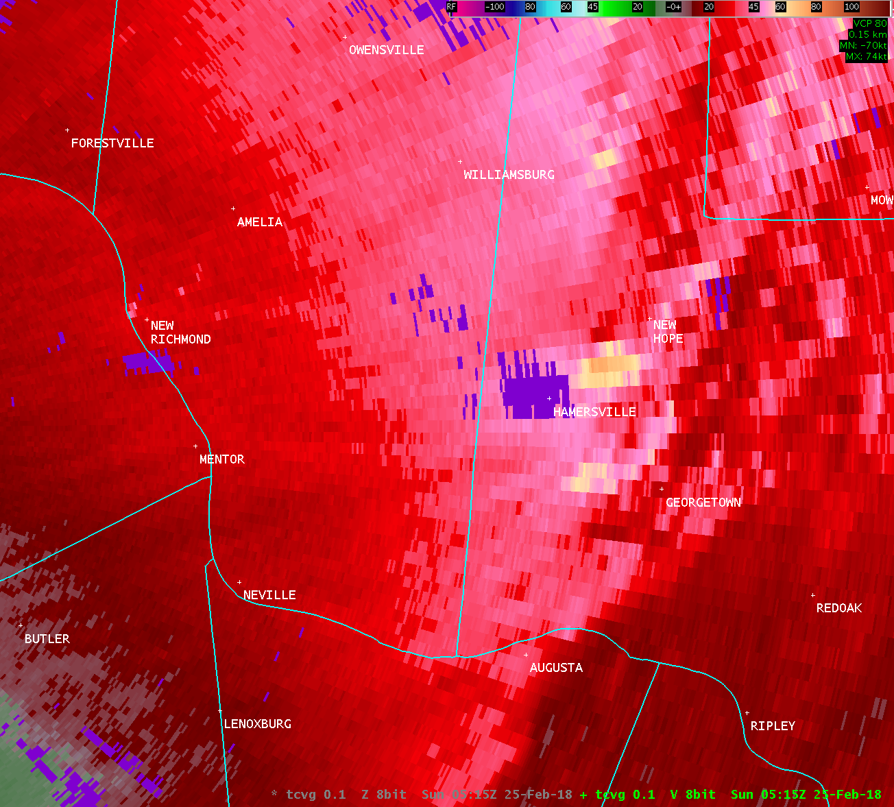
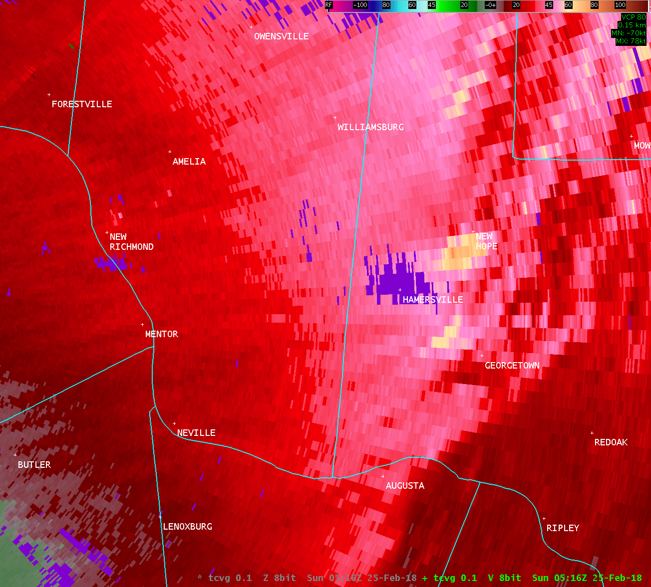
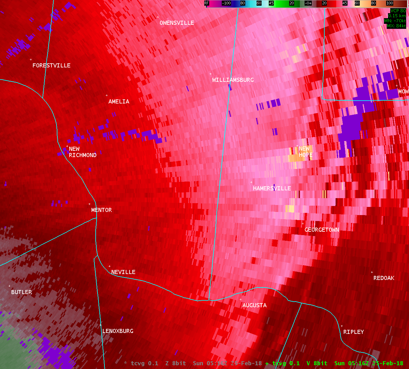
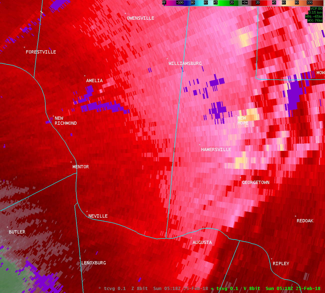
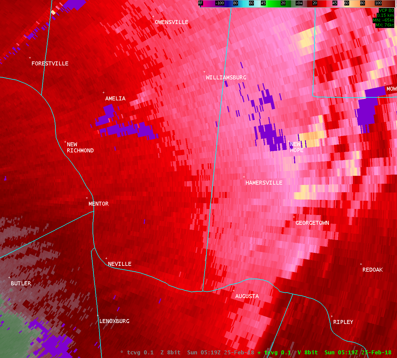
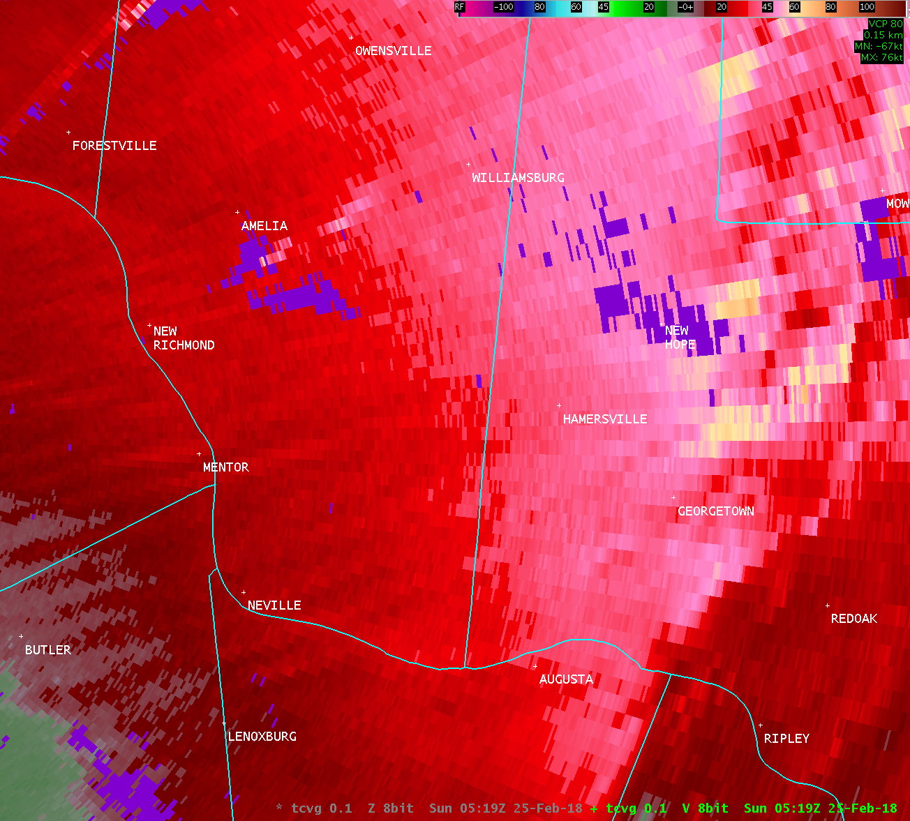
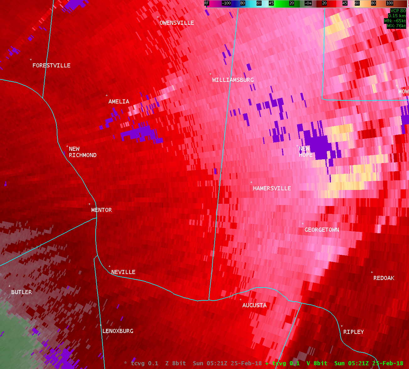
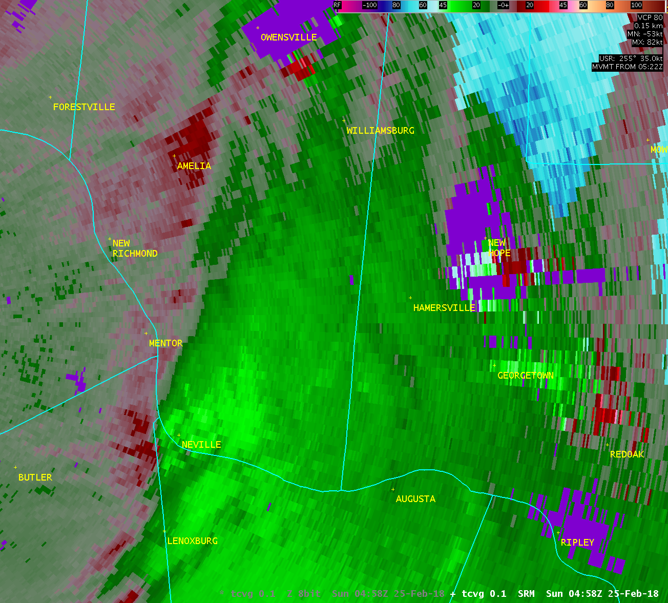
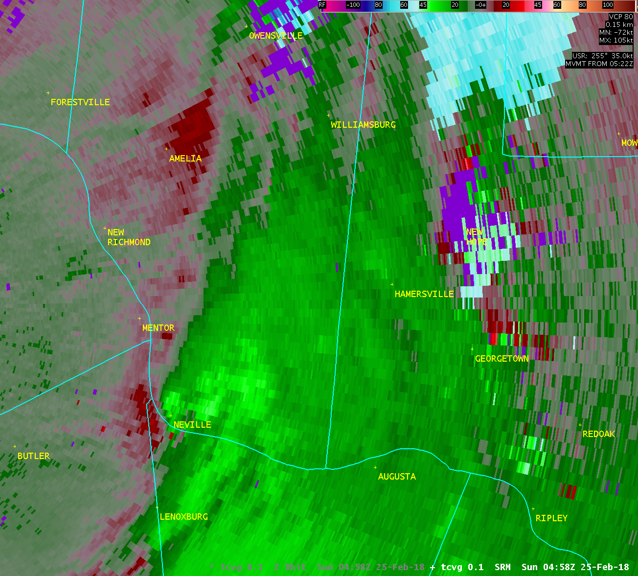
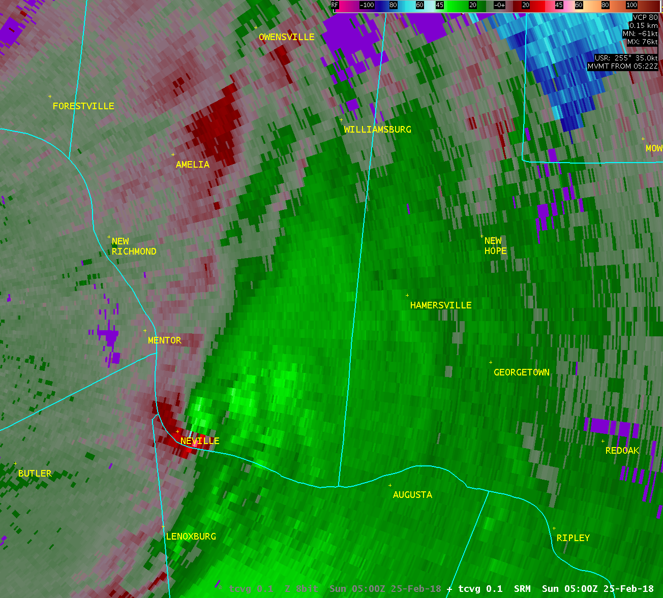
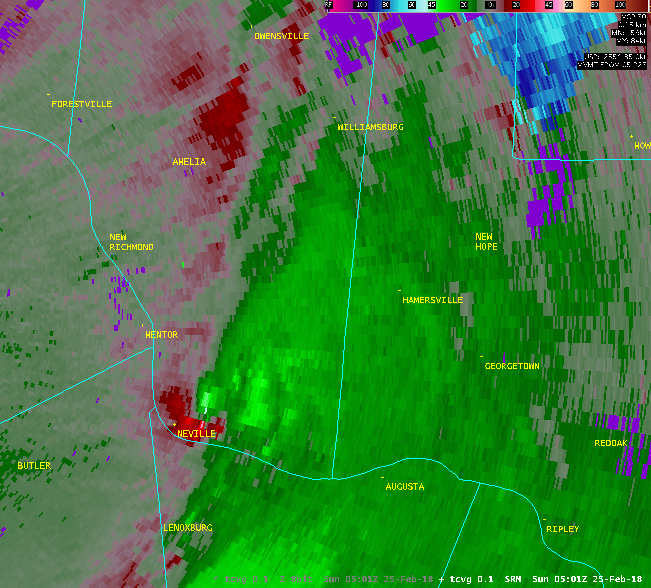
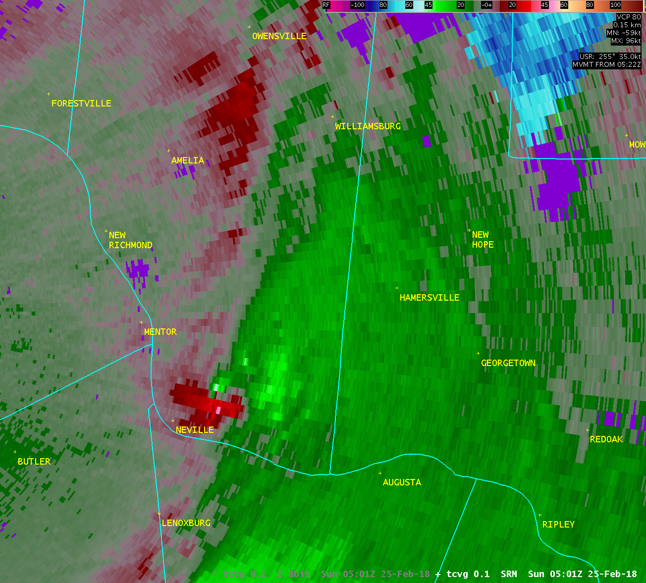
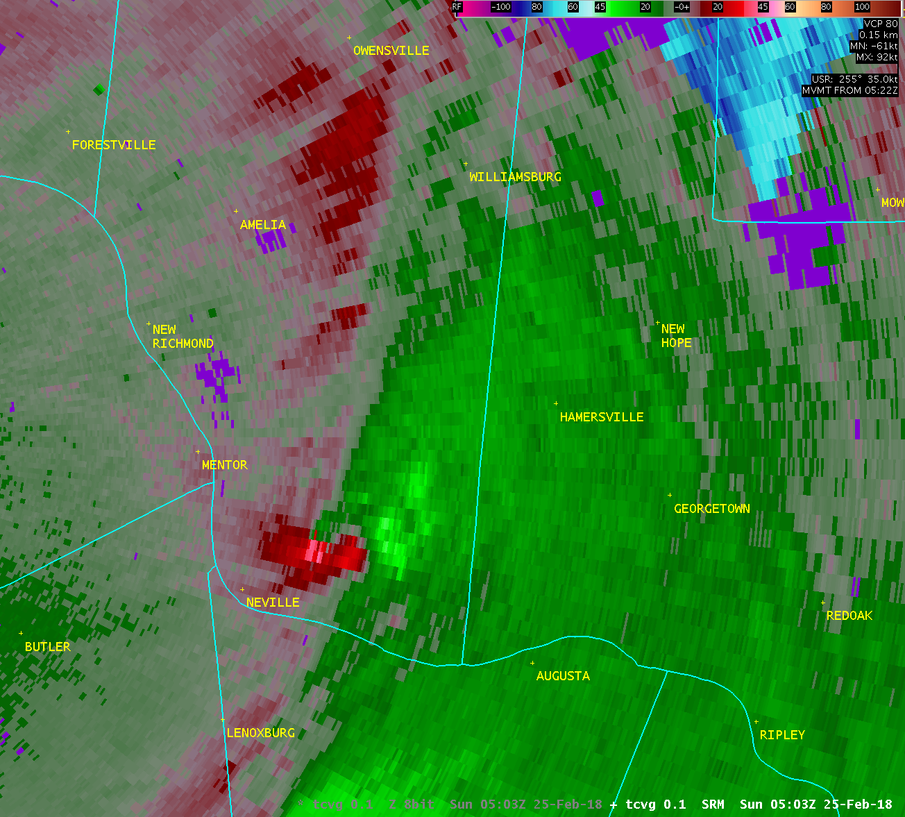
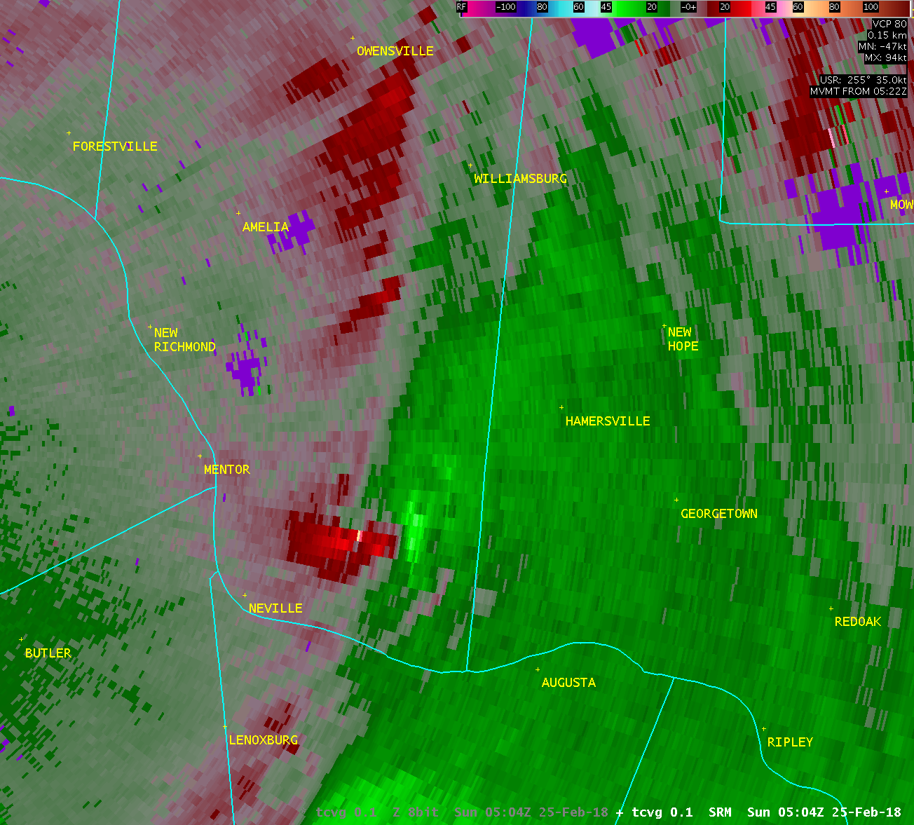
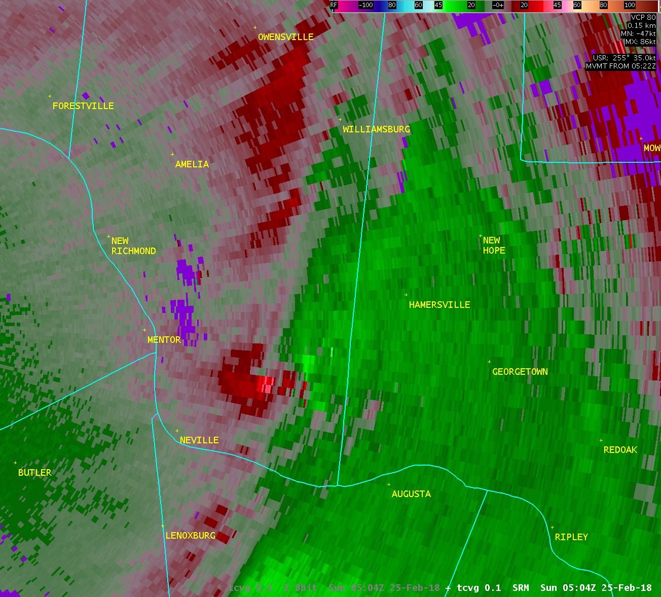
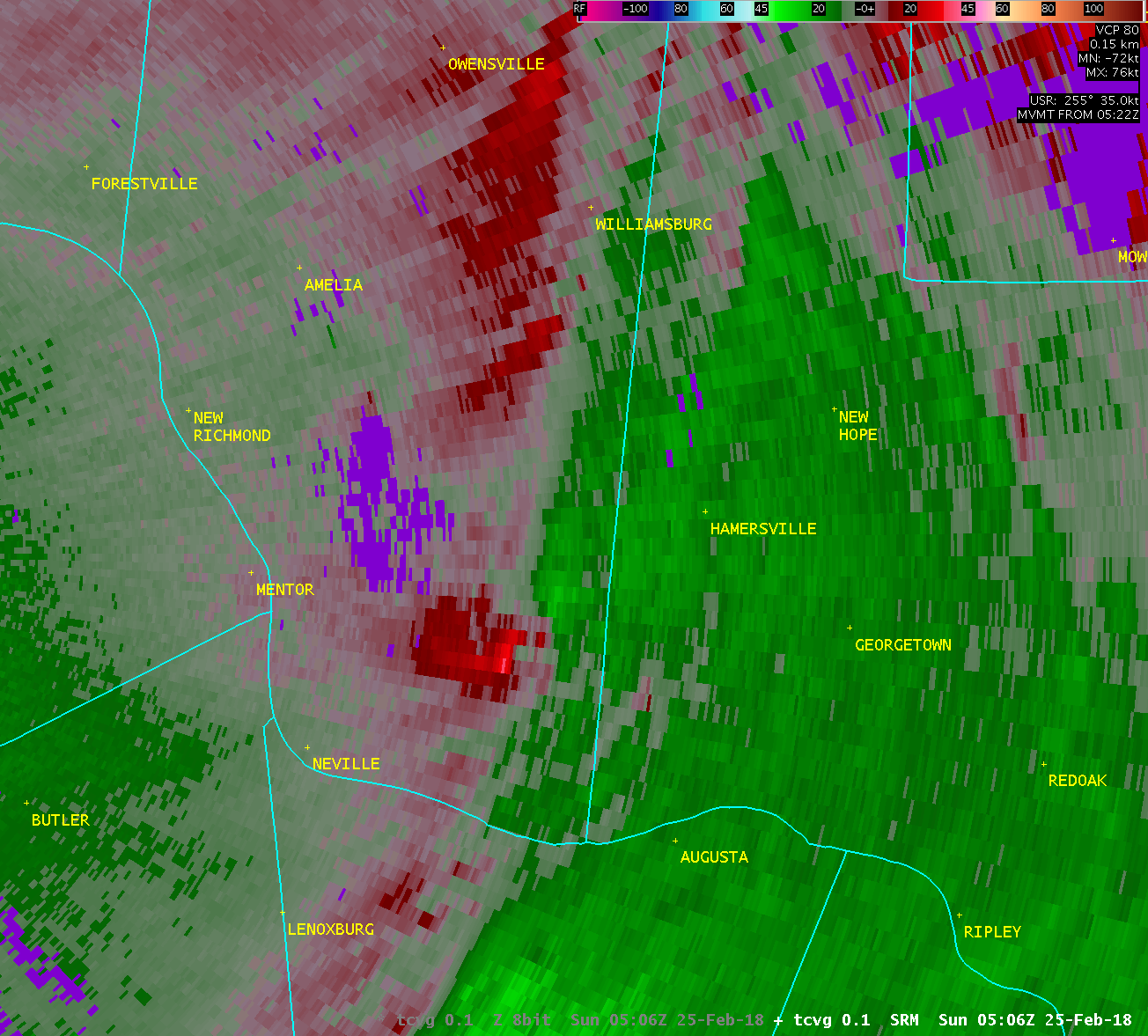
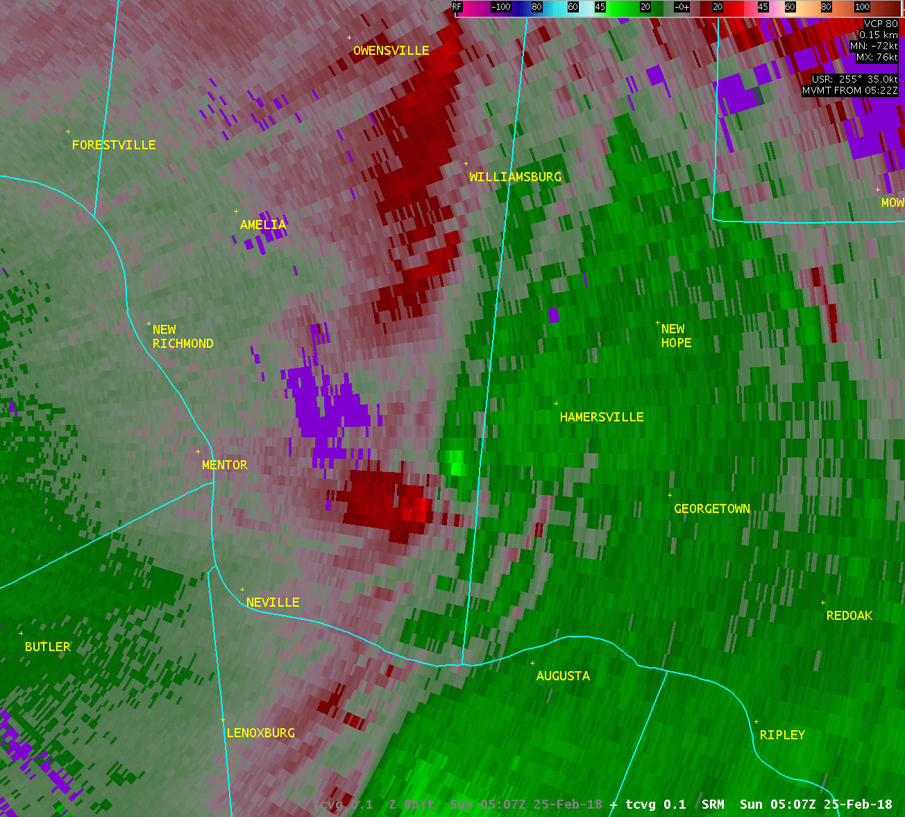
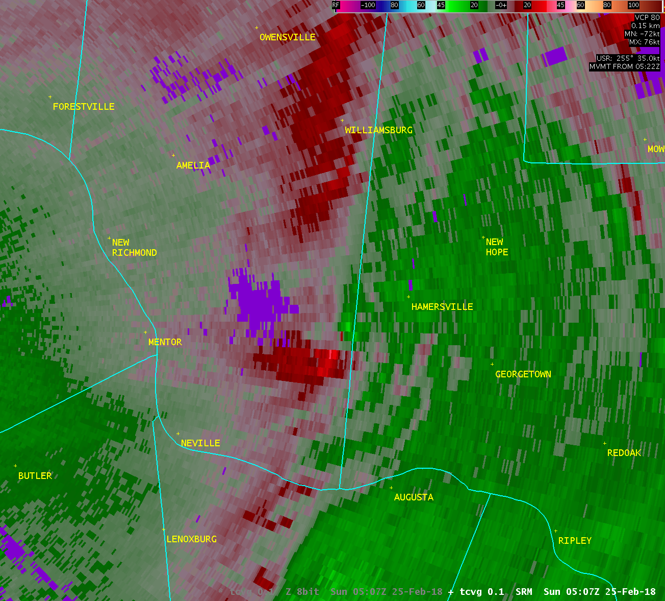
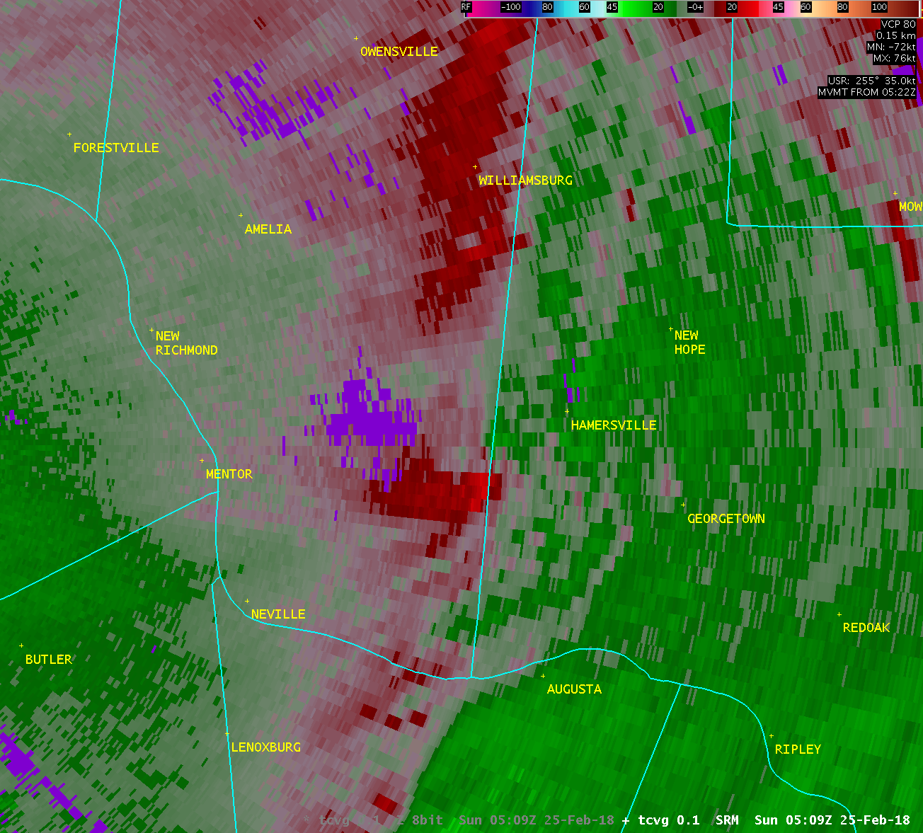
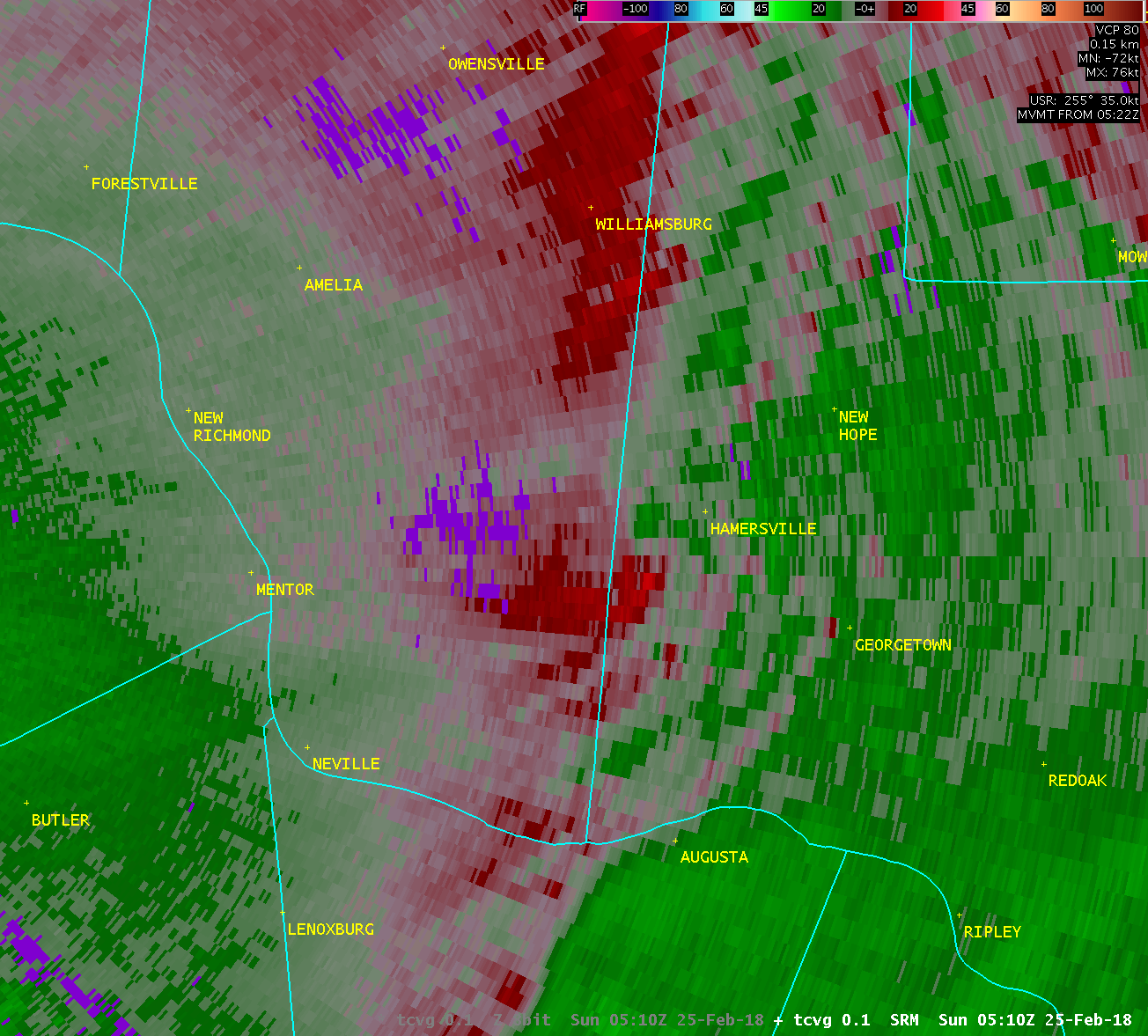
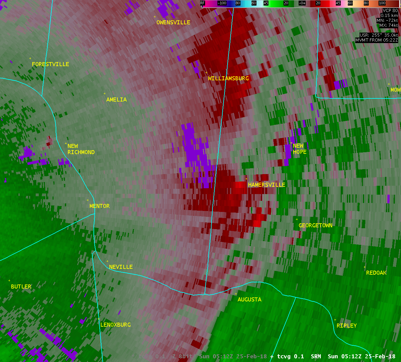
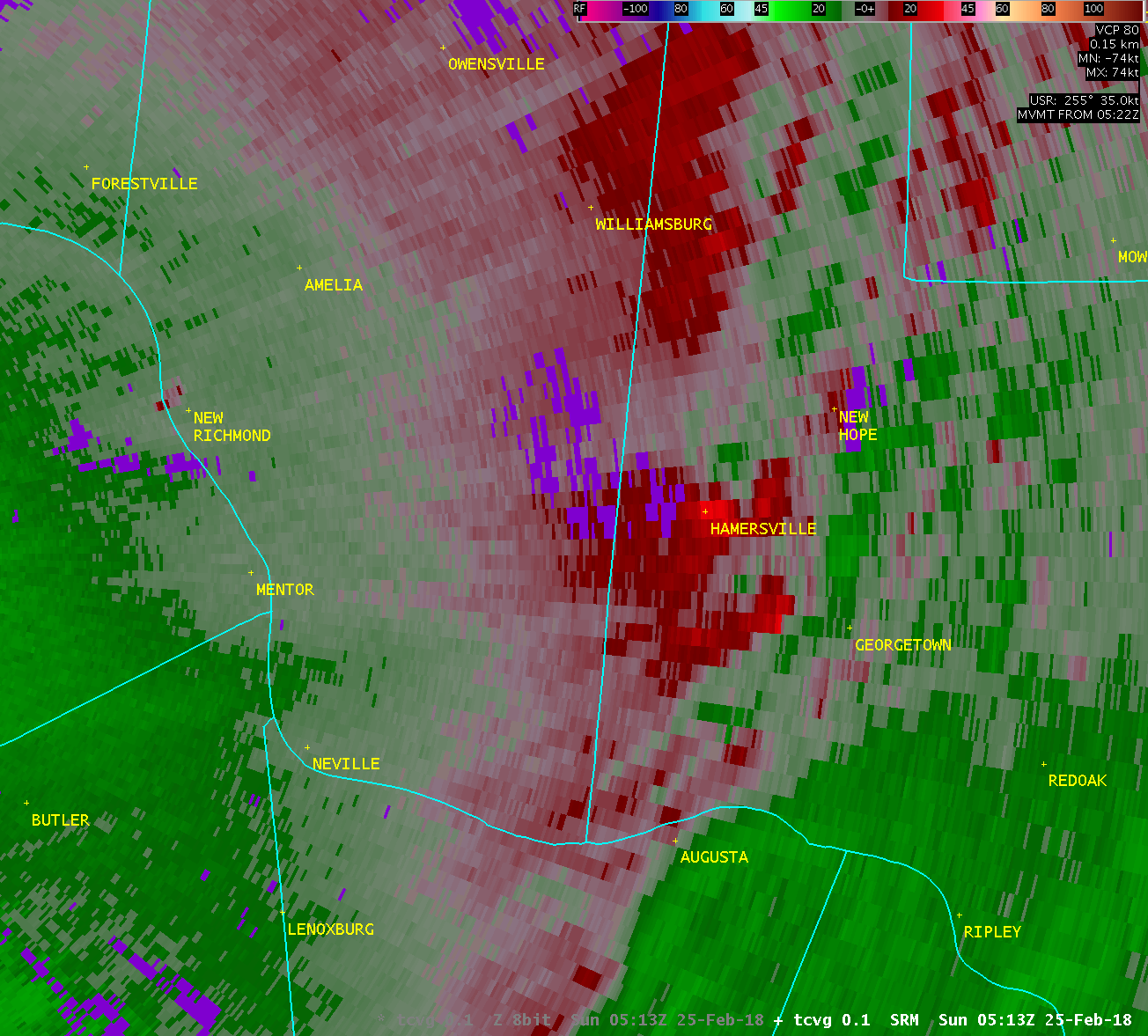
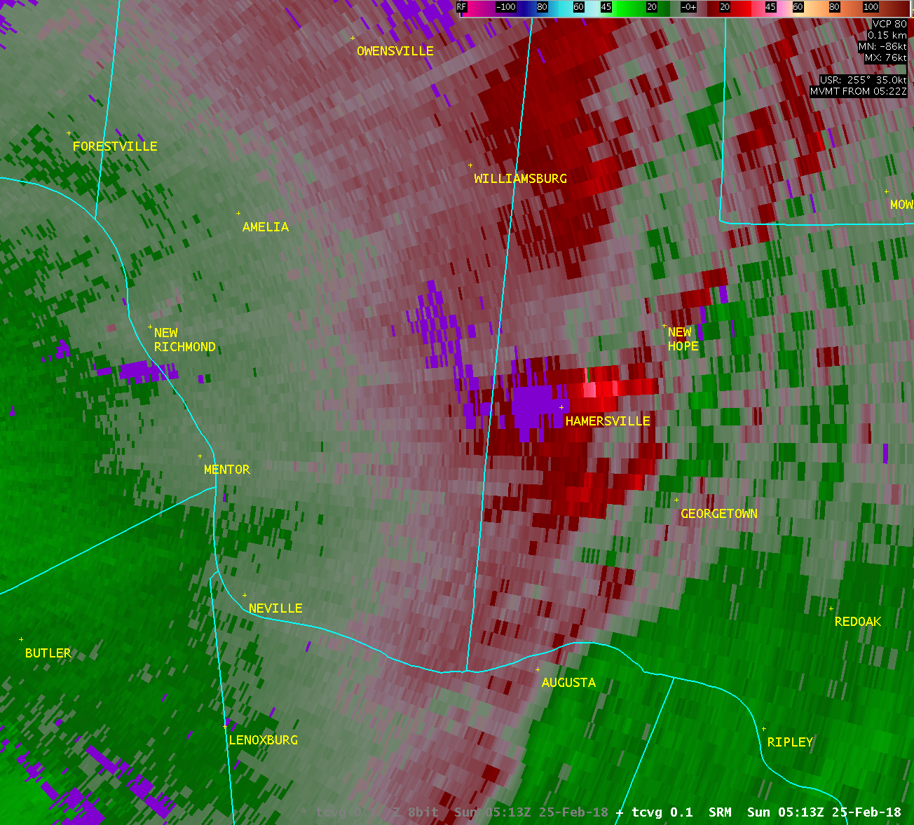
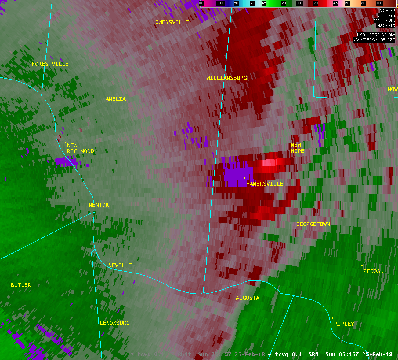
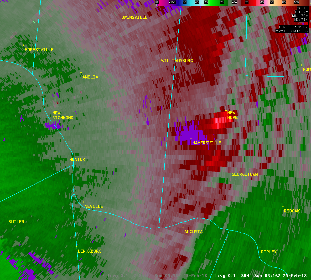
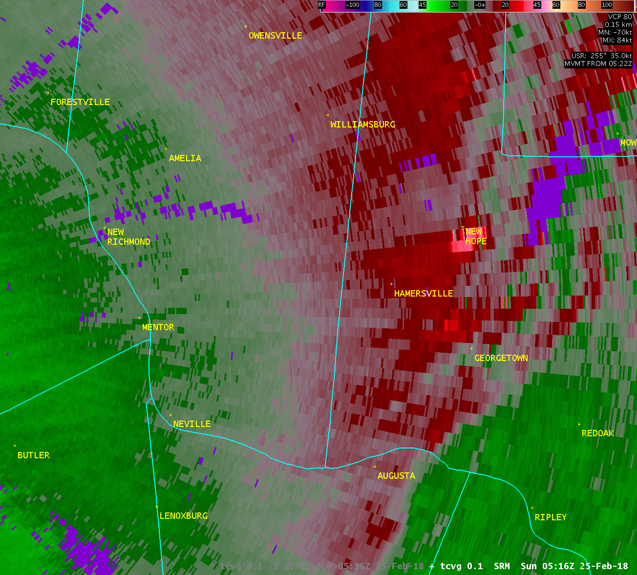
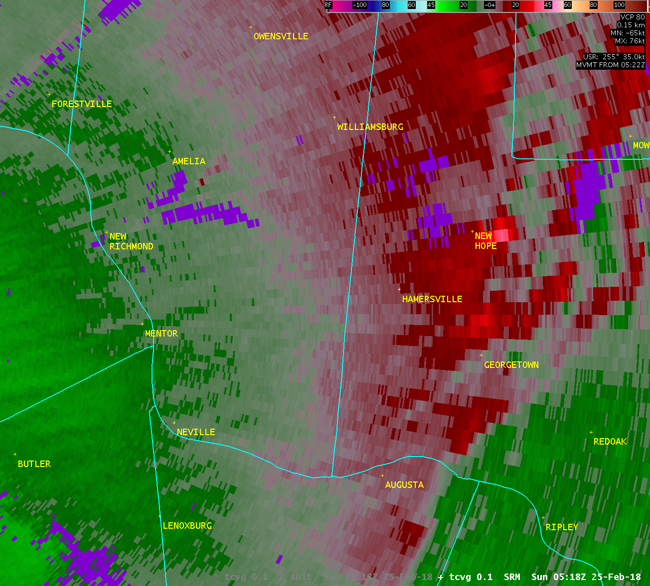
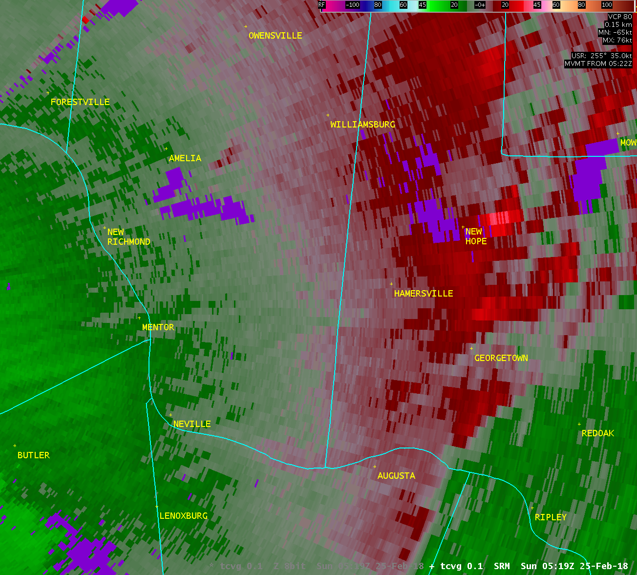
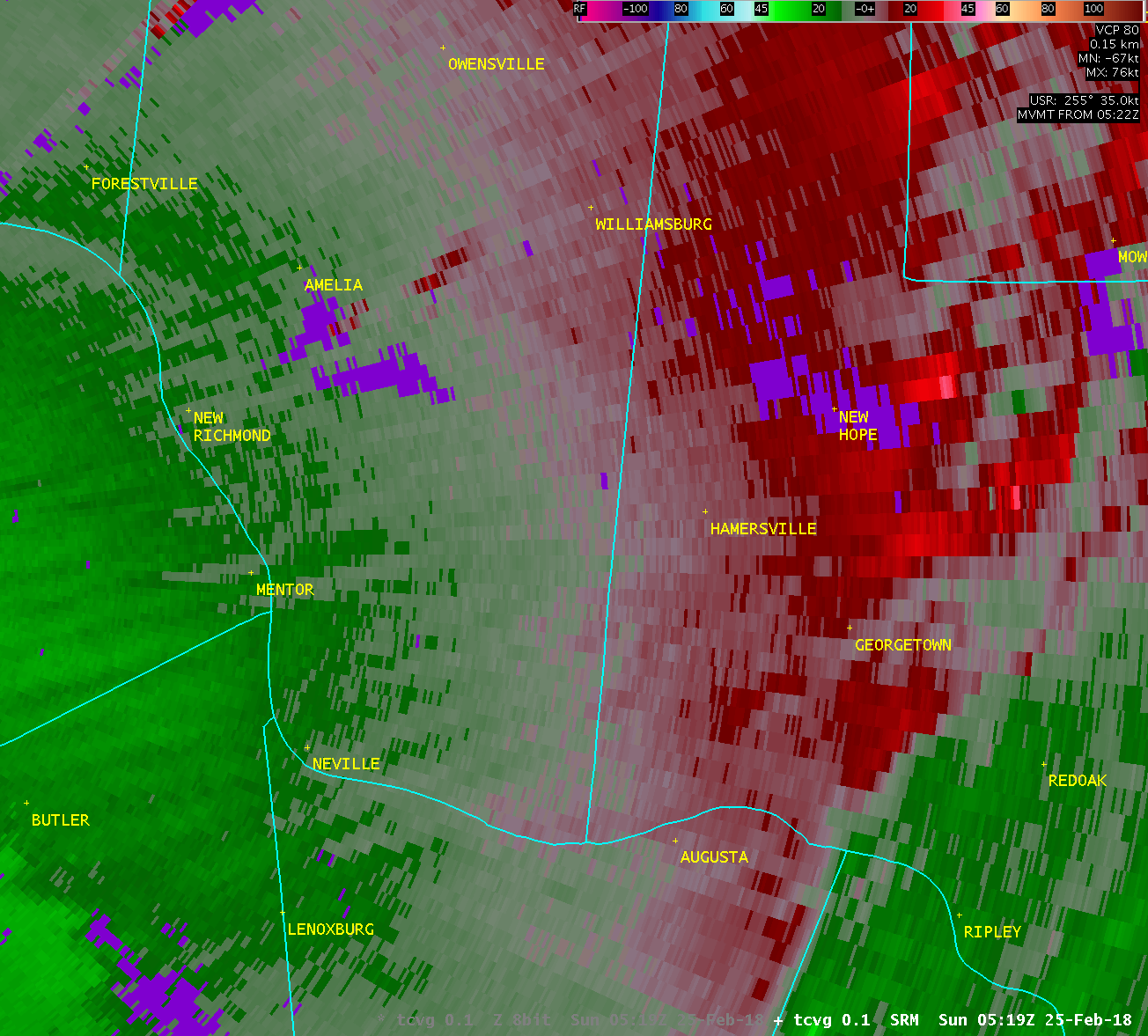
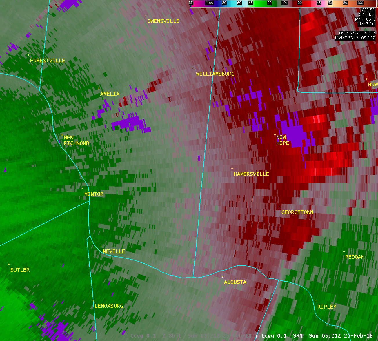
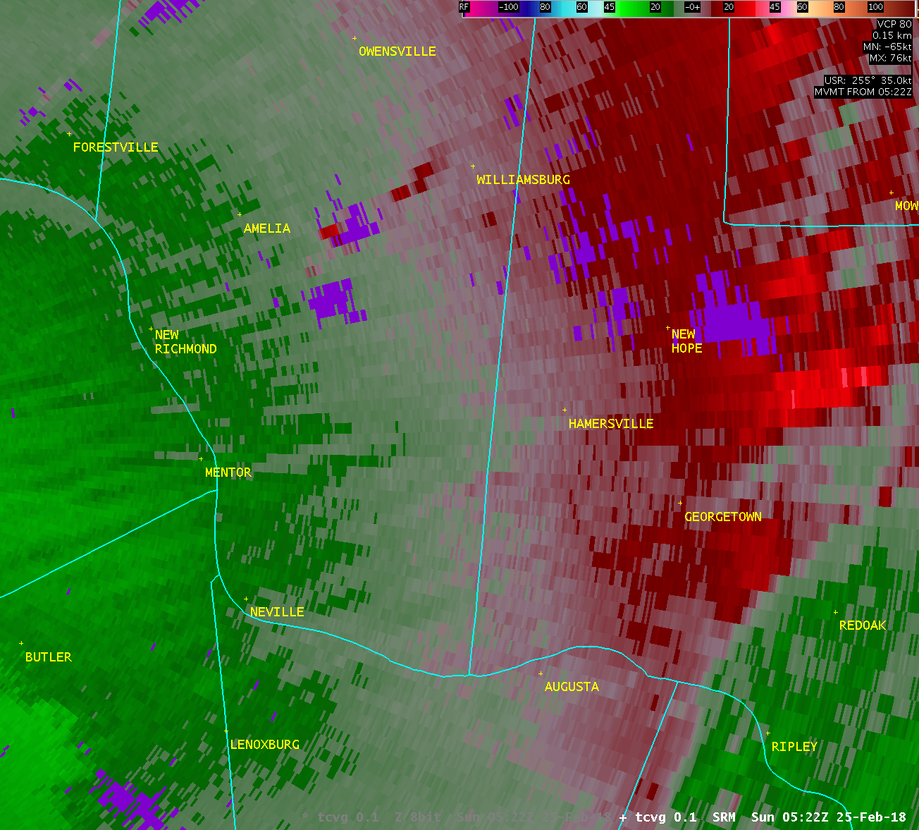
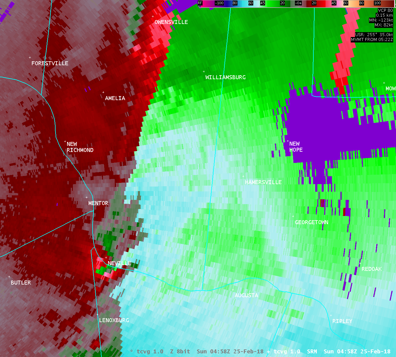
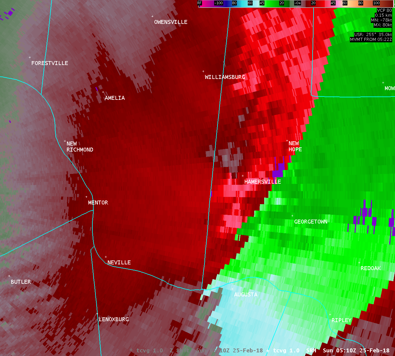
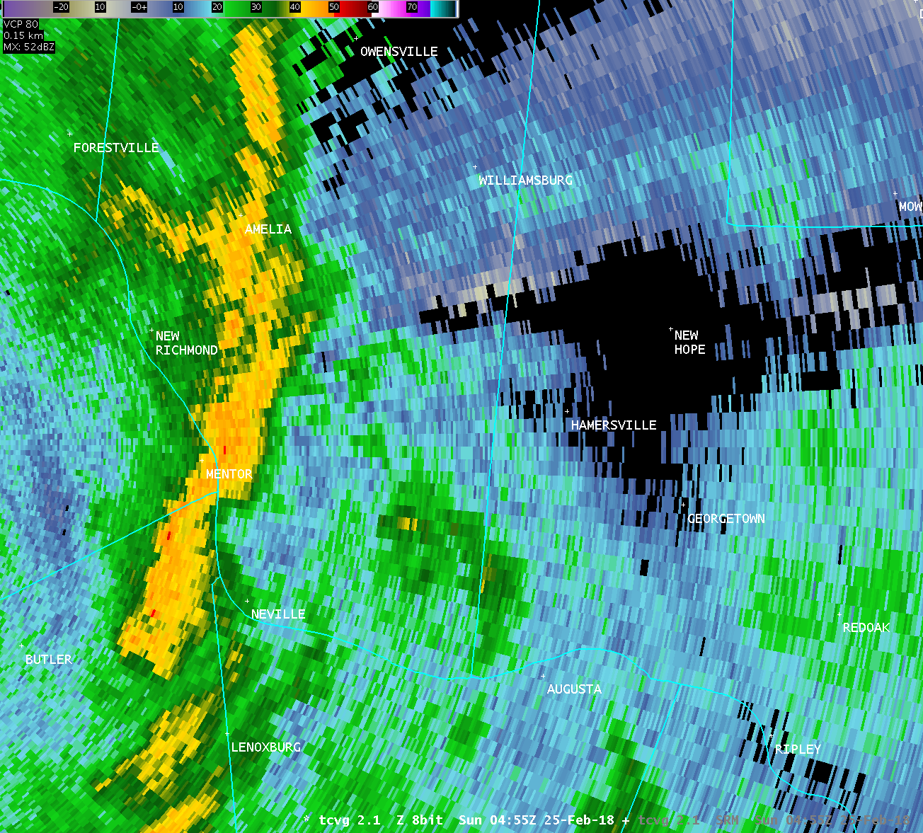
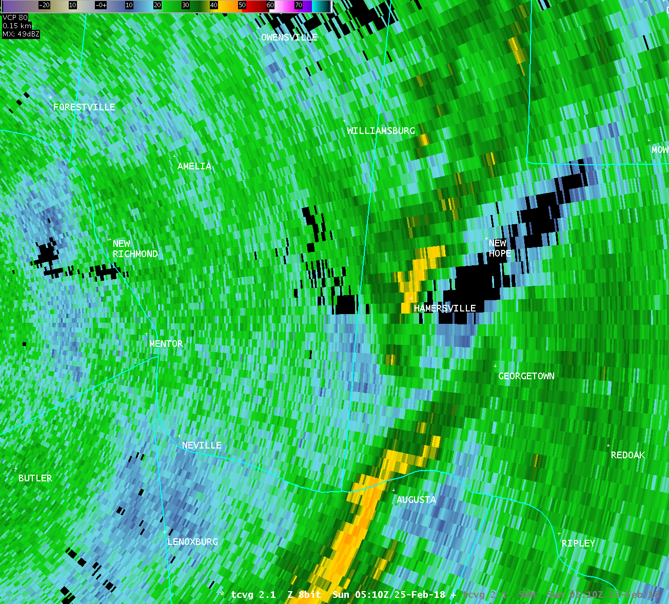
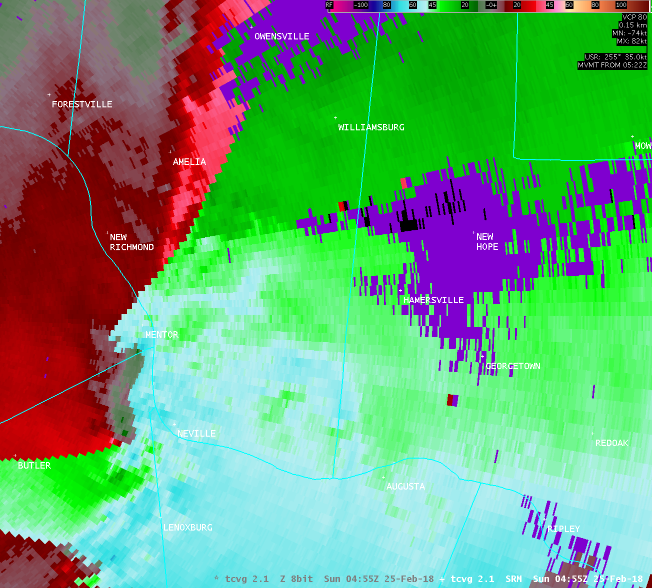
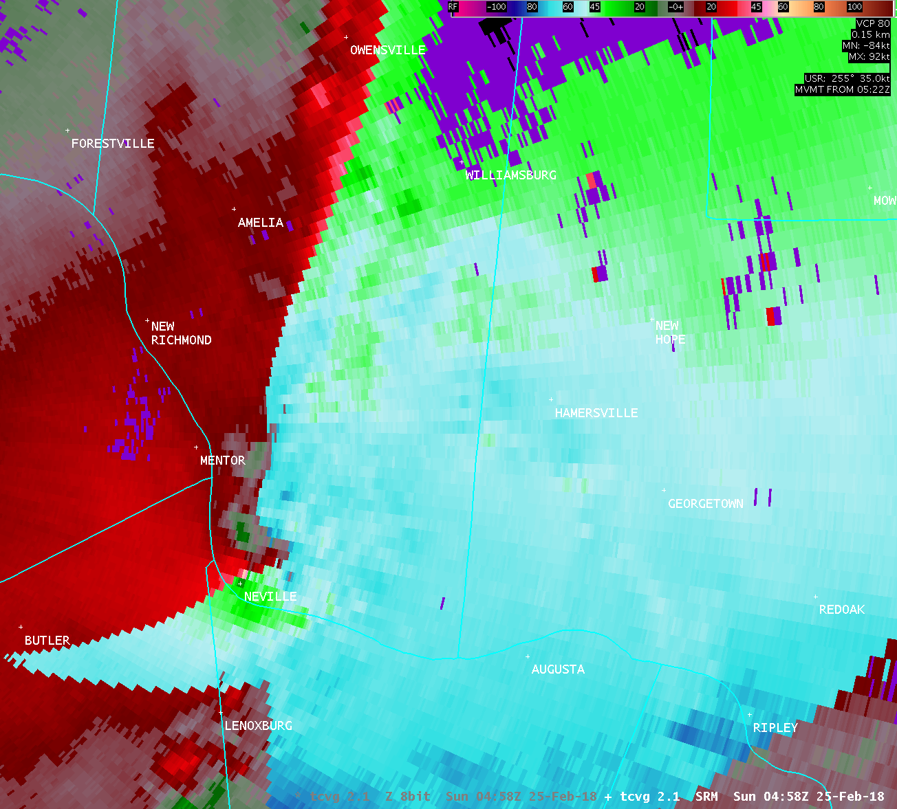
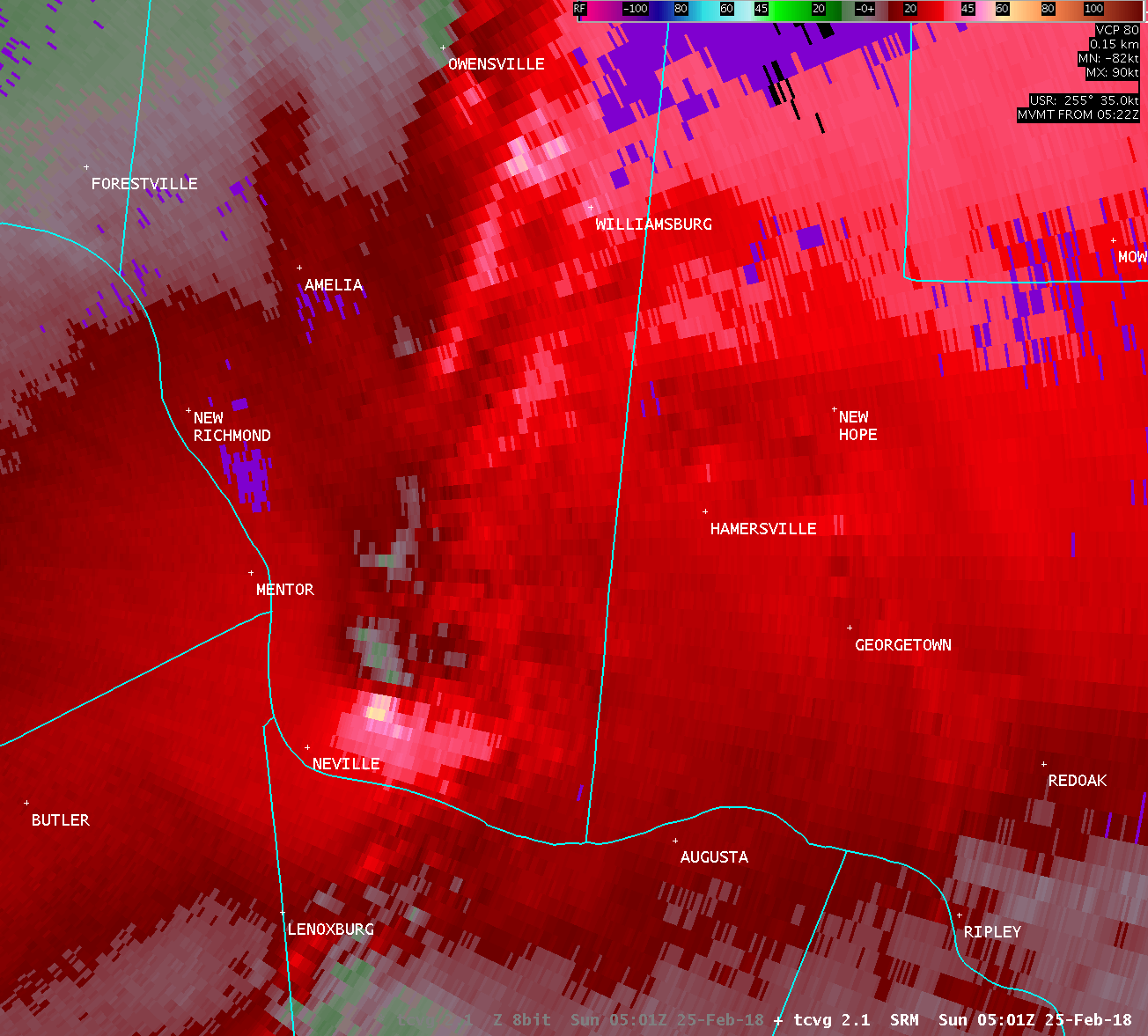
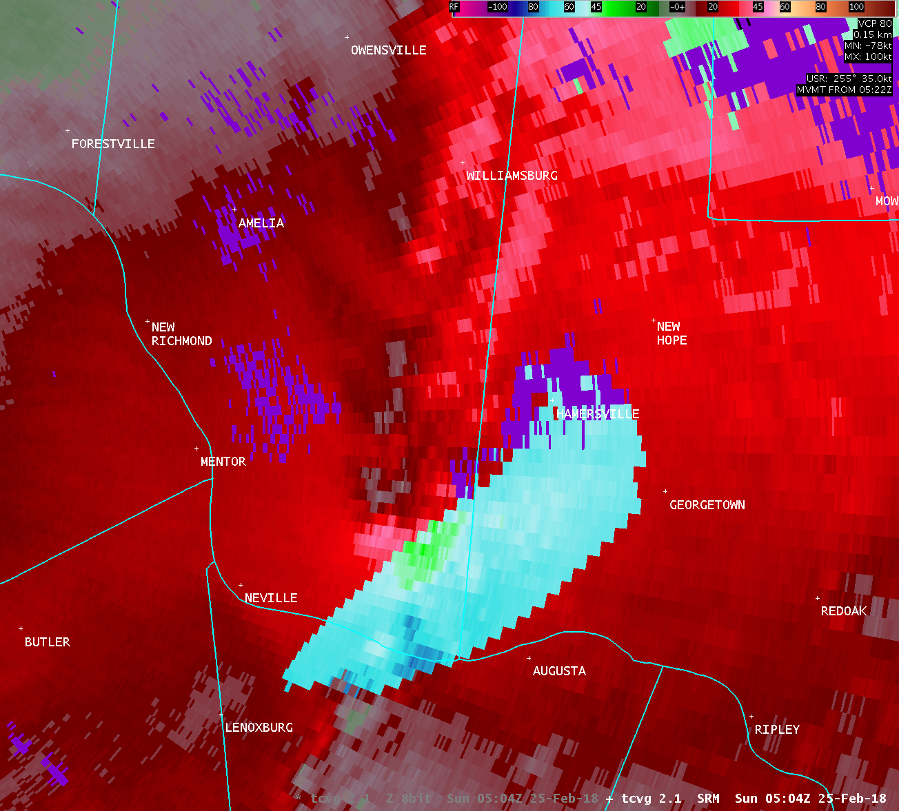
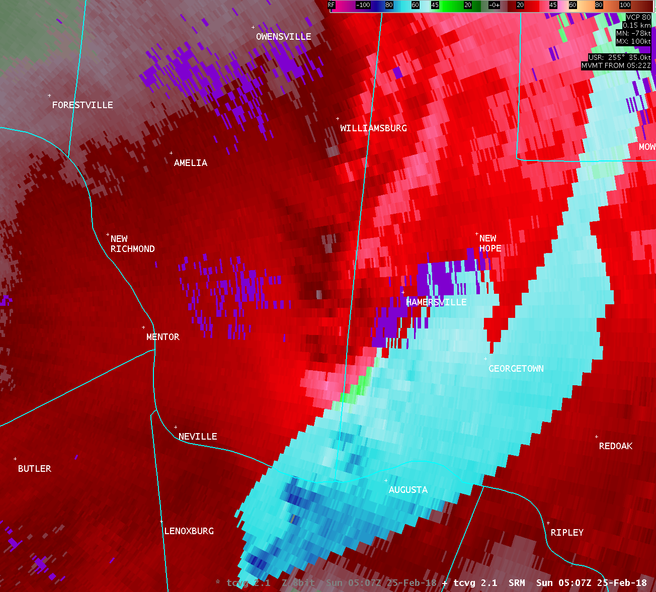
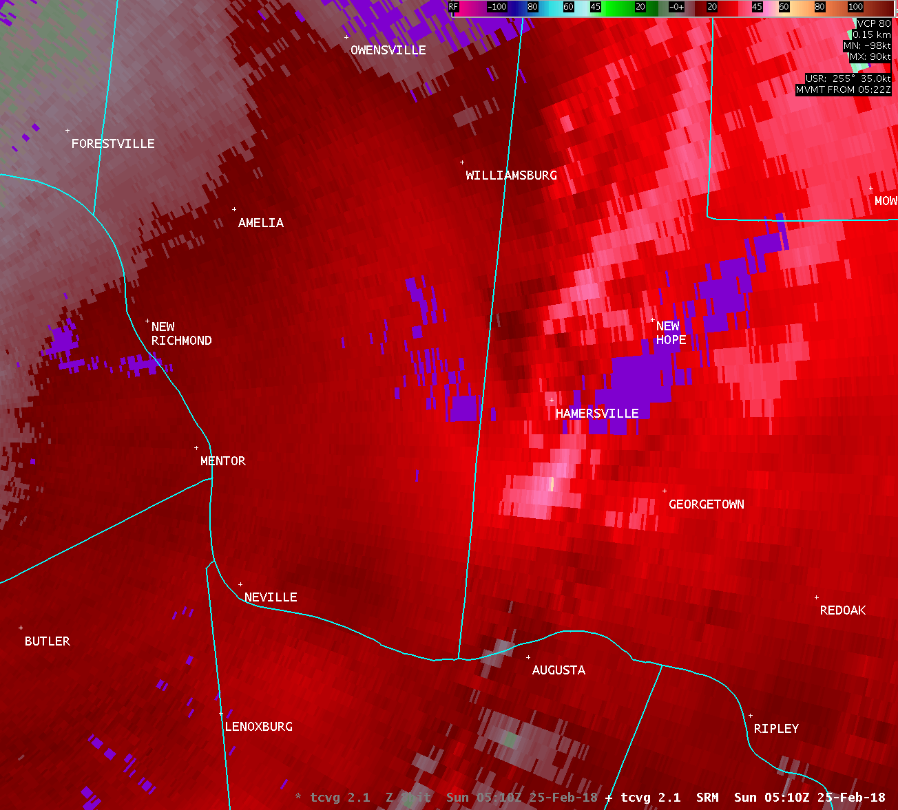
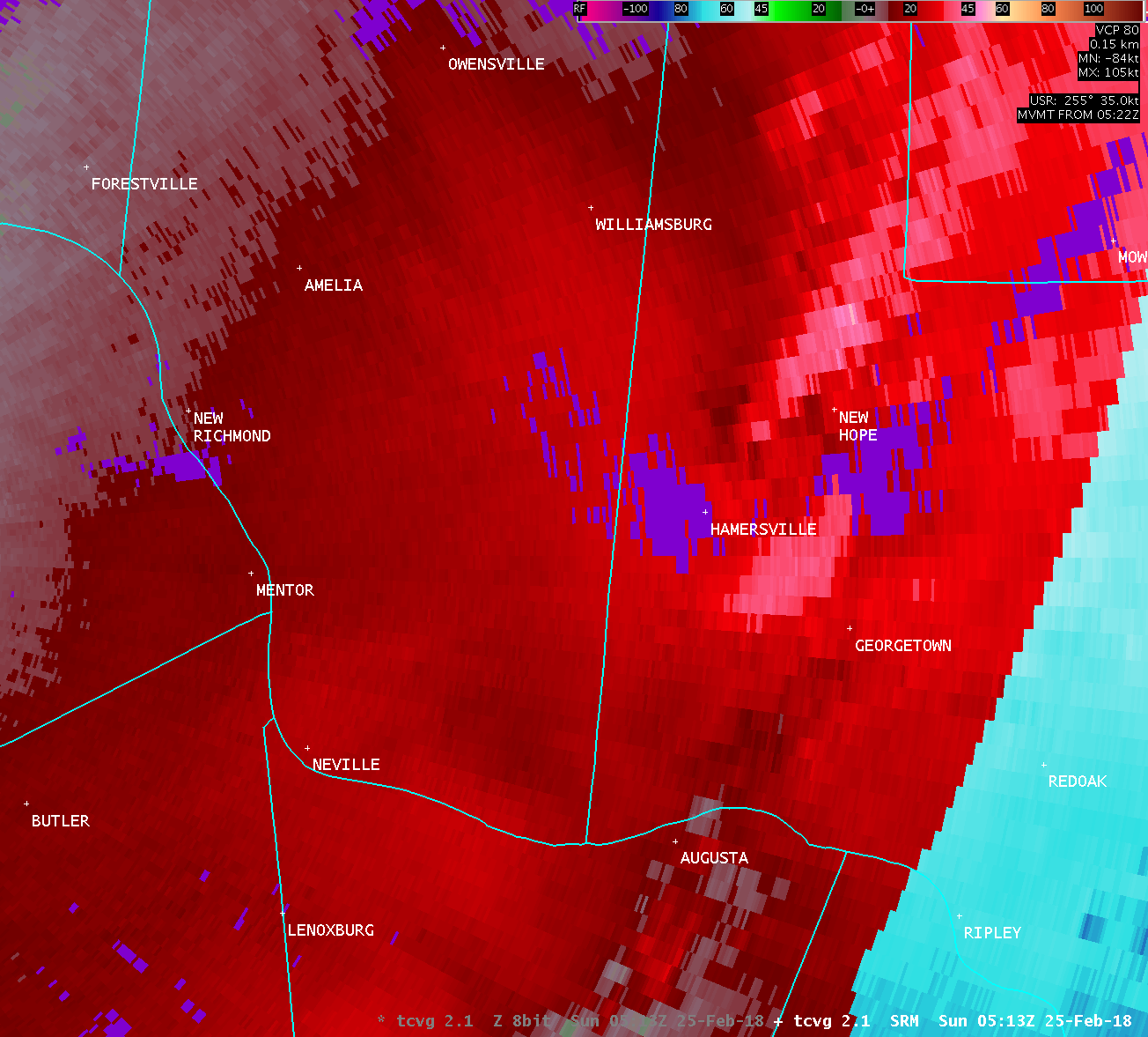
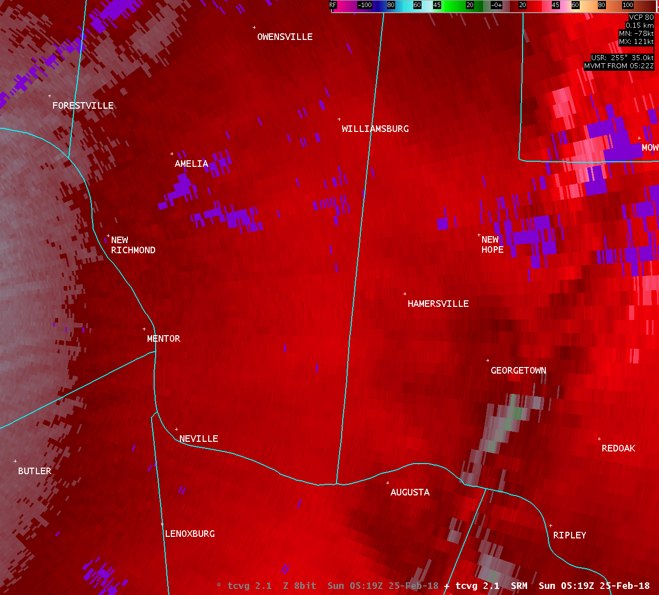
...TORNADO CONFIRMED NORTHEAST OF HAMERSVILLE IN BROWN COUNTY
OHIO...
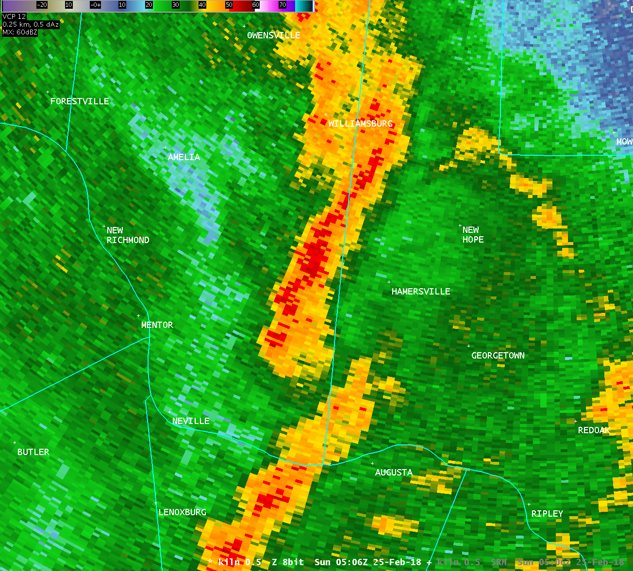
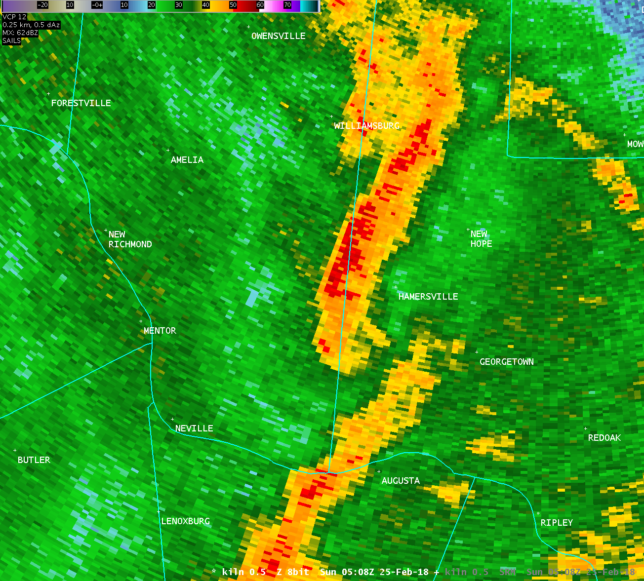
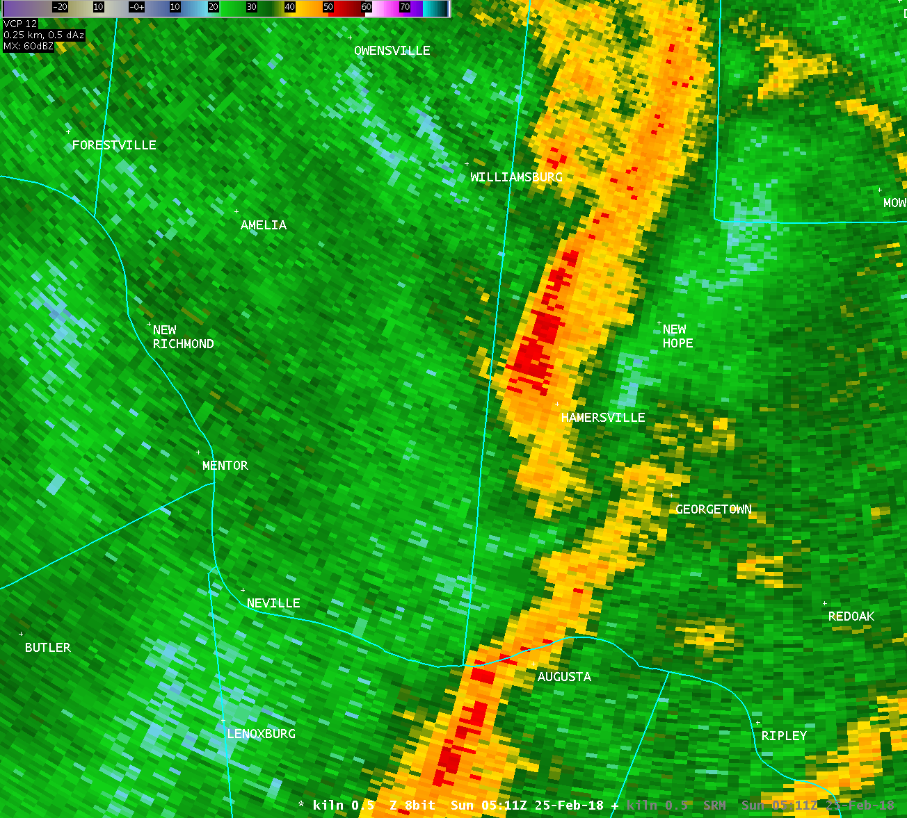
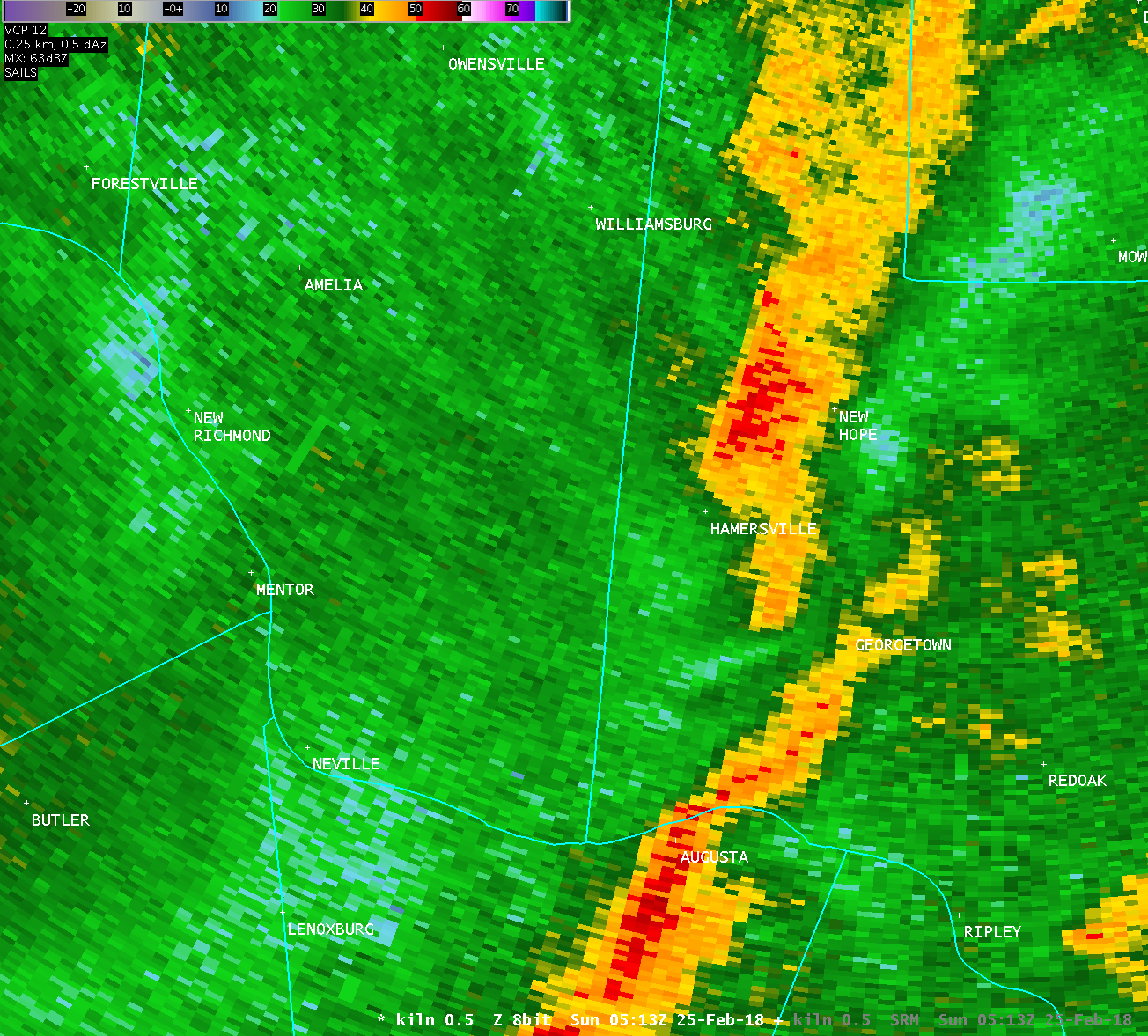
Location...Northeast of Hamersville in Brown County Ohio
Date...February 25 2018
Estimated Start Time...1213 AM
Estimated End Time.....1218 AM
Maximum EF-Scale Rating...EF1
Estimated Maximum Wind Speed...90 MPH
Maximum Path Width...300 yards
Path Length...4.9 miles
Beginning Lat/Lon...38.9237N / 83.9639W
Ending Lat/Lon......38.9702N / 83.8976W
* Fatalities...0
* Injuries.....0
* The information in this statement is preliminary and subject to
change pending final review of the event(s) and publication in
NWS Storm Data.
...Summary...
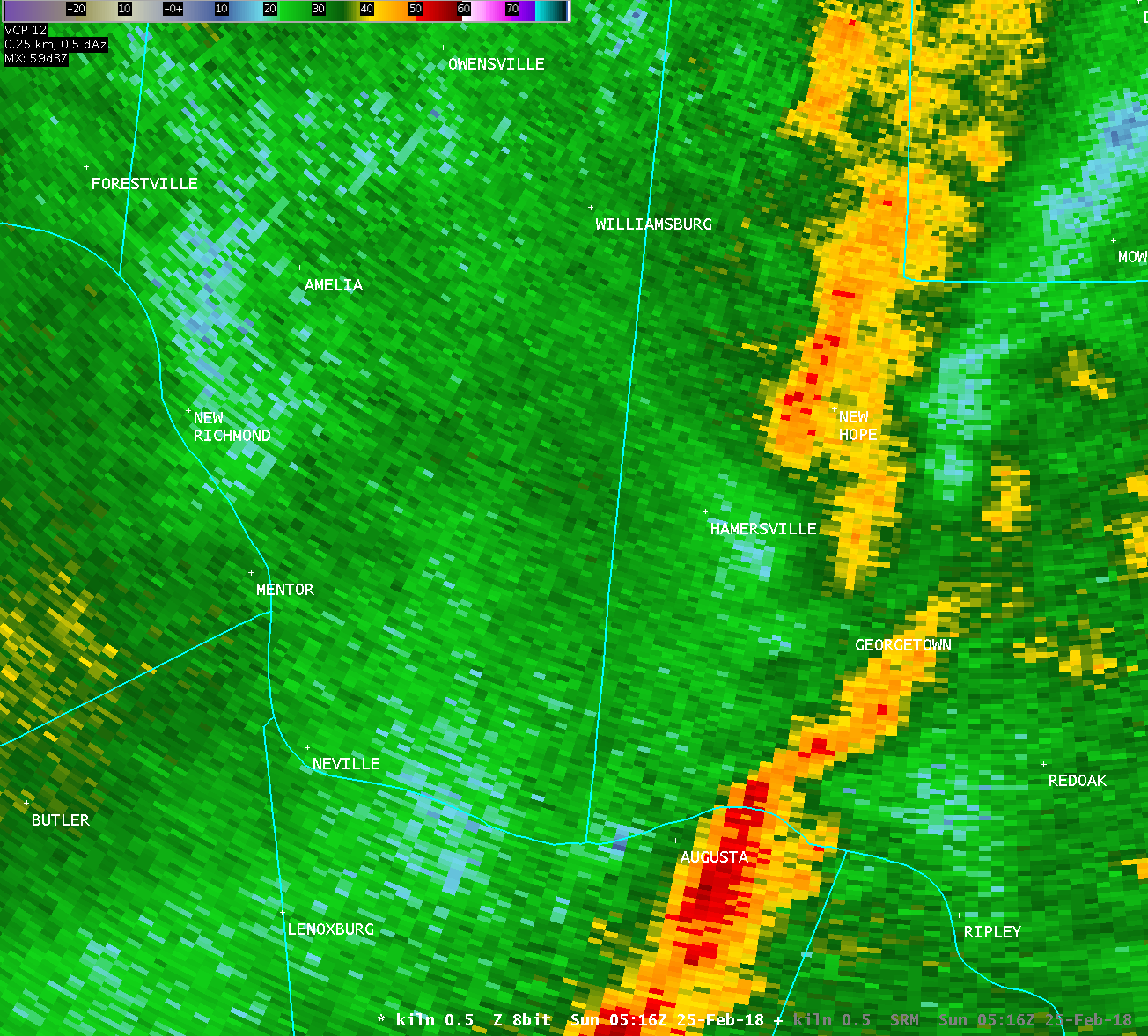
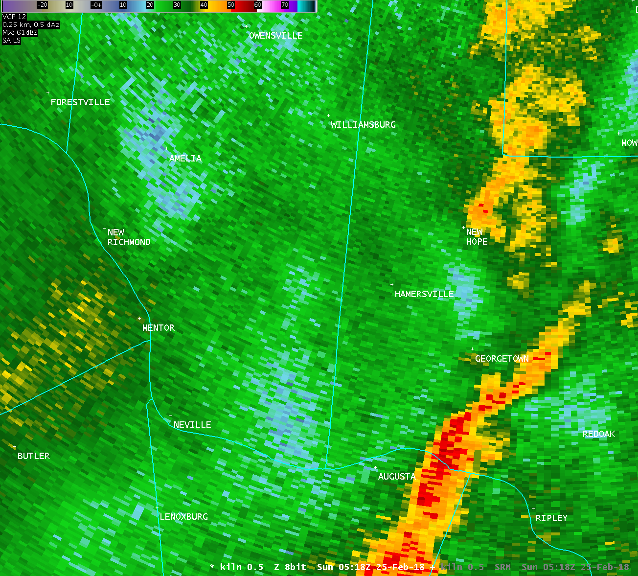
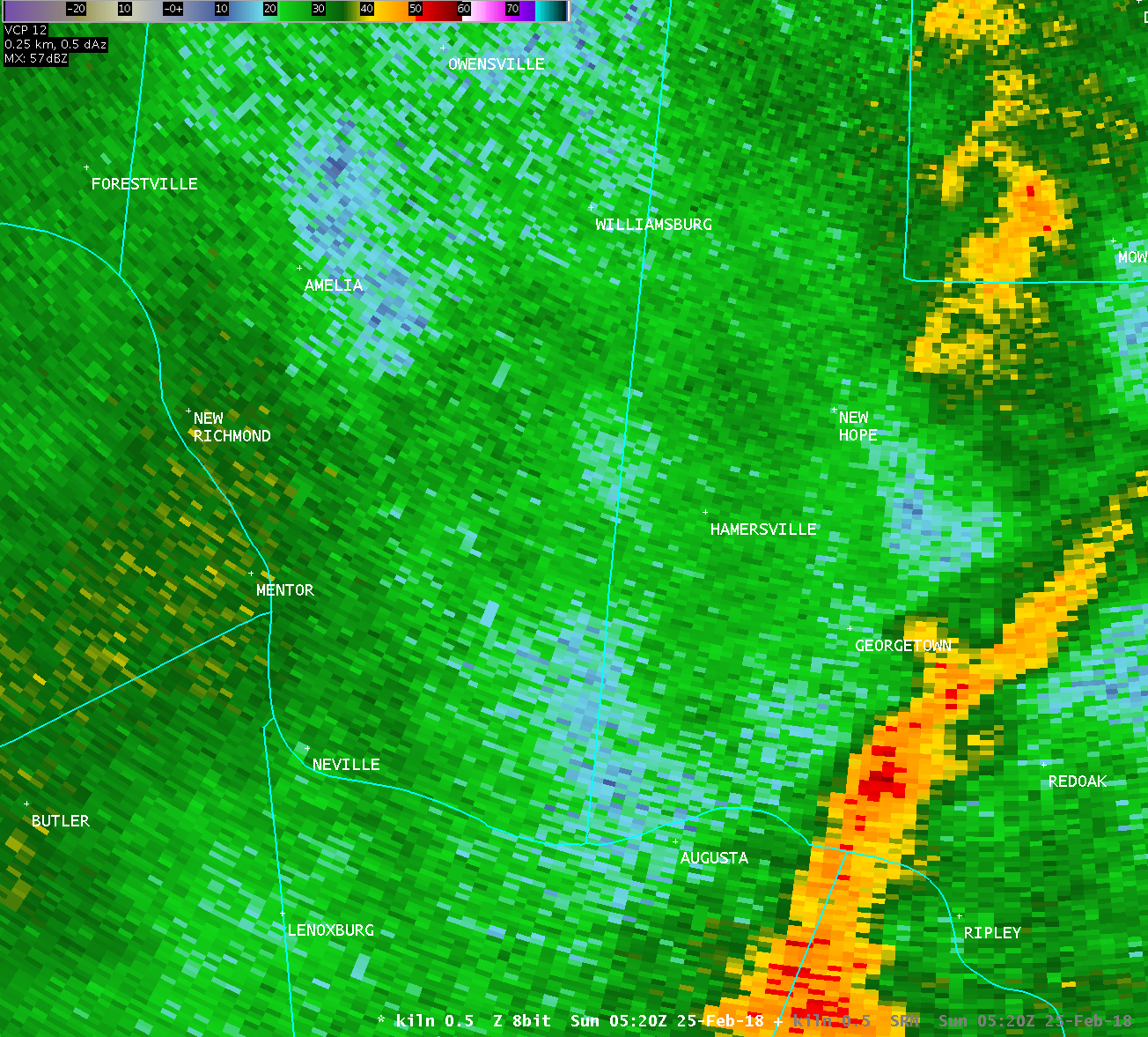
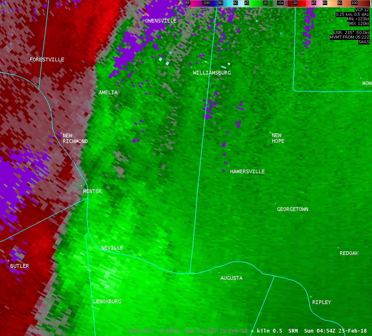
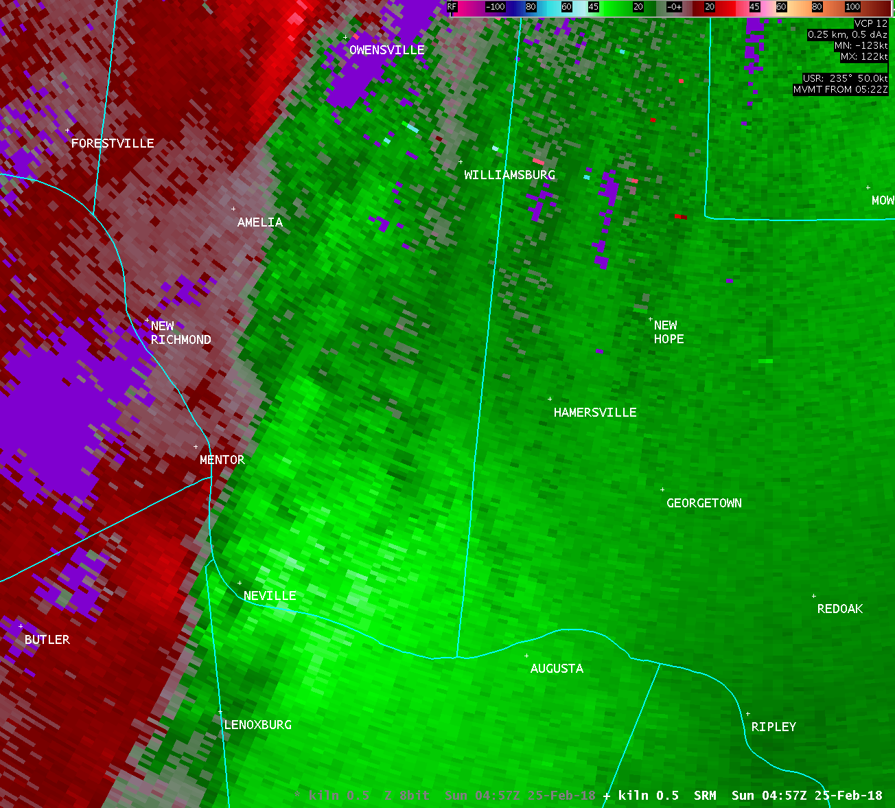
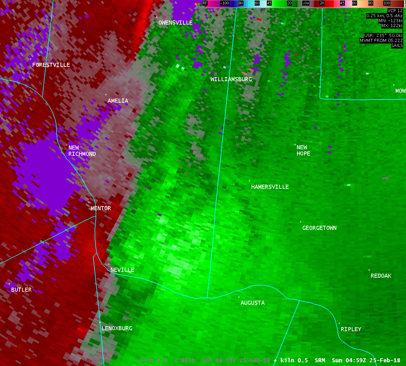
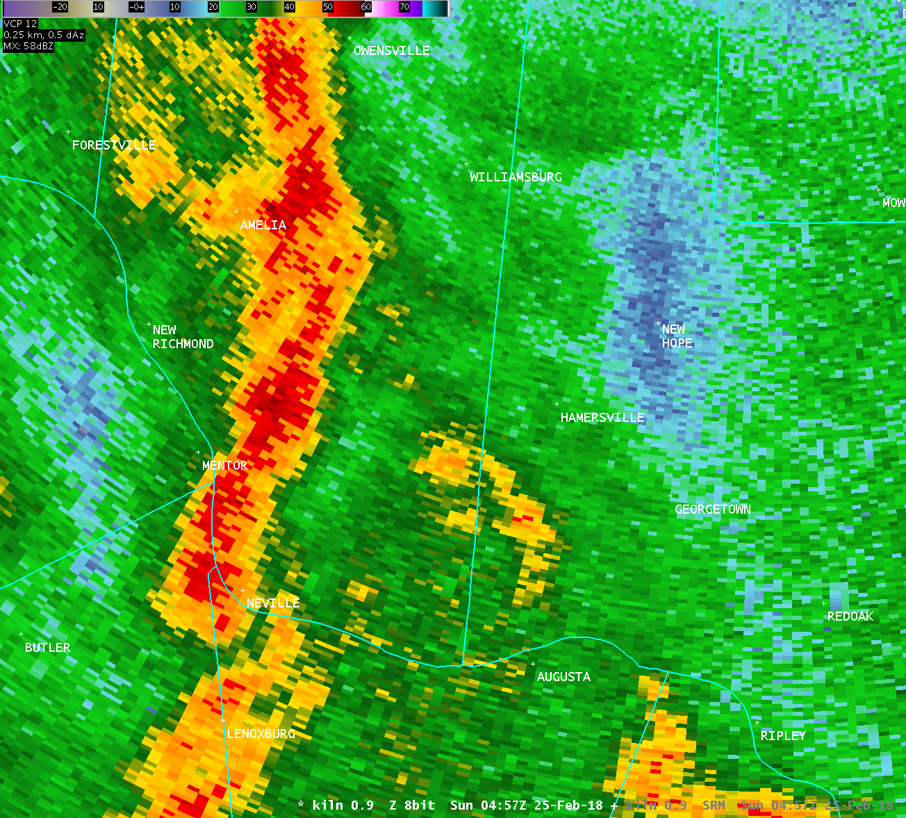
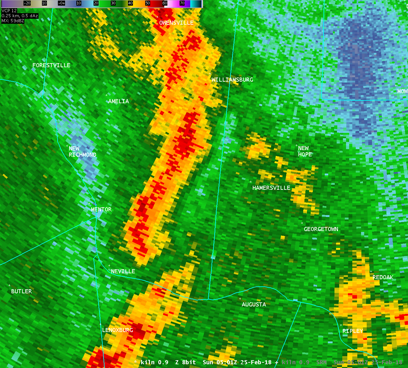
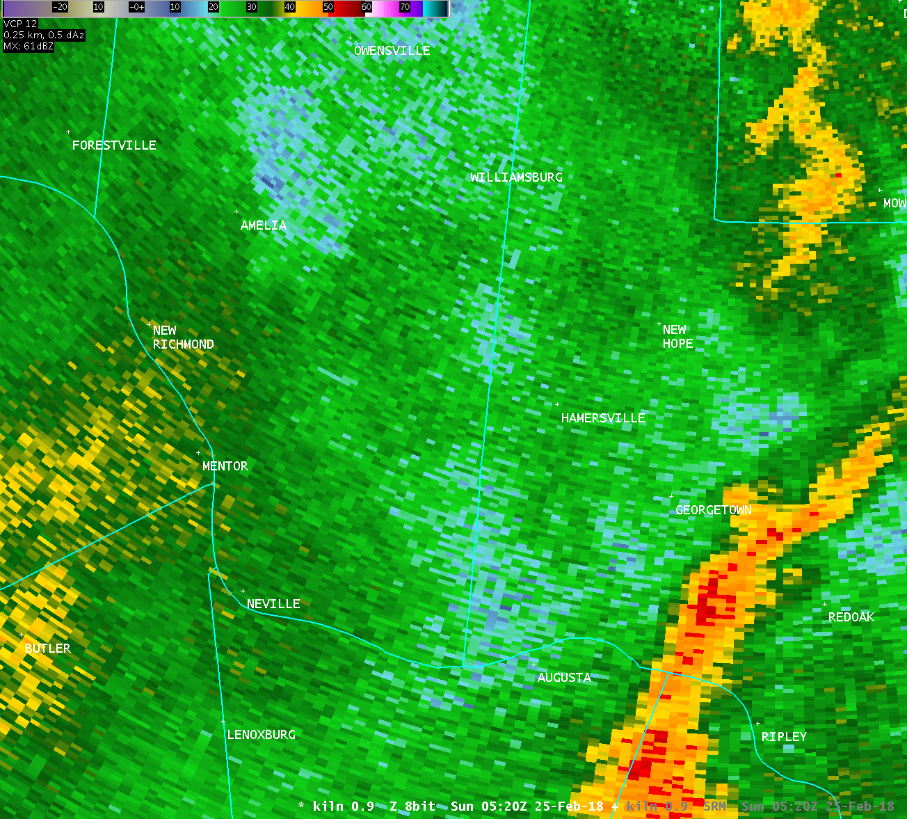
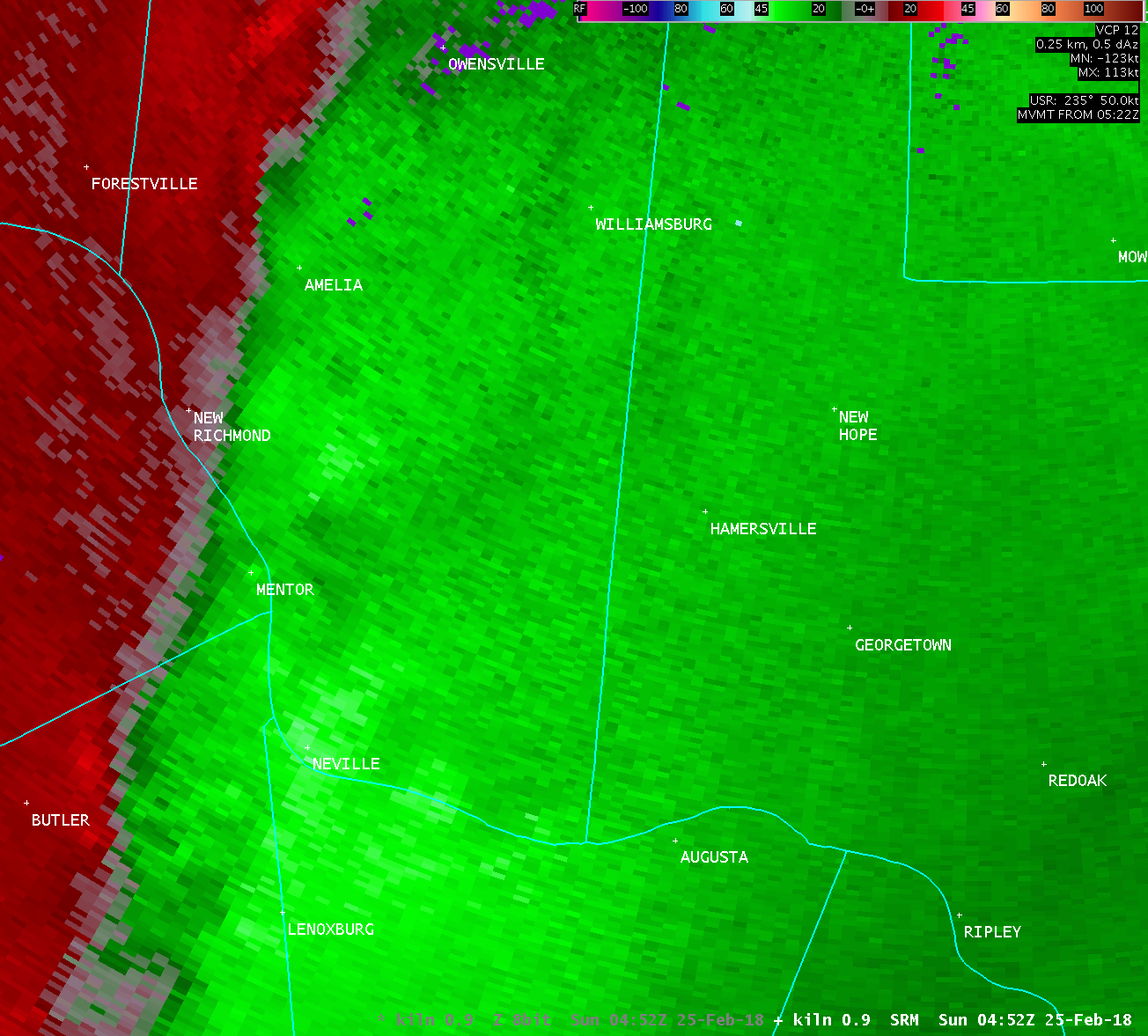
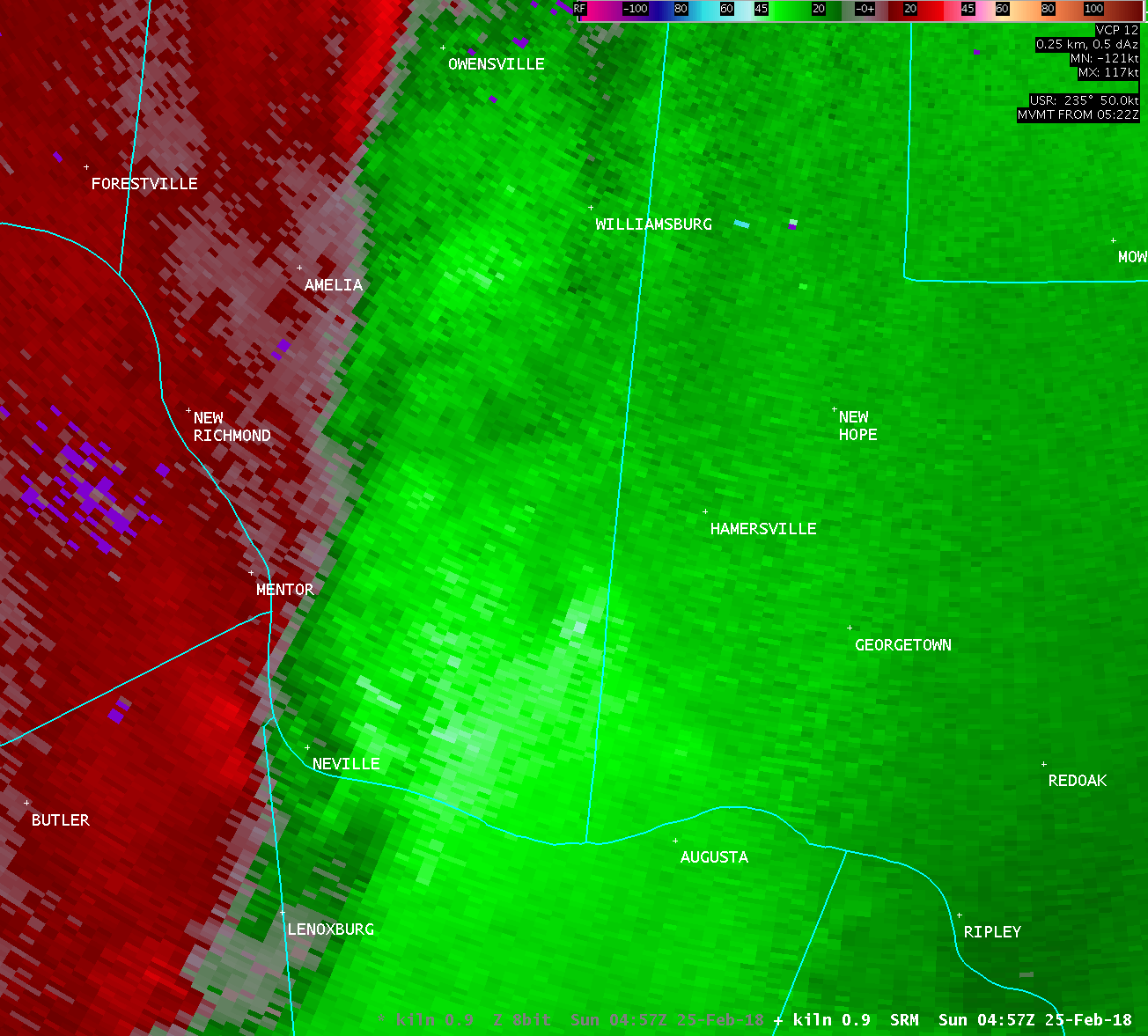
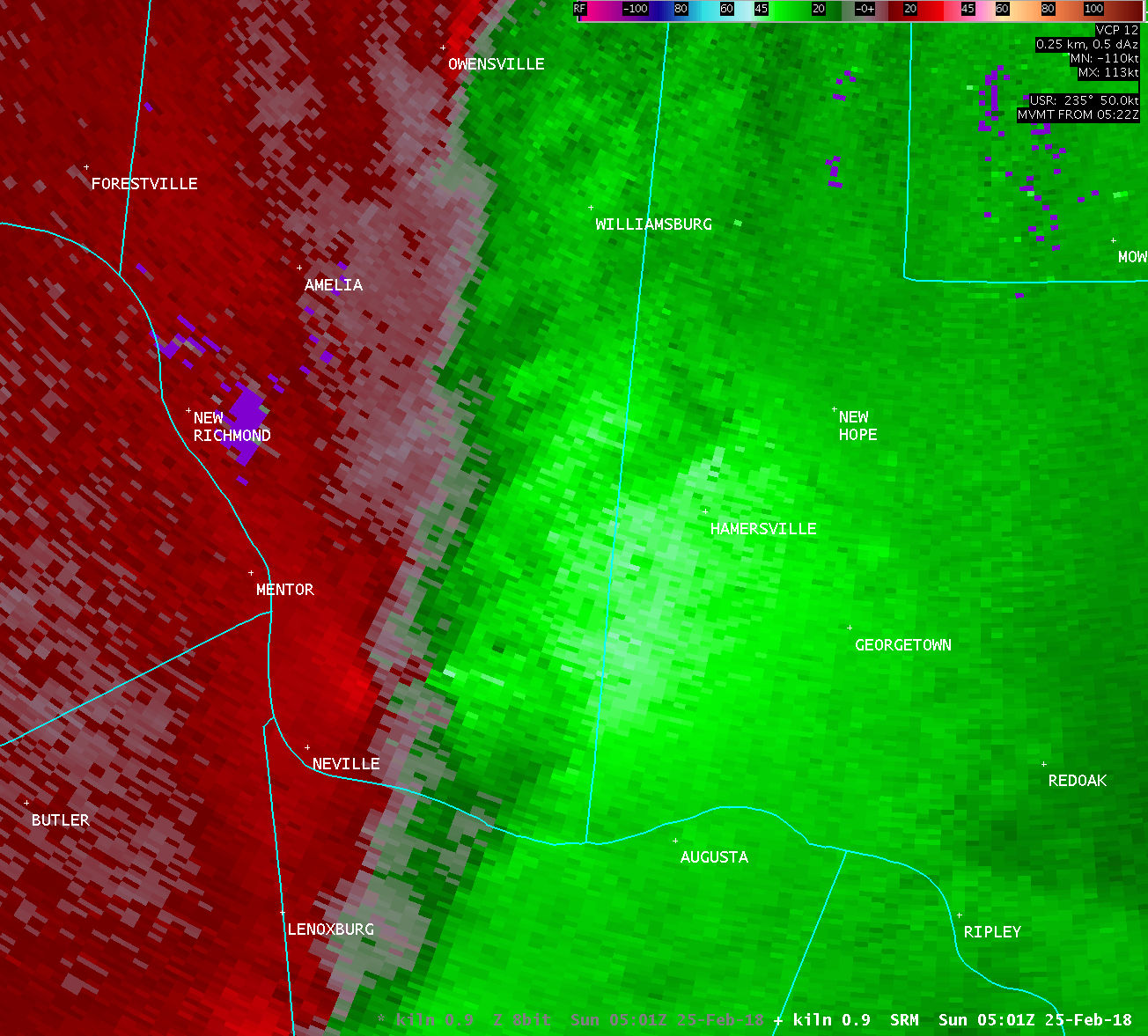
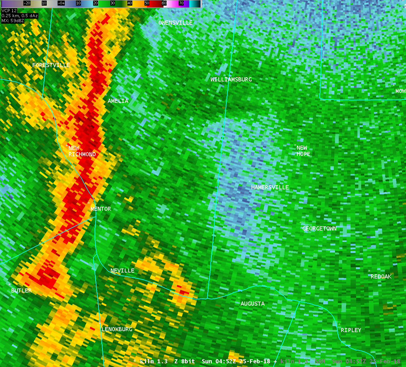
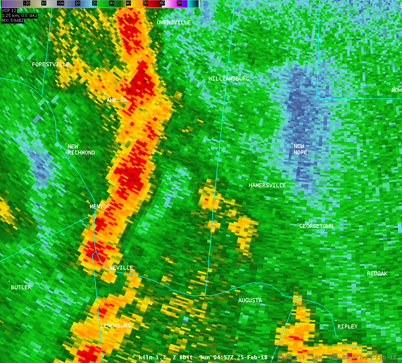
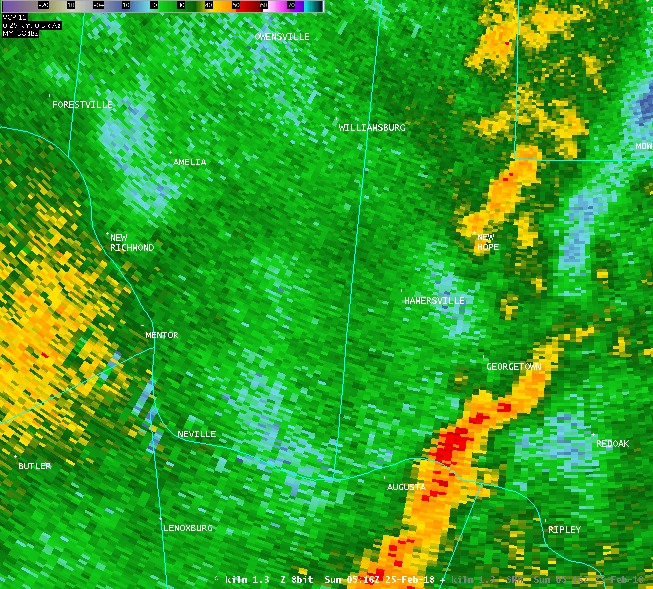
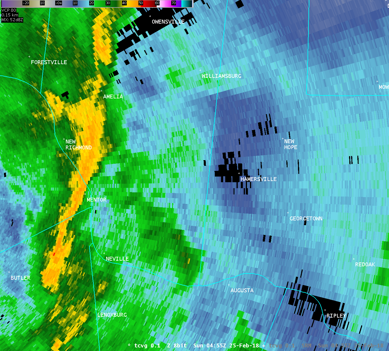
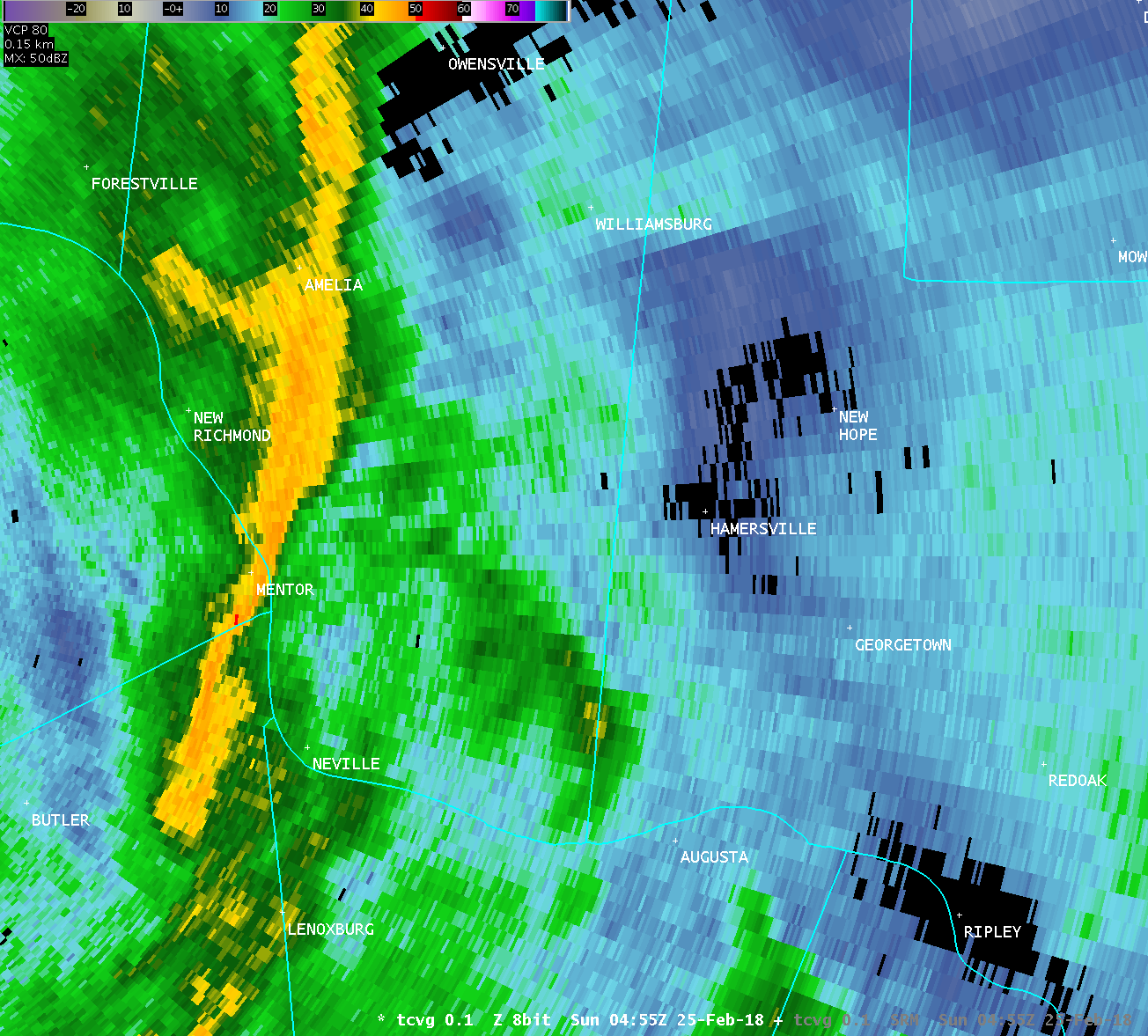
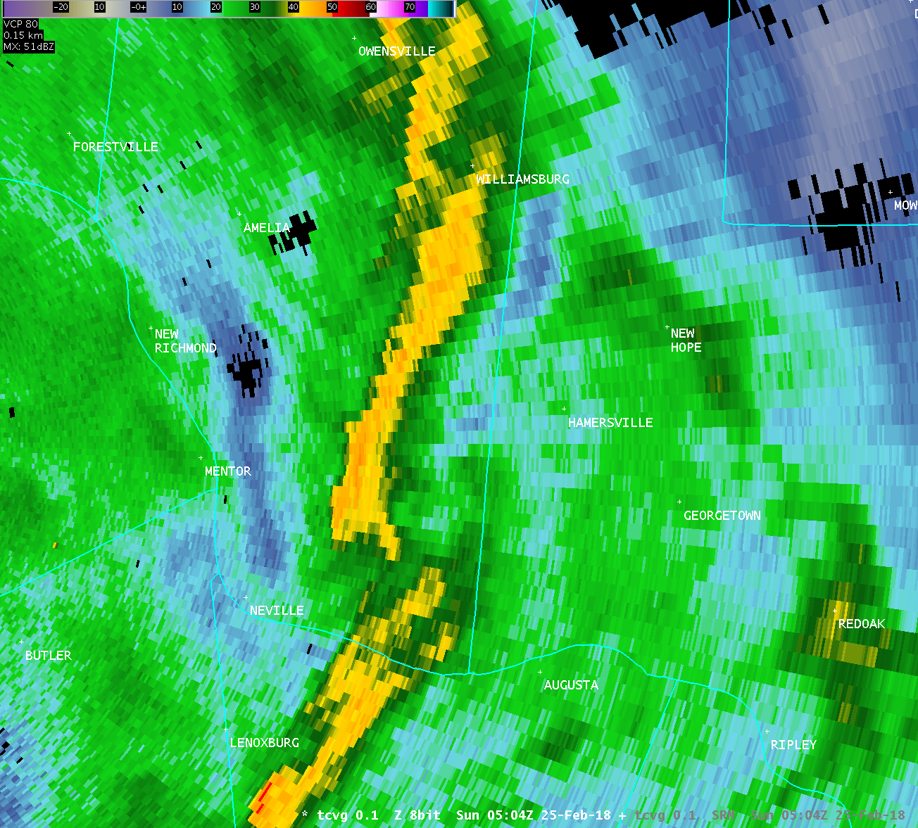
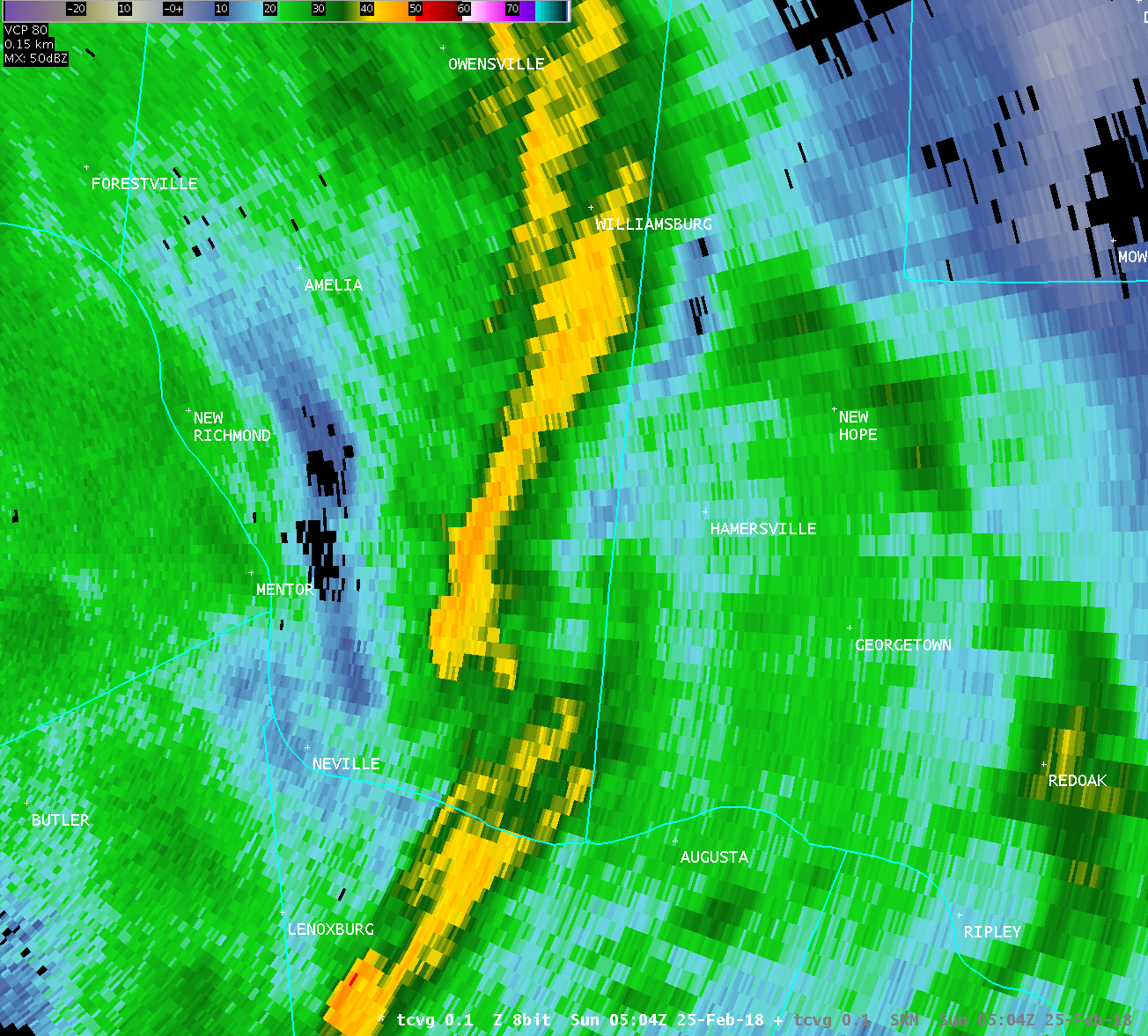
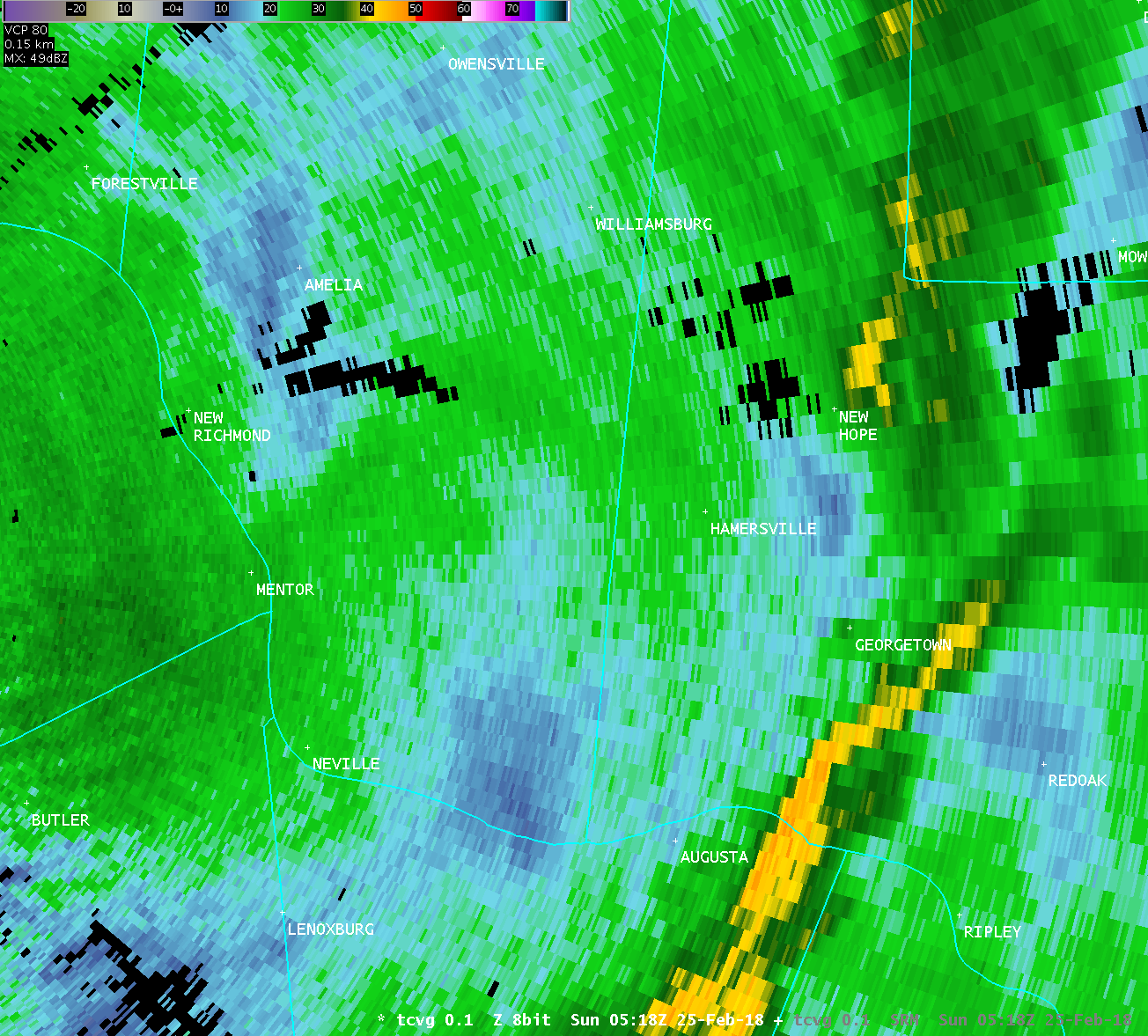
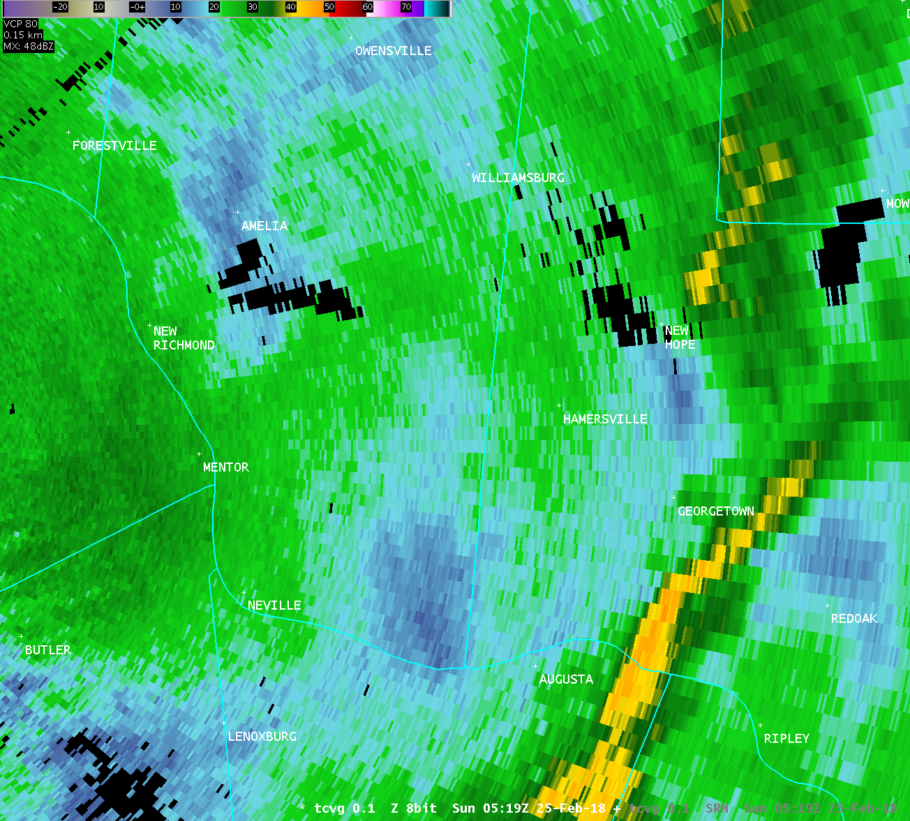
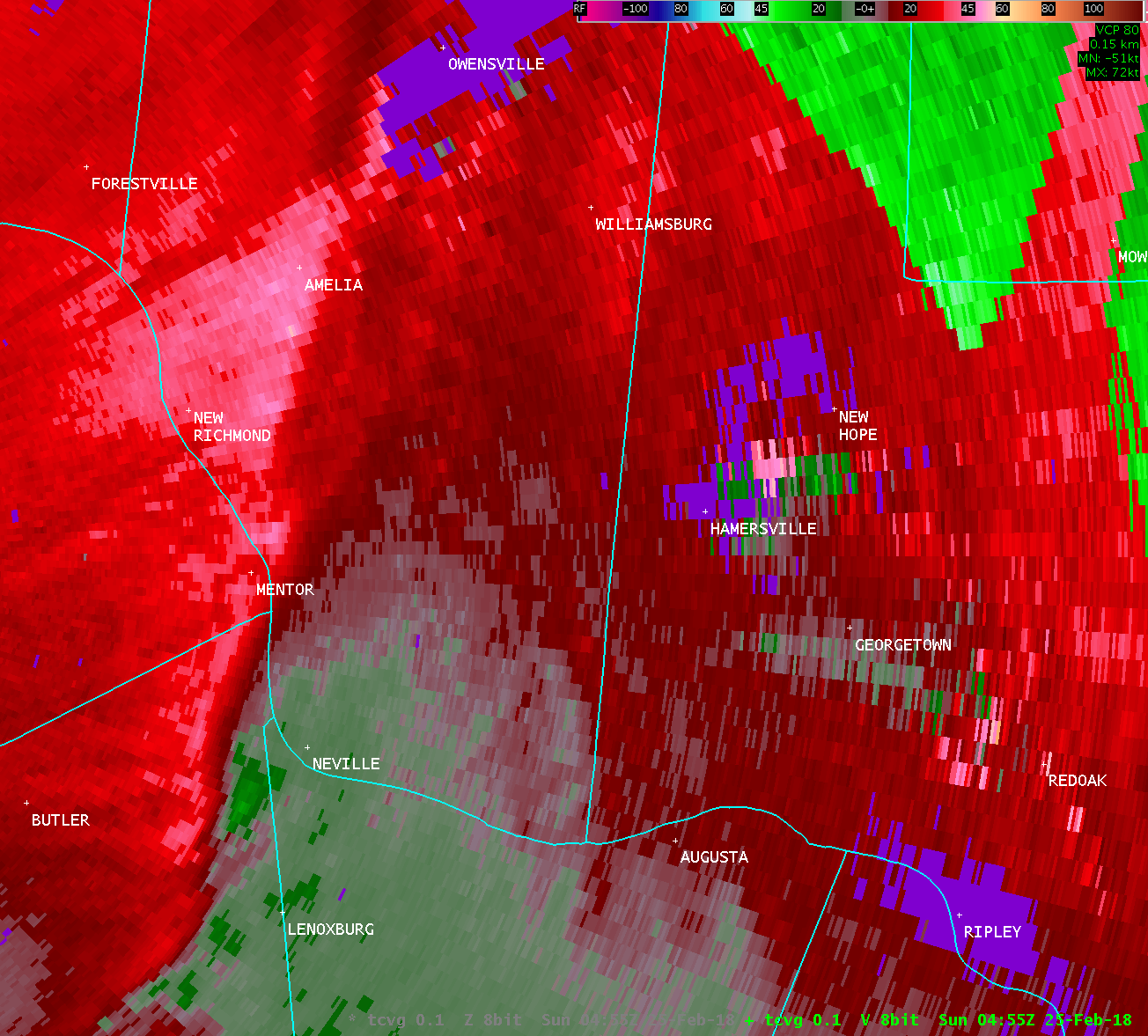
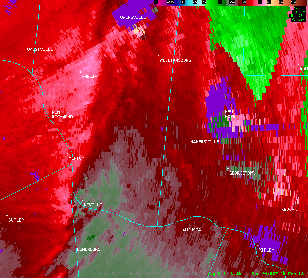
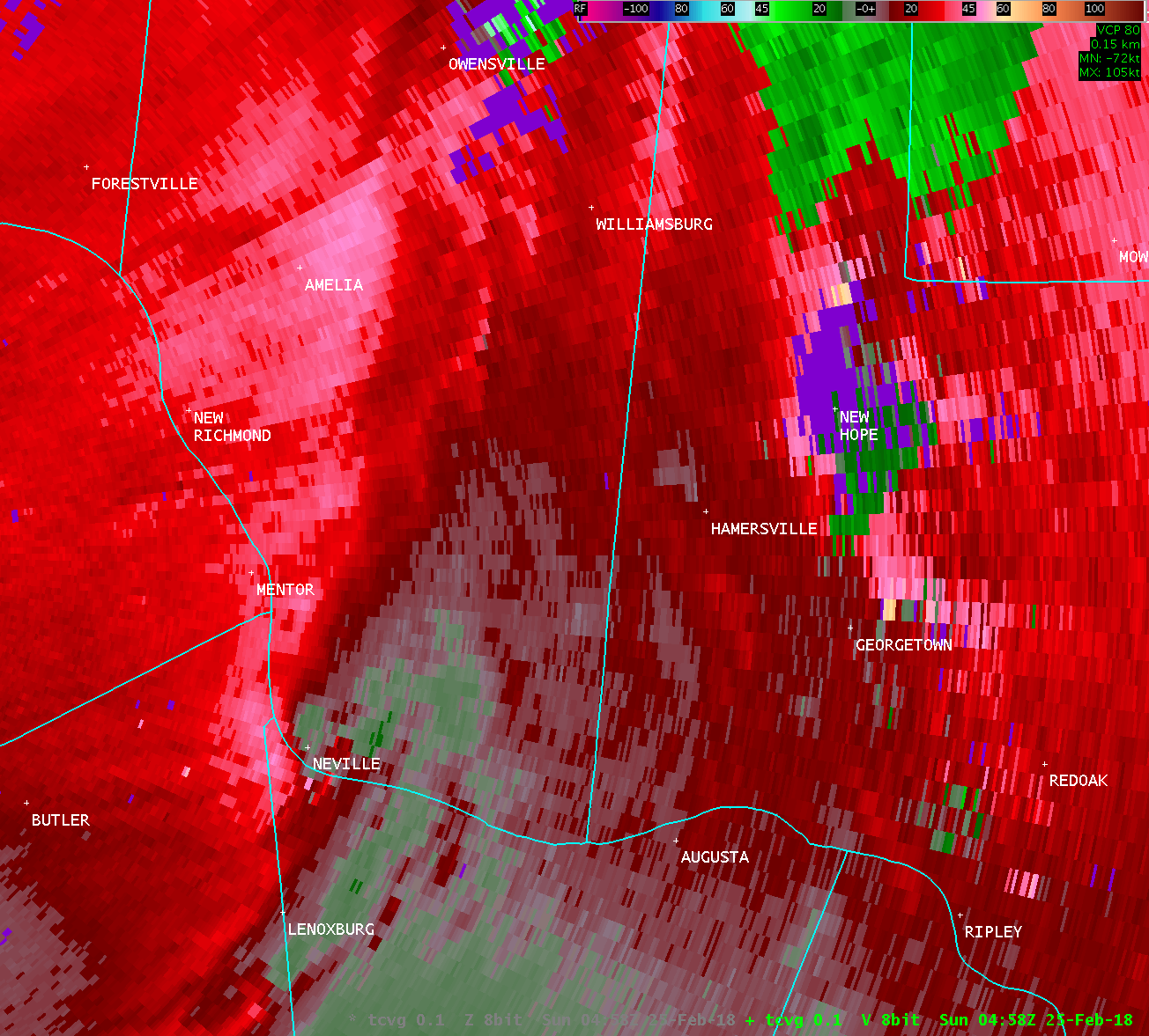
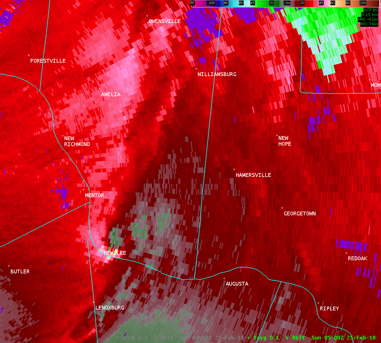
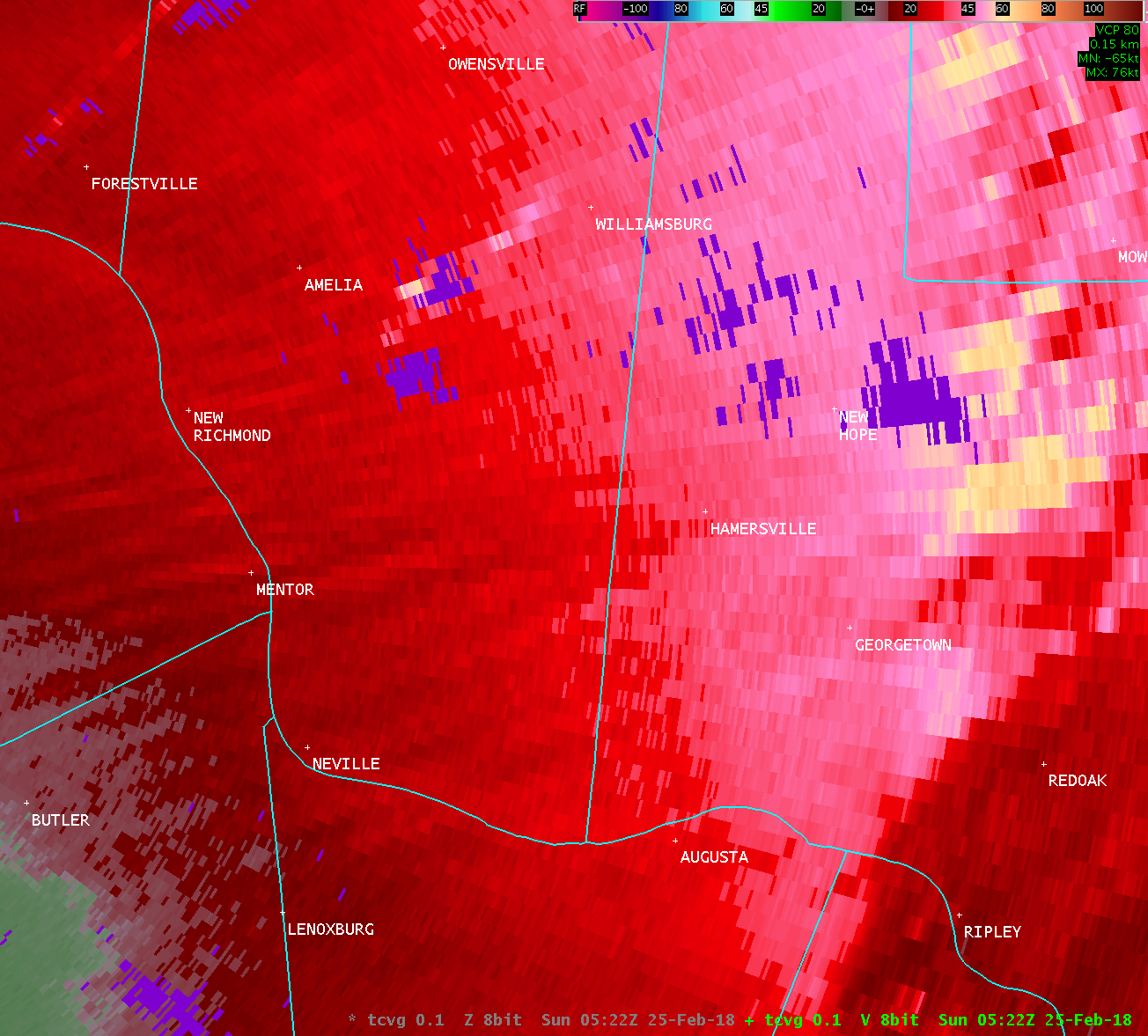
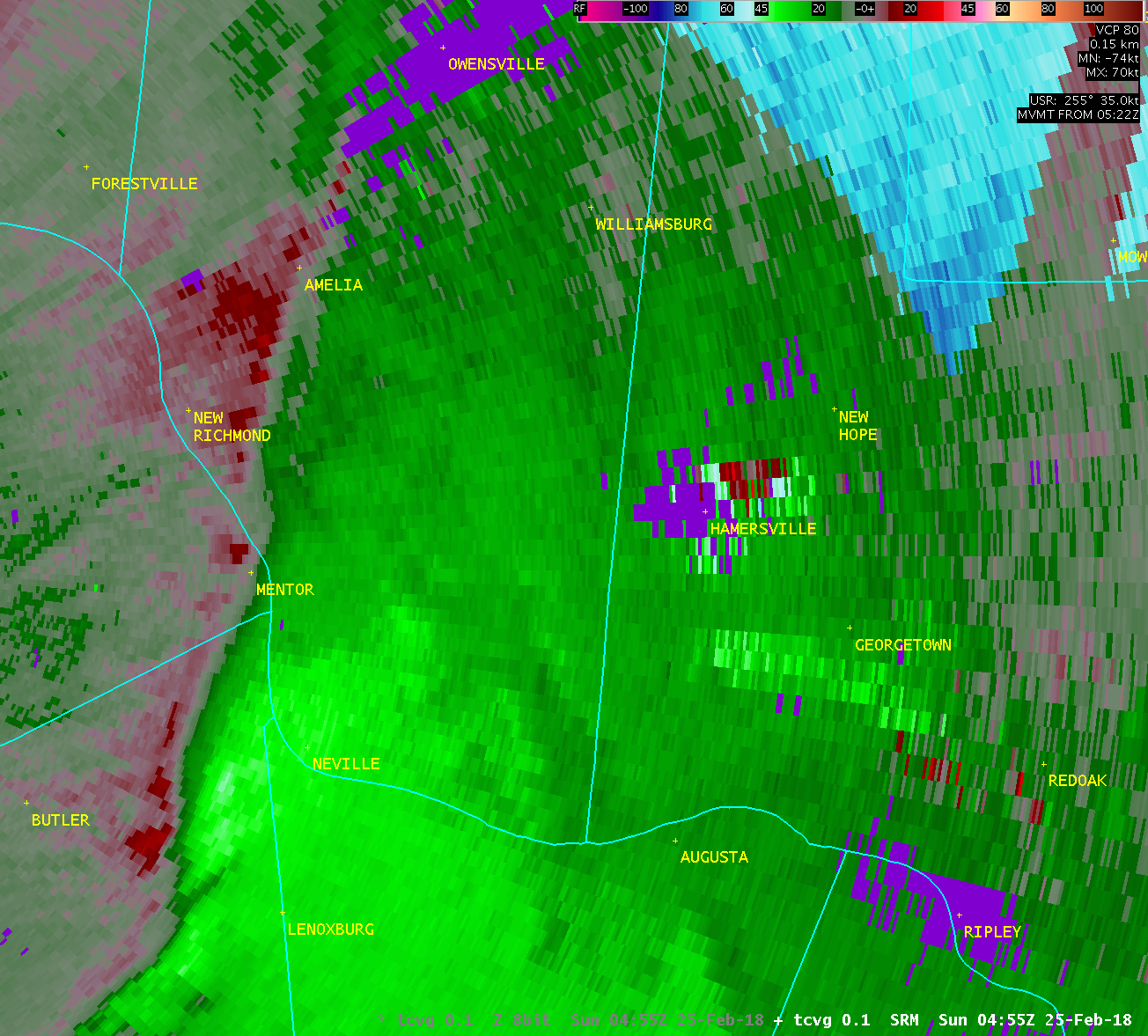
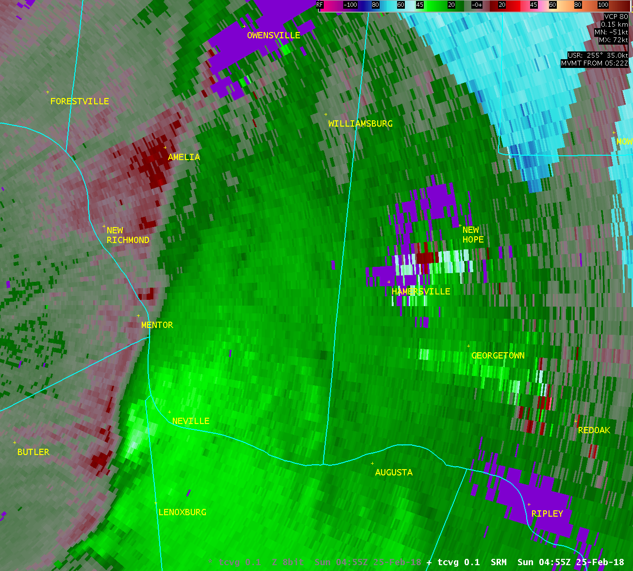
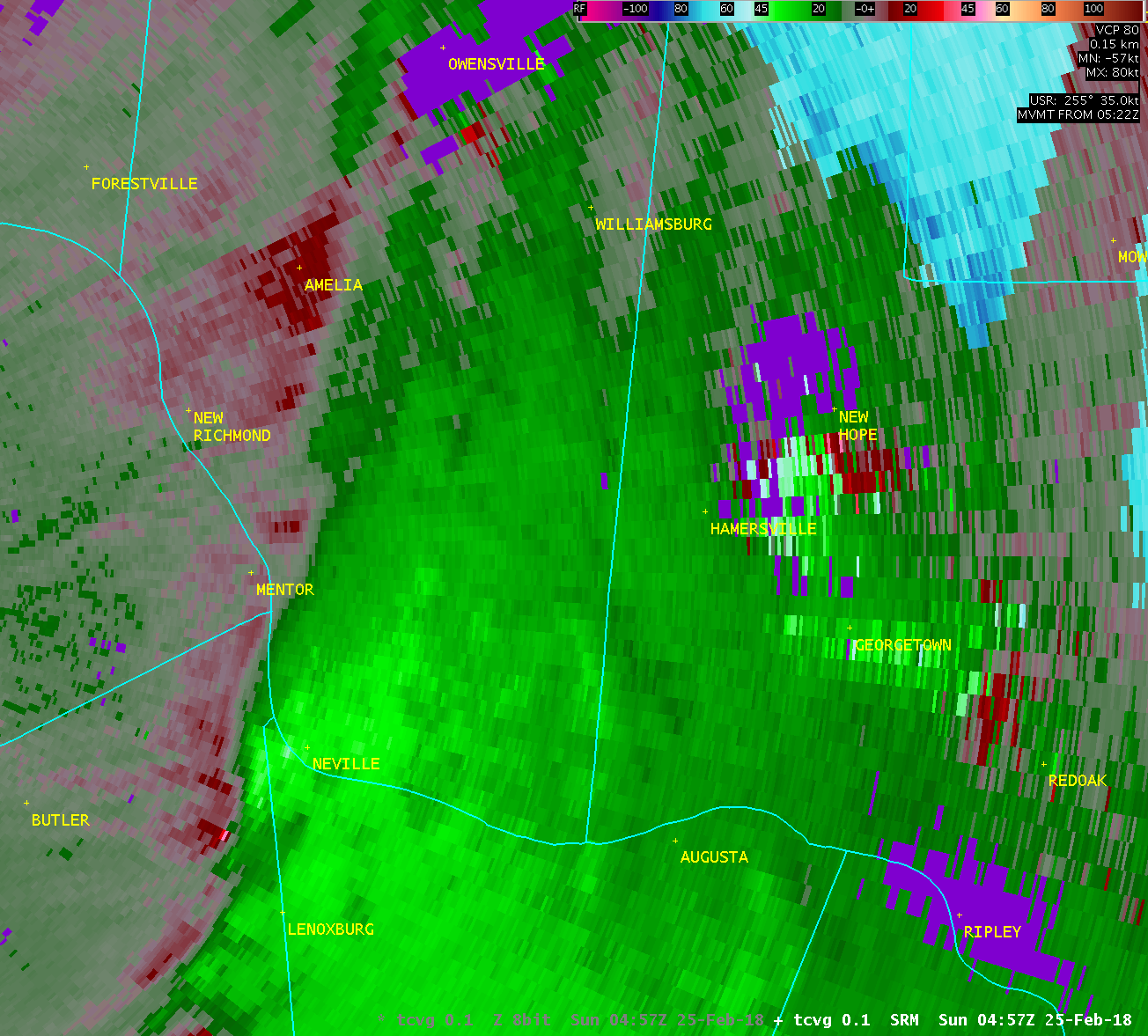
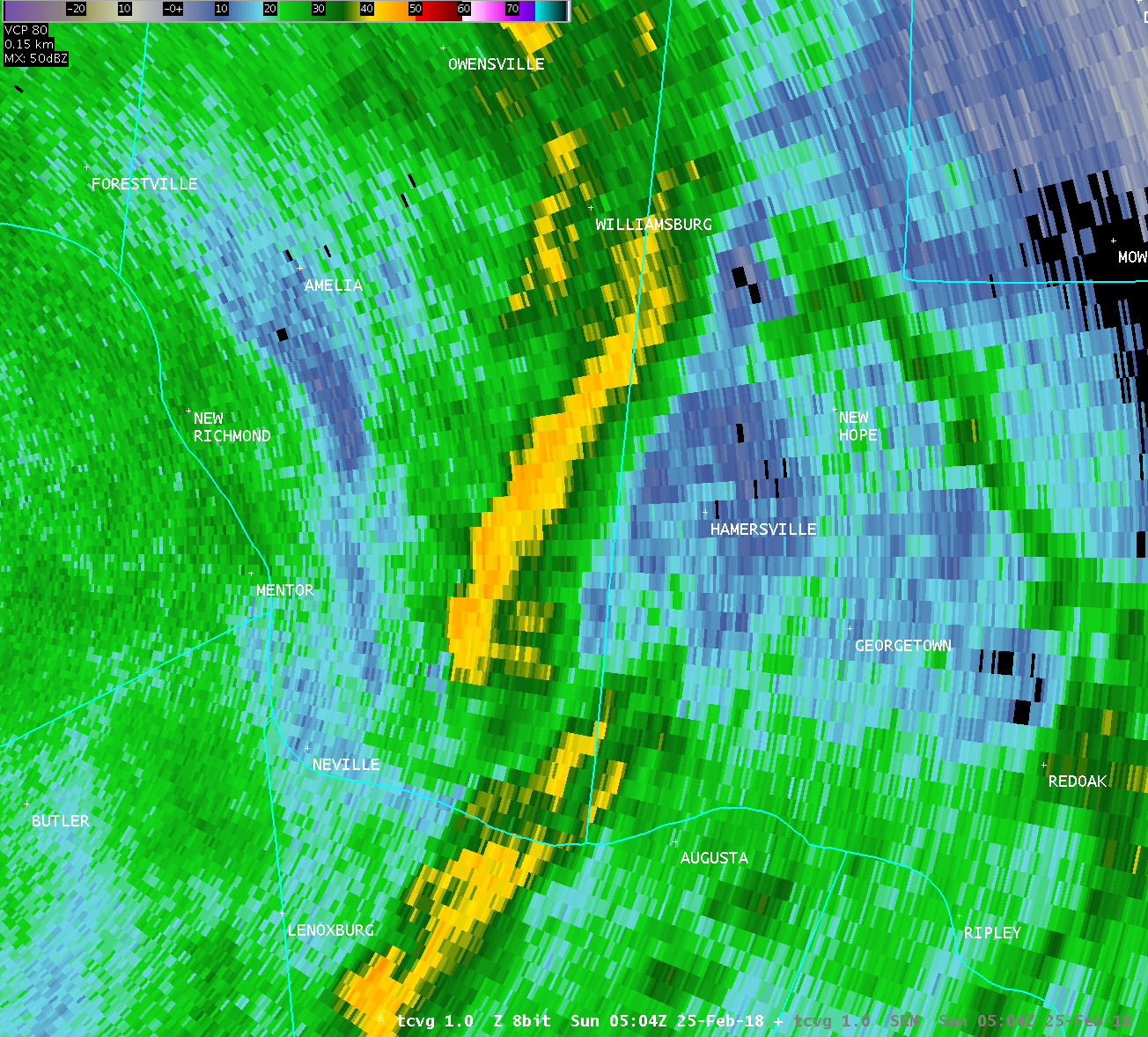
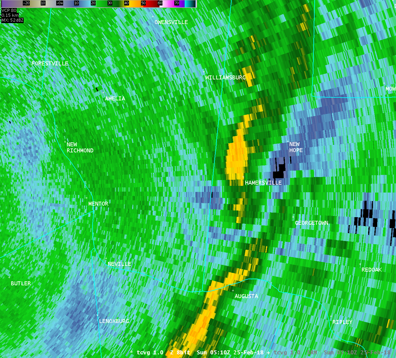
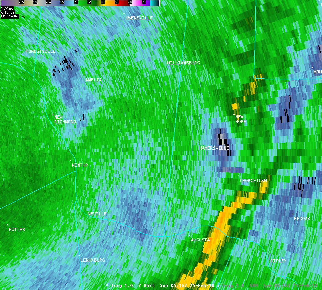
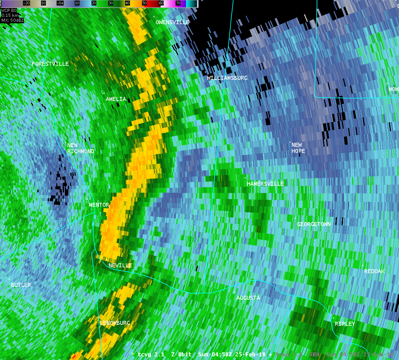
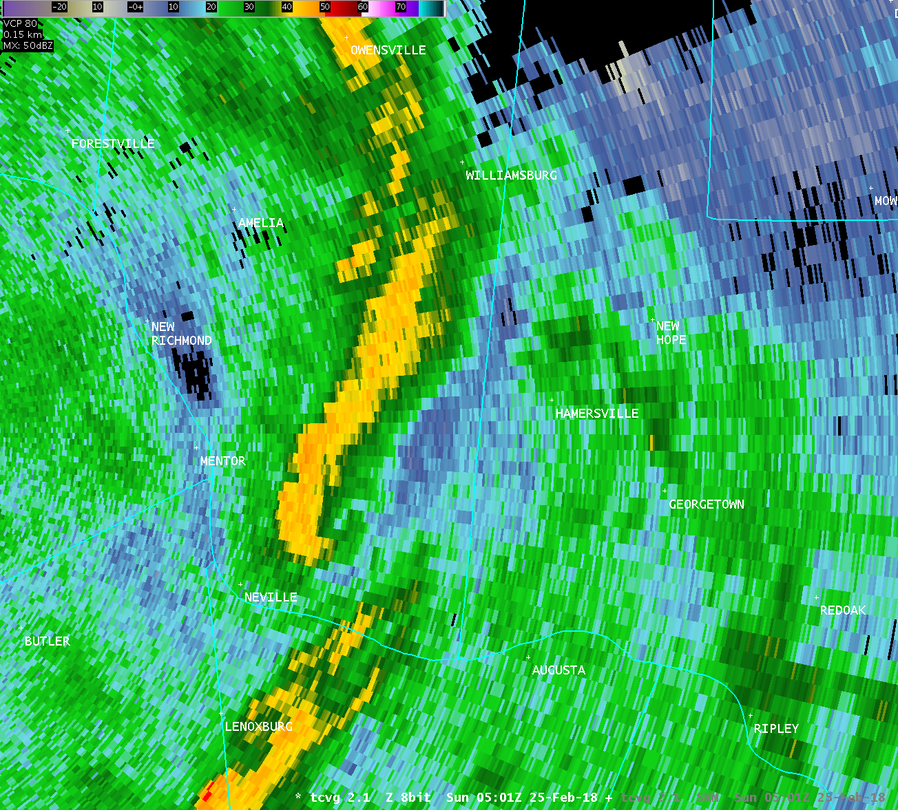
The National Weather Service in Wilmington OH has confirmed a
tornado northeast of Hamersville in Brown County Ohio on February
25 2018.
Damage assessed to be tornadic is first believed to have occurred
near Lucas Road about one mile northeast of Hamersville. More
significant damage was observed near the intersection of White Oak
Valley Road and Smokey Row Road, where a well-built home suffered
partial roof loss and additional loss of roofing material. At
another property on White Oak Valley Road, a trailer was flipped
over. Tree damage was extensive along Smokey Row Road, especially
near its intersection with Vinegar Hill Road.
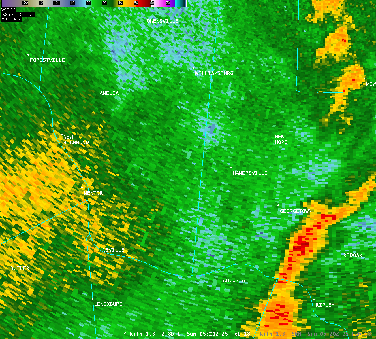
On New Hope - McKinley Road, about a half mile east of US-68, a
mobile home had its roof completely removed. Debris from this roof
was observed thrown about 500 yards downstream (northeast) of its
origin. Additional tree damage was observed along New Hope - White
Oak Station Road.
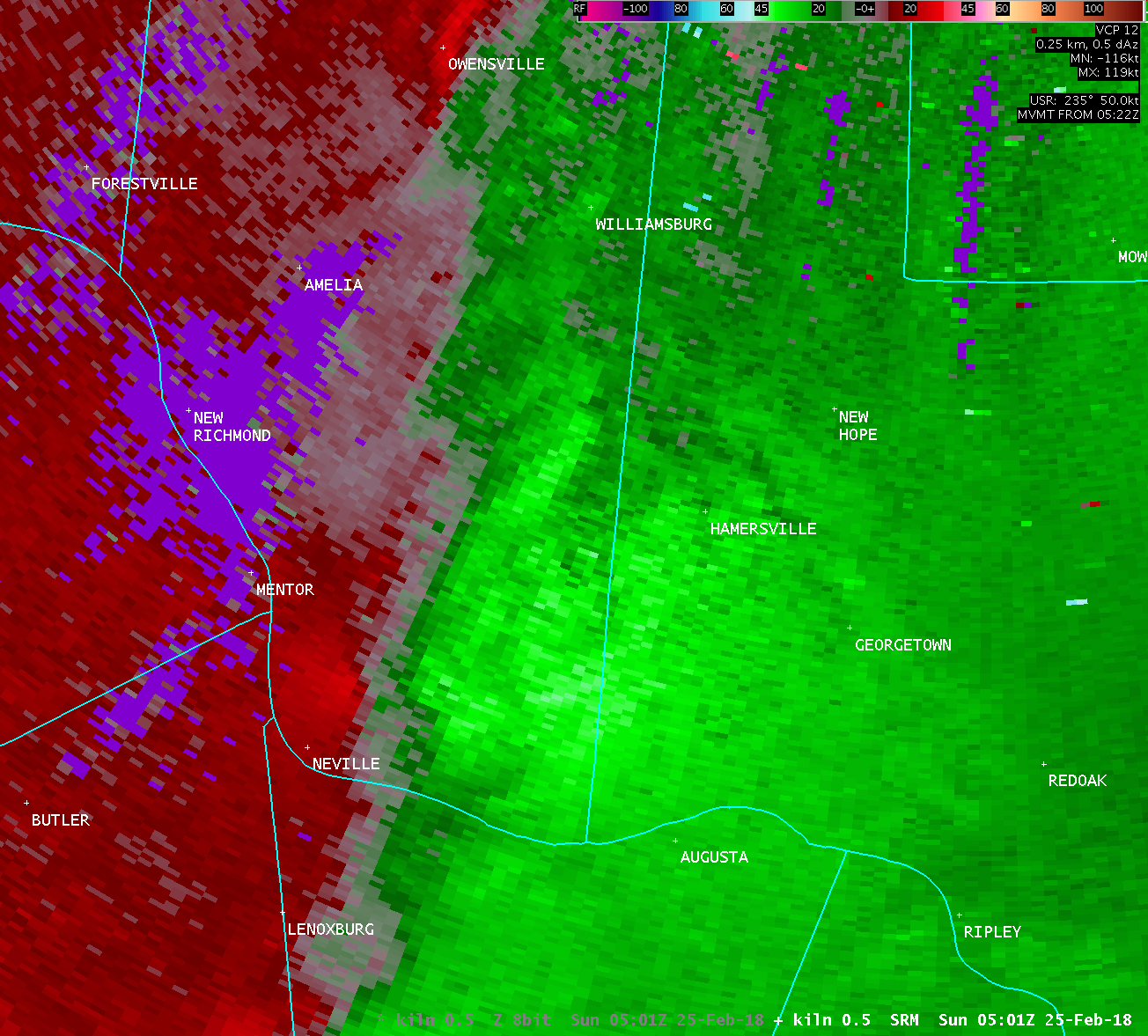
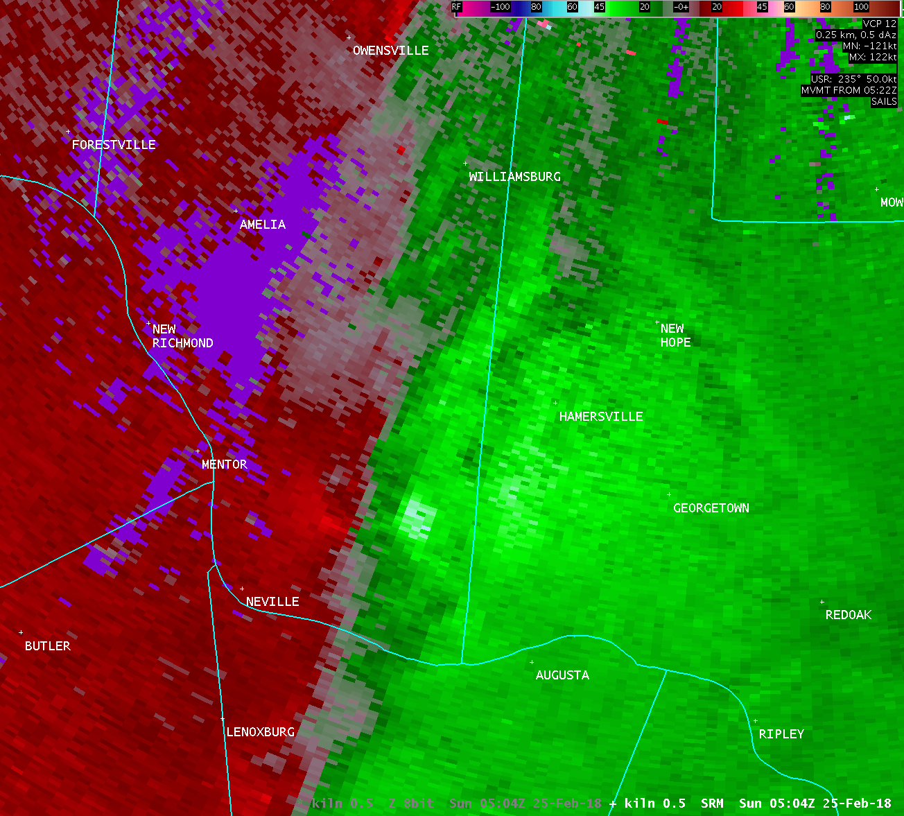
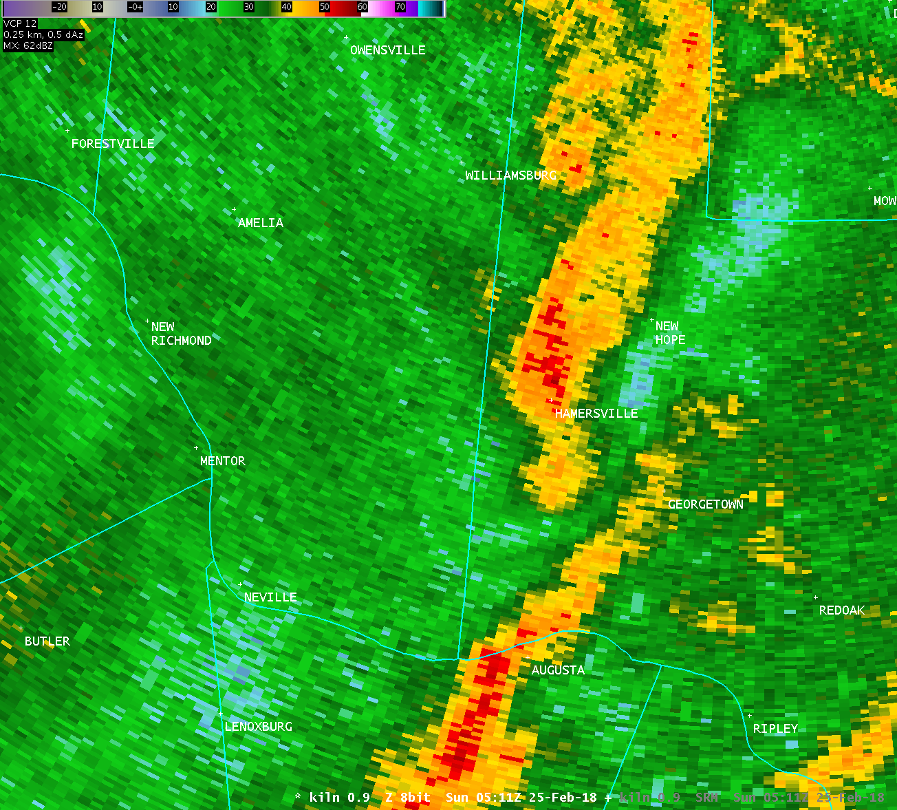
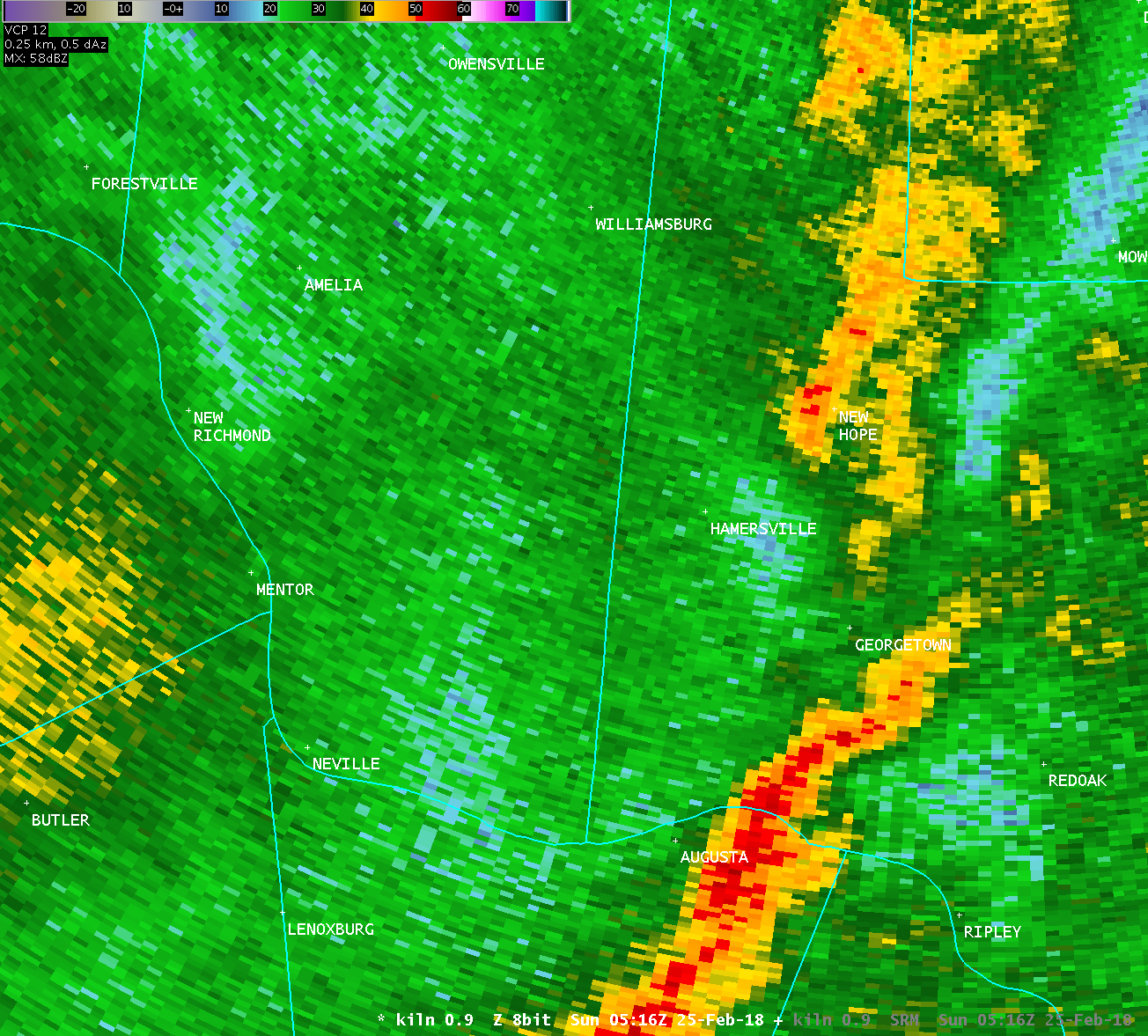
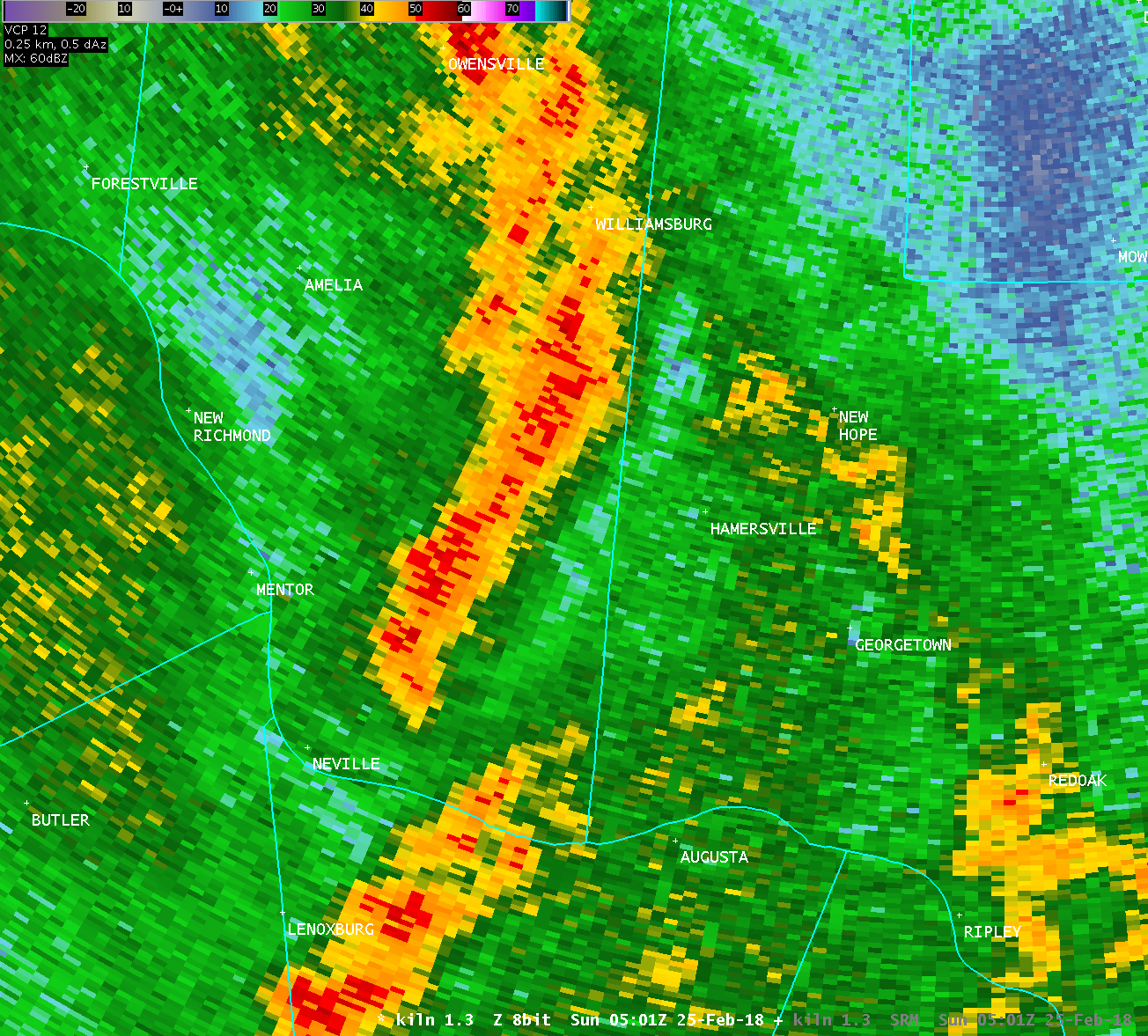
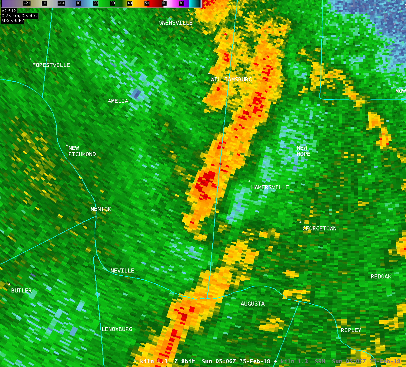
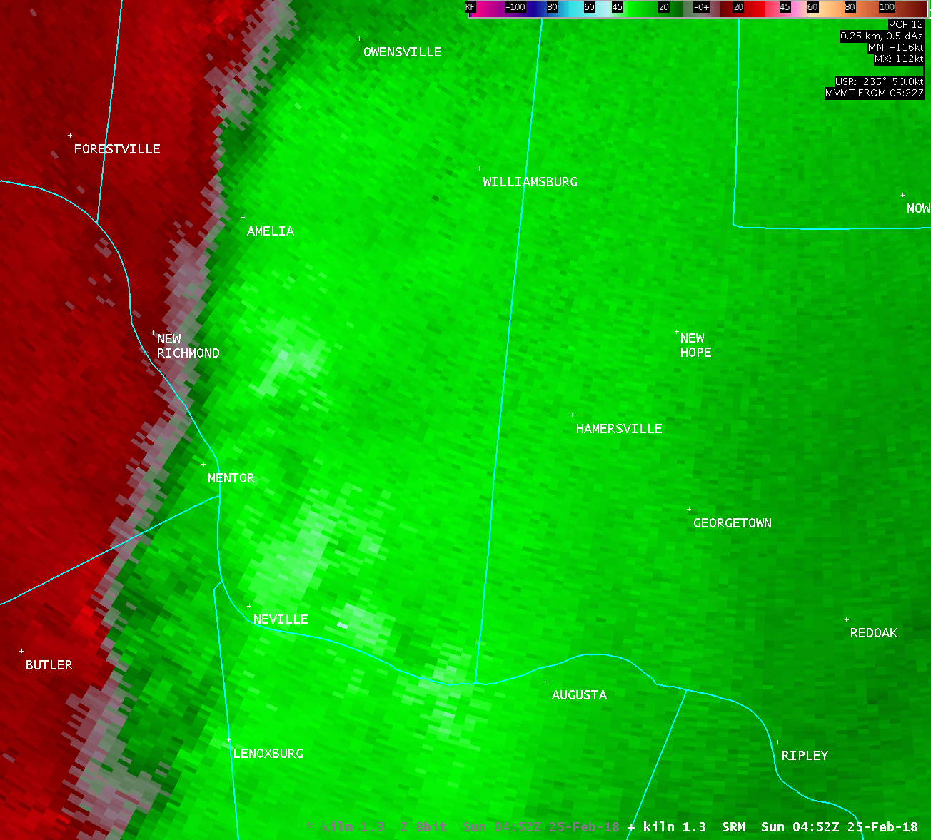
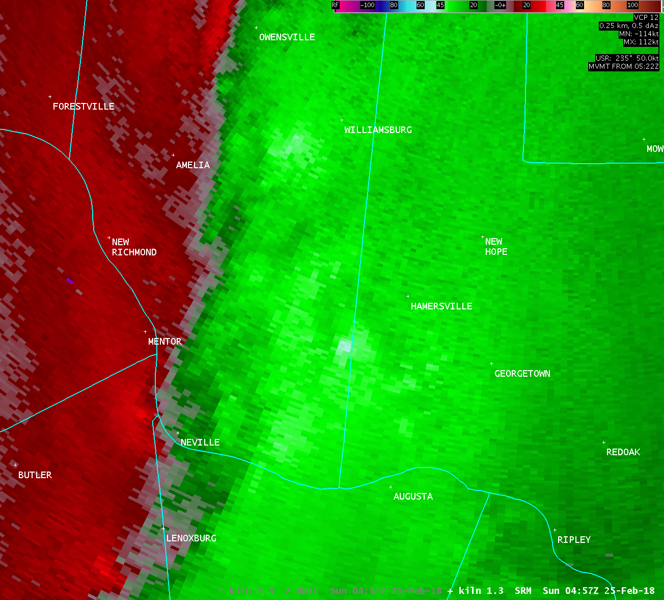
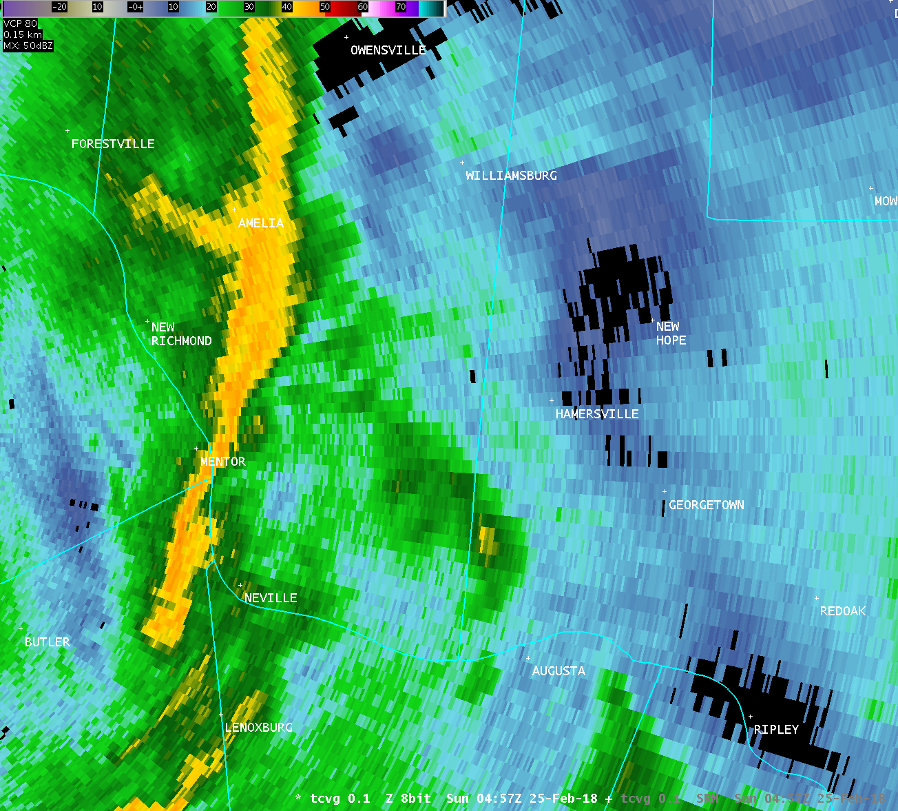
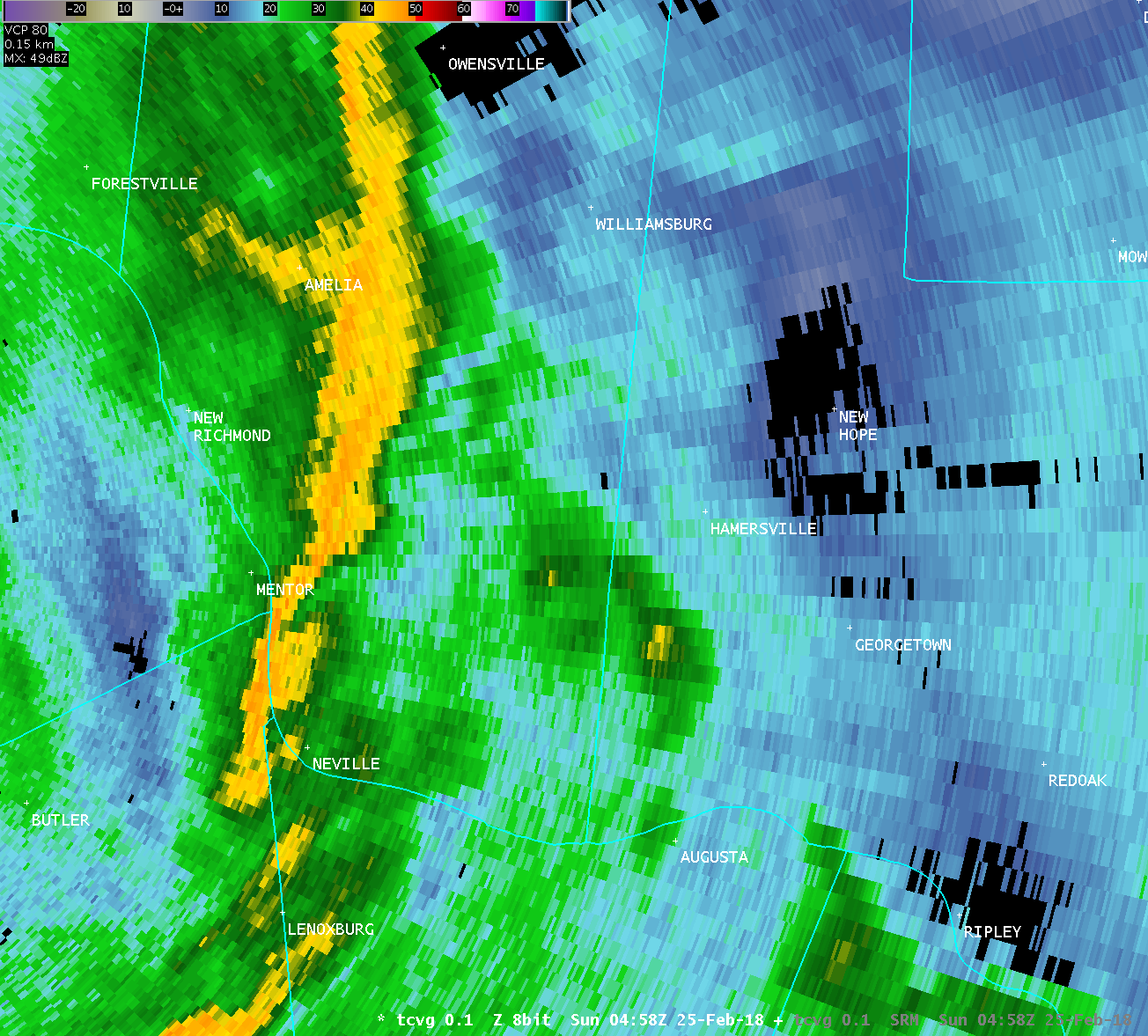
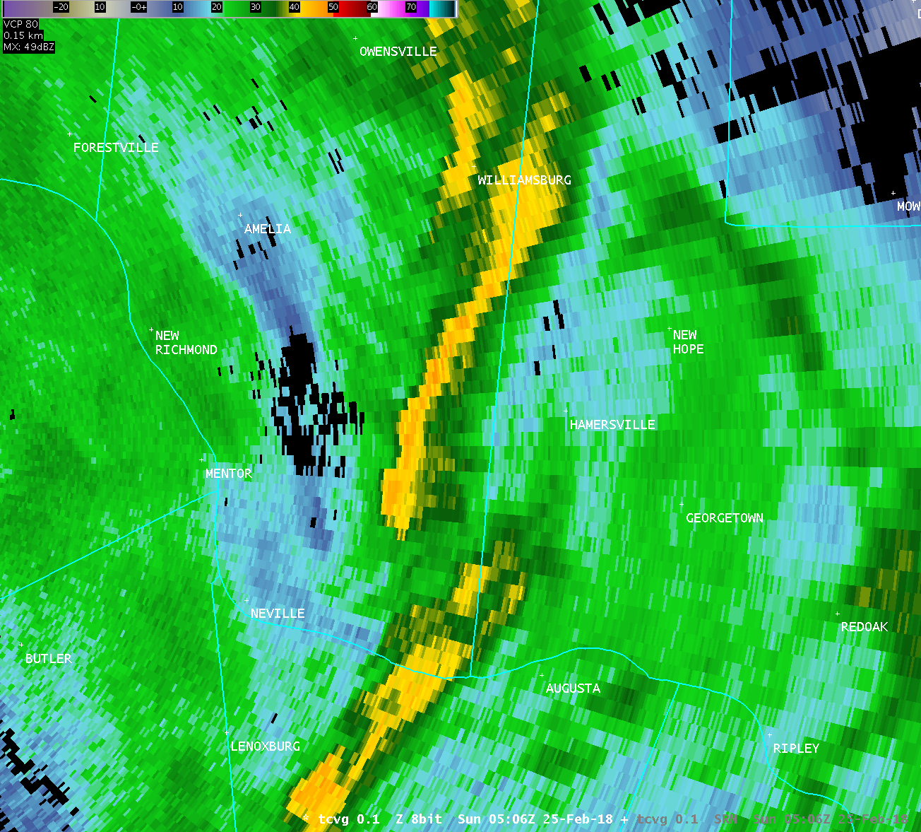
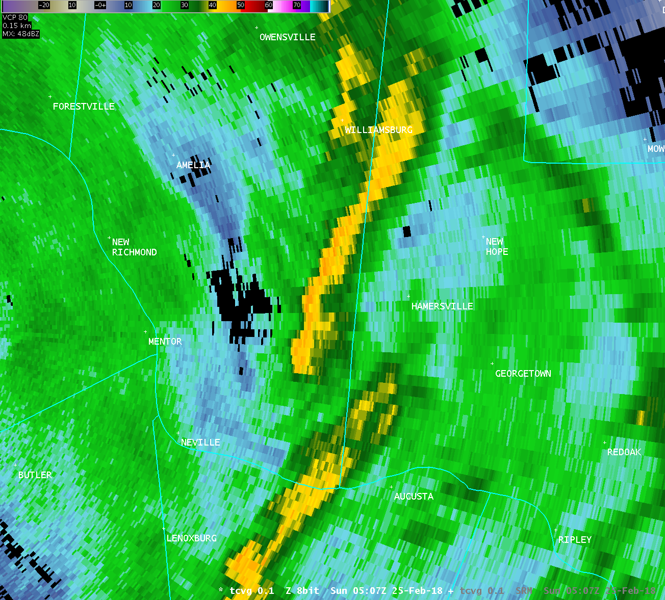
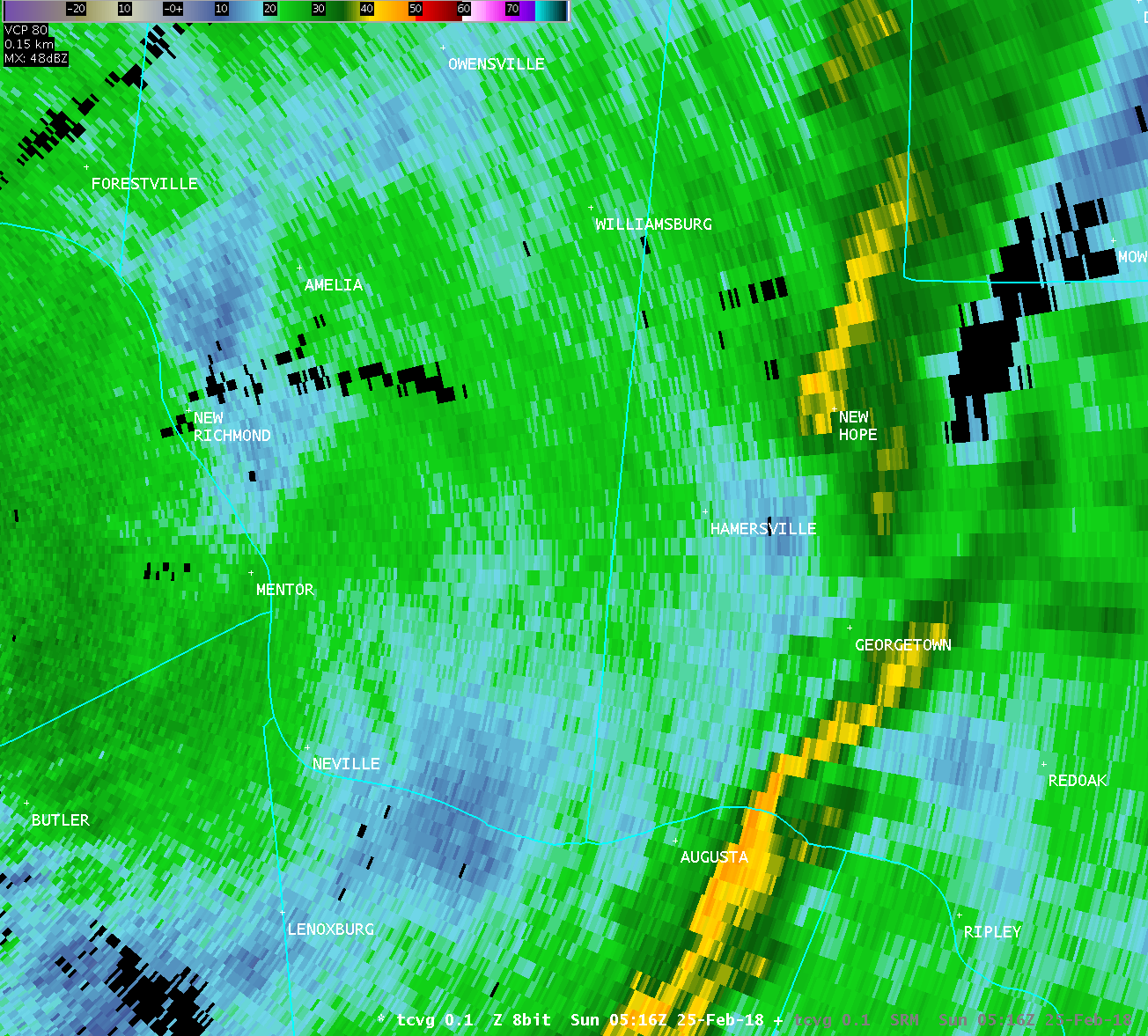
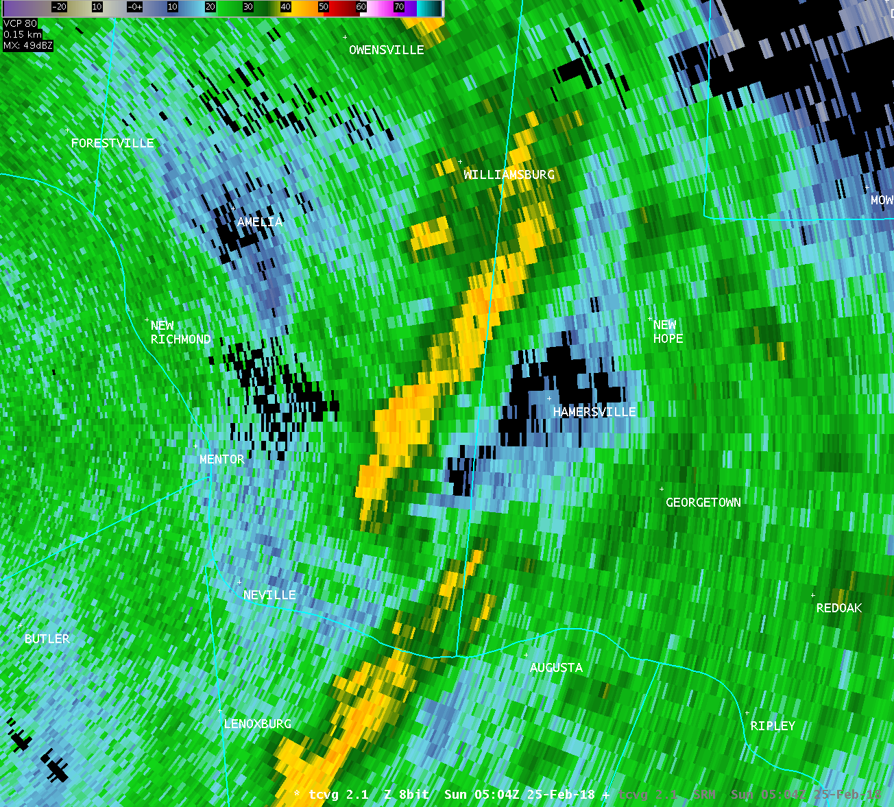
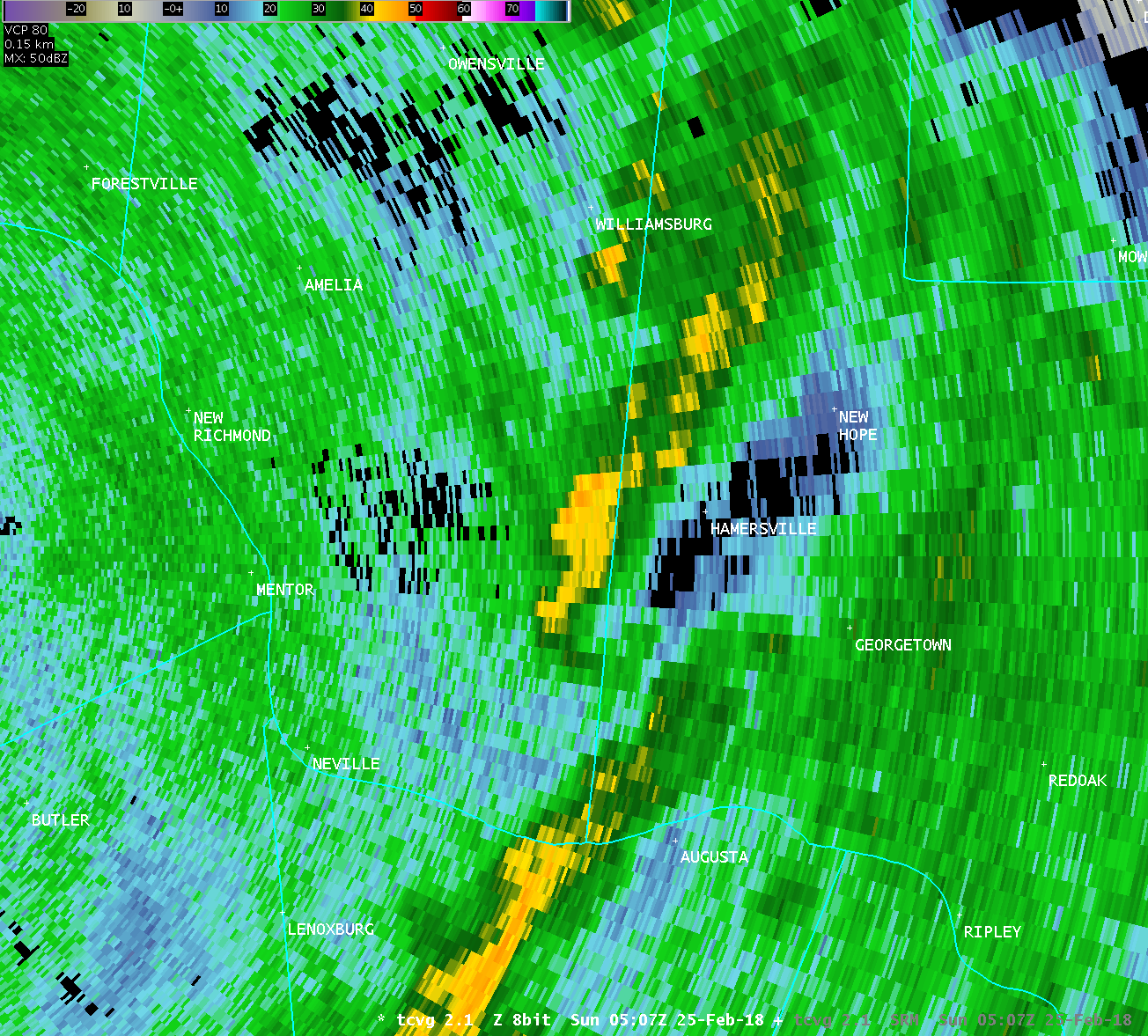
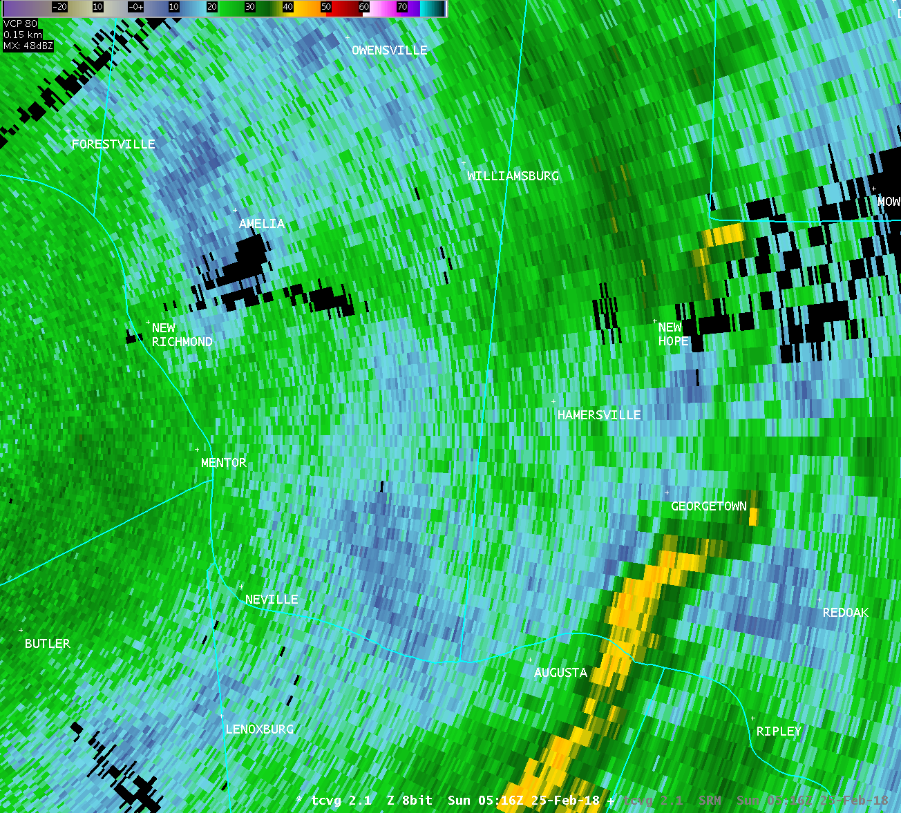
In addition to the tornadic damage described above, the National
Weather Service storm survey observed non-tornadic damage across a
much wider area. This area of damage extended about 13 miles in
length, stretching from far southeastern Clermont County through
north central Brown County. This straight-line wind damage
affected areas near Feesburg and Hamersville, and was observed on
both sides of the surveyed tornadic circulation. This damage
consisted of additional tree and outbuilding damage, including the
destruction of a few outbuildings.
The National Weather Service in Wilmington Ohio would like to
thank officials with the Brown County and Ohio Emergency
Management Agencies for their help with this survey.
For reference: the Enhanced Fujita Scale classifies tornadoes
into the following categories:
EF0...wind speeds 65 to 85 mph.
EF1...wind speeds 86 to 110 mph.
EF2...wind speeds 111 to 135 mph.
EF3...wind speeds 136 to 165 mph.
EF4...wind speeds 166 to 200 mph.
EF5...wind speeds greater than 200 mph.
$$
HATZOS/BPP/BINAU
|

