Public Information Statement
National Weather Service Wilmington OH
624 PM EST Mon Nov 6 2017
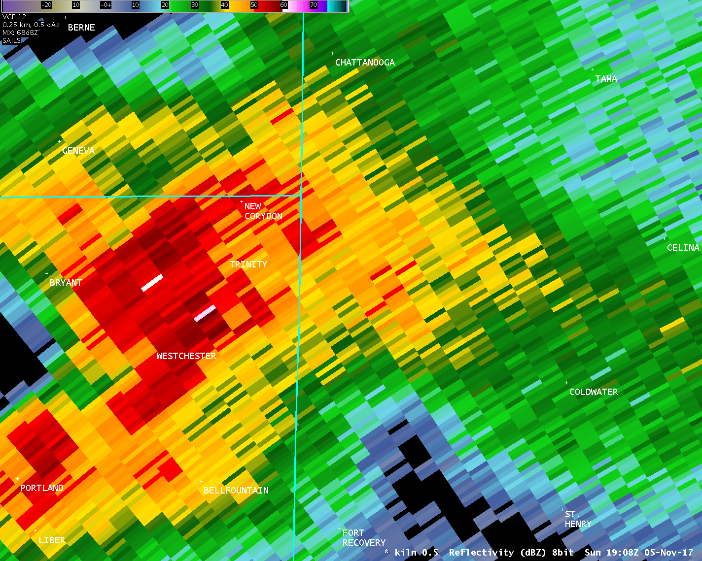
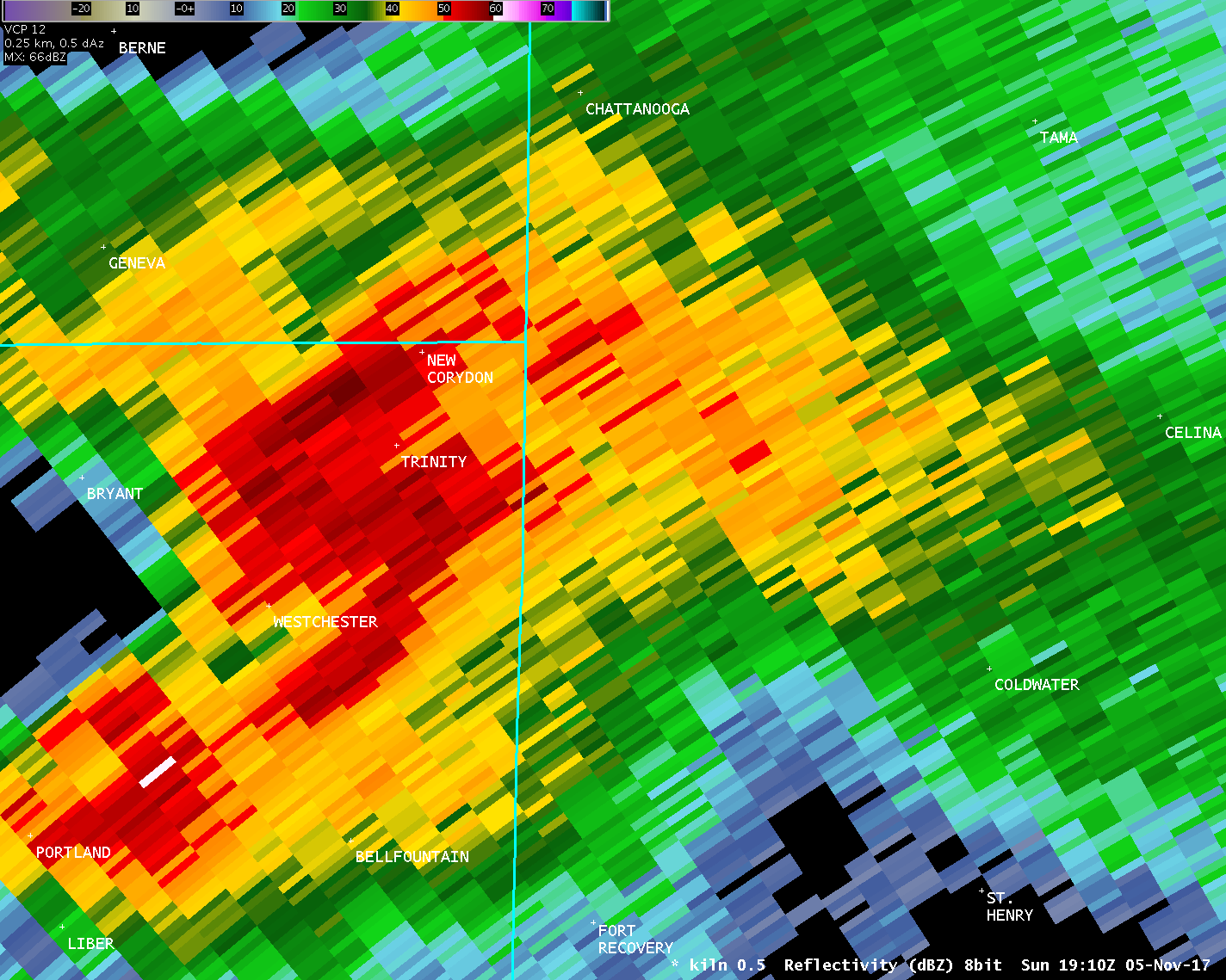
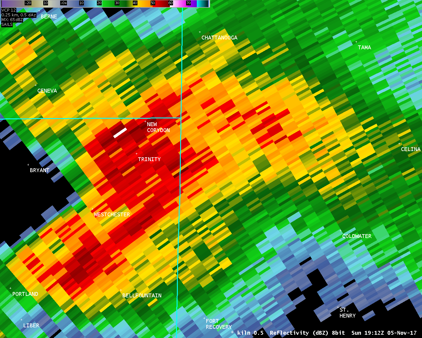
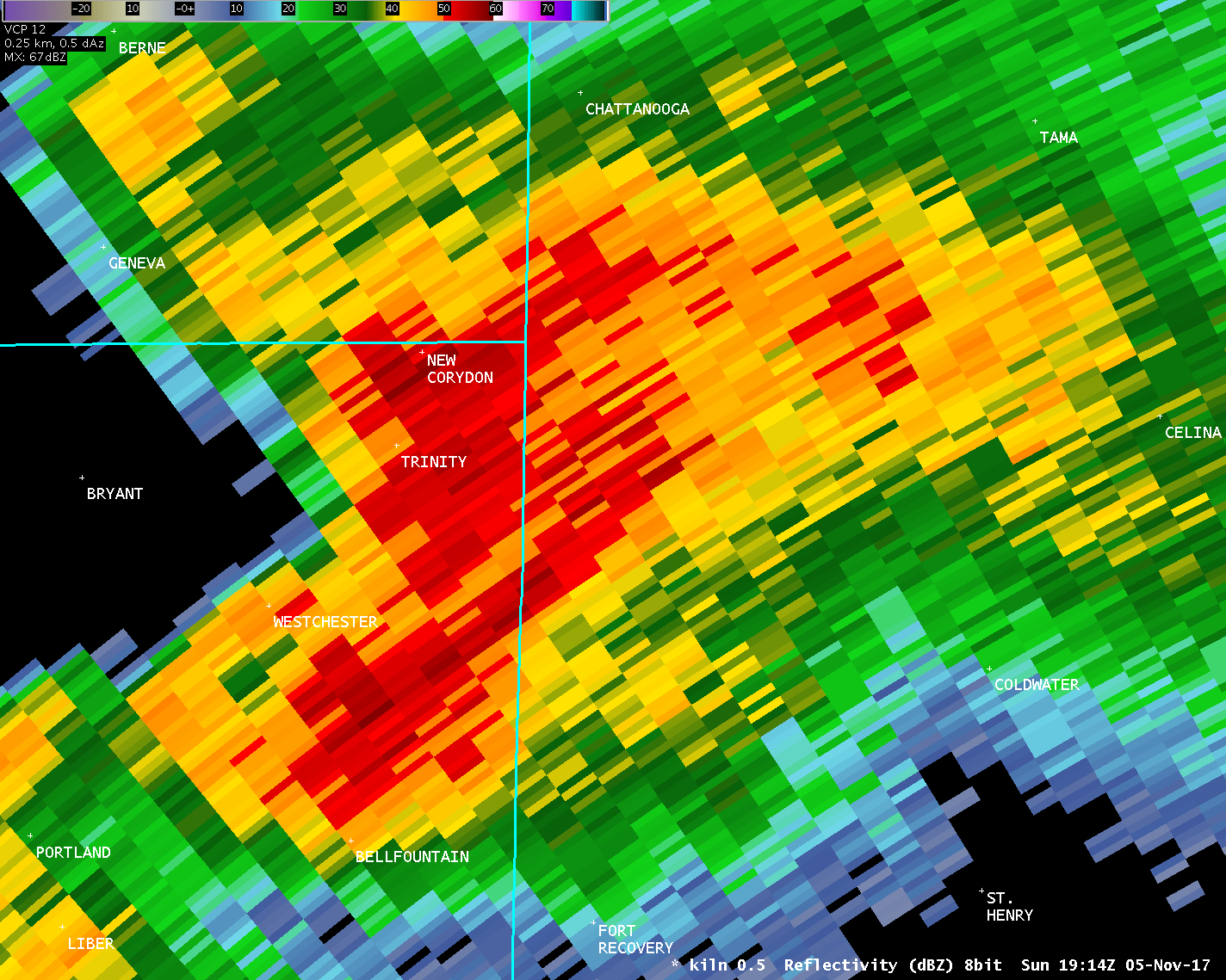
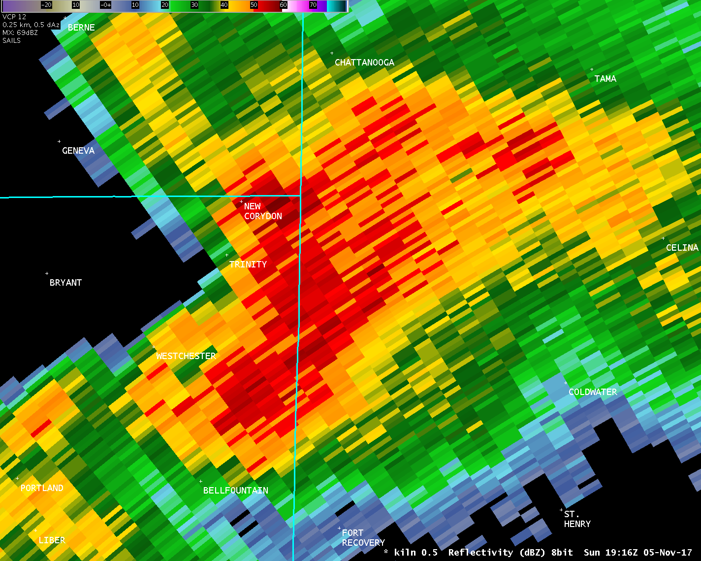
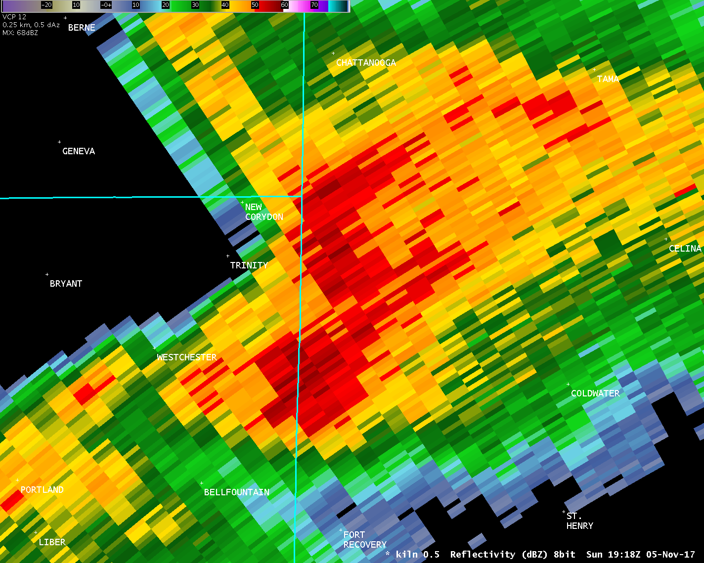
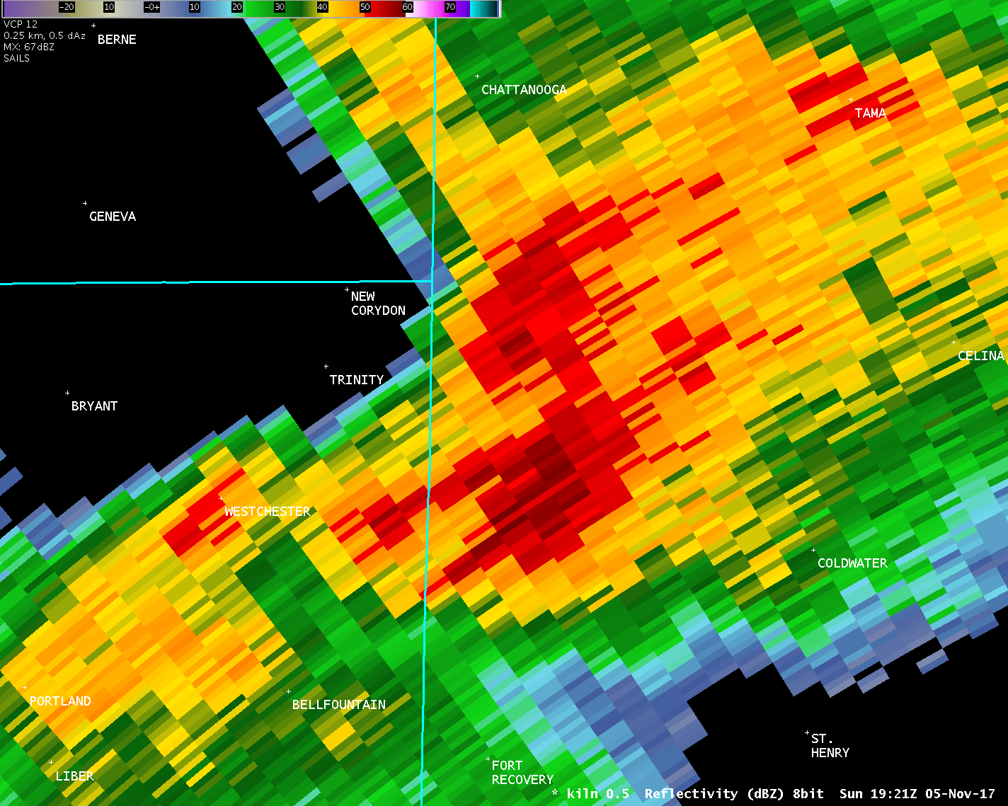
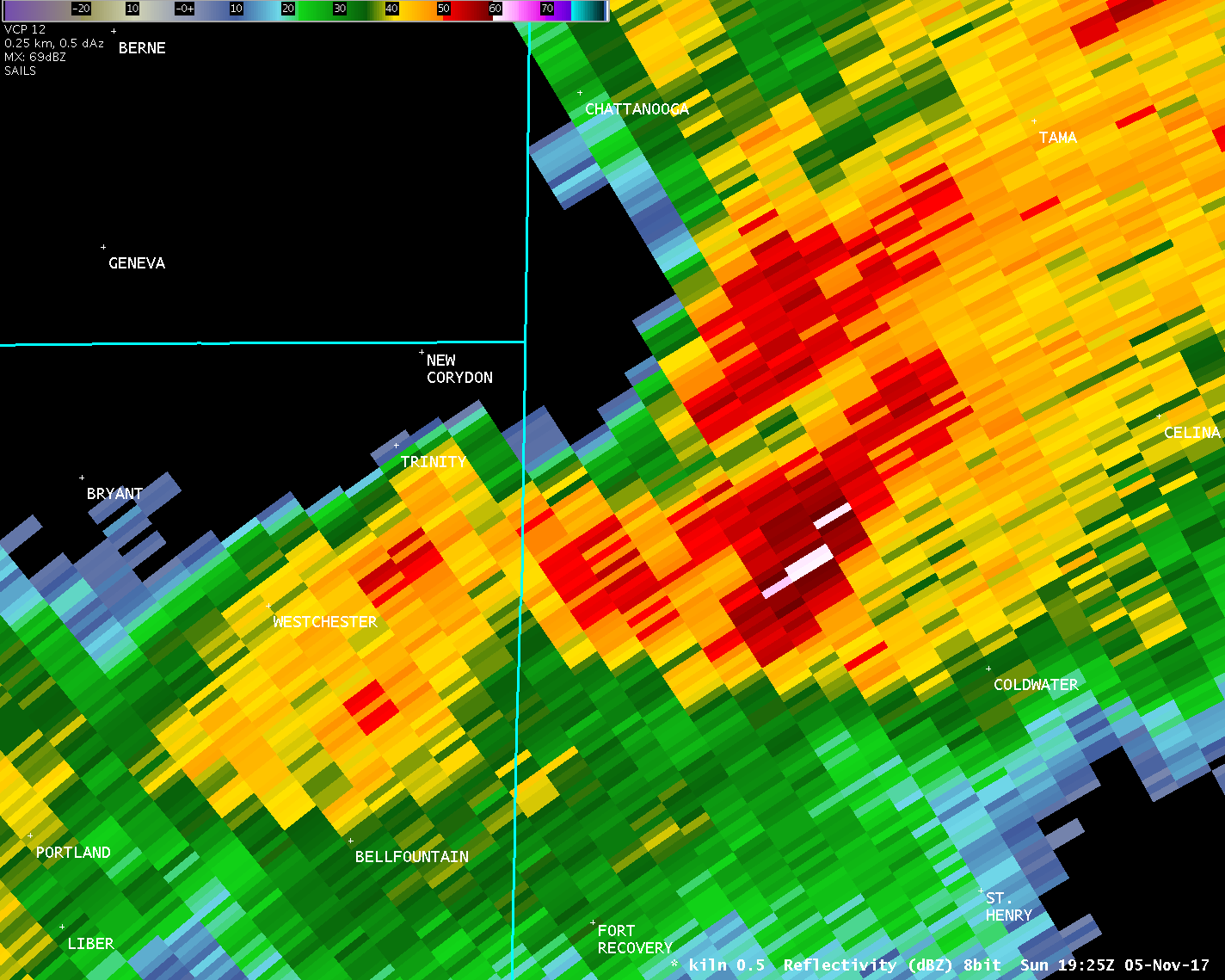
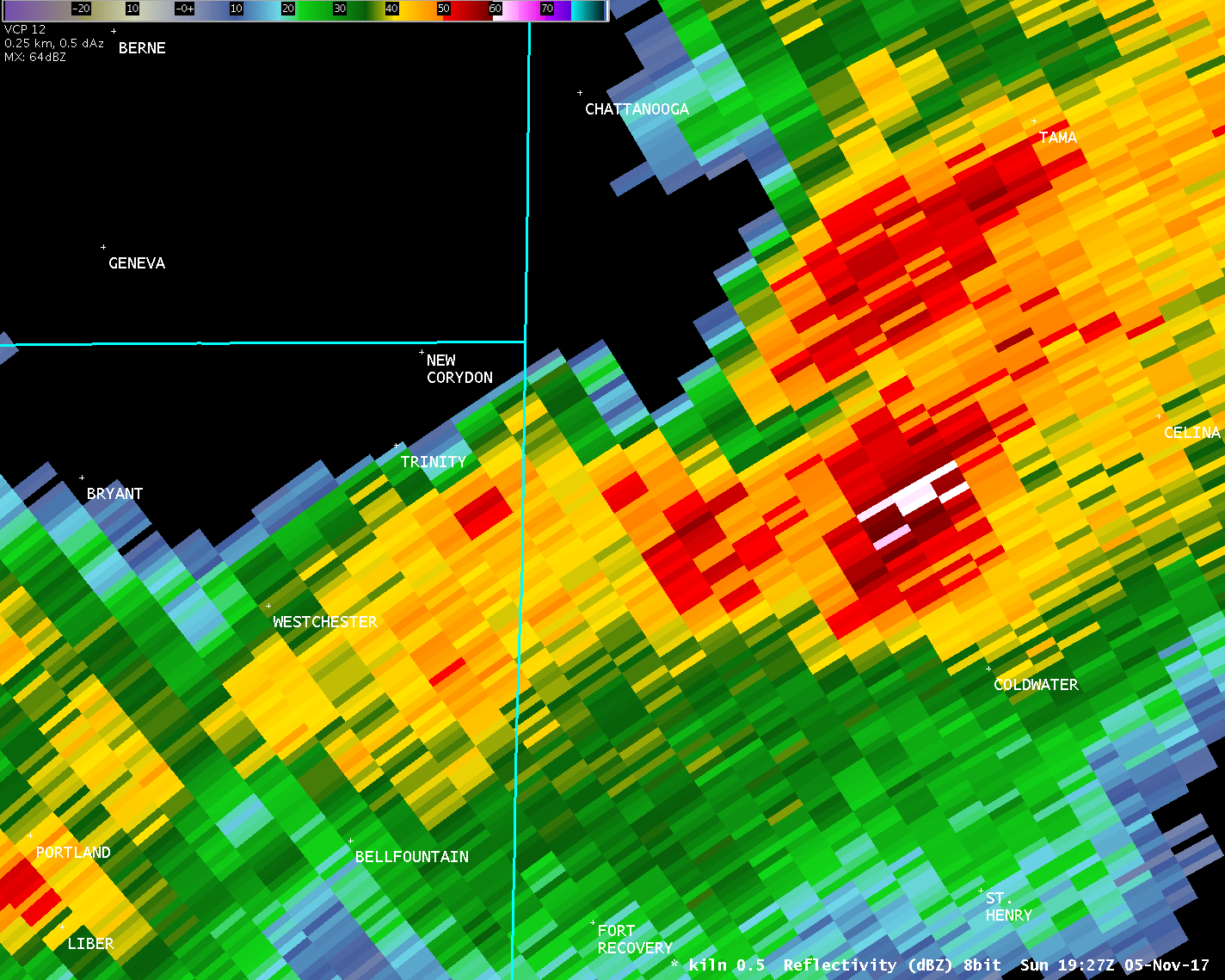
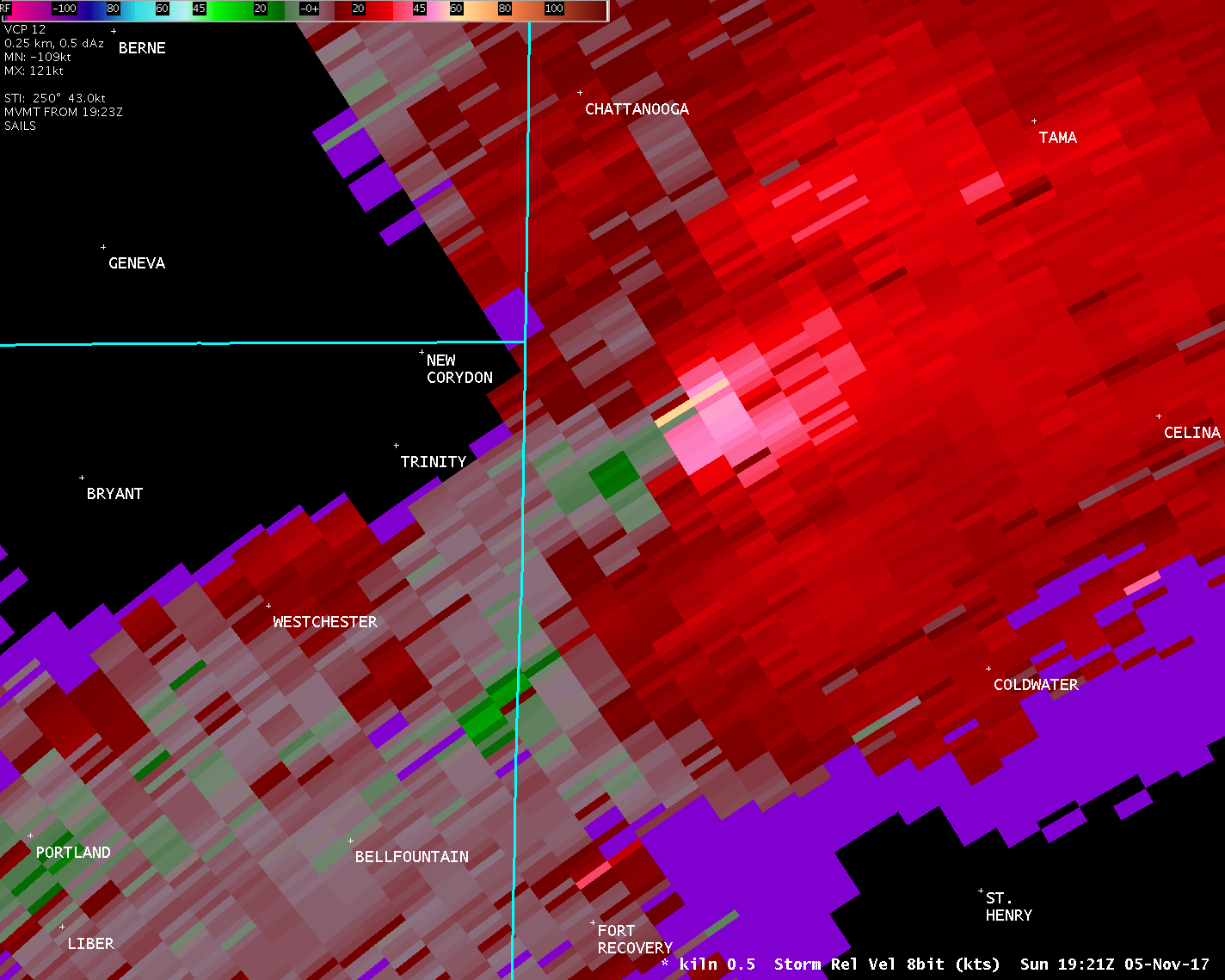
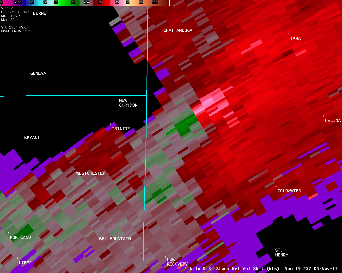
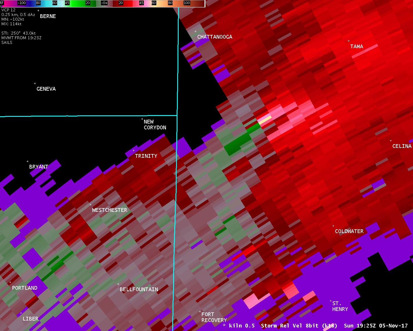
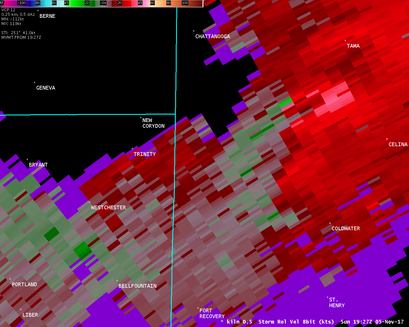
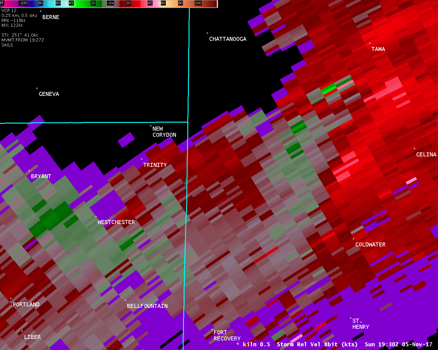
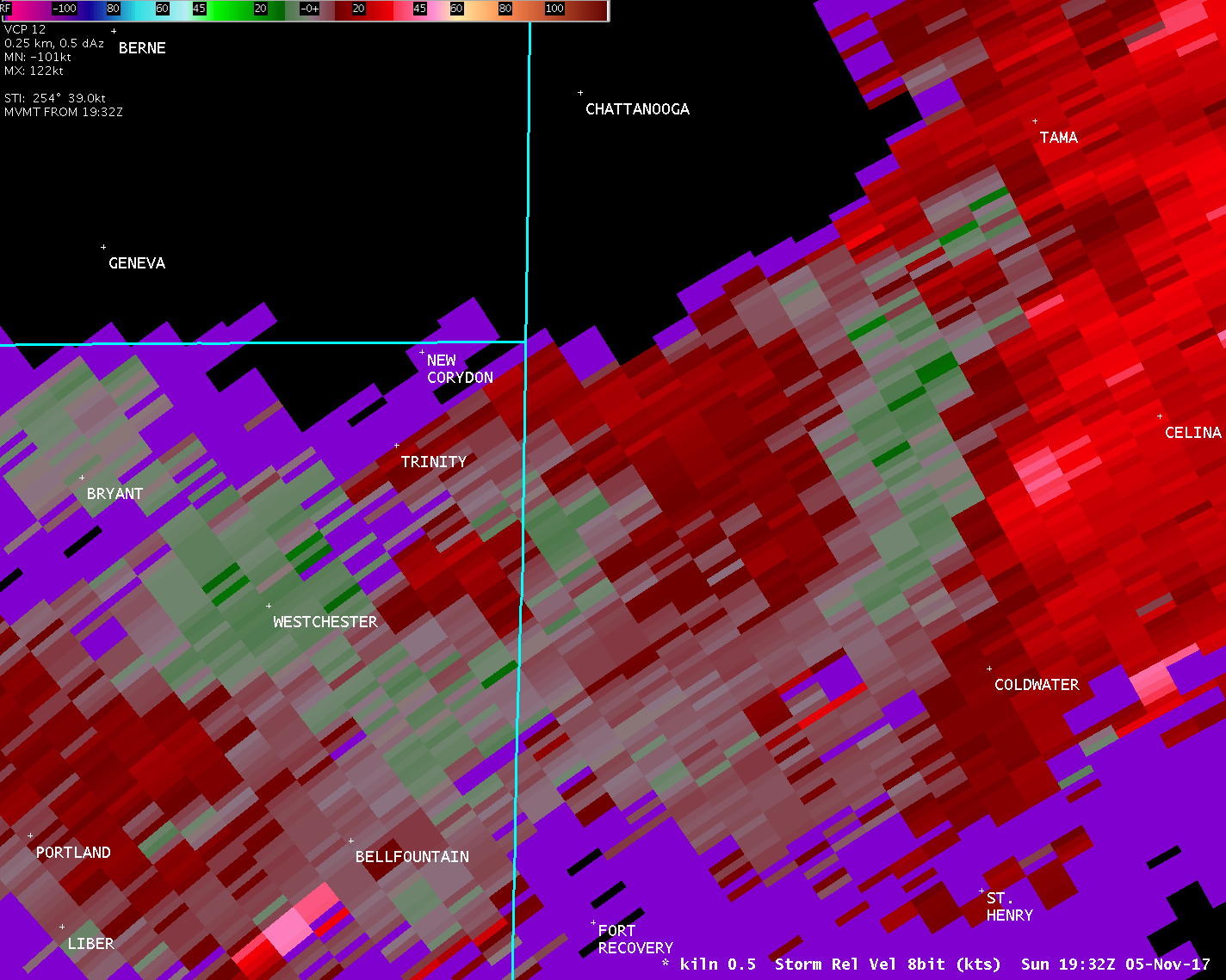
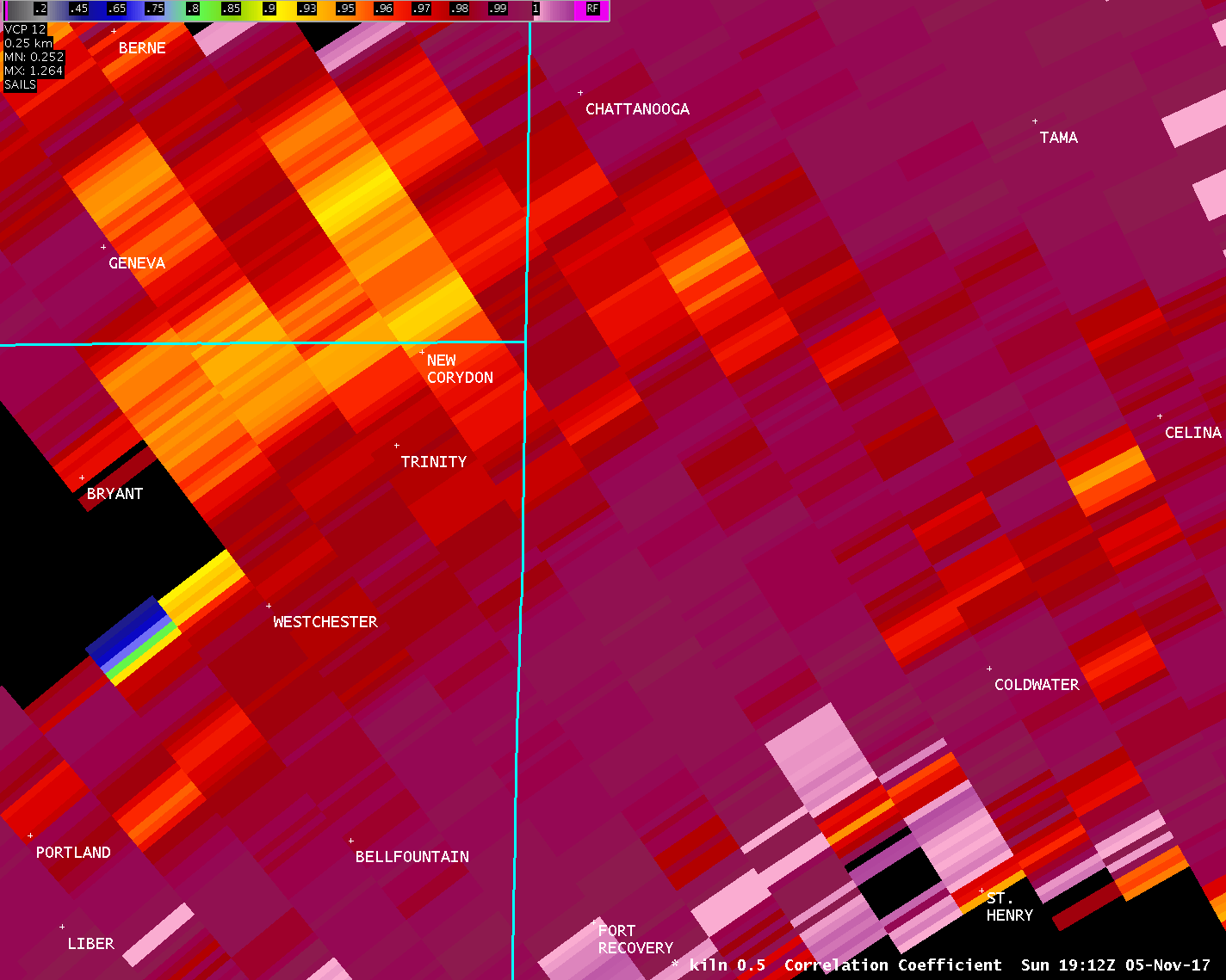
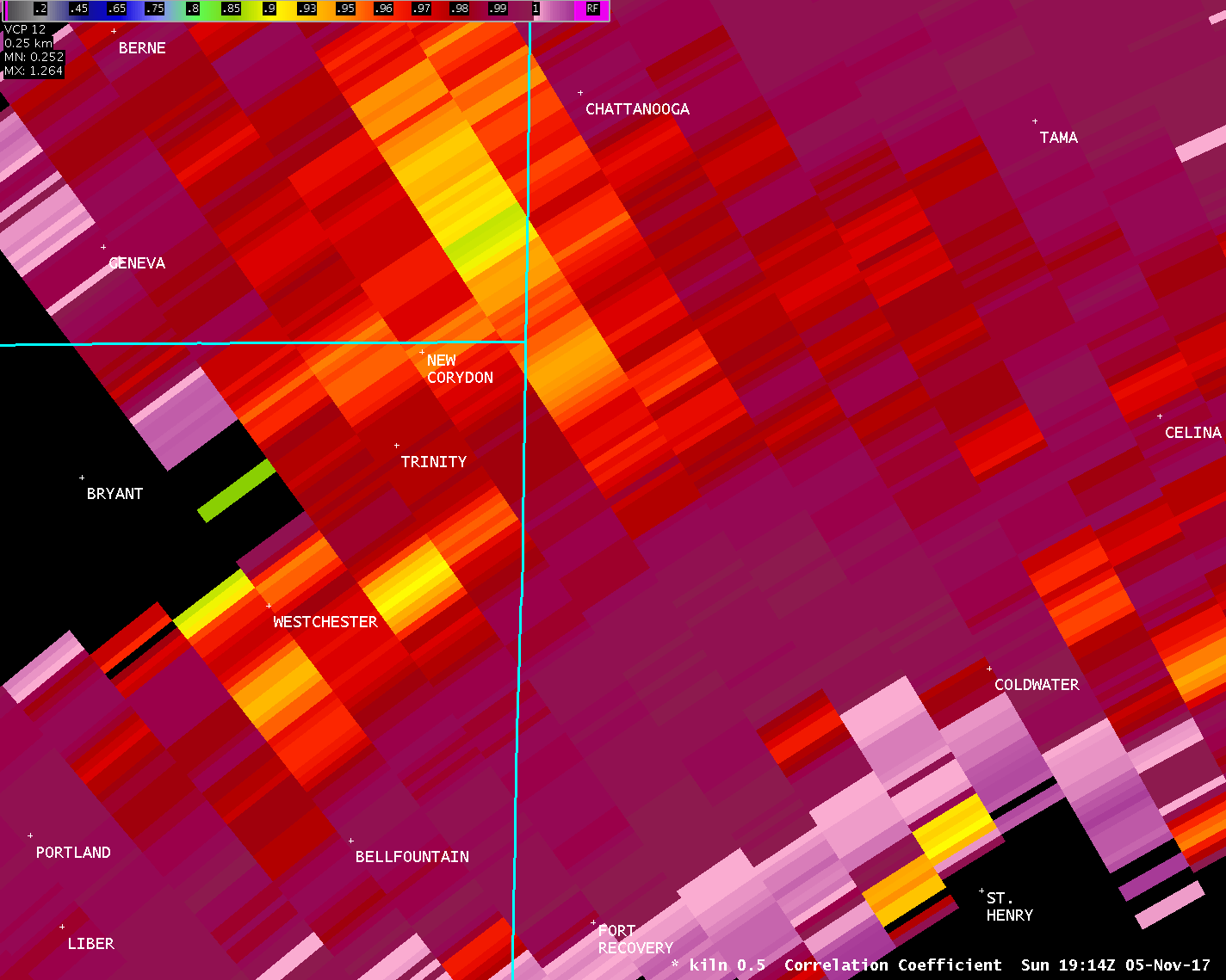
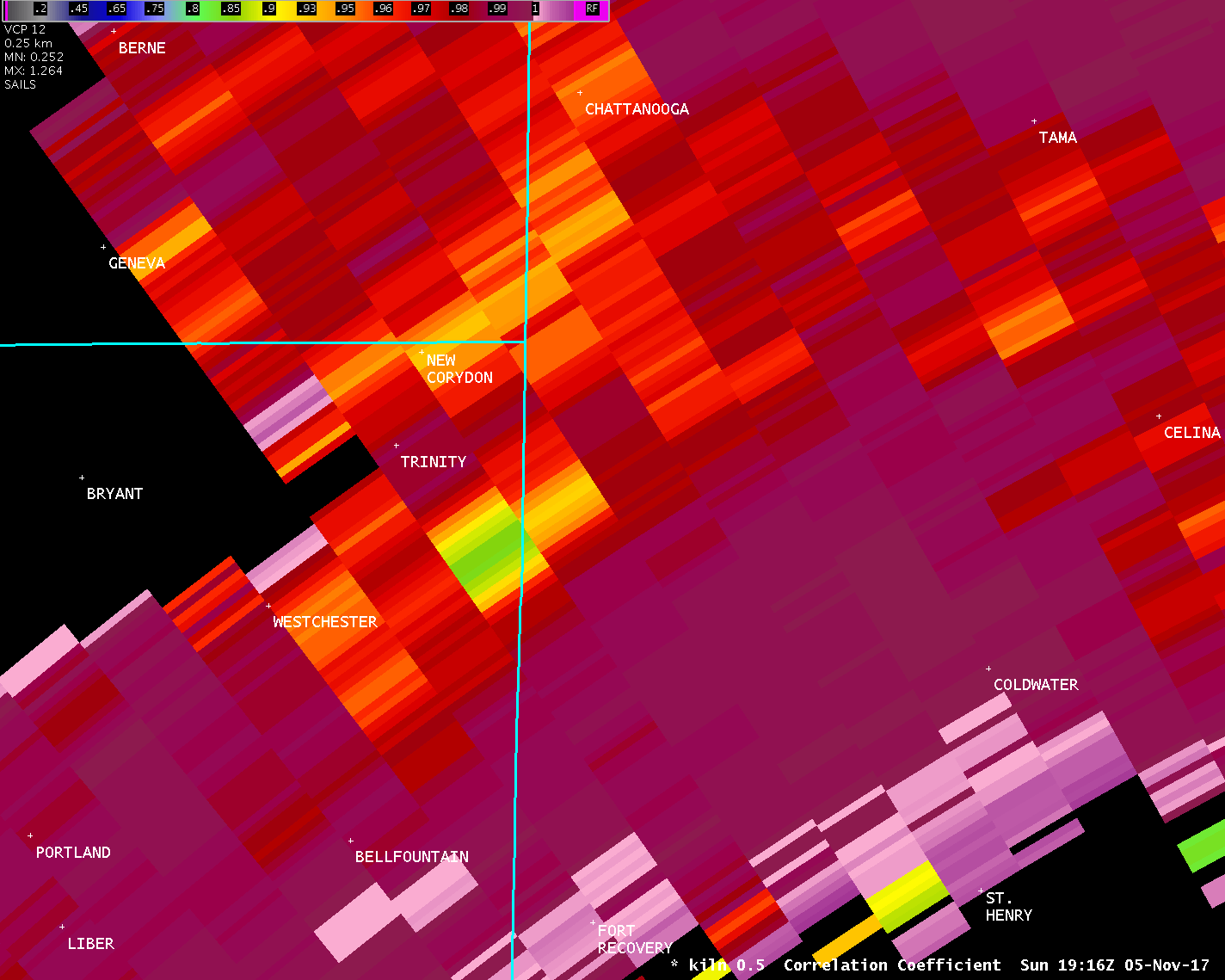
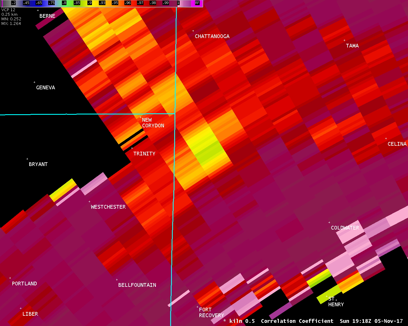
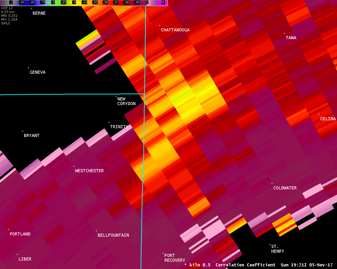
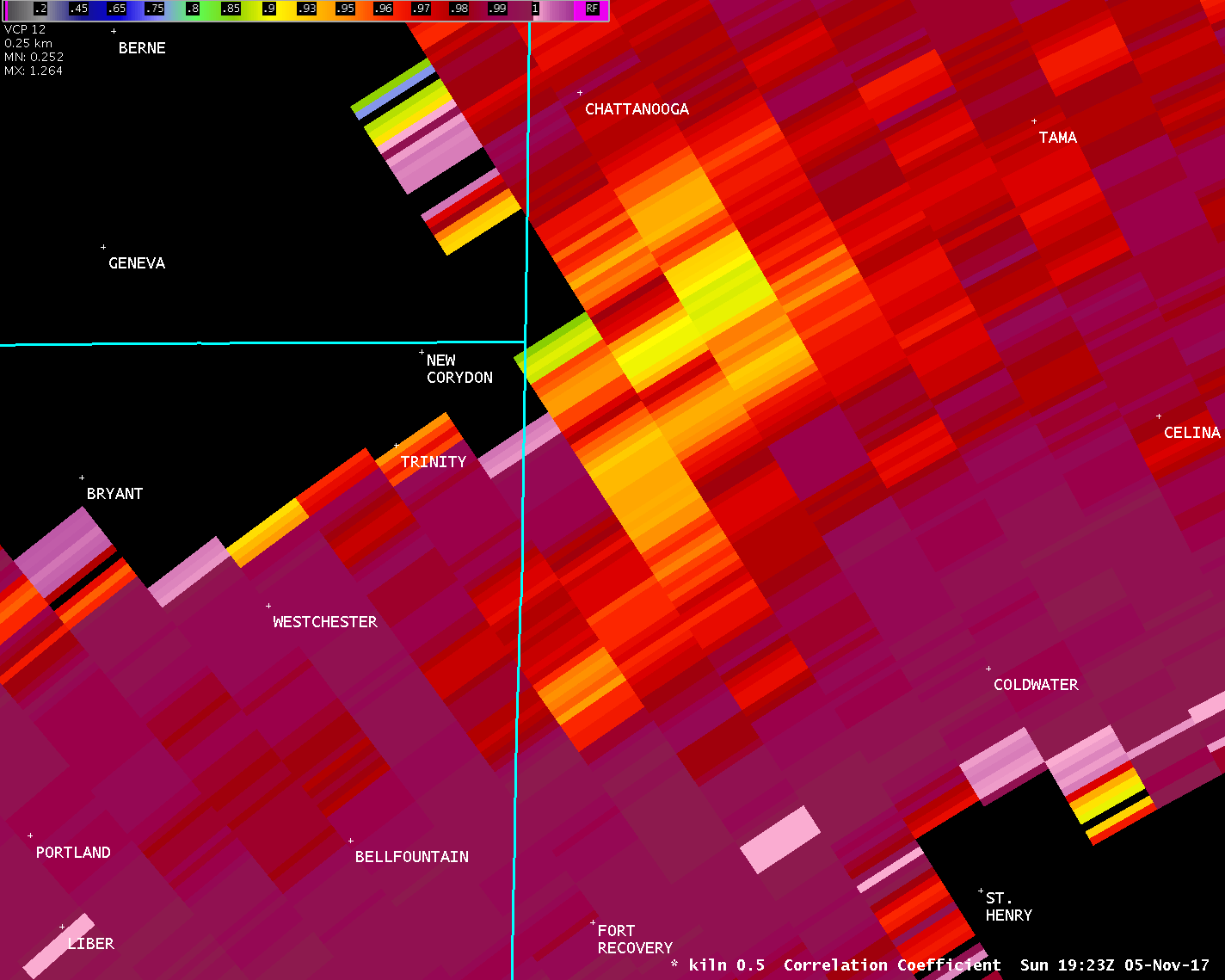
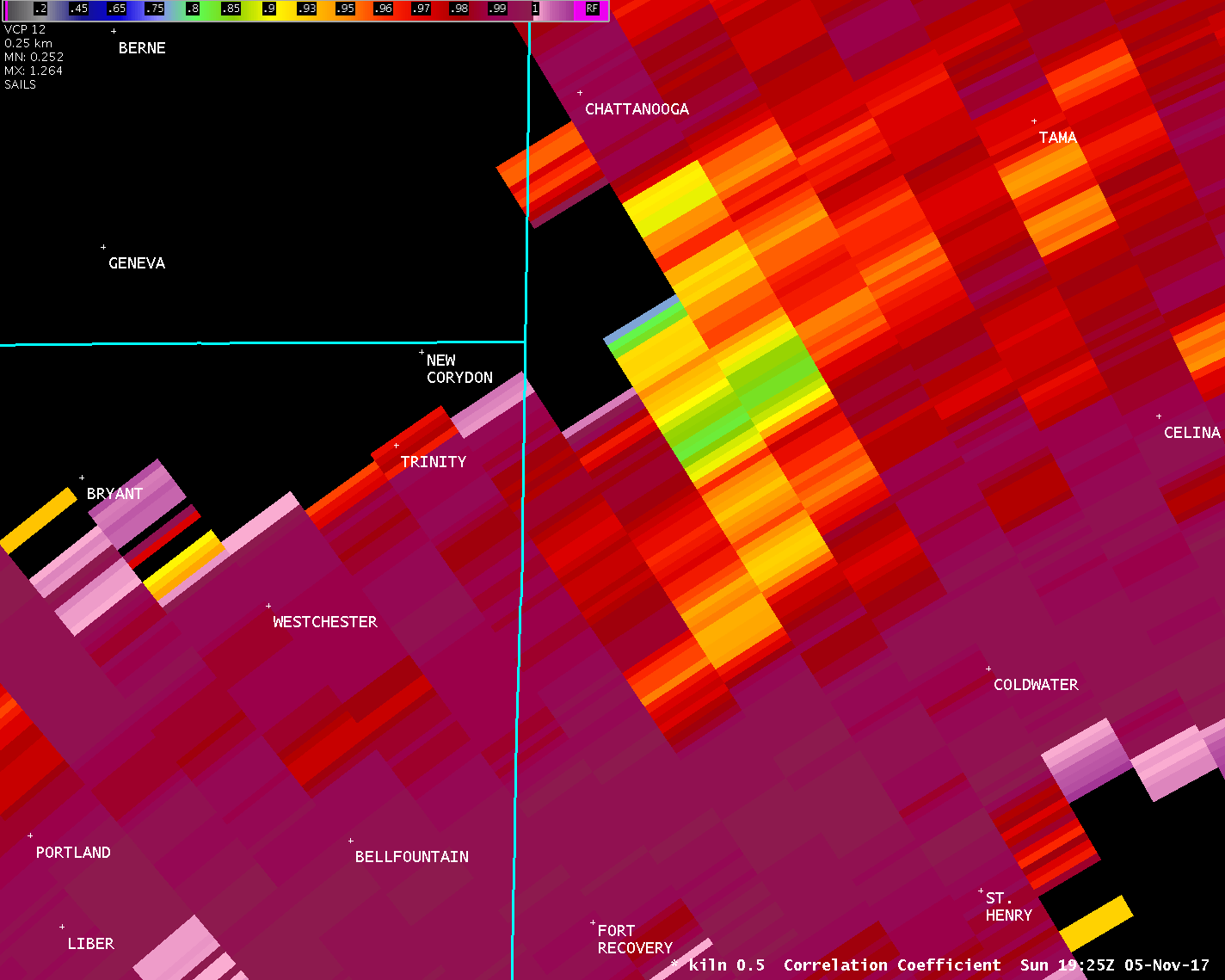
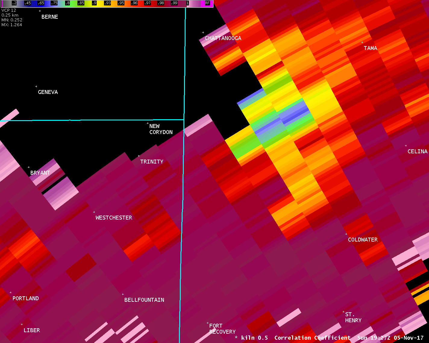
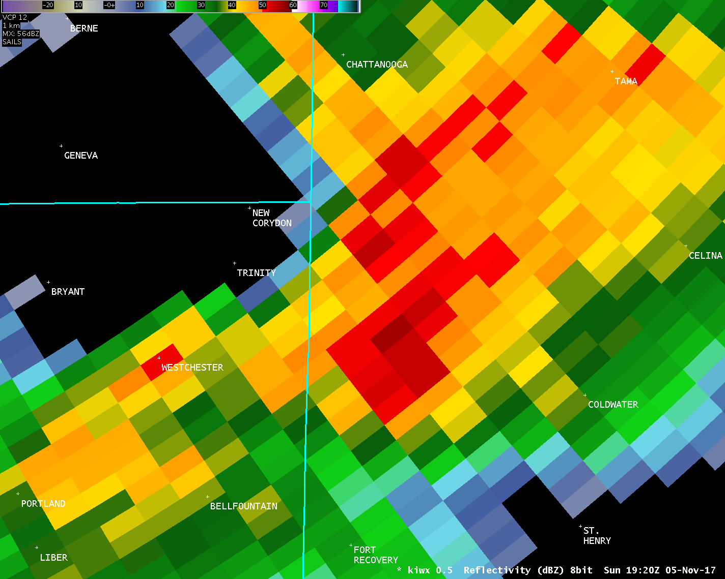
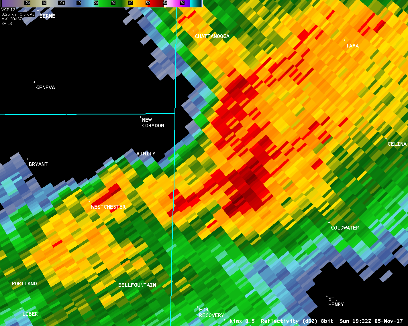
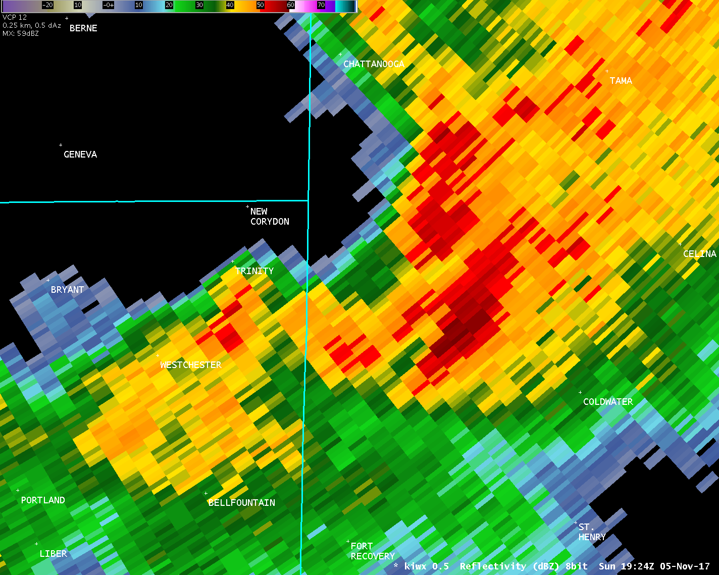
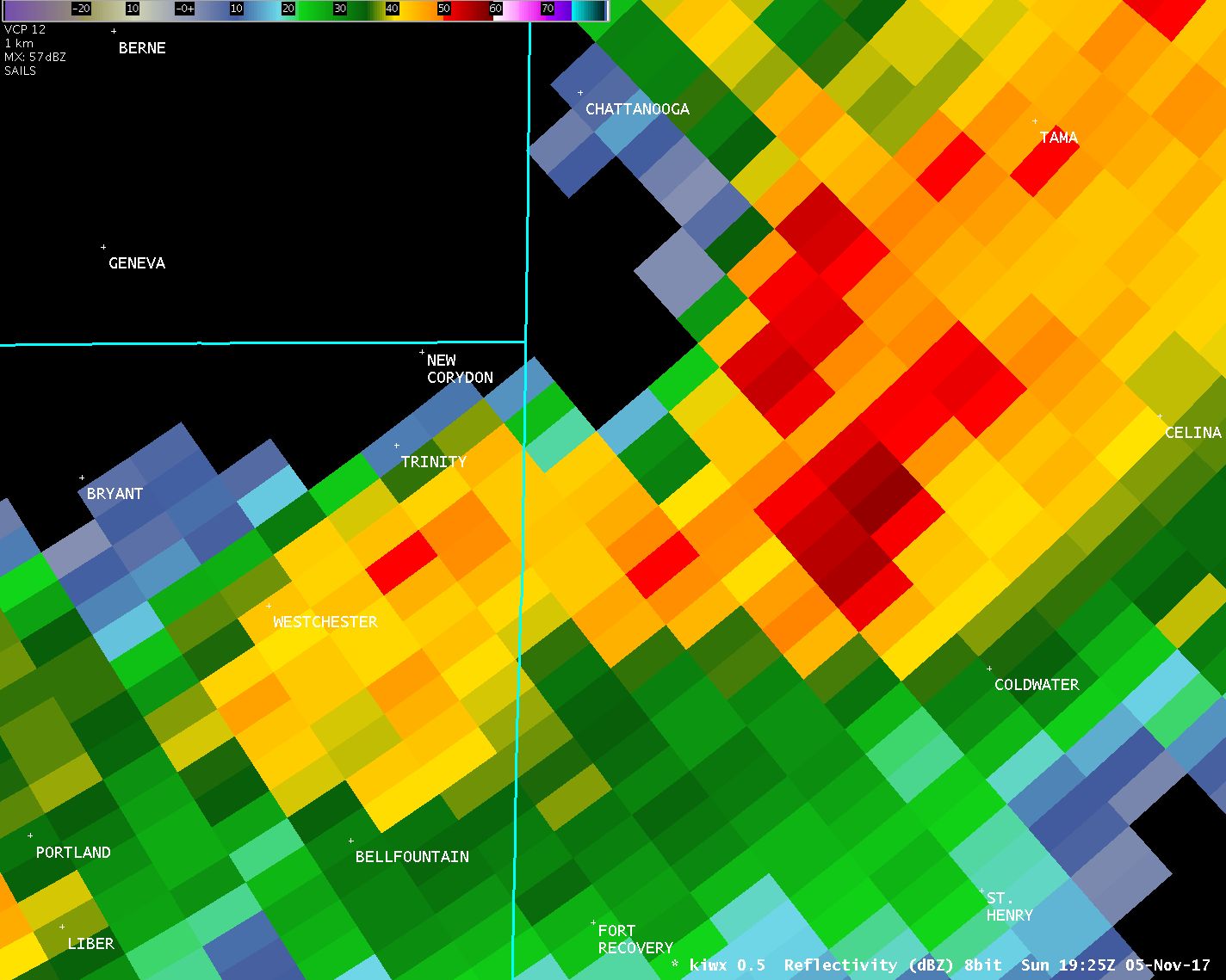
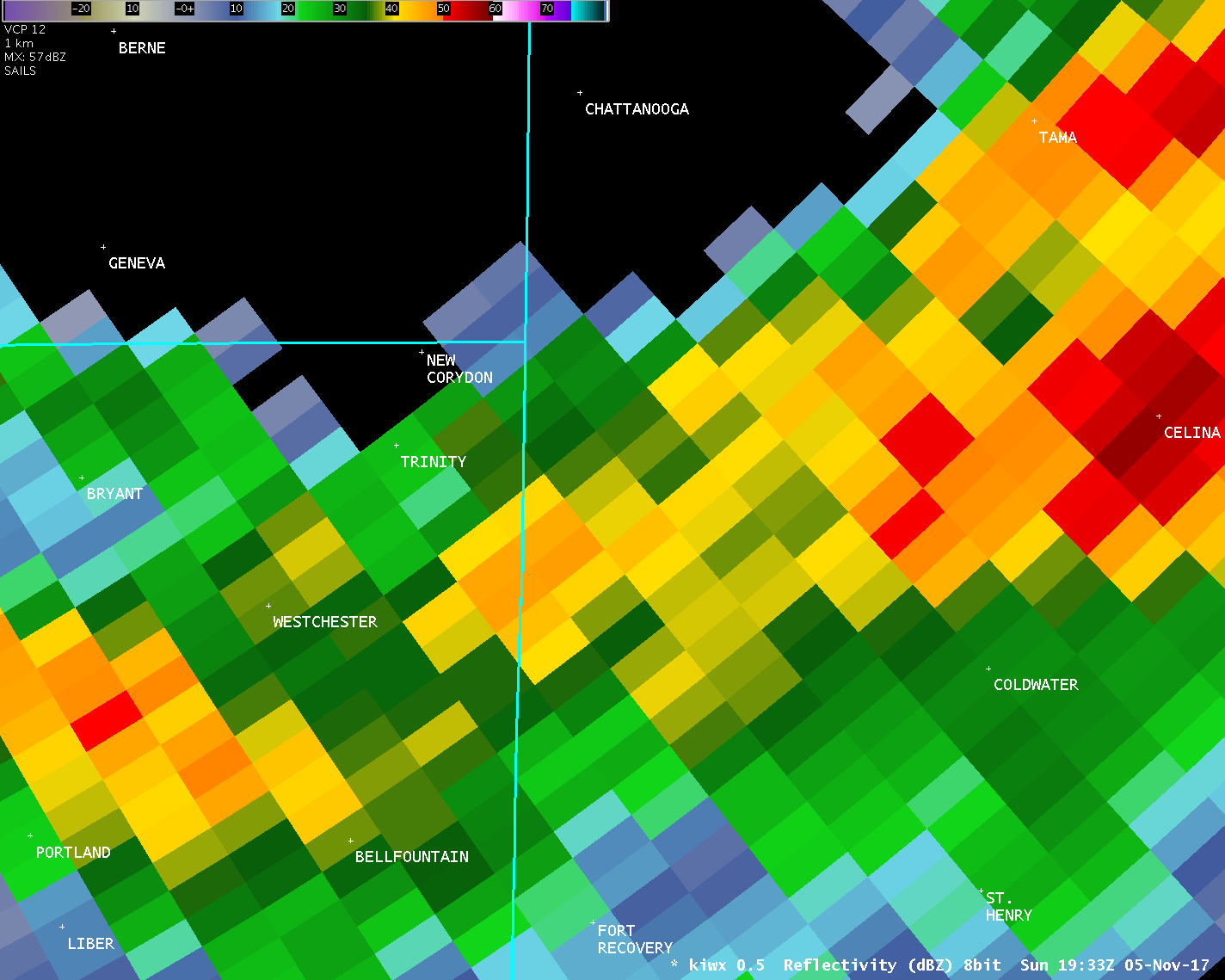
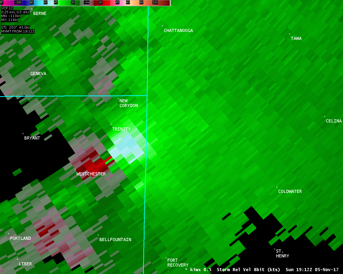
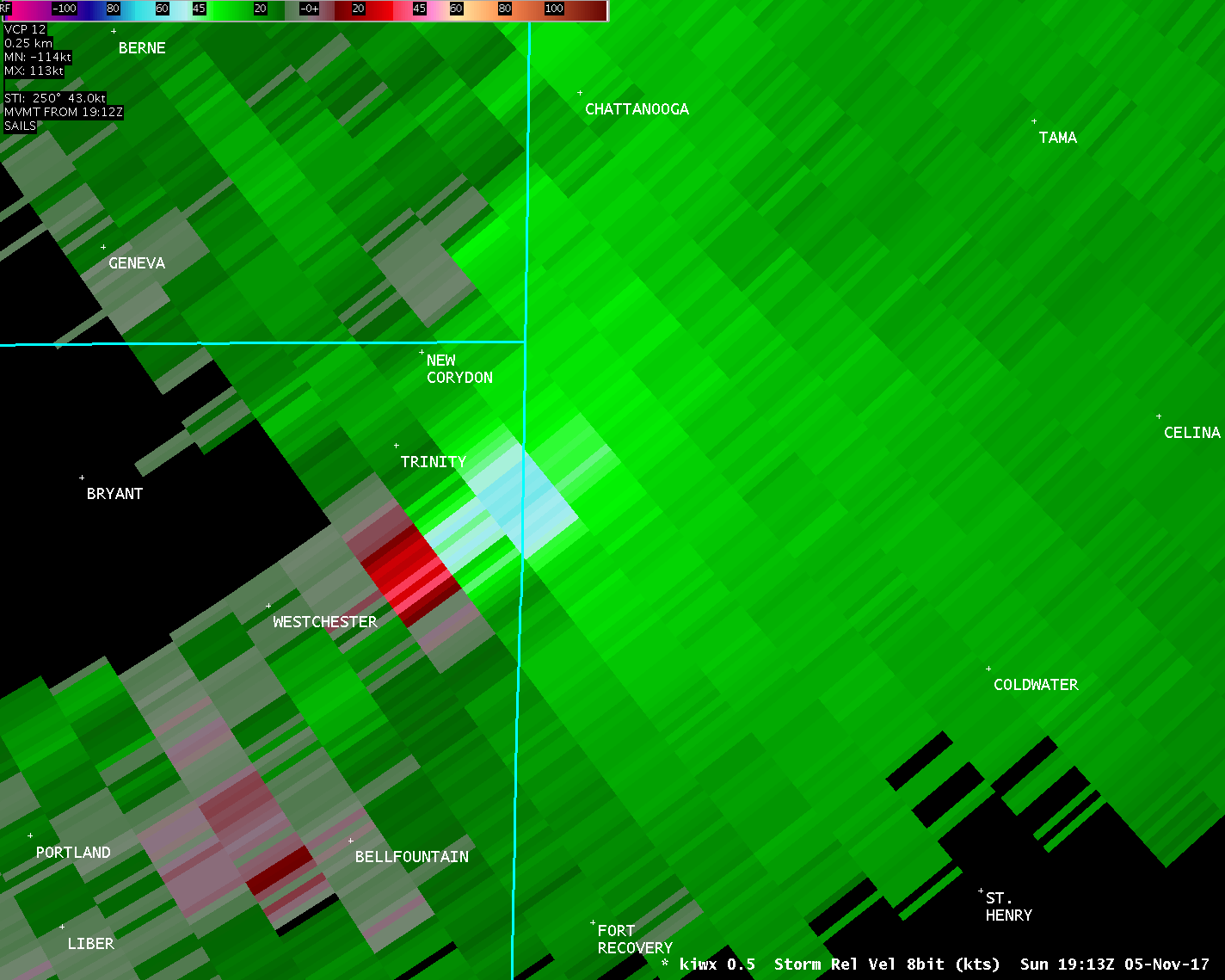
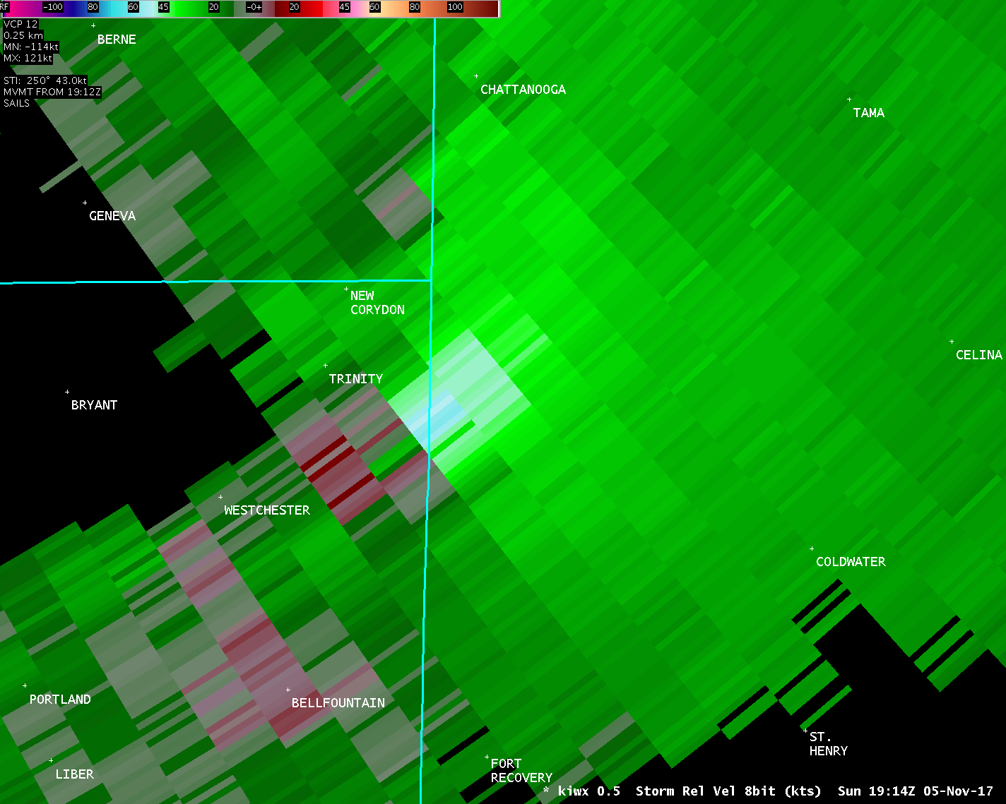
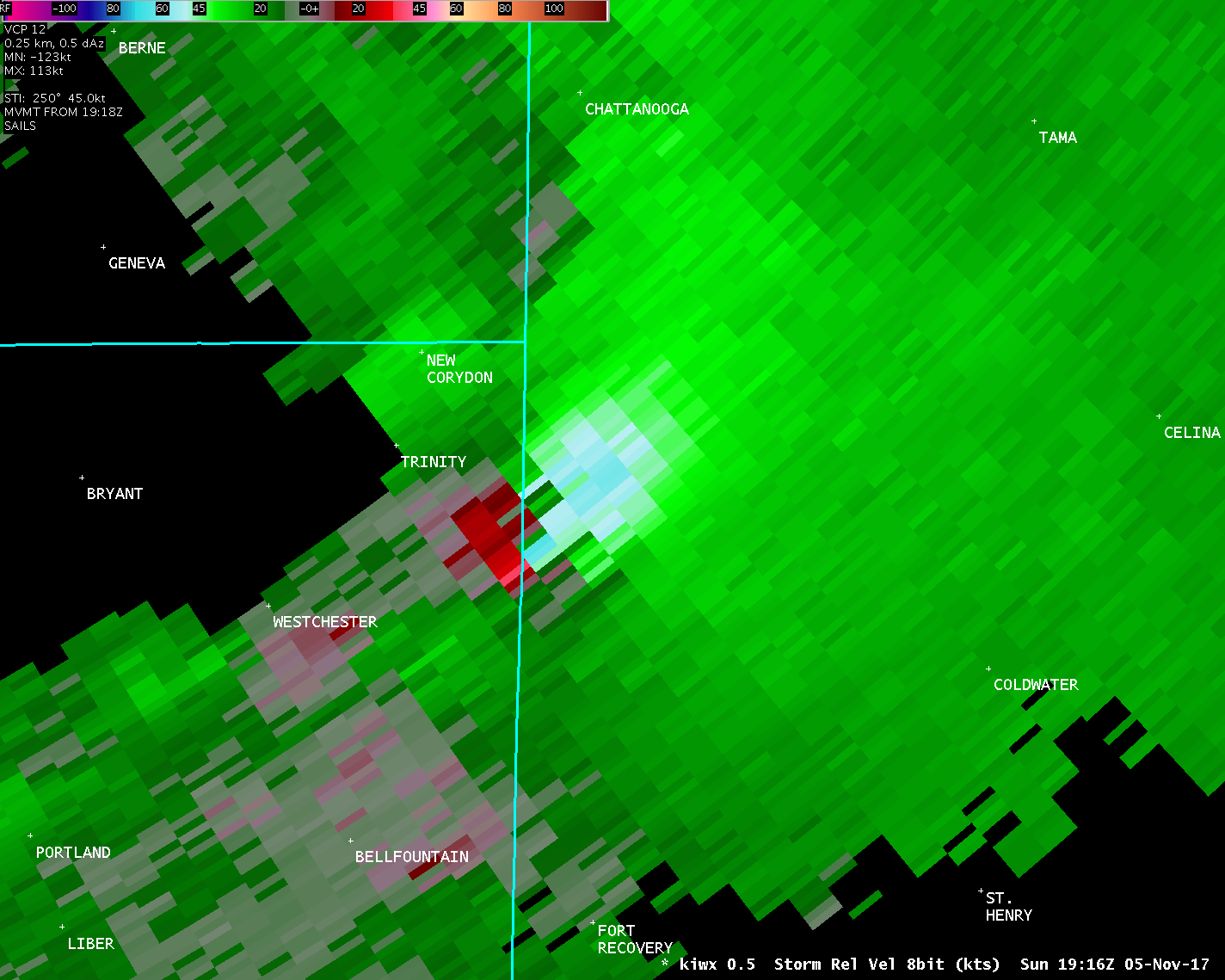
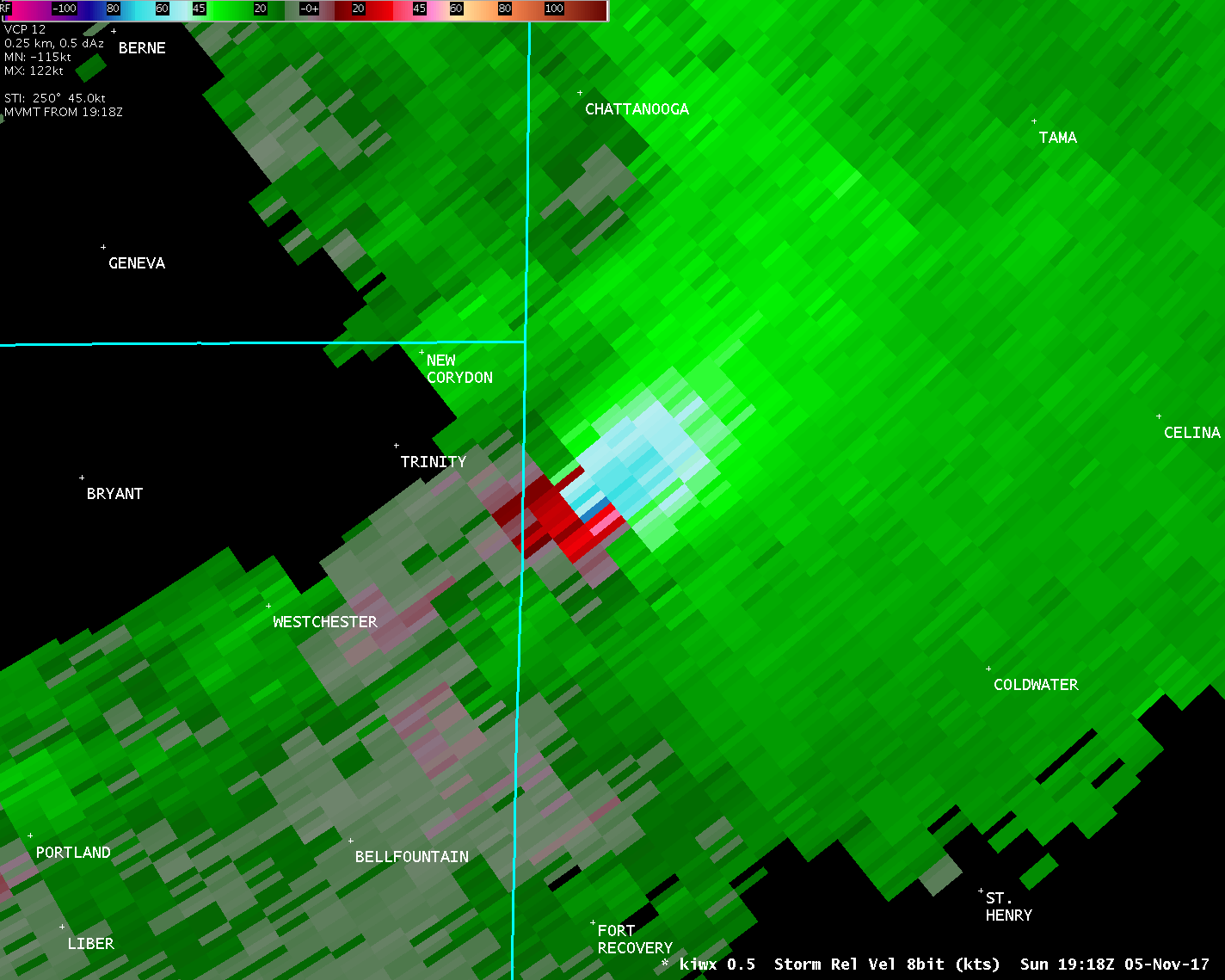
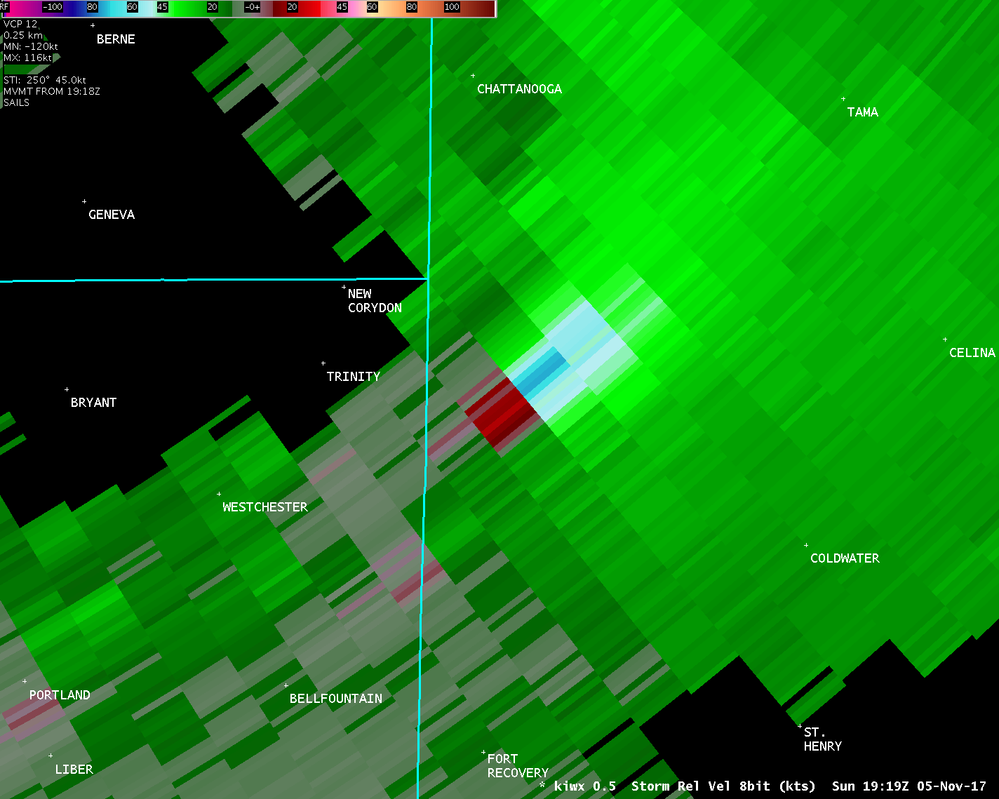
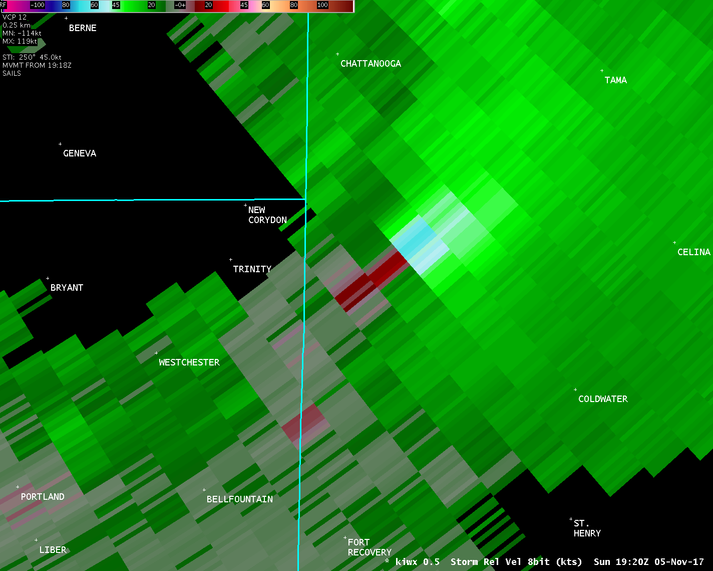
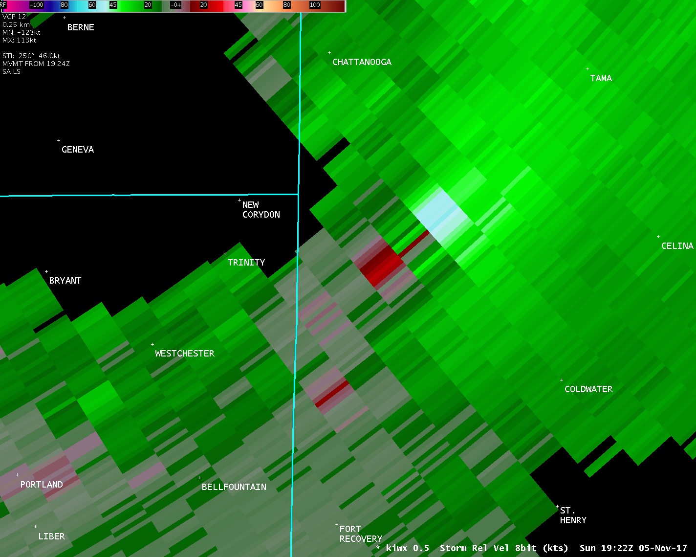
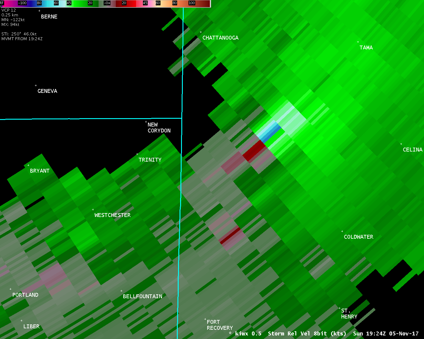
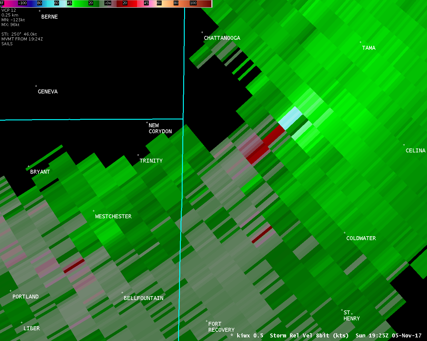
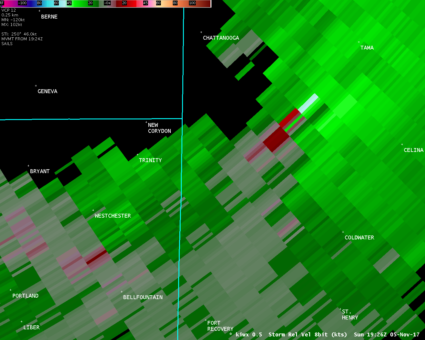
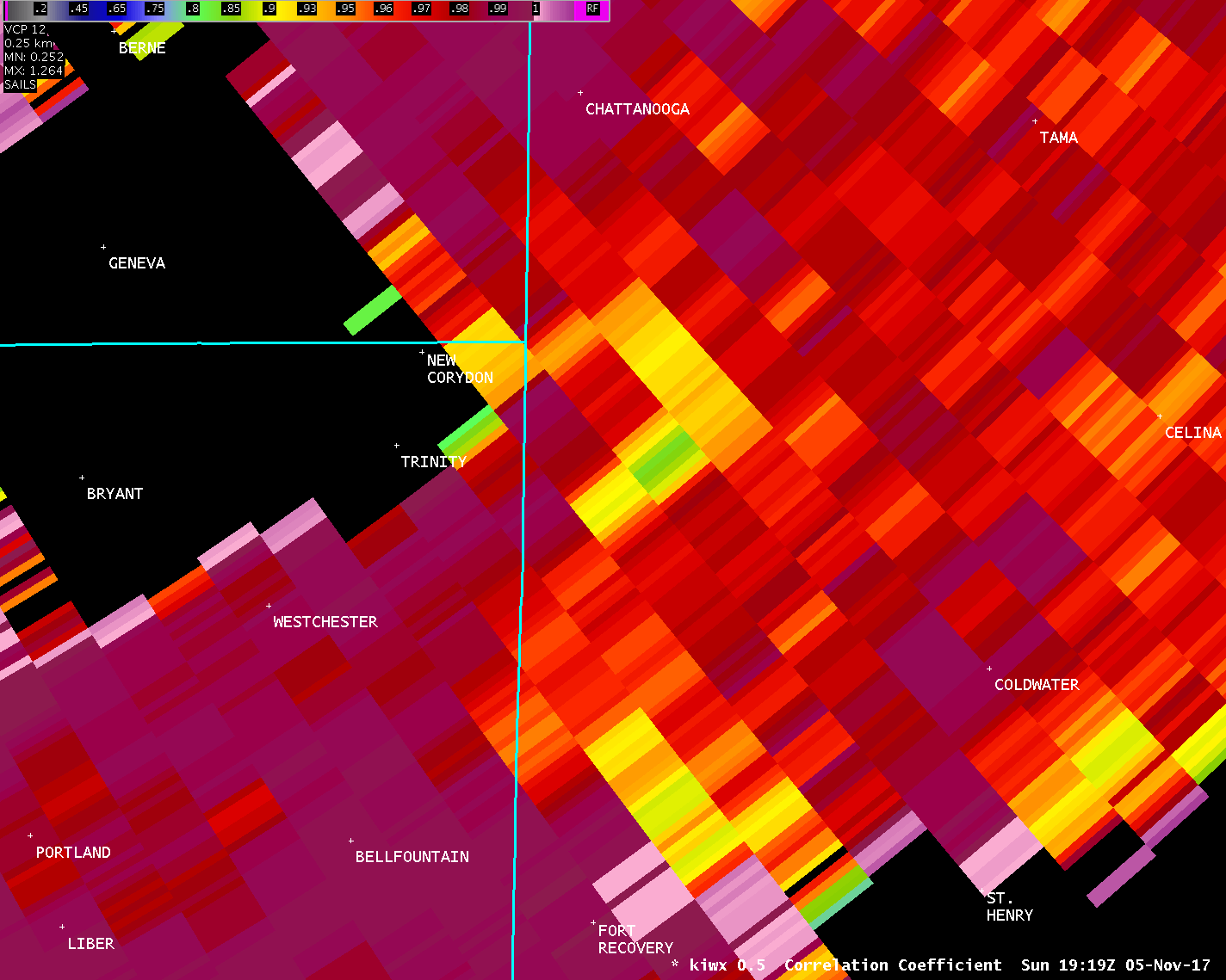
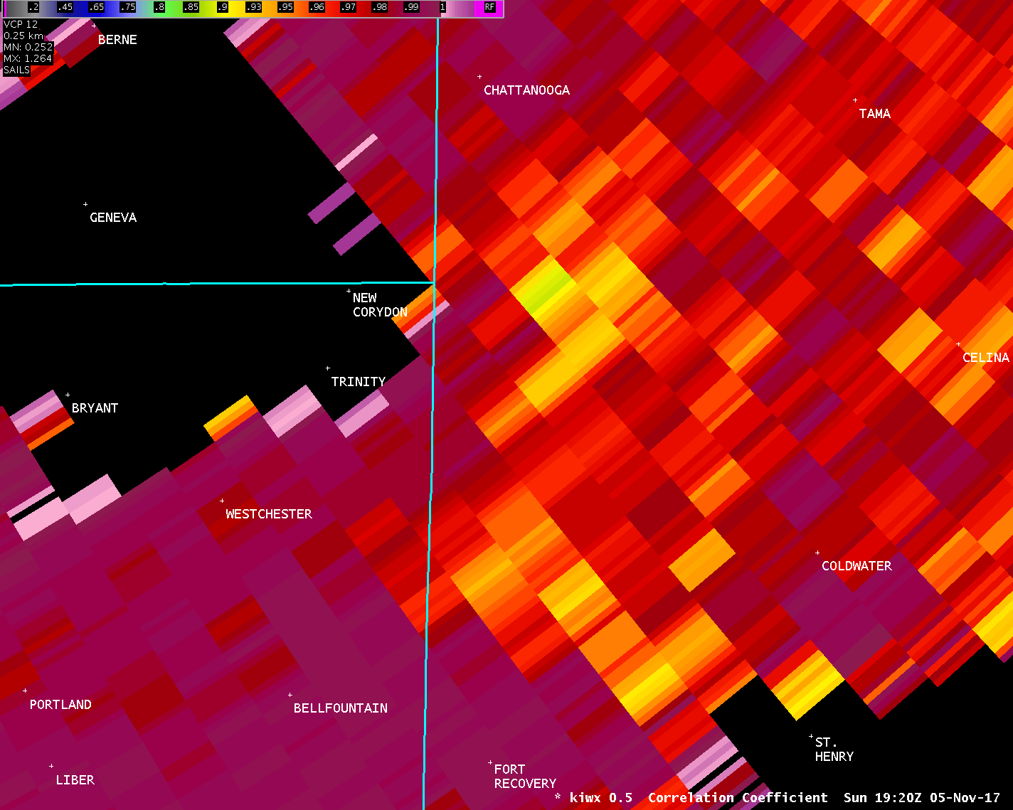
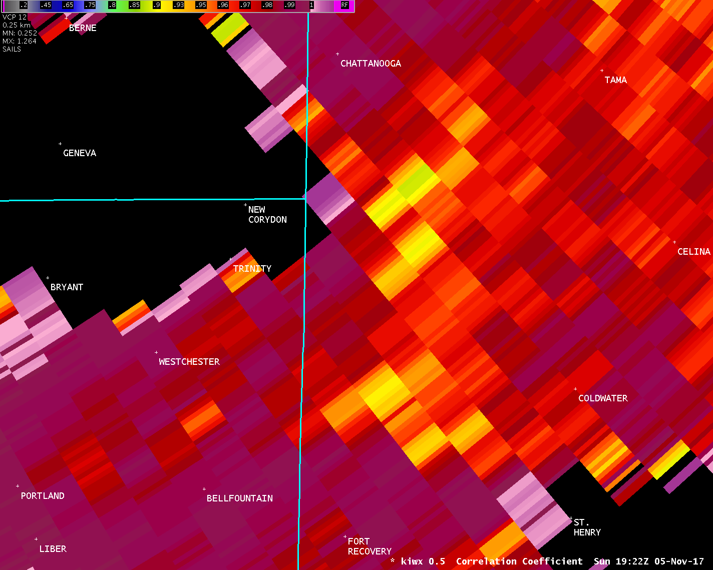
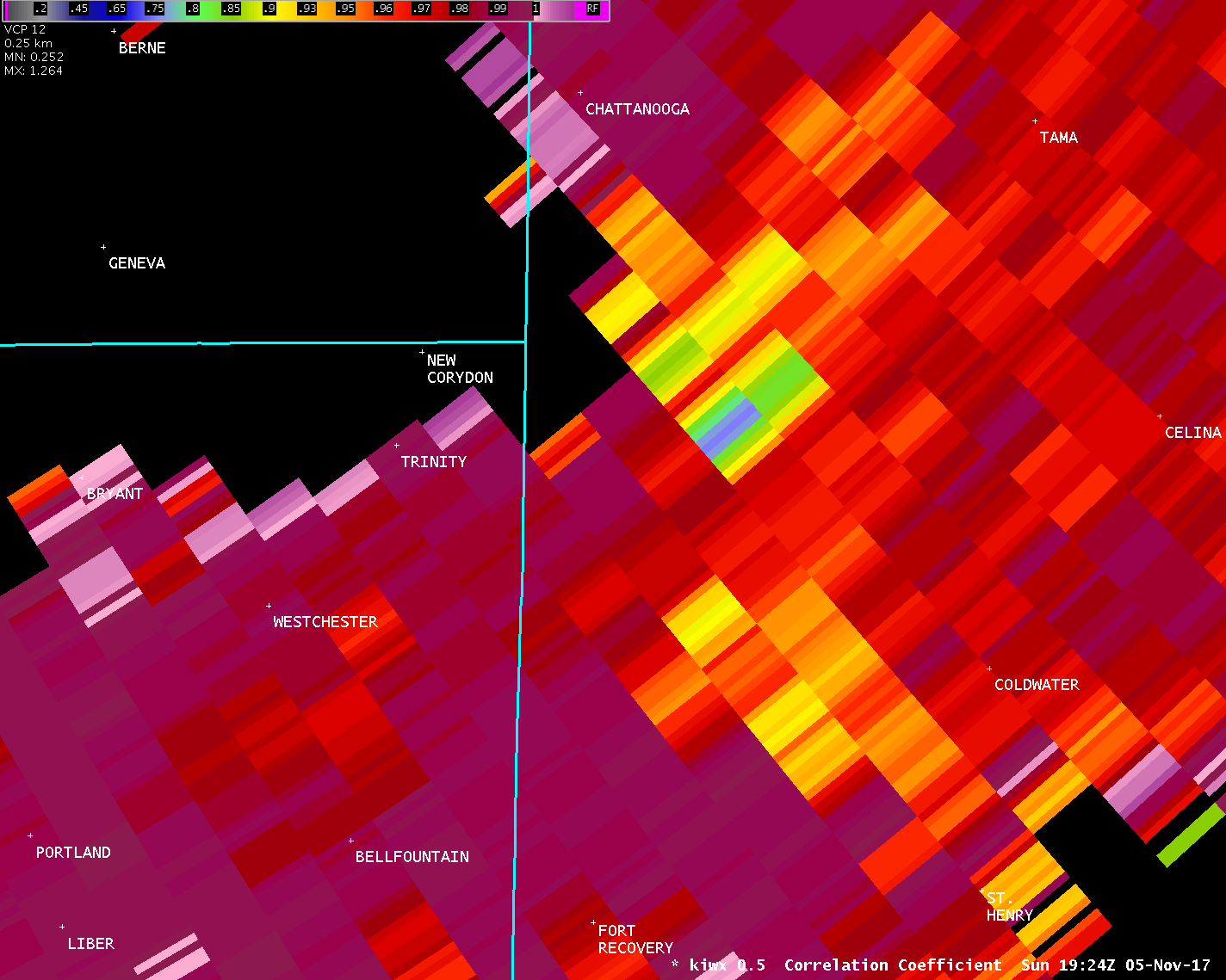
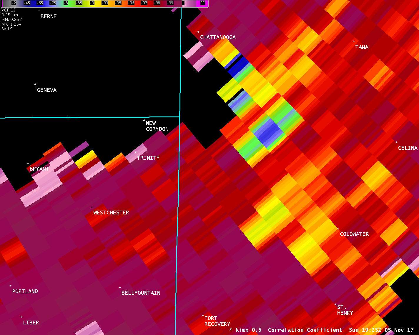
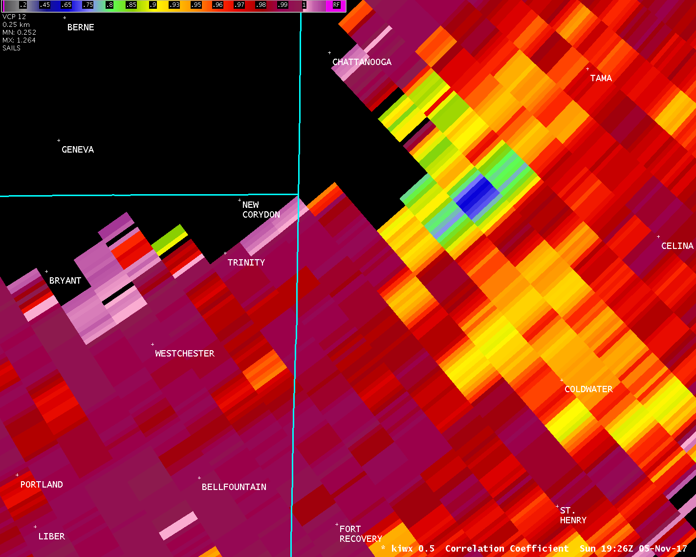
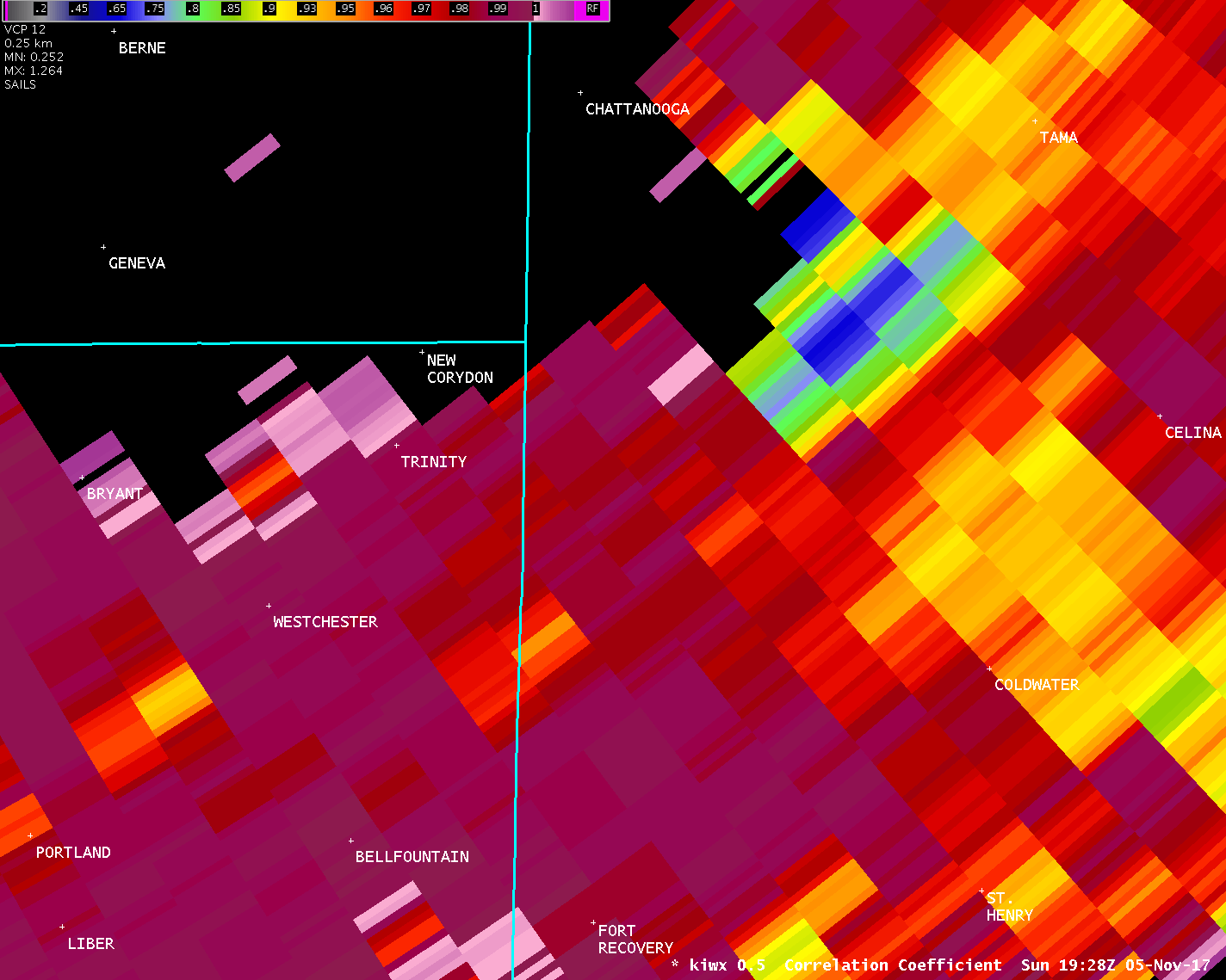
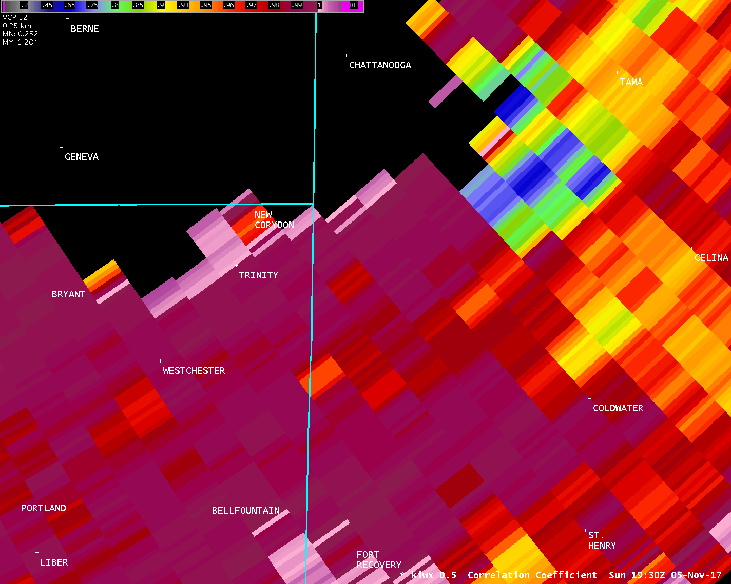
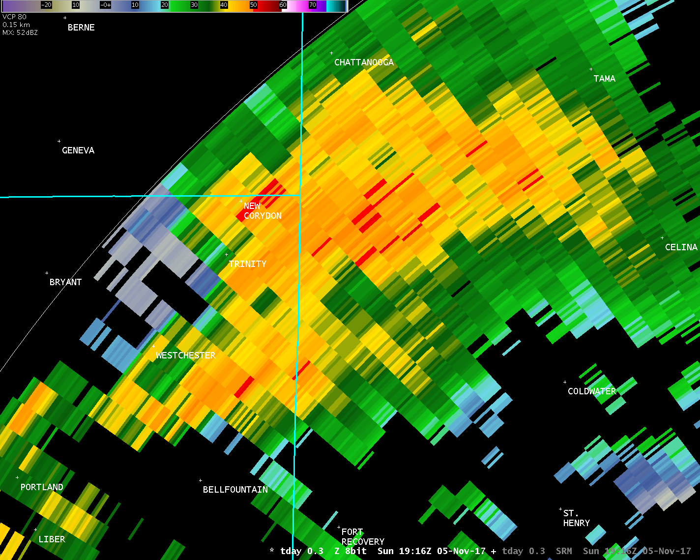
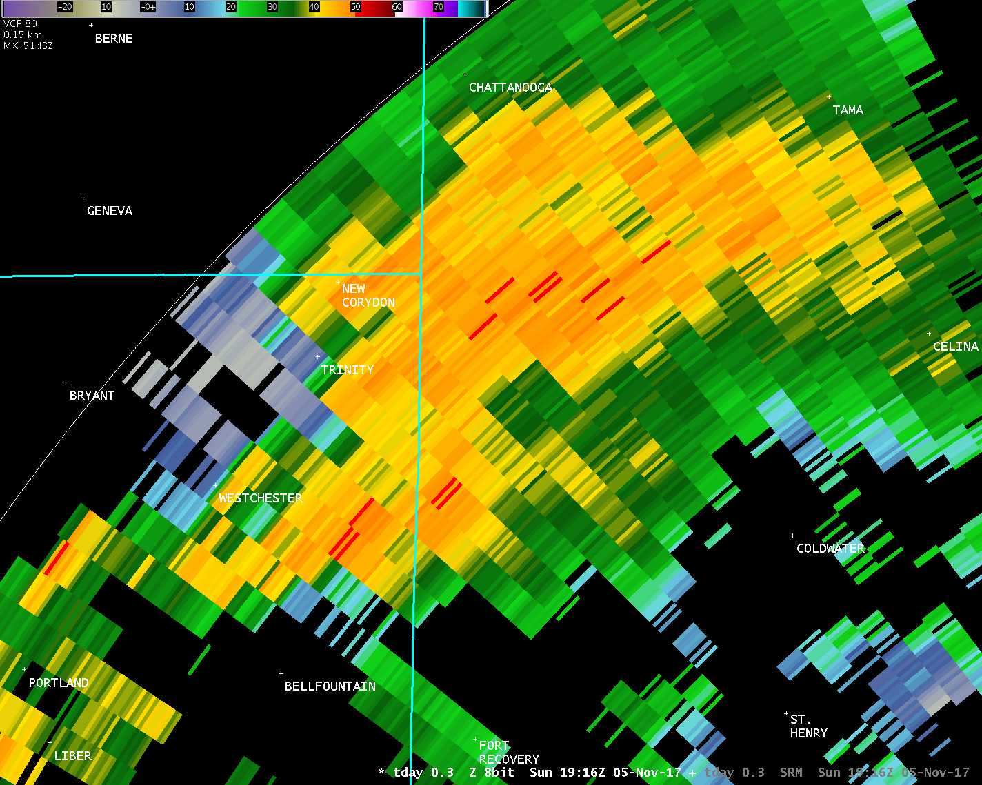
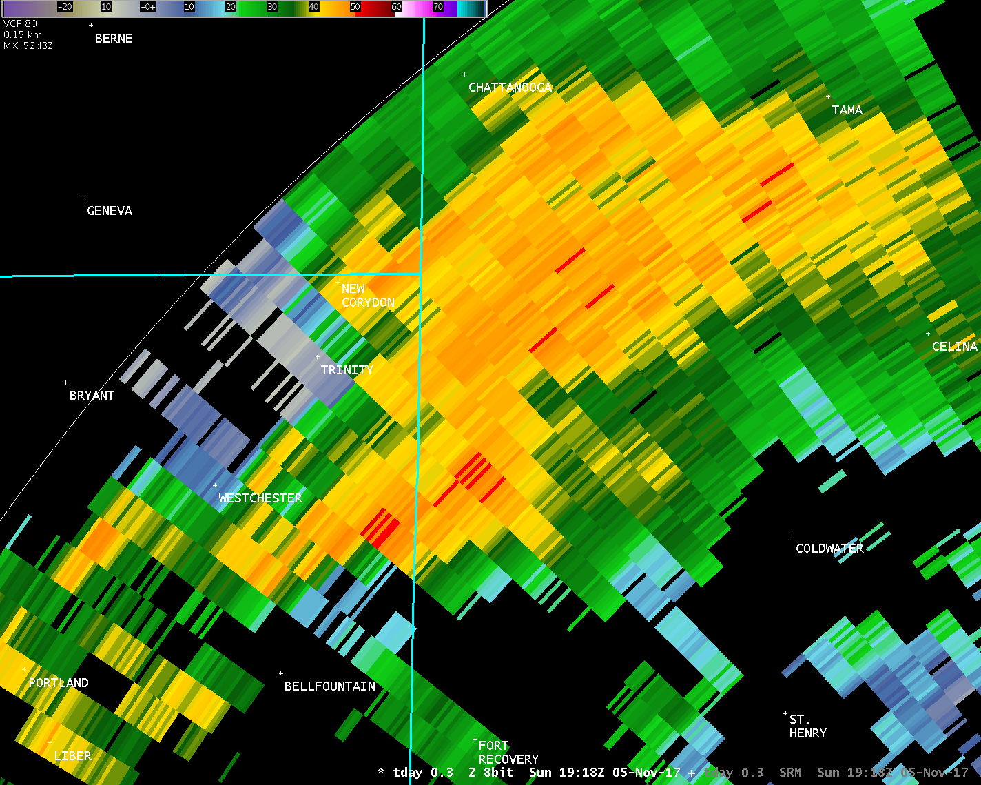
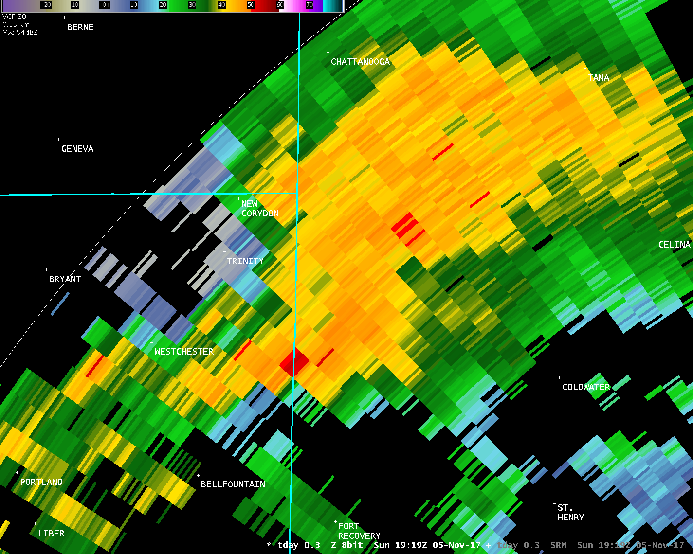
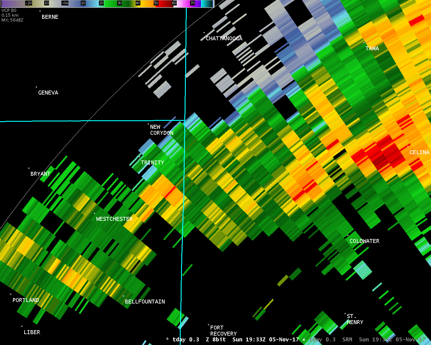
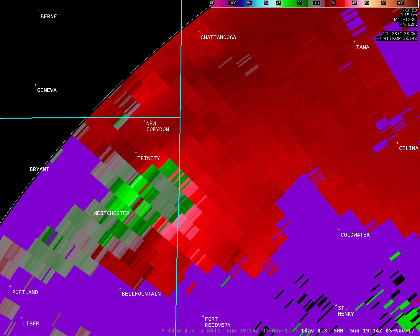
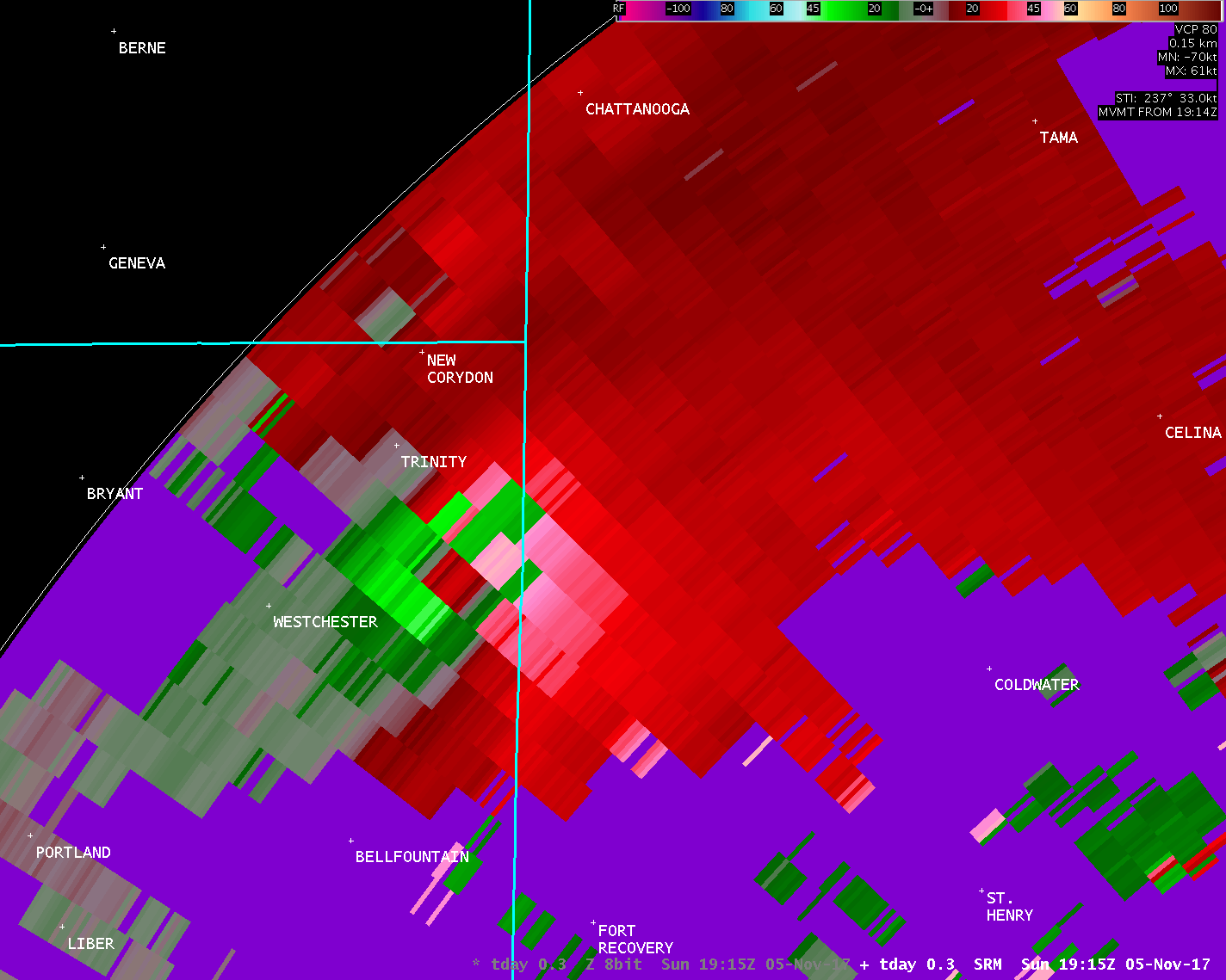
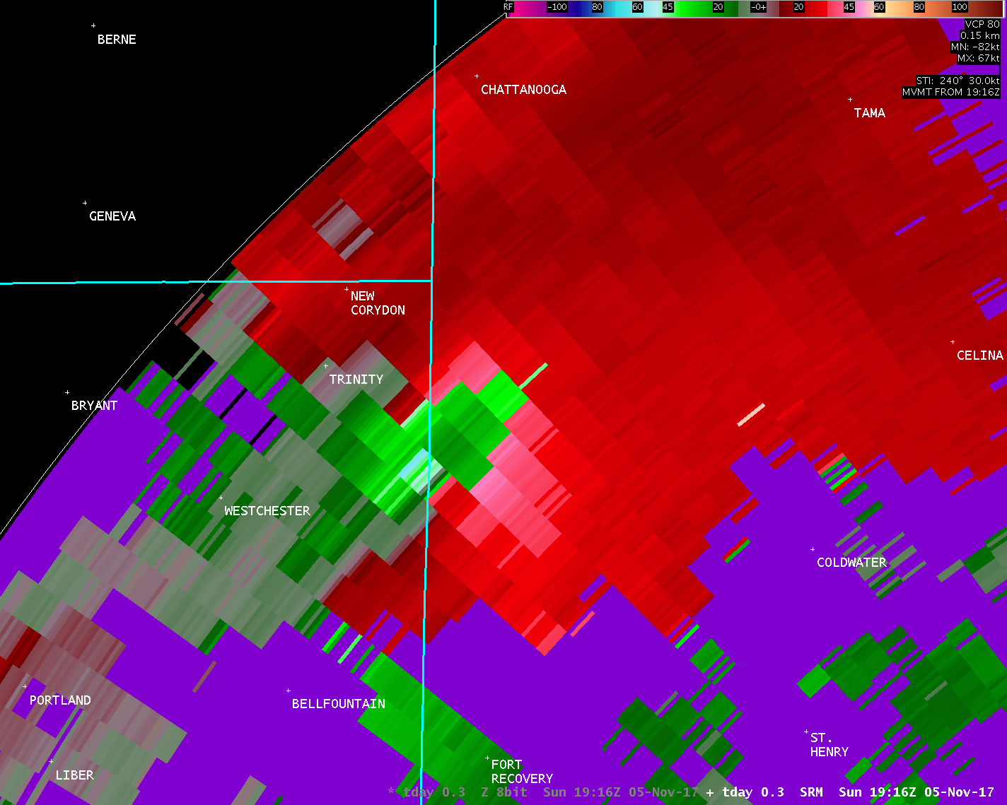
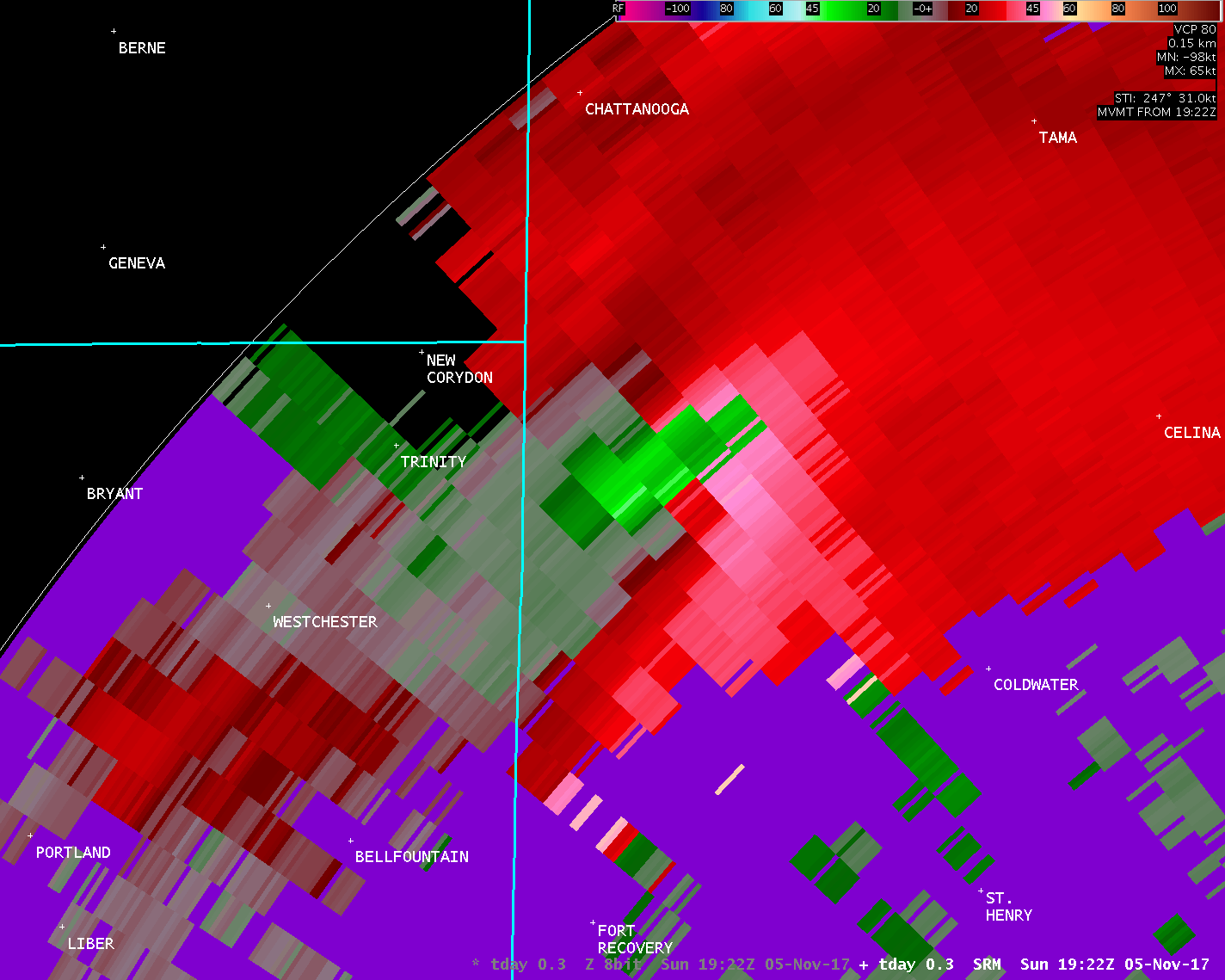
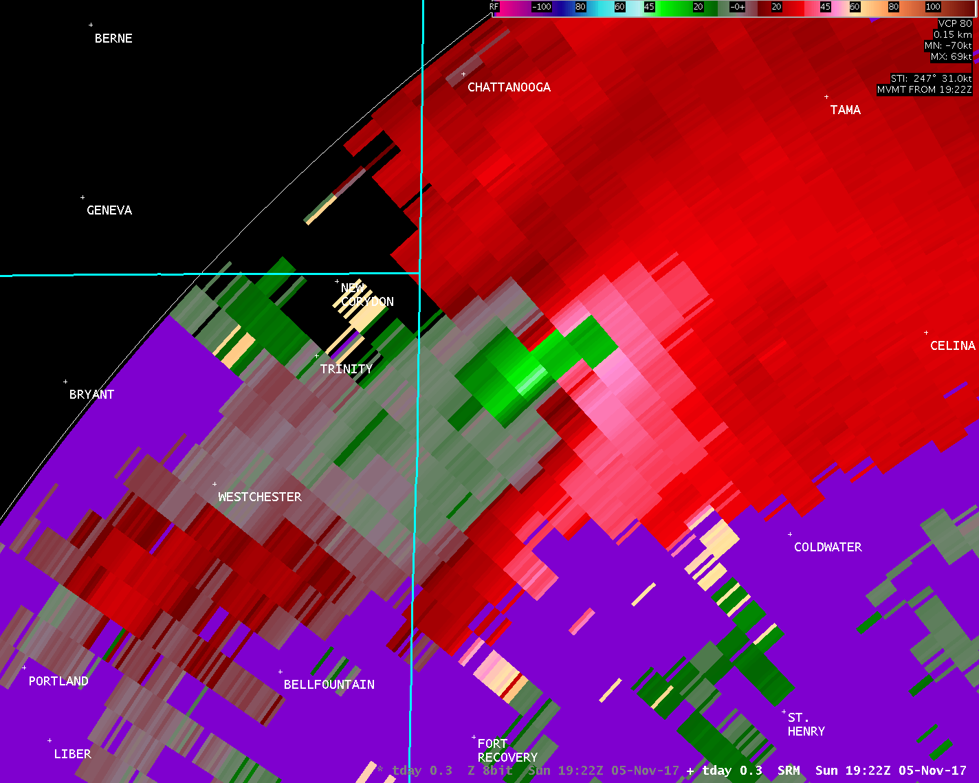
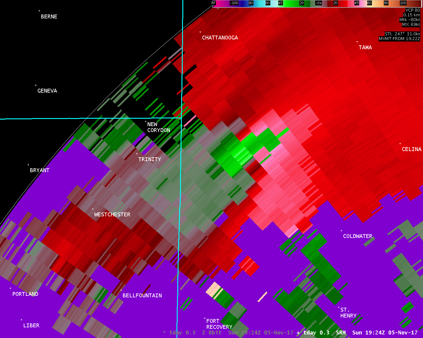
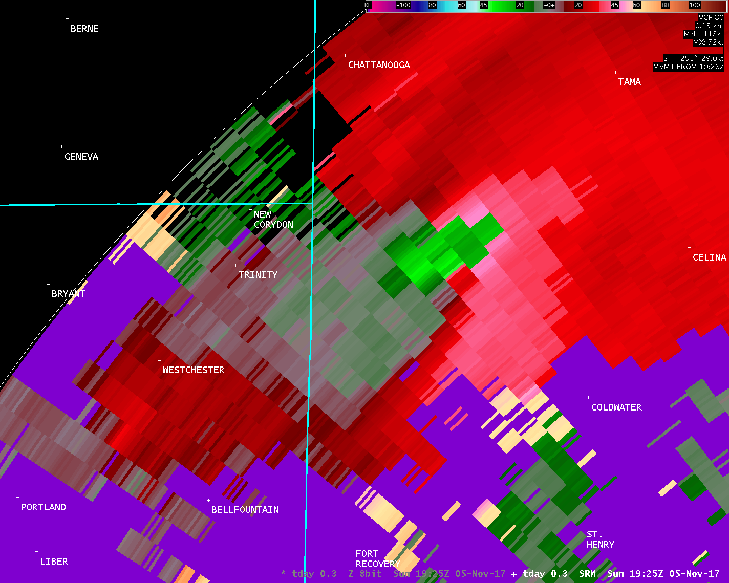
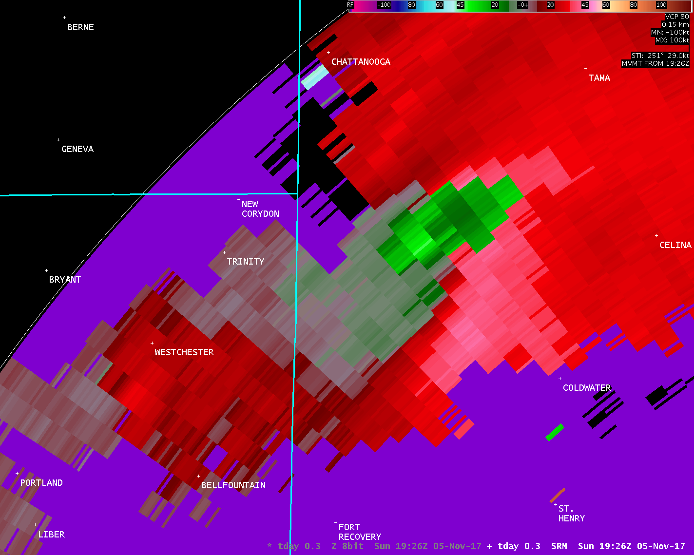
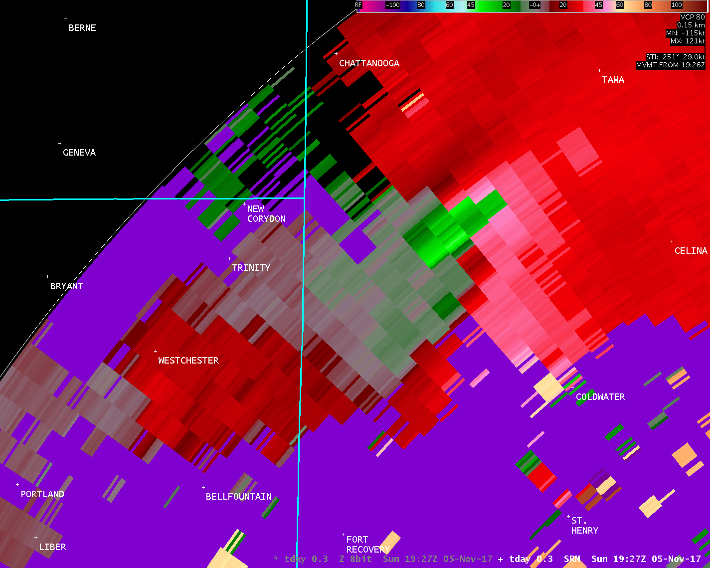
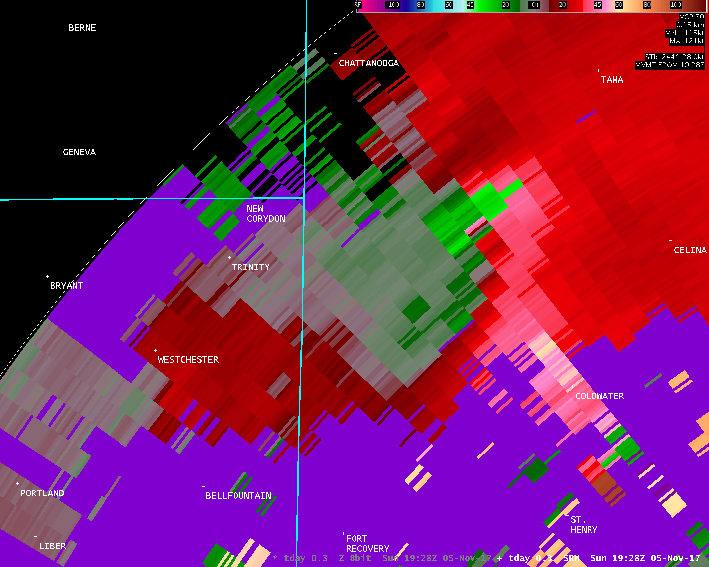
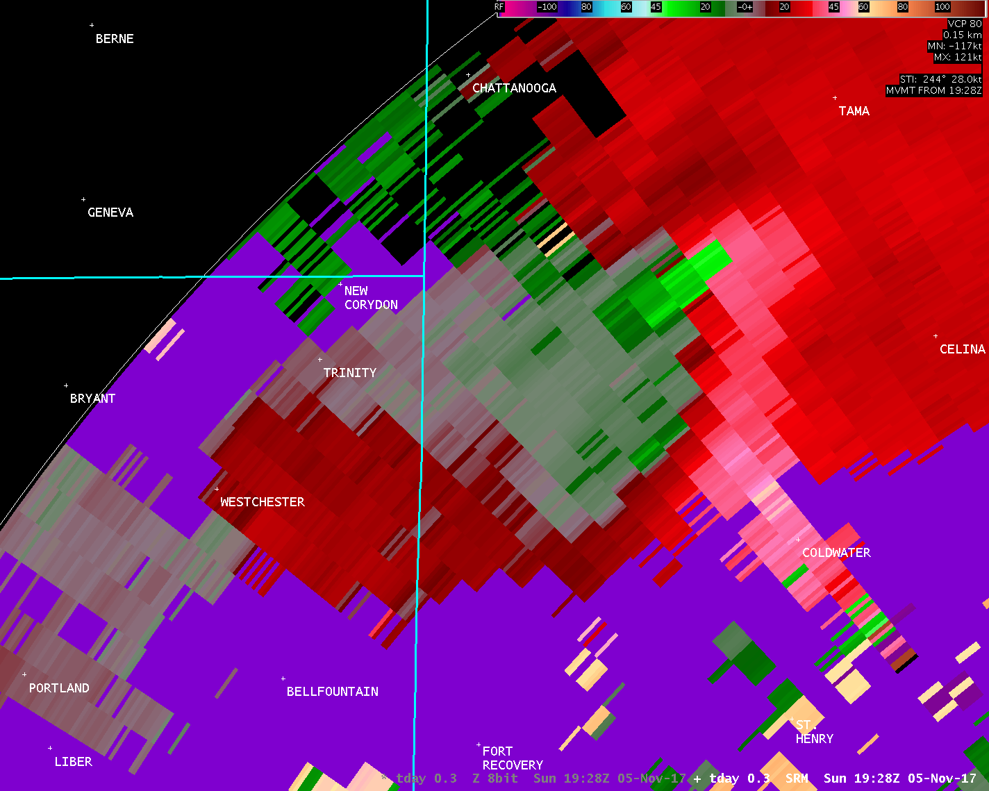
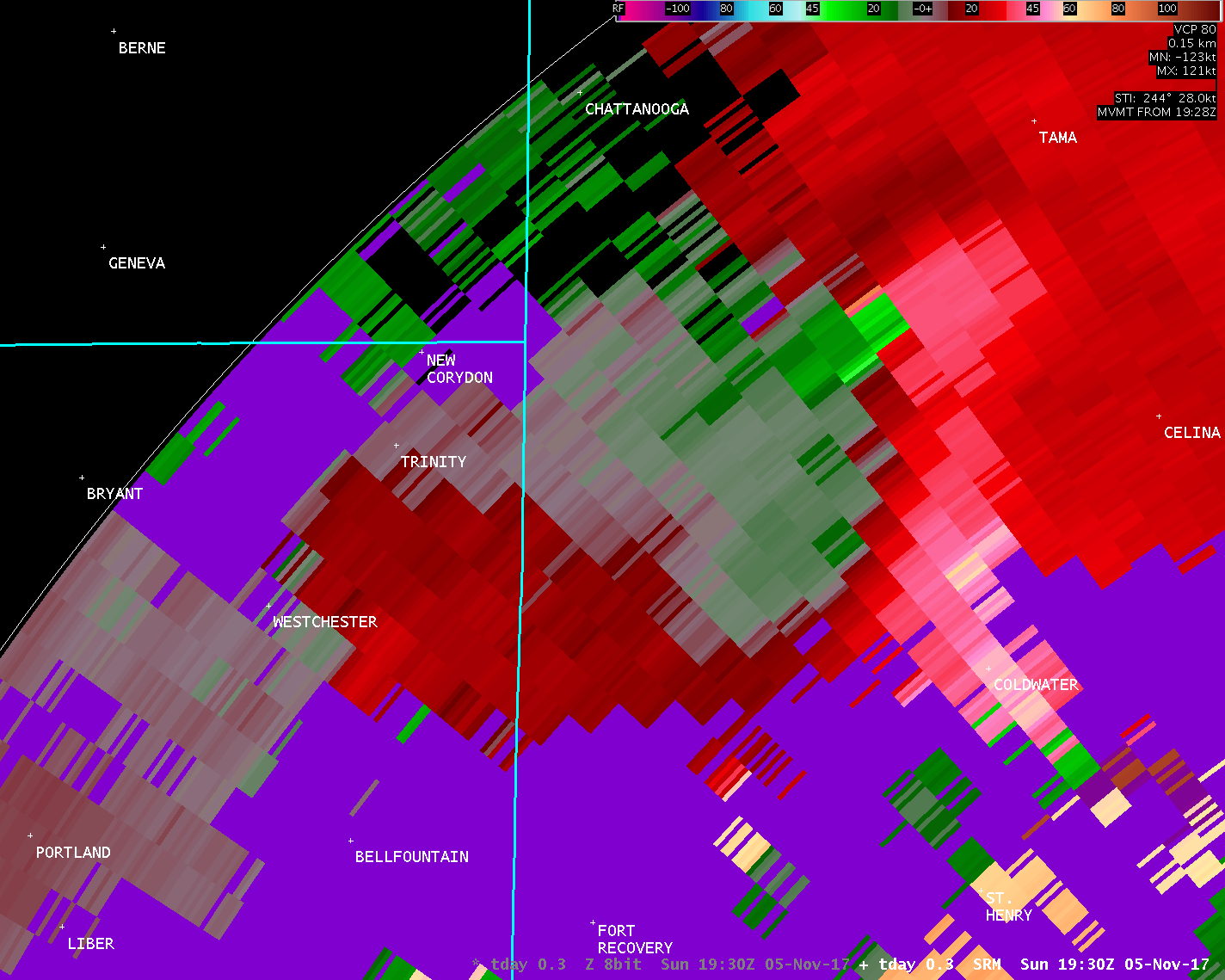
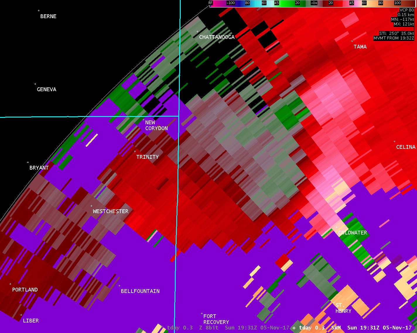
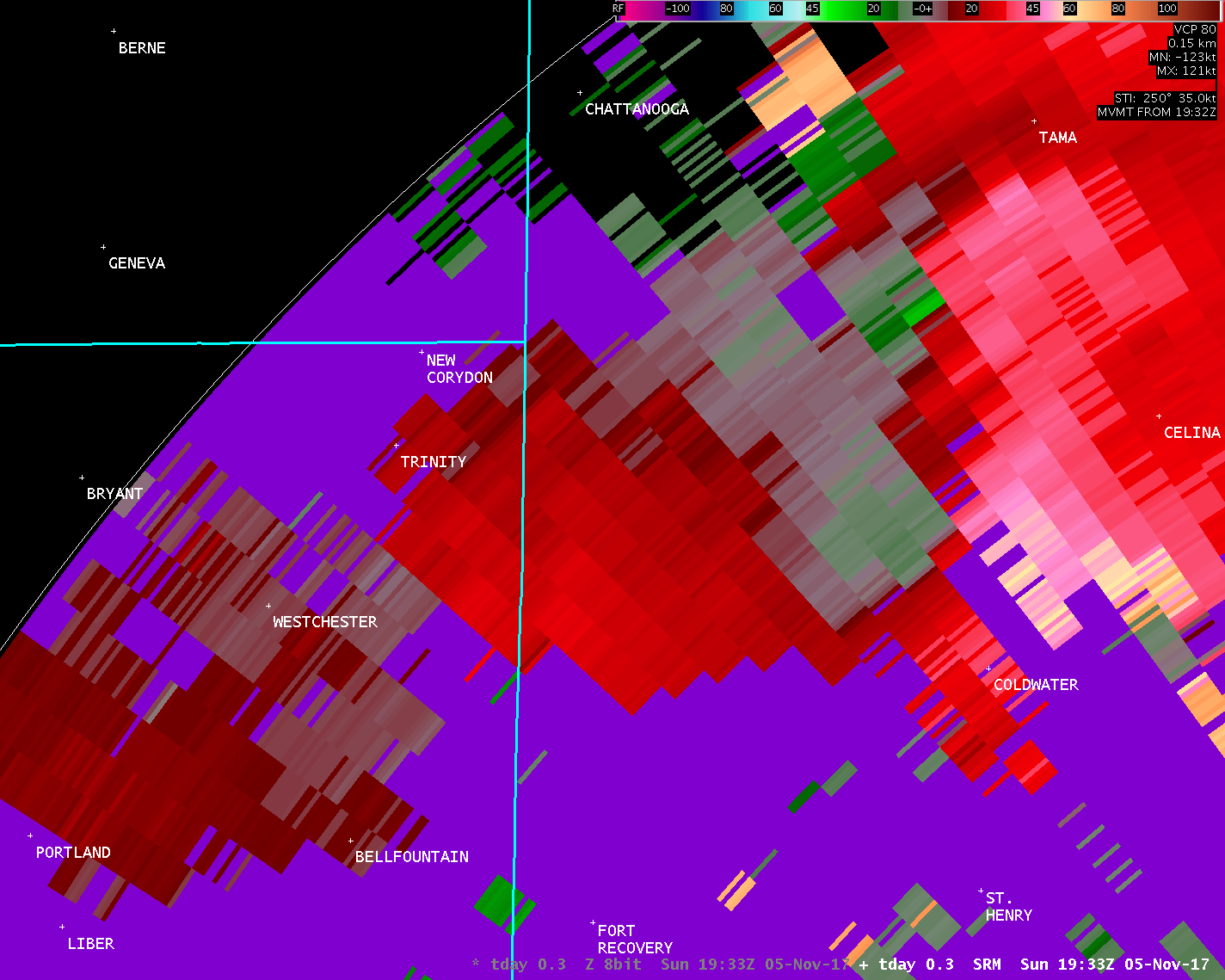
...TORNADO CONFIRMED IN WESTERN MERCER COUNTY OHIO...
Location...Western Mercer County Ohio
Date...November 5 2017
Estimated Start Time...218 PM
Estimated End Time.....230 PM
Maximum EF-Scale Rating...EF2
Estimated Maximum Wind Speed...120 MPH
Maximum Path Width...500 Yards
Path Length...8.1 Miles
Beginning Lat/Lon...40.5092N / 84.8028W
Ending lat/Lon......40.5687N / 84.6711W
* Fatalities...0
* Injuries.....0
* The information in this statement is preliminary and subject to
change pending final review of the event(s) and publication in
NWS Storm Data.
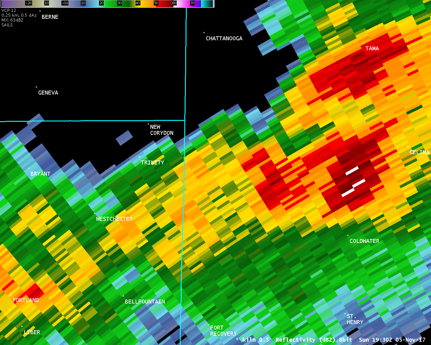
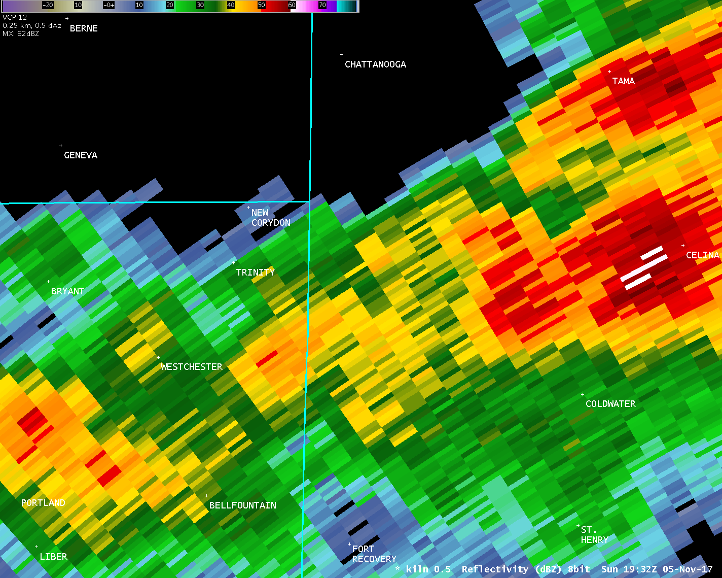
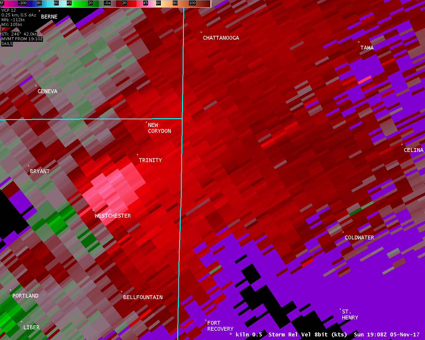
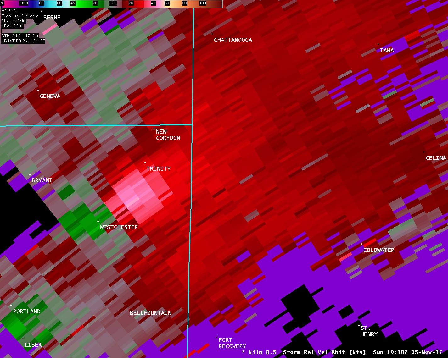
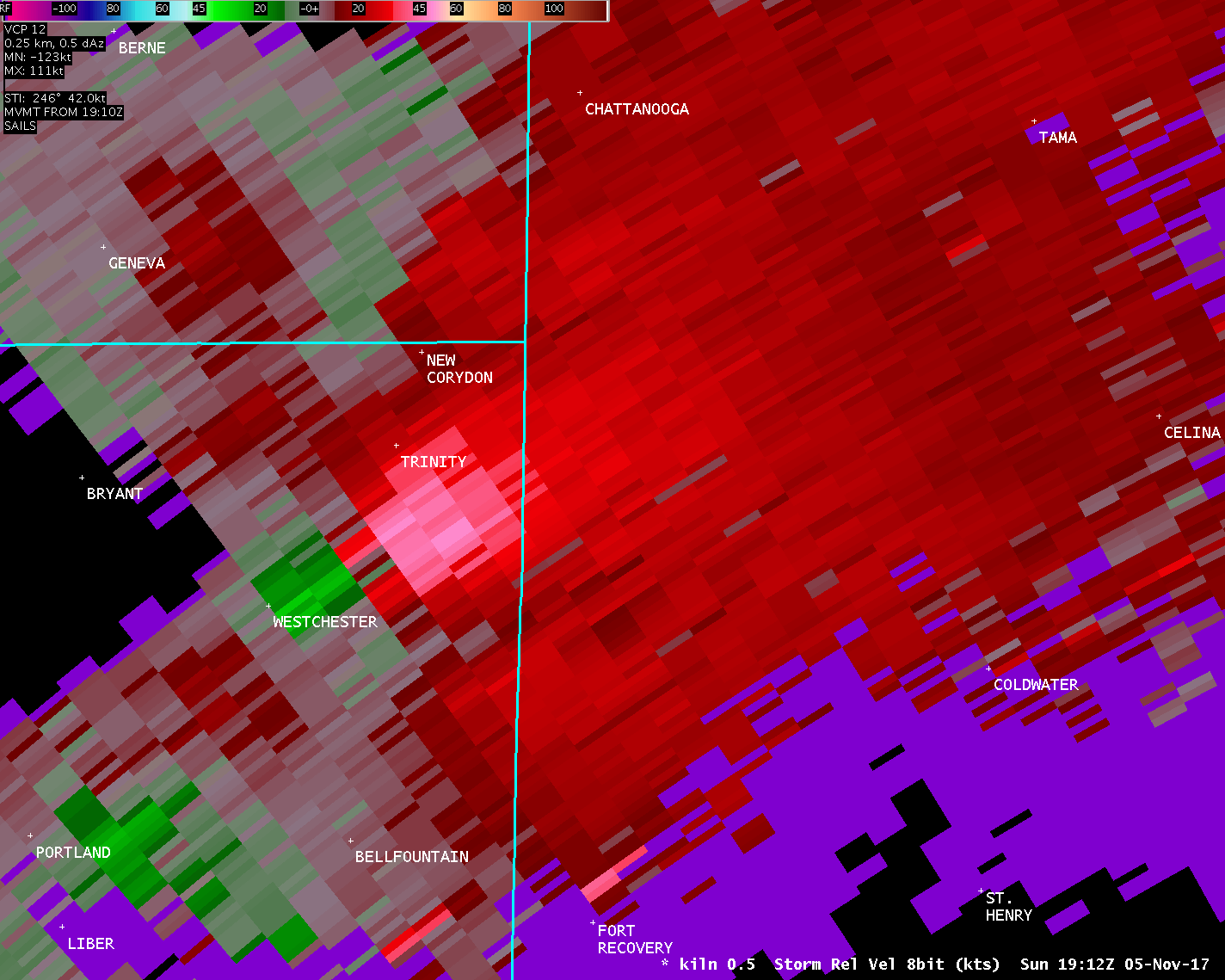
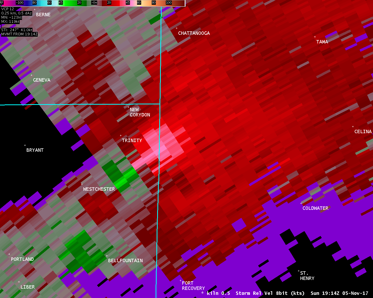
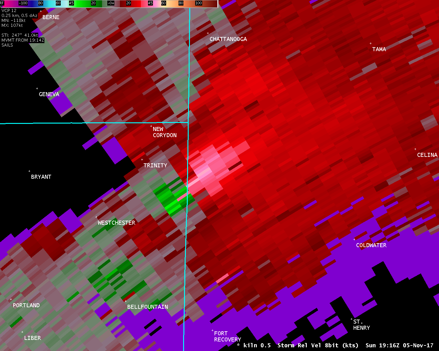
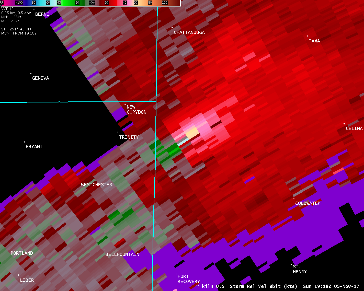
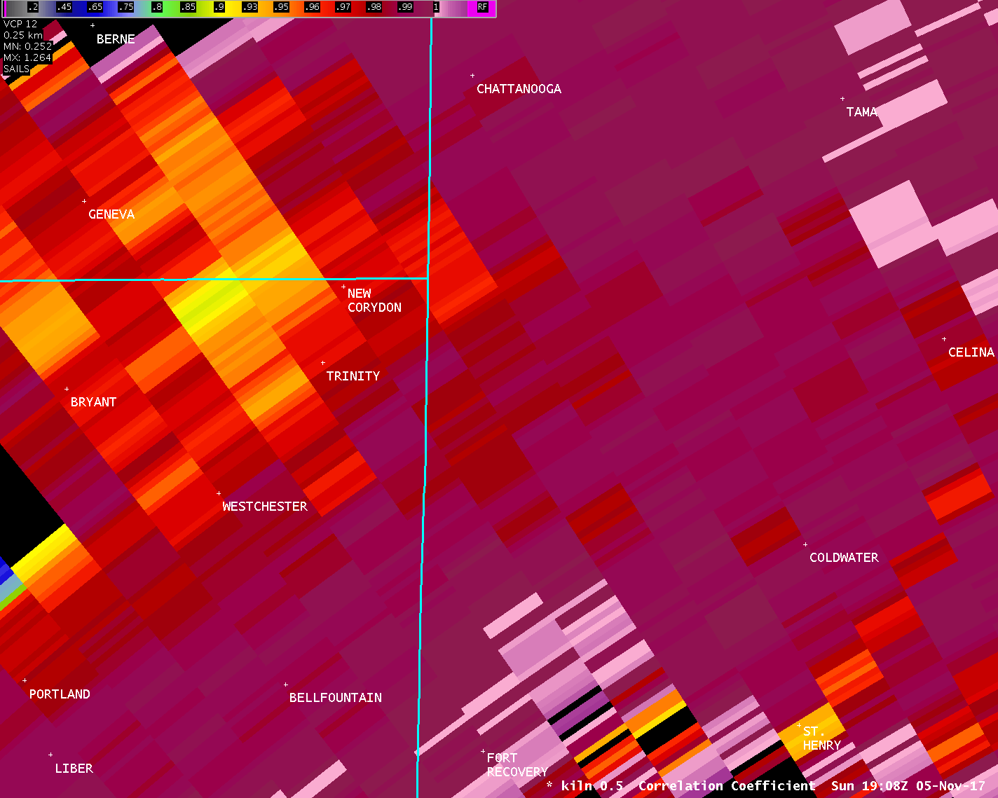
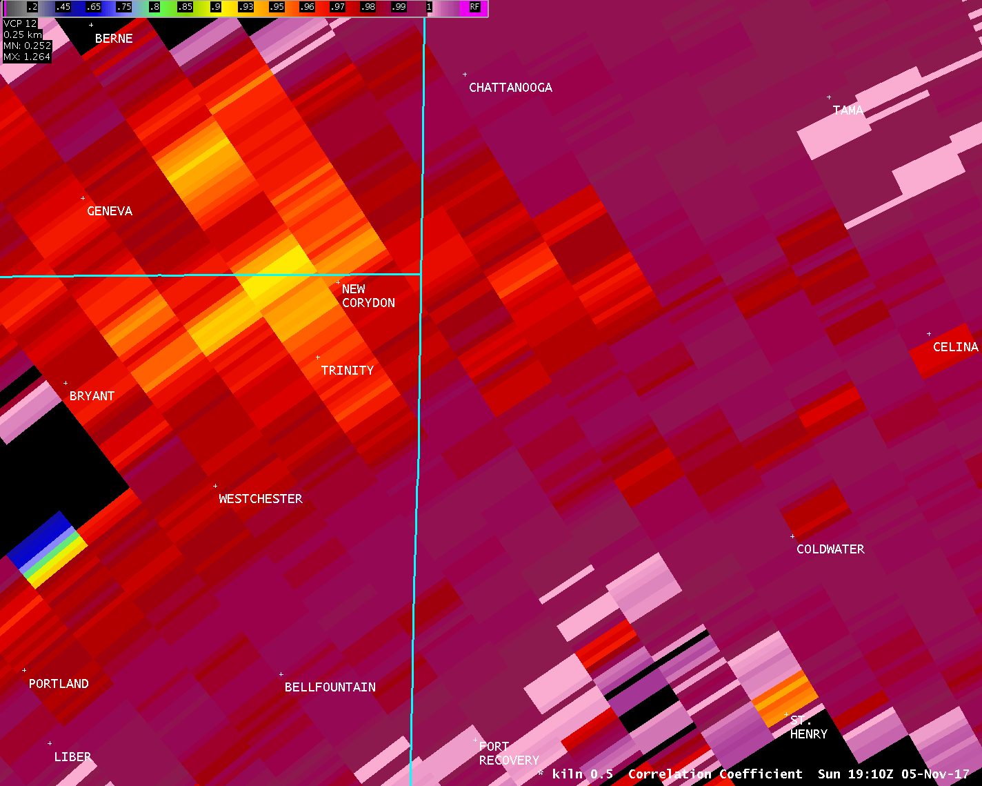
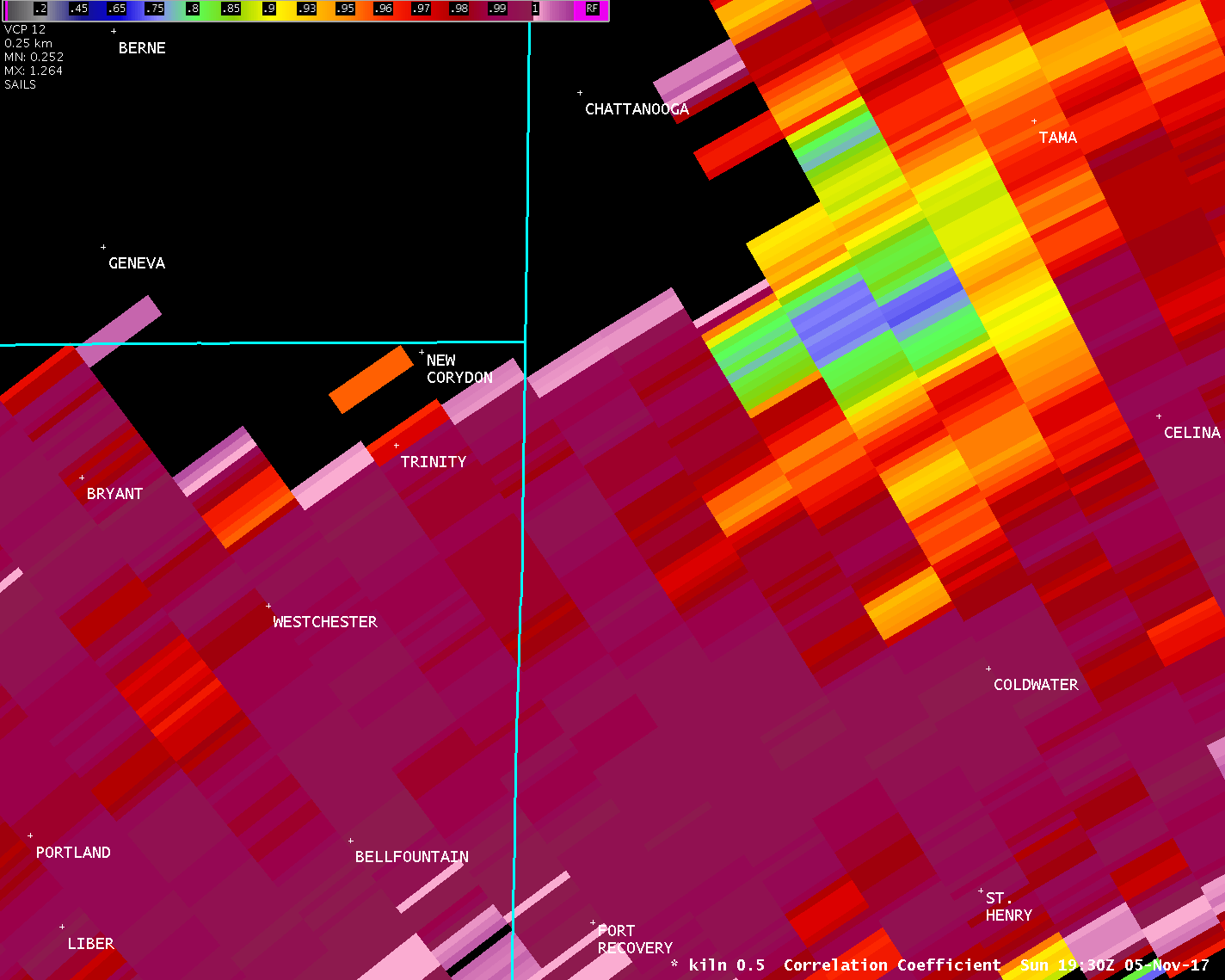
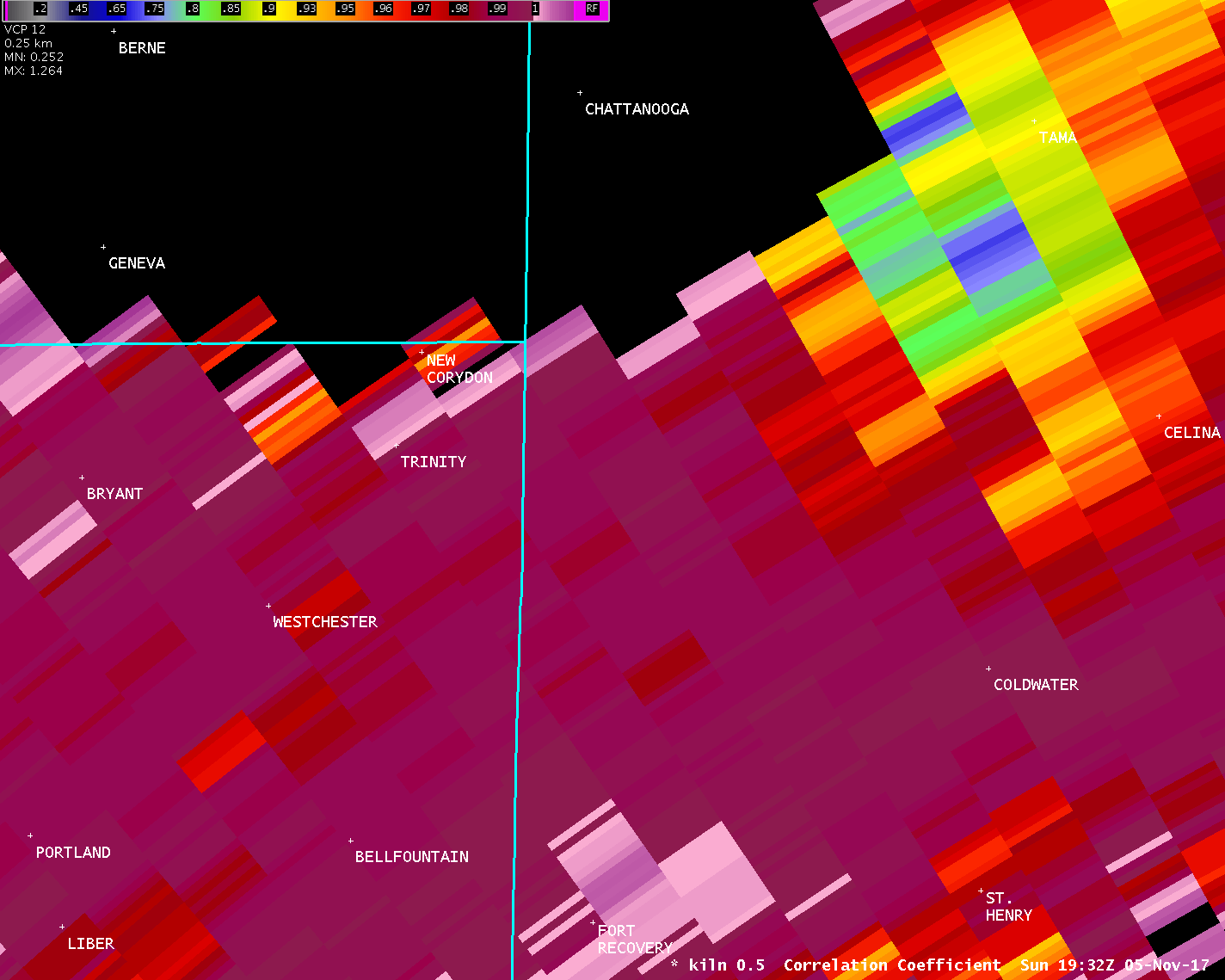
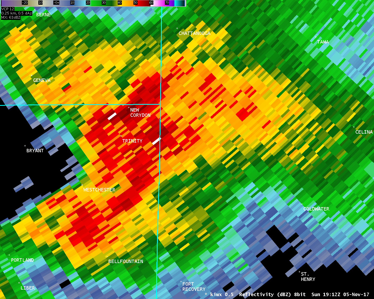
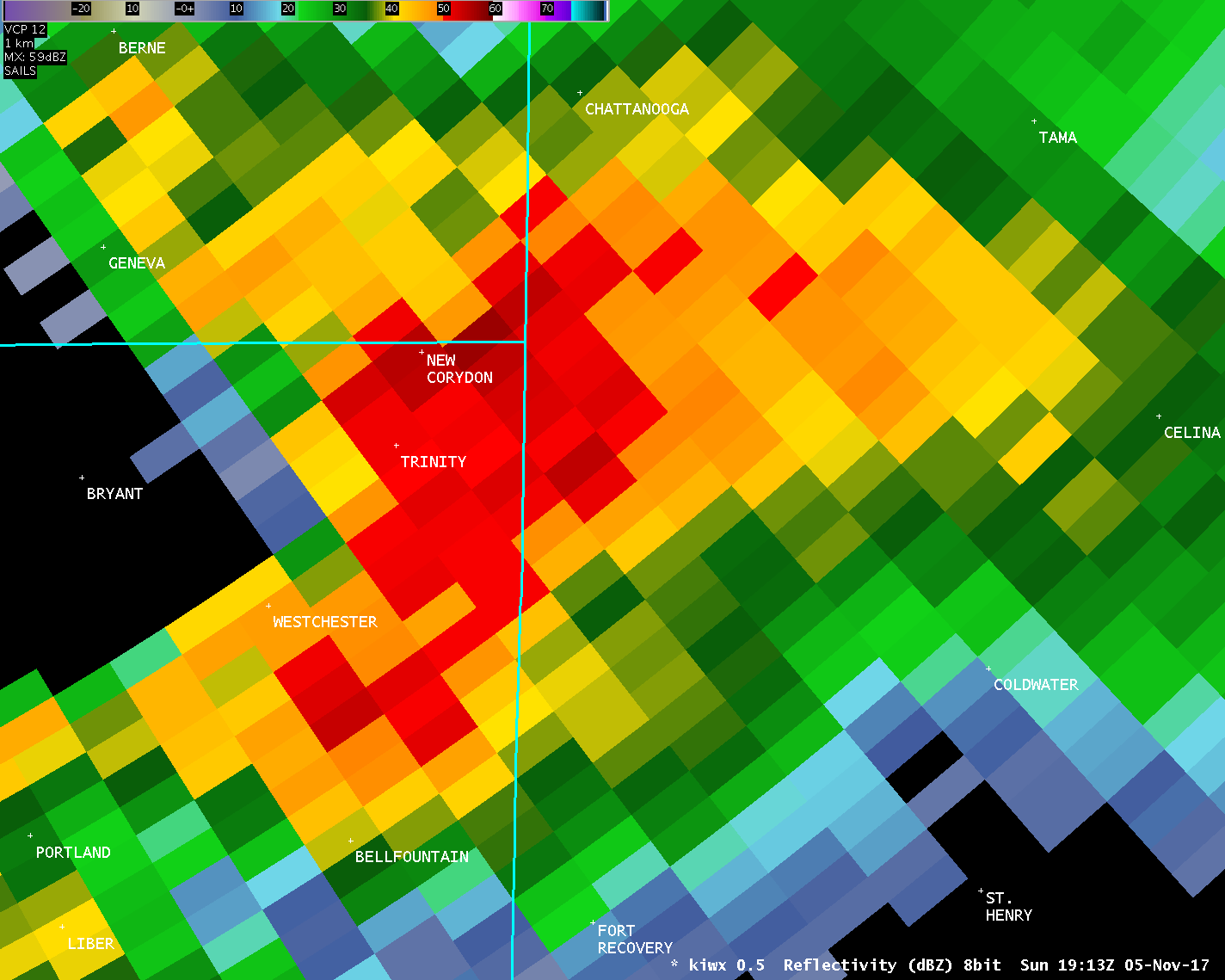
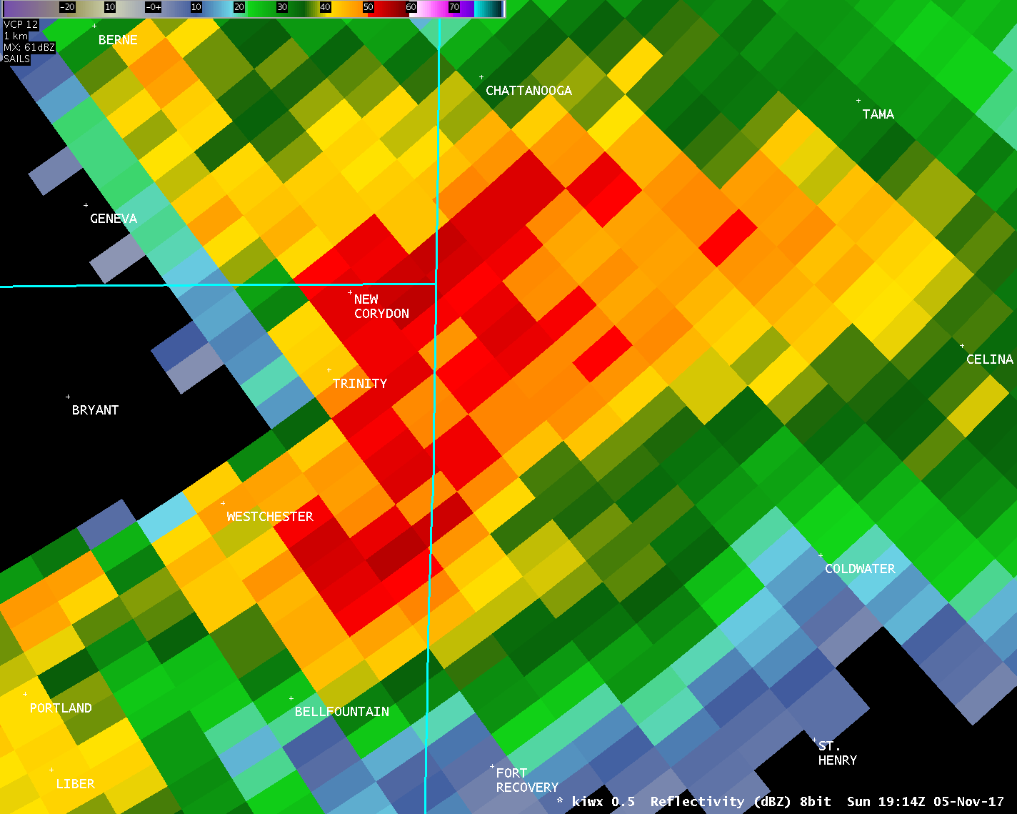
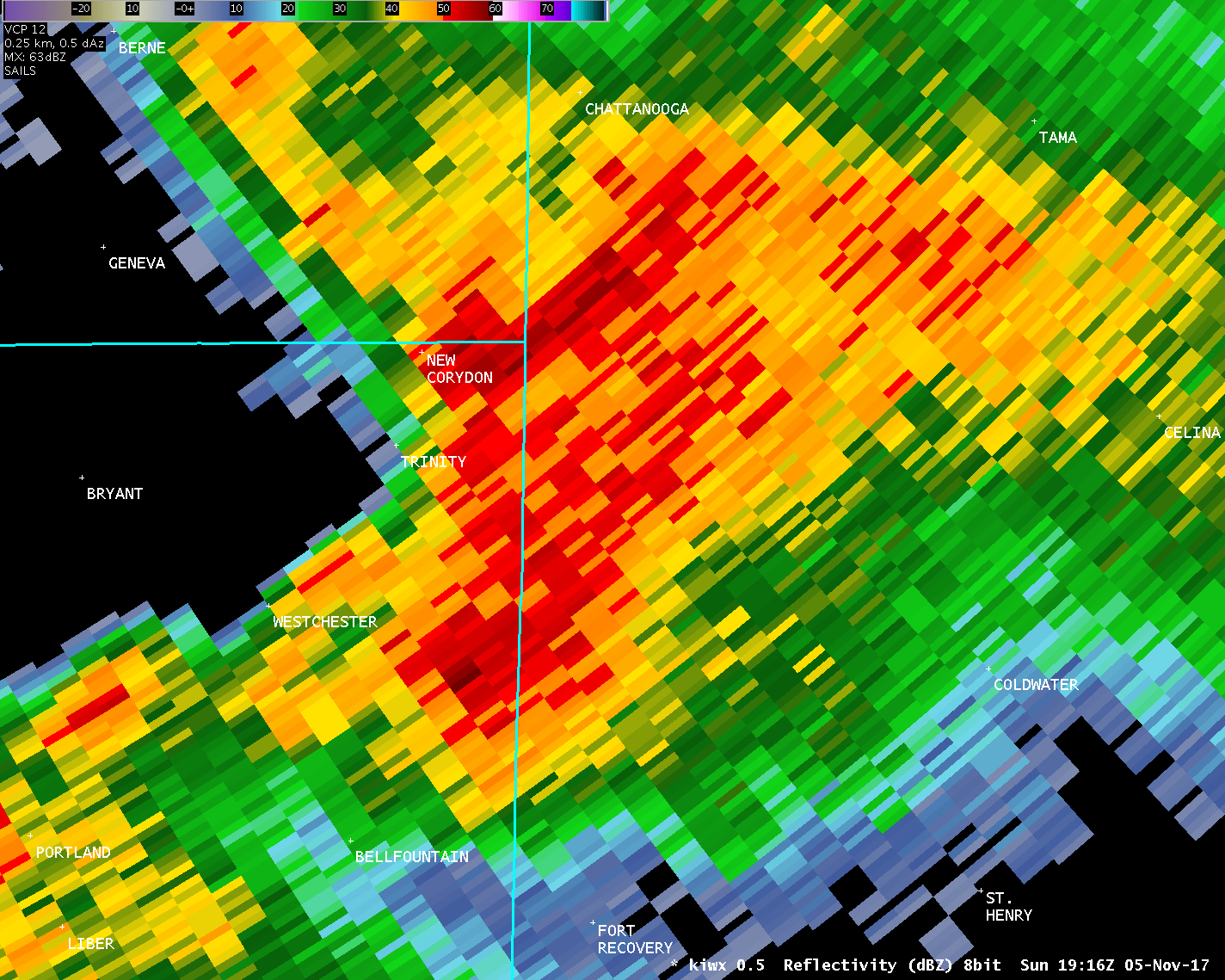
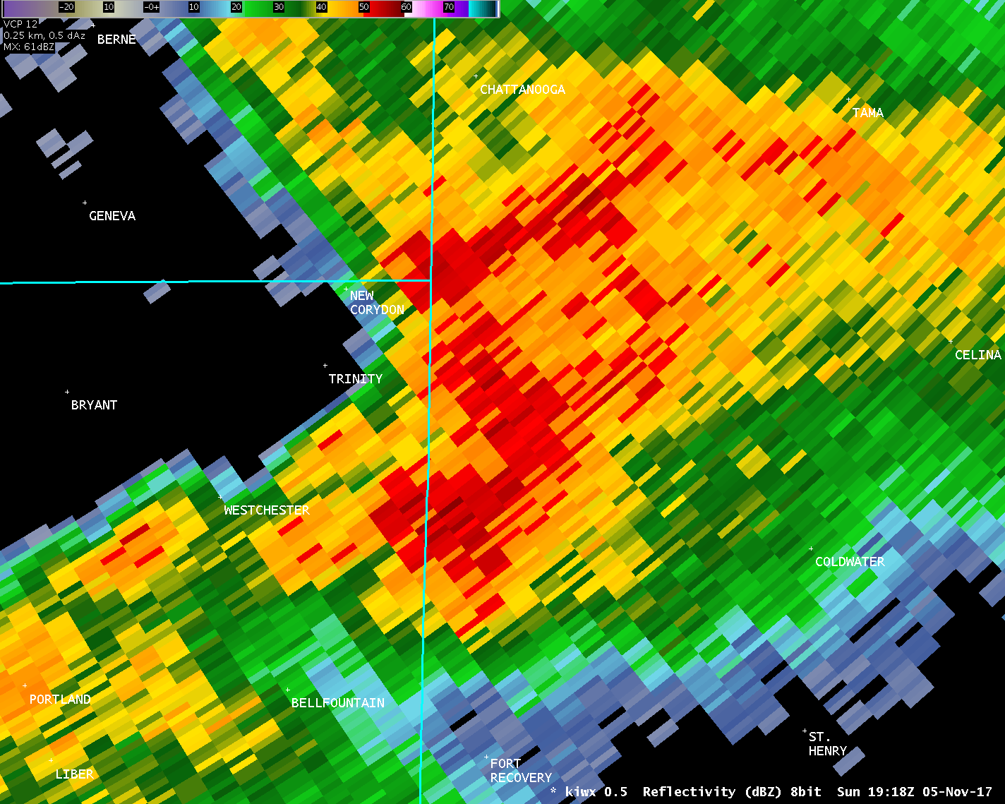
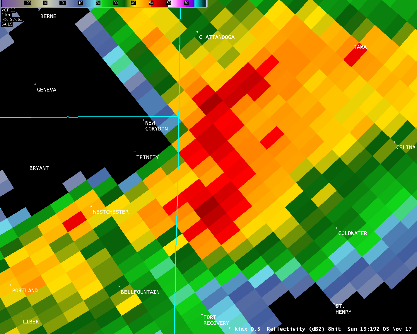
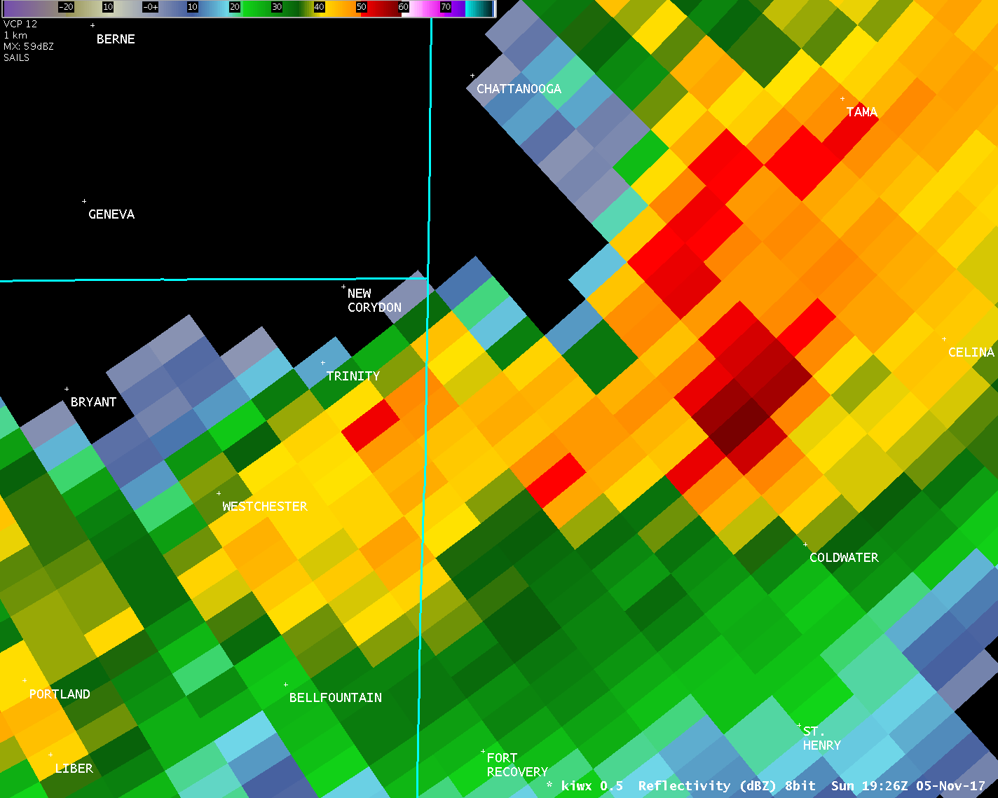
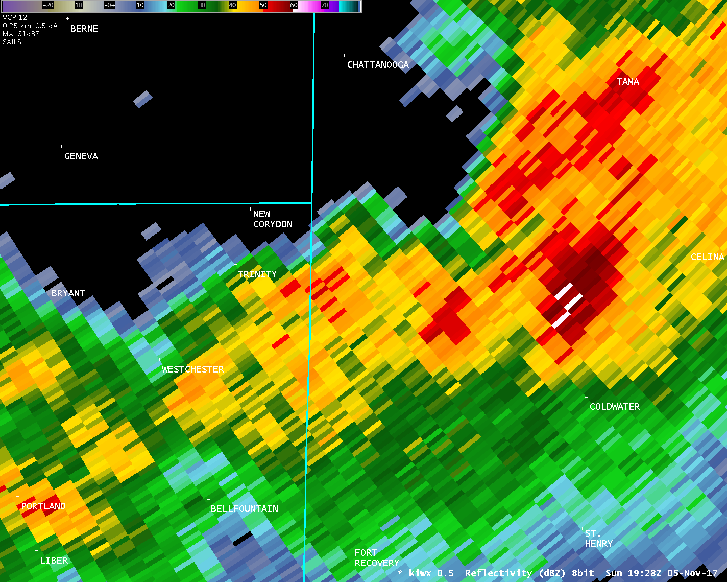
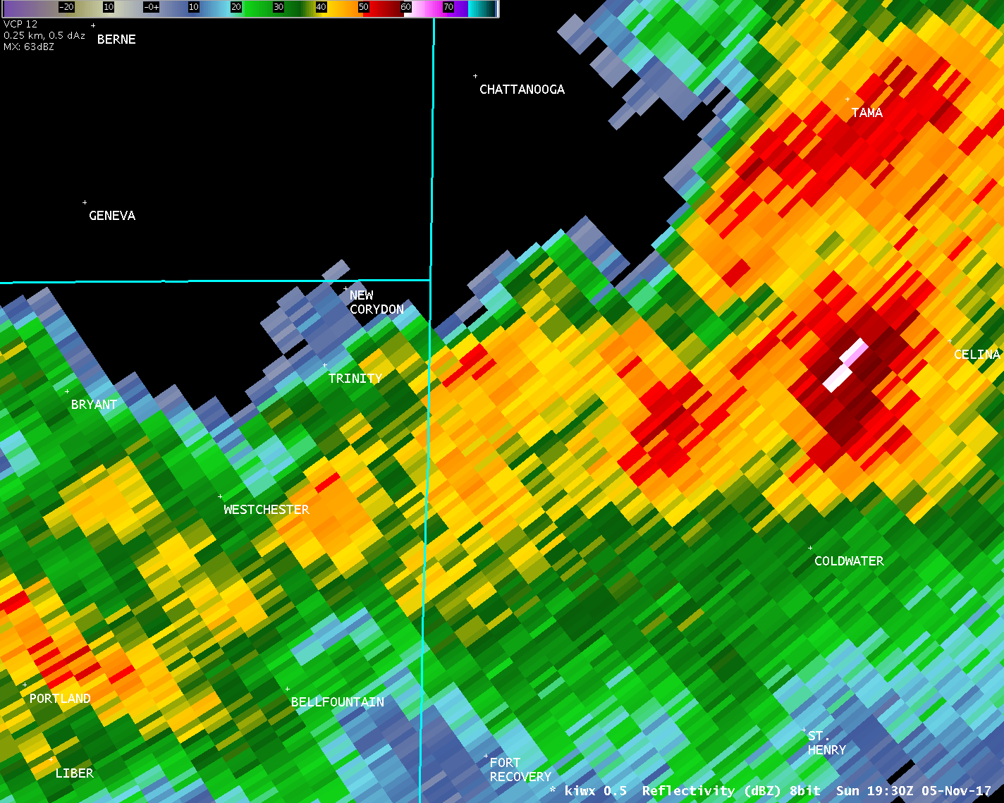
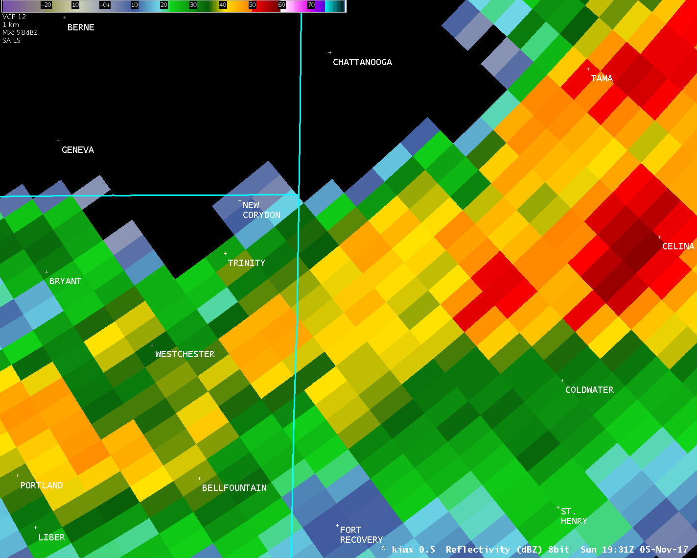
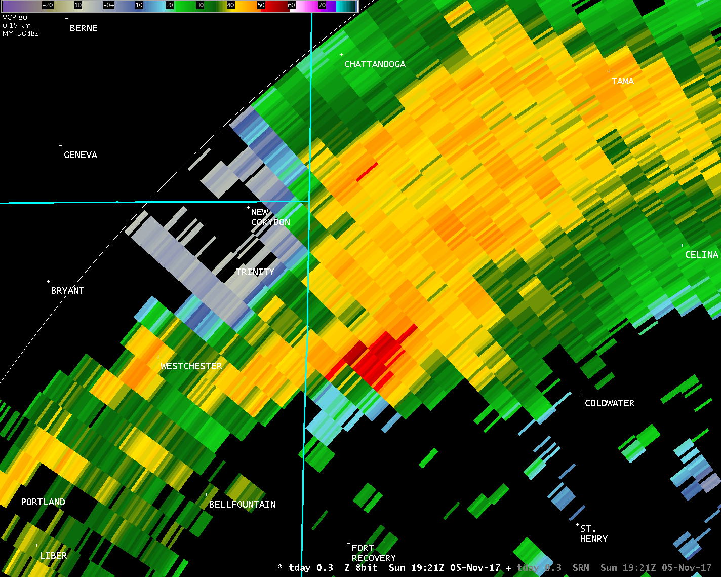
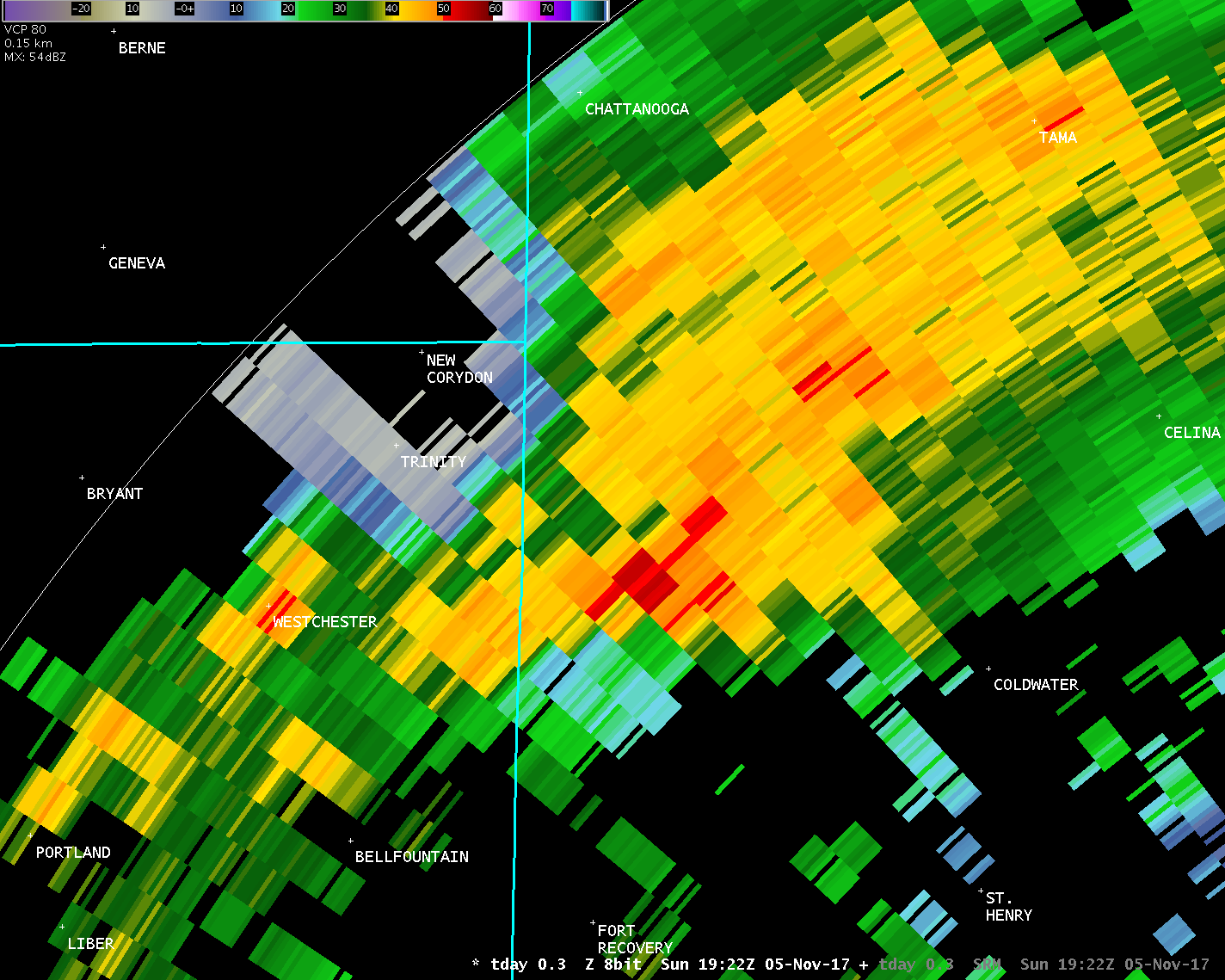
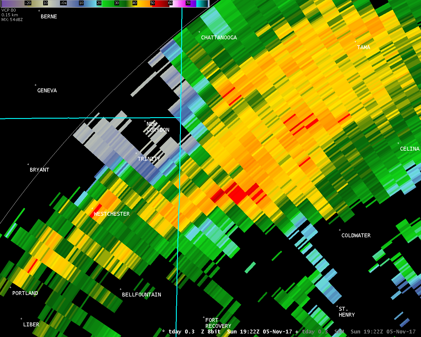
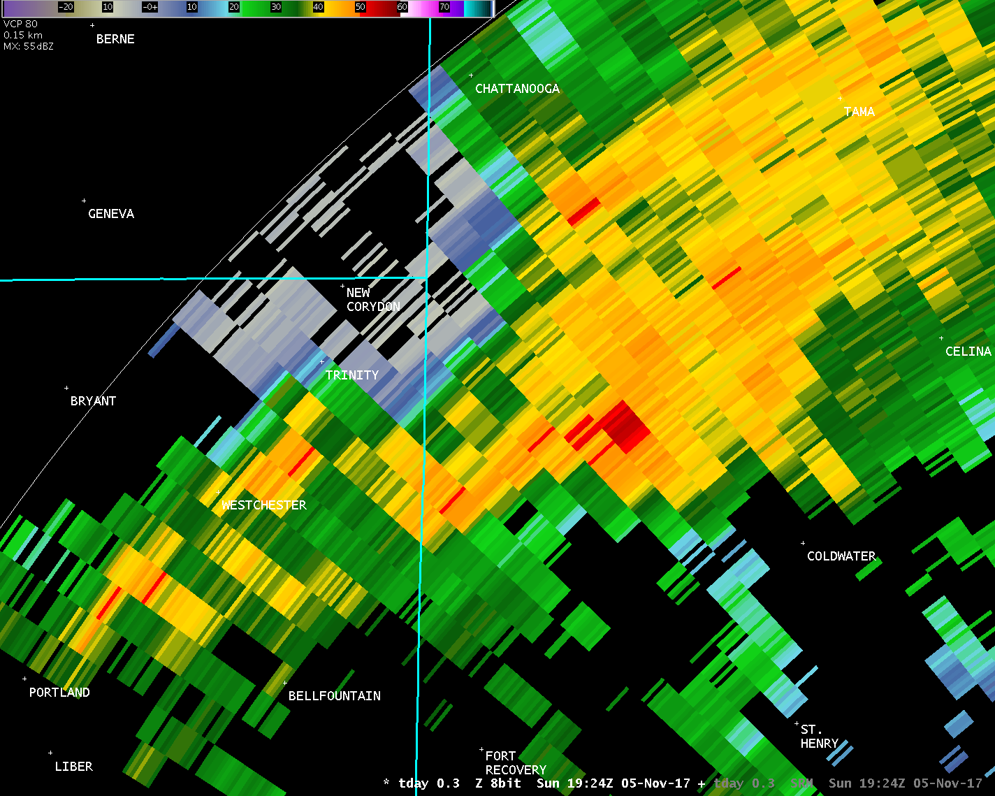
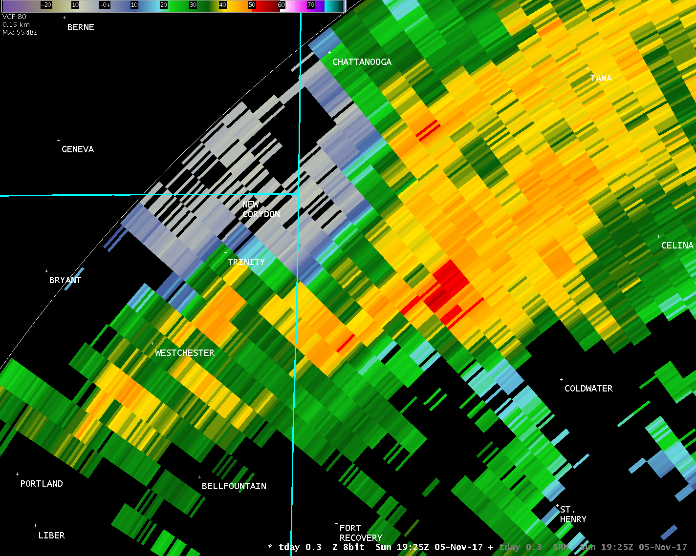
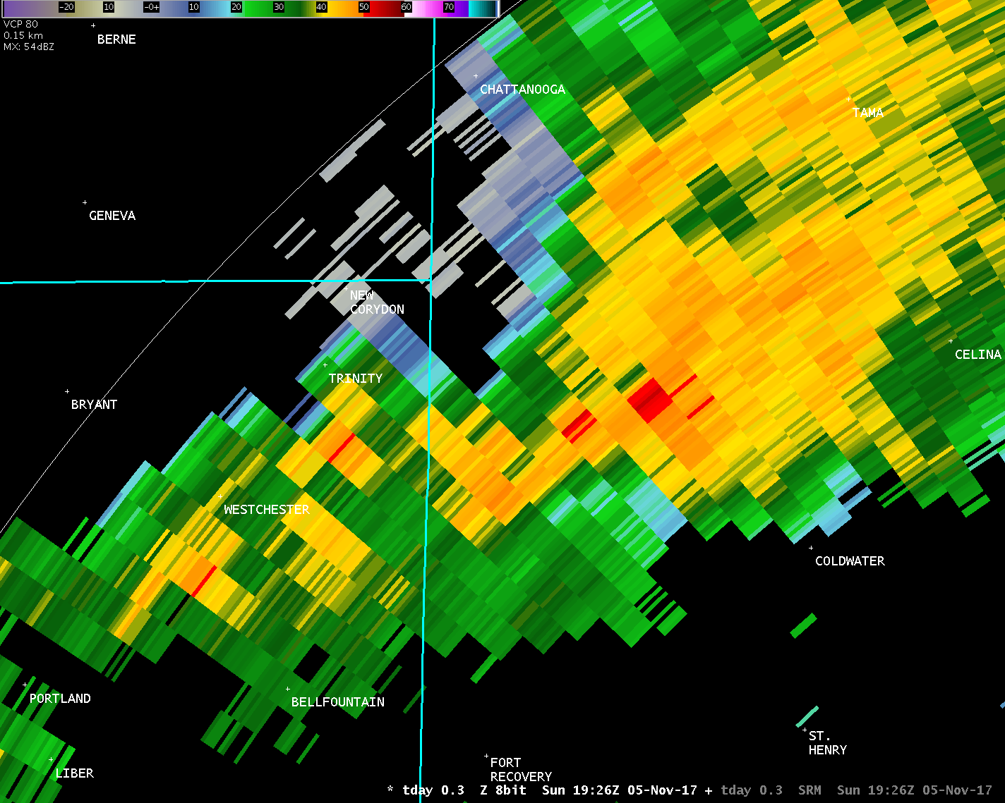
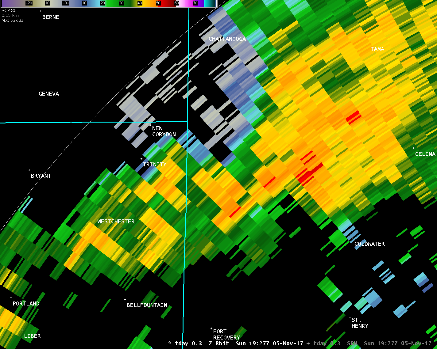
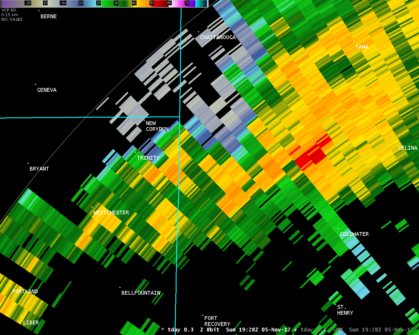
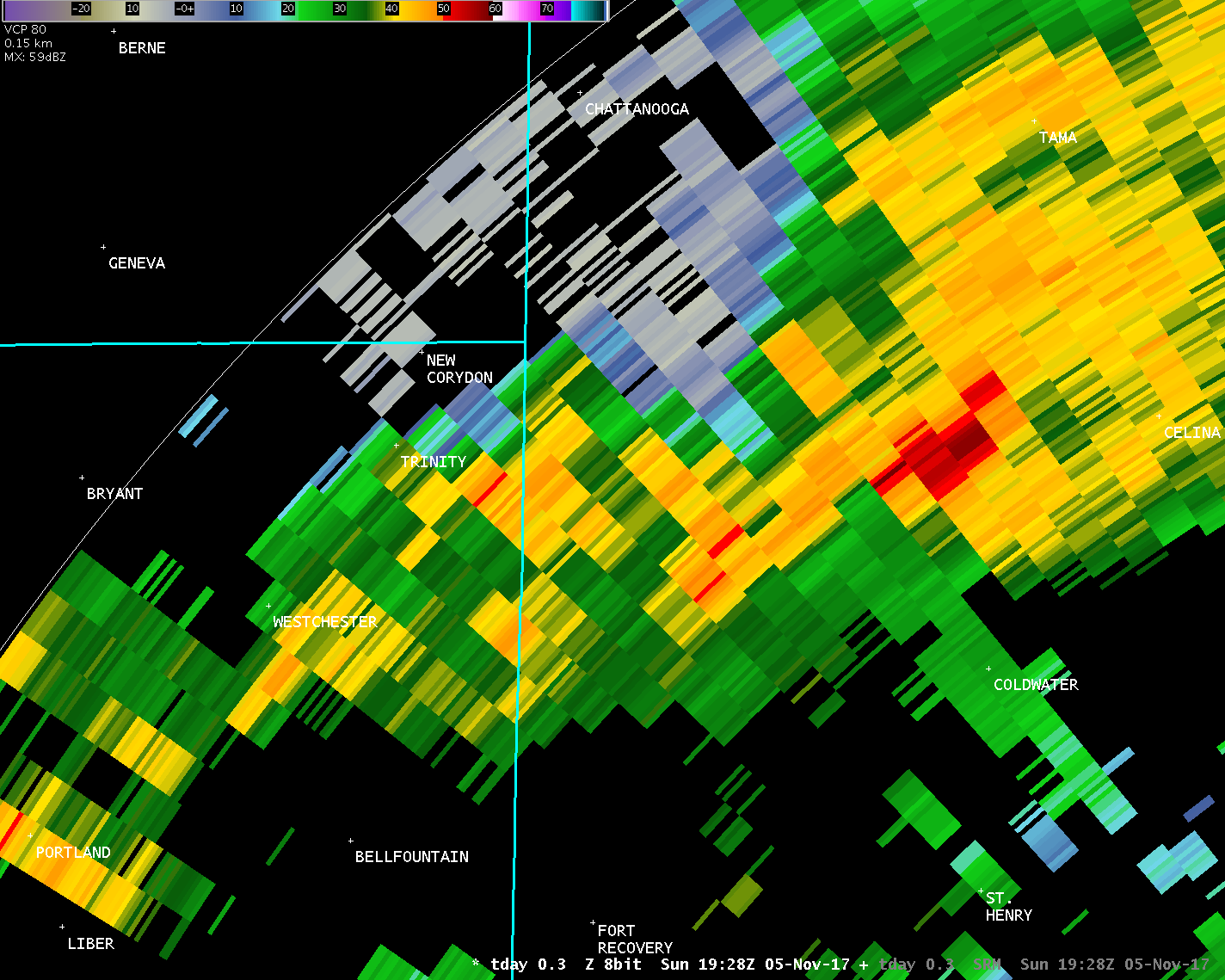
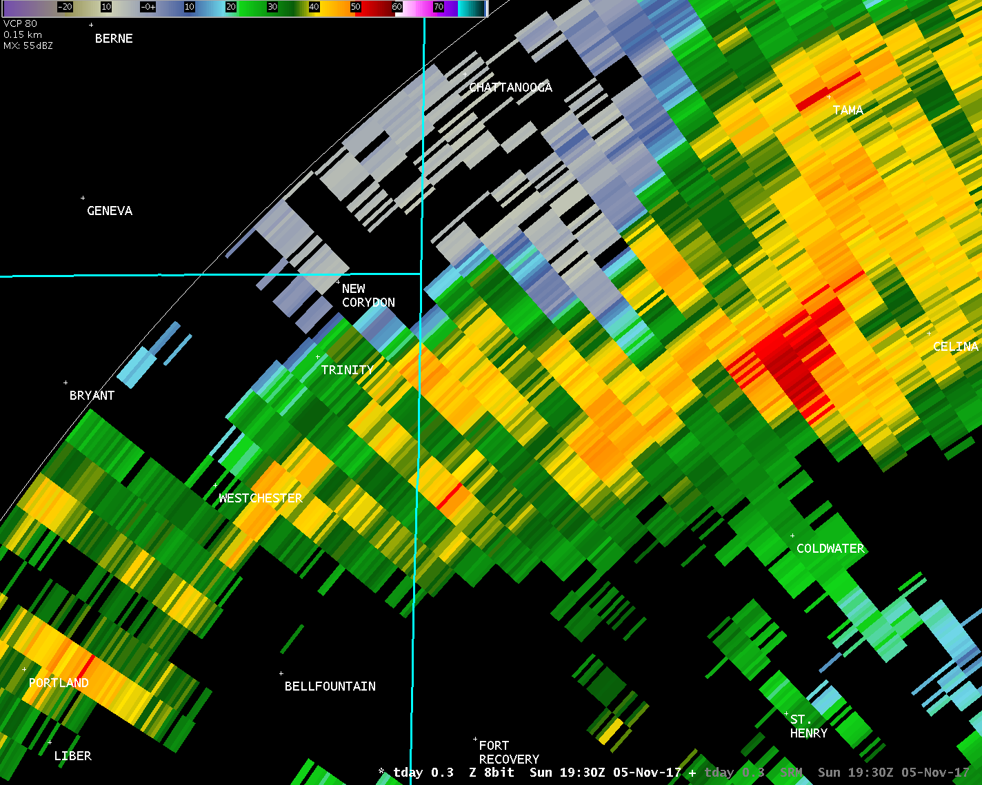
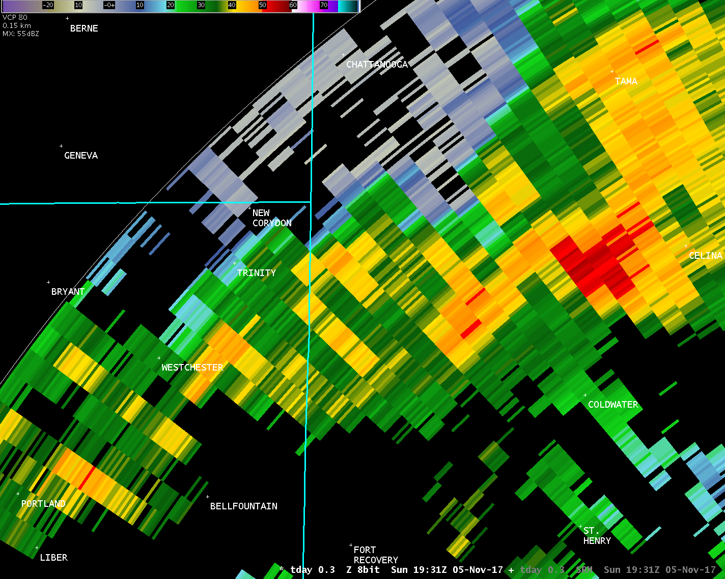
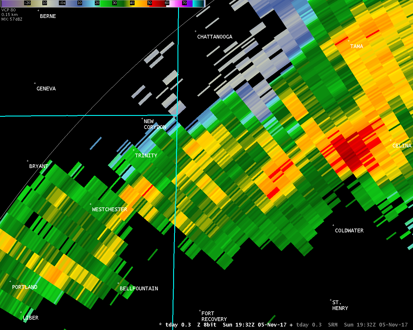
...Summary...
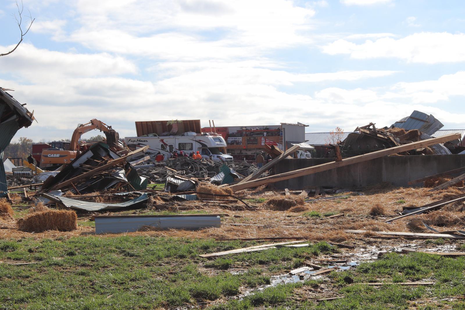
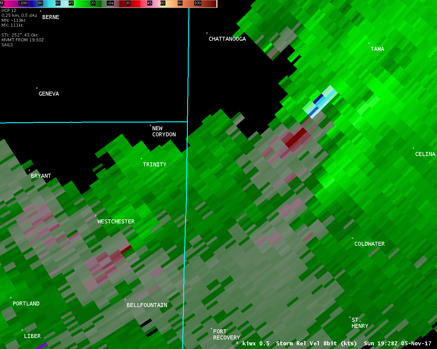
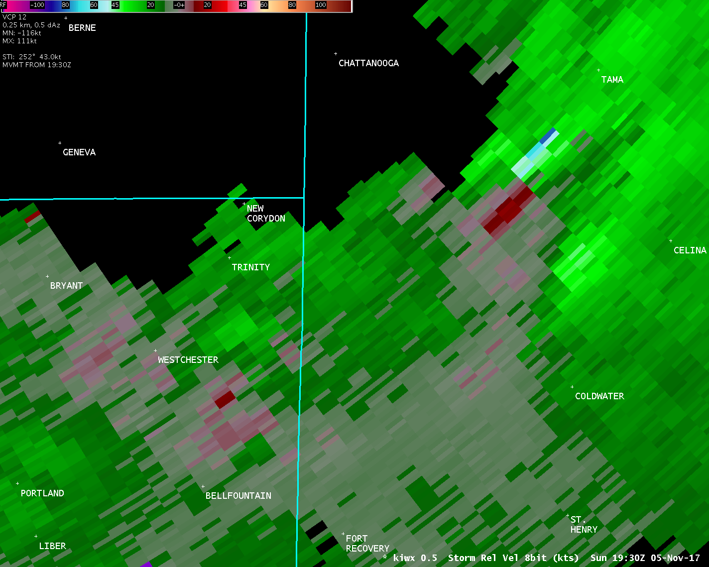
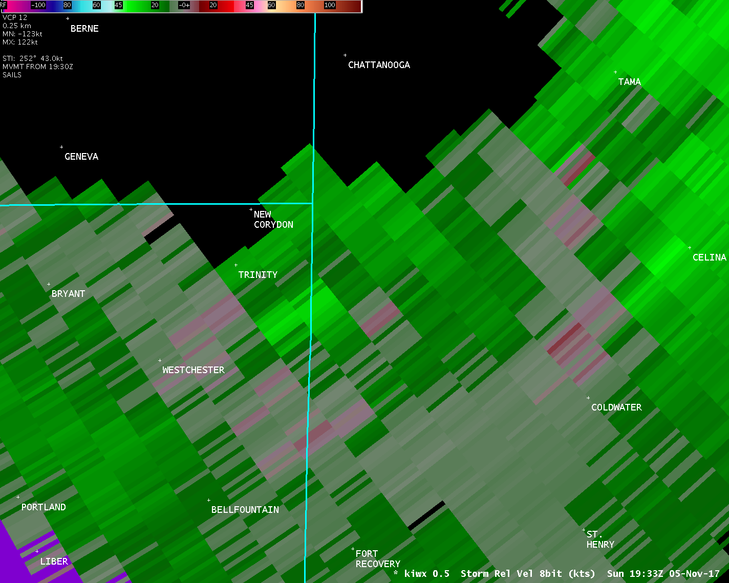
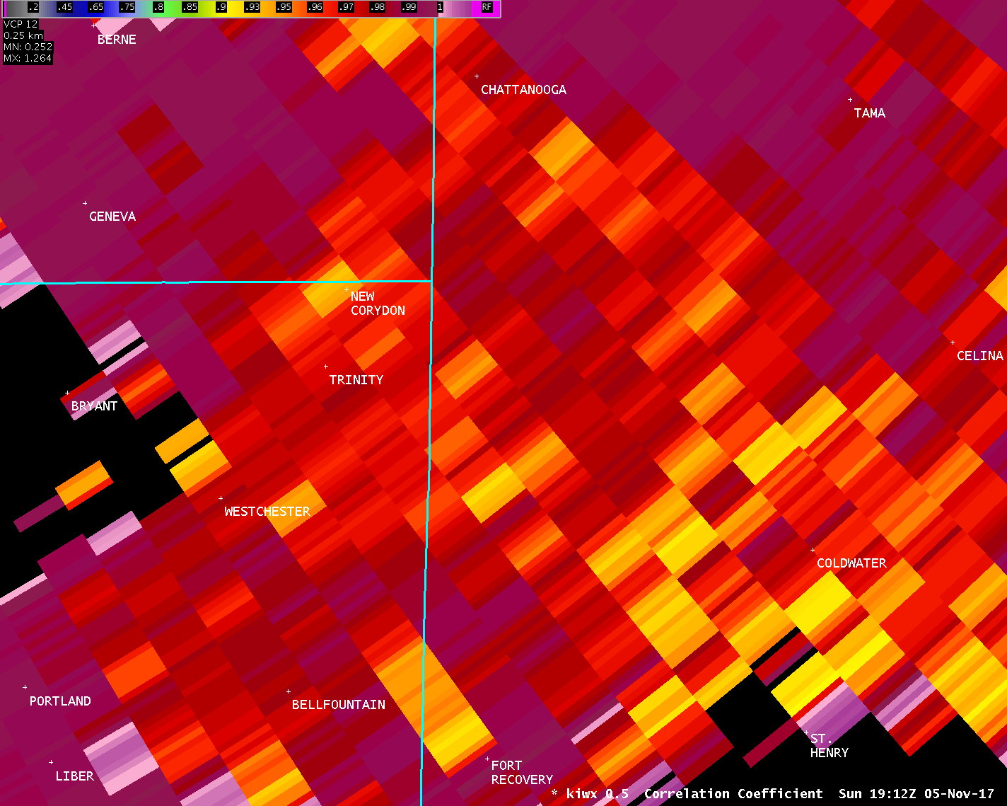
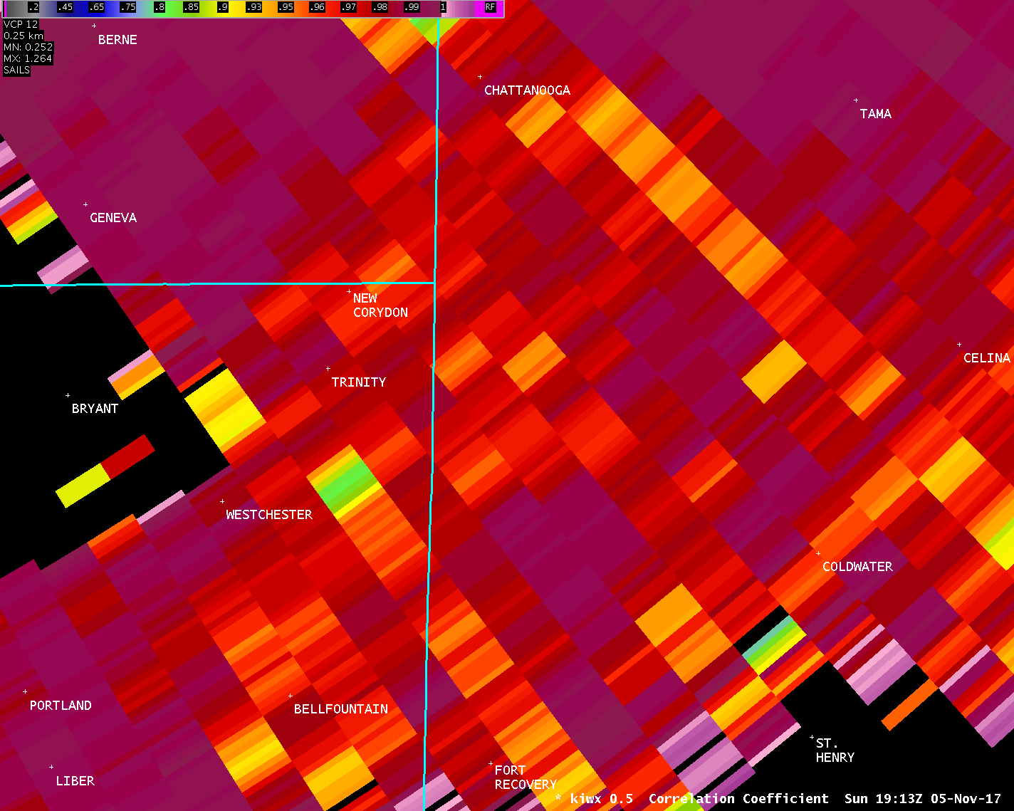
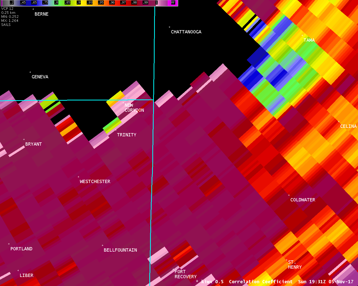
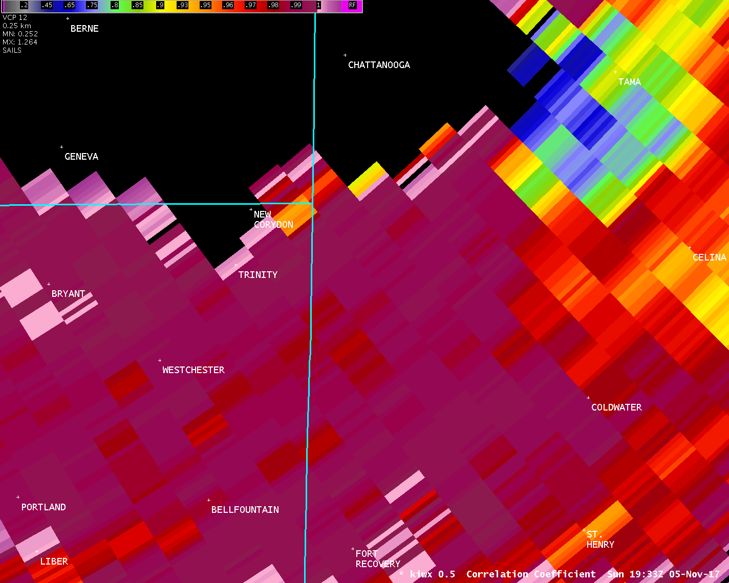
A survey team from the National Weather Service in Wilmington
Ohio, with assistance from the Mercer County Emergency Management
Agency and Ohio Emergency Management Agency, confirmed a tornado
that occurred in western Mercer County on Sunday afternoon,
November 5th 2017.
The tornado path surveyed in western Mercer County is the tail-
end of a long track tornado that moved out of Jay County, Indiana.
Please see additional statements from the NWS offices in Indiana
for details on earlier segments of this tornado.
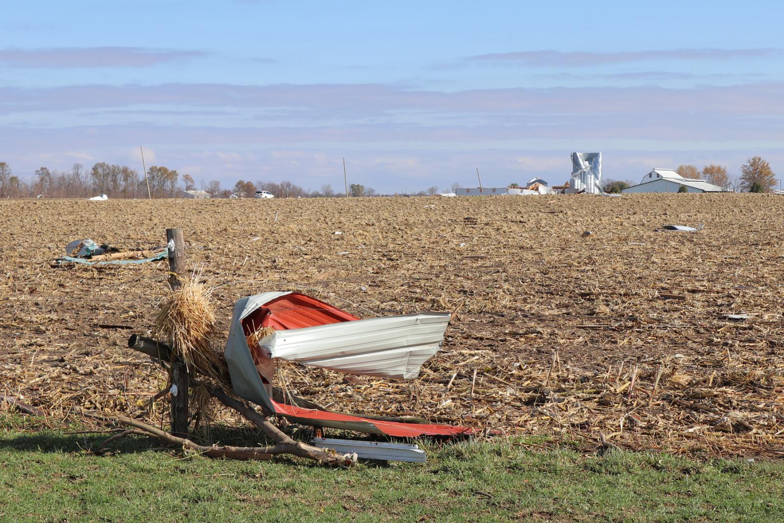
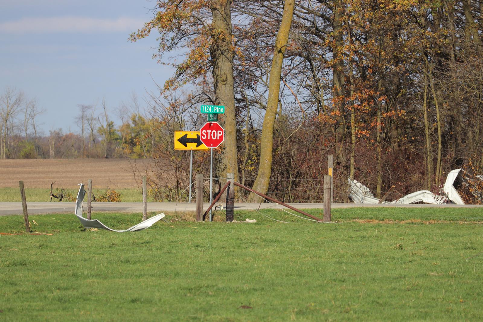
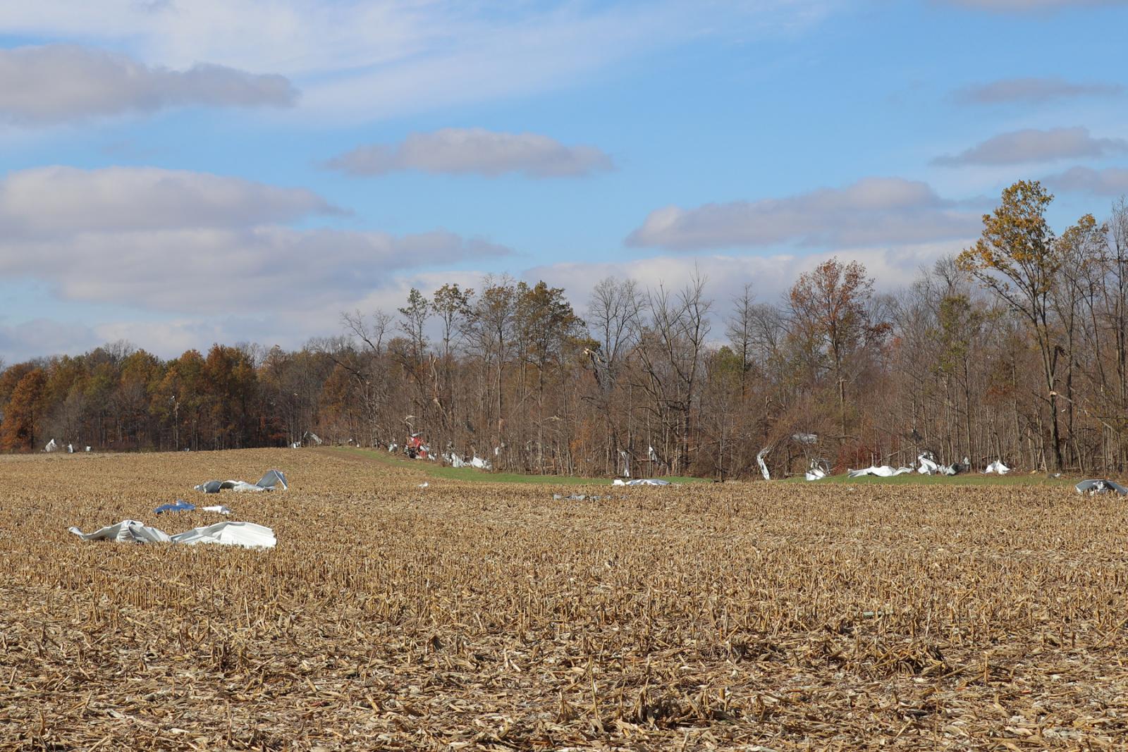
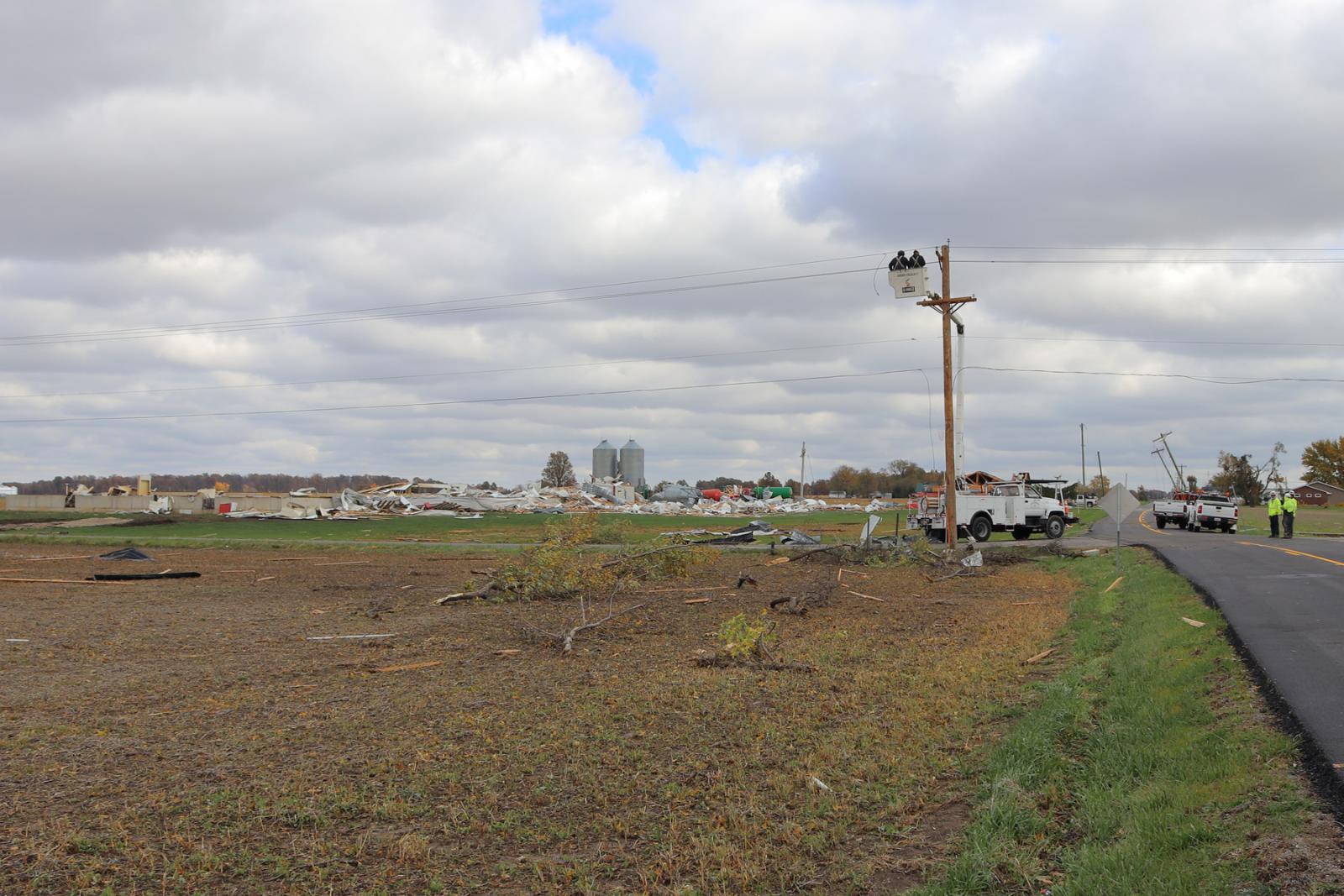
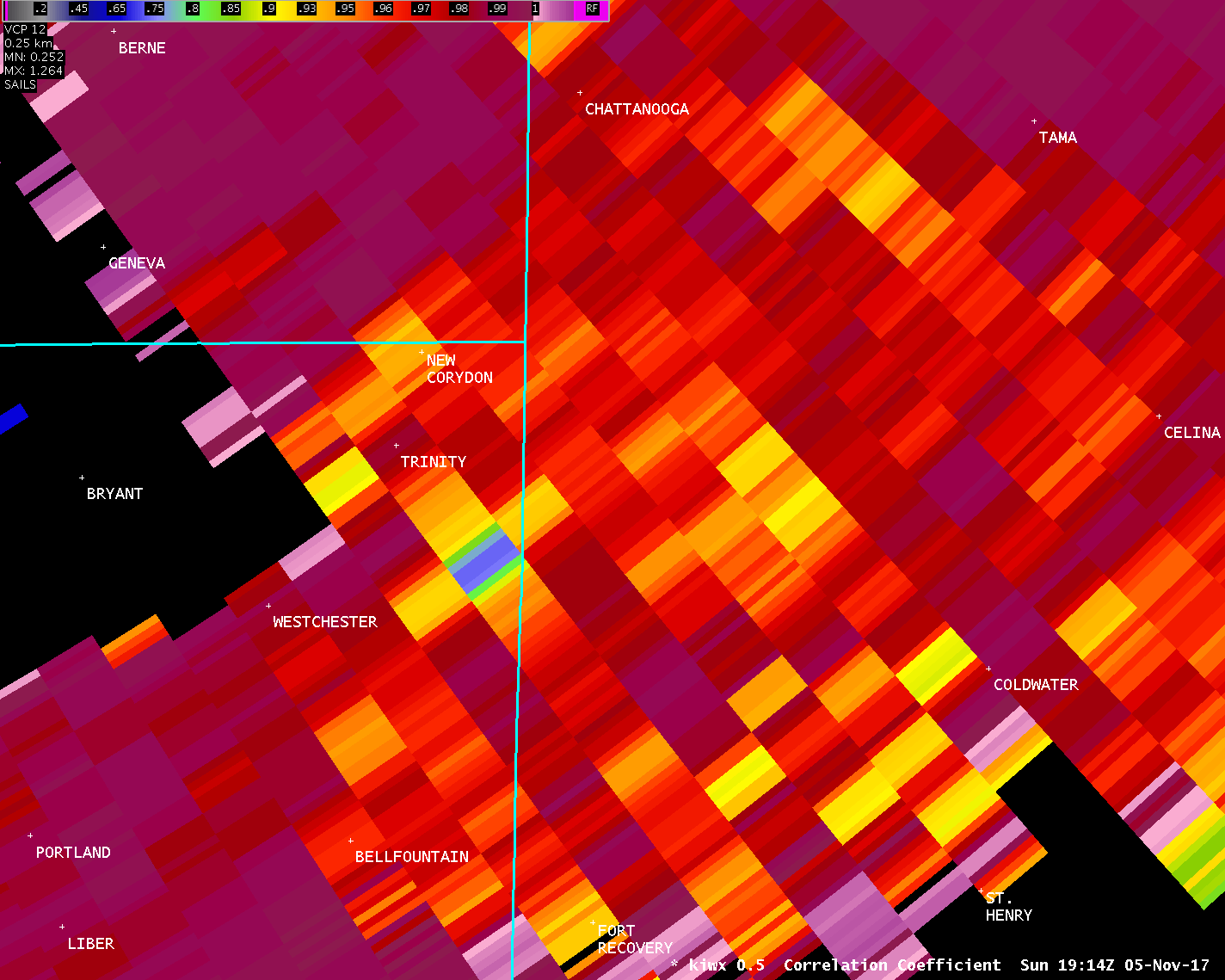
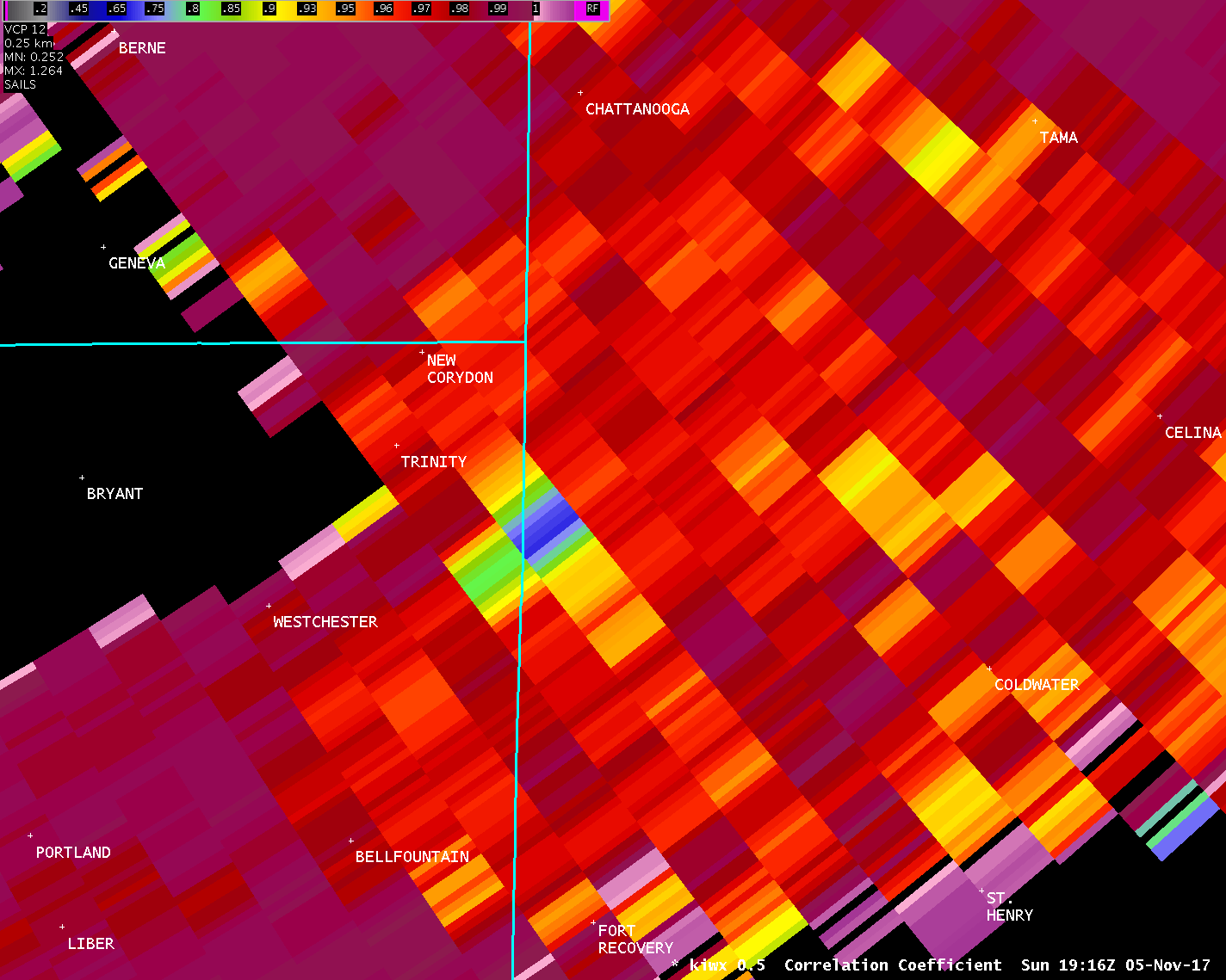
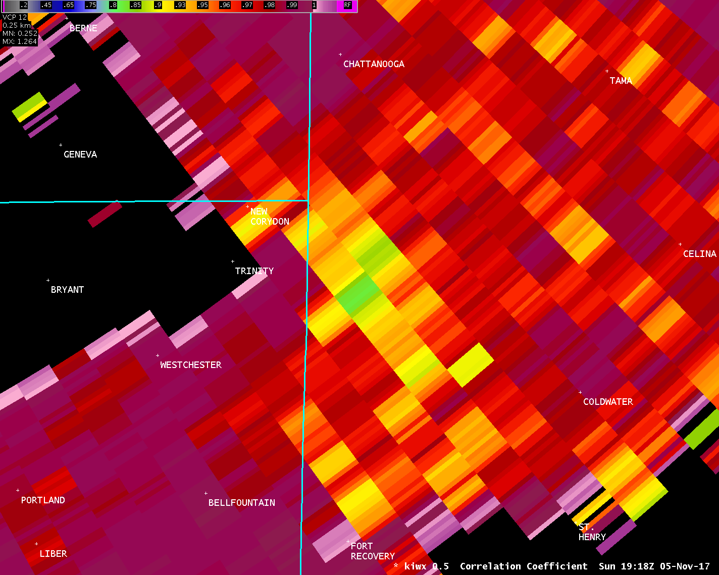
The tornado crossed into Ohio (Mercer County) near the
intersection of St. Anthony Road and County Road 235. The tornado
traveled northeast for just more than 8 miles before terminating
in a wooded area north of Carmel Church Road and west of Now Road.
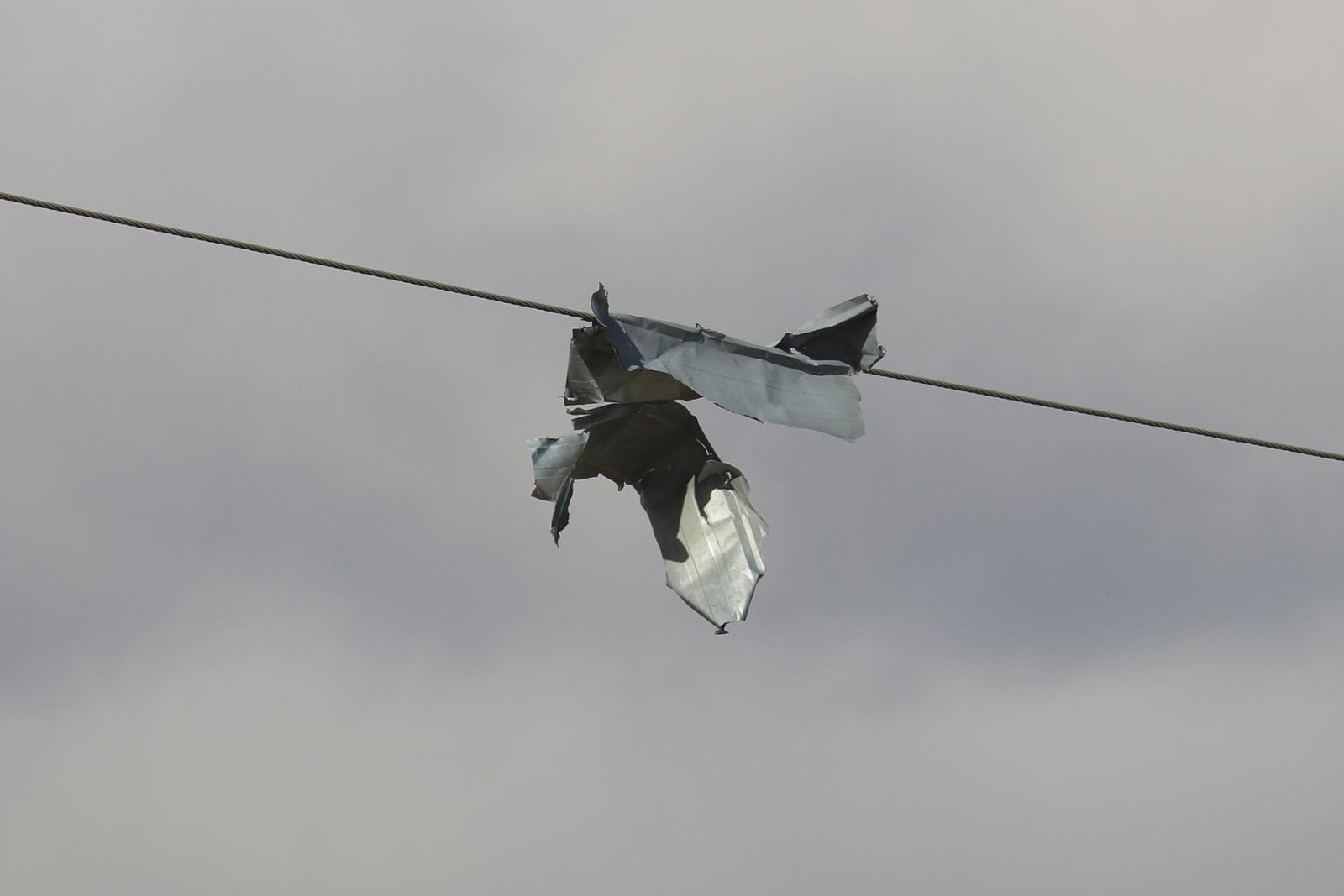
A few pieces of light debris were carried slightly further to the
northeast, but the tornado is not believed to have been on the
ground east of Now Road.
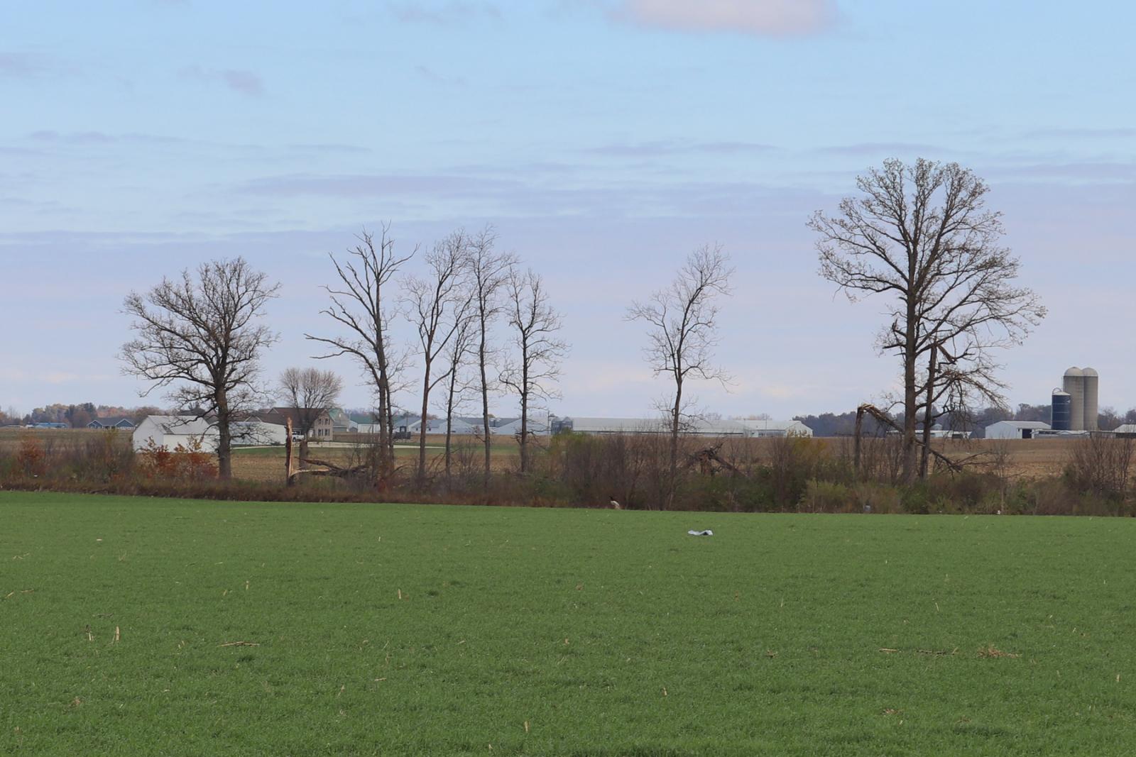
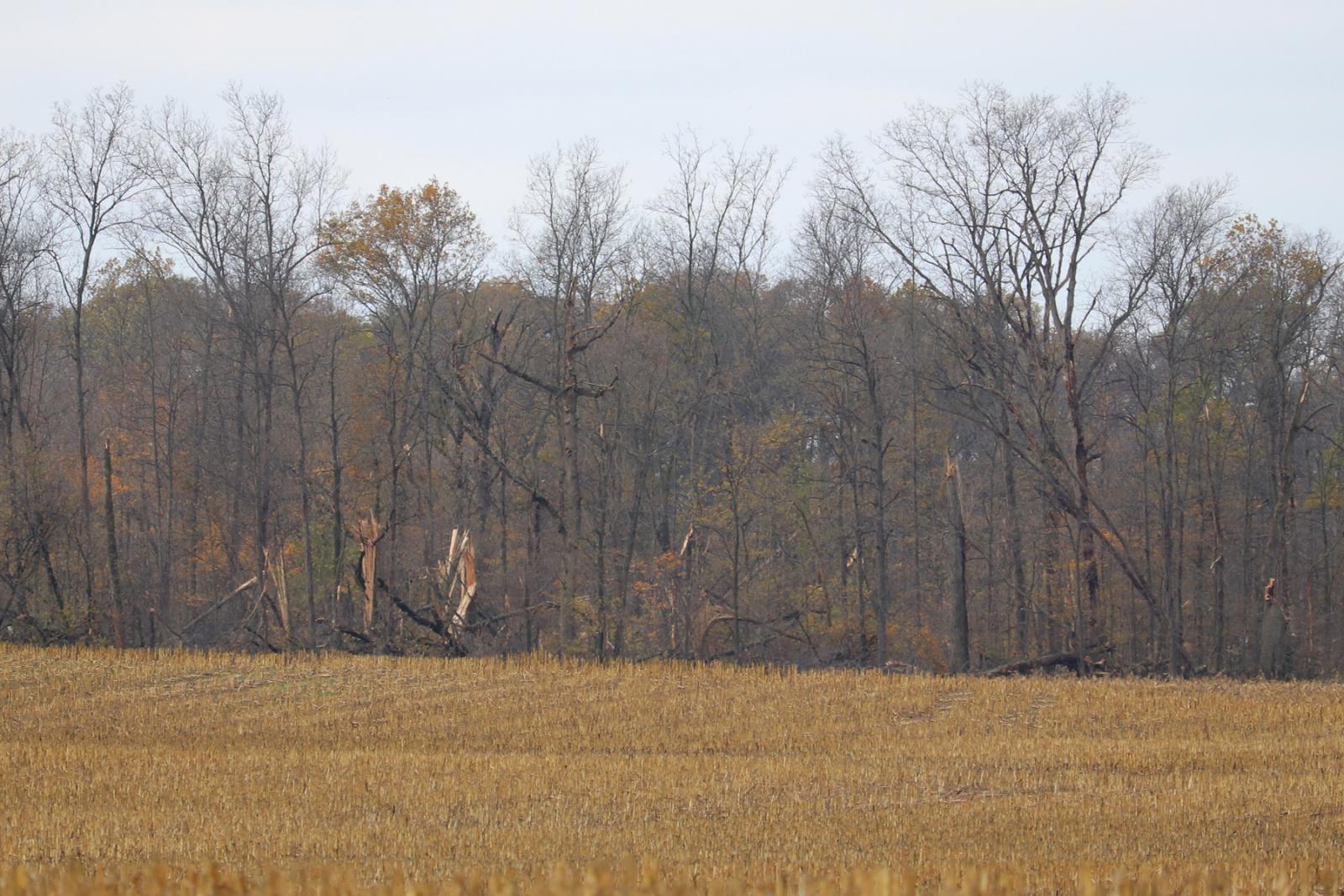
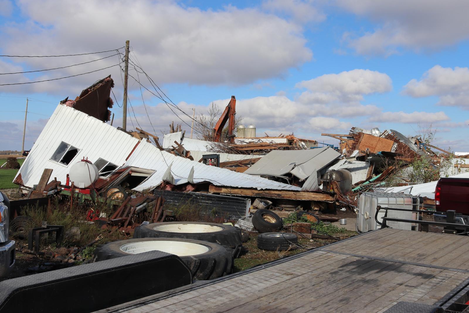
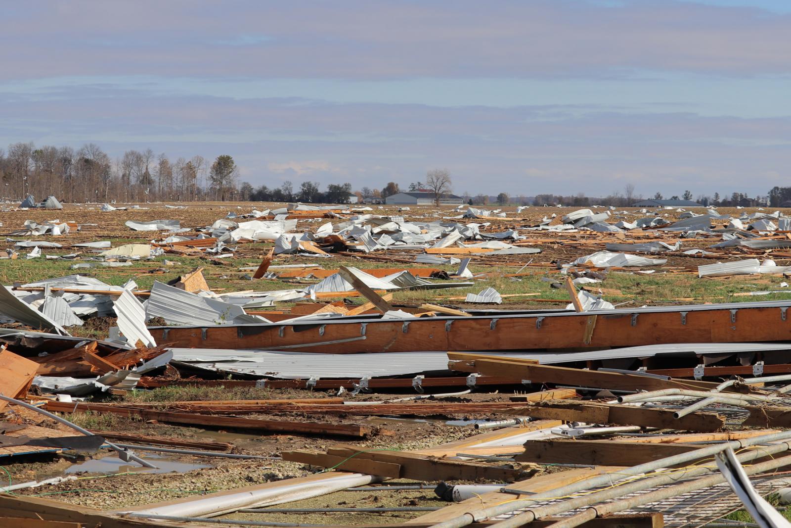
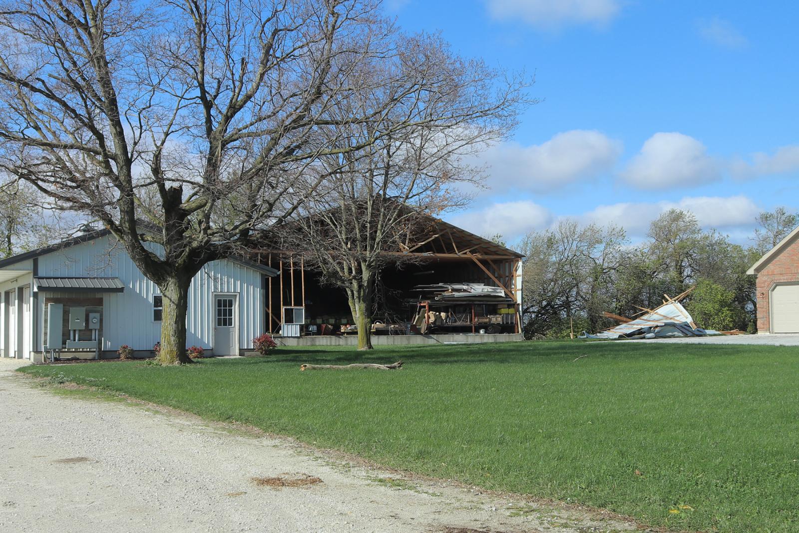
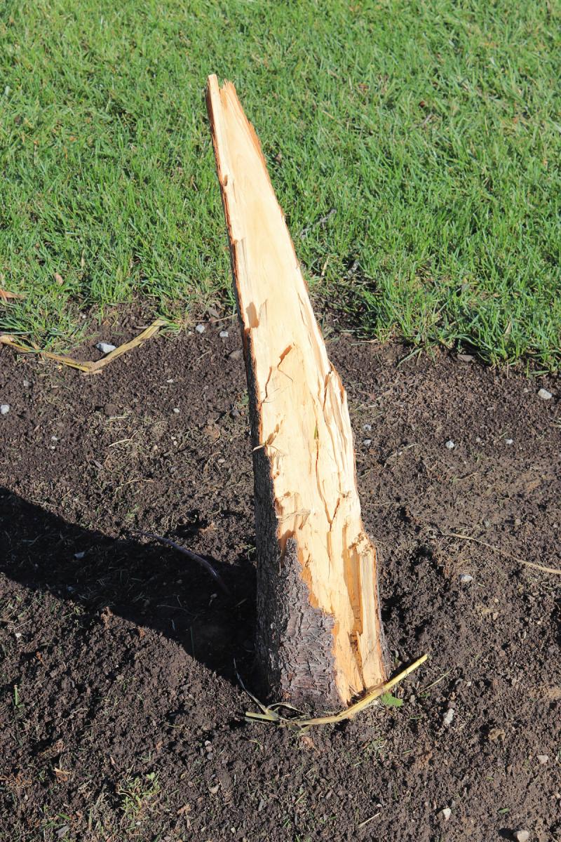
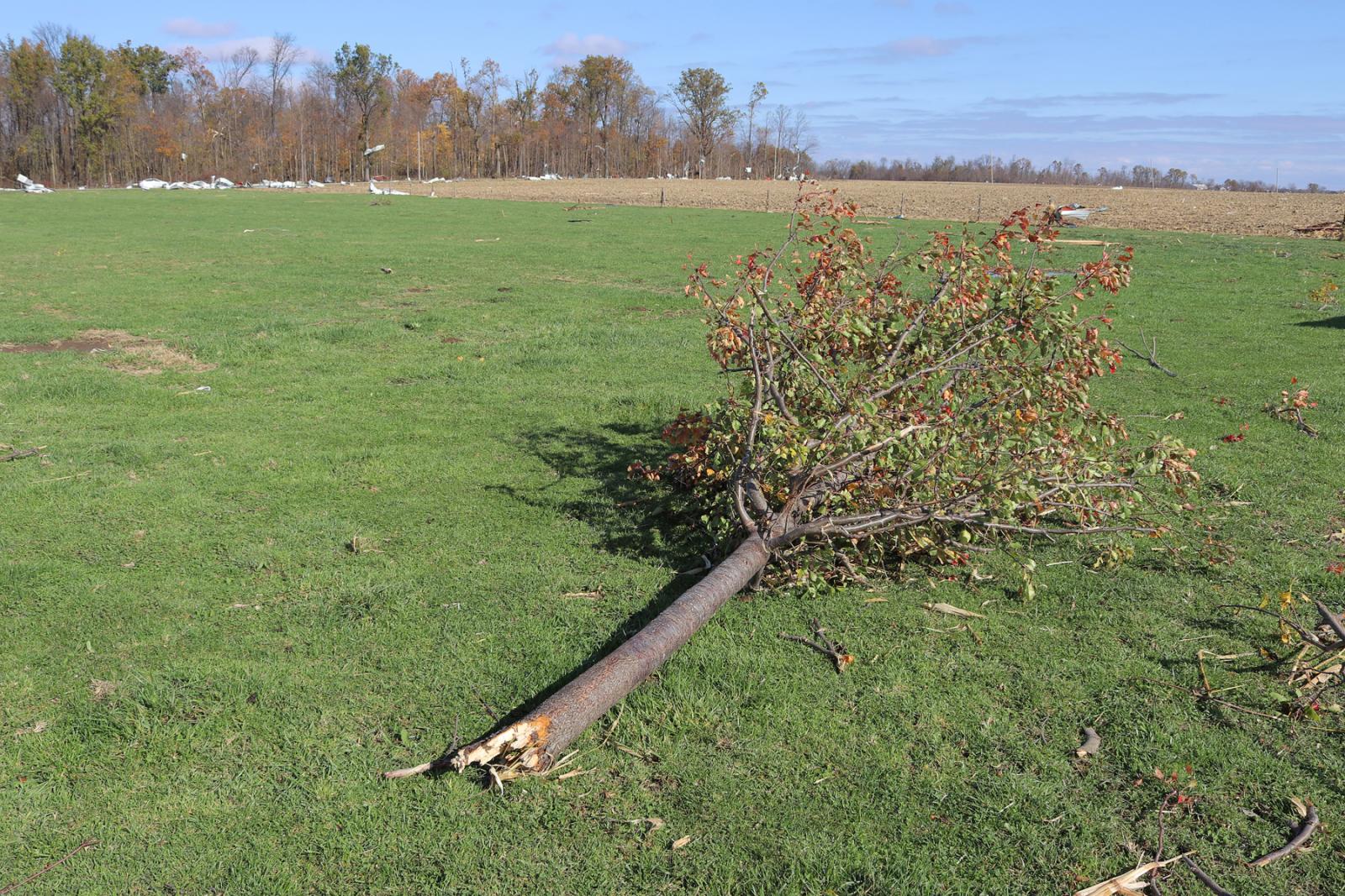
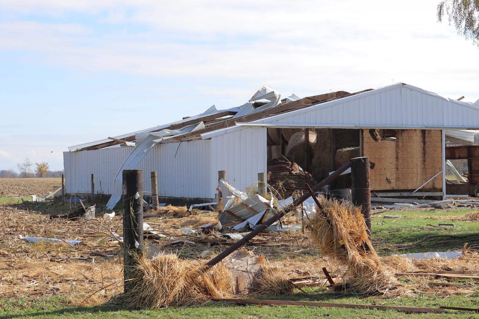
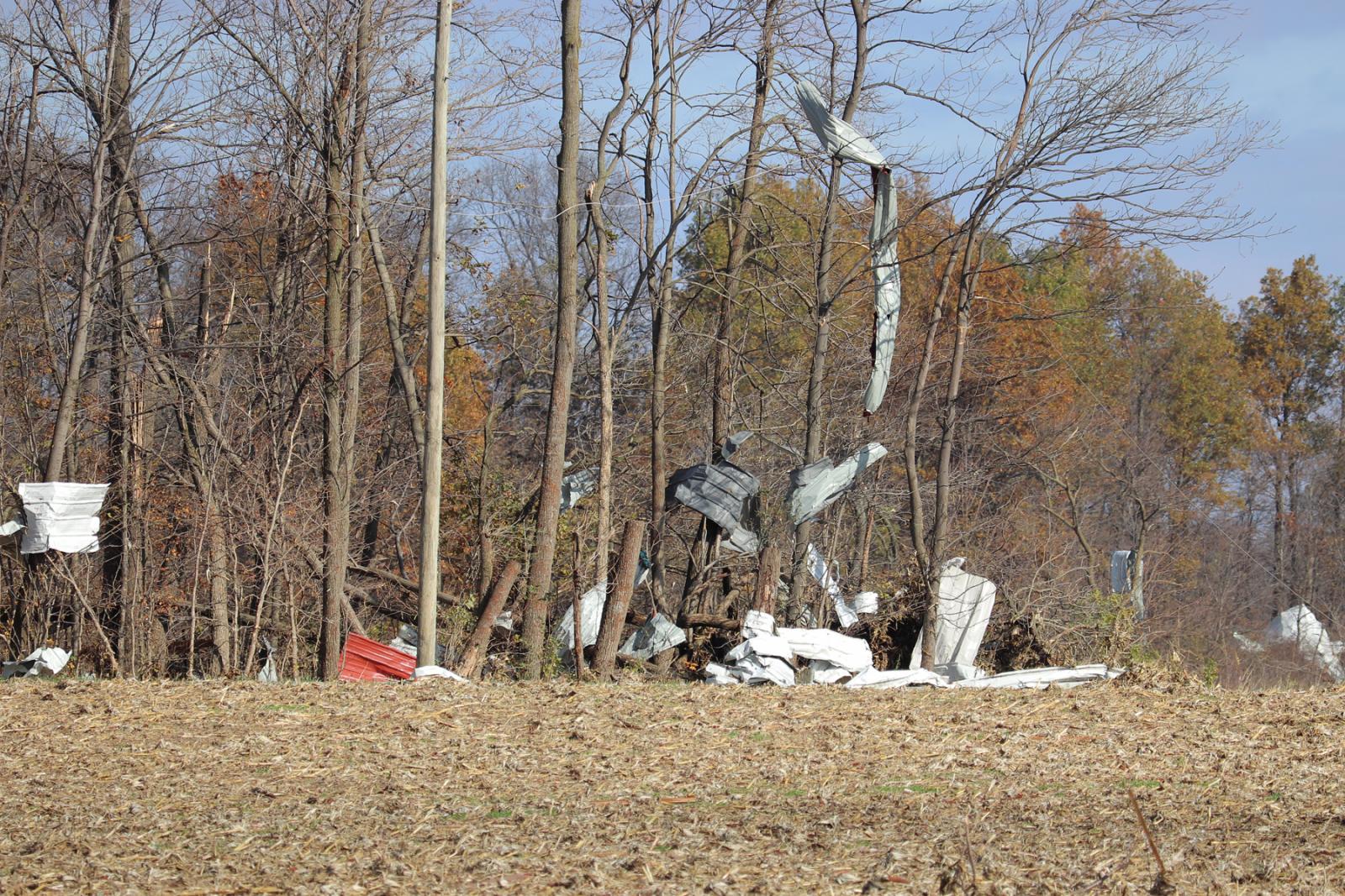
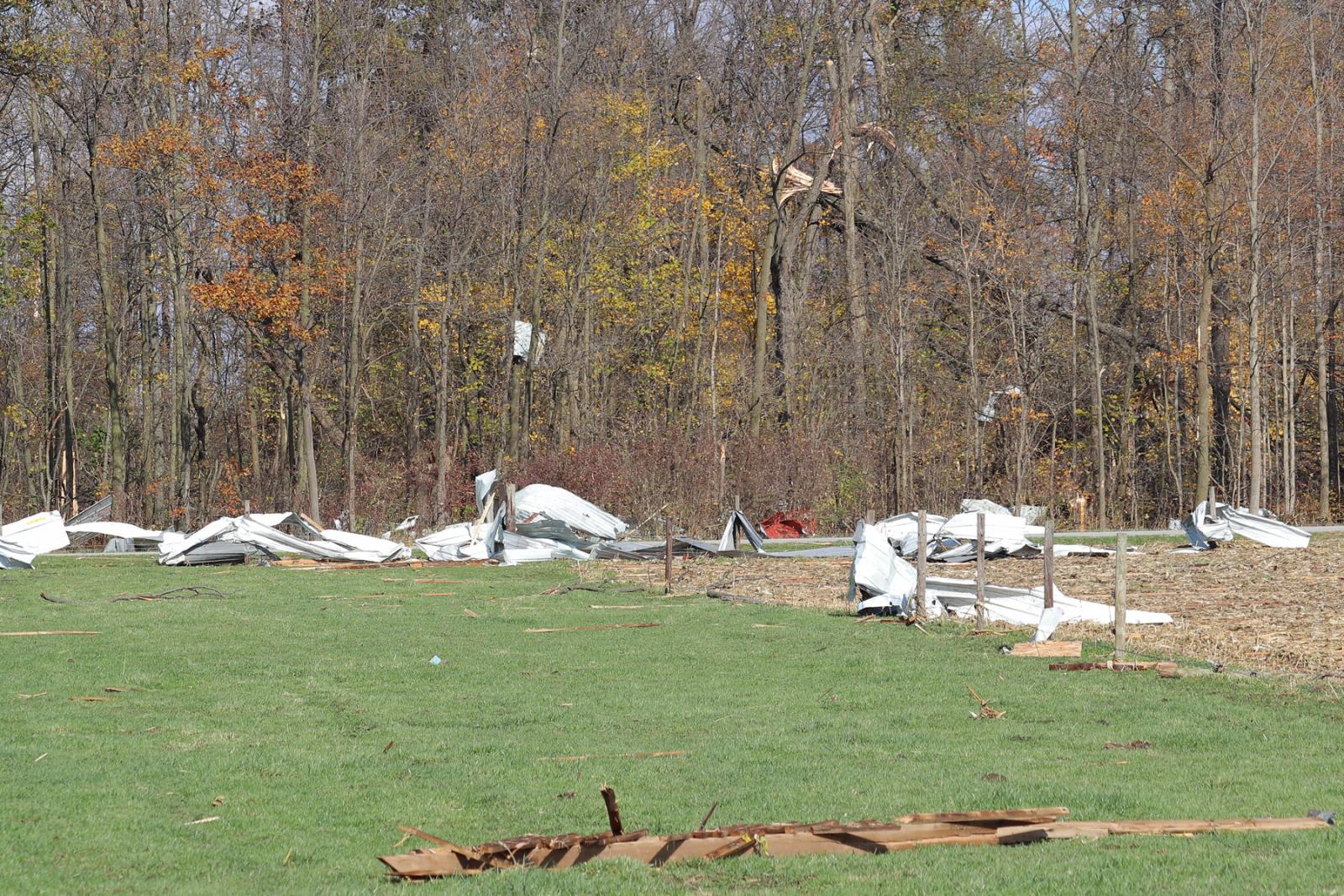
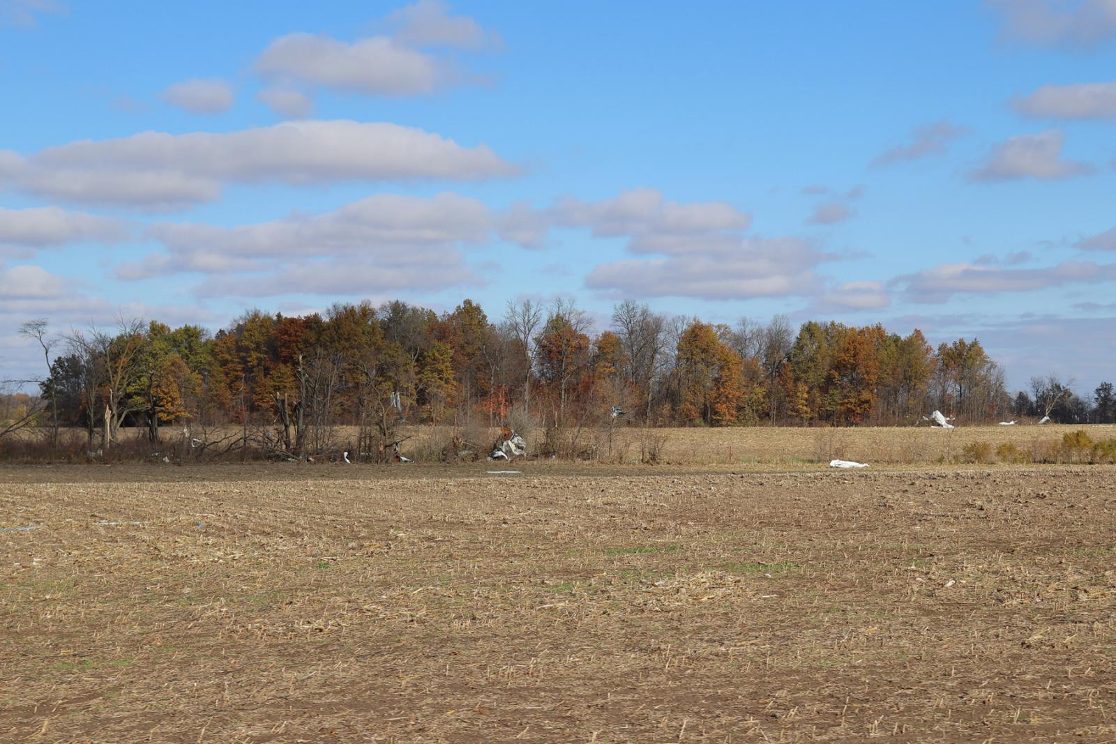
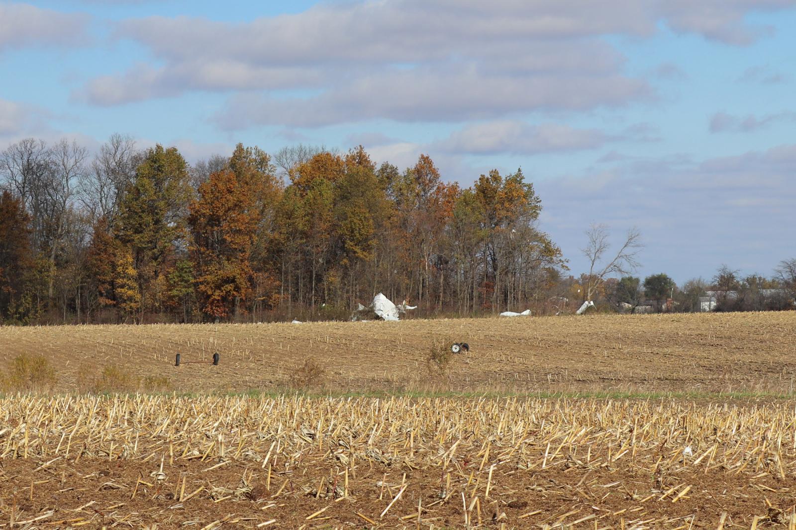
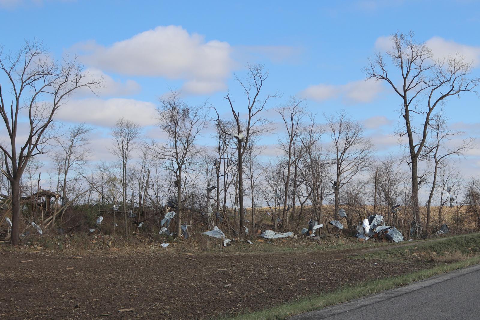
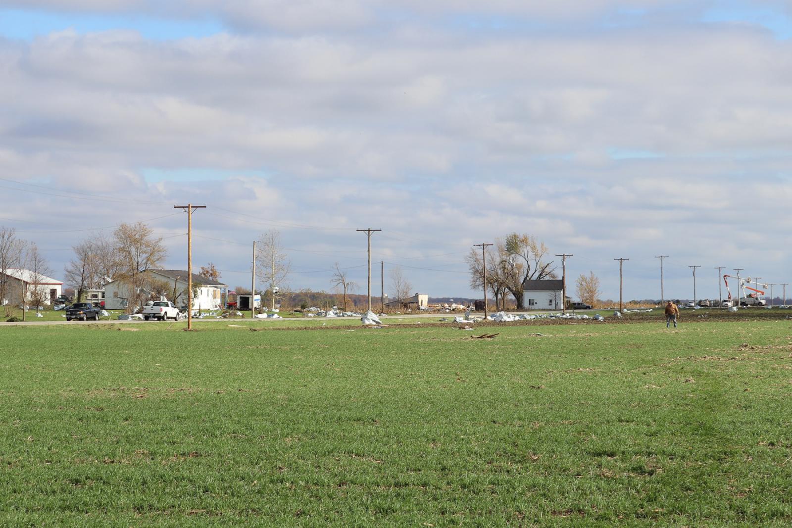
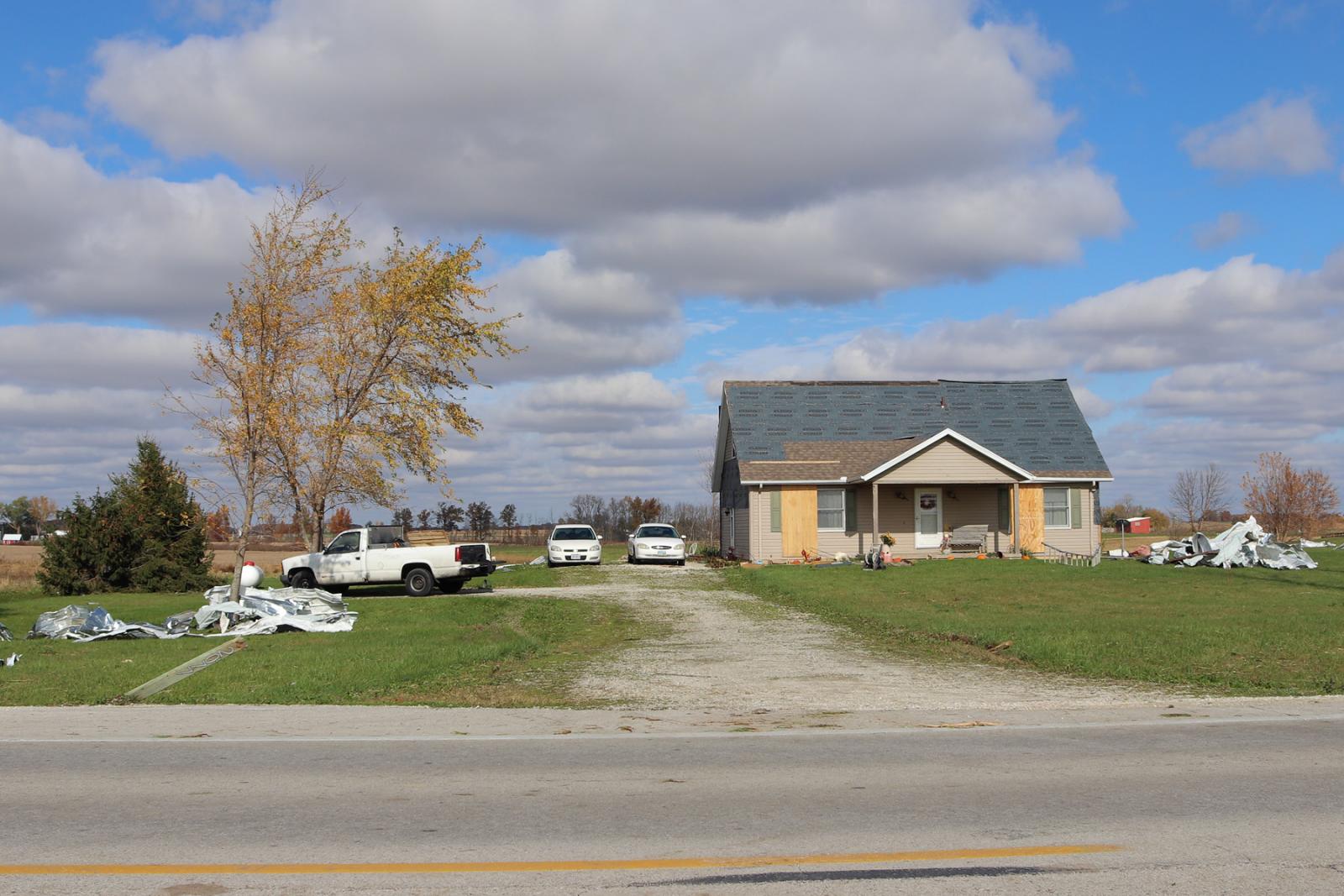
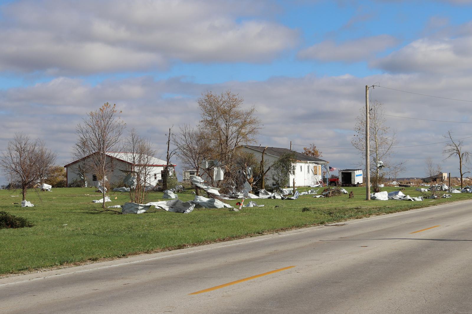
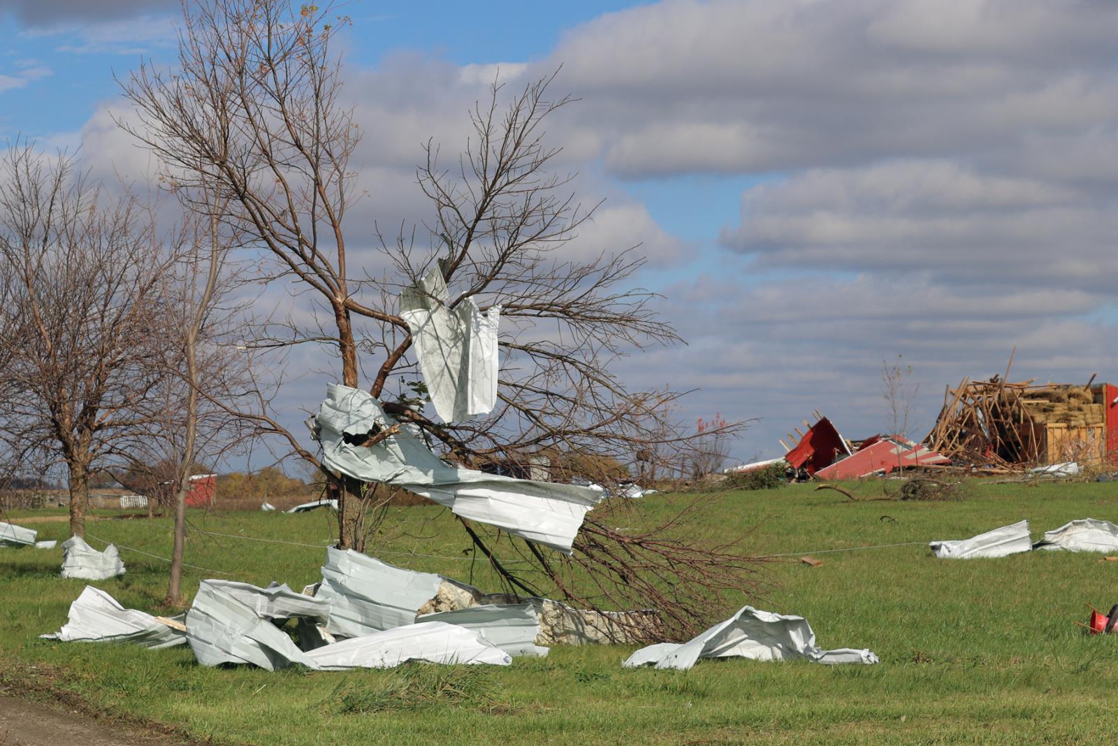
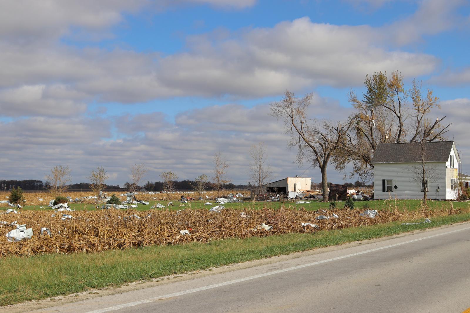
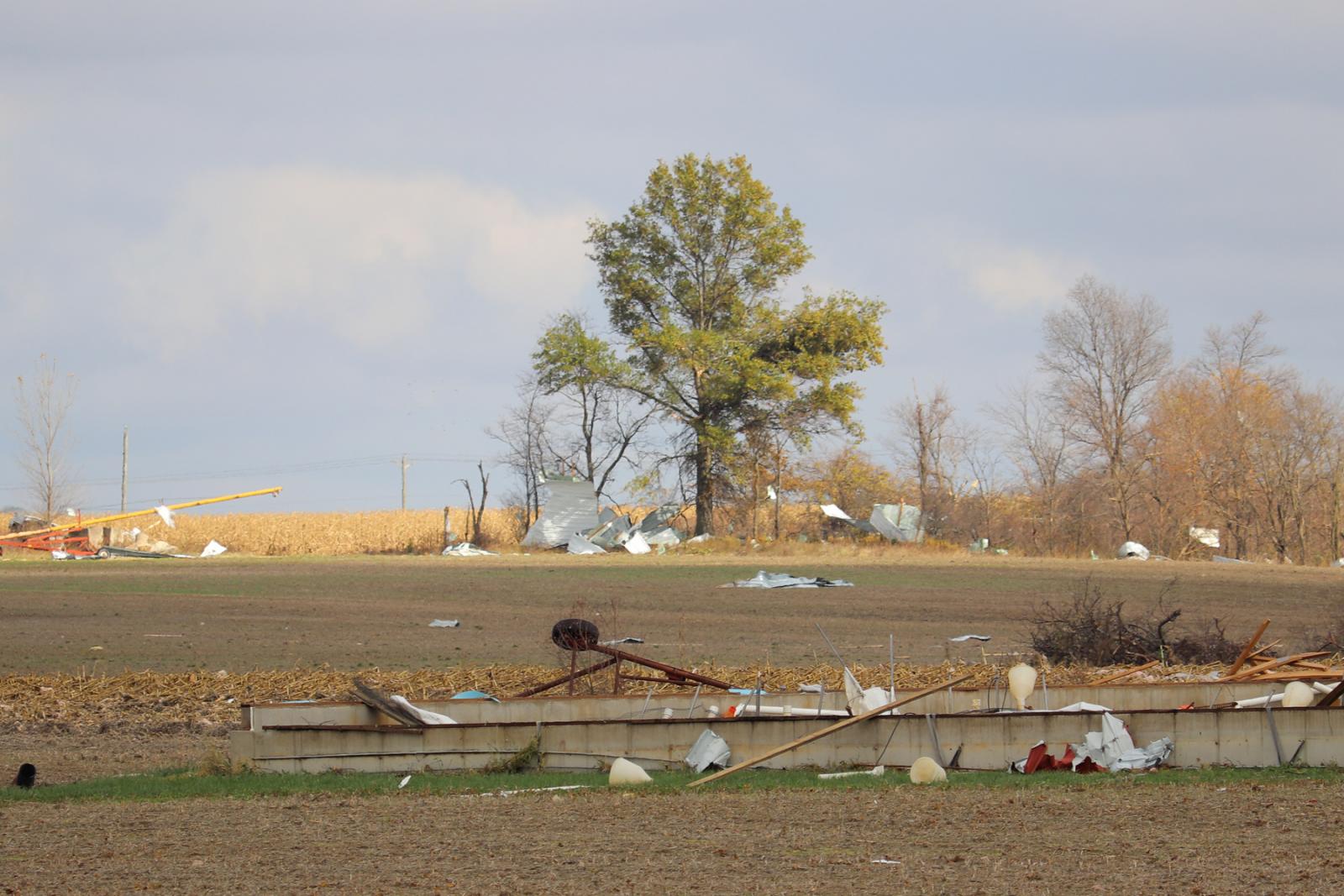
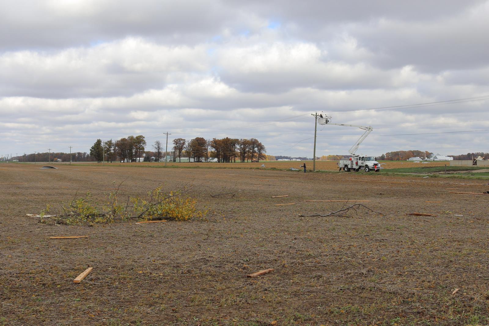
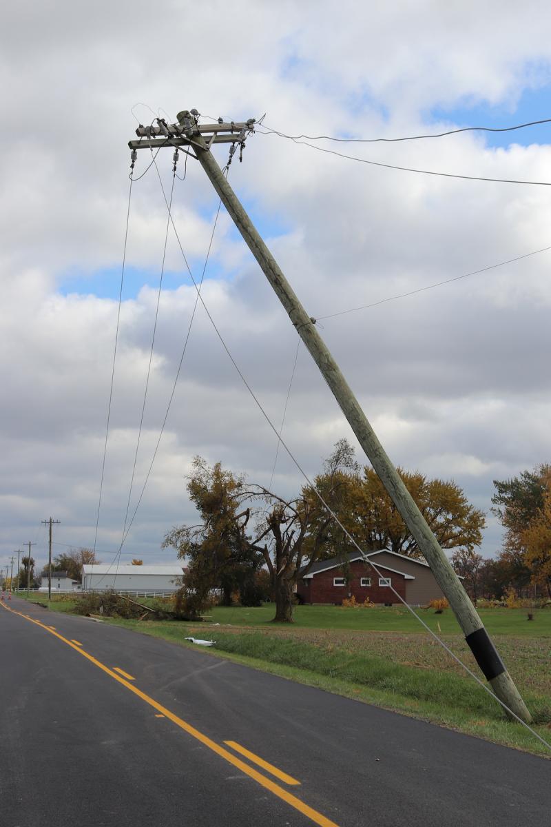
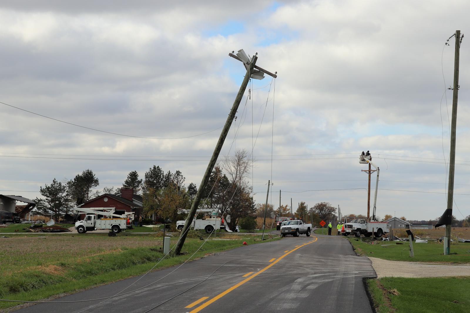
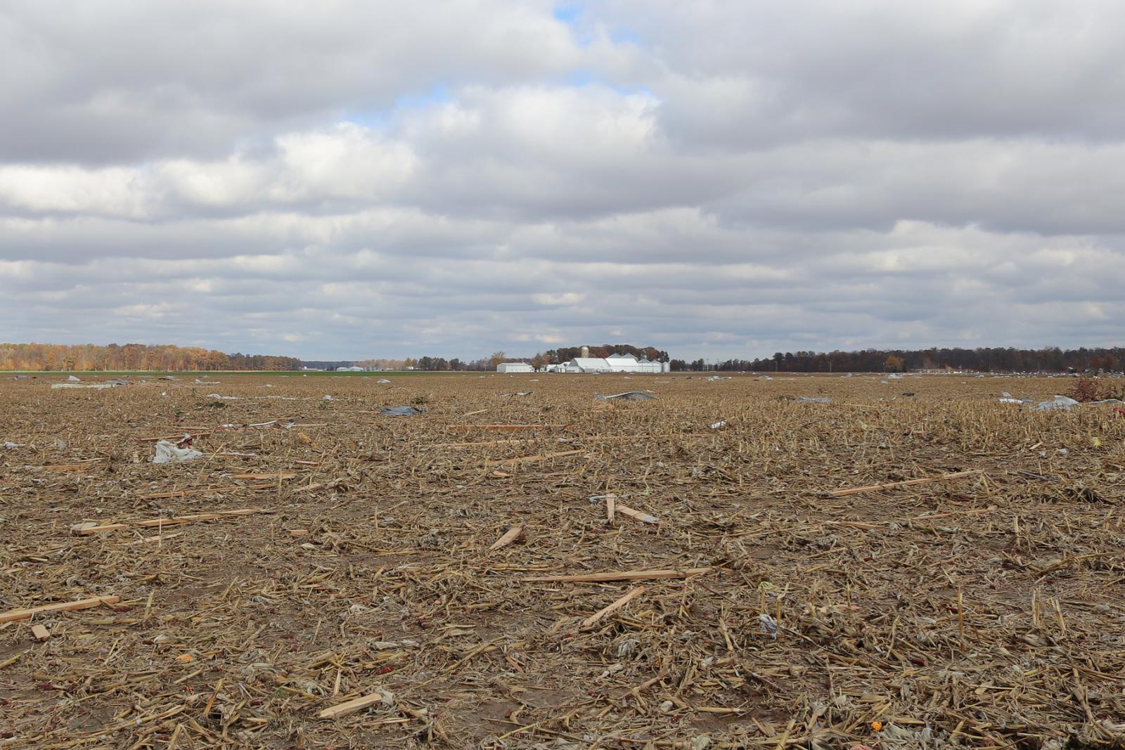
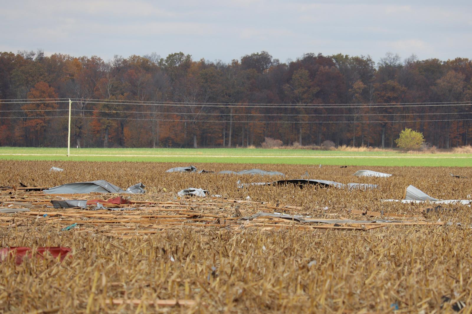
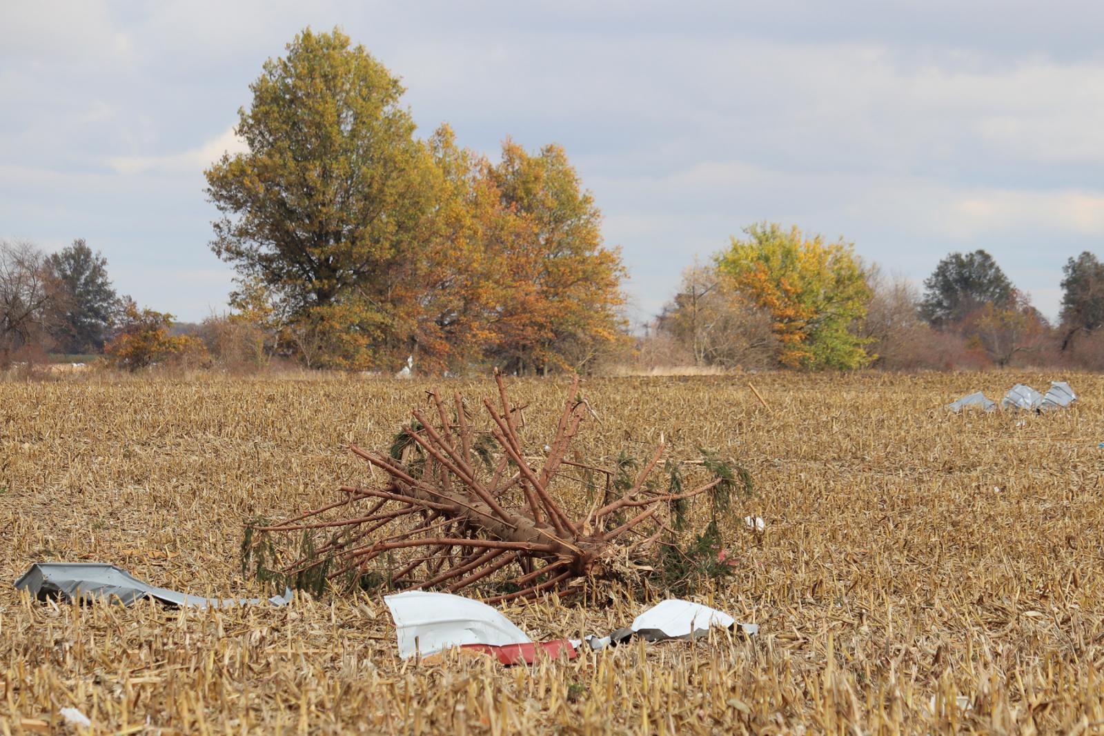
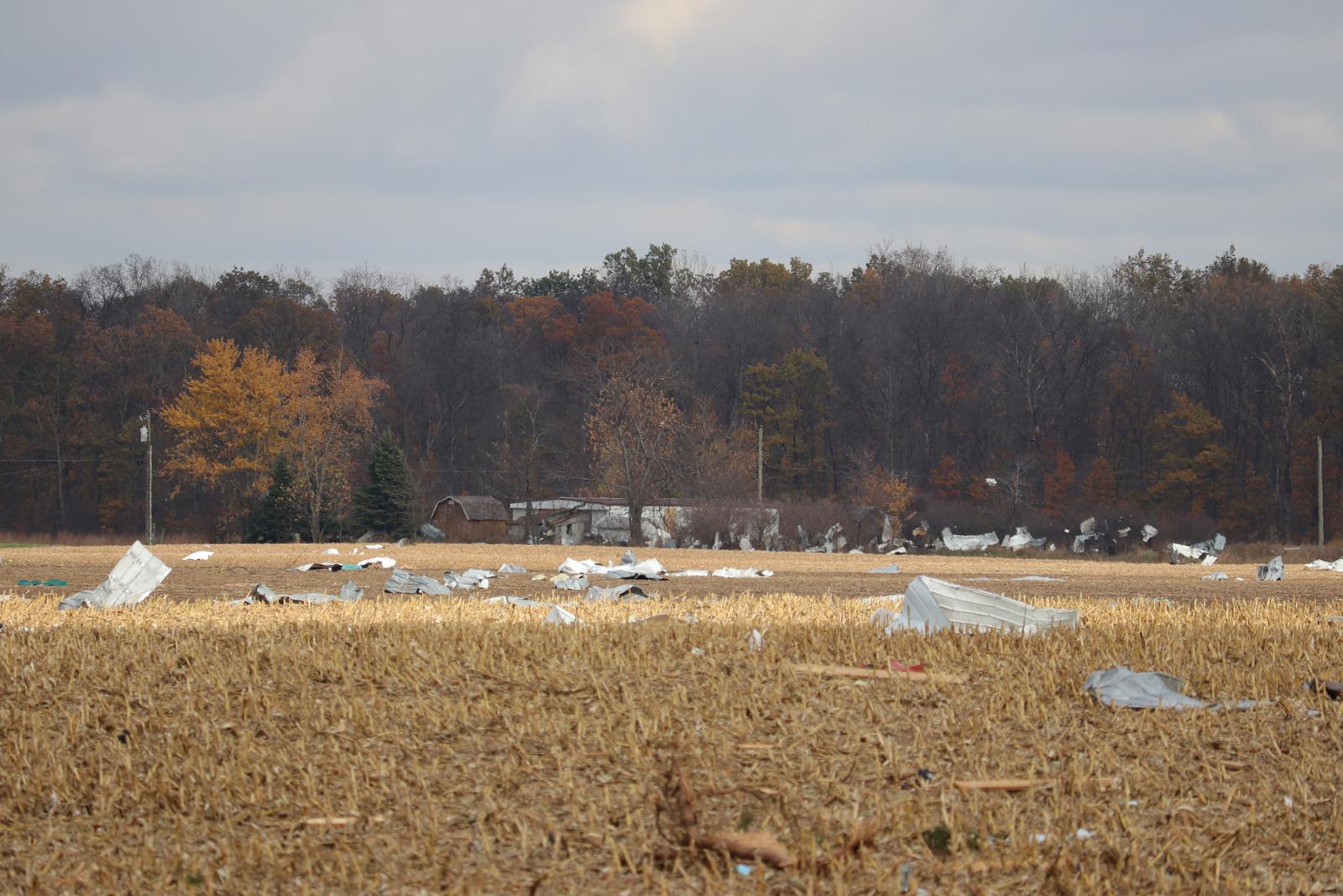
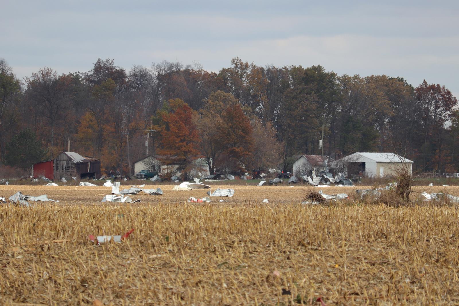
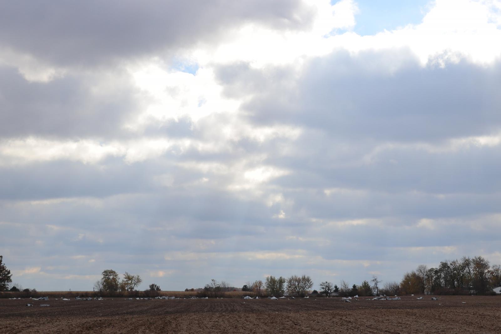
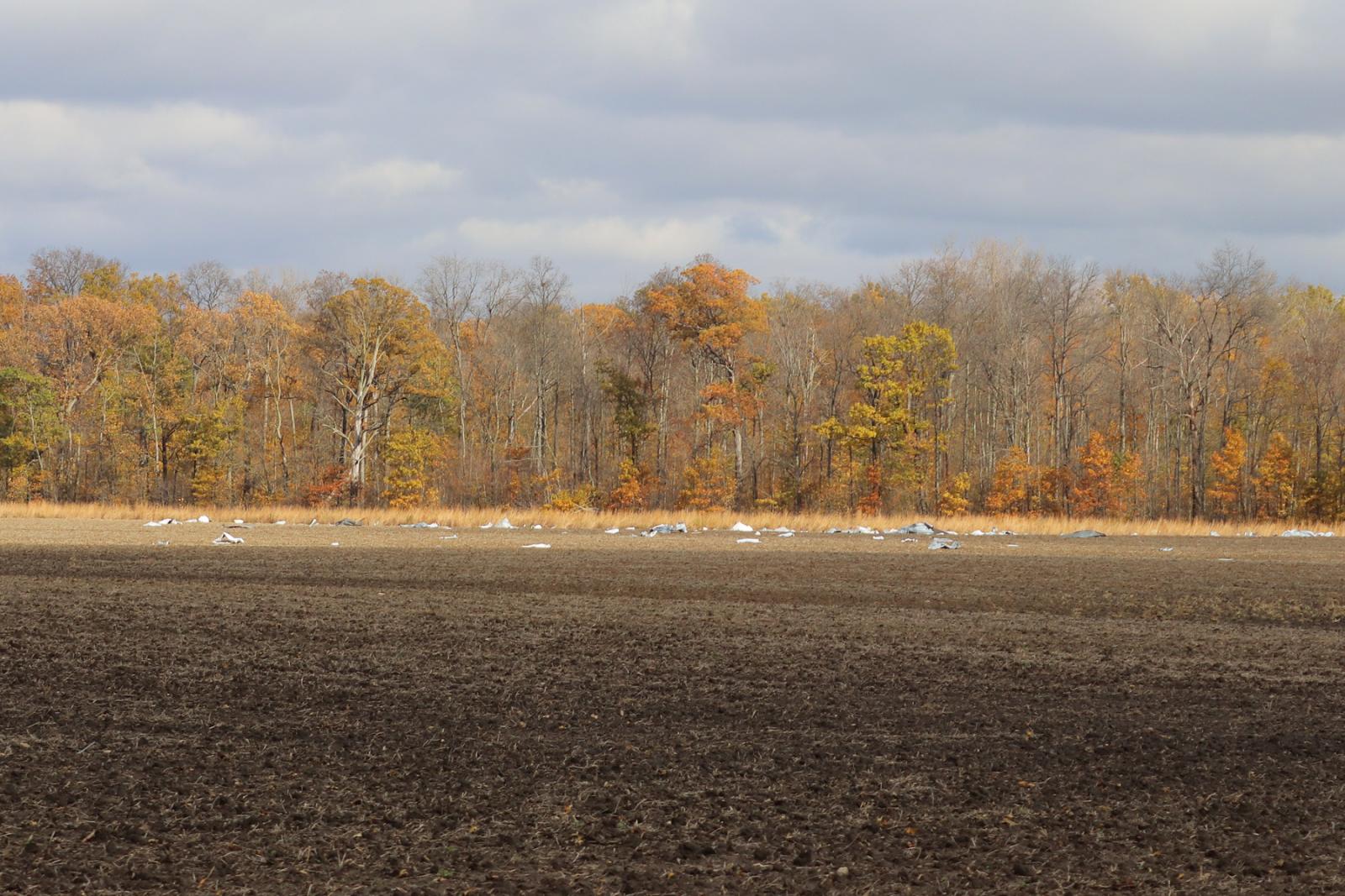
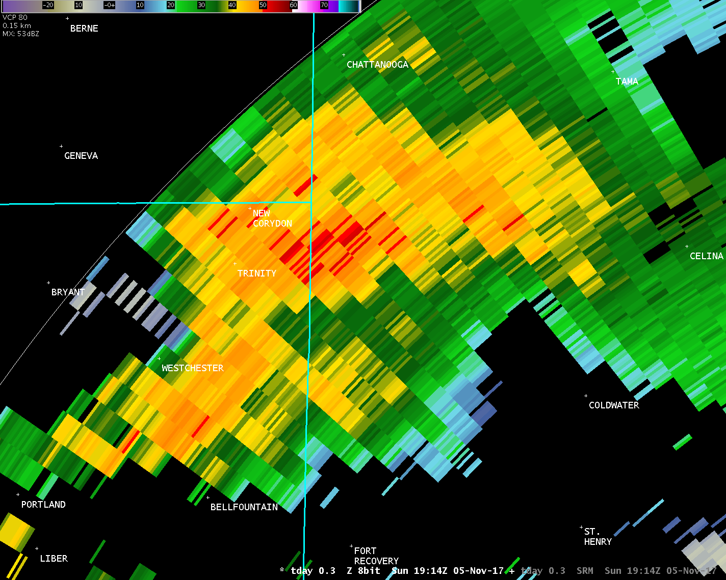
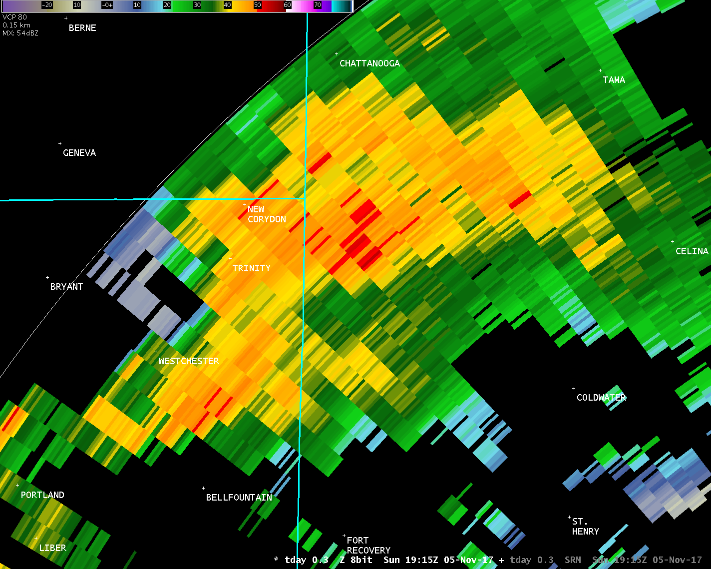
The vast majority of the surveyed path in Mercer County contained
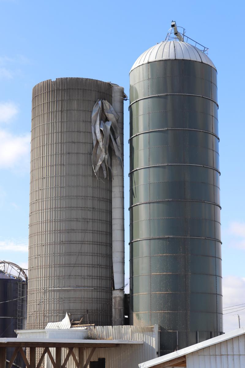
damage consistent with winds of 60-100 MPH, including scattered
tree damage, significant damage or destruction of outbuildings,
and minor damage to well-built homes. In all, 20-25 different
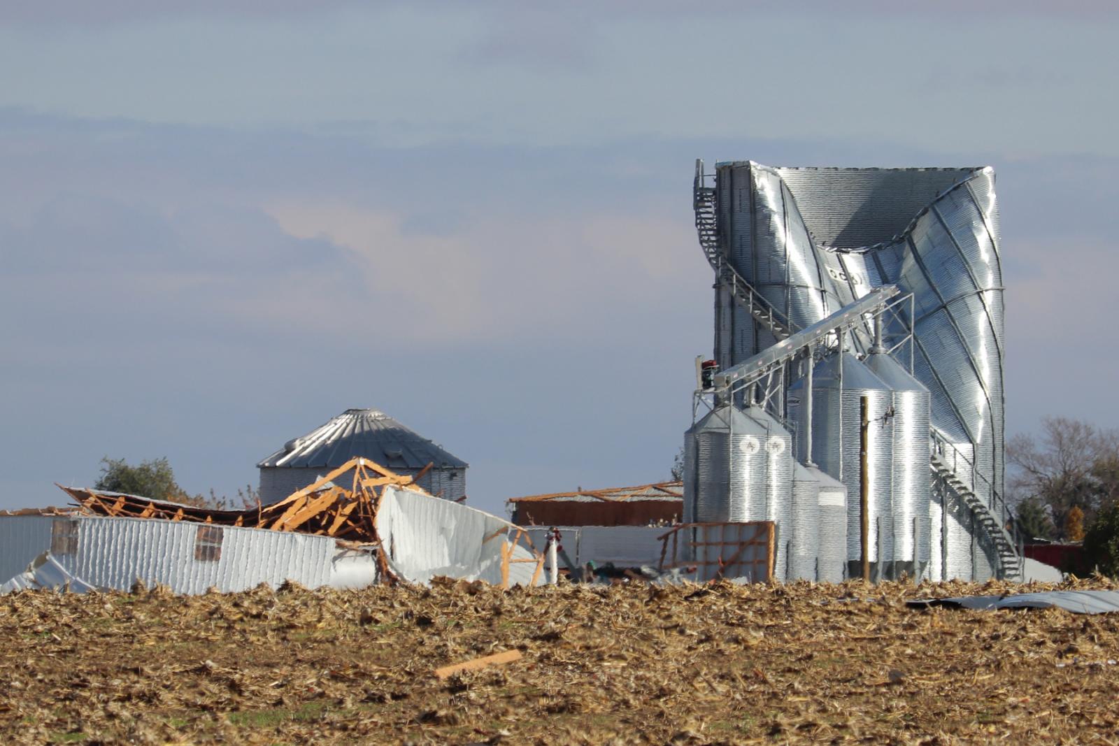
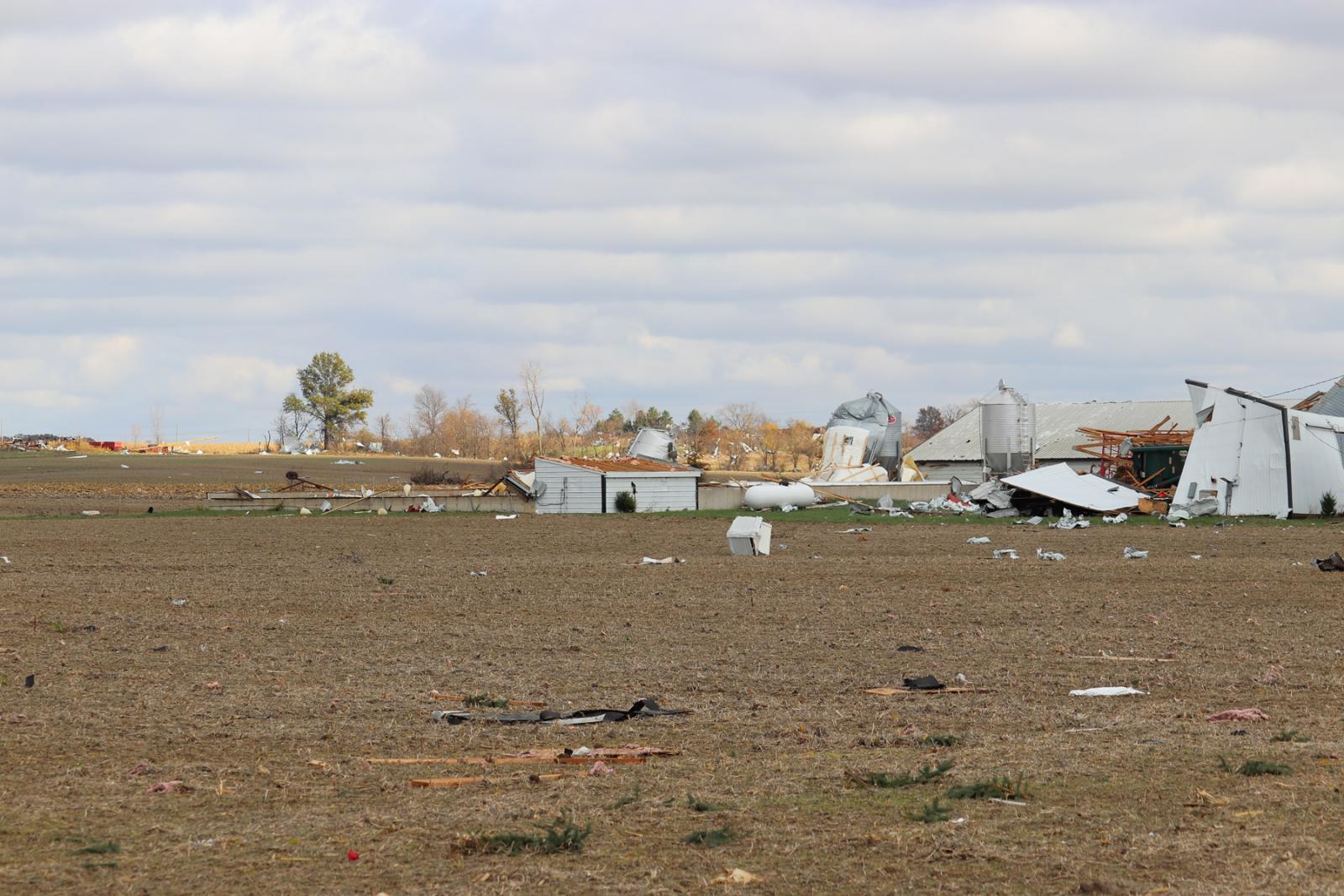
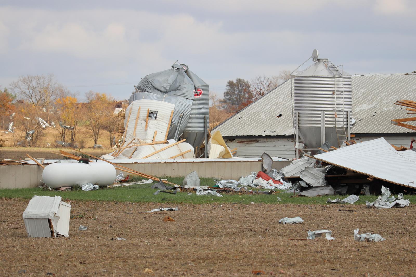
properties were affected by this tornado in Mercer County.
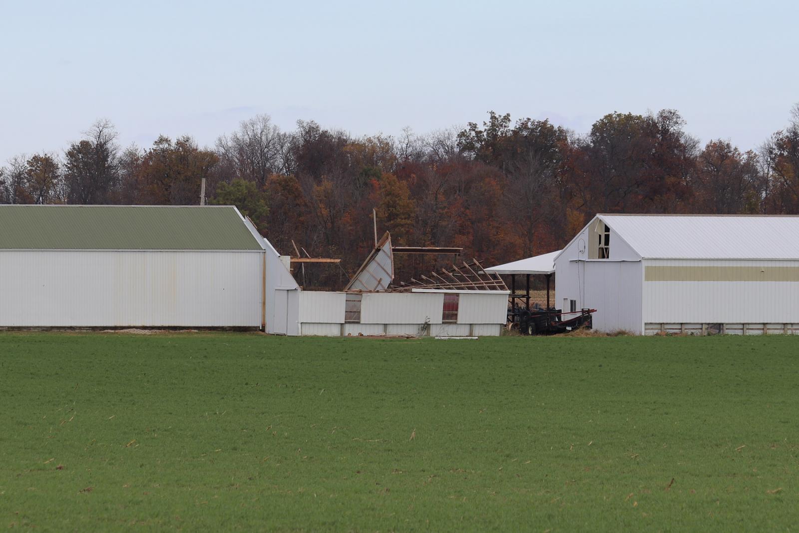
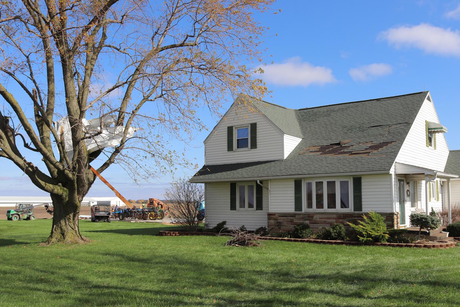
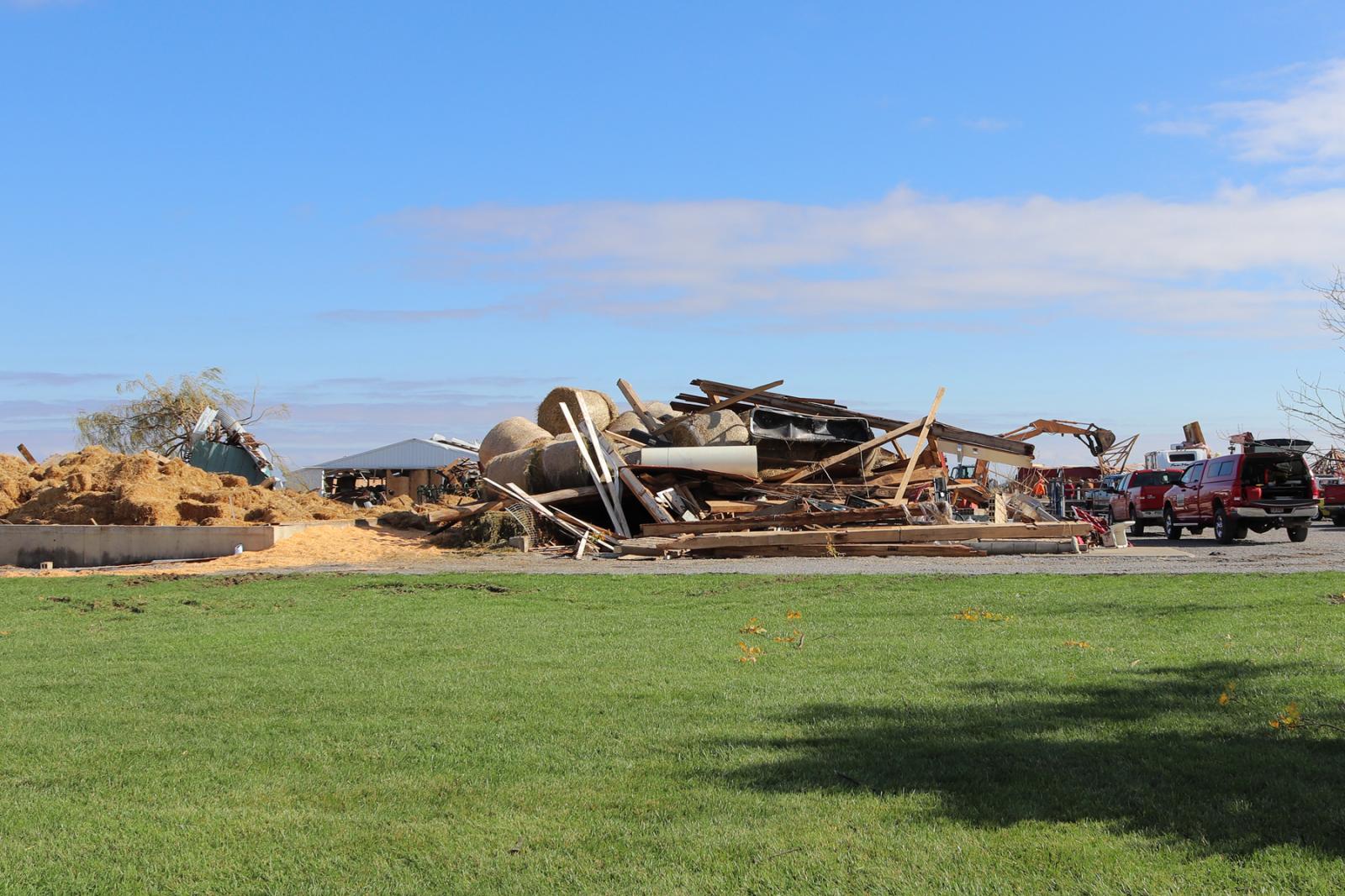
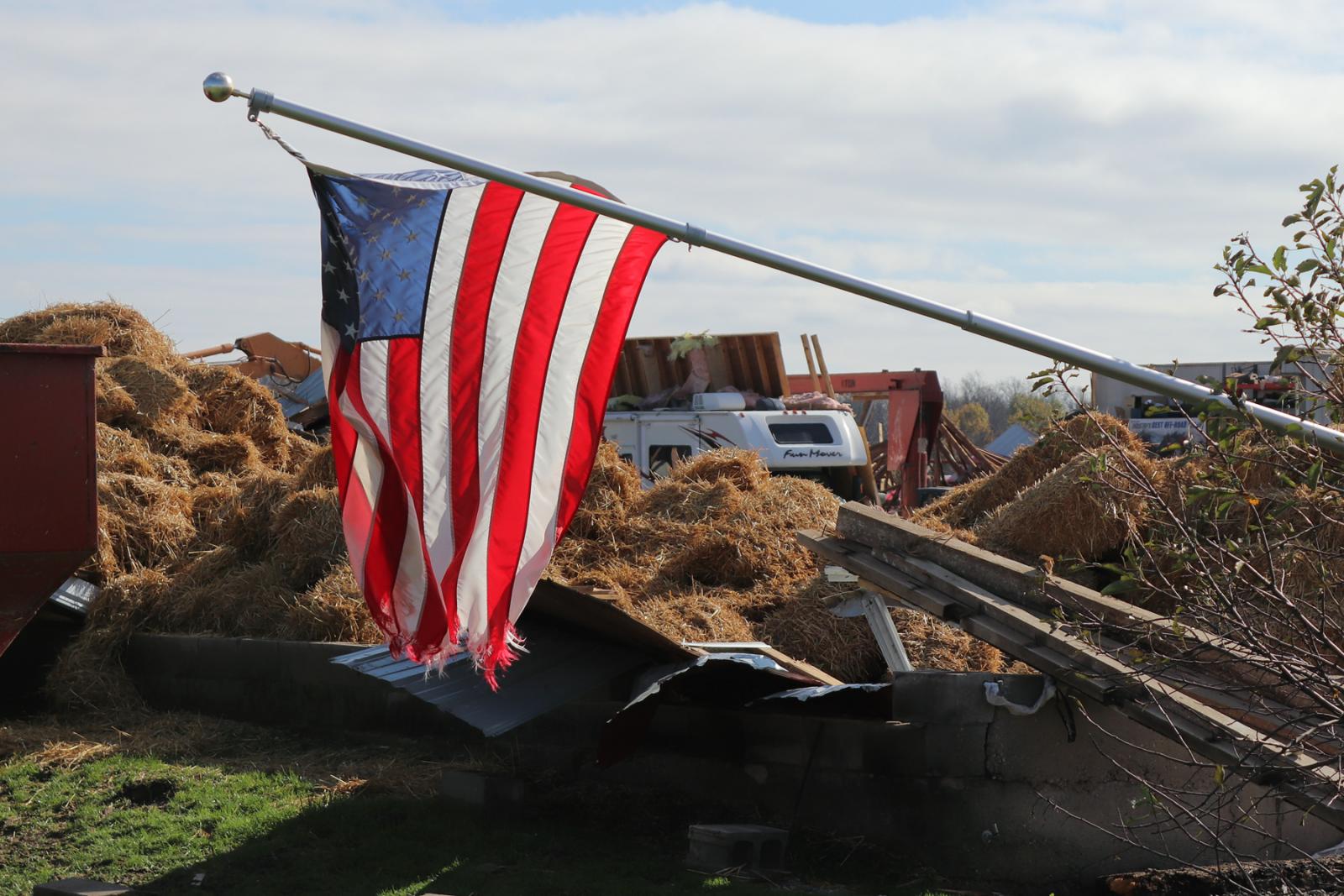
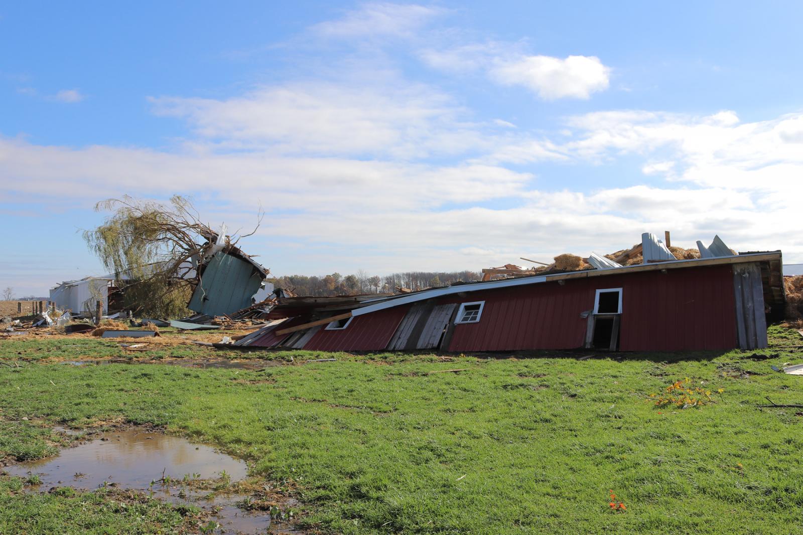
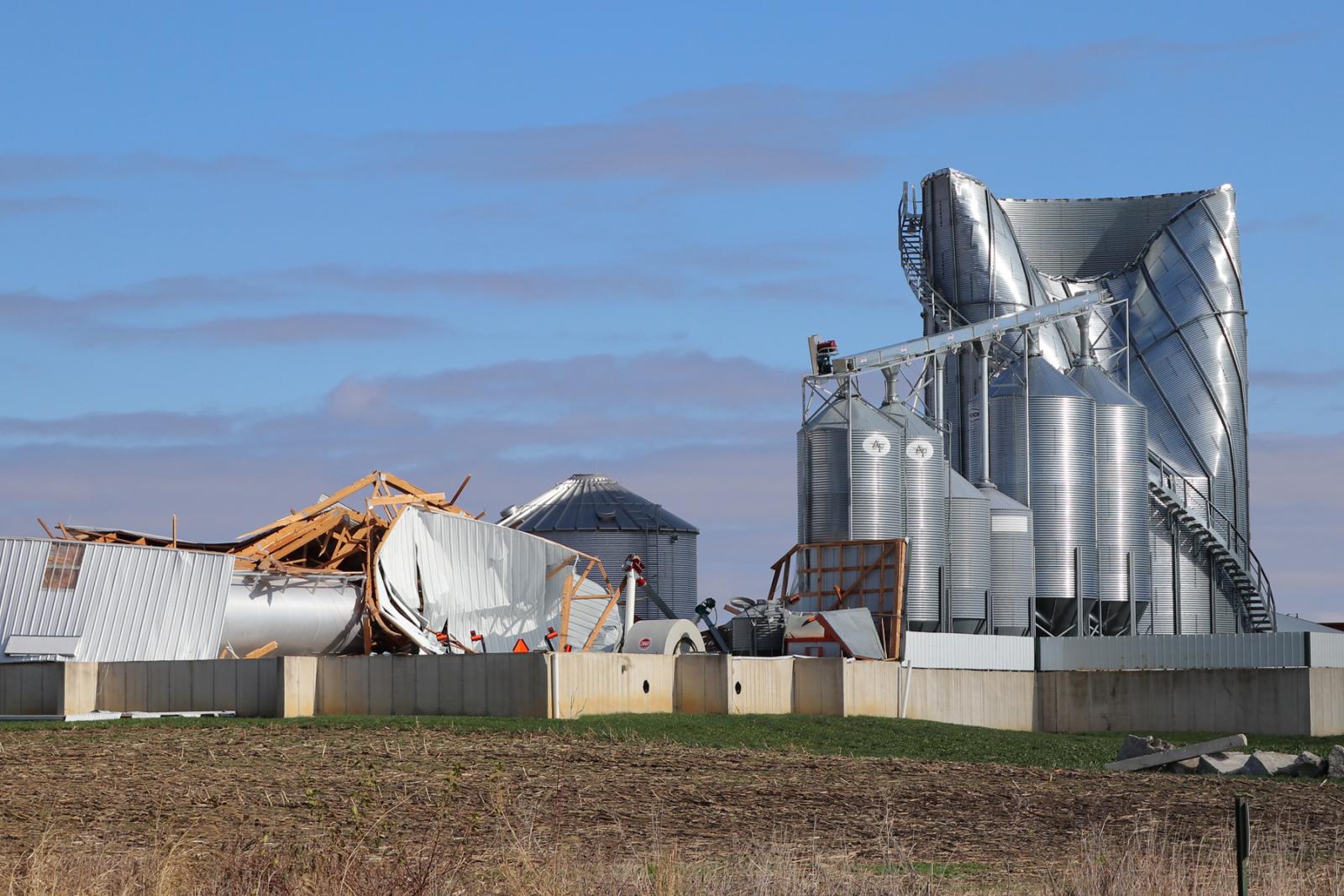
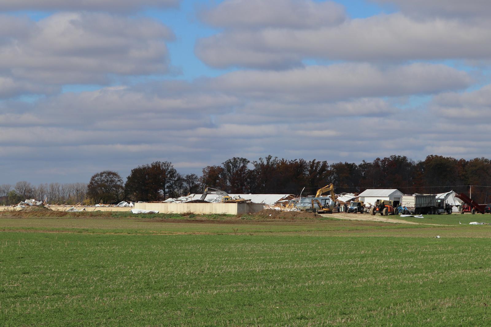
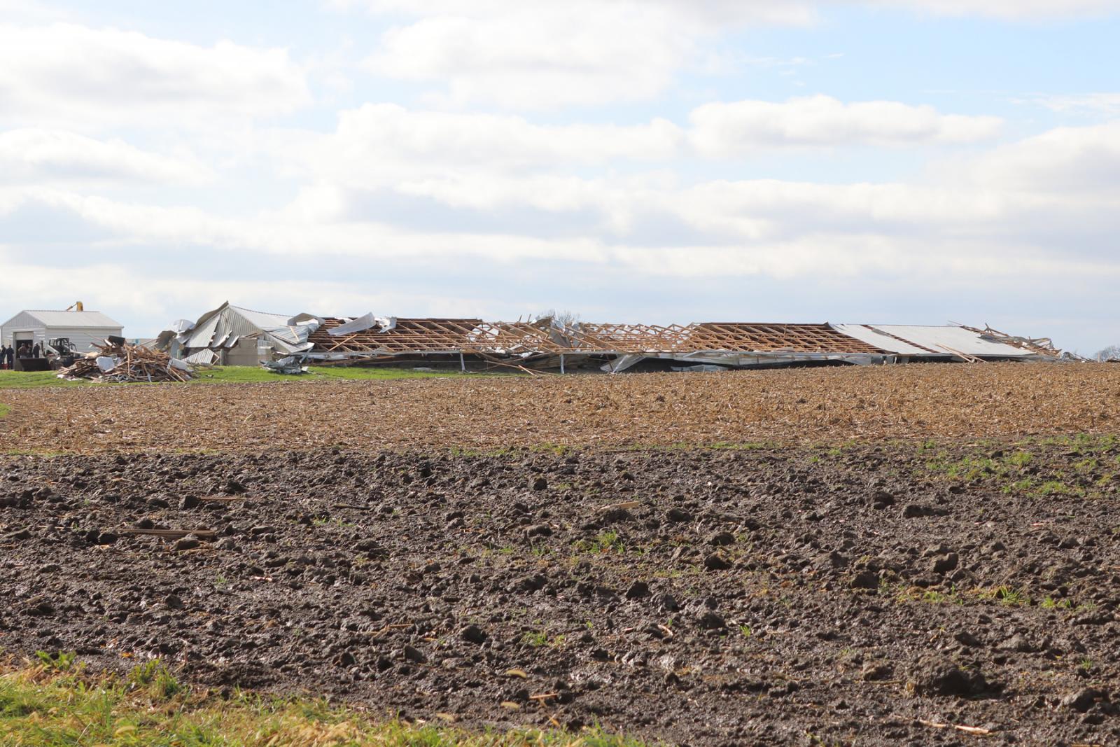
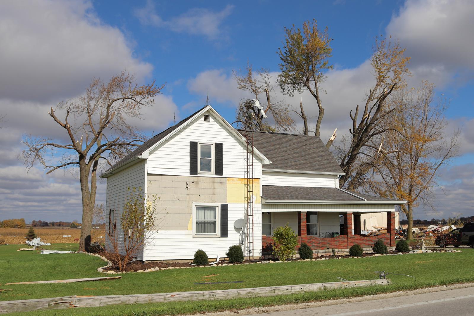
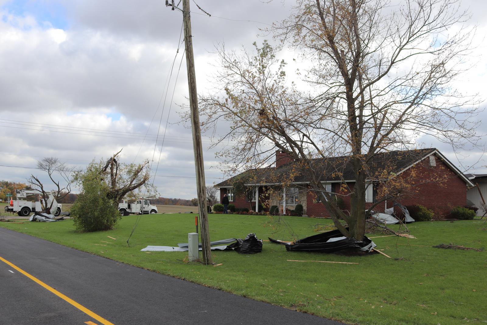
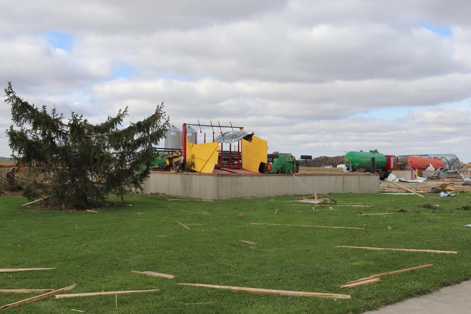
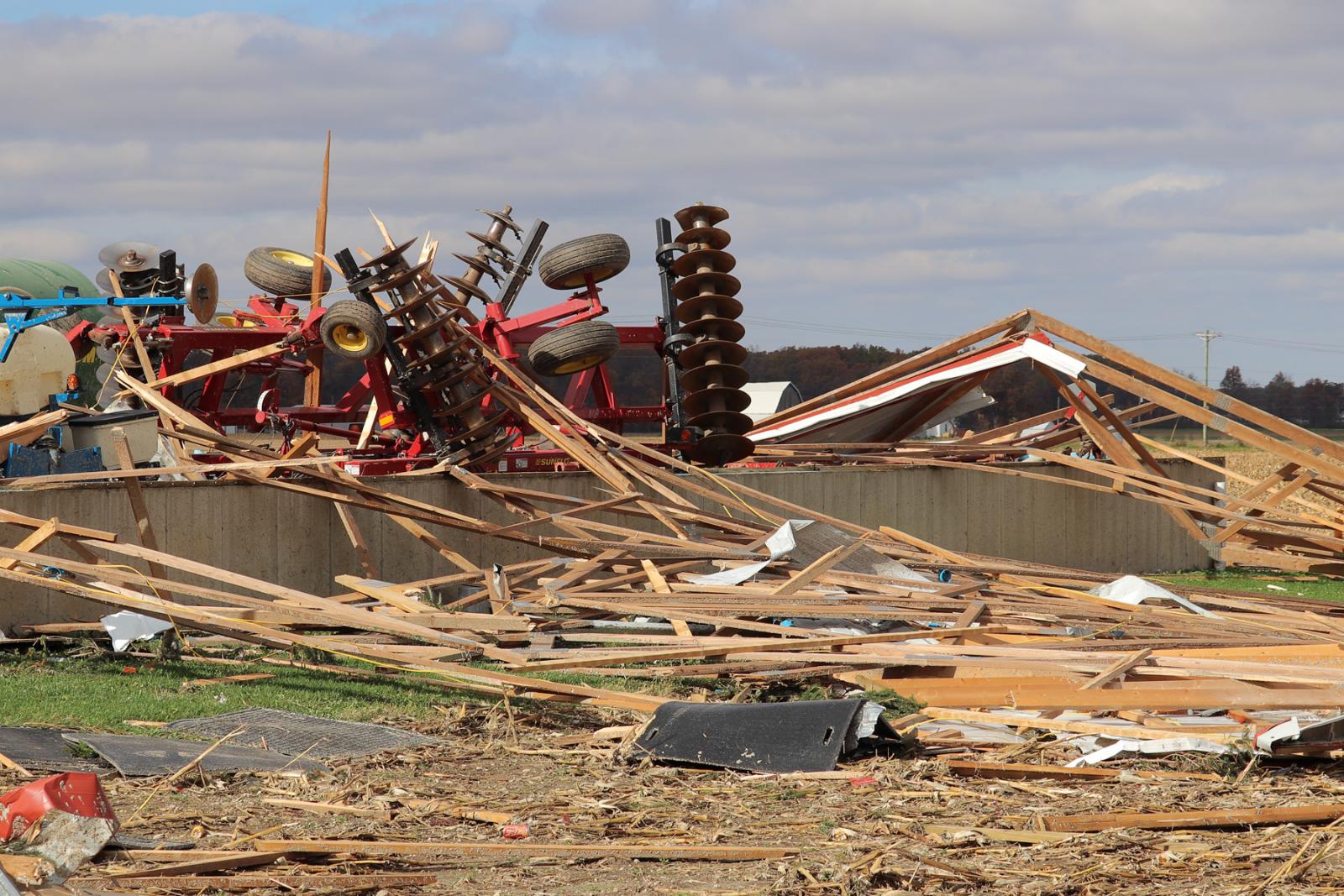
Damage was determined to be most significant at two different
locations along the track, with wind speeds estimated at 120 MPH,
or EF2 on the Enhanced Fujita Scale. The first of these locations
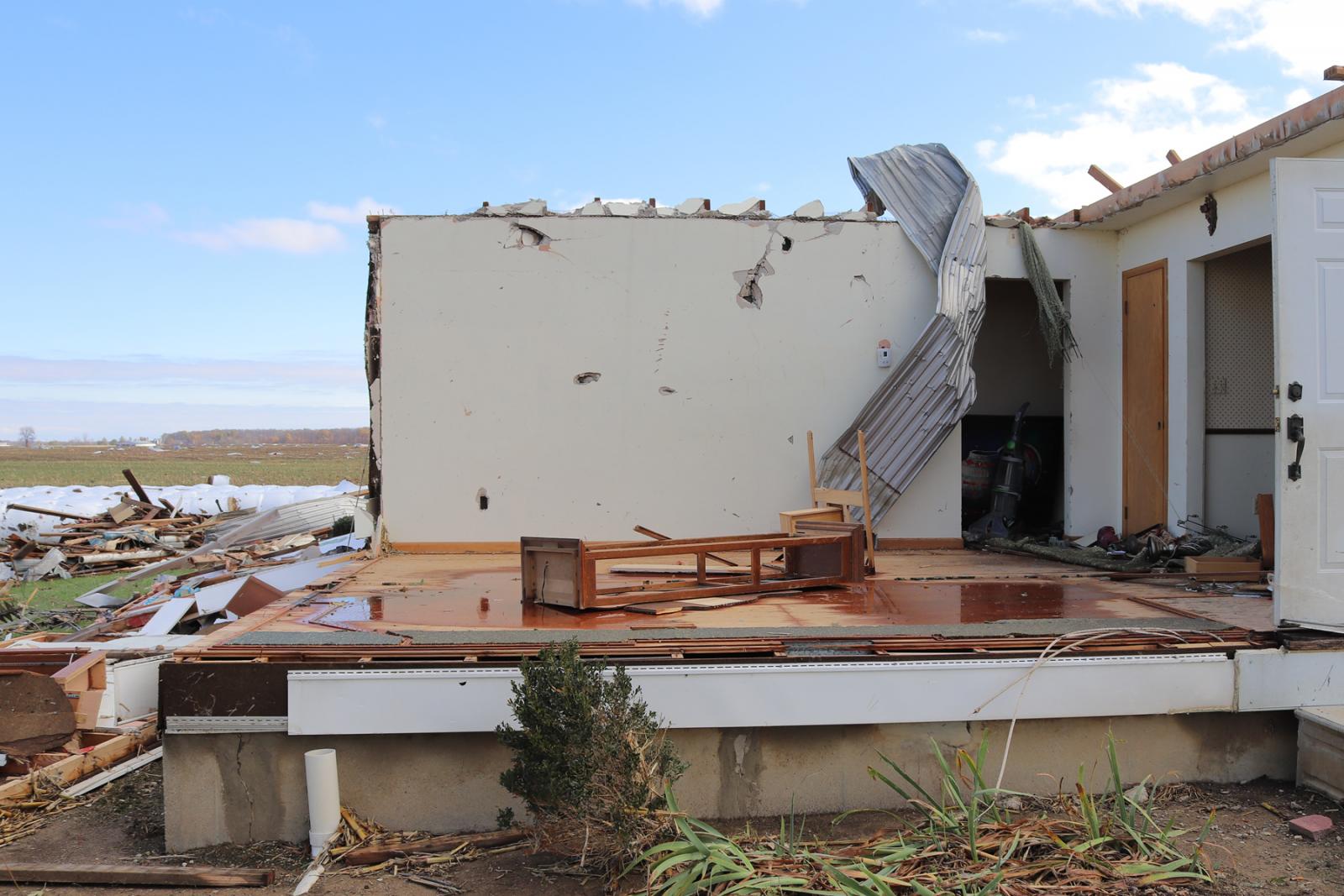
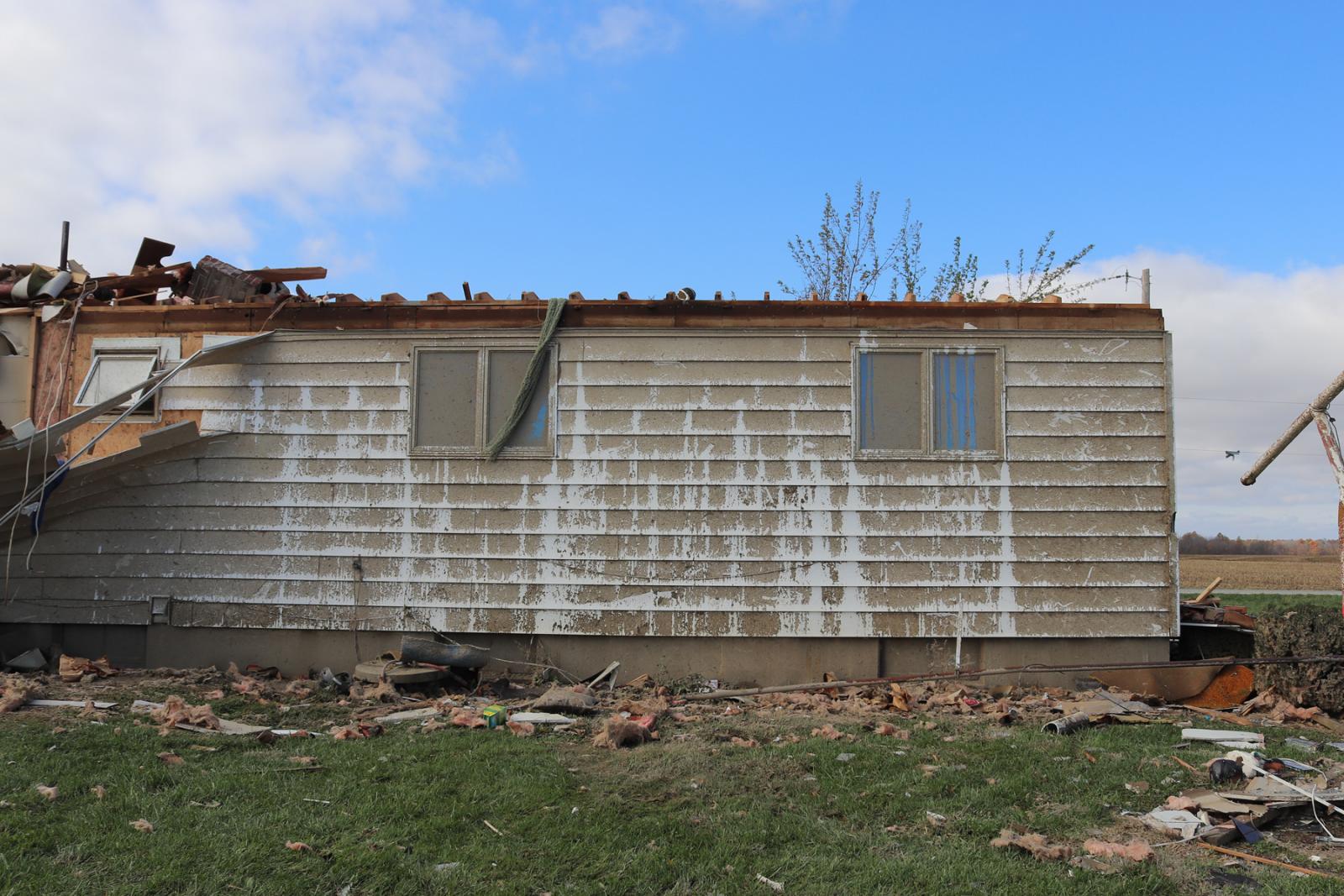
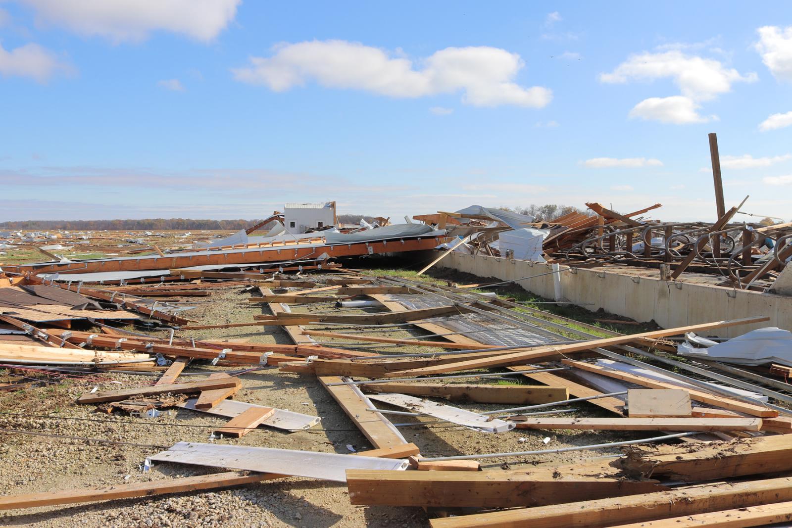
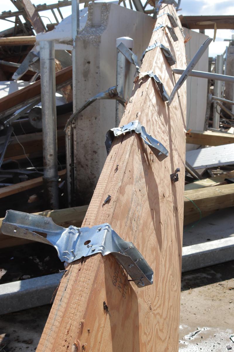
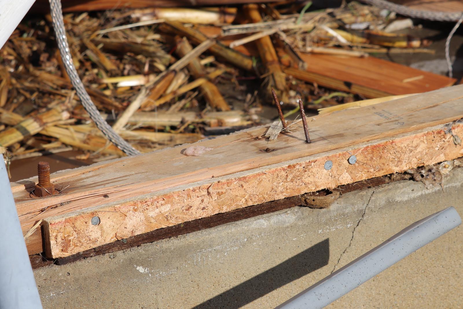
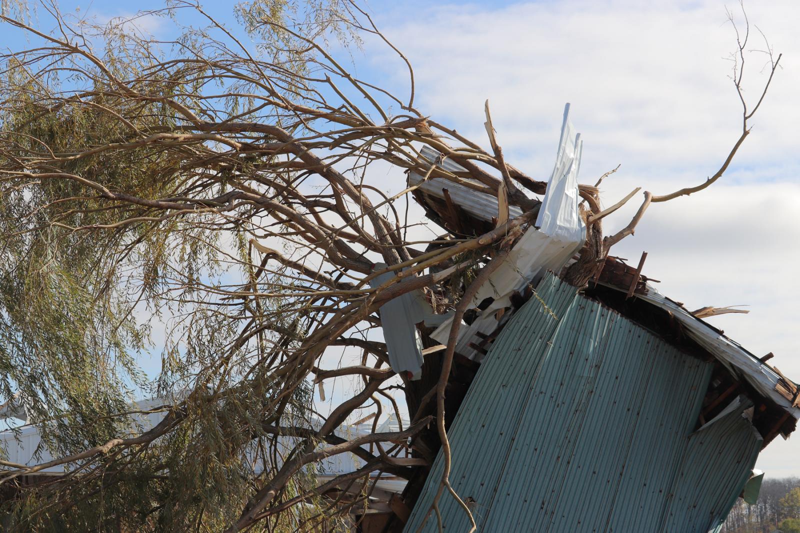
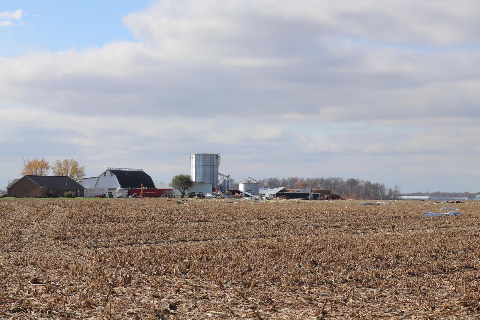
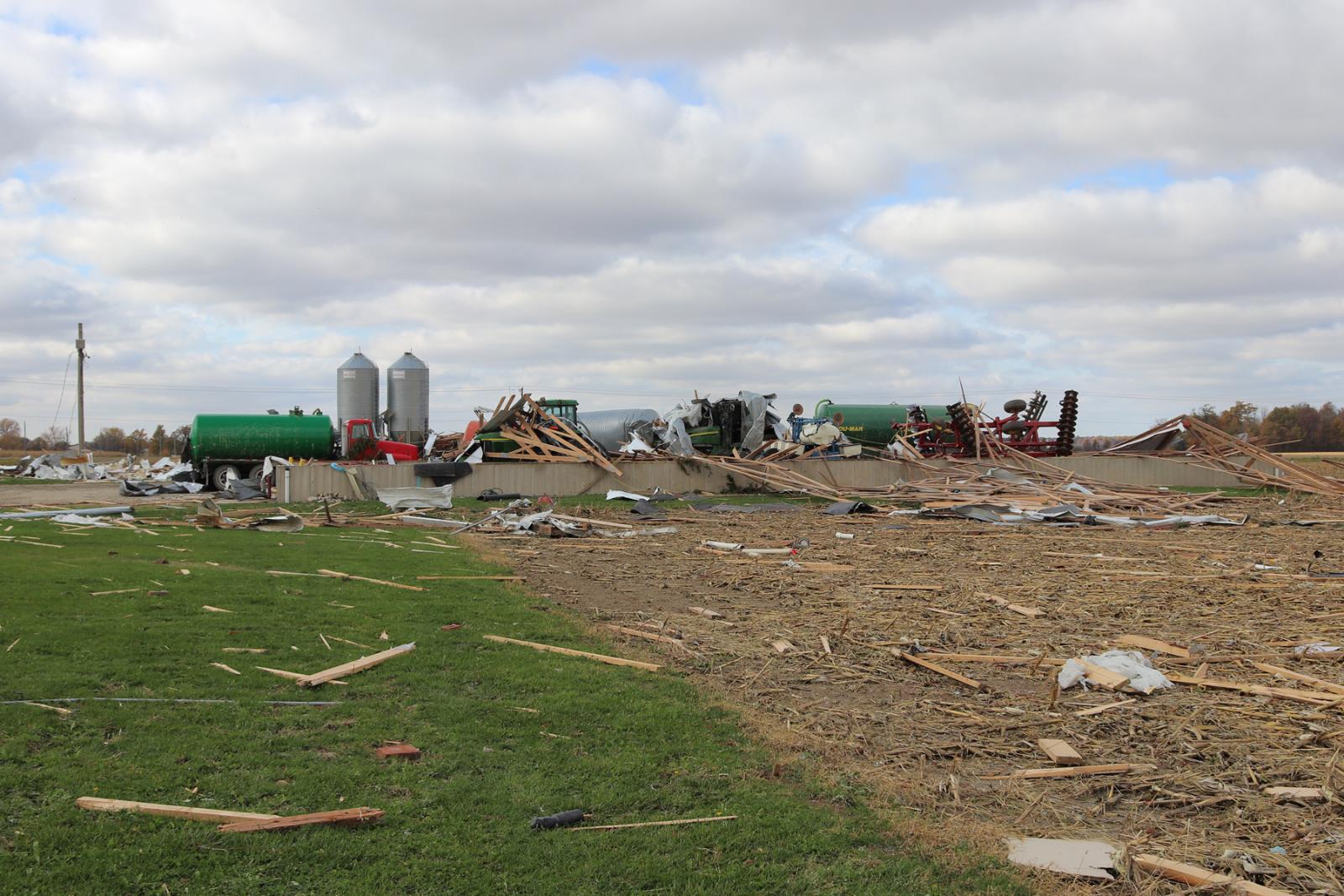
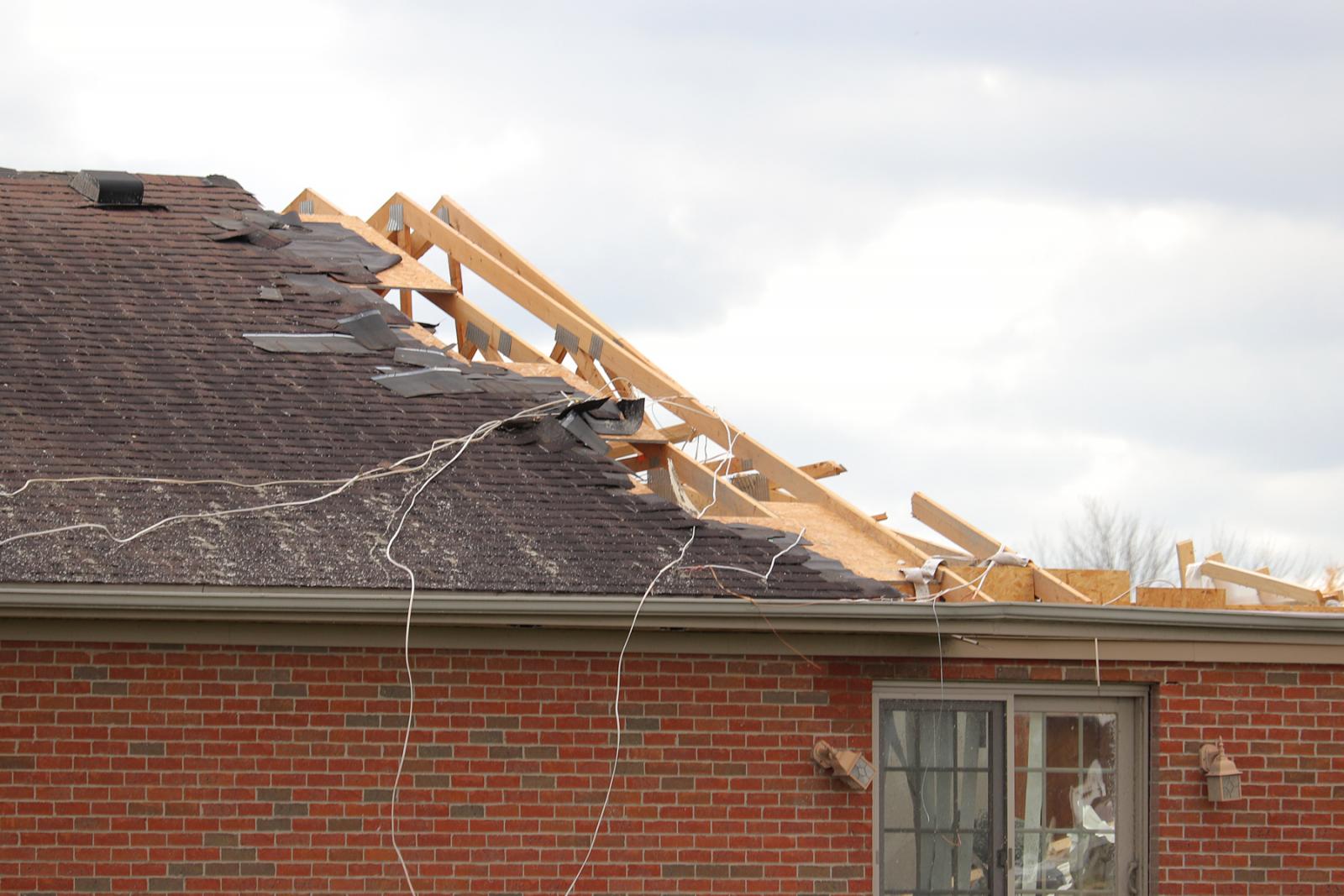
was a dairy farm on State Route 49 north of St. Anthony Road. At
this location, a small home had its roof completely removed, with
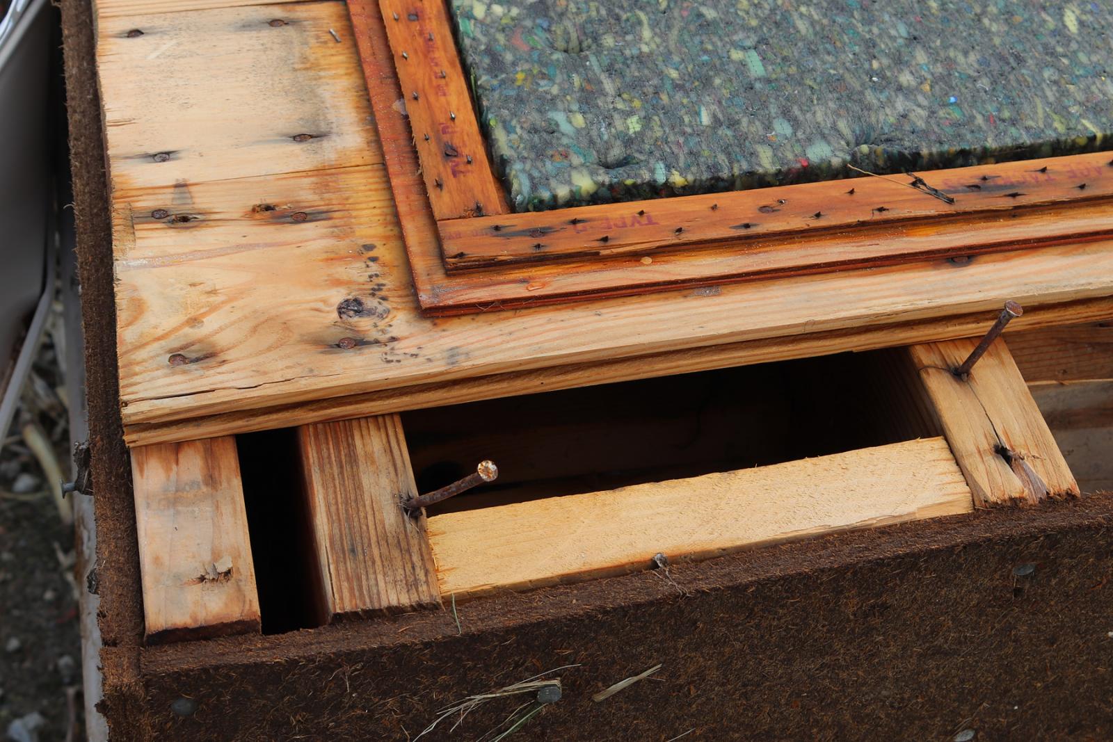
the removal and collapse of some exterior walls. It was noted that
while some walls were collapsed, toe nailing was the primary
anchoring mechanism for the roof and walls on this home. Barns
and outbuildings on the property were significantly damaged or
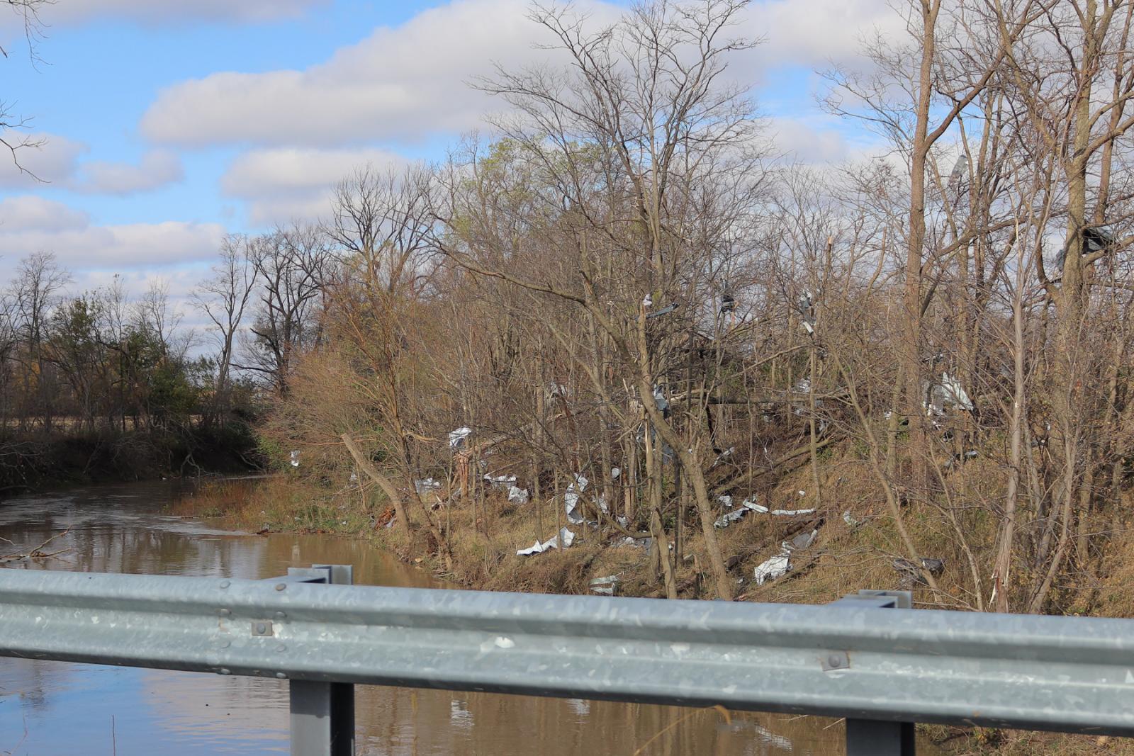
destroyed, and debris from this location was deposited up to a
mile downstream.
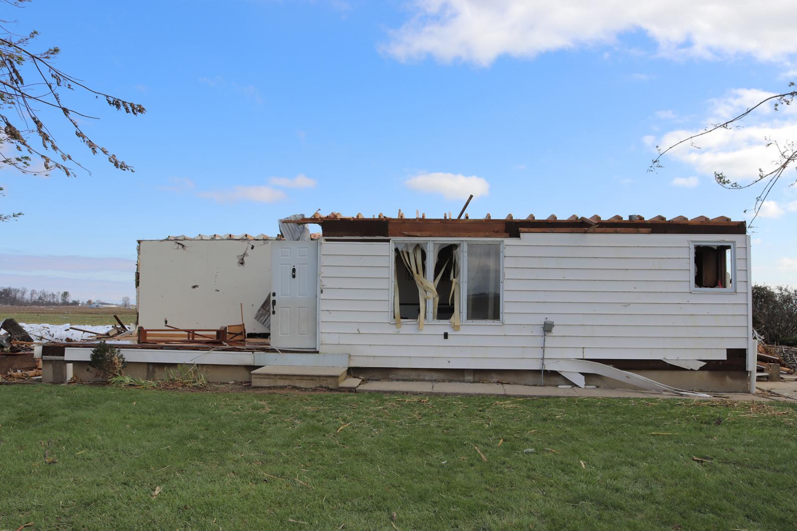
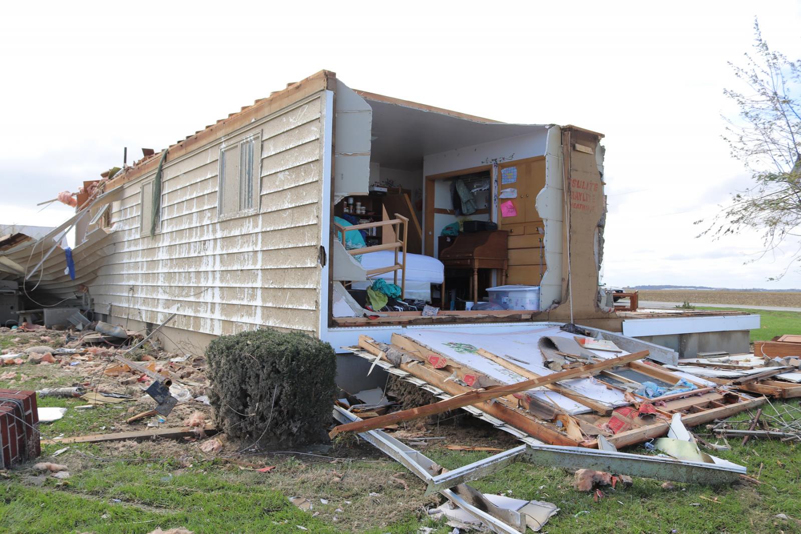
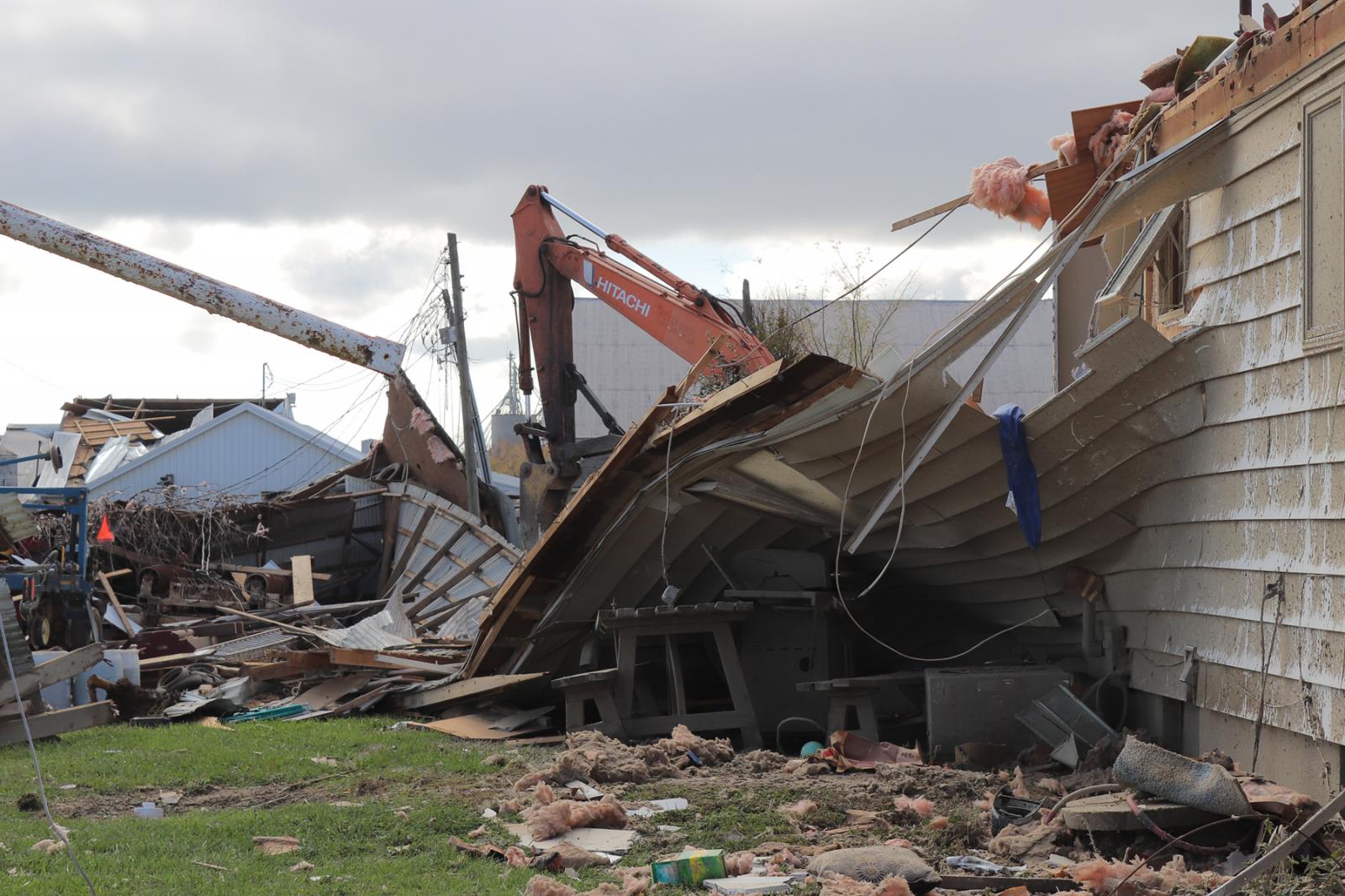
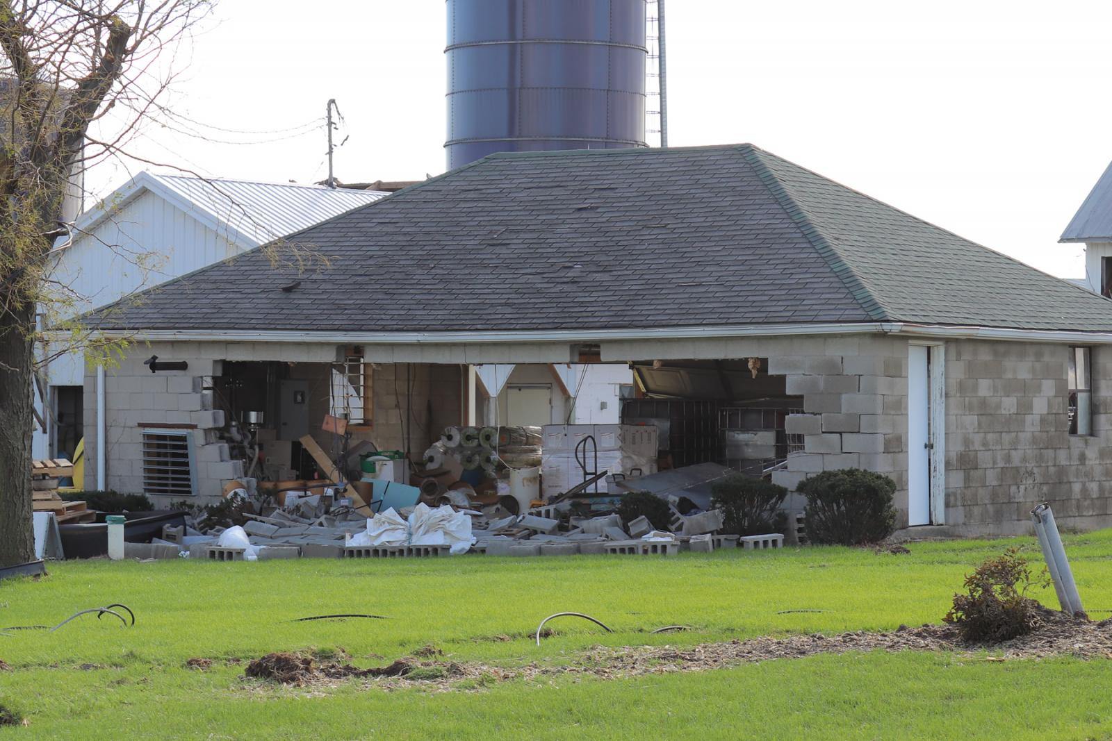
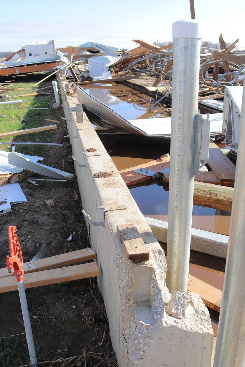
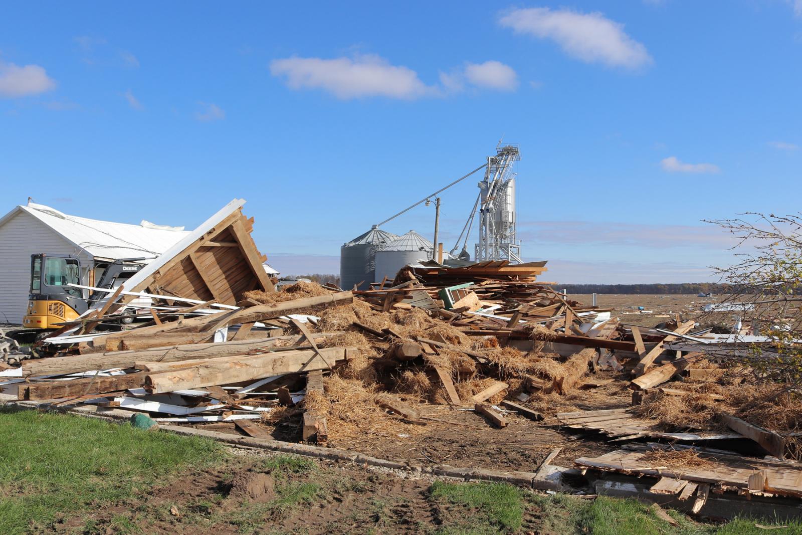
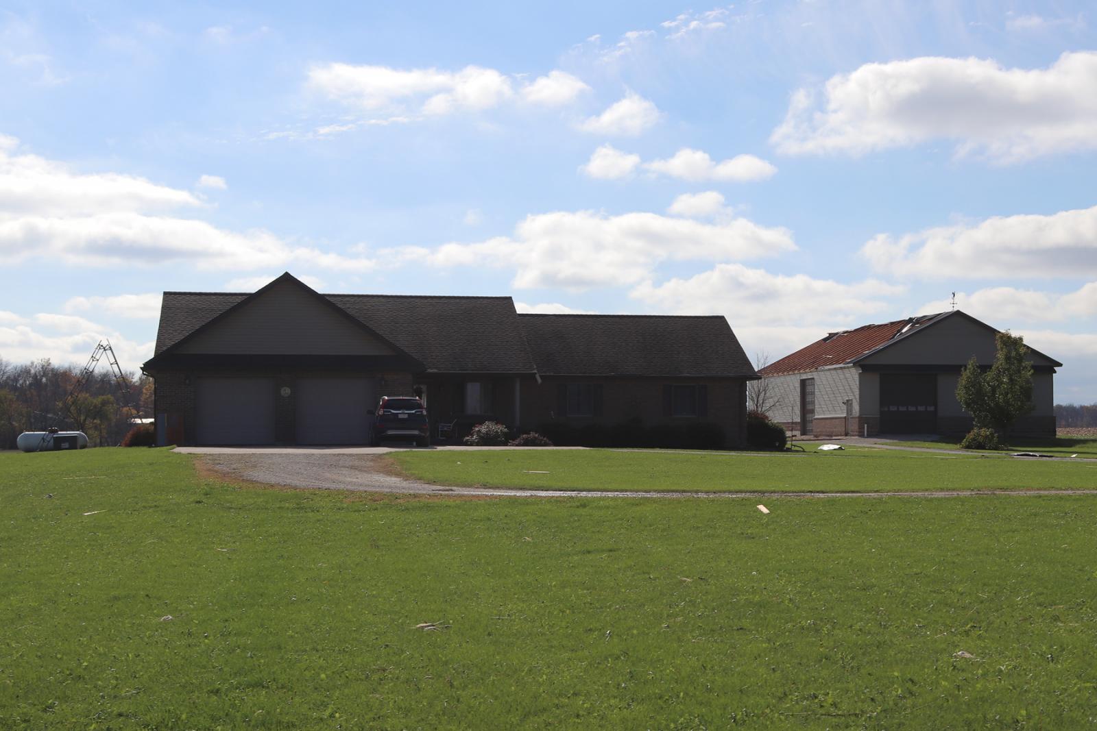
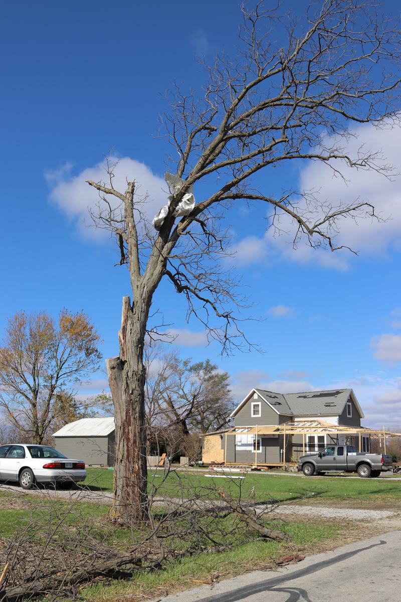
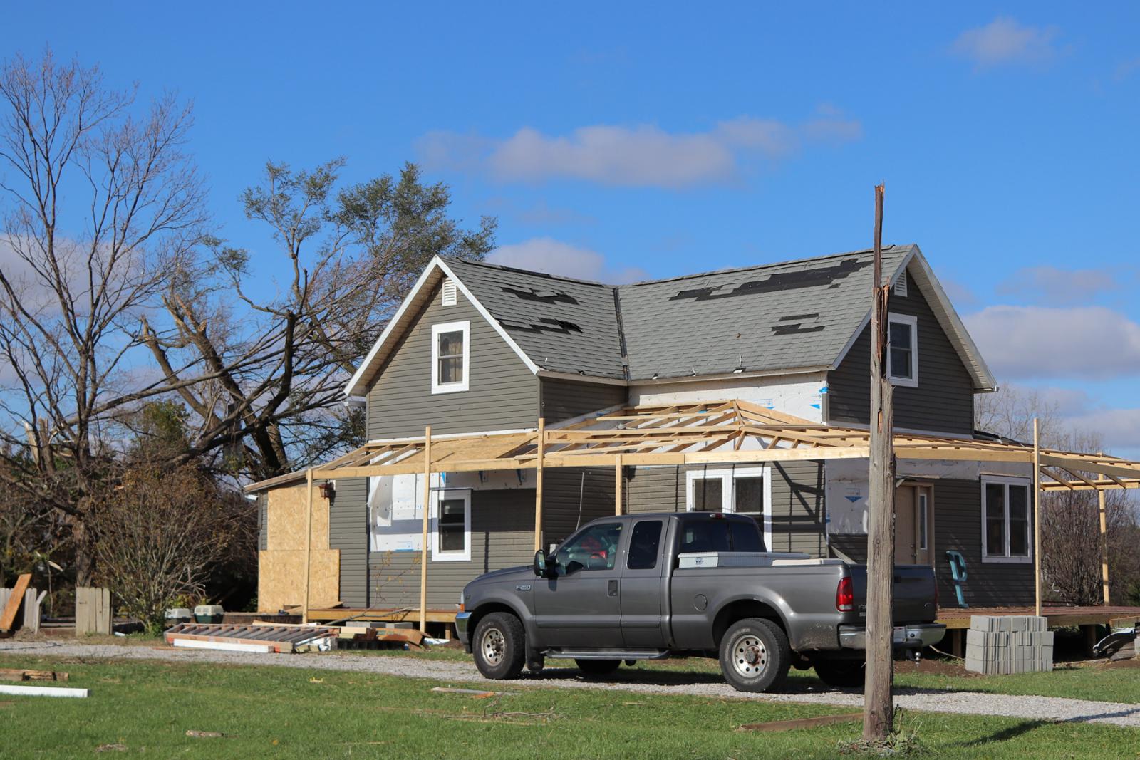
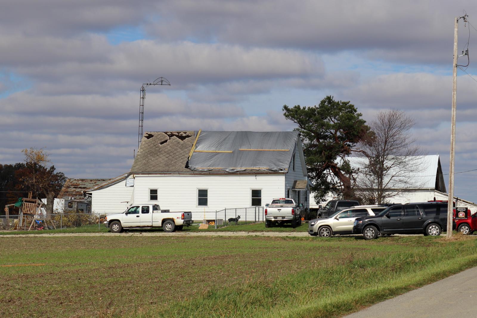
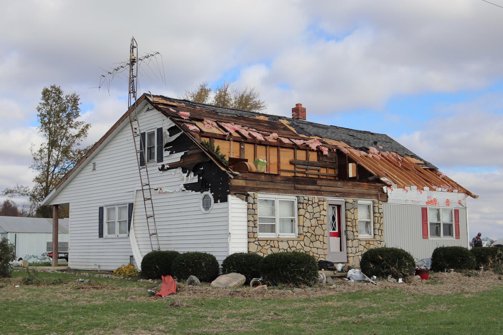
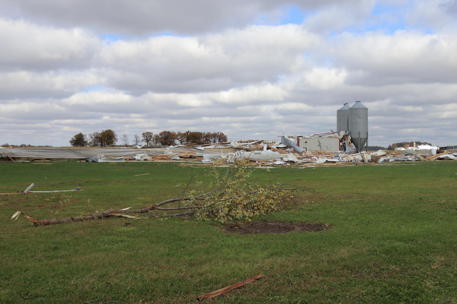
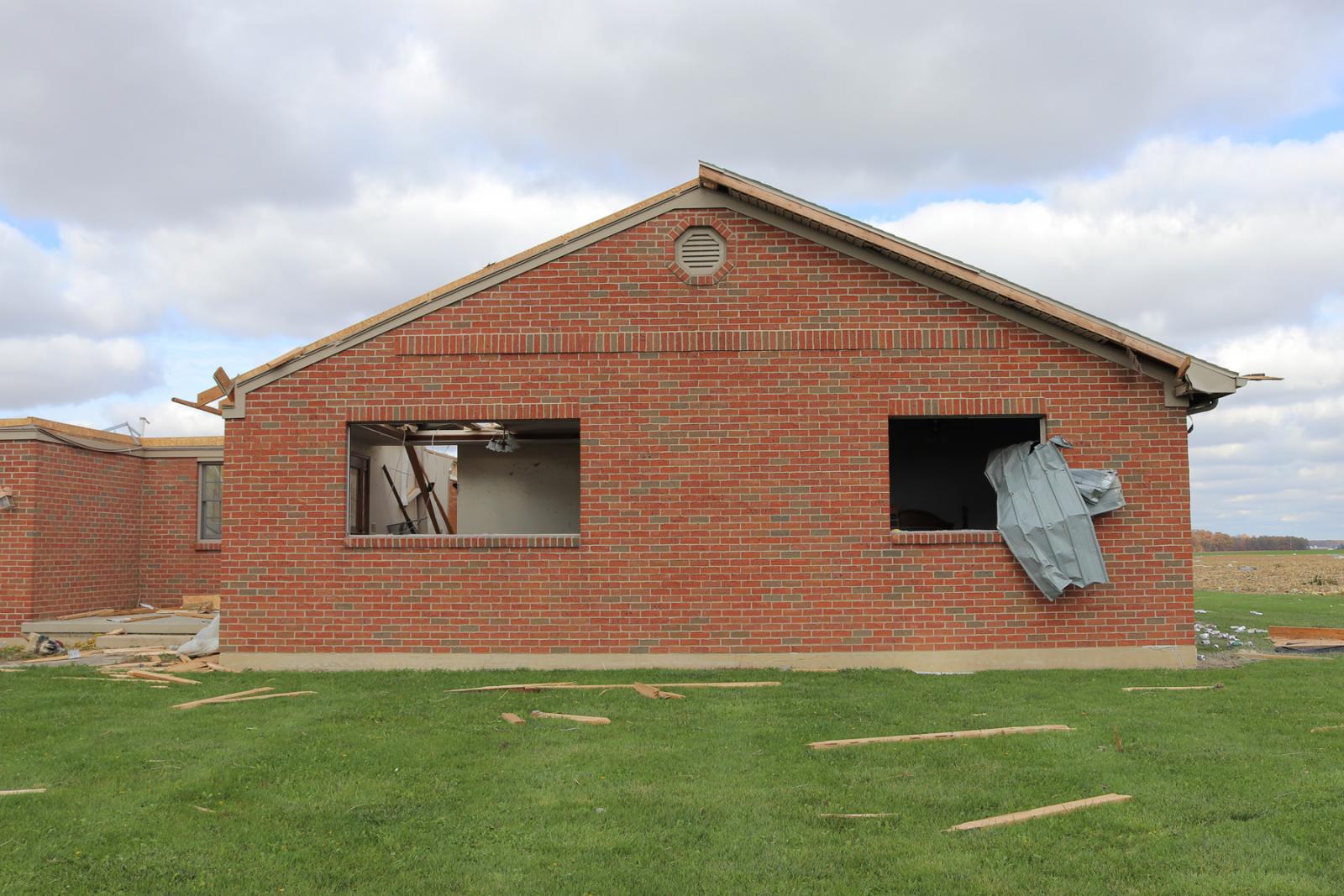
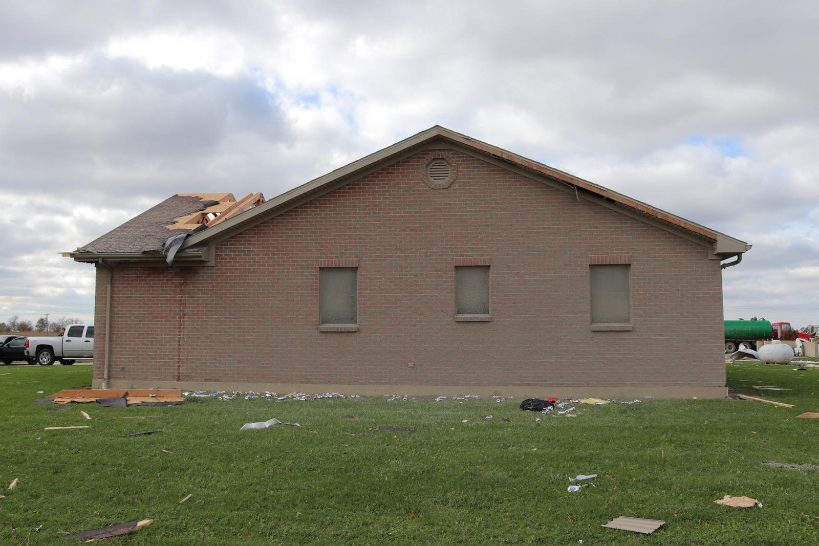
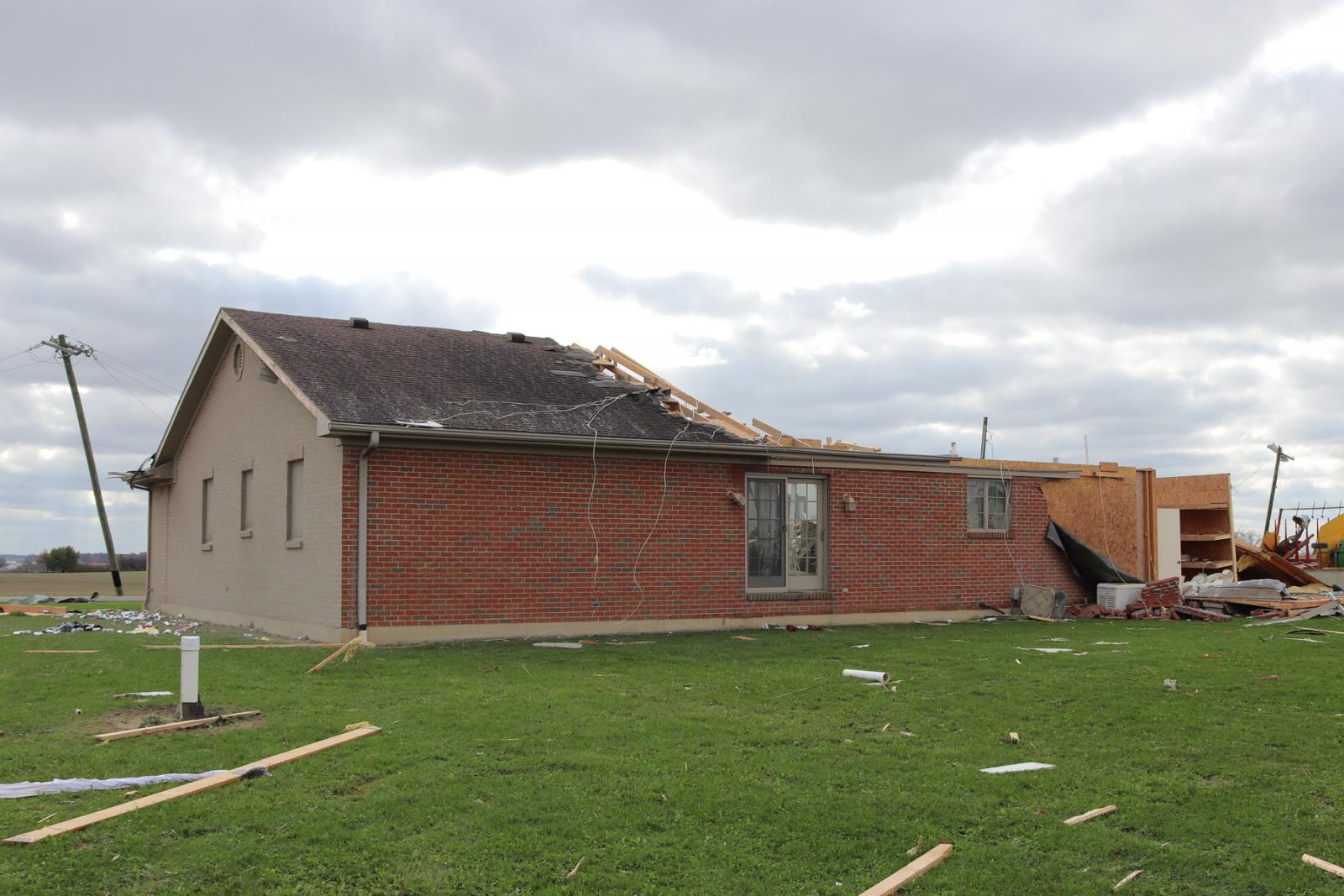
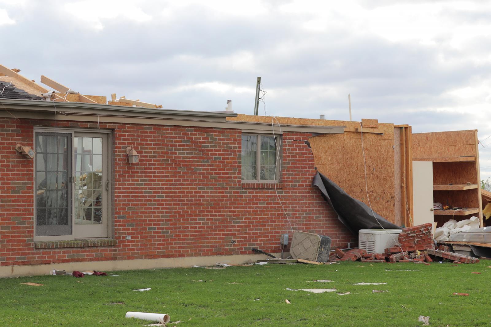
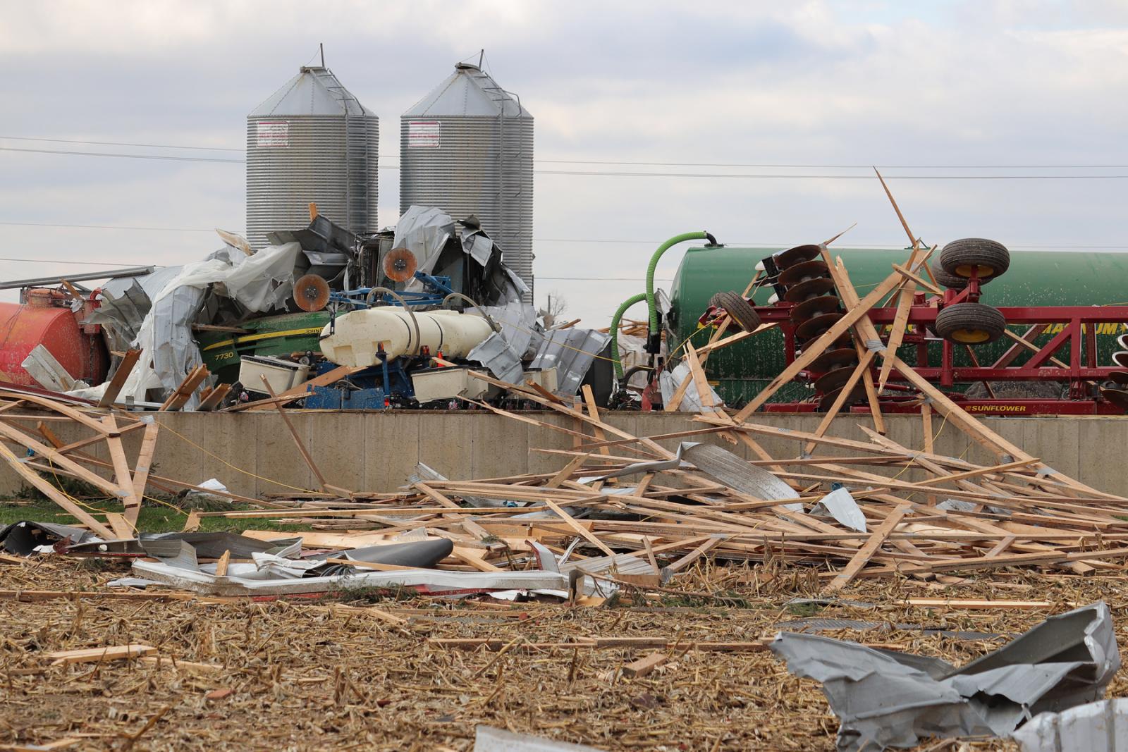
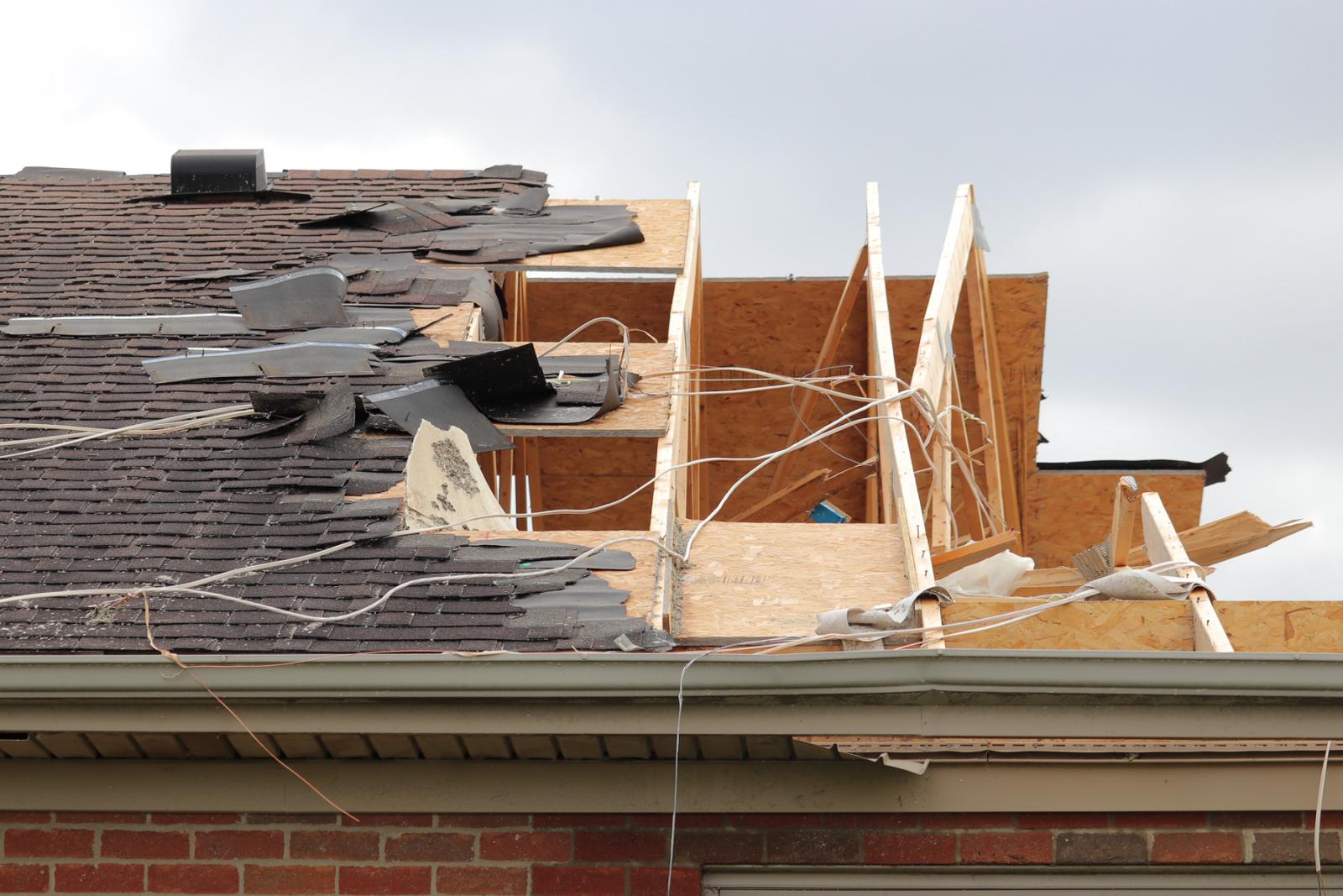
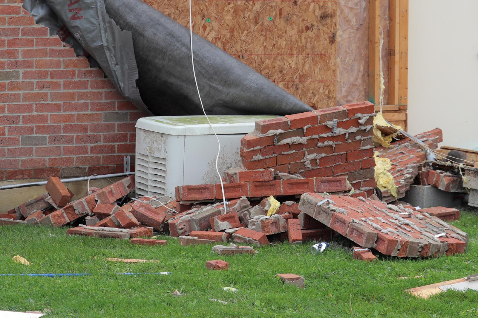
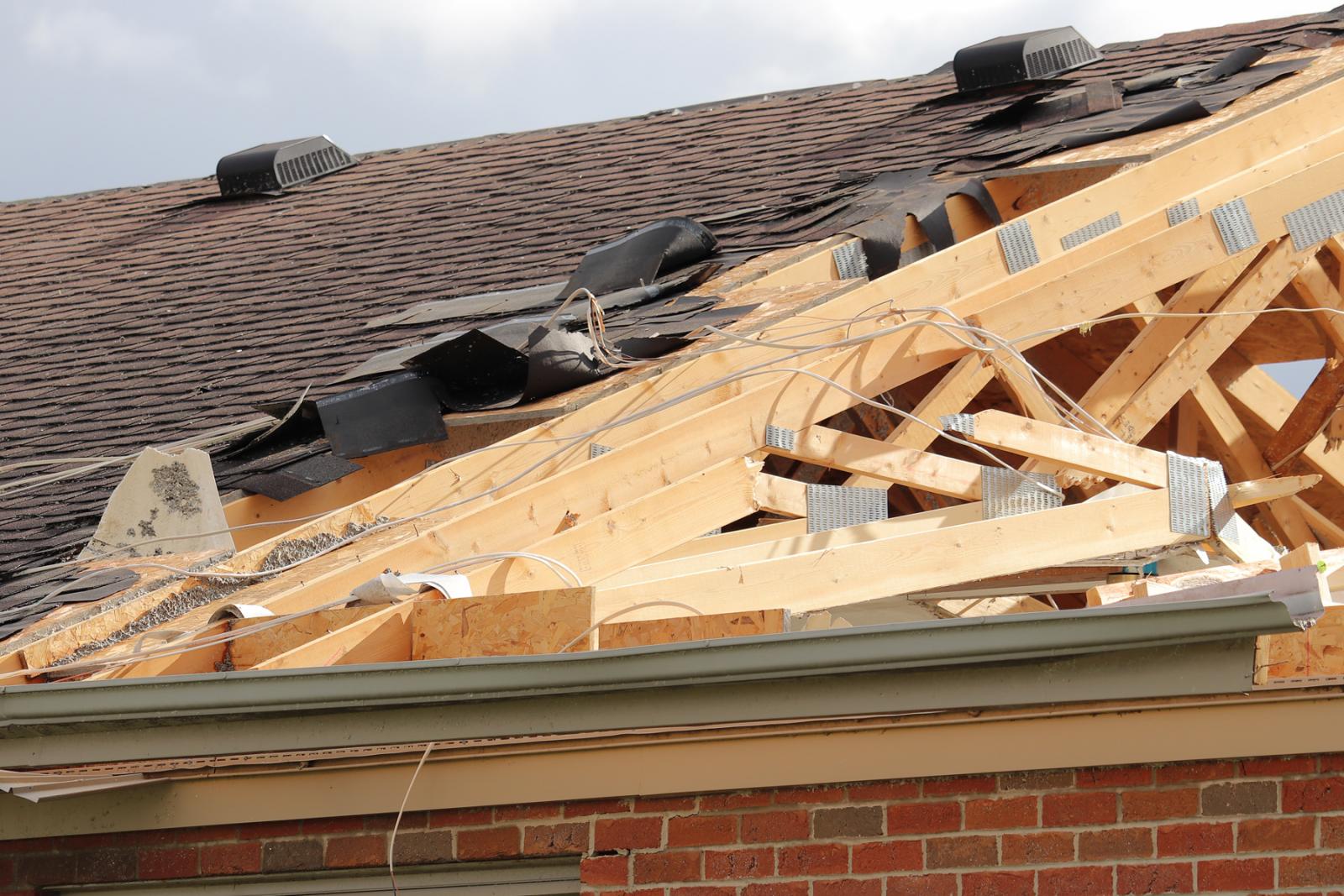
The second location exhibiting EF2-rated damage was at a property
on Mud Pike Road just east of Township Line Road. Here, a well-
built residence had the majority of its roof removed, including
the entirety of the garage roof. Sections of brick facade were
removed from the exterior walls of the home, with significant mud
splatter on the east-facing exterior wall. A large well-
constructed barn adjacent to this home was completely demolished,
with debris thrown about a mile downstream of its source location.
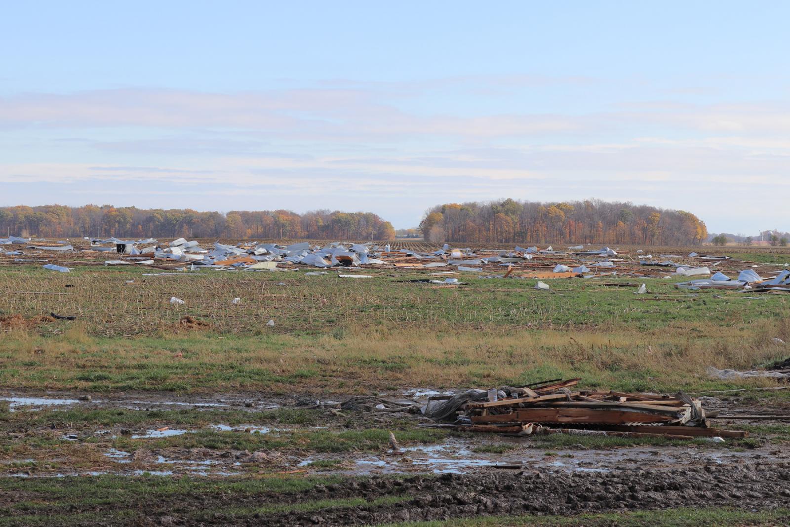
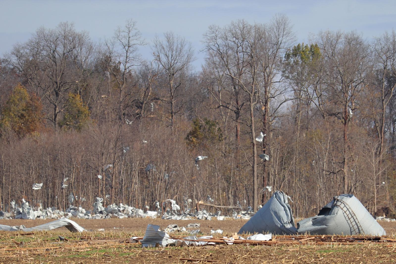
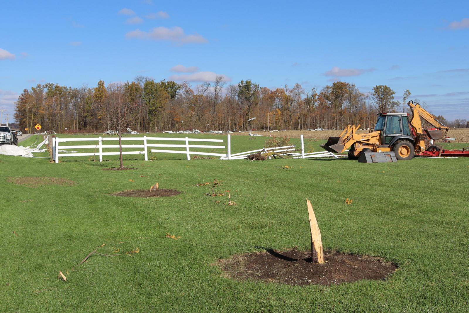
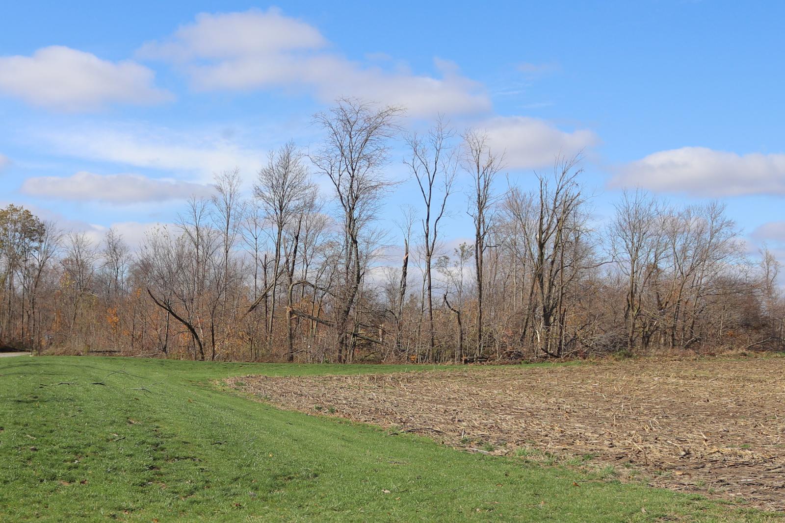
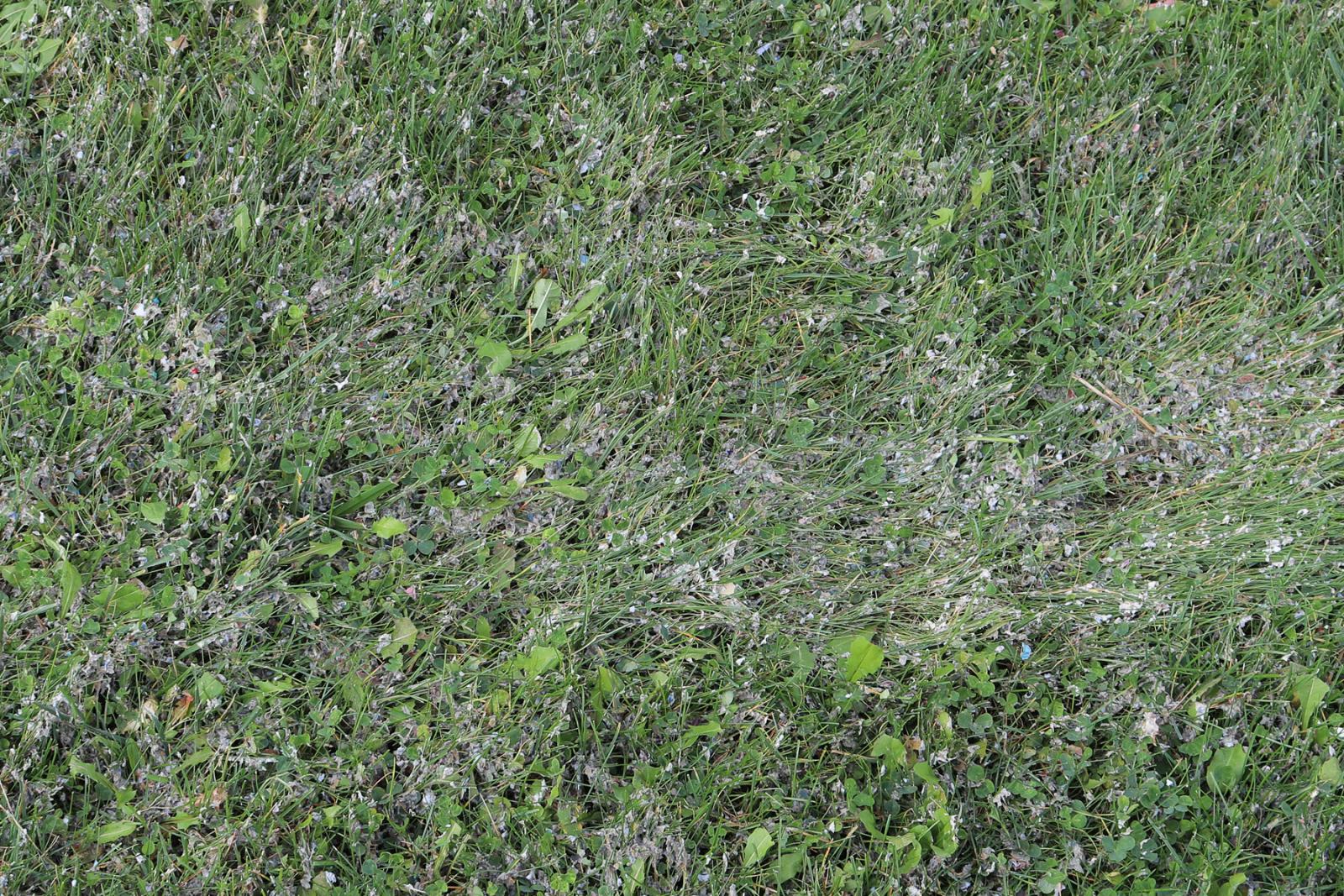
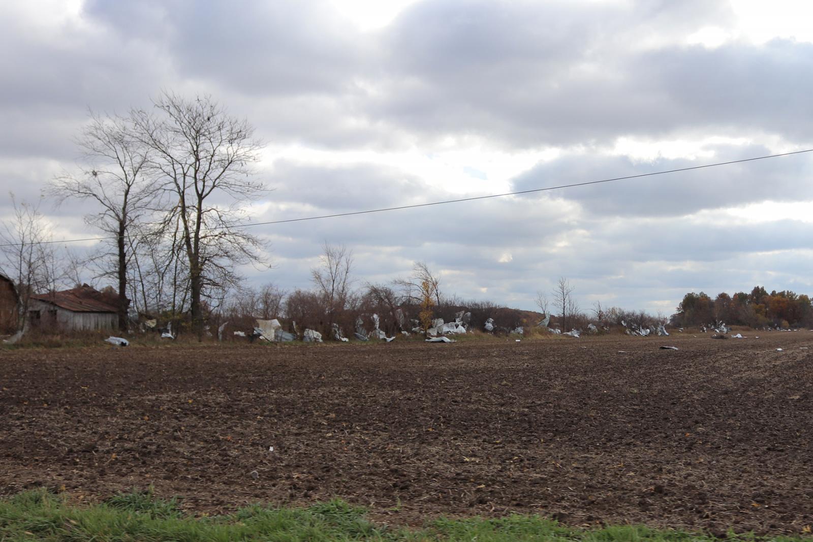
Throughout its track through Mercer County, this tornado exhibited
a large and relatively uniform width, with damage observed that
indicate a width of near or slightly greater than three tenths of
a mile. Some minor damage was even observed outside of this
estimated width. Downstream of some of the affected properties,
debris fields were observed to be long, wide, and relatively
uniform.
For reference: the Enhanced Fujita Scale classifies tornadoes
into the following categories:
EF0...wind speeds 65 to 85 mph.
EF1...wind speeds 86 to 110 mph.
EF2...wind speeds 111 to 135 mph.
EF3...wind speeds 136 to 165 mph.
EF4...wind speeds 166 to 200 mph.
EF5...wind speeds greater than 200 mph.
$$
BINAU/HATZOS
|


