|
Tornado near South Vienna OH |
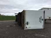
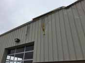
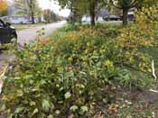
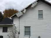
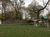
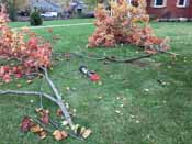
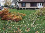
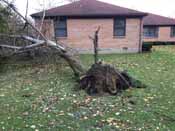
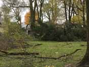
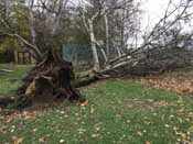
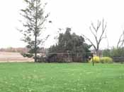
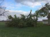
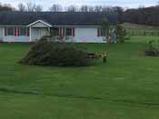
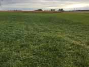
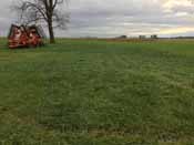
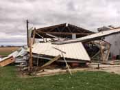
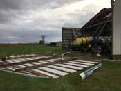
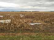
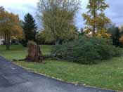
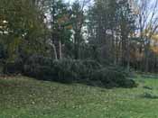
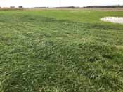
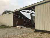
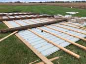
Public Information Statement National Weather Service Wilmington OH 834 PM EST Mon Nov 6 2017 ...TORNADO CONFIRMED NEAR SOUTH VIENNA IN CLARK AND MADISON COUNTY OHIO... Location...South Vienna in Clark and Madison County Ohio Date...11/05/17 Estimated Time...616 PM EST to 625 PM EST Maximum EF-Scale Rating...EF1 Estimated Maximum Wind Speed...95 MPH Maximum Path Width...200 yards Path Length...6.7 miles Beginning Lat/Lon...39.9324N / 83.6225W Ending lat/Lon......39.9262N / 83.4978W * Fatalities...0 * Injuries...0 * The information in this statement is preliminary and subject to change pending final review of the event(s) and publication in NWS Storm Data. ...Summary... The National Weather Service in Wilmington OH has confirmed a tornado near South Vienna in Clark and Madison counties in Ohio on November 5th 2017. The tornado first touched down between Ritchie Drive and Interstate 70, where a semi-trailer was overturned. Damage then was observed approaching Ritchie Dr to Ritchie Brothers Auctioneers with a hole in the roof and some siding removed. The tornado then progressed southeast into South Vienna with multiple tree limbs down across E North Street and N East Street with some minor structural damage to roofs also occurring. Damage then continued towards the southeast along E Main Street. The tornado then strengthened as it crossed Longs Court and headed east. Several trees were then snapped around half way up the trees themselves with at least three trees uprooted towards the eastern city limits of South Vienna. East of where E Main Street merges with E National Road, structural damage was observed with a garage slightly shifted off of its foundation. The tornado then continued southeast with minor tree damage observed where Wilson Road and S Houston Pike meet. Damage then continued on Markley Road just south of E National Road in the form of mostly tree damage. Most trees only had limbs down with two being uprooted. The tornado then strengthened with structural damage occurring just south of E National Road on Roberts Mill Road. A trailer attached to a tractor was then tipped on its side. A barn on the property then lost the west facing wall with some of the north and south walls also removed. The east facing wall was completely removed from the structure. Around 30% of the roof was removed with pieces of the barn blown into a corn field towards the east. Observed damage from the barn was consistent with EF1 tornadic winds. The survey then continued into the corn field were corn was observed laid down in different directions. The tornado then lifted as the track ended in the corn field. For reference: the Enhanced Fujita Scale classifies tornadoes into the following categories: EF0...wind speeds 65 to 85 mph. EF1...wind speeds 86 to 110 mph. EF2...wind speeds 111 to 135 mph. EF3...wind speeds 136 to 165 mph. EF4...wind speeds 166 to 200 mph. EF5...wind speeds greater than 200 mph. $$ BH/JG |
| Radar Loops from NWS Wilmington Ohio (6:14 PM - 6:30 PM) | ||
| KILN 0.5° Reflectivity | KILN 0.5° Storm-Relative Motion | KILN 0.5° Correlation Coefficient |
| 1 2 3 4 5 6 7 8 9 10 | 1 2 3 4 5 6 7 8 9 10 | 1 2 3 4 5 6 7 8 9 10 |
| Pictures from the storm survey: | |||
 |
 |
 |
 |
 |
 |
 |
 |
 |
 |
 |
 |
 |
 |
 |
 |
 |
 |
 |
 |
 |
 |
 |
 |
 |
 |
 |
 |