Public Information Statement
National Weather Service Wilmington OH
911 AM EDT Fri Jul 14 2017
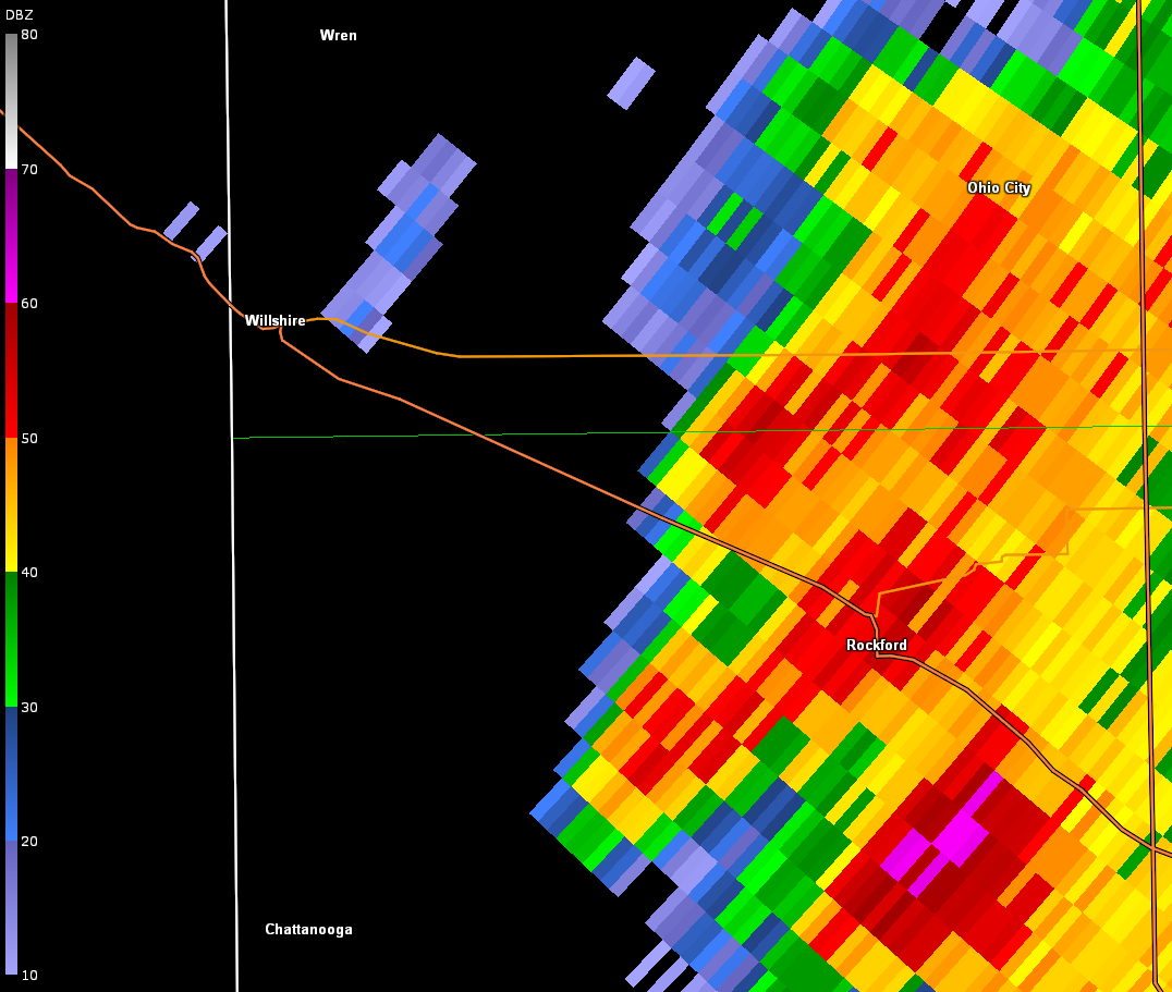
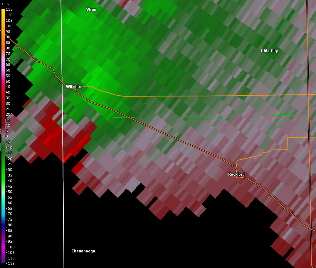
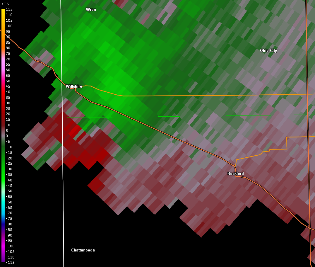
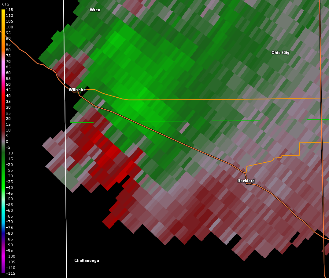
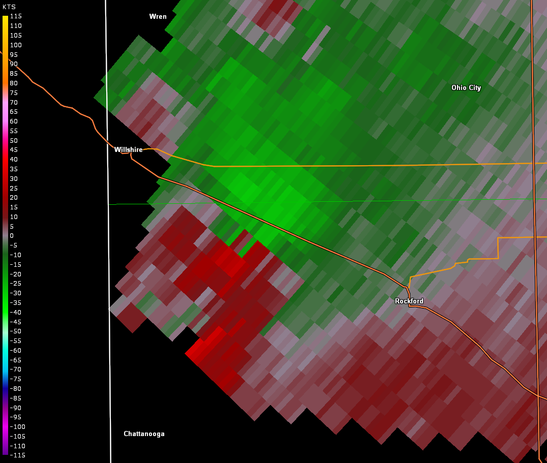
...TORNADO CONFIRMED NEAR ROCKFORD IN MERCER COUNTY OHIO...
...UPDATED TRACK DETAILS...
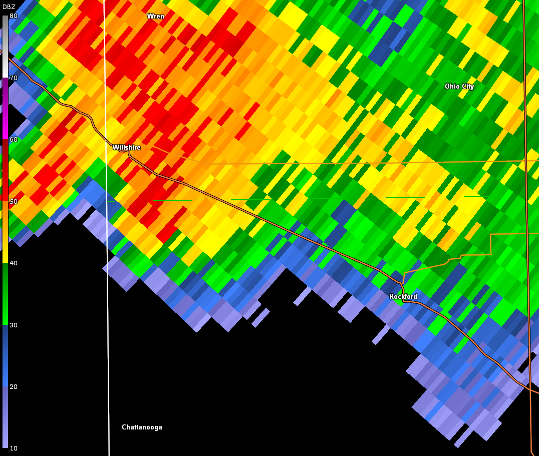
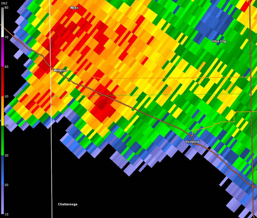
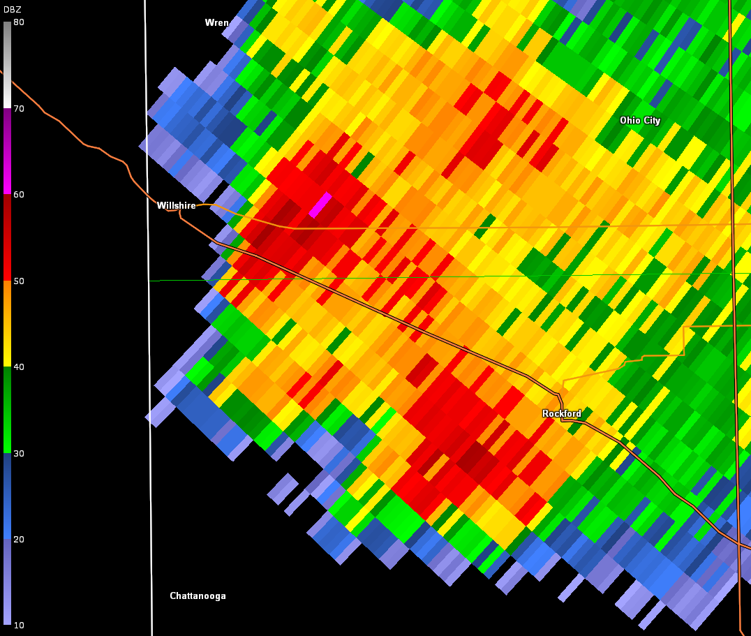
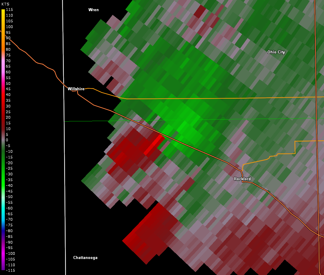
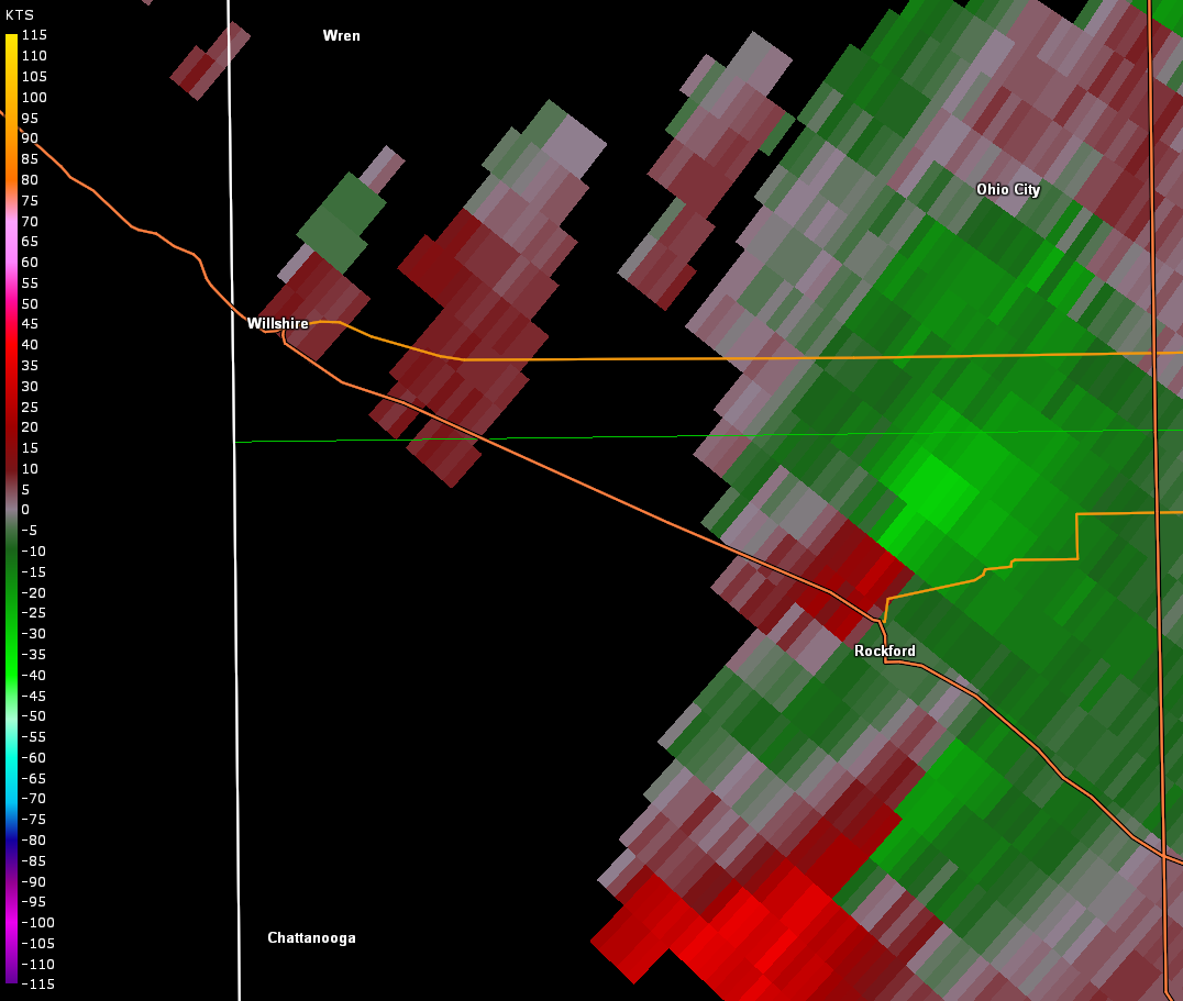
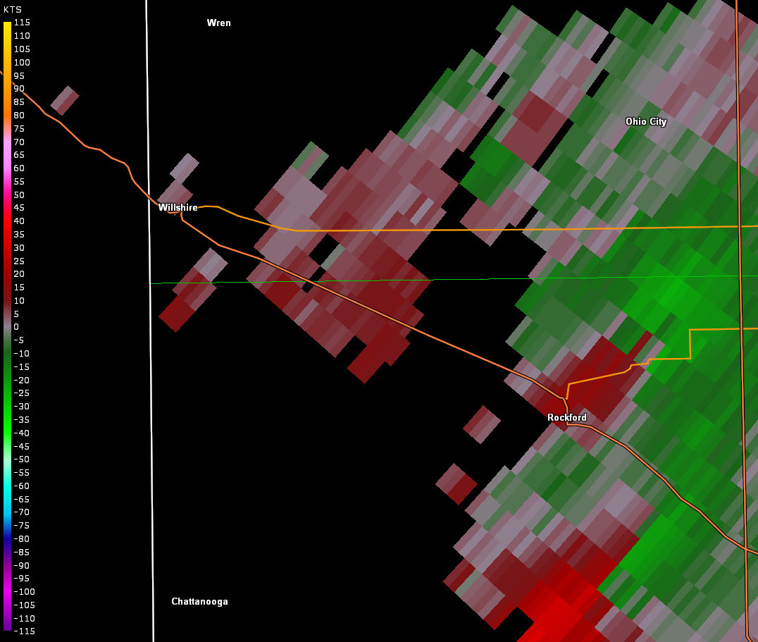
Location...Northwest of Rockford in Mercer County Ohio
Date...July 10 2017
Start Time...814 PM
End Time...831 PM
Maximum EF-Scale Rating...EF0
Estimated Maximum Wind Speed...70 MPH
Maximum Path Width...150 Yards
Path Length...6.5 Miles
Beginning Lat/Lon...40.7126N / 84.7948W
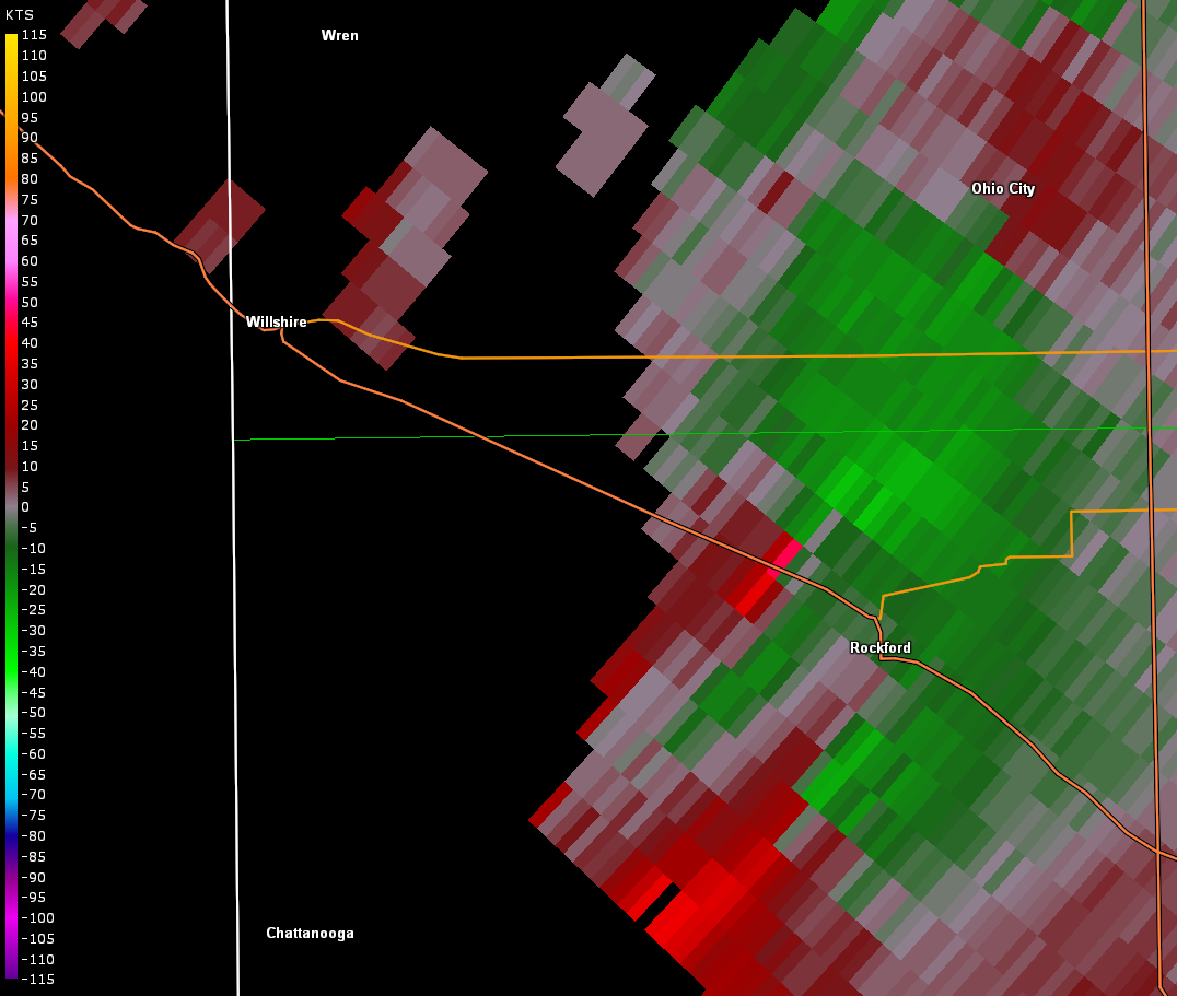
Ending Lat/Lon...40.6974N / 84.6752W
* Fatalities...0
* Injuries...0
* The information in this statement is preliminary and subject to
change pending final review of the event(s) and publication in
NWS Storm Data.
...Summary...
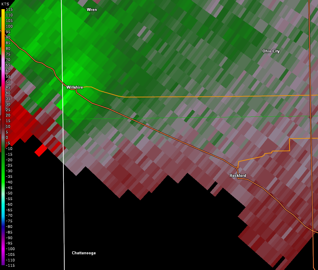
The National Weather Service in Wilmington OH has confirmed a
tornado near Rockford in Mercer County Ohio on July 10, 2017.
The tornado is believed to have touched down near Winkler Road
just west of State Route 49. As the tornado moved east, damage was
observed at a residence on the southwest corner of Winkler Road
and Short Road. The tornado damaged the roof of a home, with
several nearby trees also damaged.
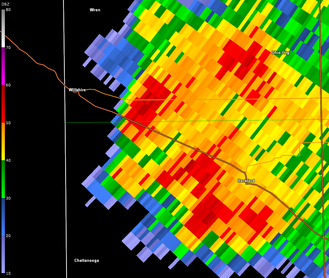
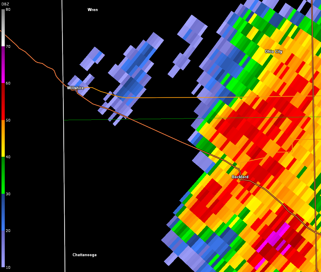
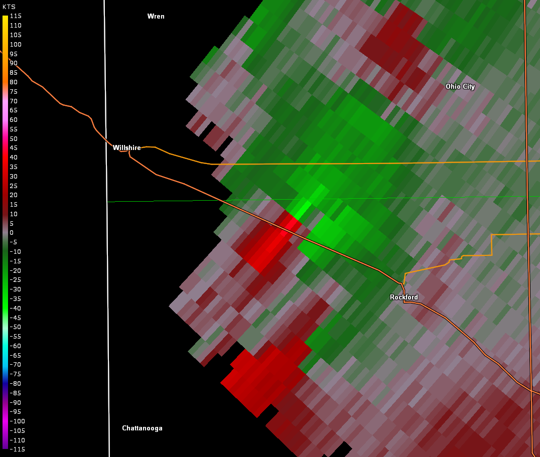
As the tornado continued east, it caused damage to the roof of a
house west of Wabash Road, along with damage to trees on the
property.
The tornado moved east-southeast across Hill Road, crossing
Winkler Road and damaging crops and trees along its path.
Cycloidal scarring was noted in the corn fields adjacent to
Winkler Road and Jordan Road.
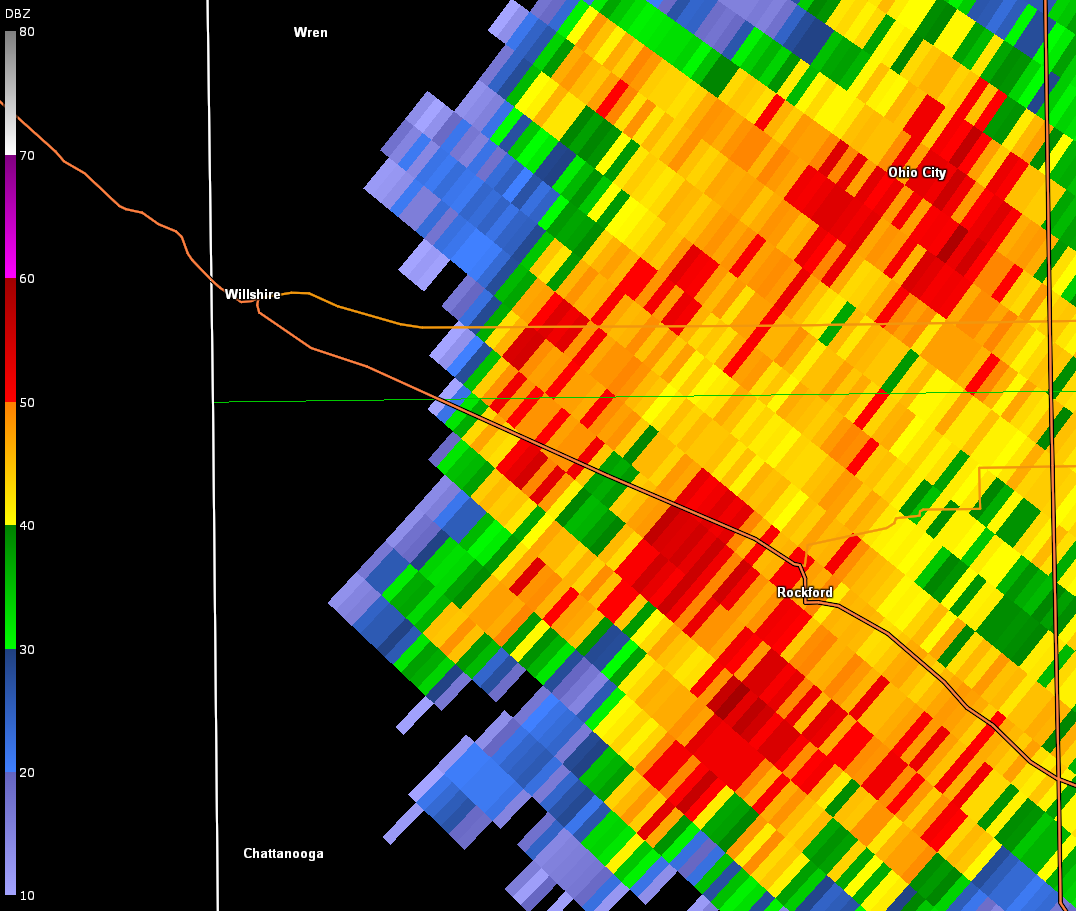
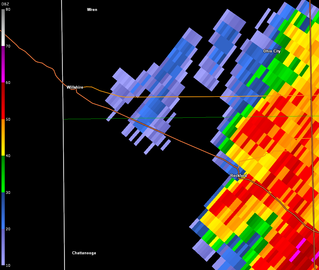
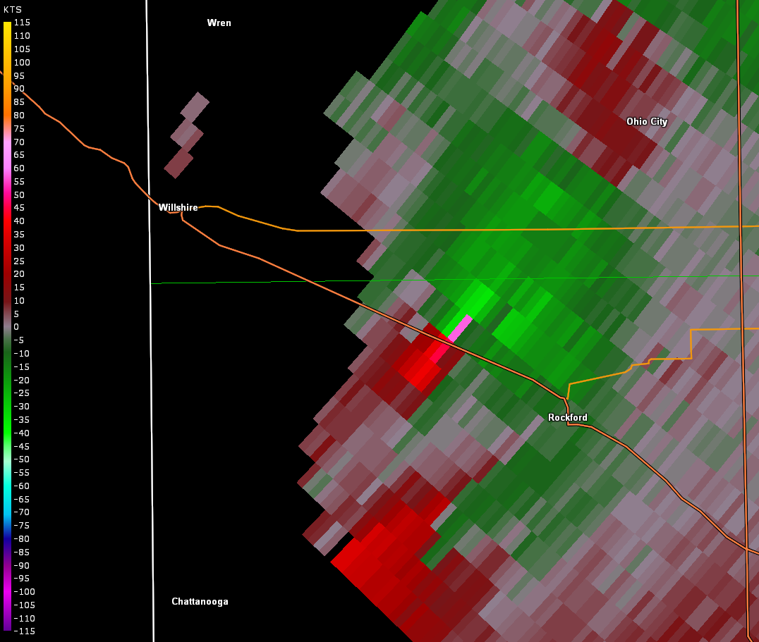
The tornado crossed Jordan Road, moving east-southeast to near the
intersection of Lee Road and Erastus-Durbin Road. At a property on
the southeast corner of this intersection, one outbuilding was
destroyed, with its debris scattered into the field to the east.
The tornado damaged another area of trees along Township Line
Road, and then continued east-southeast into open fields north of
Rockford West Road, where the tornado is believed to have
dissipated.
We would like to extend our appreciation to the Mercer County and
Van Wert County emergency management agencies for their ground and
aerial surveys, which were immensely helpful in preparing this
report and determining the track of the tornado.
For reference: the Enhanced Fujita Scale classifies tornadoes
into the following categories:
EF0...wind speeds 65 to 85 mph.
EF1...wind speeds 86 to 110 mph.
EF2...wind speeds 111 to 135 mph.
EF3...wind speeds 136 to 165 mph.
EF4...wind speeds 166 to 200 mph.
EF5...wind speeds greater than 200 mph.
$$
HATZOS/BPP
|

