|
Tornado near Park Layne, OH |
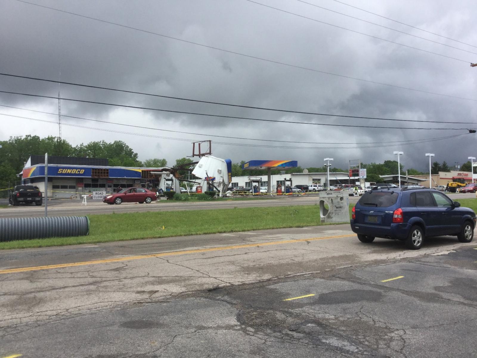
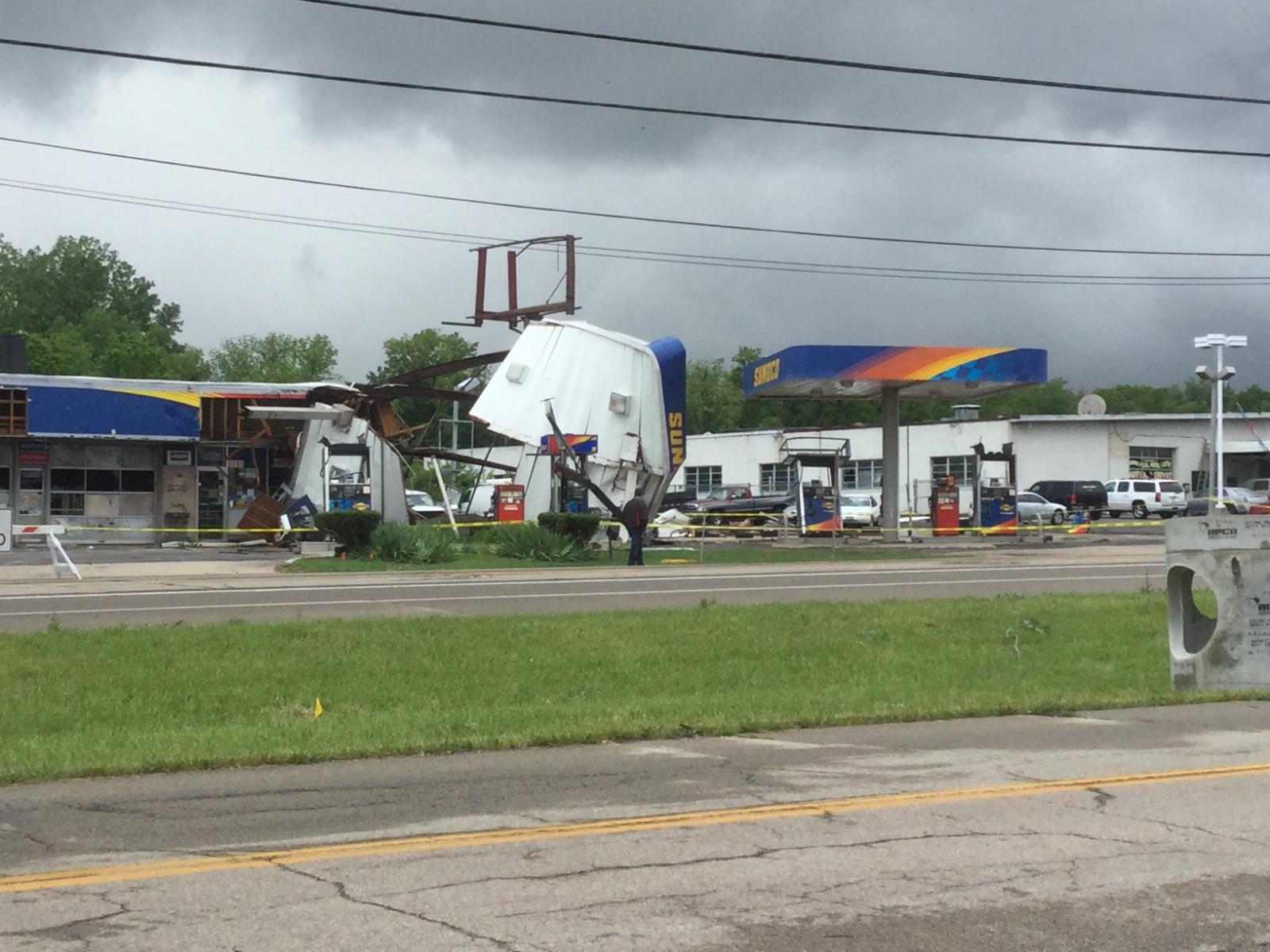
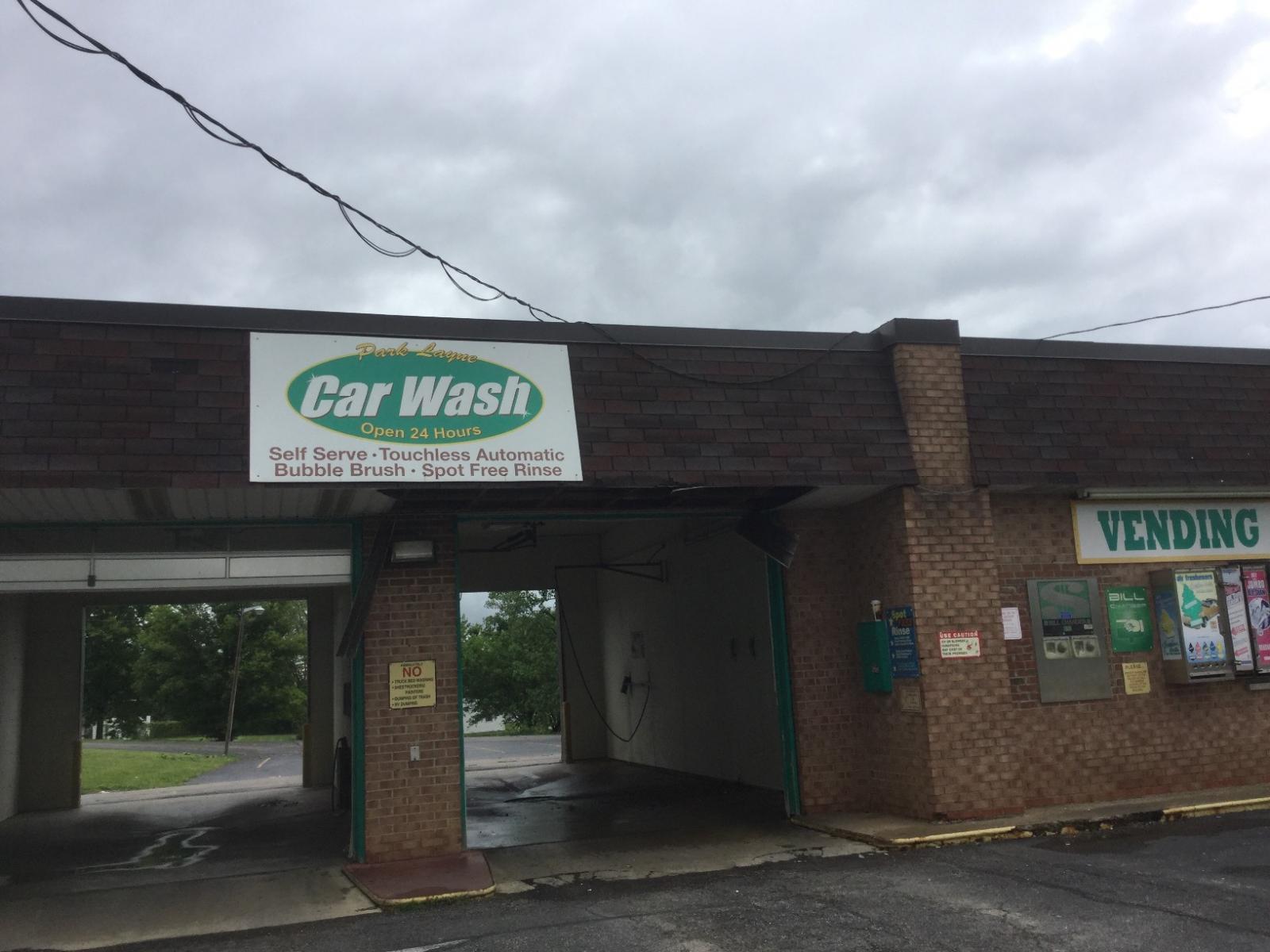
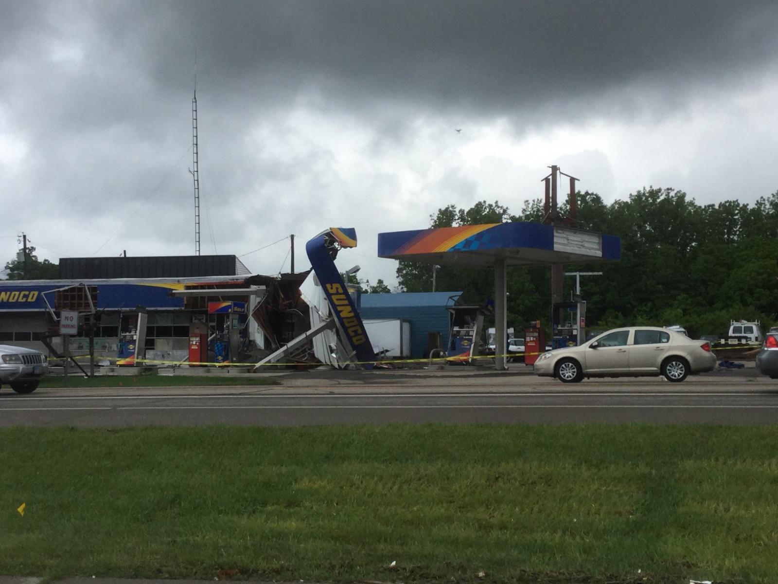
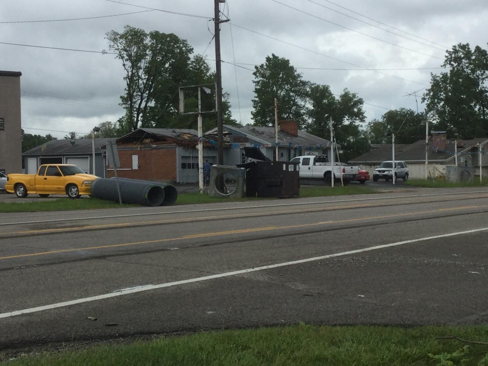
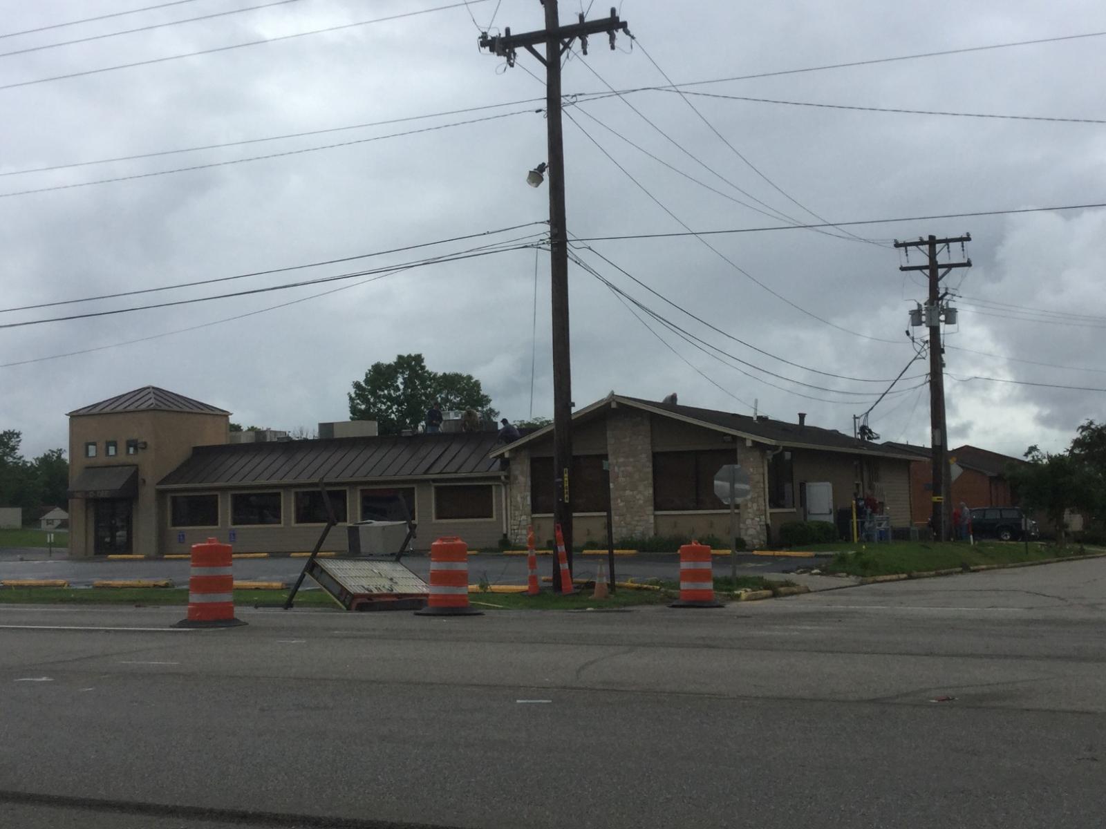
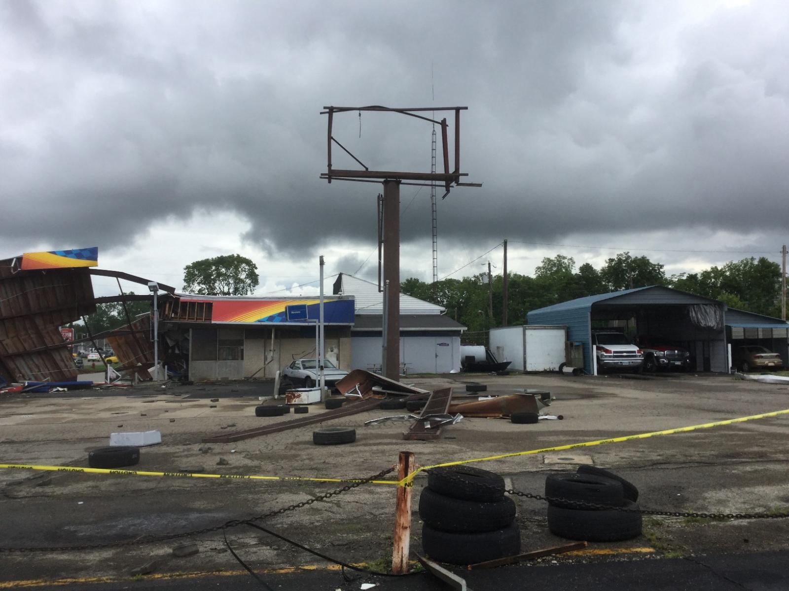
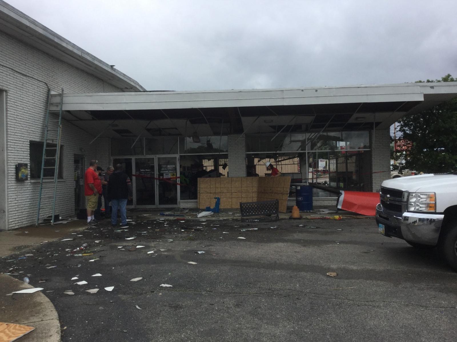
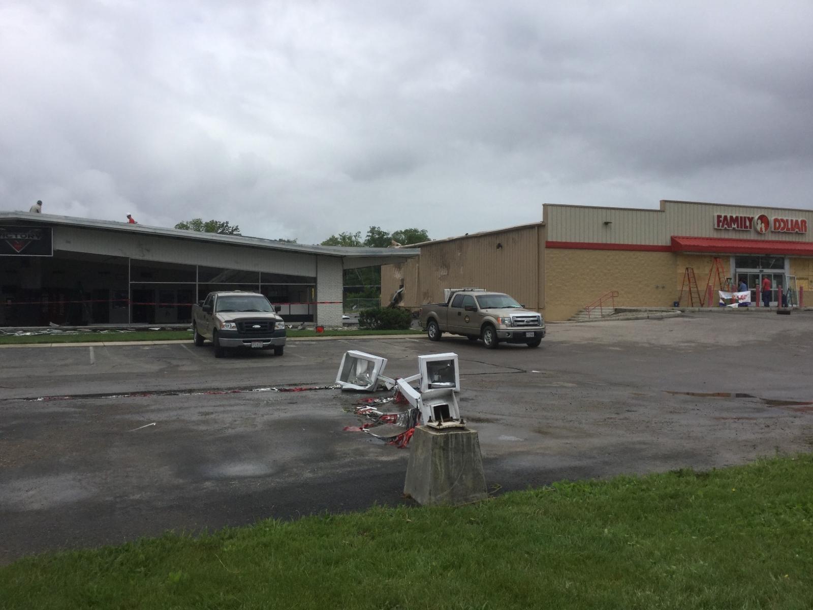
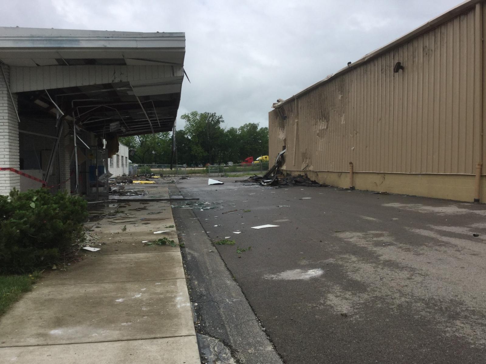
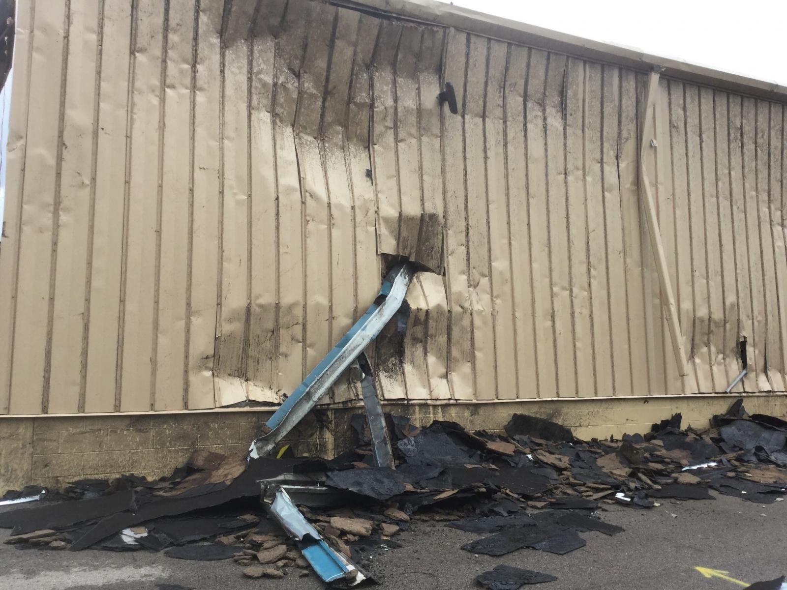
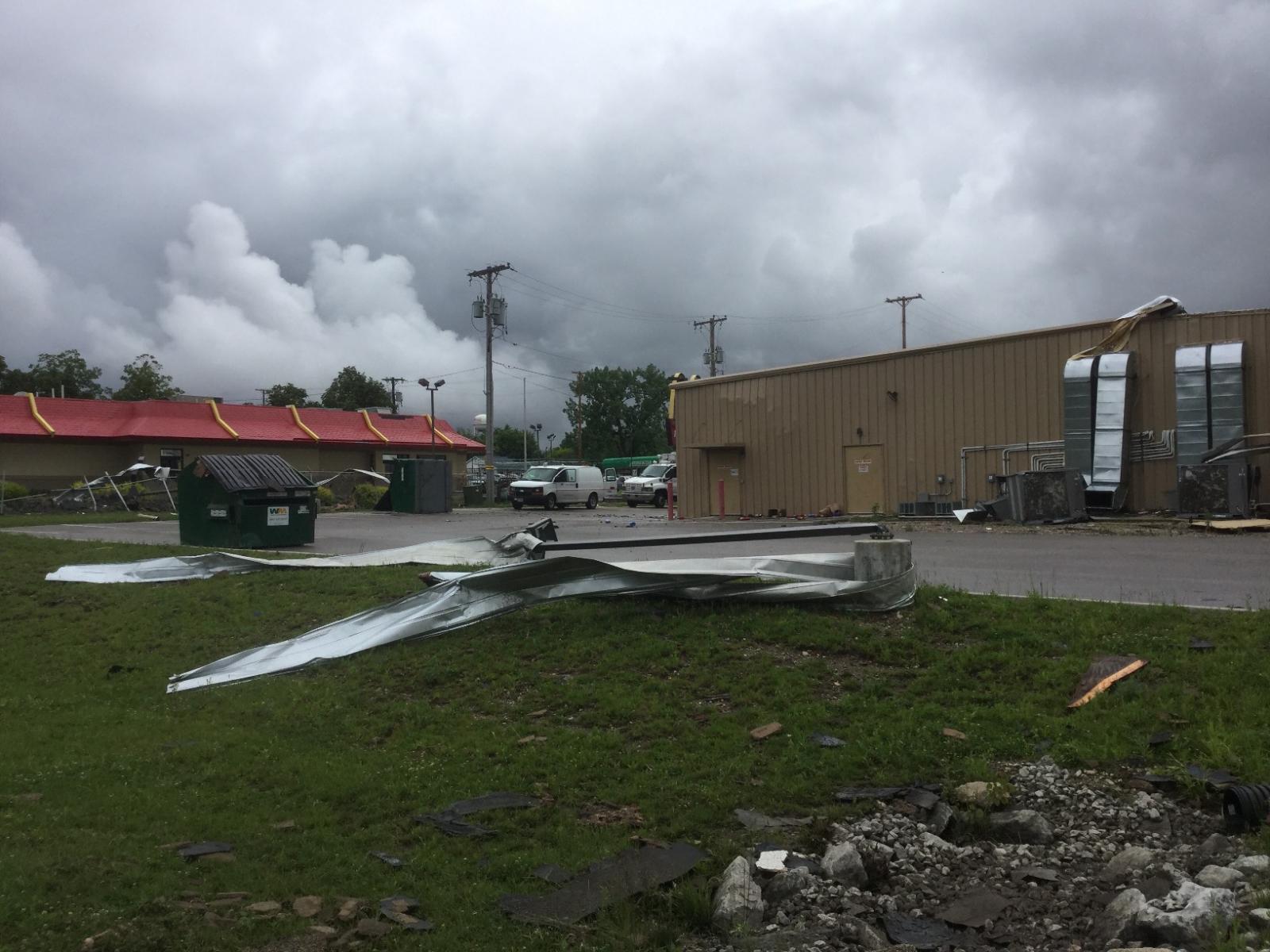
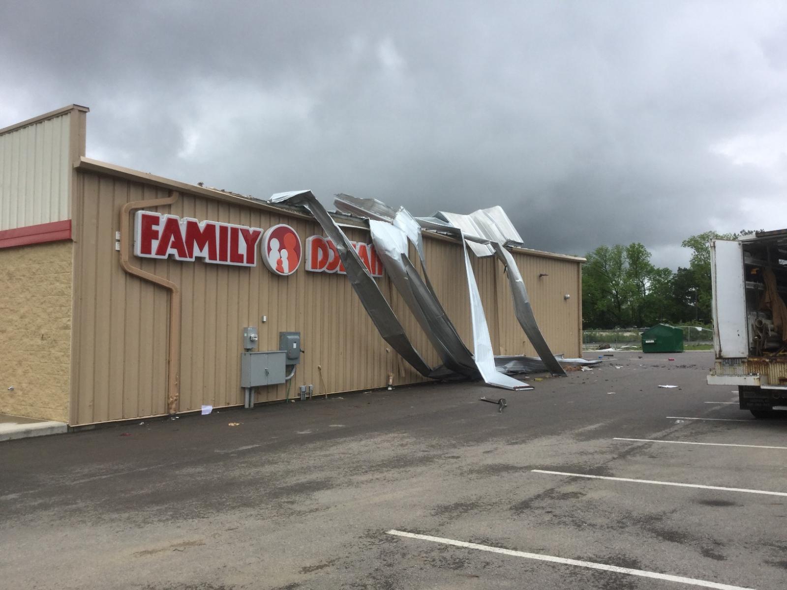
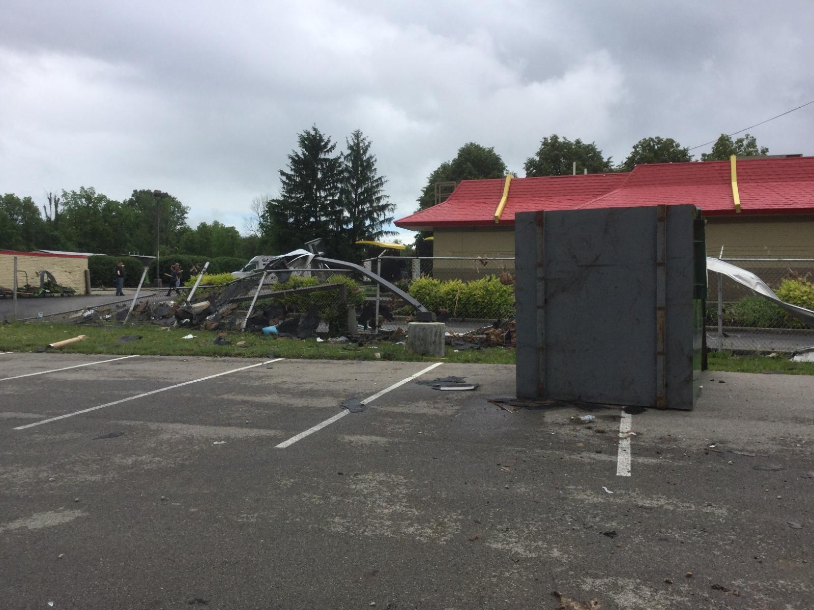
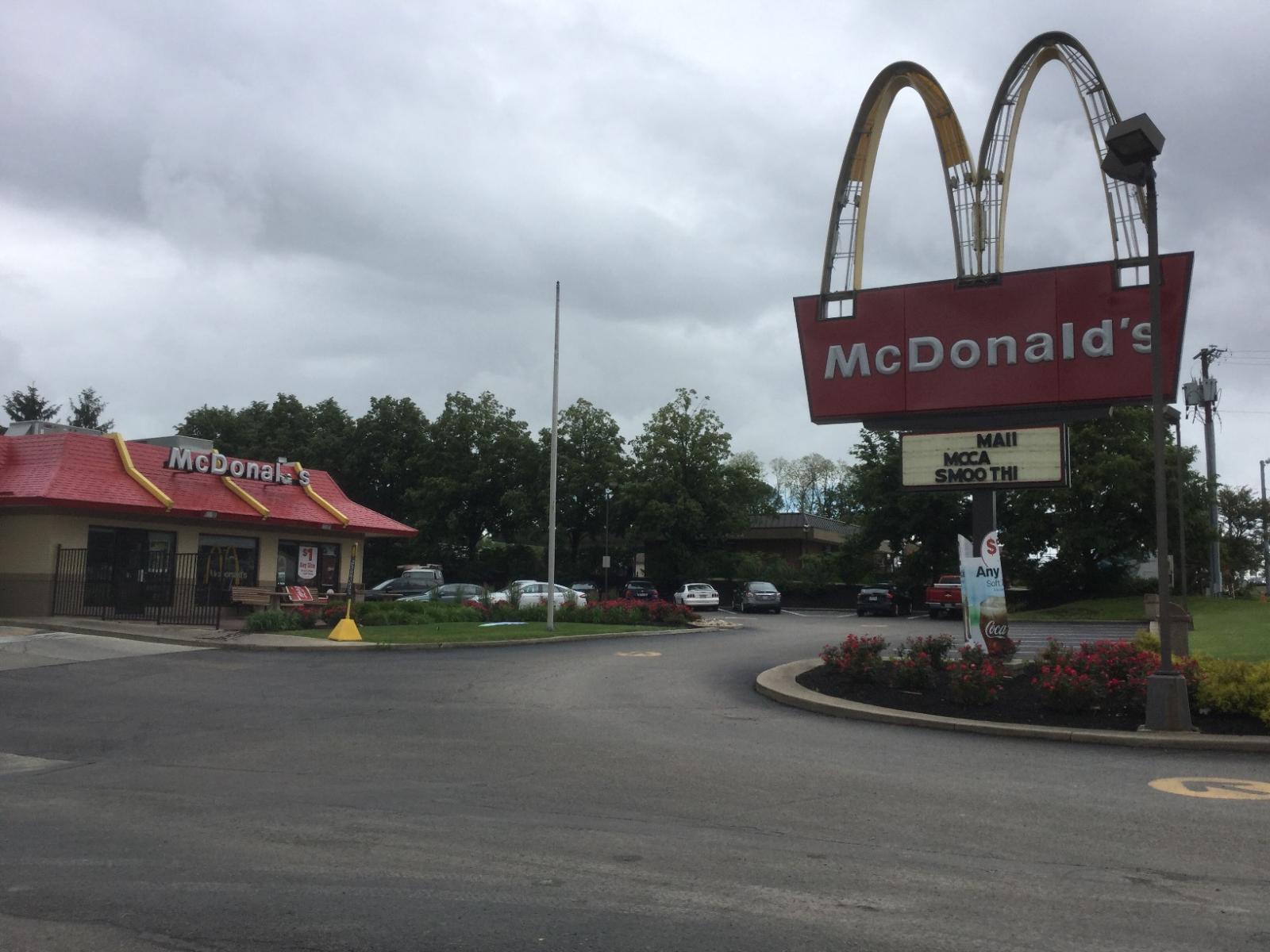
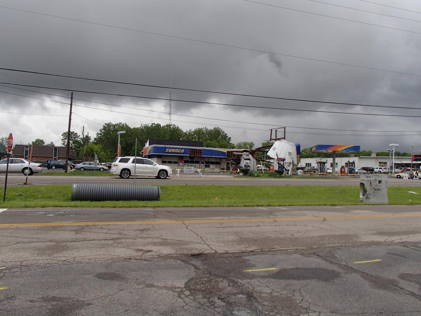
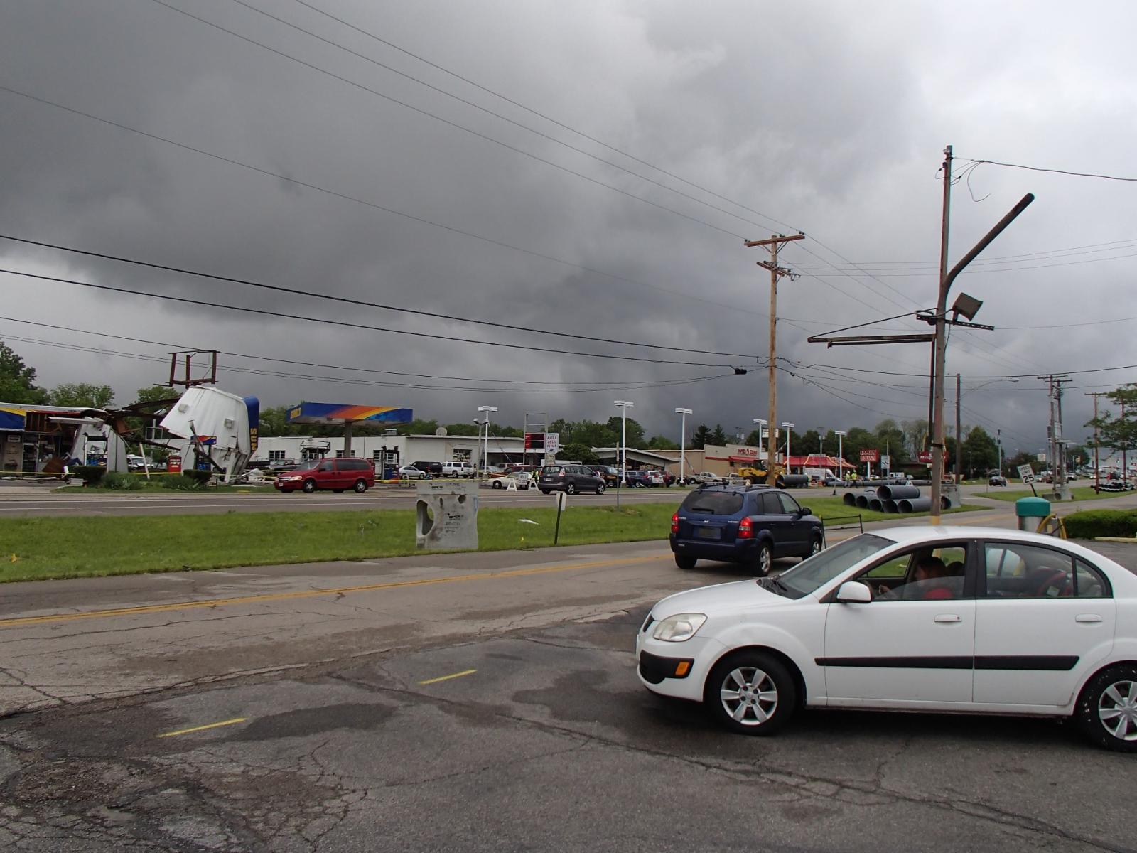
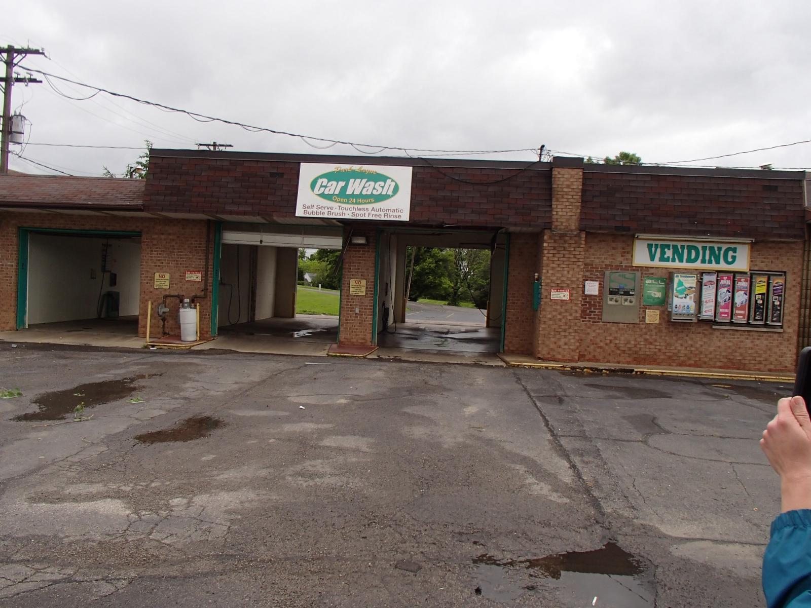
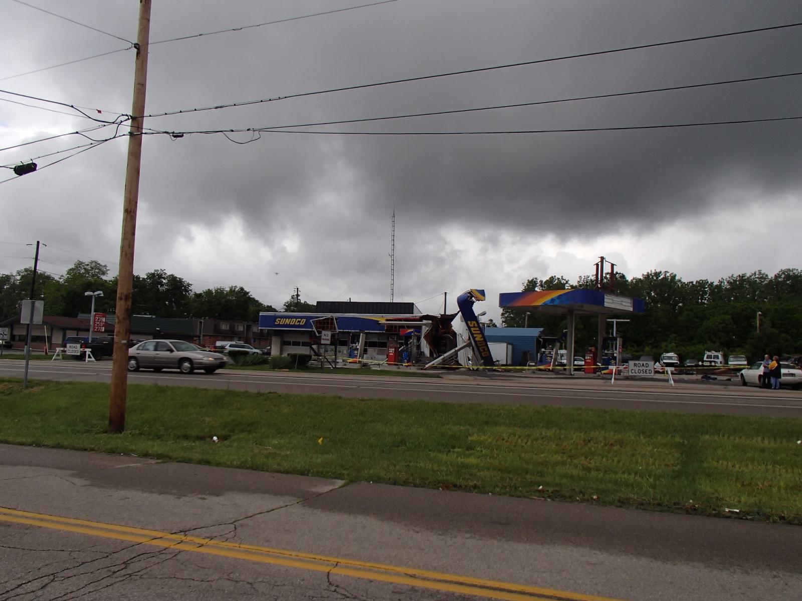
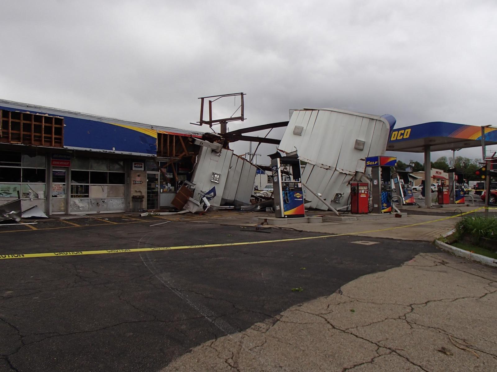
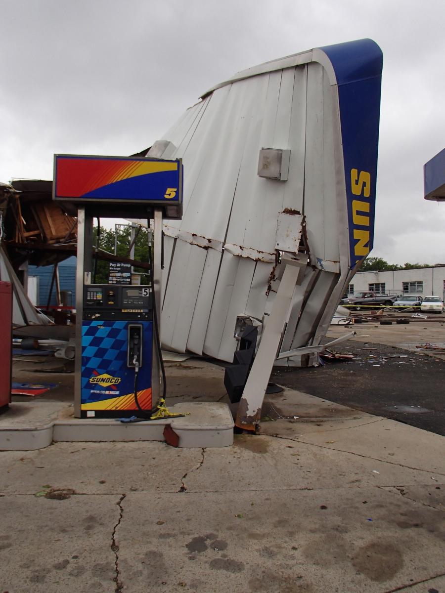
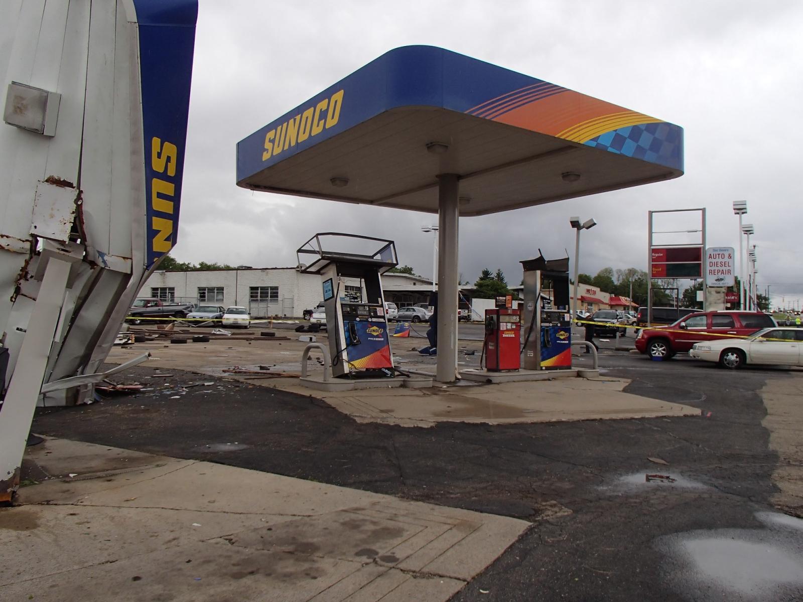
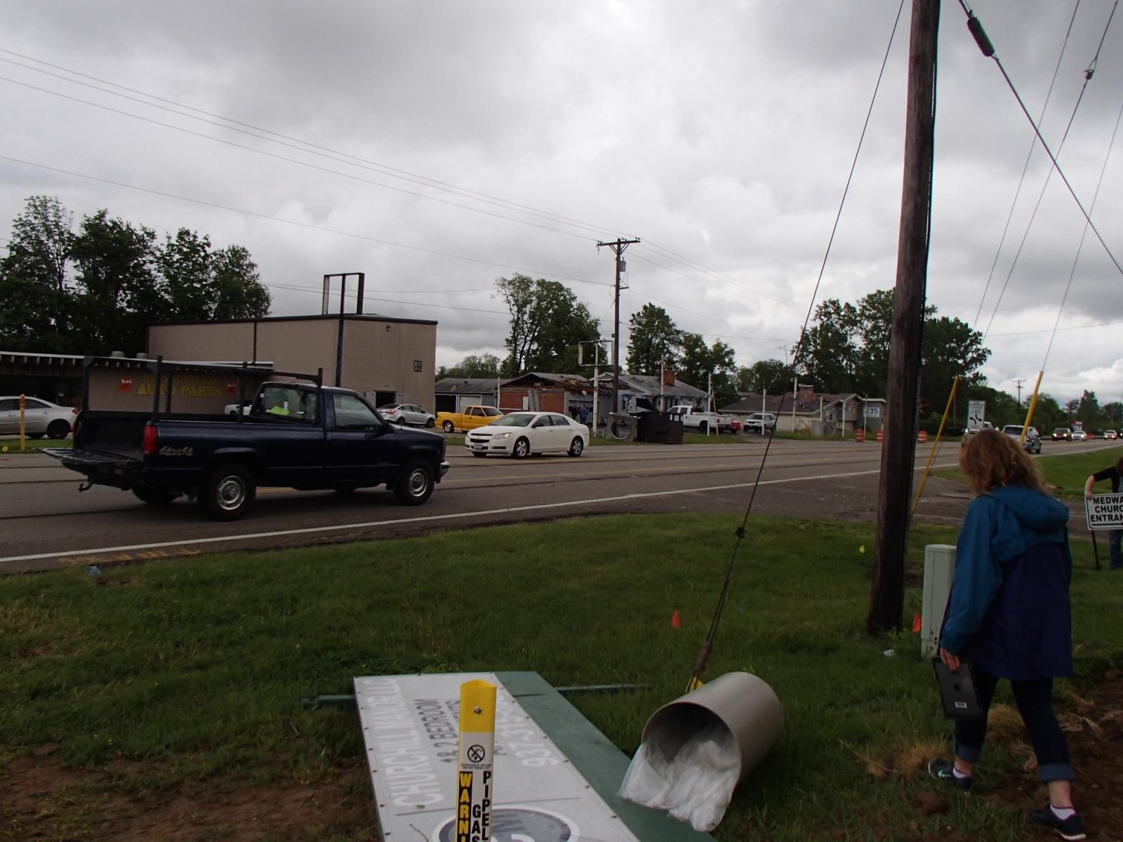
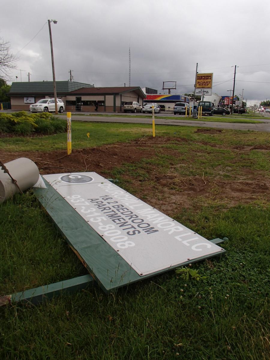
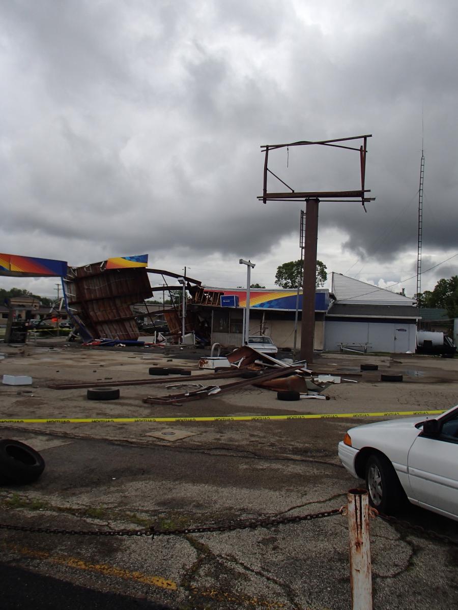
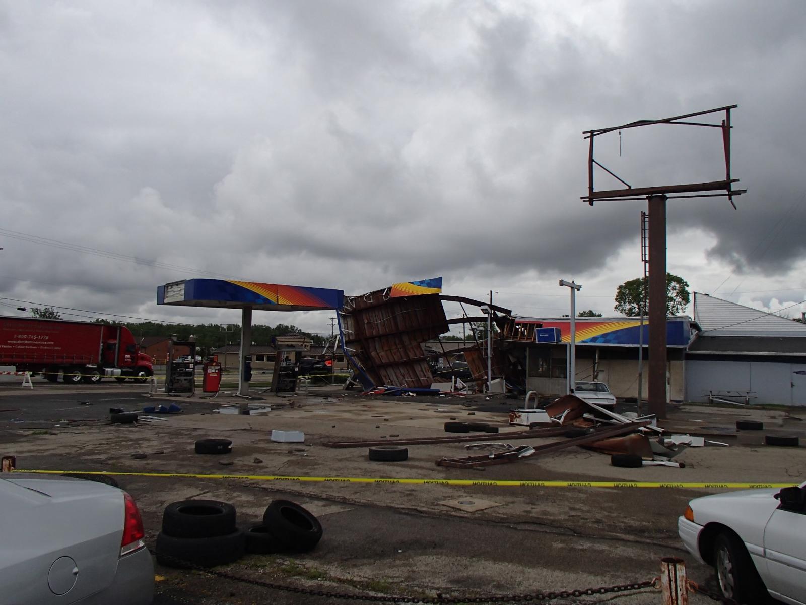
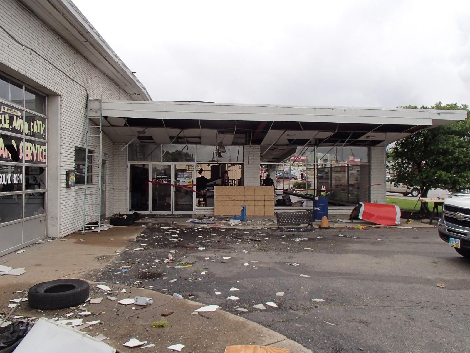
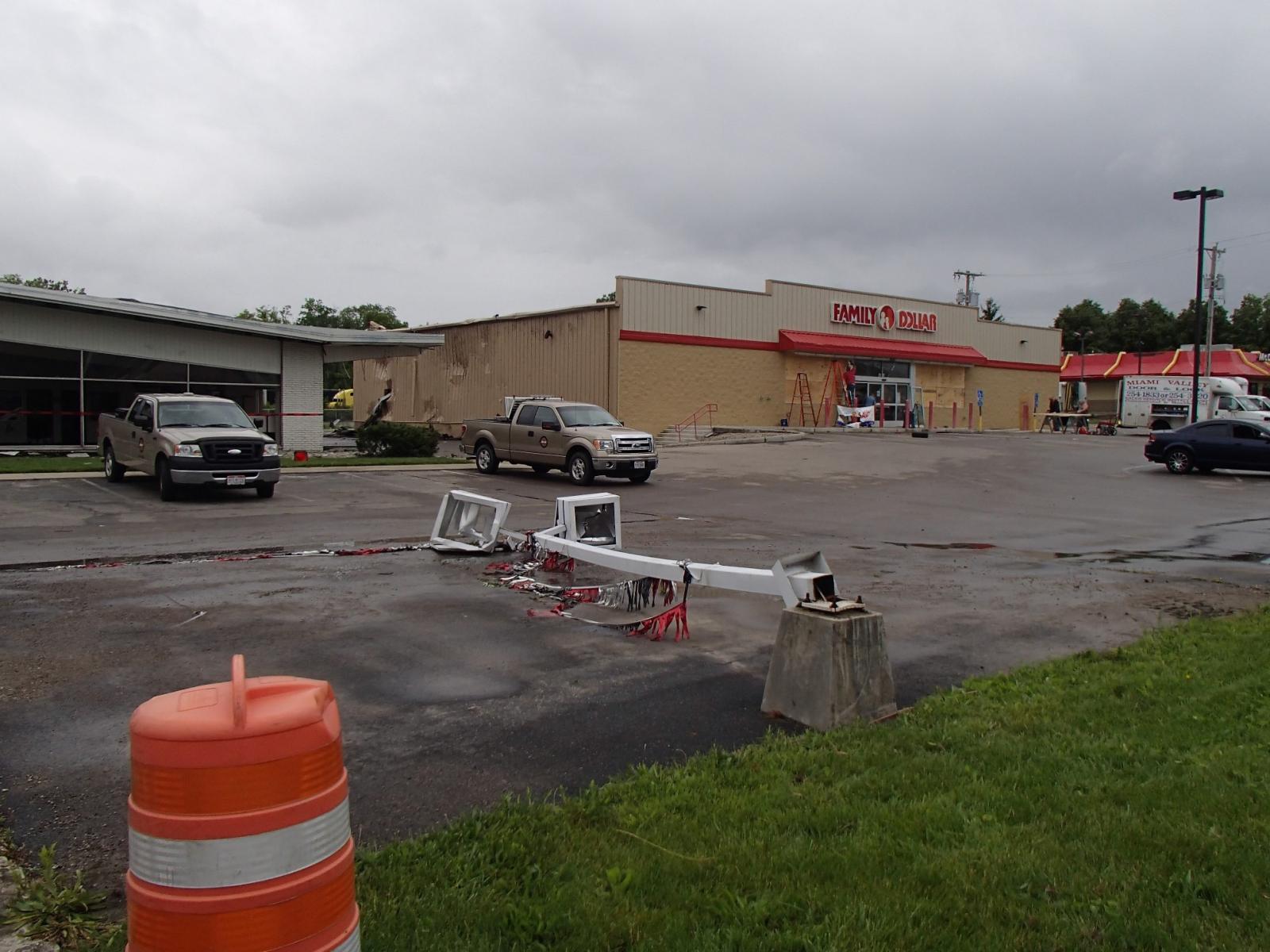
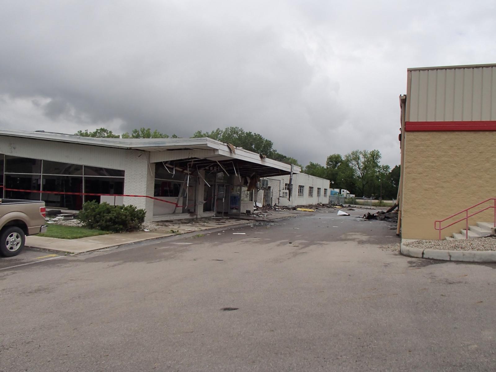
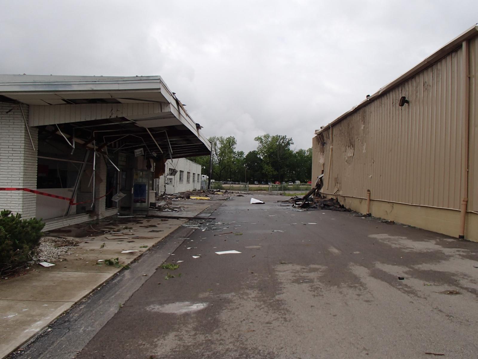
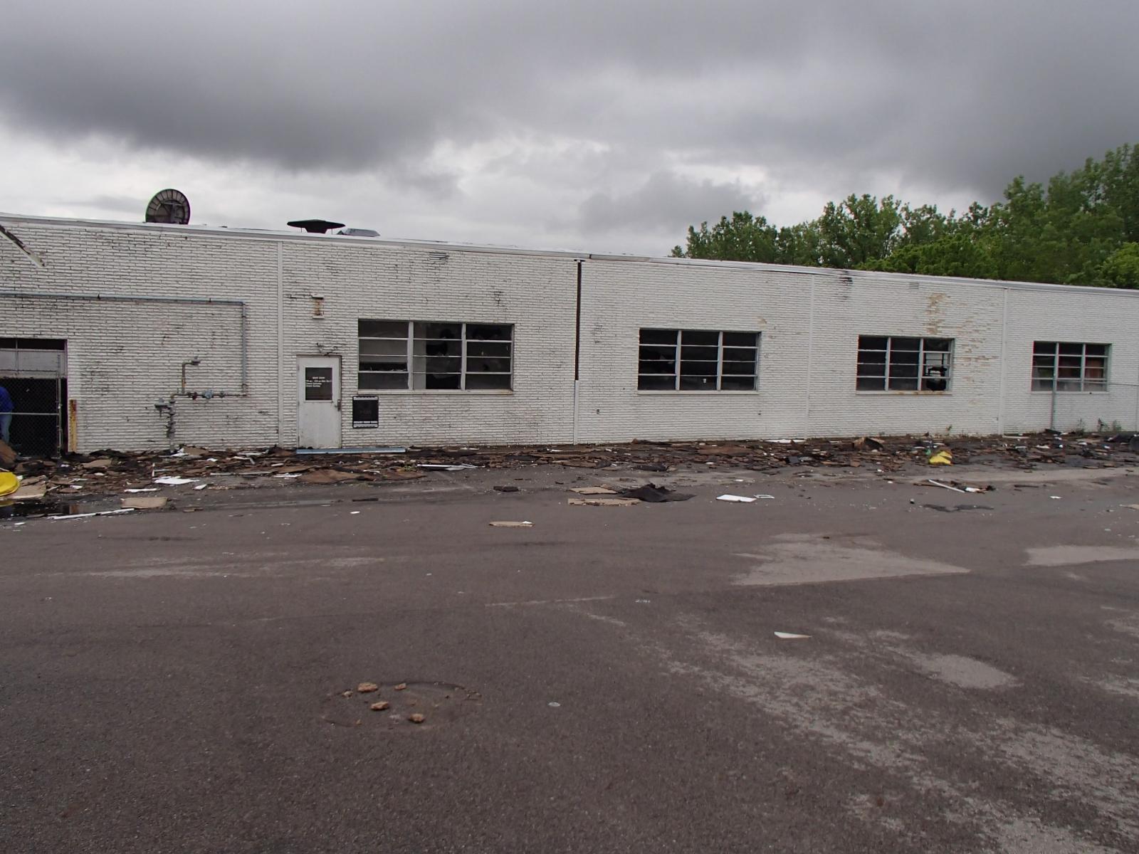
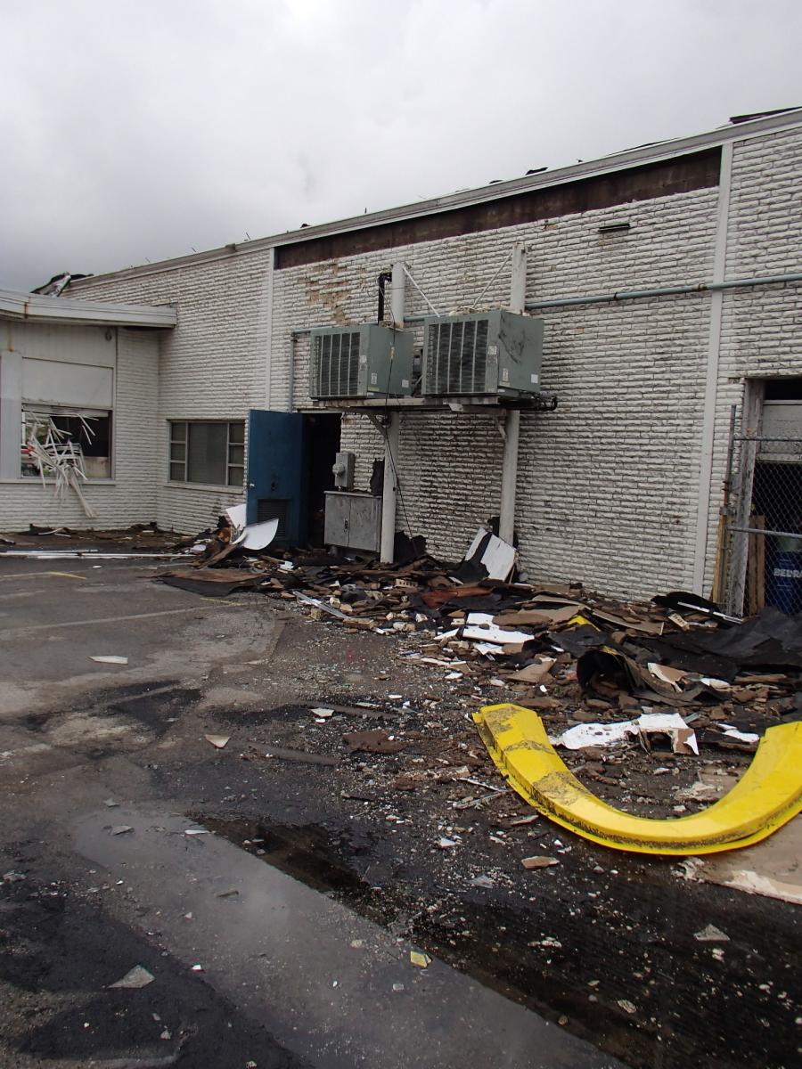
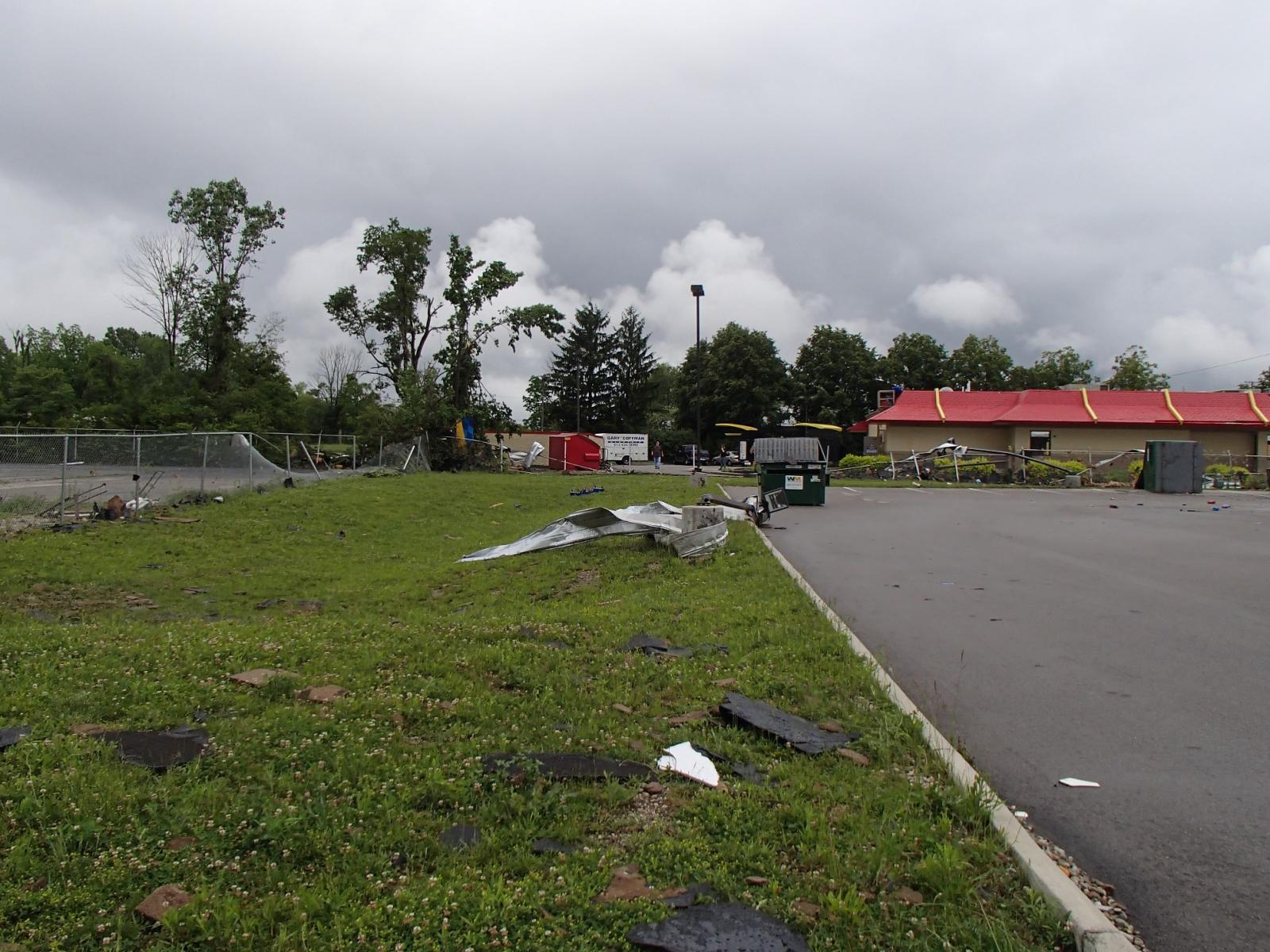
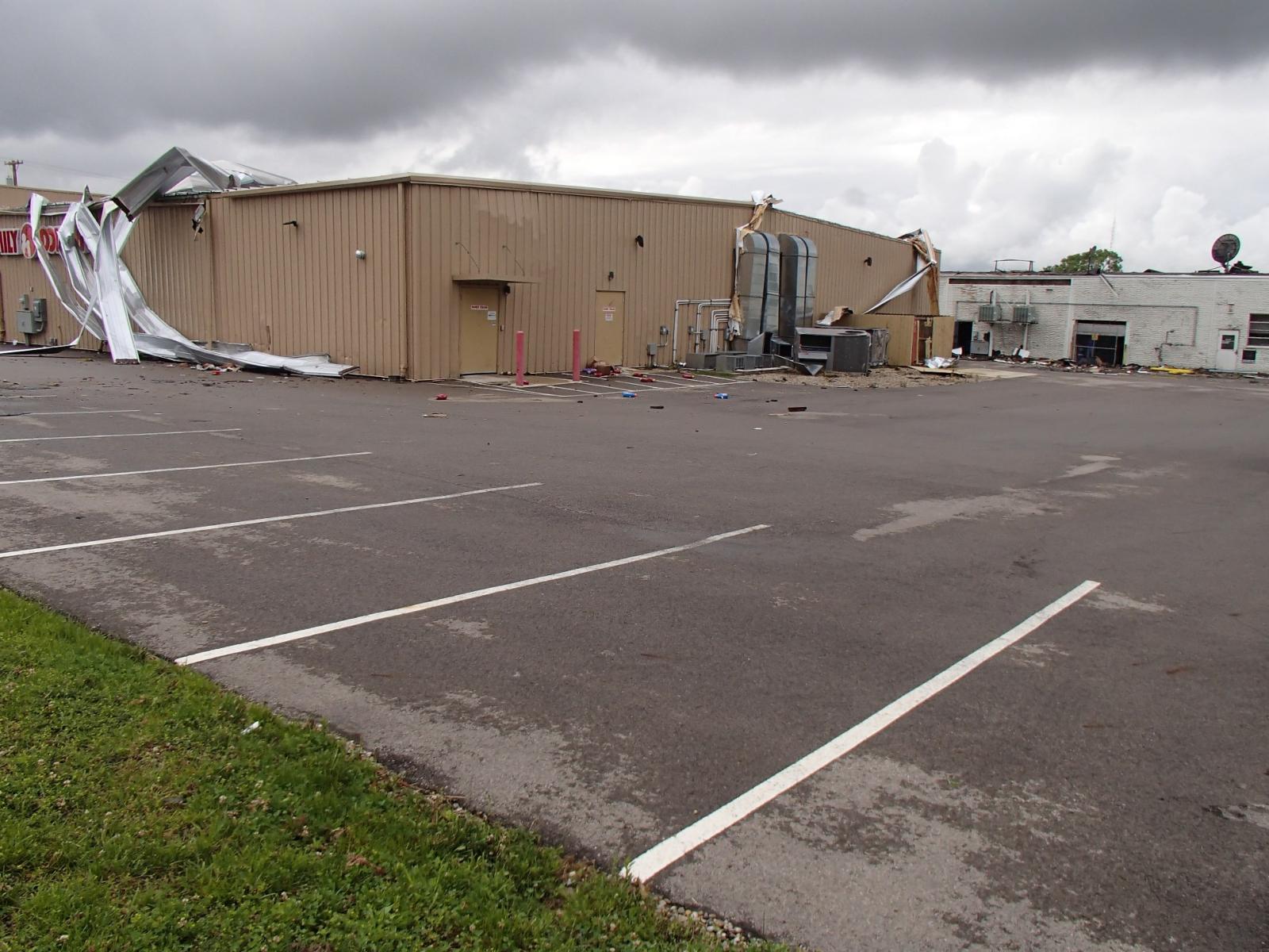
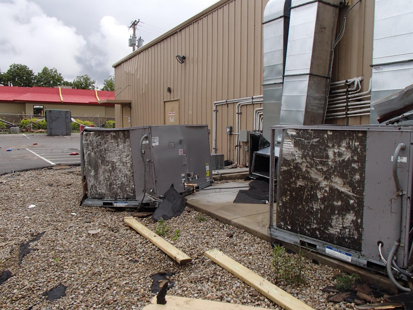
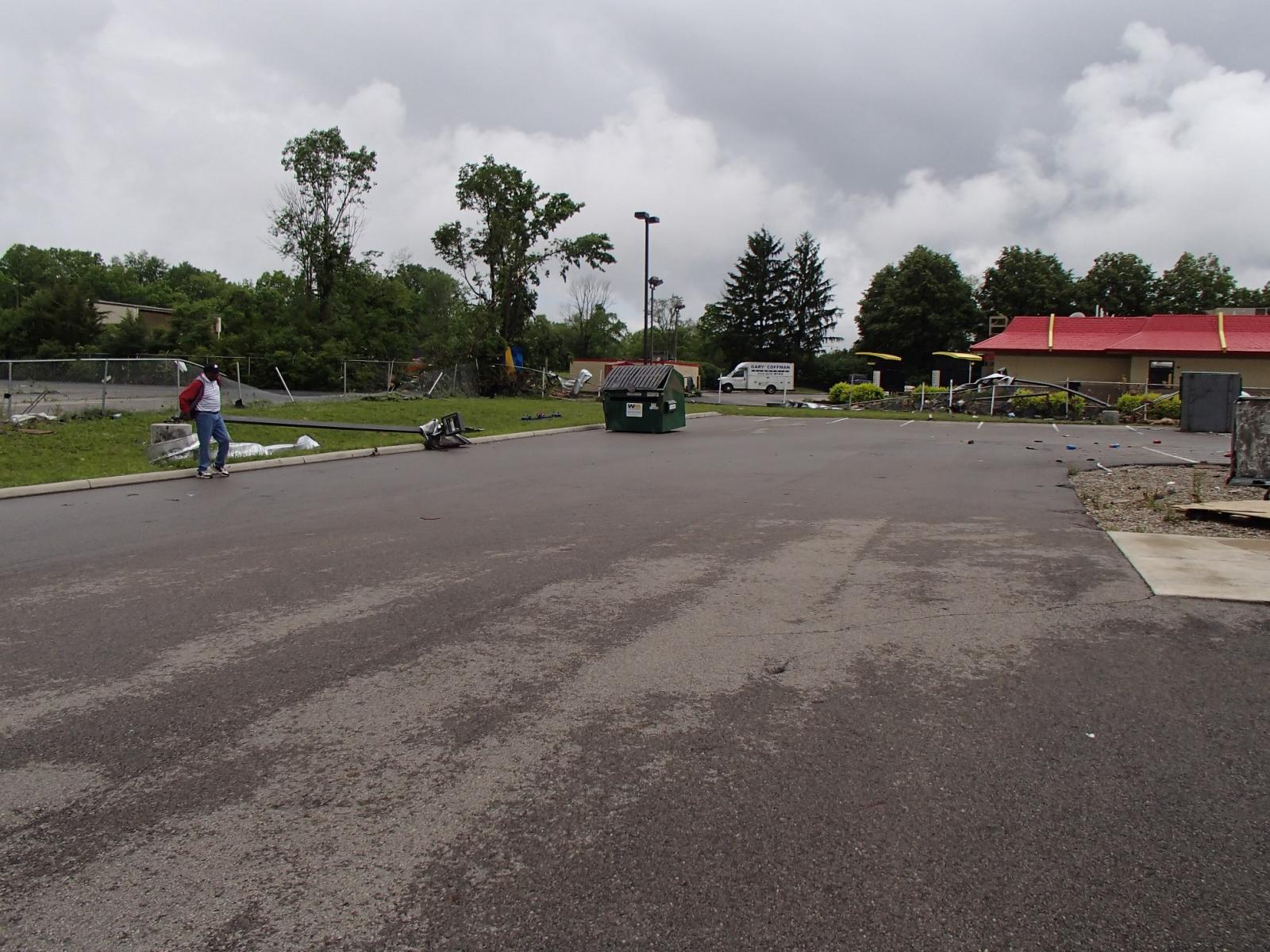
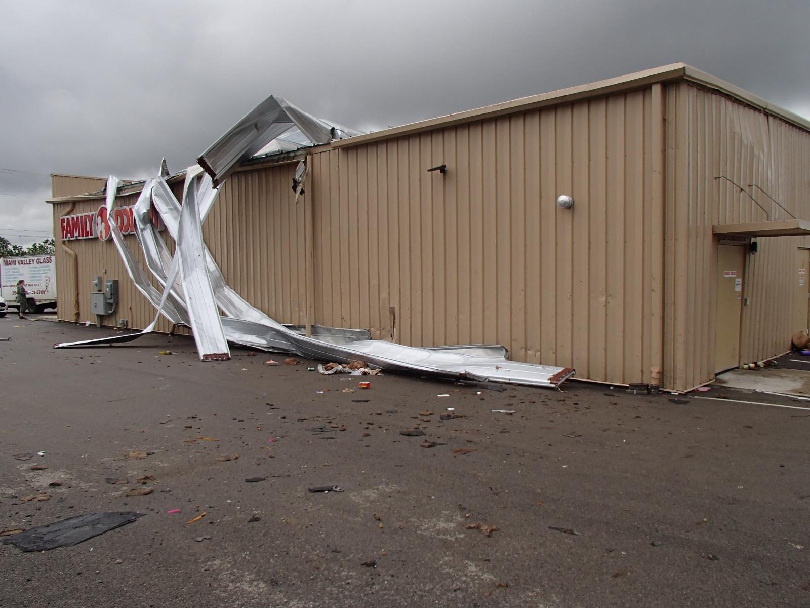
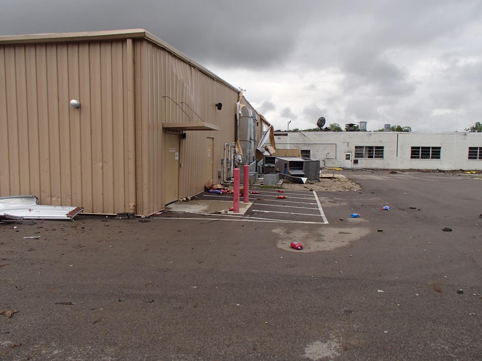
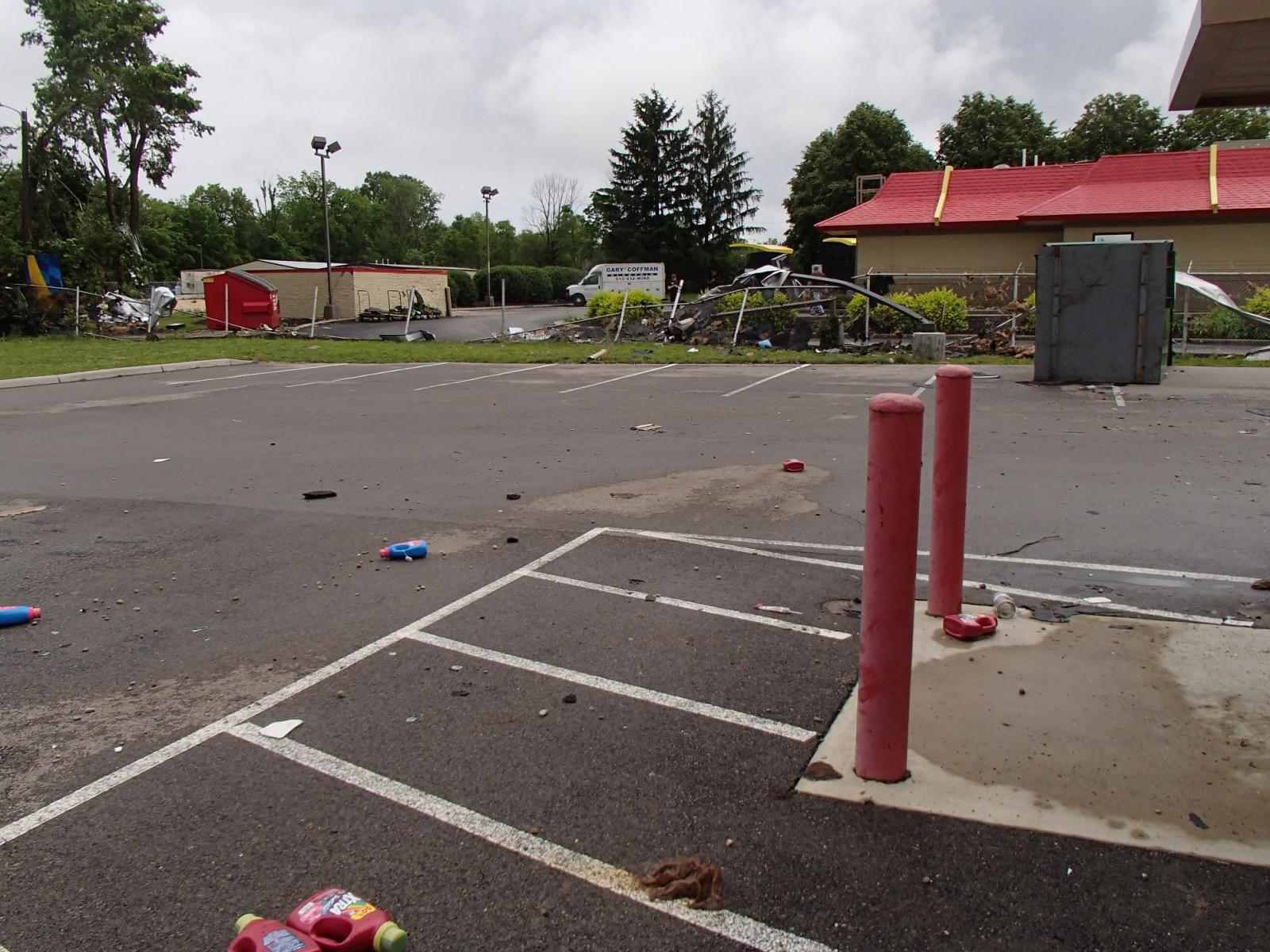
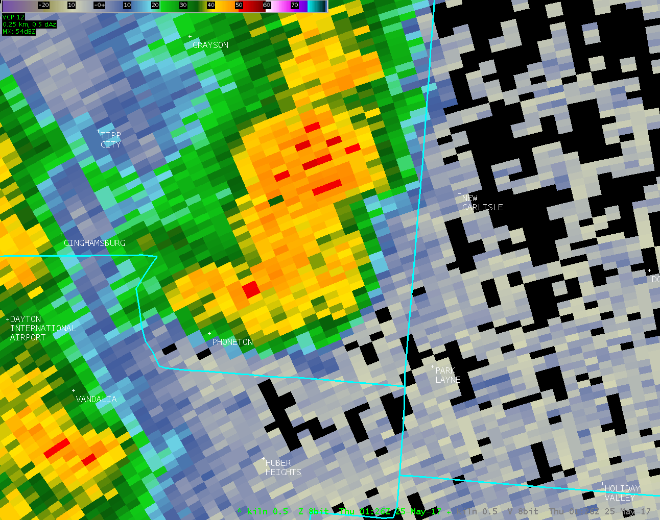
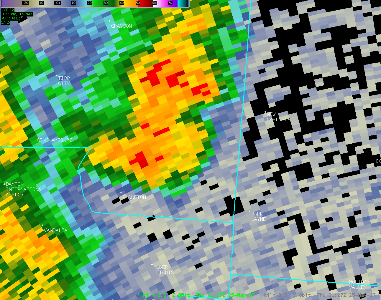
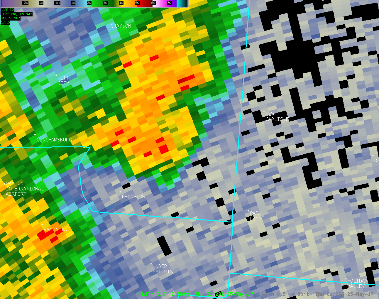
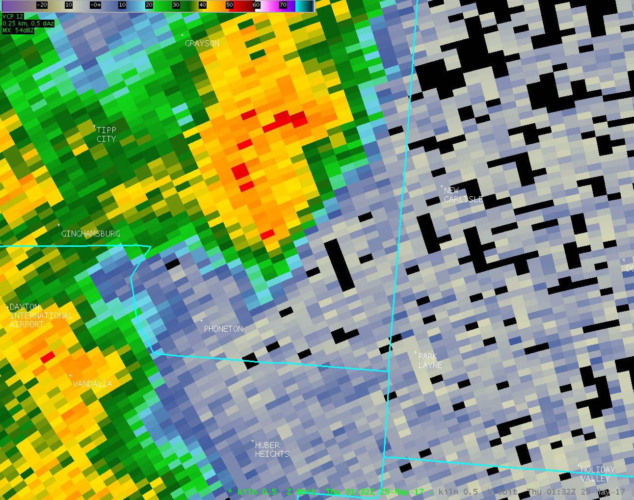
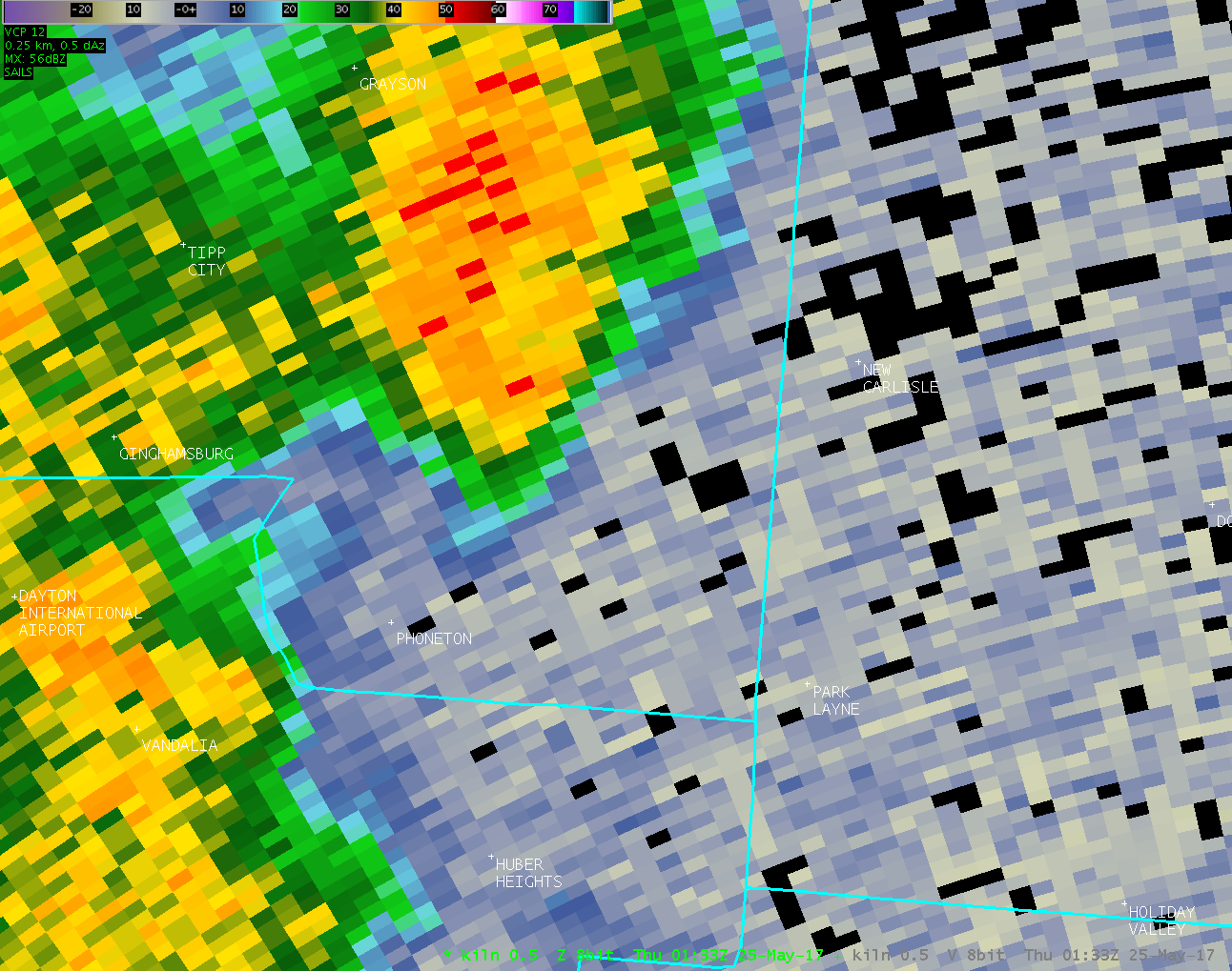
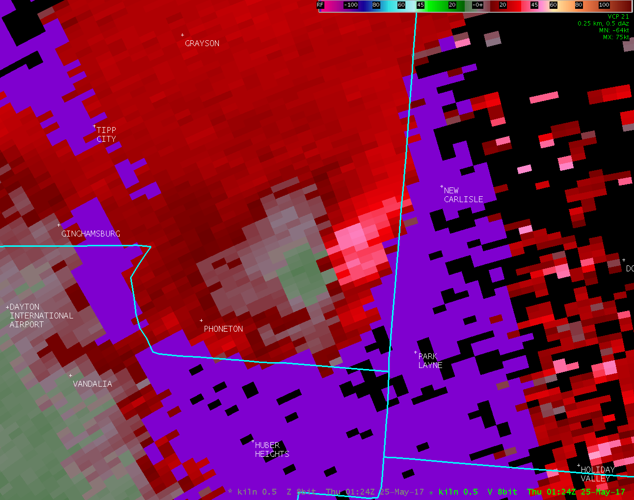
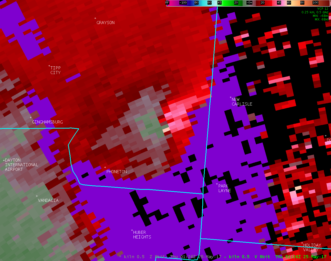
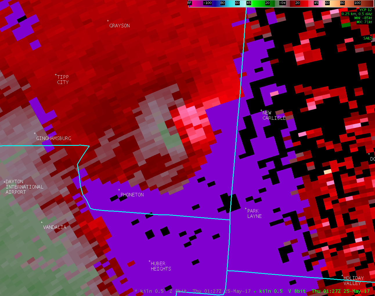
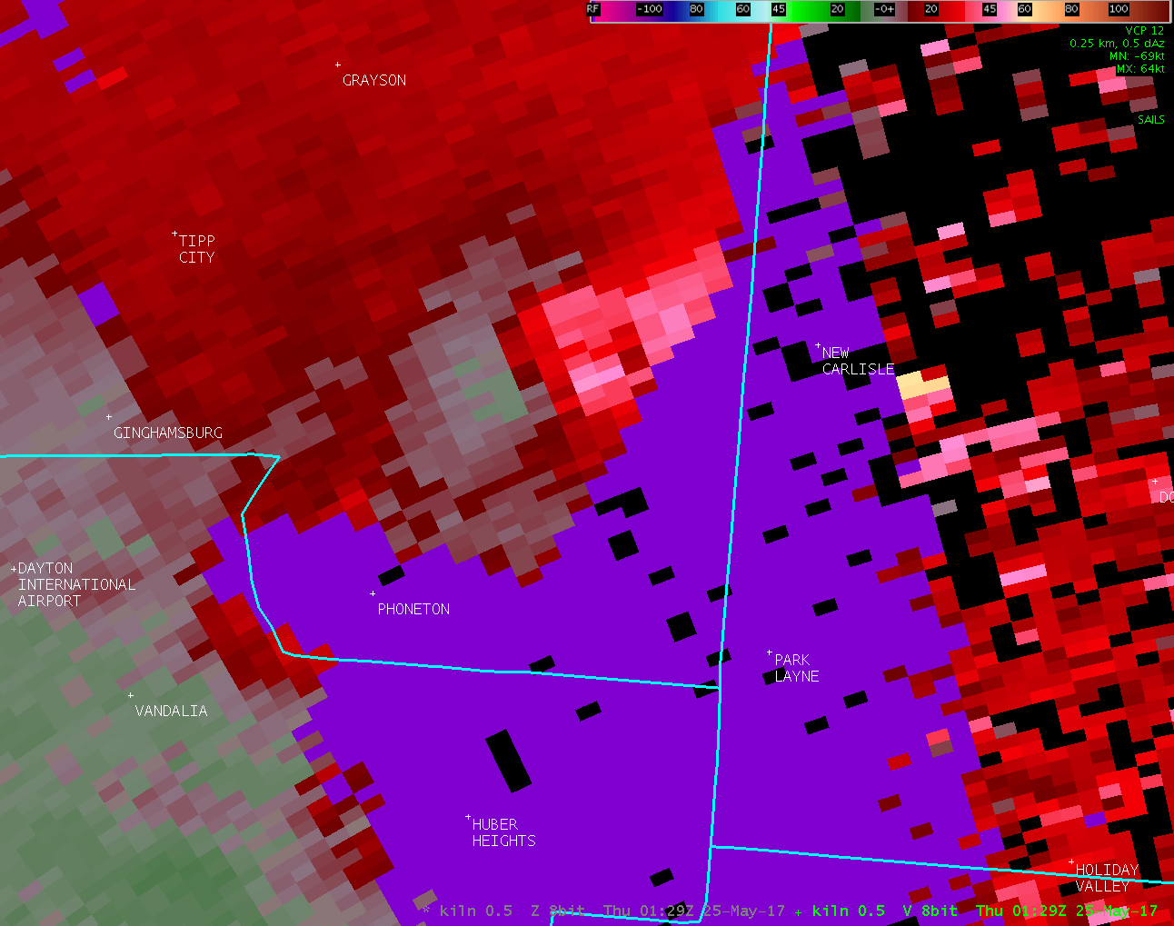
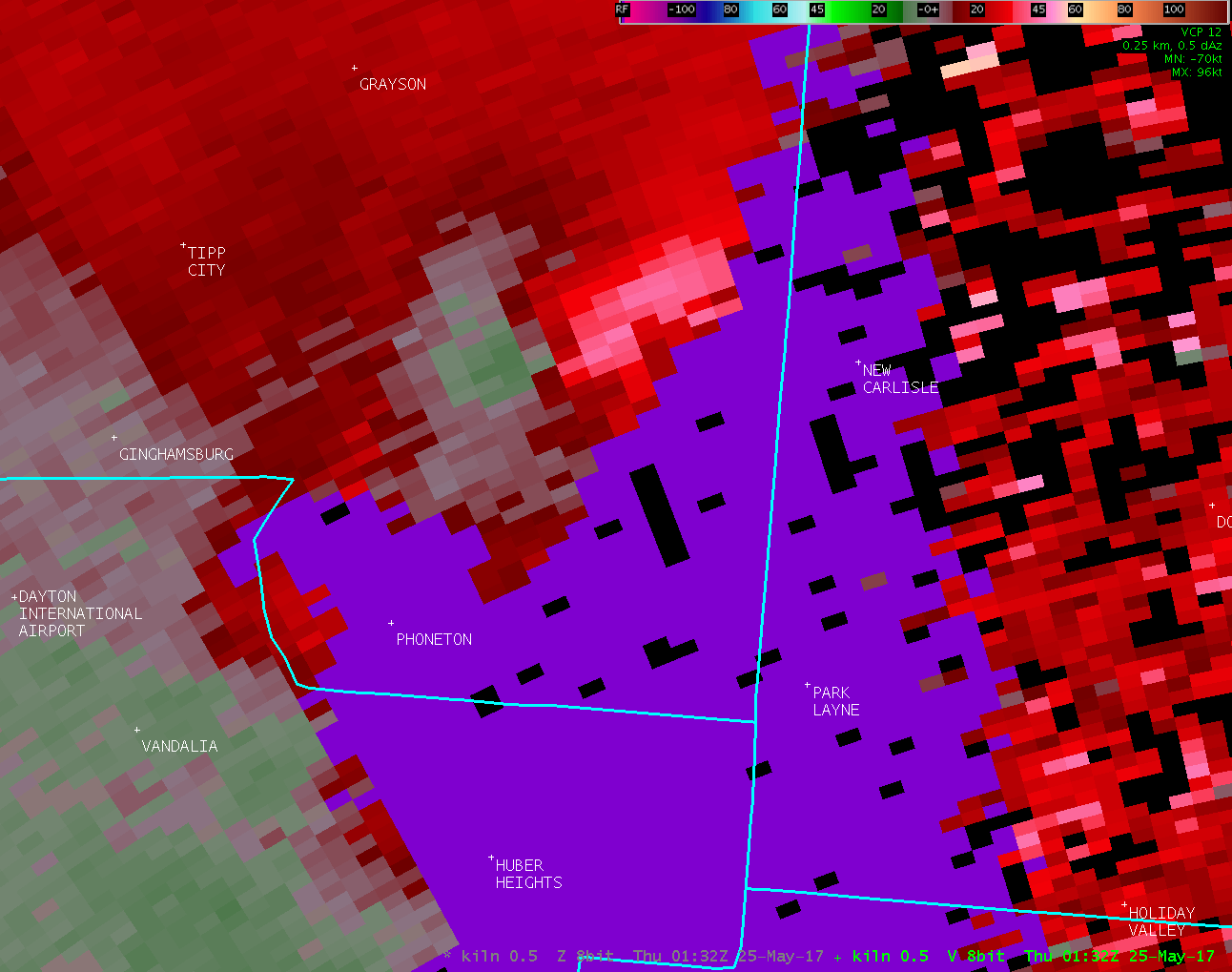
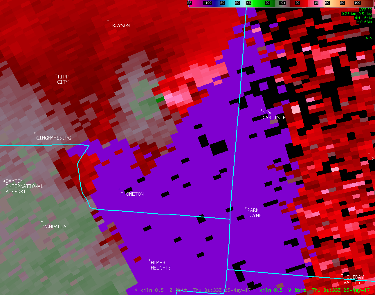
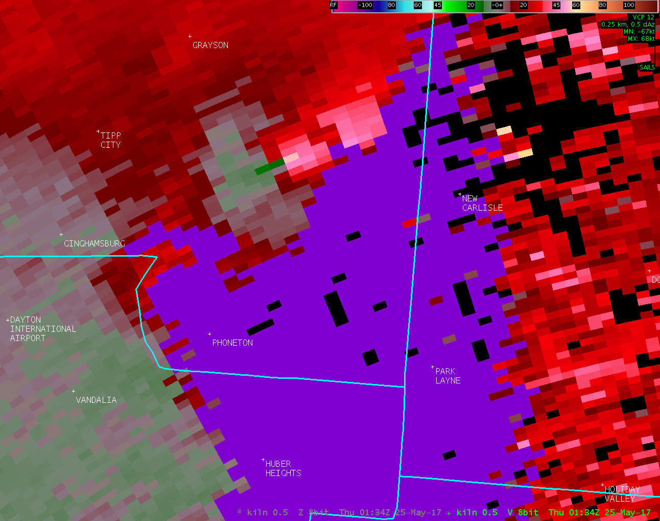
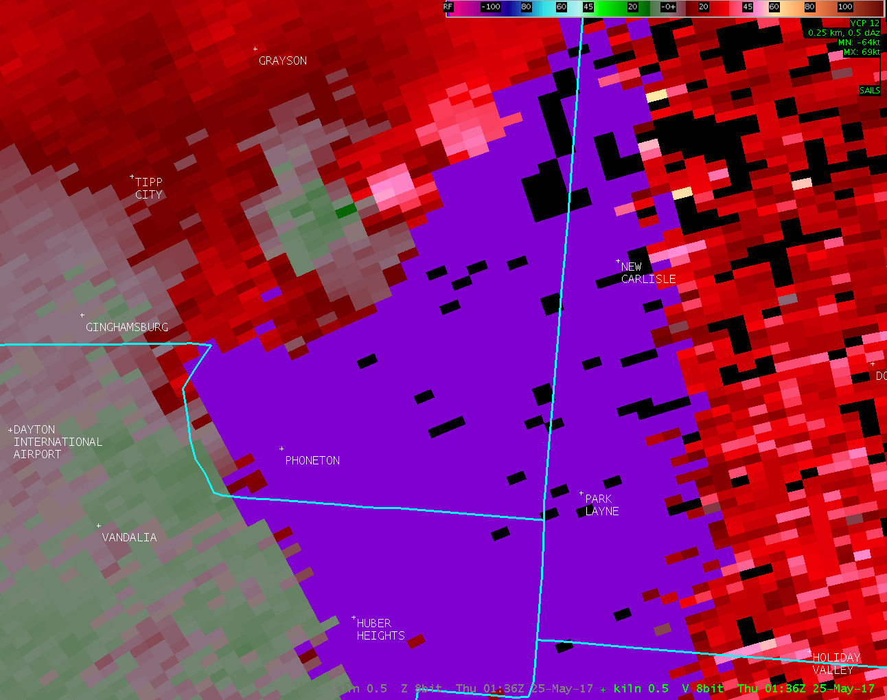
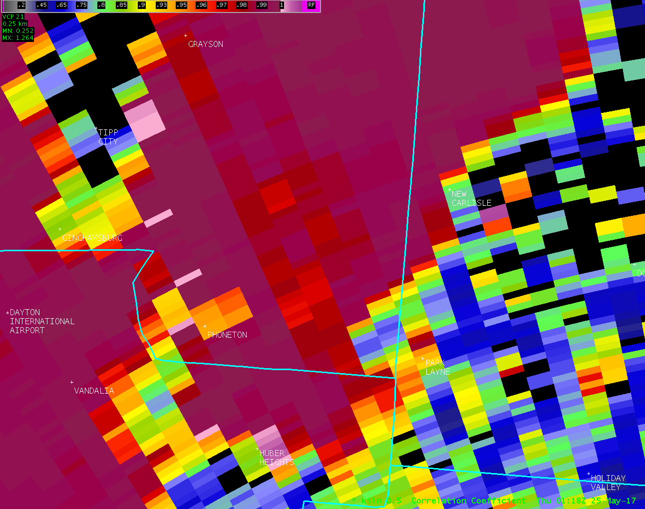
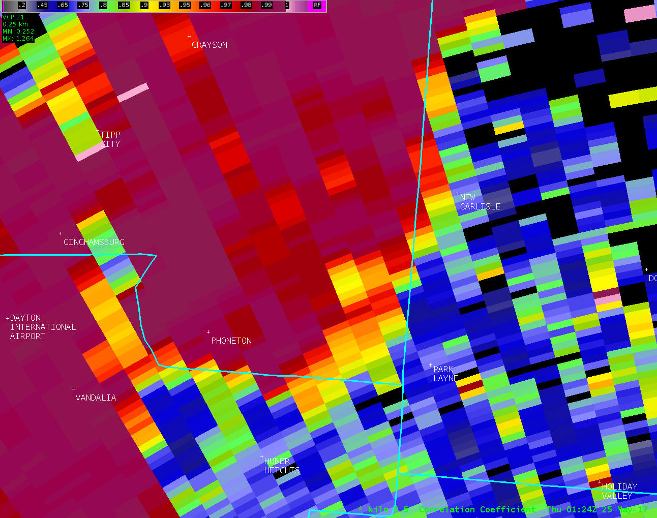
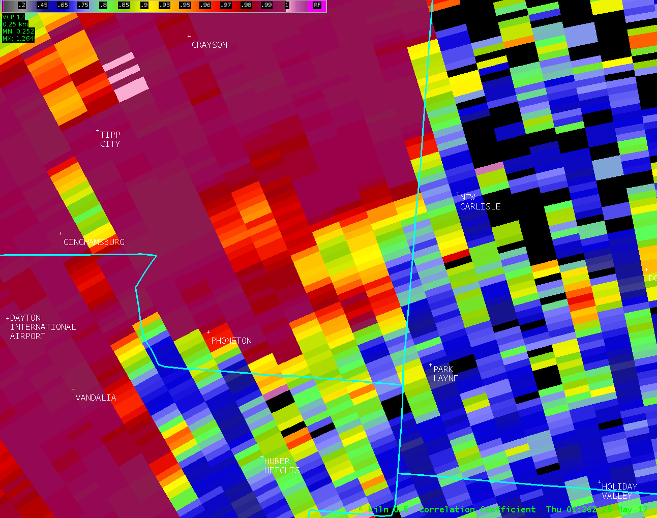
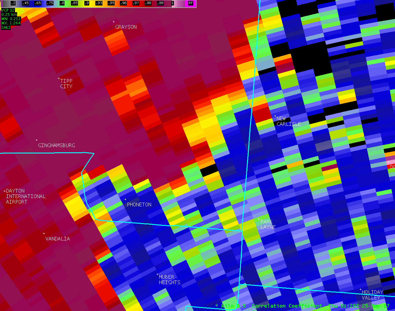
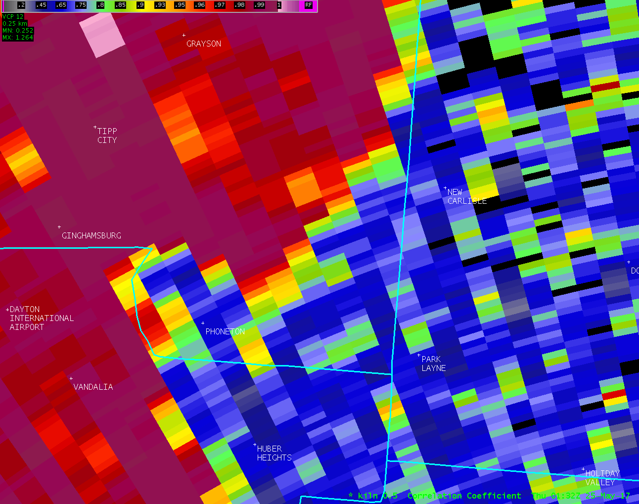
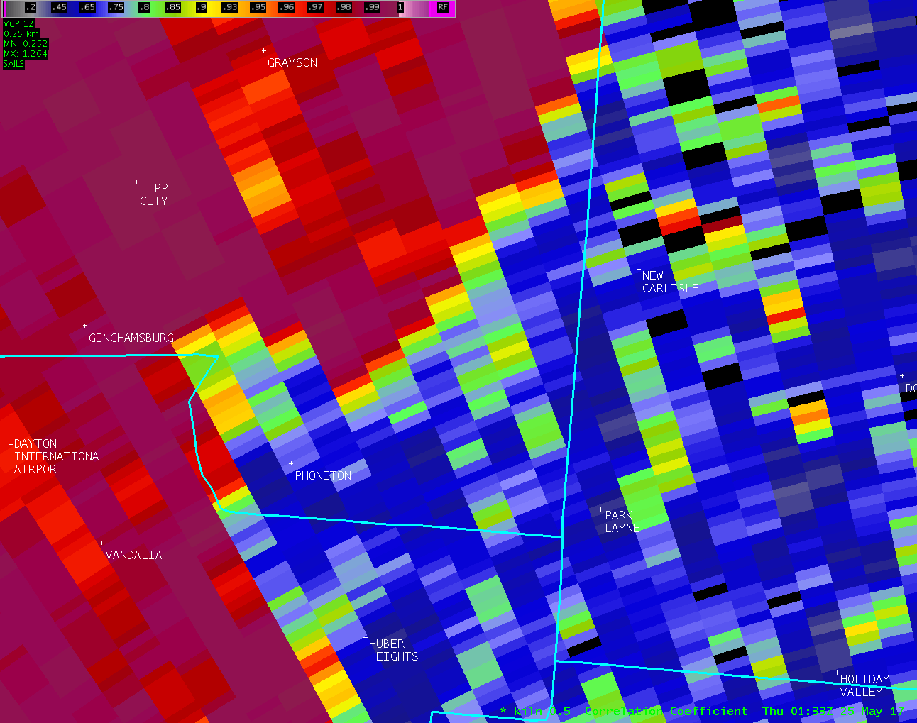
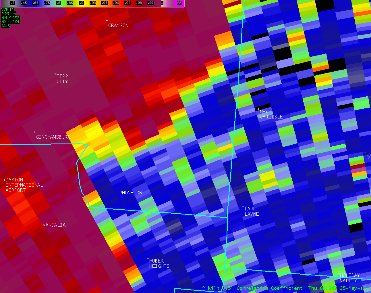
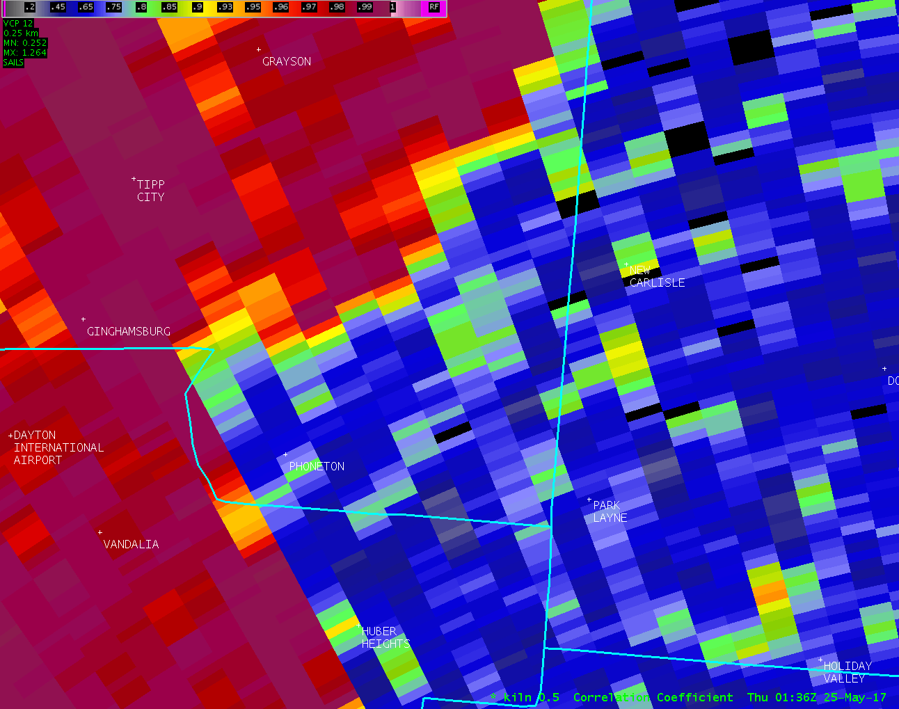
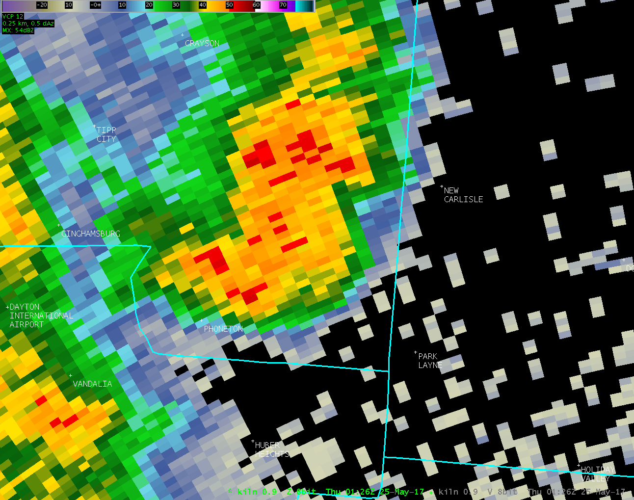
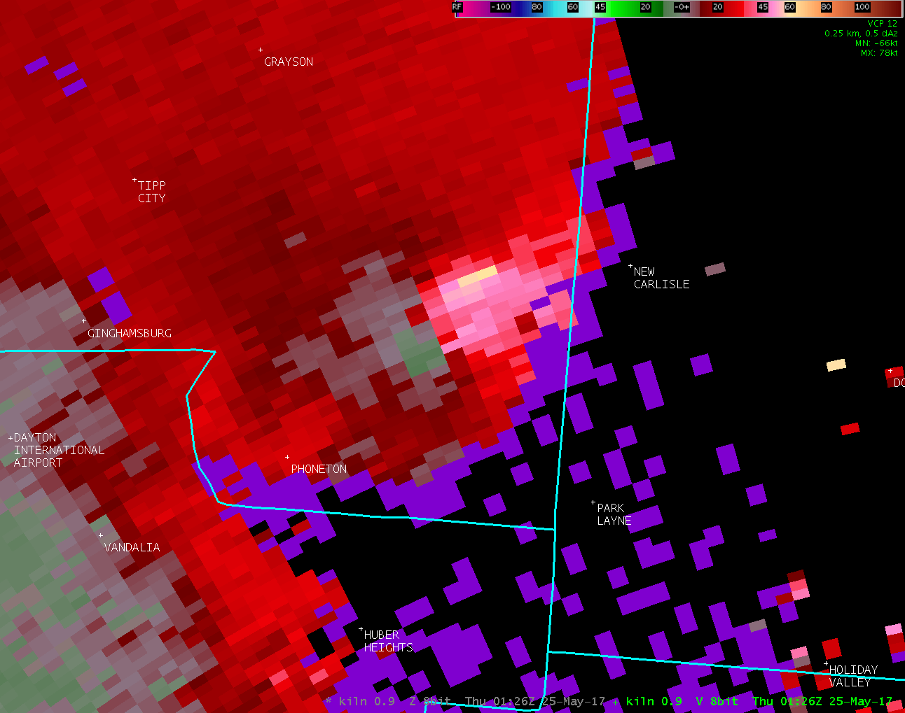
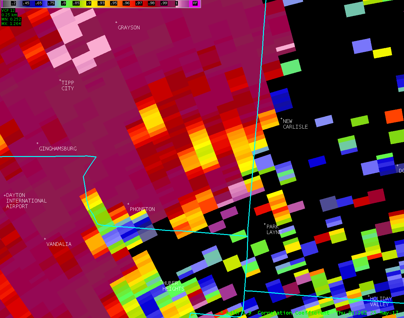
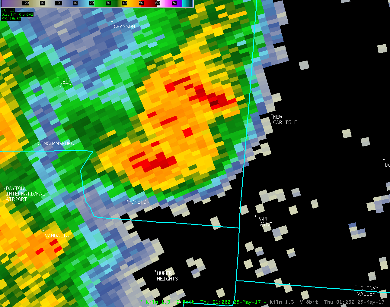
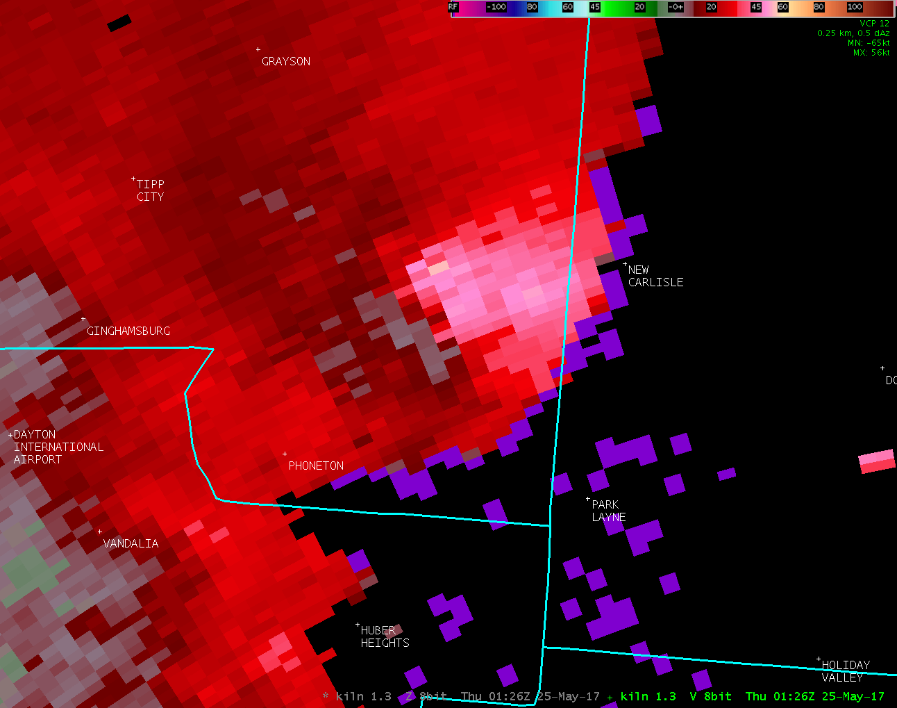
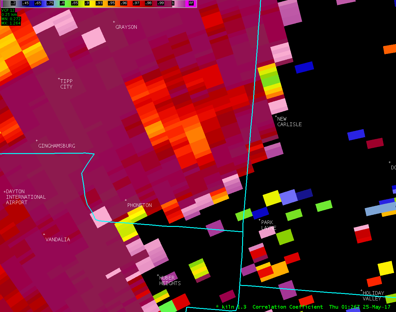
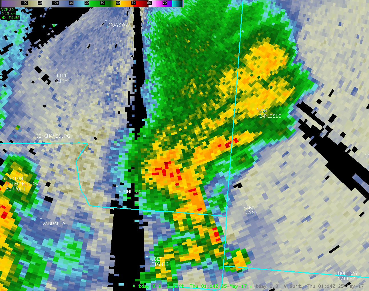
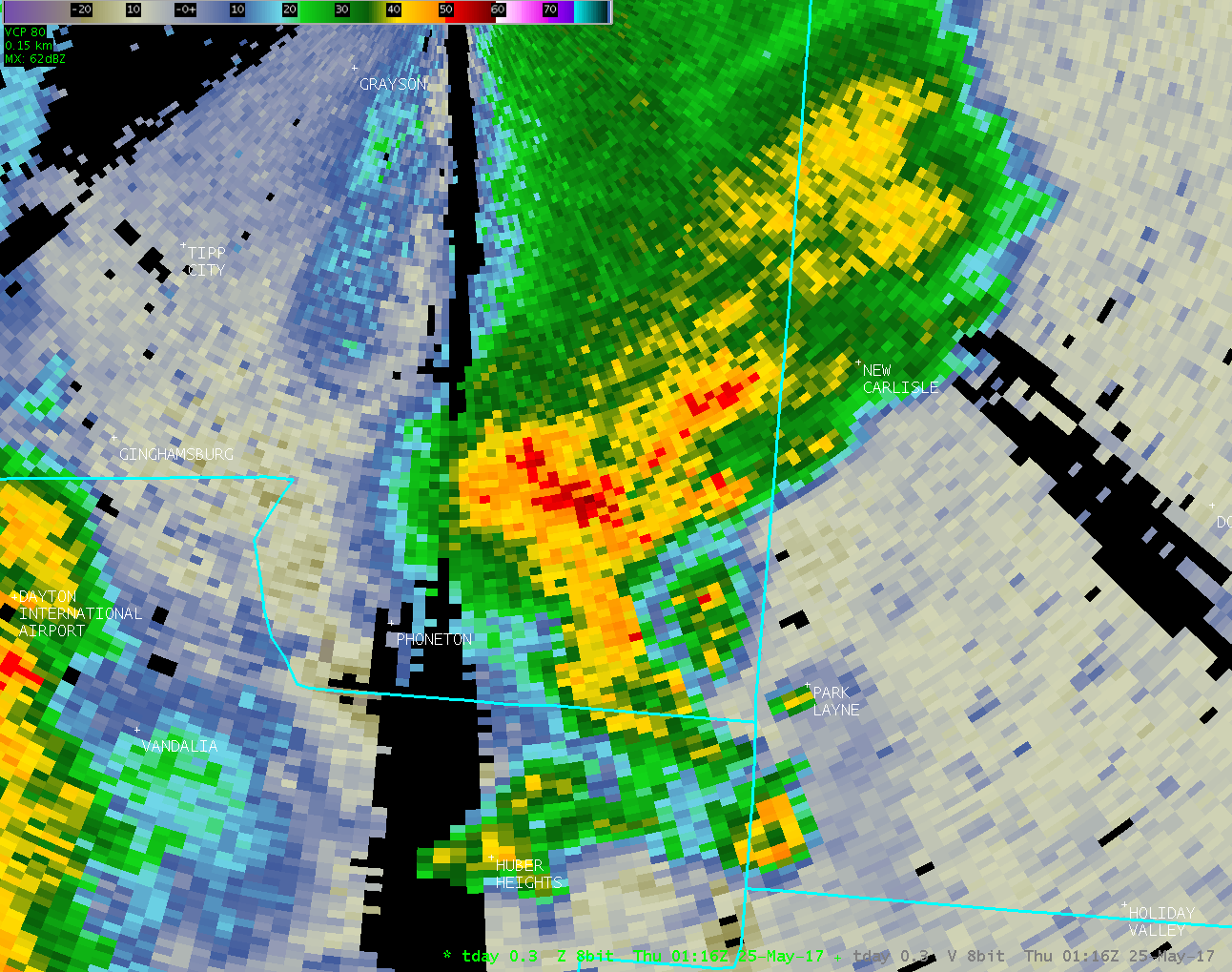
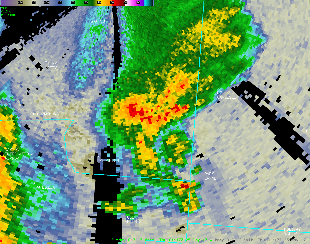
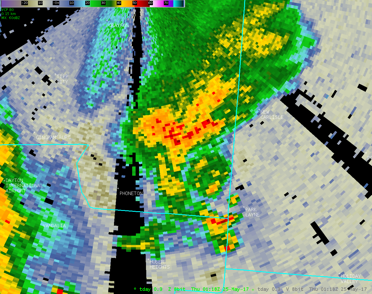
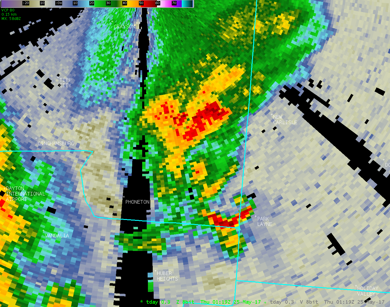
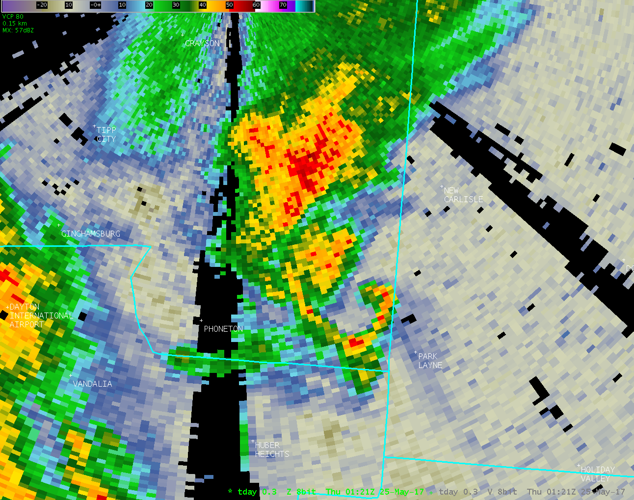
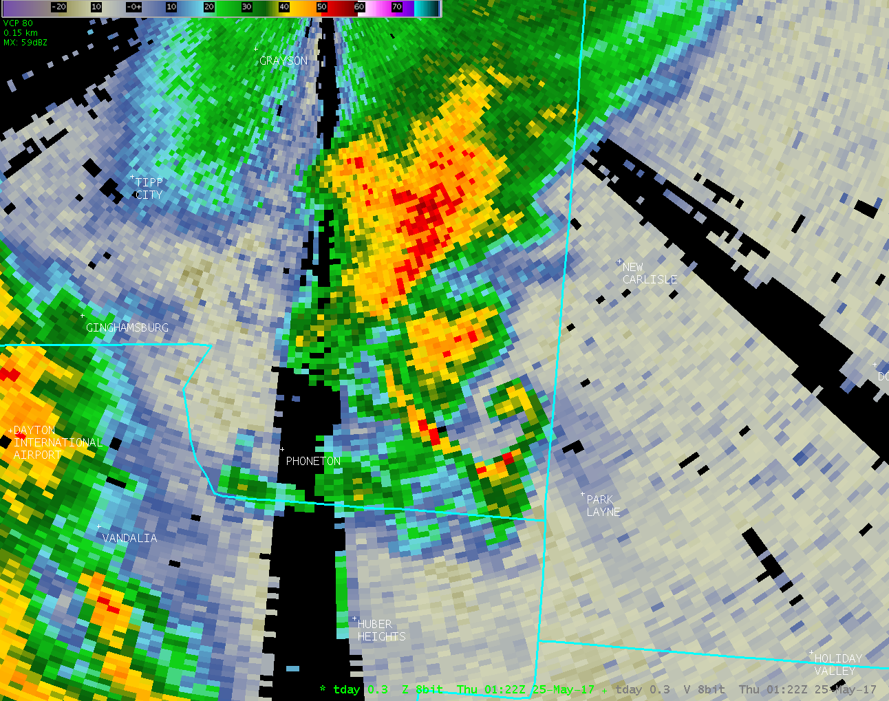
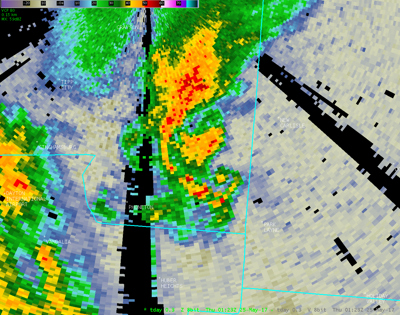
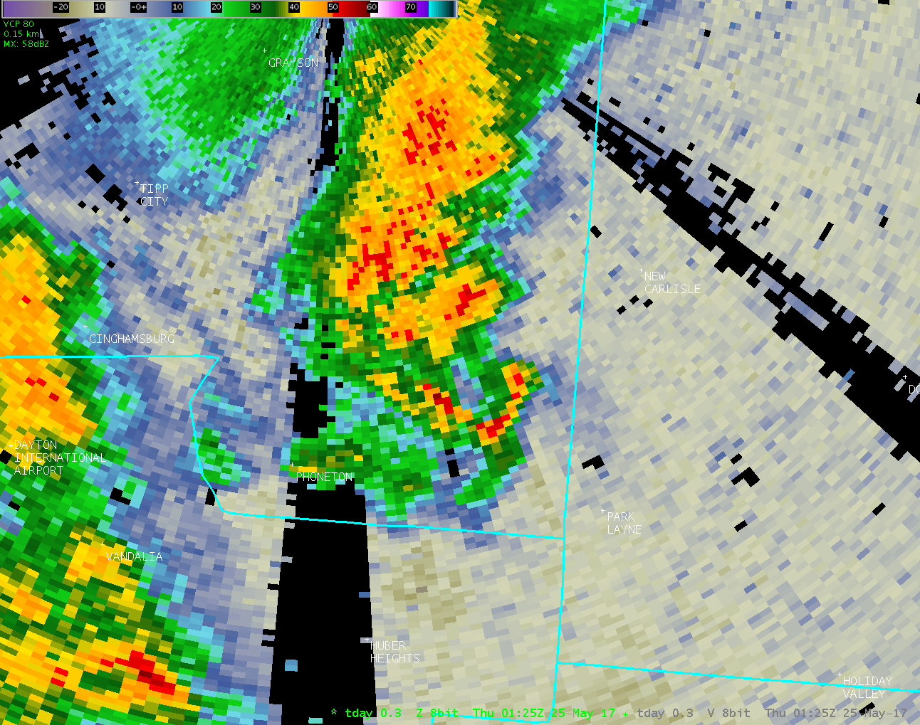
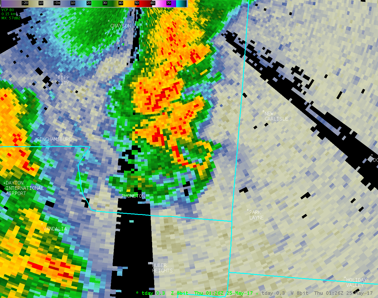
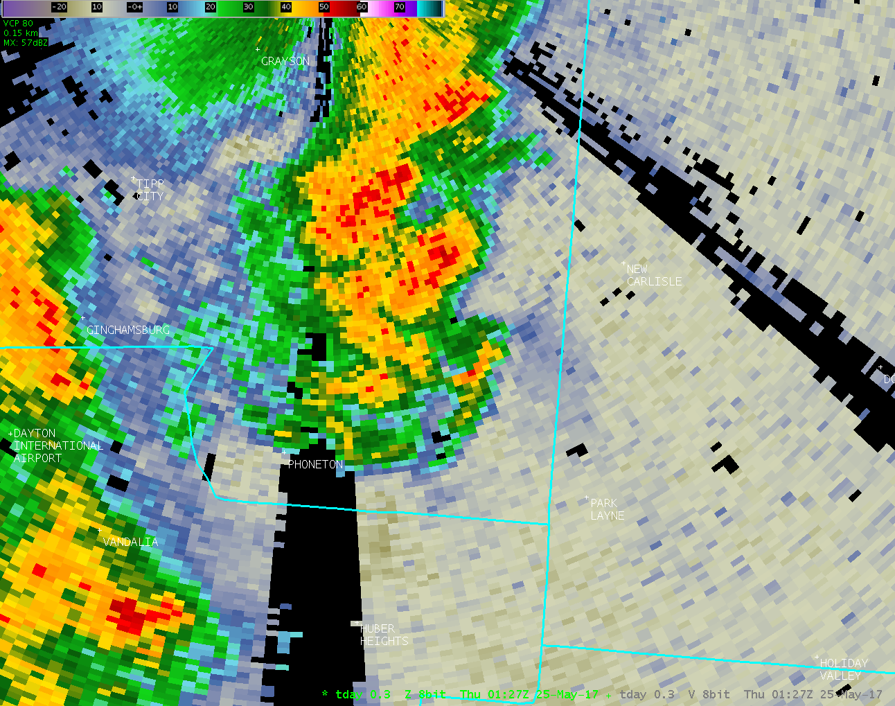
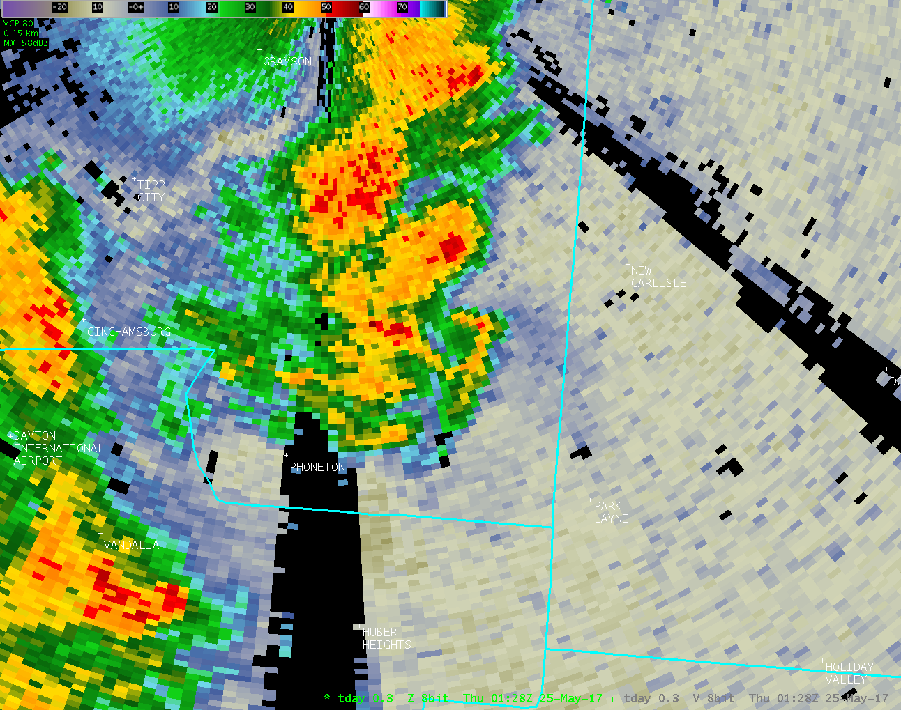
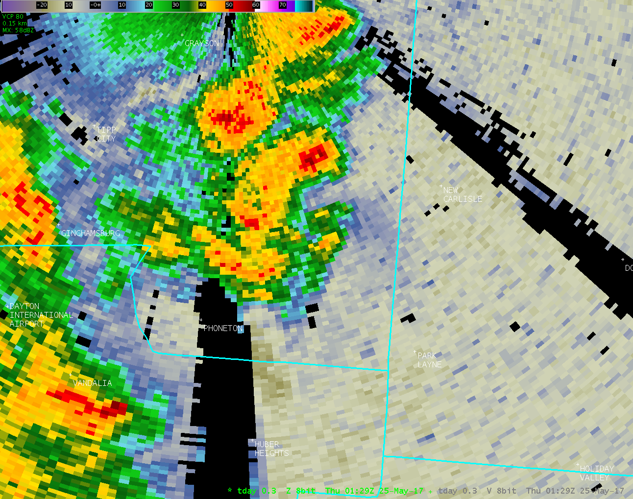
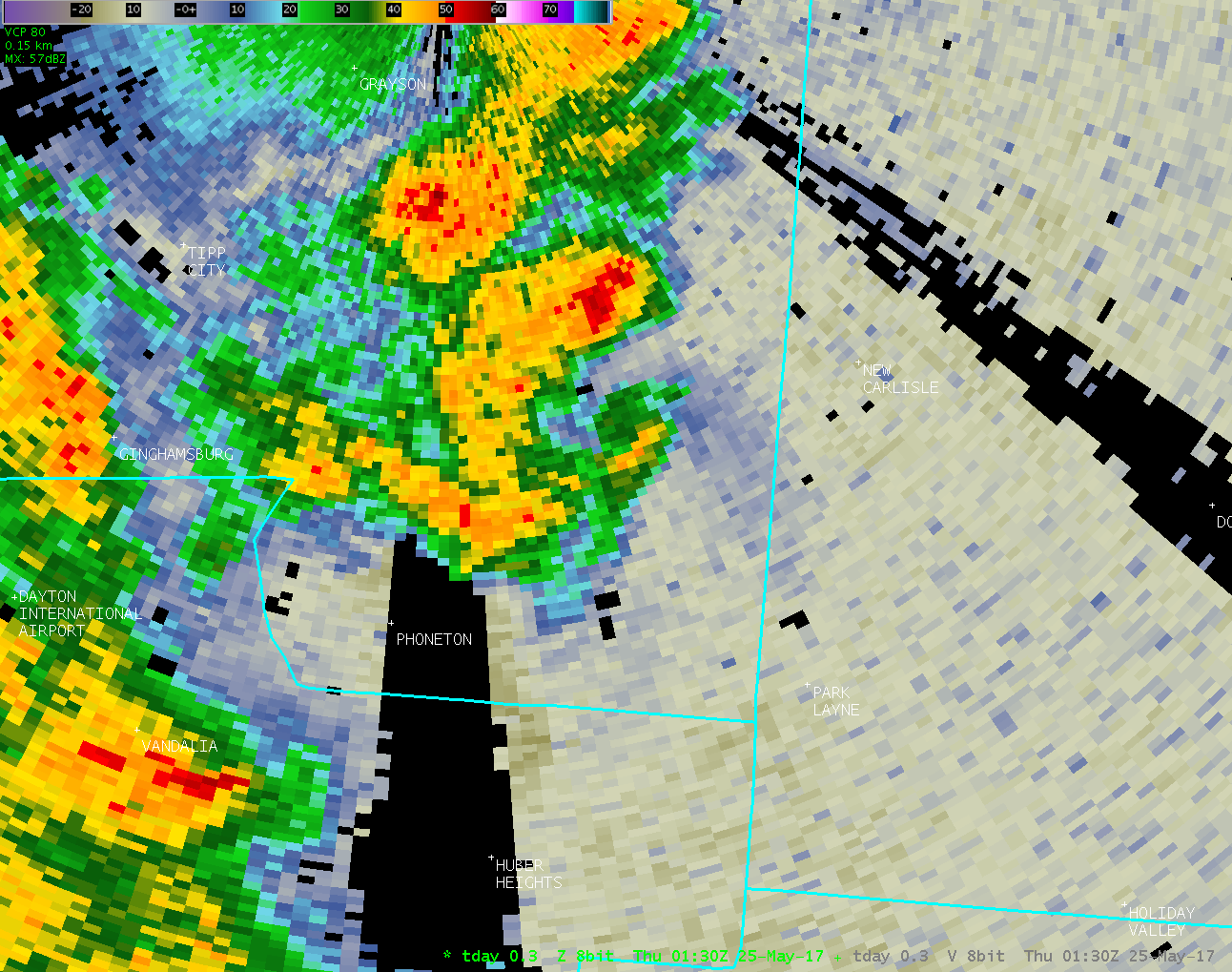
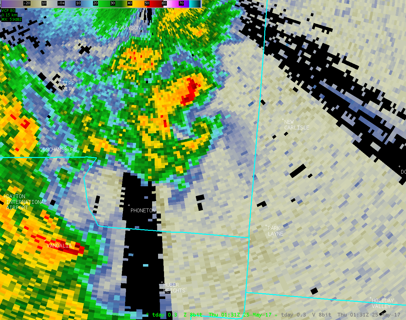
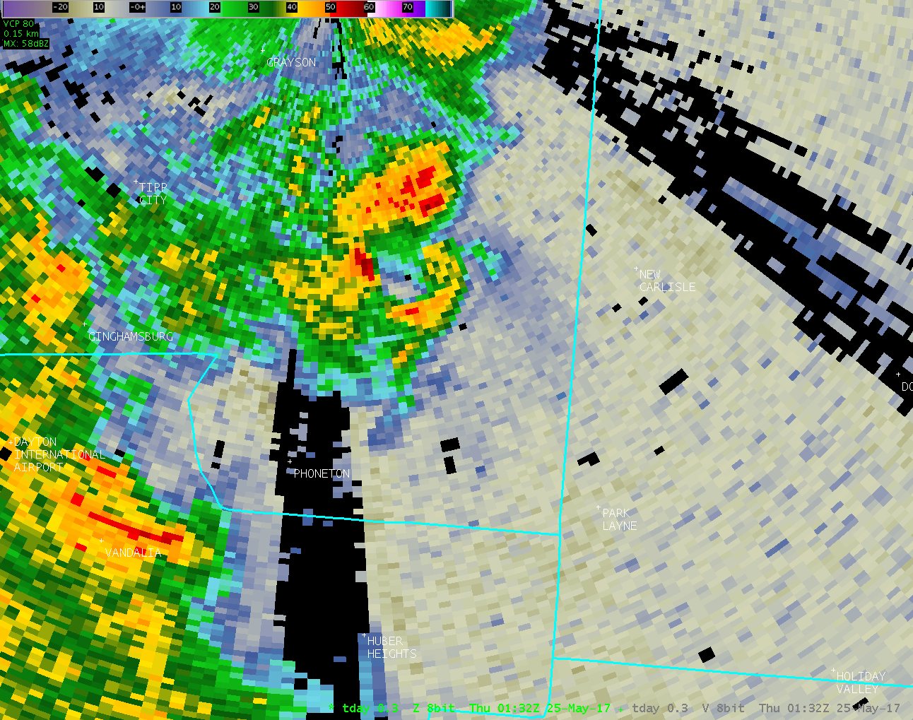
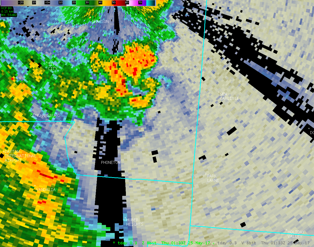
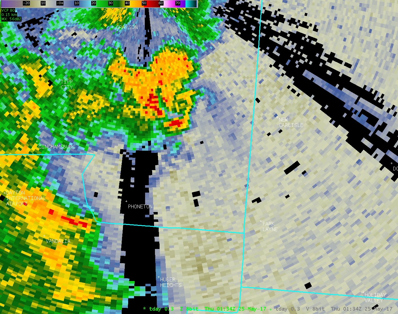
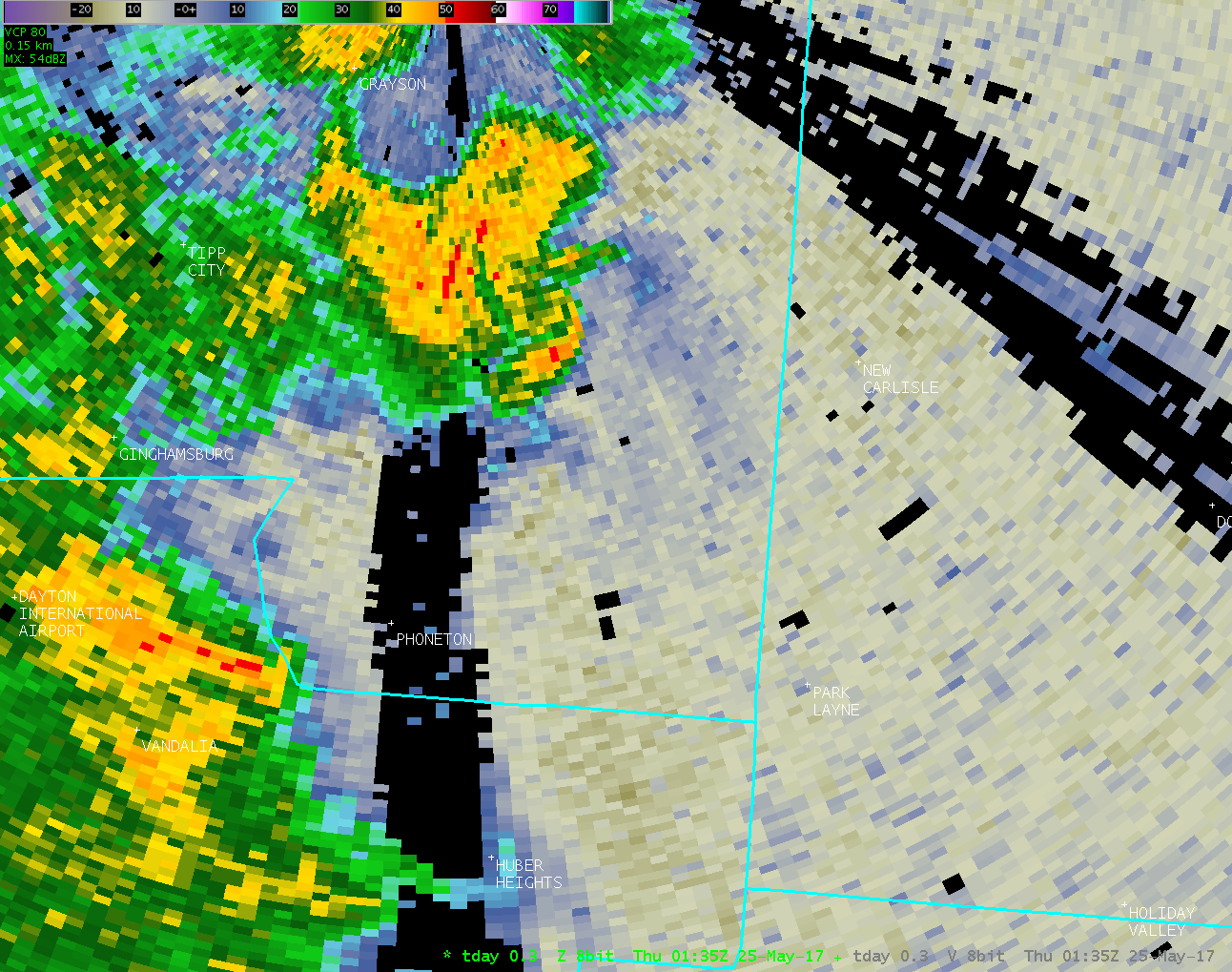
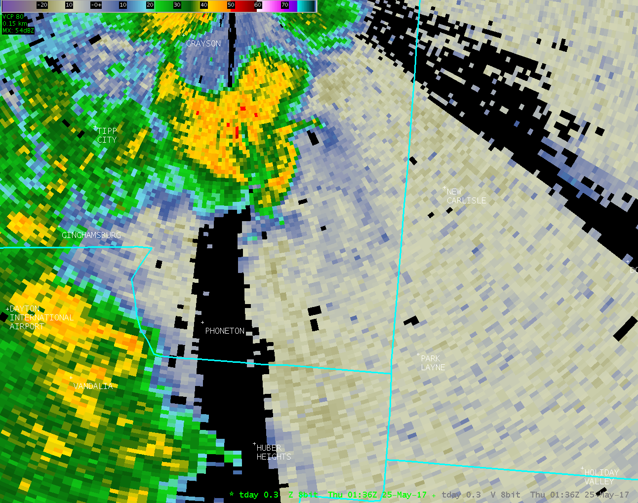
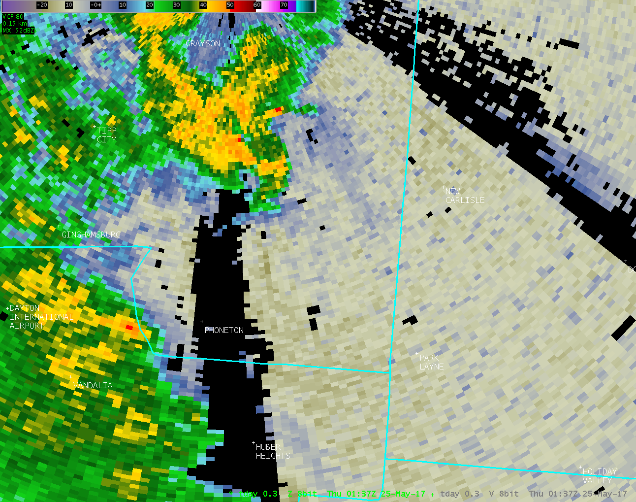
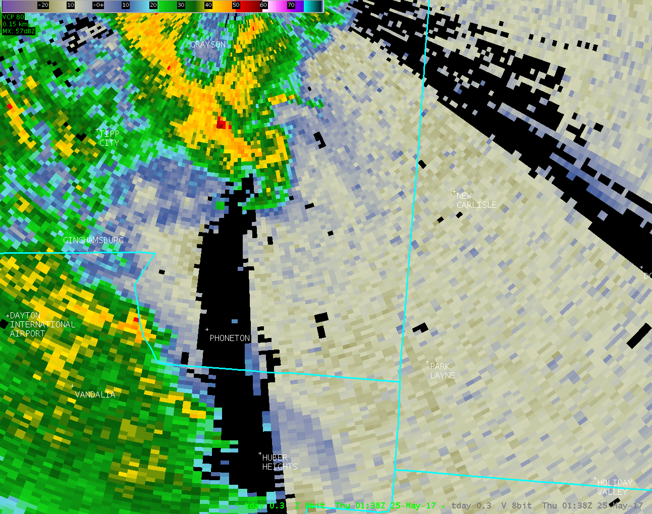
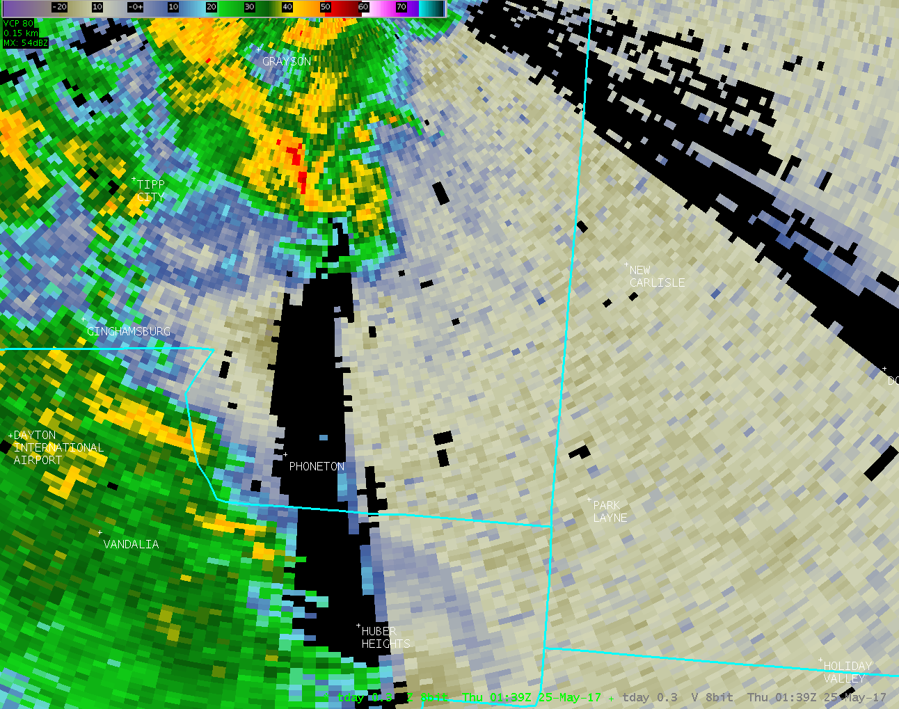
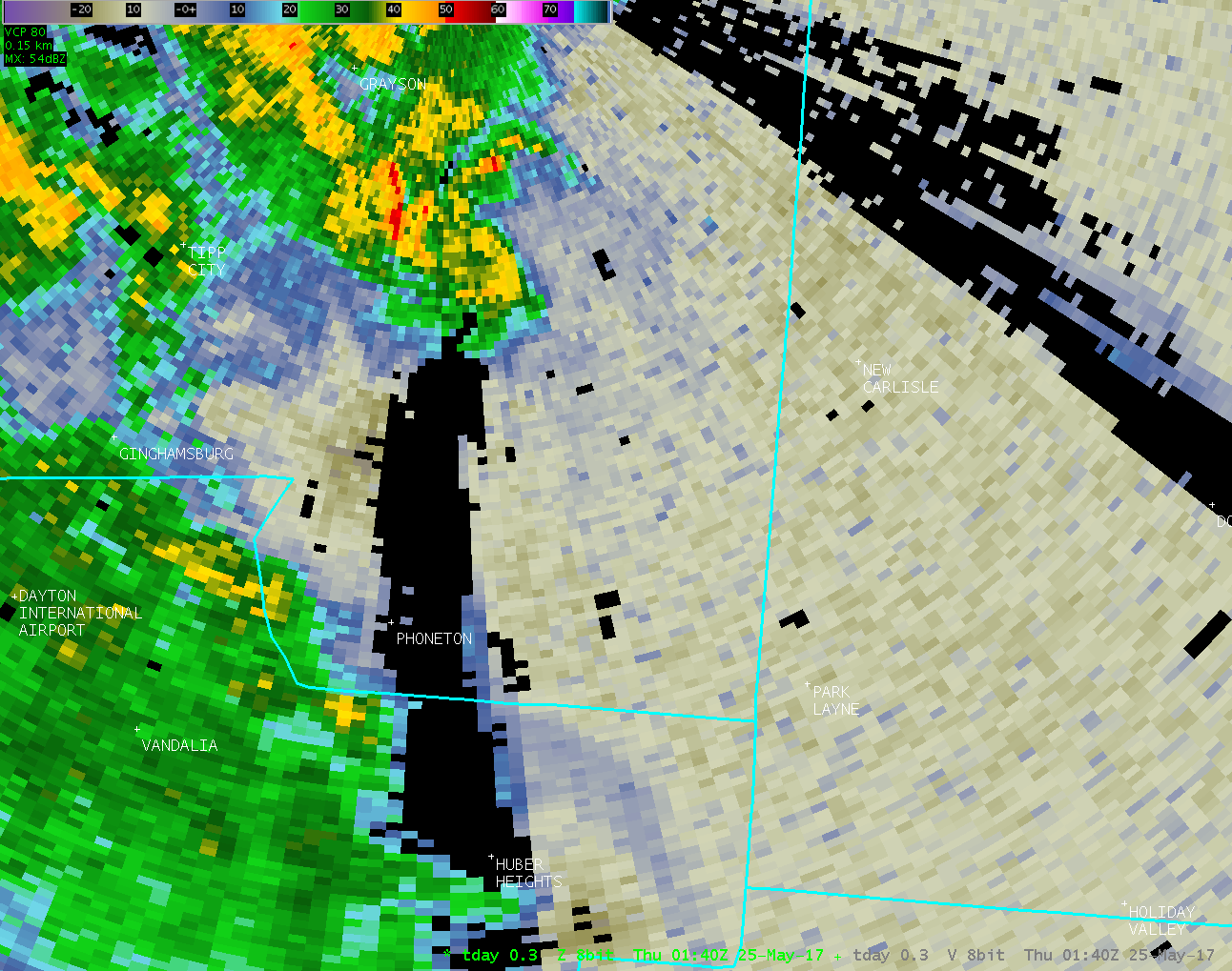
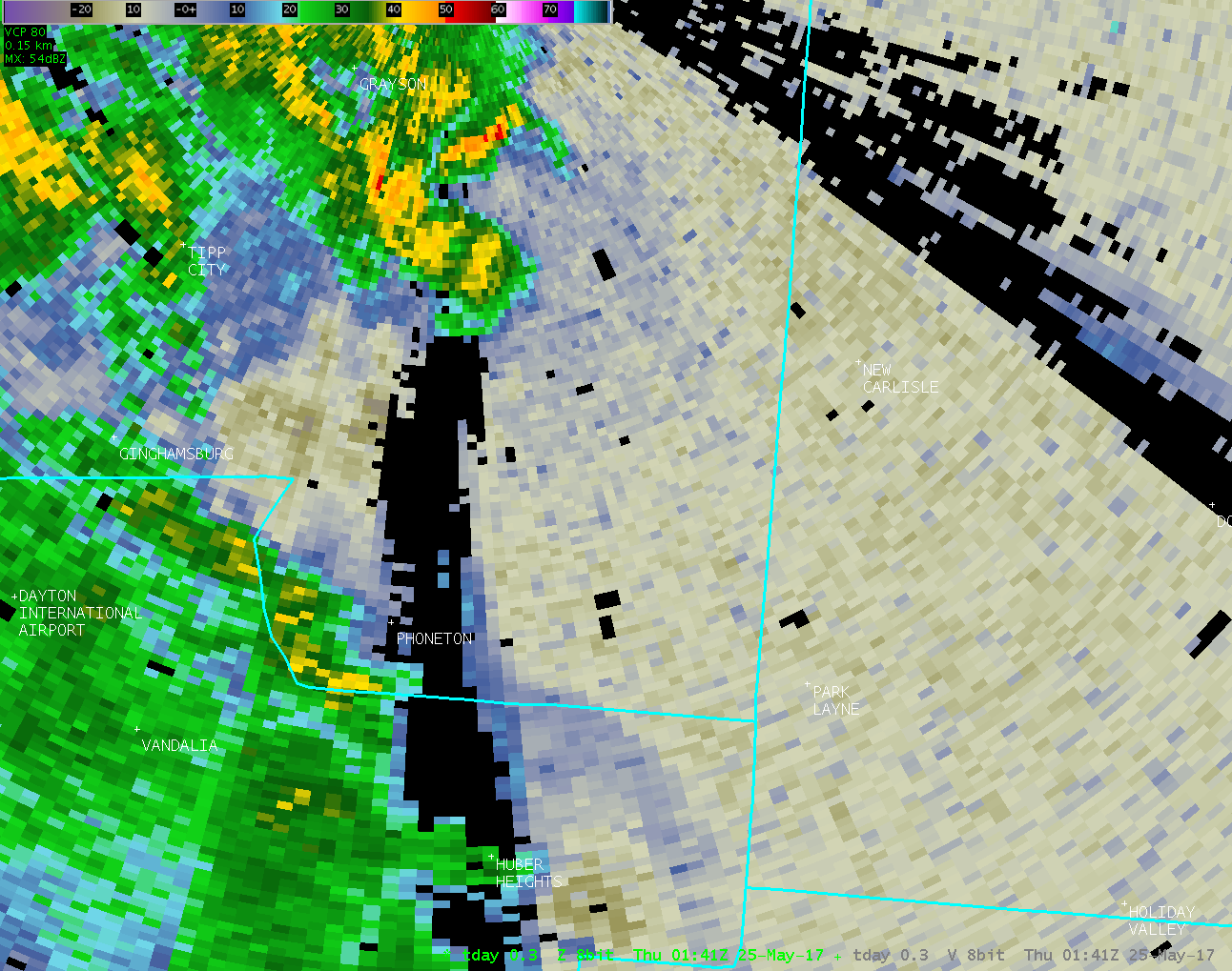
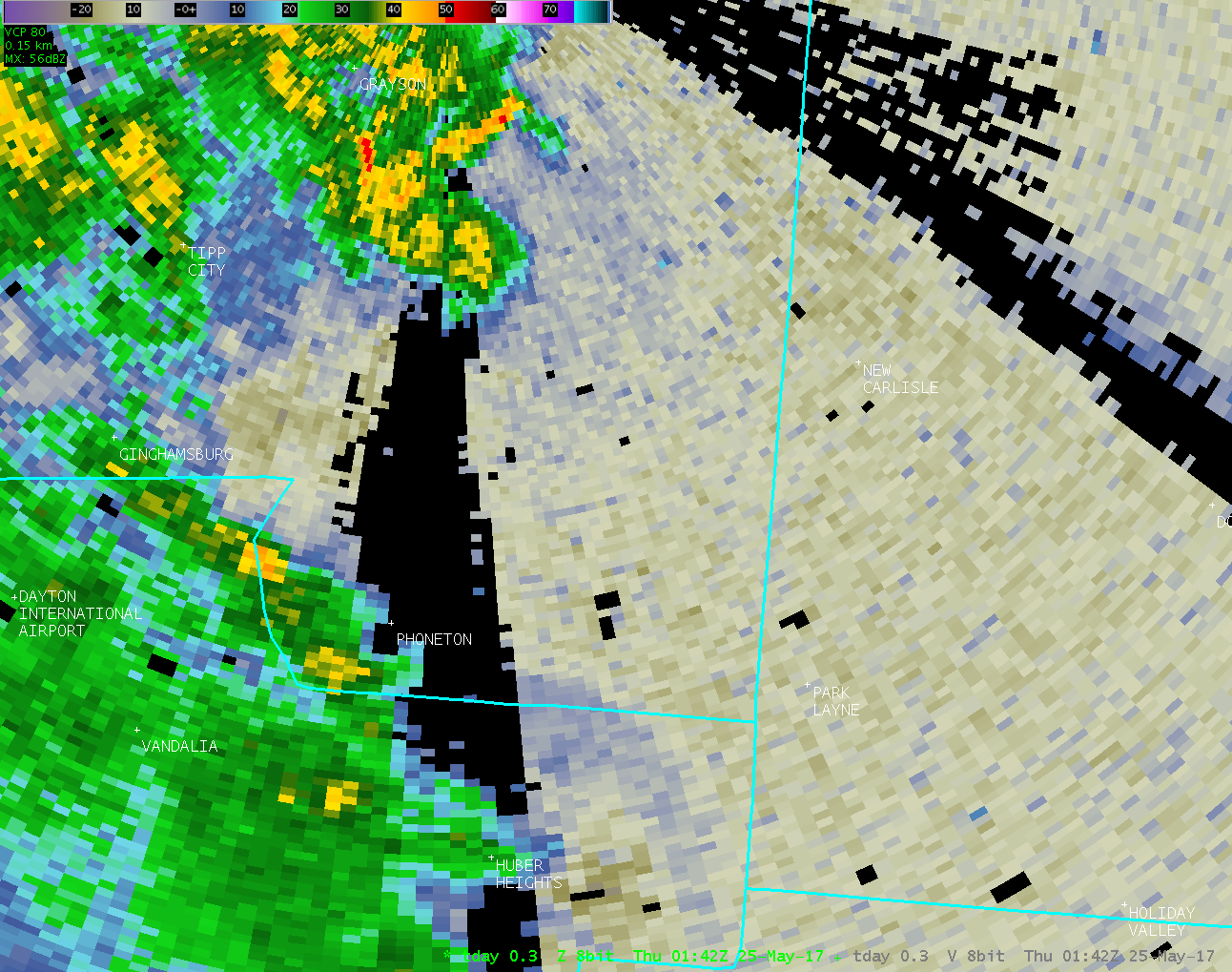
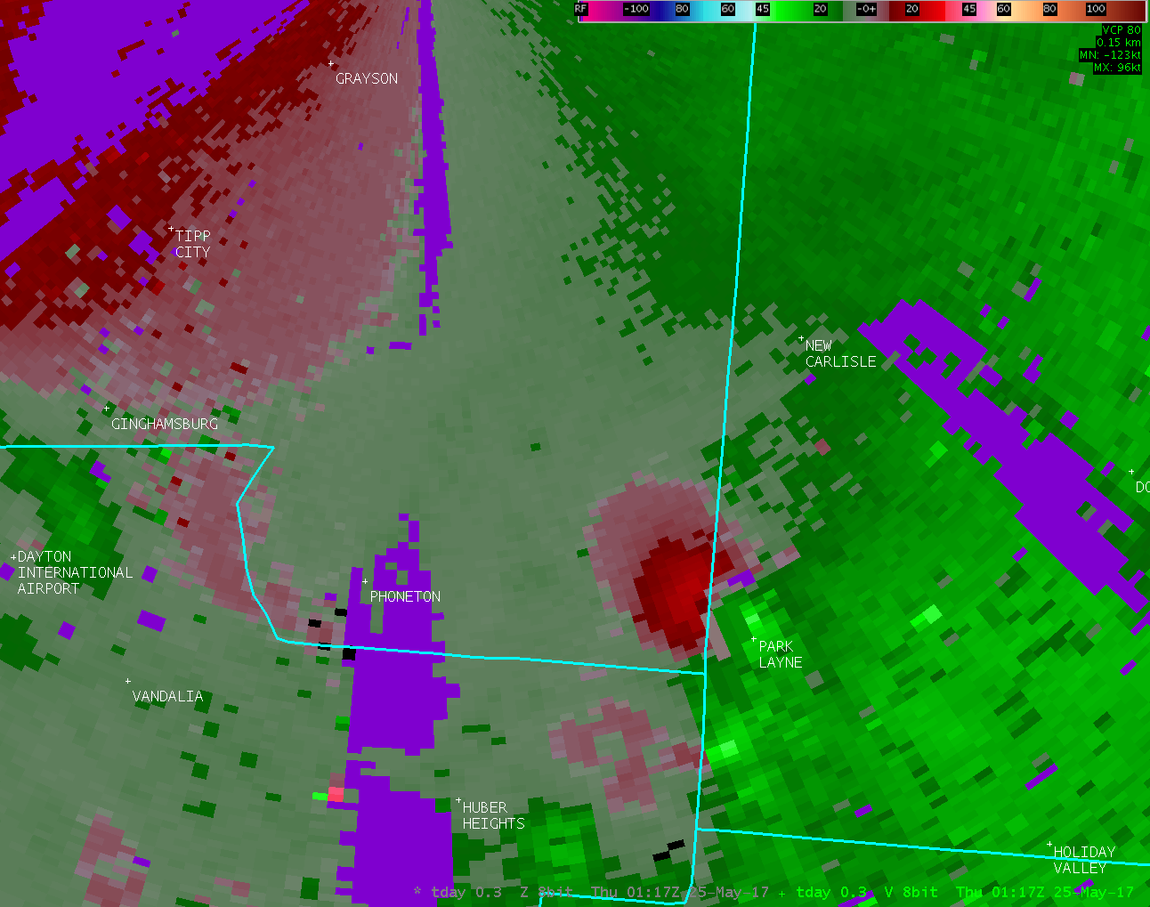
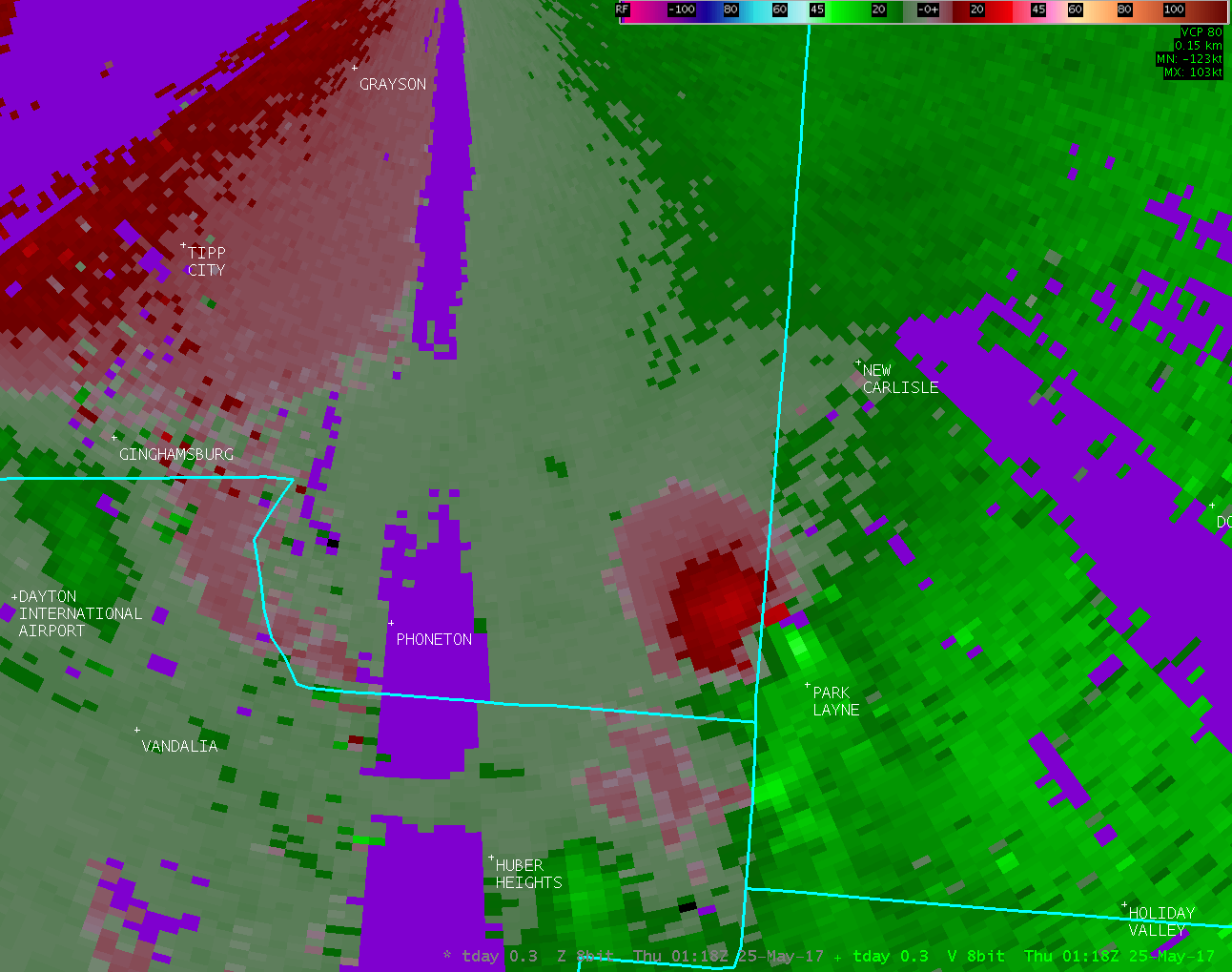
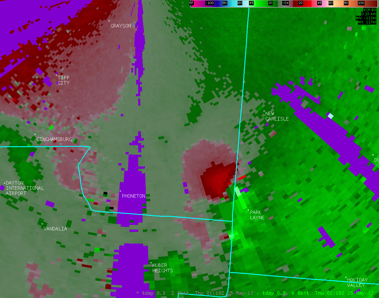
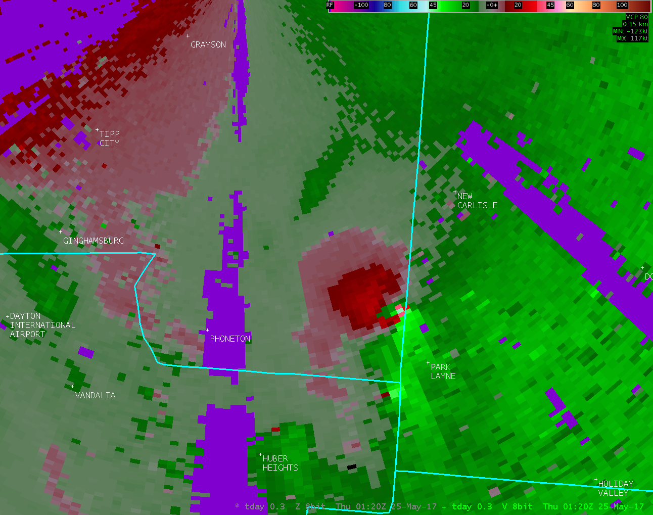
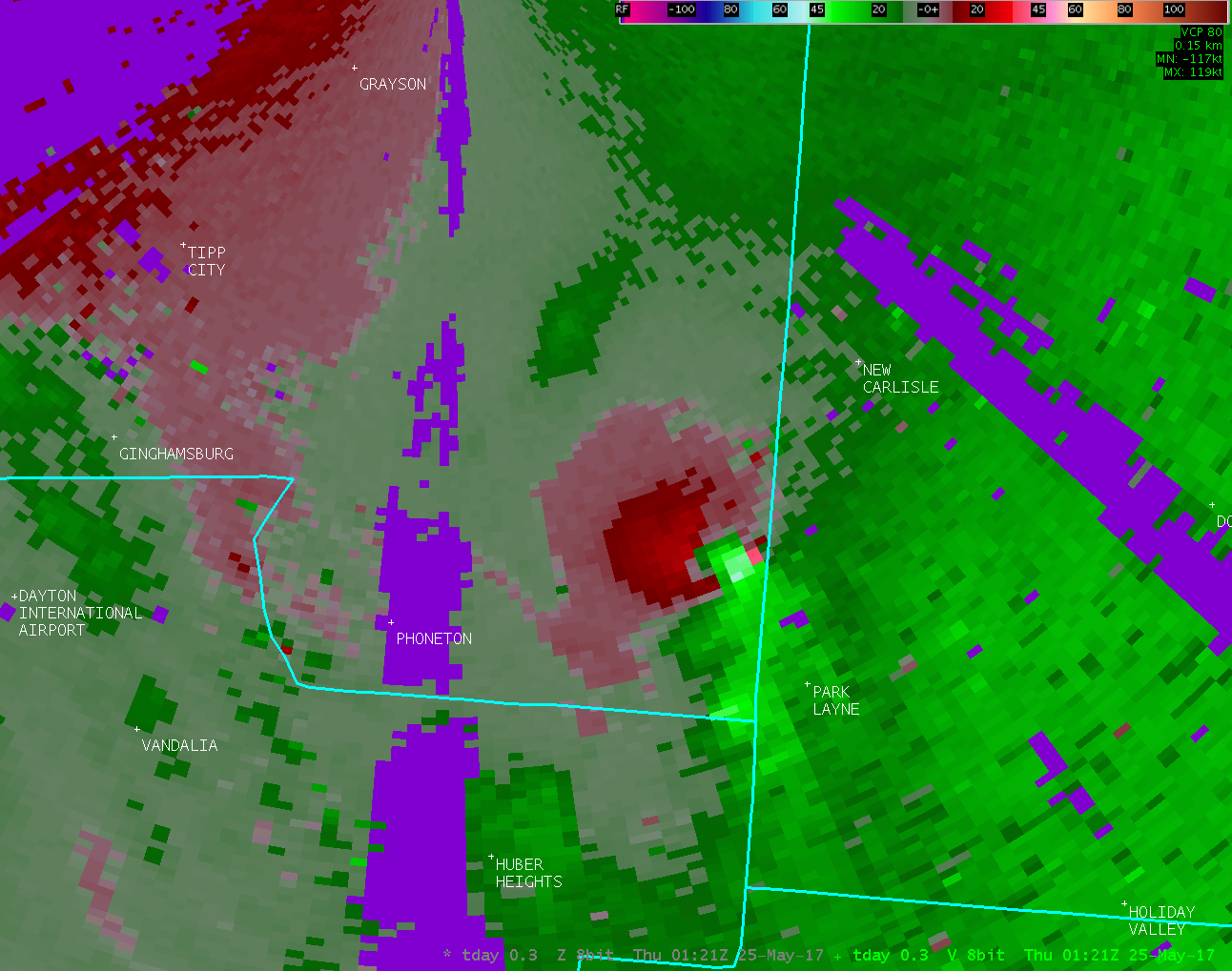
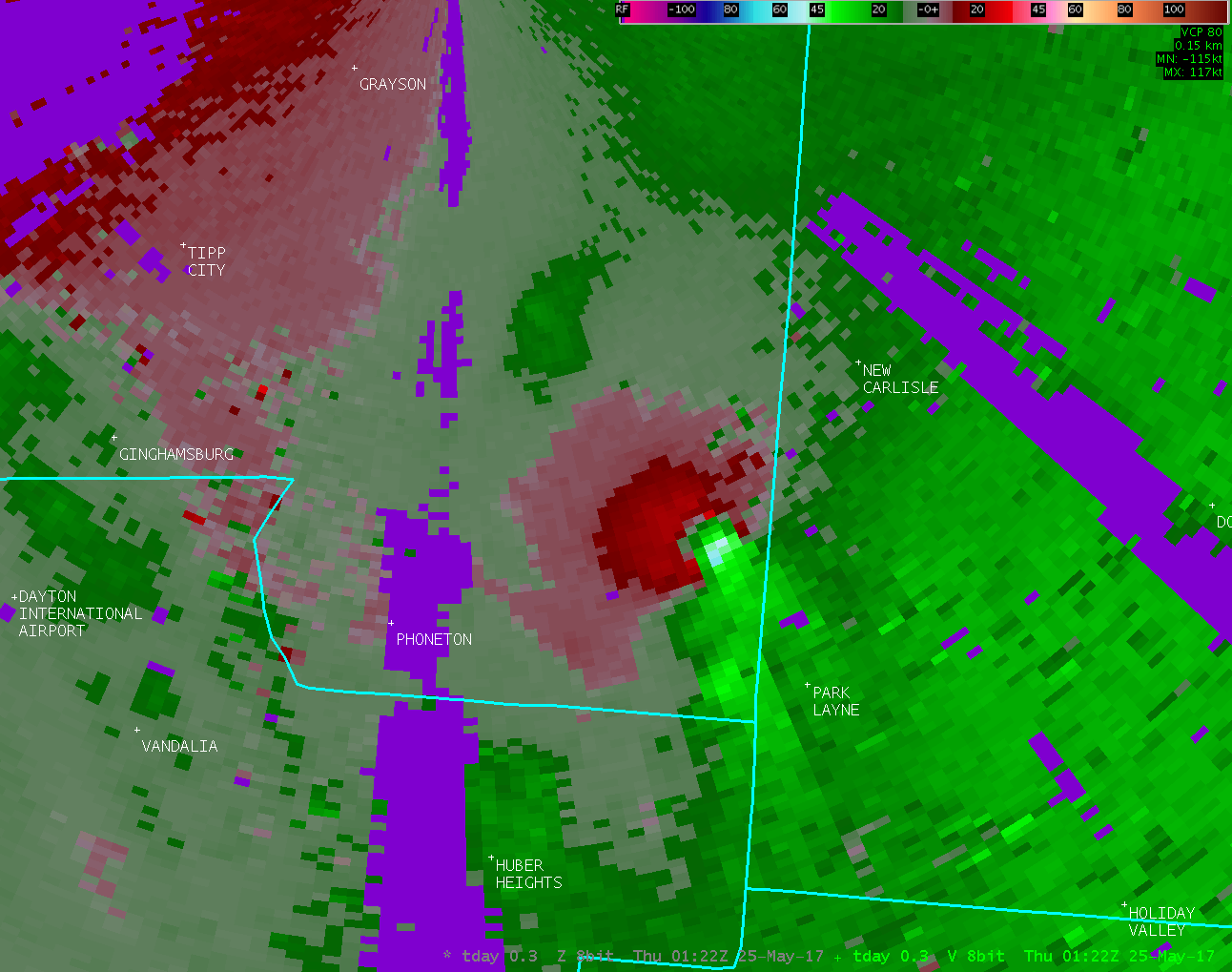
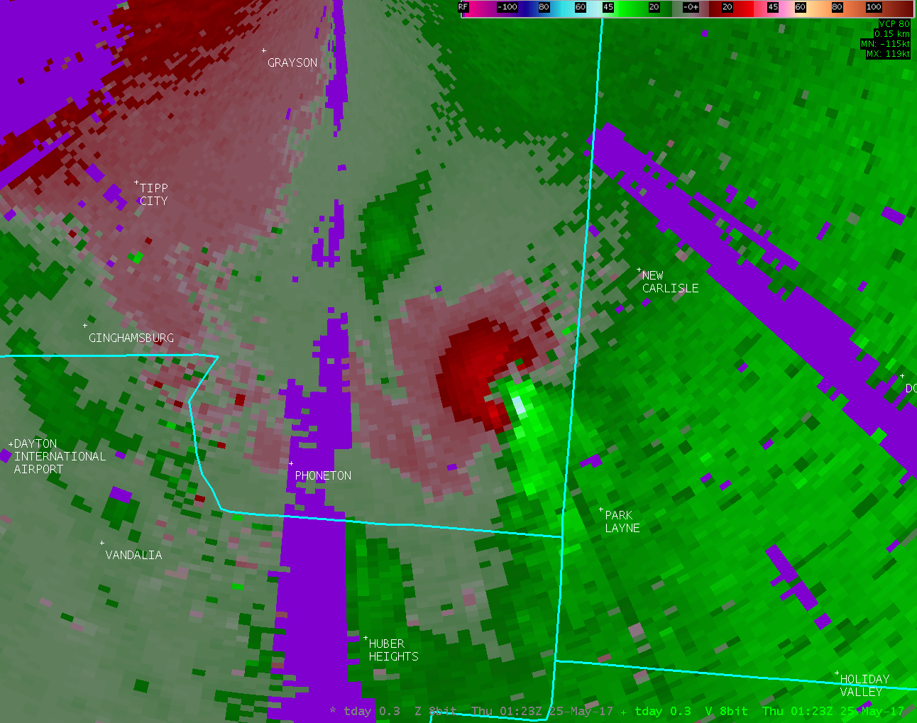
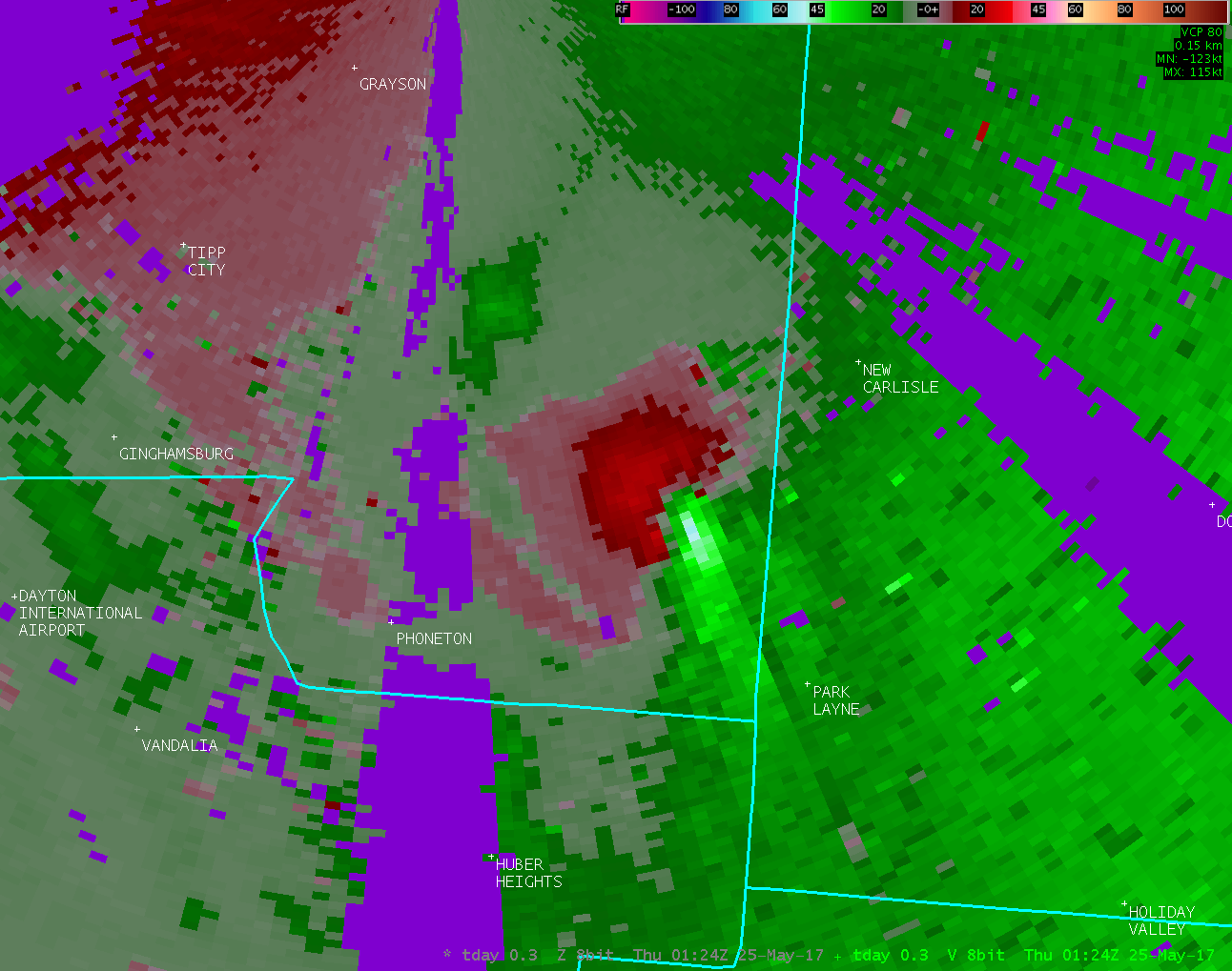
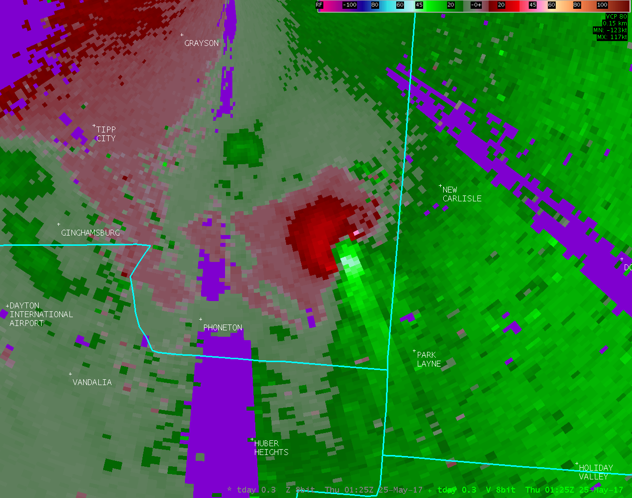
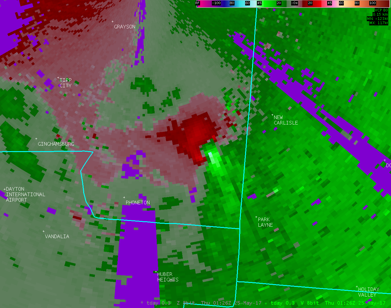
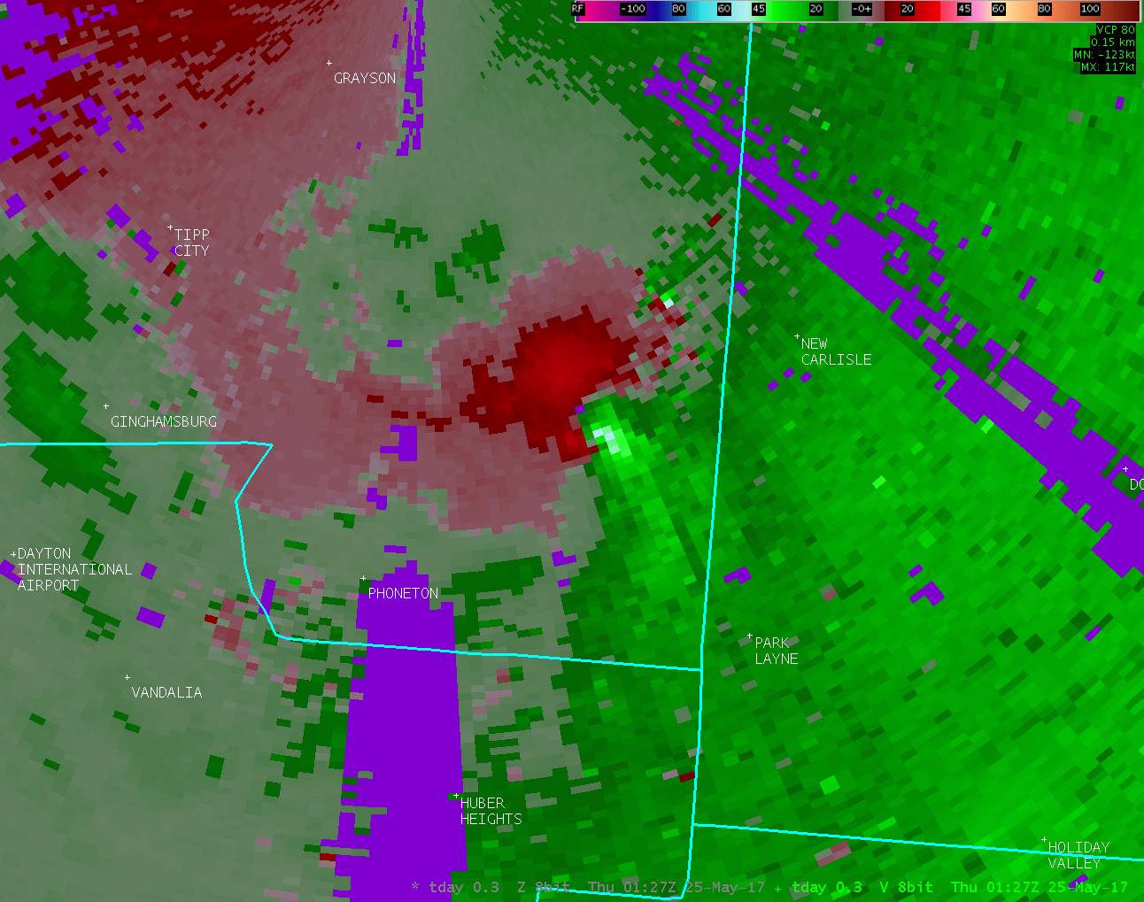
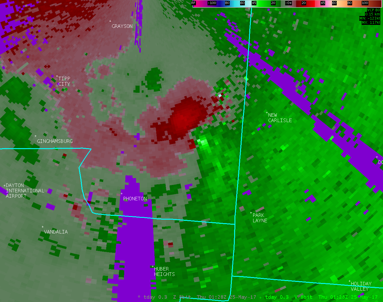
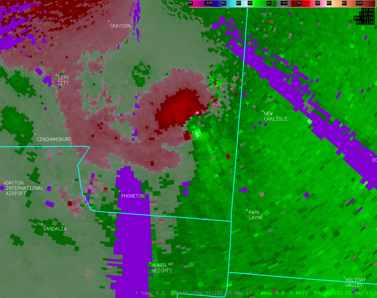
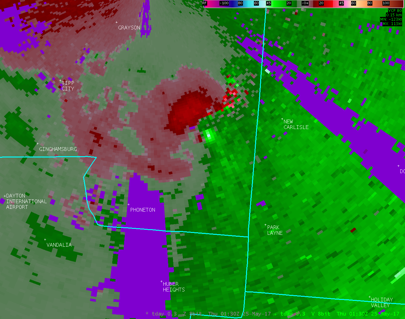
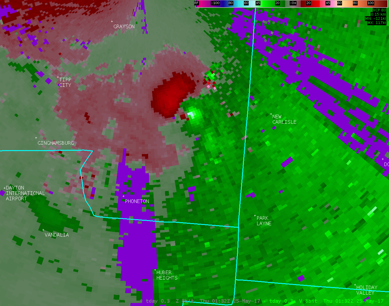
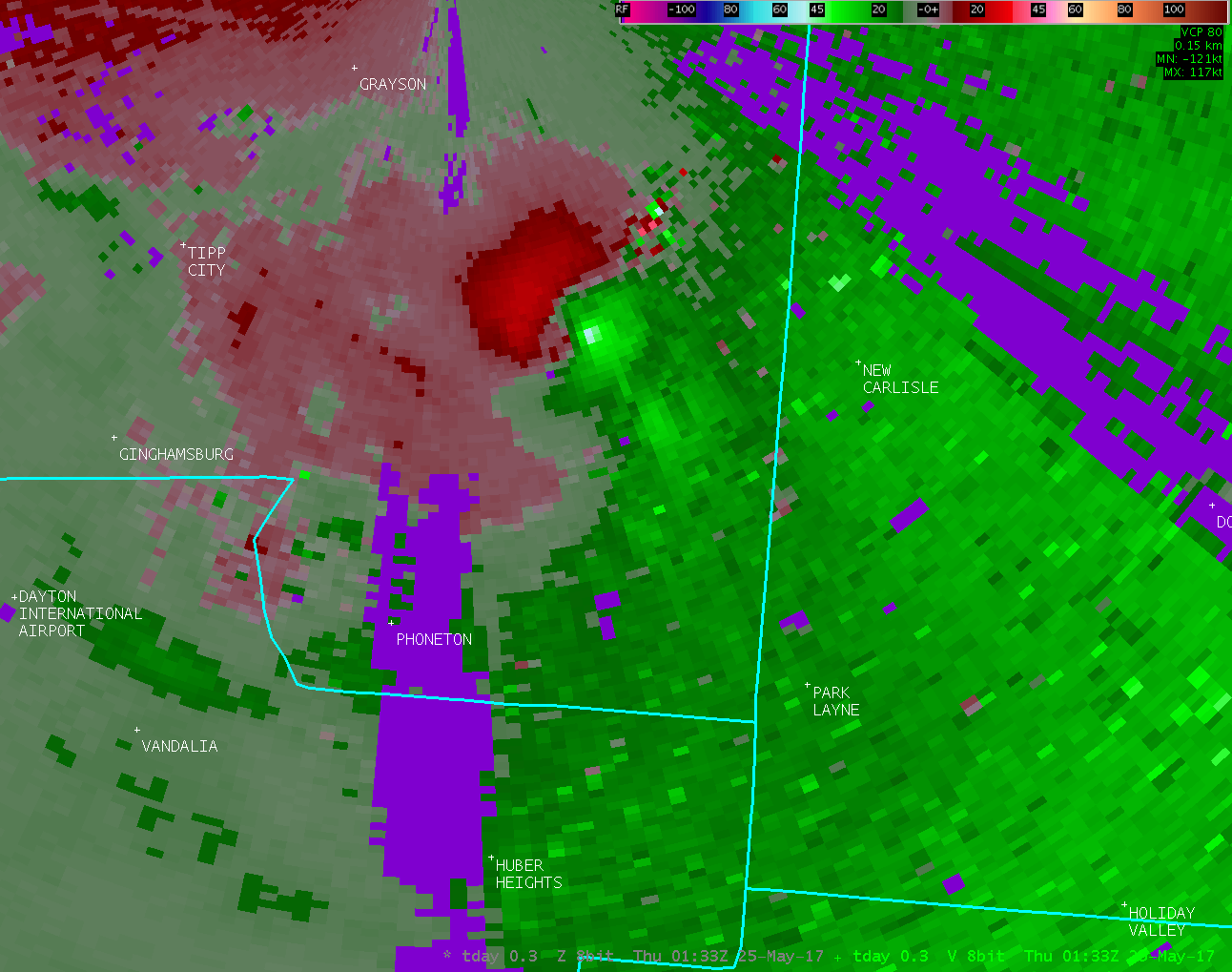
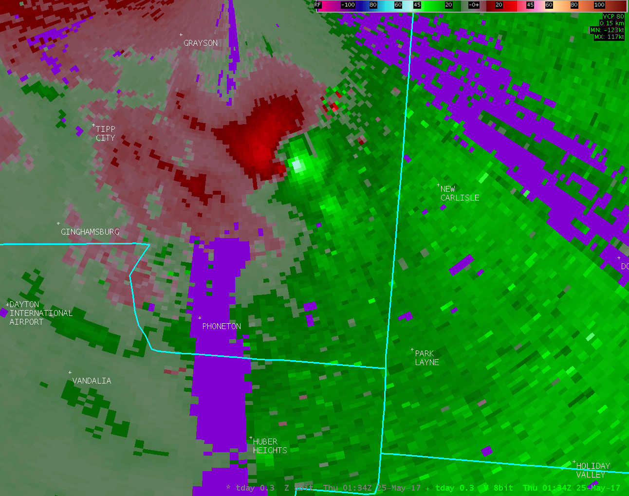
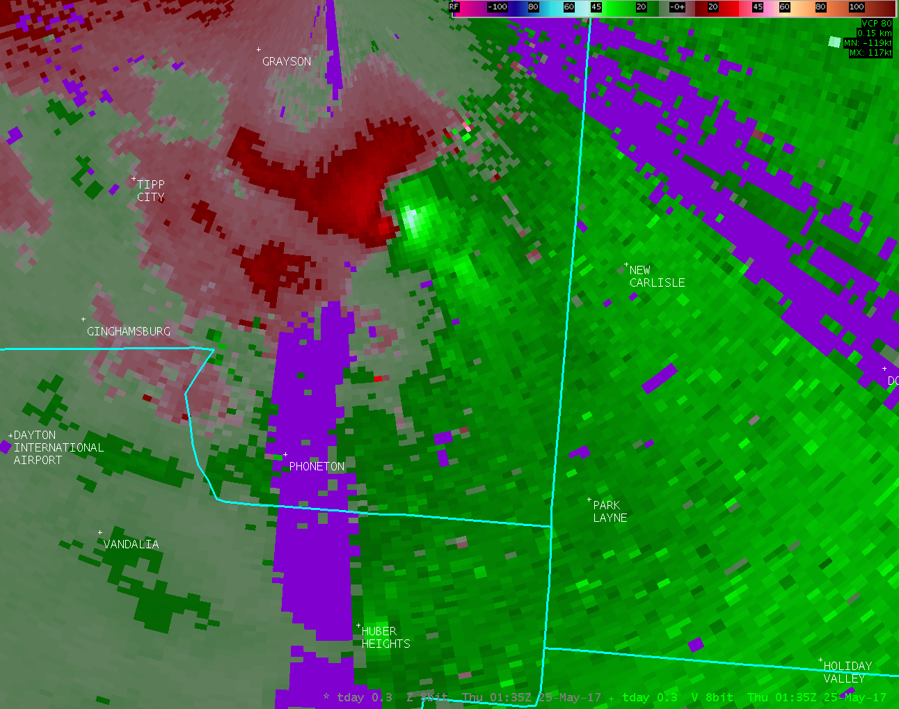
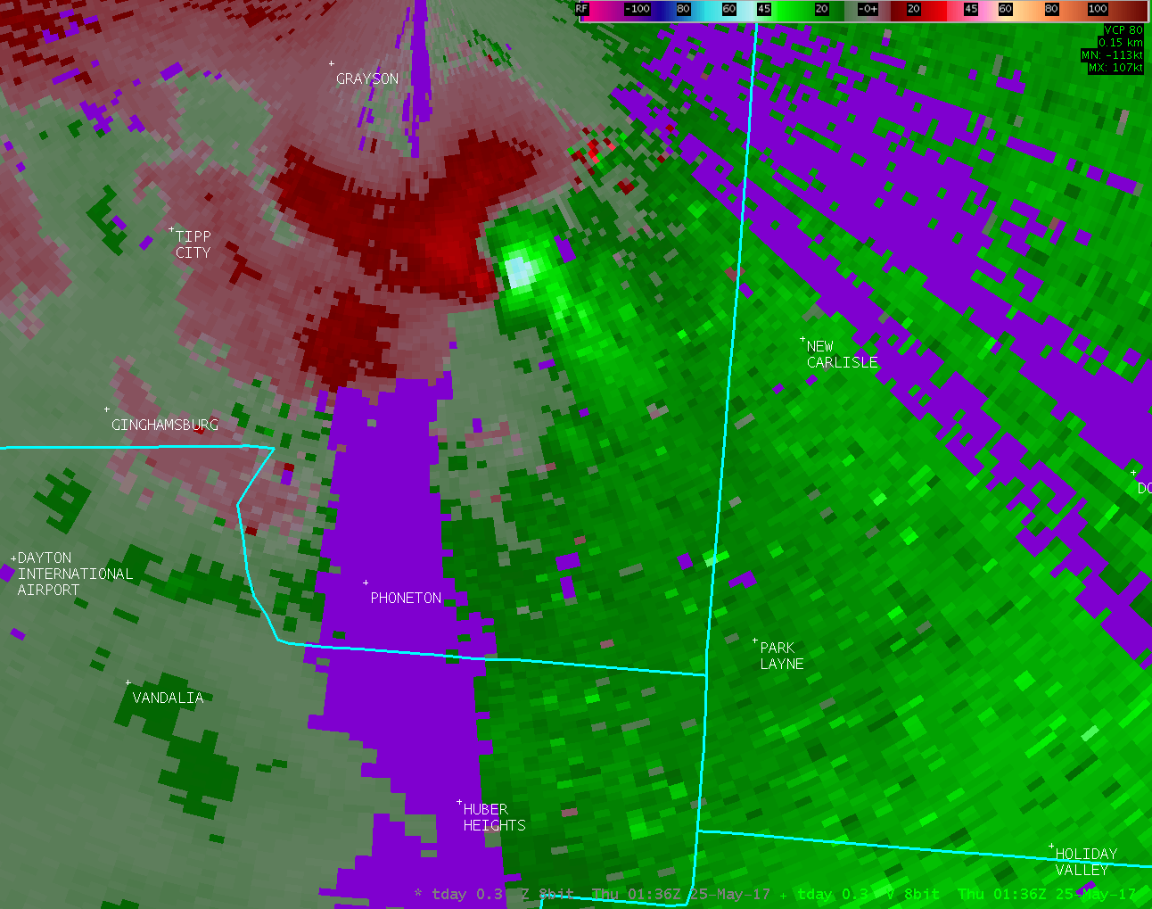
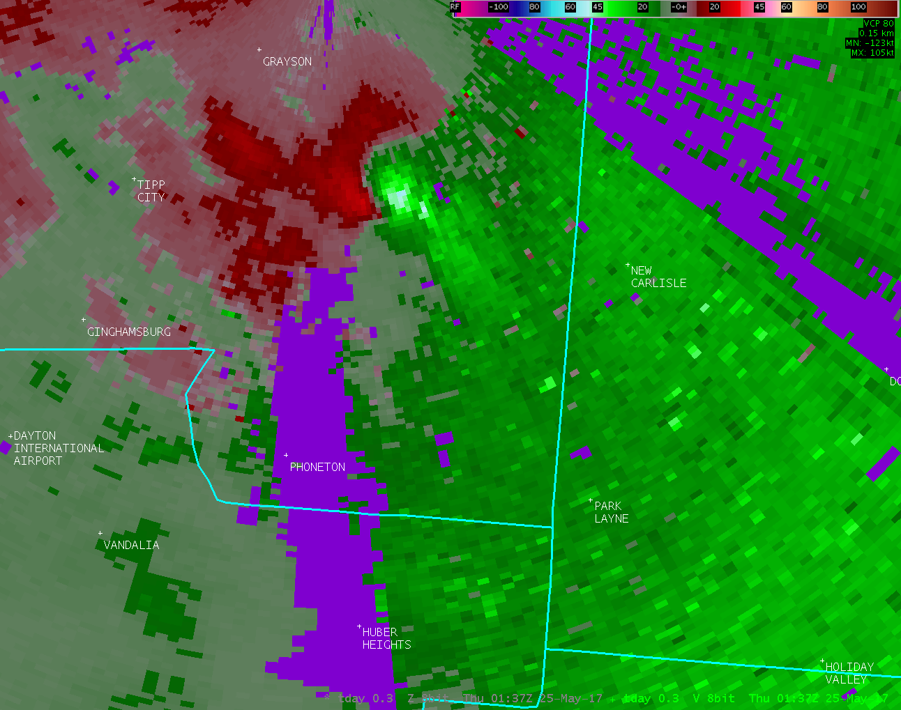
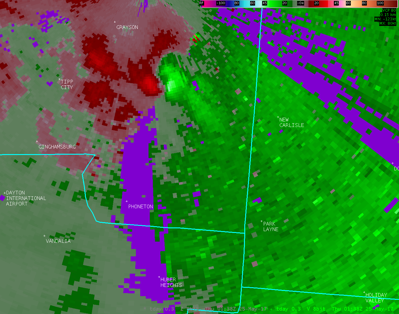
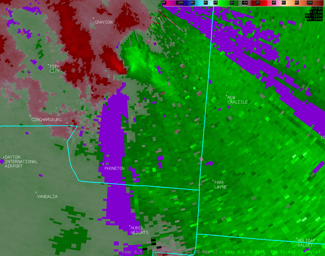
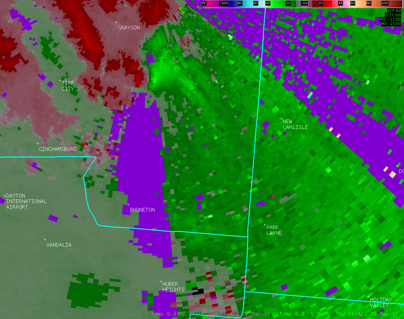
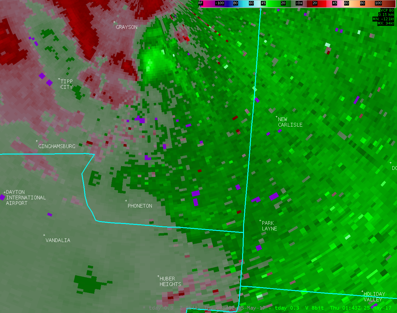
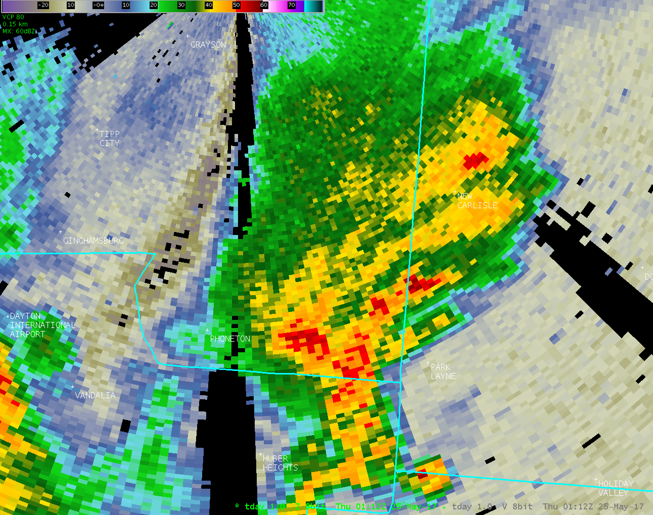
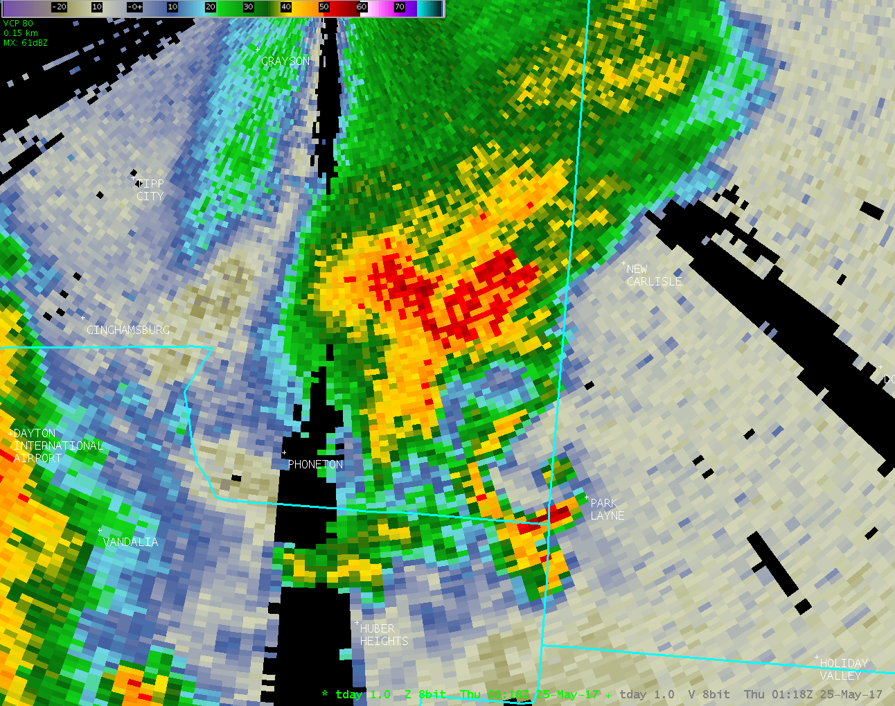
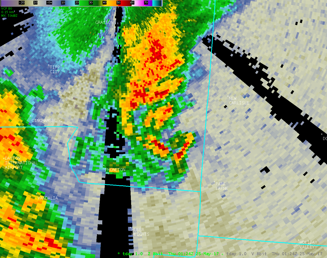
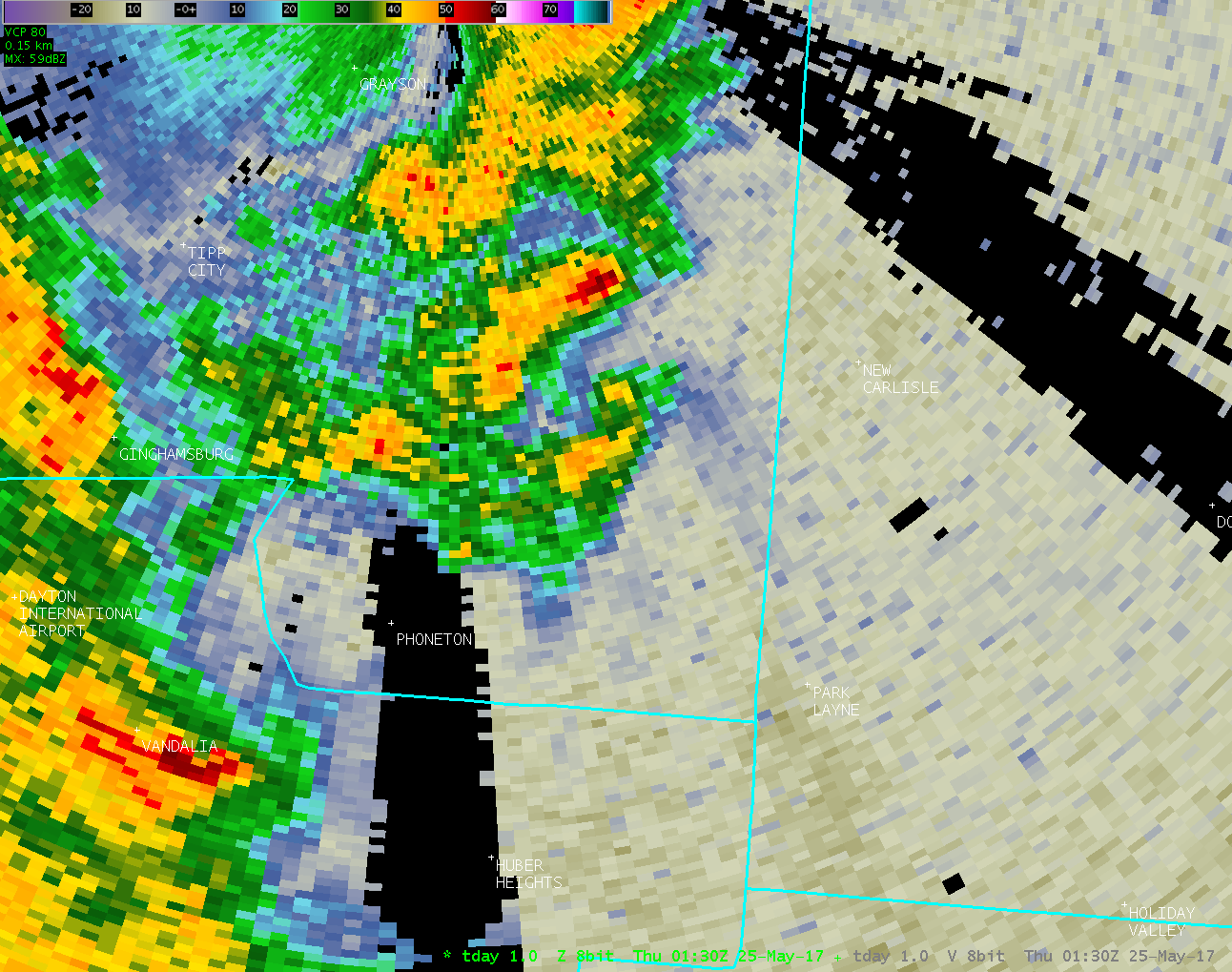
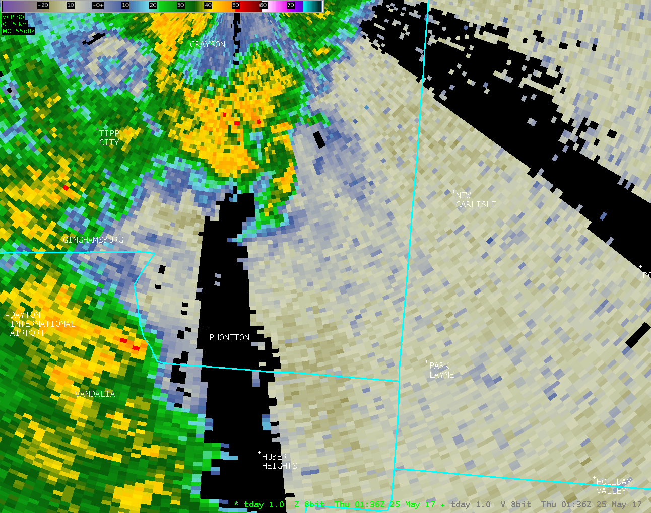
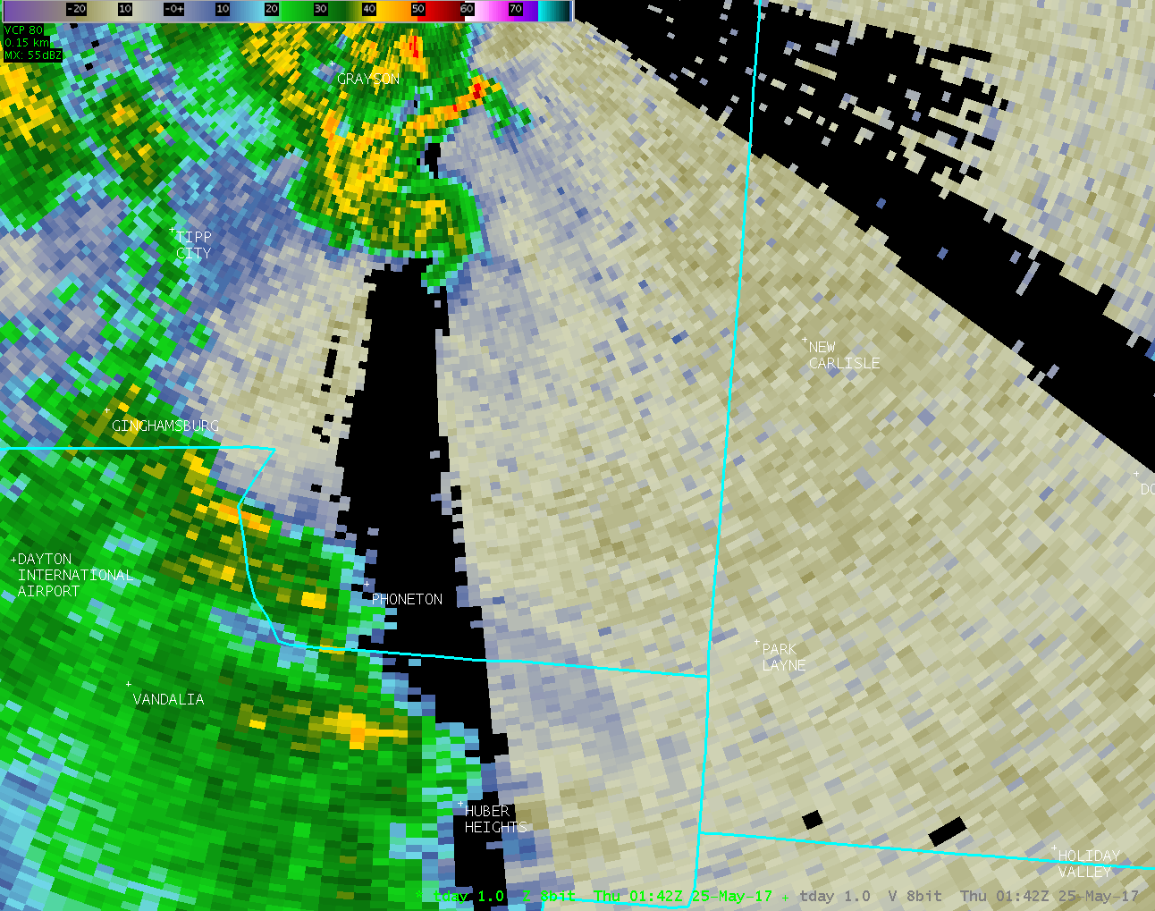
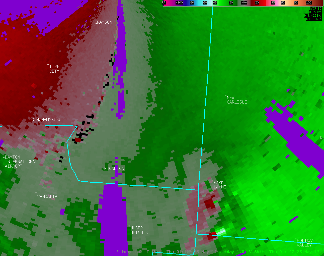
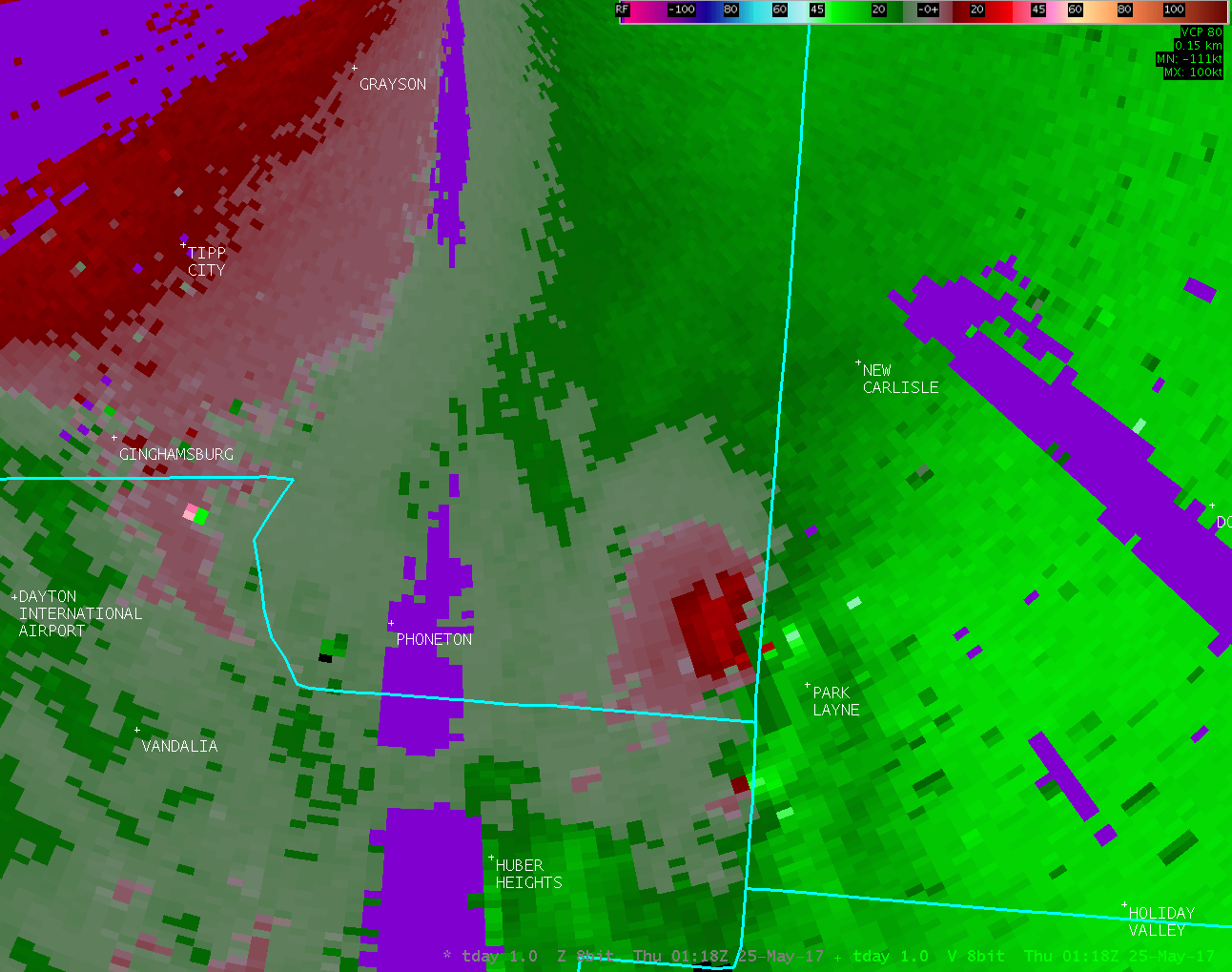
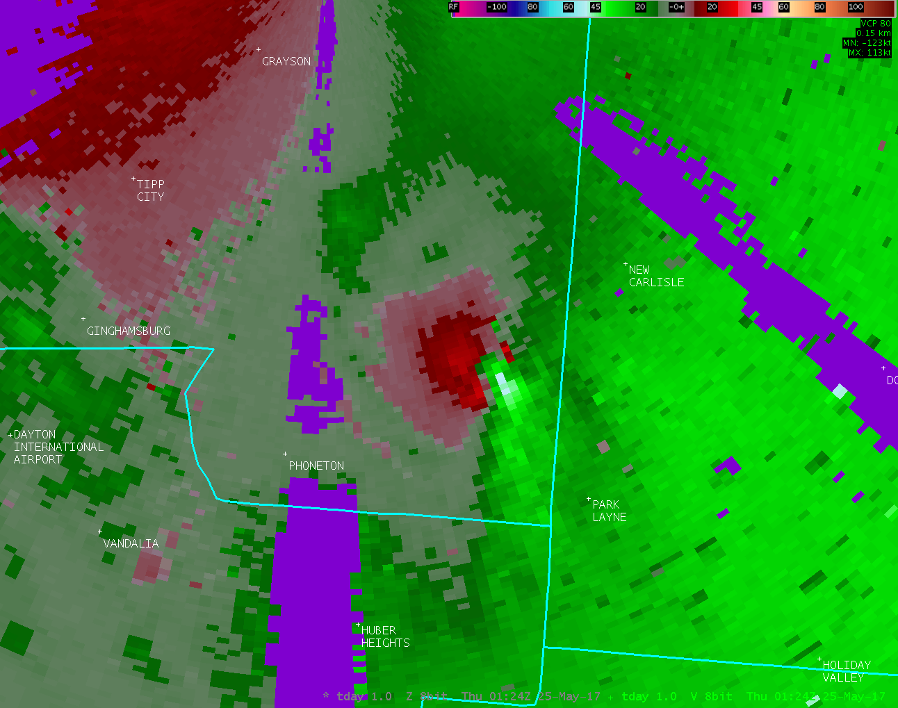
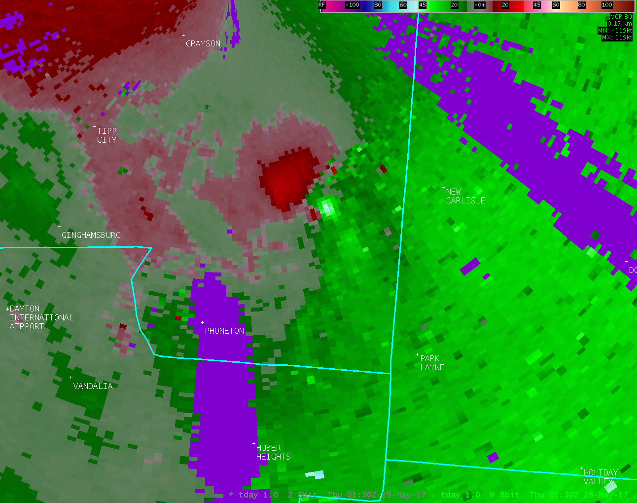
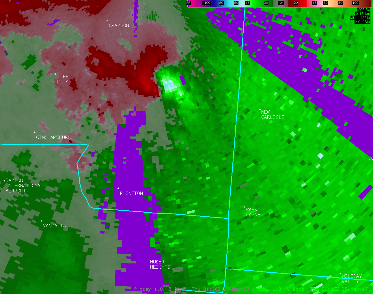
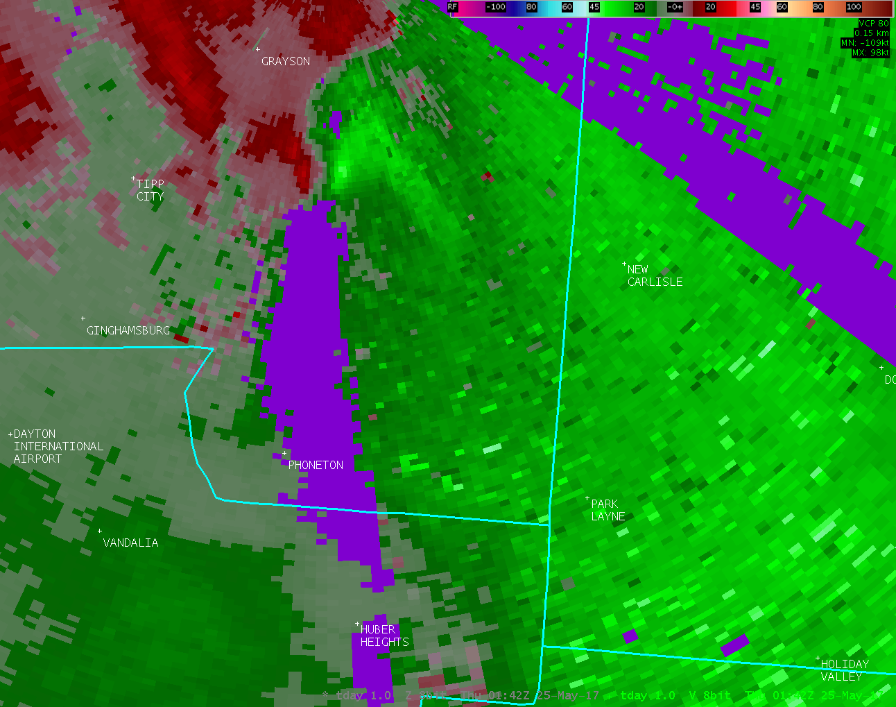
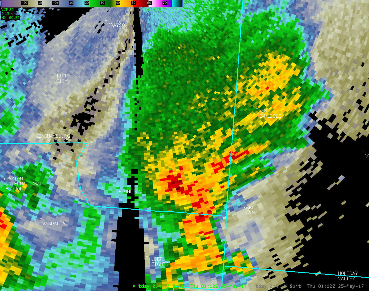
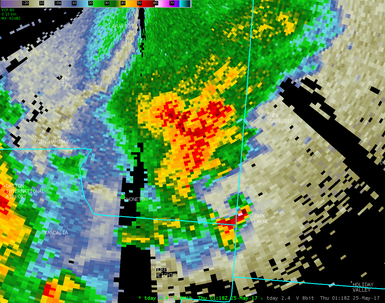
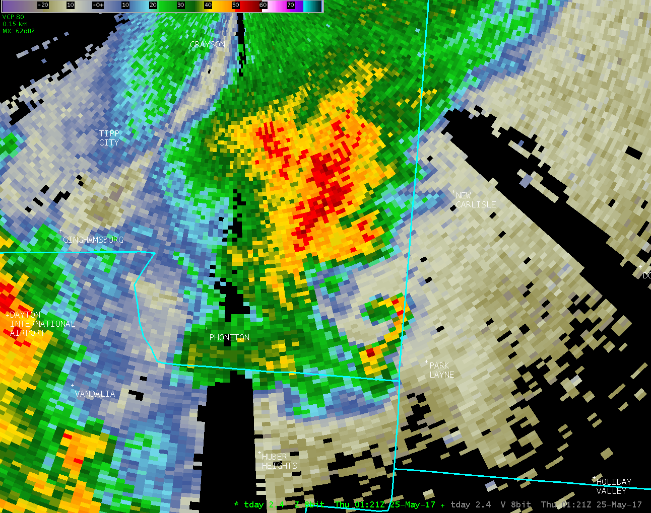
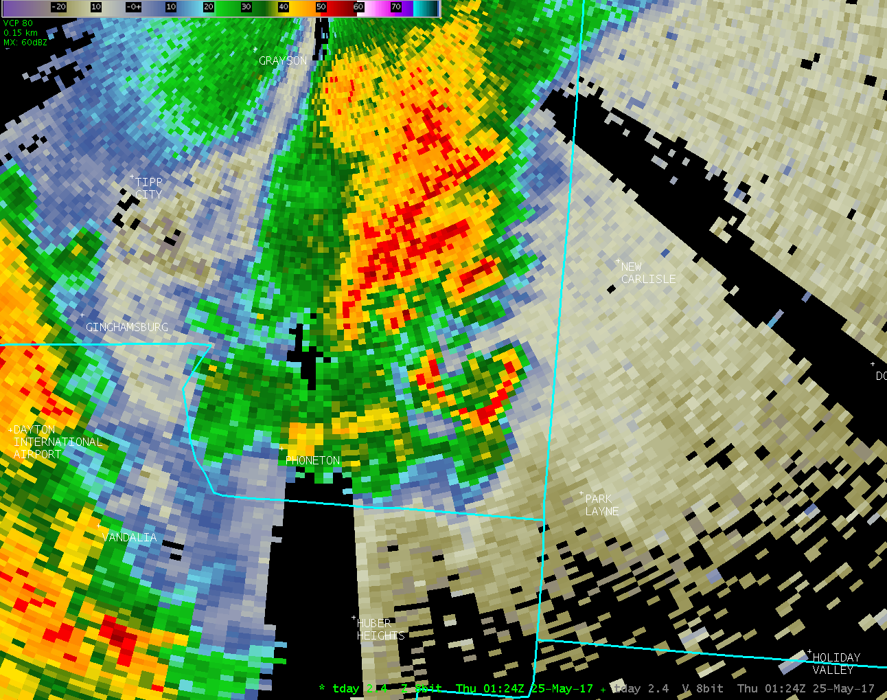
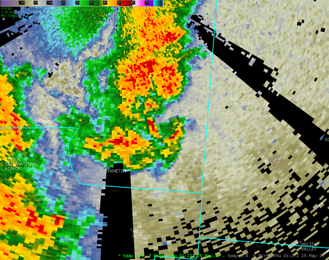
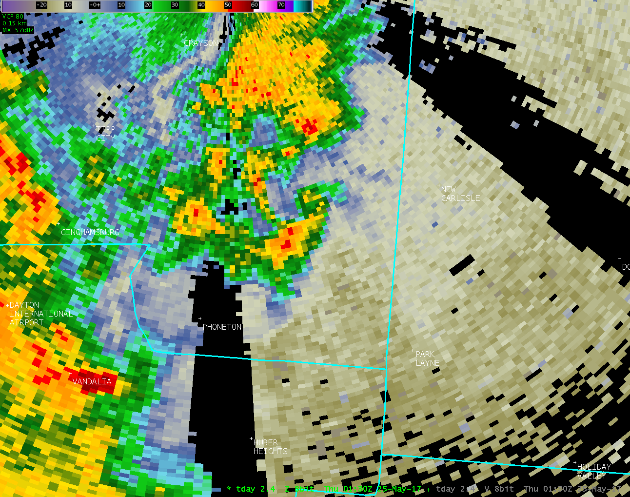
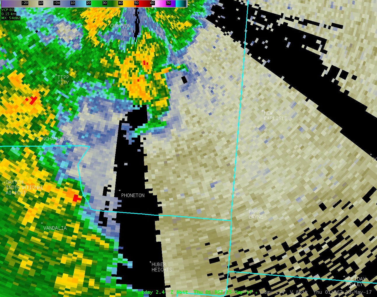
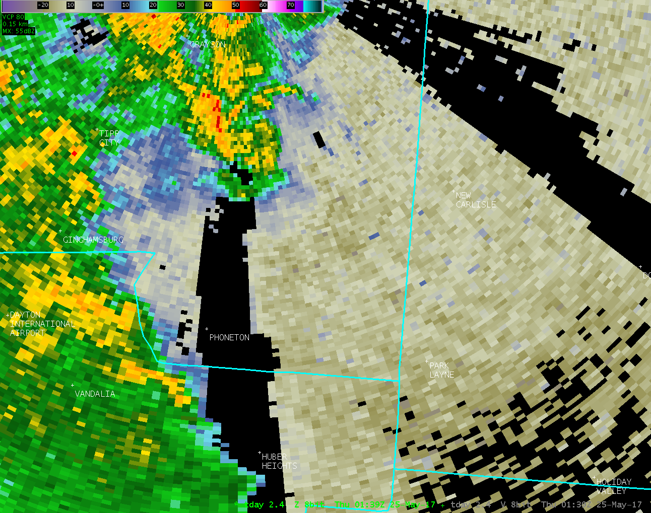
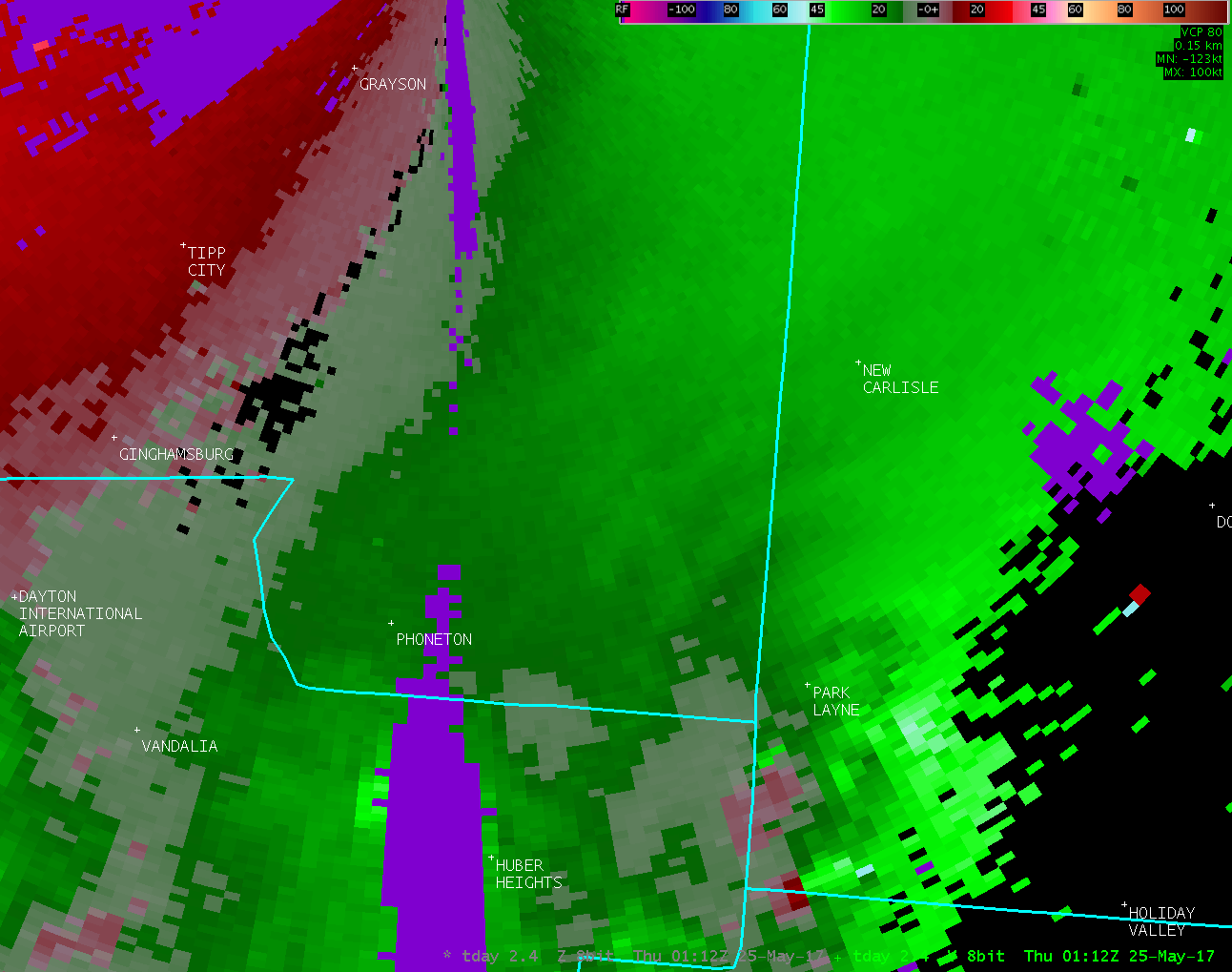
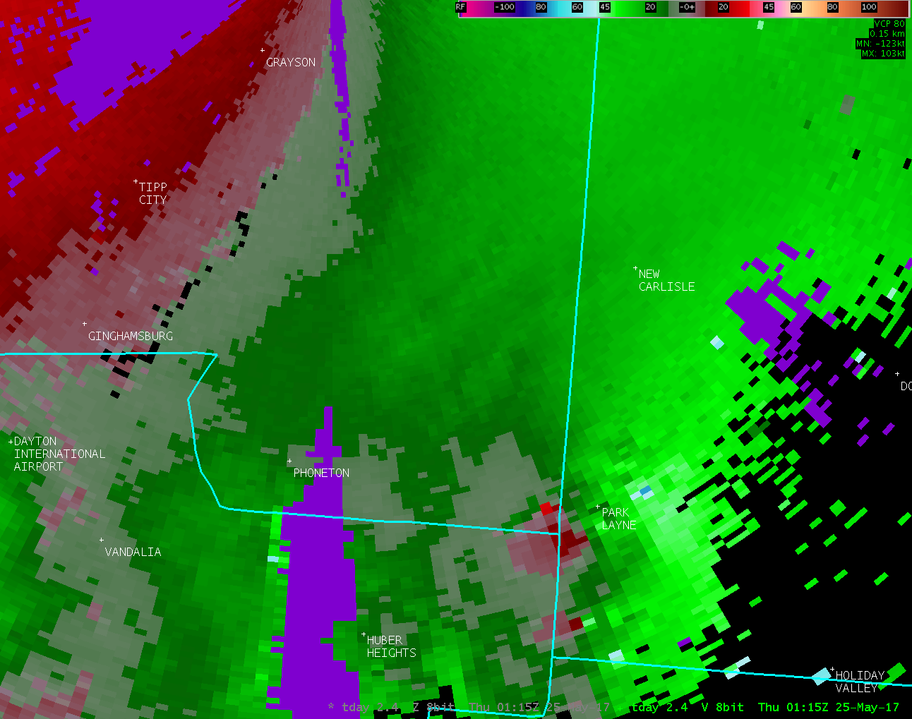
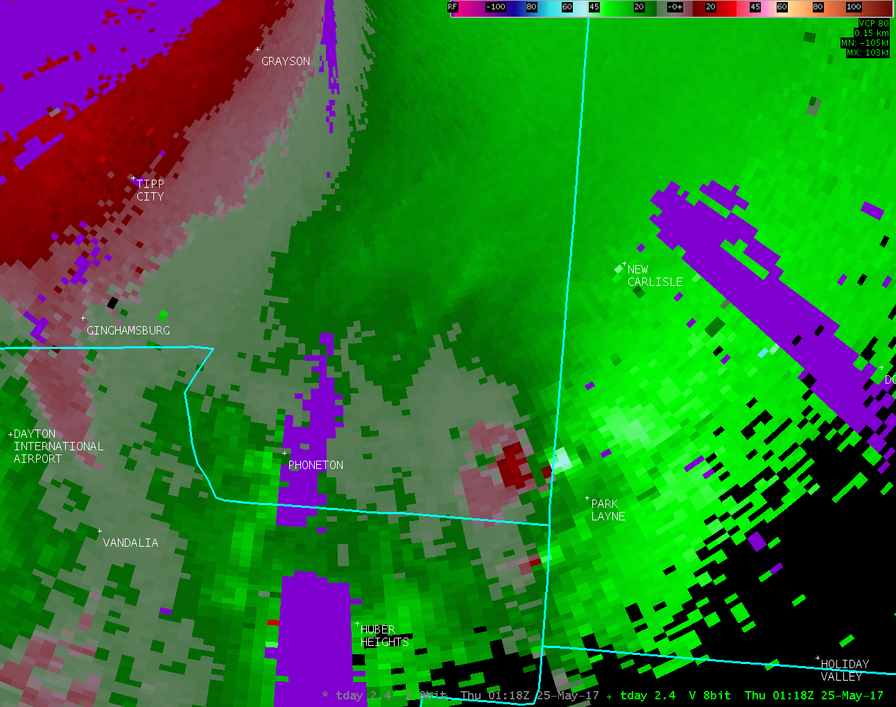
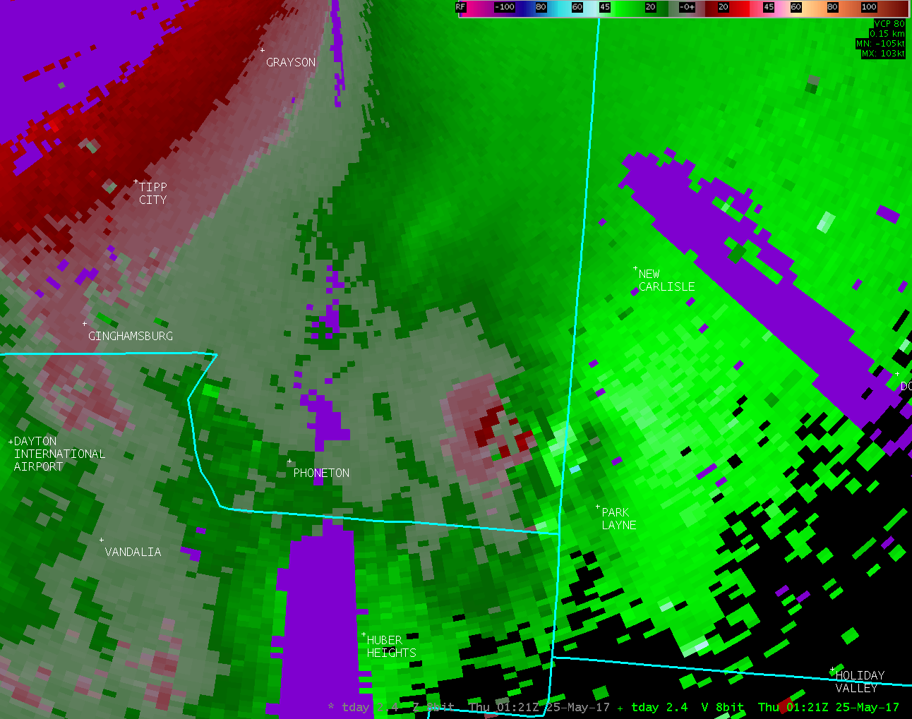
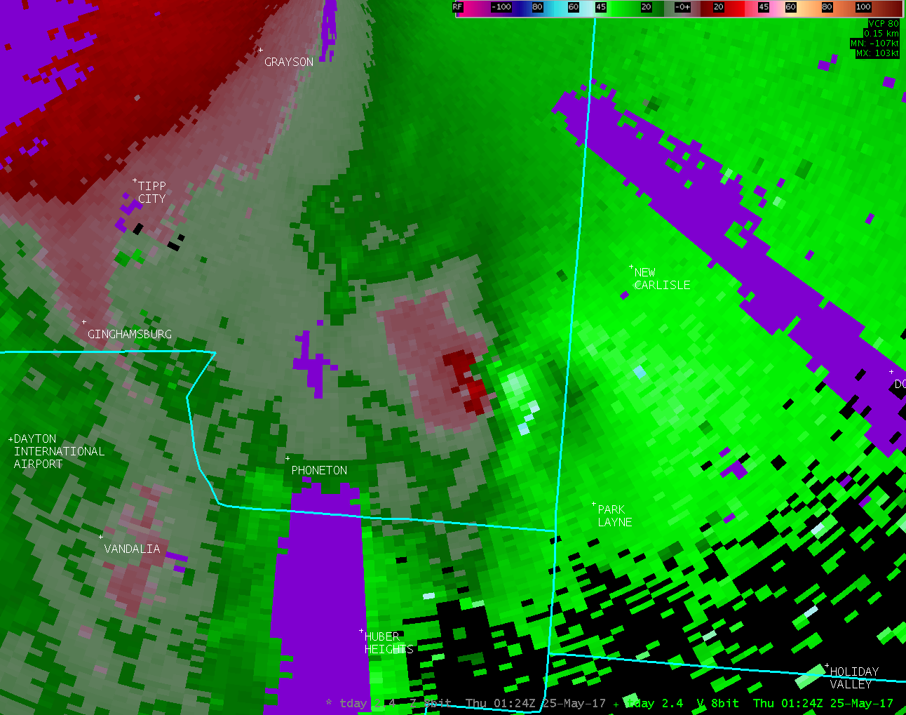
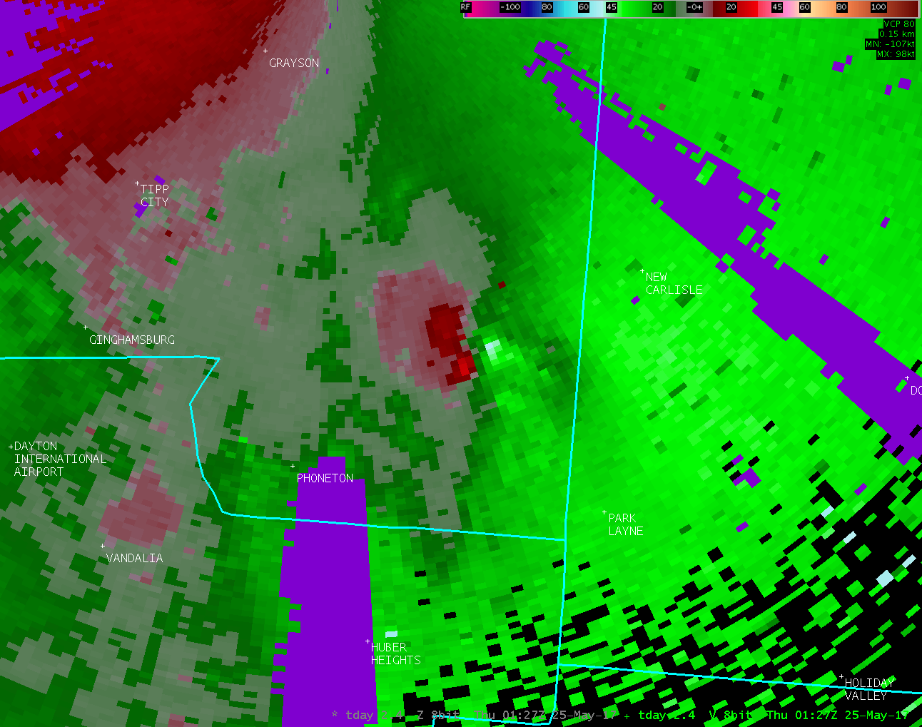
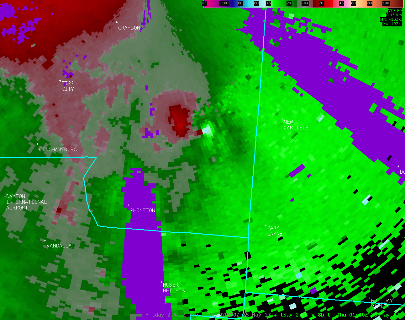
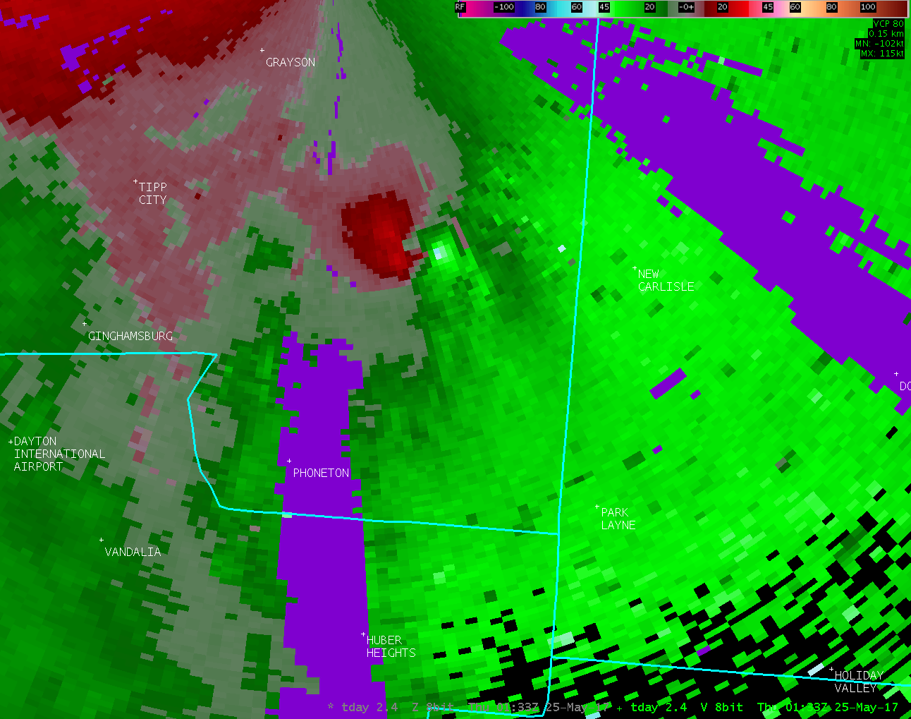
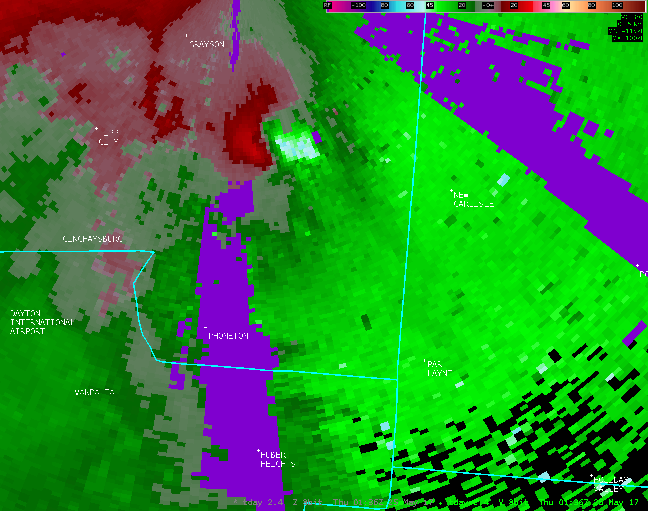
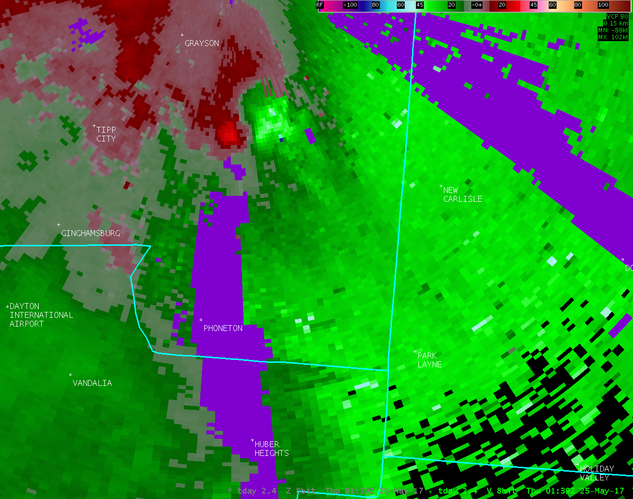
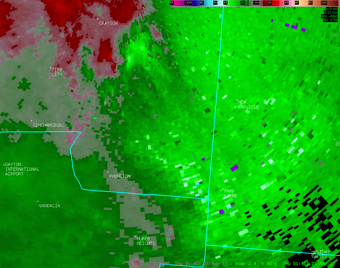
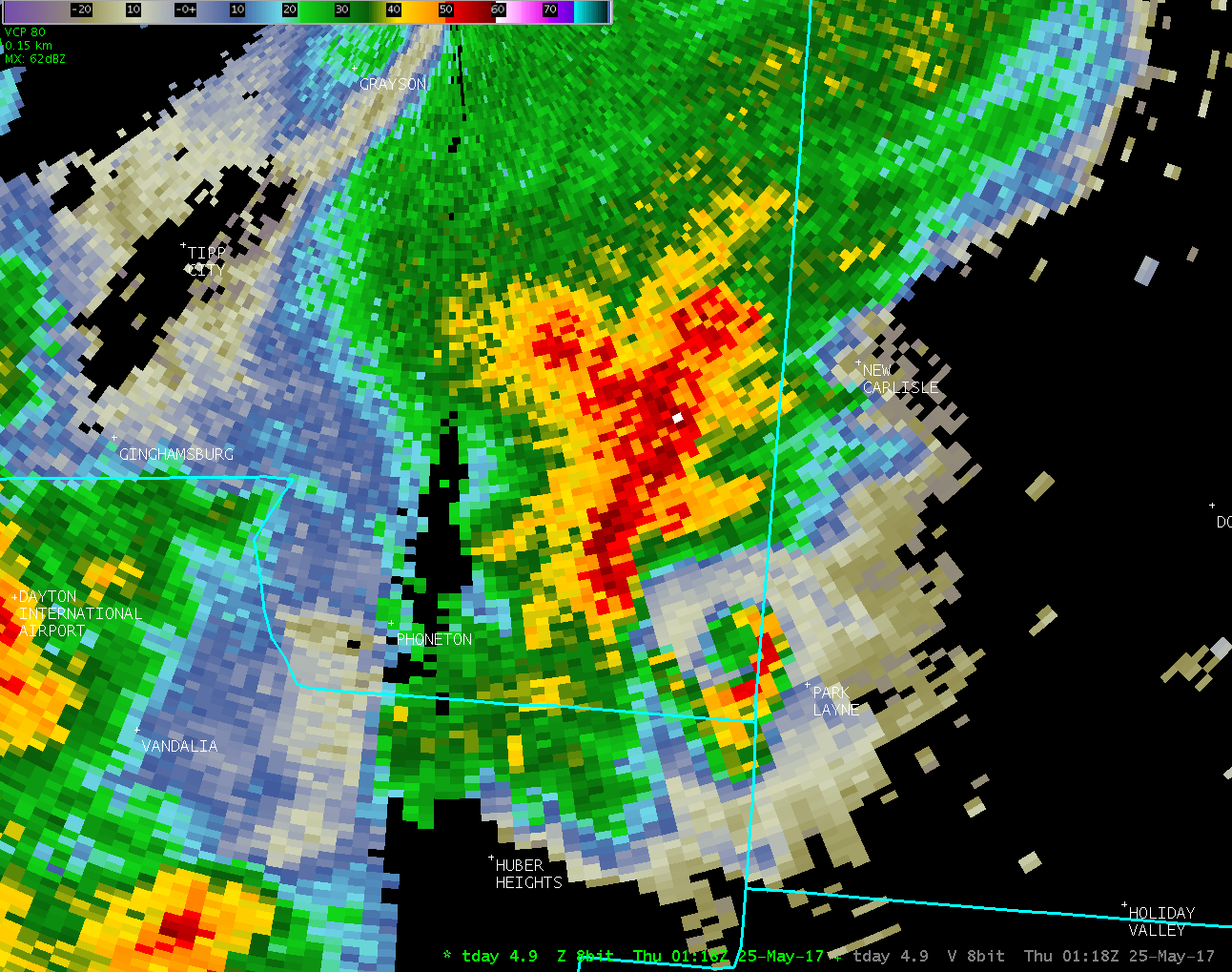
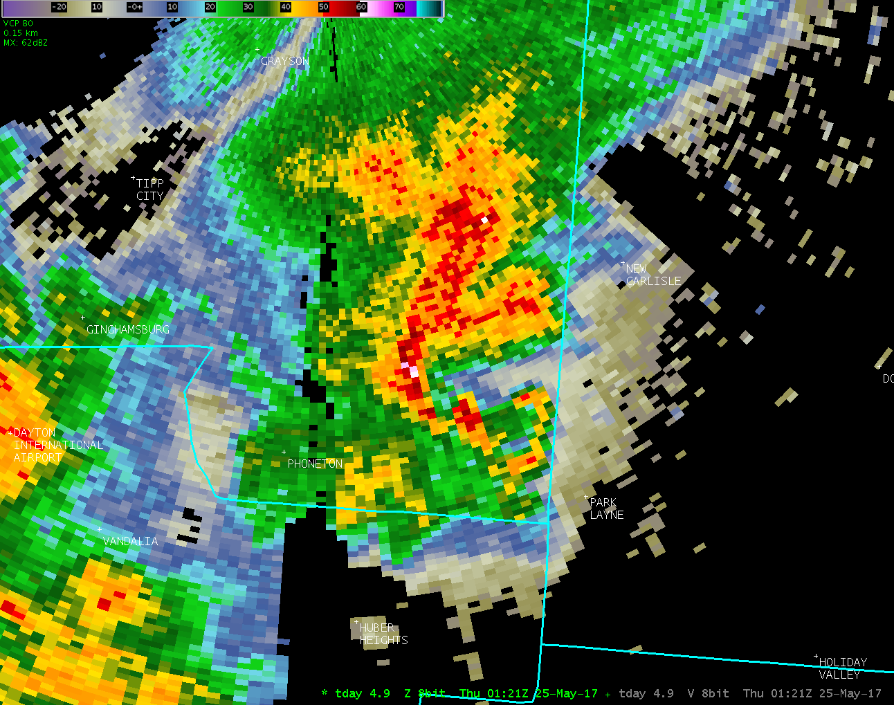
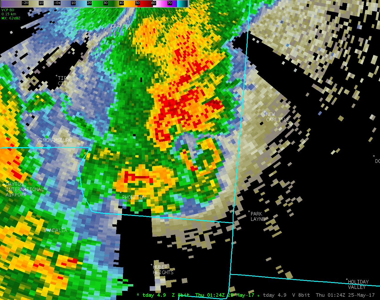
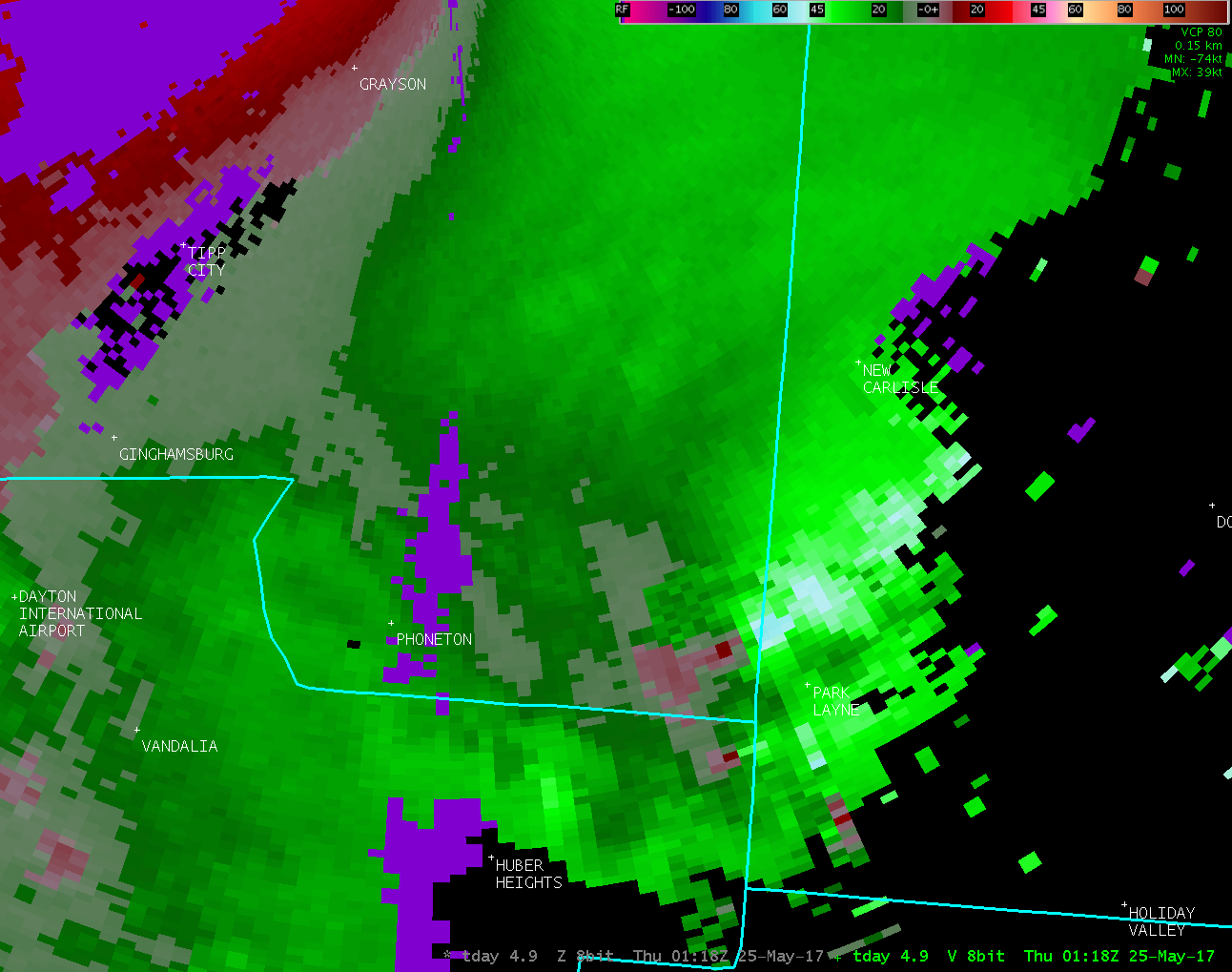
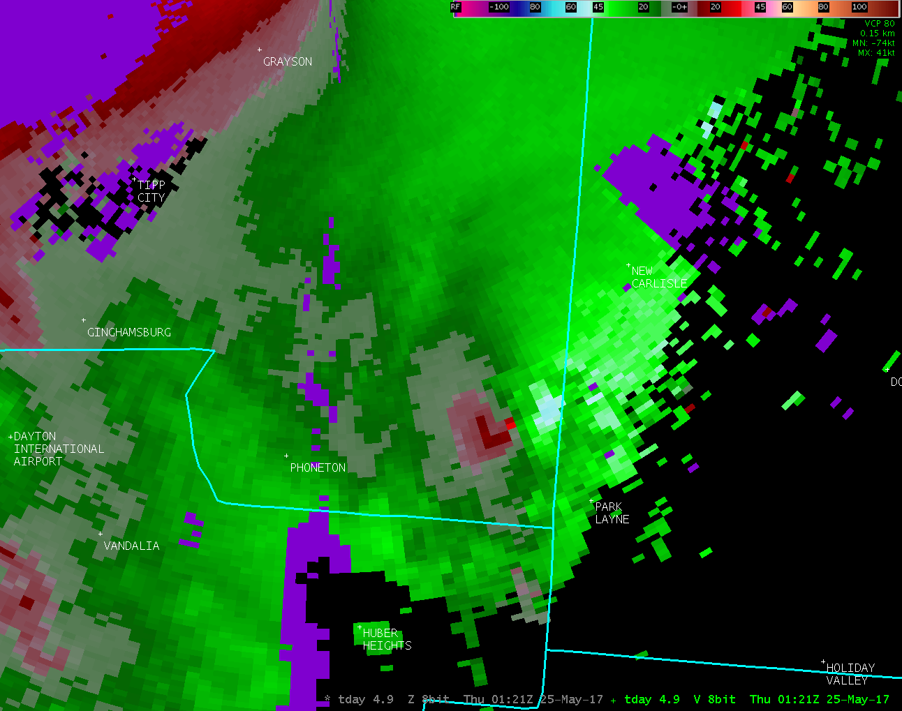
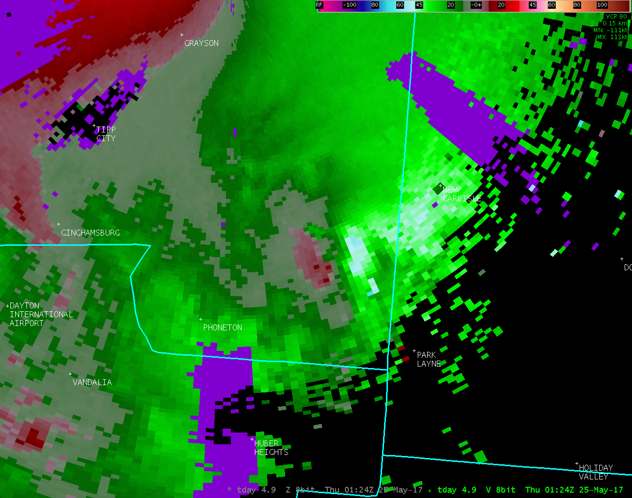
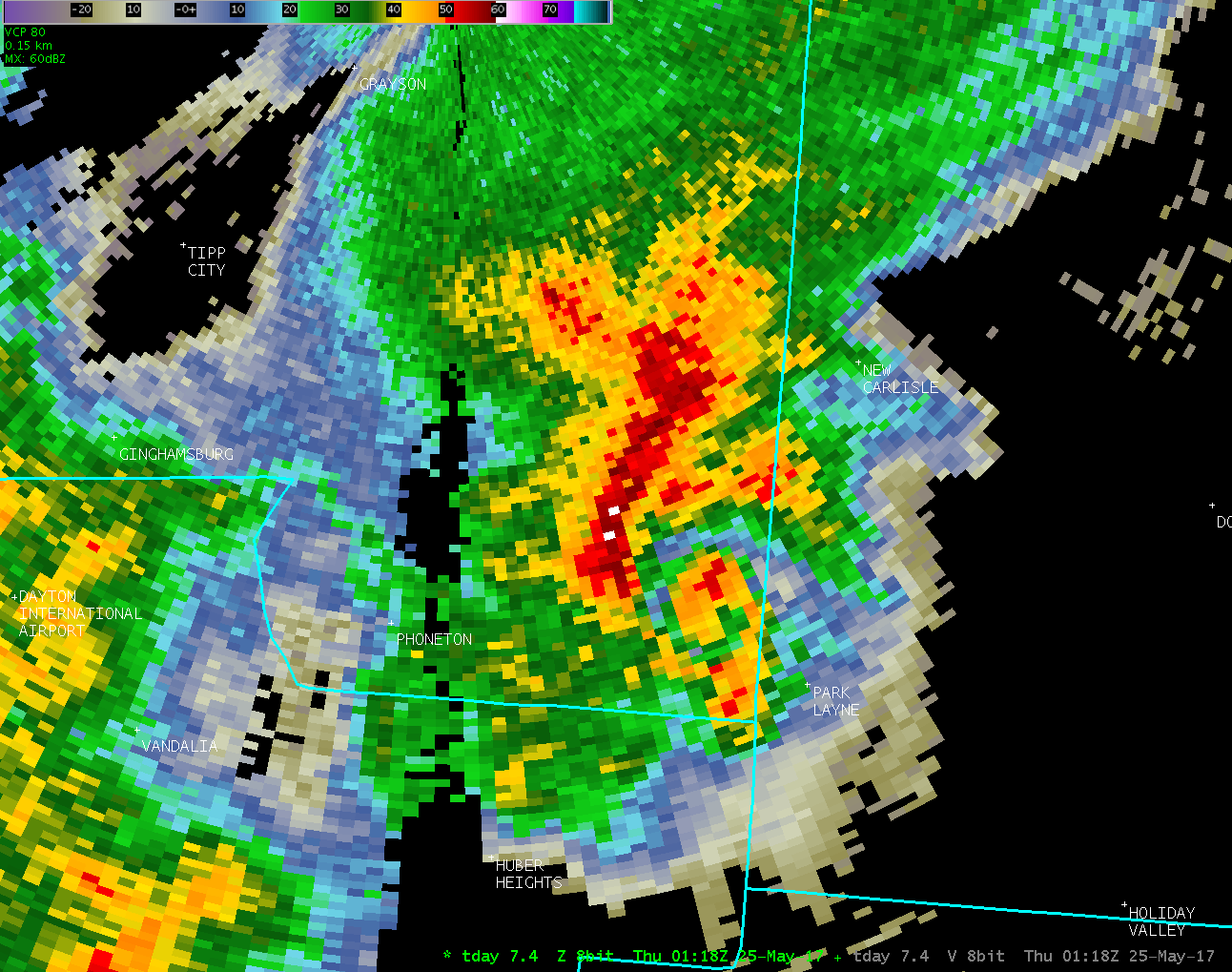
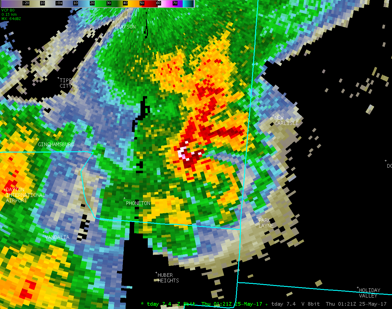
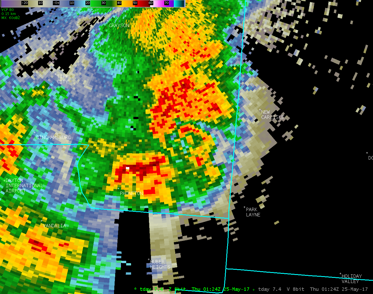
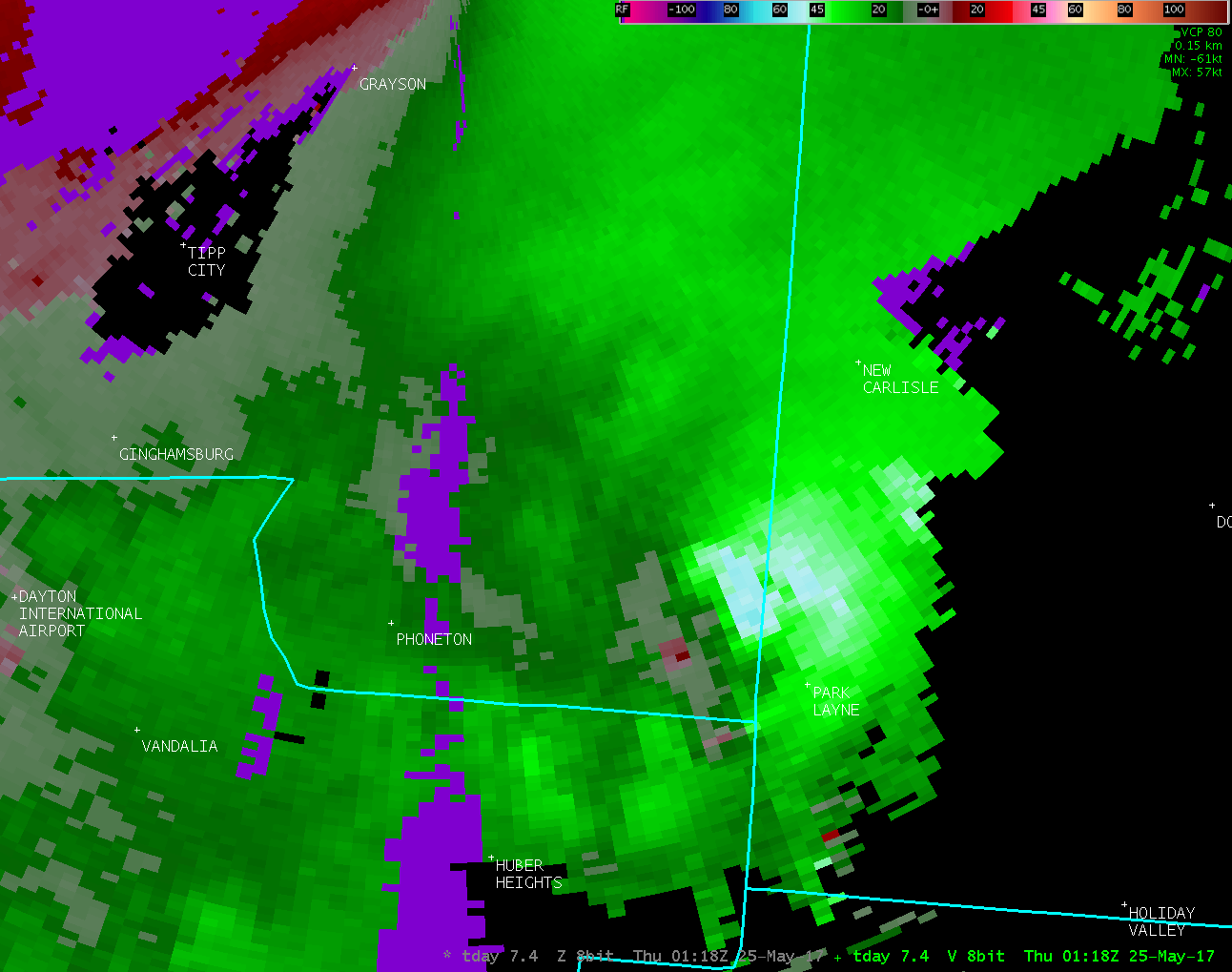
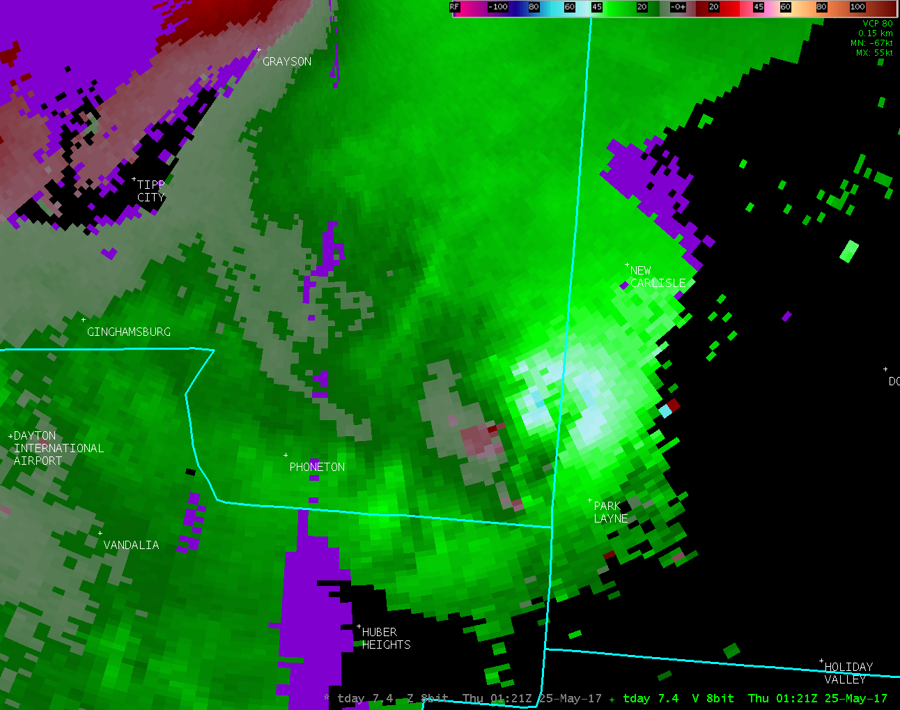
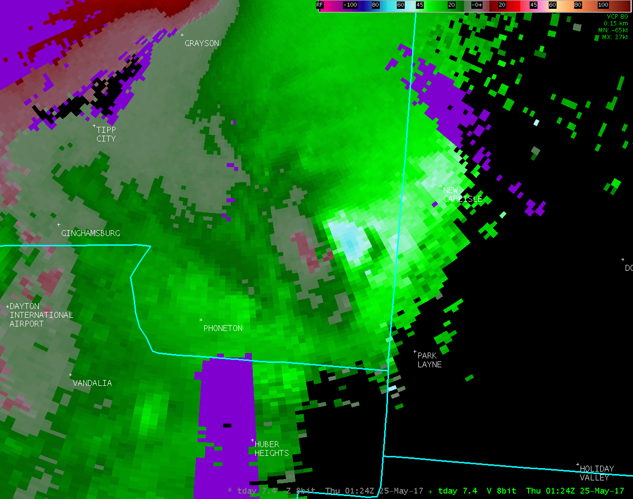
Public Information Statement...Corrected National Weather Service Wilmington OH 1026 AM EDT Fri May 26 2017 ...TORNADO CONFIRMED FROM PARK LAYNE IN CLARK COUNTY OHIO INTO SOUTHEAST MIAMI COUNTY OHIO... Location...Park Layne in Clark County Ohio into Southeast Miami County Ohio Date...May 24 2017 Estimated Start Time...9:16 PM EDT Estimated End Time...9:32 PM EDT Maximum EF-Scale Rating...EF1 Estimated Maximum Wind Speed...100 MPH Maximum Path Width...300 yards Path Length...3.8 Miles Beginning Lat/Lon...39.886529N / 84.046820W Ending lat/Lon...39.934992N / 84.083731W * Fatalities...0 * Injuries...0 * The information in this statement is preliminary and subject to change pending final review of the event(s) and publication in NWS Storm Data. ...Summary... The National Weather Service in Wilmington OH has confirmed a tornado touched down the evening of May 24 2017, near Park Layne in Clark County Ohio. The tornado then continued into southeast Miami County before ending along State Route 201 north of Studebaker Road. The tornado first touched down on the western side of Park Layne where damage occurred to some commercial buildings and trees. Damage here was consistent with maximum winds of 100 MPH (EF1 damage). Additional tree and minor roof damage occurred to the northwest along Bellefontaine Road. Sporadic damage to mainly trees was then observed farther to the northwest, ending along State Route 201 north of Studebaker Road. Damage here was consistent with an EF0 tornado. This statement was corrected to change the coordinates where the tornado first touched down. Intensity and timing of the event are unchanged from the previous issuance. For reference: the Enhanced Fujita Scale classifies tornadoes into the following categories: EF0...wind speeds 65 to 85 mph. EF1...wind speeds 86 to 110 mph. EF2...wind speeds 111 to 135 mph. EF3...wind speeds 136 to 165 mph. EF4...wind speeds 166 to 200 mph. EF5...wind speeds greater than 200 mph. $$ |
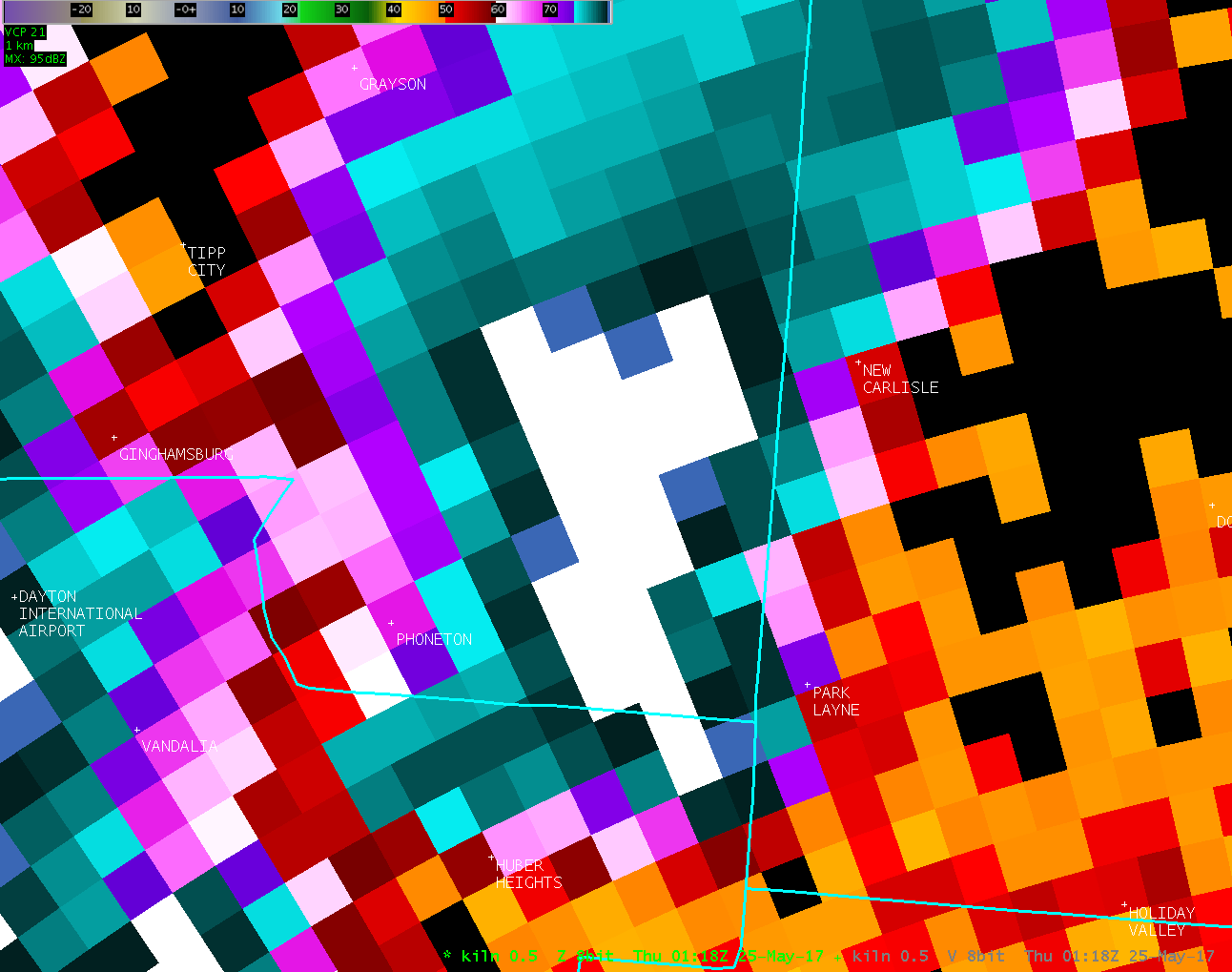
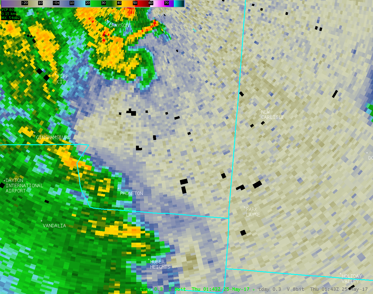
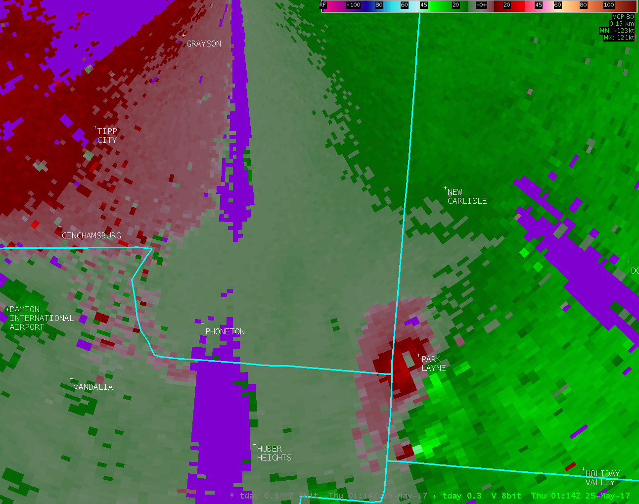
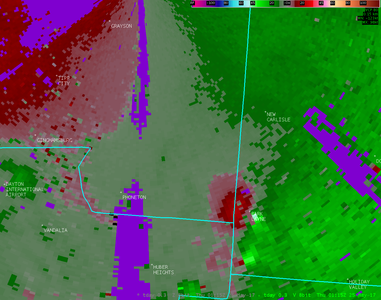
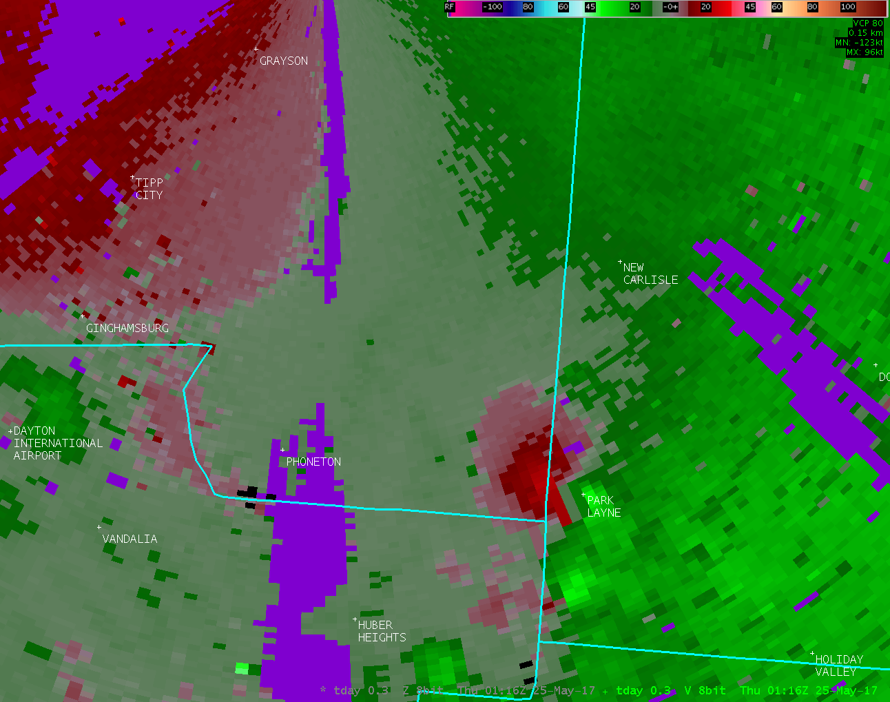
| Radar Loops from NWS Wilmington Ohio (9:18 PM - 9:36 PM) | ||
| note: KILN radar data was unavailable before 9:18 PM | ||
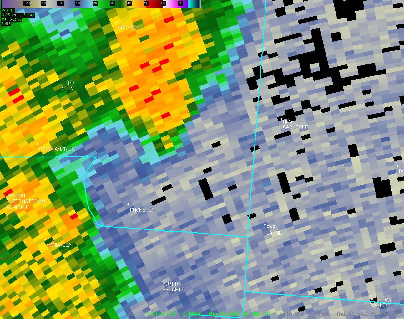
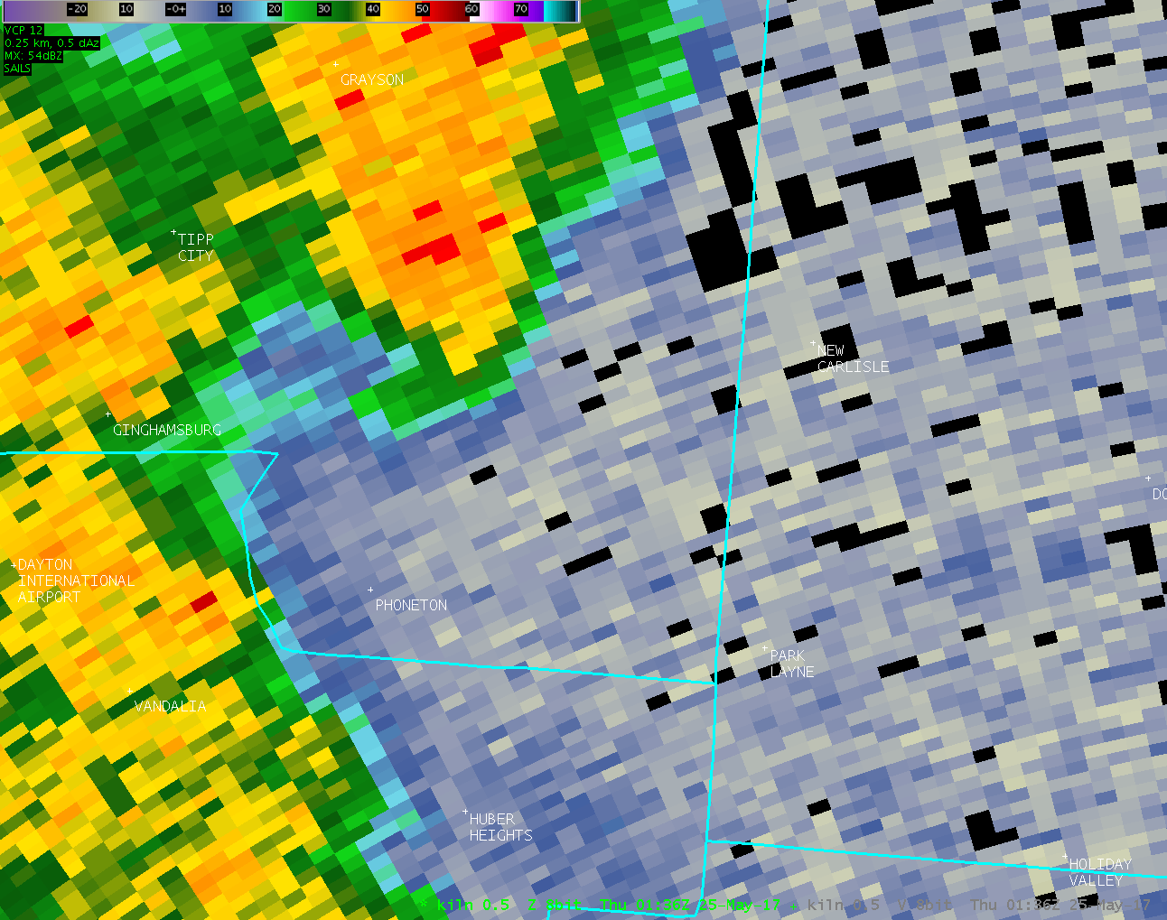
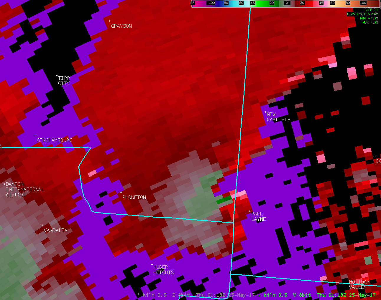
| KILN 0.5° Reflectivity | KILN 0.5° Velocity | KILN 0.5° Correlation Coefficient |
| 1 2 3 4 5 6 7 8 9 | 1 2 3 4 5 6 7 8 9 | 1 2 3 4 5 6 7 8 9 |
| KILN 0.9° Reflectivity | KILN 0.9° Velocity | KILN 0.9° Correlation Coefficient |
| 0126Z | 0126Z | 0126Z |
| KILN 1.3° Reflectivity | KILN 1.3° Velocity | KILN 1.3° Correlation Coefficient |
| 0126Z | 0126Z | 0126Z |
| Radar Loops from the Dayton Terminal Doppler Radar (9:14 PM - 9:43 PM) | |
| TDAY 0.3° Reflectivity | TDAY 0.3° Velocity |
| 01
02
03
04
05
06
07
08
09
10
11
12
13
14
15 16 17 18 19 20 21 22 23 24 25 26 27 28 29 30 |
01
02
03
04
05
06
07
08
09
10
11
12
13
14
15 16 17 18 19 20 21 22 23 24 25 26 27 28 29 30 |
| TDAY 1.0° Reflectivity | TDAY 1.0° Velocity |
| 1 2 3 4 5 6 | 1 2 3 4 5 6 |
| TDAY 2.4° Reflectivity | TDAY 2.4° Velocity |
| 1 2 3 4 5 6 7 8 9 10 11 | 1 2 3 4 5 6 7 8 9 10 11 |
| TDAY 4.9° Reflectivity | TDAY 4.9° Velocity |
| 1 2 3 | 1 2 3 |
| TDAY 7.4° Reflectivity | TDAY 7.4° Velocity |
| 1 2 3 | 1 2 3 |
| Pictures from the storm survey: | |||
 |
 |
 |
 |
 |
 |
 |
 |
 |
 |
 |
 |
 |
 |
 |
 |
 |
 |
 |
 |
 |
 |
 |
 |
 |
 |
 |
 |
 |
 |
 |
 |
 |
 |
 |
 |
 |
 |
 |
 |

