UPDATED INFORMATION
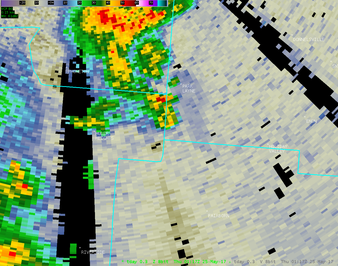
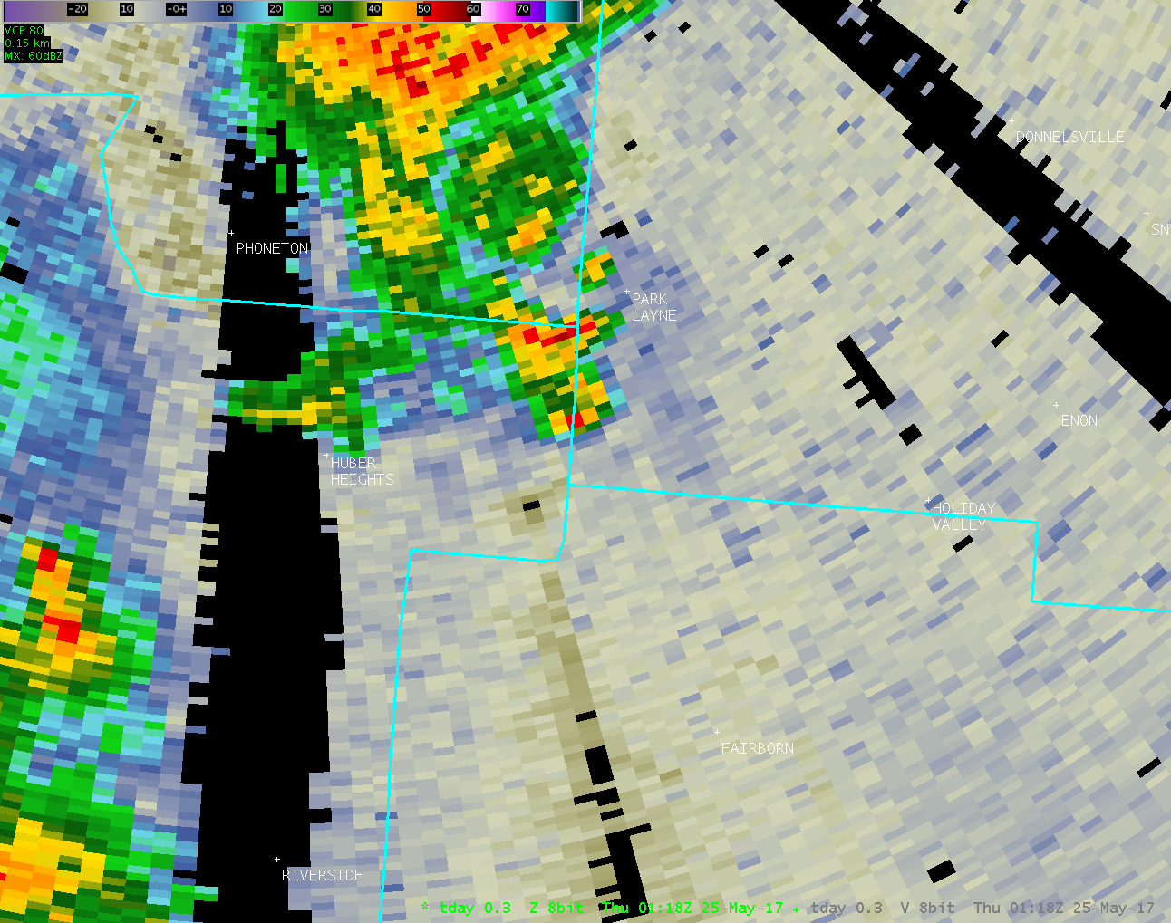
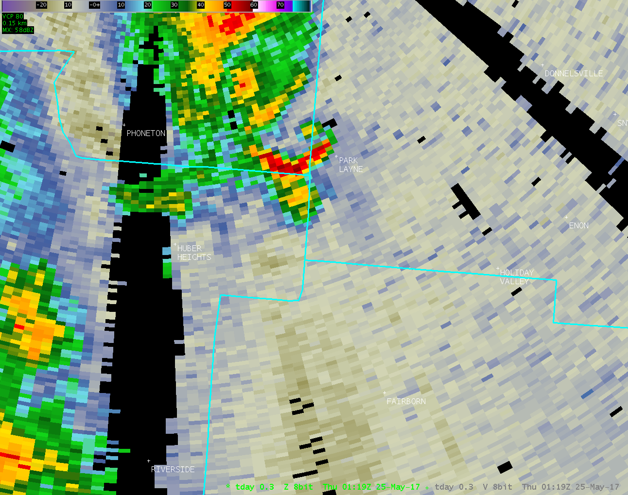
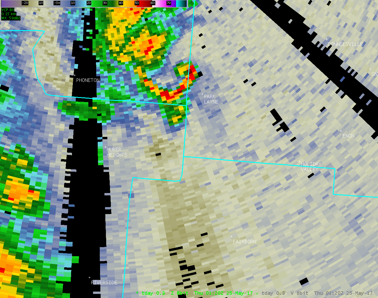
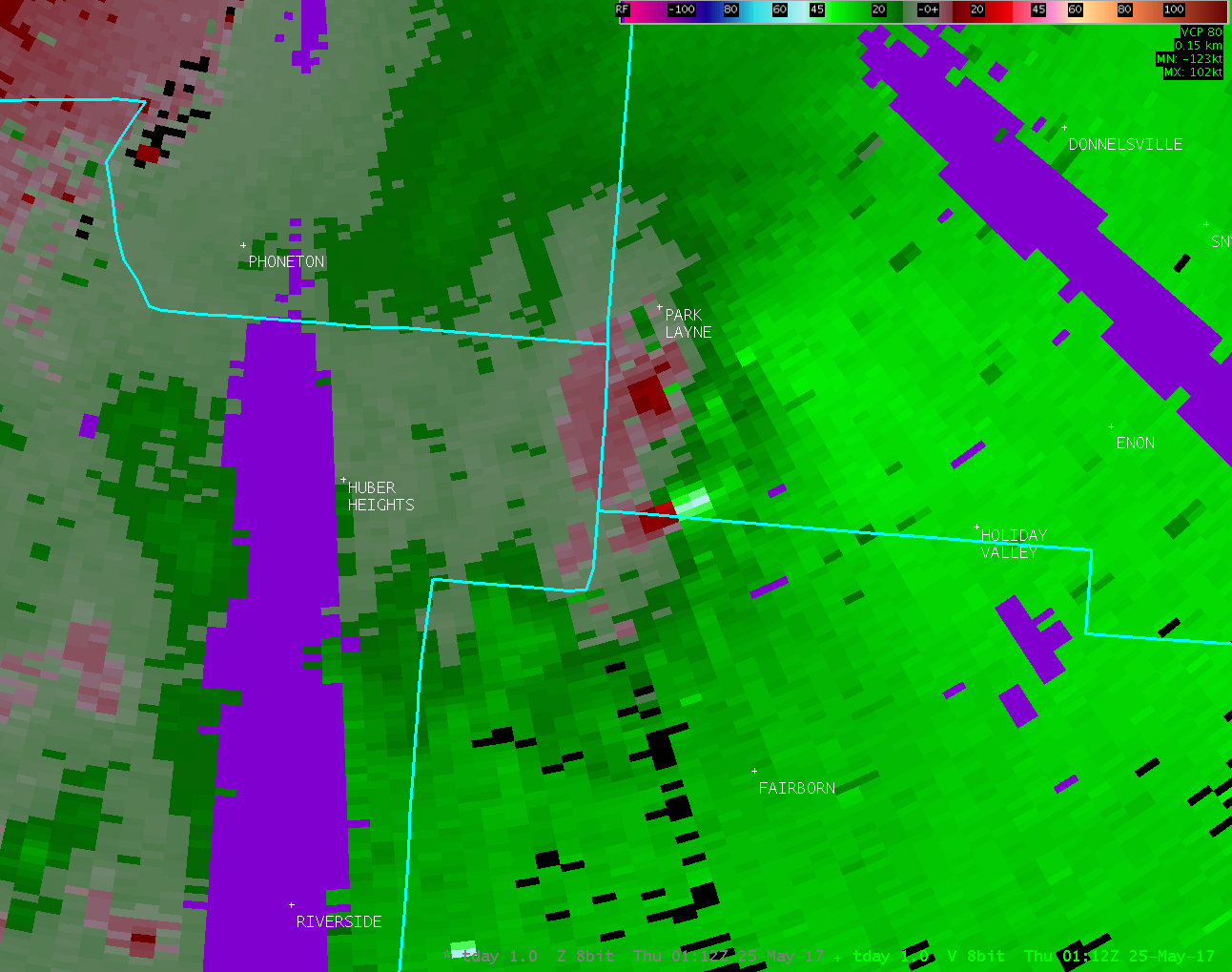
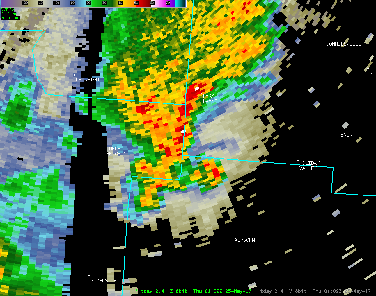
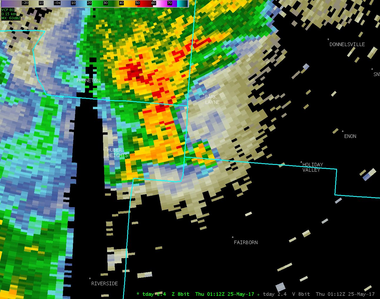
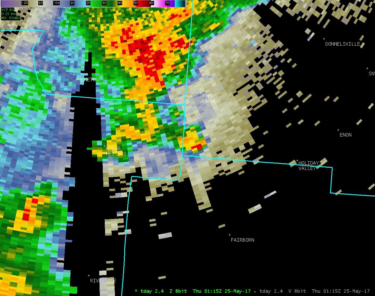
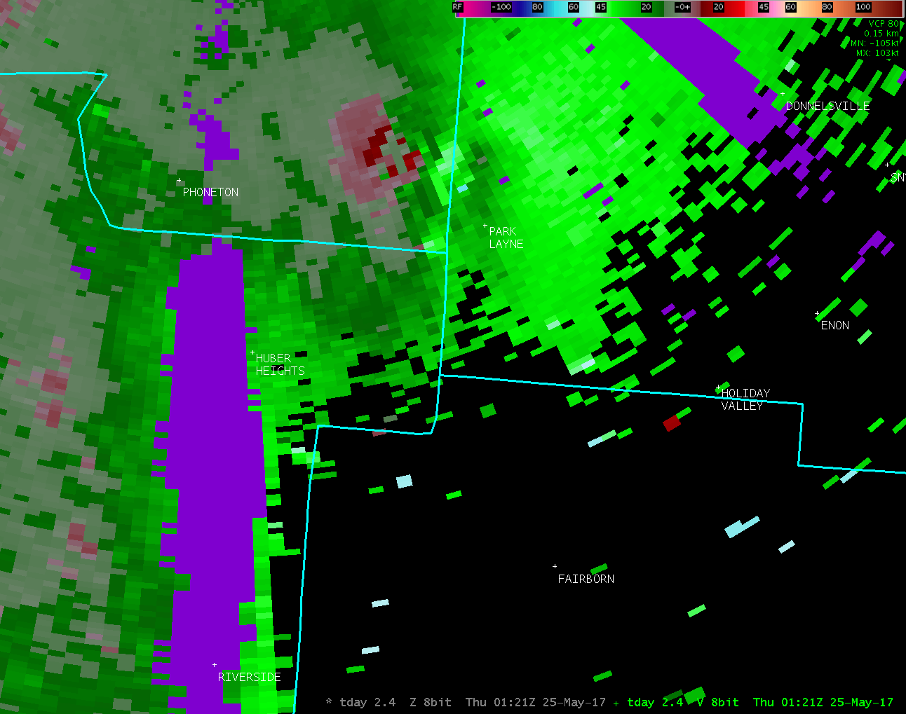
Location...Fairborn in Greene County Ohio to near Medway
in Clark County Ohio
Date...05/24/2017
Estimated Start Time...09:06 PM EDT
Estimated End Time...09:16 PM EDT
Maximum EF-Scale Rating...EF0
Estimated Maximum Wind Speed...75 MPH
Maximum Path Width...90 Yards
Path Length...2.7 Miles
Beginning Lat/Lon...39.8311N / 84.0207W
Ending lat/Lon...39.8638N / 84.0497W
* Fatalities...0
* Injuries...0
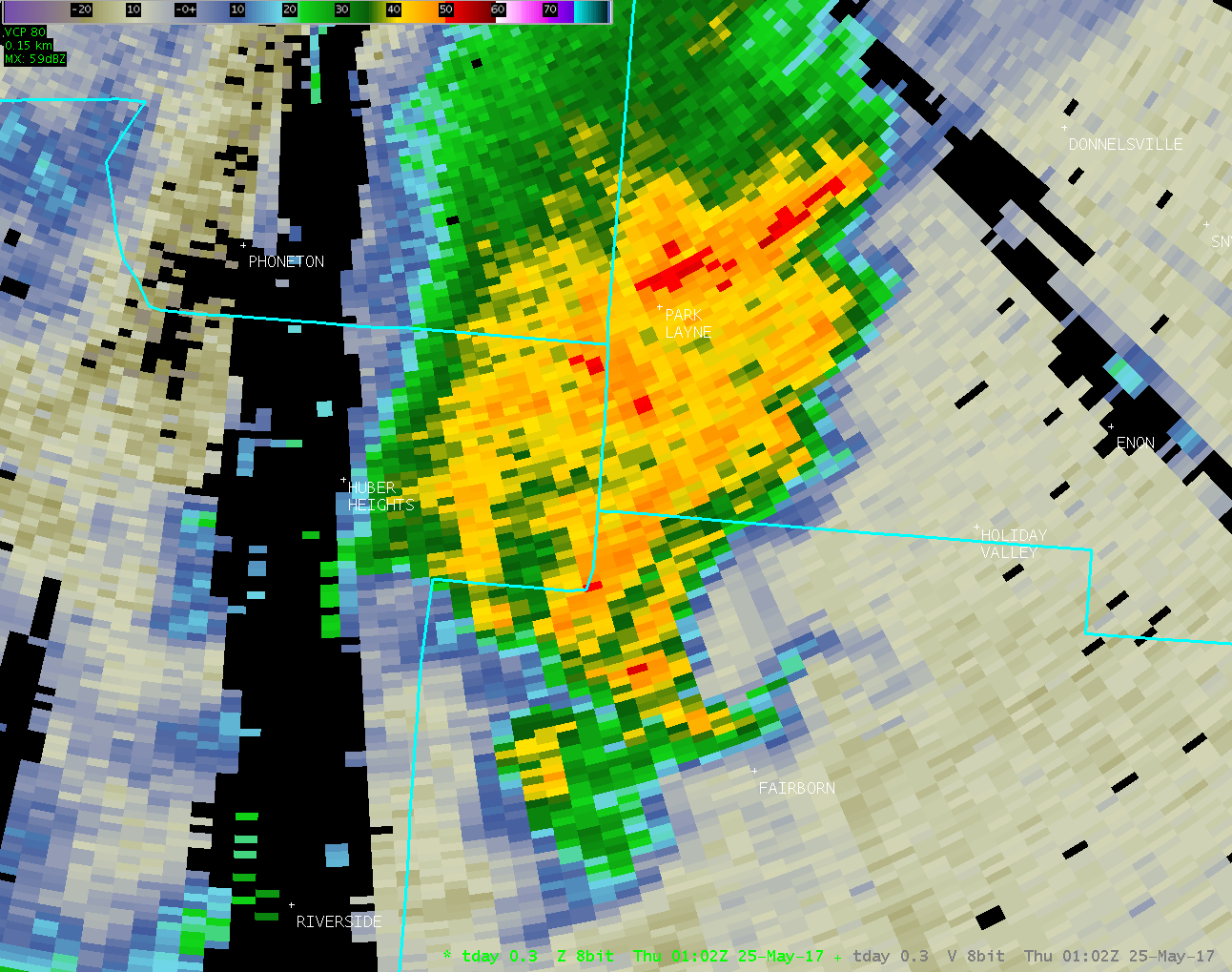
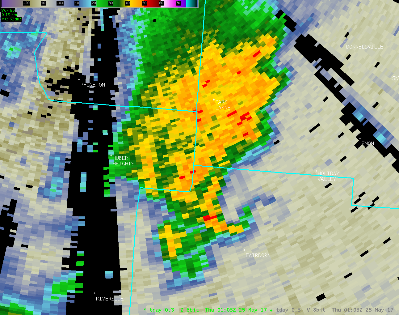
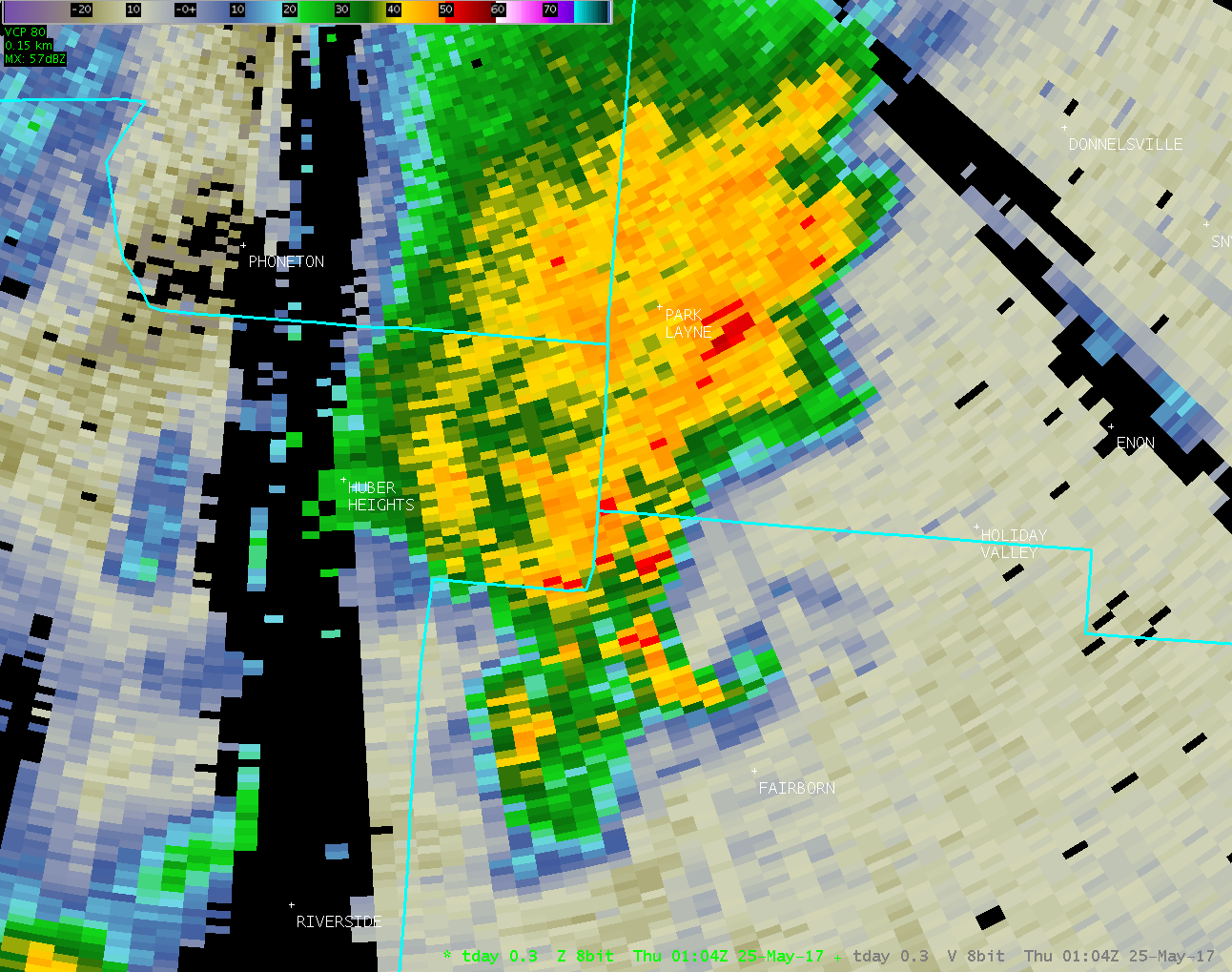
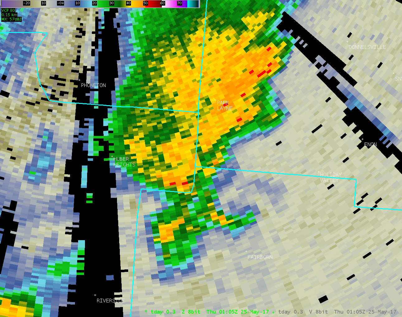
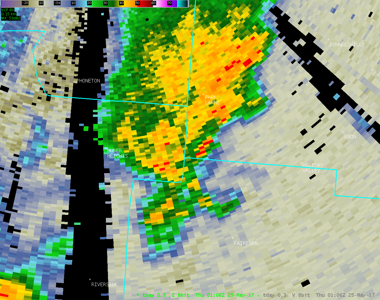
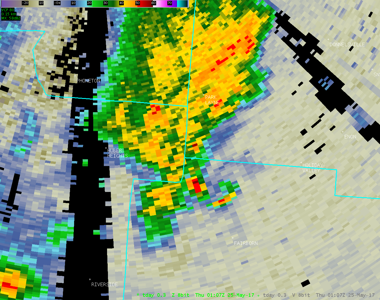
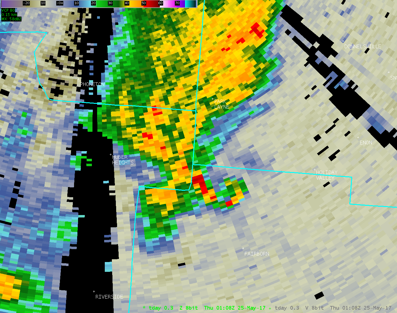
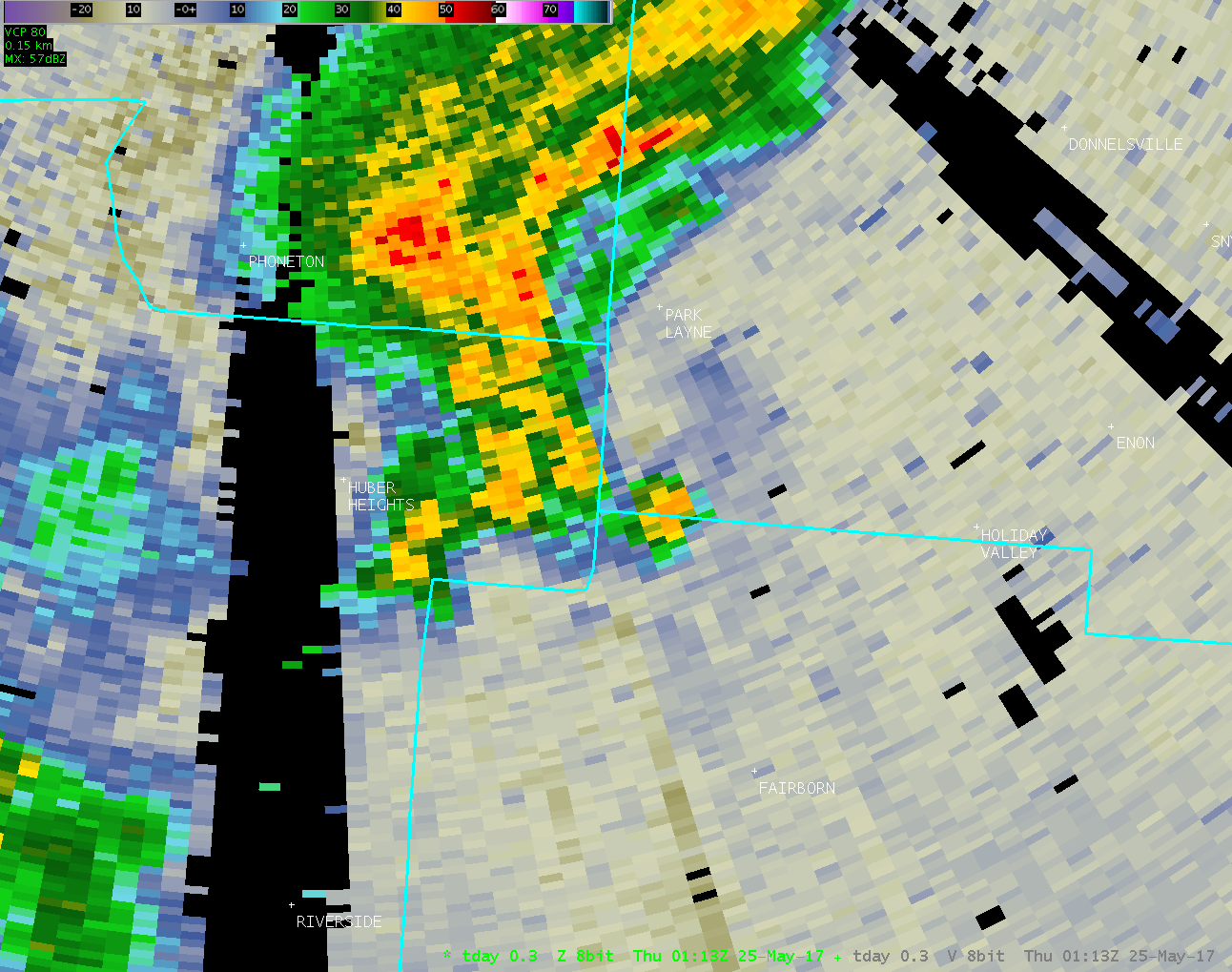
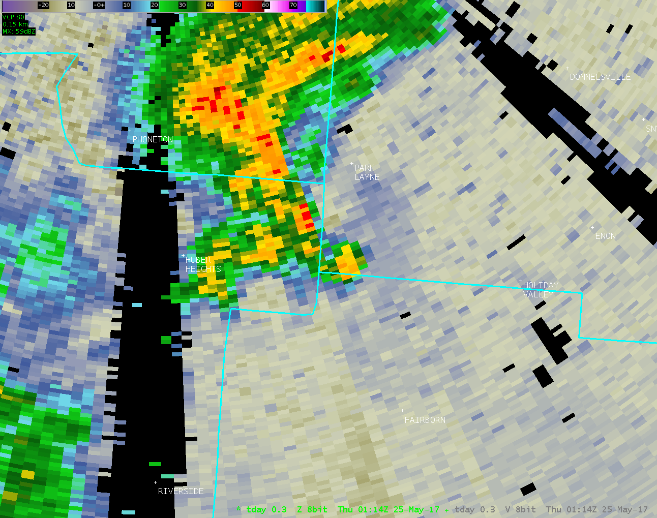
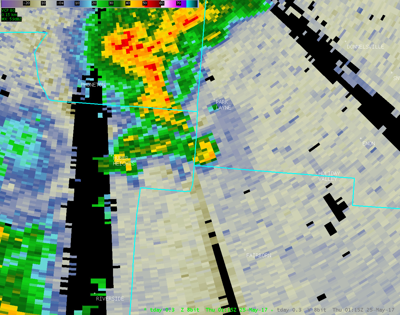
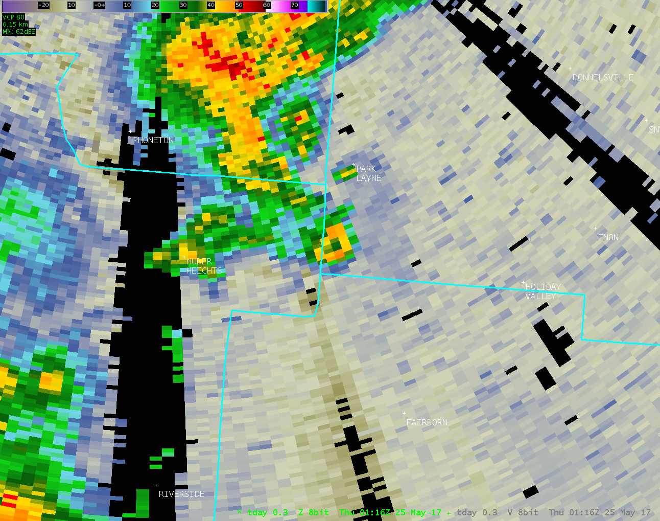
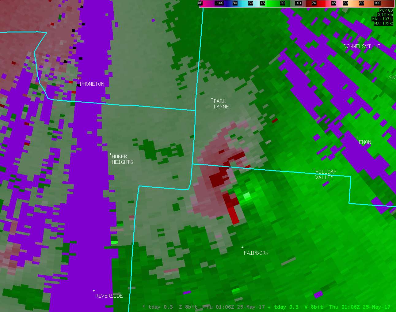
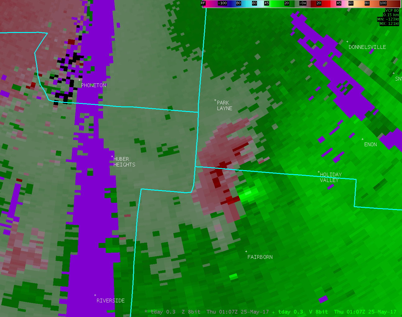
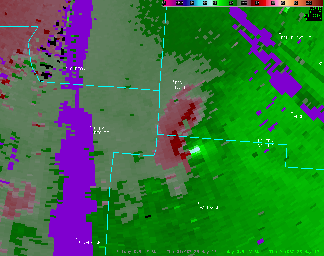
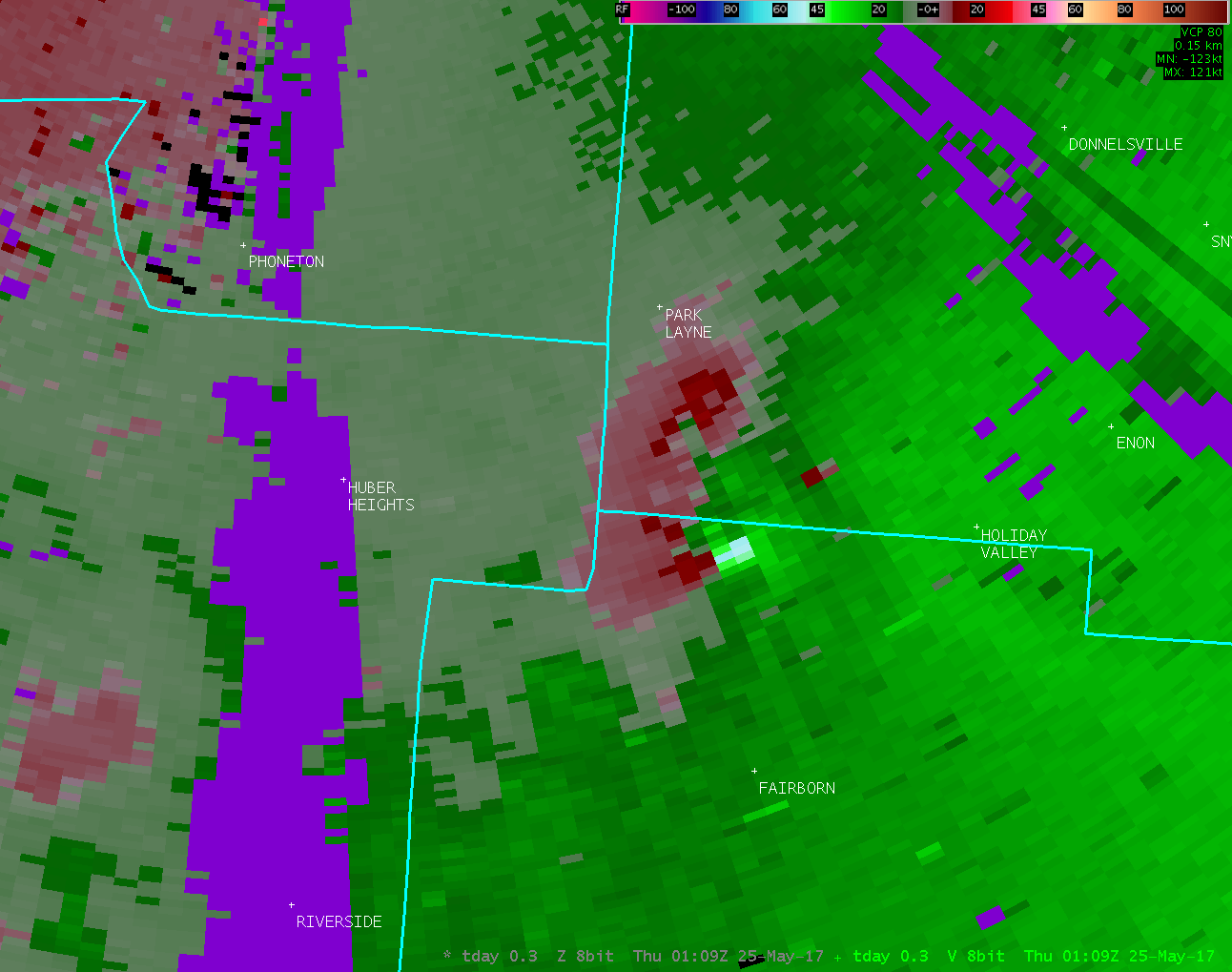
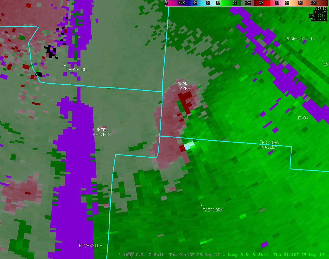
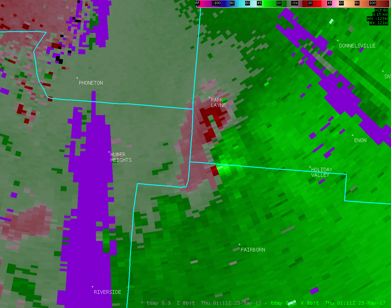
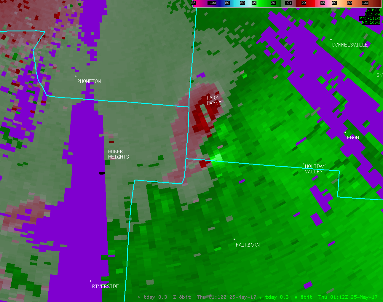
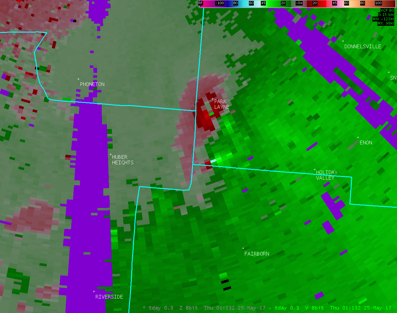
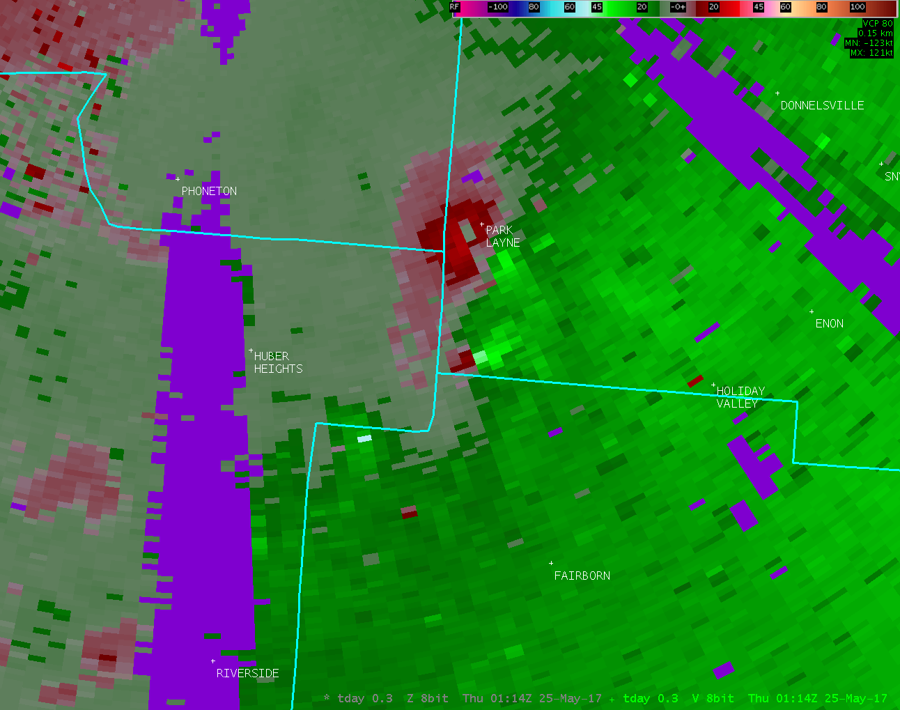
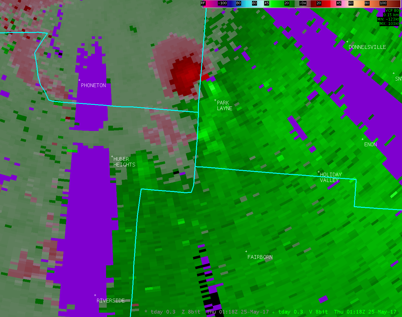
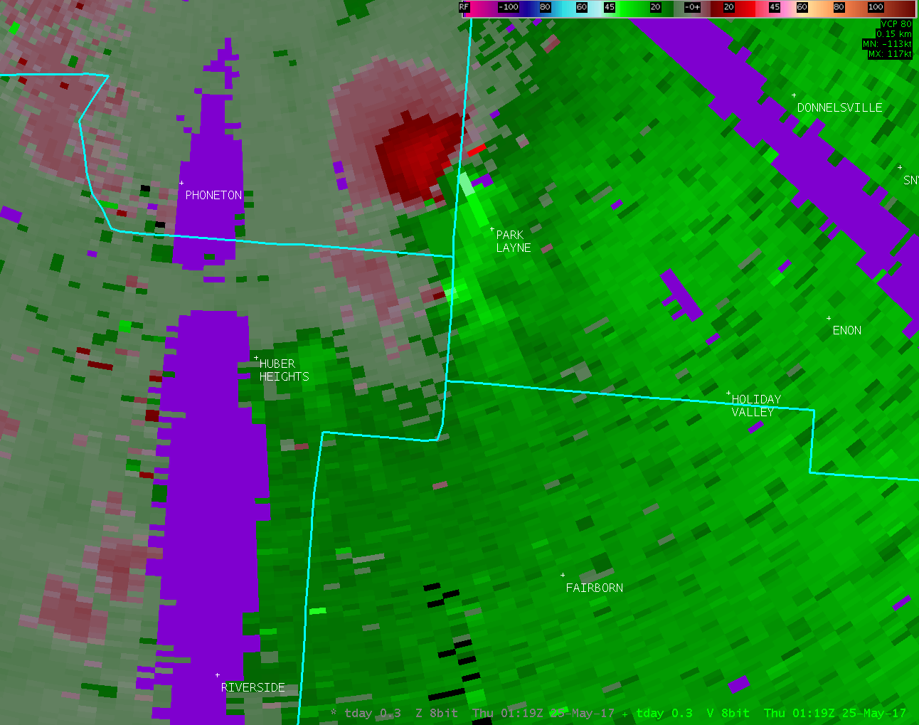
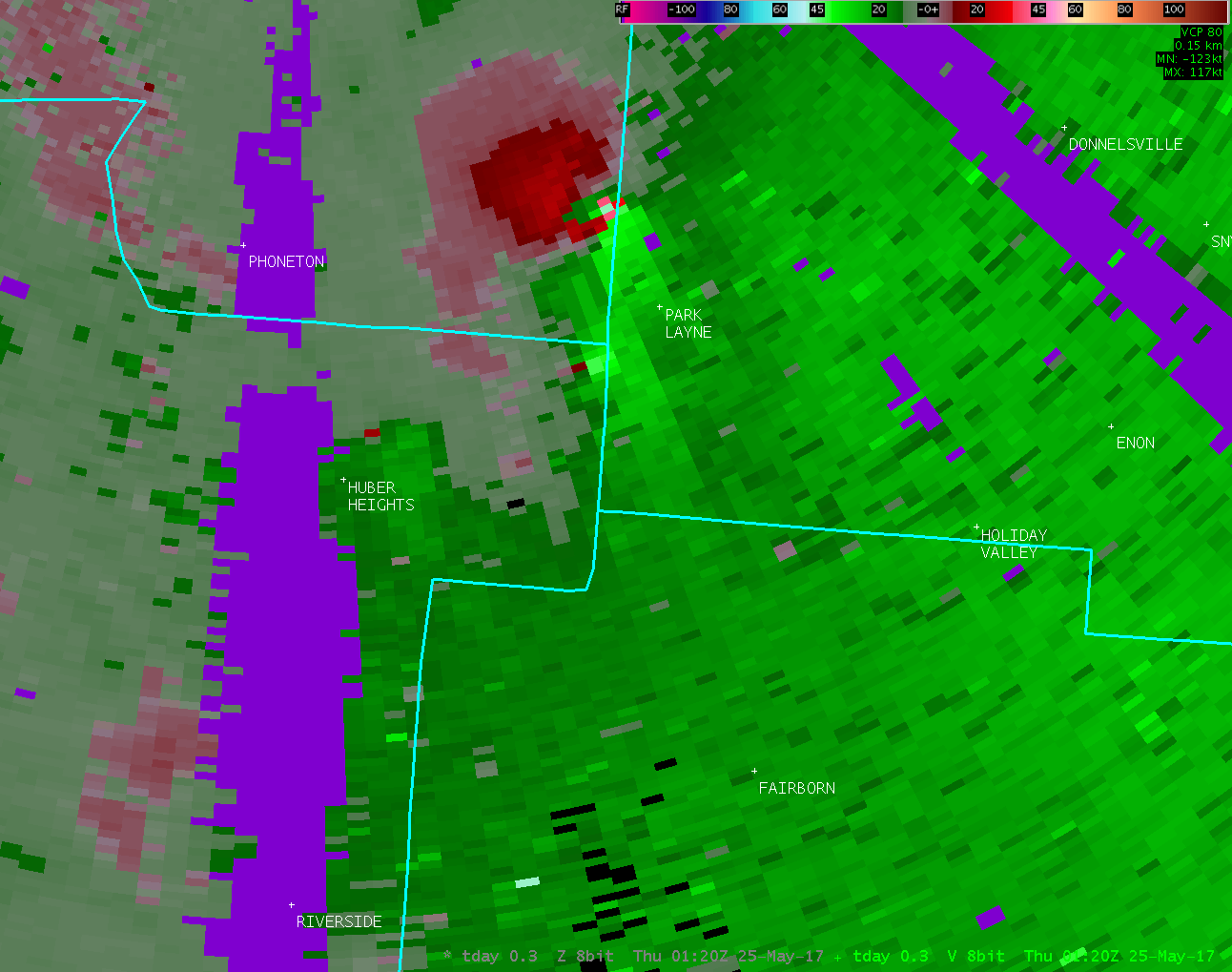
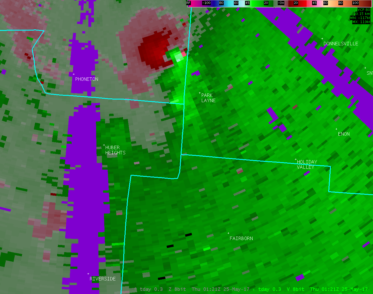
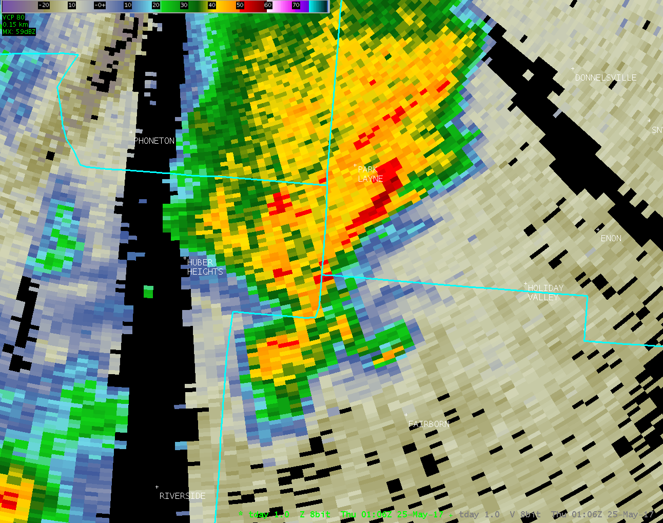
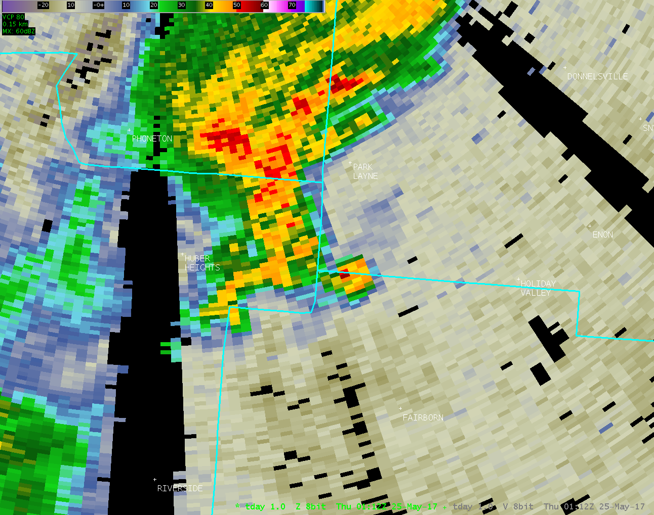
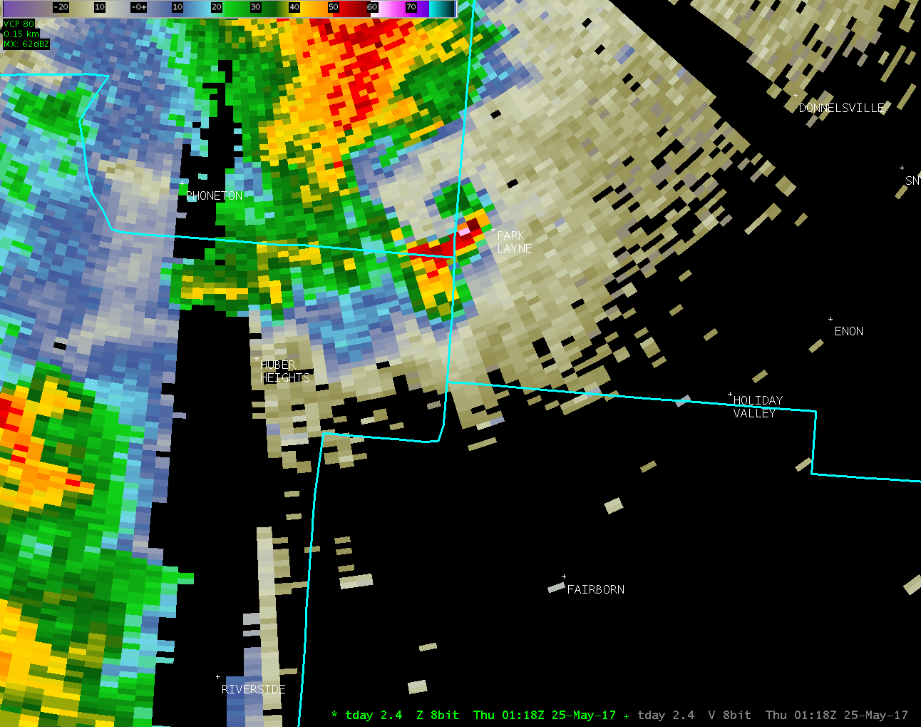
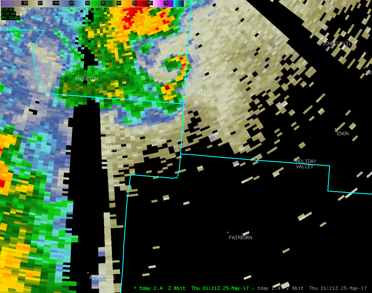
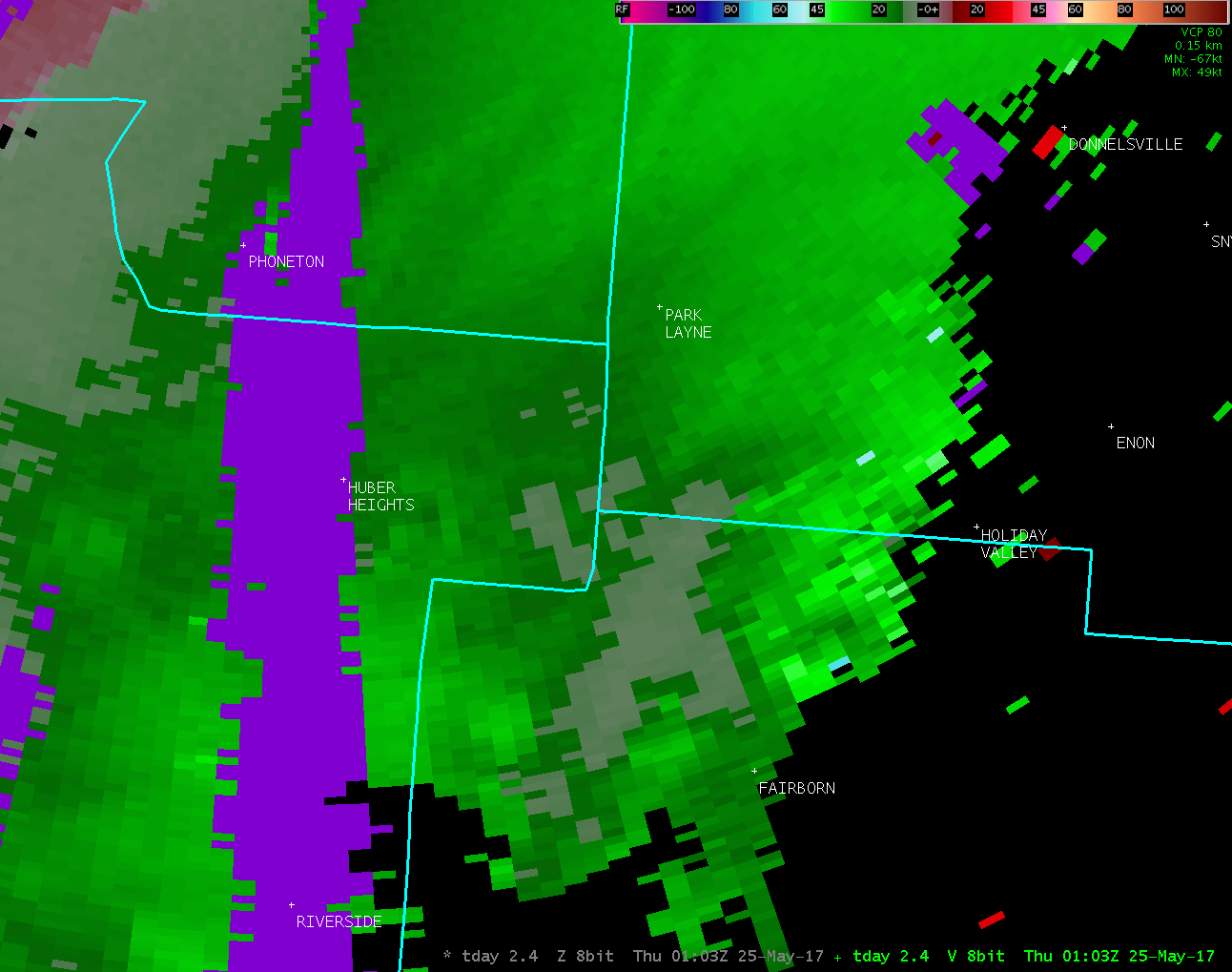
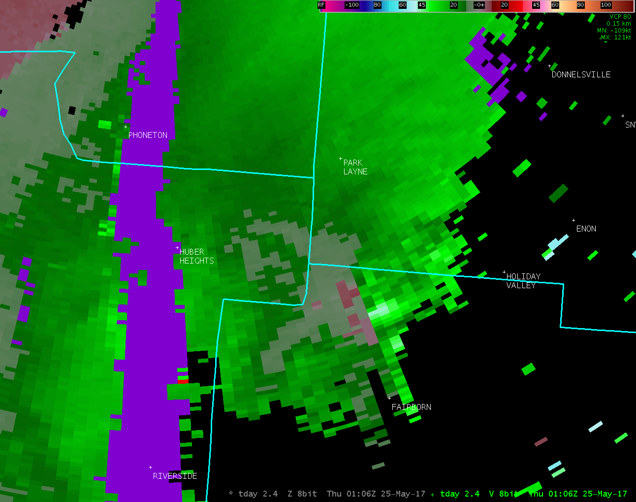
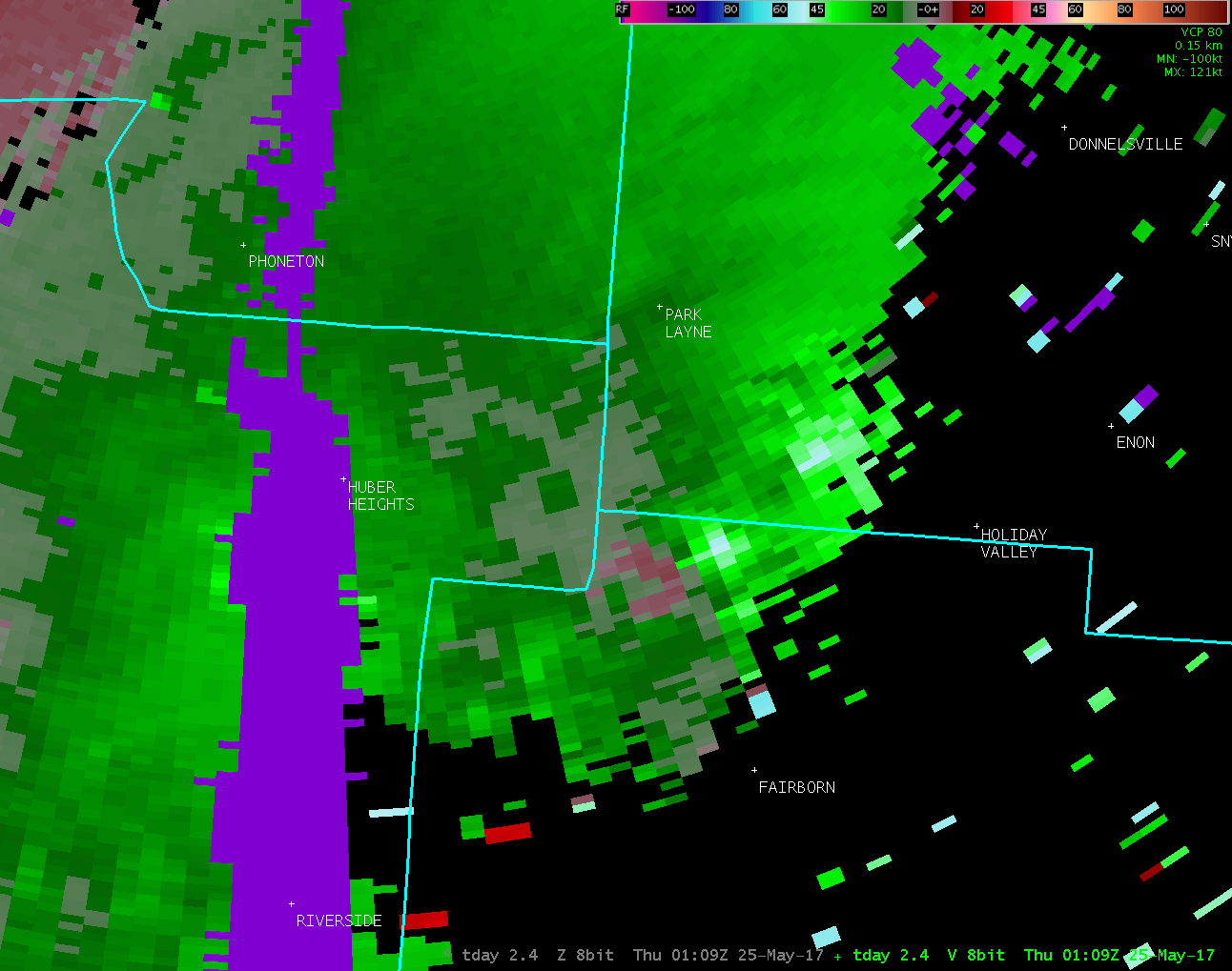
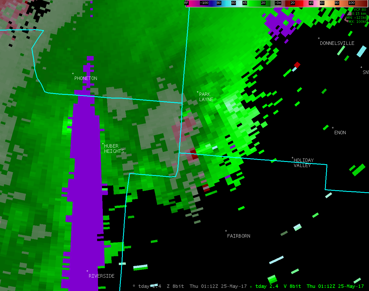
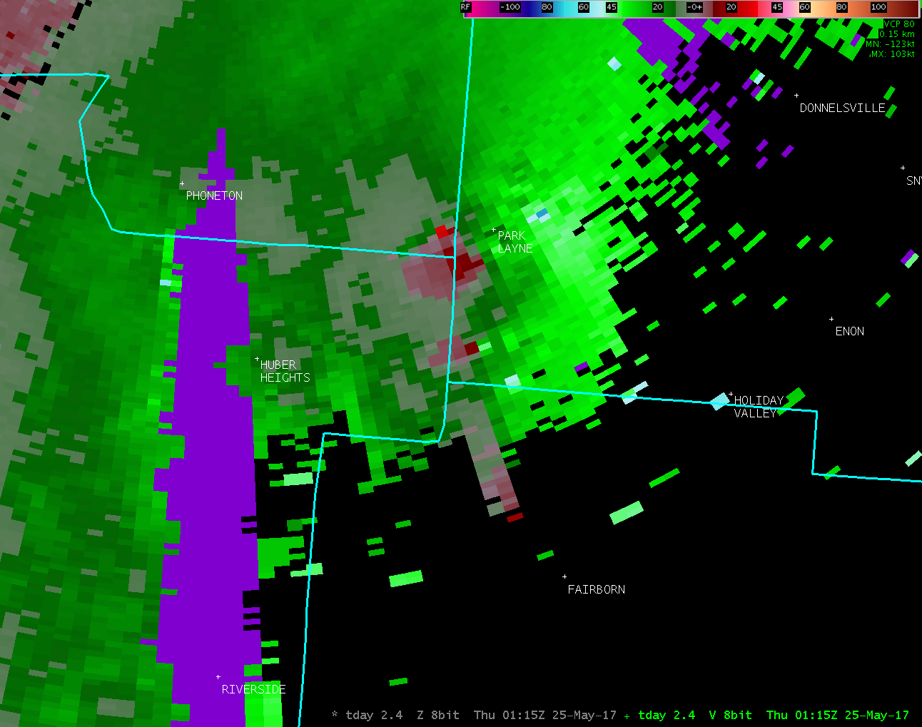
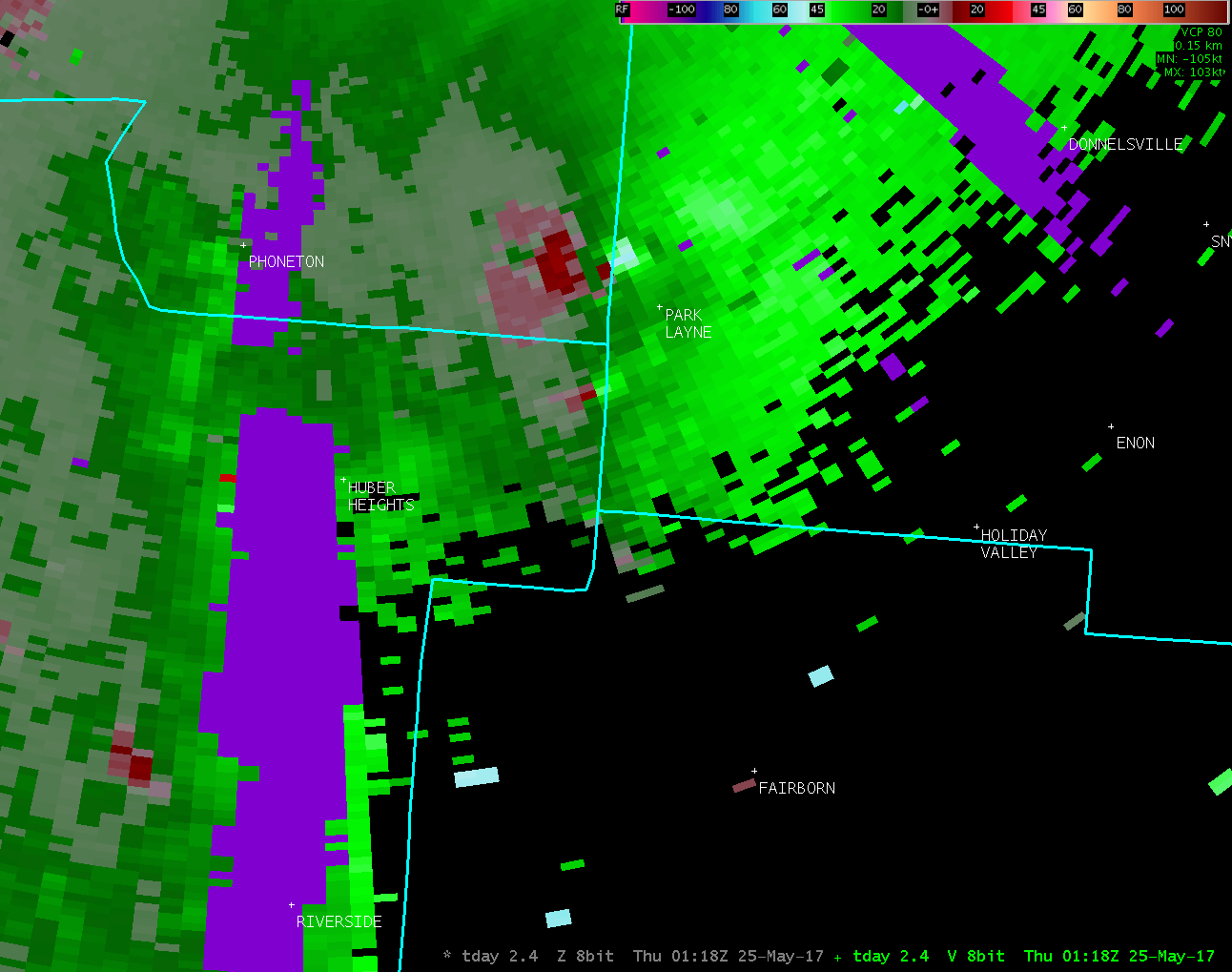
Based on radar data, video evidence and eyewitness reports, the
tornado is estimated to have touched down along Broad Street
just southwest of the intersection with Central Ave.
|
ORIGINAL STATEMENT
Public Information Statement
National Weather Service Wilmington OH
1235 PM EDT Fri May 26 2017
...TORNADO CONFIRMED FROM NEAR FAIRBORN IN GREENE COUNTY OHIO
TO NEAR MEDWAY IN CLARK COUNTY OHIO...
Location...Fairborn in Greene County Ohio to near Medway
in Clark County Ohio
Date...05/24/2017
Estimated Start Time...09:07 PM EDT
Estimated End Time...09:16 PM EDT
Maximum EF-Scale Rating...EF0
Estimated Maximum Wind Speed...75 MPH
Maximum Path Width...90 Yards
Path Length...2.5 Miles
Beginning Lat/Lon...39.8330N/84.0227W
Ending lat/Lon...39.8638N/84.0497W
* Fatalities...0
* Injuries...0
* The information in this statement is preliminary and subject to
change pending final review of the event(s) and publication in
NWS Storm Data.
...Summary...
The National Weather Service in Wilmington OH has confirmed a
tornado from near Fairborn in Greene County Ohio to near Medway
in Clark County Ohio on 05/24/2017.
Based on additional photos and radar evidence, the beginning point
of this tornado has been adjusted farther to the southeast toward
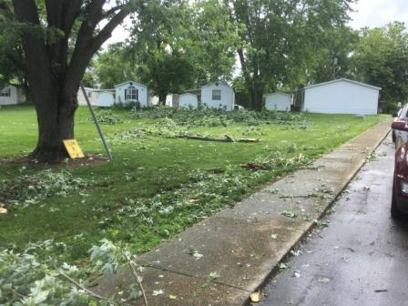
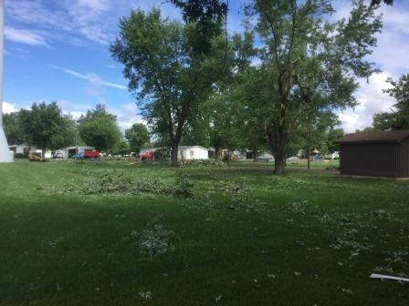
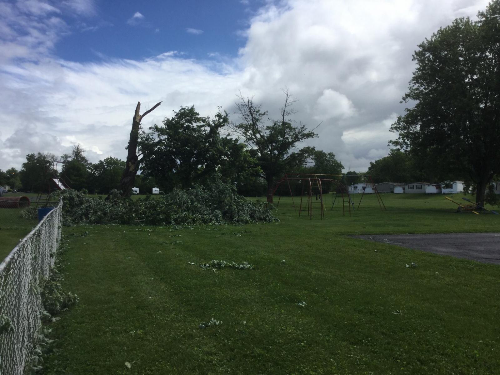
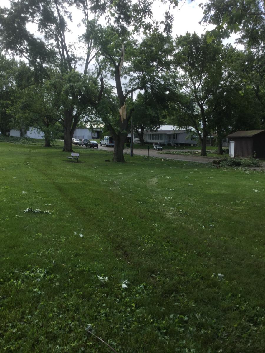
Fairborn in Greene County Ohio. Some minor tree damage occurred in
Fairborn Park, just northwest of Fairborn and then some additional
minor tree damage was found along Osborn Road in extreme northwest
Greene County.
Tornado damage was also found along Lower Valley Pike near Princeton
Drive, just southwest of the Interstate 70 and route 235
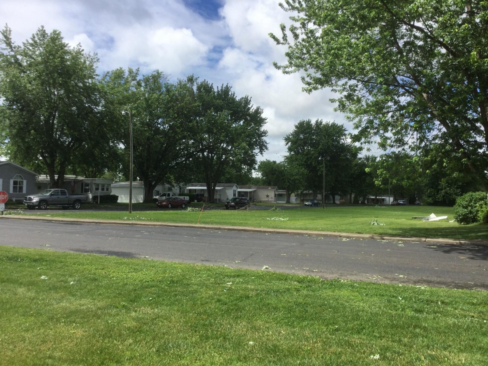
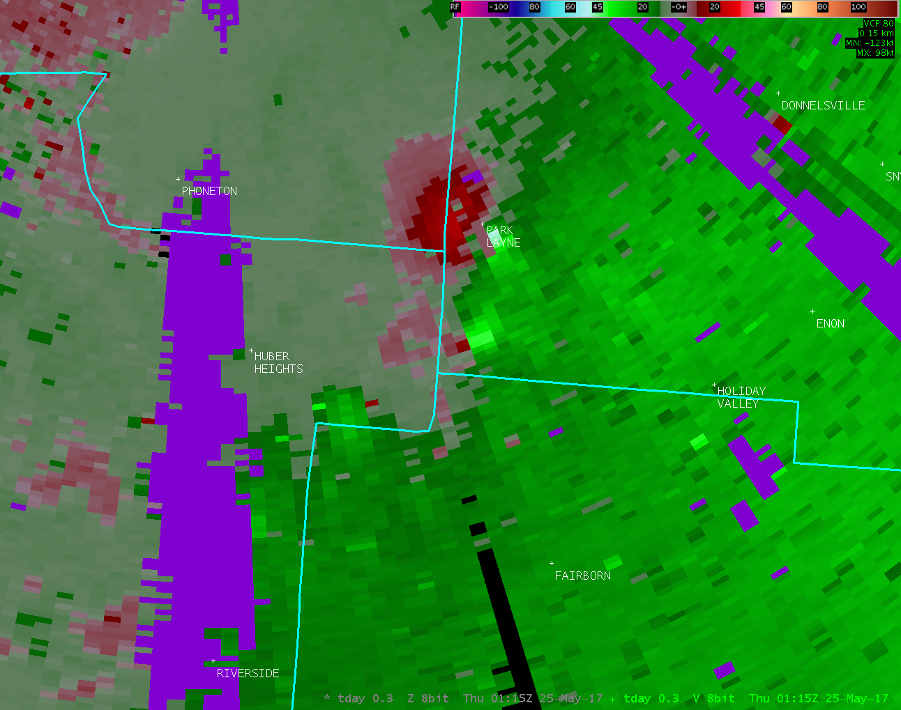
interchange. The tornado then continued in a north-northwest path
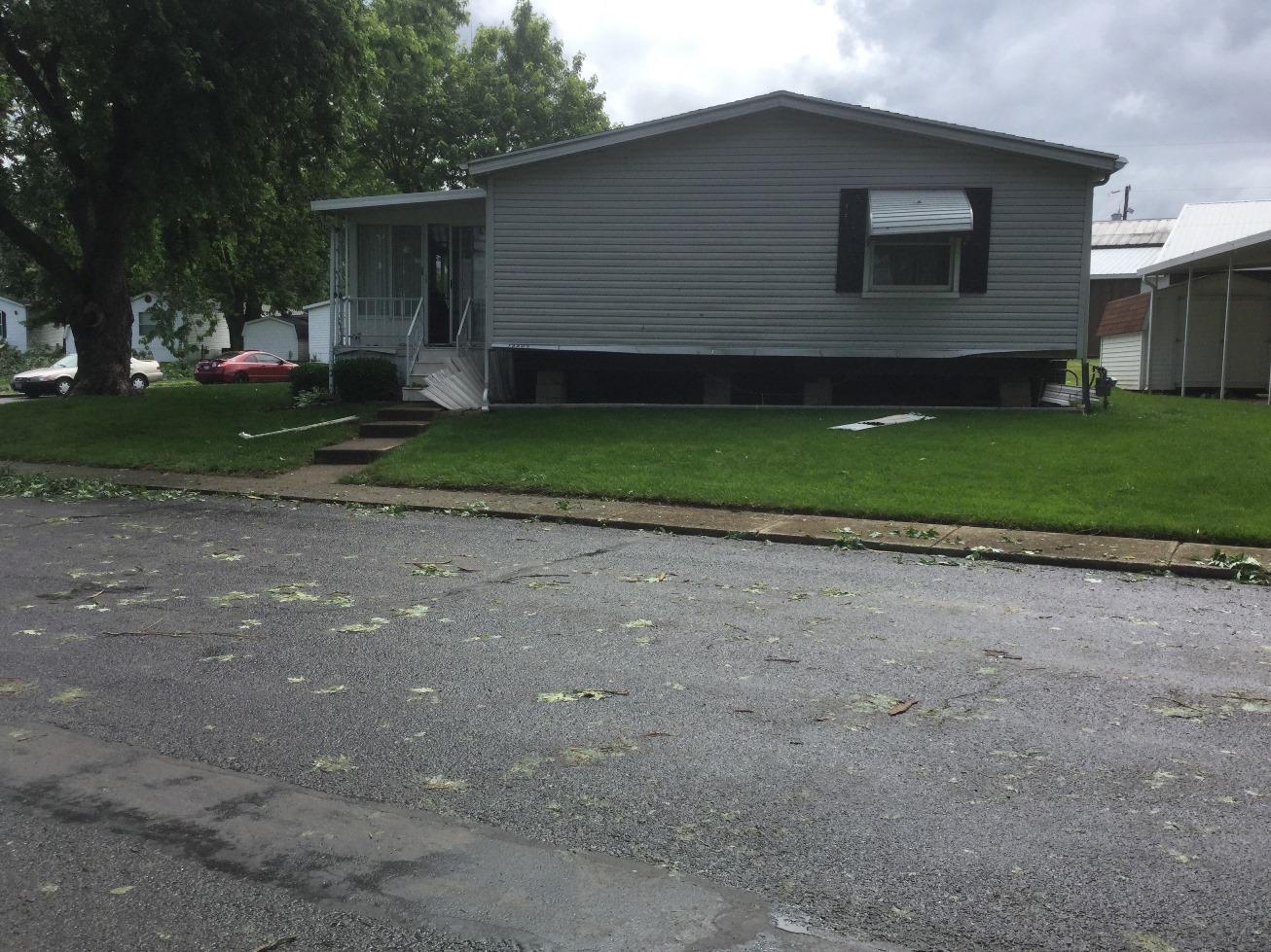
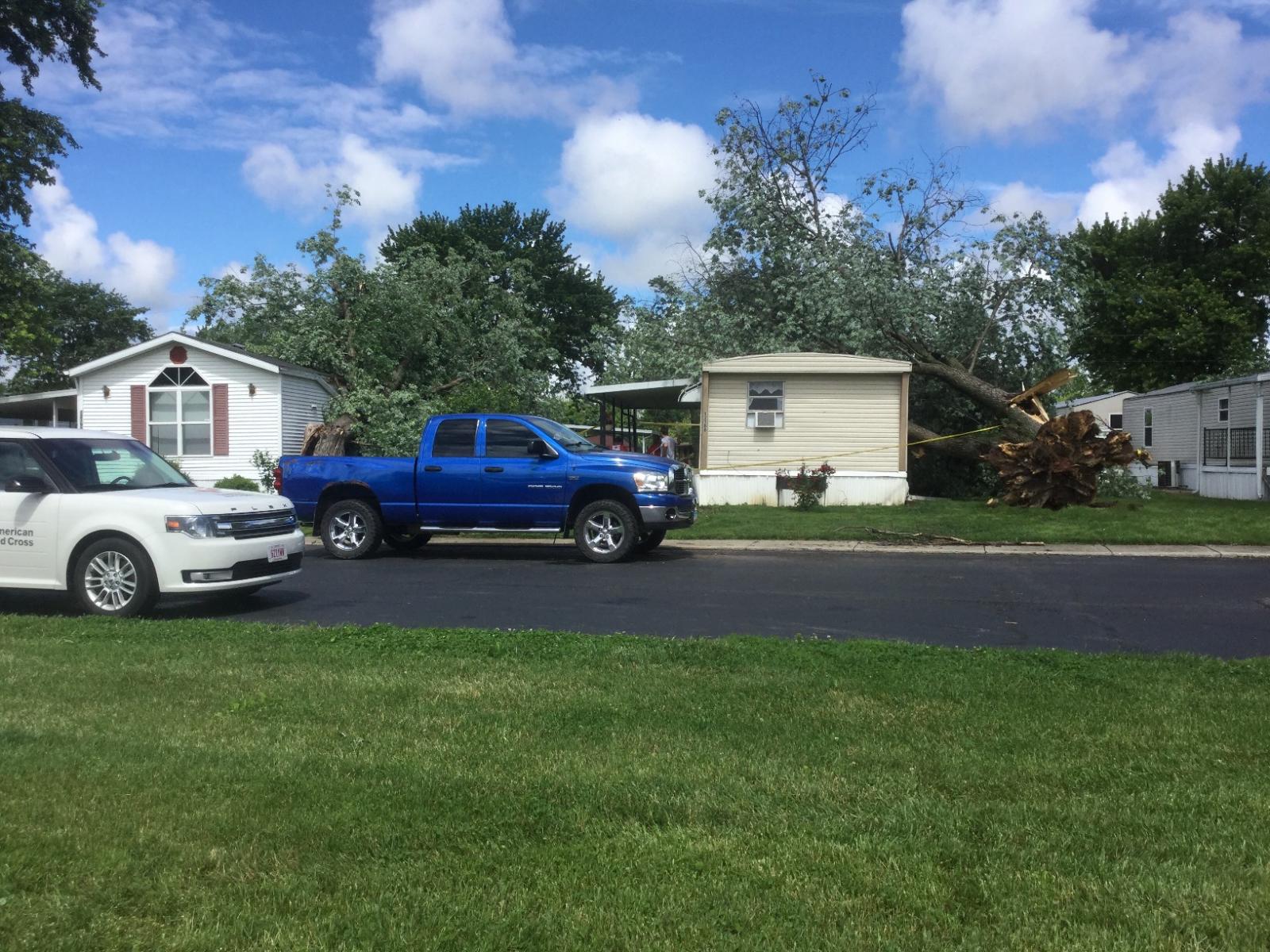
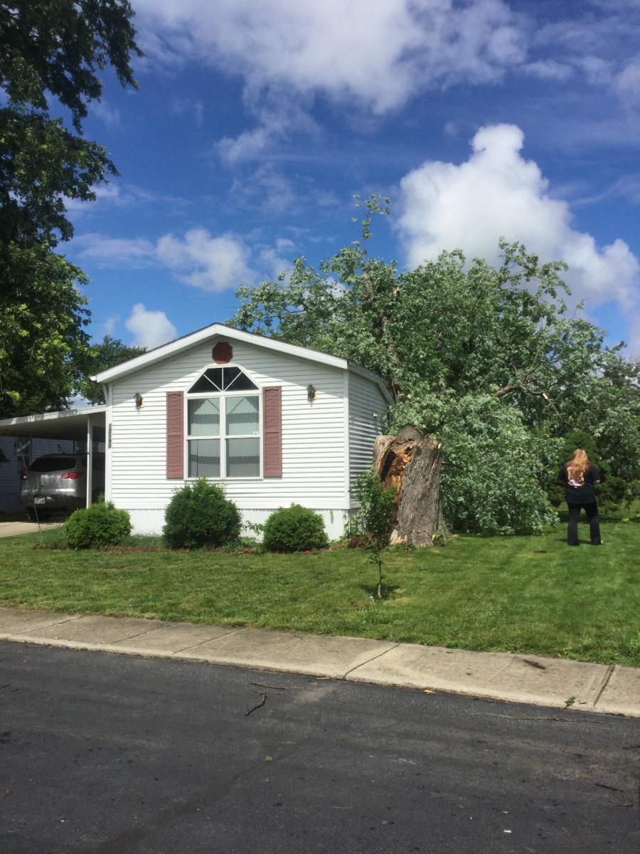
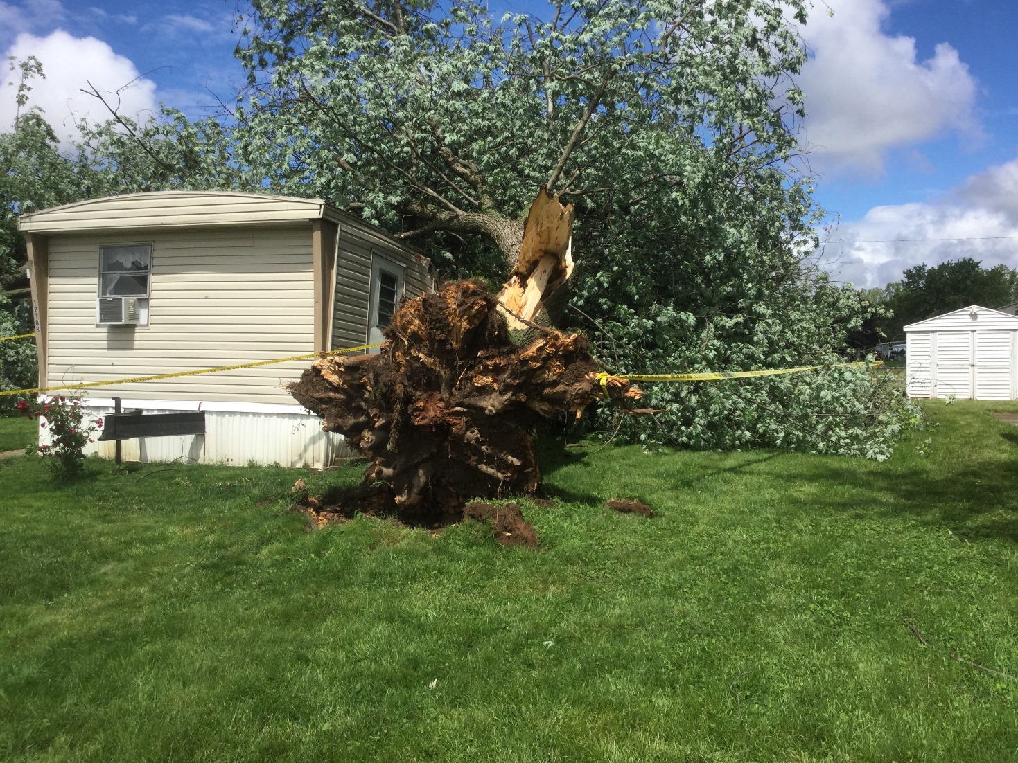
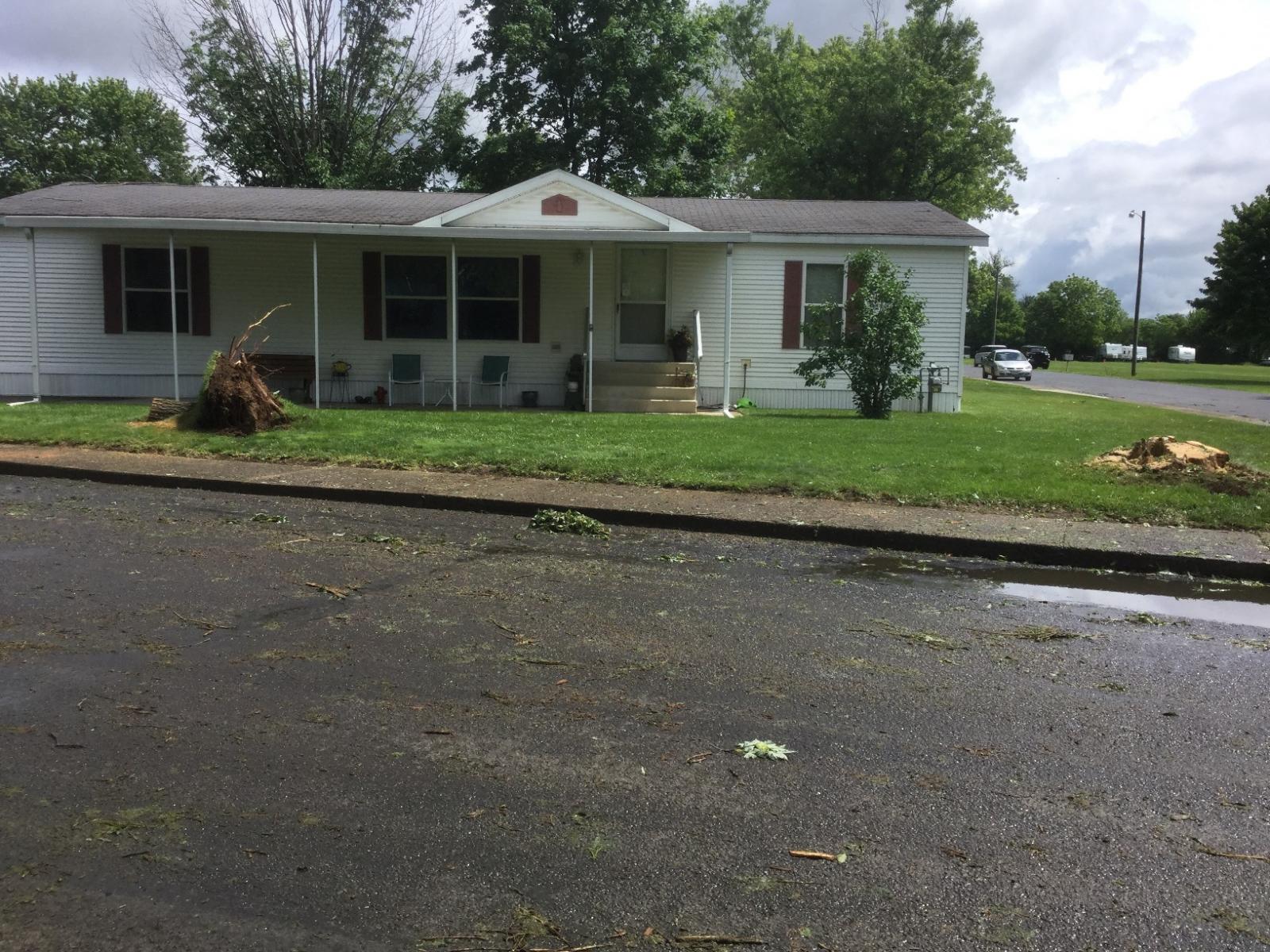
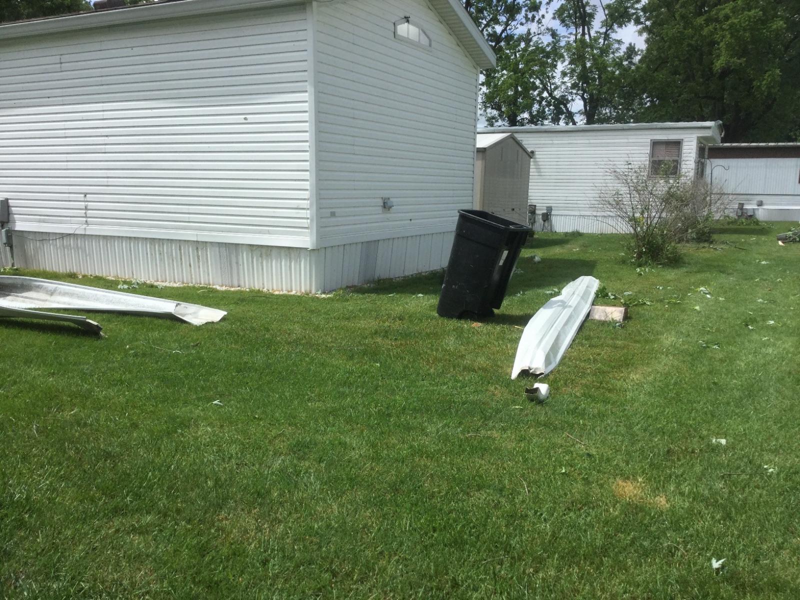
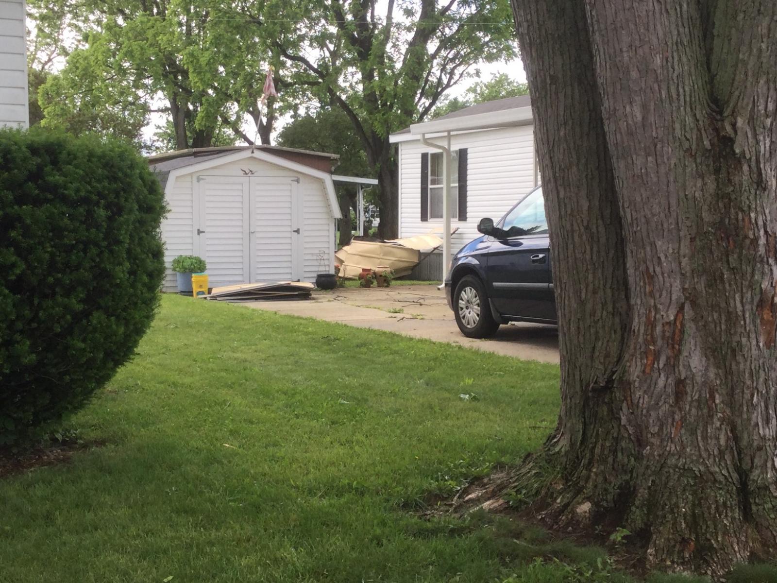
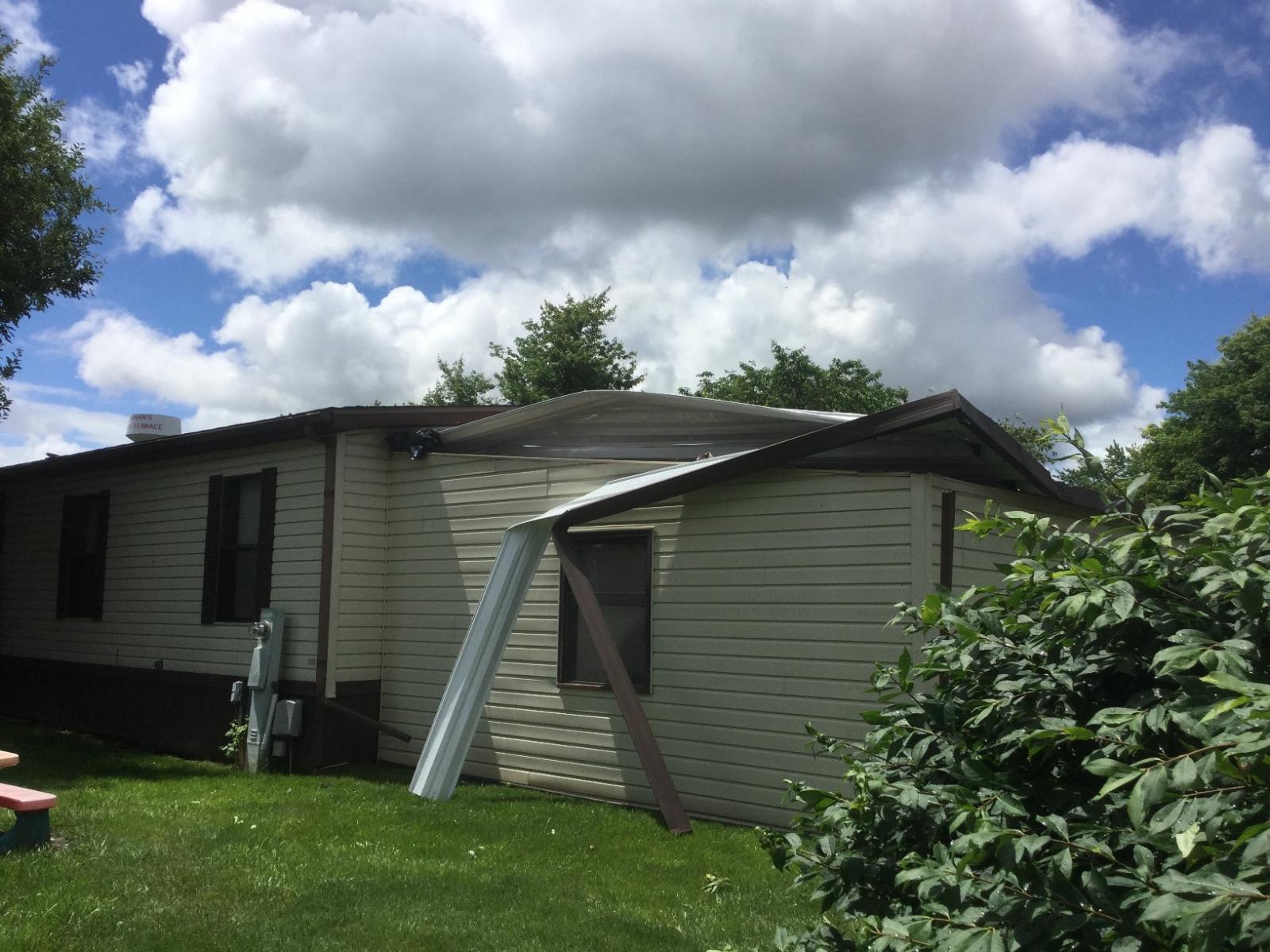
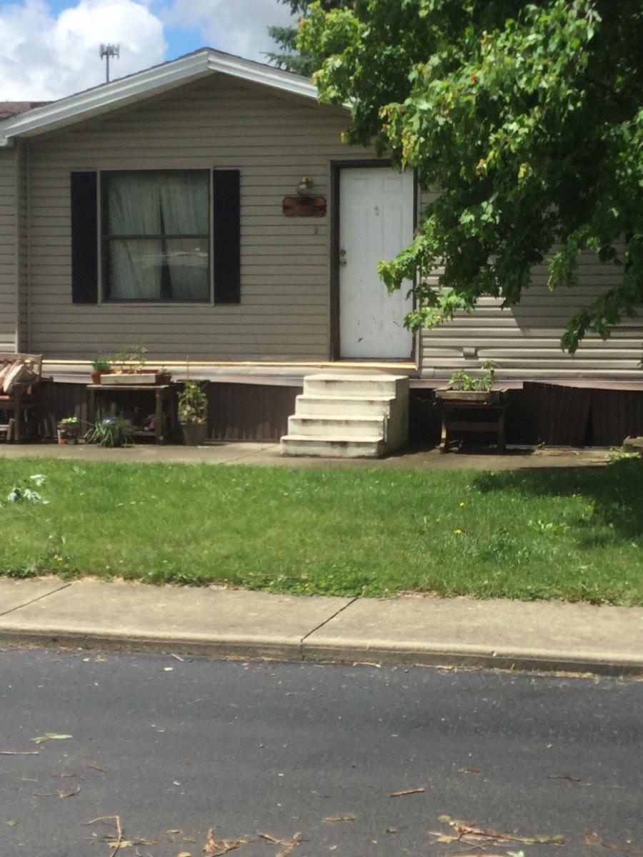
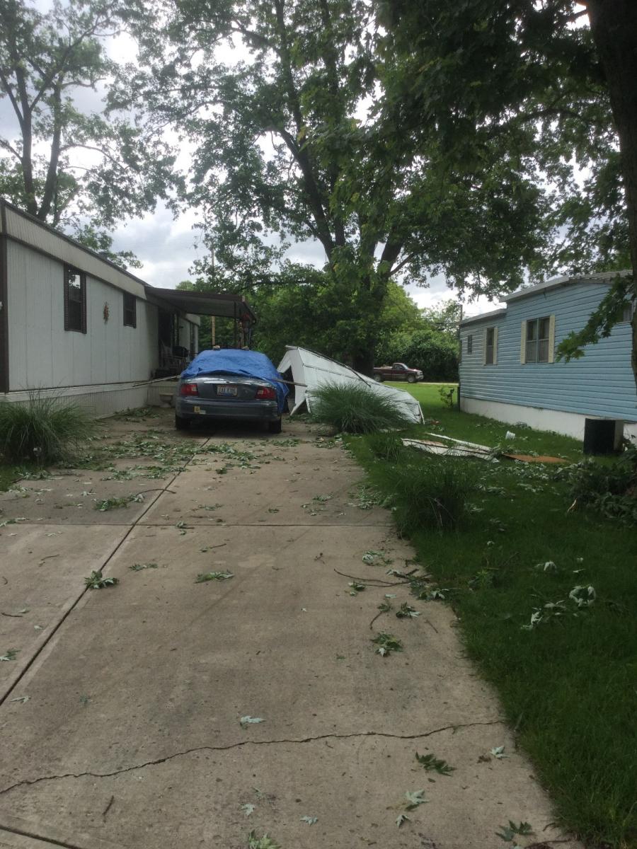
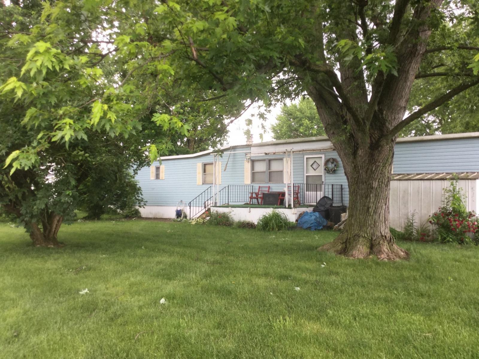
along and either side of Princeton Drive. Several manufactured
homes sustained roof and siding damage, along with carports and
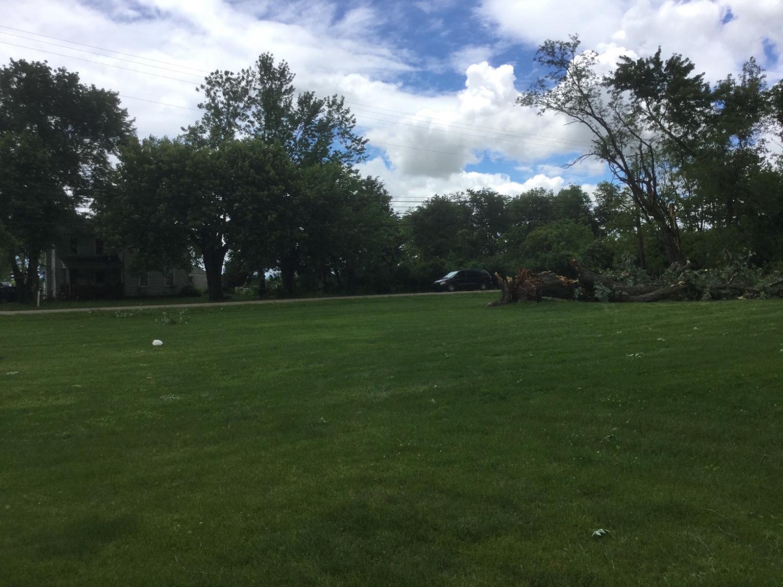
awnings destroyed. Several large trees were damaged, either
uprooted or with large branches snapped off. Two large trees fell
on and destroyed 2 homes on Cordova Drive.
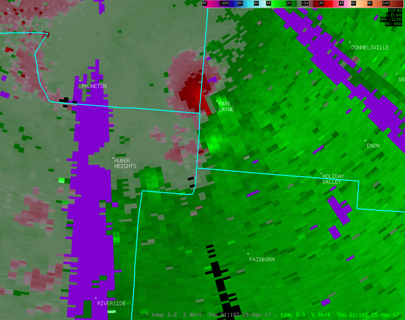
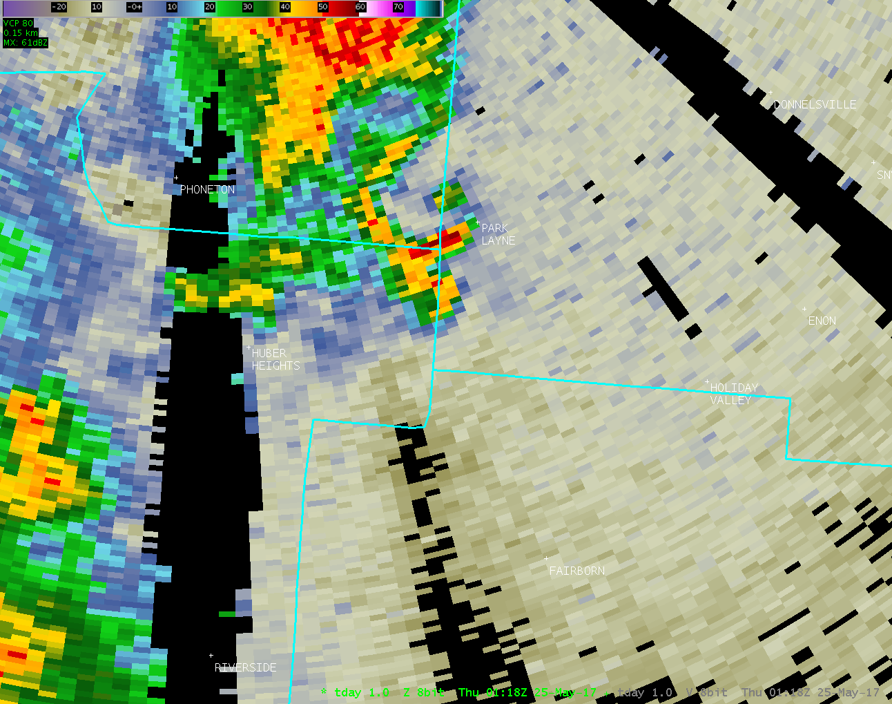
Several homes along Wellington Avenue had mud splattered on the
north or east side of the homes, showing evidence of rotation.
The damage quickly lessened in strength further to the northwest
with minimal damage along Jason Drive and no evidence of damage by
Amy Dee Lane.
For reference: the Enhanced Fujita Scale classifies tornadoes
into the following categories:
EF0...wind speeds 65 to 85 mph.
EF1...wind speeds 86 to 110 mph.
EF2...wind speeds 111 to 135 mph.
EF3...wind speeds 136 to 165 mph.
EF4...wind speeds 166 to 200 mph.
EF5...wind speeds greater than 200 mph.
$$
JDR
|


