UPDATED INFORMATION
Location...3 NNE Harveysburg in Warren County Ohio
Date...May 24 2017
Estimated Start Time...7:47 PM EDT
Estimated End Time...7:48 PM EDT
Maximum EF-Scale Rating...EF0
Estimated Maximum Wind Speed...50 MPH
Maximum Path Width...25 Yards
Path Length....0.25 Miles
Beginning Lat/Lon...39.5411N / 83.9813W
Ending lat/Lon...39.5436N / 83.9832W
* Fatalities...0
* Injuries...0
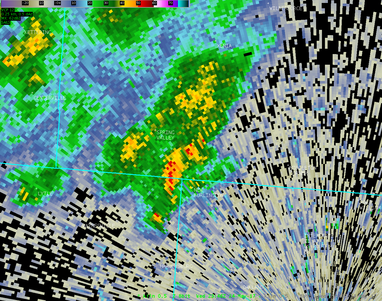
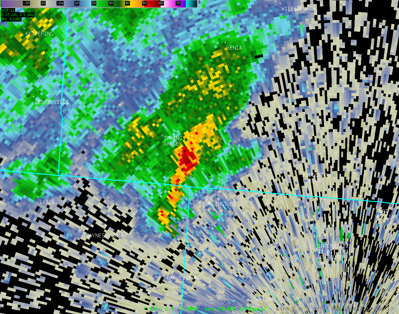
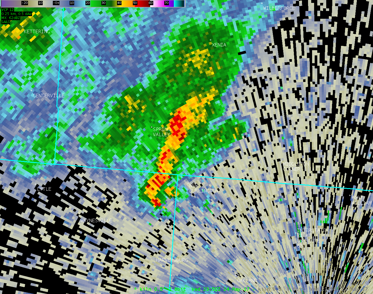
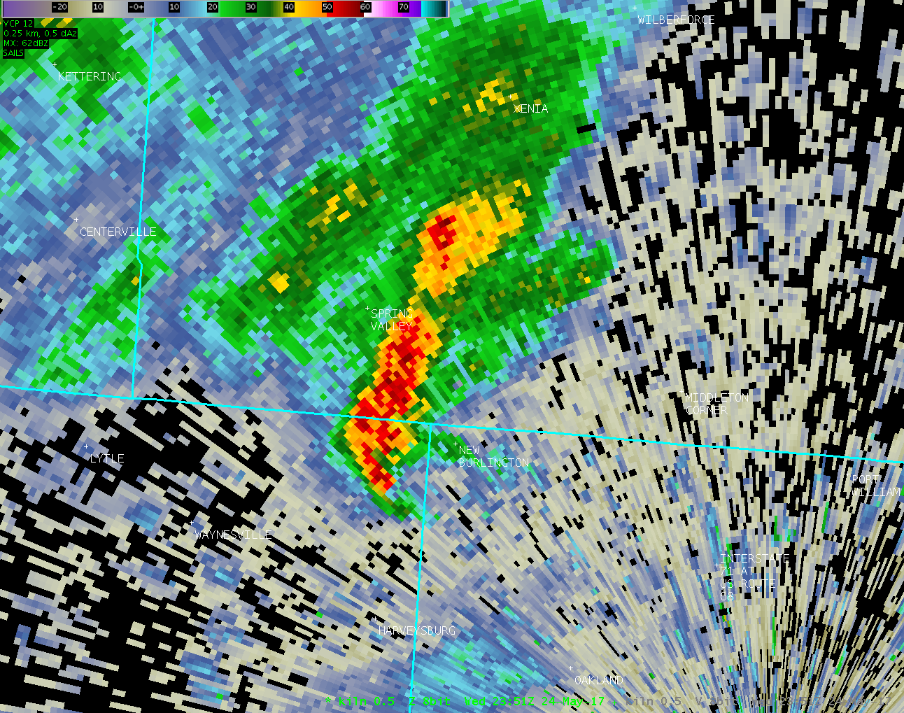
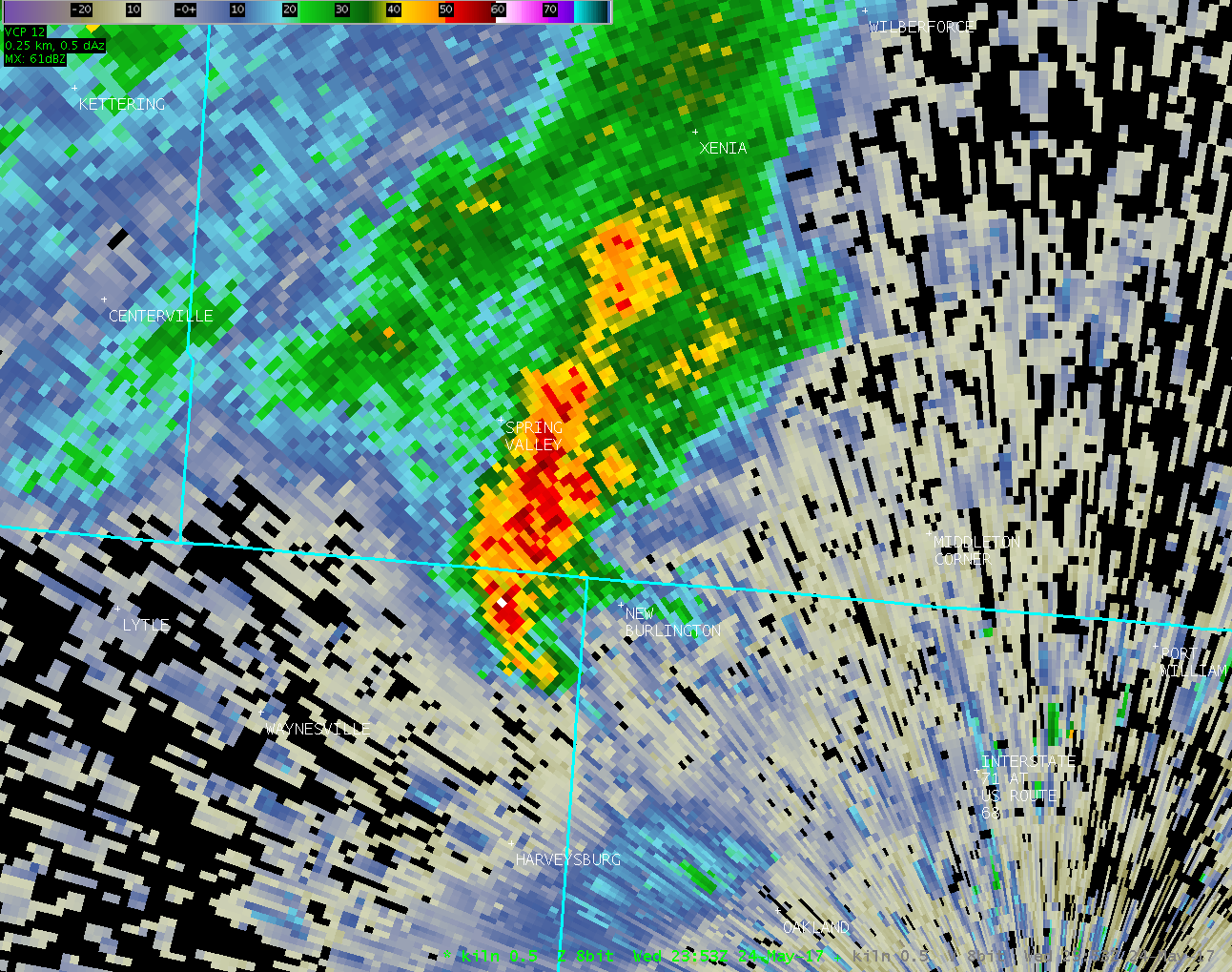
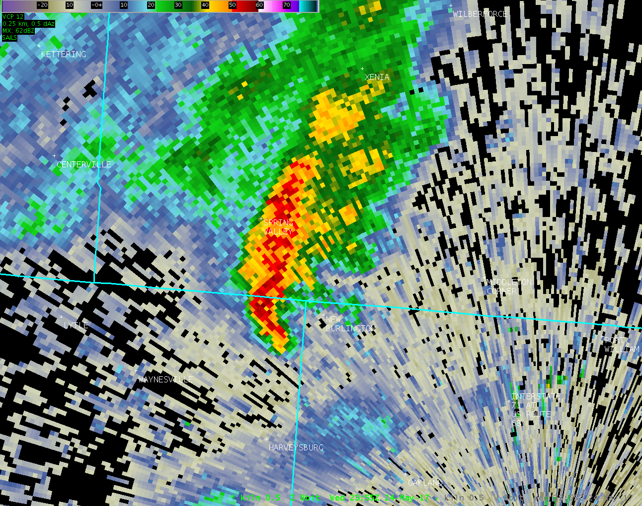
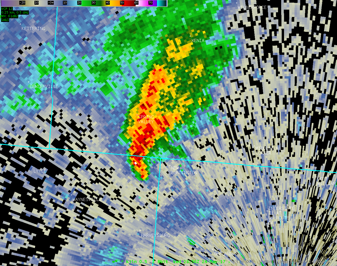
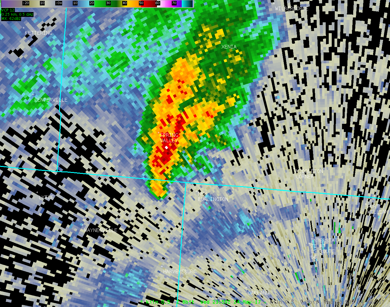
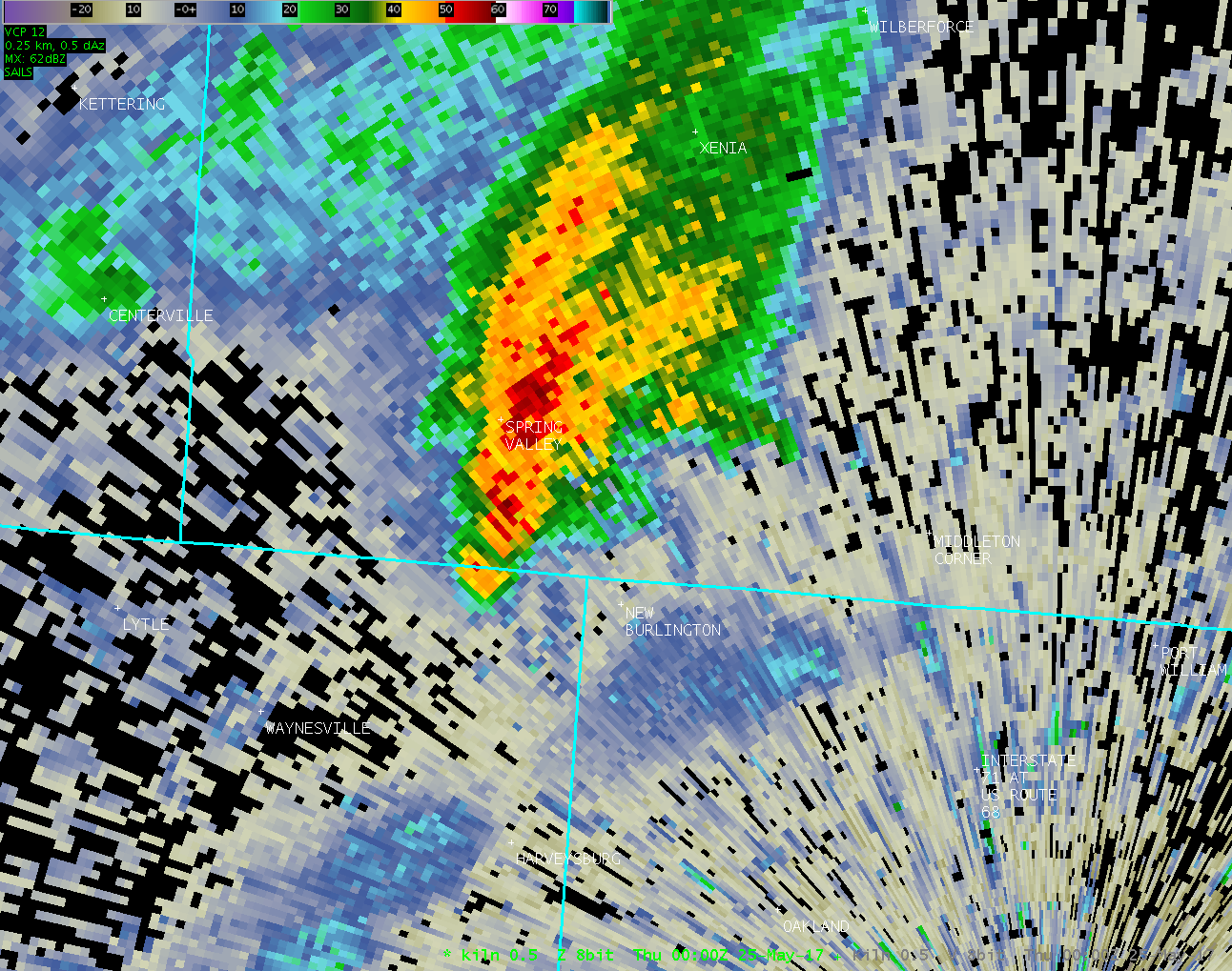
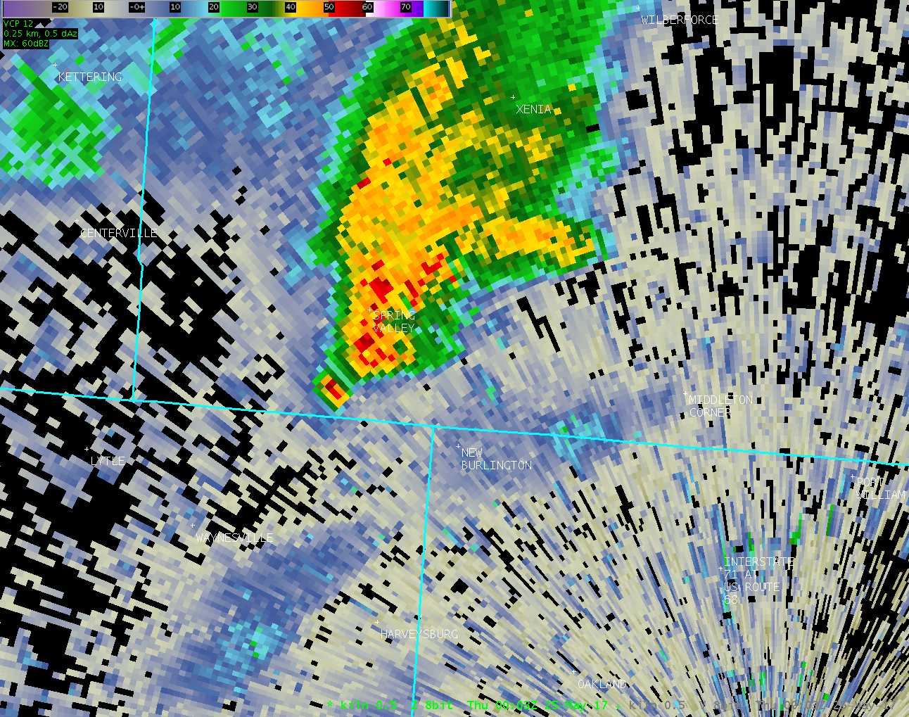
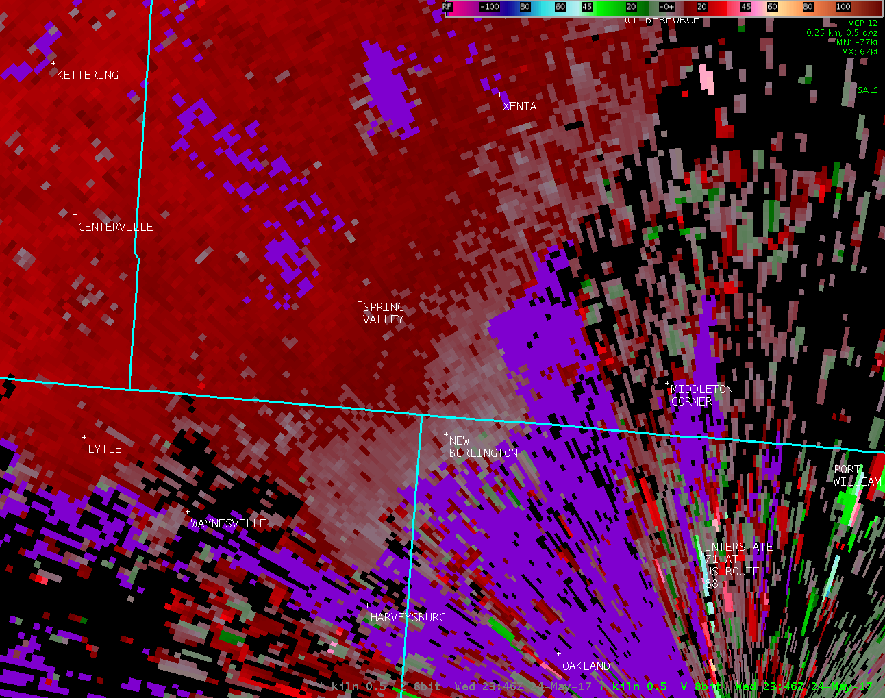
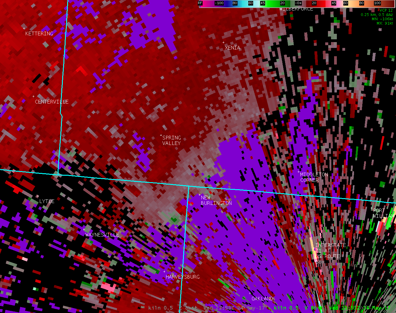
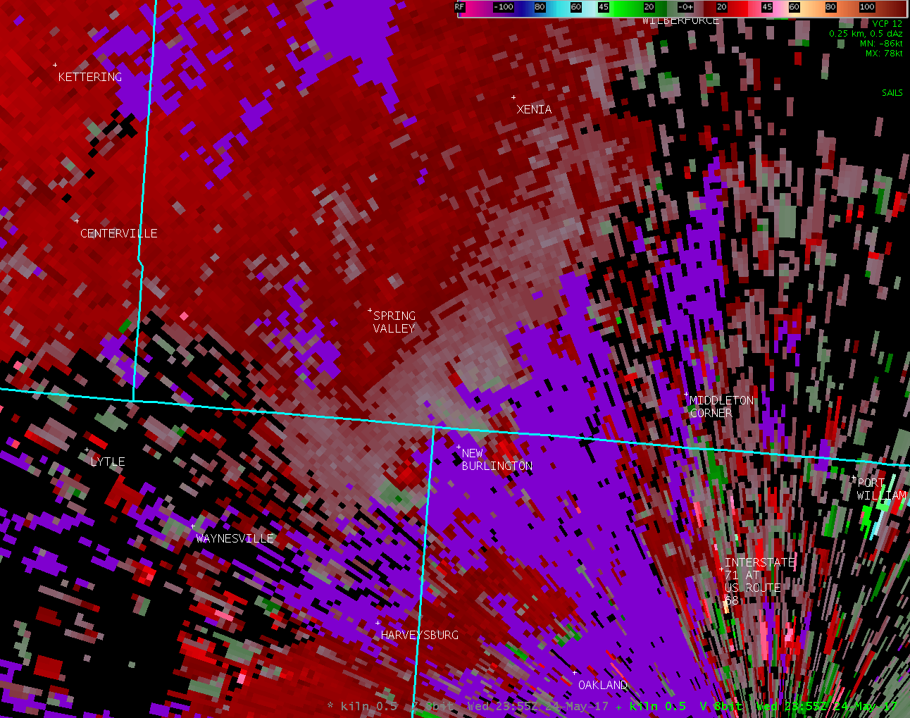
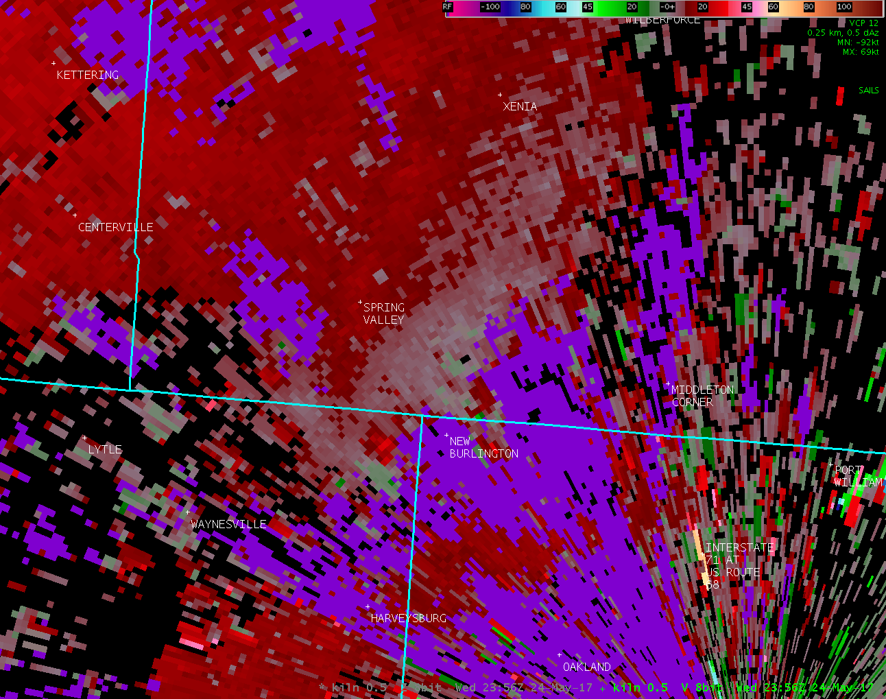
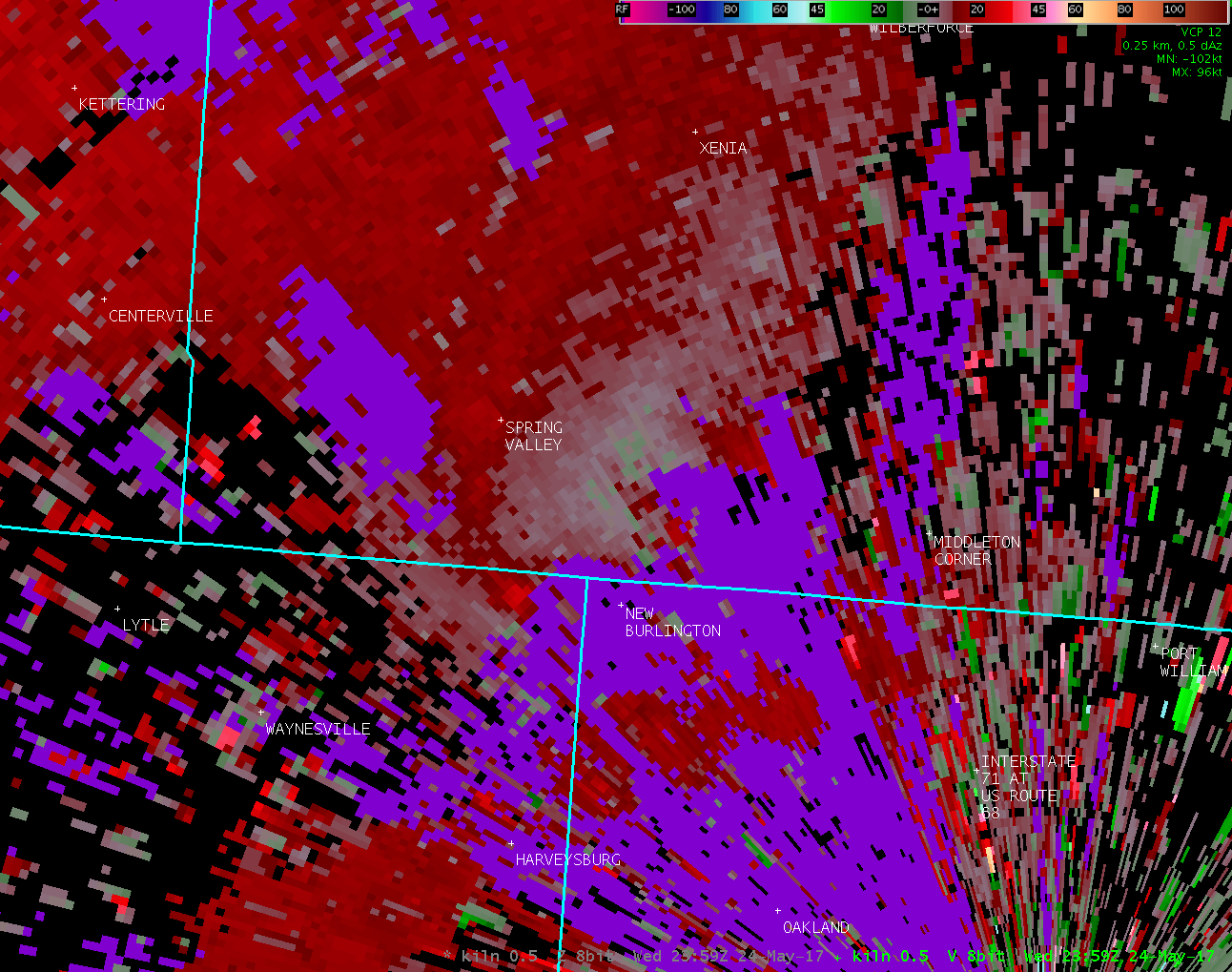
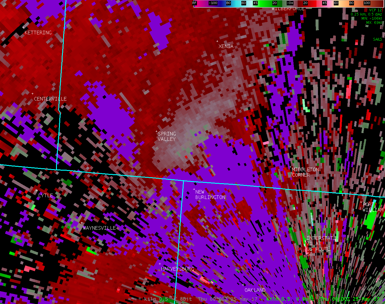
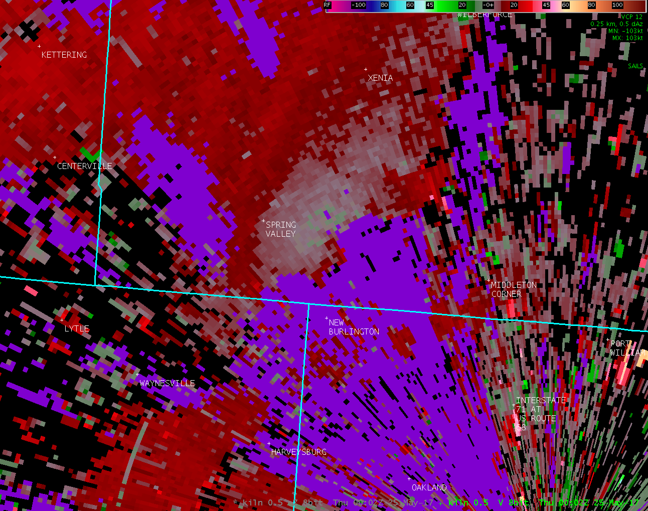
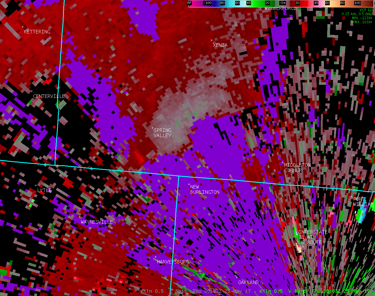
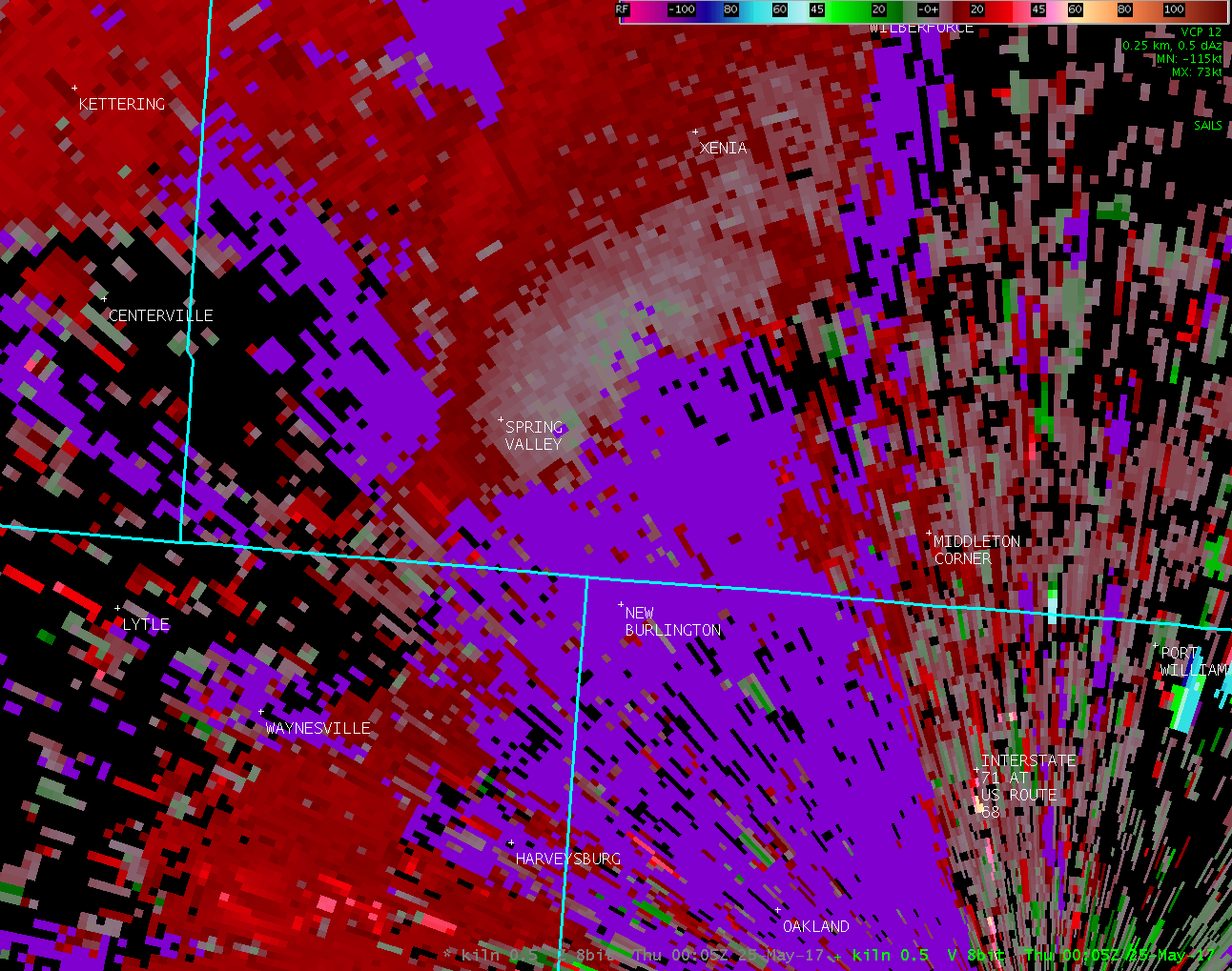
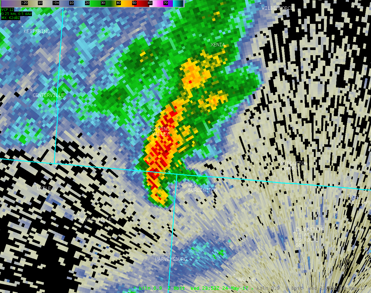
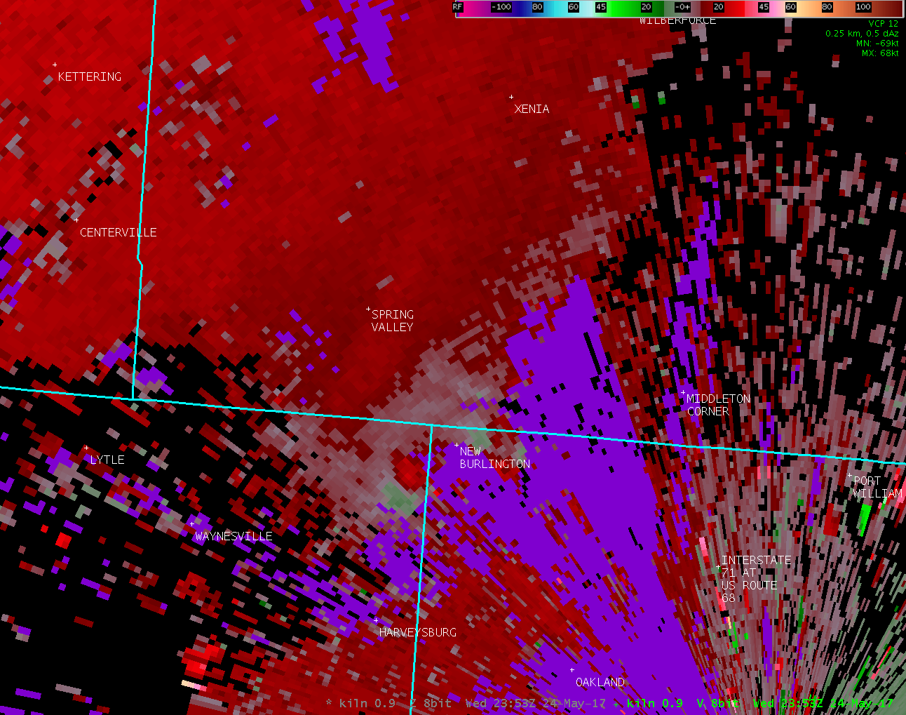
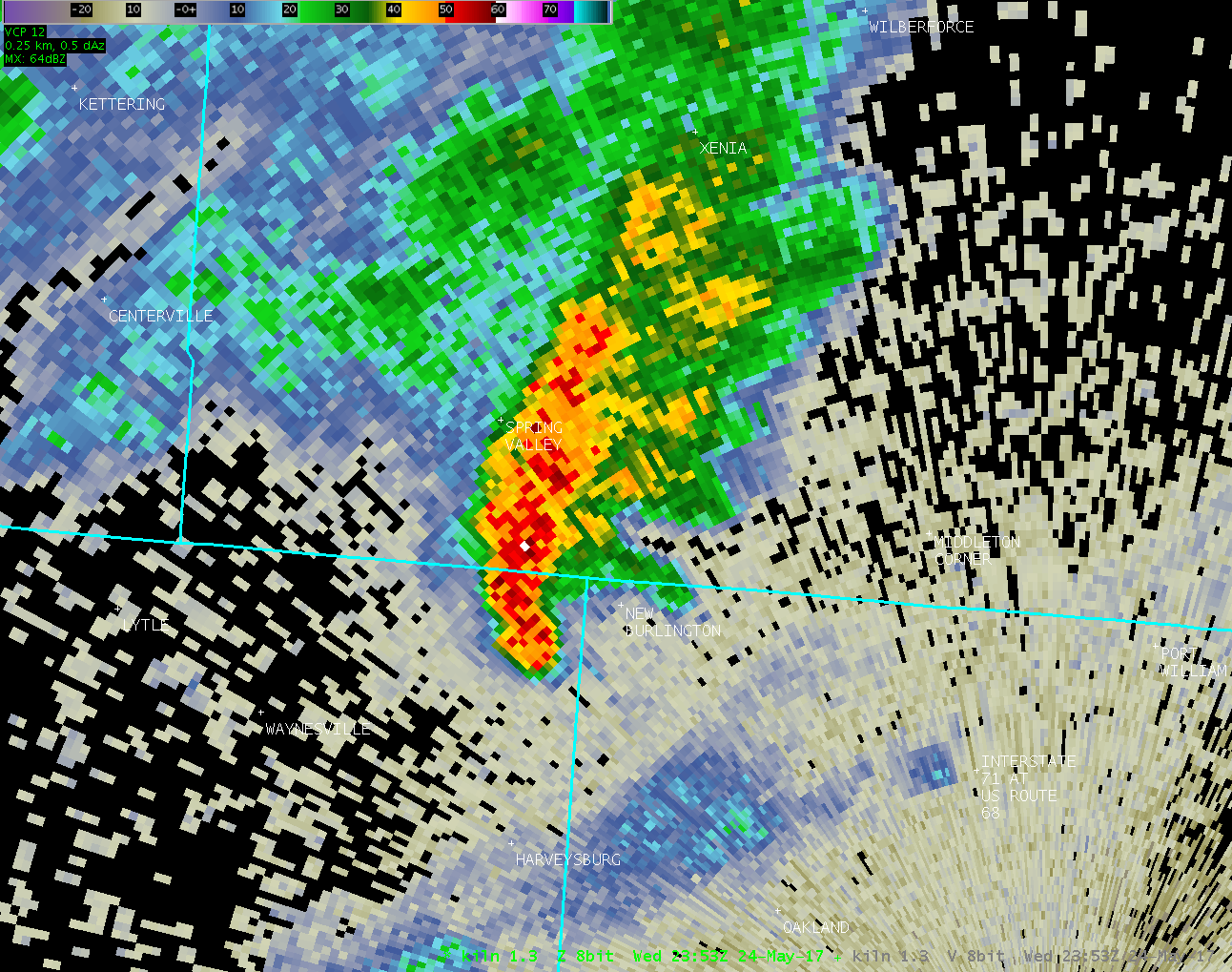
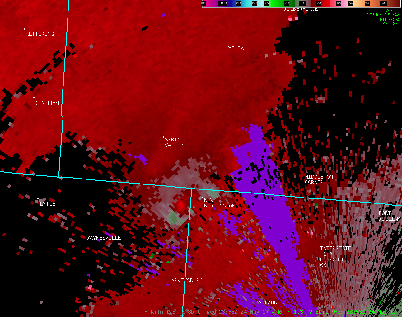
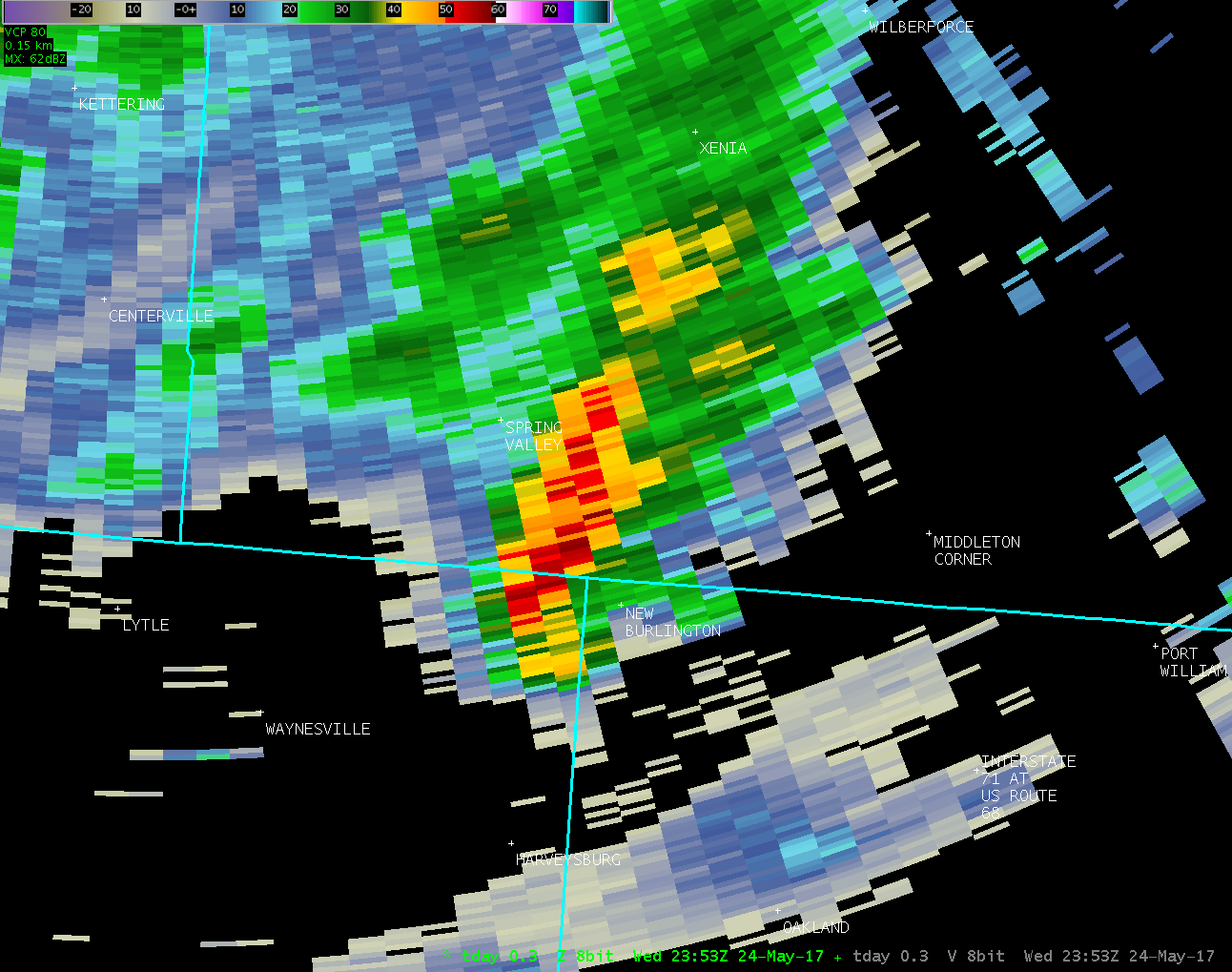
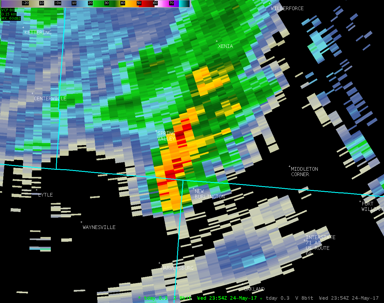
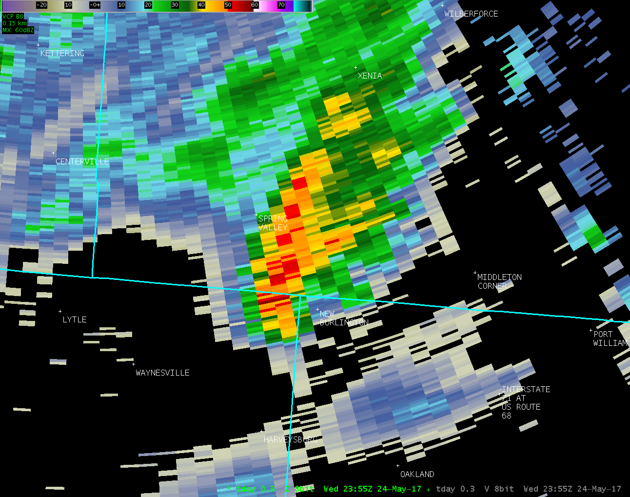
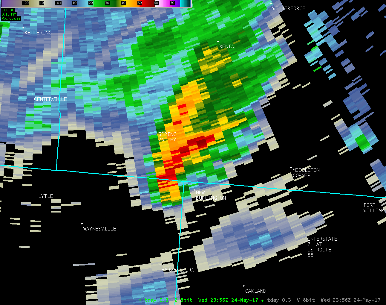
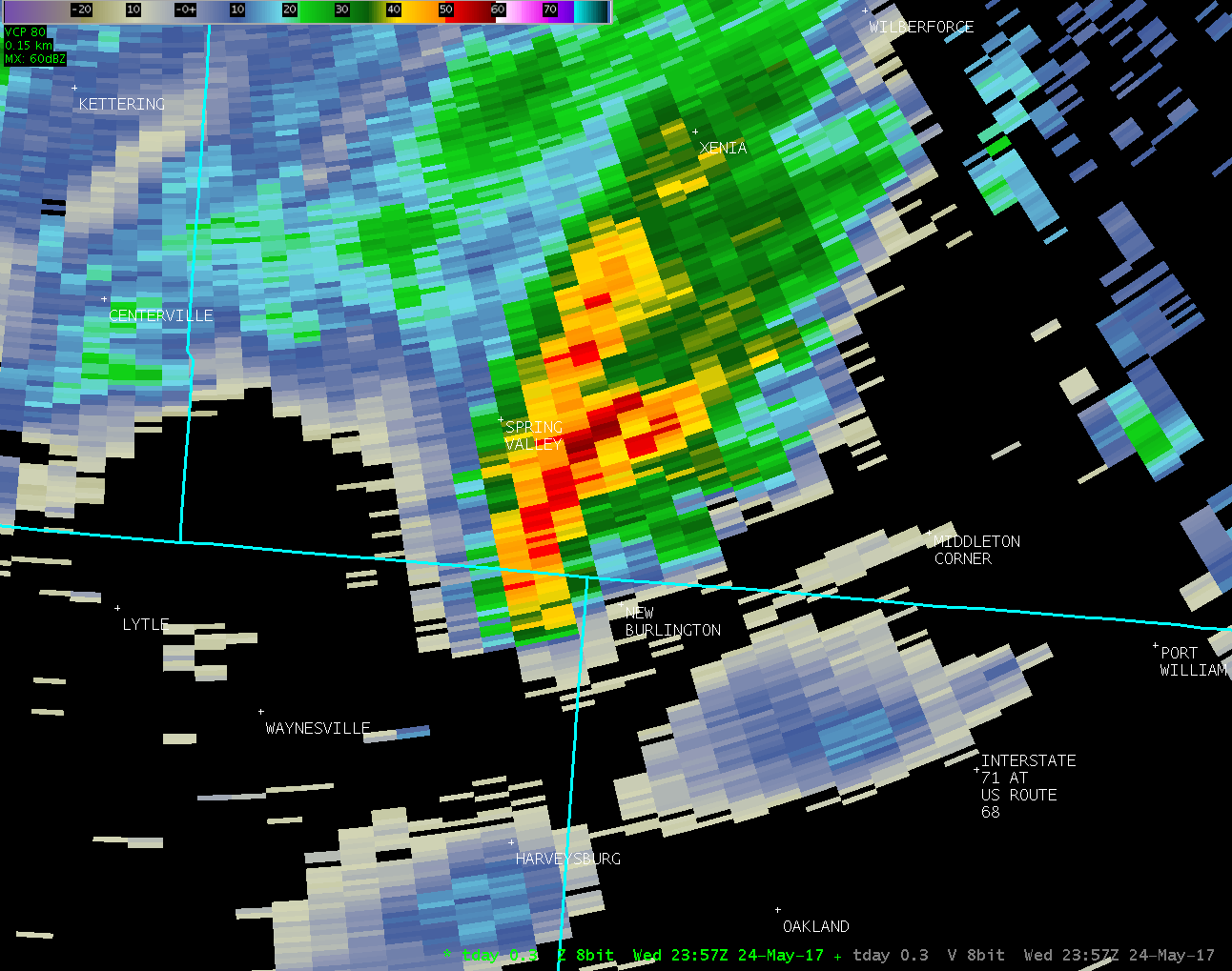
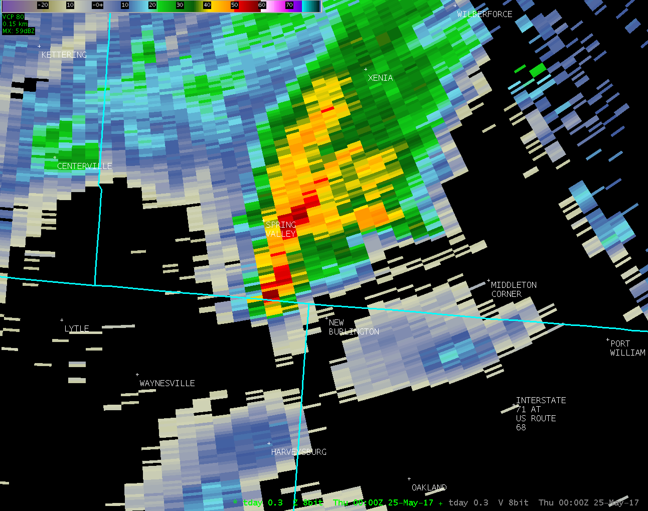
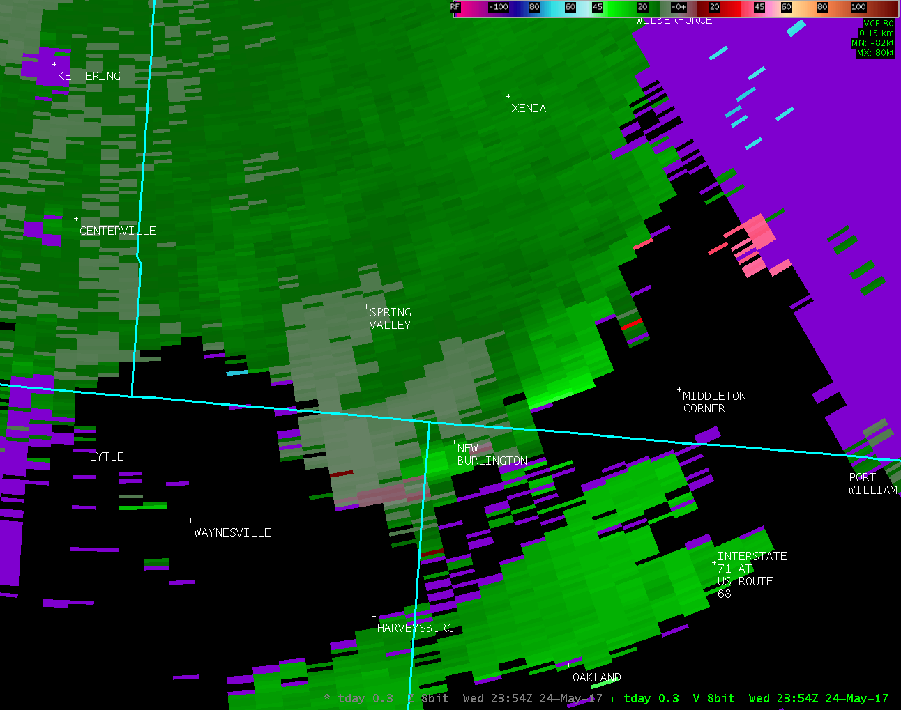
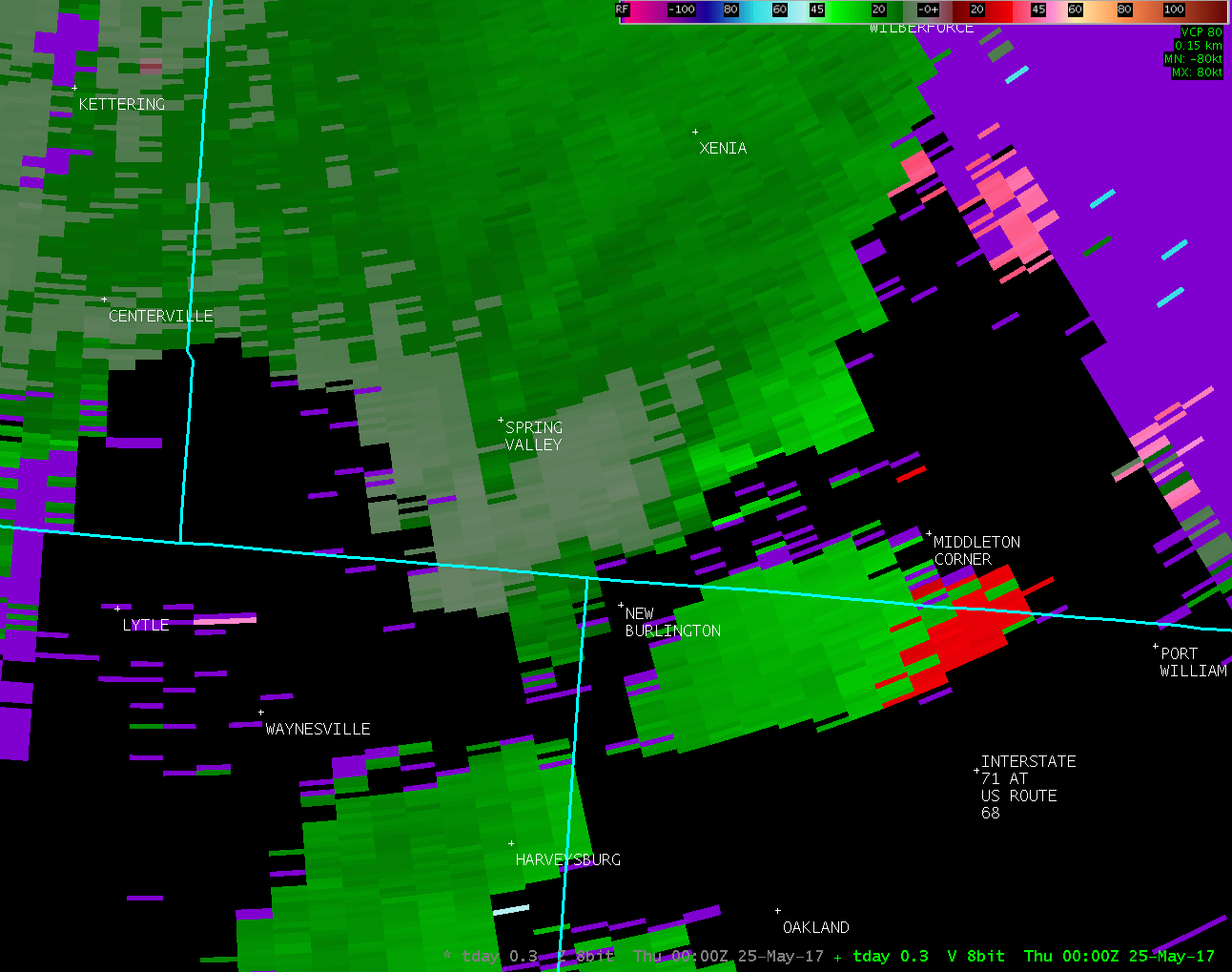
Based on radar data, video evidence and eyewitness reports, the
tornado is estimated to have touched down near the northern end
of Caesar Creek Lake. No damage was observed.
|
ORIGINAL STATEMENT
Public Information Statement
National Weather Service Wilmington OH
143 PM EDT Fri May 26 2017
...TORNADO CONFIRMED NEAR 4 NNE HARVEYSBURG IN WARREN COUNTY
OHIO...
Location...4 NNE Harveysburg in Warren County Ohio
Date...May 24 2017
Estimated Start Time...7:55 PM EDT
Estimated End Time...7:55 PM EDT
Maximum EF-Scale Rating...EF0
Estimated Maximum Wind Speed...50 MPH
Maximum Path Width...25 Yards
Path Length....0.25 Miles
Beginning Lat/Lon...39.5527N / 83.9794W
Ending lat/Lon...39.5552N / 83.9822 W
* Fatalities...0
* Injuries...0
* The information in this statement is preliminary and subject to
change pending final review of the event(s) and publication in
NWS Storm Data.
...Summary...
The National Weather Service in Wilmington OH has confirmed a
tornado near 4 NNE Harveysburg in Warren County Ohio on May
24 2017.
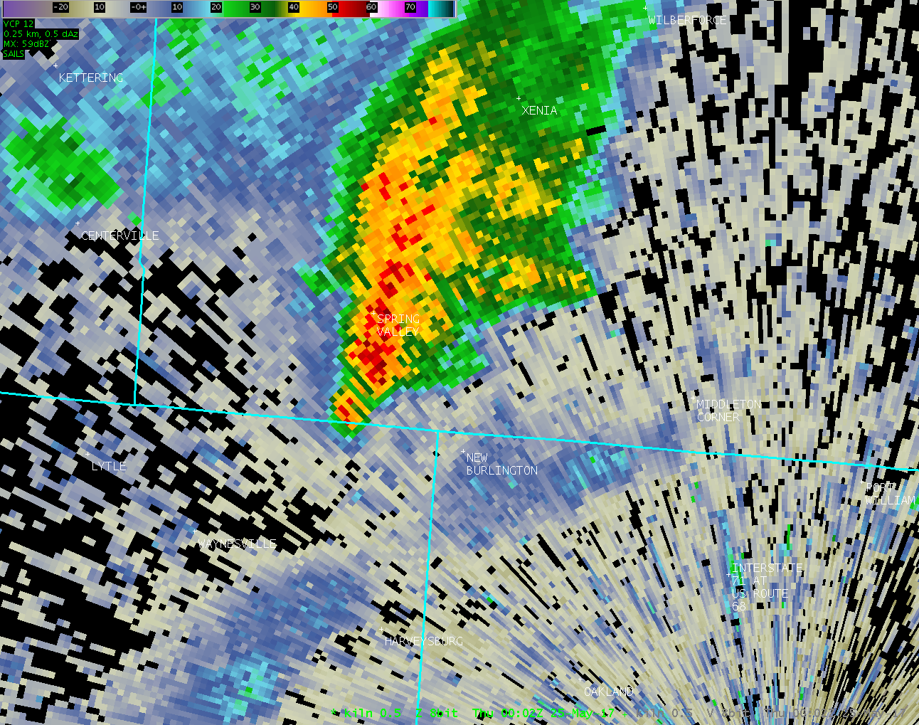
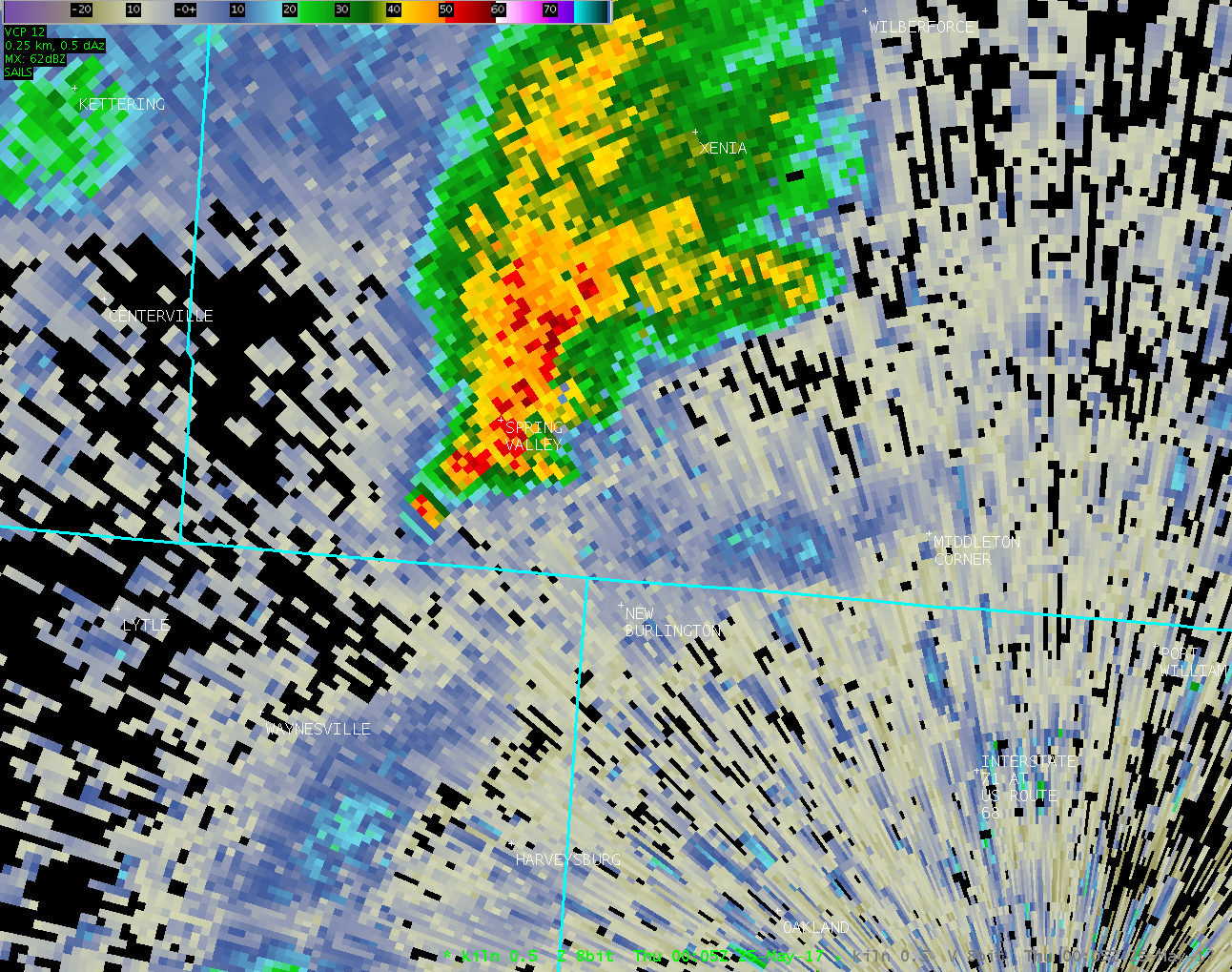
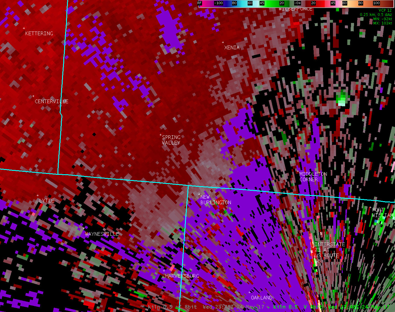
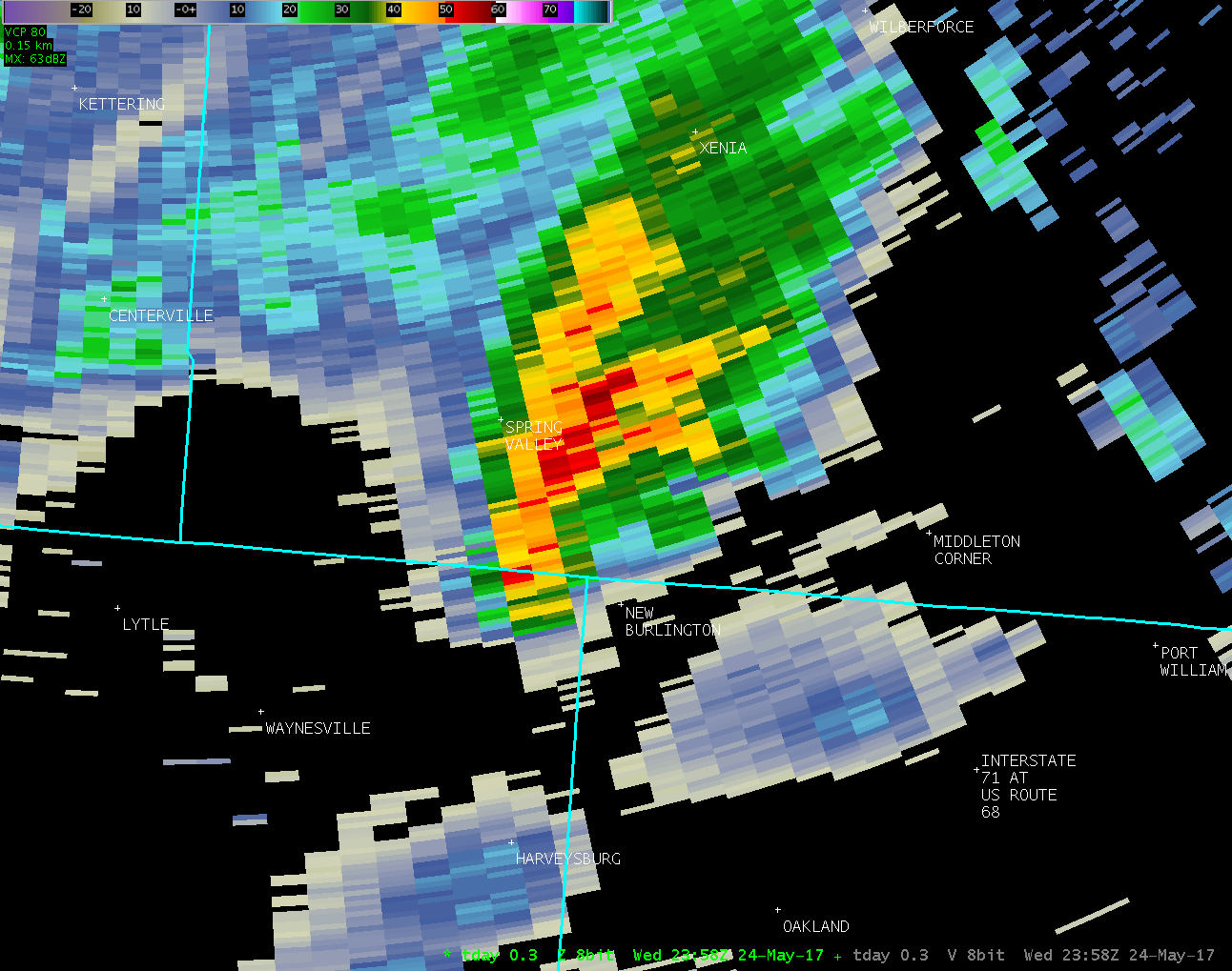
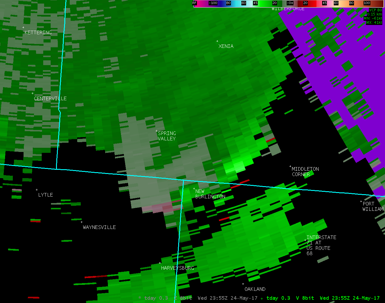
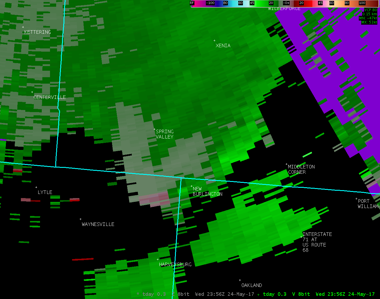
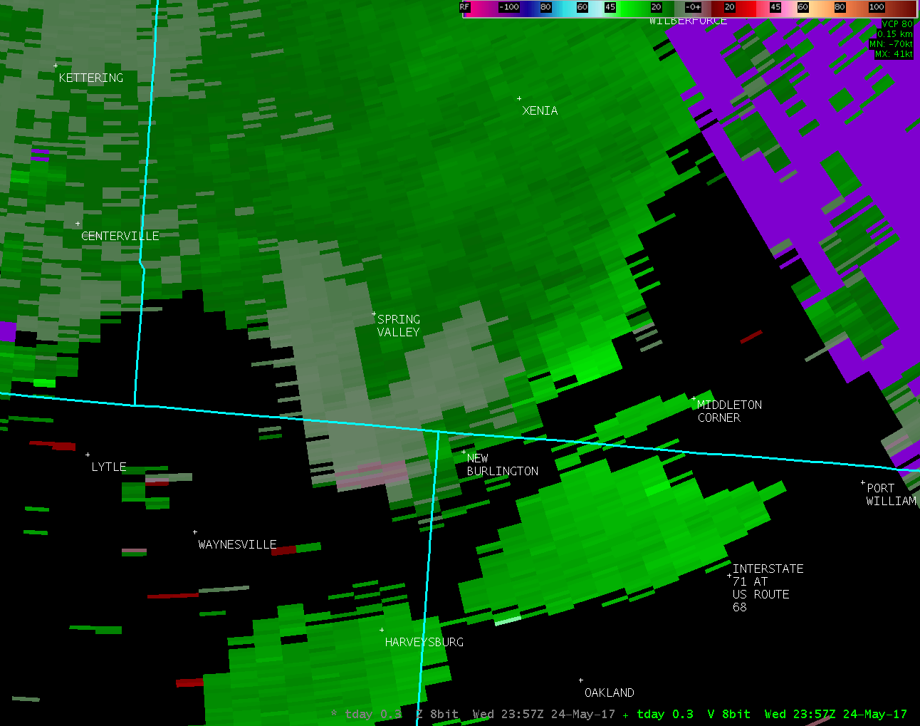
Based on radar data, video evidence and eyewitness reports, the
tornado appeared to briefly touch down in a farm field about 4
miles NNE of Harveysburg in extreme northeast Warren County.
No damage was observed so the maximum winds were estimated to be
50 MPH, equivalent to a weak EF0 tornado.
For reference: the Enhanced Fujita Scale classifies tornadoes
into the following categories:
EF0...wind speeds 65 to 85 mph.
EF1...wind speeds 86 to 110 mph.
EF2...wind speeds 111 to 135 mph.
EF3...wind speeds 136 to 165 mph.
EF4...wind speeds 166 to 200 mph.
EF5...wind speeds greater than 200 mph.
$$
|

