|
Two Tornadoes in Clark County, Ohio |
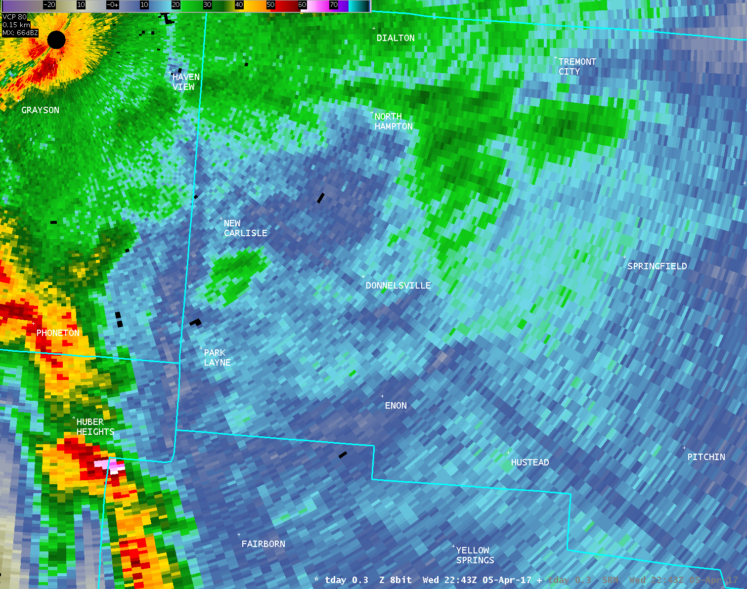
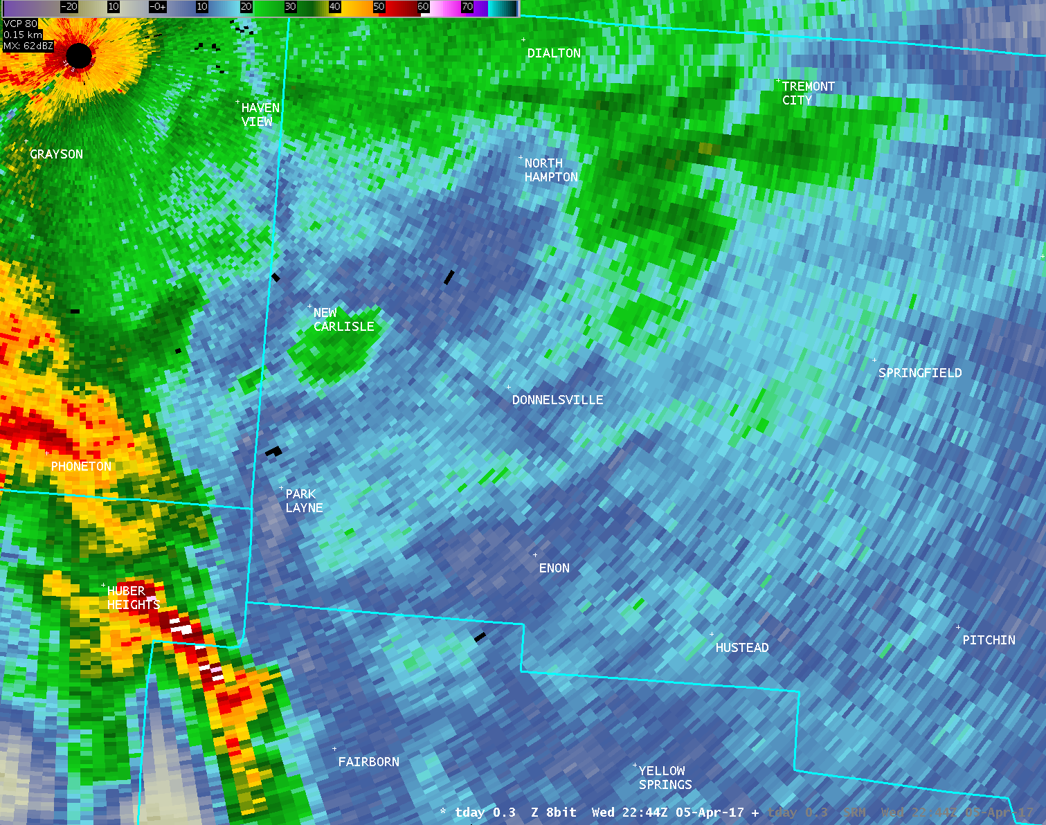
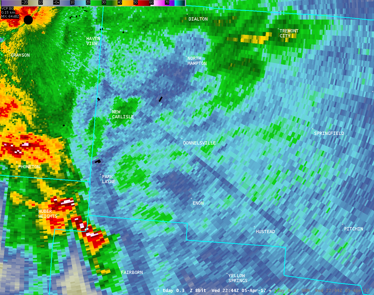
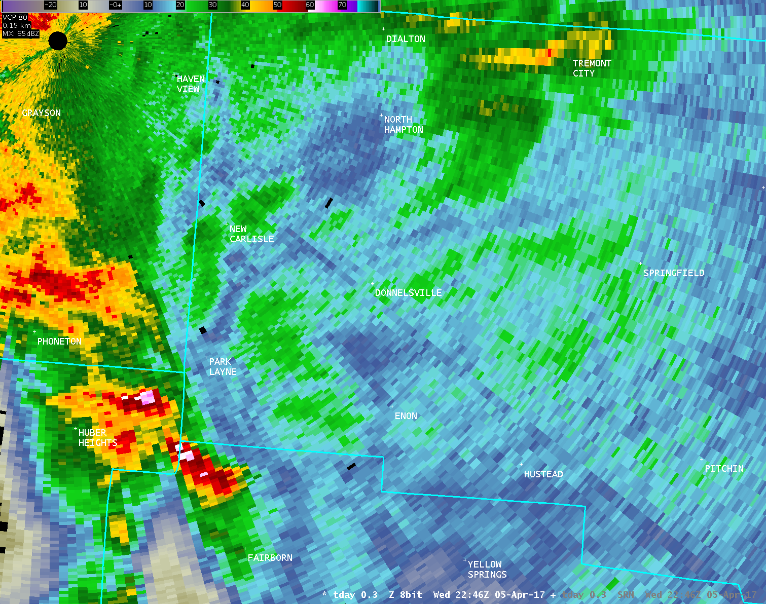
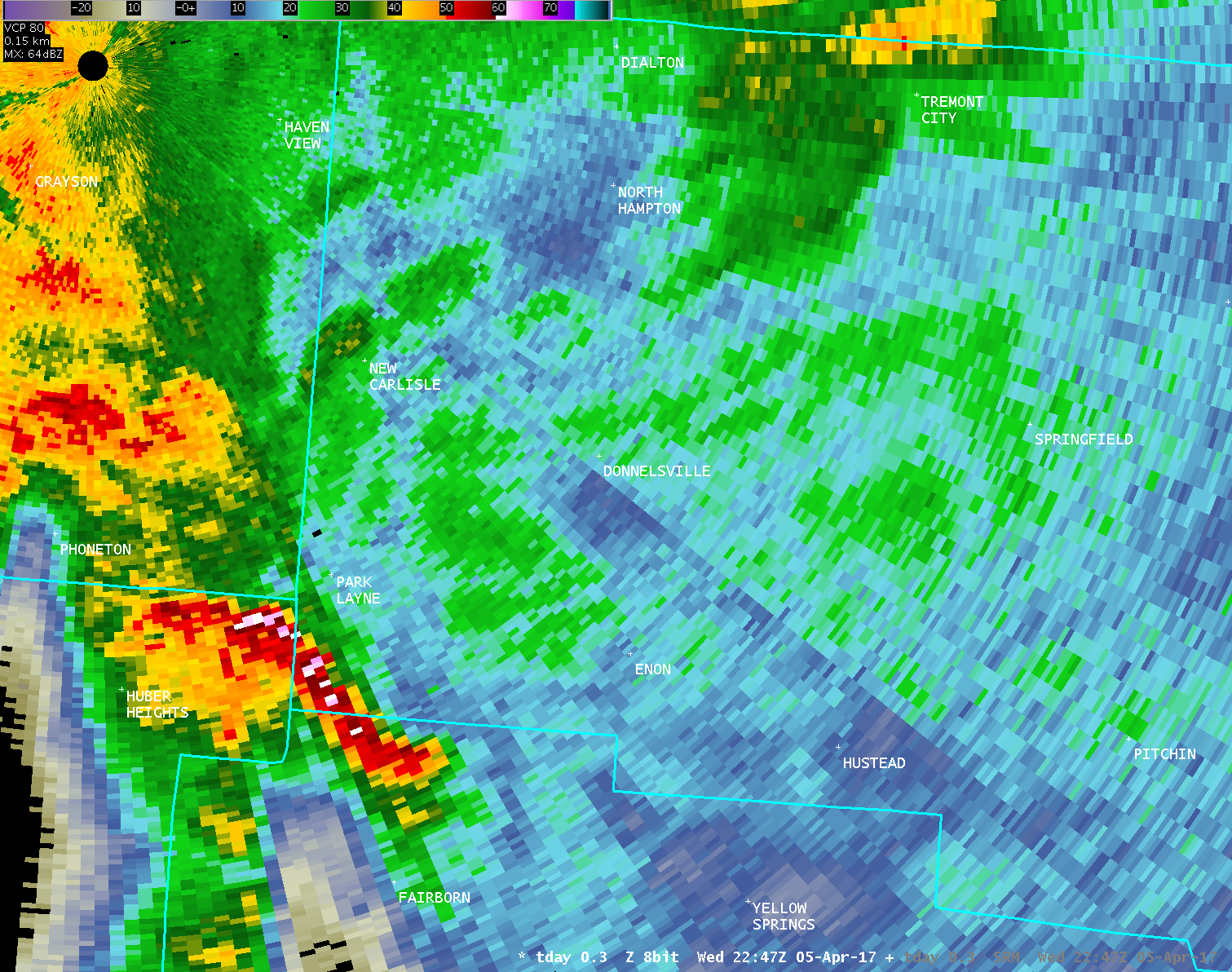
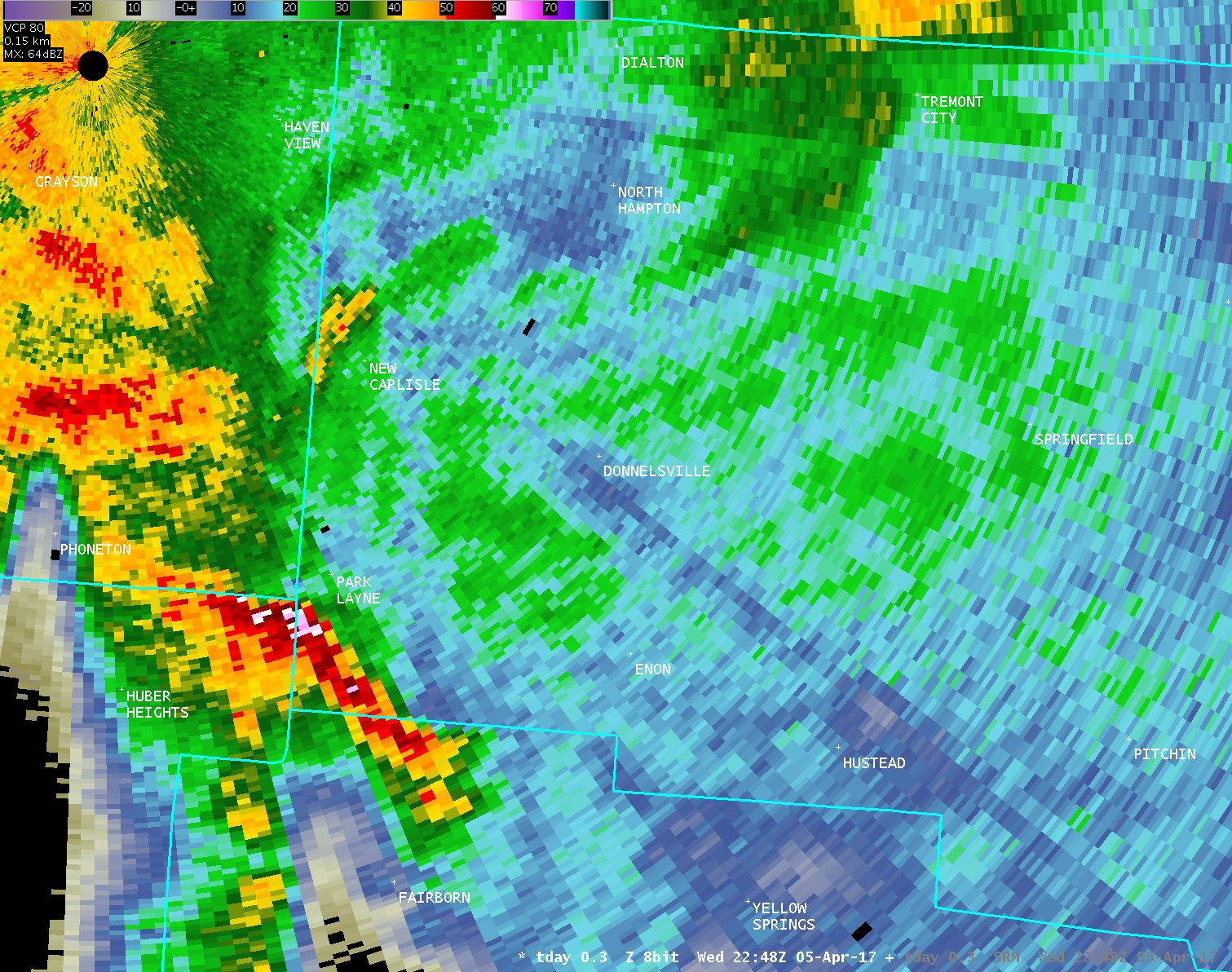
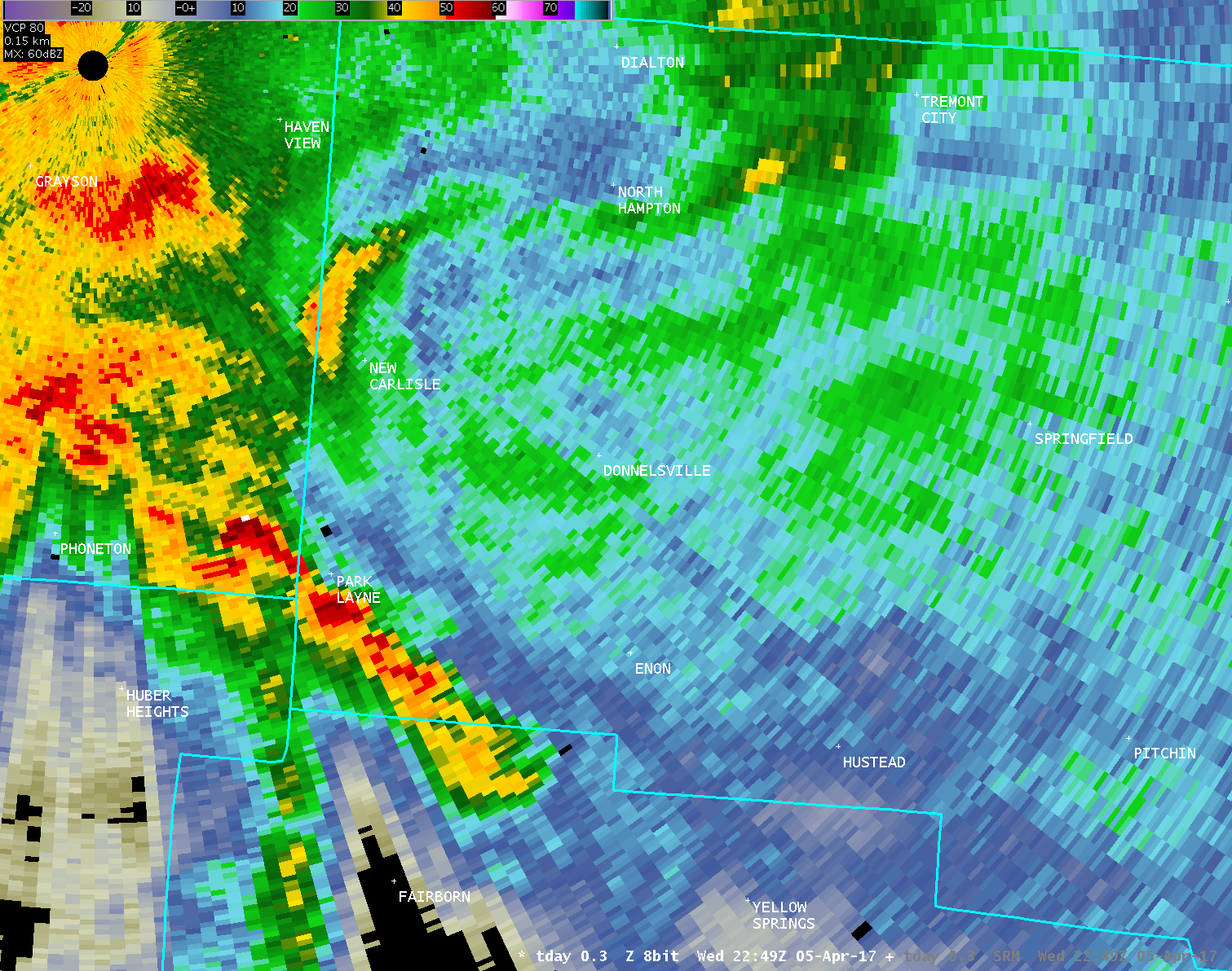
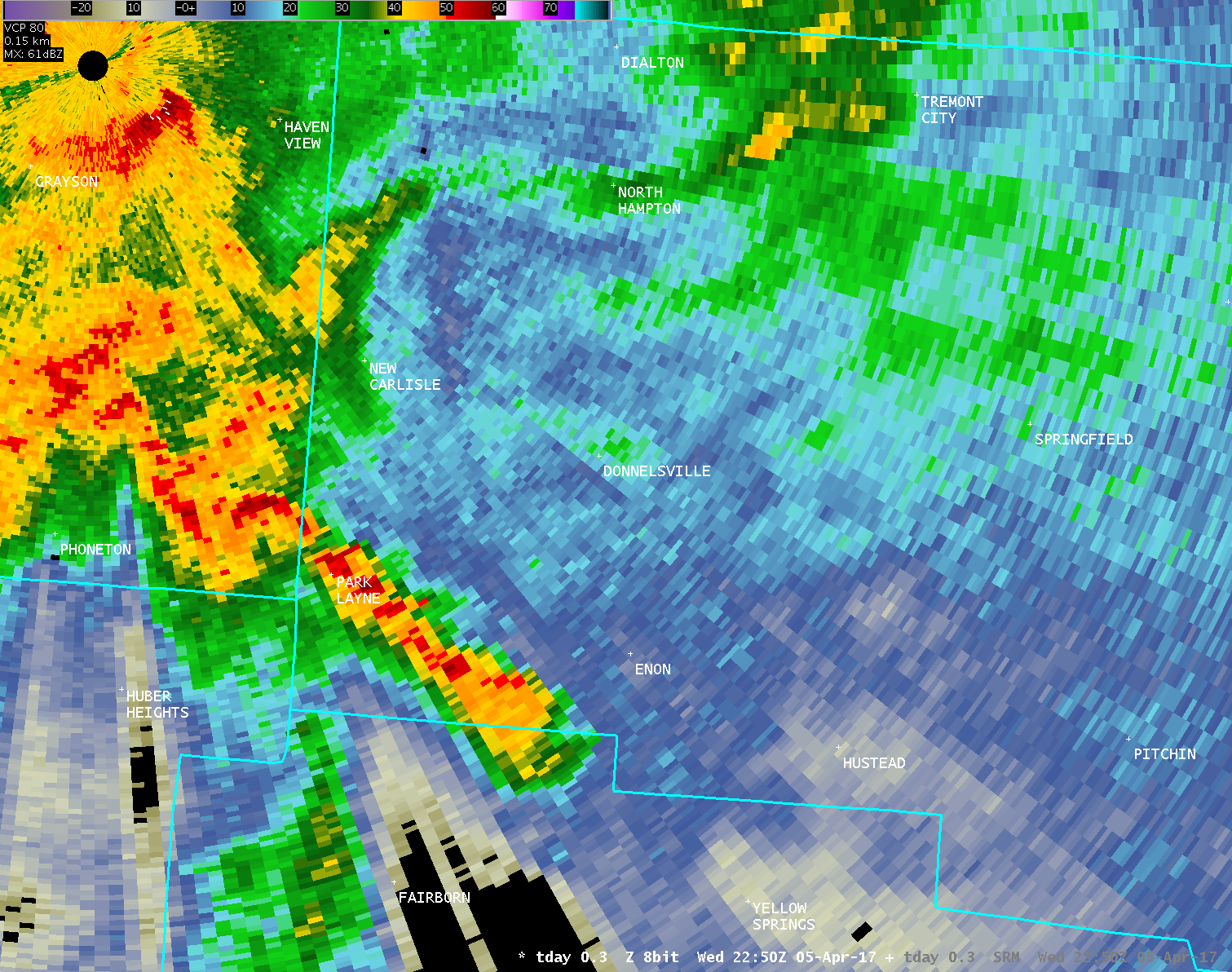
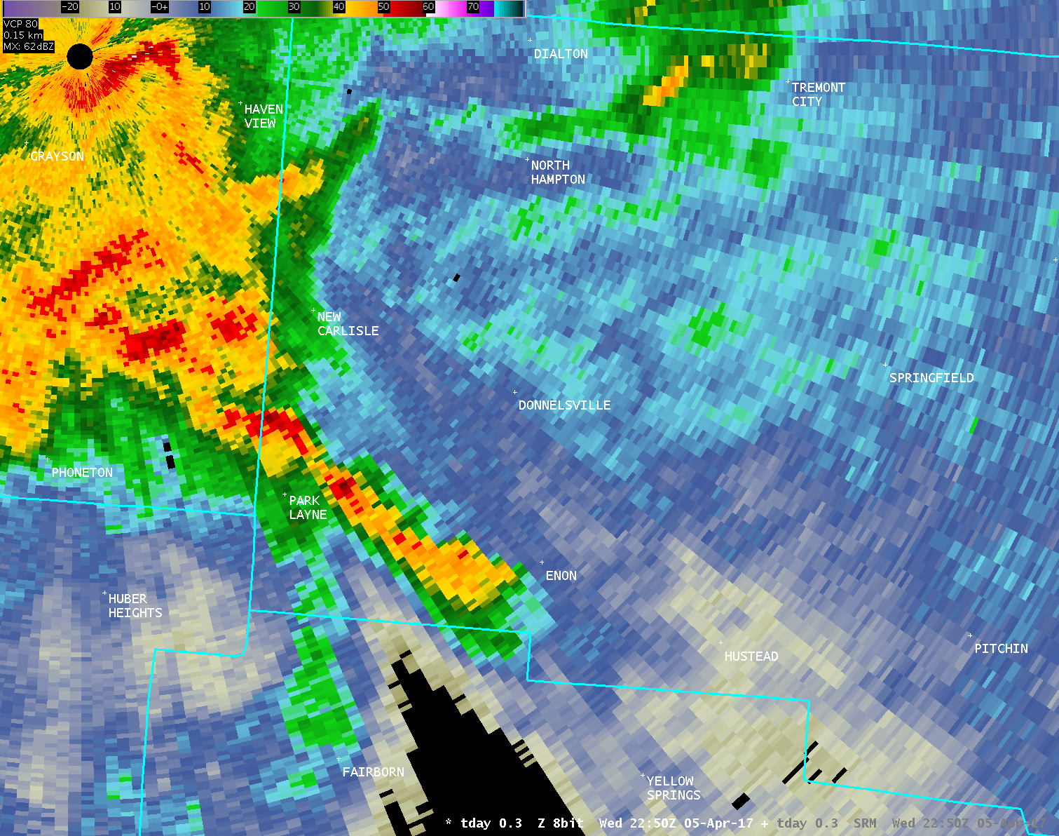
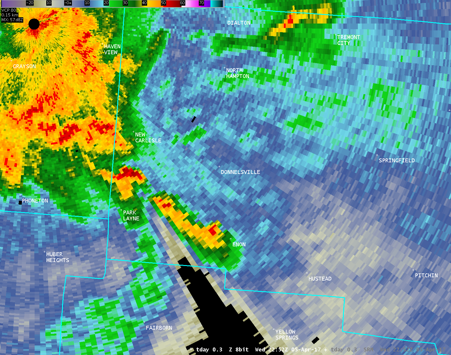
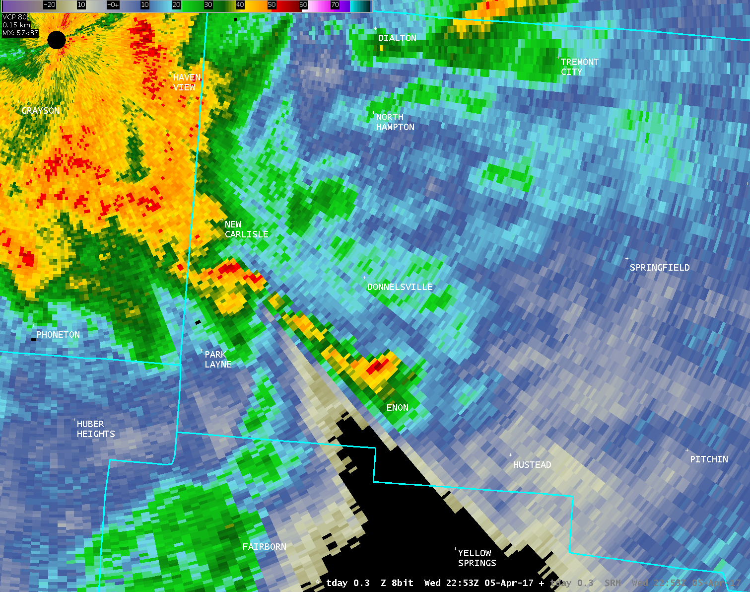
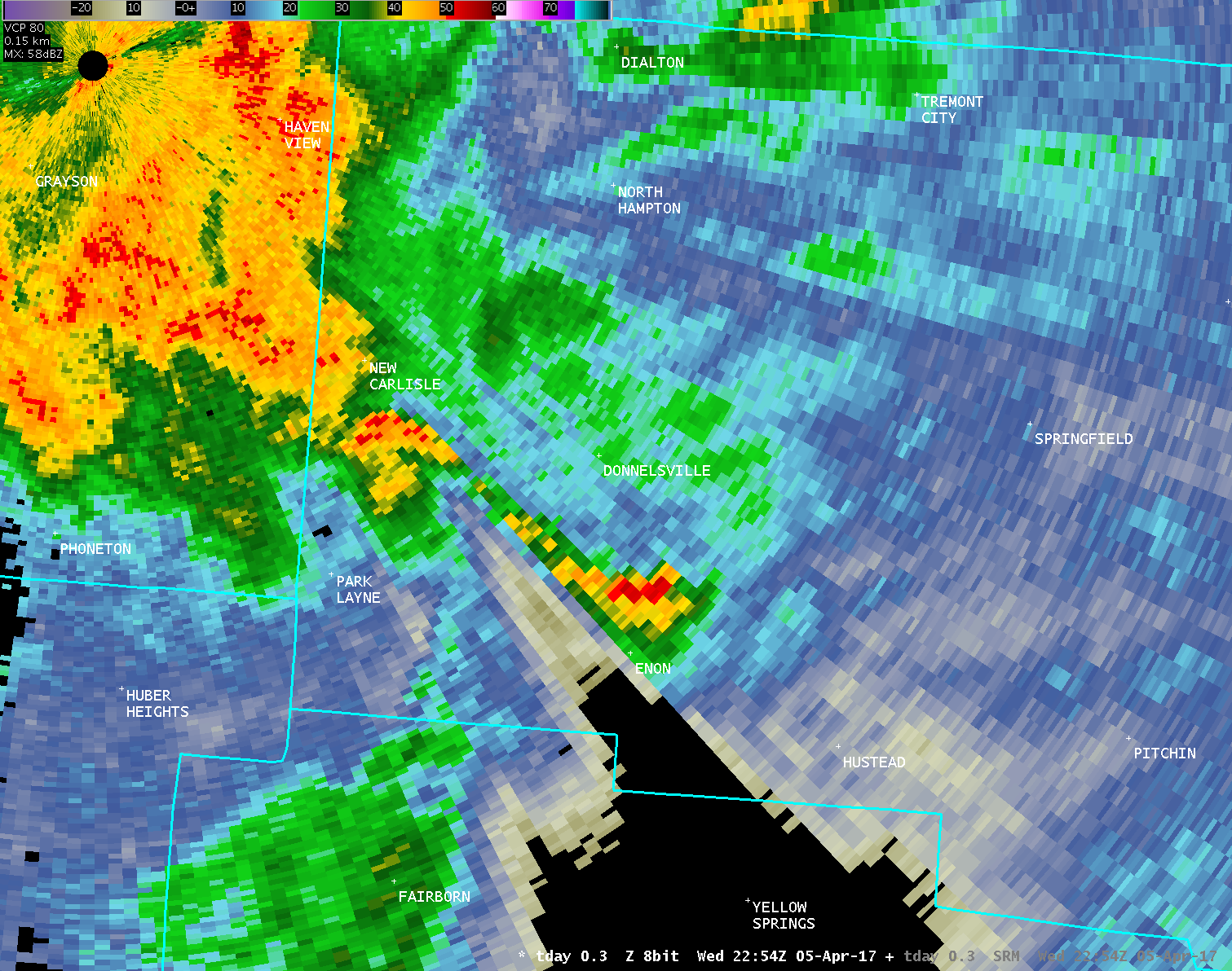
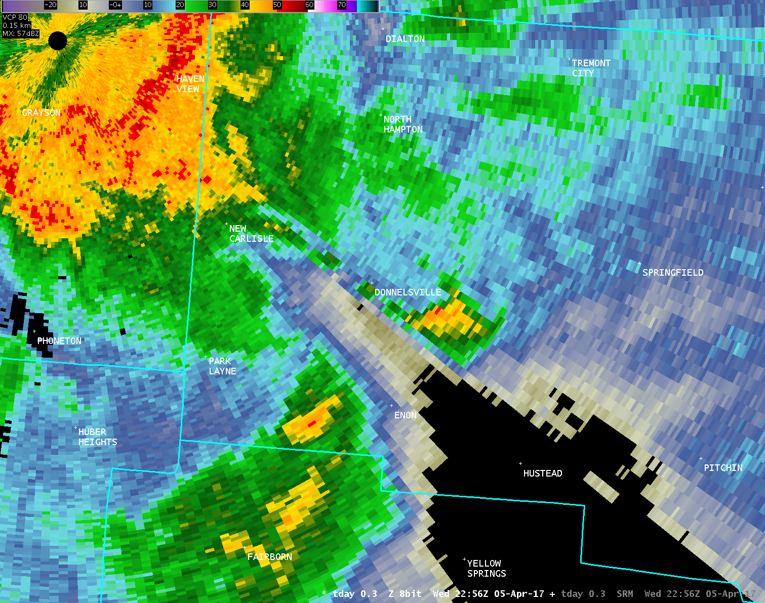
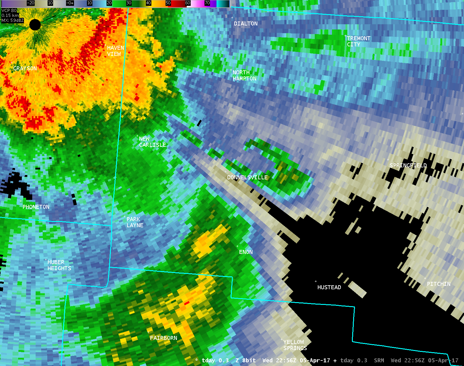
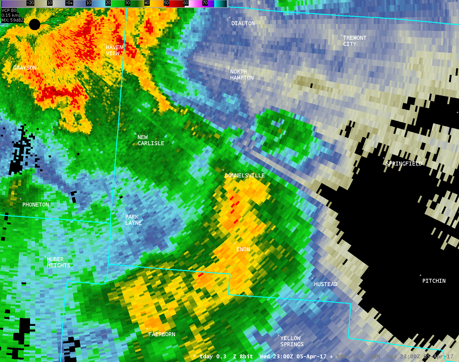
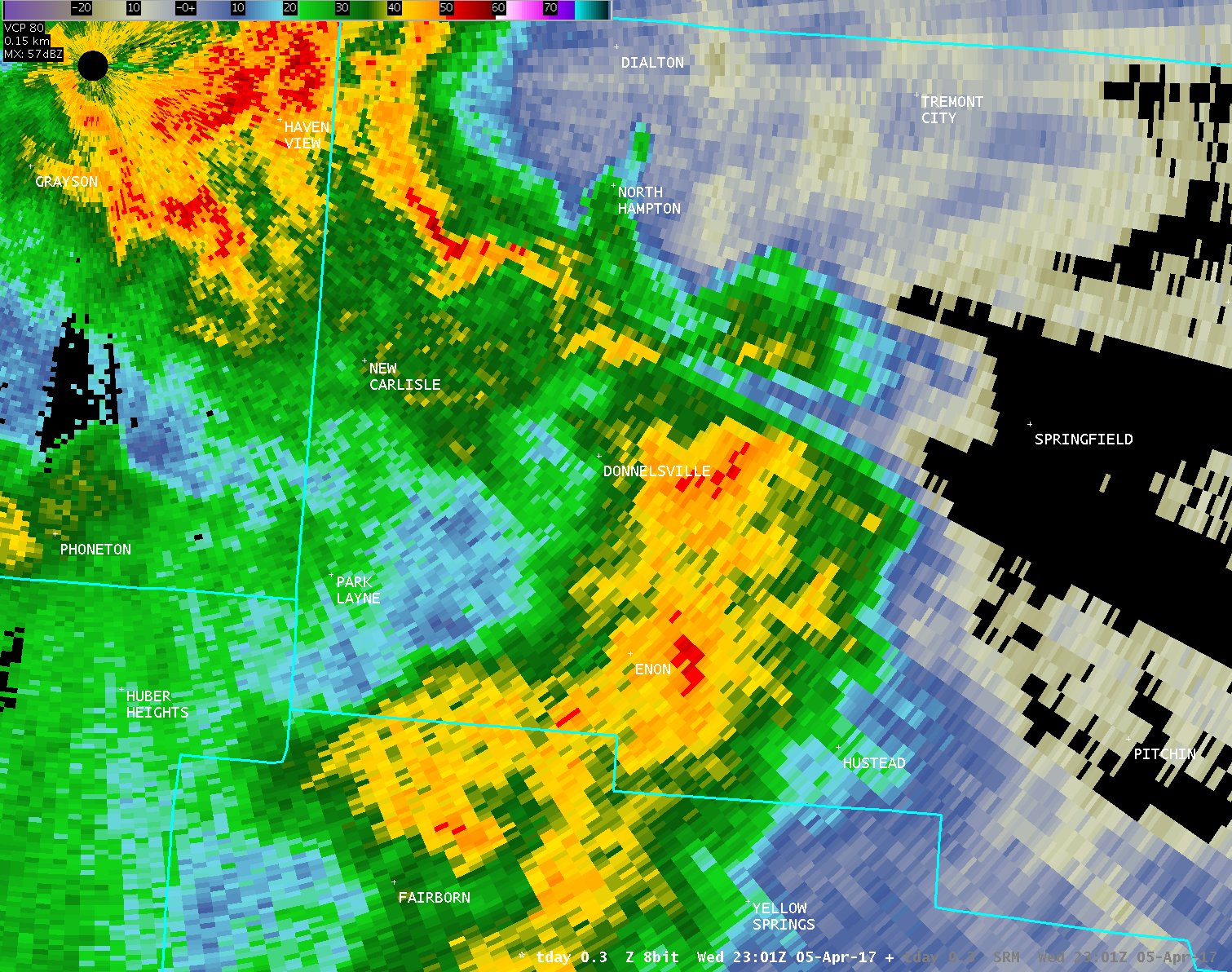
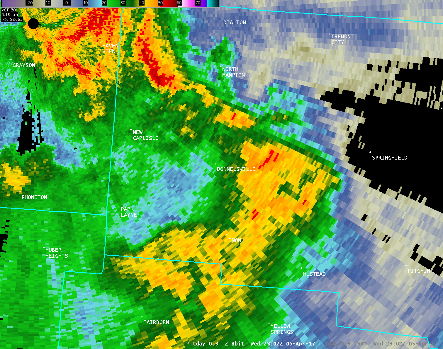
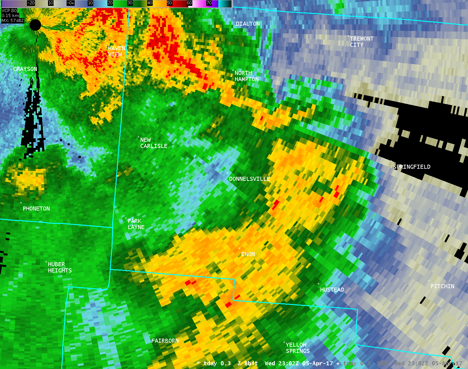
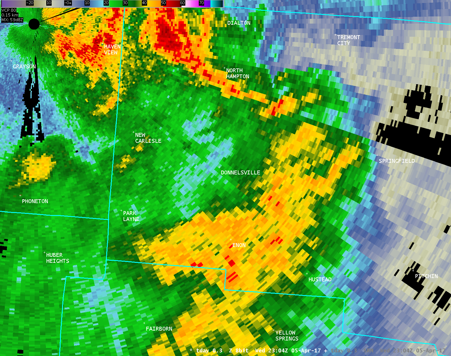
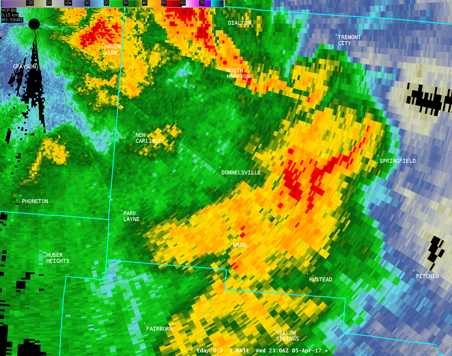
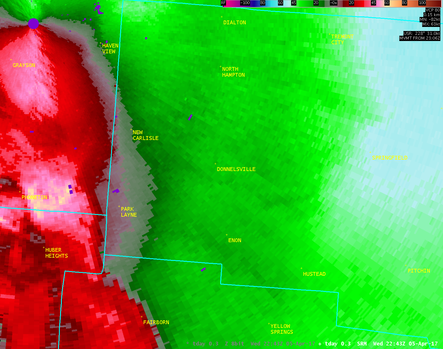
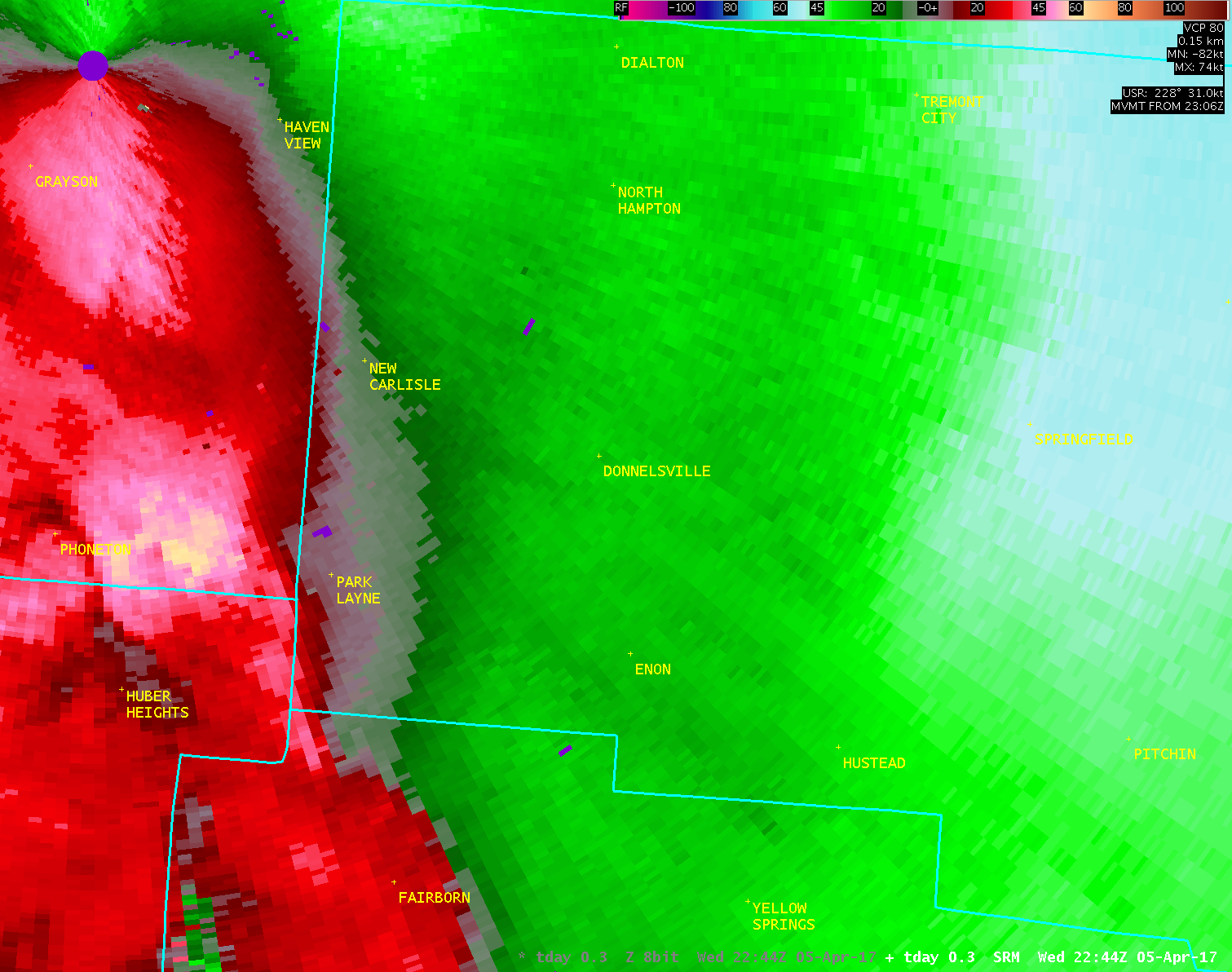
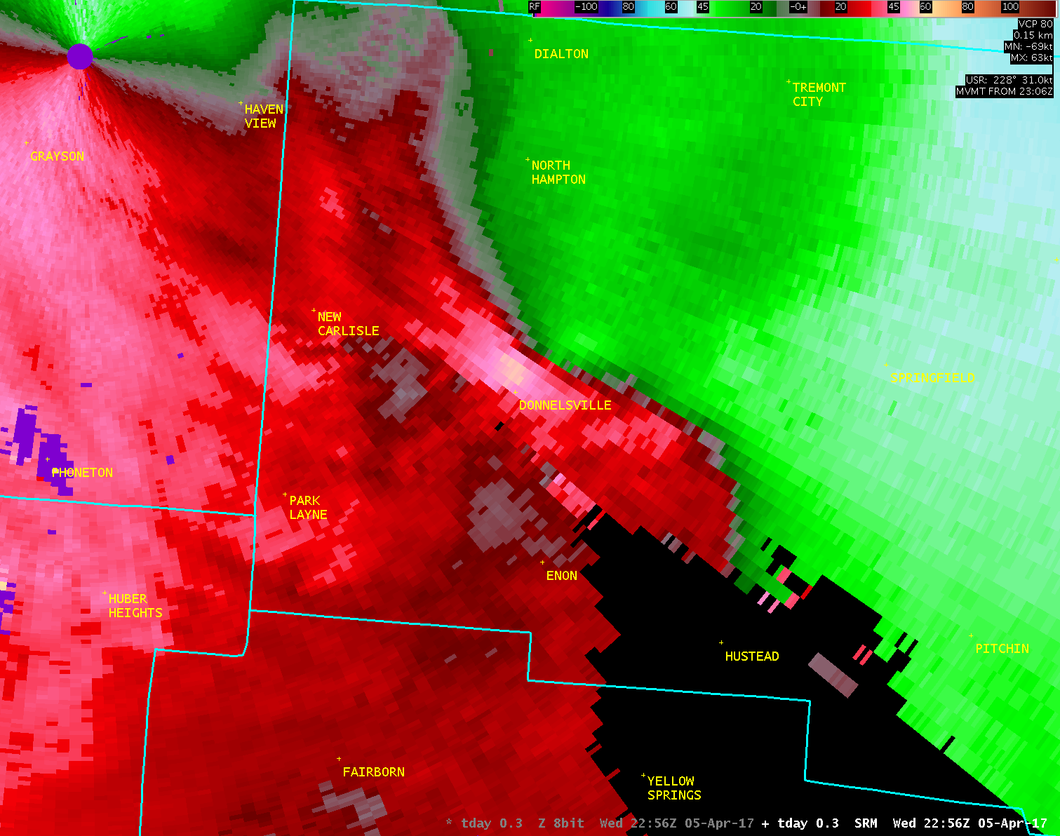
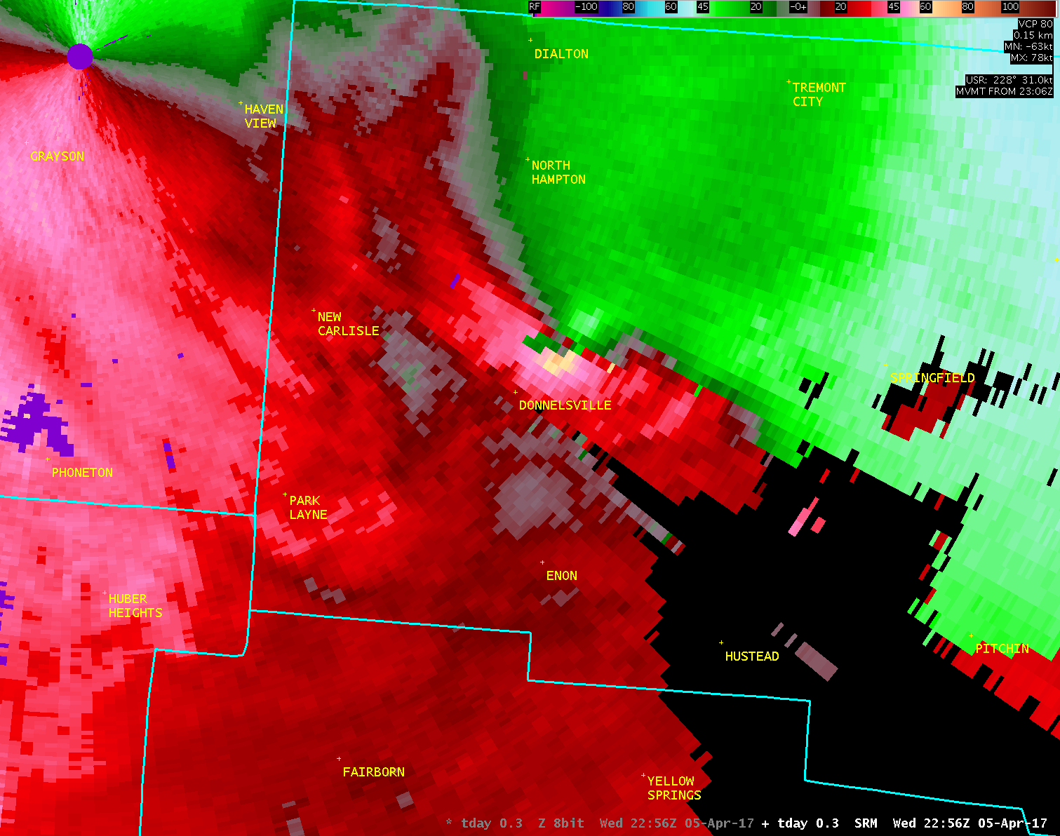
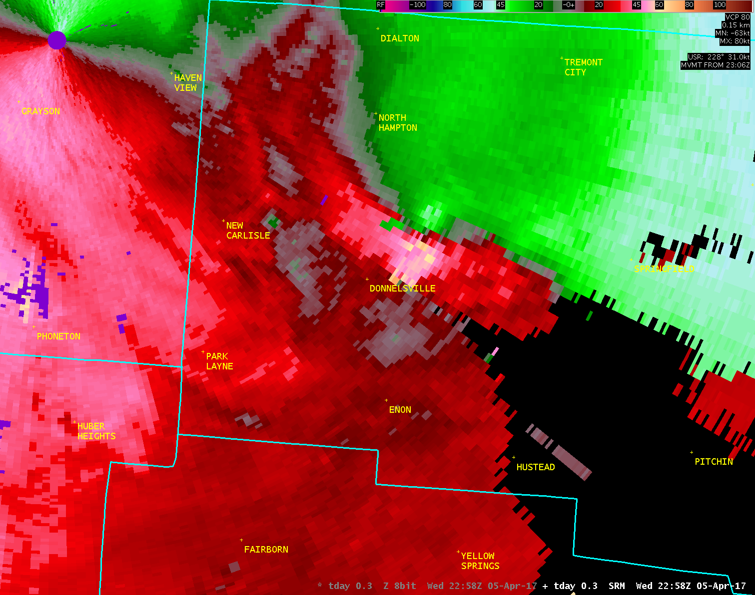
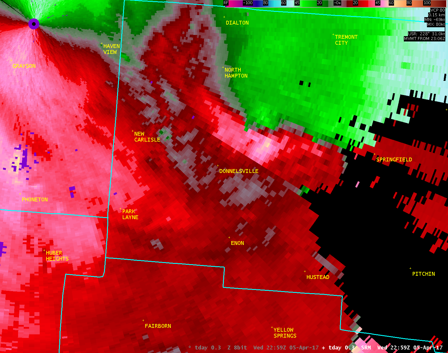
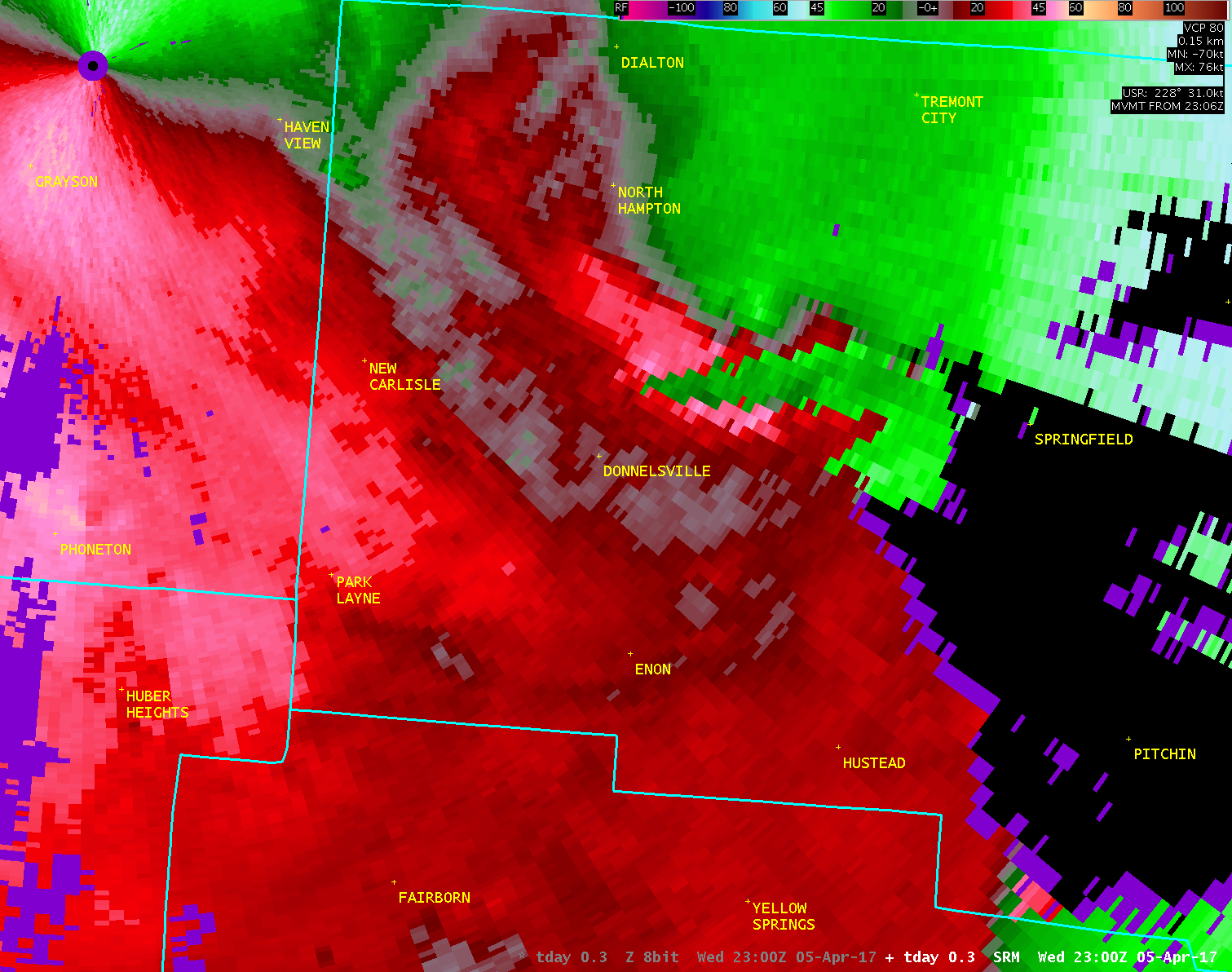
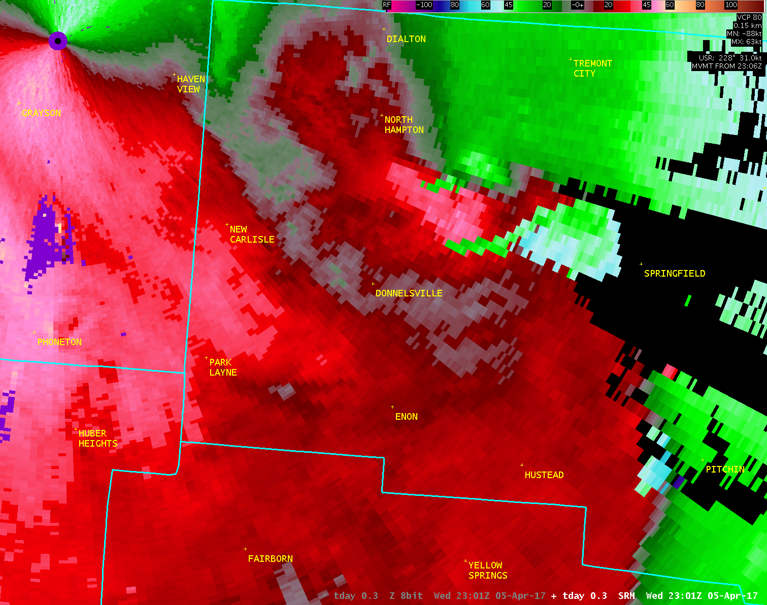
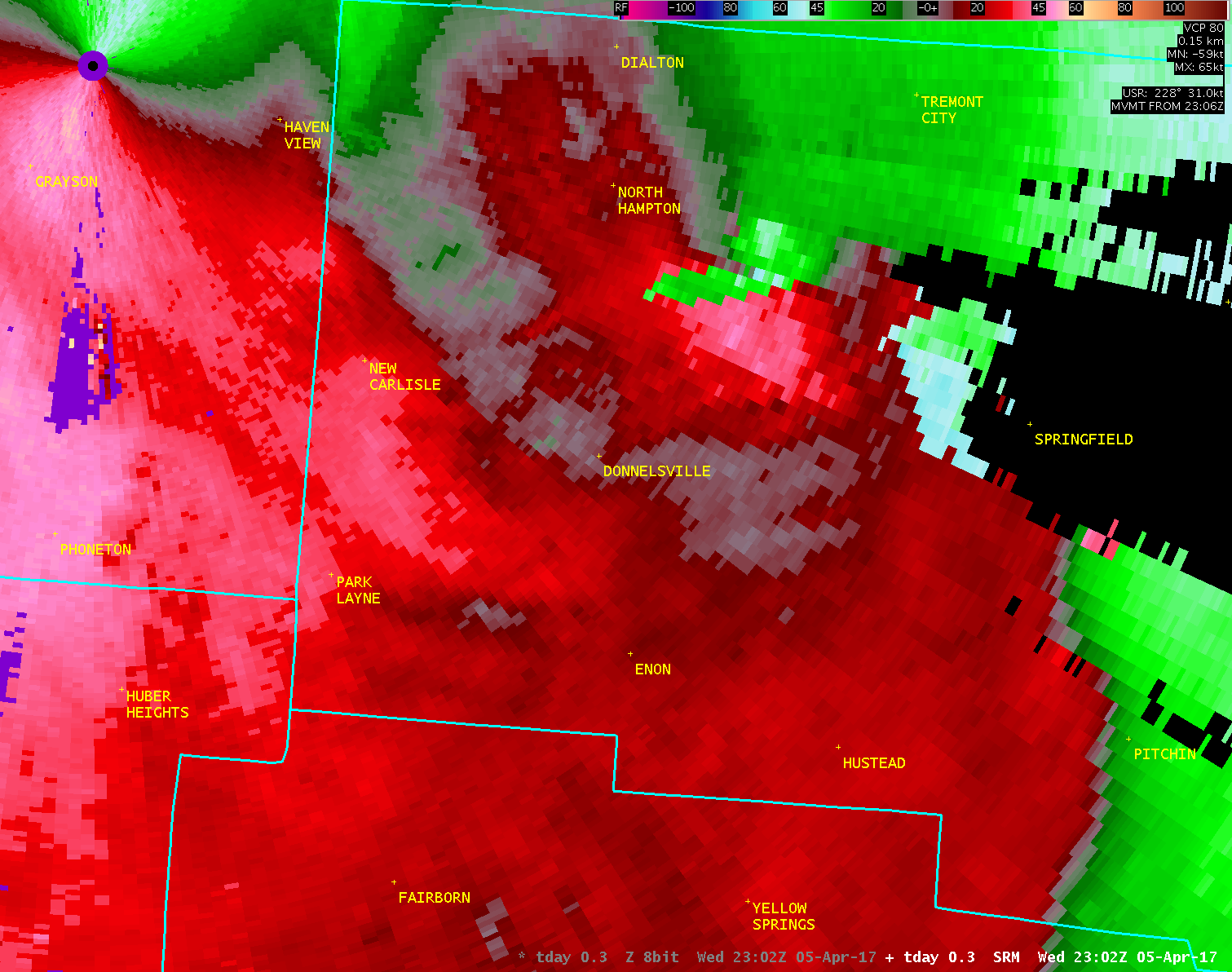
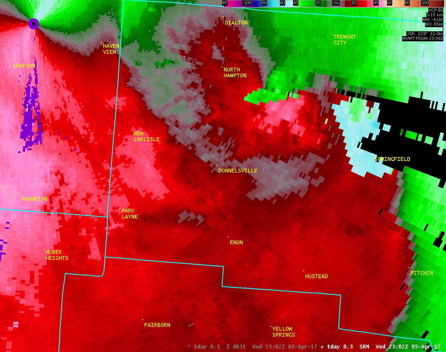
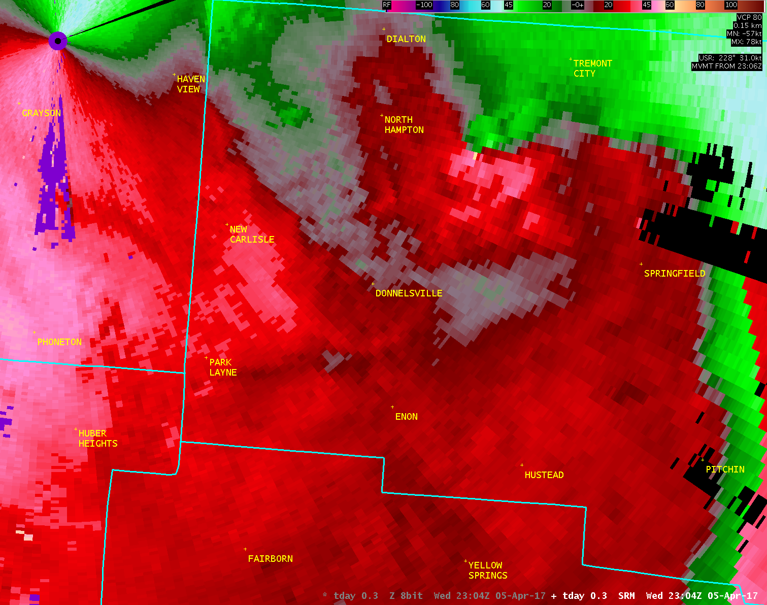
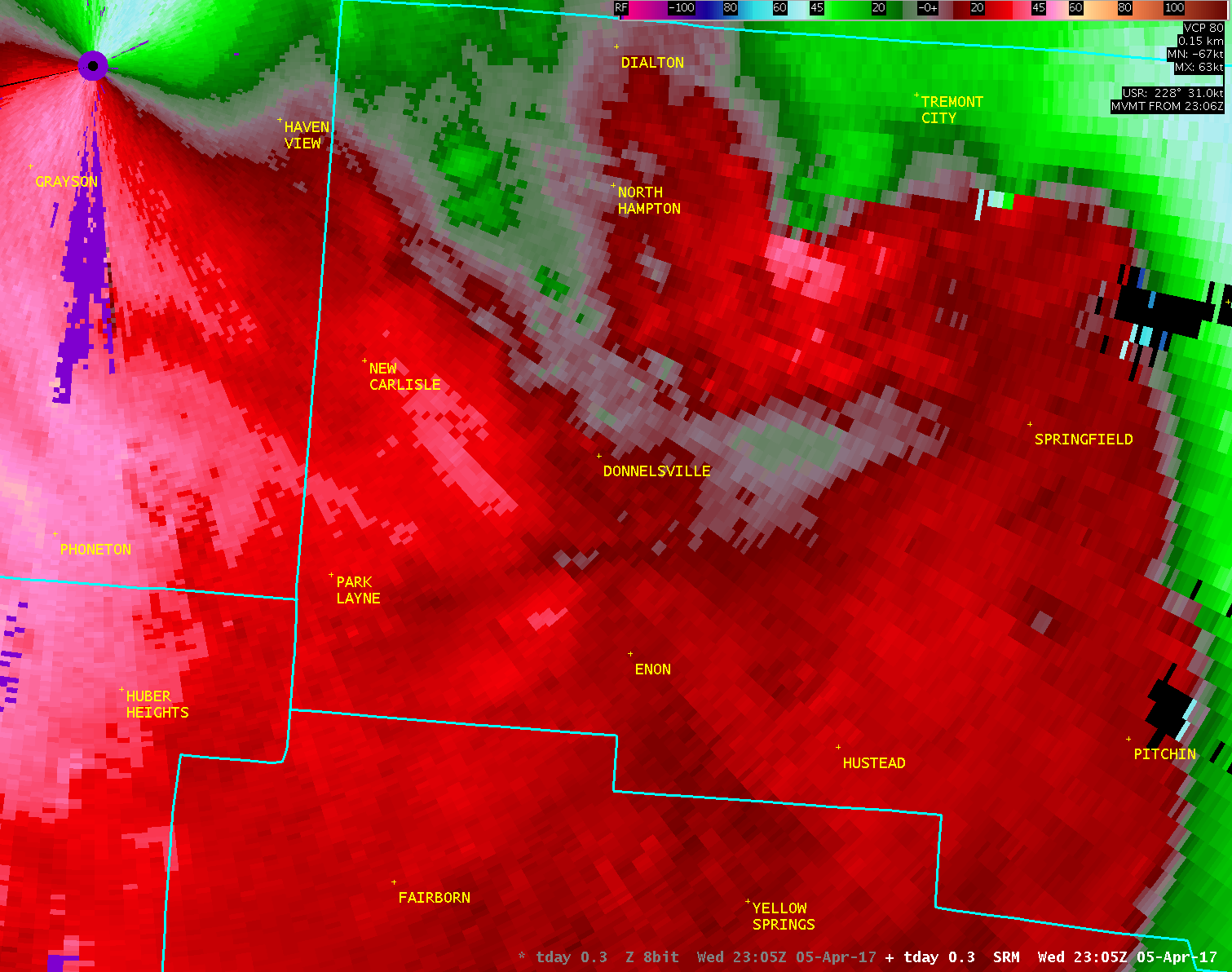
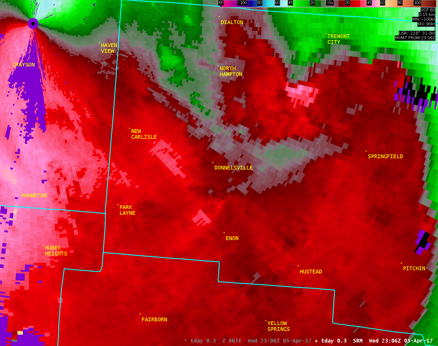
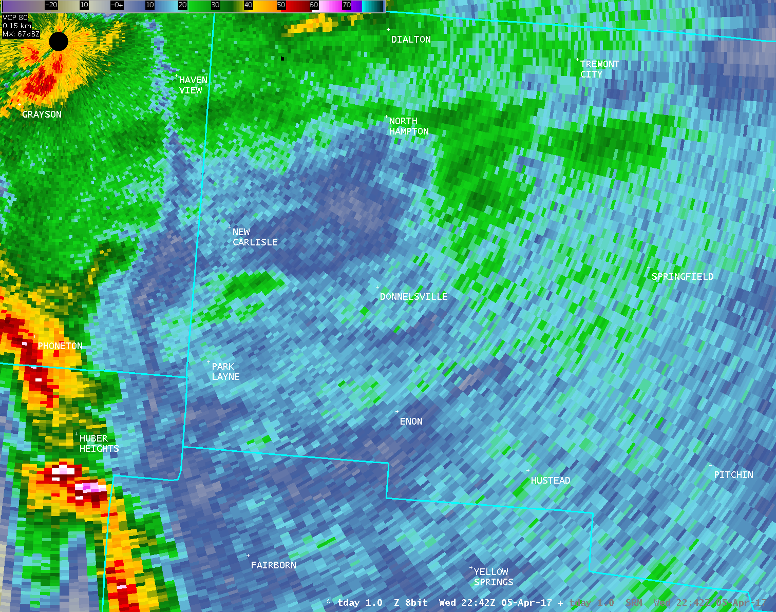
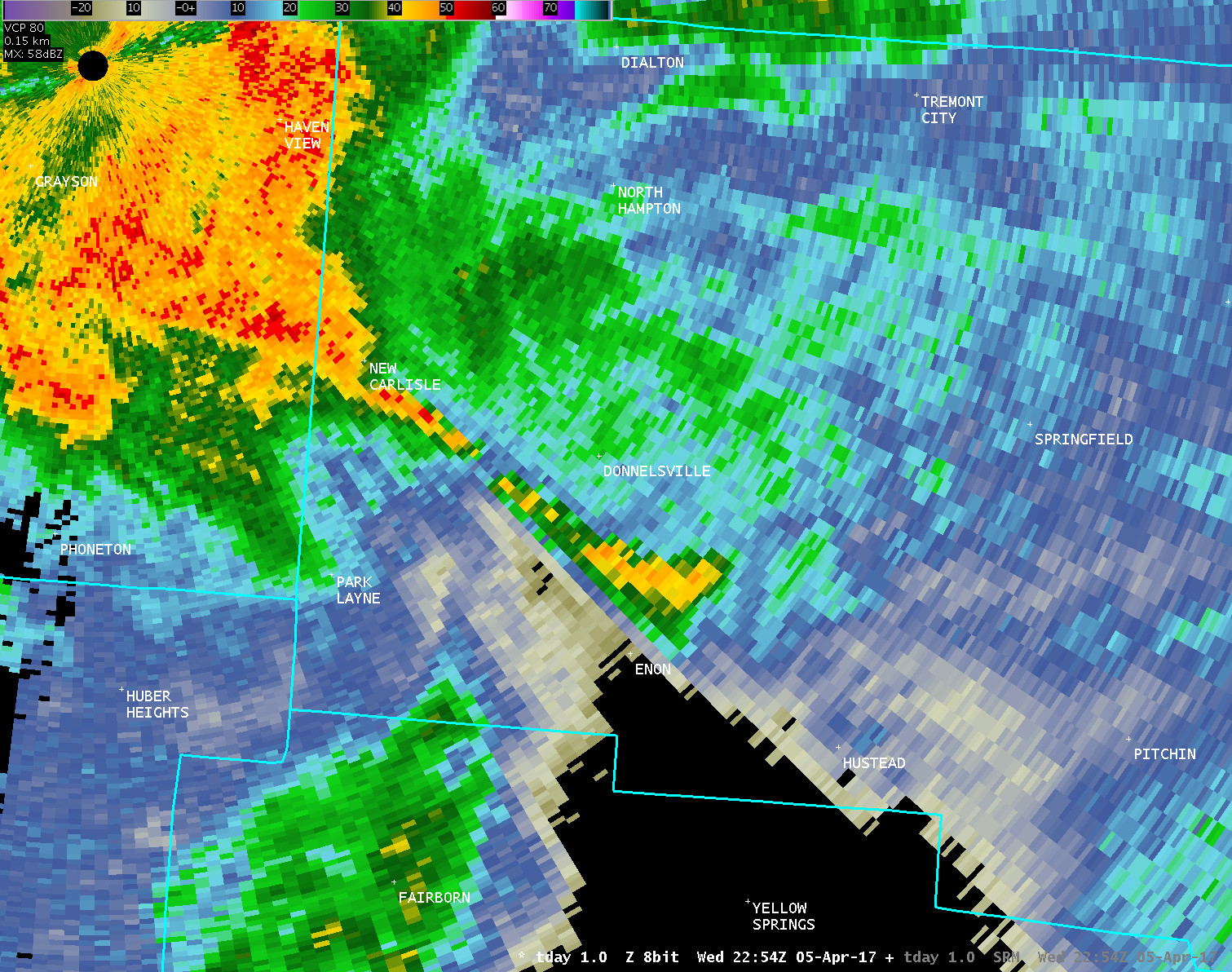
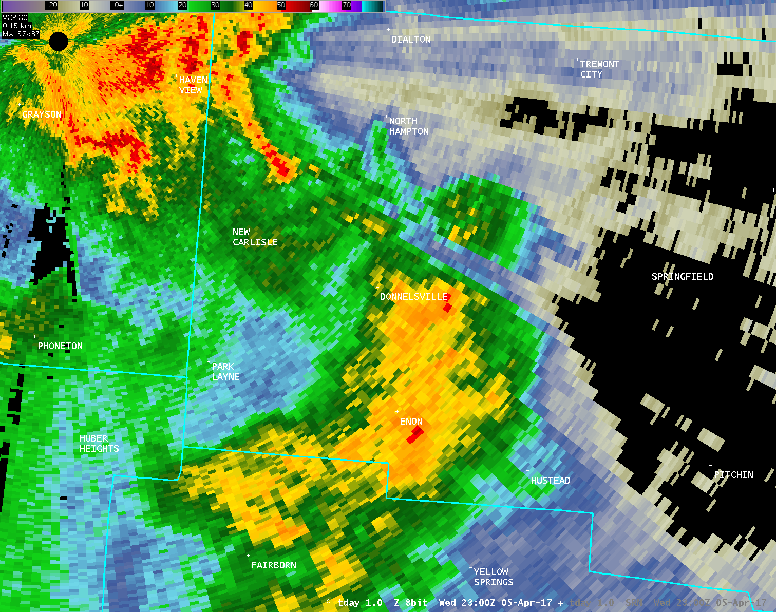
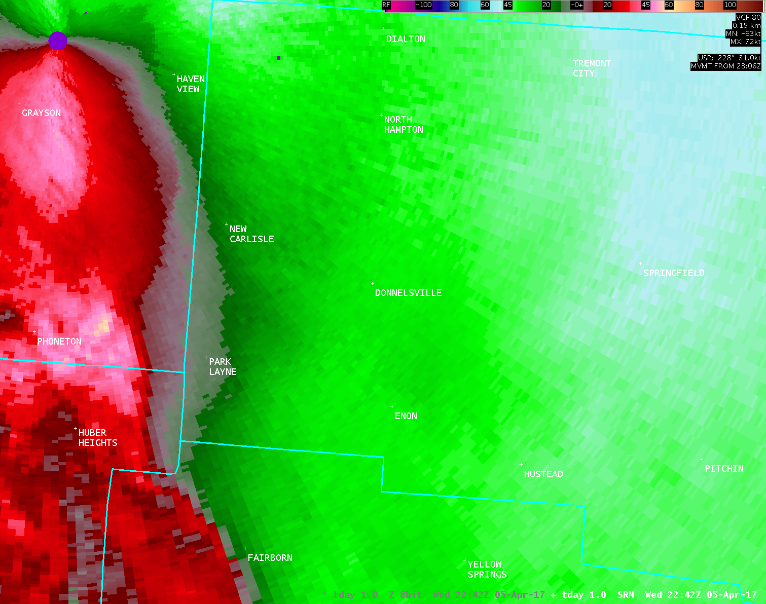
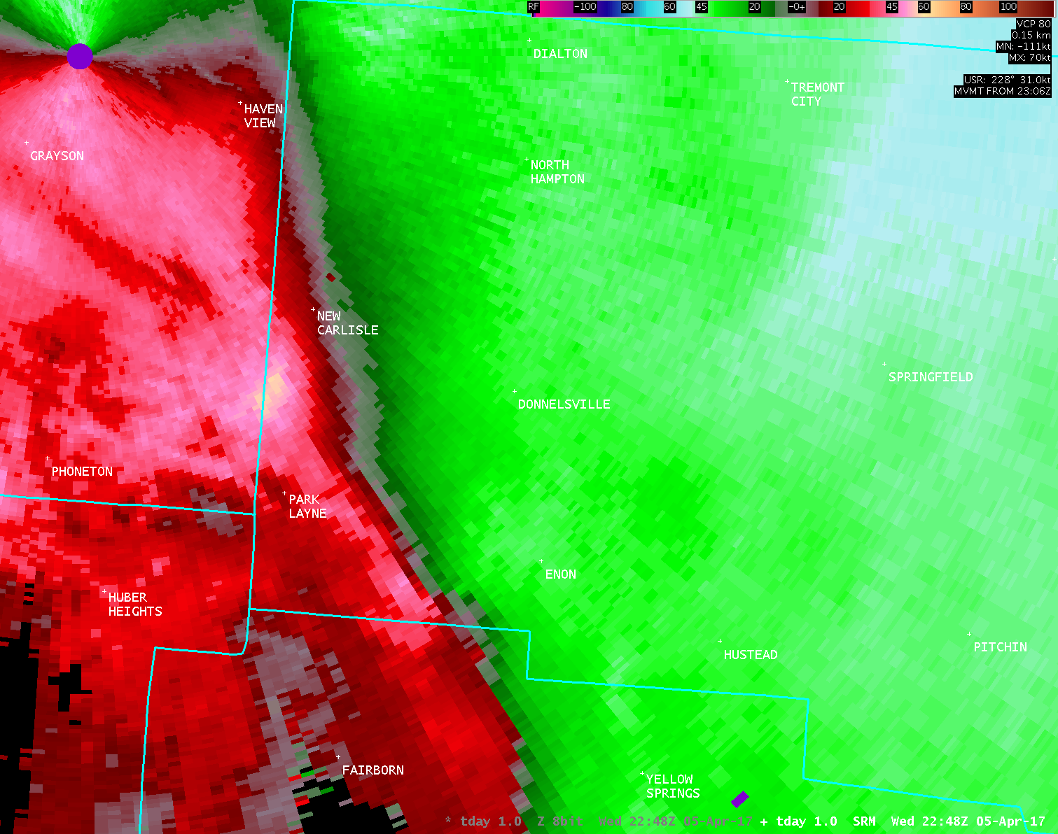
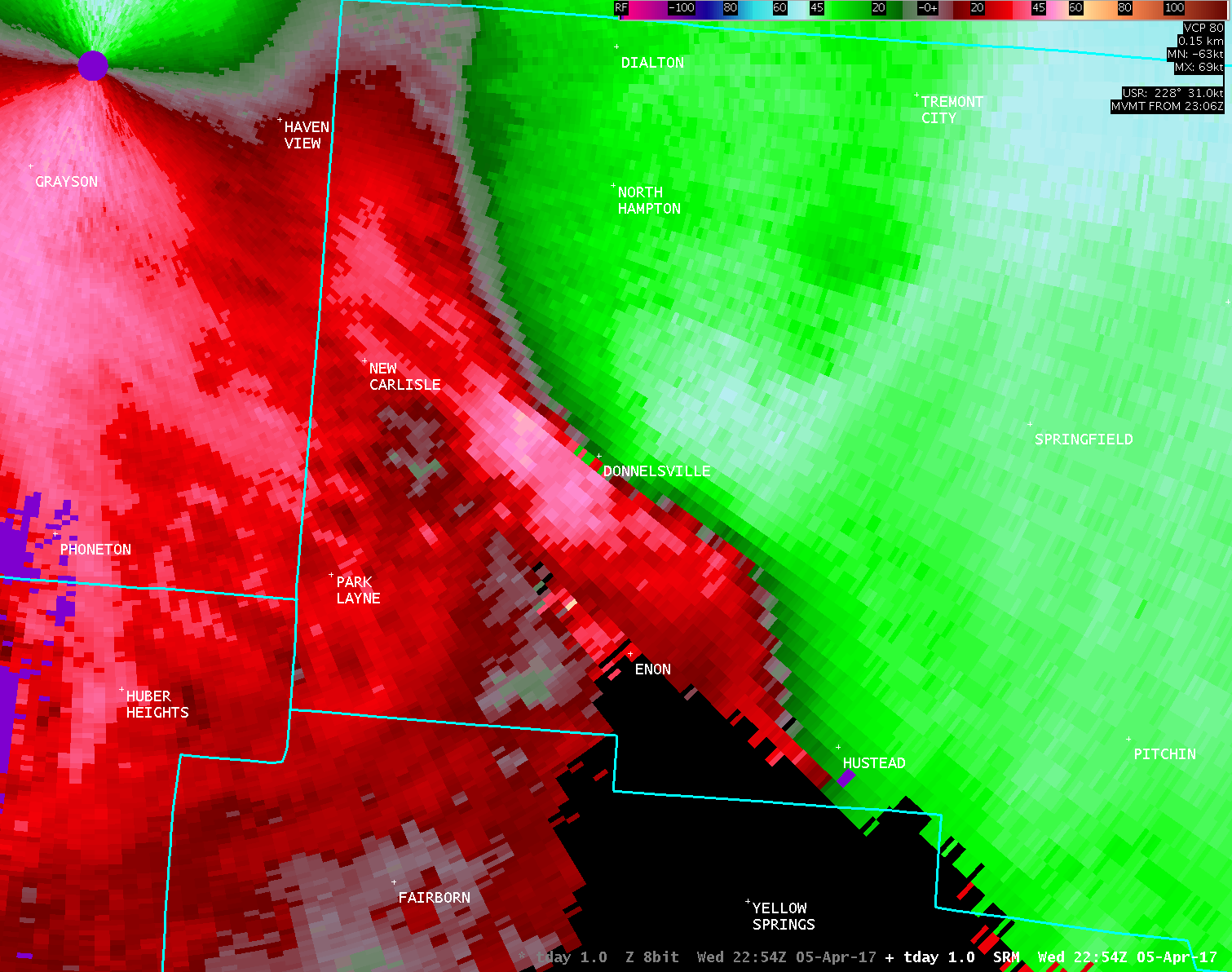
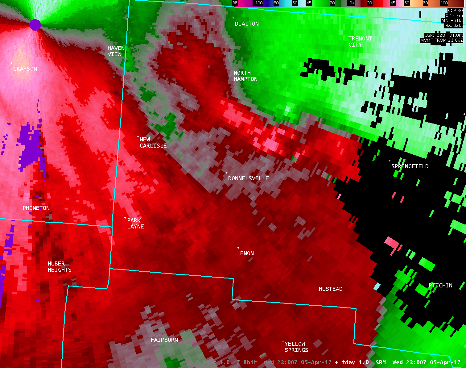
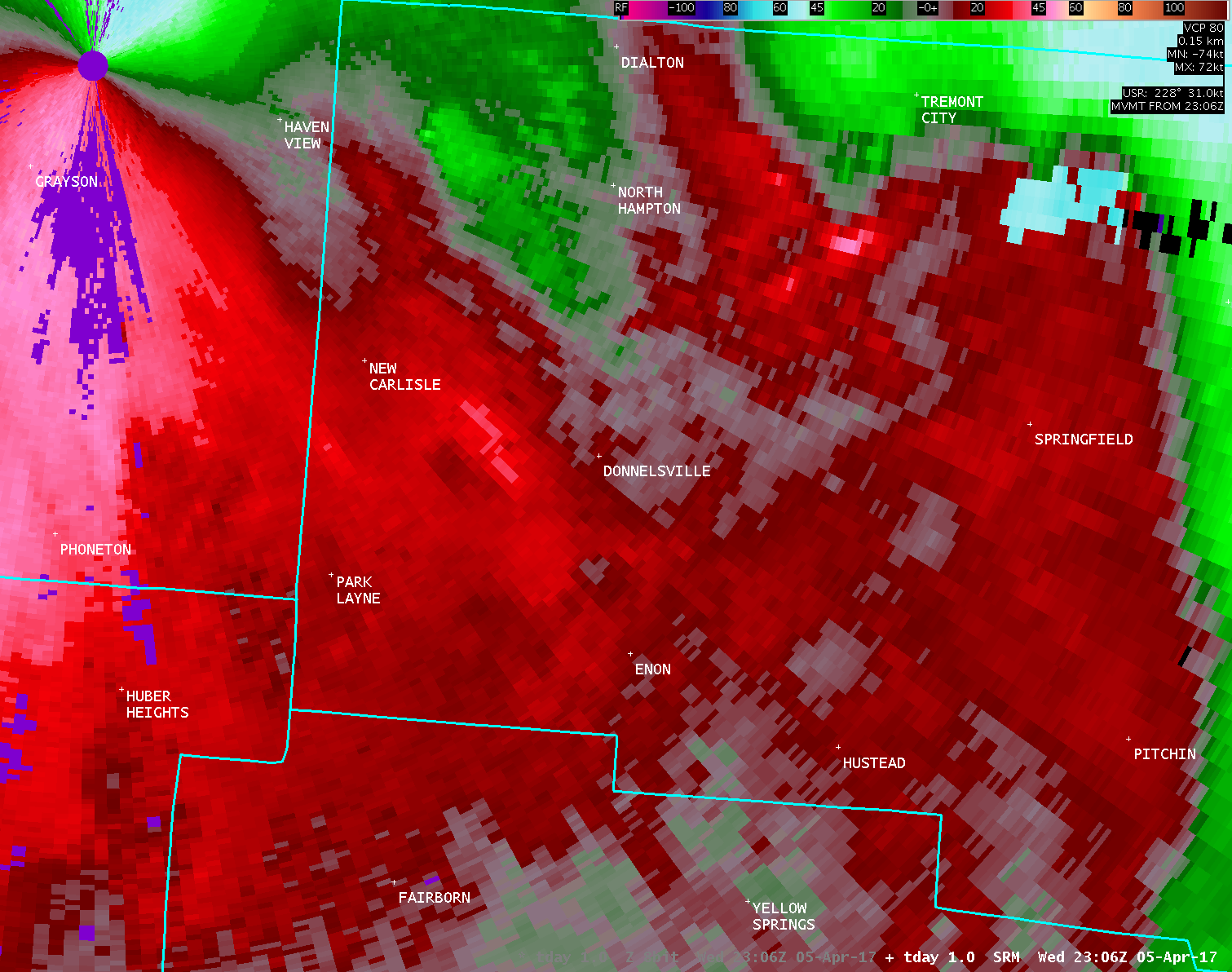
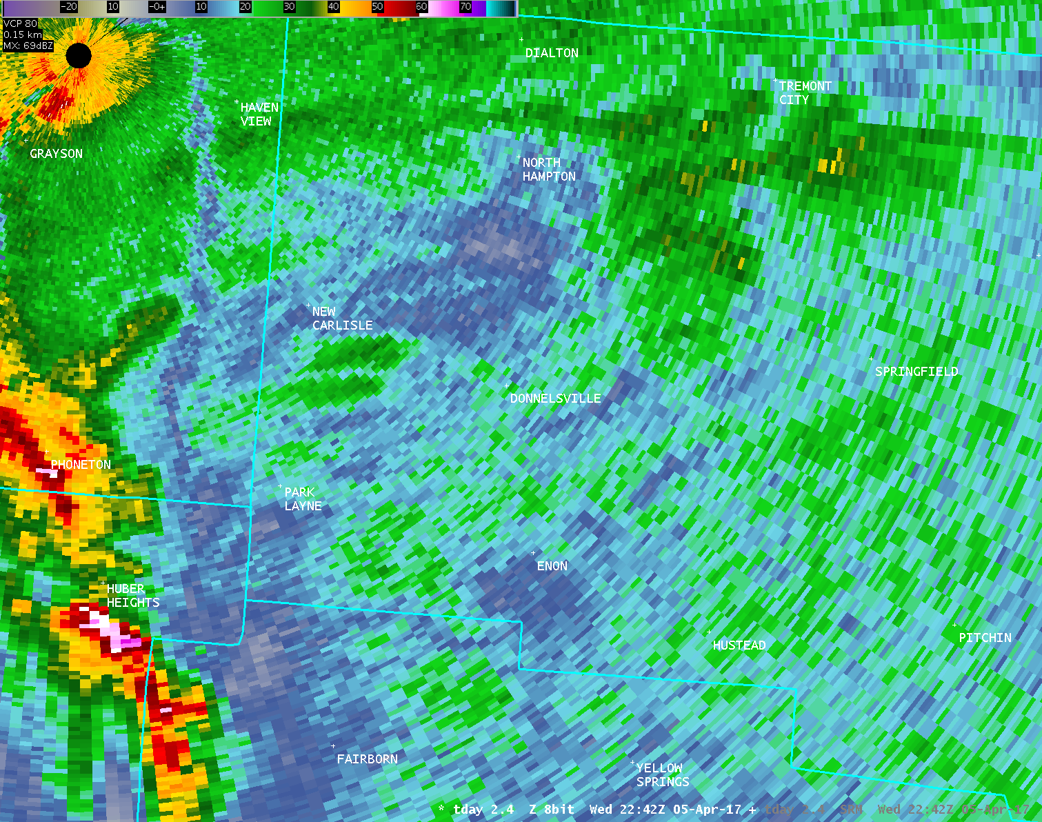
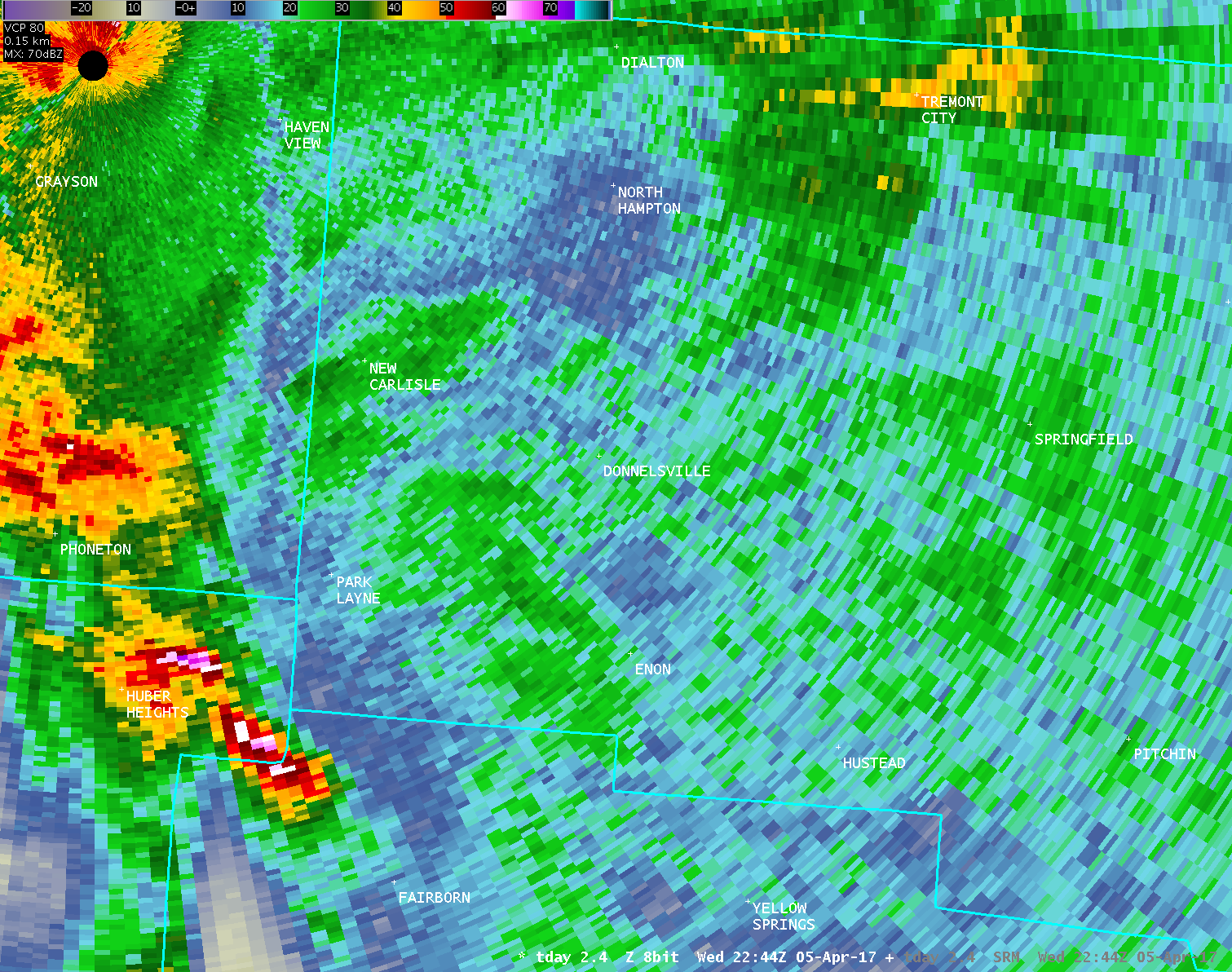
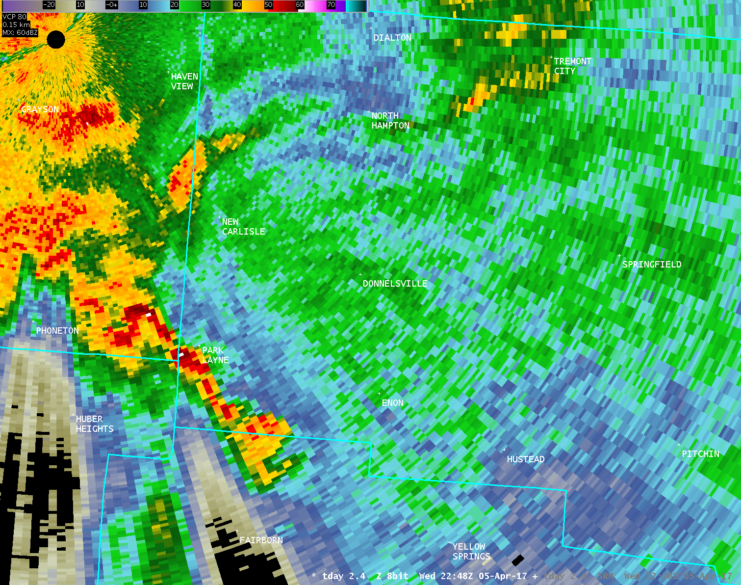
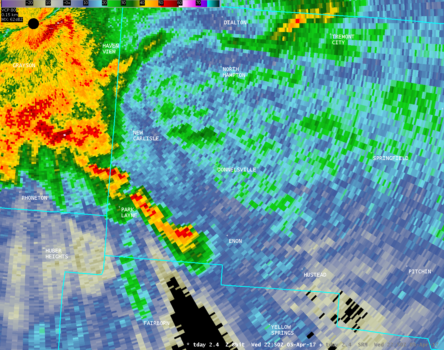
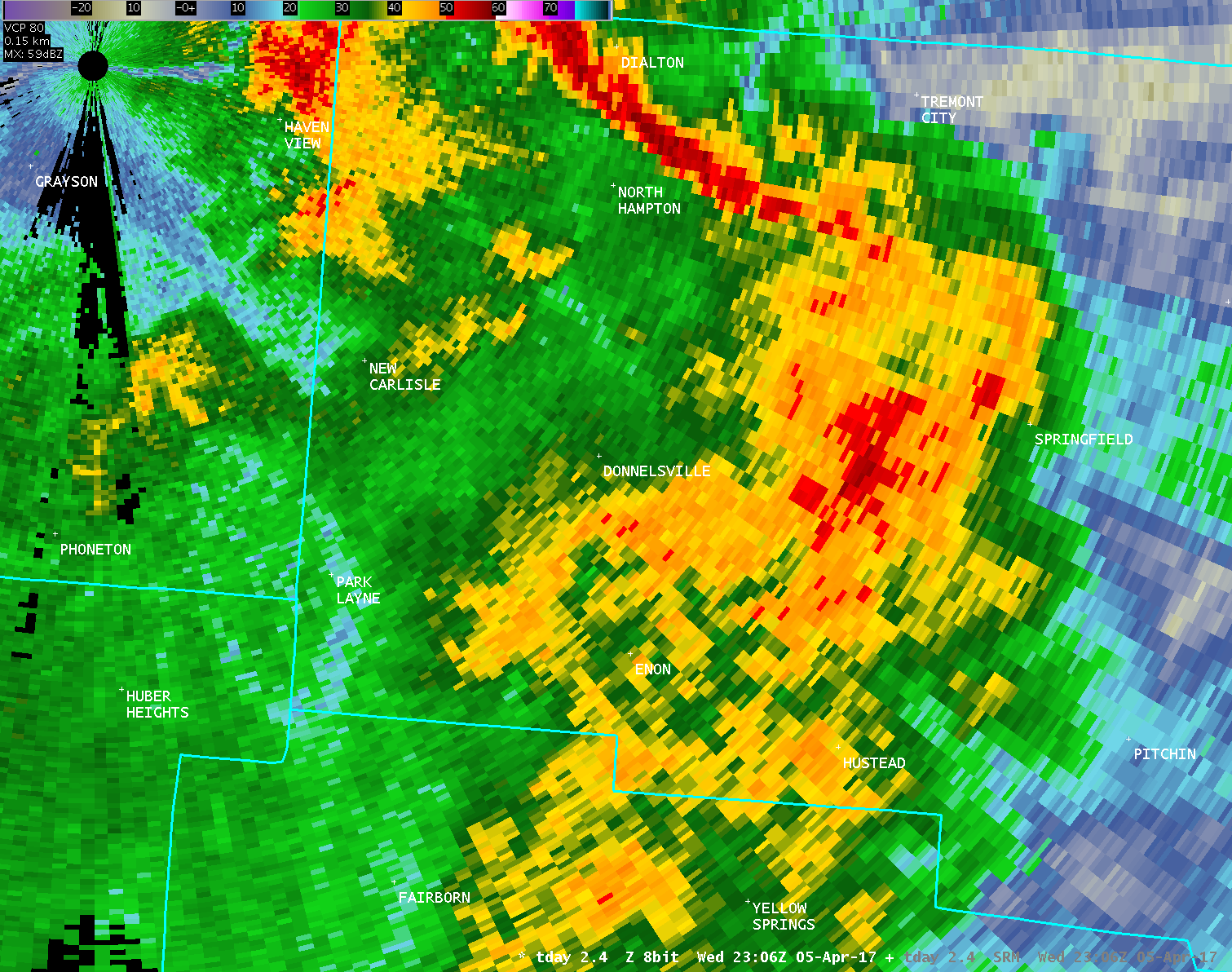
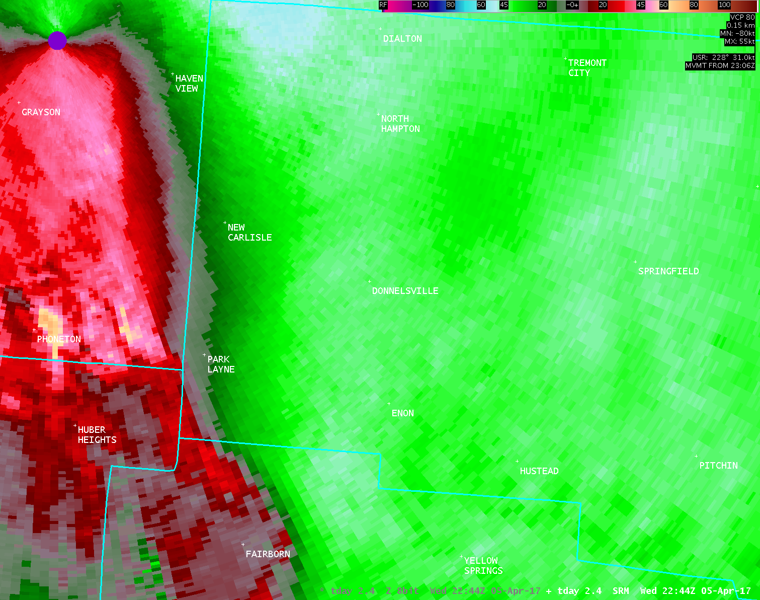
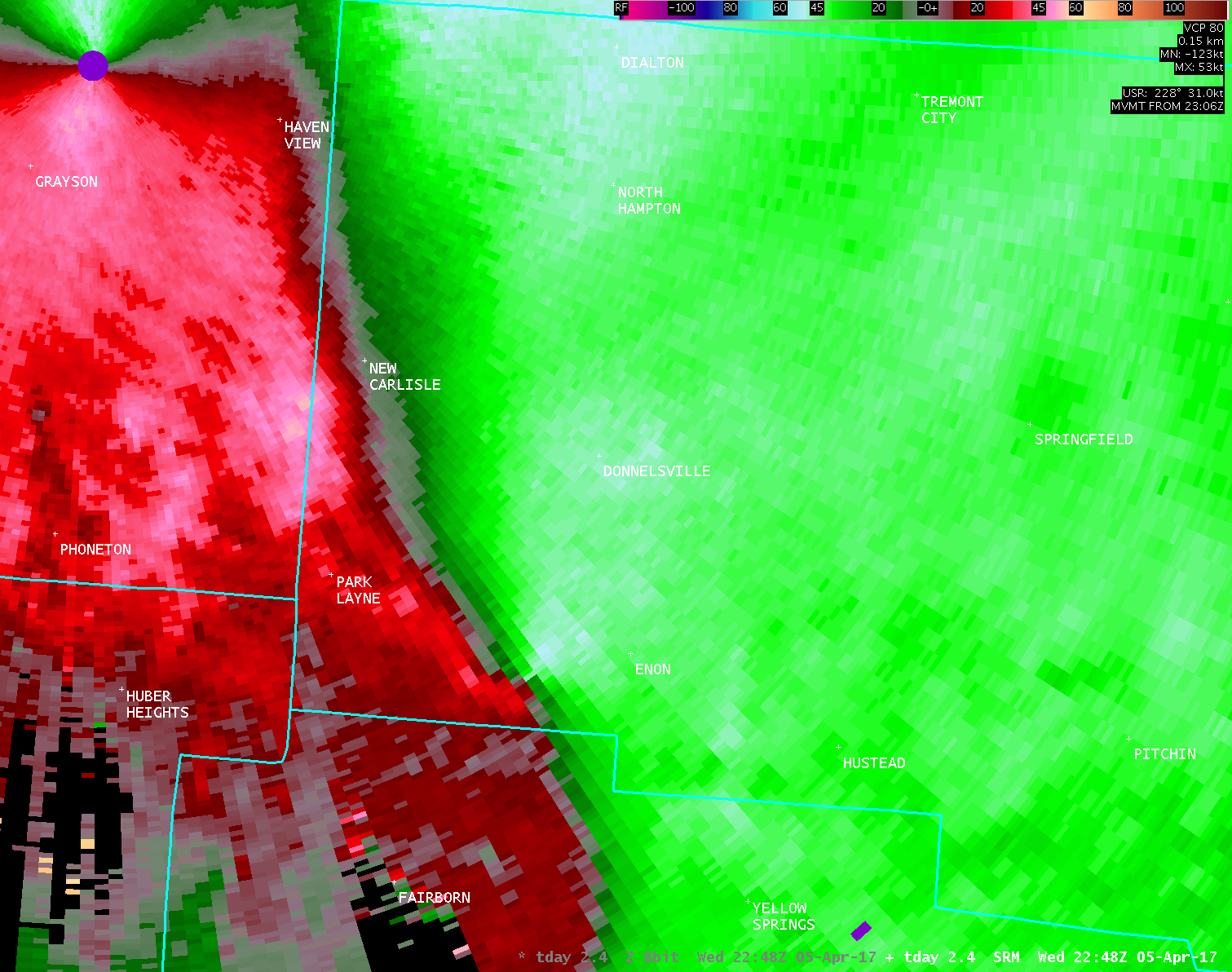
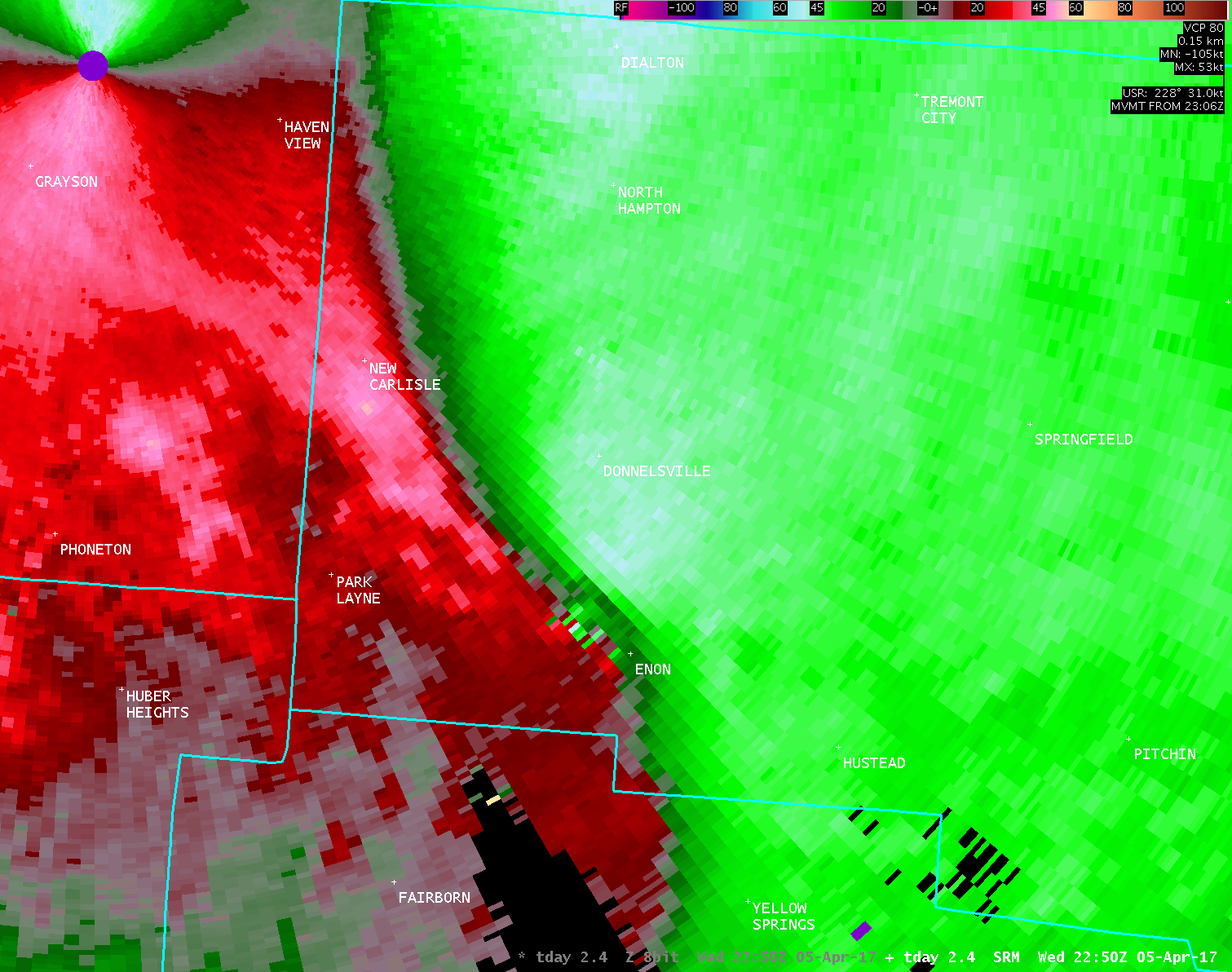
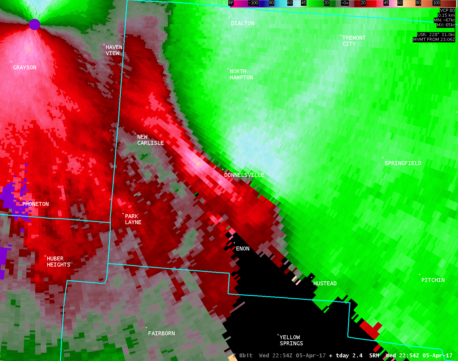
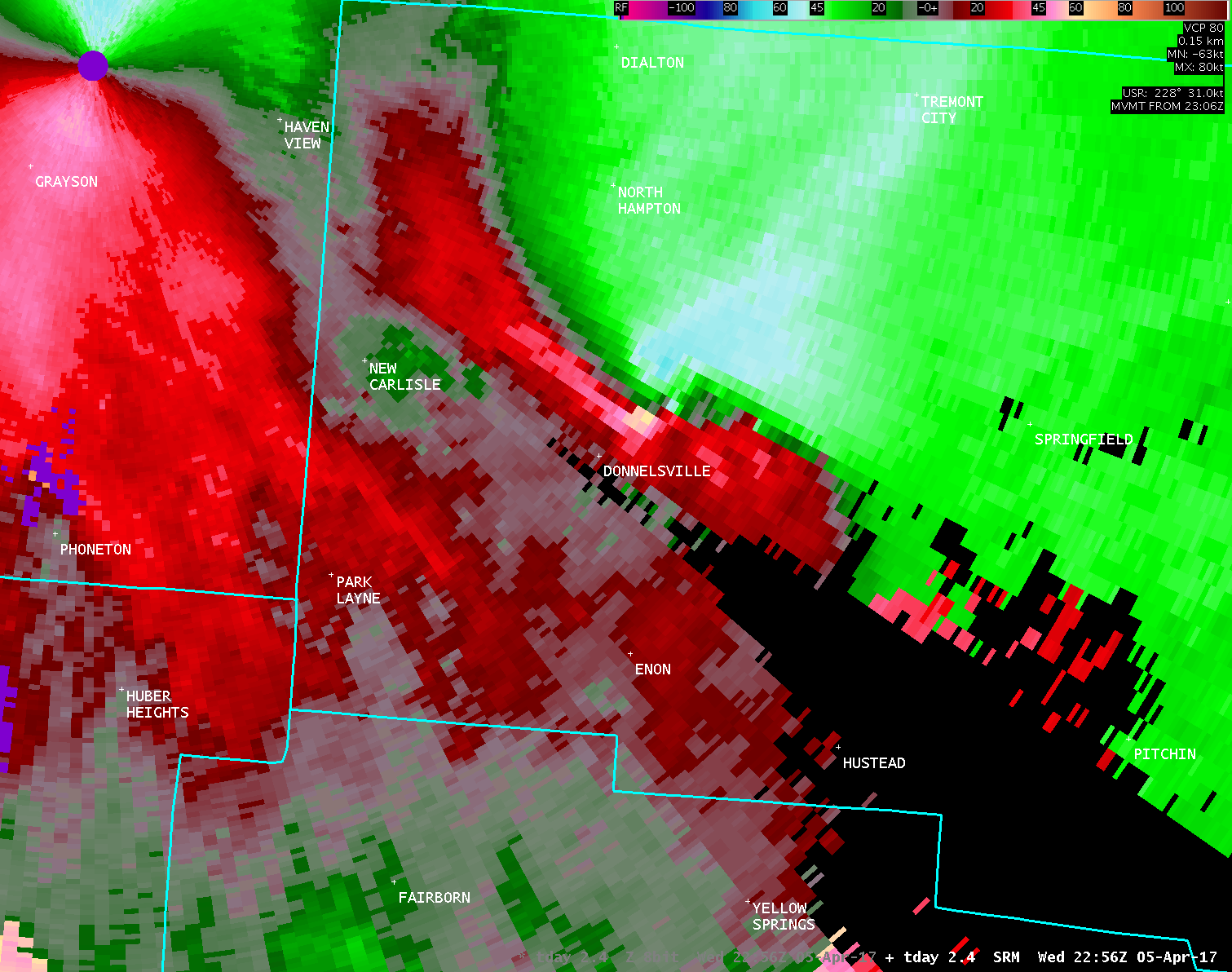
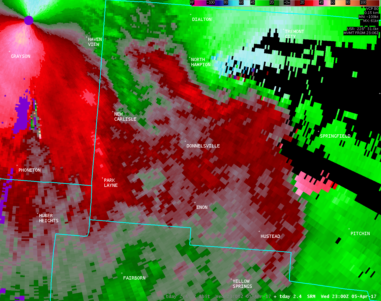
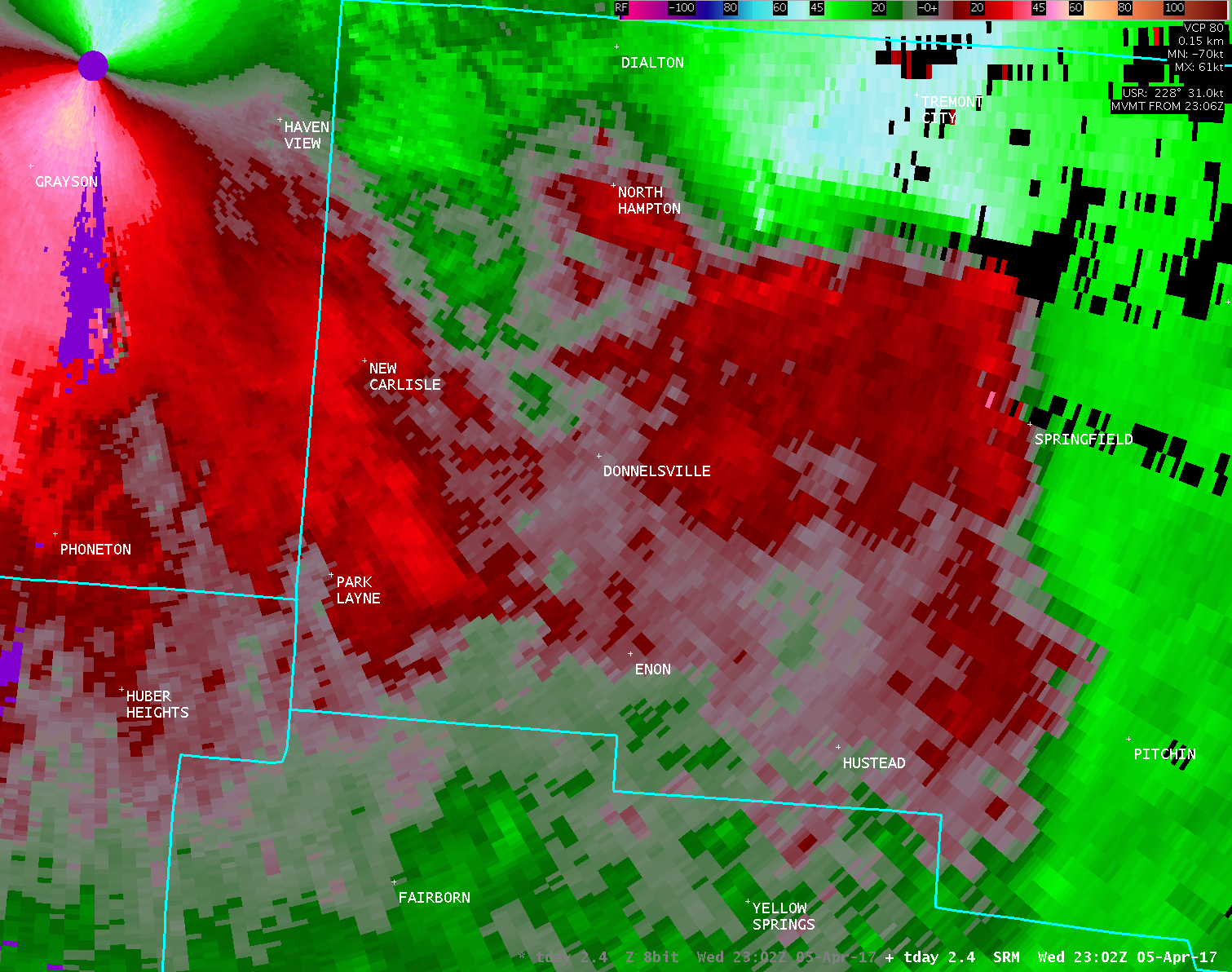
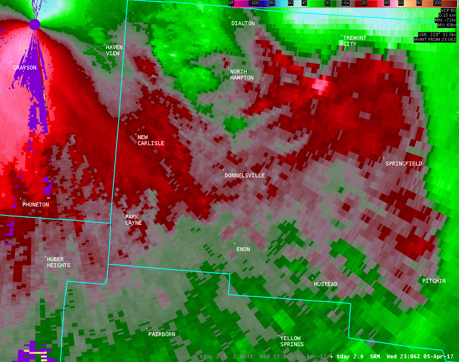
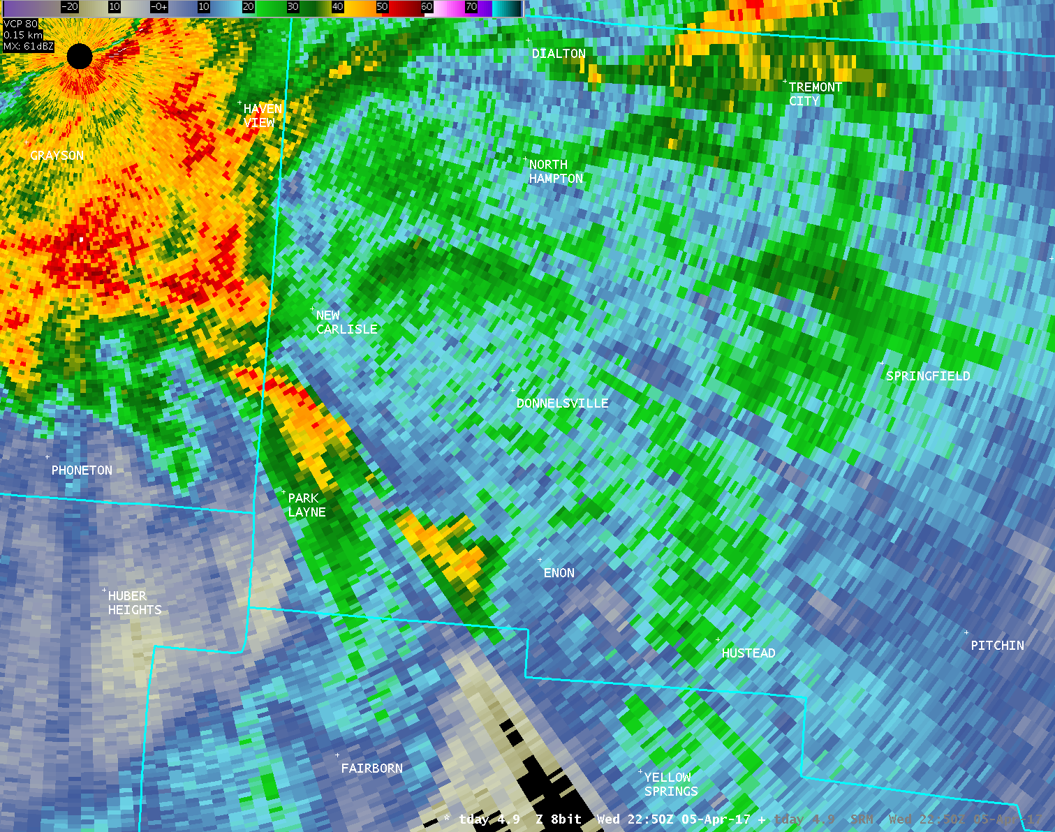
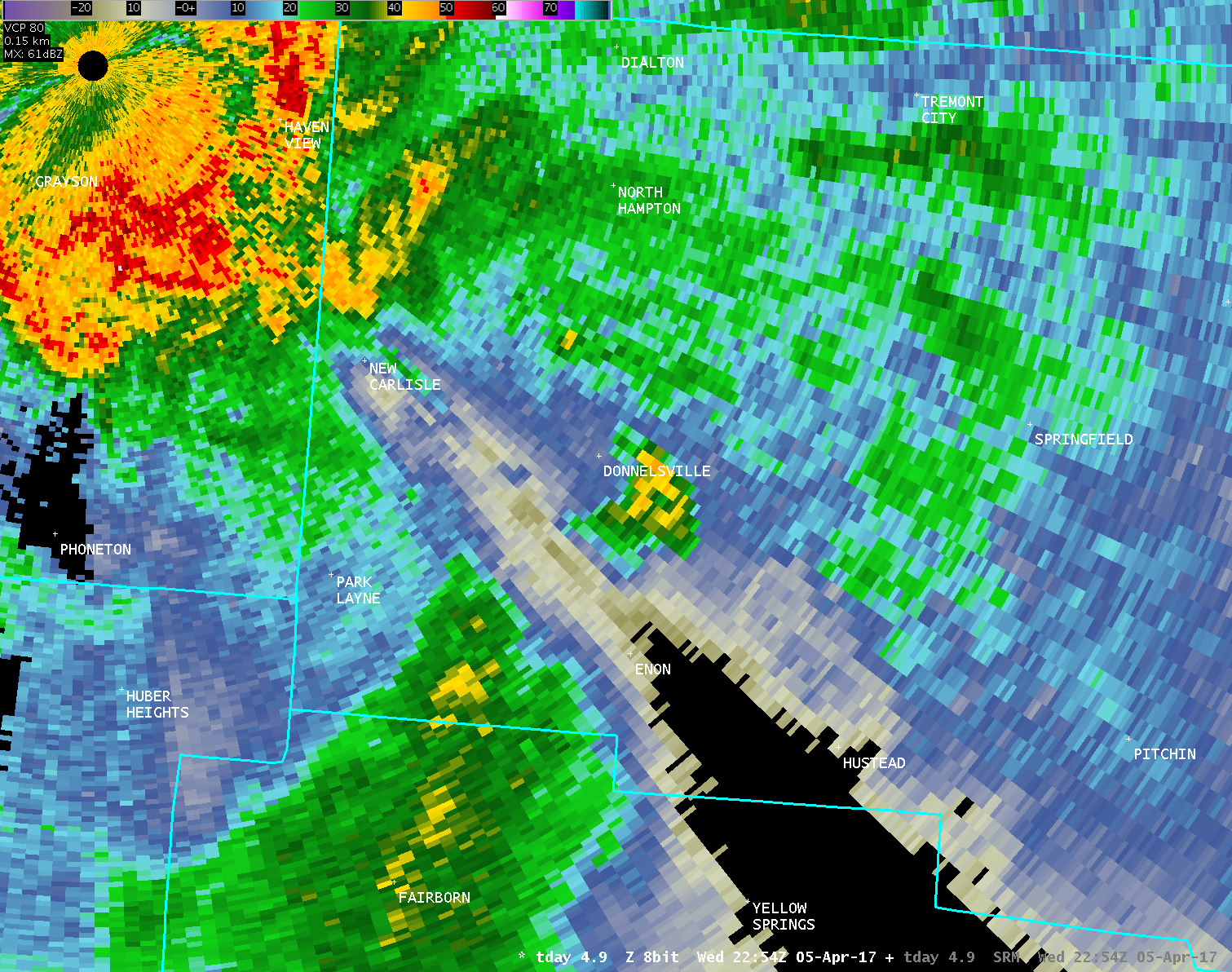
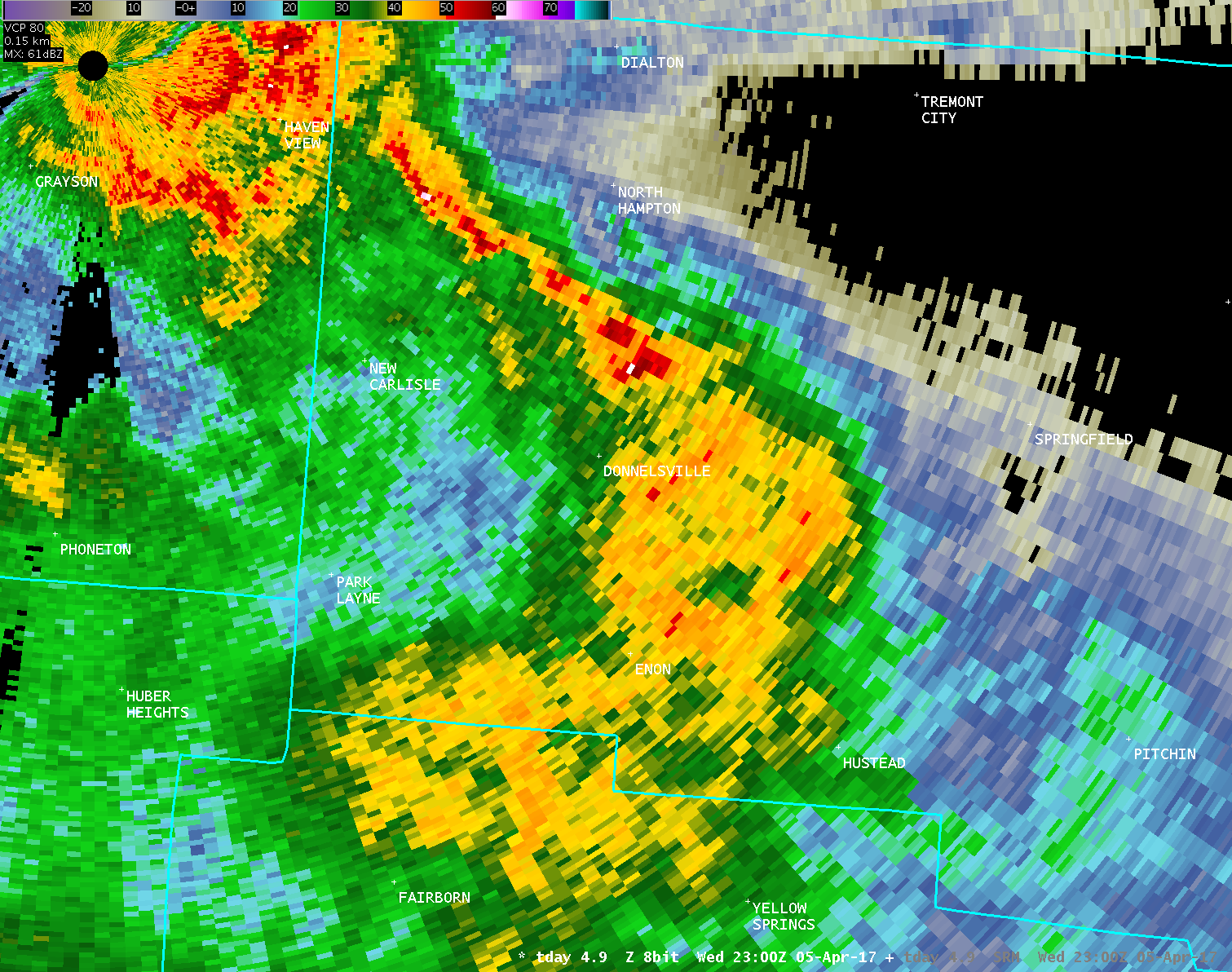
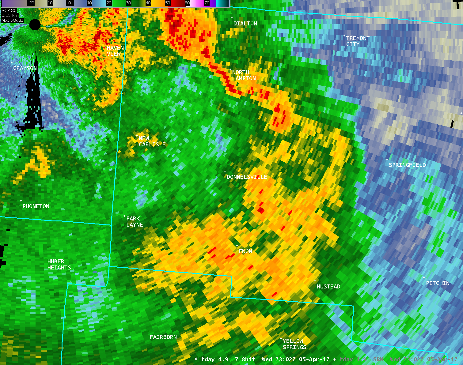
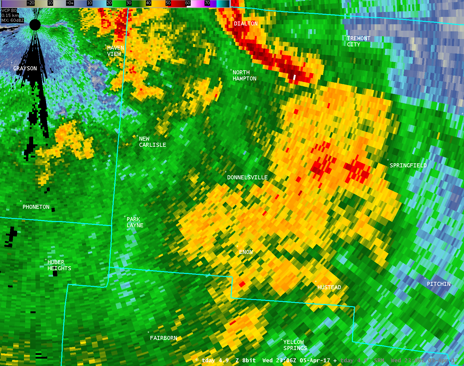
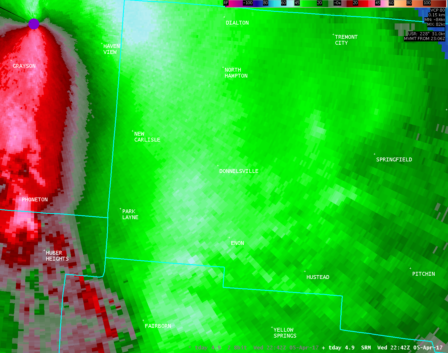
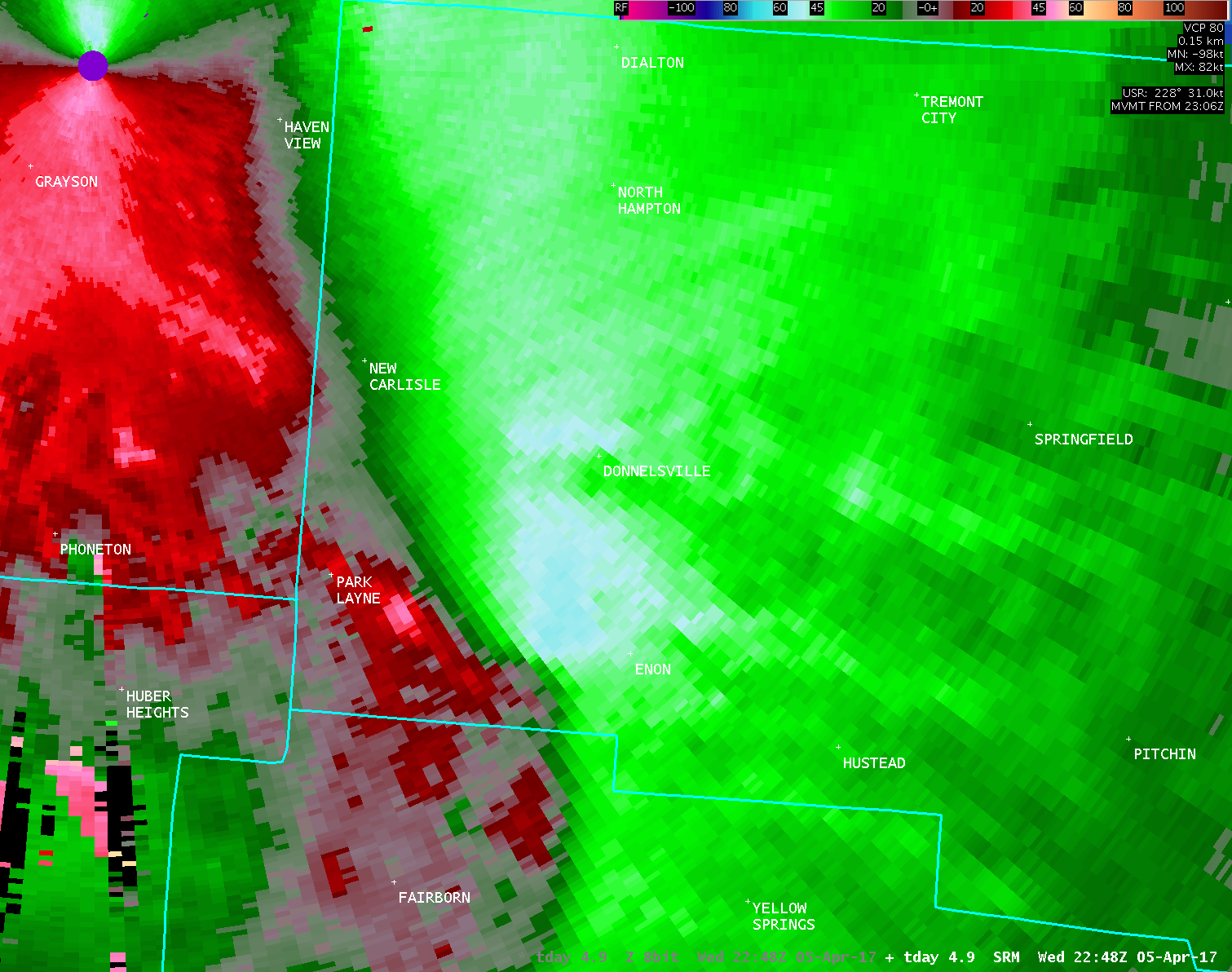
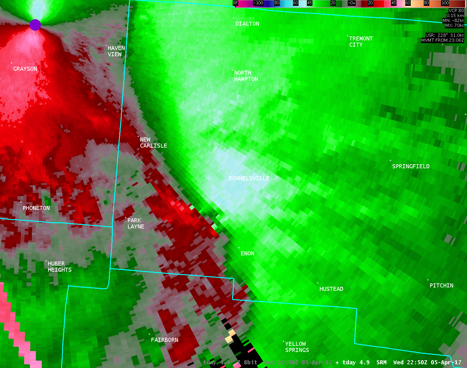
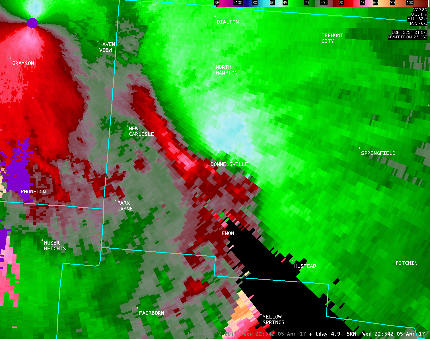
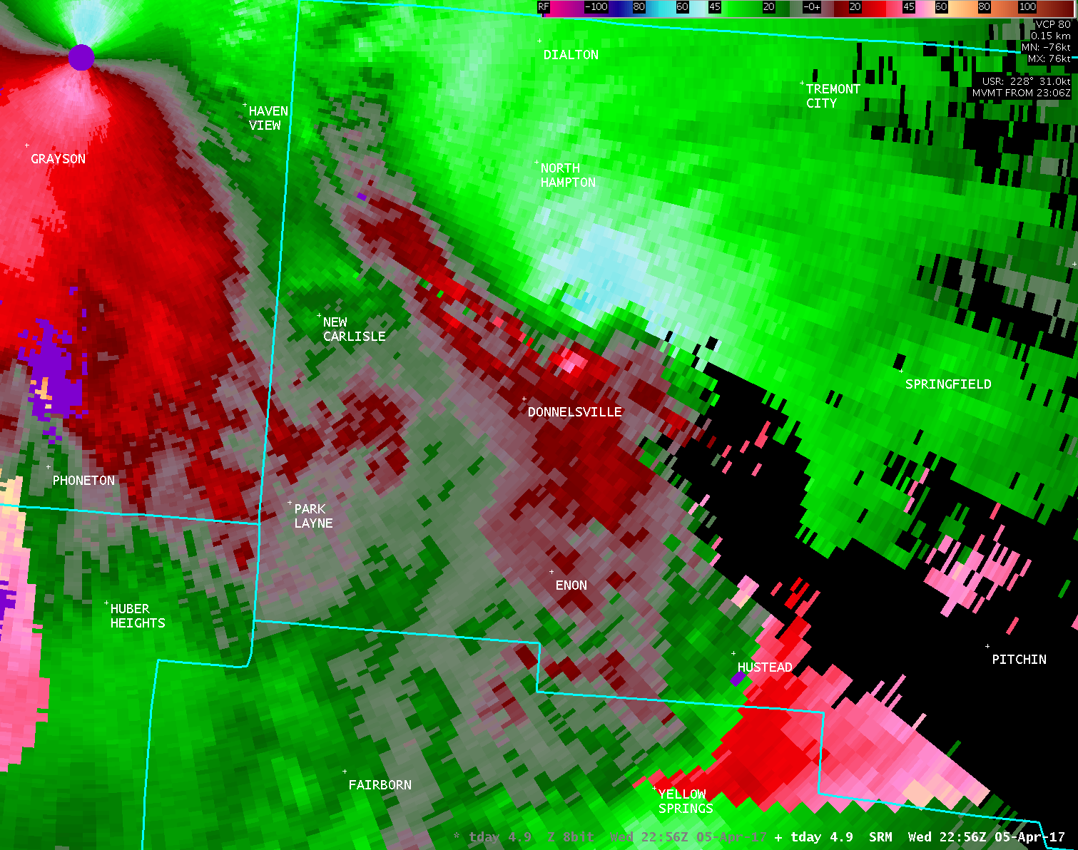
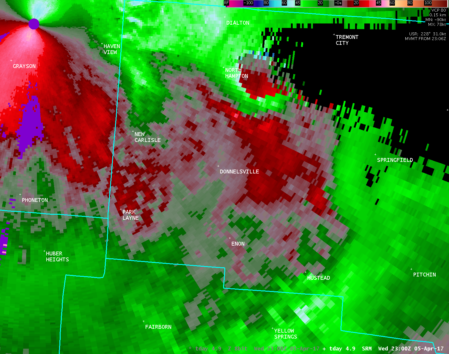
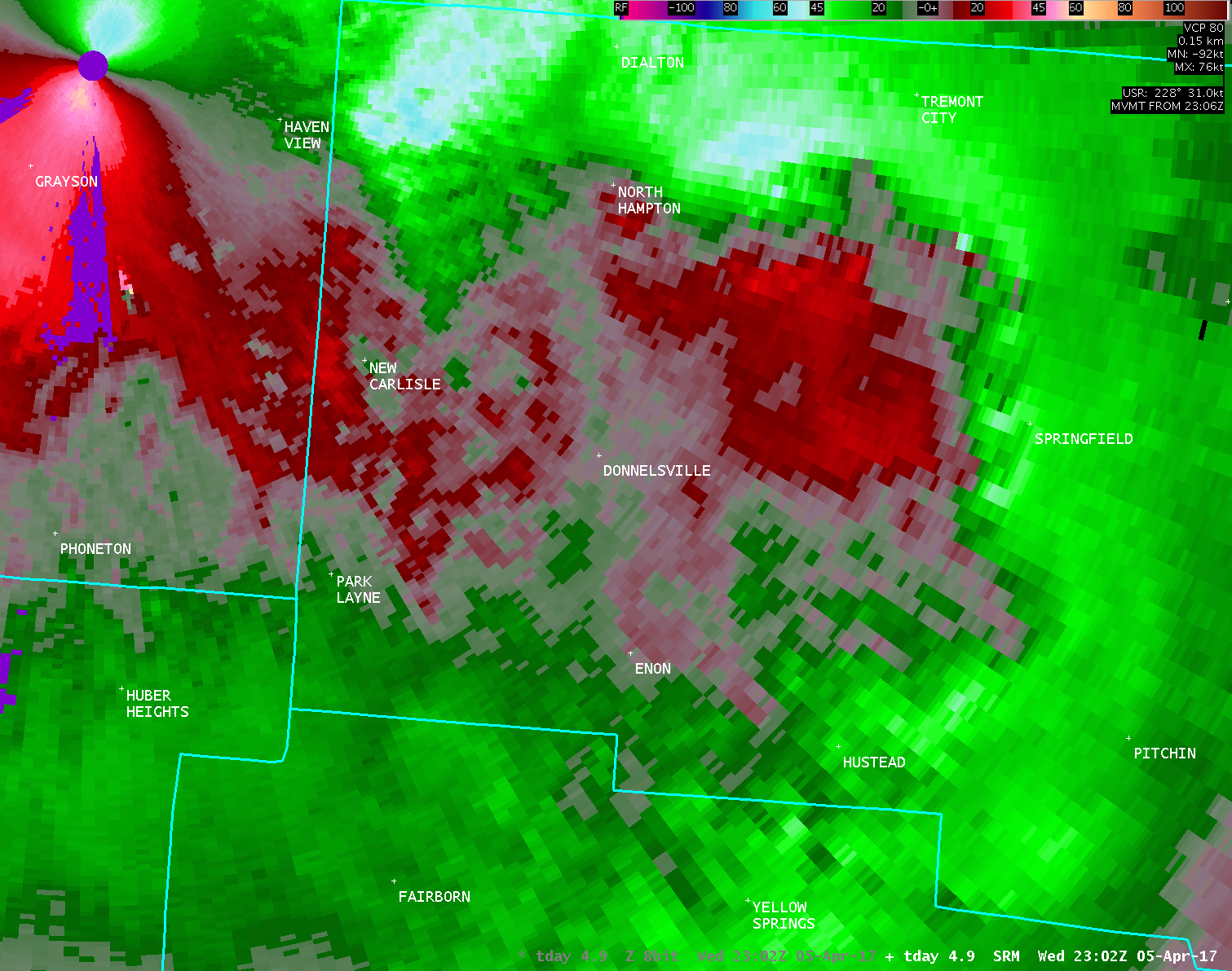
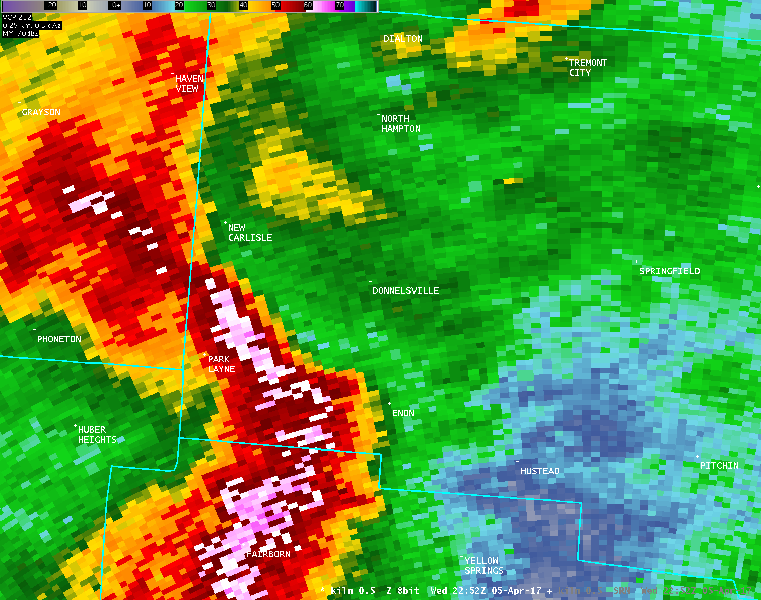
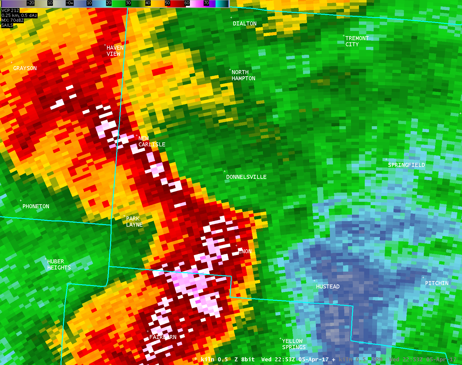
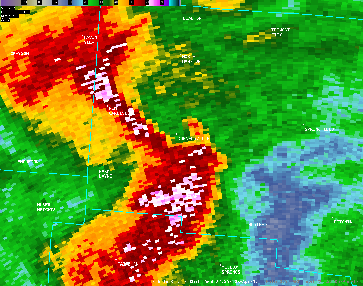
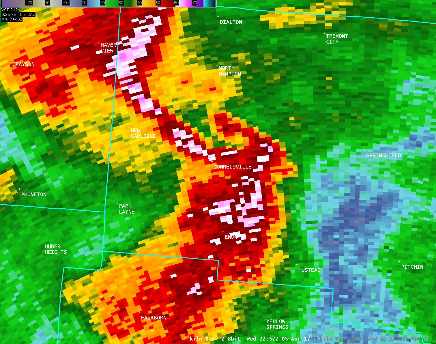
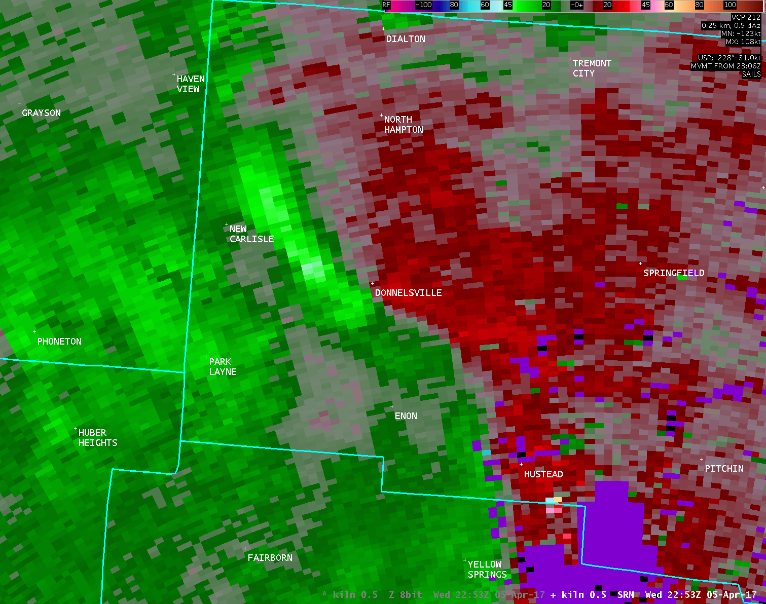
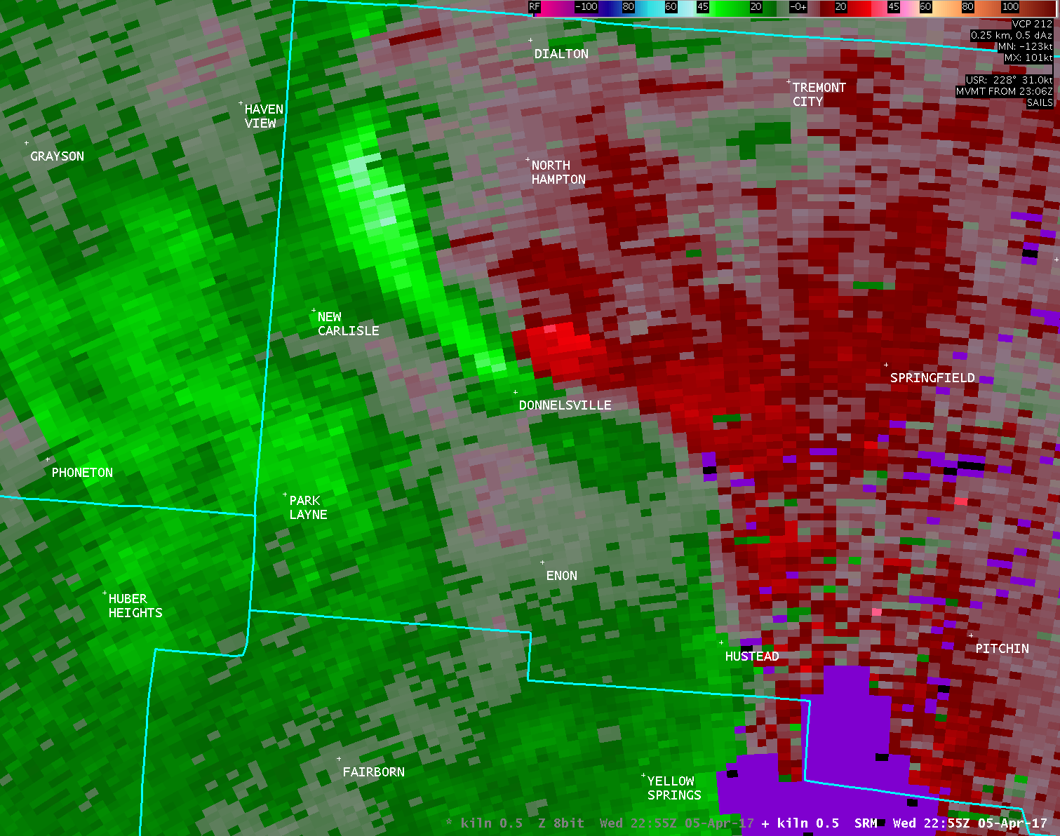
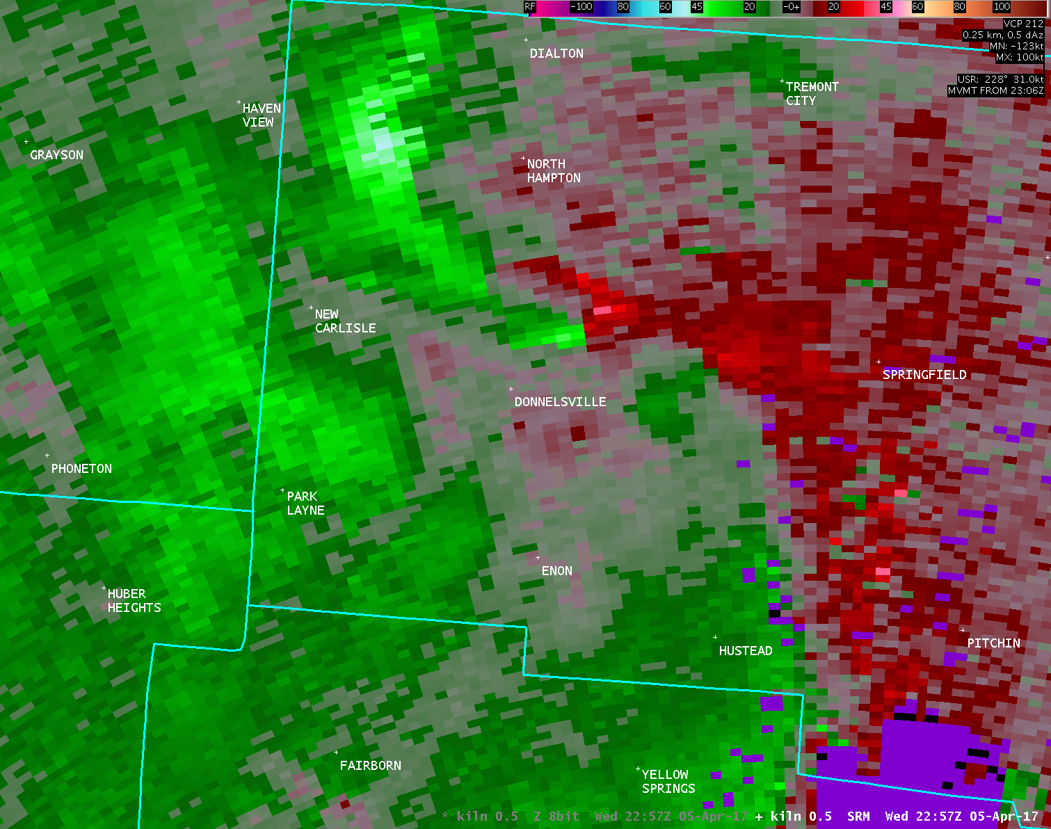
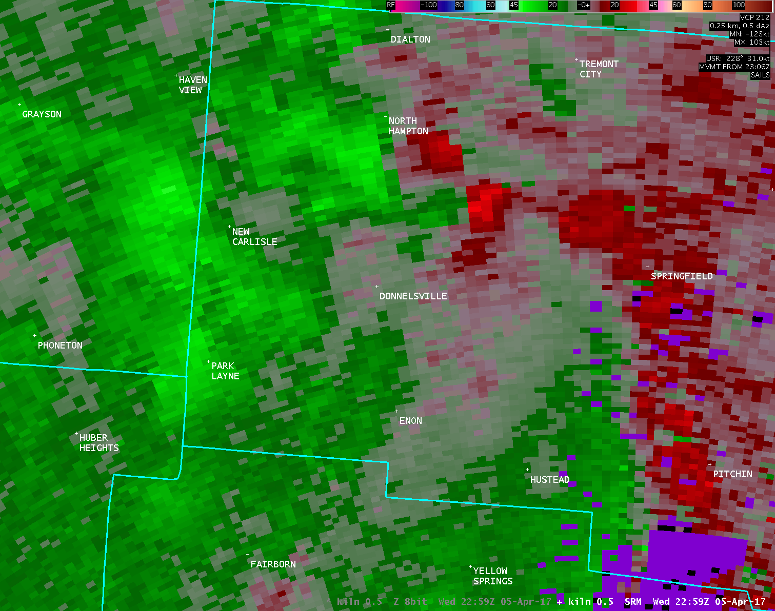
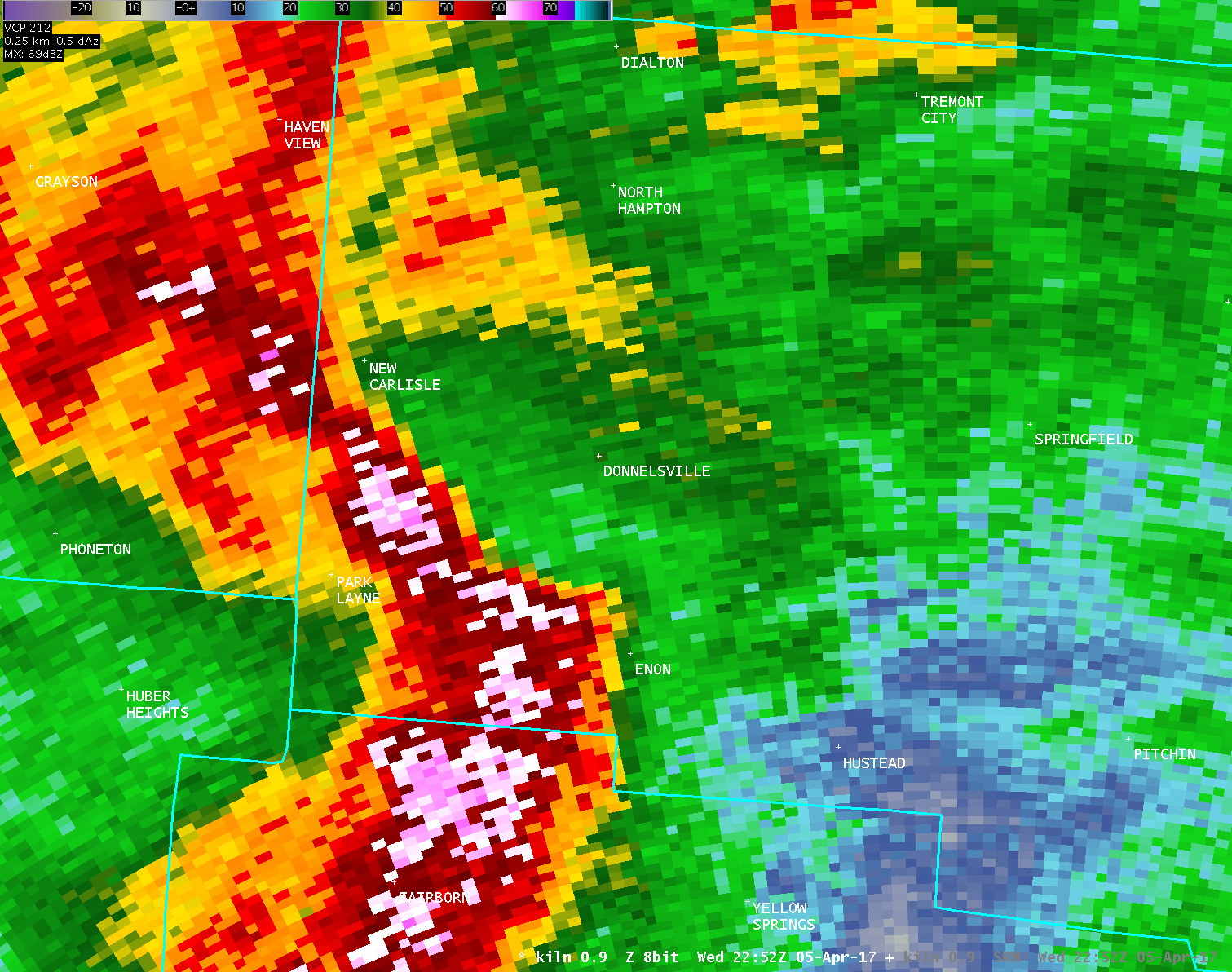
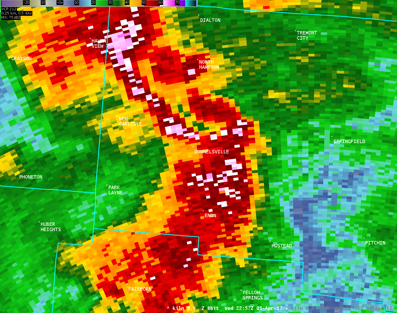
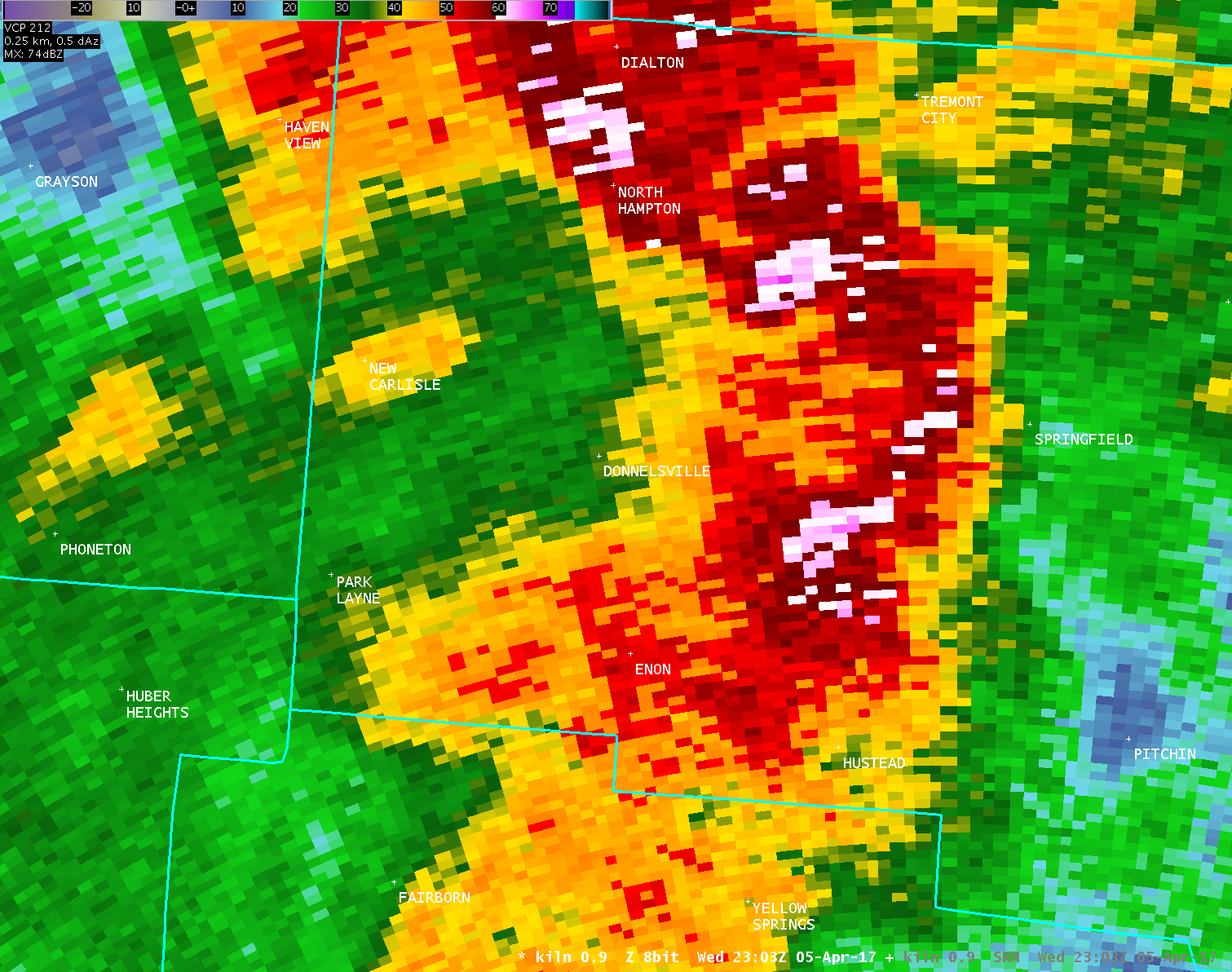
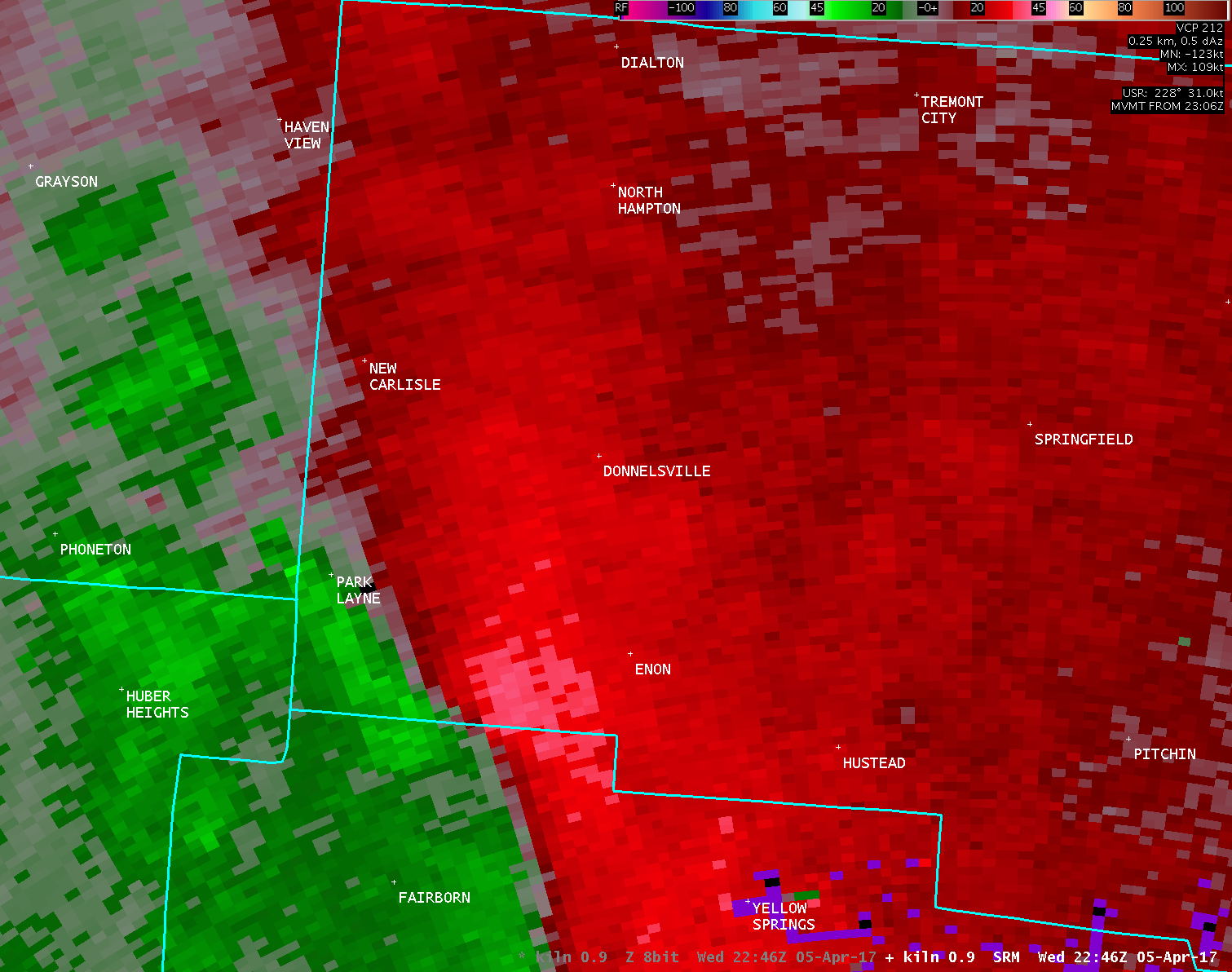
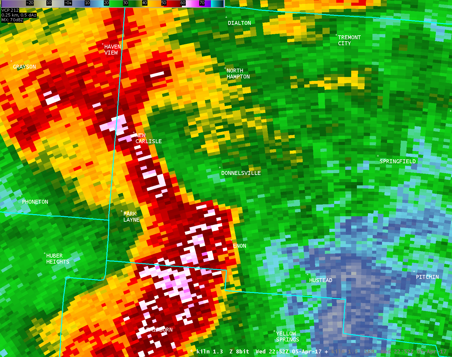
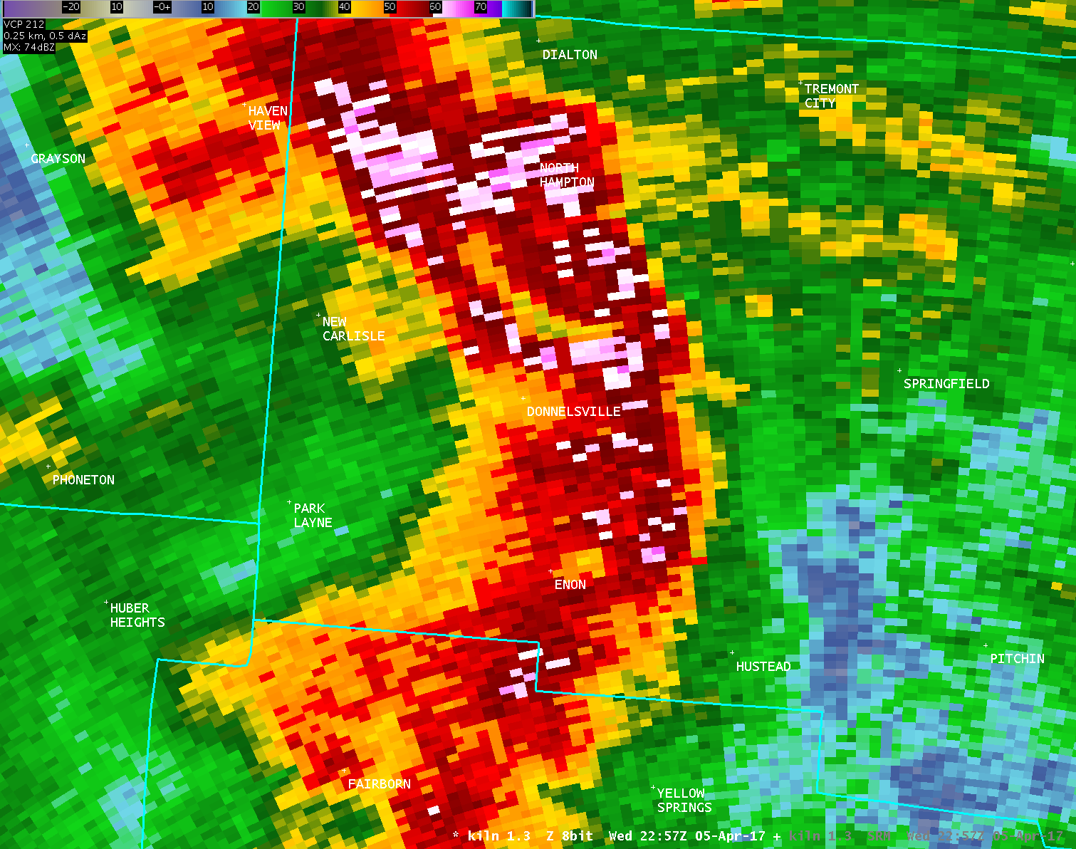
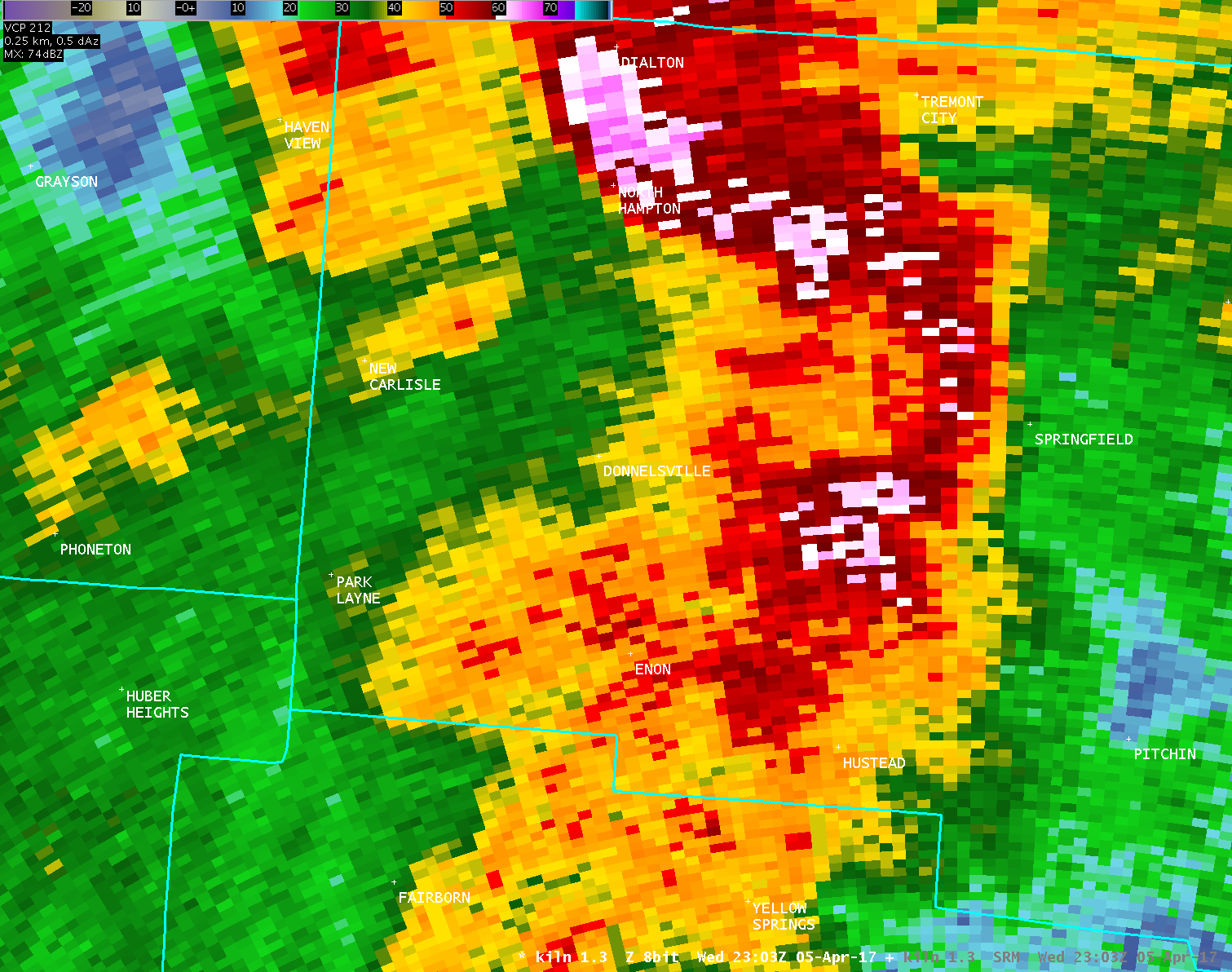
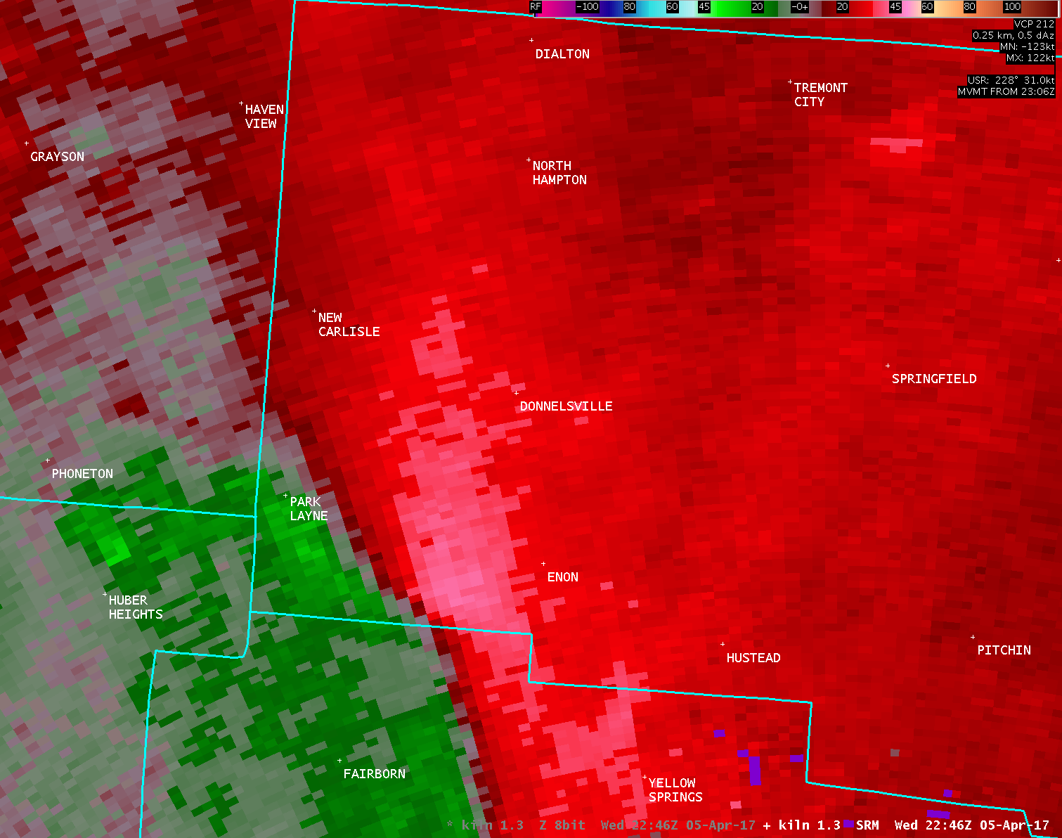
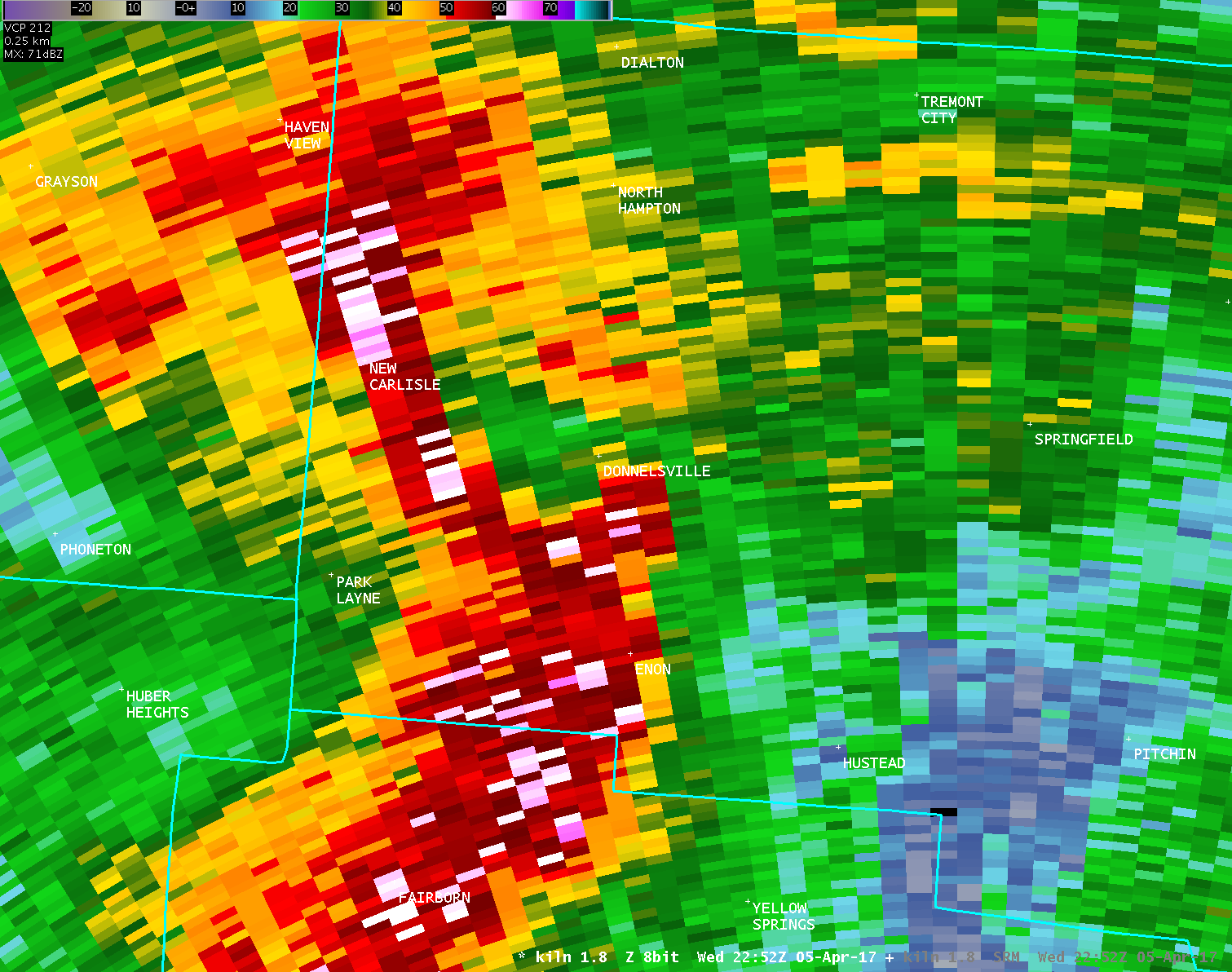
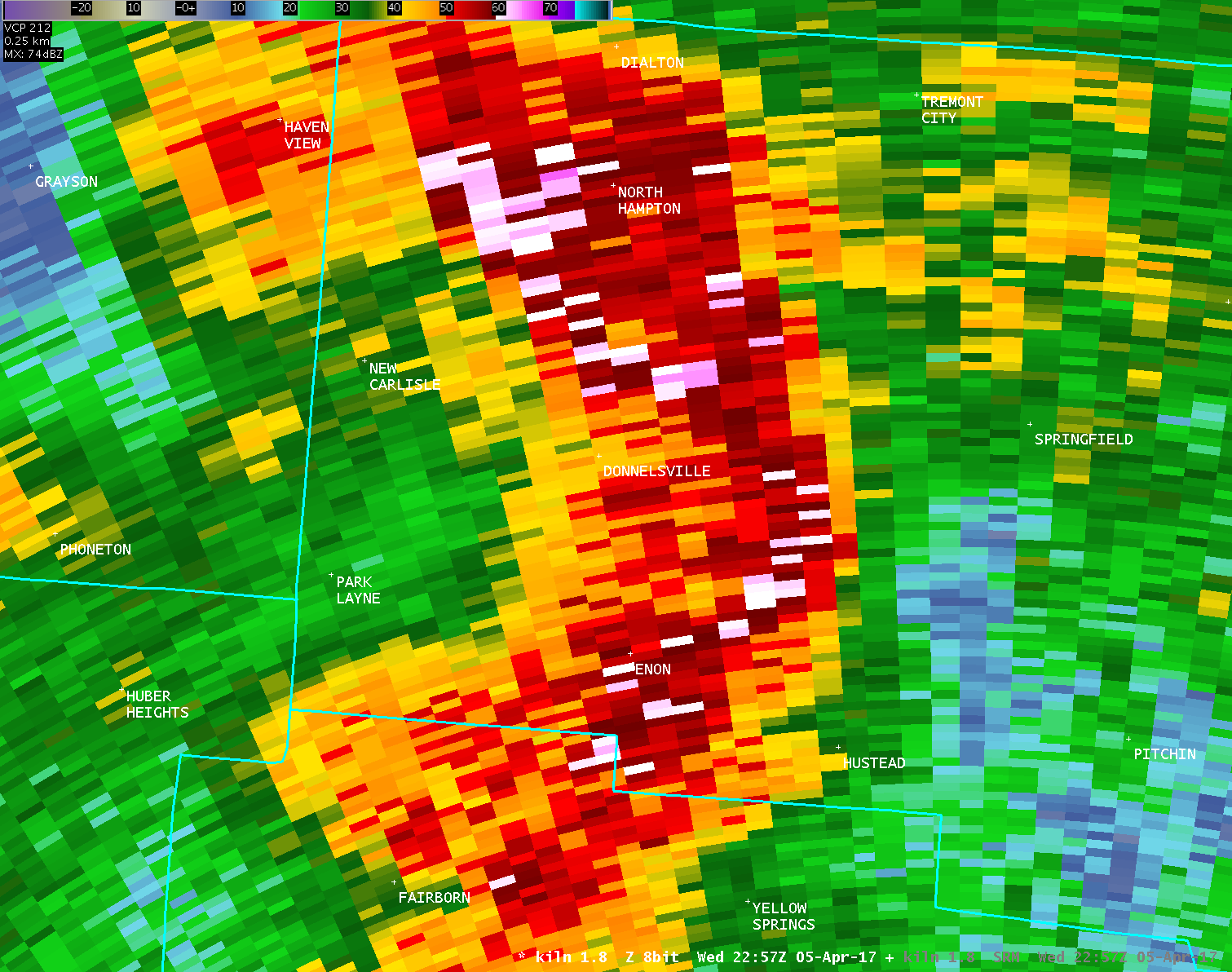
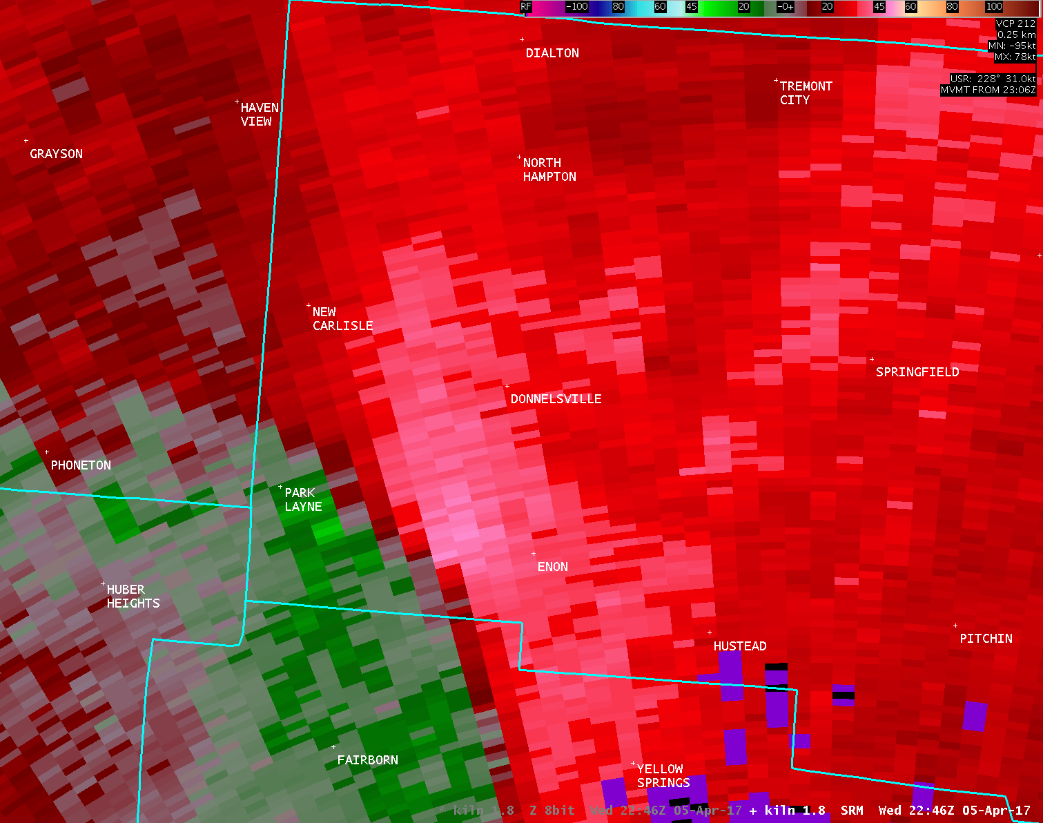
Public Information Statement National Weather Service Wilmington OH 405 PM EDT Thu Apr 6 2017 ...TORNADO CONFIRMED NEAR ENON IN CLARK COUNTY OHIO... Location...Enon in Clark County Ohio Date...April 5, 2017 Estimated Start Time...6:51 PM EDT Estimated End Time...6:51 PM EDT Maximum EF-Scale Rating...EF0 Estimated Maximum Wind Speed...75-80 MPH Maximum Path Width...40 yards Path Length...150 yards Beginning Lat/Lon...39.8709N / 83.9524W Ending lat/Lon...39.8714N / 83.9510W * Fatalities...0 * Injuries...0 * The information in this statement is preliminary and subject to change pending final review of the event(s) and publication in NWS Storm Data. ...Summary... The National Weather Service in Wilmington OH has confirmed a tornado southwest of Enon in Clark County Ohio on April 5, 2017. The first evidence of damage occurred to a home and farm buildings along Dayton-Springfield Road southwest of Enon. While there were numerous homes in the area which sustained tree damage and lightweight debris damage, the vast majority of this damage was from straightline winds estimated at 70 mph. The wind damage was southwest to northeast with no evidence of tornadic winds making direct contact with the ground nor debris found on downwind sides of buildings. There was embedded damage to a farm home and barns where large sections of roofing material was peeled off and lofted, causing damage to the downwind home. There was additional roof damage to the home and 2 additional farm buildings. The southward facing garage door to the home was blown inward. Two combines located in one of the outbuildings were pushed downwind, with the outbuilding itself collapsed. Where there was evidence of tornado damage was in the downwind/northeast facing wall of the home and one of the barns, where debris splatter was observed. Because of heavy rain after the passage of the storm, direct ground damage indicative of a tornado in contact with the ground was inconclusive. For reference: the Enhanced Fujita Scale classifies tornadoes into the following categories: EF0...wind speeds 65 to 85 mph. EF1...wind speeds 86 to 110 mph. EF2...wind speeds 111 to 135 mph. EF3...wind speeds 136 to 165 mph. EF4...wind speeds 166 to 200 mph. EF5...wind speeds greater than 200 mph. $$ JDR |
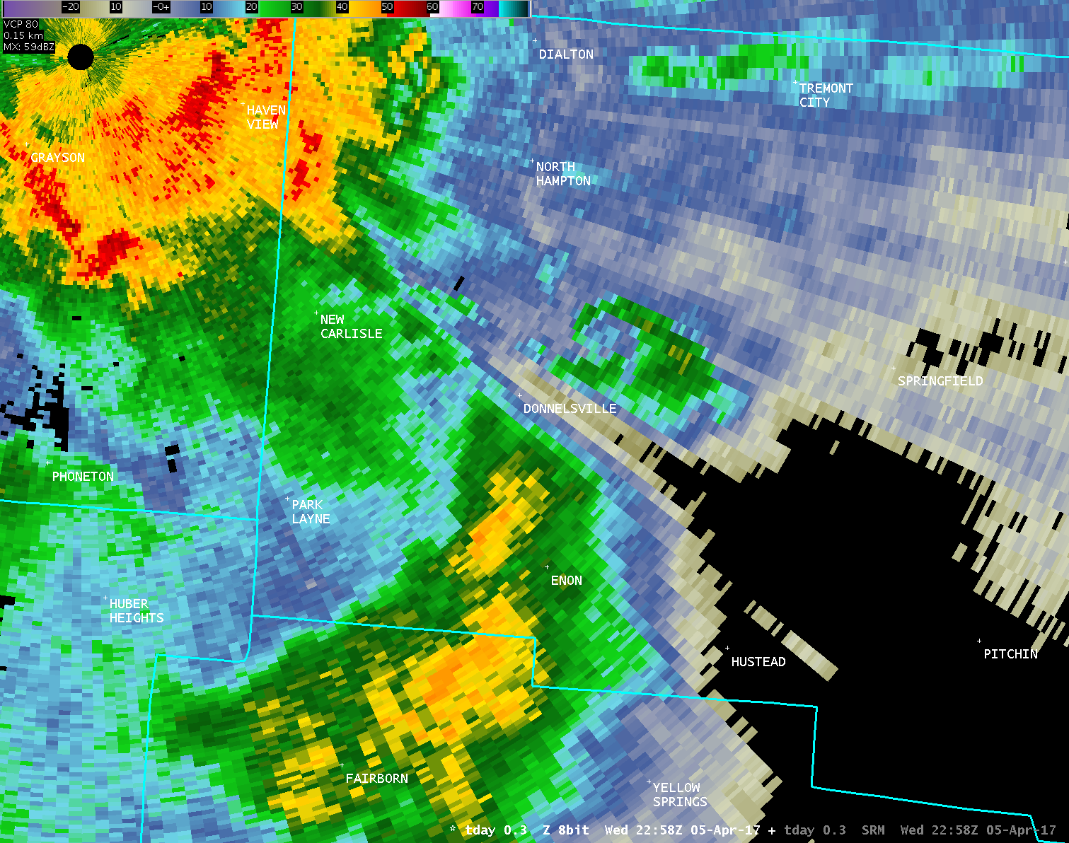
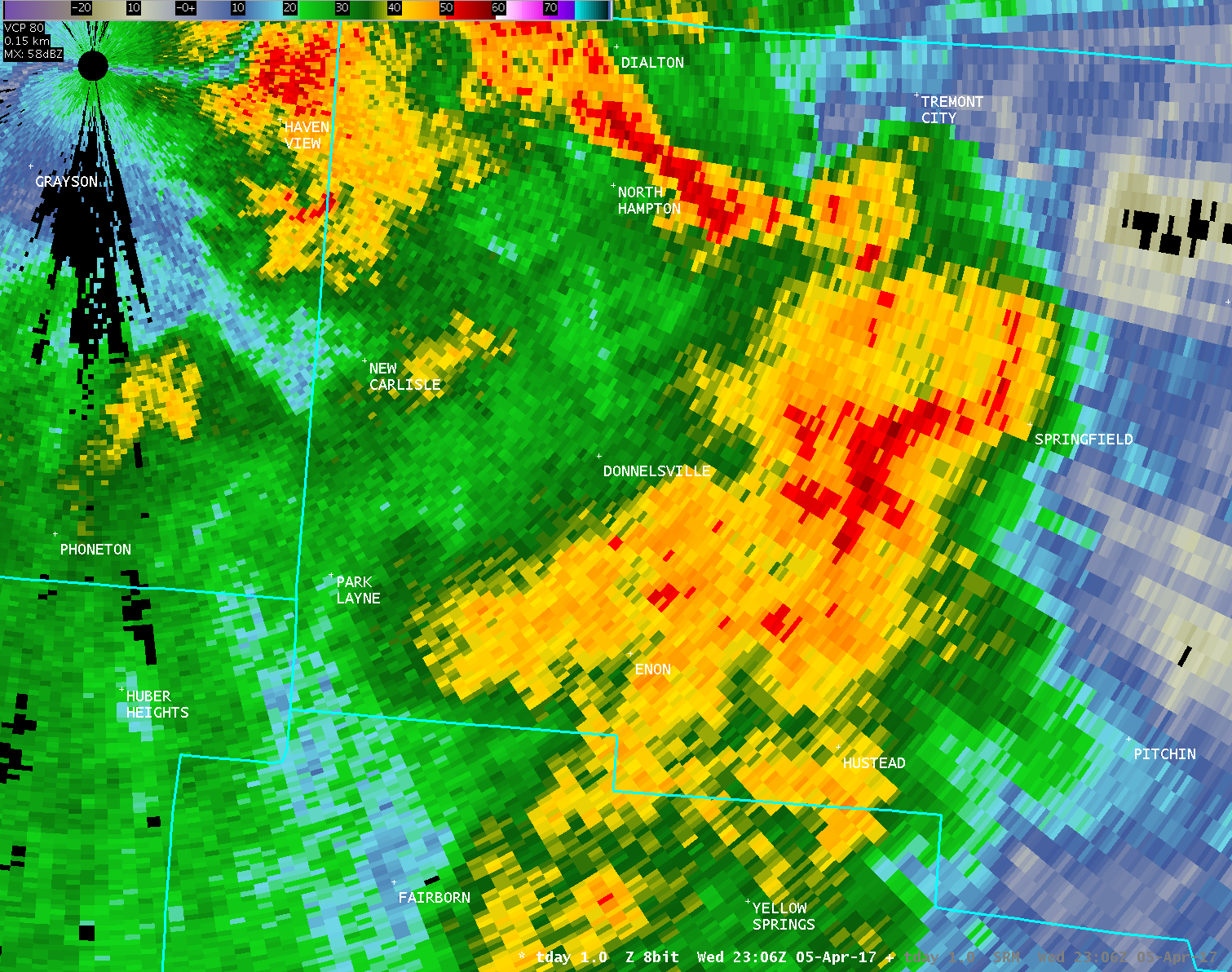
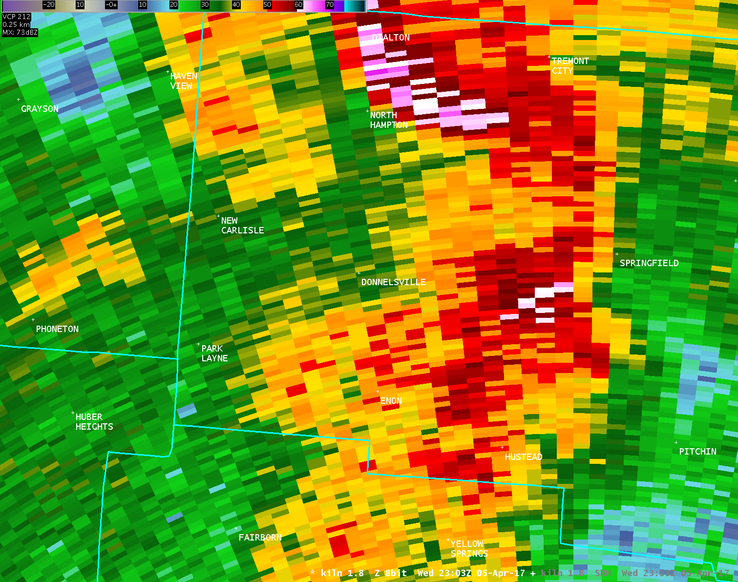
Public Information Statement National Weather Service Wilmington OH 527 PM EDT Thu Apr 6 2017 ...TORNADO CONFIRMED NEAR 6 MILES WEST OF SPRINGFIELD IN CLARK COUNTY OHIO... Location...6 Miles West of Springfield in Clark County Ohio Date...April 5, 2017 Estimated Time...6:58 PM EDT Maximum EF-Scale Rating...EF0 Estimated Maximum Wind Speed...75-80 MPH Maximum Path Width...40 yards Path Length...180 yards Beginning Lat/Lon...39.9358N / 83.9143W Ending lat/Lon...39.9363N / 83.9123W * Fatalities...0 * Injuries...0 * The information in this statement is preliminary and subject to change pending final review of the event(s) and publication in NWS Storm Data. ...Summary... The National Weather Service in Wilmington OH has confirmed a tornado 6 Miles West of Springfield in Clark County Ohio on April 5, 2017. Widespread wind damage was observed west of Springfield in the Tecumseh Trails Subdivision and along North Tecumseh Road north of New Carlisle Pike. Several homes in the Tecumseh Trails subdivision sustained roof damage indicative of 75 to 80 mph winds. However, all of the debris was scattered in a northerly to northeasterly direction, with no ground based evidence of a tornado apparent. There was no evidence of light mud nor debris splatter in the downwind facing side of the homes. However, the wind damage was significant, resulting in a large section of roof removed from one home, with other homes in the area sustaining smaller sections of roof damage. There was additional tree damage along New Carlisle Pike, including damage to a fence caused by damaged trees. Where tornado damage was evident was further east along North Tecumseh Road. Roof and siding damage was sustained by several homes. One home had clear debris splatter on the north facing side of the home, as well as splatter and damage on an eastward facing porch. This strongly suggests winds traveling in an opposite direction of the north to northeastward moving storm and provides evidence of tornadic damage. The storm traveling through this area of Clark County had significant winds producing widespread tree and roof damage. Nearly all of the damage surveyed was pretty clearly in a northerly to northeasterly direction, indicating strong straight line wind damage. Damage caused by the brief tornado touchdown along North Tecumseh Road was similar in magnitude to the strongest straight line wind damage nearby. Through witness accounts, it is estimated that the tornado was on the ground a very brief time, likely less than 1 minute. For reference: the Enhanced Fujita Scale classifies tornadoes into the following categories: EF0...wind speeds 65 to 85 mph. EF1...wind speeds 86 to 110 mph. EF2...wind speeds 111 to 135 mph. EF3...wind speeds 136 to 165 mph. EF4...wind speeds 166 to 200 mph. EF5...wind speeds greater than 200 mph. $$ JDR |
| Full Radar Loops from the Dayton Terminal Doppler Weather Radar (6:43 PM - 7:06 PM) | |
| TDAY 0.3° Reflectivity (400-700 feet AGL) | |
| 1 2 3 4 5 6 7 8 9 10 11 12 13 14 15 16 17 18 19 20 21 22 23 24 | |
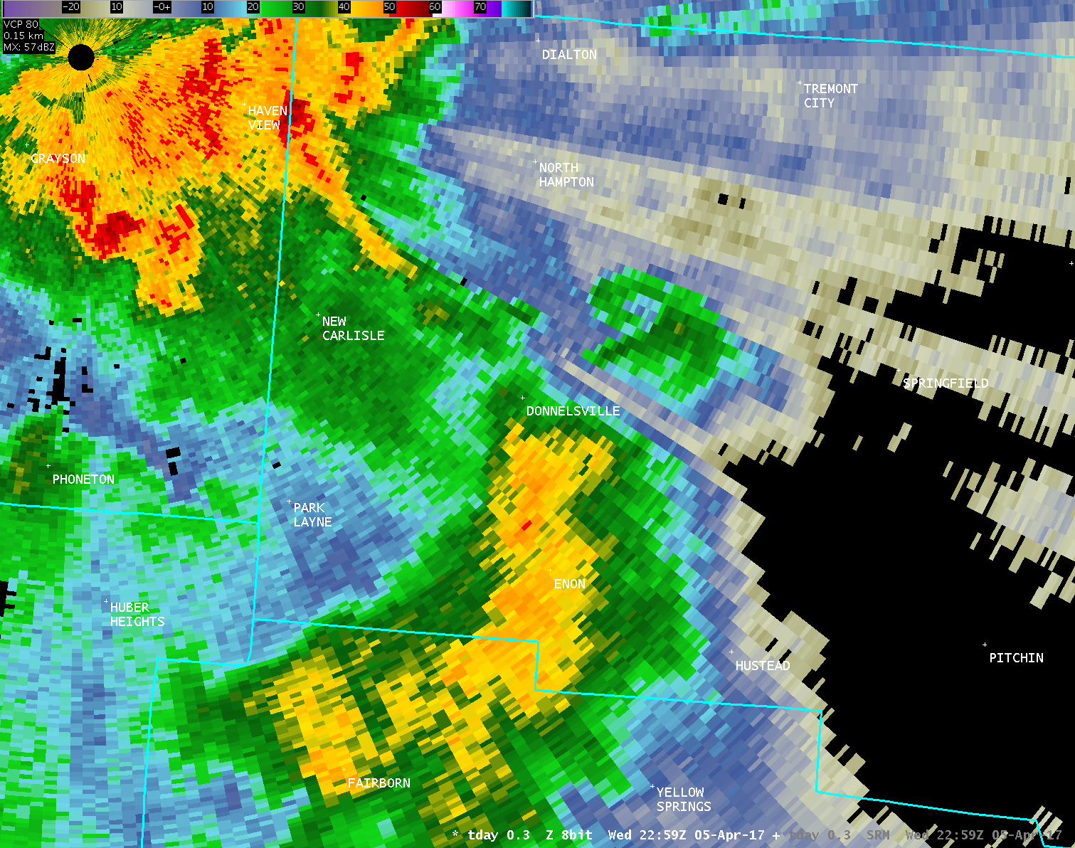
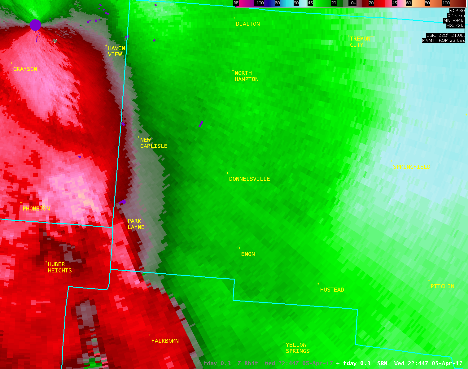
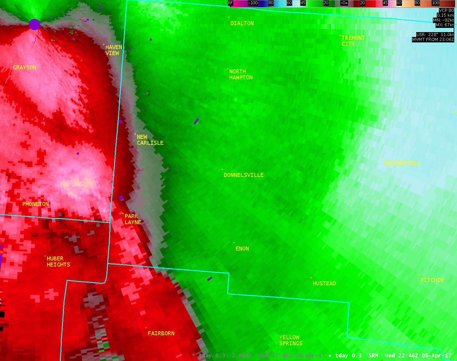
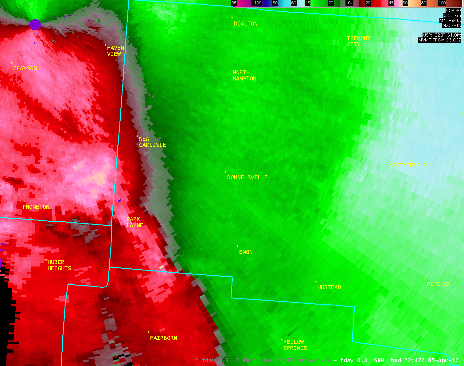
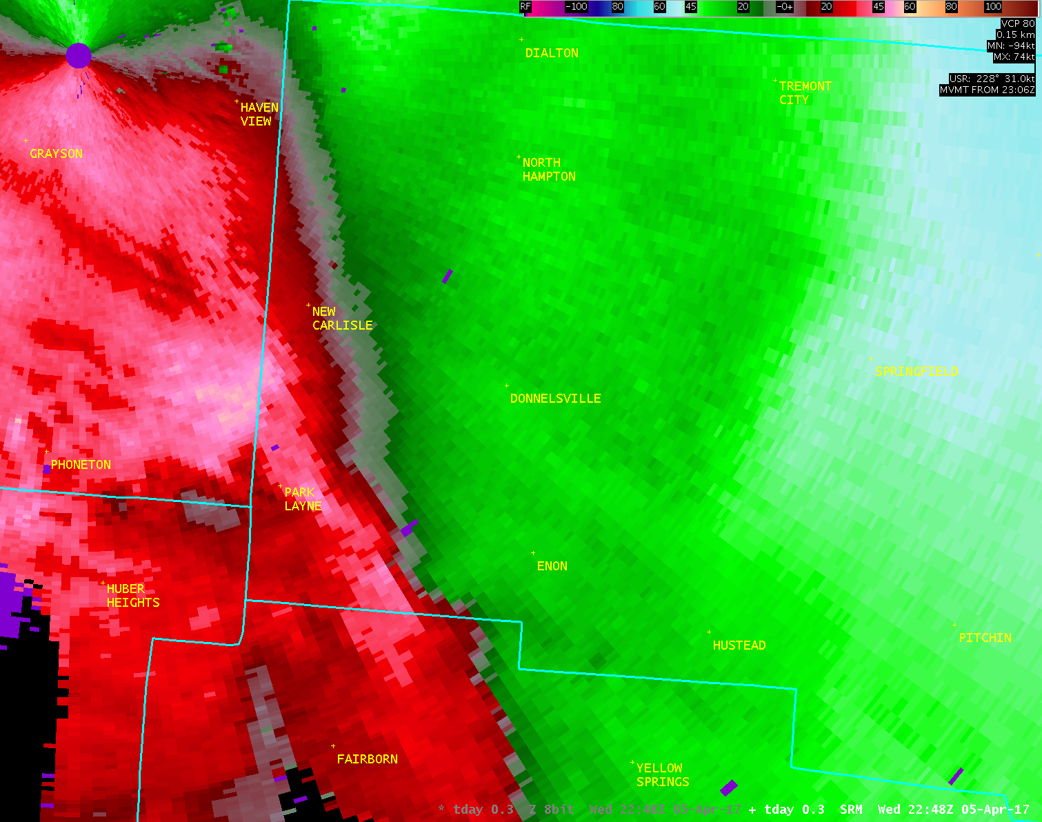
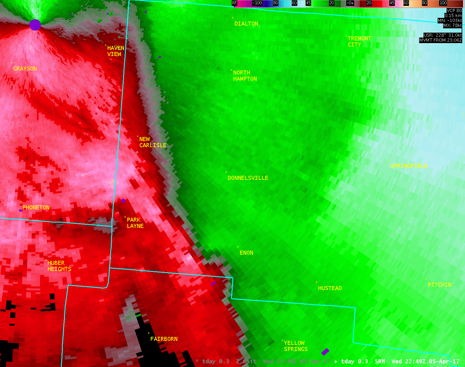
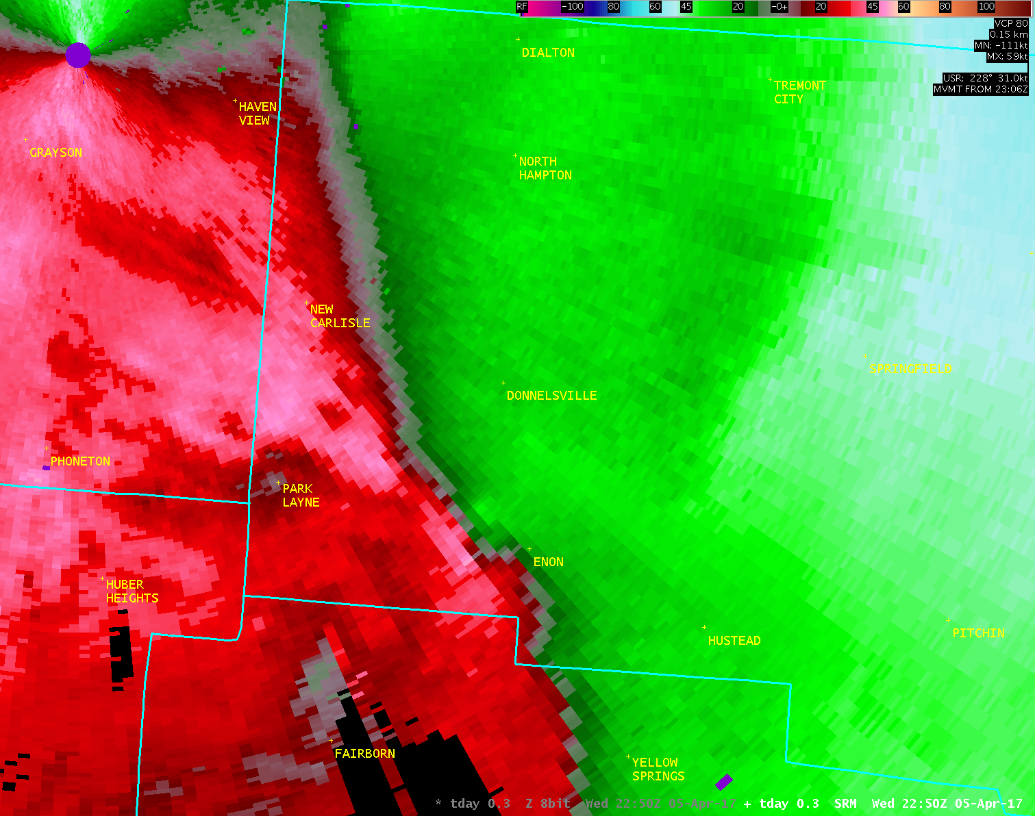
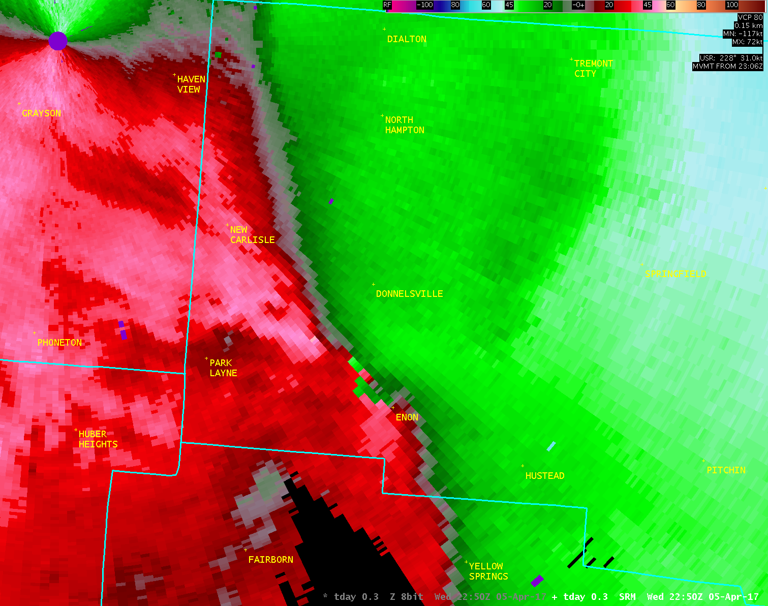
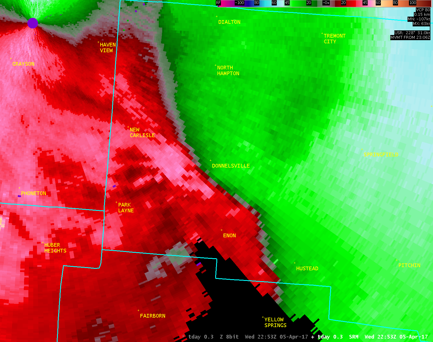
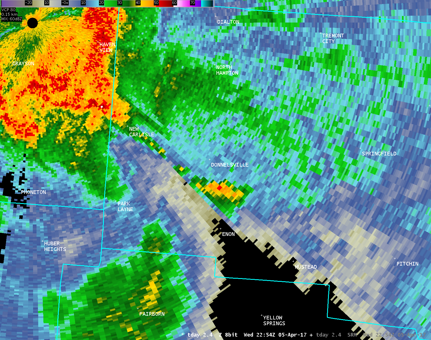
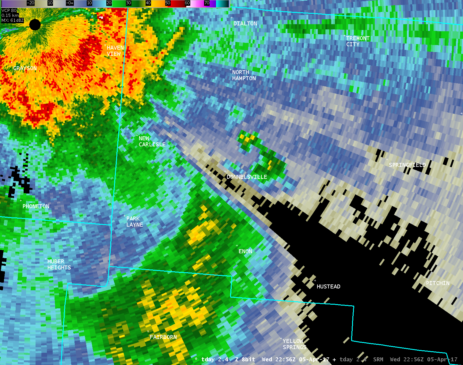
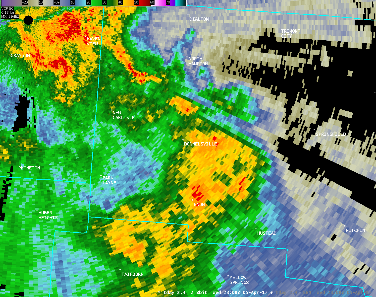
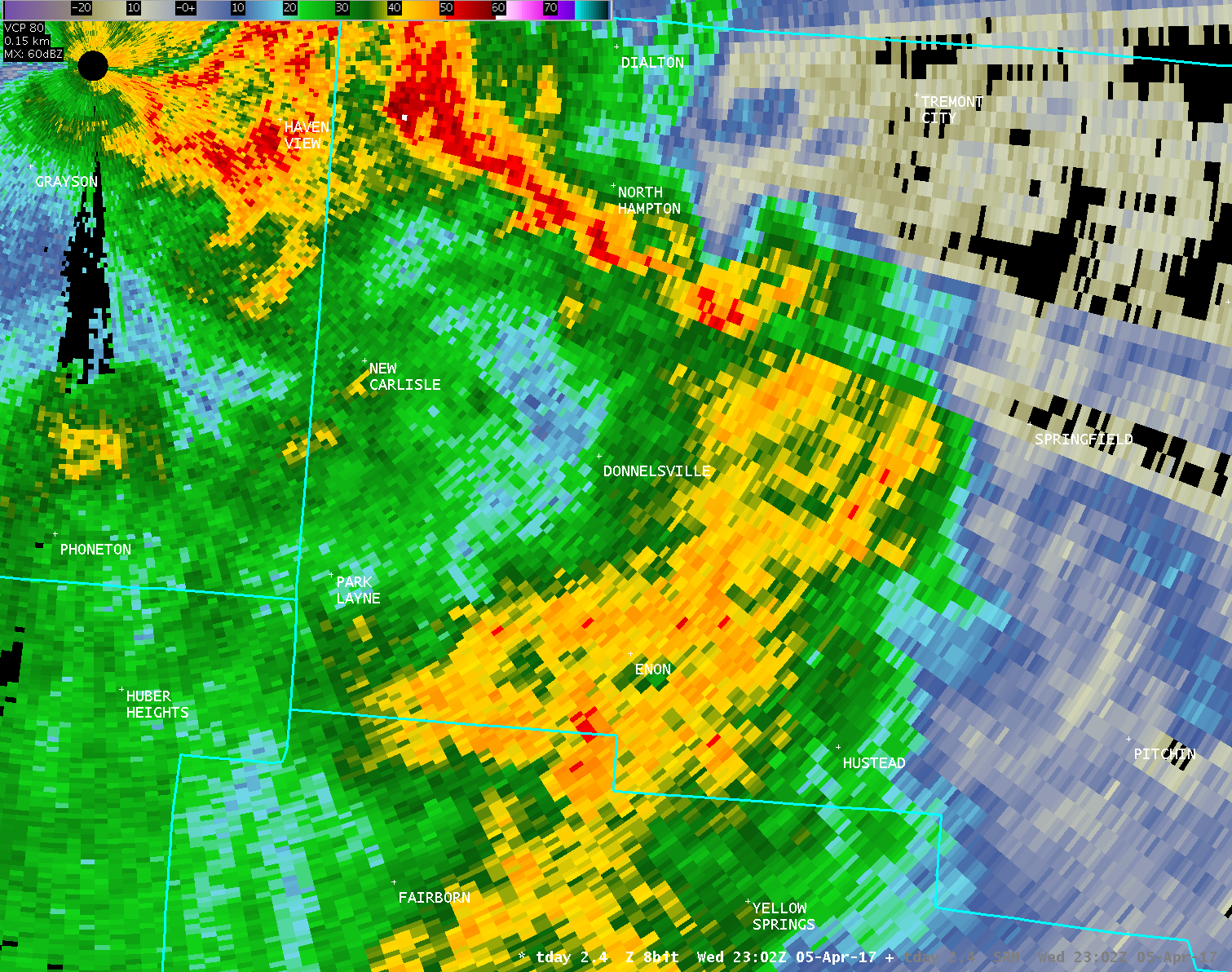
| TDAY 0.3° Storm-Relative Motion (400-700 feet AGL) | |
| 1 2 3 4 5 6 7 8 9 10 11 12 13 14 15 16 17 18 19 20 21 22 23 24 | |
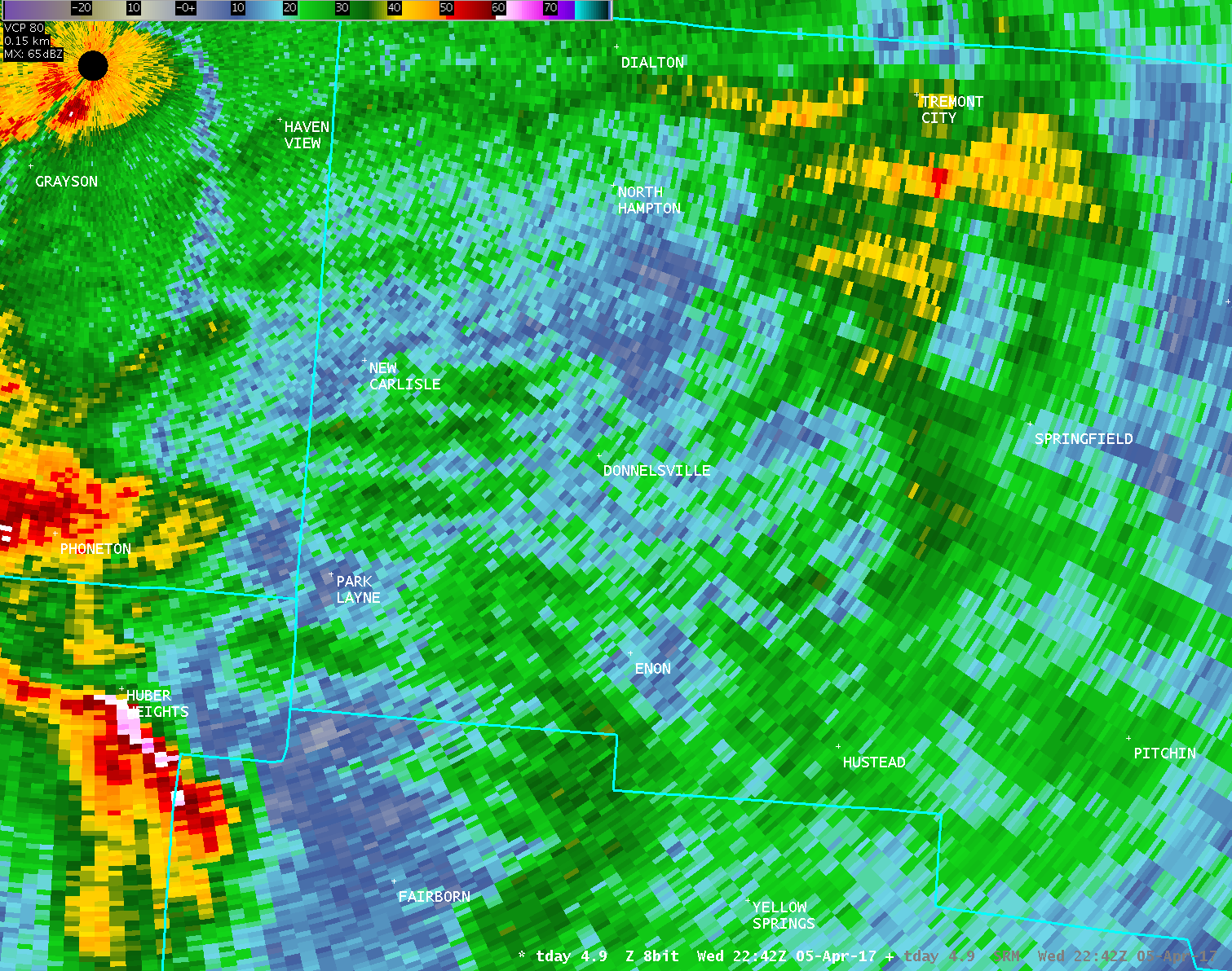
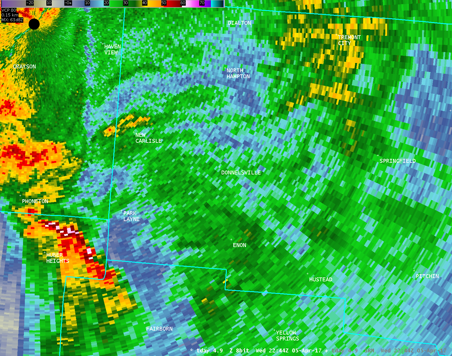
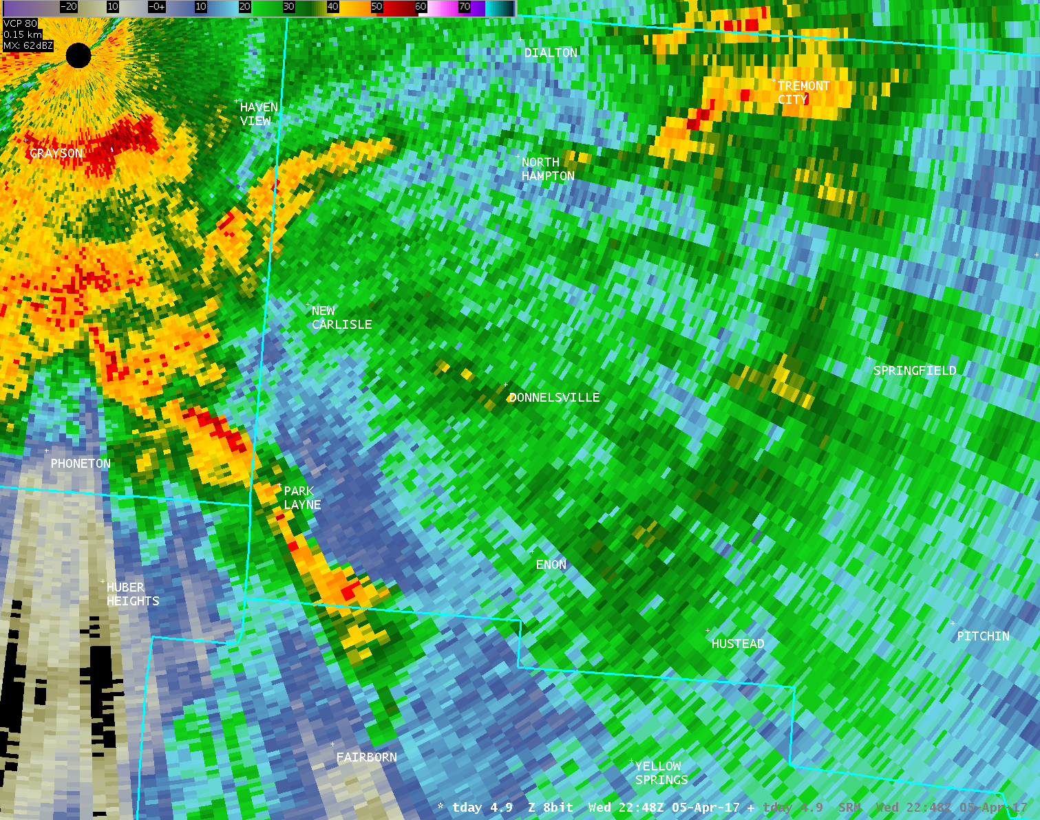
| TDAY 1.0° Reflectivity (1200-1600 feet AGL) | TDAY 1.0° Storm-Relative Motion (1200-1600 feet AGL) |
| 1 2 3 4 5 | 1 2 3 4 5 |
| TDAY 2.4° Reflectivity (2600-3100 feet AGL) | TDAY 2.4° Storm-Relative Motion (2600-3100 feet AGL) |
| 1 2 3 4 5 6 7 8 9 | 1 2 3 4 5 6 7 8 9 |
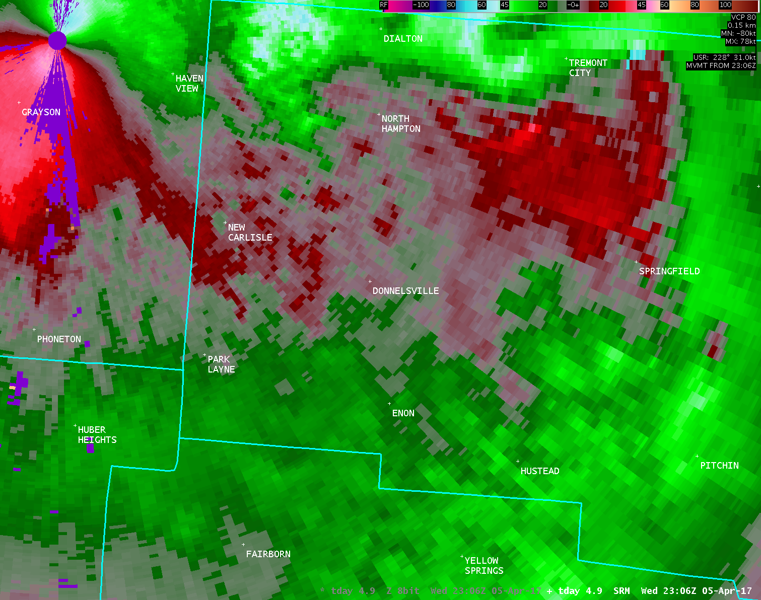
| TDAY 4.9° Reflectivity (5400-5800 feet AGL) | TDAY 4.9° Storm-Relative Motion (5400-5800 feet AGL) |
| 1 2 3 4 5 6 7 8 9 | 1 2 3 4 5 6 7 8 9 |
| Full Radar Loops from NWS Wilmington Ohio (6:43 PM - 7:05 PM) | |
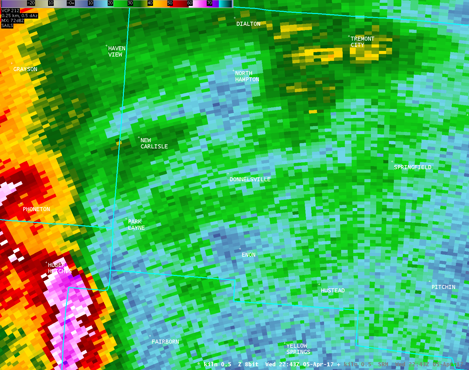
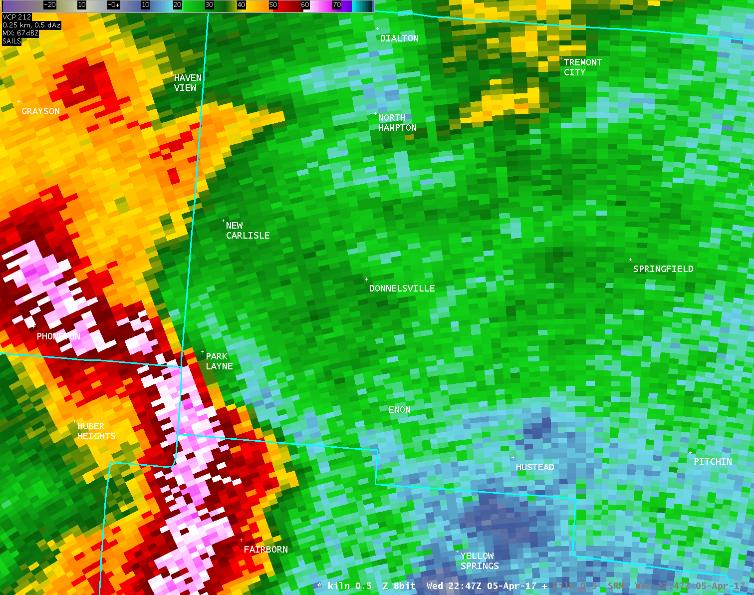
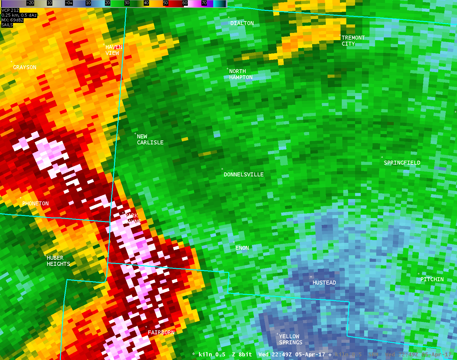
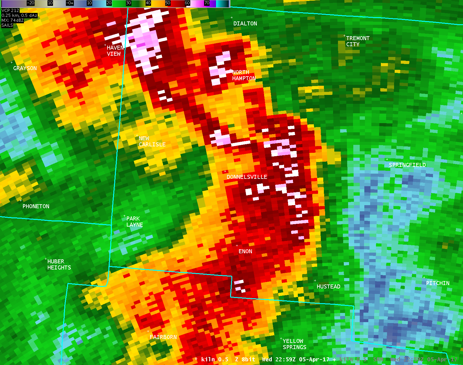
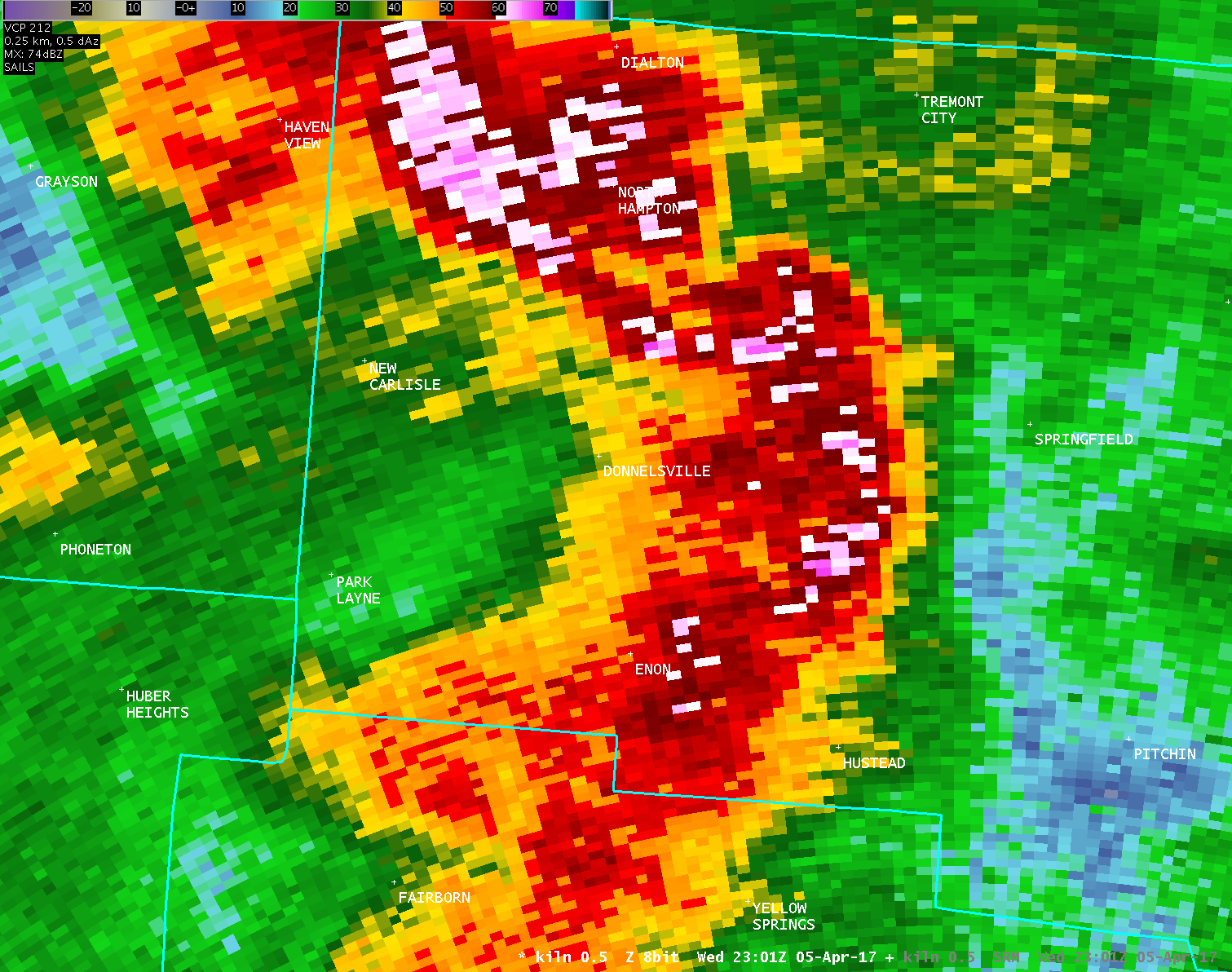
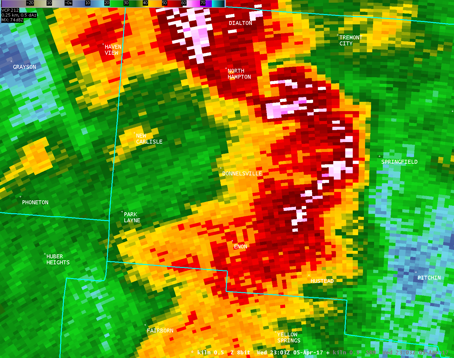
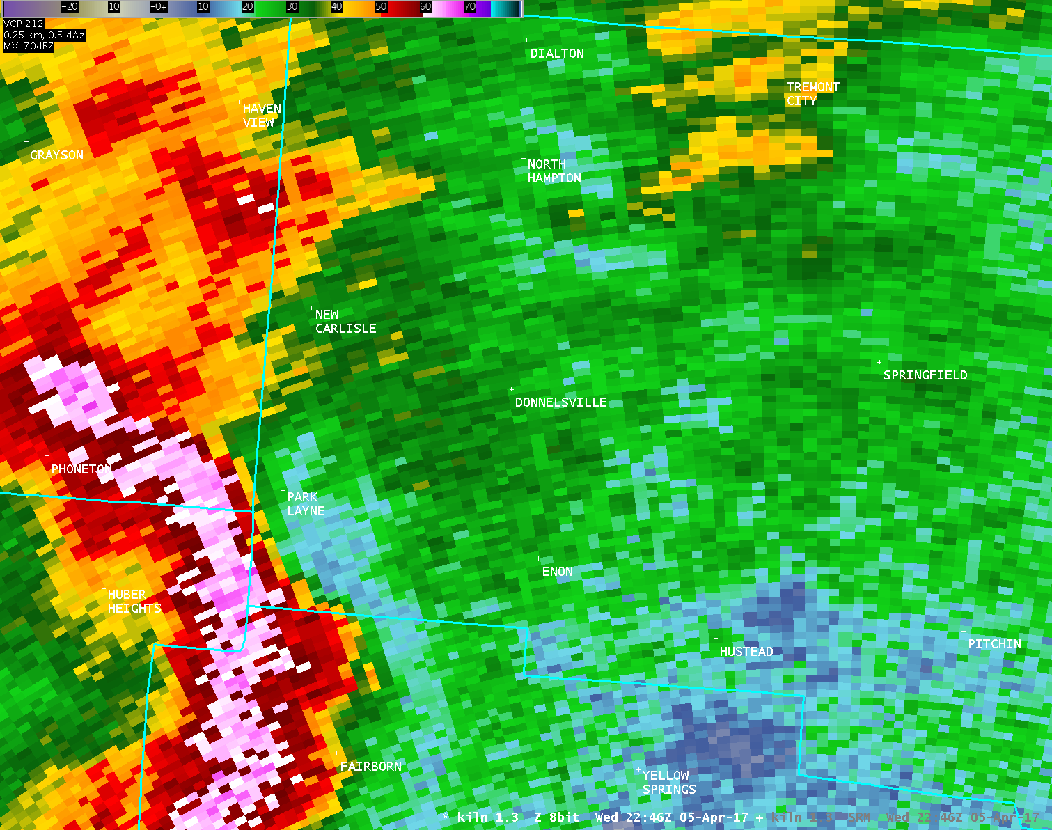
| KILN 0.5° Reflectivity (2100-2600 feet AGL) | |
| 1 2 3 4 5 6 7 8 9 10 11 12 | |
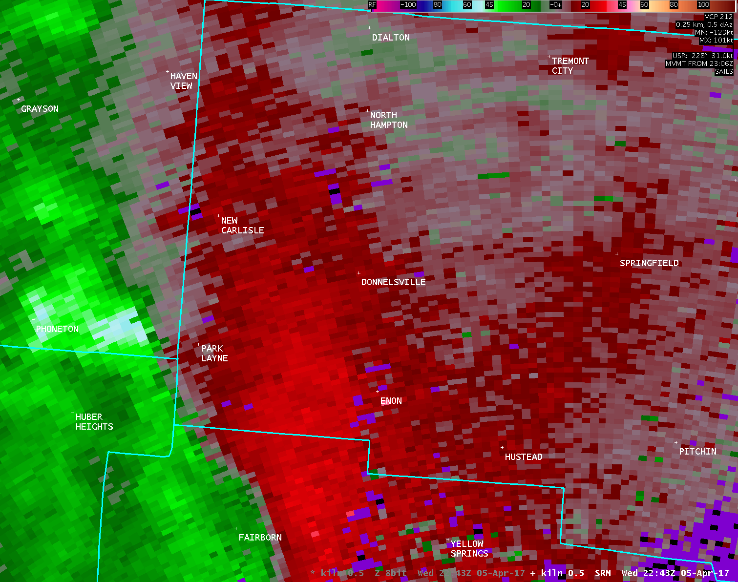
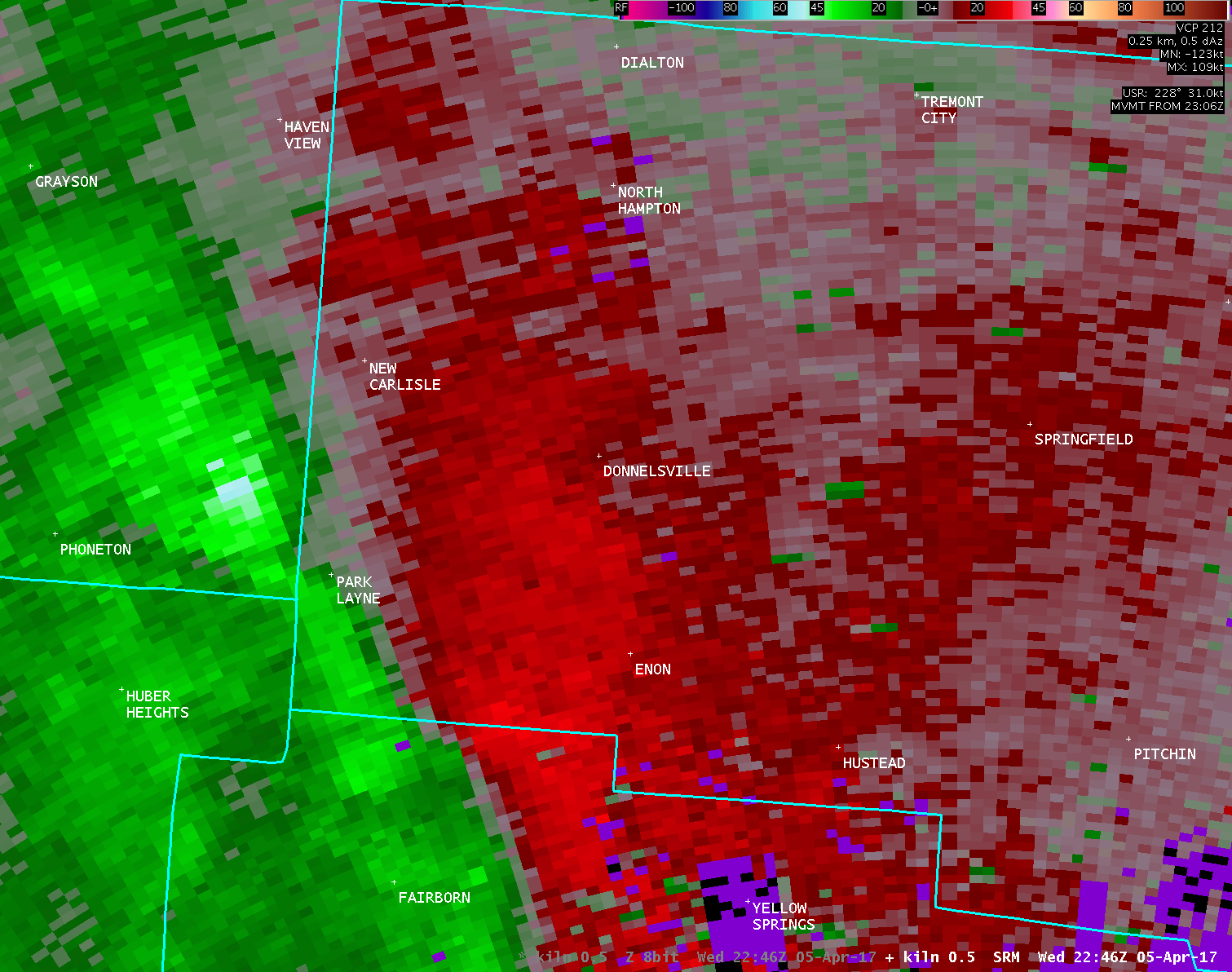
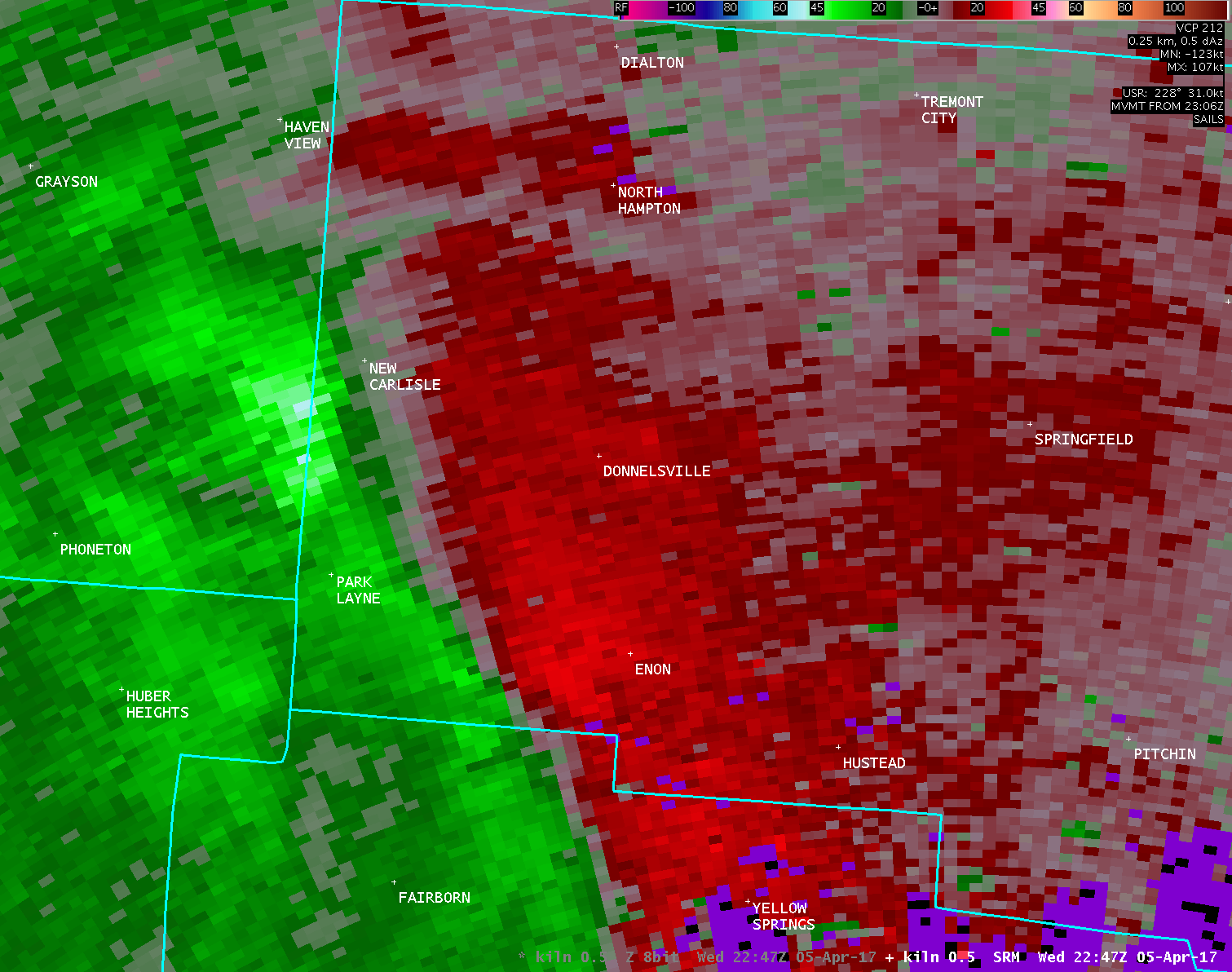
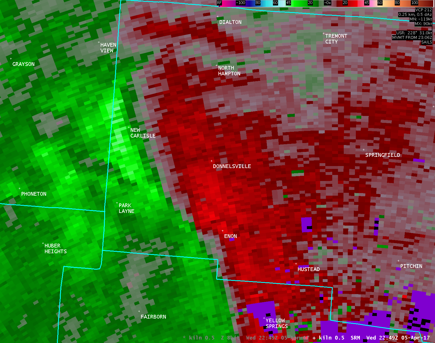
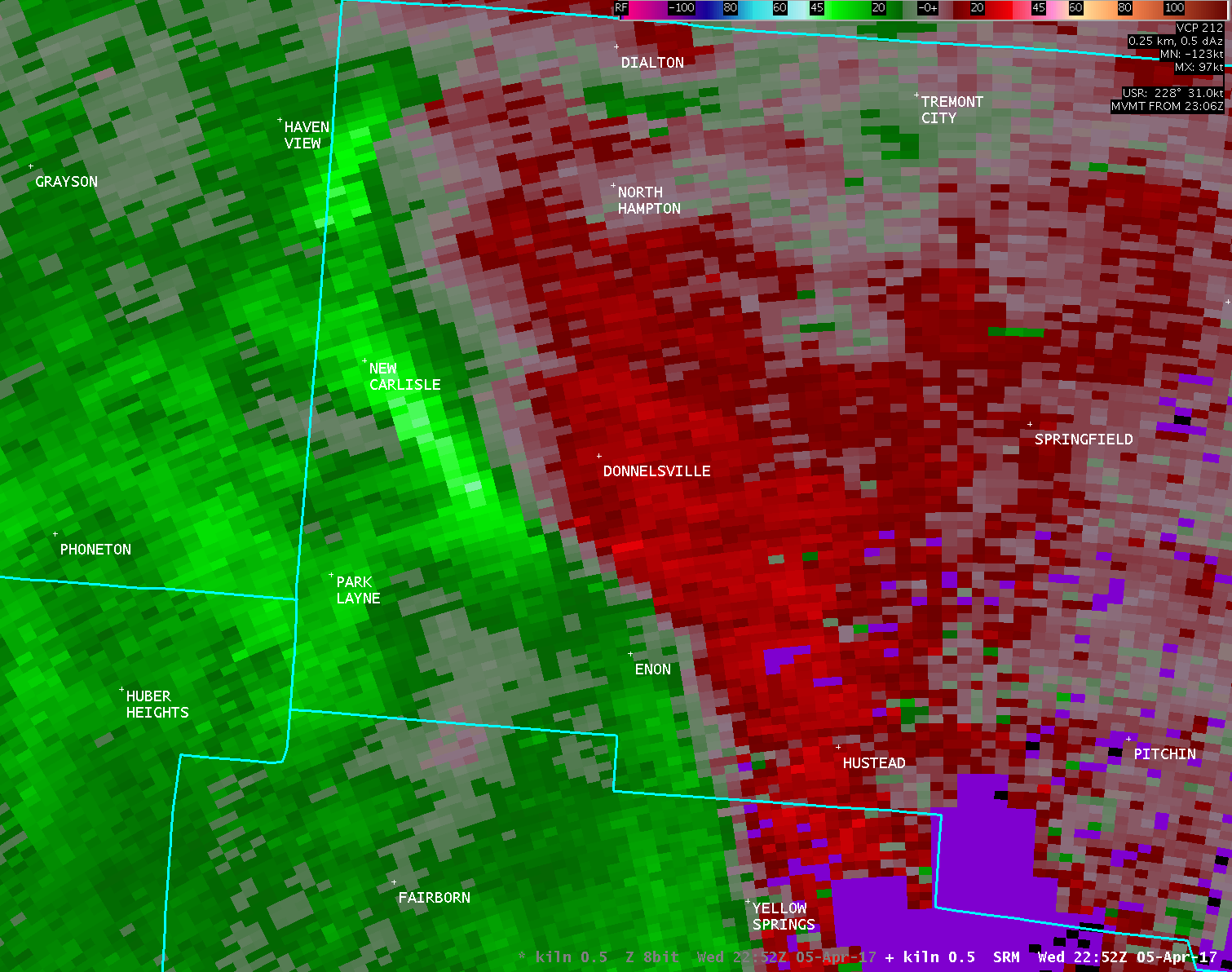
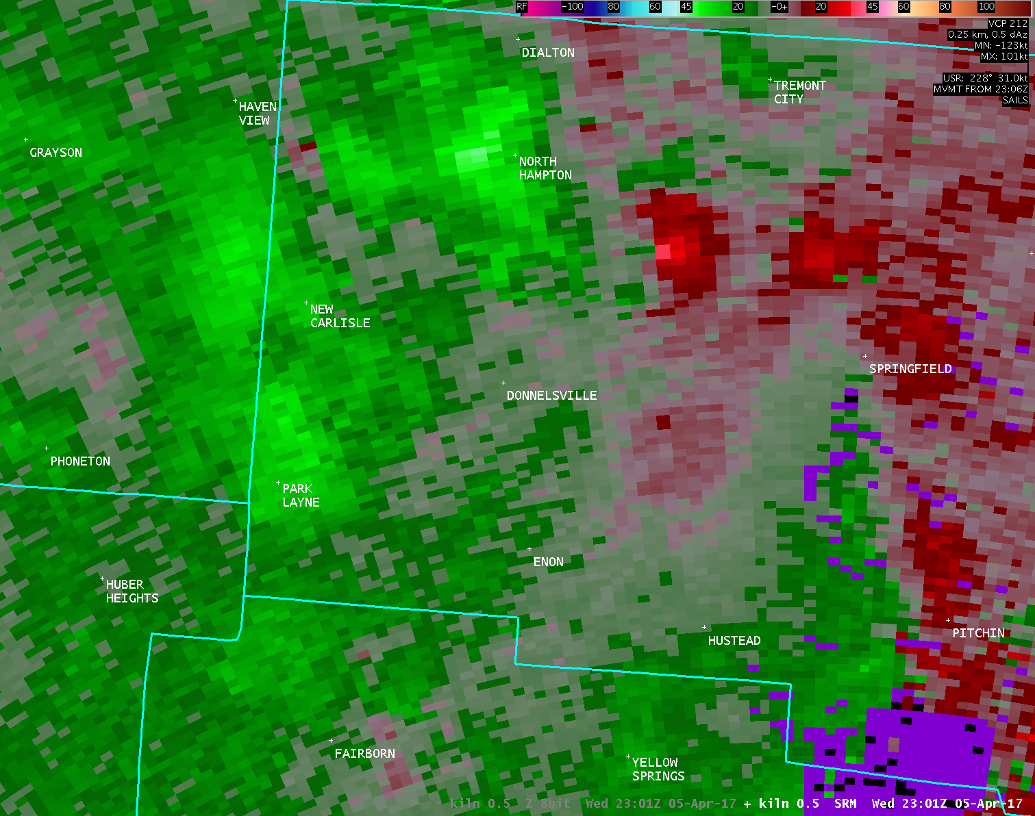
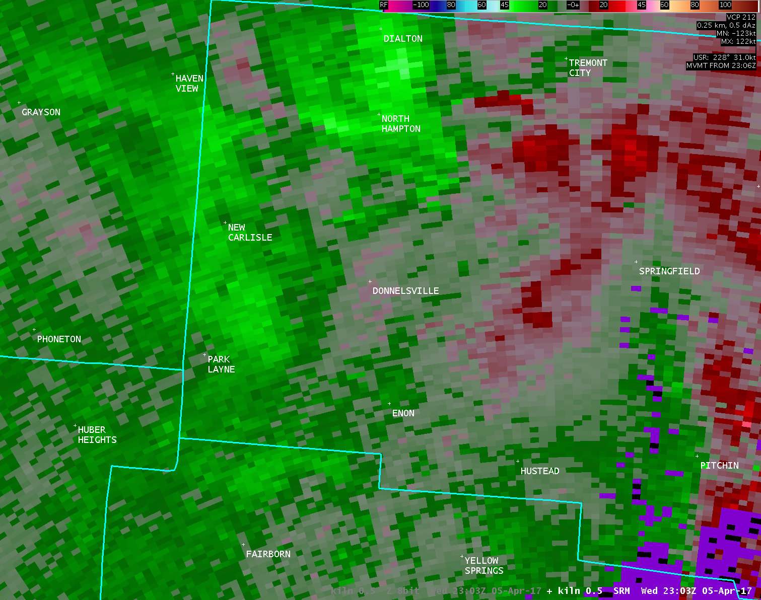
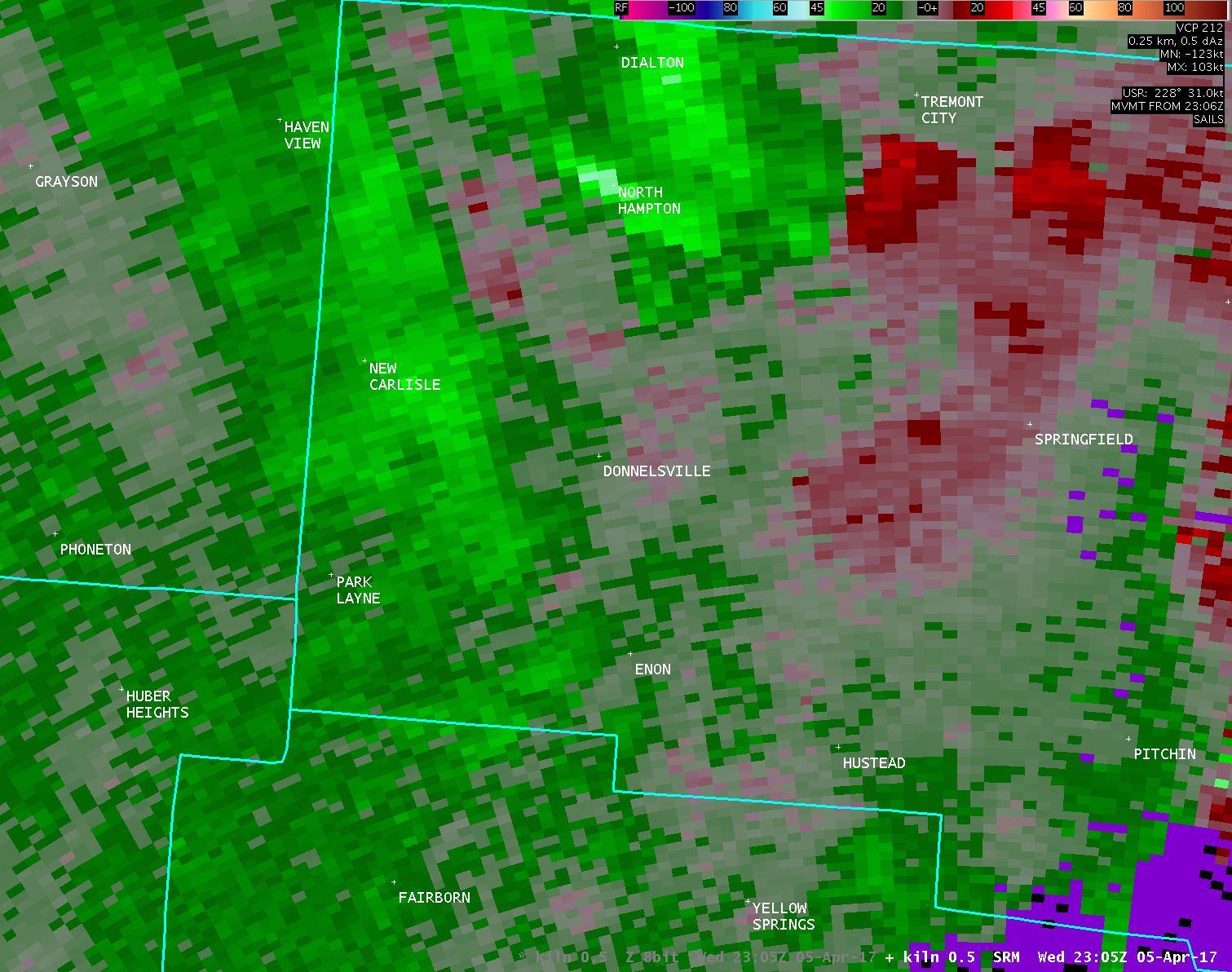
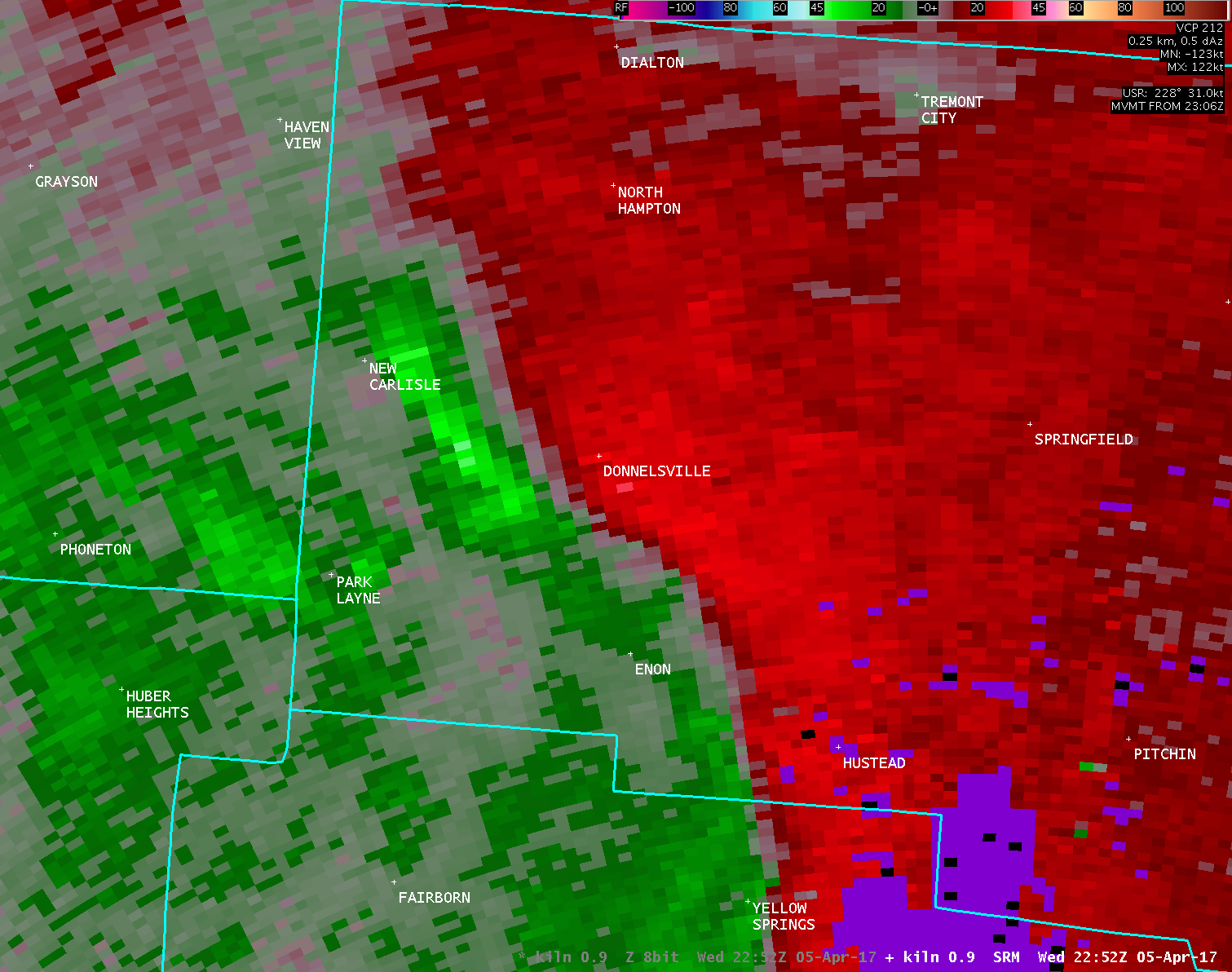
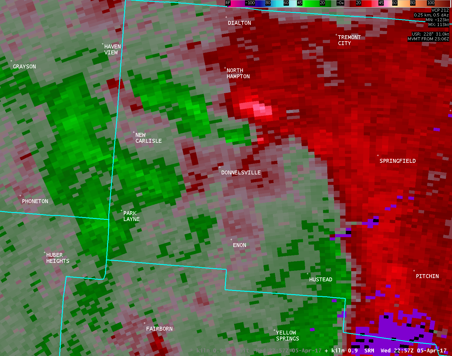
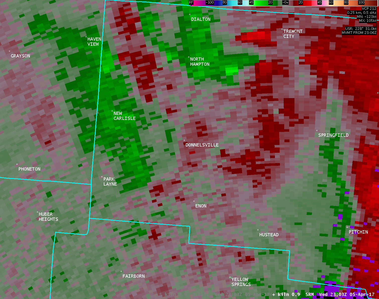
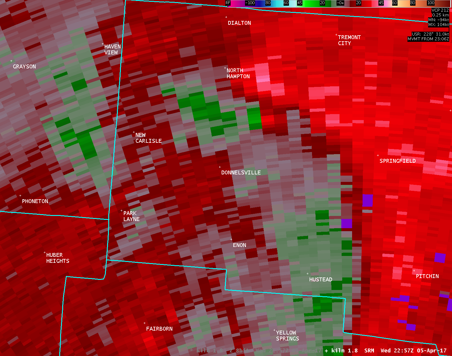
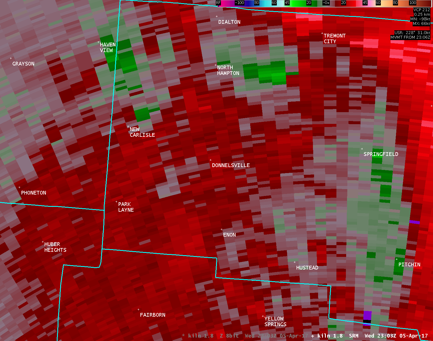
| KILN 0.5° Storm-Relative Motion (2100-2600 feet AGL) | |
| 1 2 3 4 5 6 7 8 9 10 11 12 | |
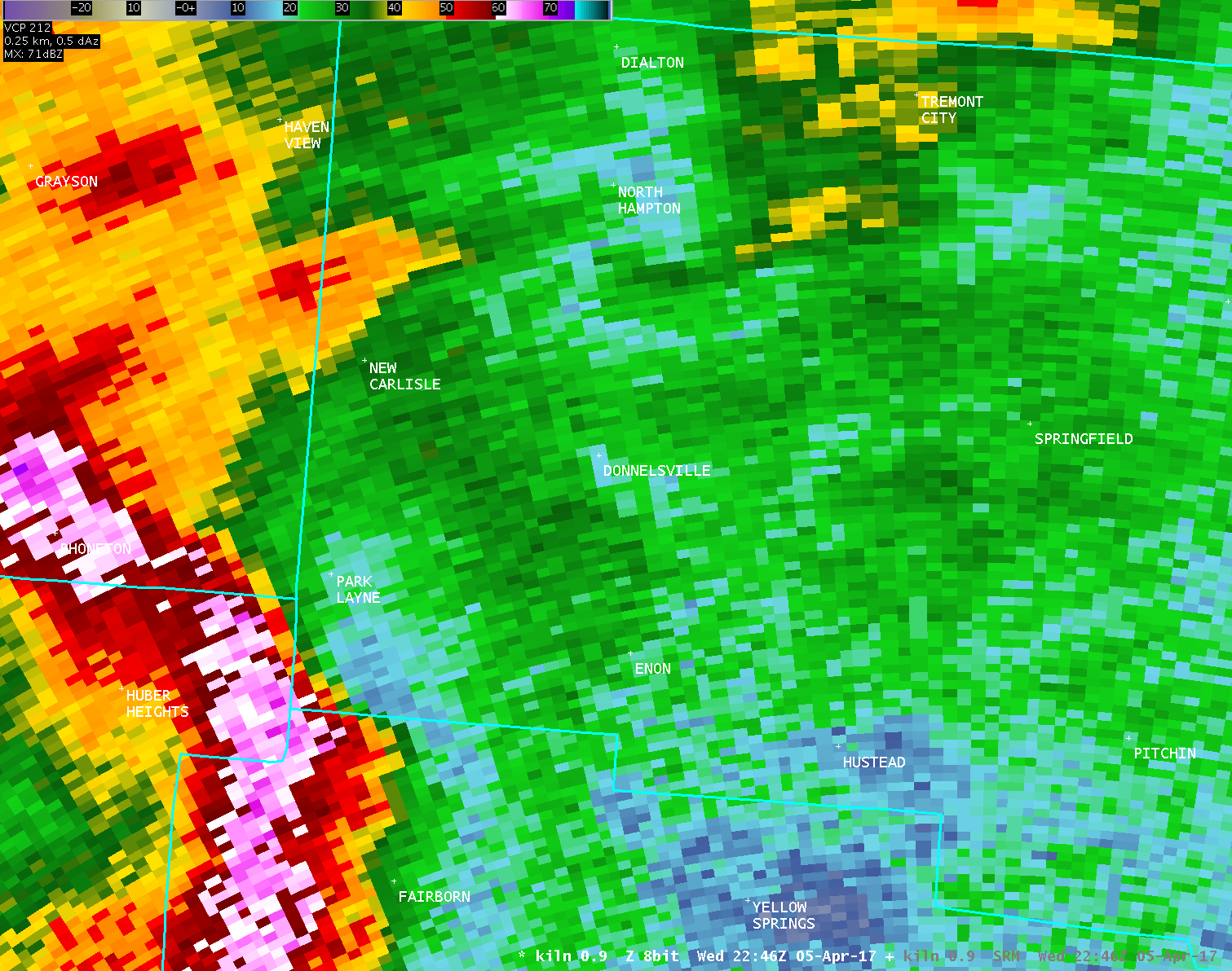
| KILN 0.9° Reflectivity (3300-4000 feet AGL) | KILN 0.9° Storm-Relative Motion (3300-4000 feet AGL) |
| 1 2 3 4 | 1 2 3 4 |
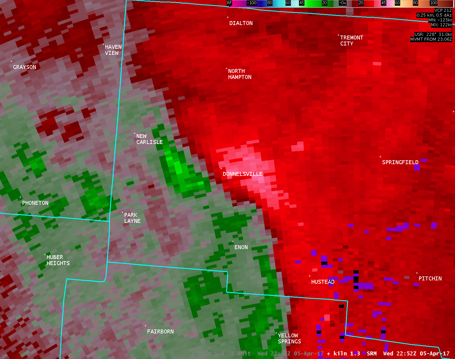
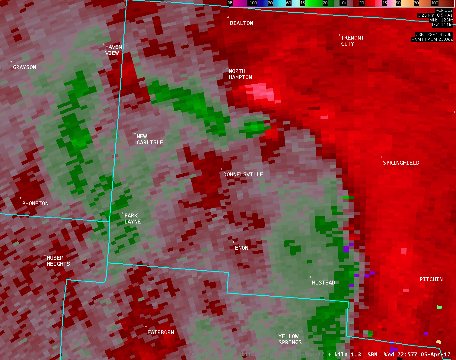
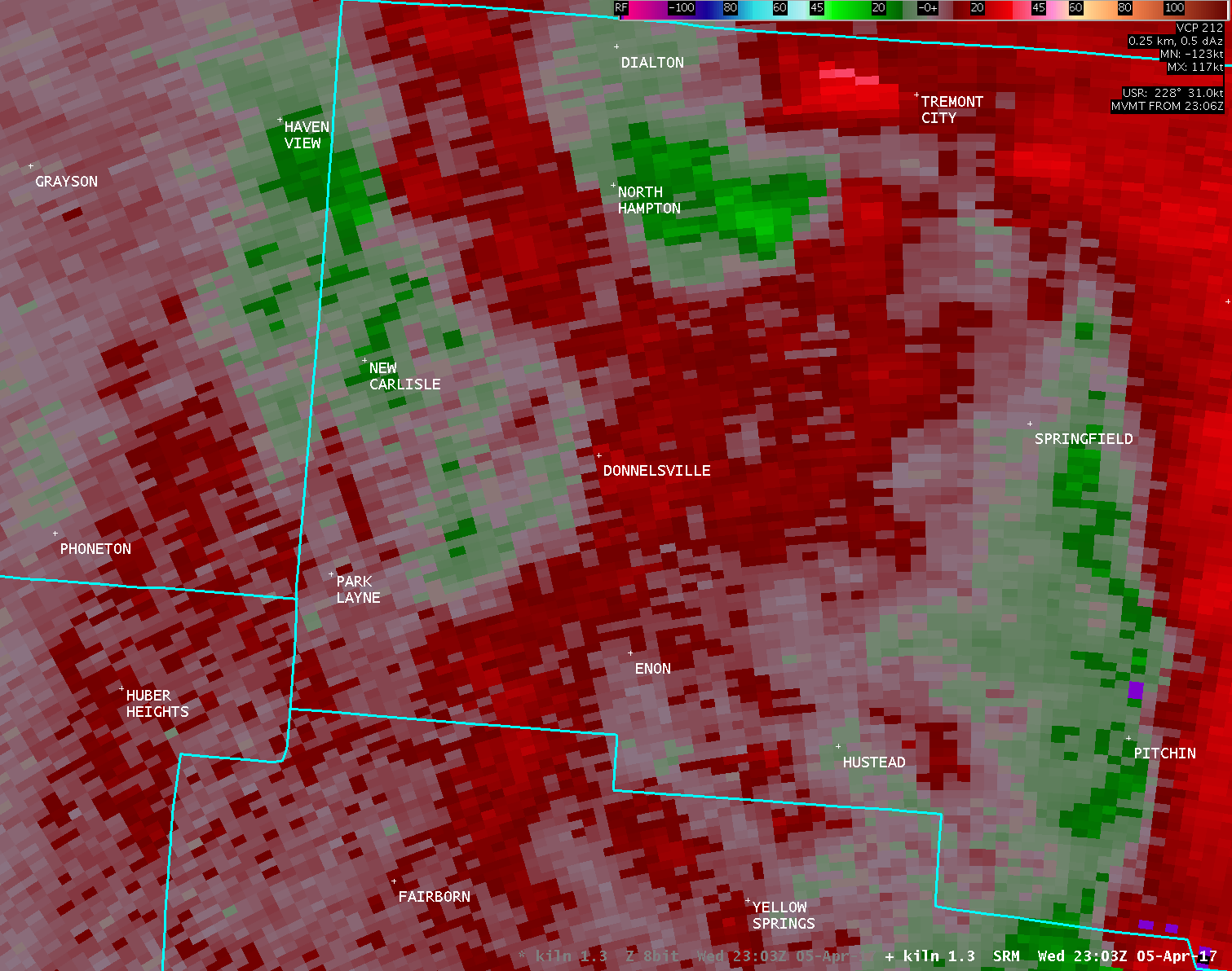
| KILN 1.3° Reflectivity (4500-5500 feet AGL) | KILN 1.3° Storm-Relative Motion (4500-5500 feet AGL) |
| 1 2 3 4 | 1 2 3 4 |
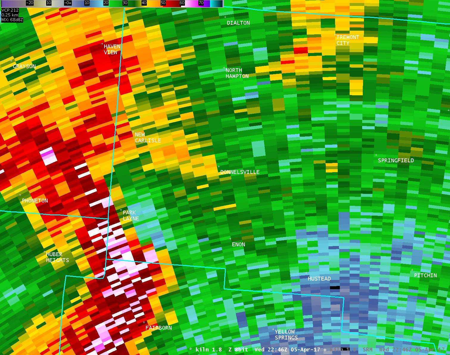
| KILN 1.8° Reflectivity (5900-7400 feet AGL) | KILN 1.8° Storm-Relative Motion (5900-7400 feet AGL) |
| 1 2 3 4 | 1 2 3 4 |

