|
Tornado near Williamsburg, Ohio |
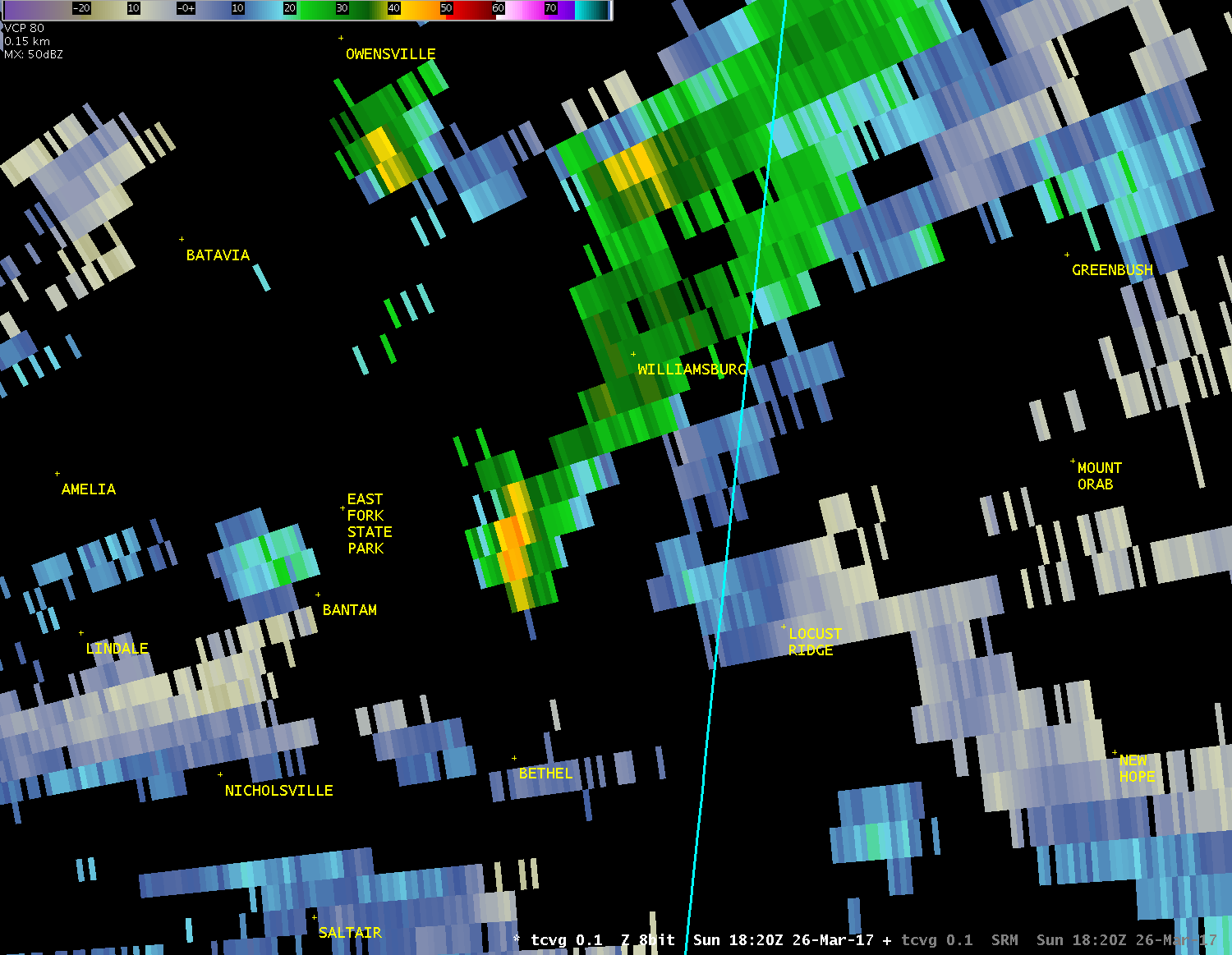
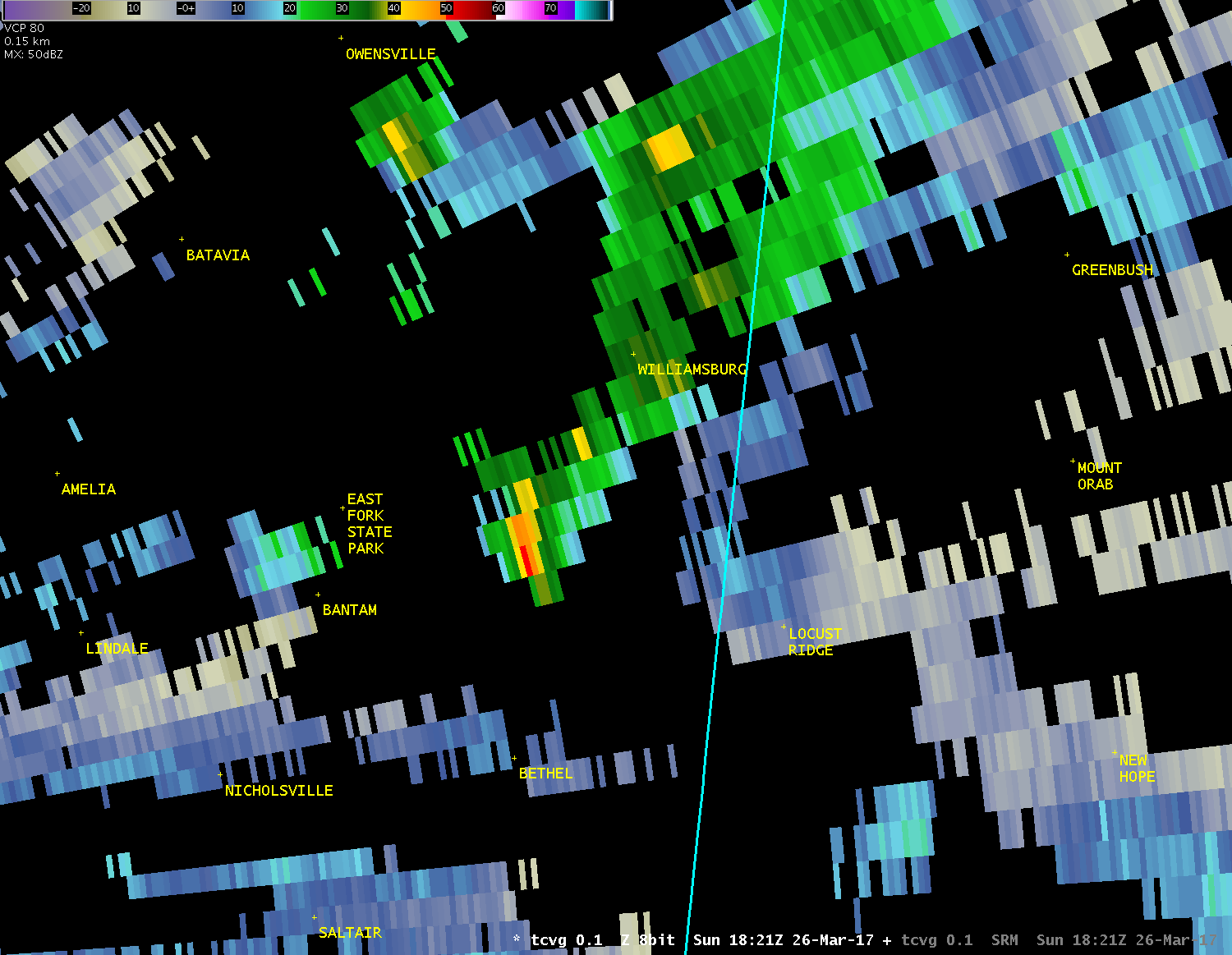
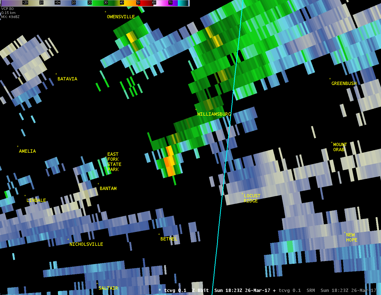
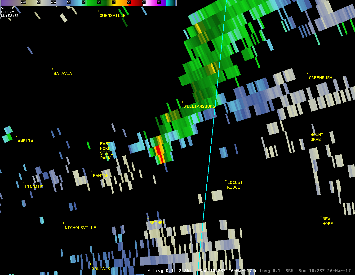
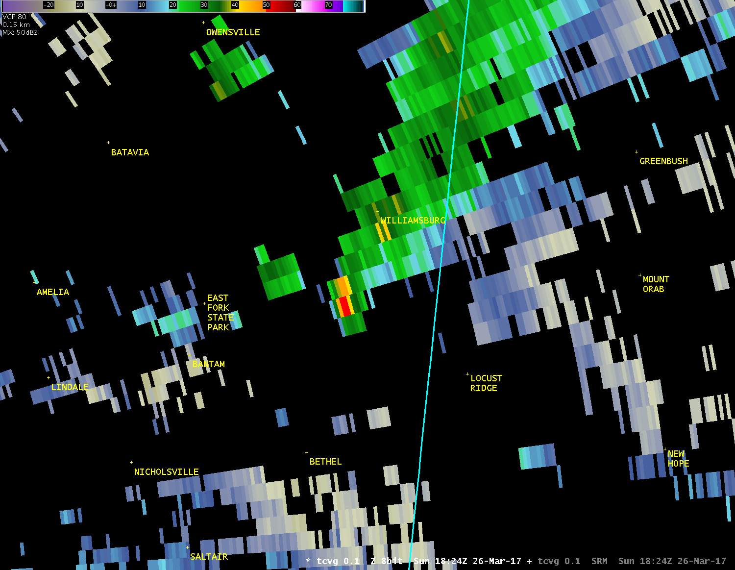
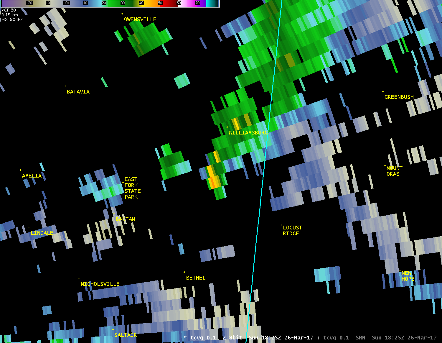
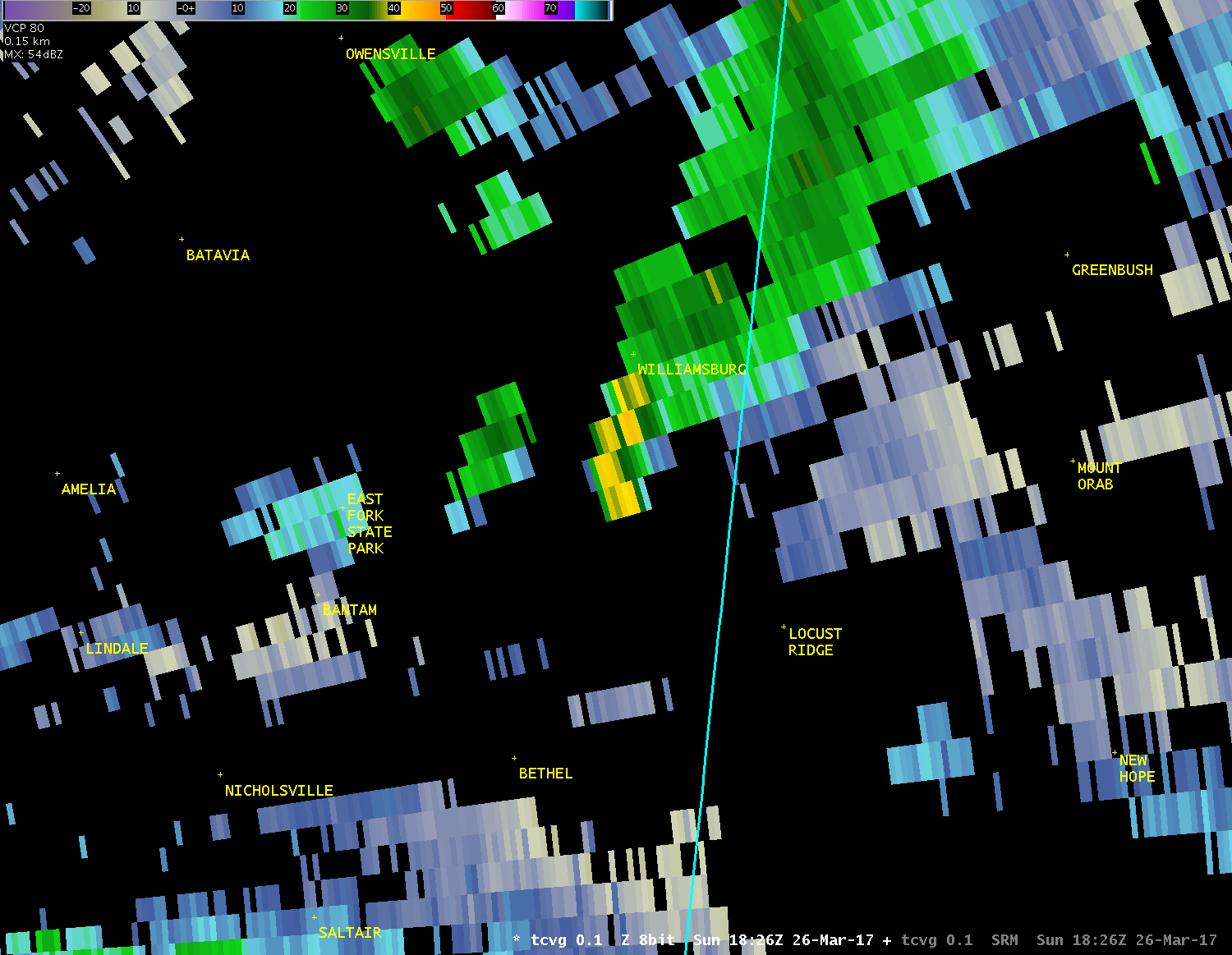
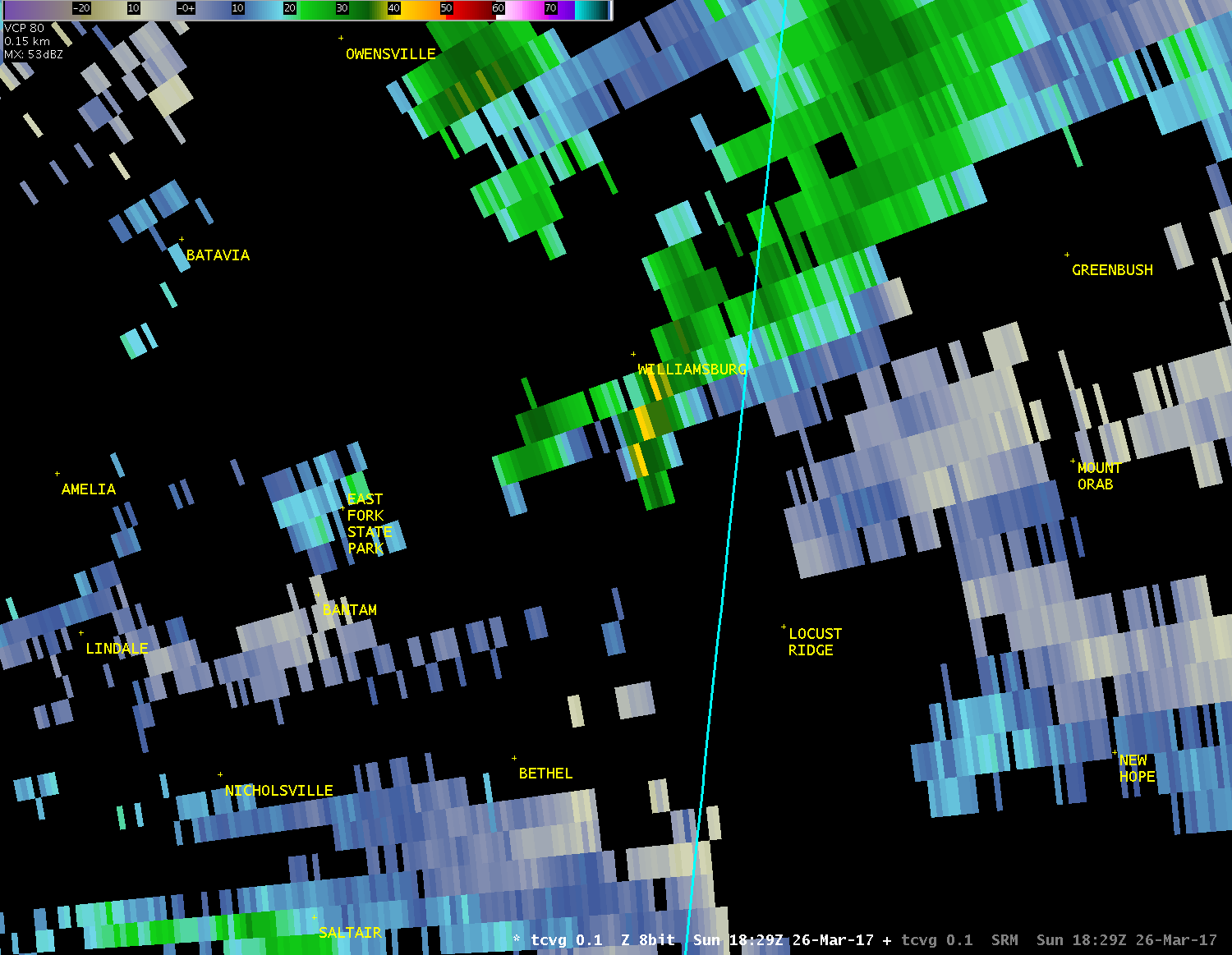
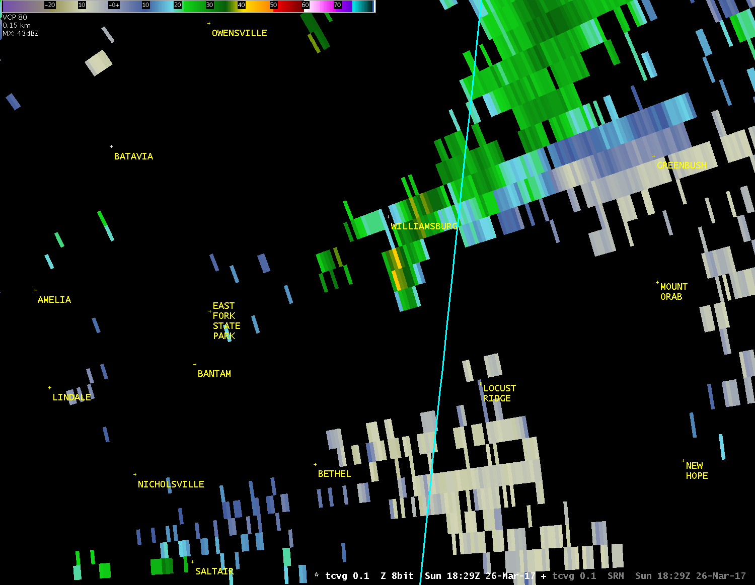
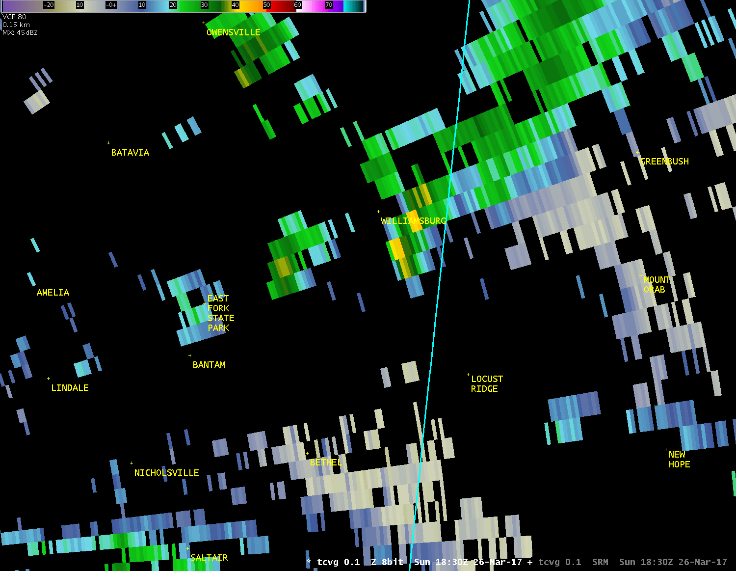
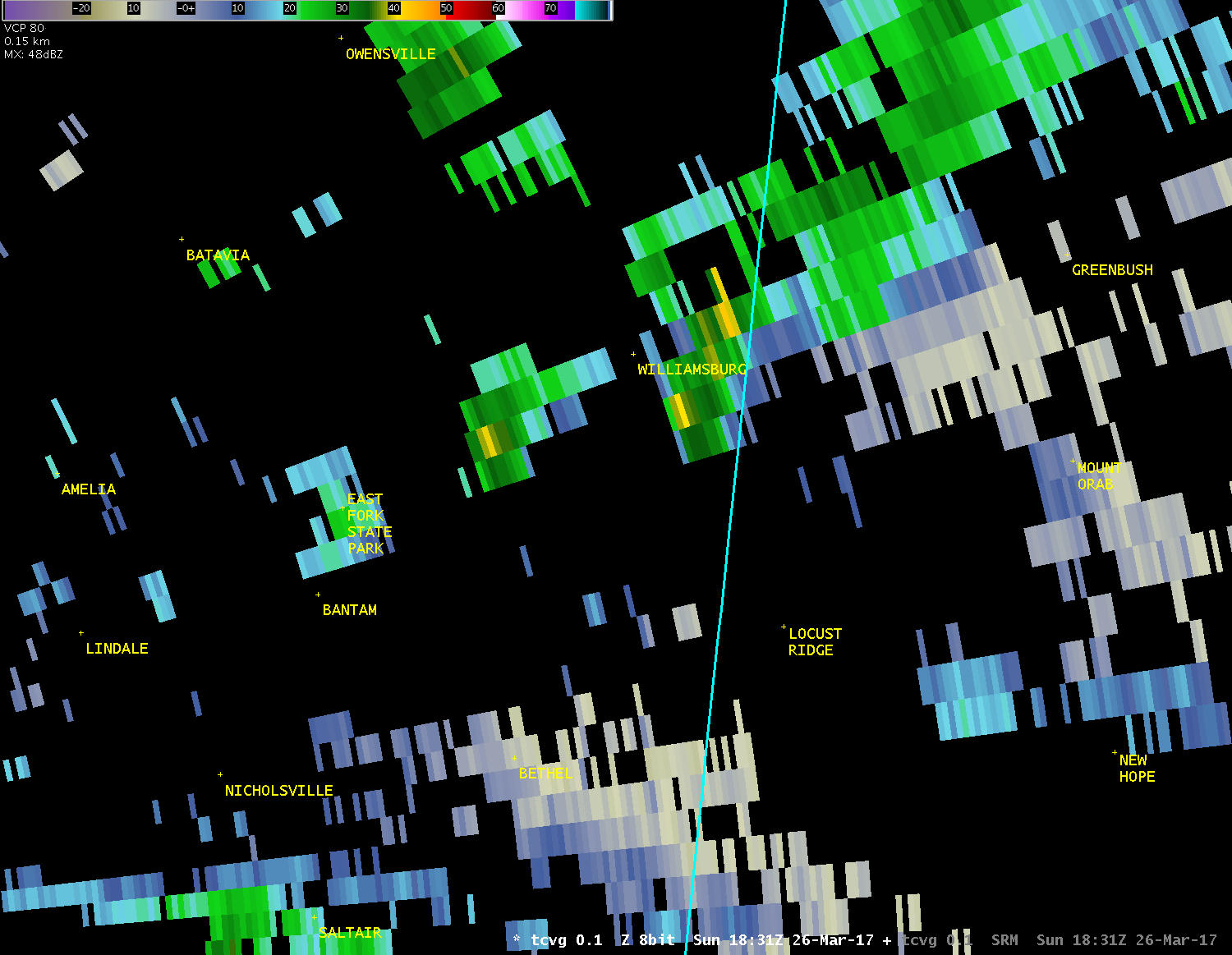
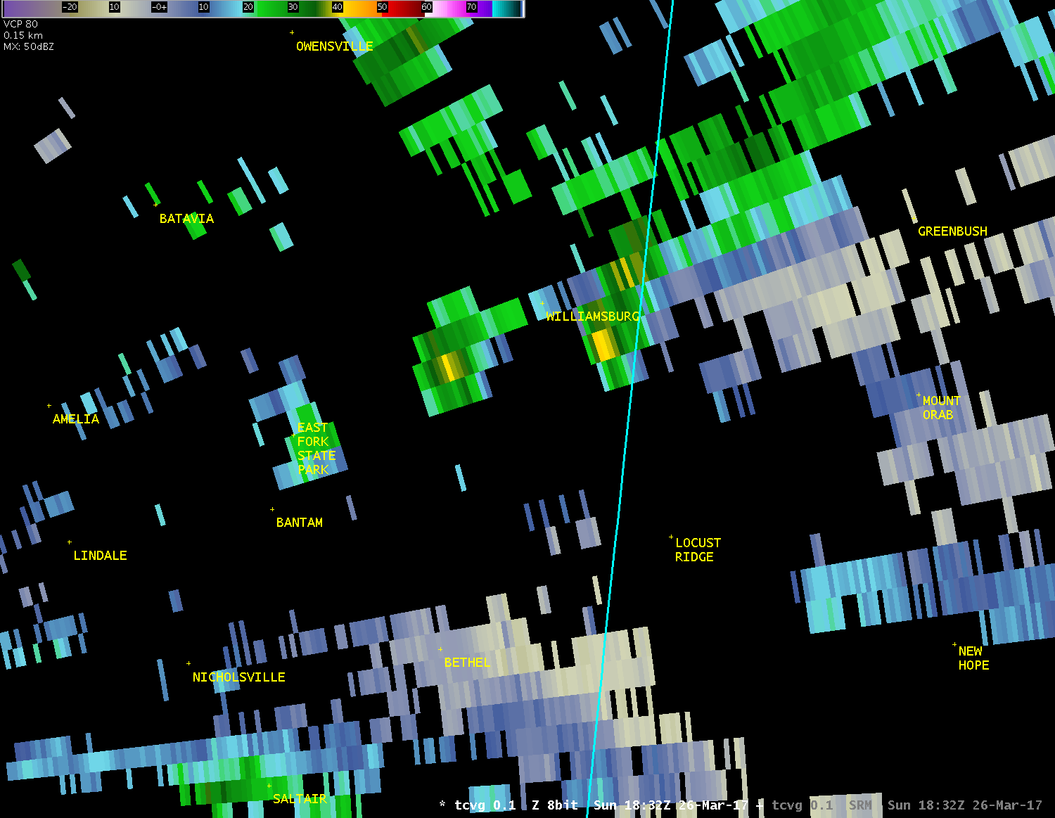
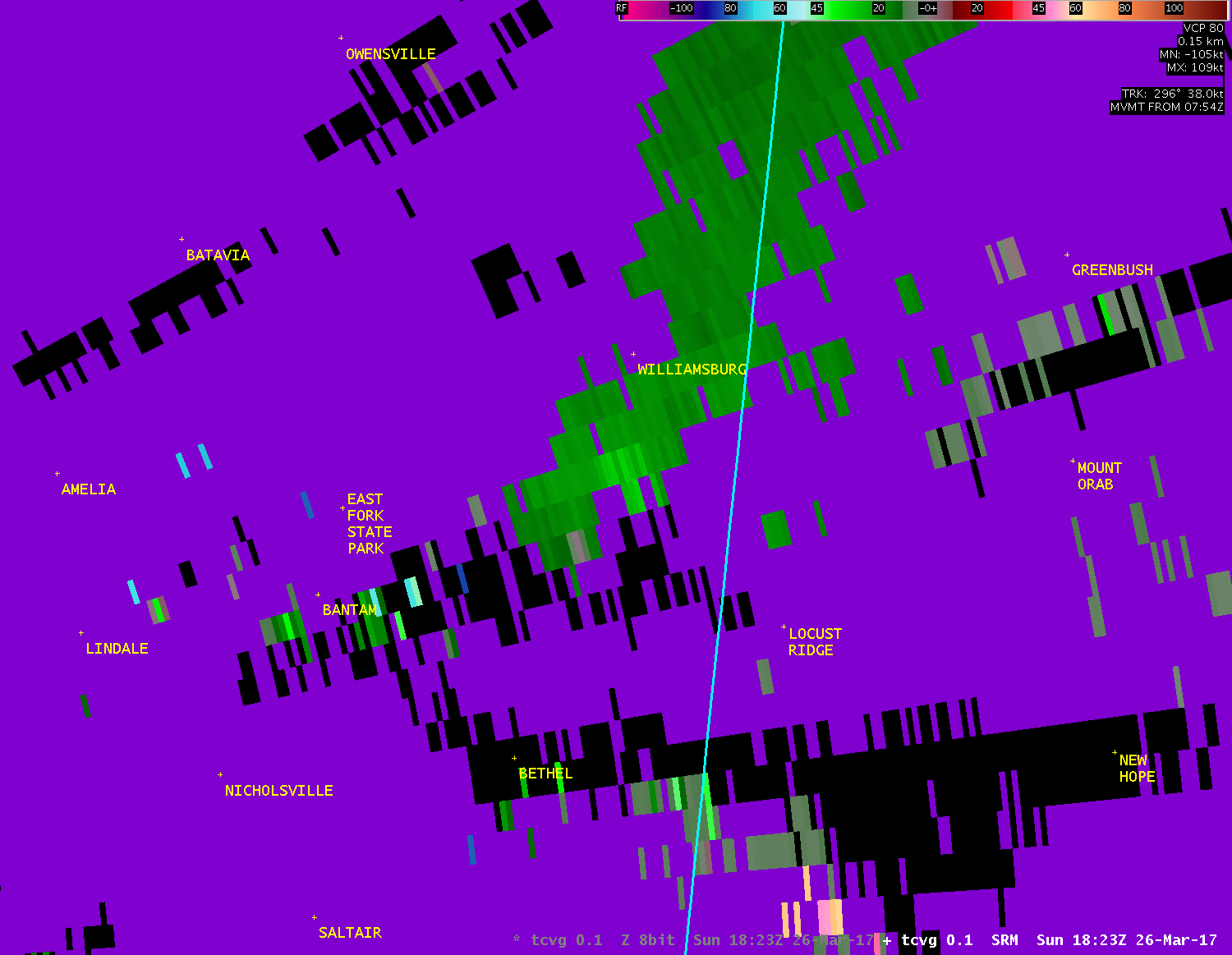
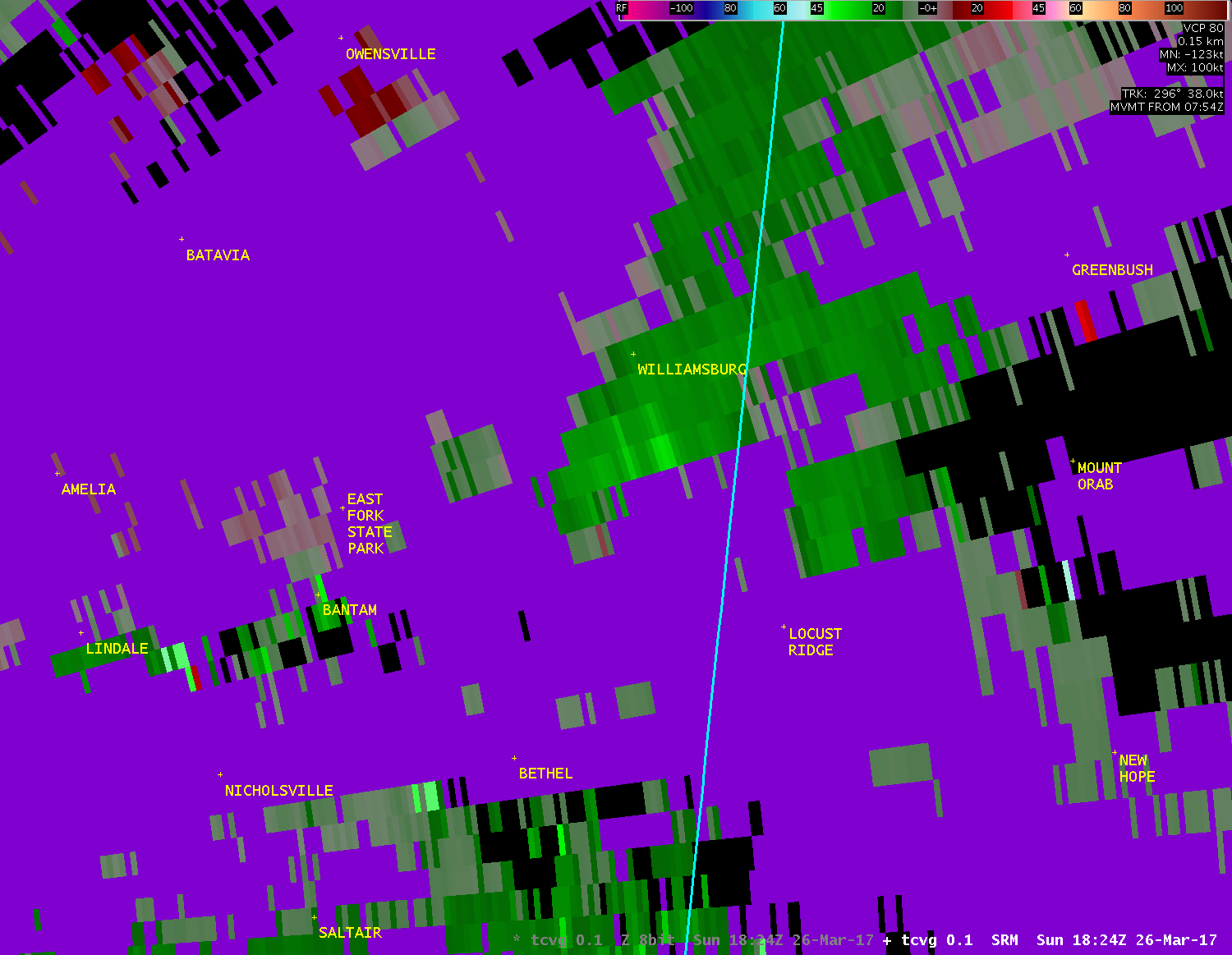
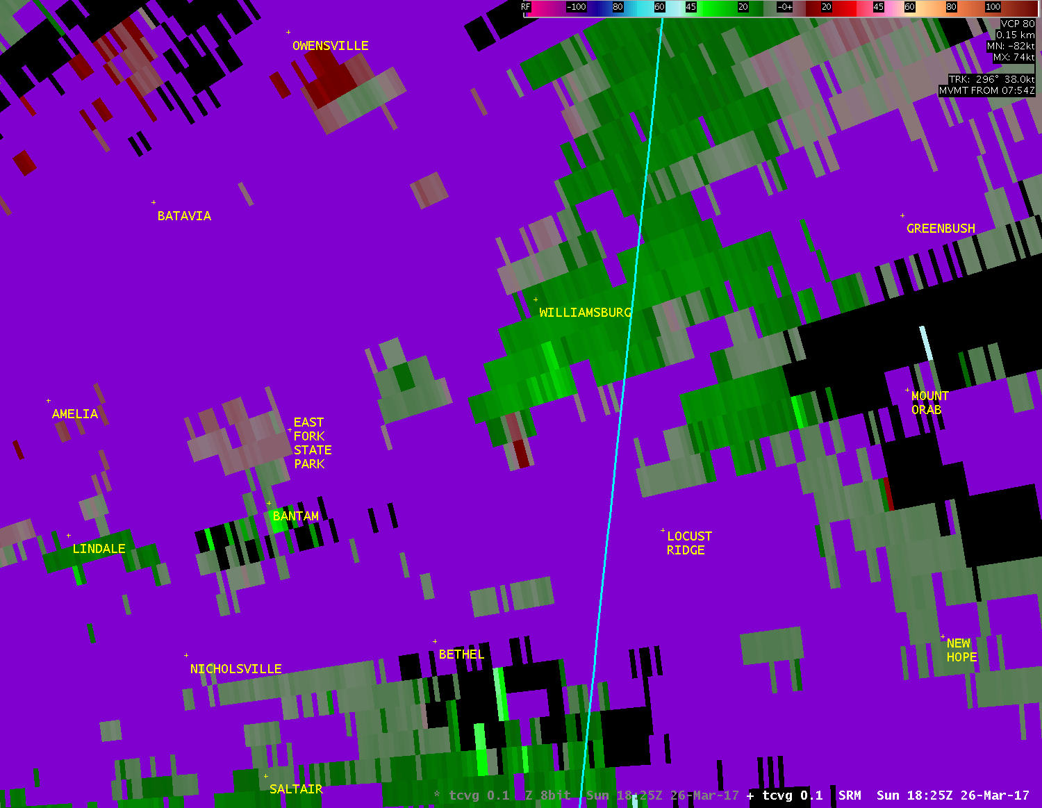
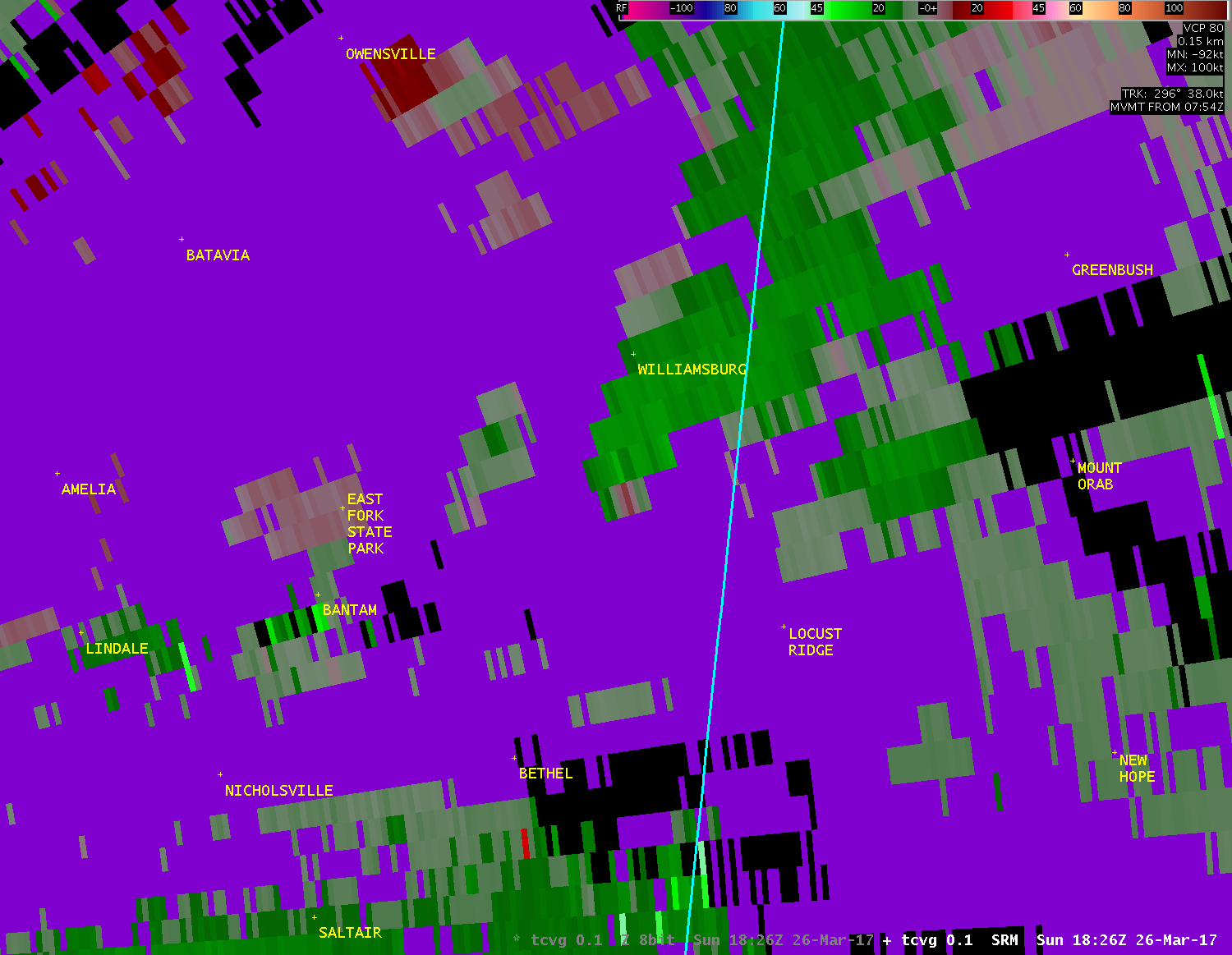
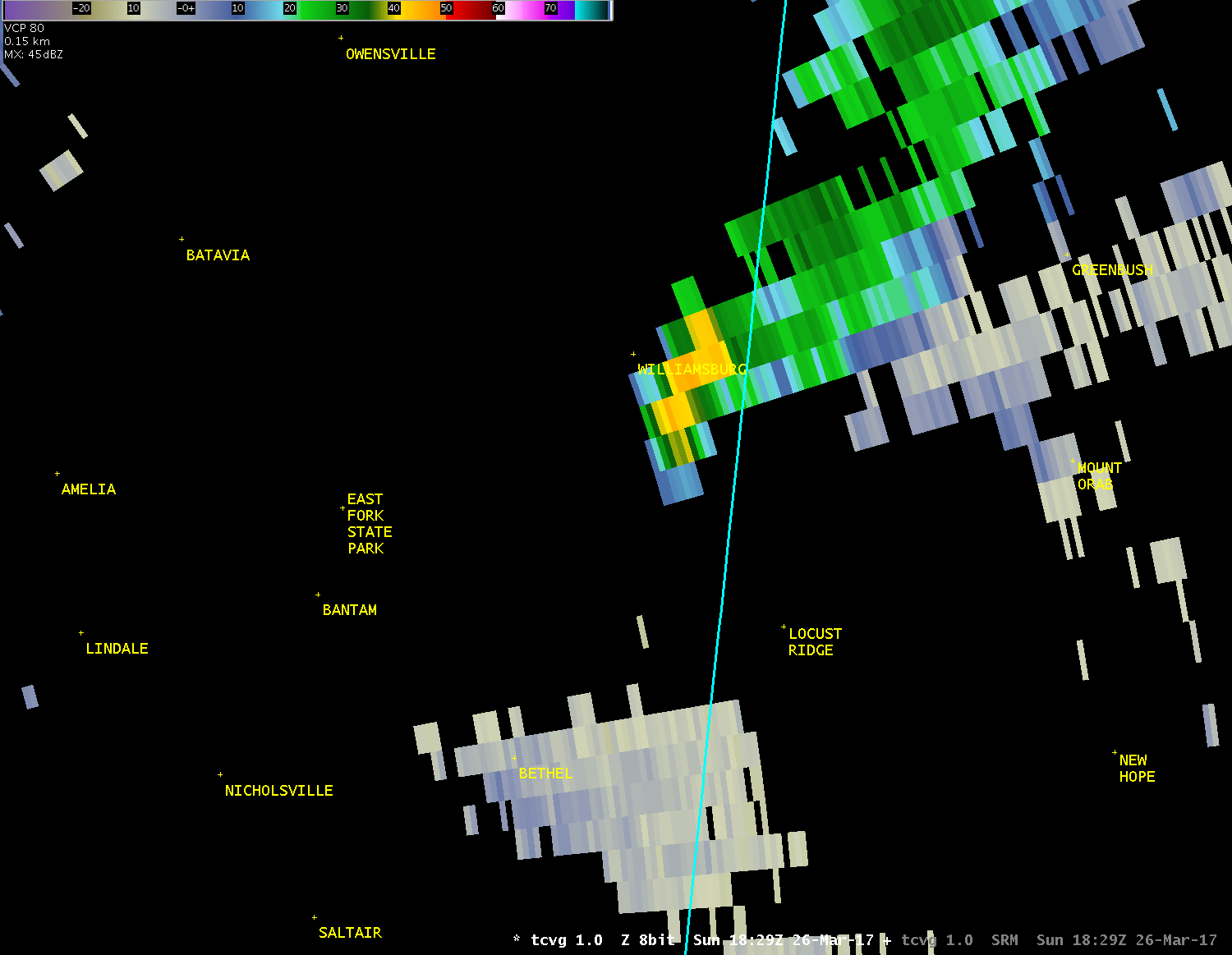
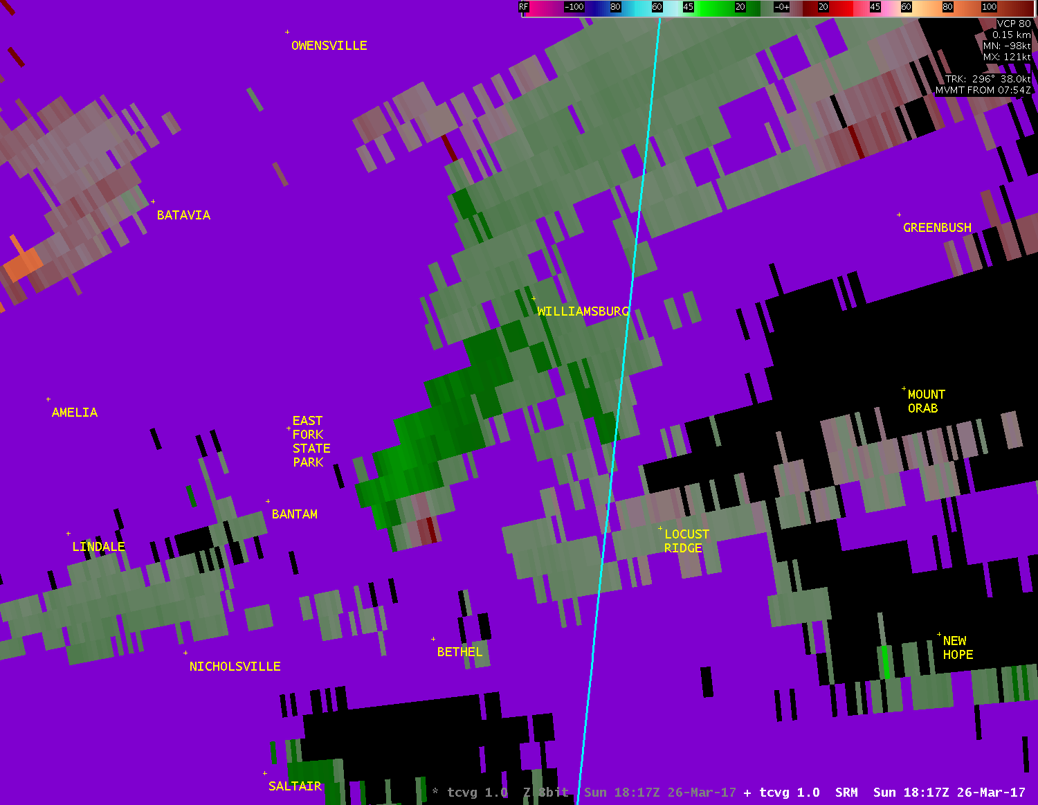
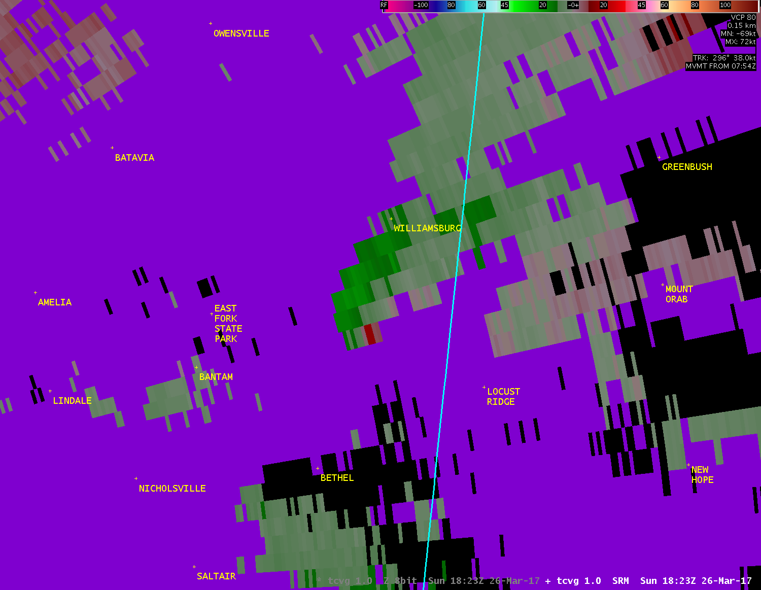
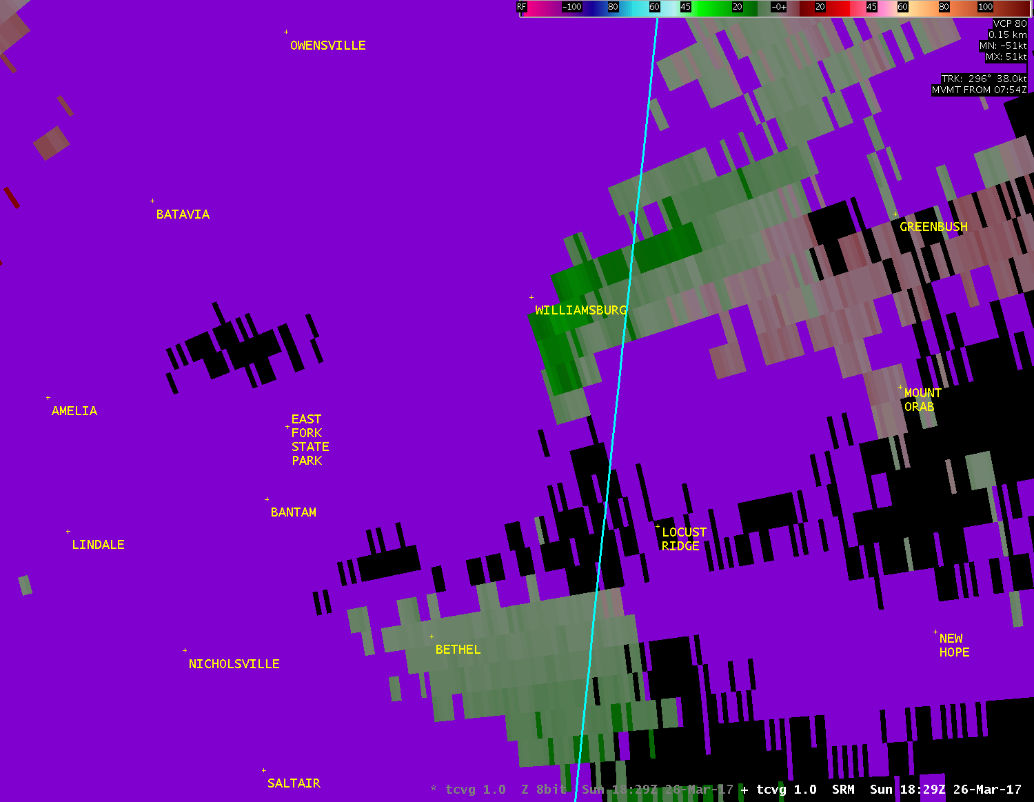
Public Information Statement National Weather Service Wilmington OH 324 PM EDT Mon Mar 27 2017 ...TORNADO CONFIRMED NEAR WILLIAMSBURG IN CLERMONT COUNTY OHIO... Location...Williamsburg in Clermont County Ohio Date...March 26 2017 Estimated Start Time...2:24 PM EDT Estimated End Time...2:25 PM EDT Maximum EF-Scale Rating...EF1 Estimated Maximum Wind Speed...90 MPH Maximum Path Width...70 yards Path Length...0.3 miles Beginning Lat/Lon...39.0139N / 84.0608W Ending Lat/Lon...39.0172N / 84.0568W * Fatalities...0 * Injuries...0 * The information in this statement is preliminary and subject to change pending final review of the event(s) and publication in NWS Storm Data. ...Summary... The National Weather Service in Wilmington OH has confirmed an EF1 tornado near Williamsburg in Clermont County Ohio on March 26th, 2017. A weak tornado briefly touched down, initially just in front of a tree line south of Concord Hennings Mill Rd. Initial damage from the tornado consisted of an overturned small barn with an overturned camper. The tornado then headed northeast and caused structural damage to a residence on Concord Hennings Mill Rd. The garage door walls were collapsed inwards with the roof blown off and debris scattered into a field north of Concord Hennings Mill Rd. The tornado then lifted north of Concord Hennings Mill Rd in a field where debris came to an end. For reference: the Enhanced Fujita Scale classifies tornadoes into the following categories: EF0...wind speeds 65 to 85 mph. EF1...wind speeds 86 to 110 mph. EF2...wind speeds 111 to 135 mph. EF3...wind speeds 136 to 165 mph. EF4...wind speeds 166 to 200 mph. EF5...wind speeds greater than 200 mph. $$ Haines |
| Full Radar Loops from the Cincinnati Terminal Doppler Weather Radar (2:20 PM - 2:33 PM) |
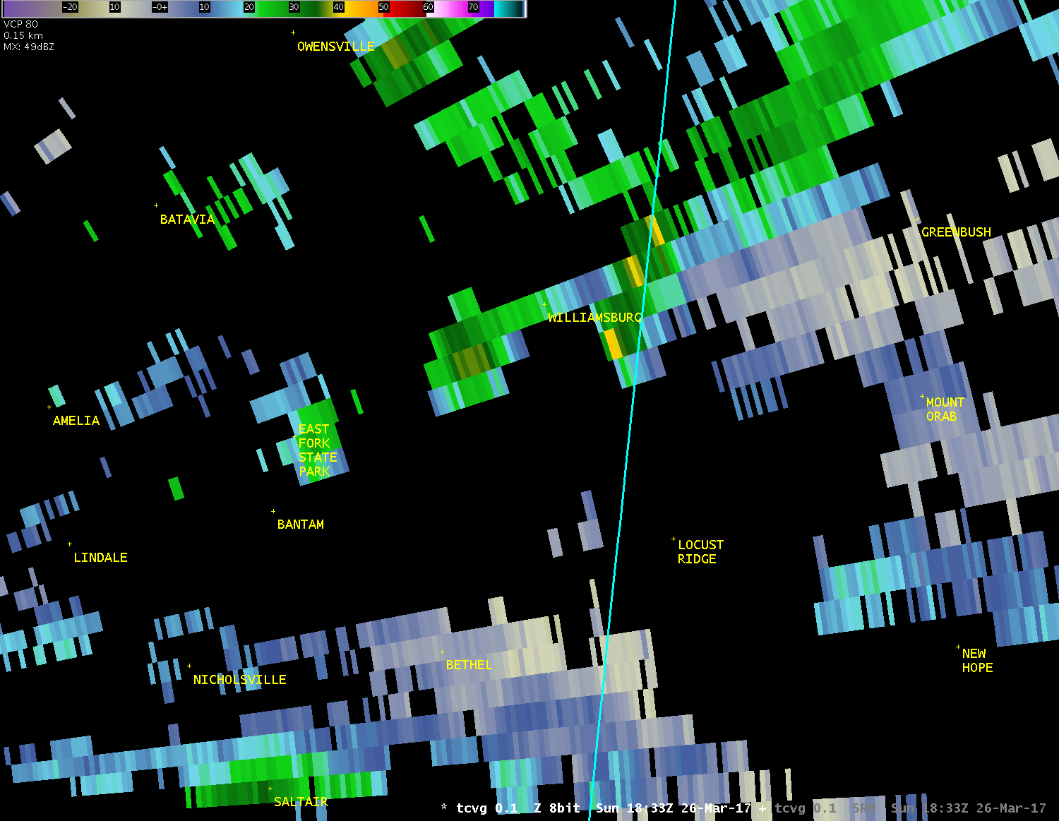
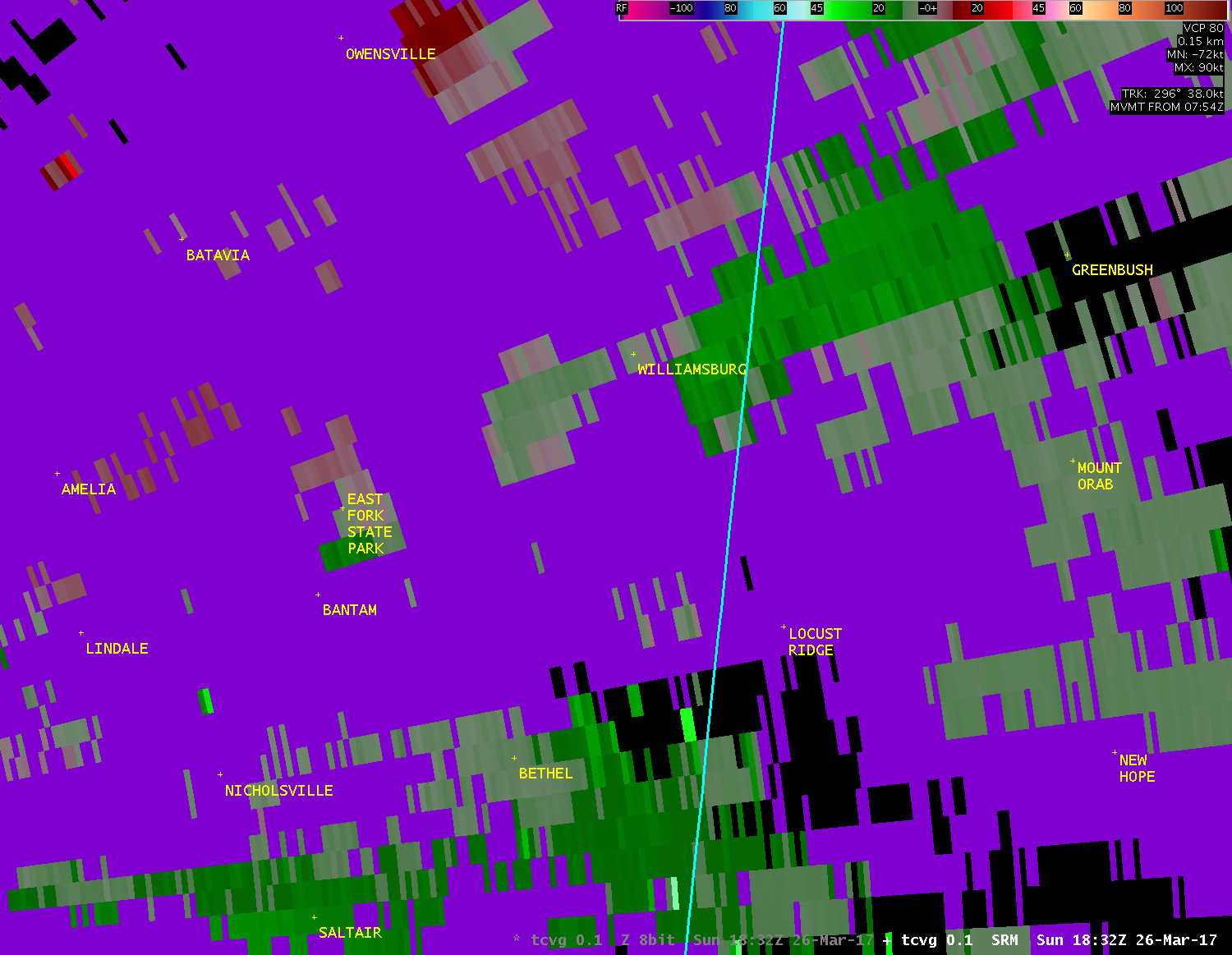
| TCVG 0.1° Reflectivity (800-1100 feet AGL) |
| 1 2 3 4 5 6 7 8 9 10 11 12 13 14 |
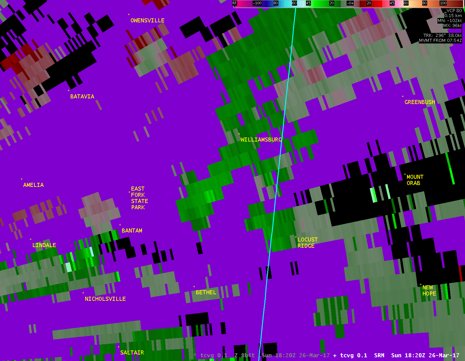
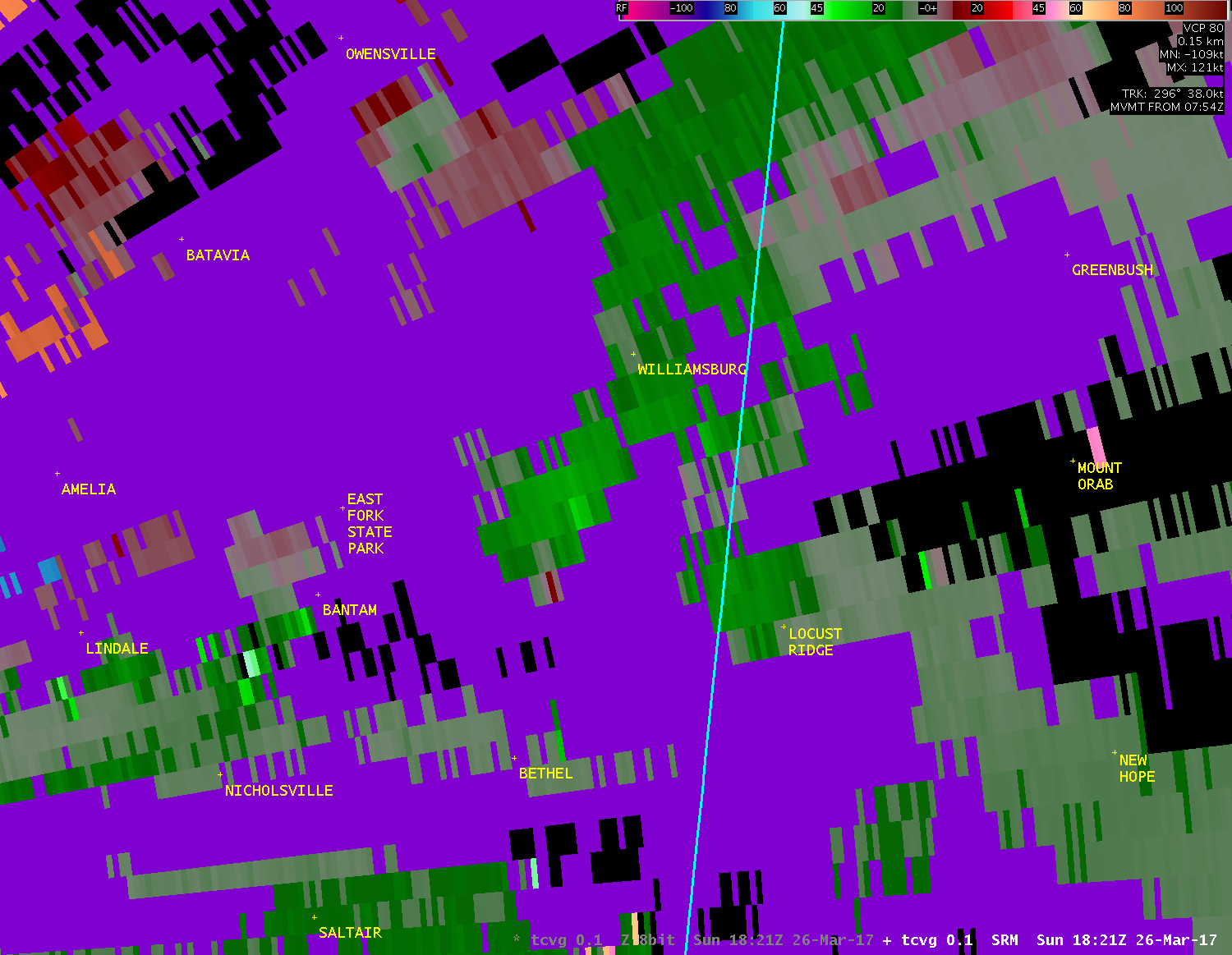
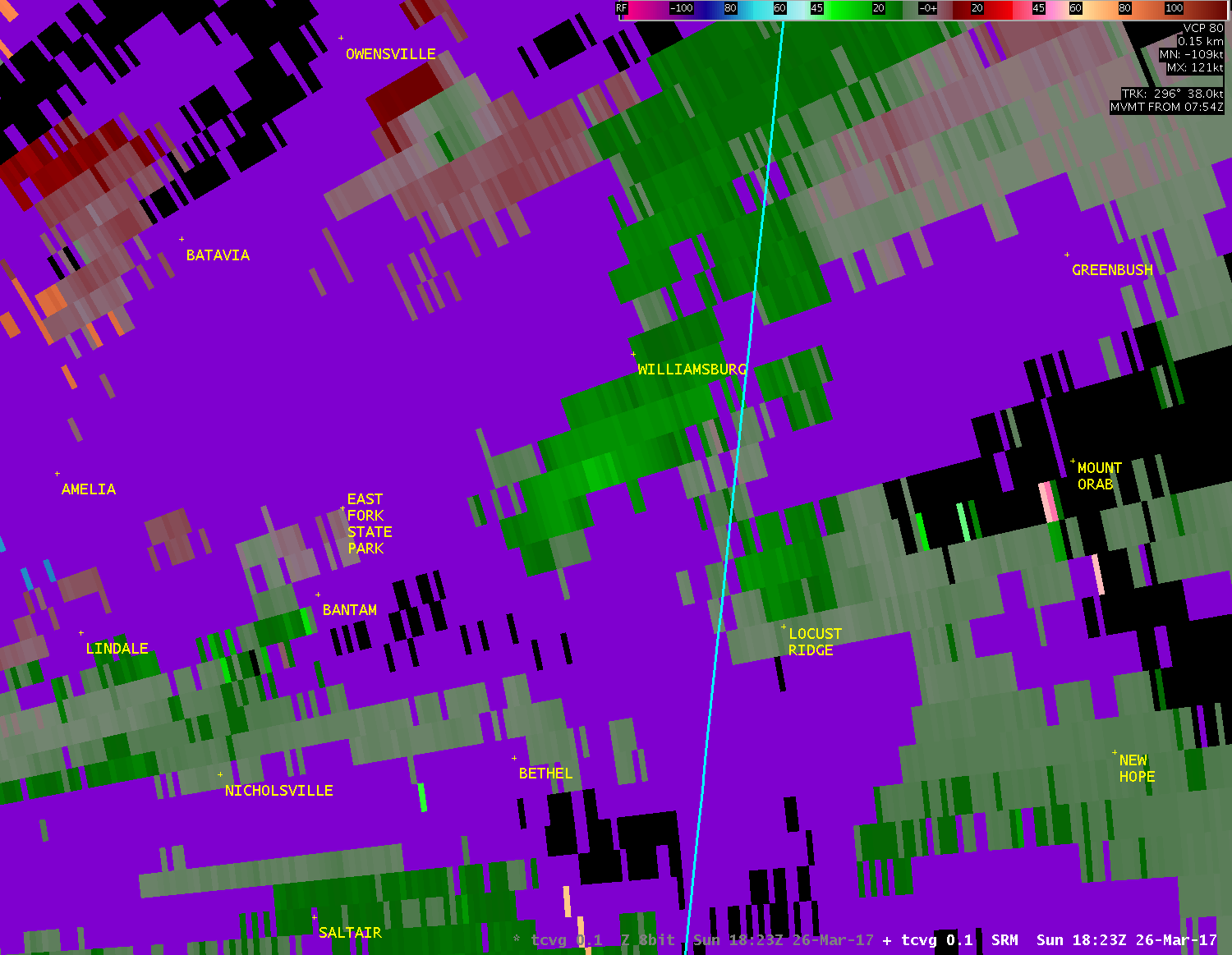
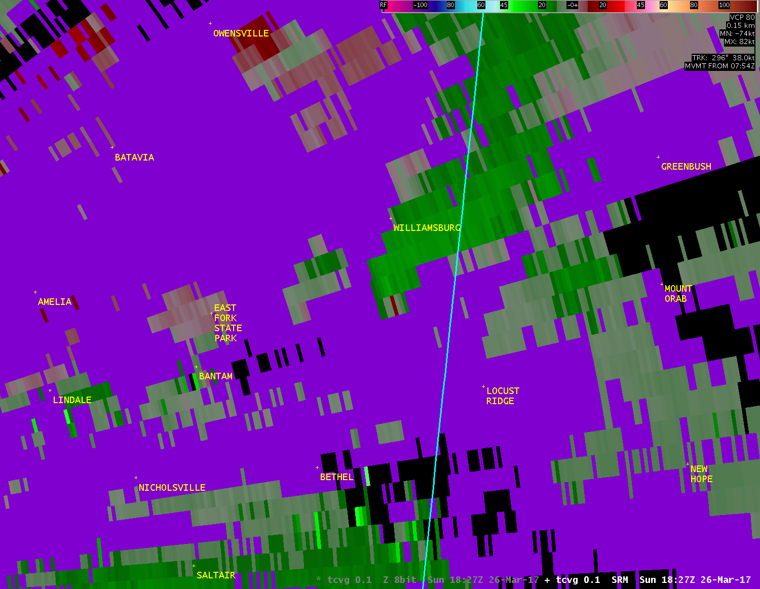
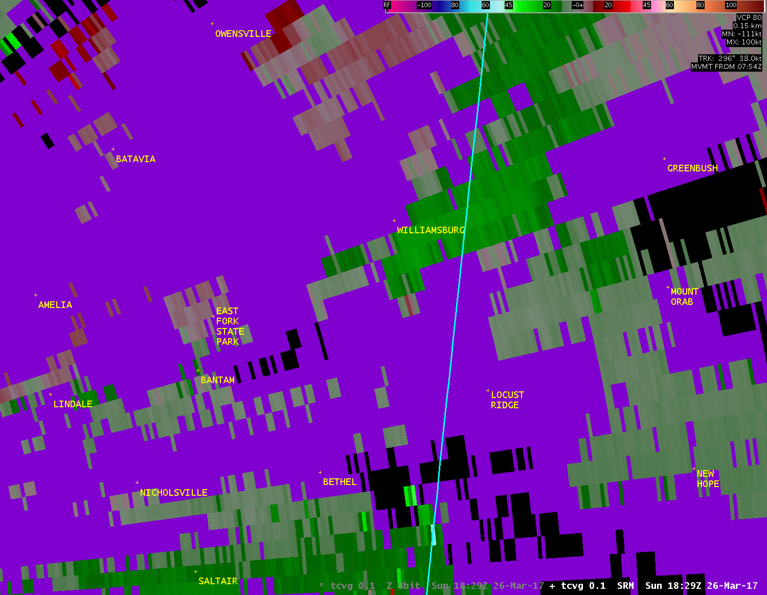
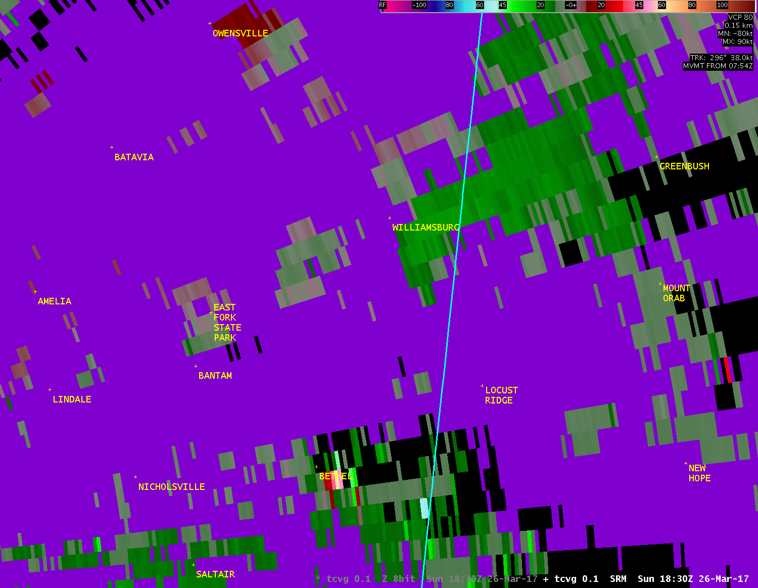
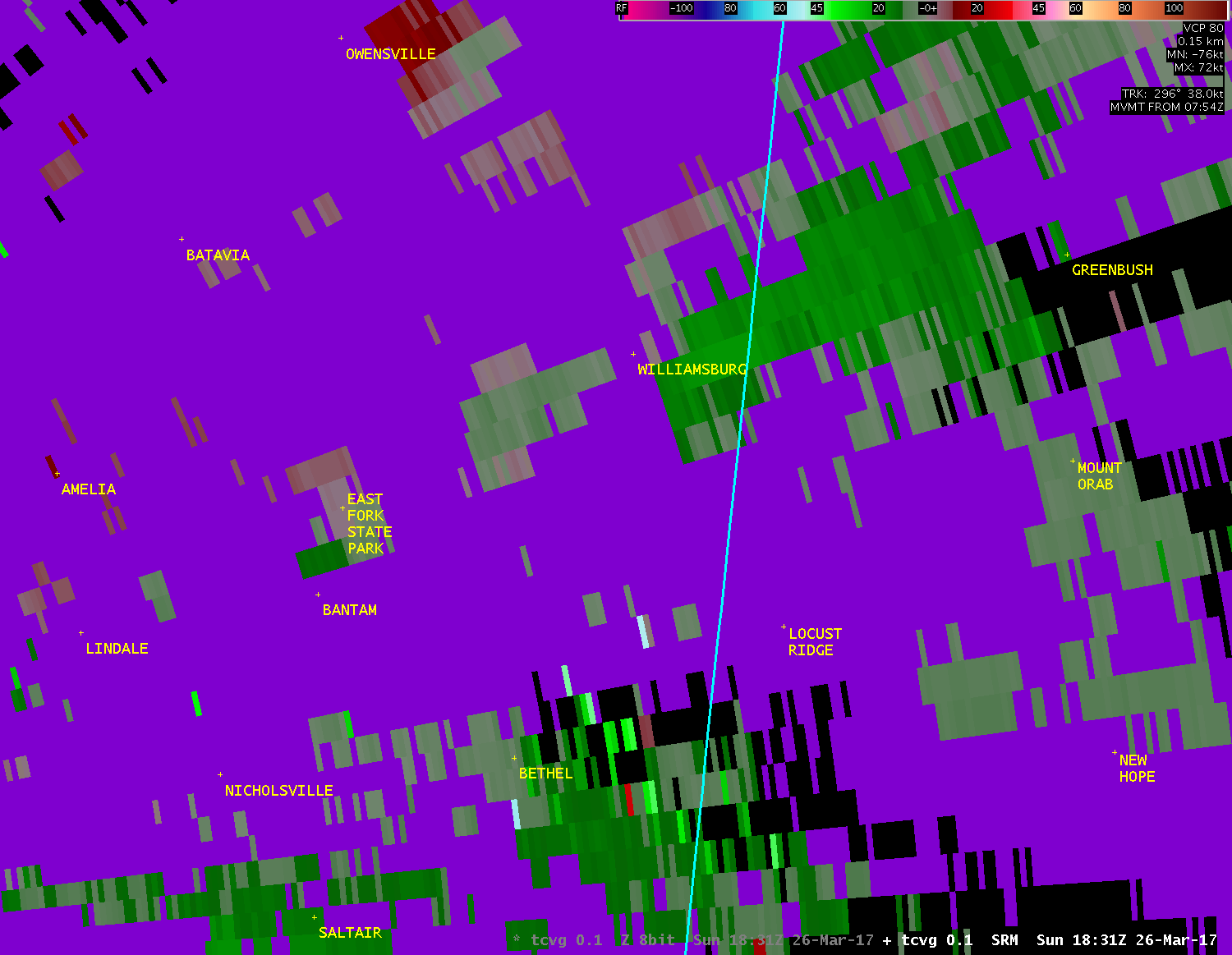
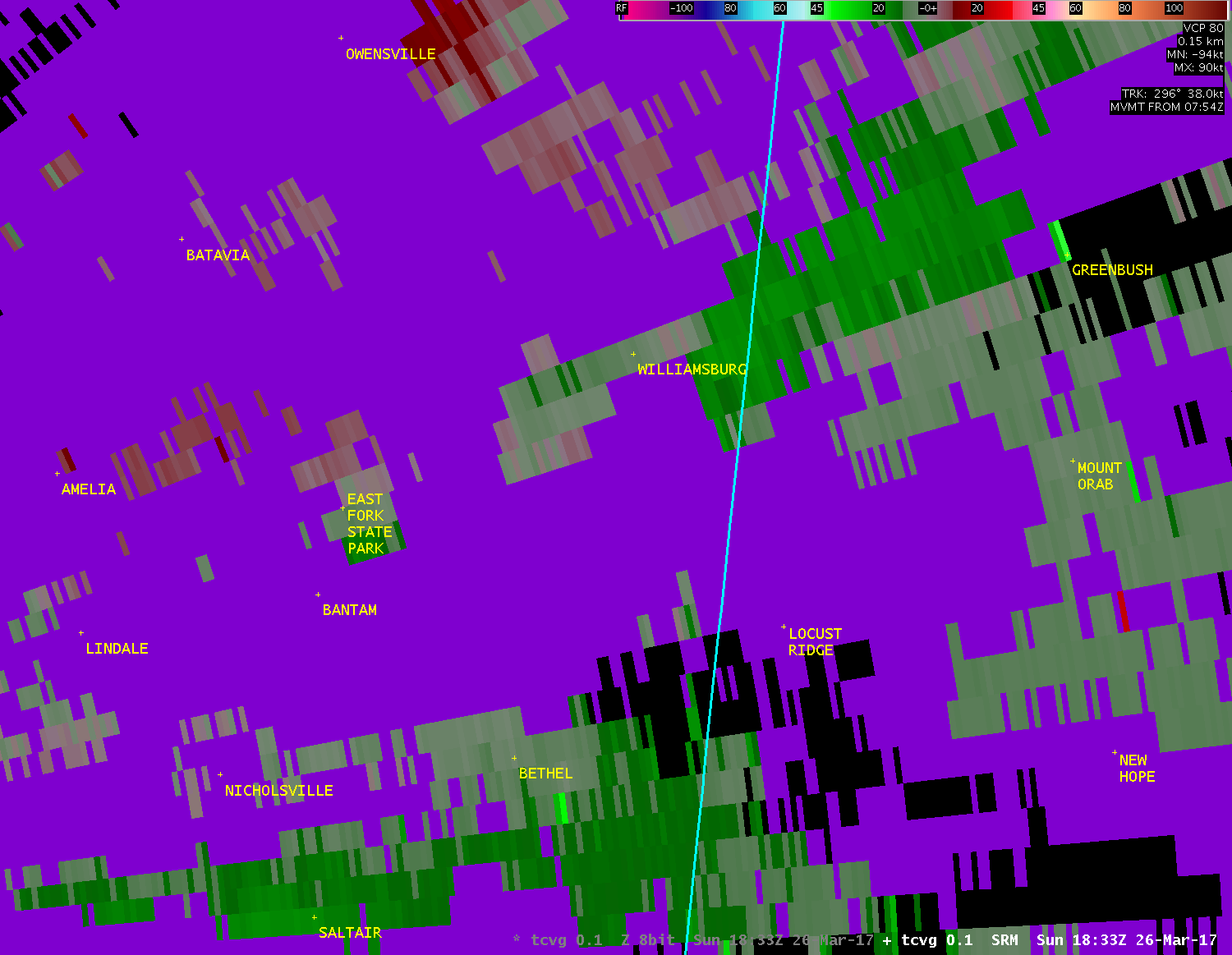
| TCVG 0.1° Storm-Relative Motion (800-1100 feet AGL) |
| 1 2 3 4 5 6 7 8 9 10 11 12 13 14 |
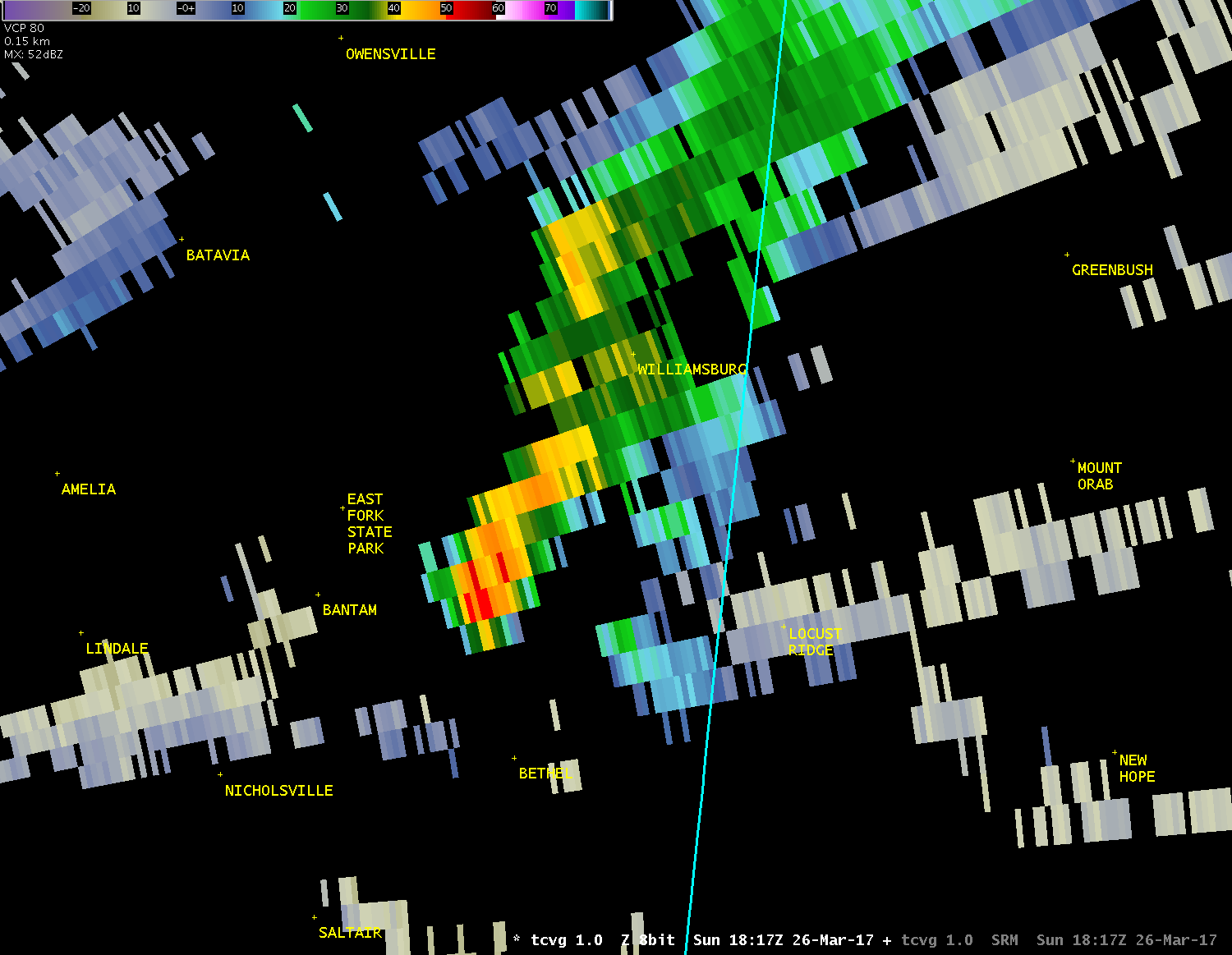
| TCVG 1.0° Reflectivity (3000-3800 feet AGL) |
| 1 2 3 |
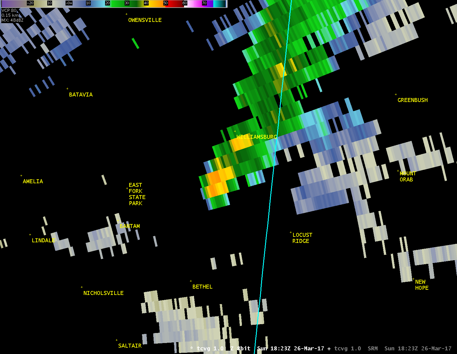
| TCVG 1.0° Storm-Relative Motion (3000-3800 feet AGL) |
| 1 2 3 |

