Public Information Statement
National Weather Service Wilmington OH
919 PM EST Wed Mar 1 2017
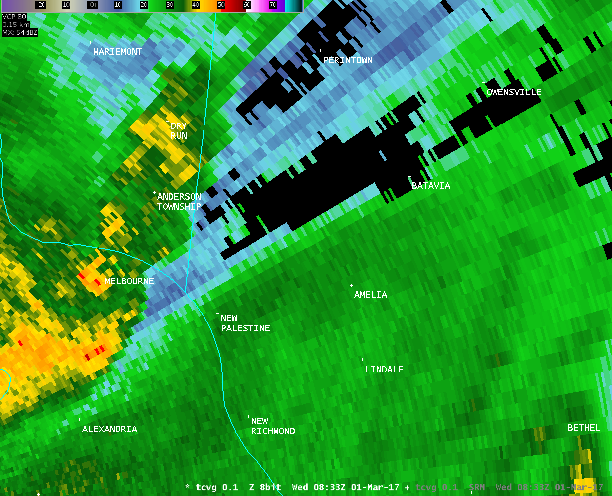
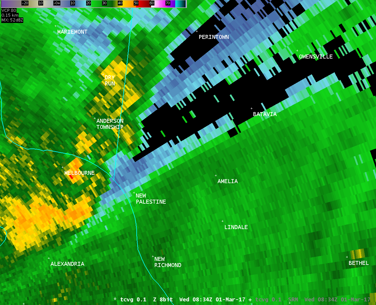
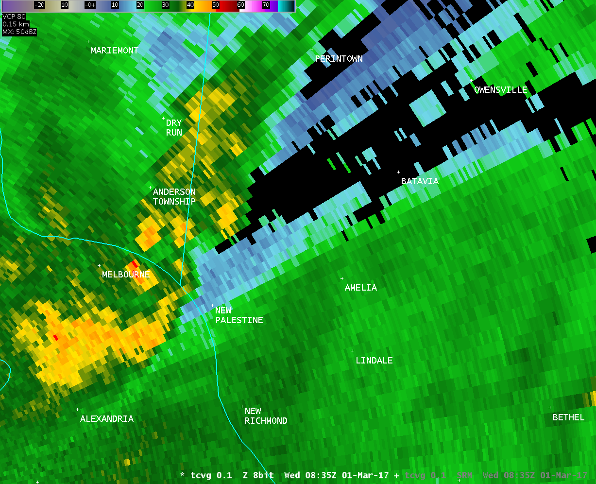
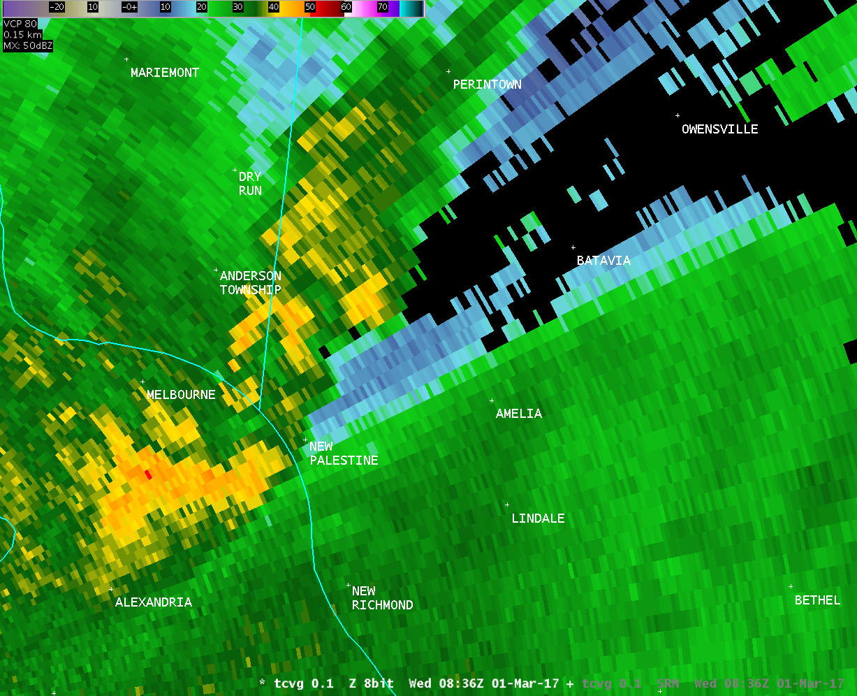
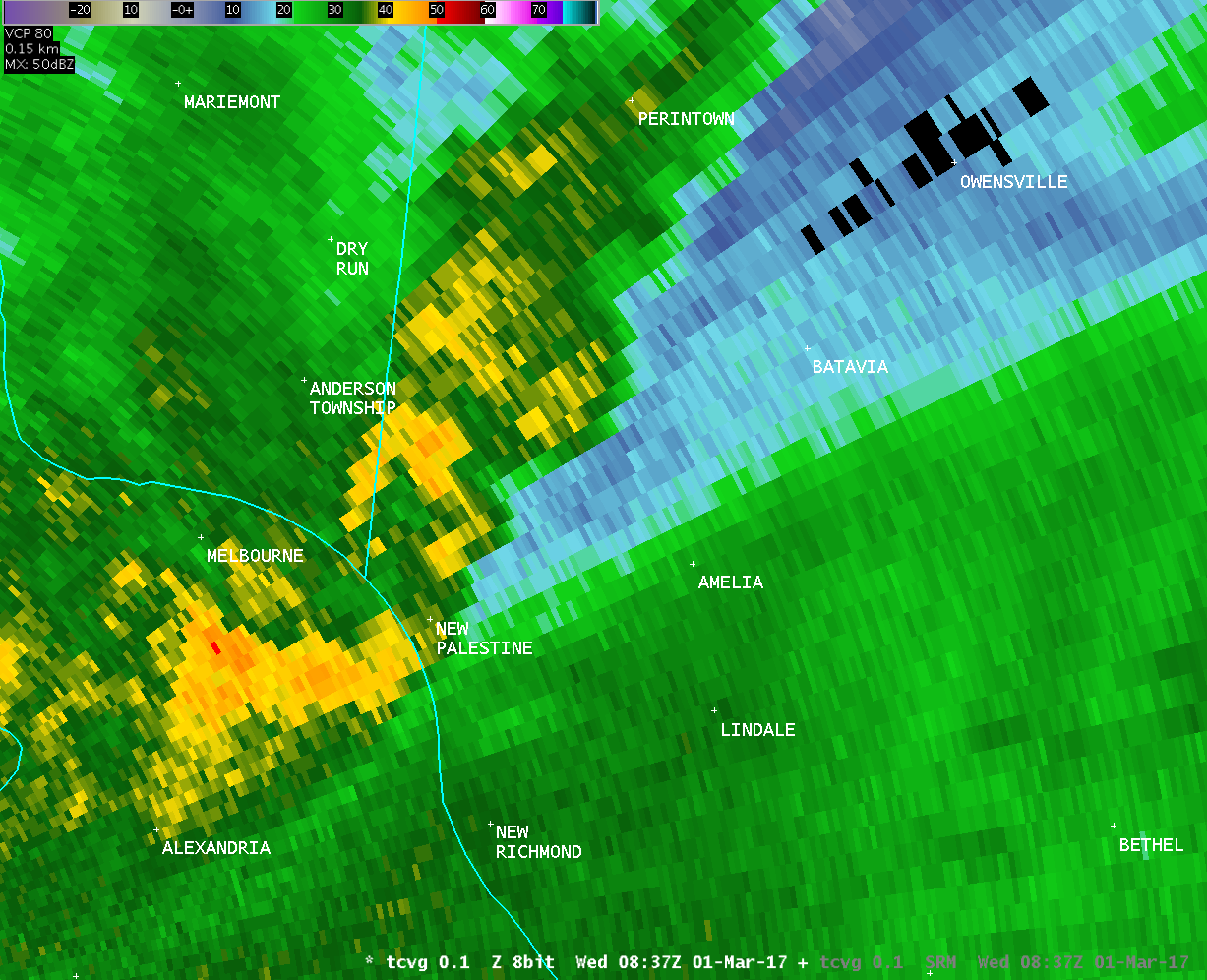
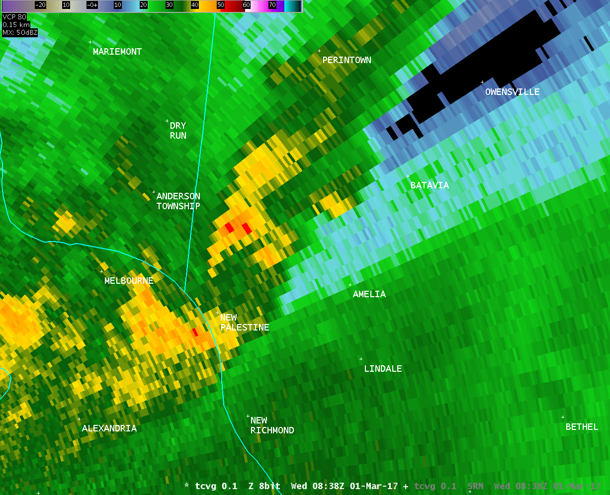
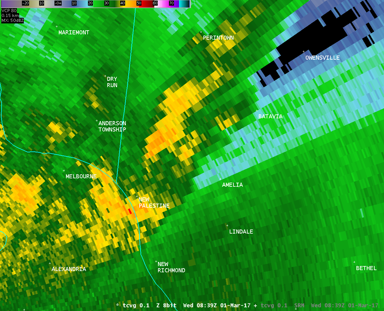
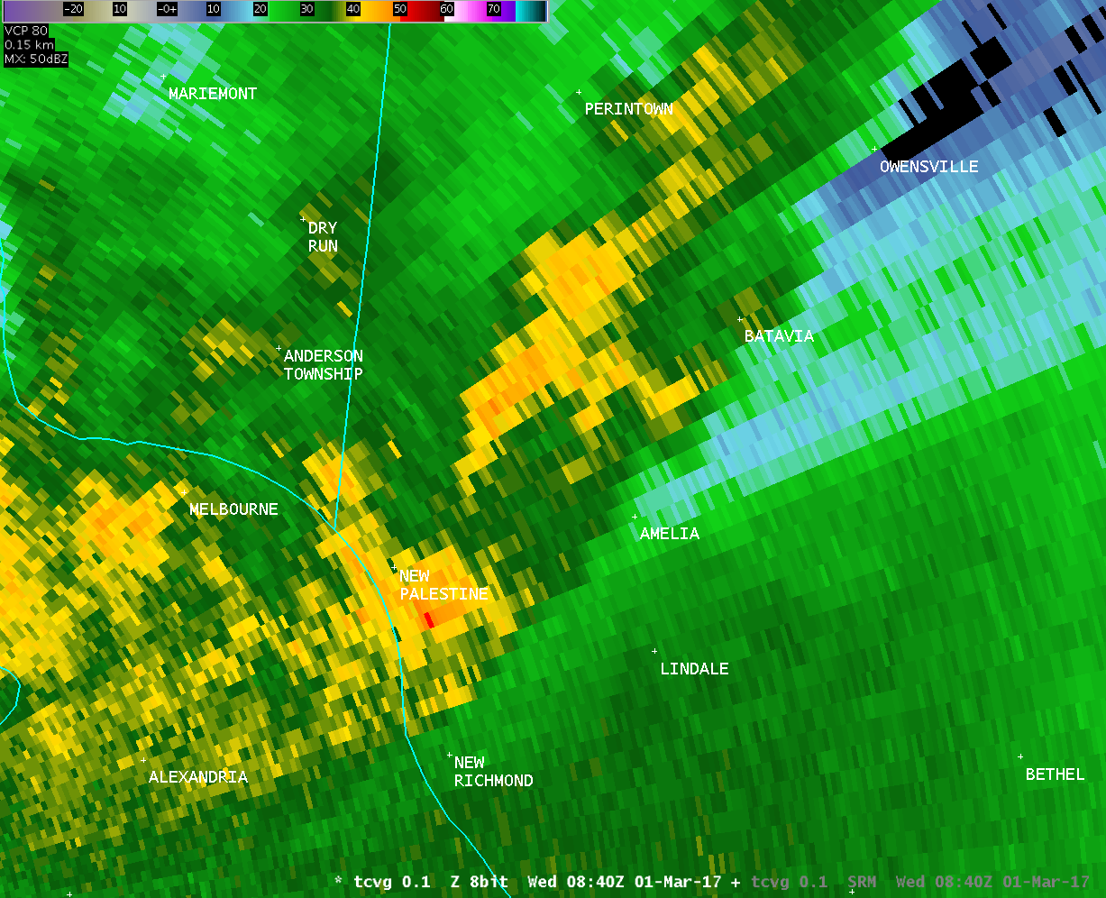
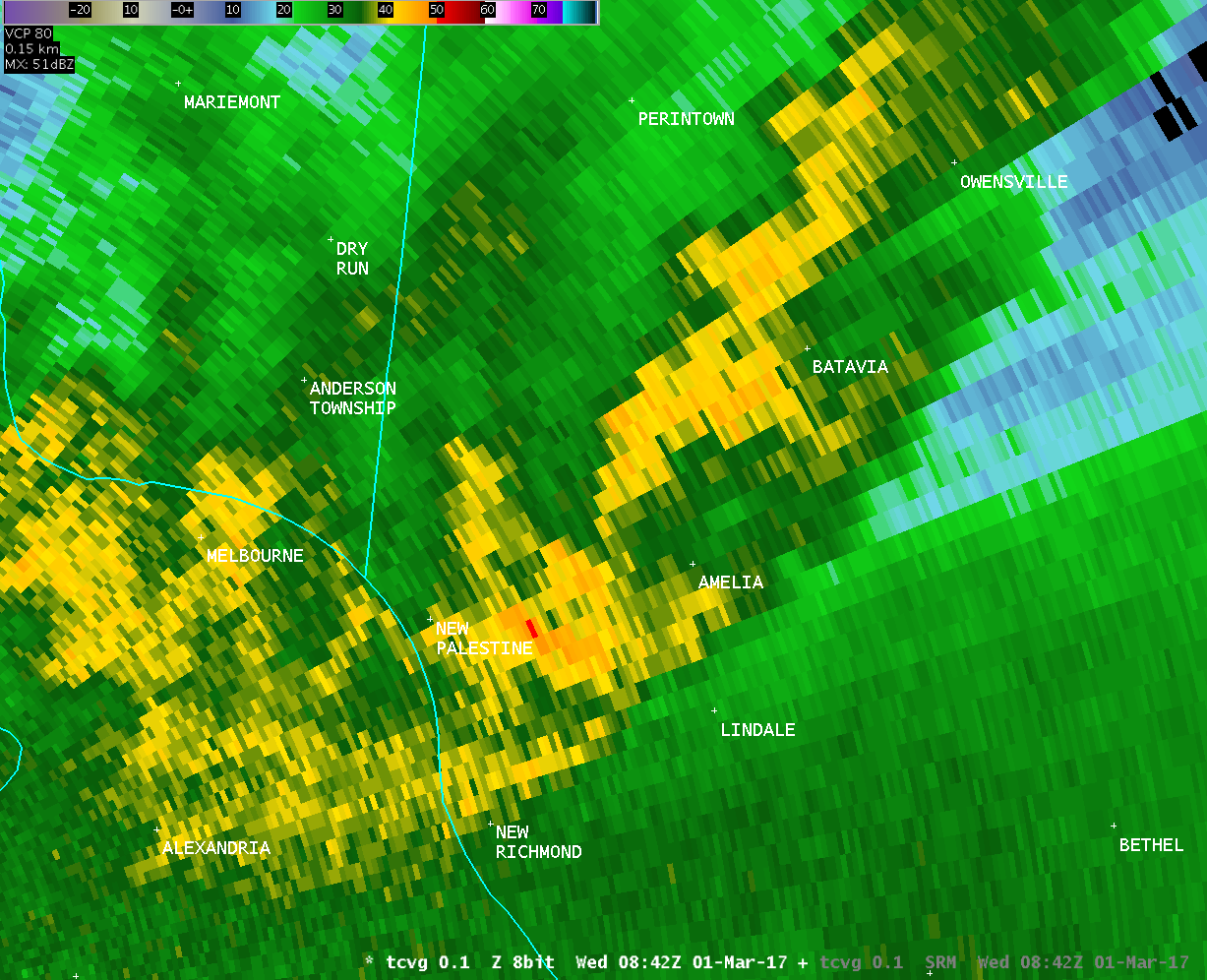
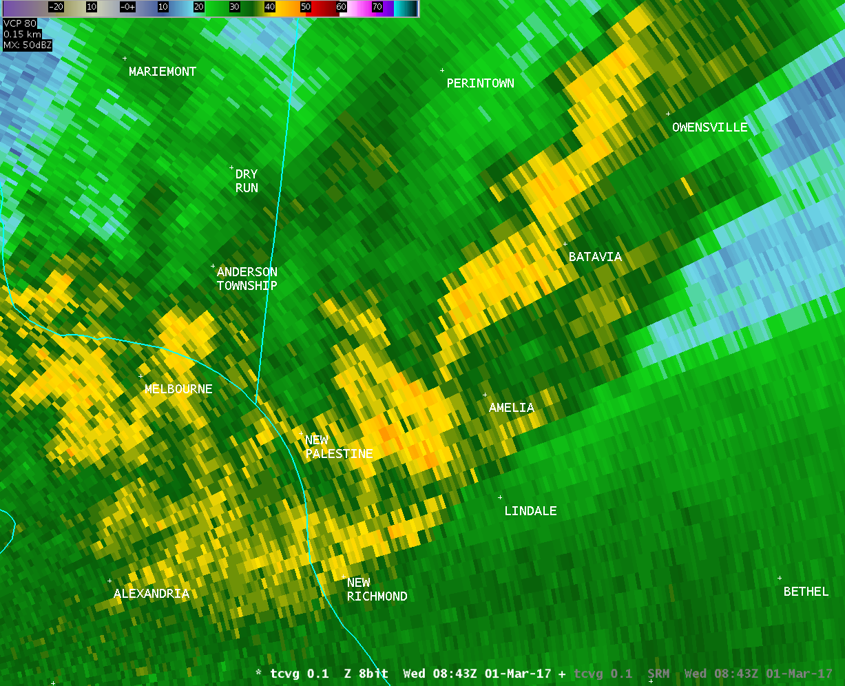
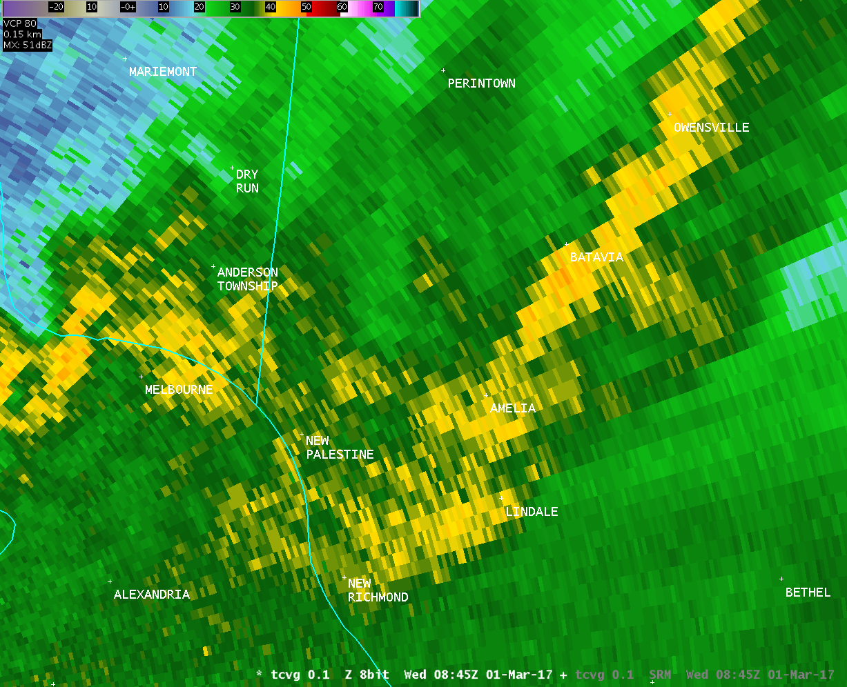
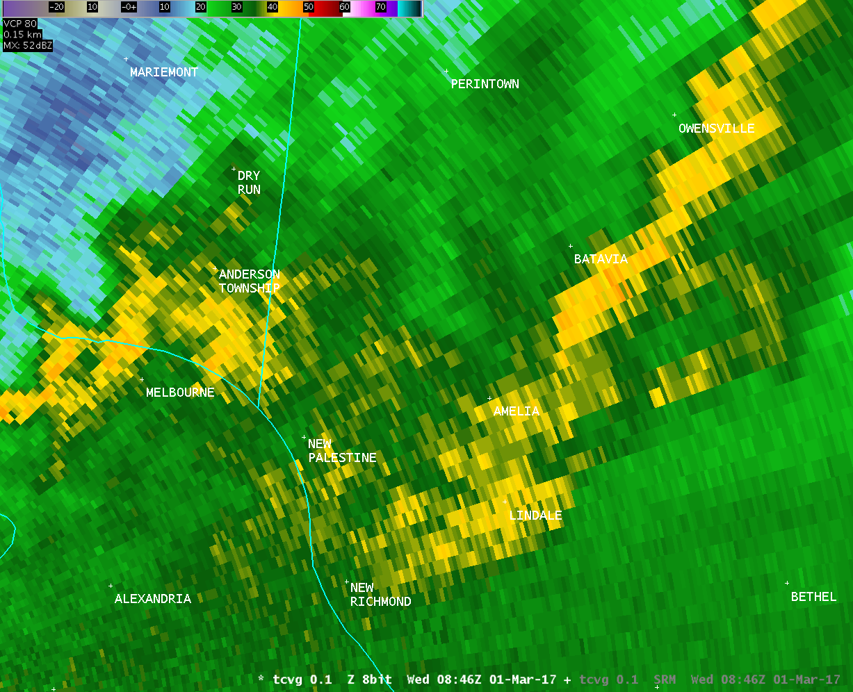
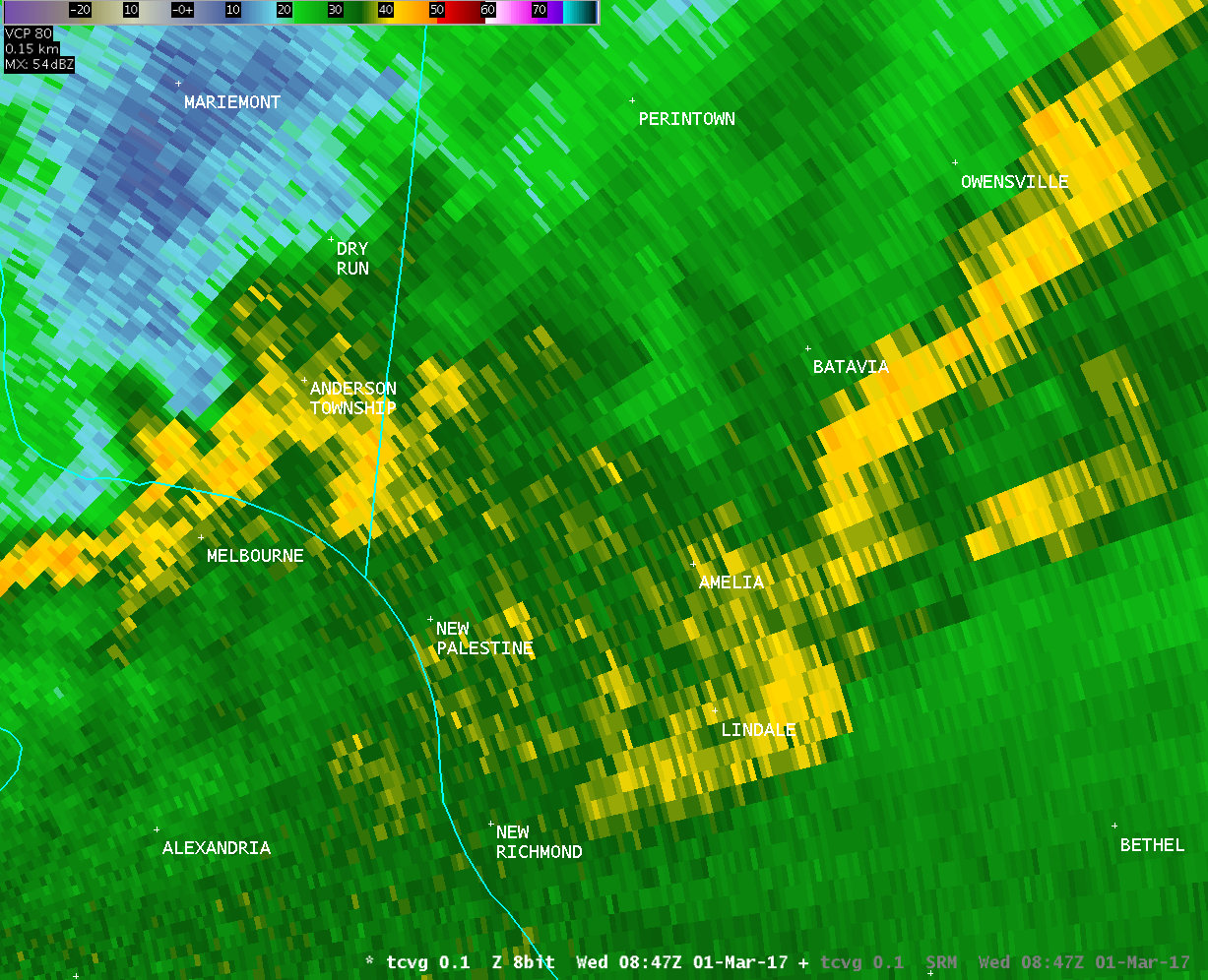
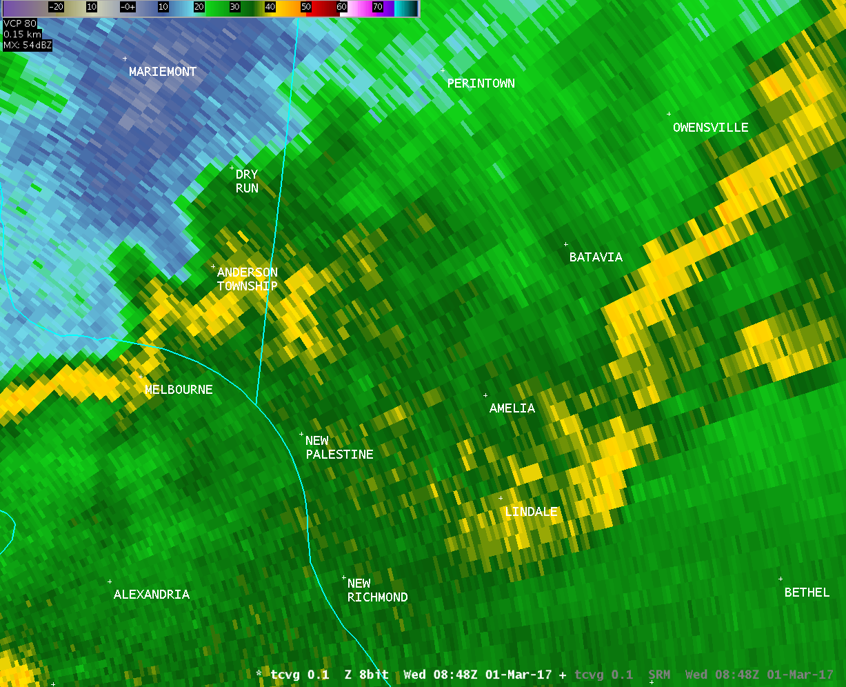
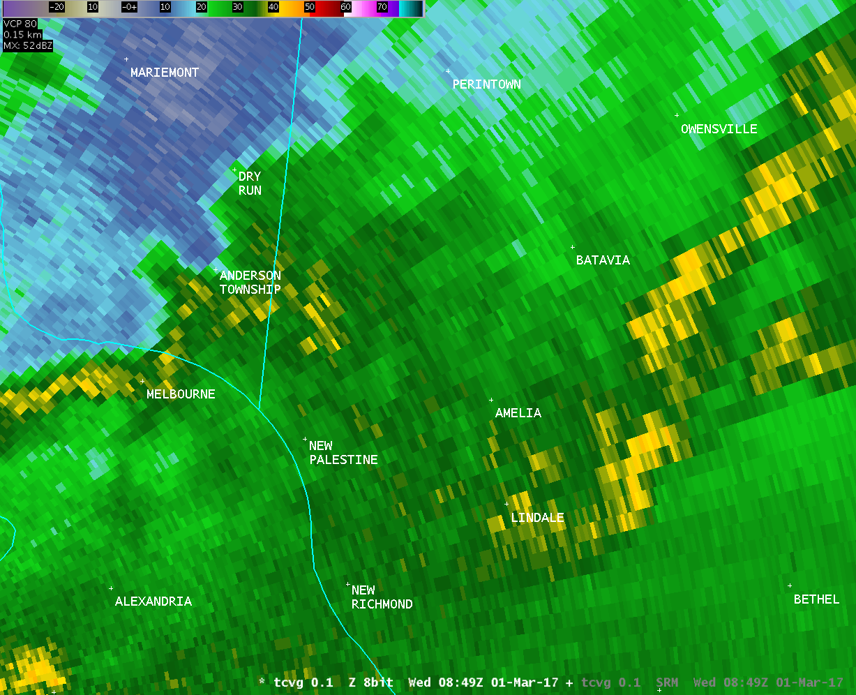
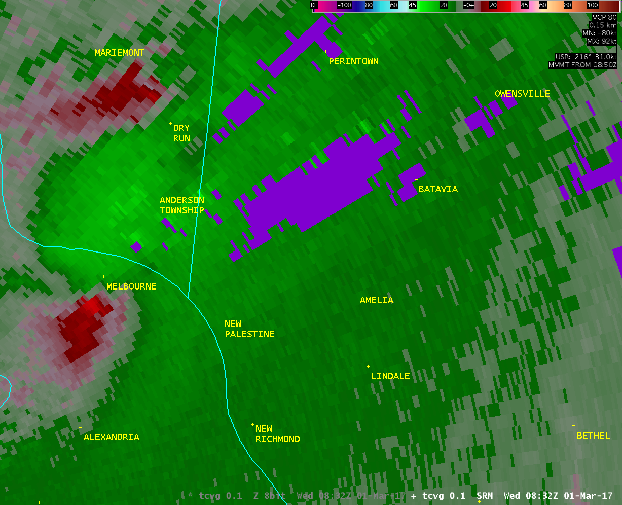
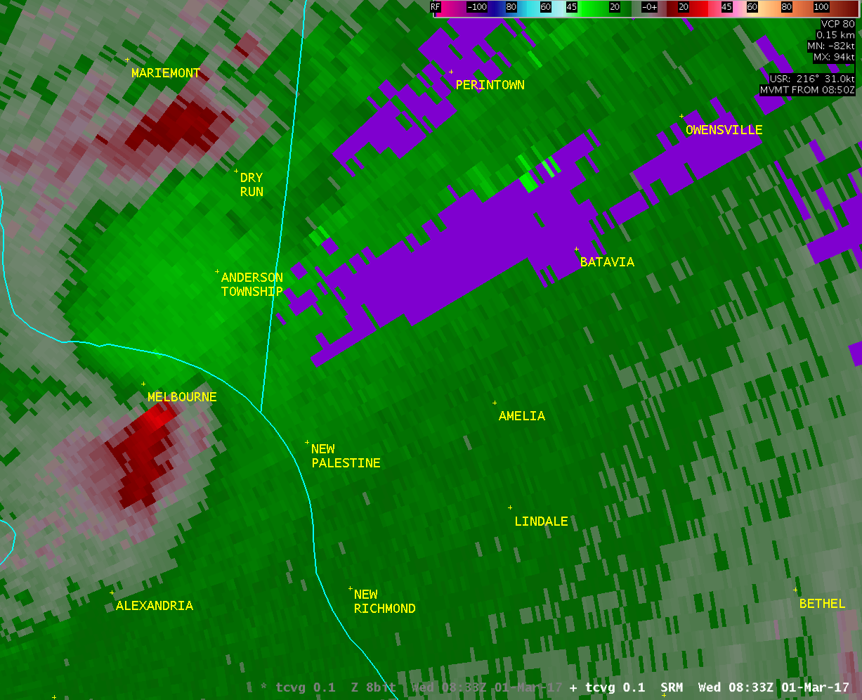
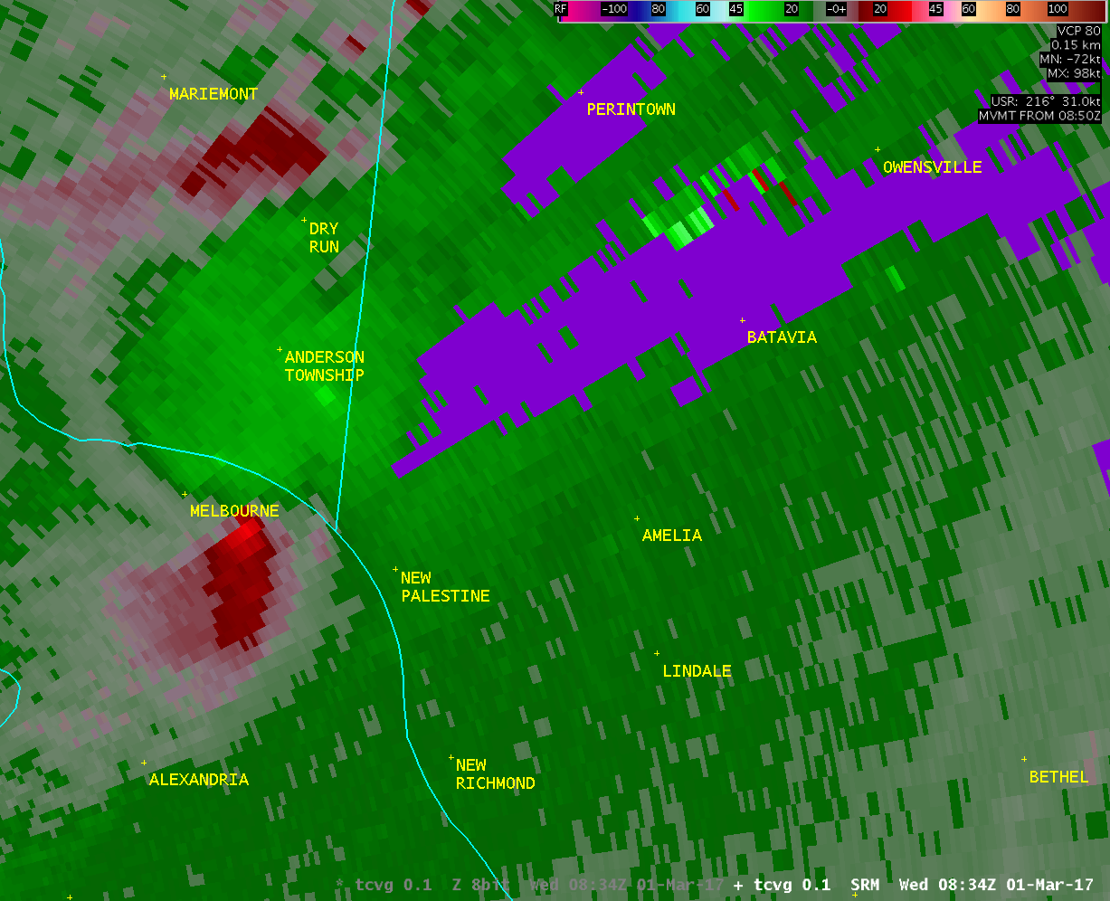
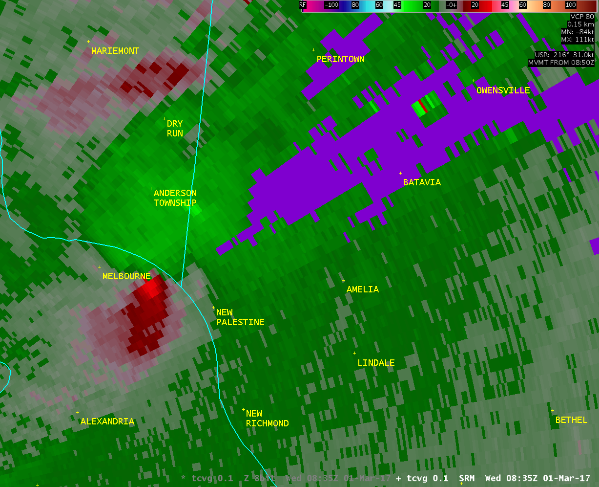
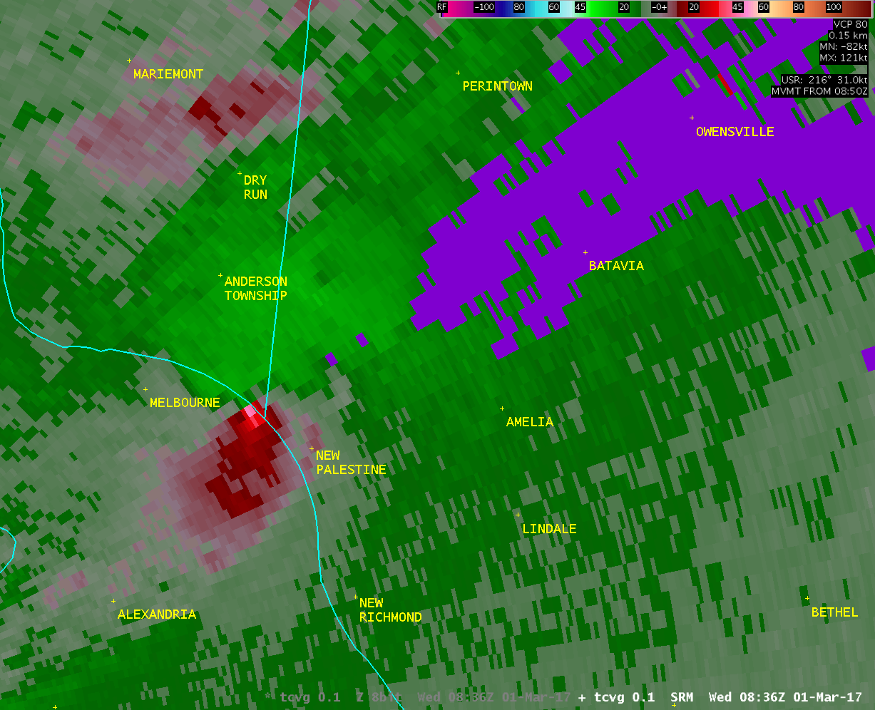
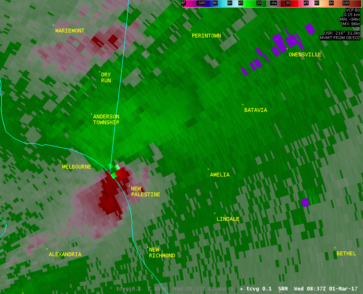
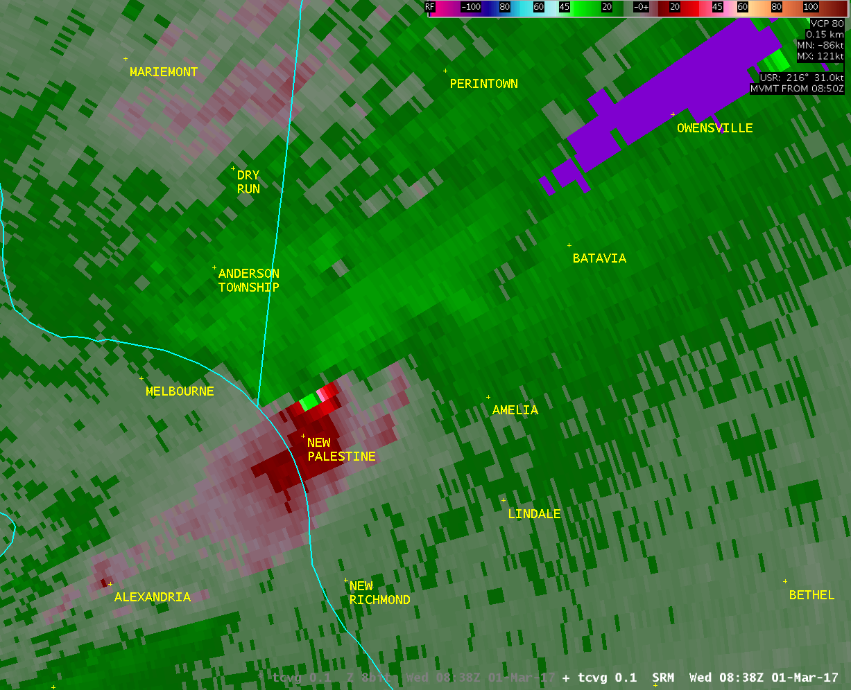
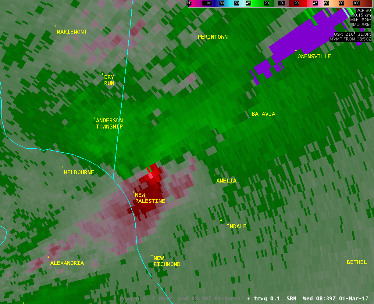
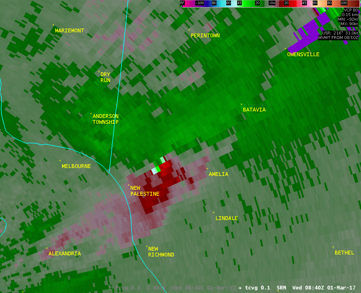
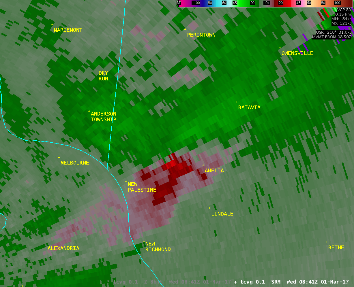
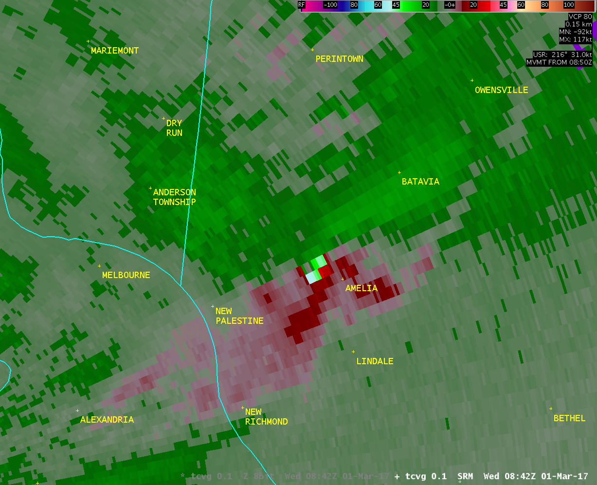
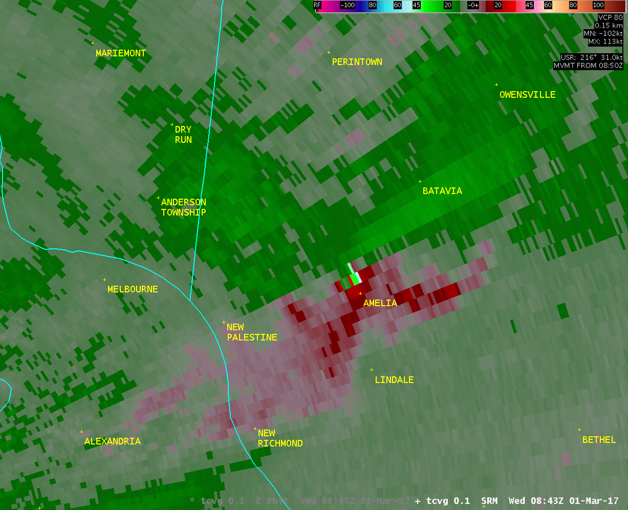
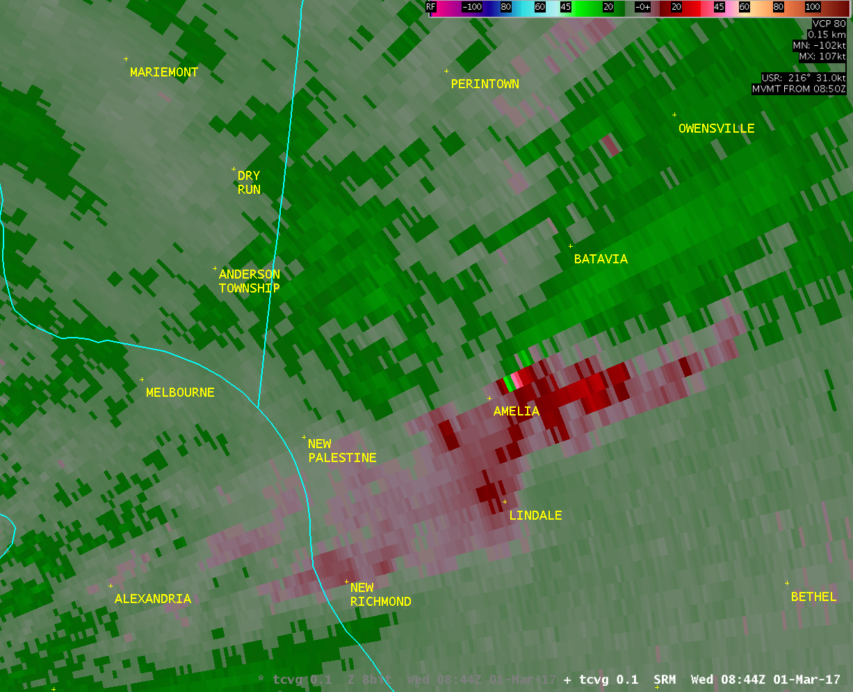
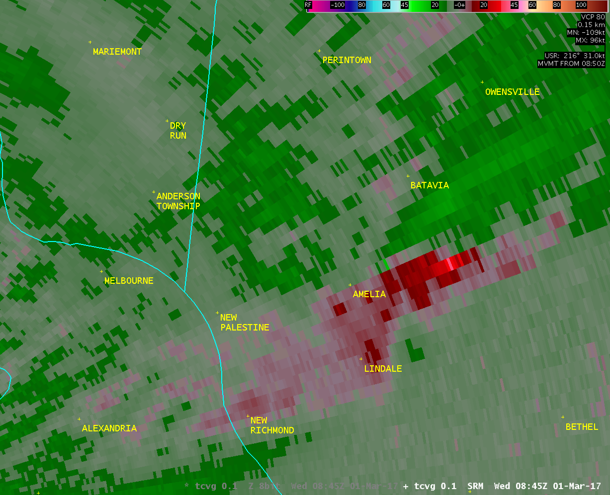
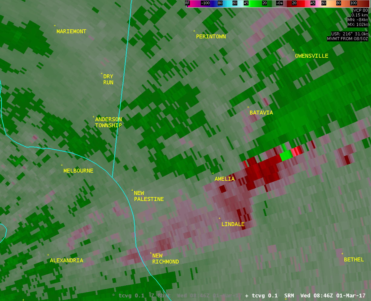
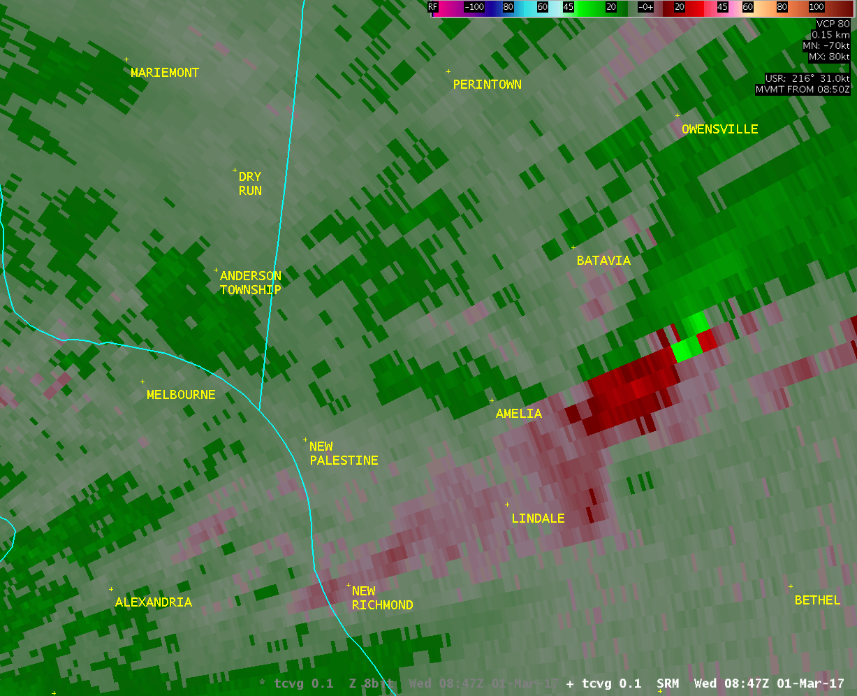
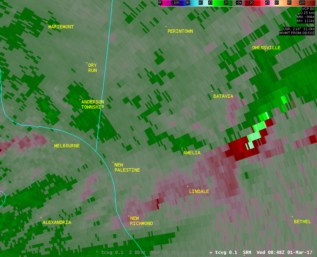
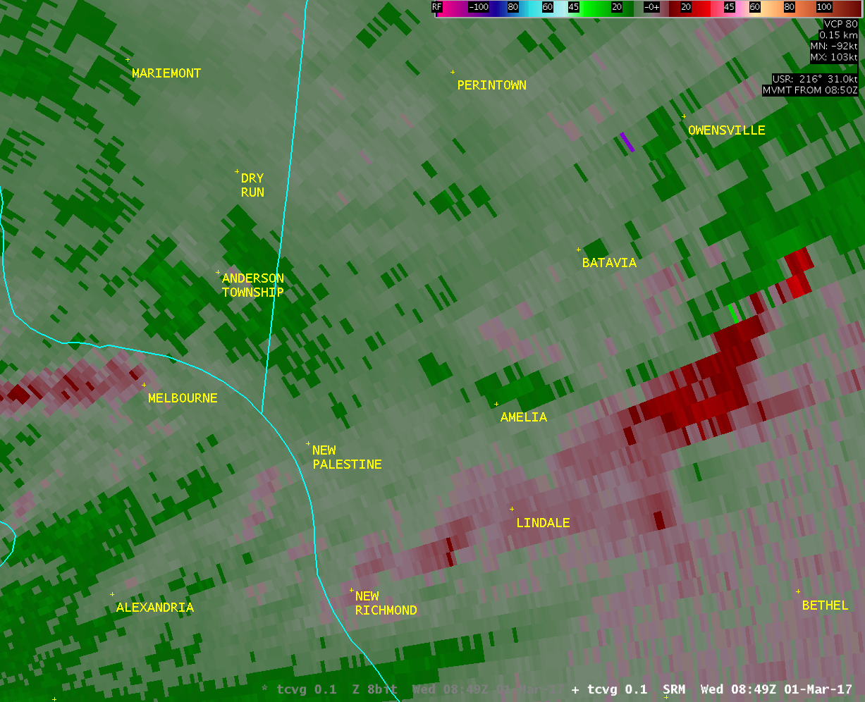
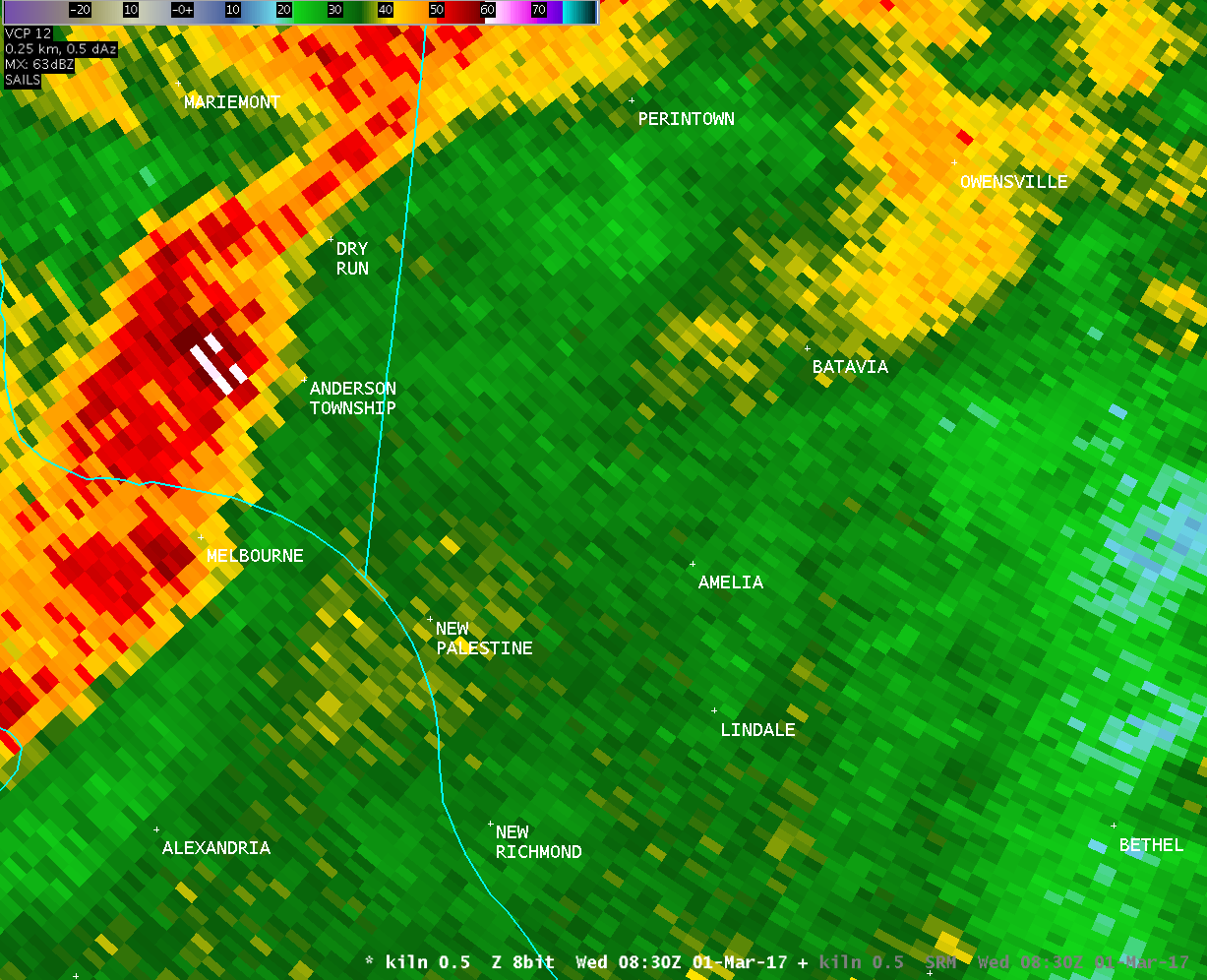
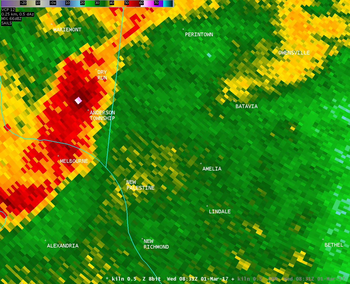
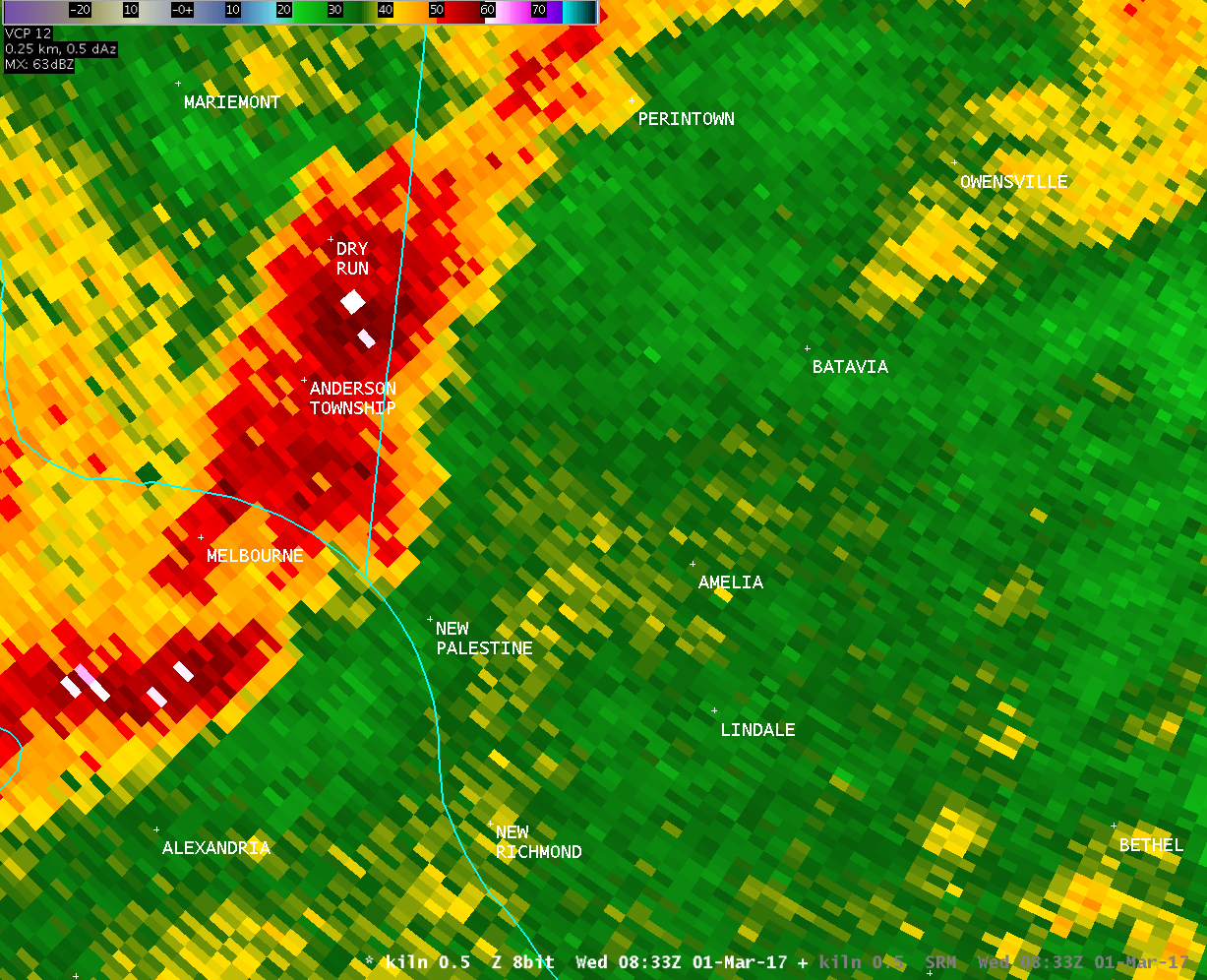
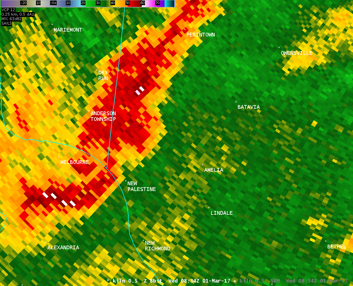
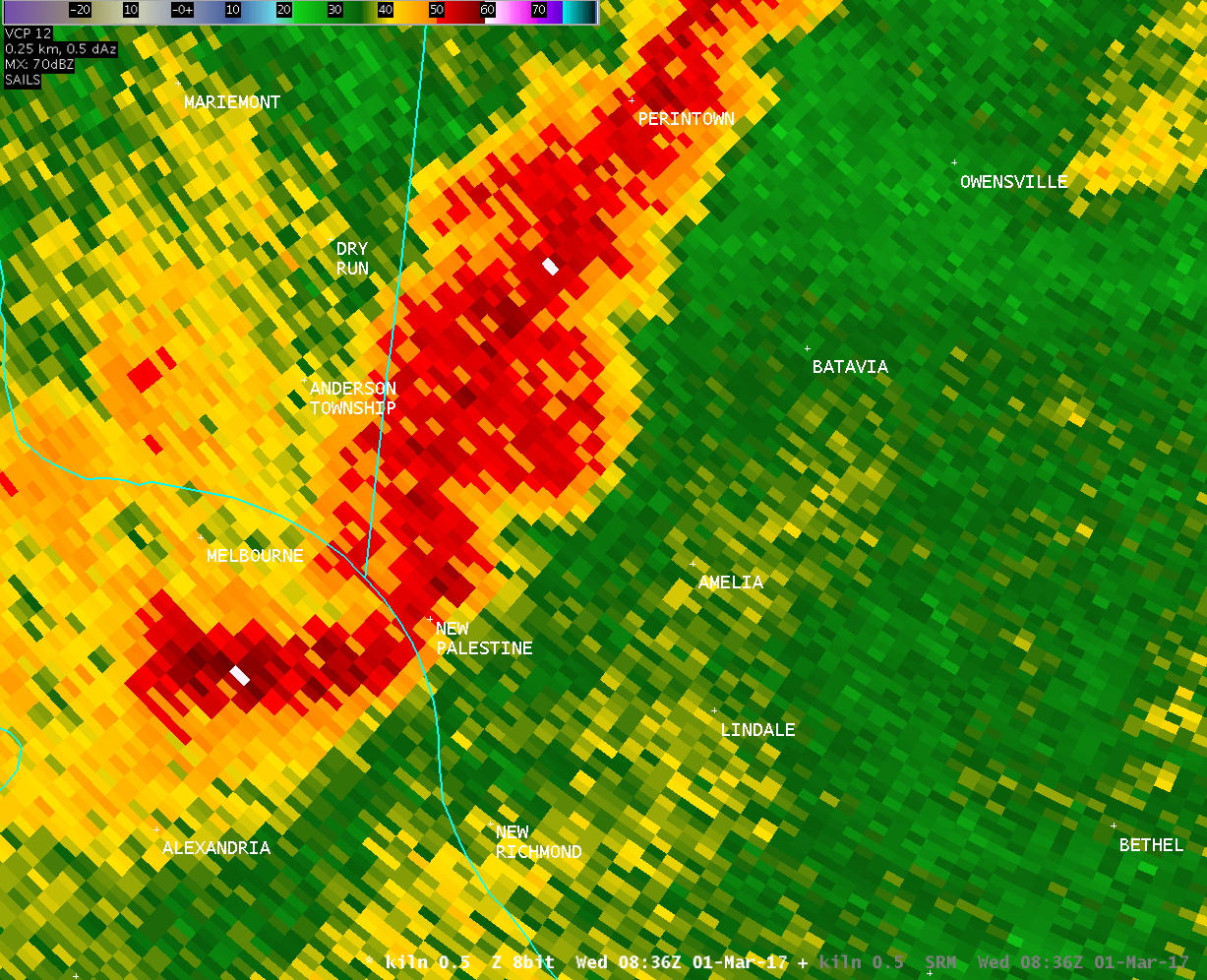
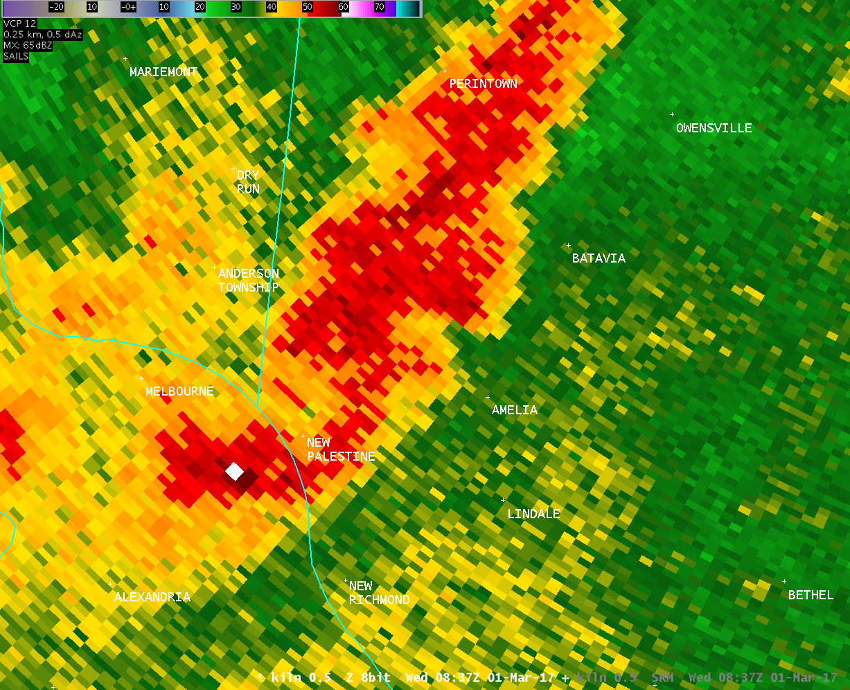
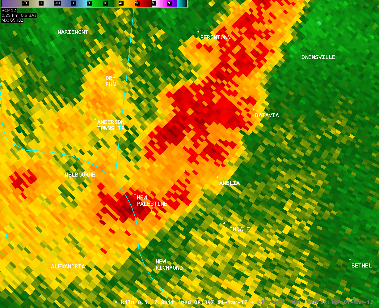
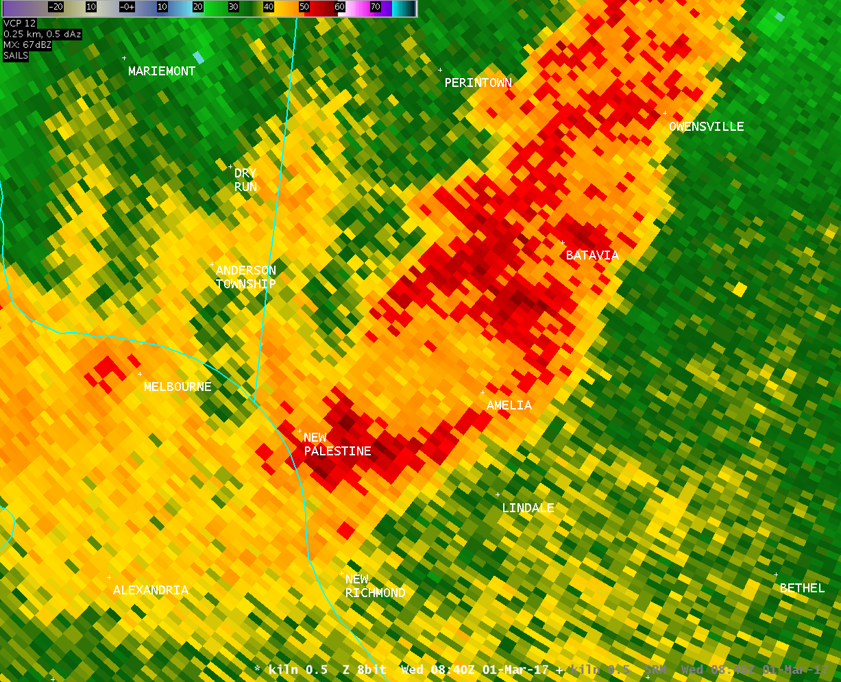
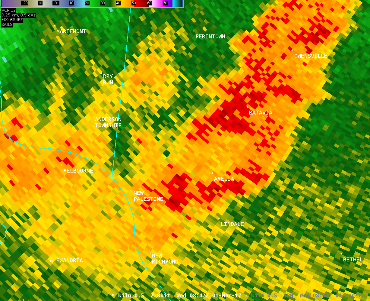
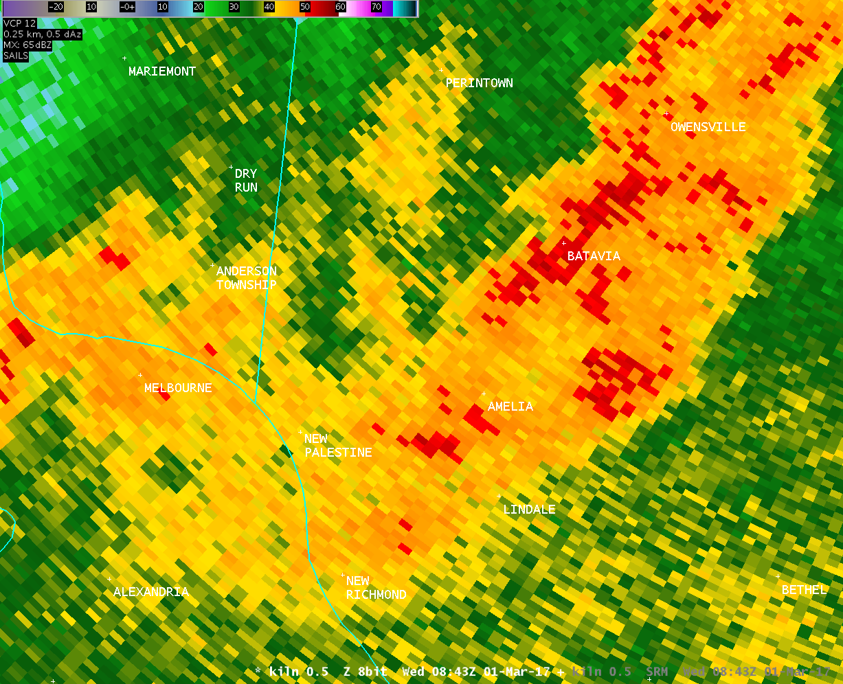
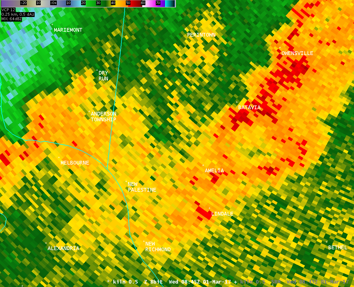
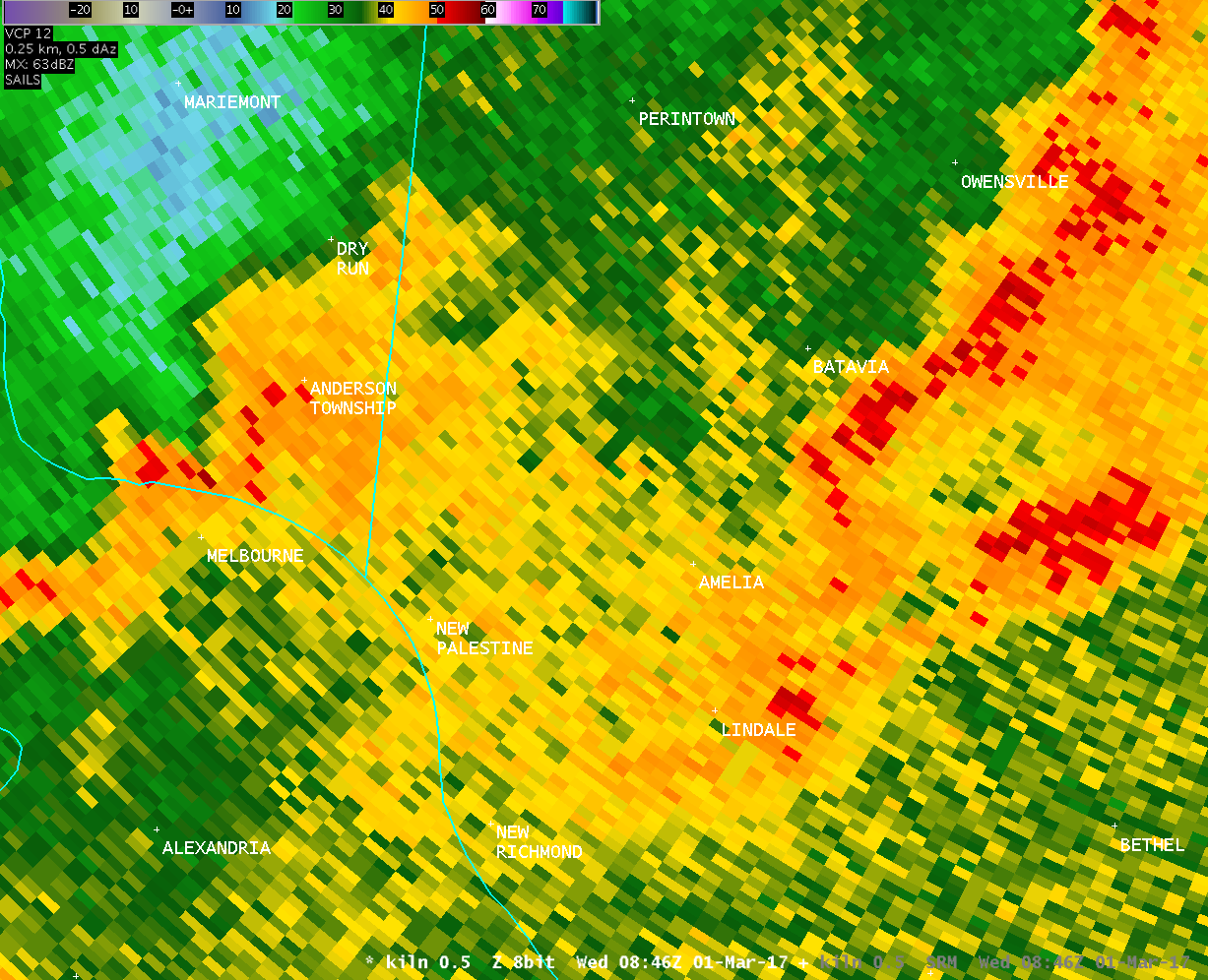
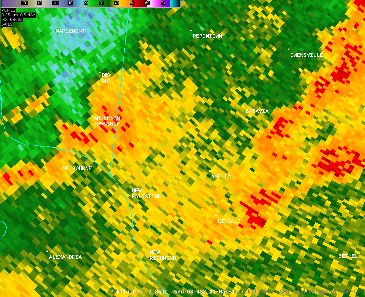
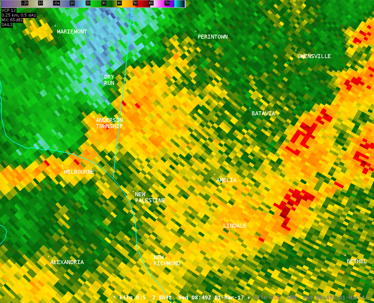
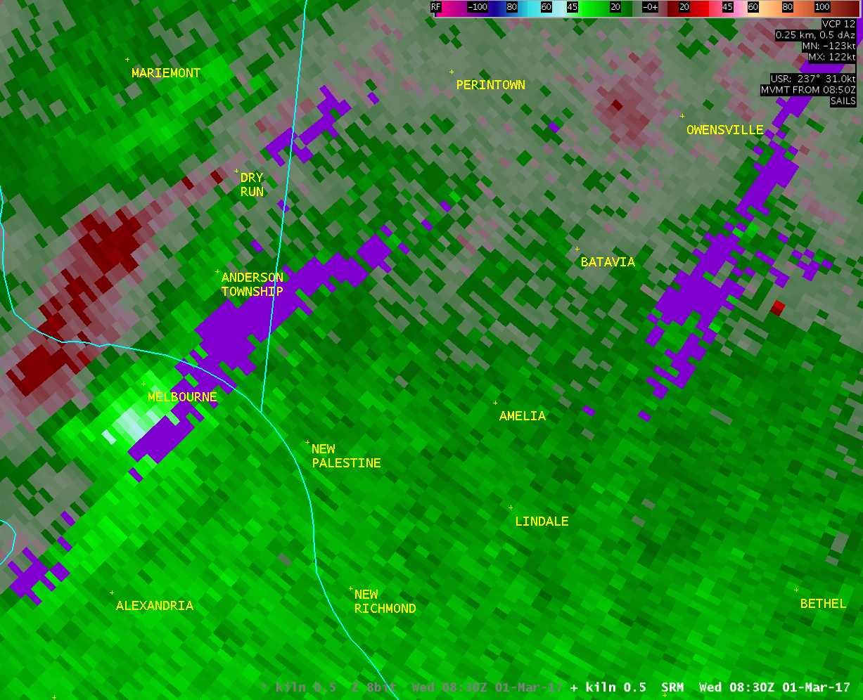
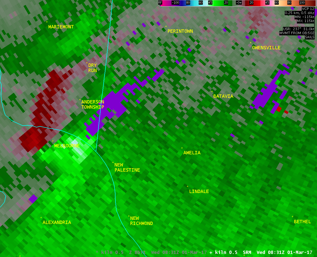
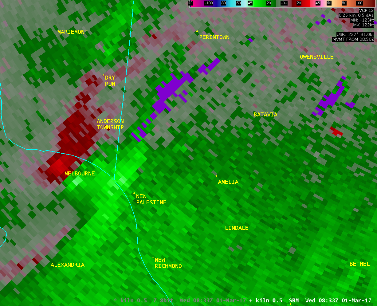
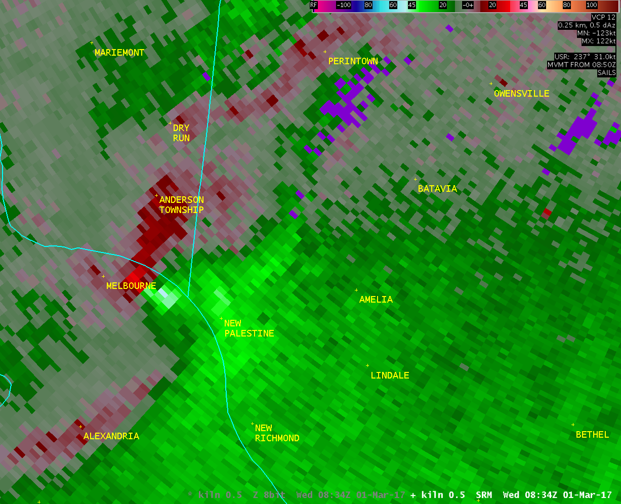
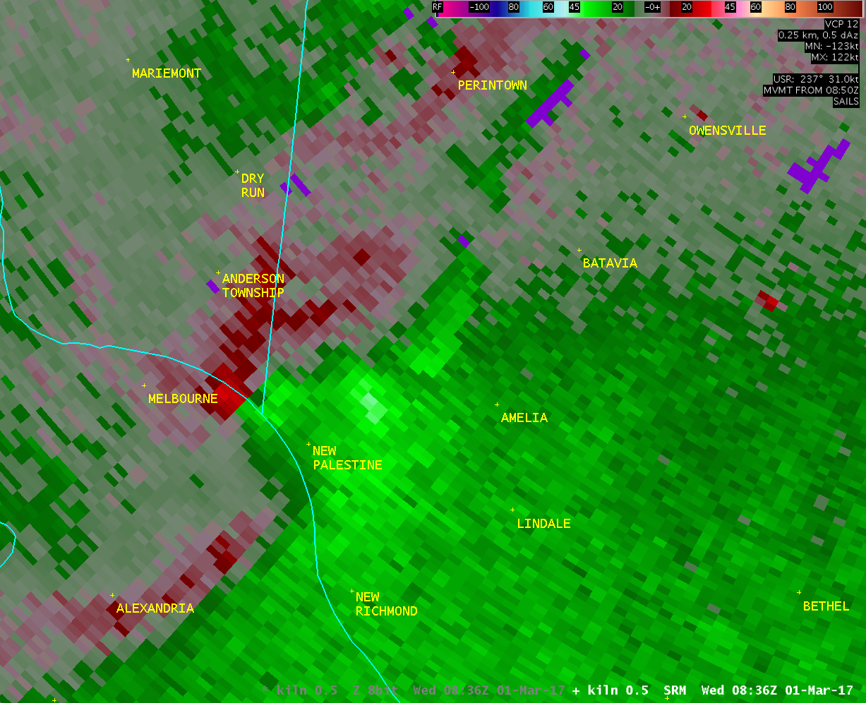
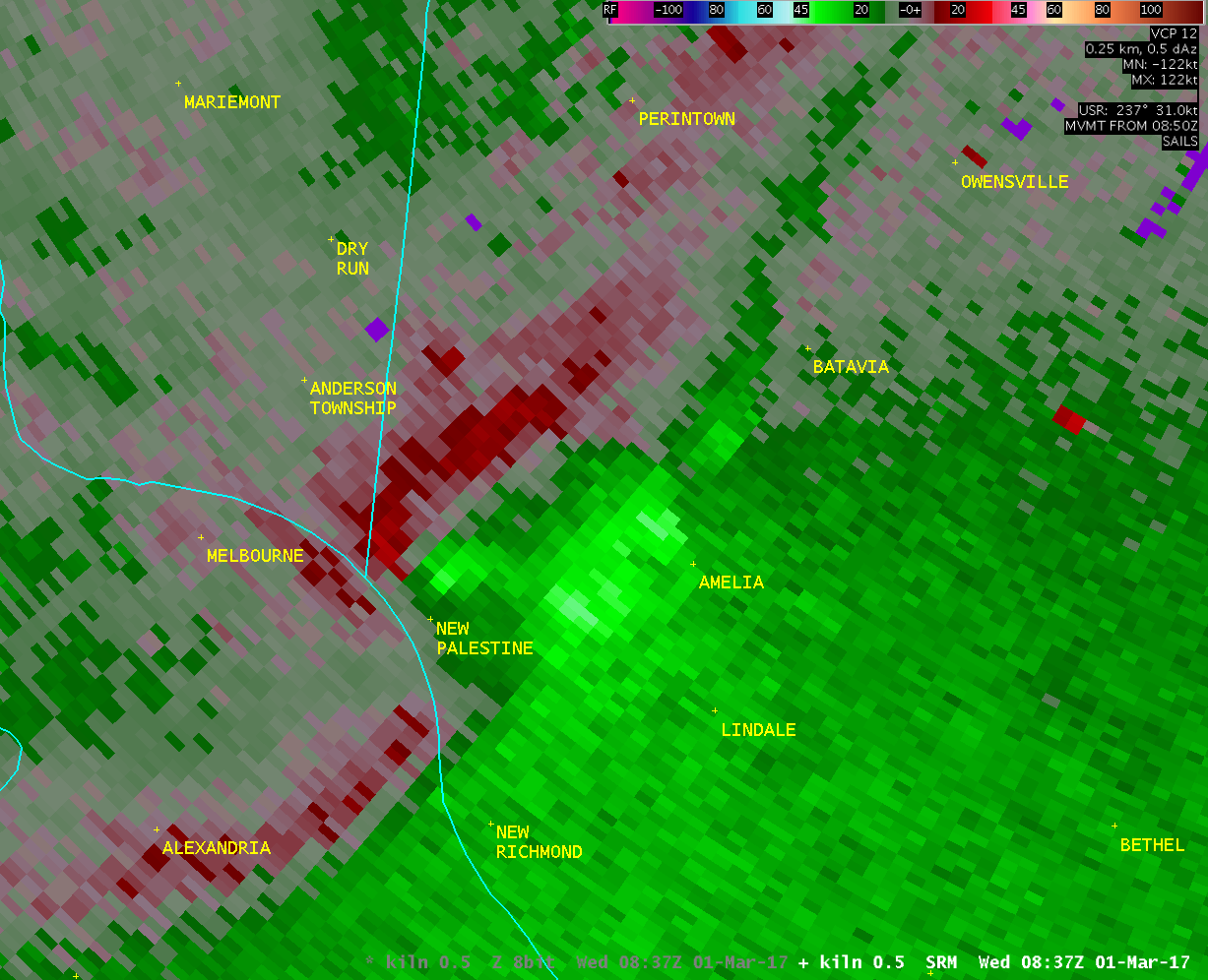
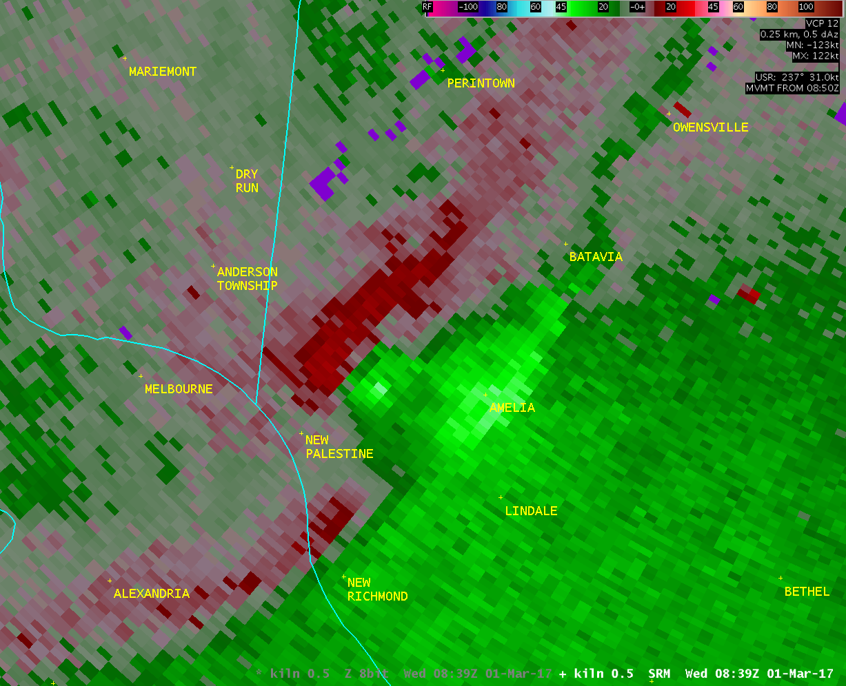
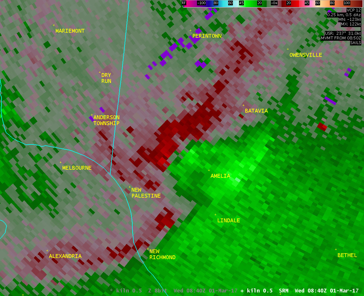
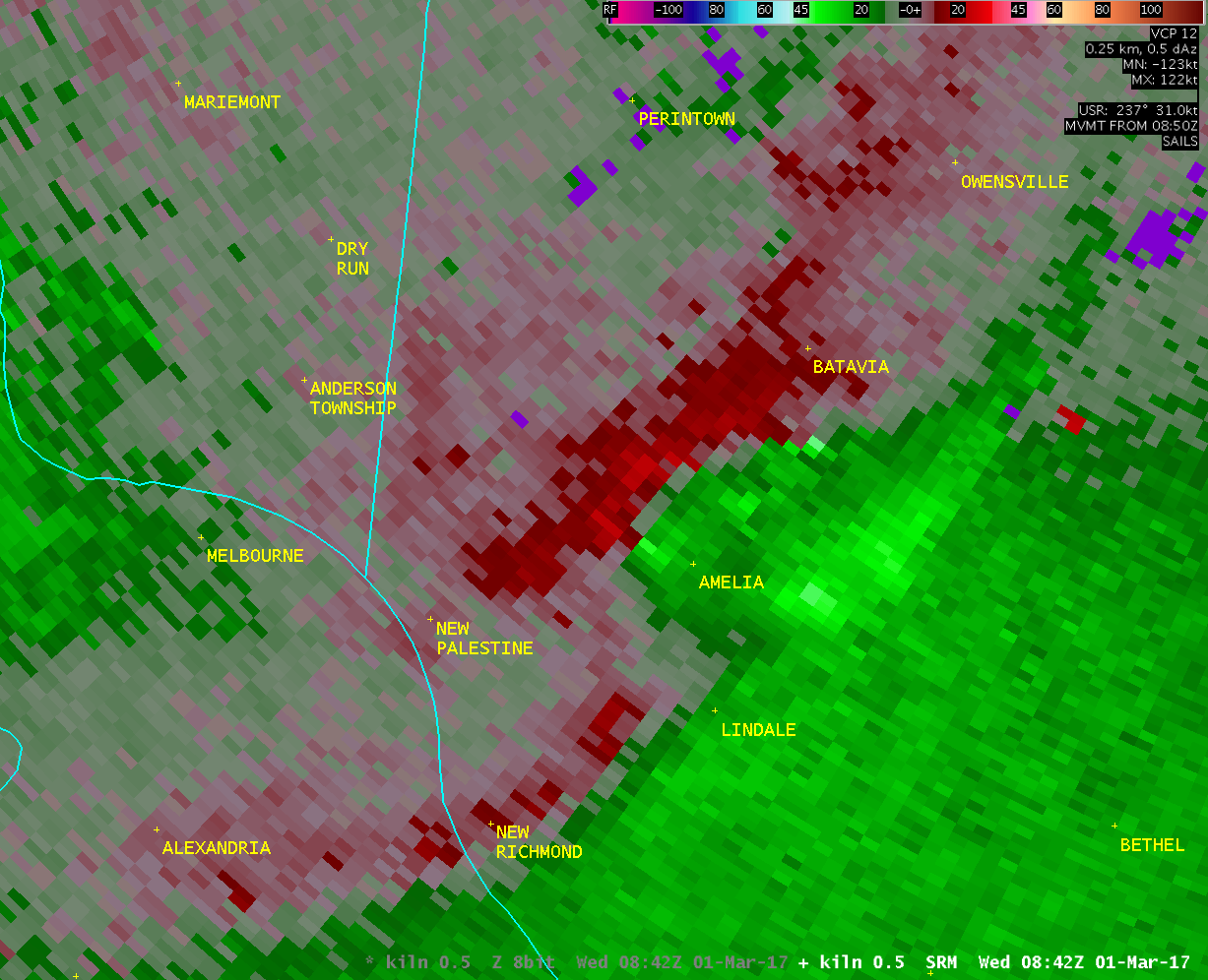
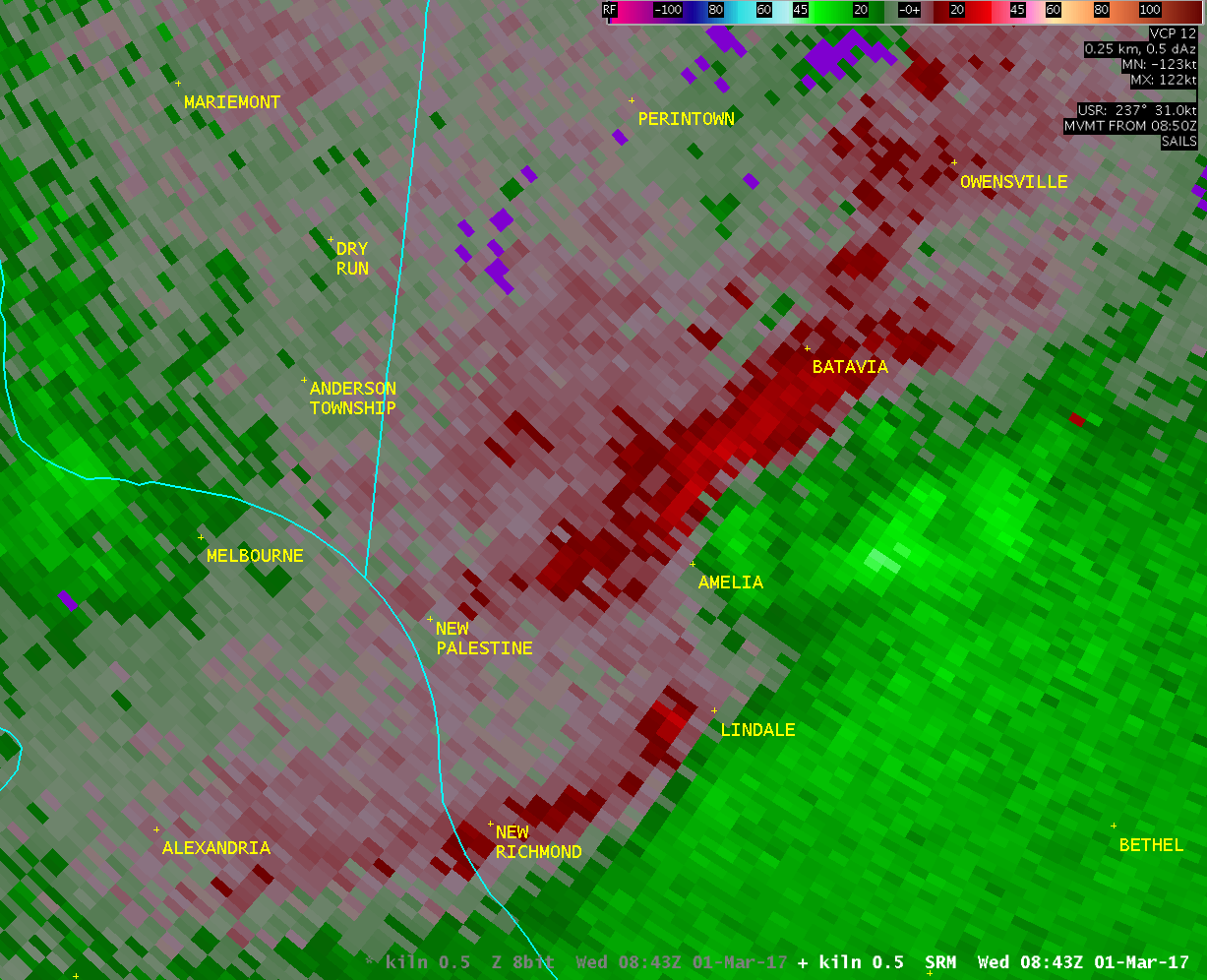
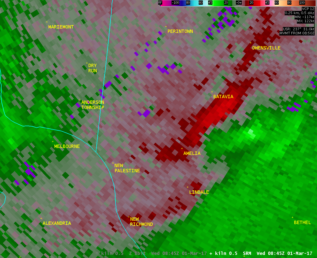
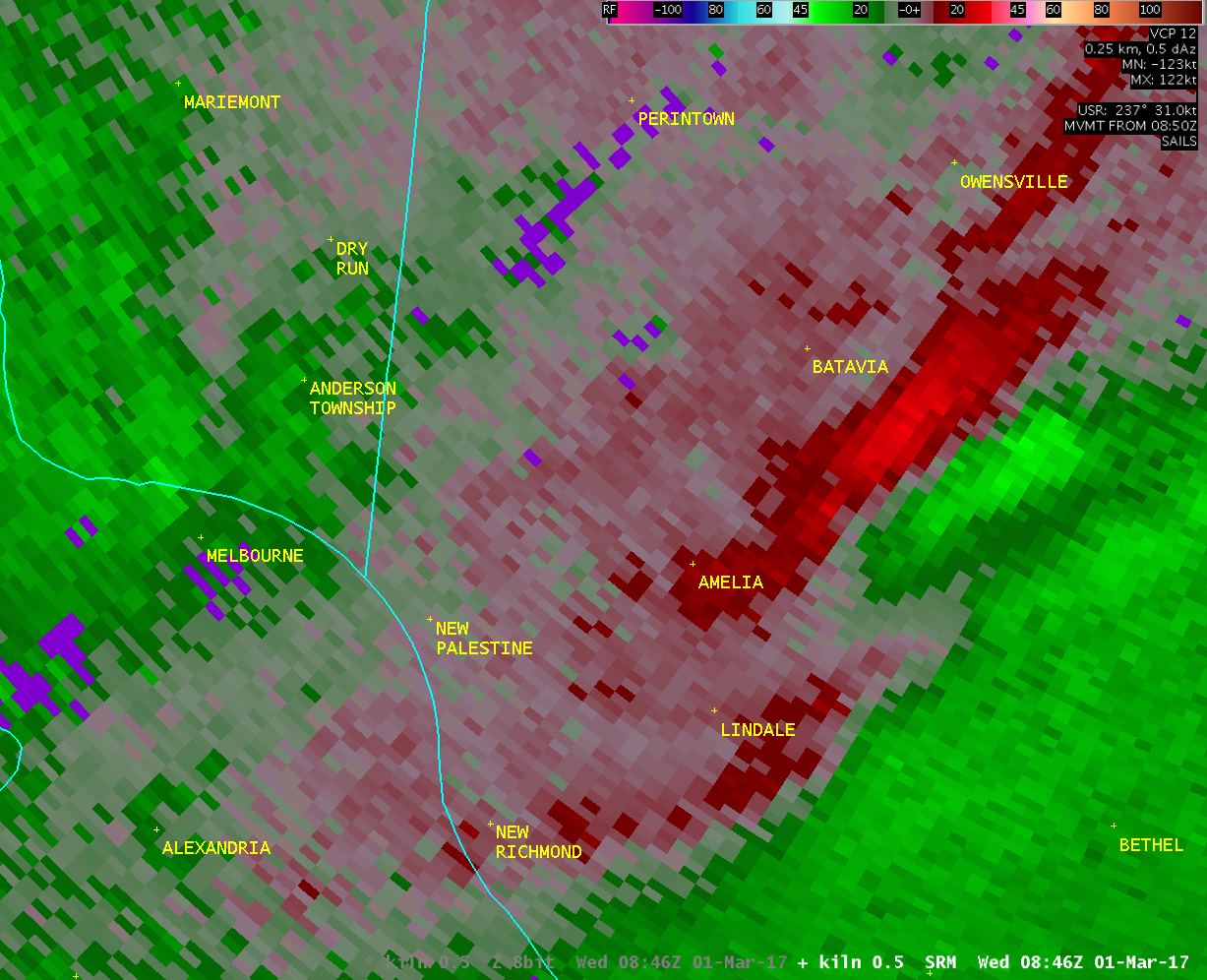
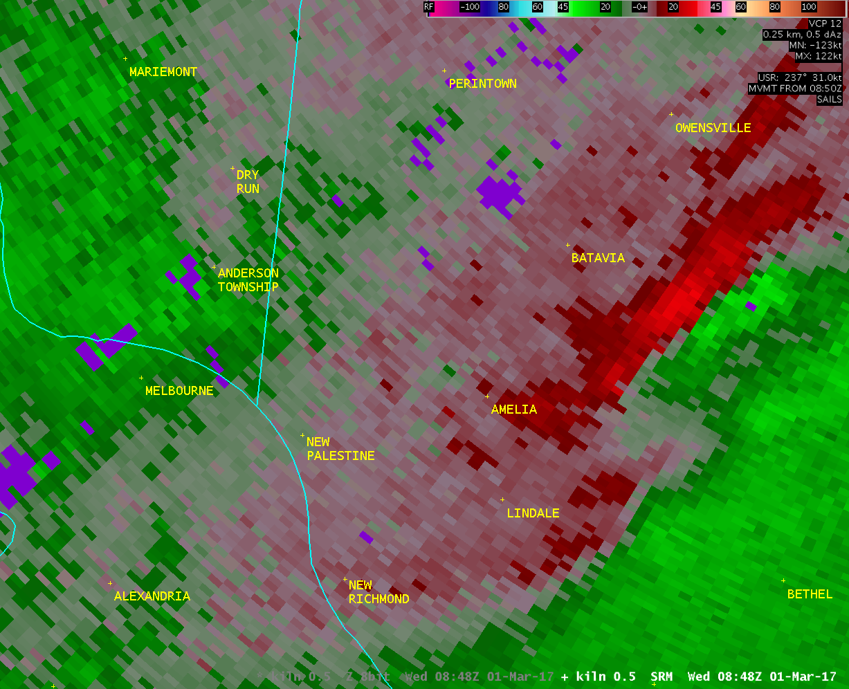
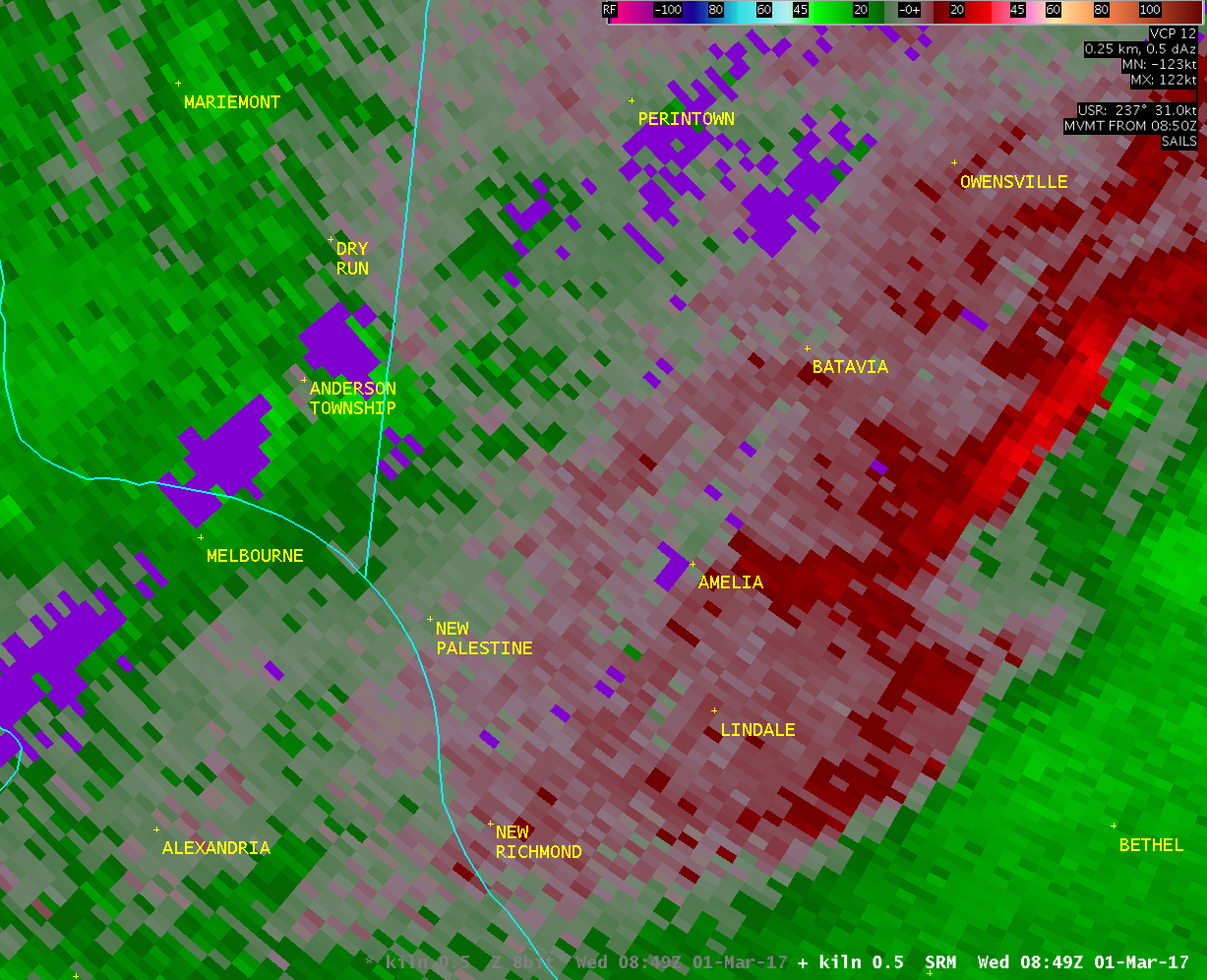
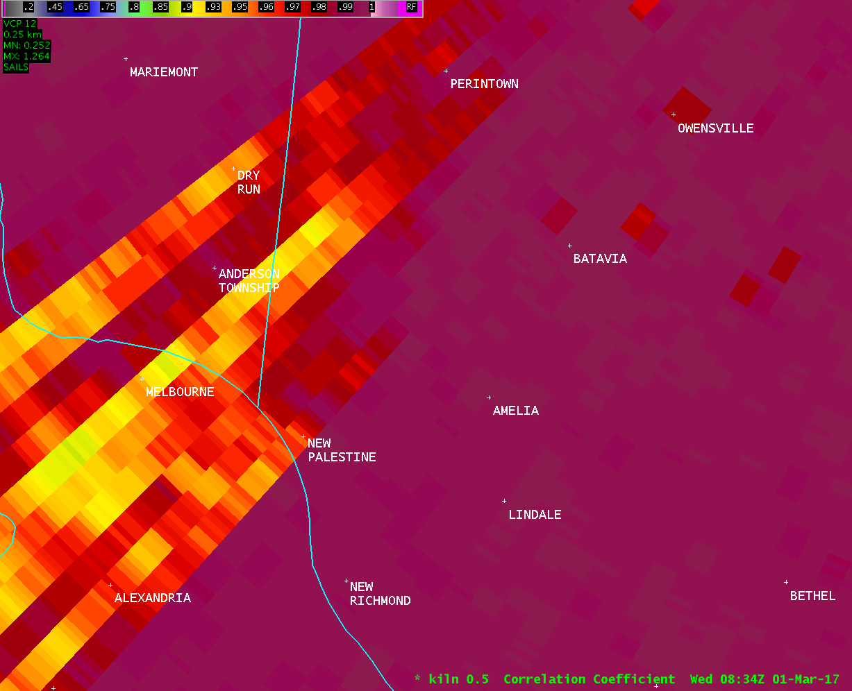
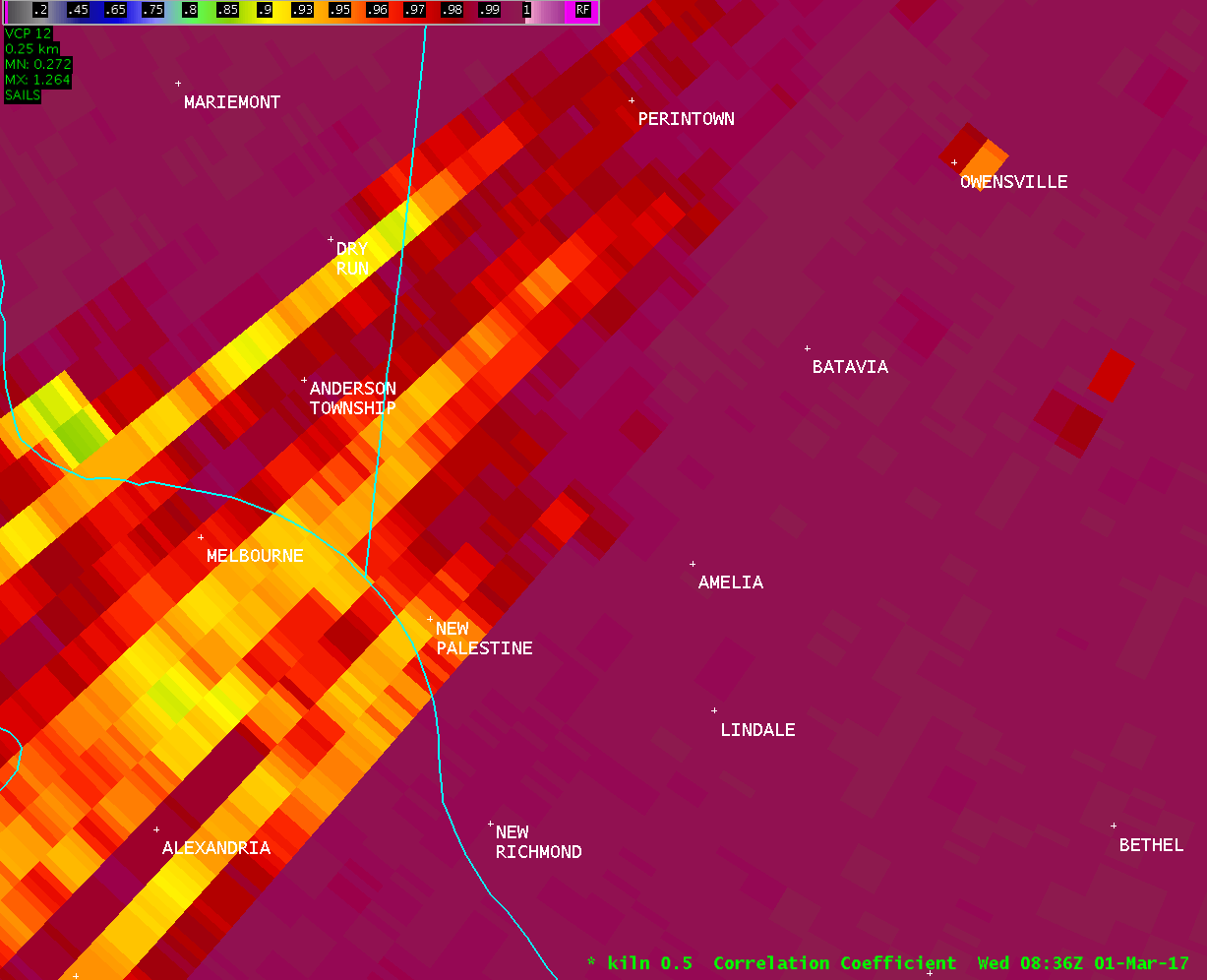
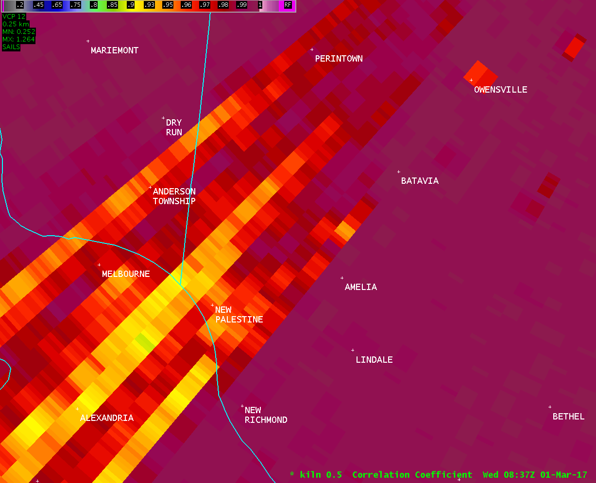
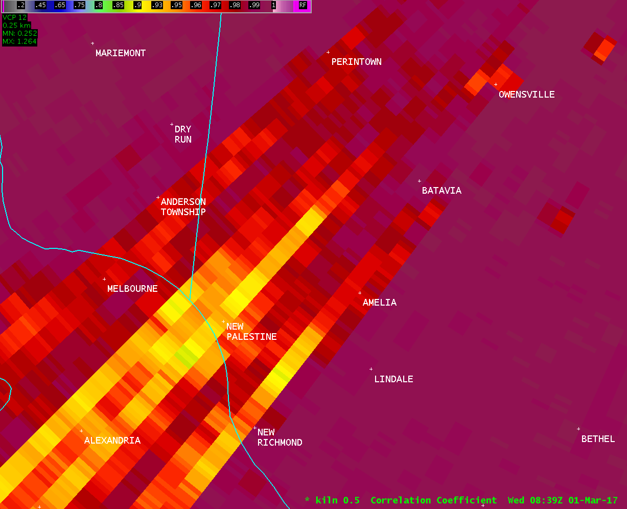
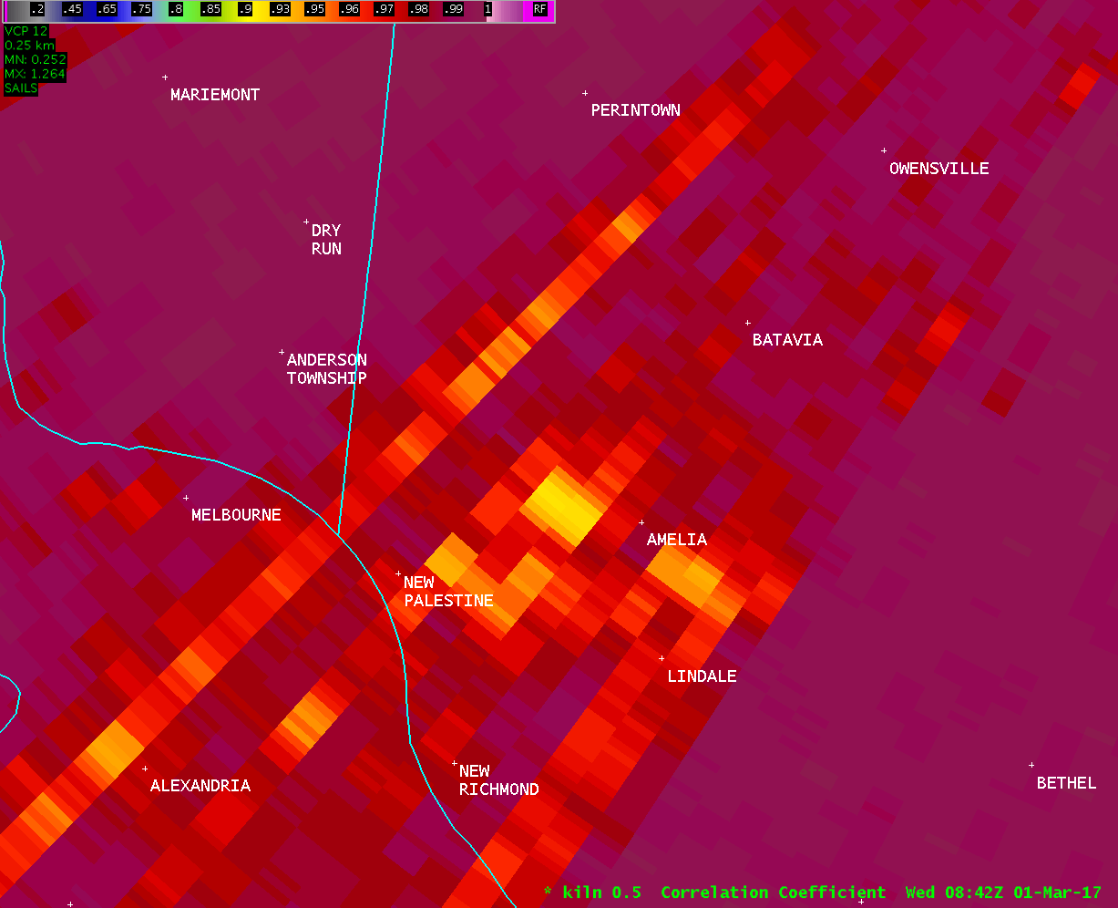
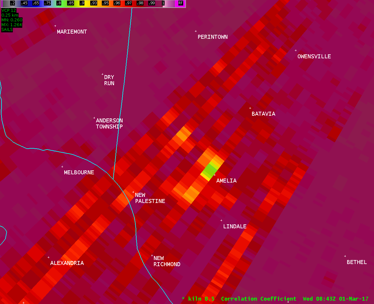
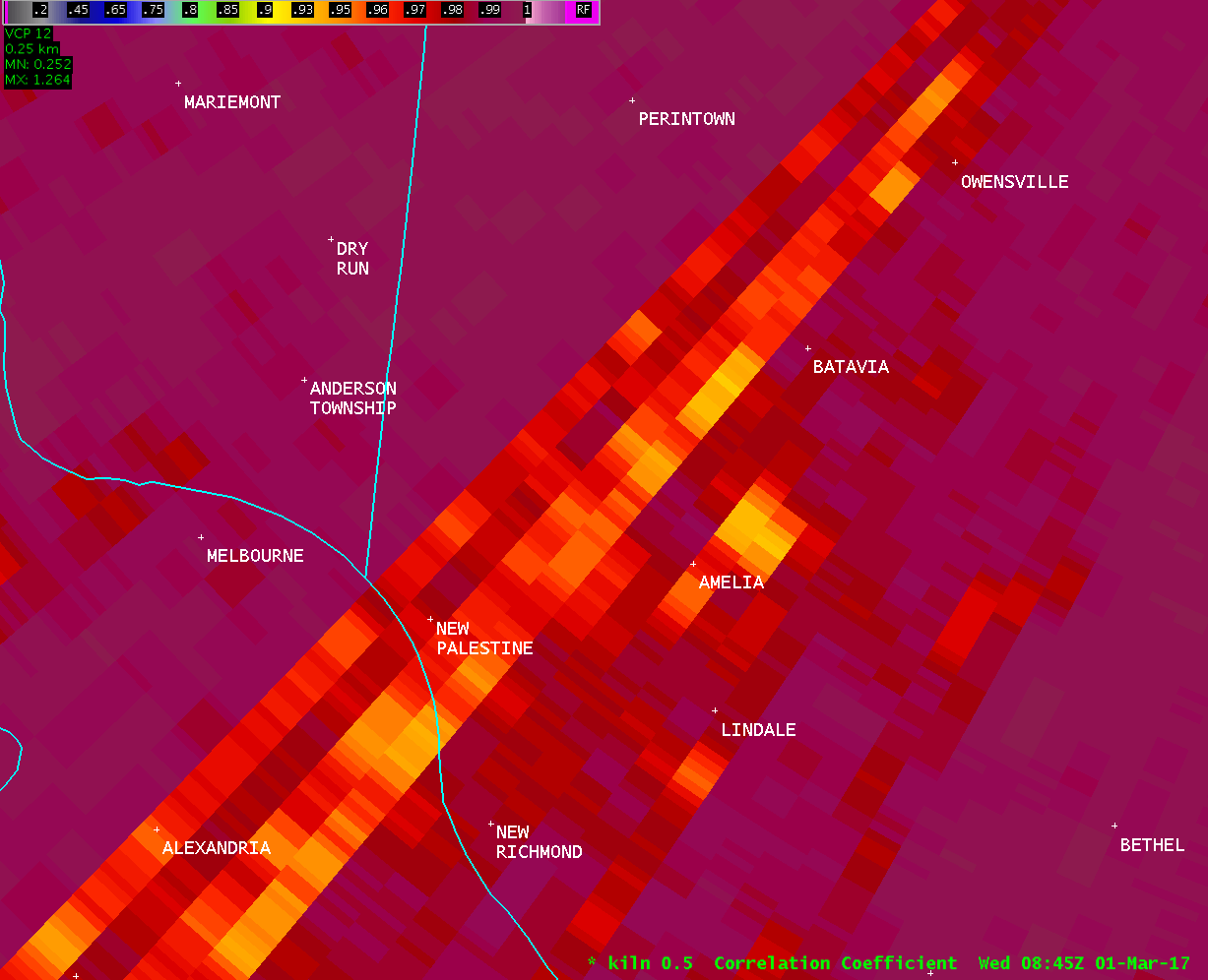
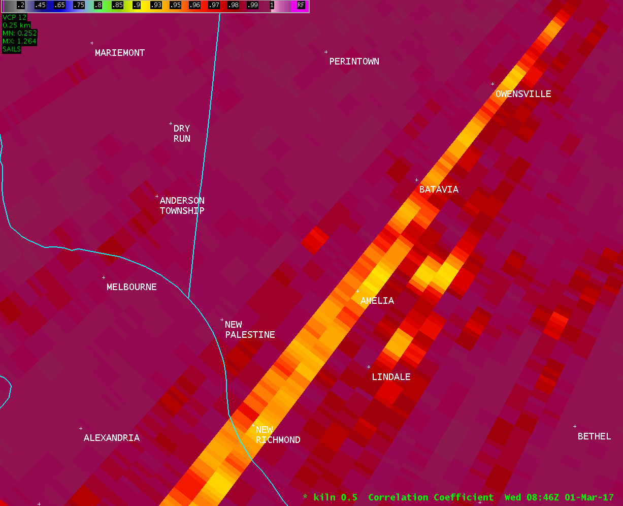
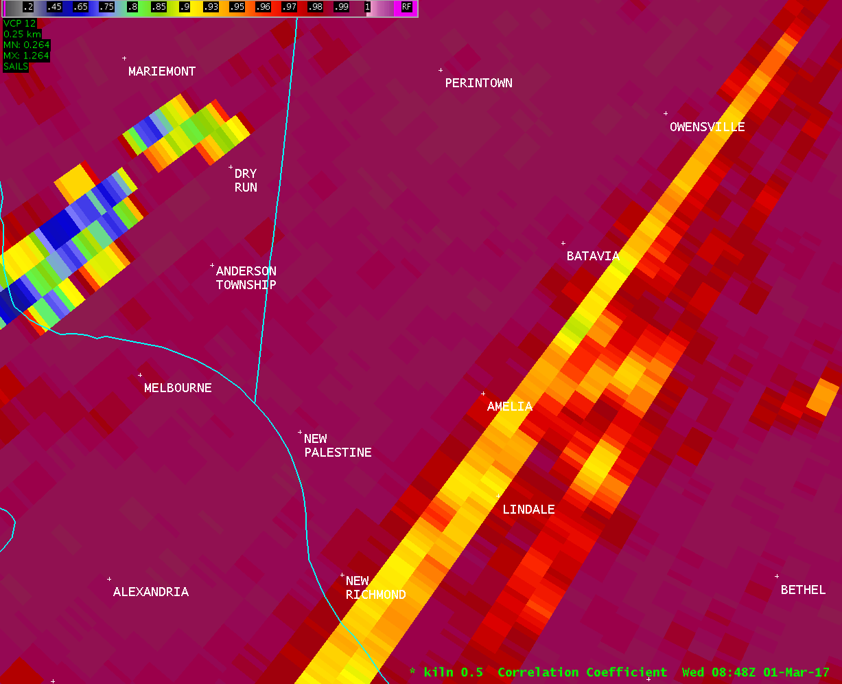
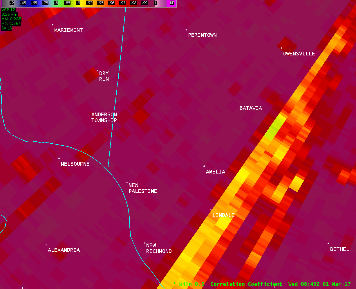
...Tornado Confirmed Near Amelia in Clermont County Ohio...
Location...Amelia in Clermont County Ohio
Date...March 1, 2017
Estimated Start Time...3:38 AM EST
Estimated End Time...3:47 AM EST
Maximum EF-Scale Rating...EF1
Estimated Maximum Wind Speed...110 MPH
Maximum Path Width...150 yards
Path Length...6.4 miles
Beginning Lat/Lon...39.0258N/84.2955W
Ending lat/Lon...39.0288N/84.1765W
* Fatalities...0
* Injuries...0
* The information in this statement is preliminary and subject to
change pending final review of the event(s) and publication in
NWS Storm Data.
...Summary...
The National Weather Service in Wilmington OH has confirmed a
tornado near Amelia in Clermont County Ohio which occurred during
the early morning hours on March 1, 2017.
The first sign of tornadic damage was observed on Locust Corner
Road in Pierce Township near the Pierce Township Nature Area where
several trees were snapped. A power pole was also snapped on the
corner of Locust Corner Road and Wagner Road.
Damage continued on Locust Corner Road near the Pierce Township
Park. Damage was mostly in the form of snapped trees and downed
tree branches. Several evergreen trees were also uprooted.
Further east, beginning at the intersection of Lewis Road and
Locust Lake Road, tree damage continued and was more significant.
Structural damage was also observed at the 1300 block of Locust
Lake Road. The most significant damage occurred to a home which
had its roof completely lifted off and displaced into the
backyard. Damage here was estimated to be EF1 in nature, with
maximum winds near 110 MPH. Other homes further east on Locust
Lake Road also suffered damage, including shingles ripped off and
several instances of siding partially or completely removed from
multiple sides of several structures. Multiple trees also fell
onto one of the homes, resulting in roof damage.
To the east of Locust Lake Road, any structural damage was more
sporadic and primarily consisted of shingles torn from a few
homes on Maple Avenue and South Klein Avenue. A few trees were
snapped as far east as Amelia Park Drive and Mount Holly Road.
The National Weather Service extends thanks to Clermont County
Emergency Management, Ohio Emergency Management, and eyewitnesses
for their assistance with this damage survey.
For reference...the Enhanced Fujita Scale classifies tornadoes
into the following categories:
EF0...wind speeds 65 to 85 mph.
EF1...wind speeds 86 to 110 mph.
EF2...wind speeds 111 to 135 mph.
EF3...wind speeds 136 to 165 mph.
EF4...wind speeds 166 to 200 mph.
EF5...wind speeds greater than 200 mph.
$$
BPP/KC
|

