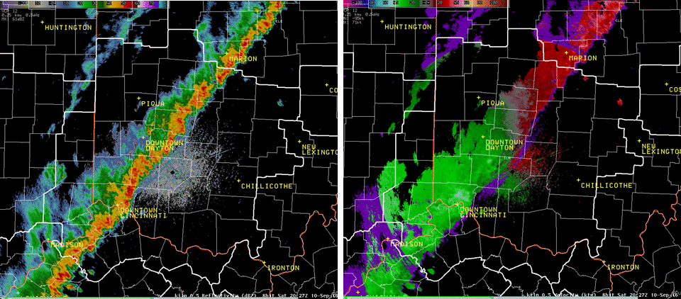
The following radar loop shows the evolution of storm development across extreme eastern Indiana and west-central Ohio during the early afternoon of September 10th. The storms quickly merged into a quasi-linear structure through the afternoon with pockets of strong to severe wind. During the track eastward, a very well-defined outflow boundary raced out in front of the main thunderstorm complex. This outflow boundary was responsible for some of the tree damage as winds gusted between 40 and 50 MPH along the gust front. However, as the outflow separated itself from the main broken line, the storms began to weaken, allowing the damaging wind potential to diminish for central and south-central Ohio (compared to farther west).
KILN 0.5° Reflectivity (Z) and Velocity (V) from 18:30Z to 22:56Z (Click for Animation)
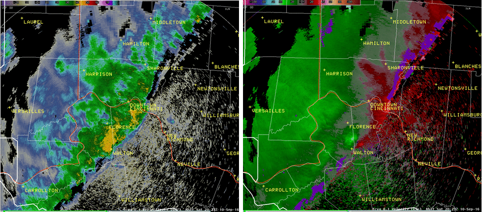
The following radar loop shows the development of strong/severe wind within storms that tracked across southeastern Indiana, northern Kentucky, and extreme southern Ohio as seen from Terminal Doppler Weather Radar Cincinnati (TCVG). The wind was able to translate down to the ground (measured to 53 MPH at the Cincinnati-Northern Kentucky International Airport), creating tree damage in numerous locations along the storms' path.
TCVG 0.1° Reflectivity (Z) and Velocity (V) from 19:30 to 20:59Z (Click for Animation)