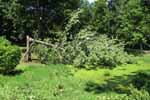
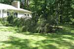
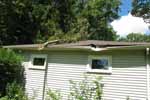
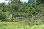
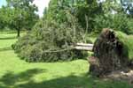
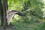
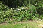
Public Information Statement National Weather Service Wilmington OH 637 PM EDT SUN AUG 21 2016 ...Tornado Confirmed Near Delaware Lake in Delaware County Ohio... Location...Delaware Lake in Delaware County Ohio Date...08/20/2016 Estimated Start Time...637 PM EDT Estimated End Time...649 PM EDT Maximum EF-Scale Rating...EF0 Estimated Maximum Wind Speed...75 MPH Maximum Path Width...100 yards Path Length...3.3 miles Beginning Lat/Lon...40.343899/-83.089444 Ending lat/Lon...40.385043/-83.057970 * Fatalities...none * Injuries...none * The information in this statement is preliminary and subject to change pending final review of the event(s) and publication in NWS Storm Data. ...Summary... The National Weather Service in Wilmington OH has confirmed a weak tornado near Delaware Lake in Delaware County Ohio on 08/20/2016. A weak tornado initially touched down just south of the Buckeye Valley Middle School. The damage near the school was limited to one tree with a limb down. The track continued north-northeast into a residential area. In this residential area several 2 to 4 inch limbs were snapped and a few shallow-rooted trees were uprooted. Roof damage was observed due to a fallen tree on Coover Road and a barn had part of the roof cave in on its east side. The tornado lifted until it crossed US-23 just west of Delaware Dam. A small cluster of trees were twisted on the west side of the highway. The next location is Delaware State Park where the tornado was on the ground for a few minutes. At Delaware State Park, a few partially rotten large limbs were downed and numerous 2 to 3 inch limbs were also downed. Also, several shallow rooted trees were uprooted. A medium-sized dumpster near the marina was tipped and moved about 20 feet. Three boats at the marina sustained minor awning damage. A few 2 to 3 inch tree limbs around the marina were snapped. Across the river from the marina, a snapped limb marked the end of the tornado track. For reference...the Enhanced Fujita Scale classifies tornadoes into the following categories: EF0...wind speeds 65 to 85 mph. EF1...wind speeds 86 to 110 mph. EF2...wind speeds 111 to 135 mph. EF3...wind speeds 136 to 165 mph. EF4...wind speeds 166 to 200 mph. EF5...wind speeds greater than 200 mph. $$ KH/JG/AR |
| Full Radar Loops from NWS Cleveland Ohio (6:31 PM - 6:56 PM) | |
| KCLE 0.5° Reflectivity (8200-8500 feet AGL) | |
| 1 2 3 4 5 6 7 8 9 10 11 12 13 14 15 16 | Loop | |
| KCLE 0.5° Storm-Relative Motion (8200-8500 feet AGL) | |
| 1 2 3 4 5 6 7 8 9 10 11 12 13 14 15 16 | Loop | |
| KCLE 0.5° Correlation Coefficient (CC) (8200-8500 feet AGL) | |
| 1 2 3 4 5 6 7 8 9 10 11 12 13 14 15 16 | Loop | |
| Full Radar Loops from NWS Wilmington Ohio (6:32 PM - 6:55 PM) | |
| KILN 0.5° Reflectivity (7200-7500 feet AGL) | |
| 1 2 3 4 5 6 7 8 9 10 11 12 | Loop | |
| KILN 0.5° Storm-Relative Motion (7200-7500 feet AGL) | |
| 1 2 3 4 5 6 7 8 9 10 11 12 | Loop | |
| KILN 0.5° Correlation Coefficient (7200-7500 feet AGL) | |
| 1 2 3 4 5 6 7 8 9 10 11 12 | Loop | |
| Pictures from the storm survey: | |||
 |
 |
 |
 |
 |
 |
 |
 |
 |
 |
 |
 |