
Strong to severe thunderstorms capable of producing large to very large hail, damaging wind gusts and a few strong tornadoes are likely from the Midwest to the Mid-Atlantic tonight. Moderate Risk (level 4 of 5) of severe thunderstorms is outlooked for the Midwest. A widespread heat wave will peak in the South and East on Friday, with many temperature records expected to be broken. Read More >
|
Severe Thunderstorms |
| In the early morning hours of July 13th, a mesoscale convective system (MCS) began to organize across parts of the Central Plains (Kansas and Missouri). During the day, the MCS tracked east from Kansas to the Ohio Valley, laying out a large swath of damaging winds, including in the St. Louis metro area. During the afternoon across the Ohio Valley, heat and humidity began to build, helping to destabilize the atmosphere. Scattered storms developed across parts of Indiana during the late afternoon hours and slowly tracked eastward into the area, producing several instances of damaging wind. The remaining structure of the decaying MCS from the Central Plains began to move into the area toward the late evening hours. The storms that had developed across Indiana and moved into Ohio set out an outflow boundary (out ahead of main convection). This boundary interacted with the remnants of the MCS across Hamilton County, Ohio to produce an EF0 tornado and straight-line winds of up to 100 MPH. As the storms tracked east of the Greater Cincinnati area, they weakened considerably before dissipating altogether. | 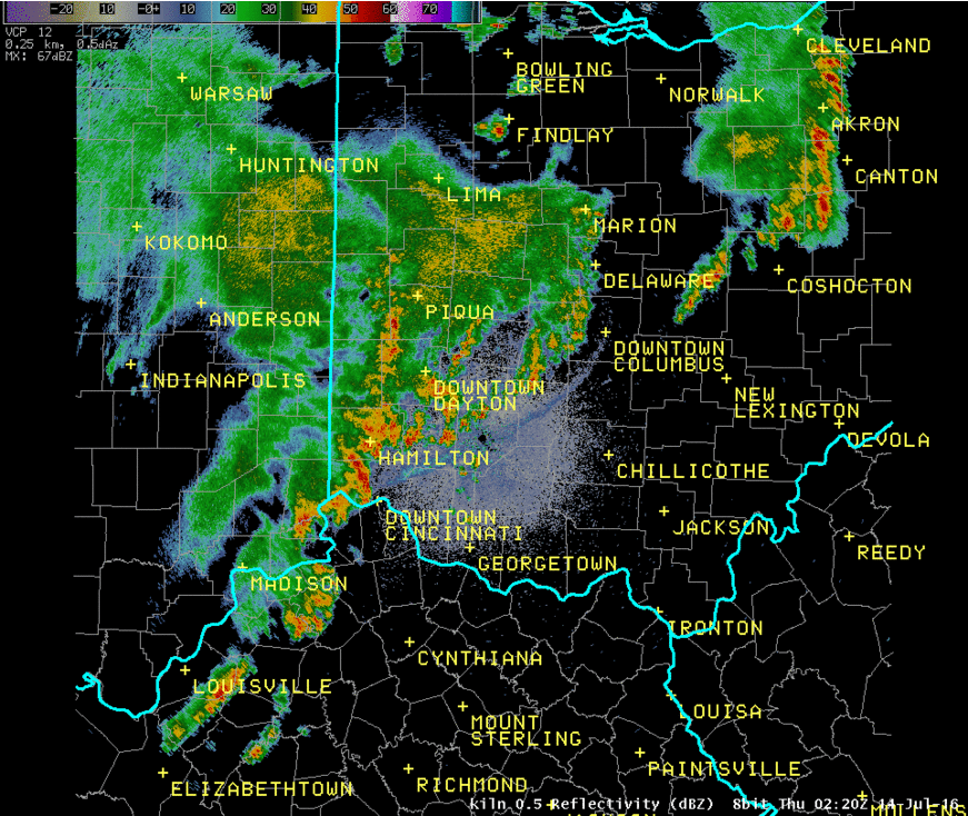 Click for Animation. |
|
|

