|
Tornado West of Washington Court House, OH |
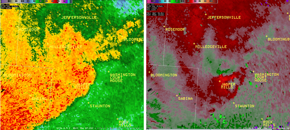
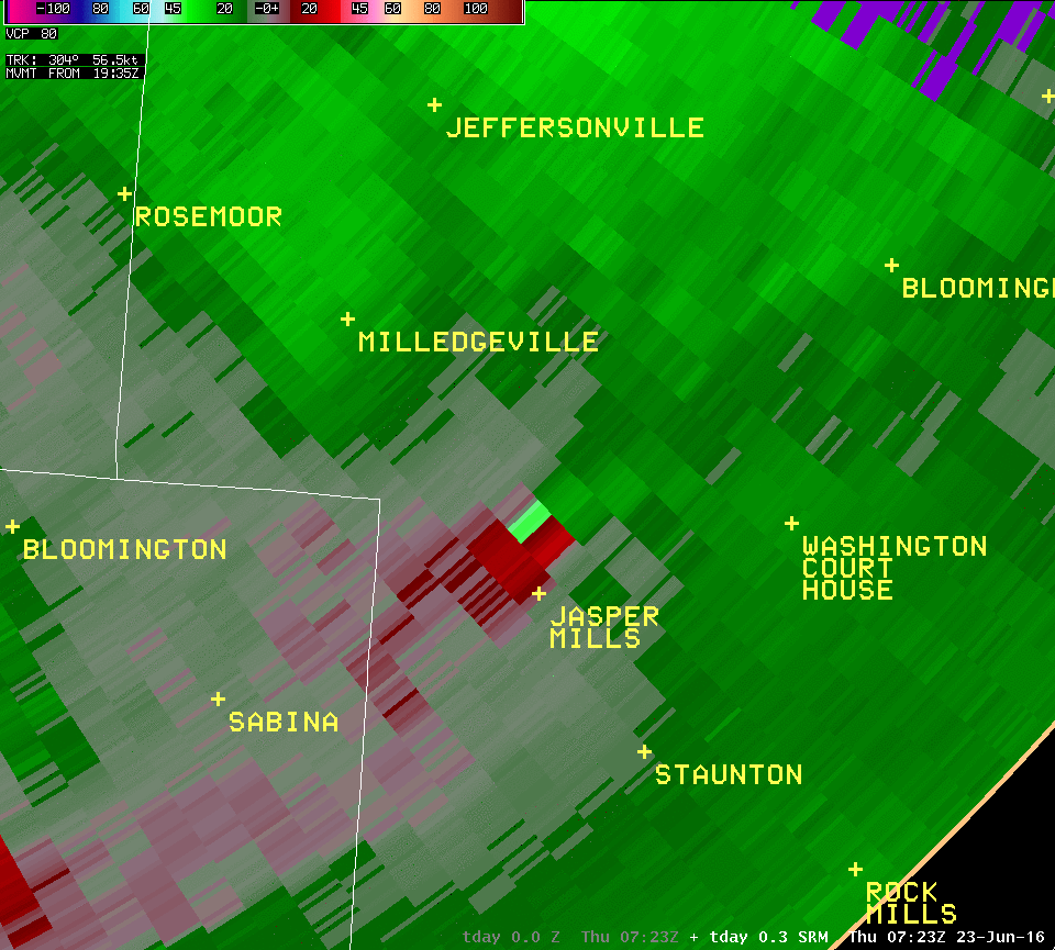
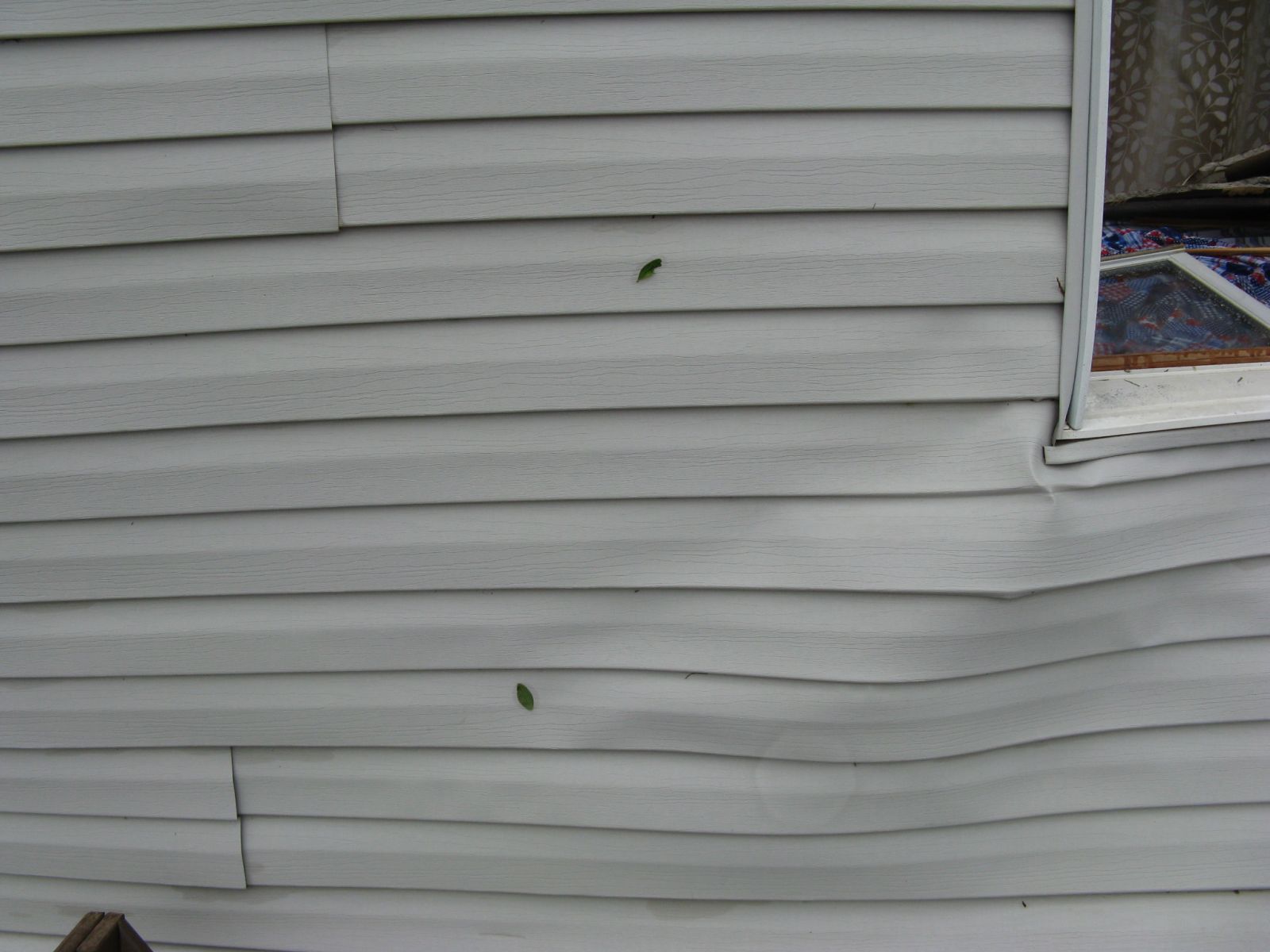
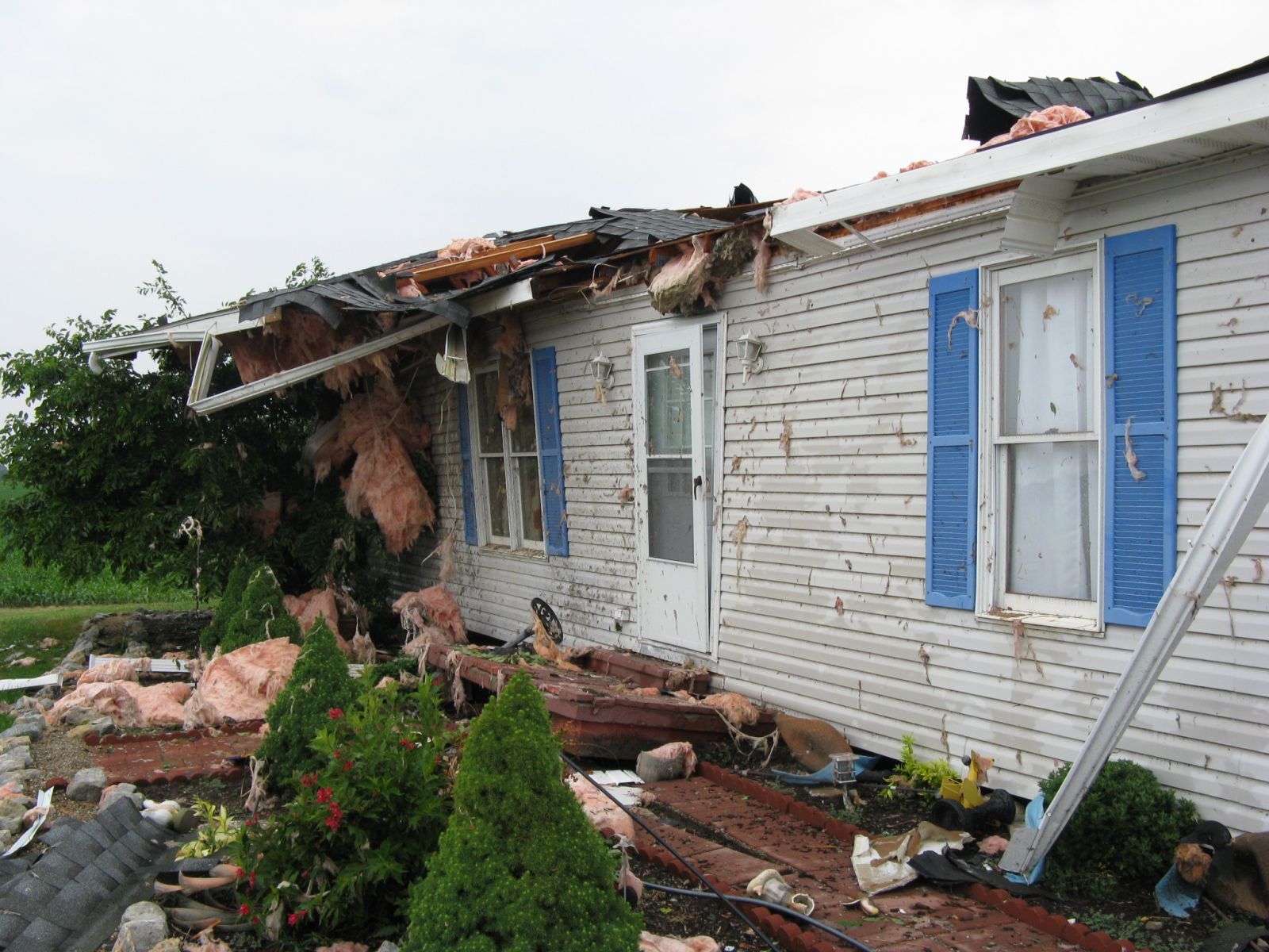
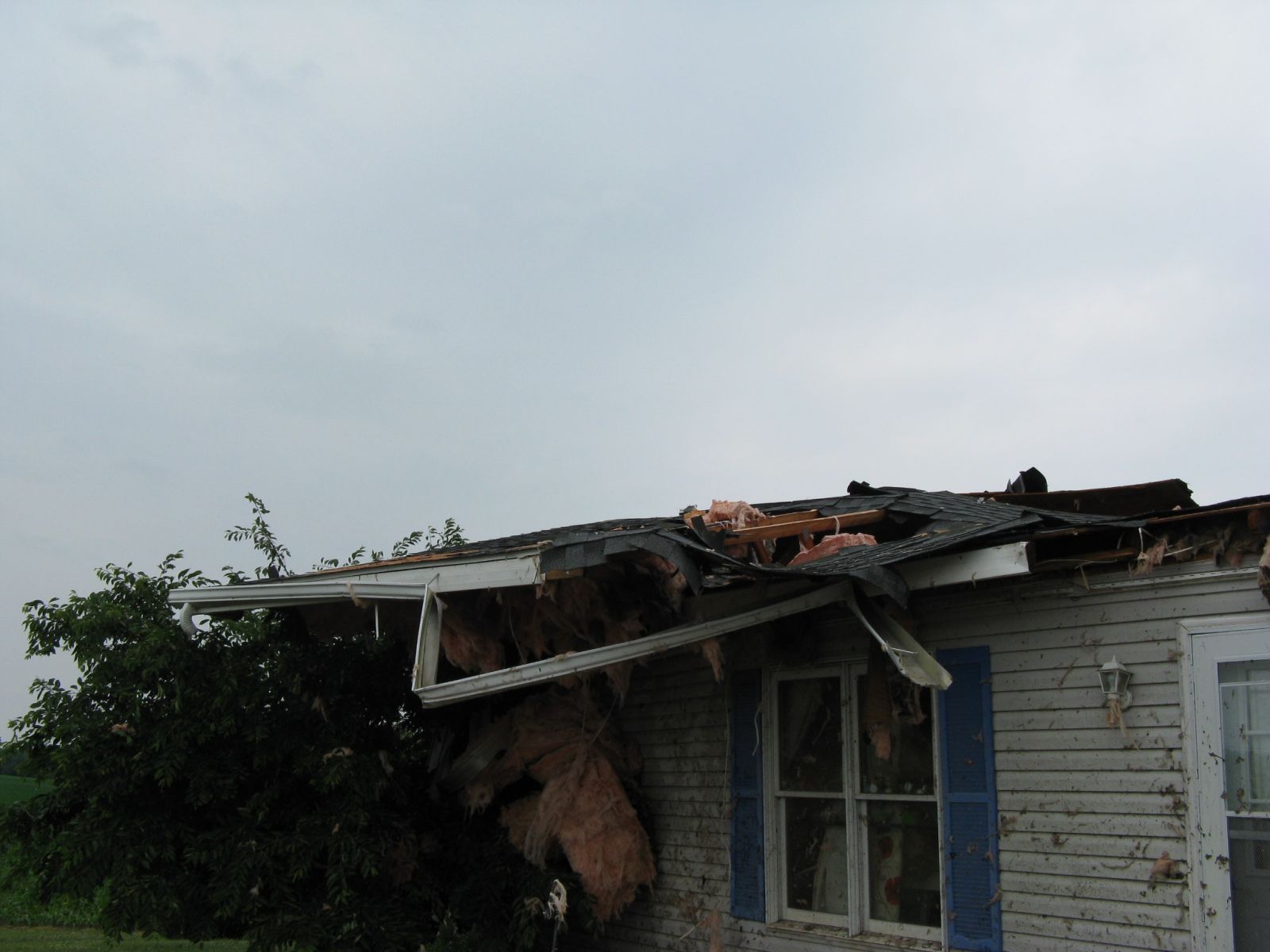
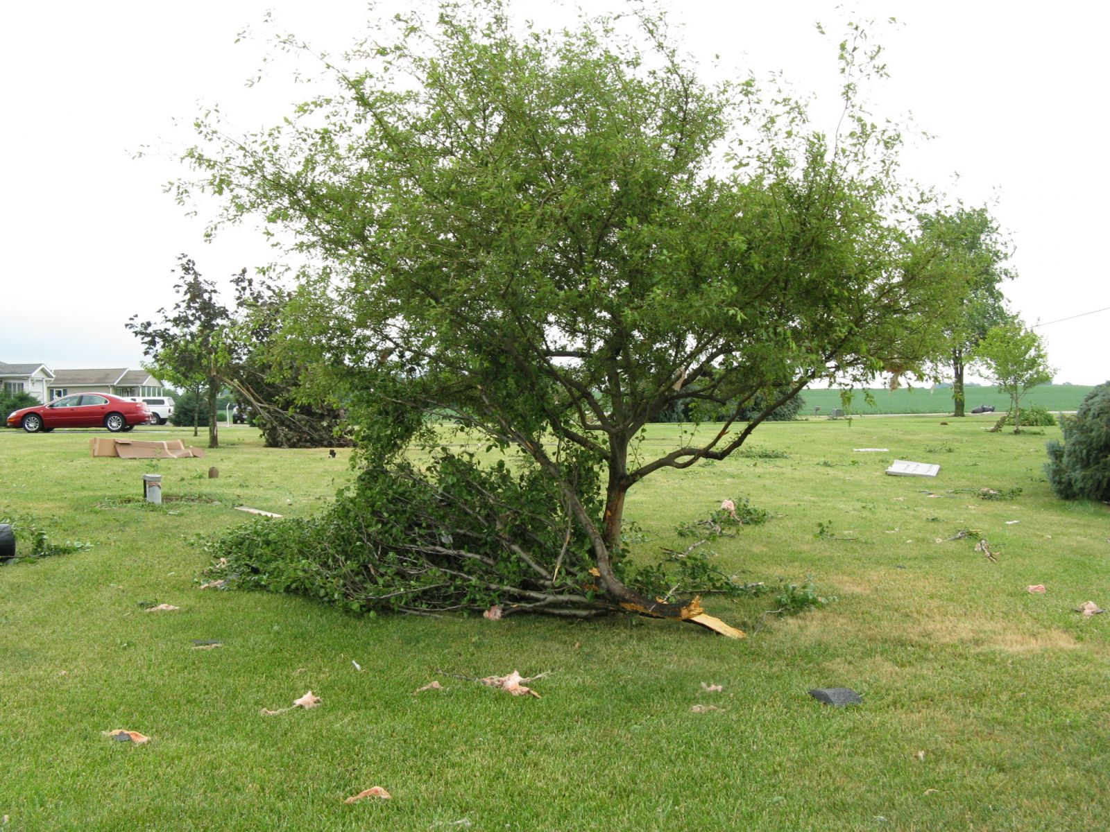
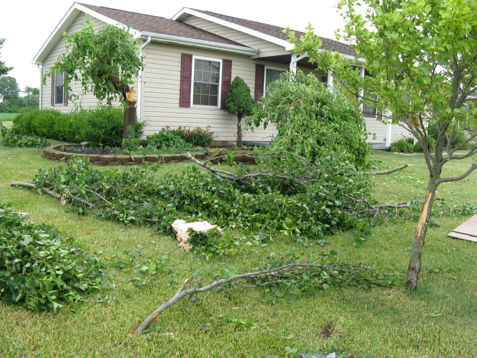
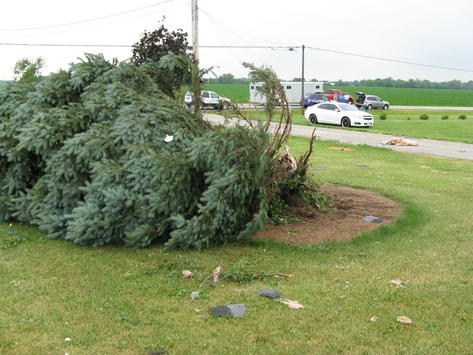
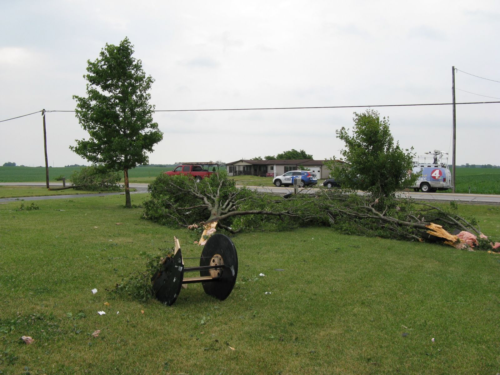
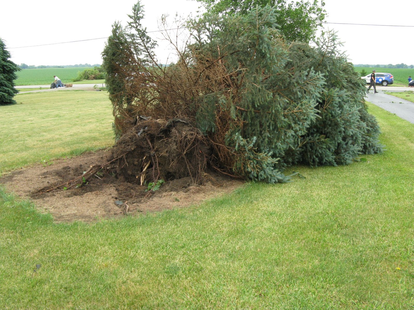
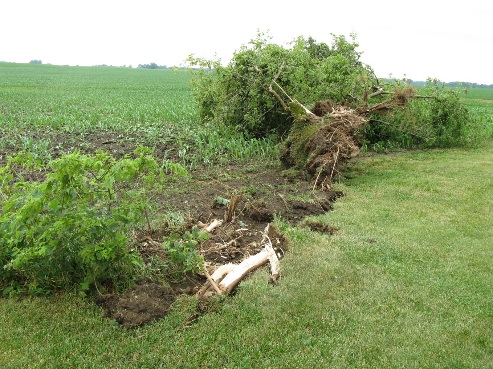
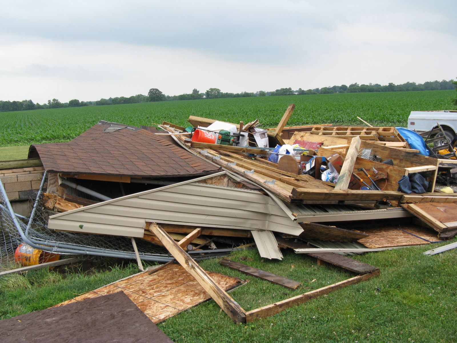
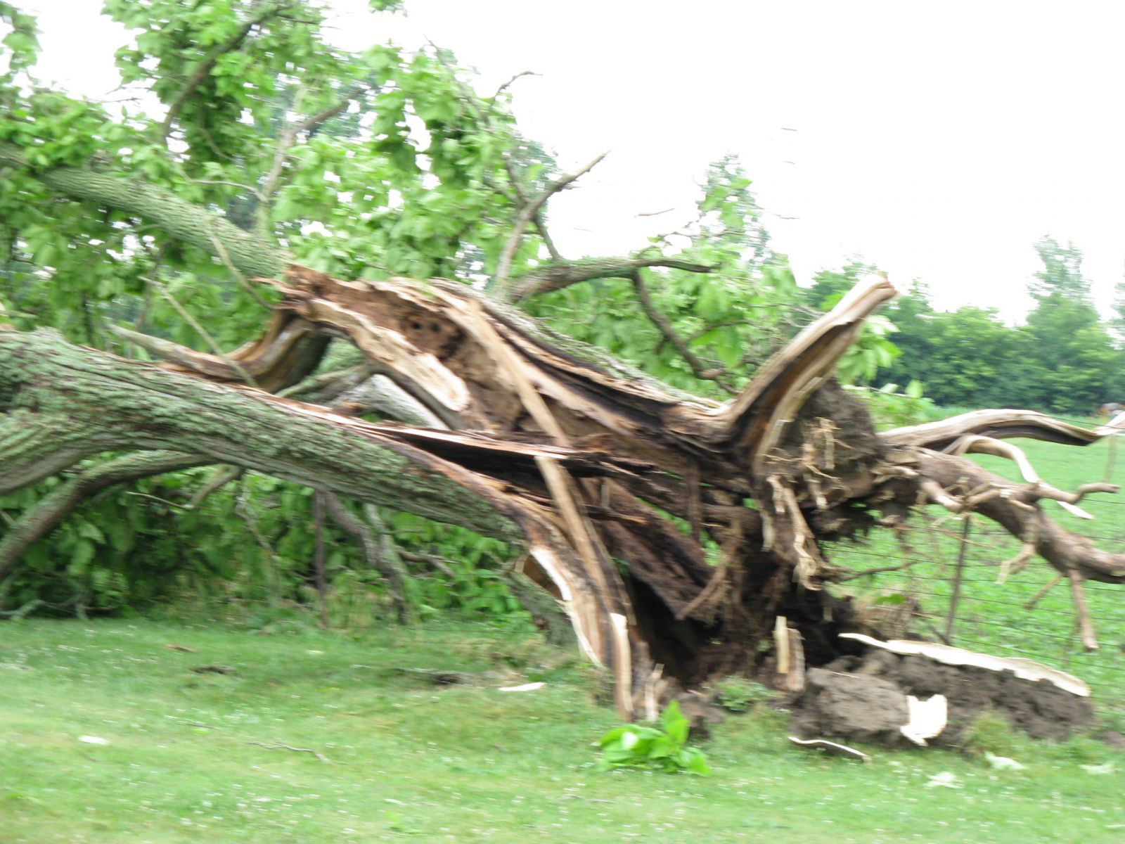
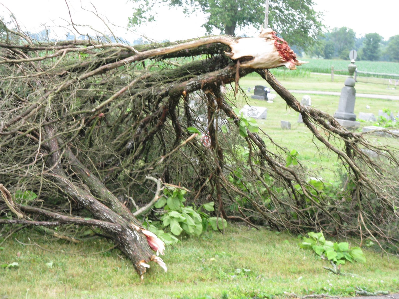
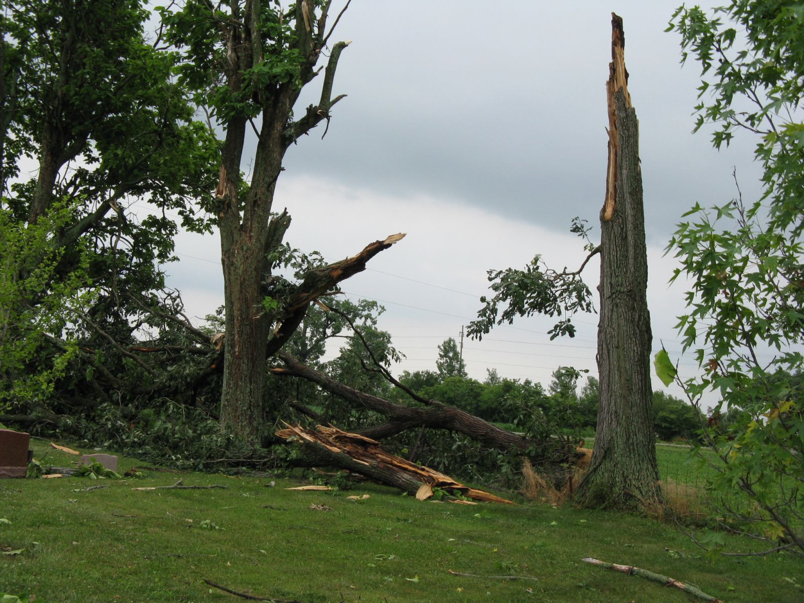
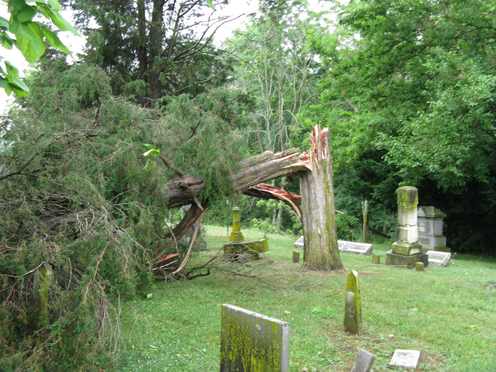
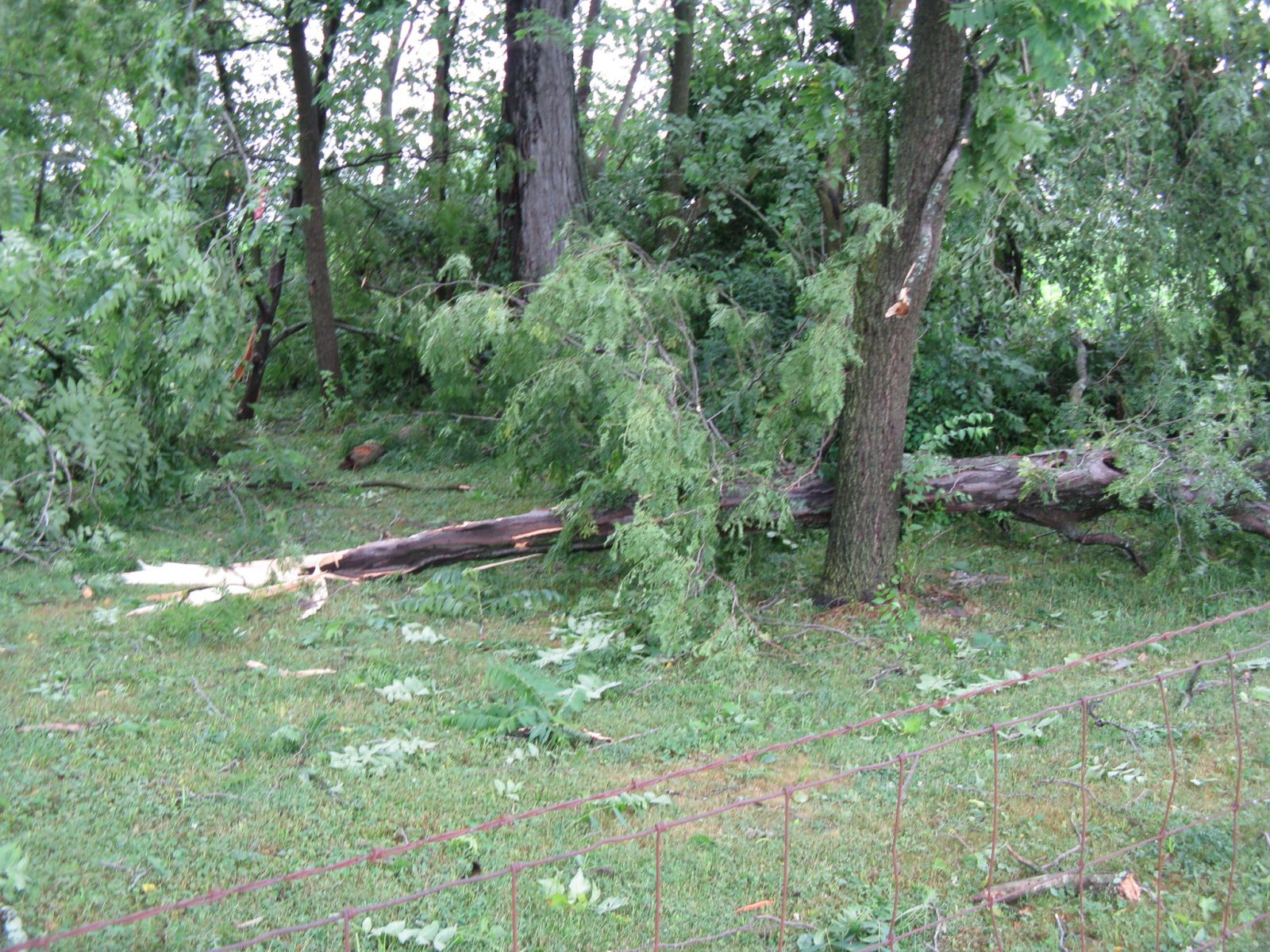
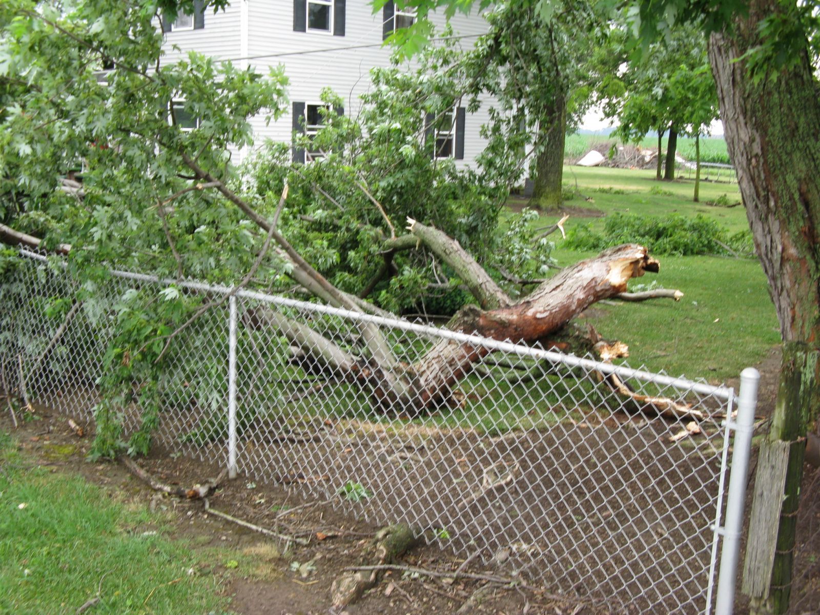
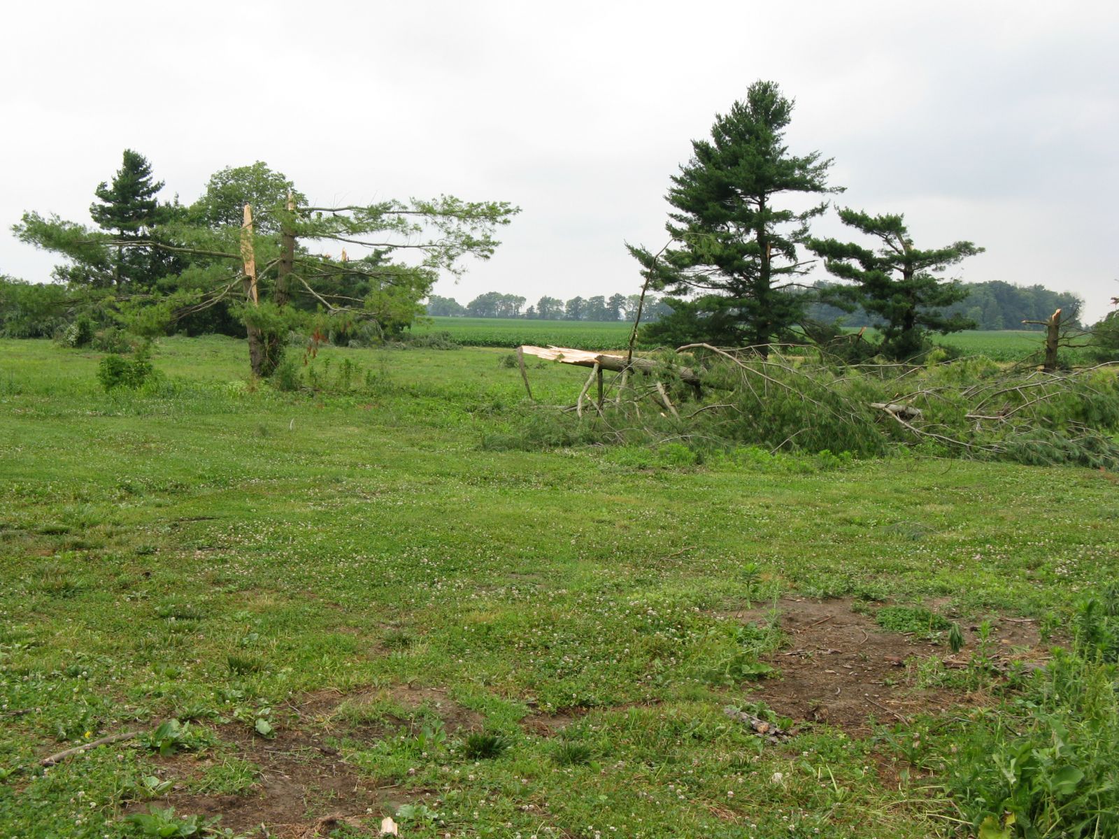
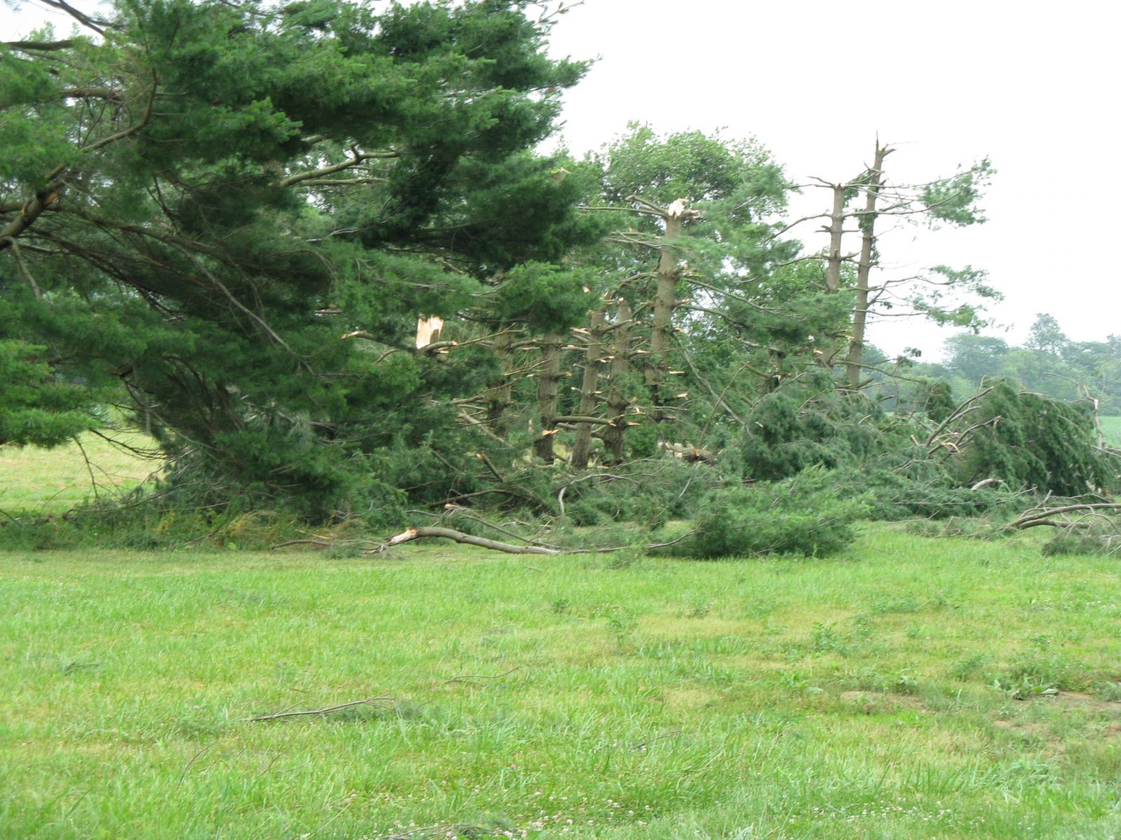
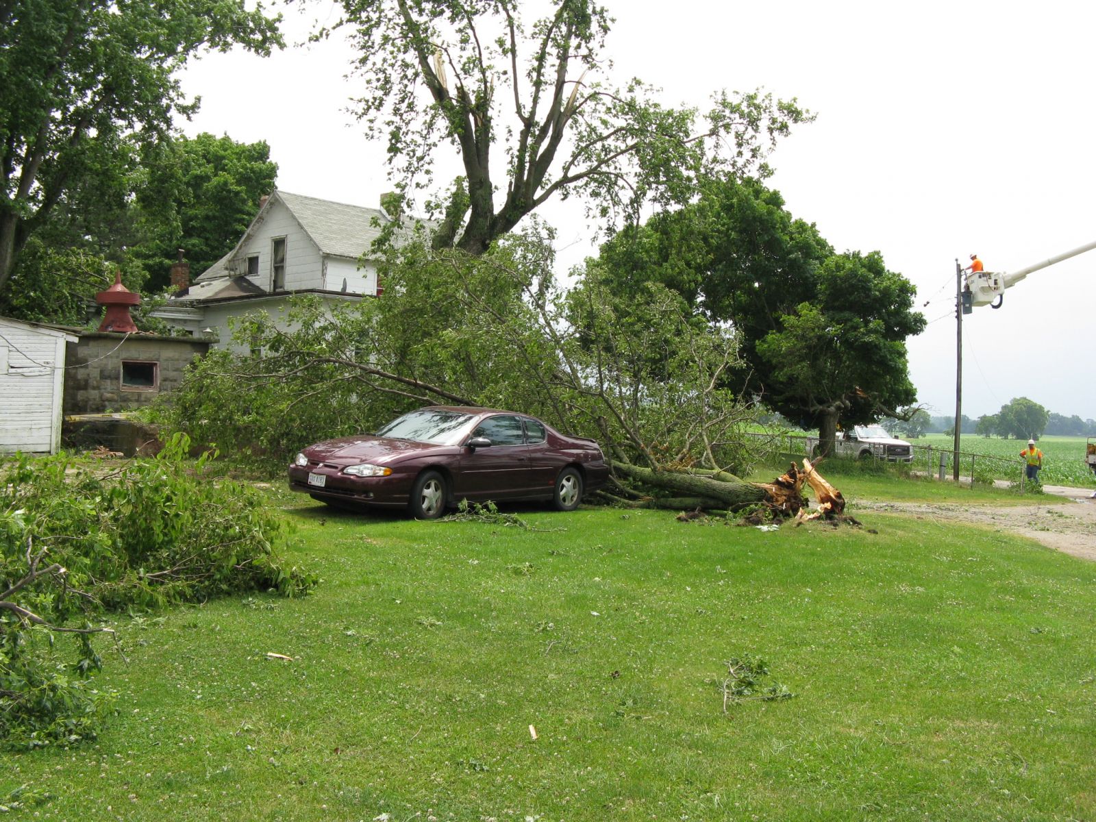
Public Information Statement National Weather Service Wilmington OH 152 PM EDT FRI JUN 24 2016 ...Tornado Confirmed West of Washington Court House in Fayette County Ohio... Location...West of Washington Court House in Fayette County Ohio Date...06/23/2016 Estimated Time...3:20 AM EDT to 3:22 AM EDT Maximum EF-Scale Rating...EF1 Estimated Maximum Wind Speed...100 MPH Maximum Path Width...300 Yards Path Length...3.8 Miles Beginning Lat/Lon...39.5518N / 83.5538 W Ending lat/Lon...39.5197 N / 83.4990 W * Fatalities...0 * Injuries...0 * The information in this statement is preliminary and subject to change pending final review of the event(s) and publication in NWS Storm Data. ...Summary... The National Weather Service in Wilmington OH has confirmed a tornado west of Washington Court House in Fayette County Ohio on 06/23/2016. The first sign of tornadic damage was observed near the corner of Palmer Road NW and Harmony Road. Siding was removed from multiple sides of a two story home, particularly on the southeast facing side. Large tree limbs were also knocked down near this residence. Damage continued to the southeast along Harmony Road and onto Burnett Perrill Road. Damage primarily affected hardwood trees, and several large branches were snapped from the trees. The orientation of the trees exhibited a convergent pattern to the damage. Siding was also removed from a garage at a residence on Burnett Perrill Road. Near the intersection of Burnett Perrill Road and Jasper-Coil Road, numerous evergreen trees were snapped or uprooted on the Jasper-Coil Road side. The tornado moved across a cornfield and then across Bush Cemetary on Bush Road. Tree damage at Bush Cemetary was extensive, and consisted of both snapped and uprooted trees thrown in multiple directions. A well-defined swirl was noted in the cornfield to the southeast of Bush Cemetary. The most significant damage was observed along U.S. Route 22. Two homes along the 3700 block of US Route 22 suffered structural damage. One of the homes suffered partial uplift of the roof and a significant loss of the covering of the roof. The garage was also heavily damaged and the front porch was lifted. Leaf and other debris splatter was observed on all sides of the home. Spruce trees were uprooted and large limbs from other trees were broken. The residence located on the opposite side of U.S. Route 22 had shingles and siding removed. An un-attached one car garage was also destroyed. Damage in this area was estimated to be EF1 in nature, with maximum winds near 100 mph. To the southeast of this area, sporadic damage to trees and power poles was noted, however the damage was more consistent with straight-line winds. The survey also concluded that damage in the Jasper Mills area was also caused by straight-line winds. The National Weather Service extends thanks to Fayette County OH Emergency Management, Fayette County Sheriff's Office and the affected homeowners for their assistance with this damage survey. For reference...the Enhanced Fujita Scale classifies tornadoes into the following categories: EF0...wind speeds 65 to 85 mph. EF1...wind speeds 86 to 110 mph. EF2...wind speeds 111 to 135 mph. EF3...wind speeds 136 to 165 mph. EF4...wind speeds 166 to 200 mph. EF5...wind speeds greater than 200 mph. $$ Peloquin |
 |
 |
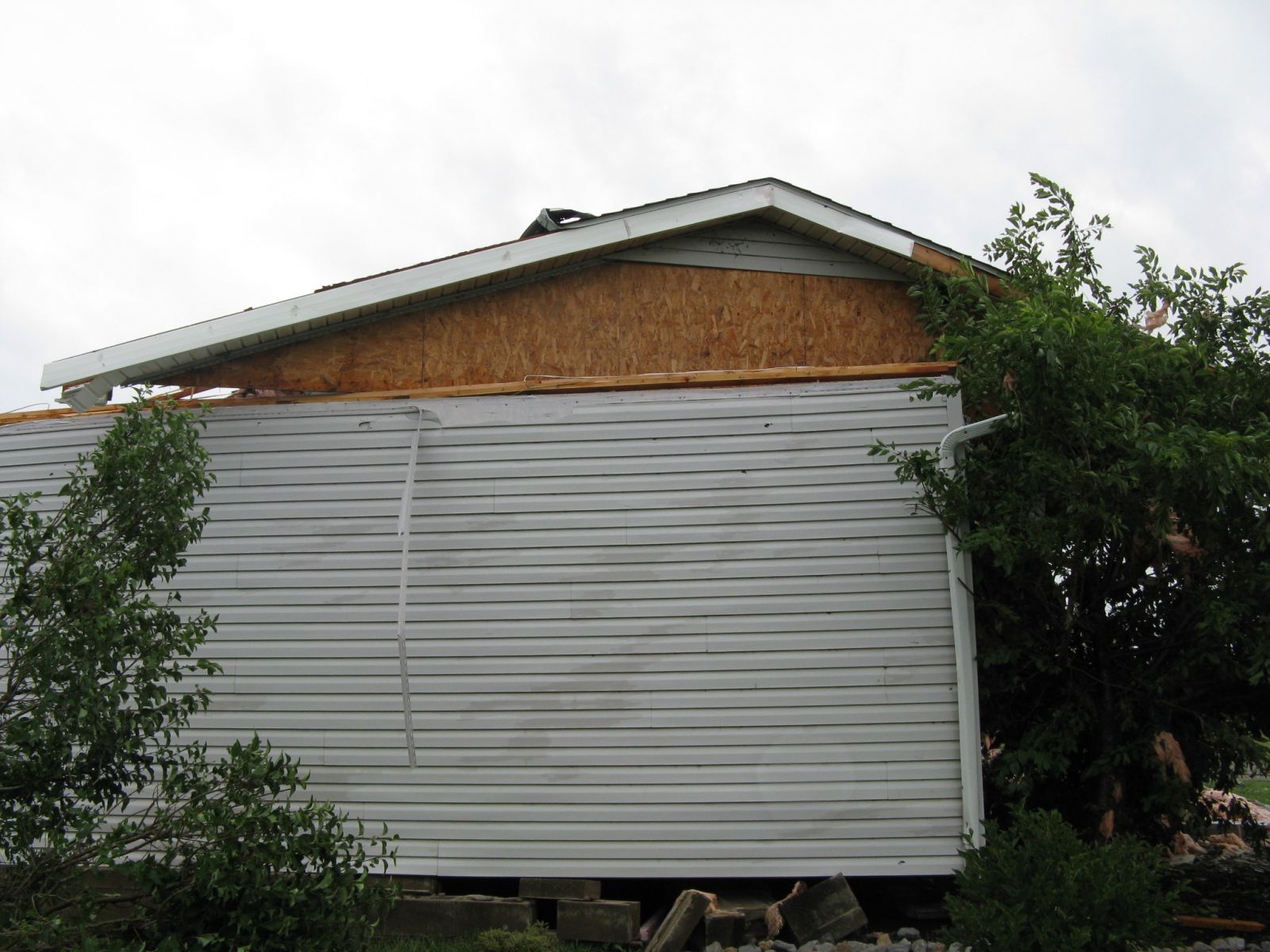
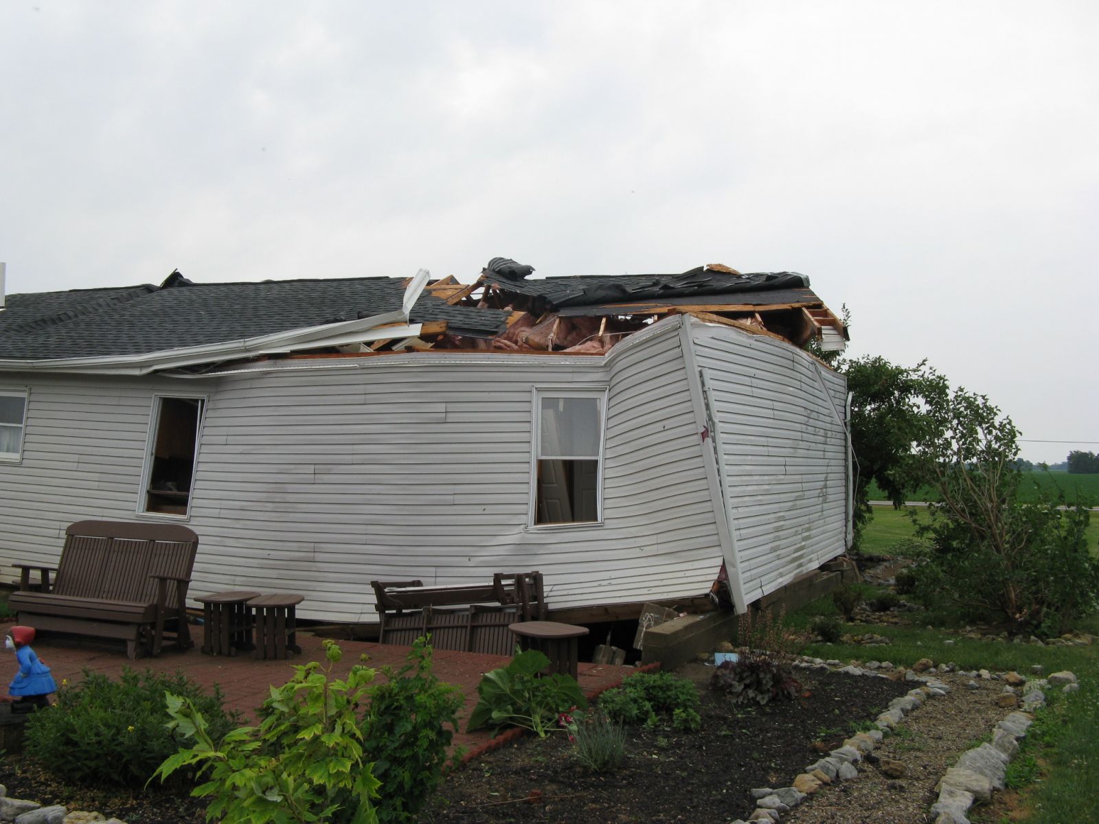
These select survey pictures were taken by NWS Wilmington, Ohio employees during a storm survey conducted on June 23, 2016:
 |
 |
 |
 |
 |
 |
 |
 |
 |
 |
 |
 |
 |
 |
 |
 |
 |
 |
 |
 |
 |
 |
 |
 |
 |
 |
 |

