|
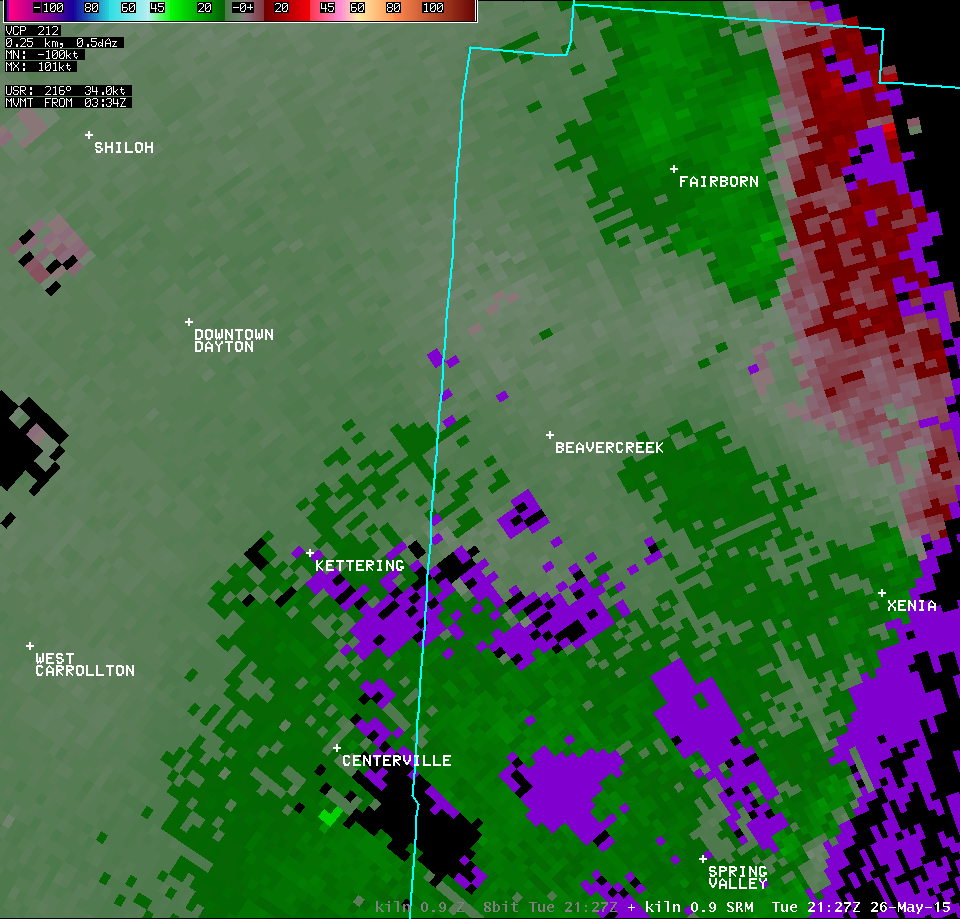
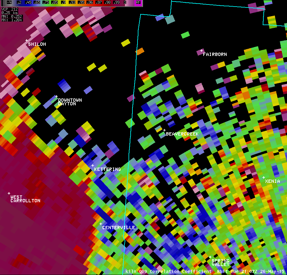
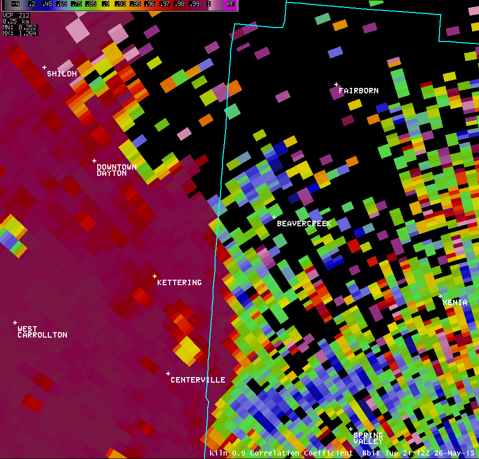
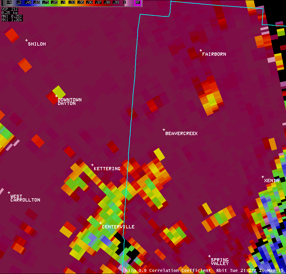
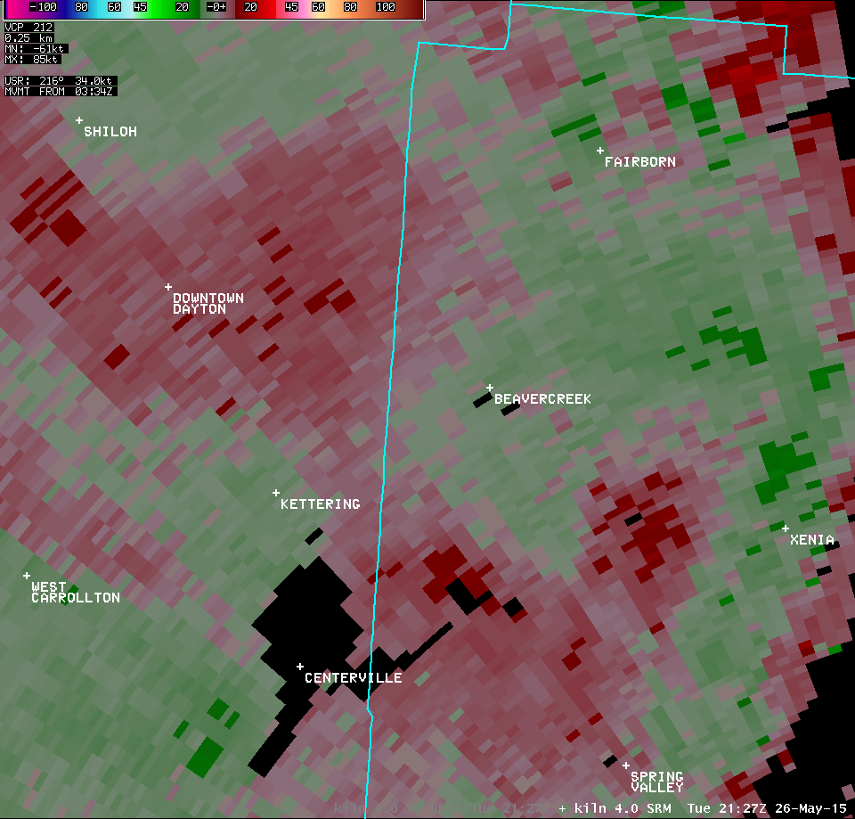
Tornado in Beavercreek Scattered Damaging Winds |
|
|
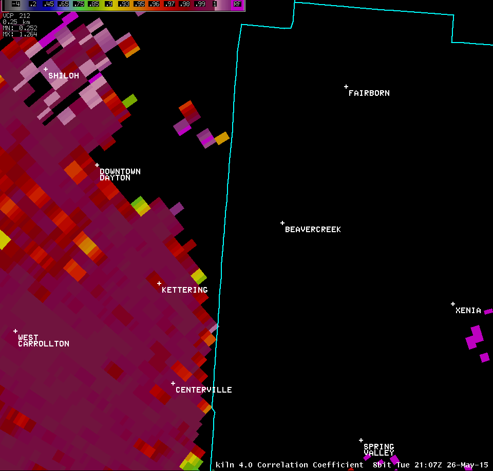
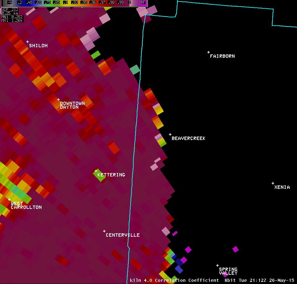
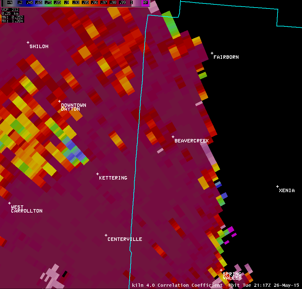
Radar Imagery:
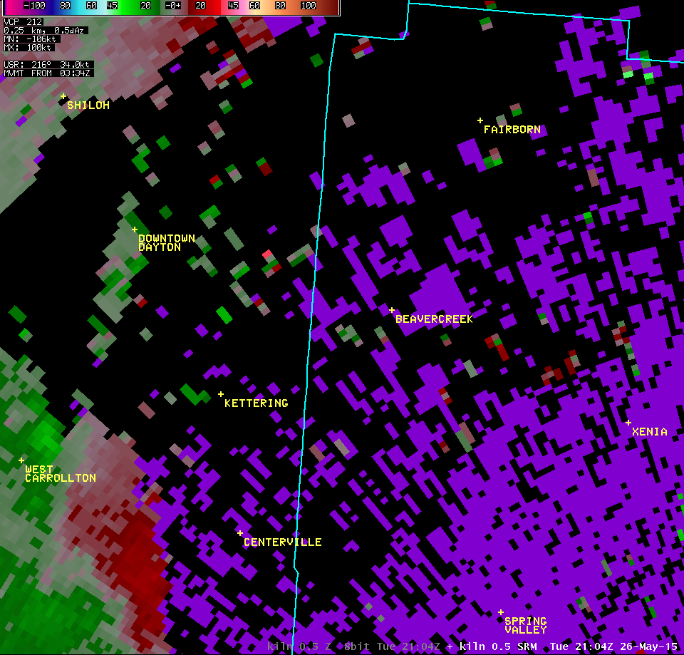
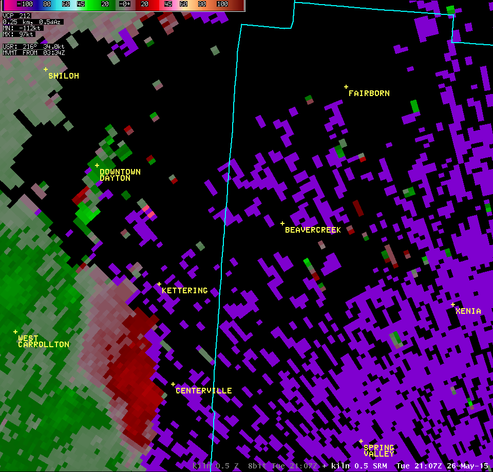
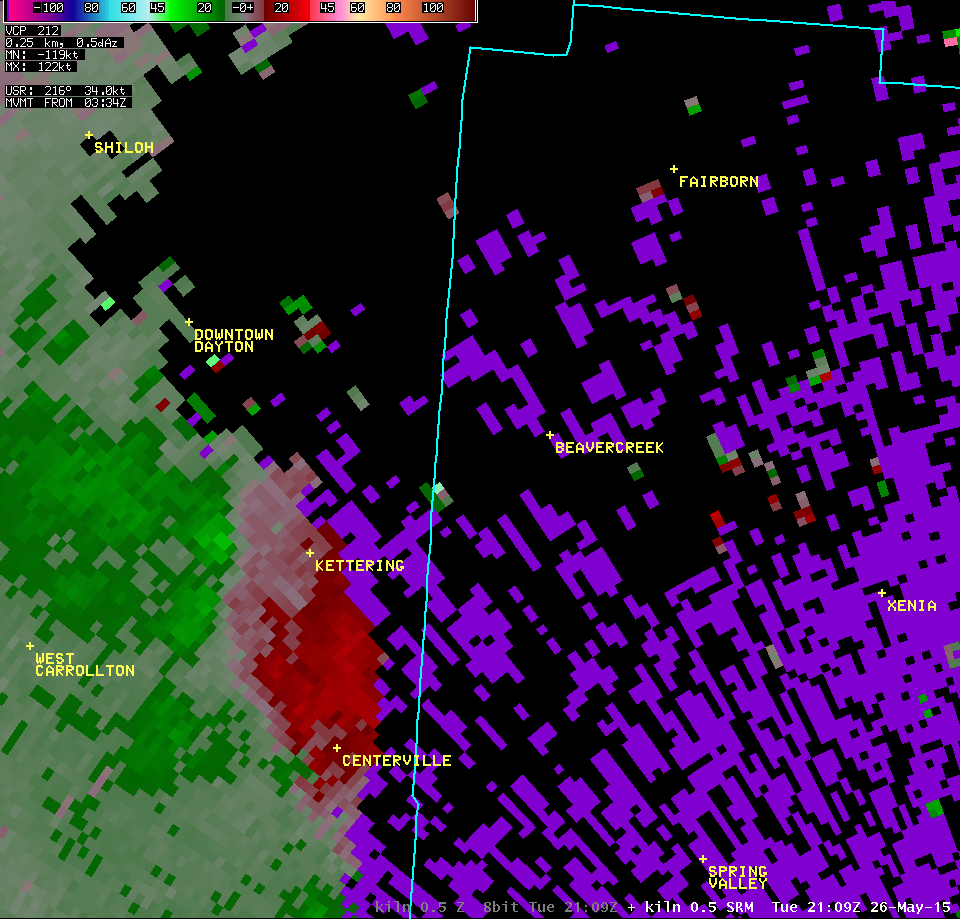
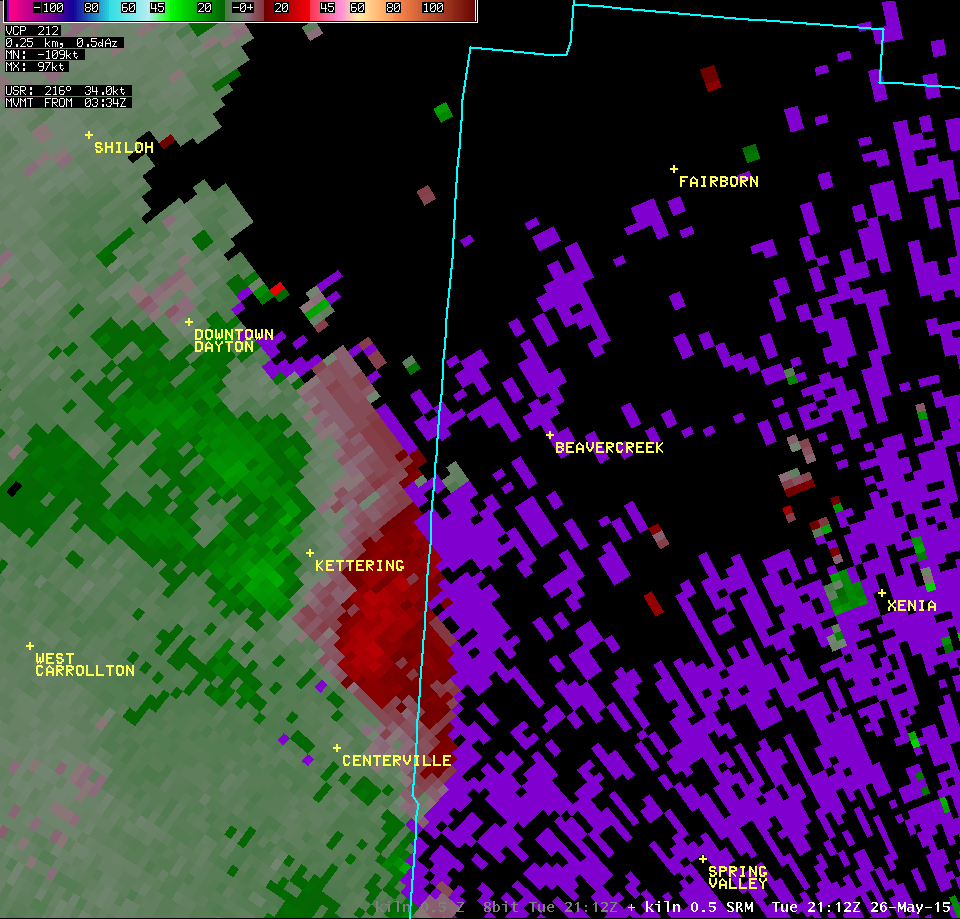
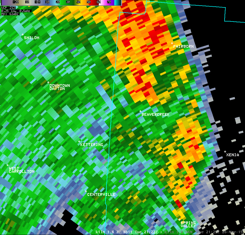
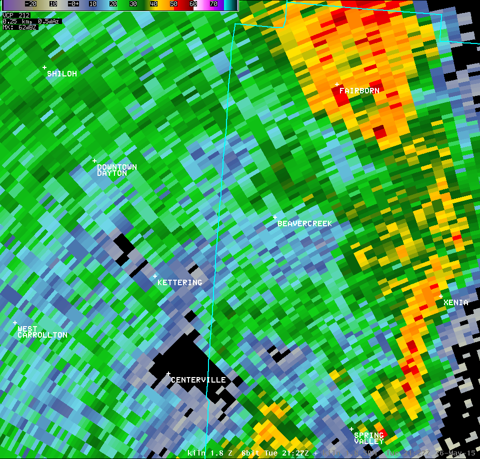
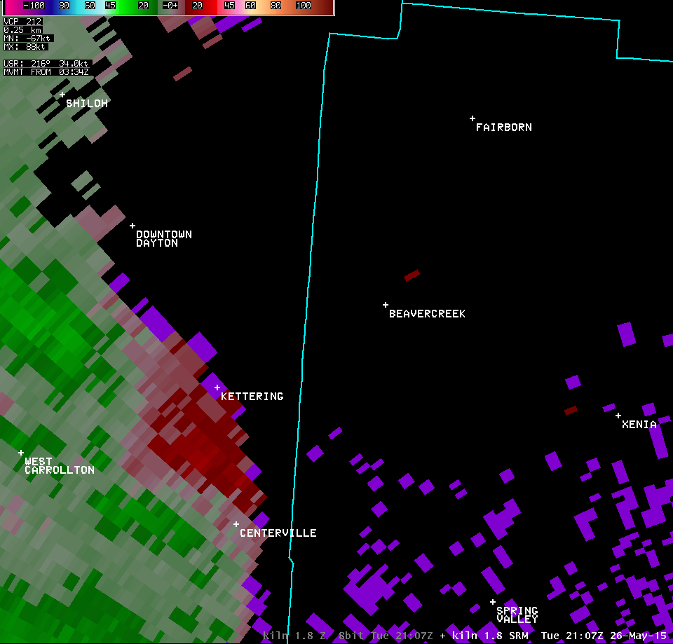
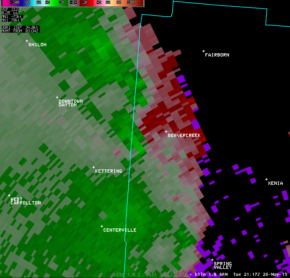
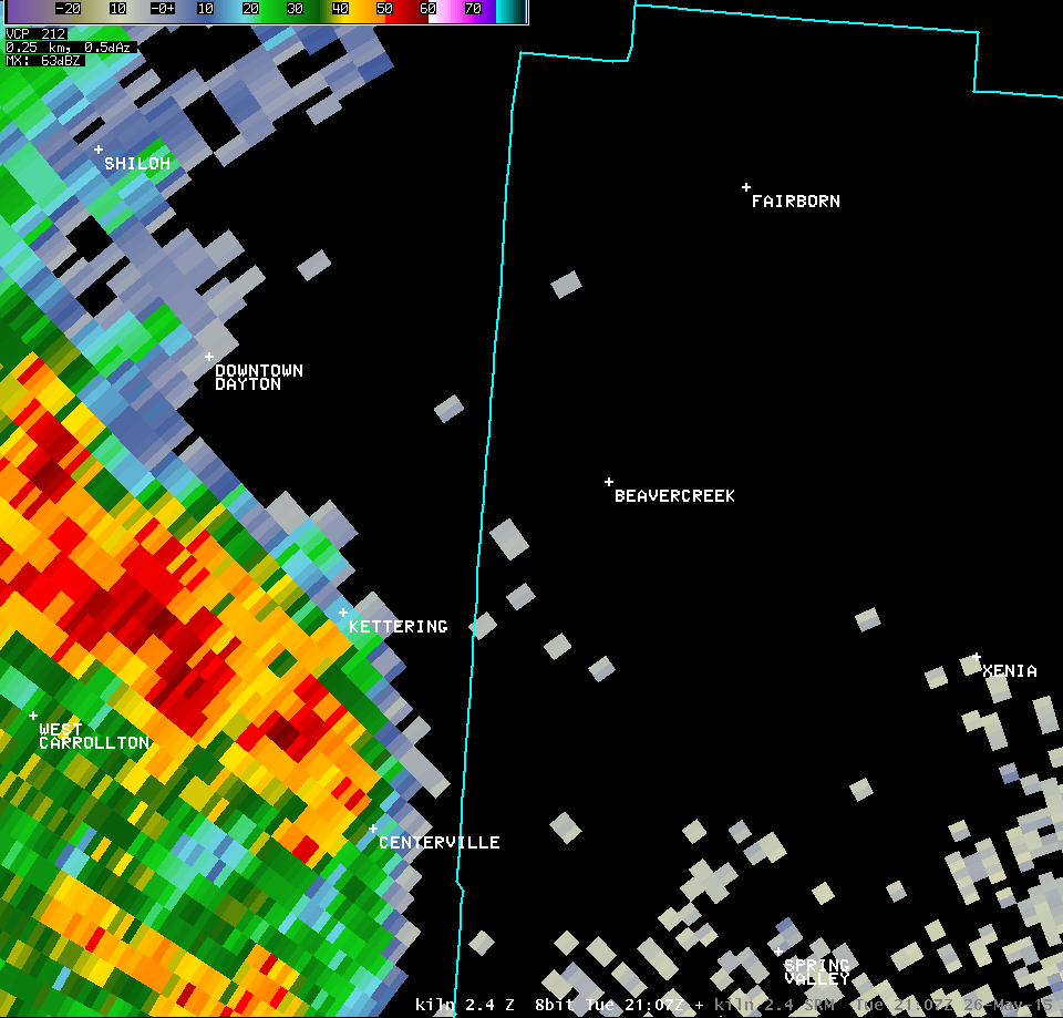
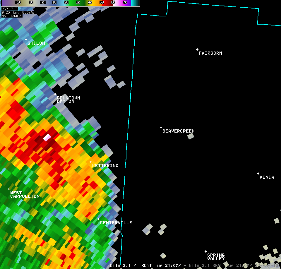
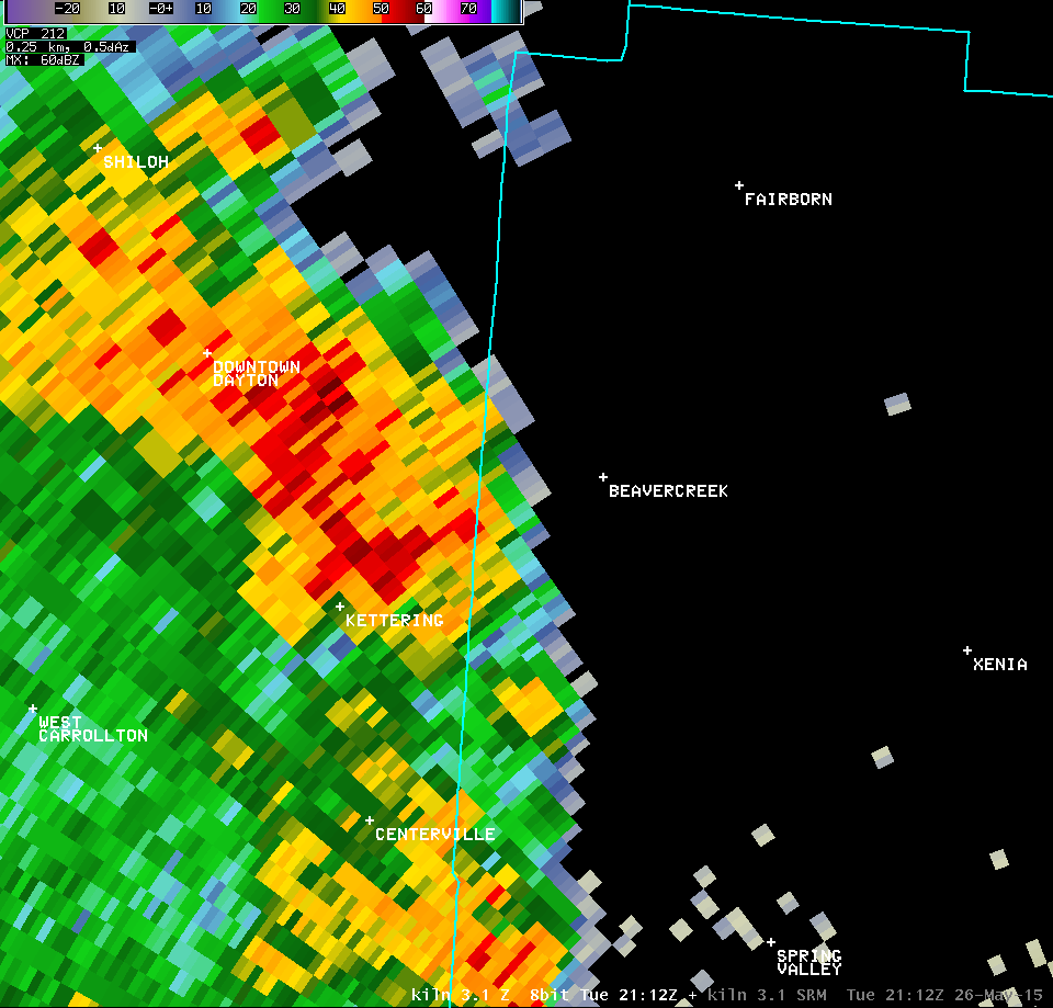
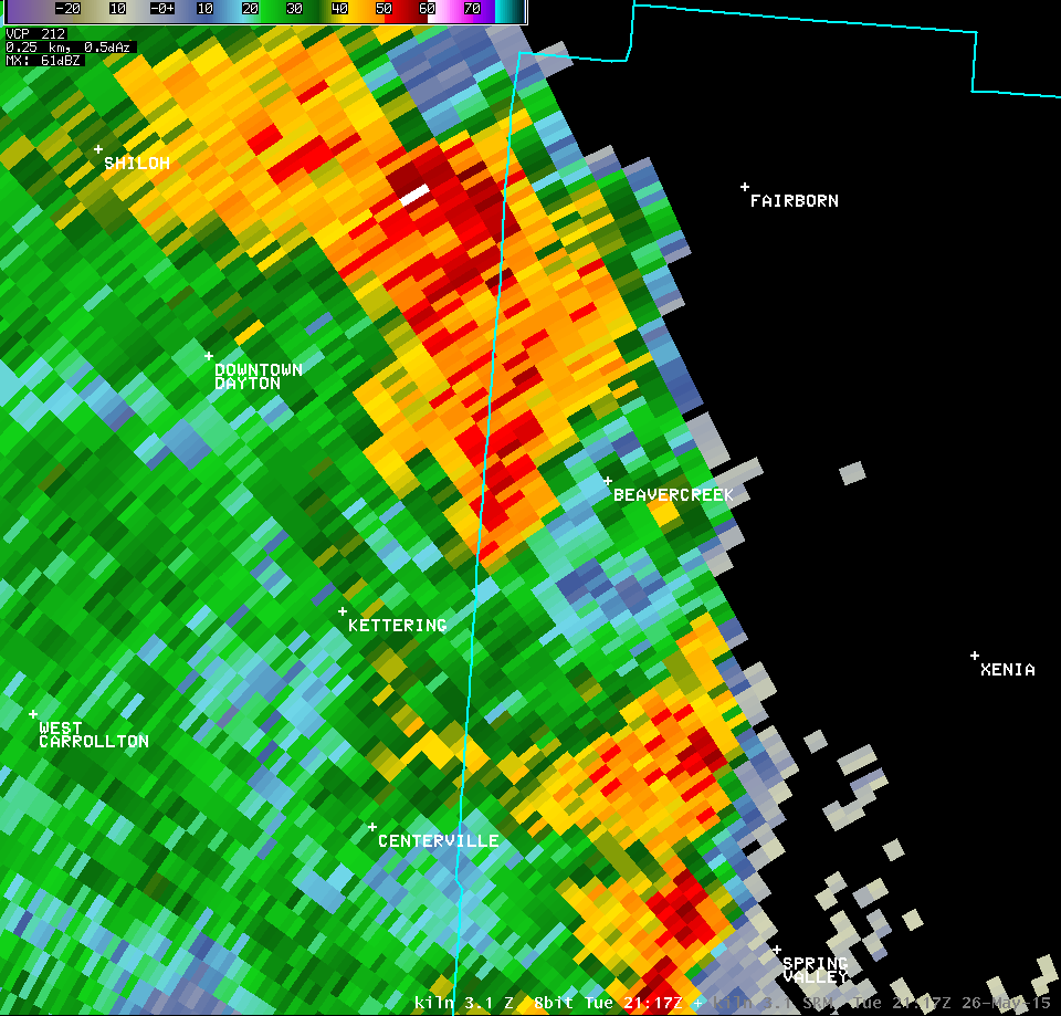
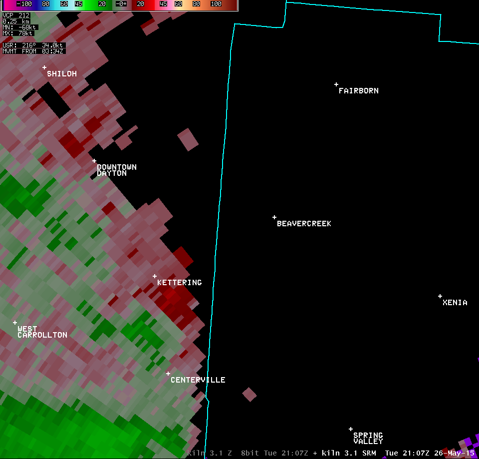
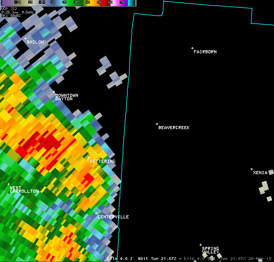
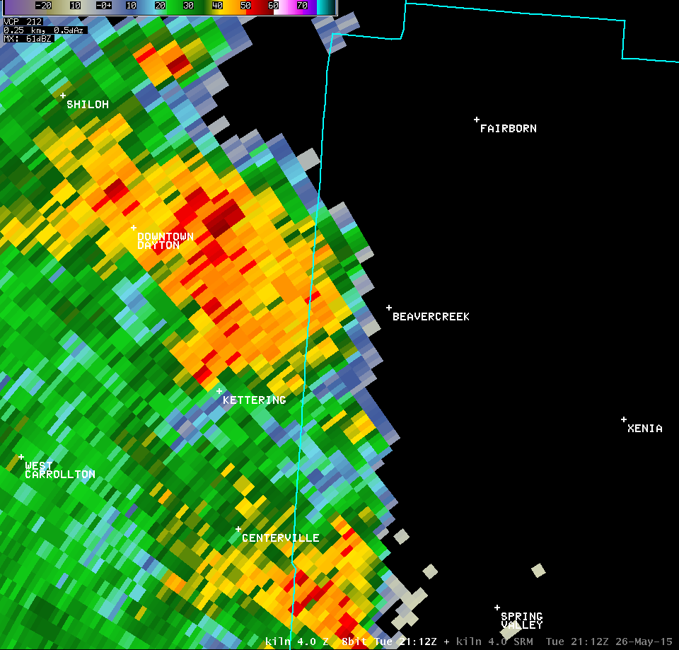
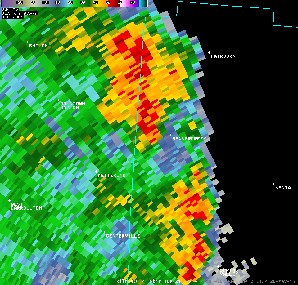
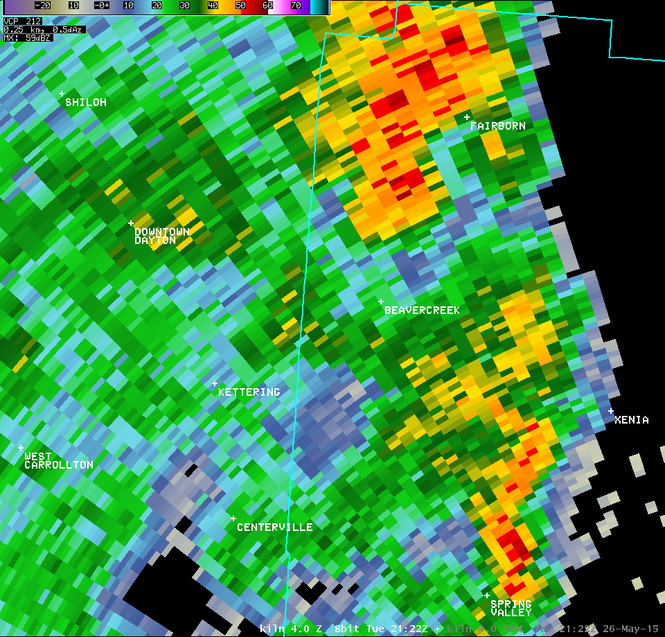
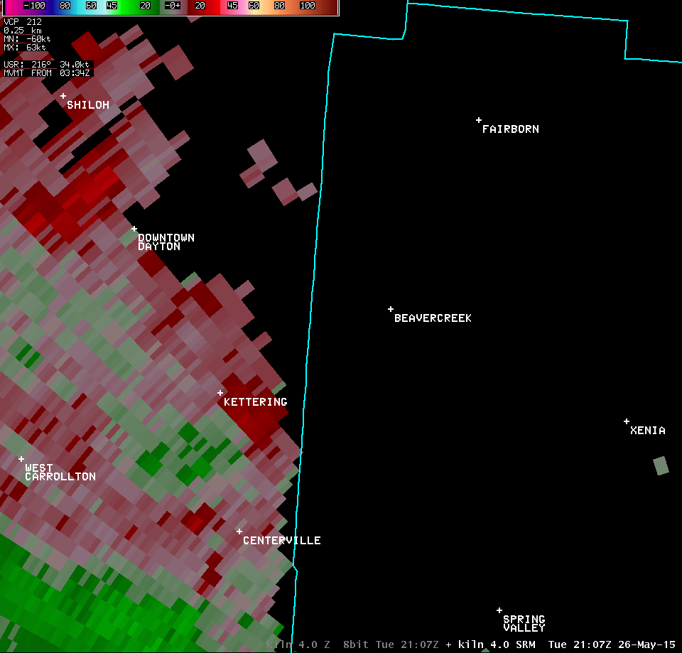
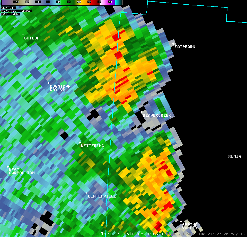
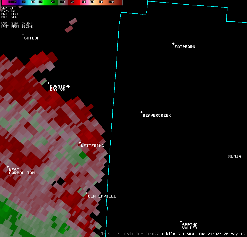
| NWS Wilmington OH (KILN) | |||
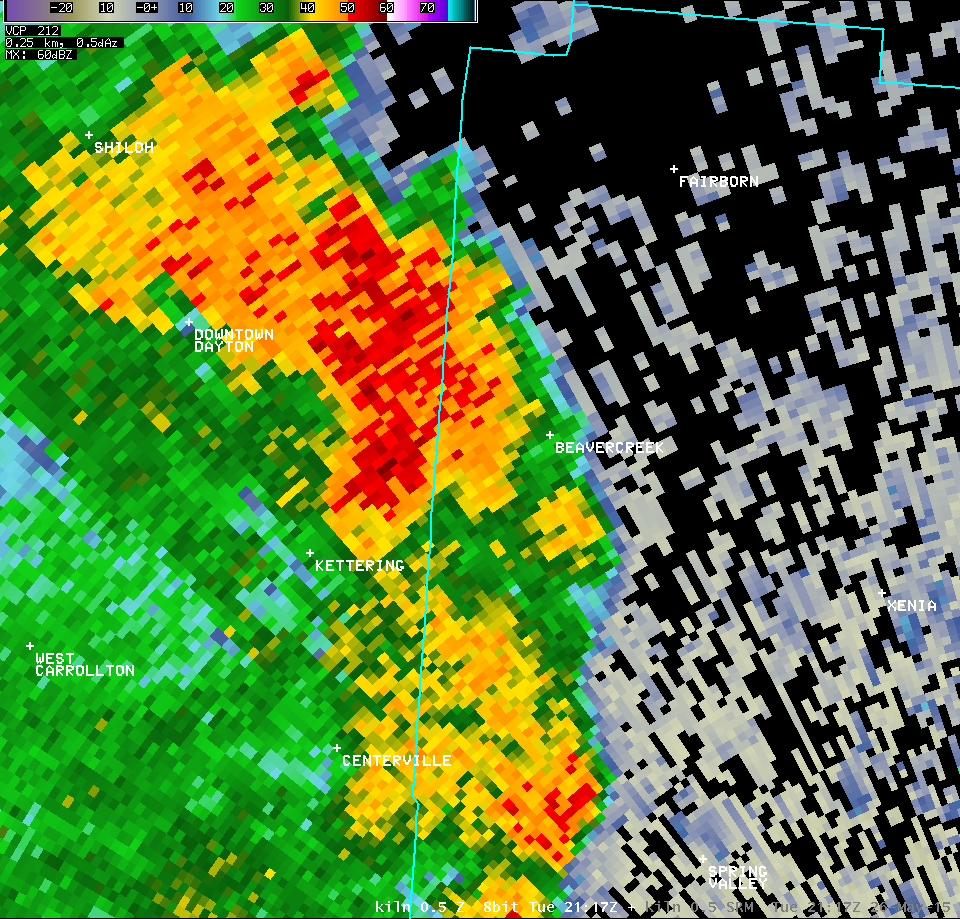
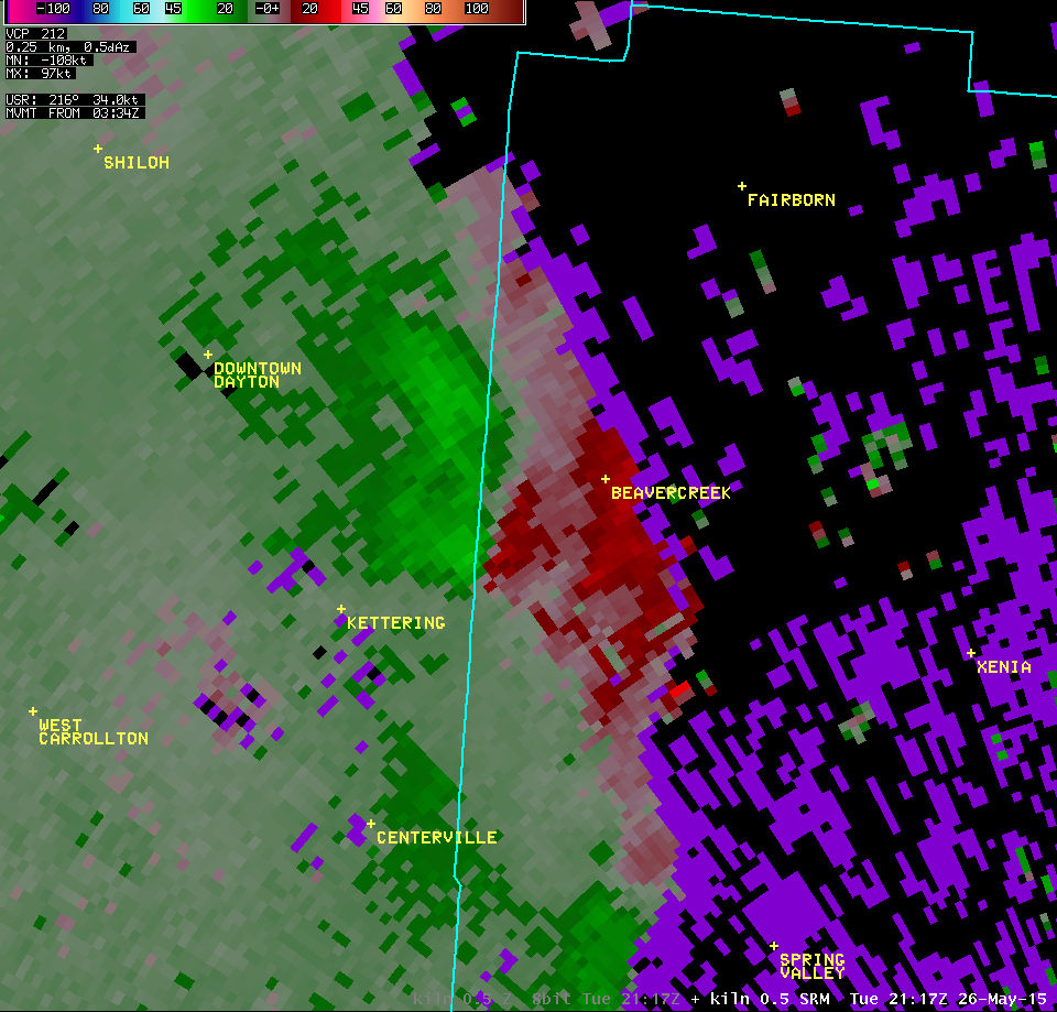
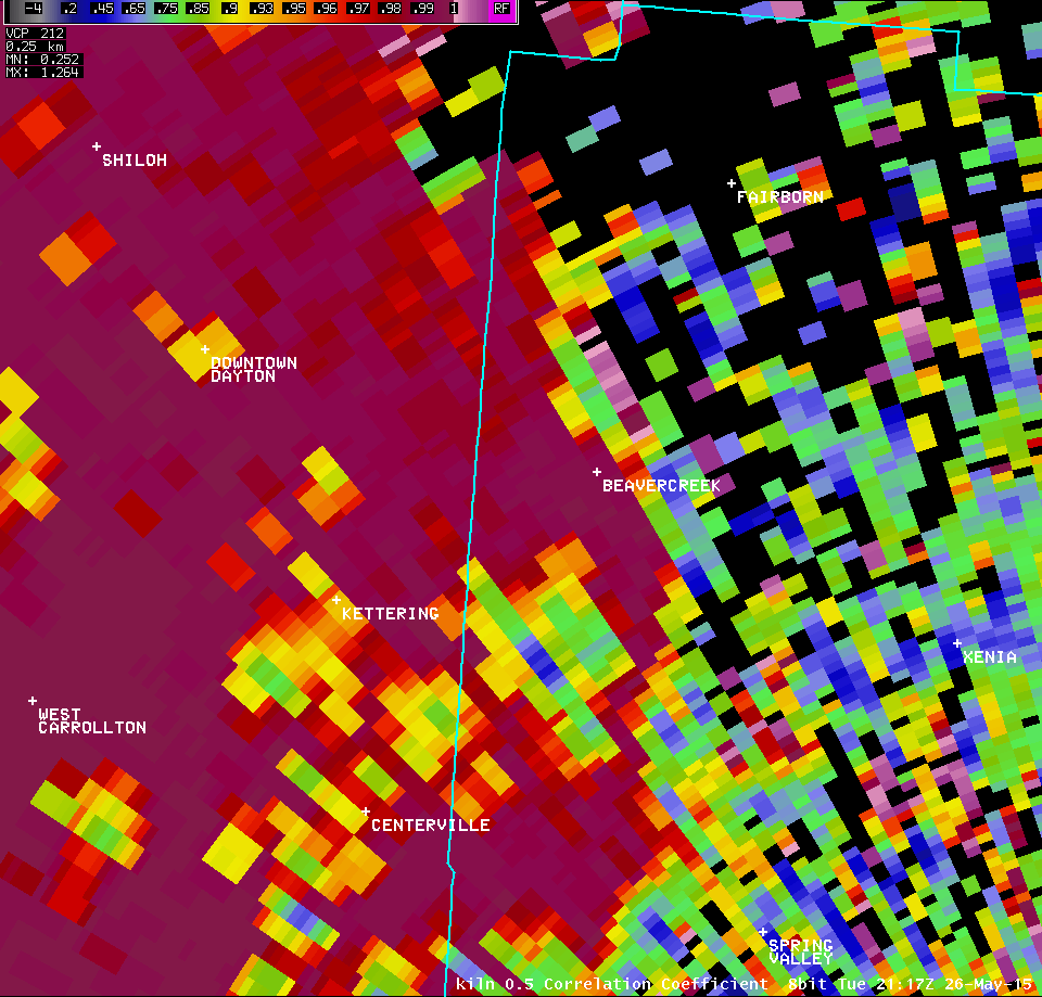
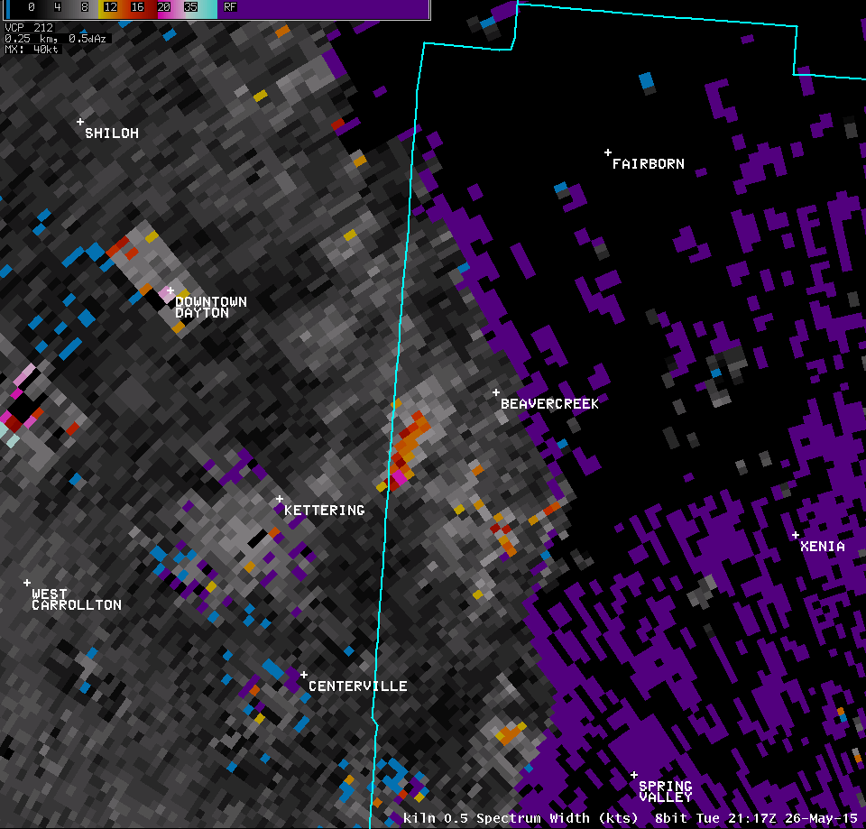
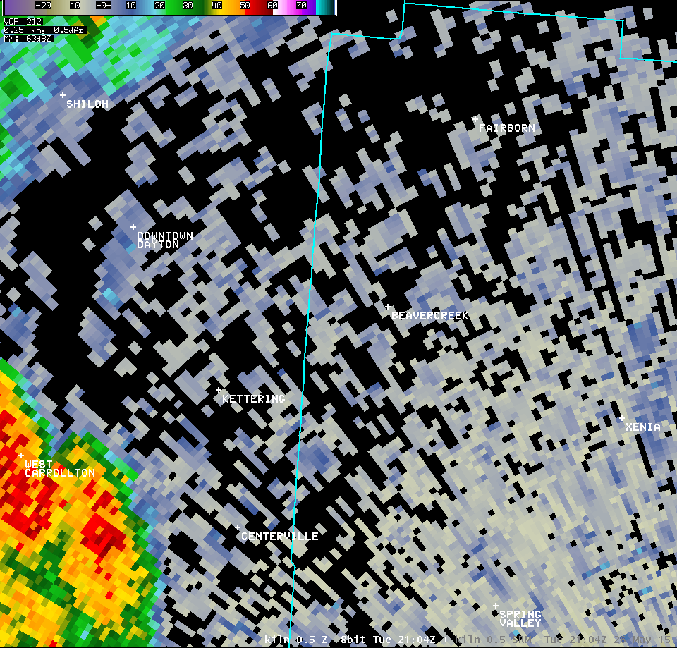
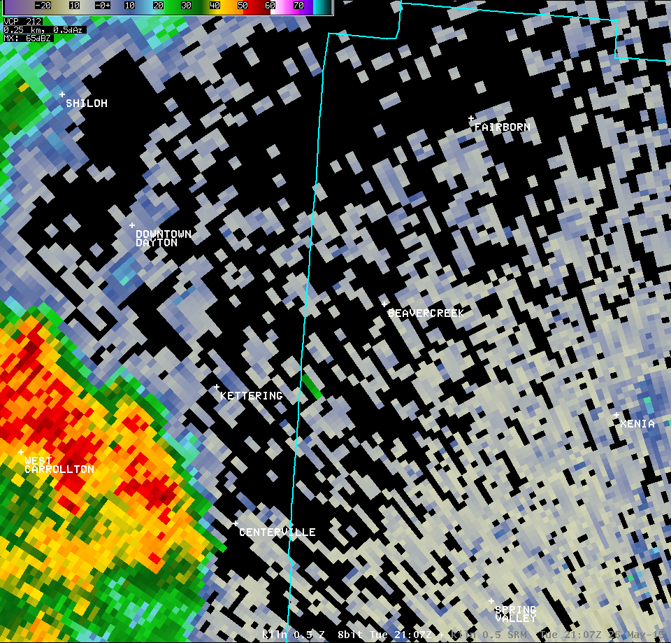
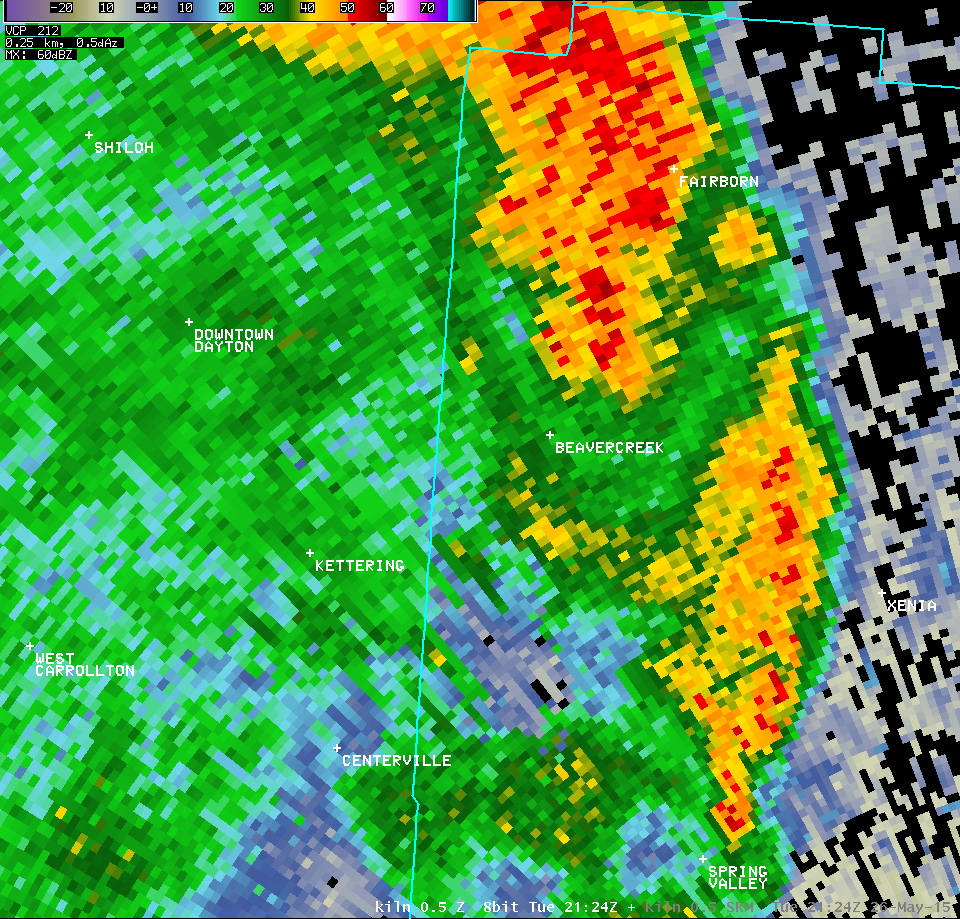
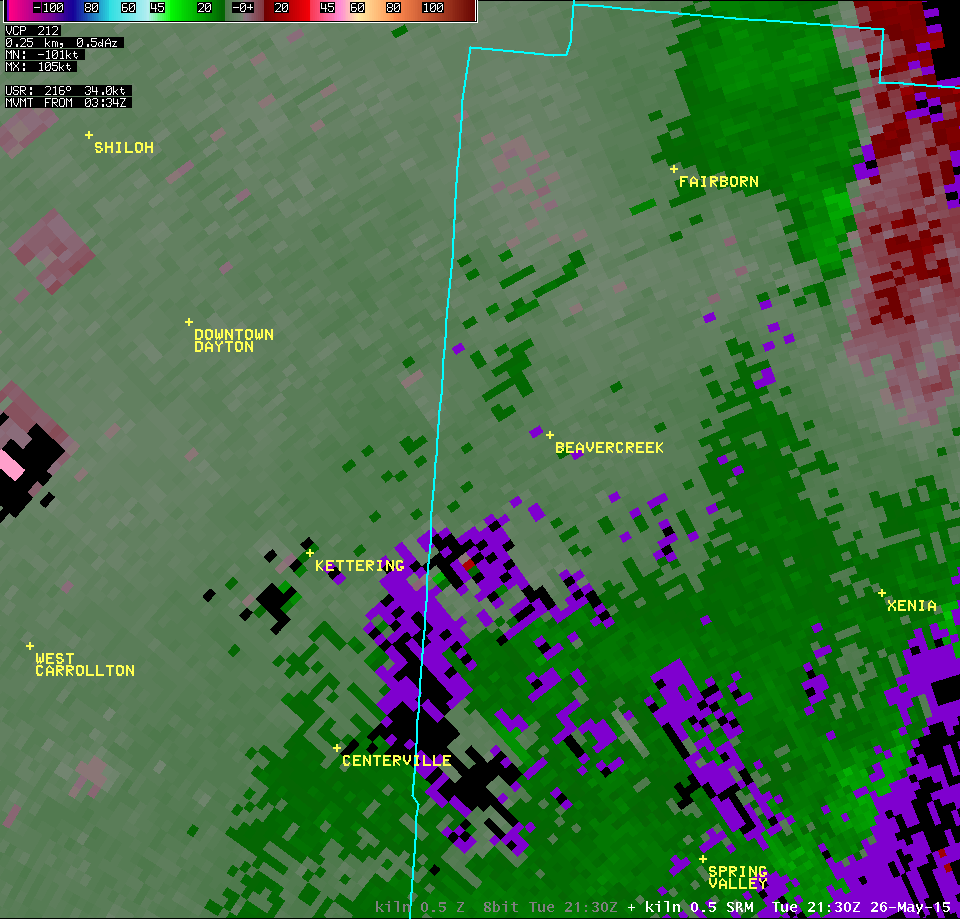
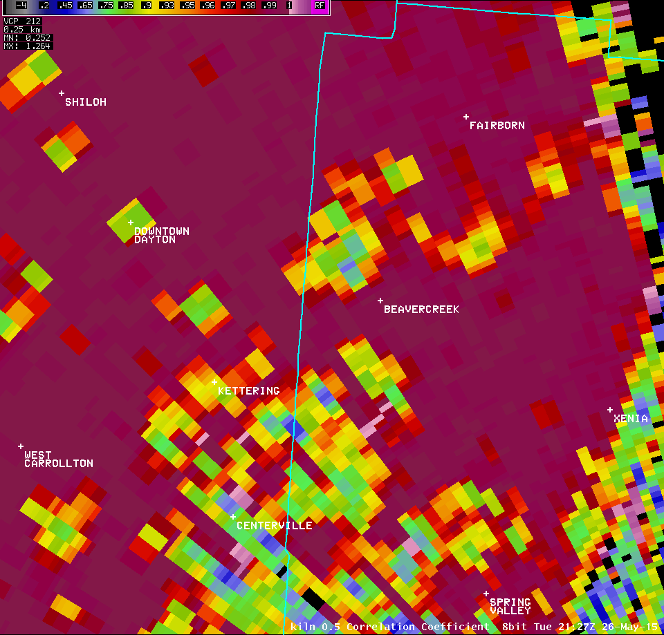
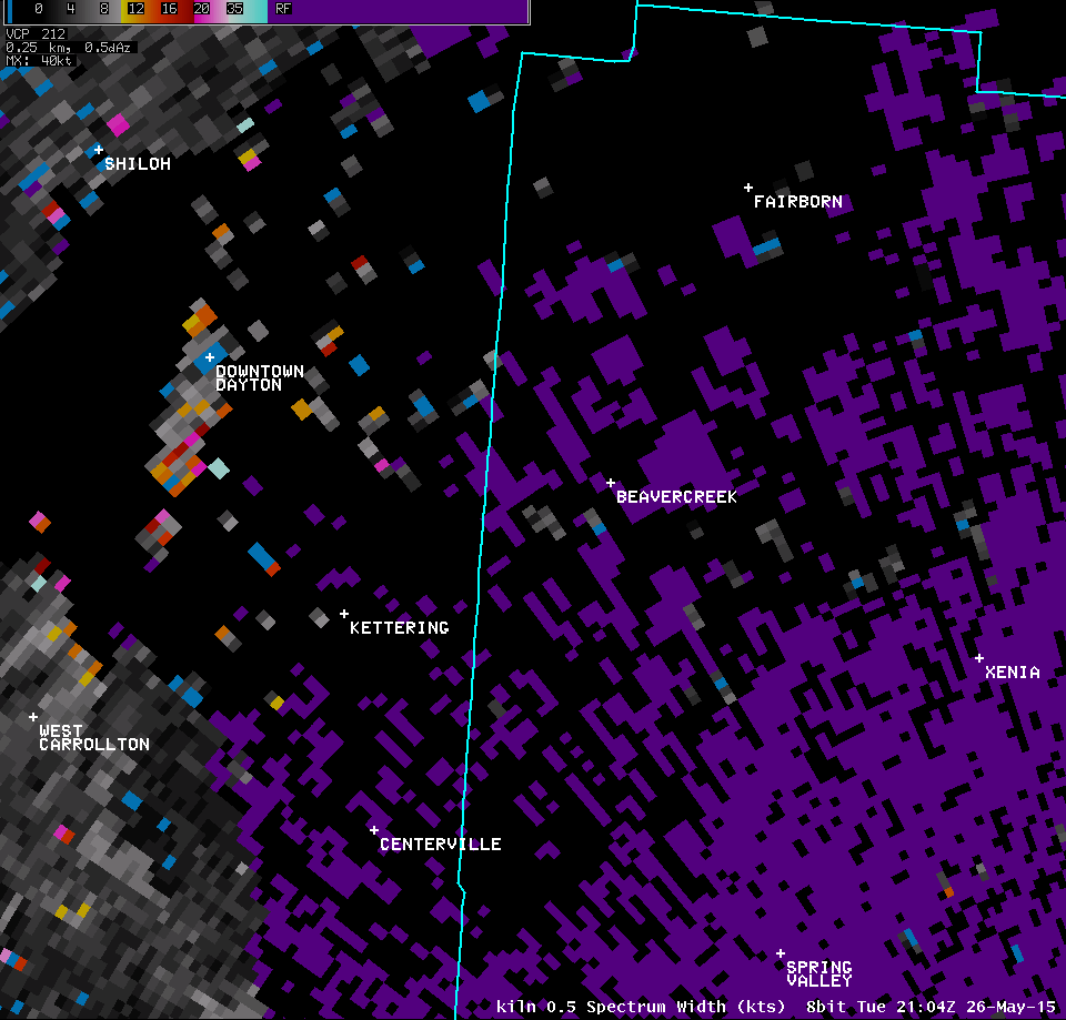
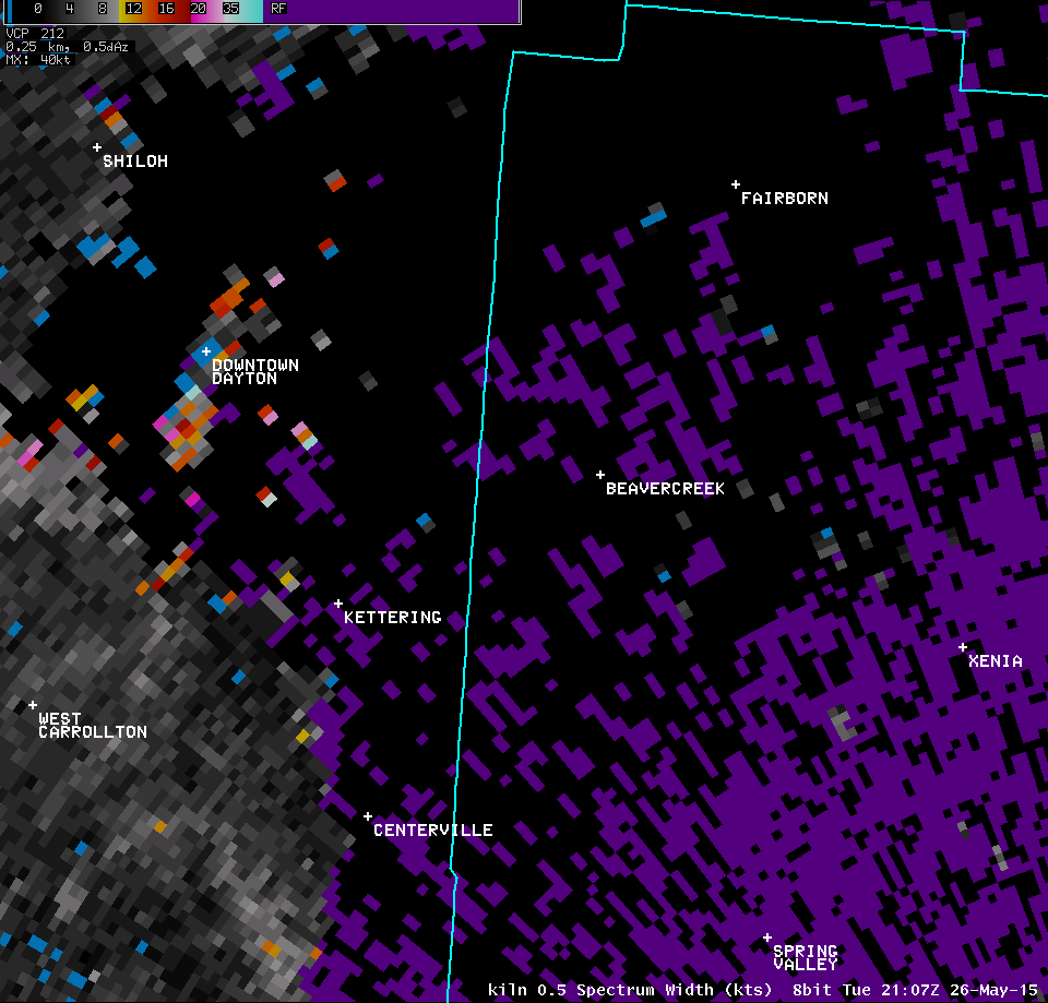
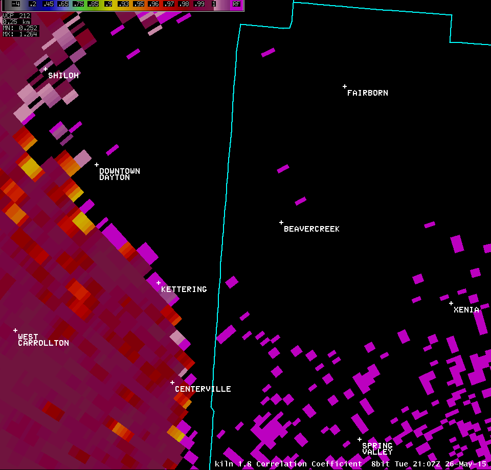
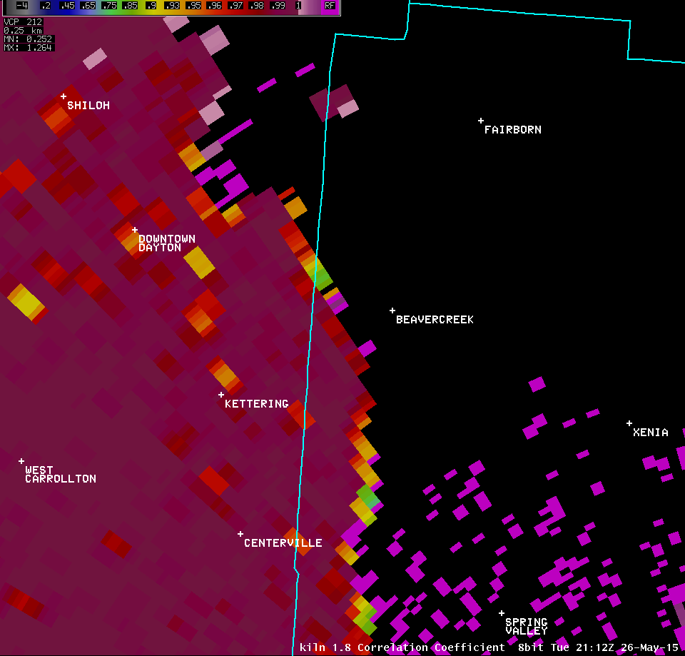
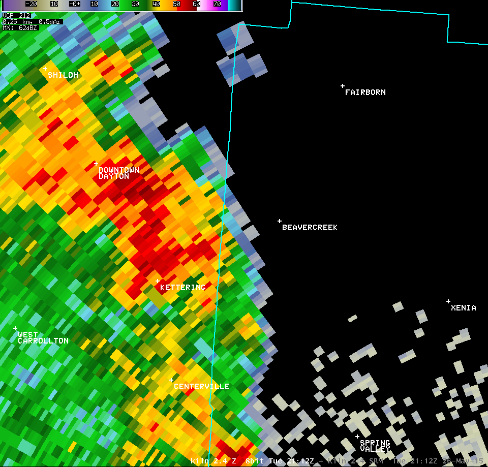
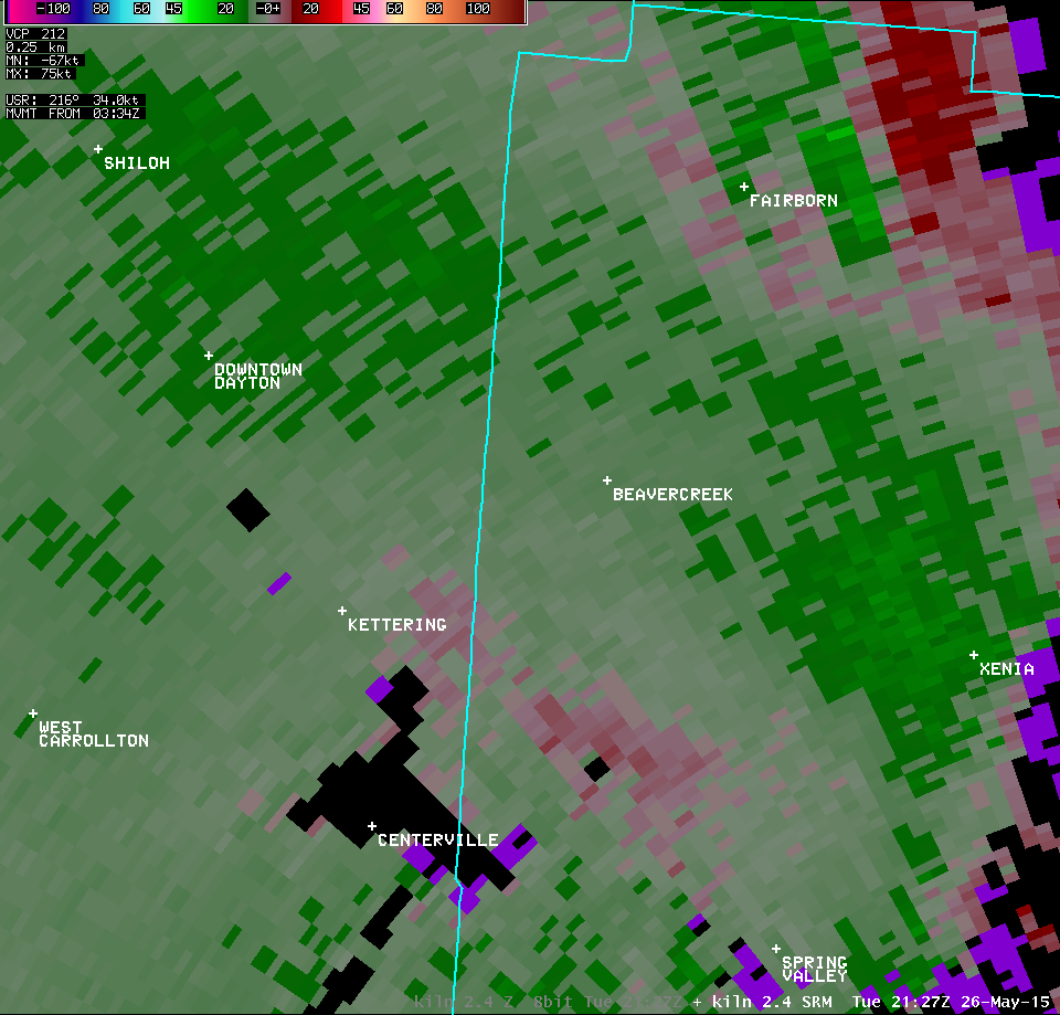
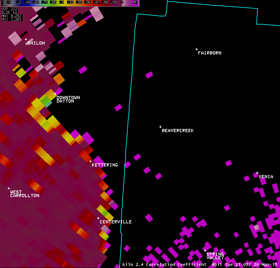
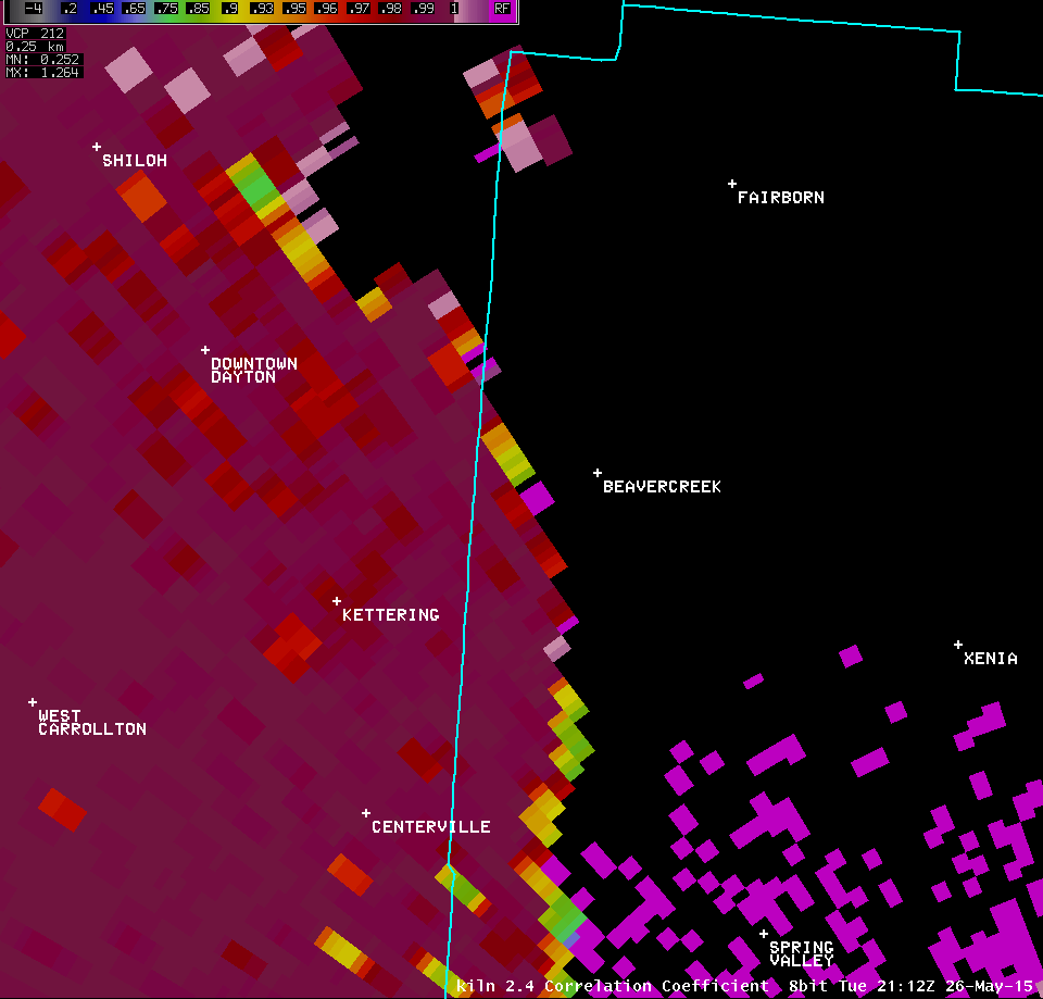
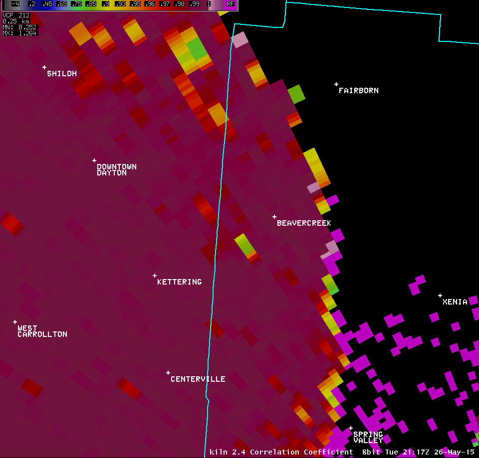
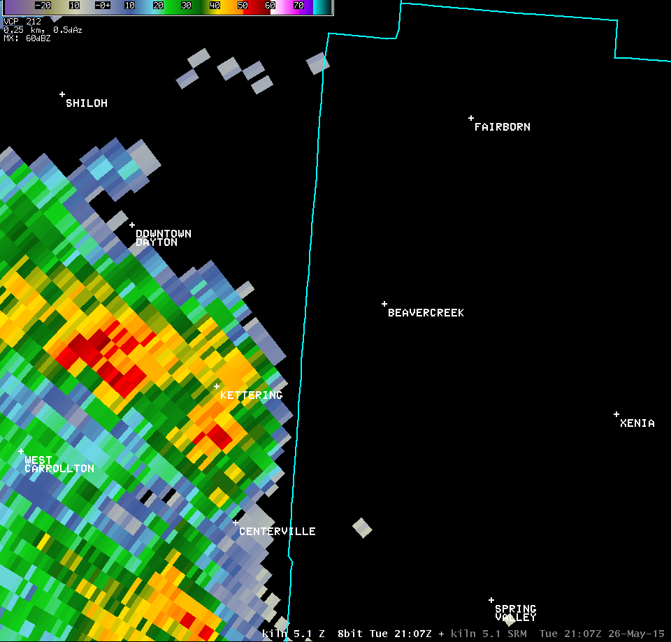
| 0.5° Z -- 5:17 PM | 0.5° SRM -- 5:17 PM | 0.5° CC -- 5:17 PM | 0.5° SW -- 5:17 PM |
 |
 |
 |
 |
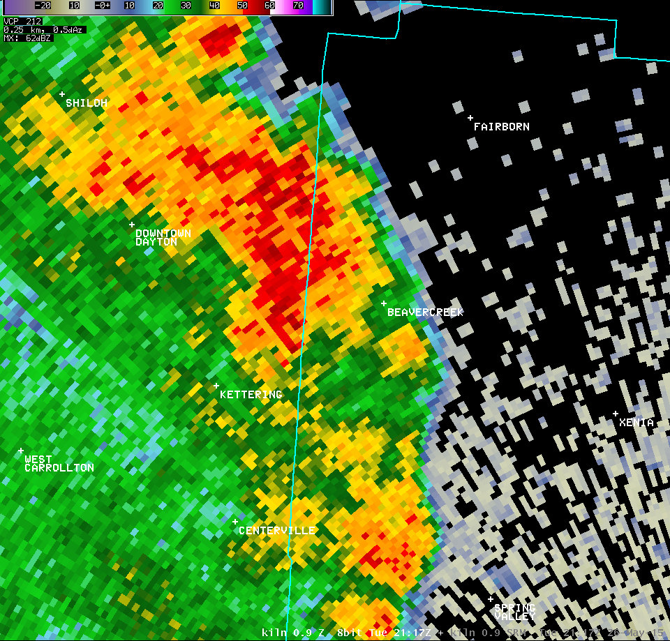
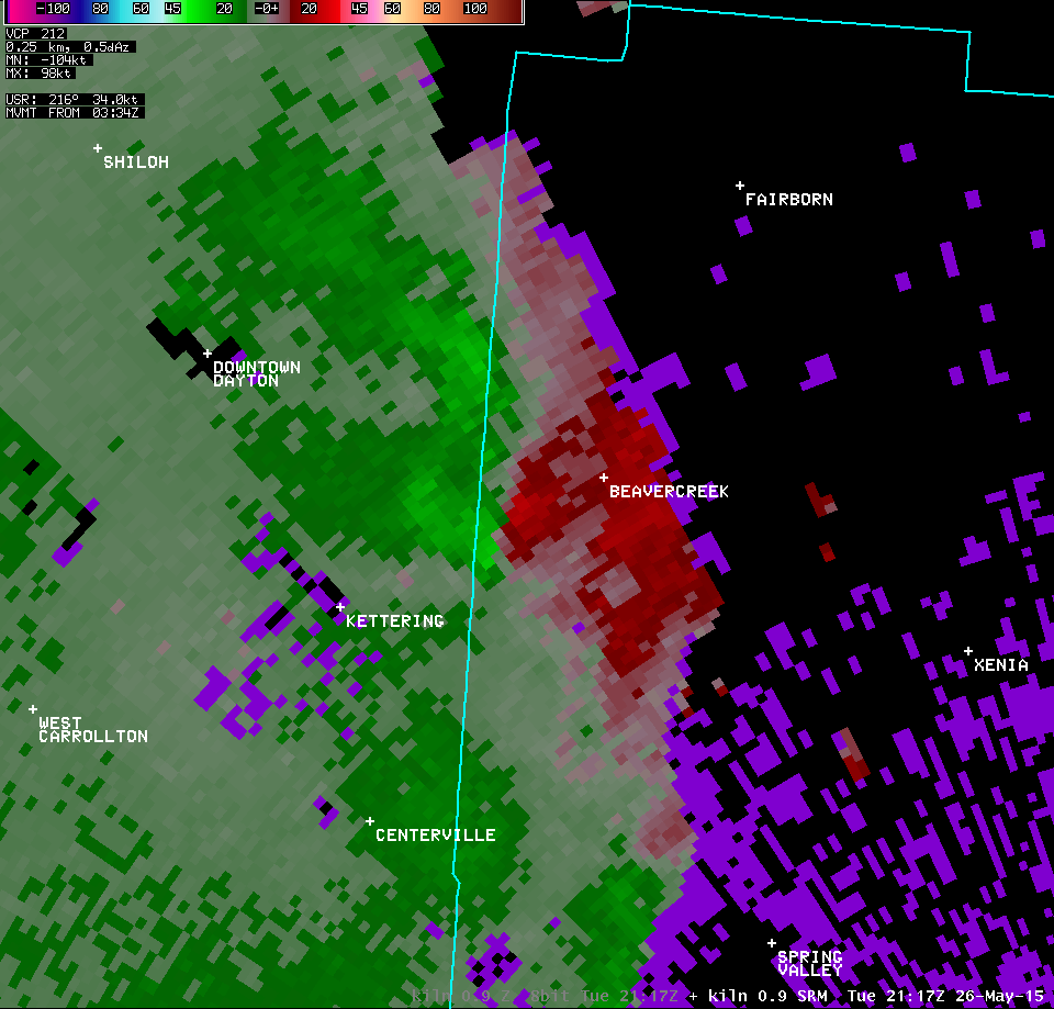
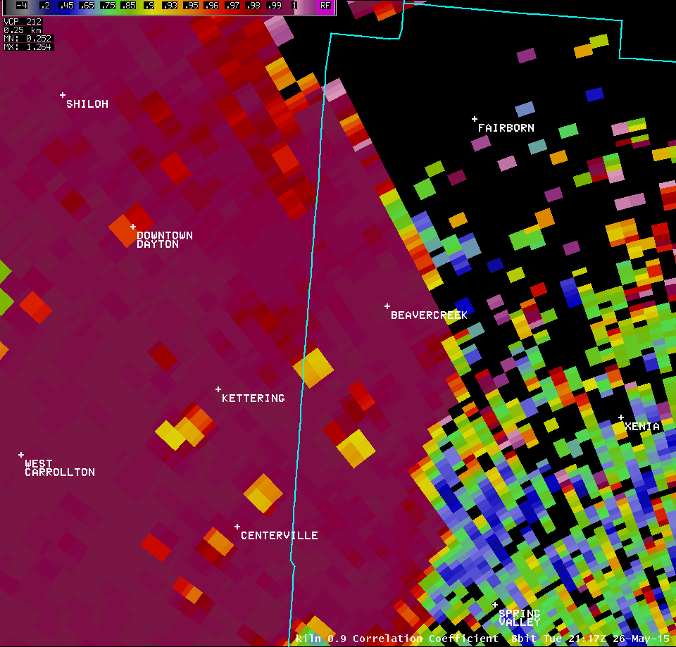
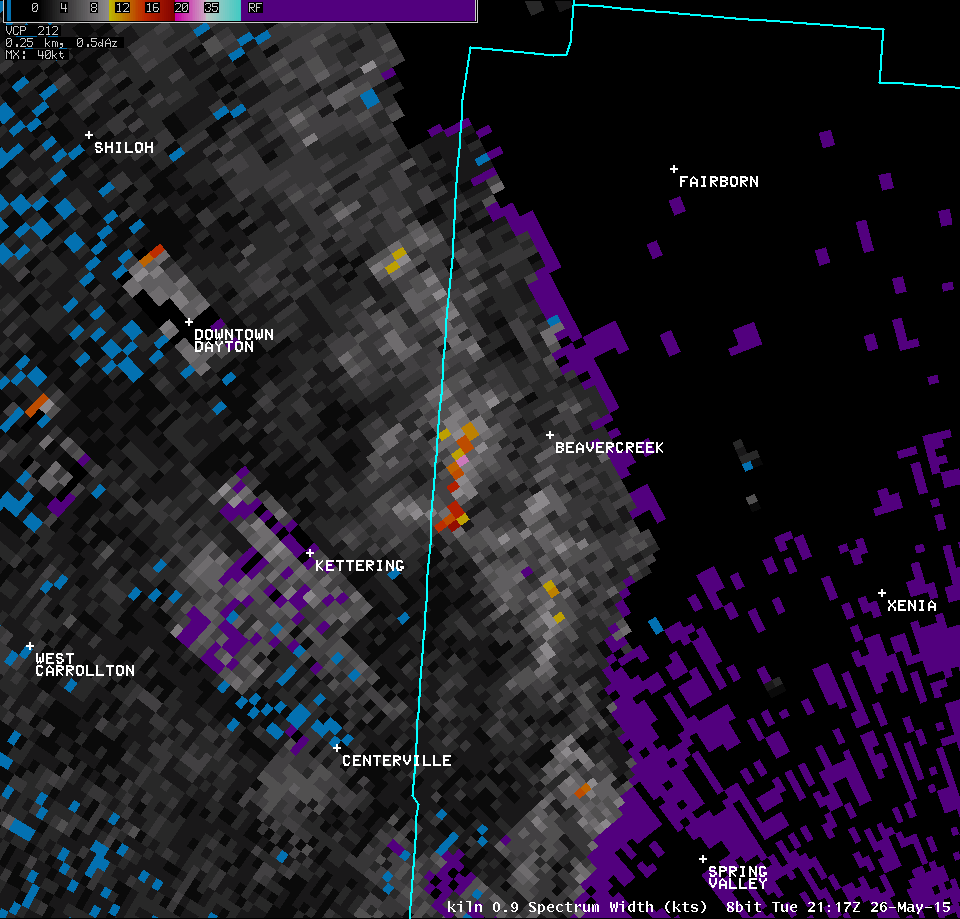
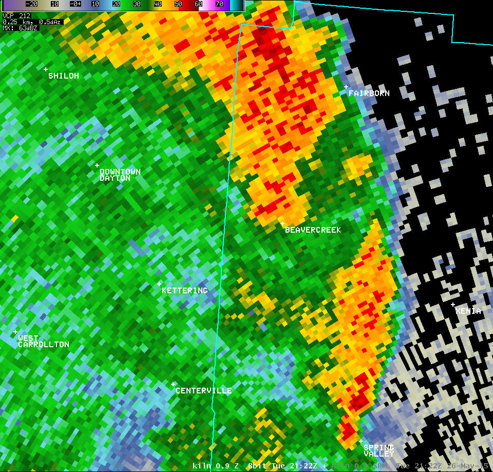
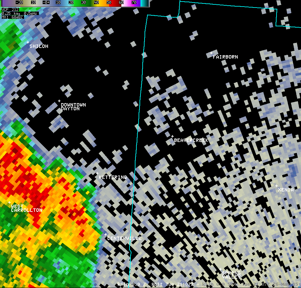
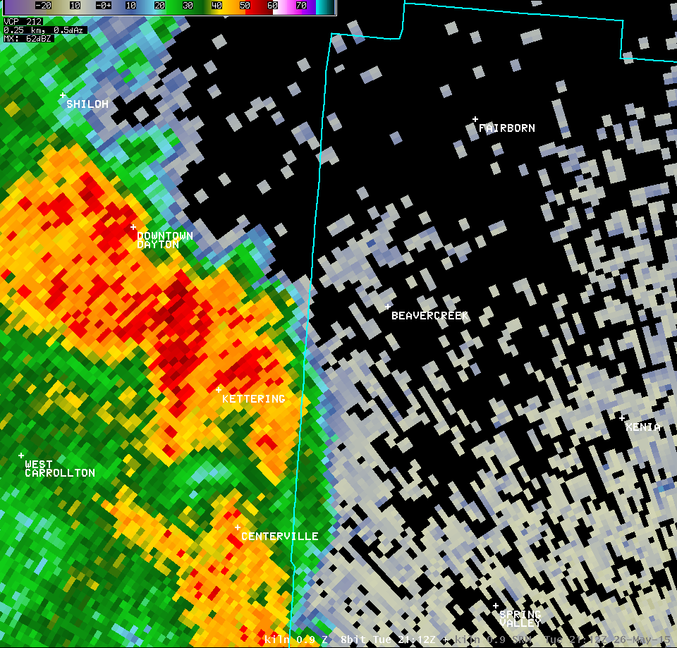
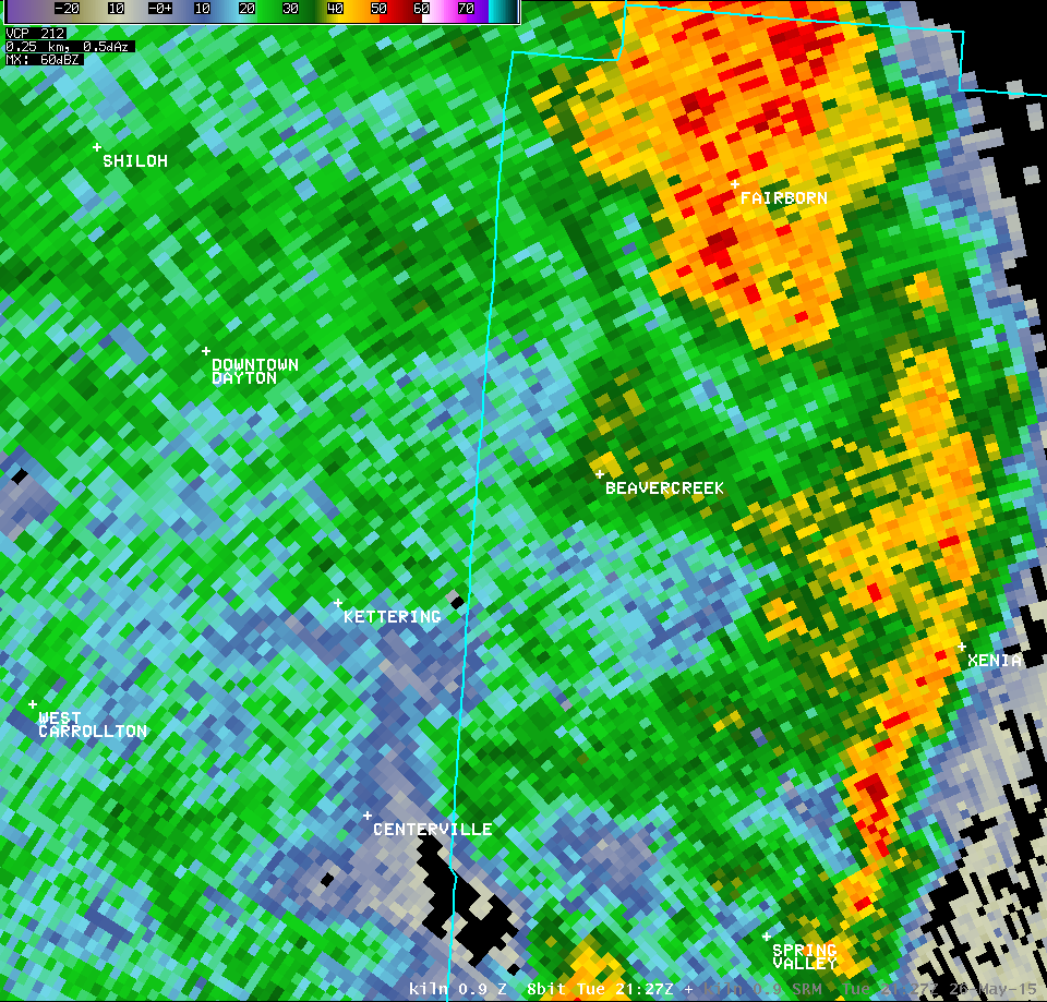
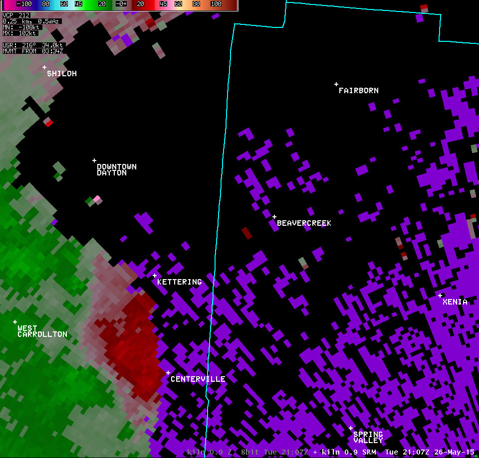
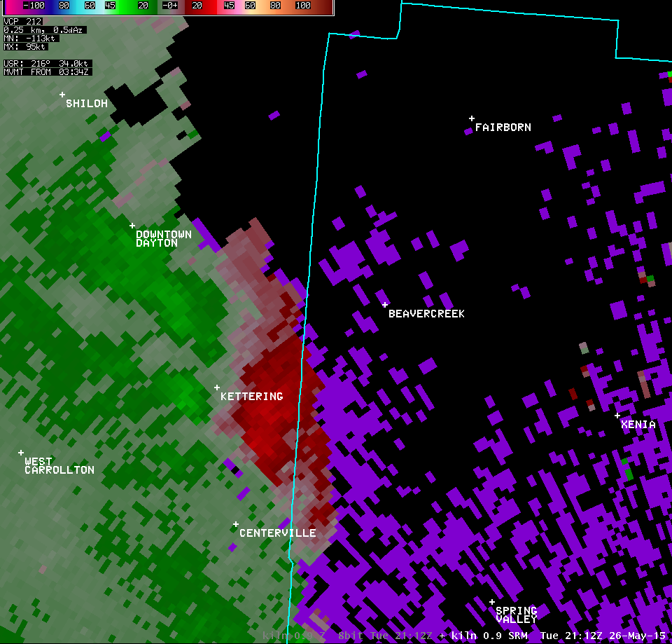
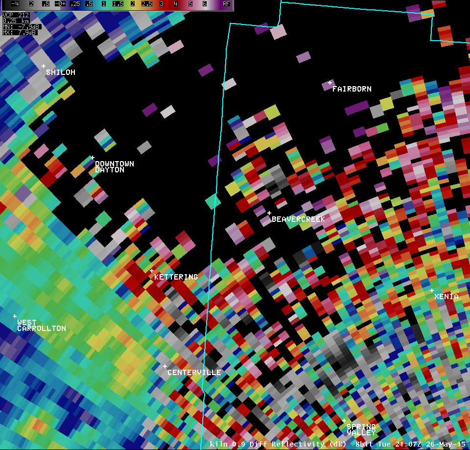
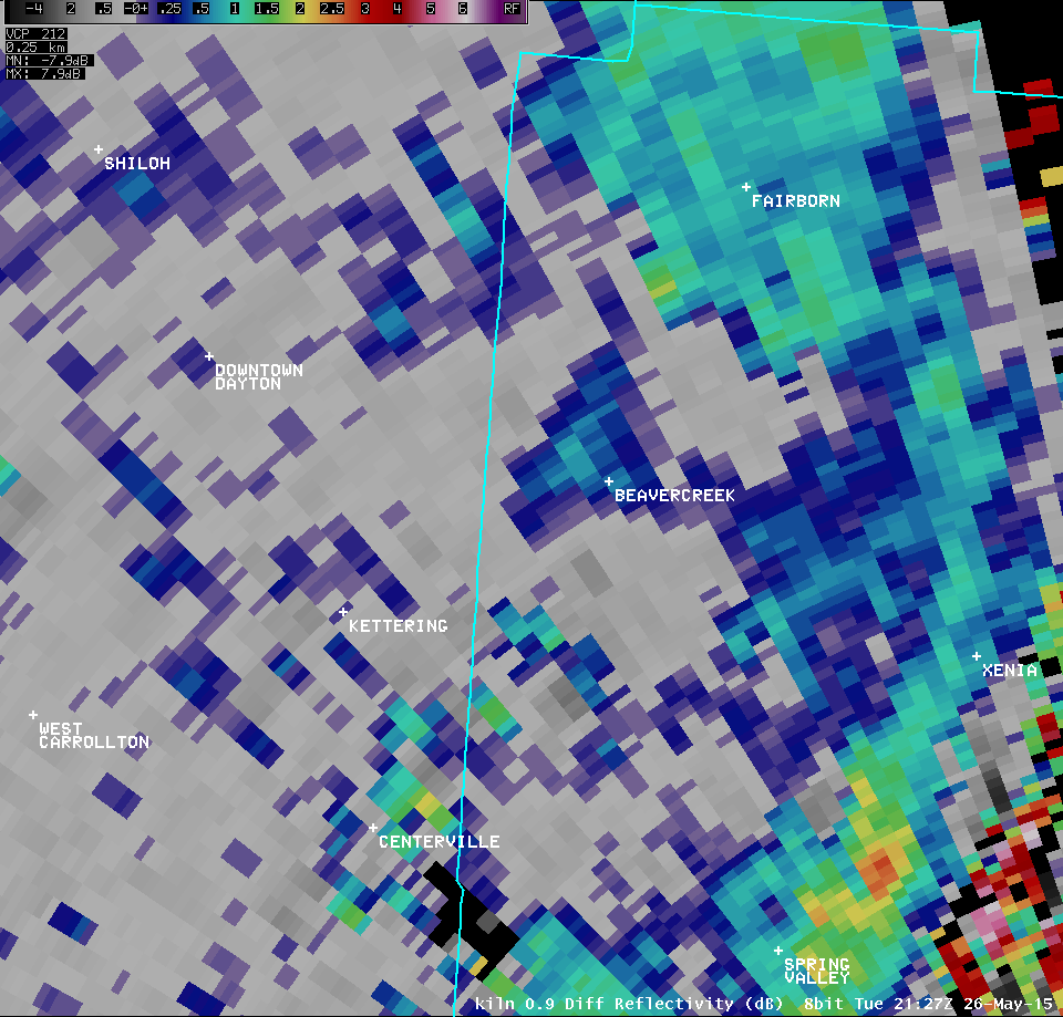
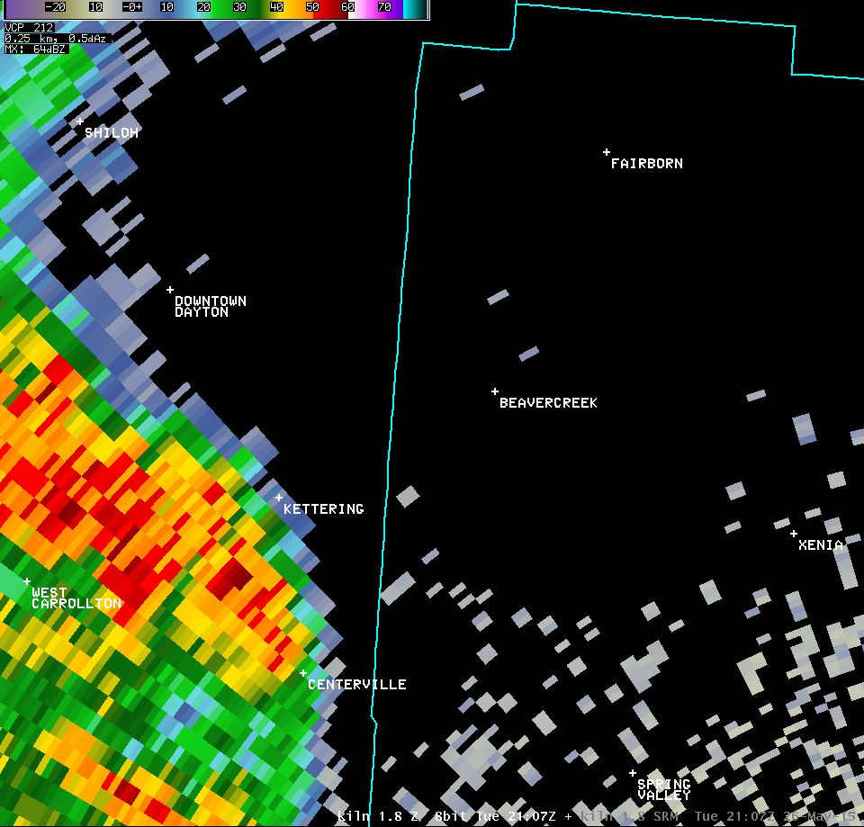
| 0.9° Z -- 5:17 PM | 0.9° SRM -- 5:17 PM | 0.9° CC -- 5:17 PM | 0.9° SW -- 5:17 PM |
 |
 |
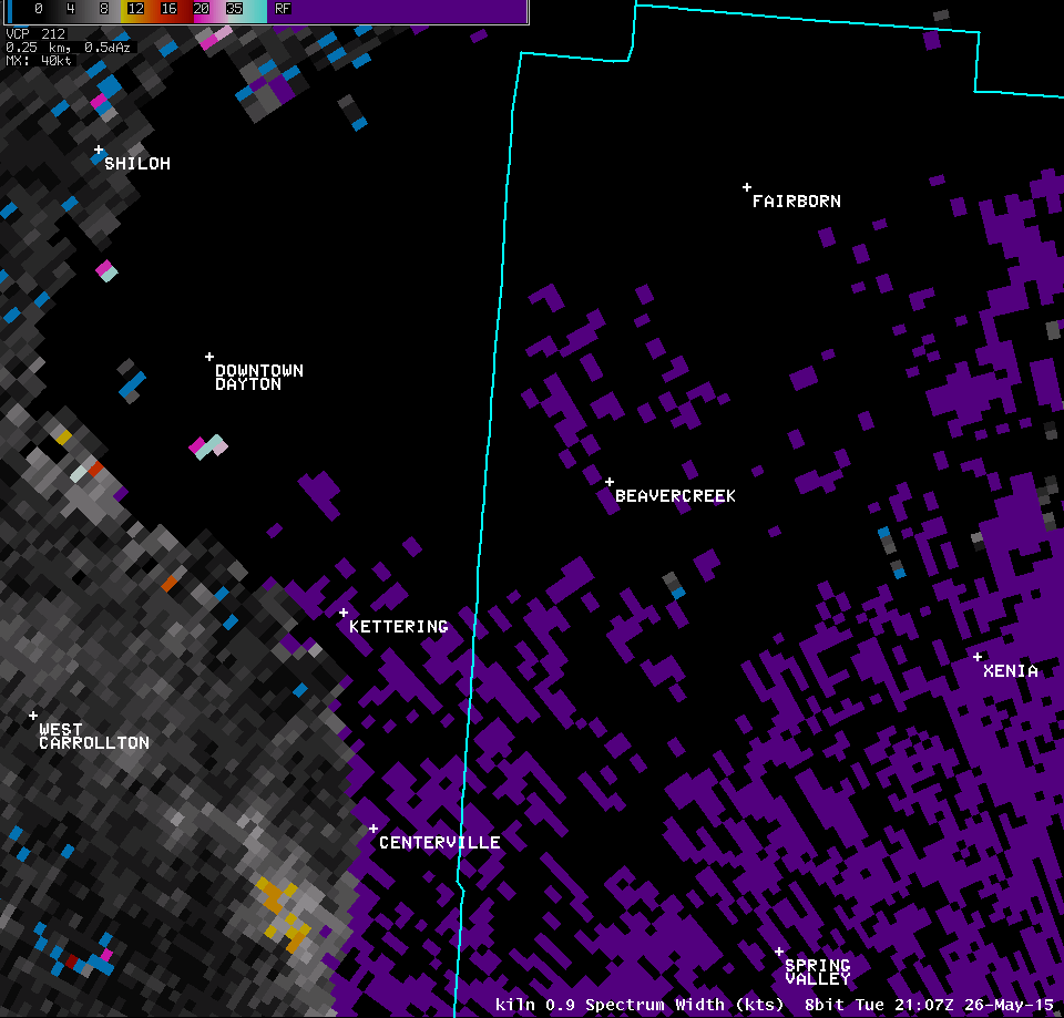
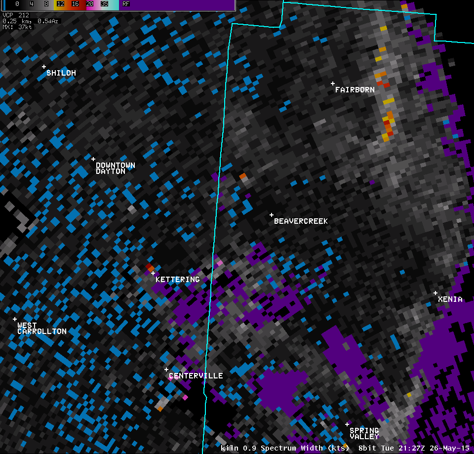
 |
 |
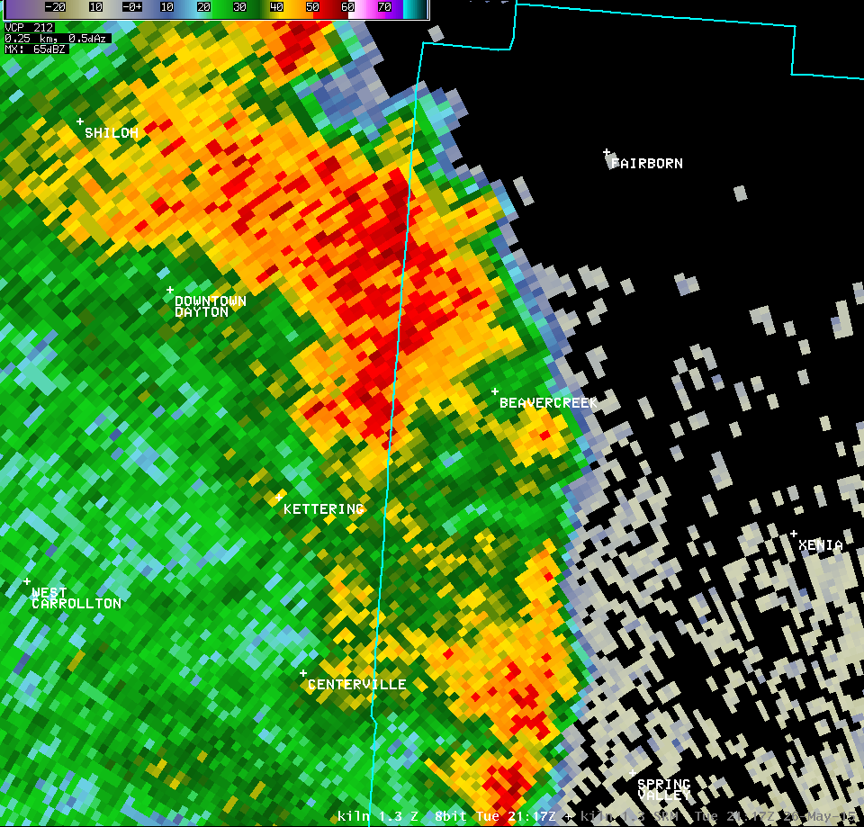
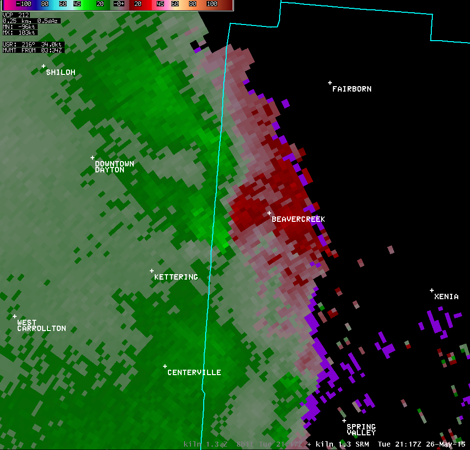
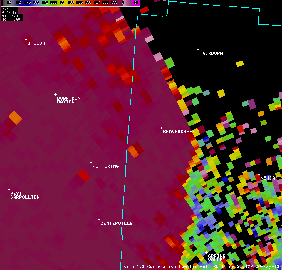
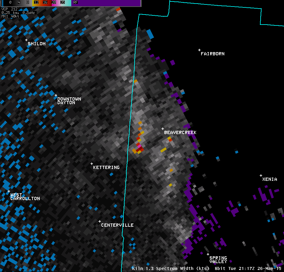
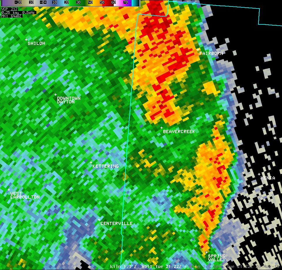
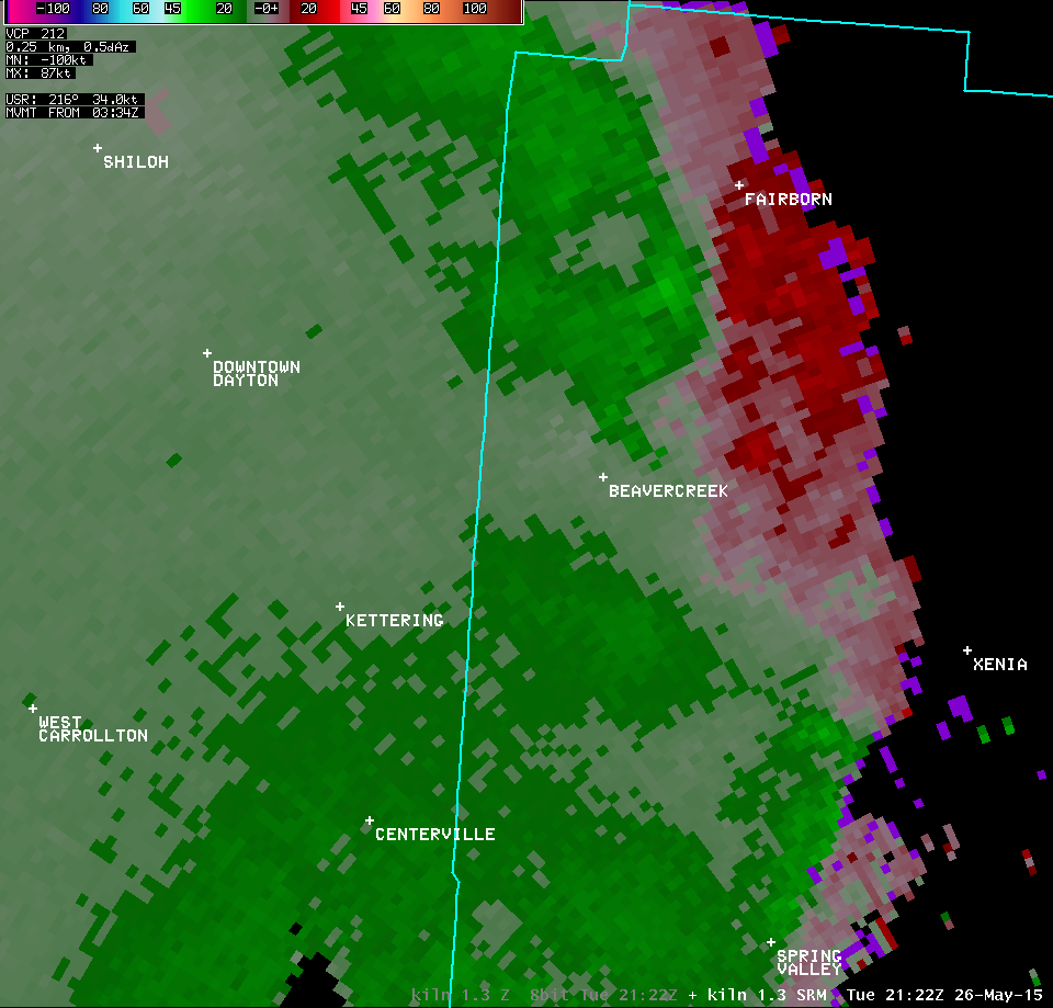
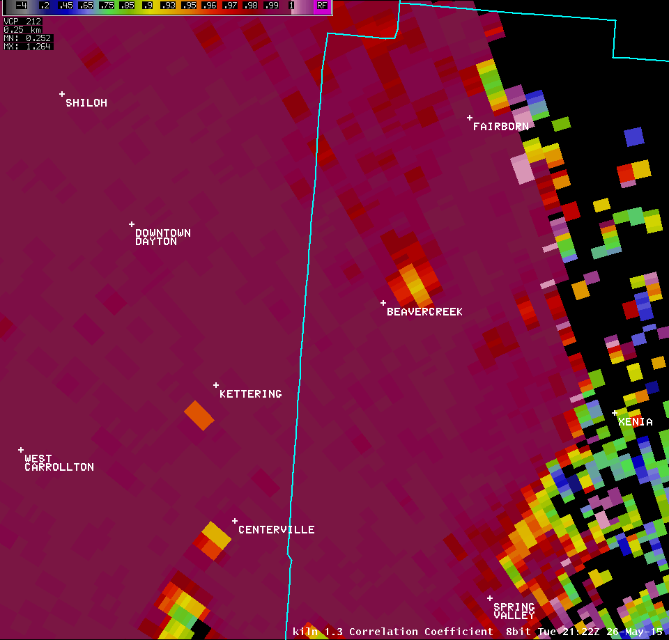
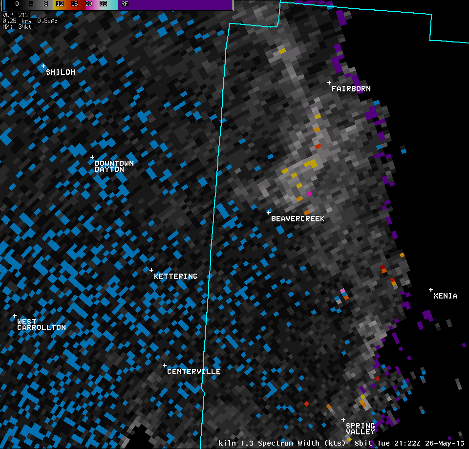
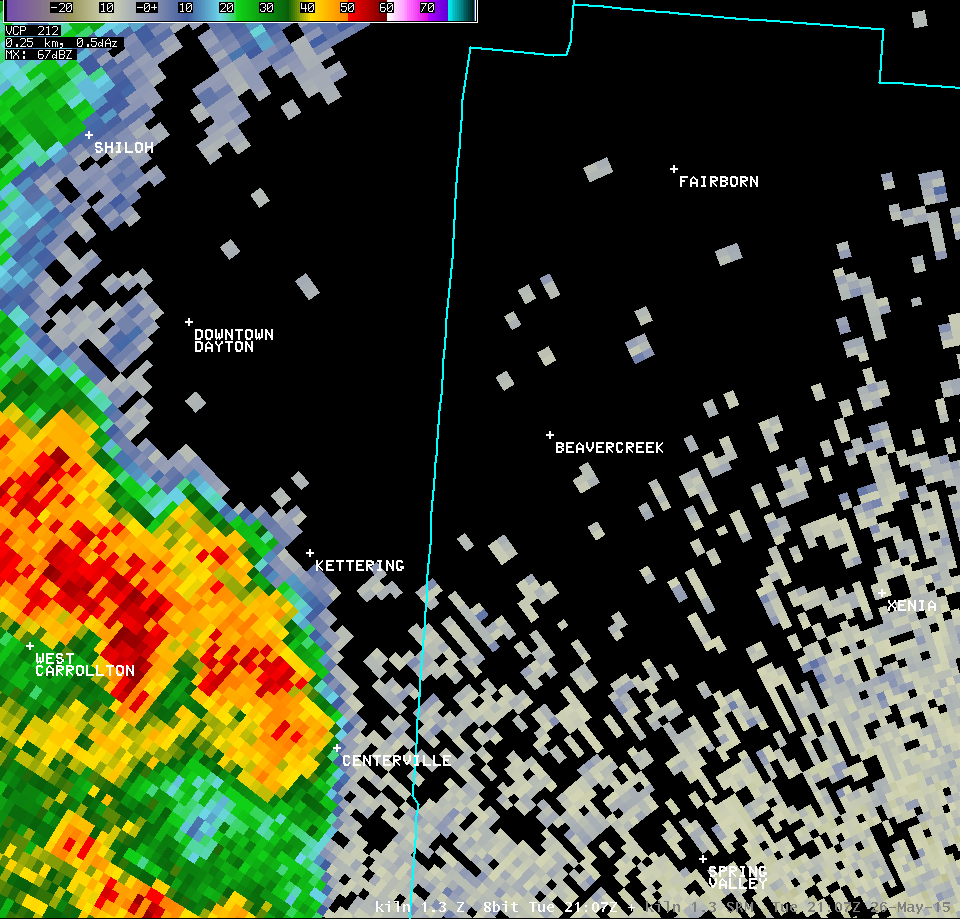
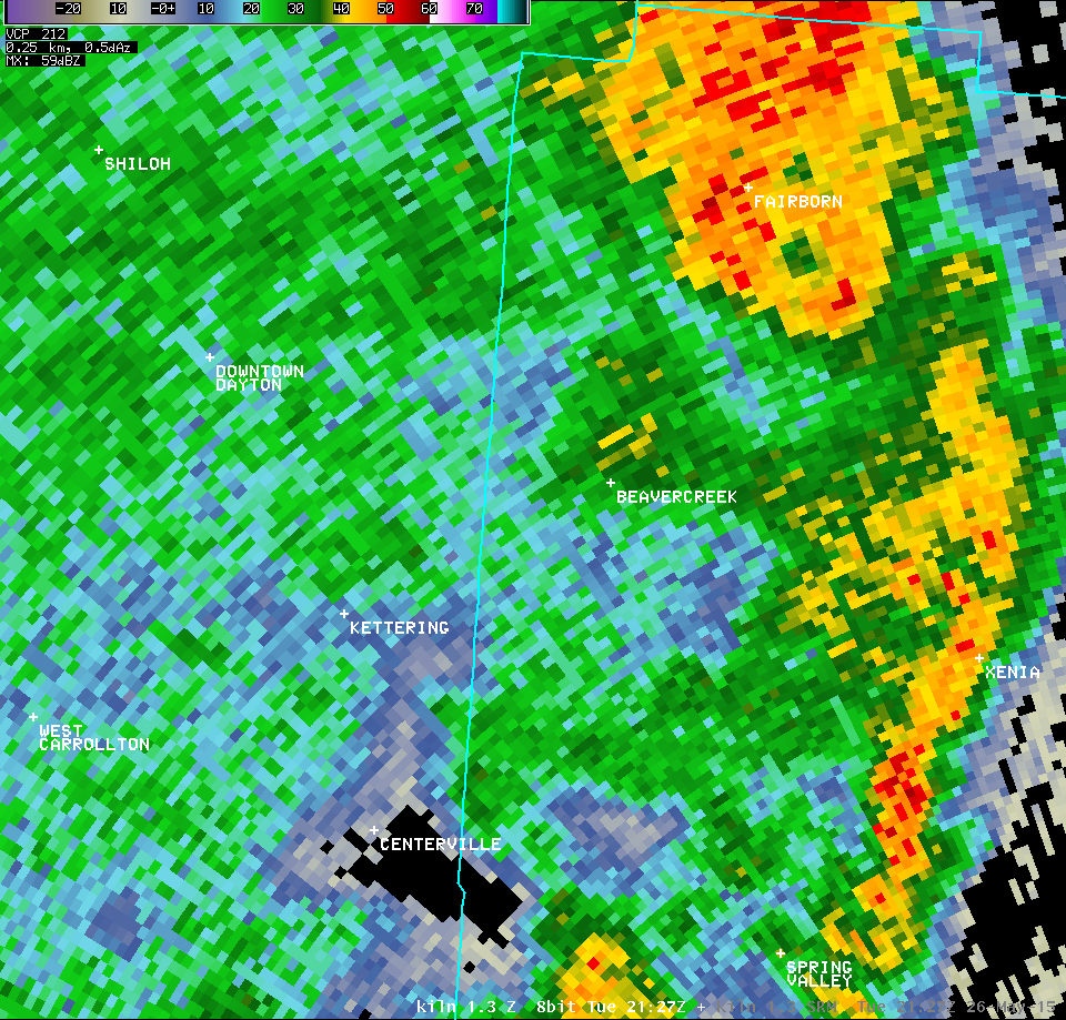
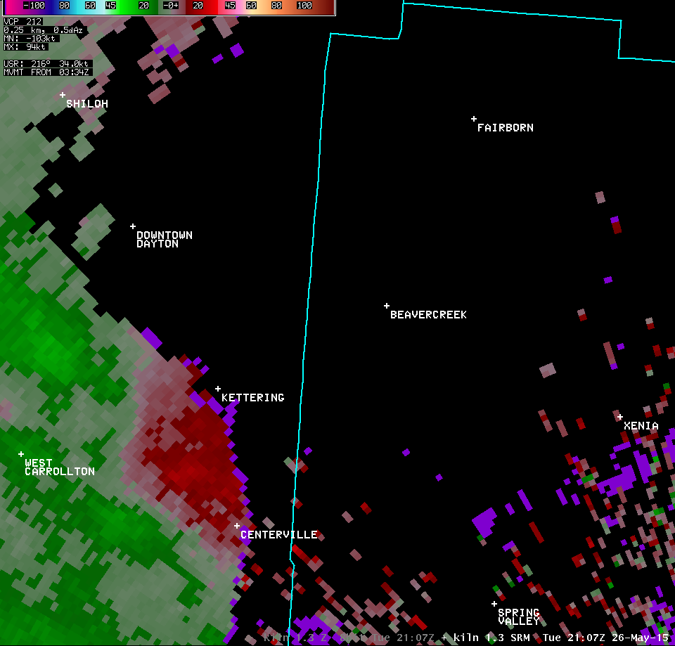
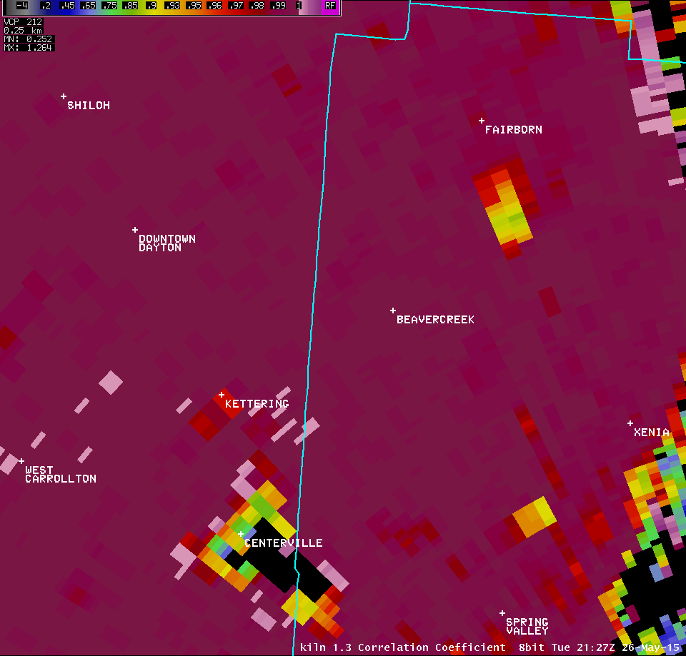
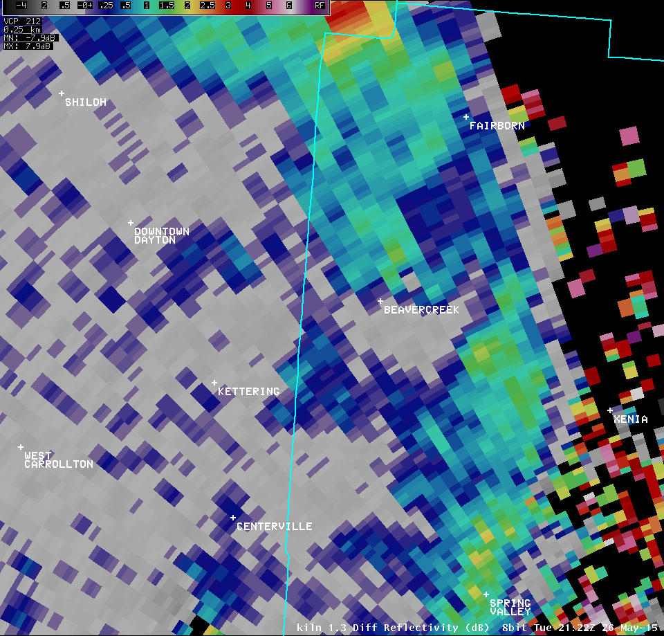
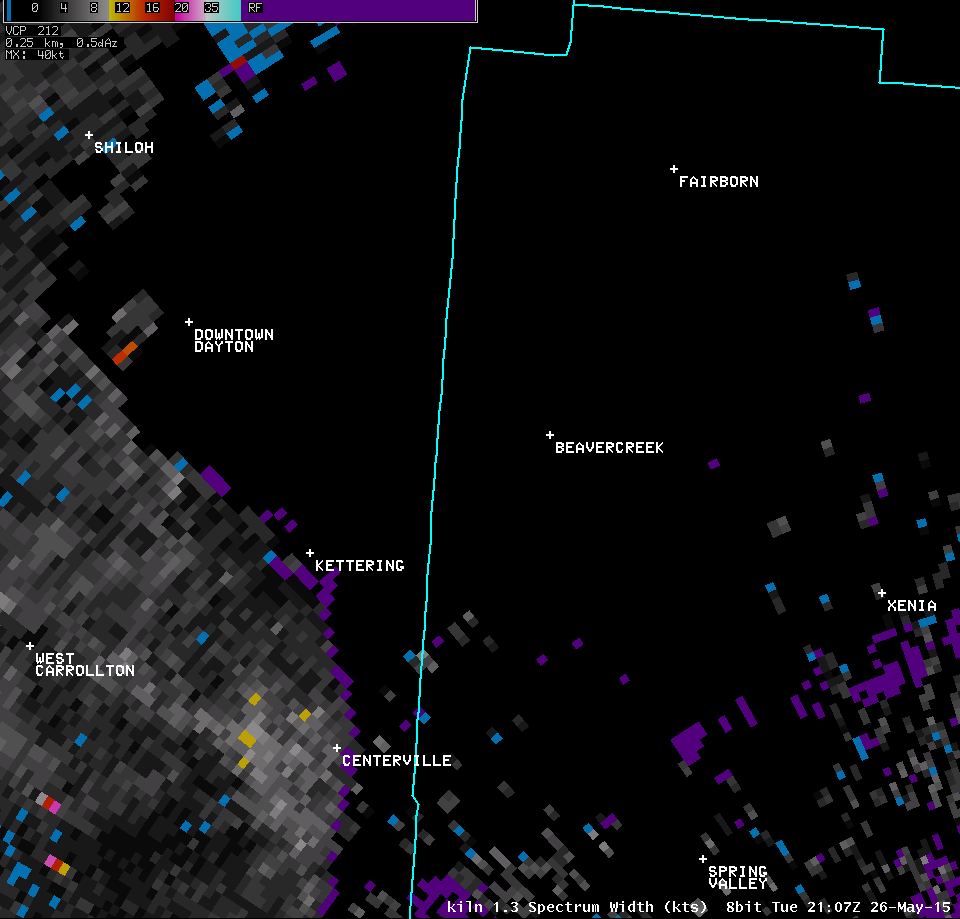
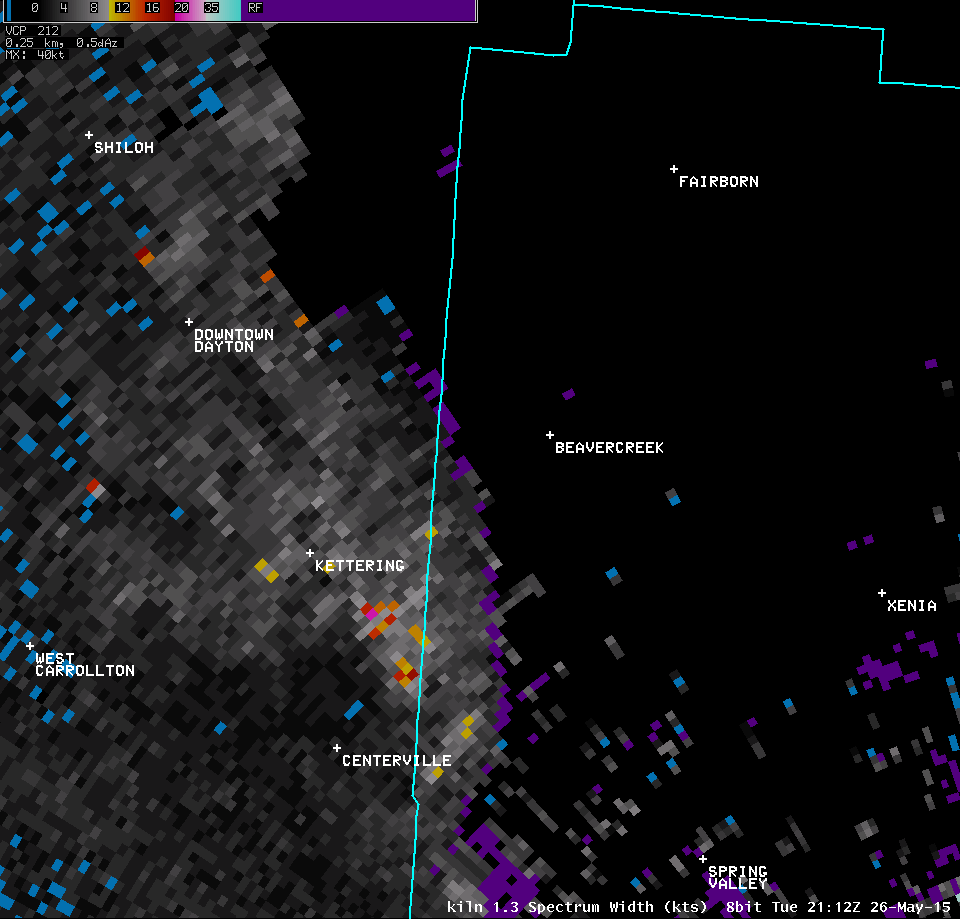
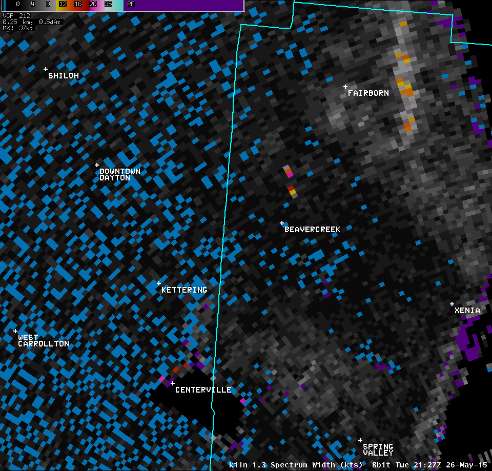
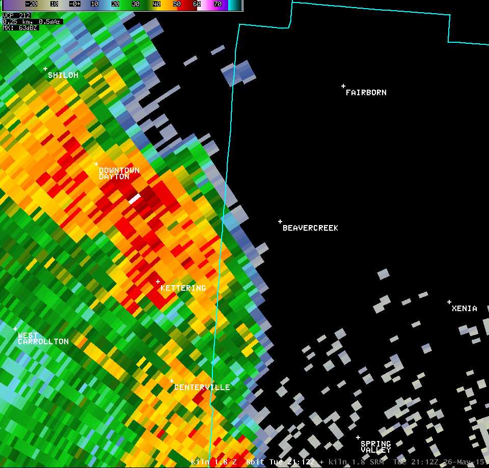
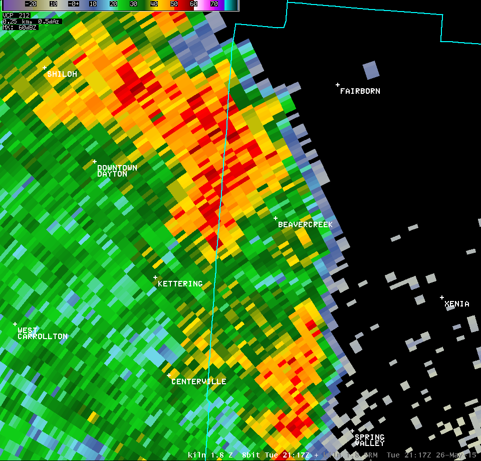
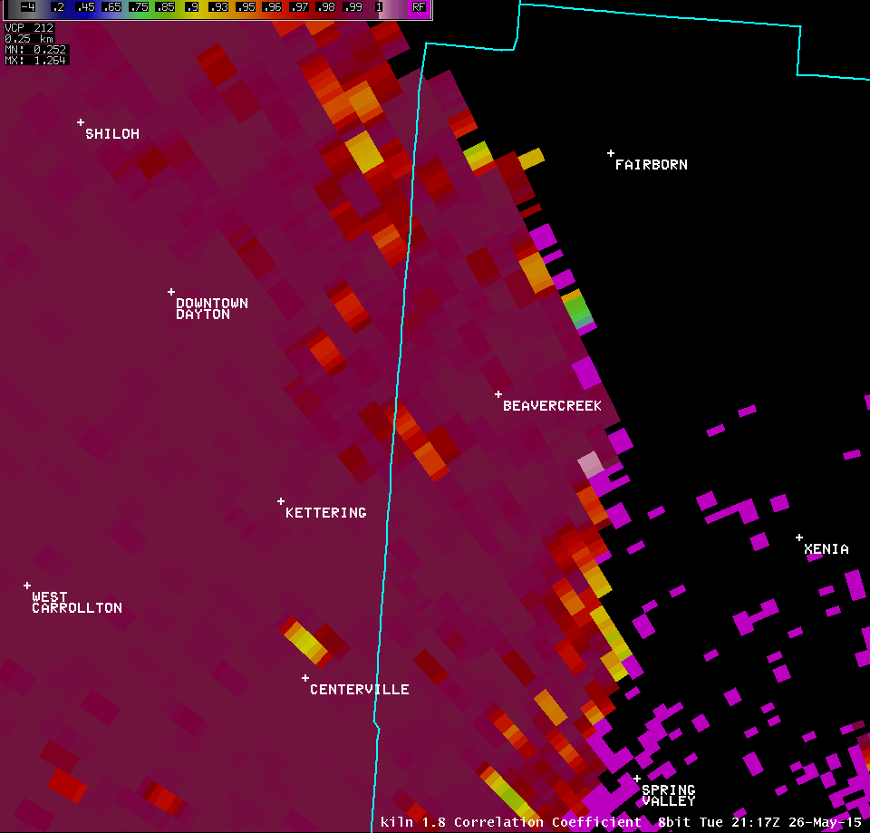
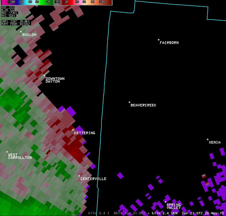
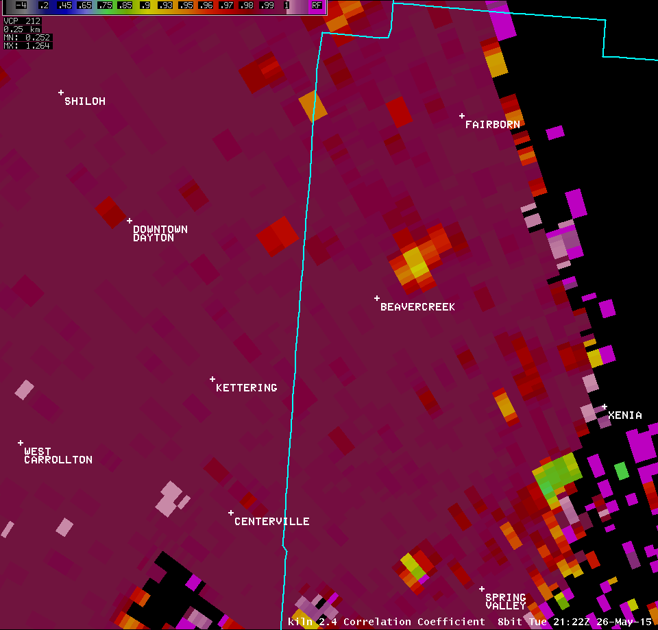
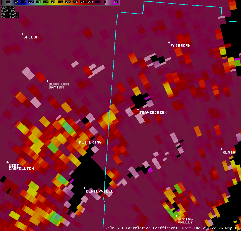
| 1.3° Z -- 5:17 PM | 1.3° SRM -- 5:17 PM | 1.3° CC -- 5:17 PM | 1.3° SW -- 5:17 PM |
 |
 |
 |
 |
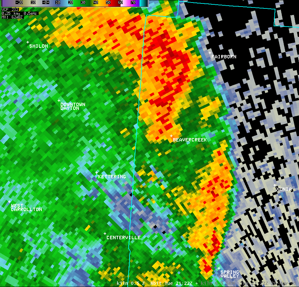
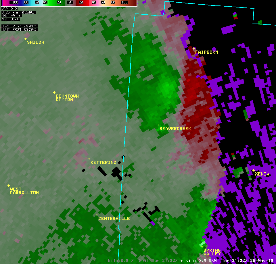
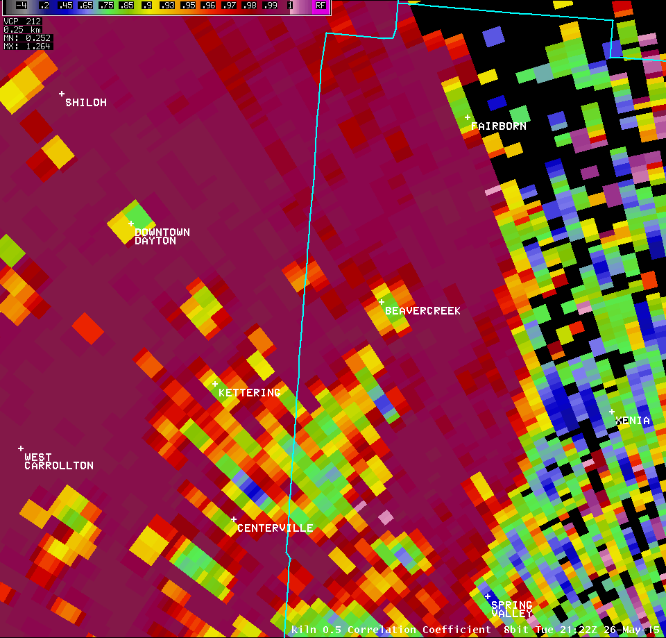
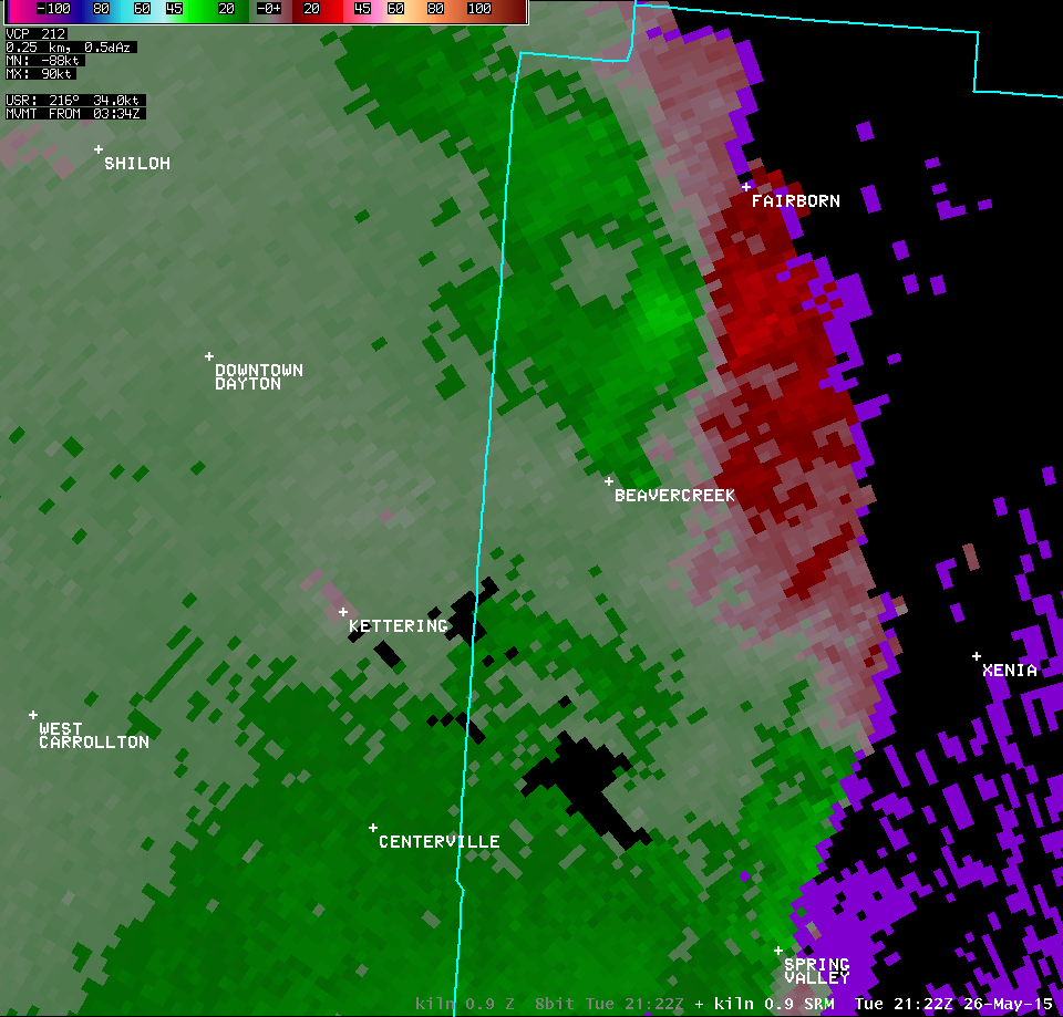
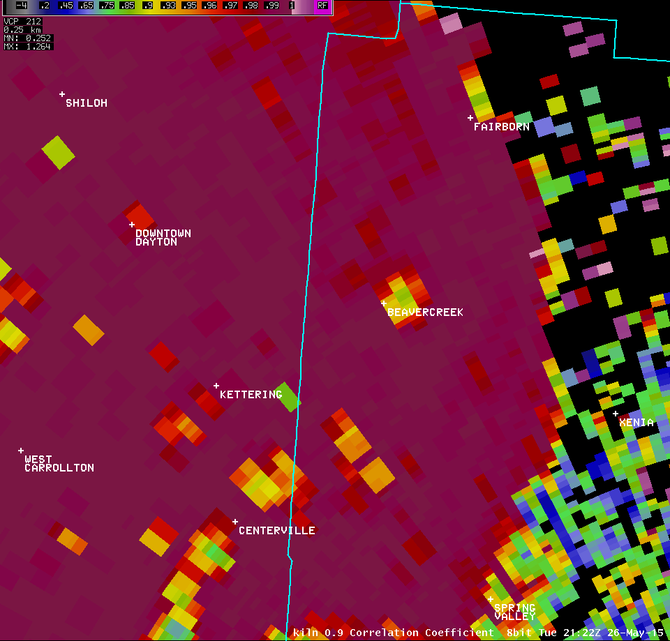
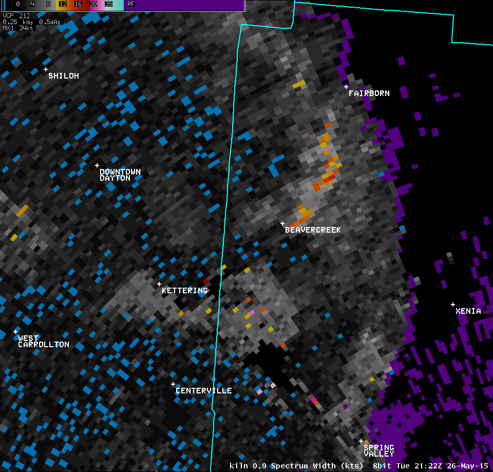
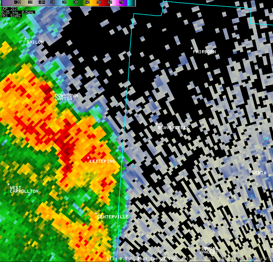
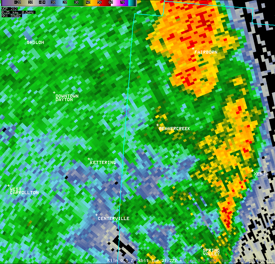
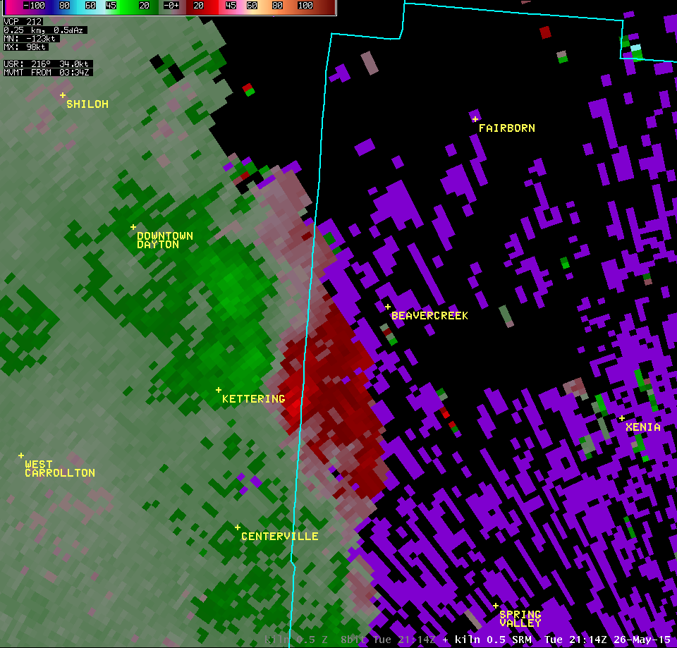
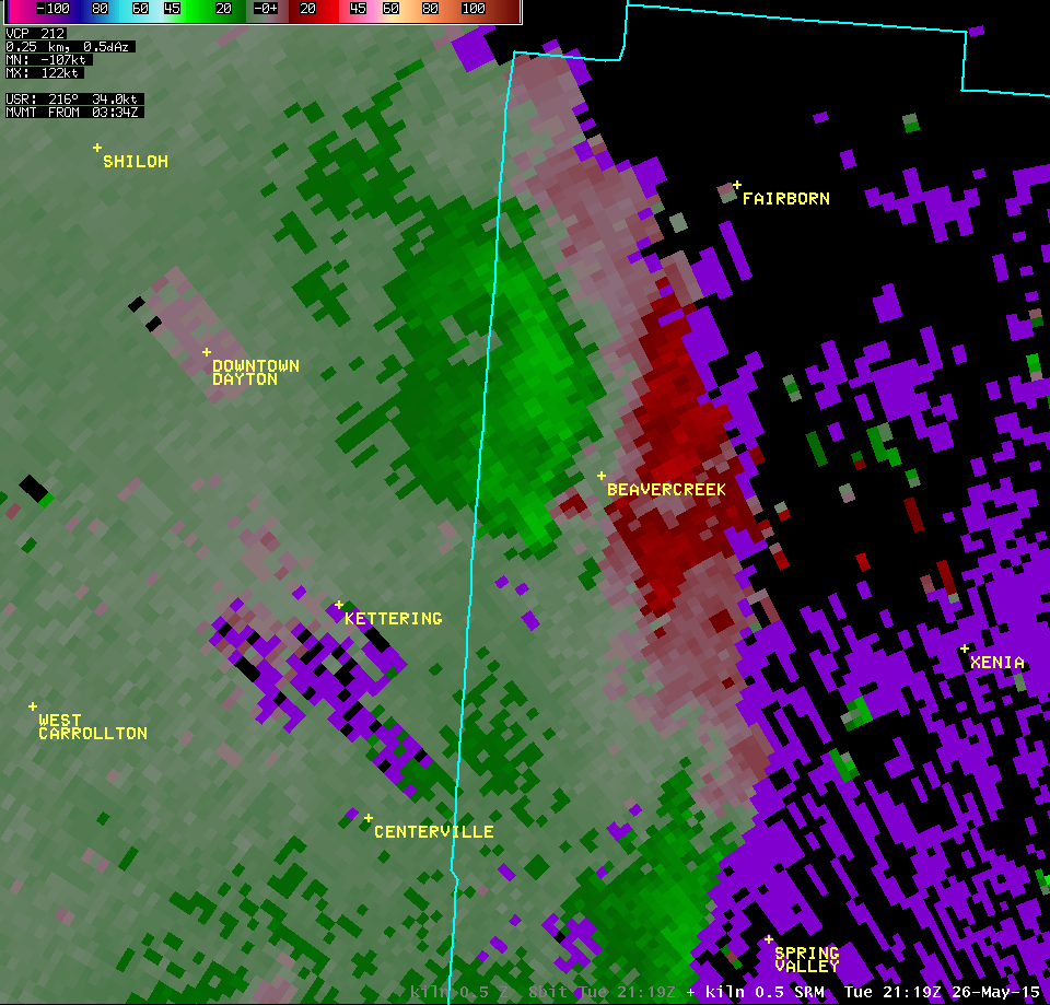
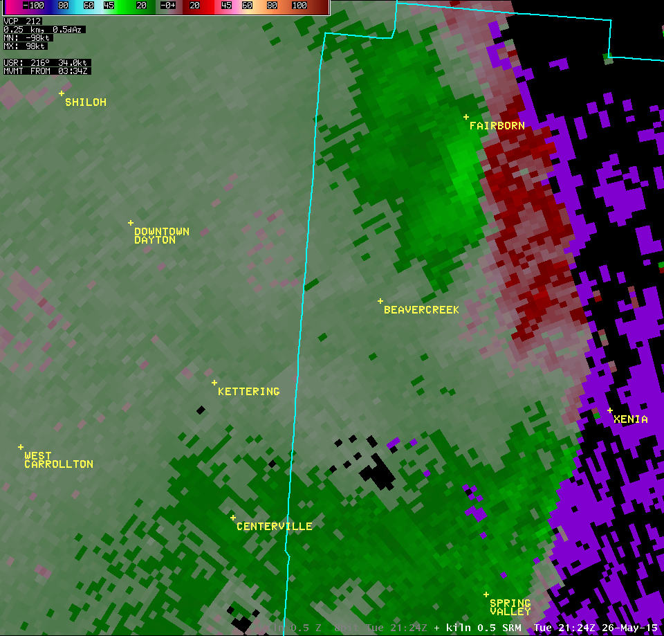
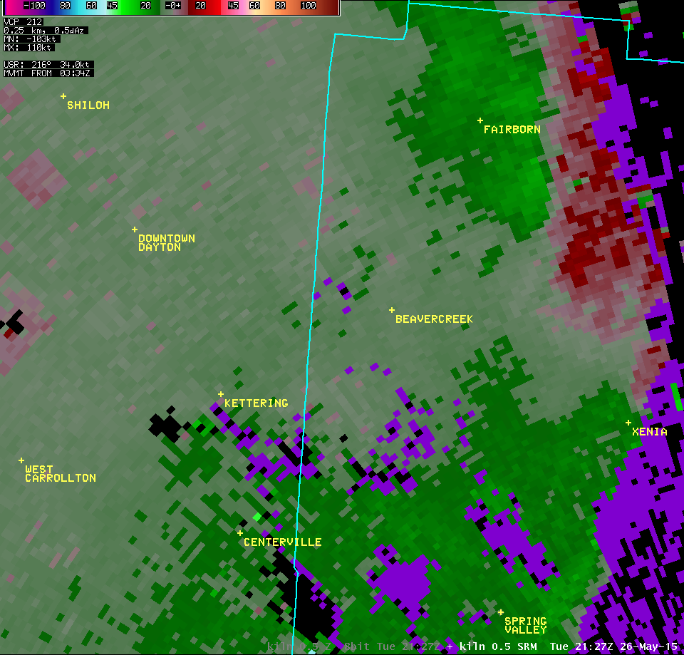
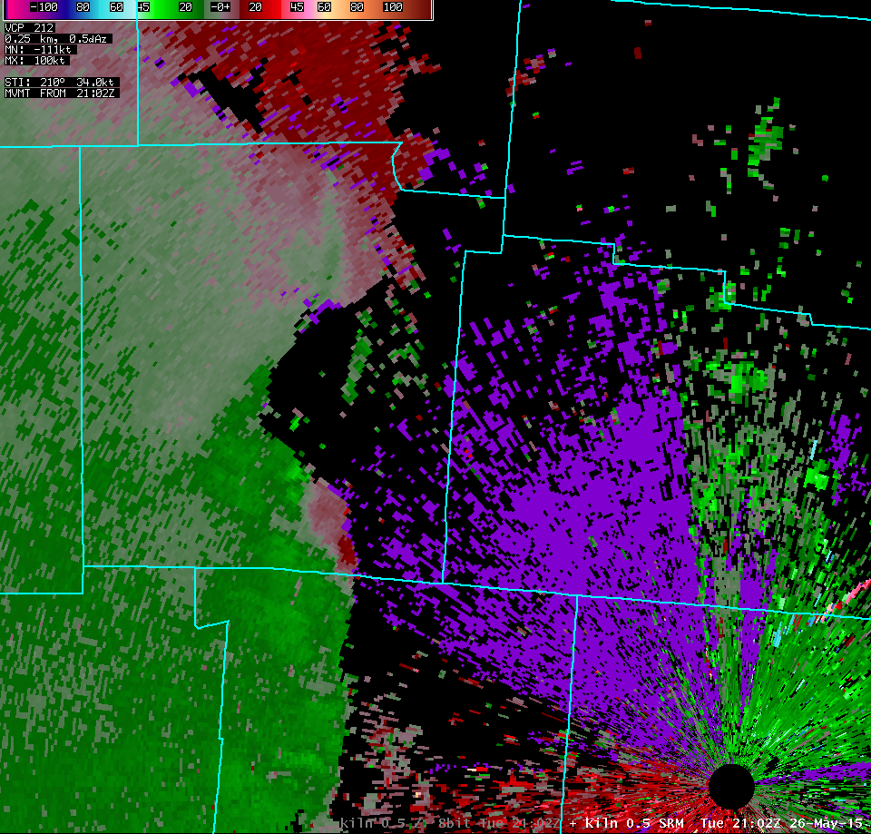
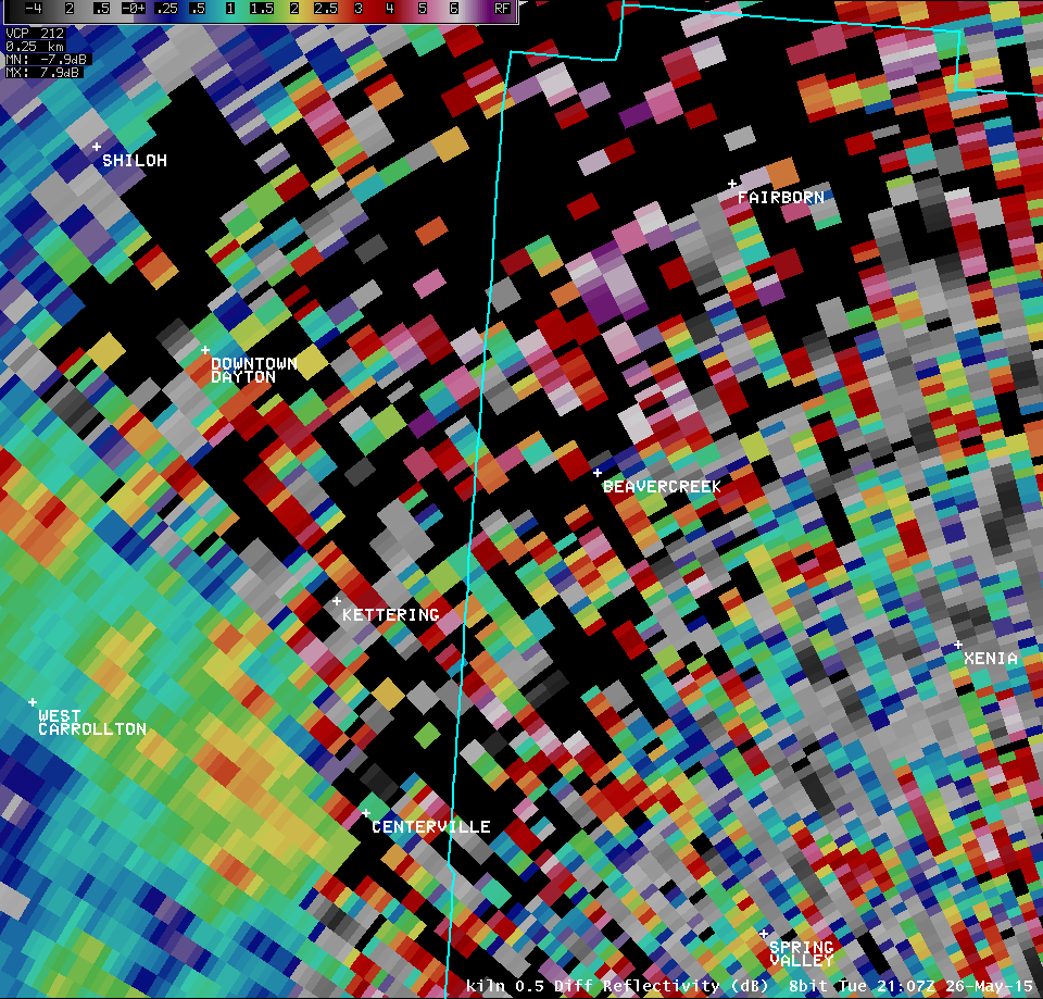
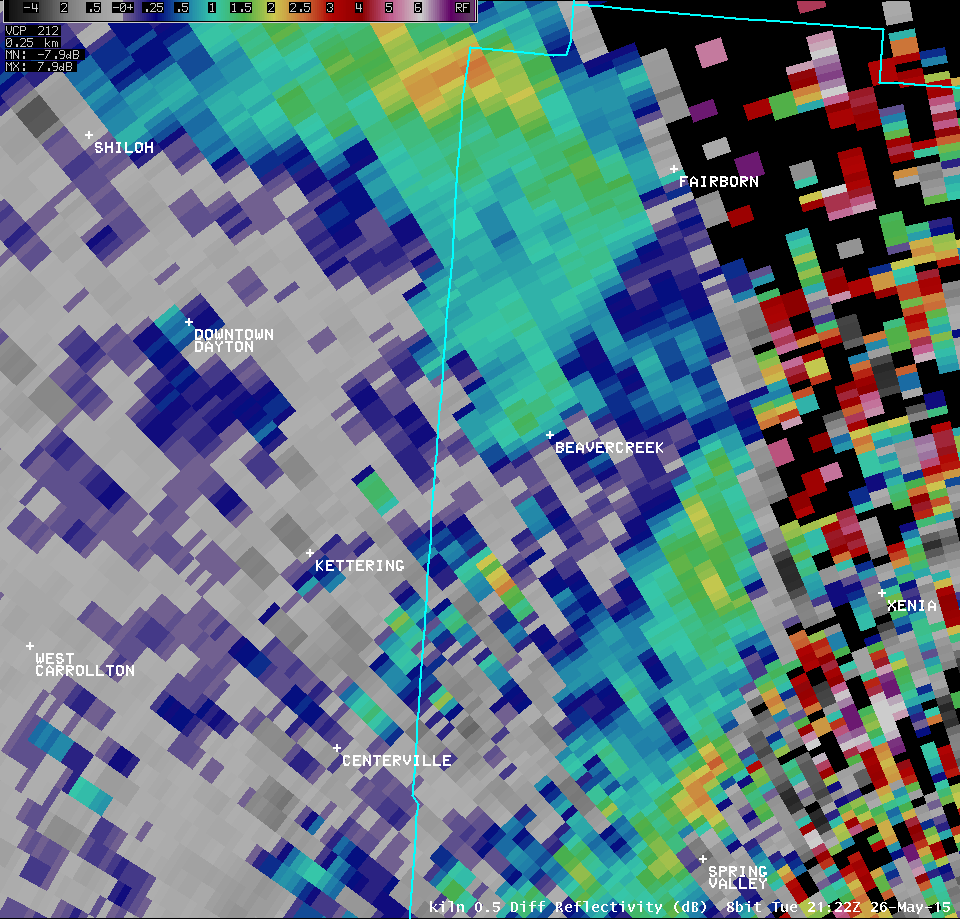
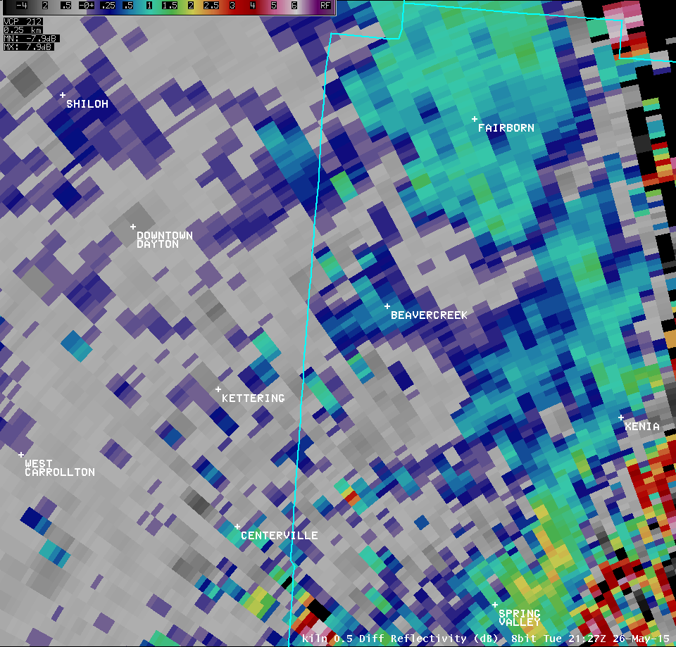
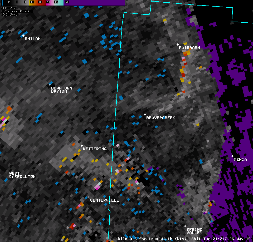
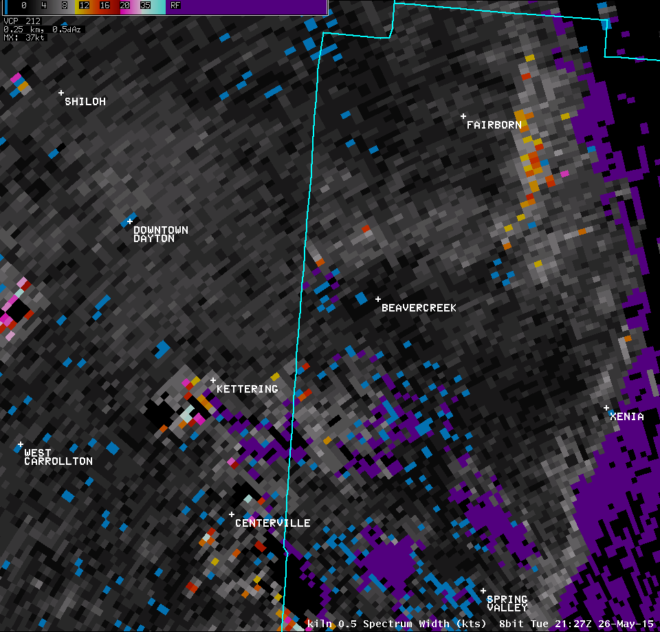
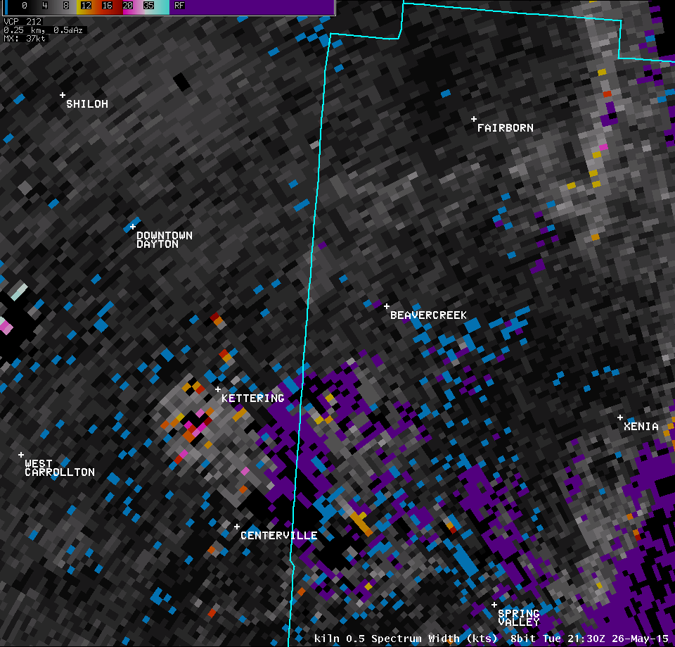
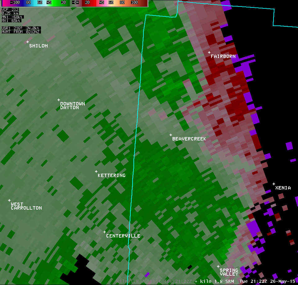
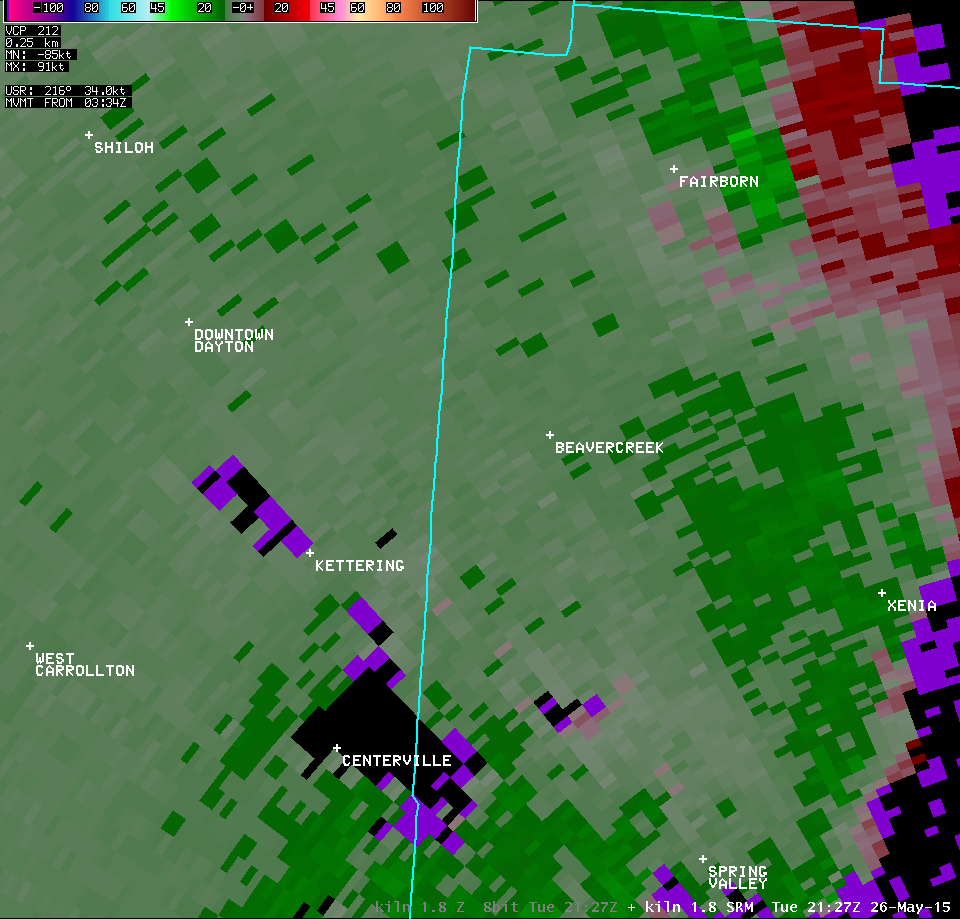
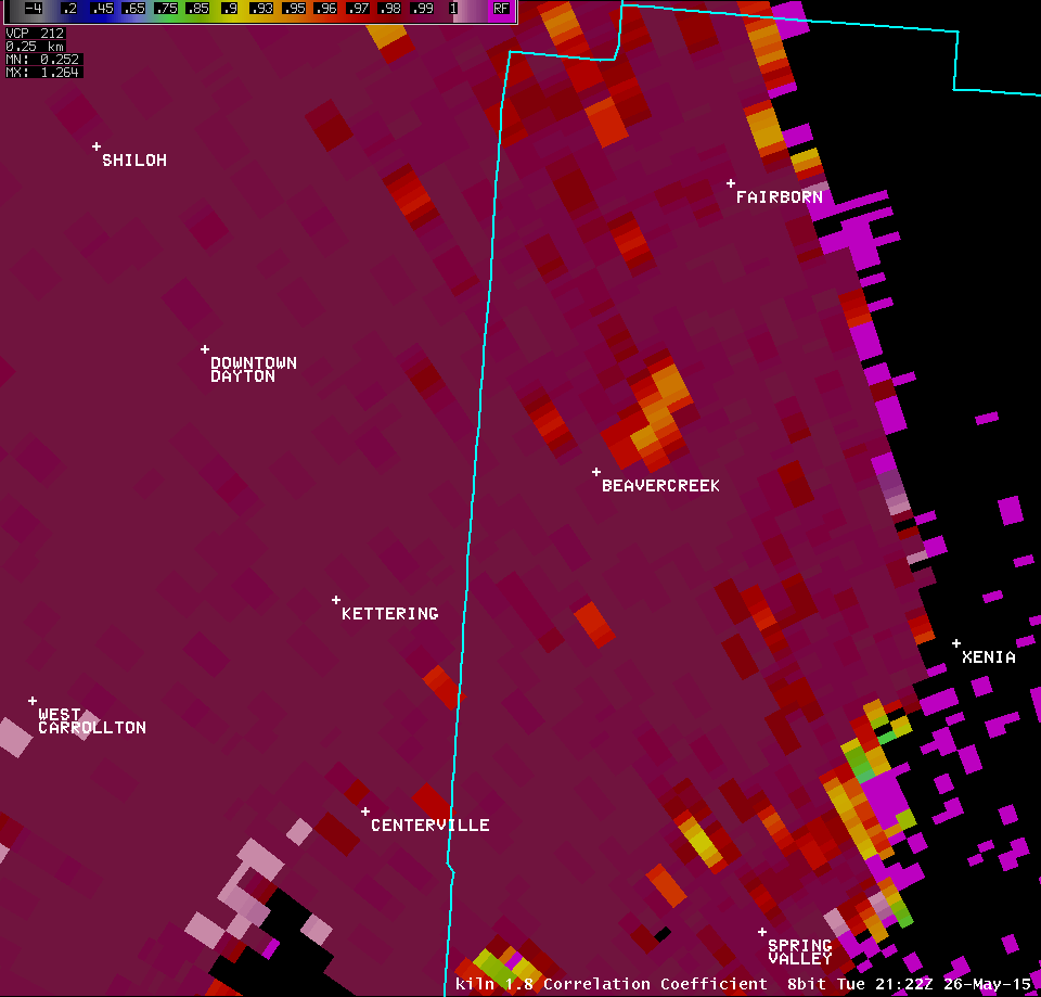
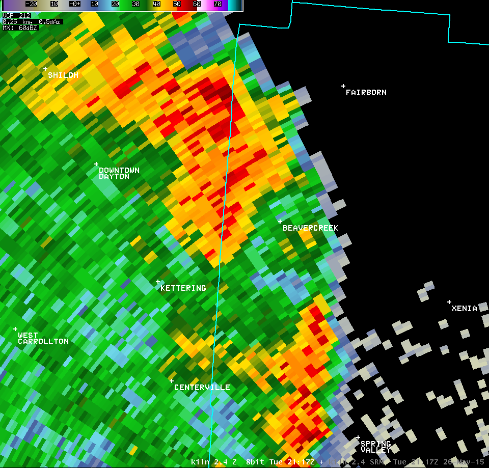
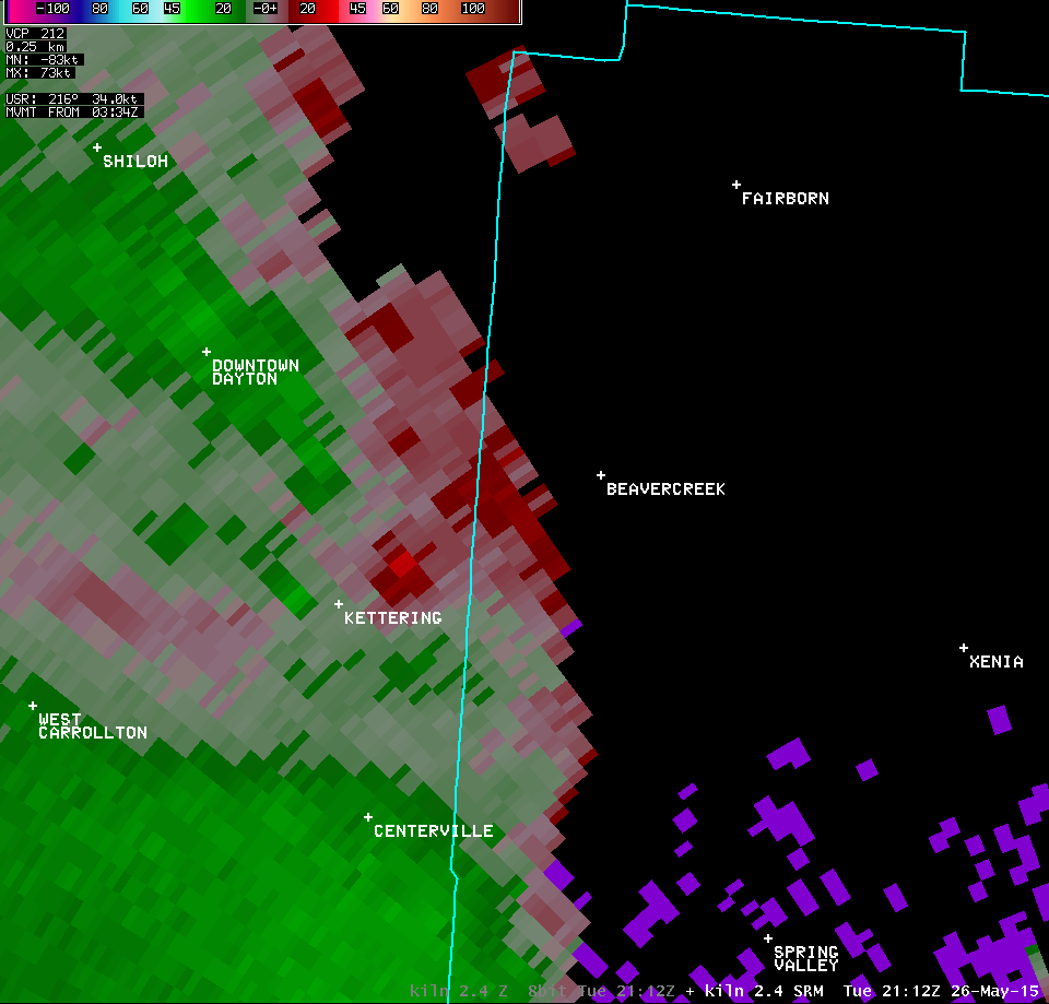
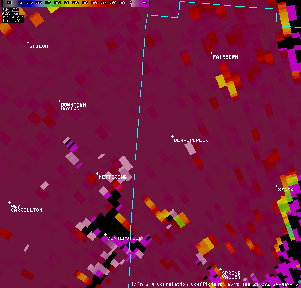
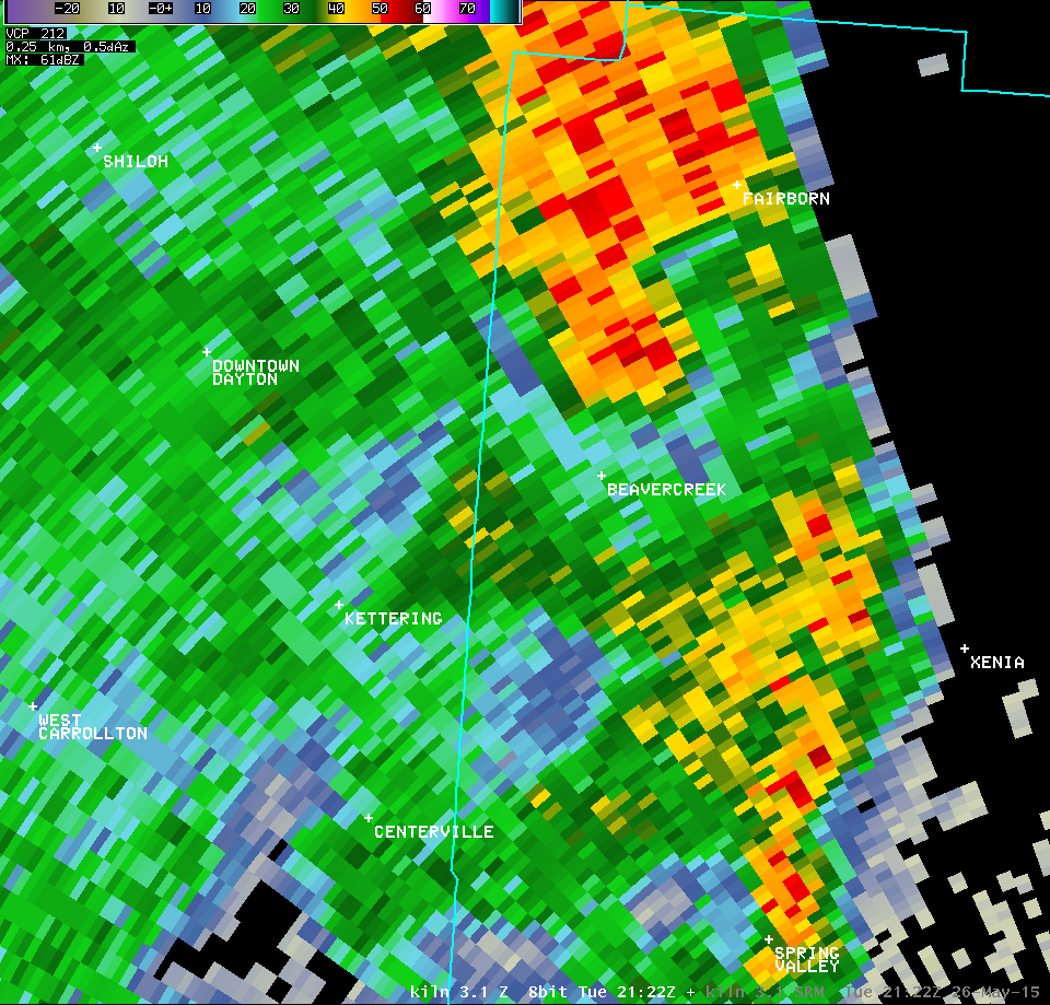
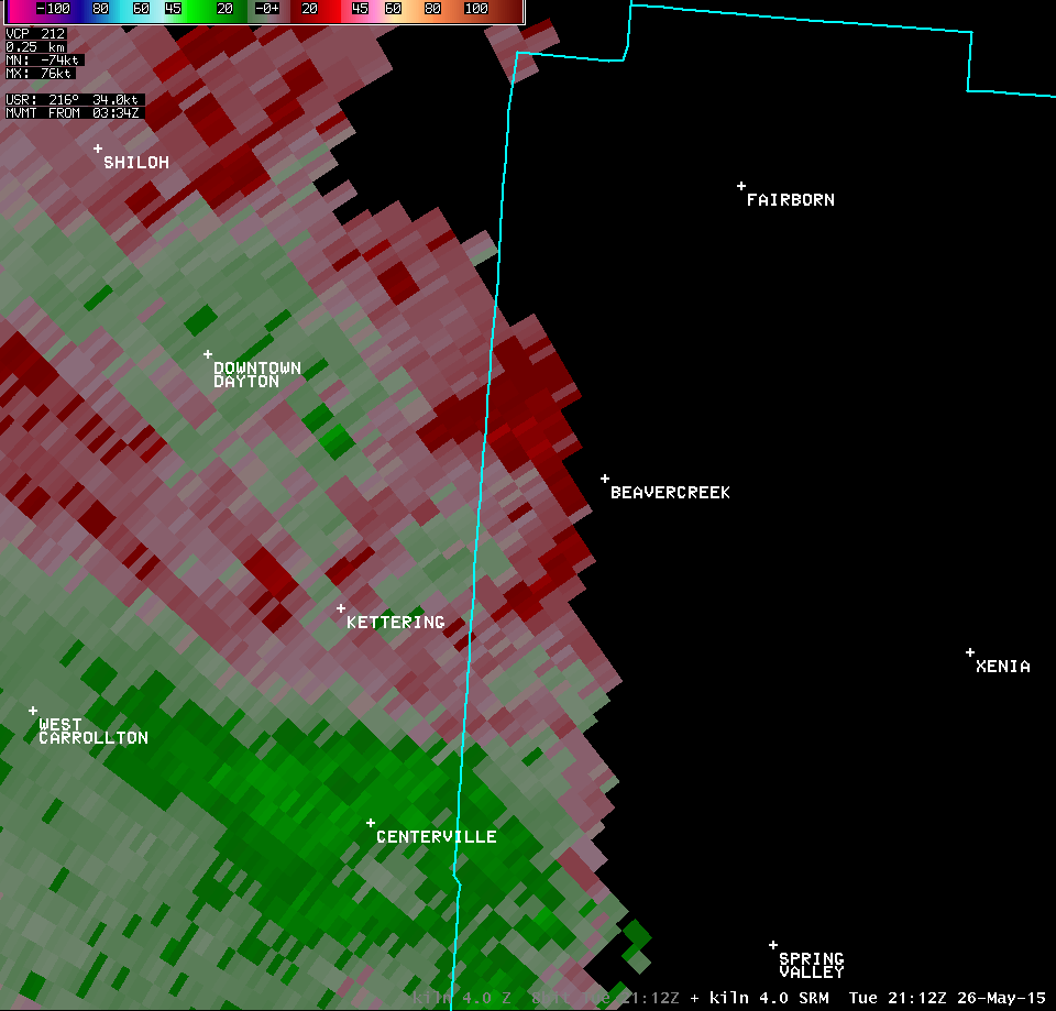
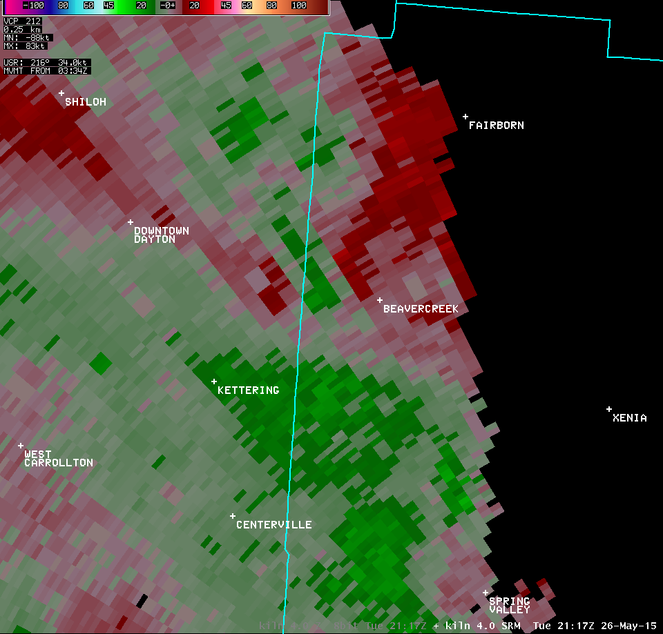
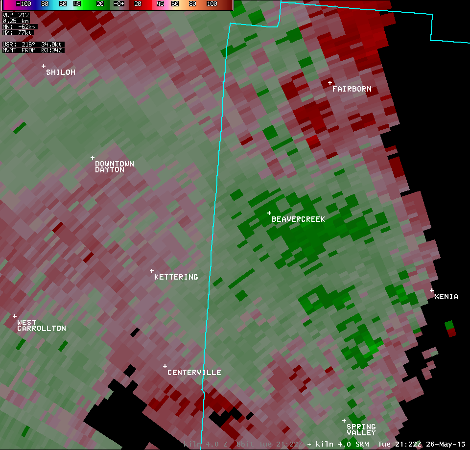
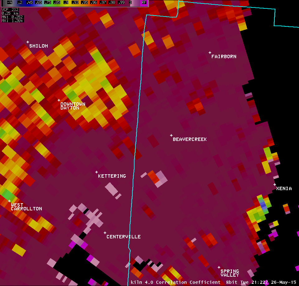
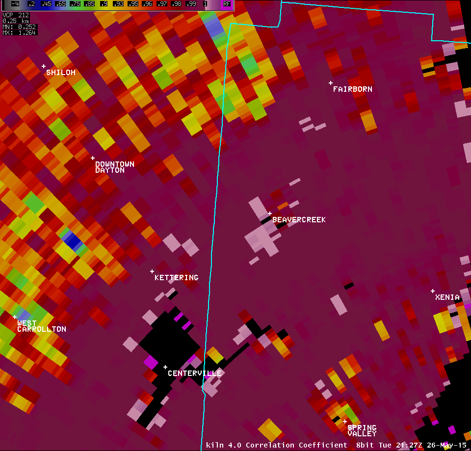
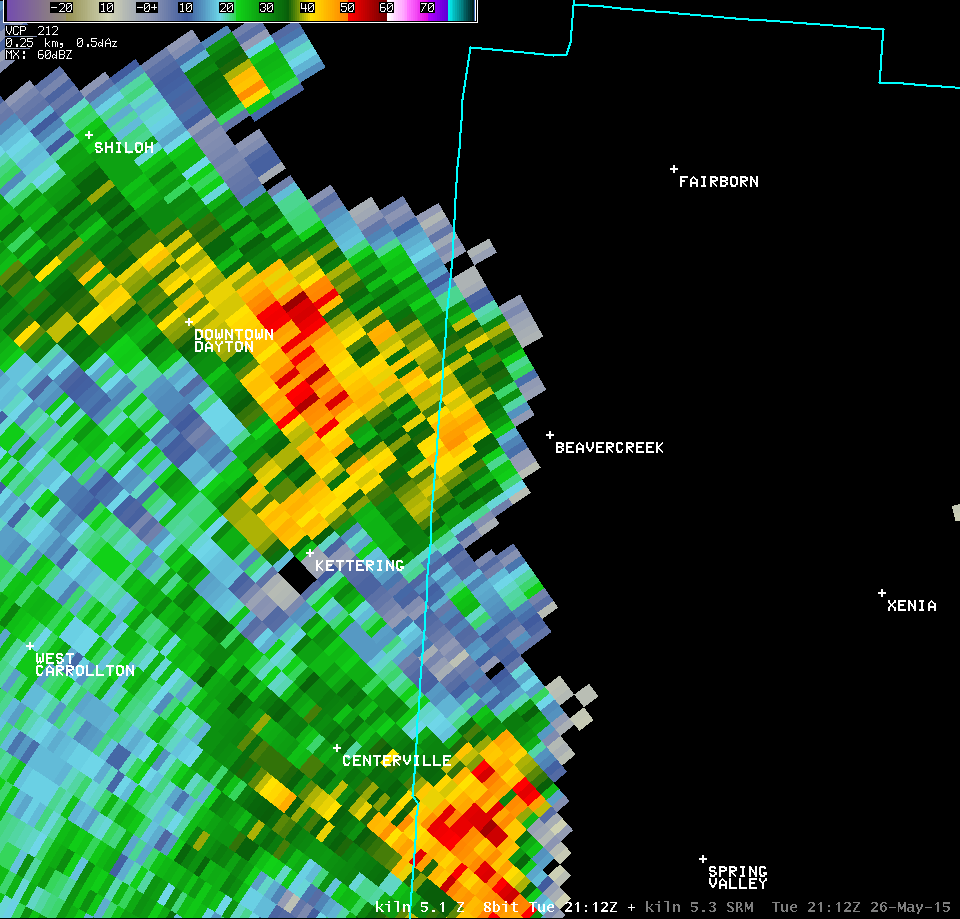
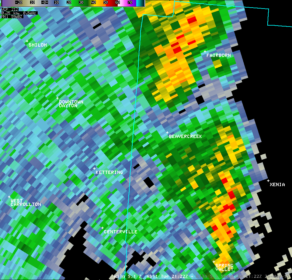
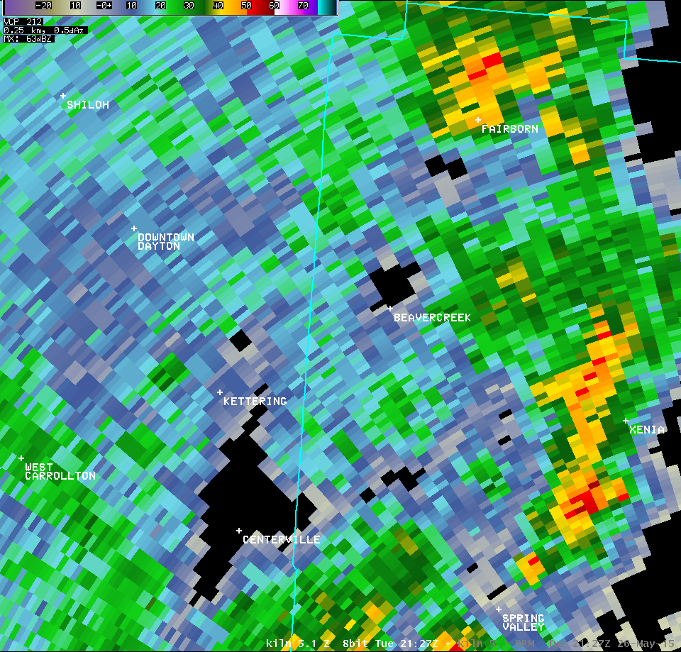
| 0.5° Z -- 5:22 PM | 0.5° SRM -- 5:22 PM | 0.5° CC -- 5:22 PM | 0.5° SW -- 5:22 PM |
 |
 |
 |
 |
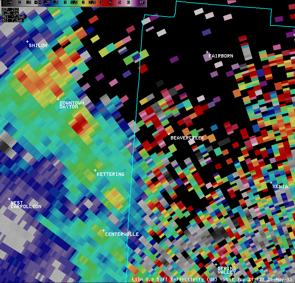
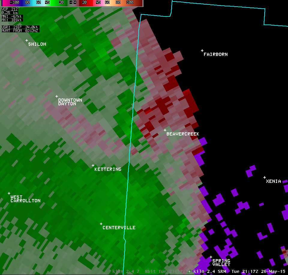
| 0.9° Z -- 5:22 PM | 0.9° SRM -- 5:22 PM | 0.9° CC -- 5:22 PM | 0.9° SW -- 5:22 PM |
 |
 |
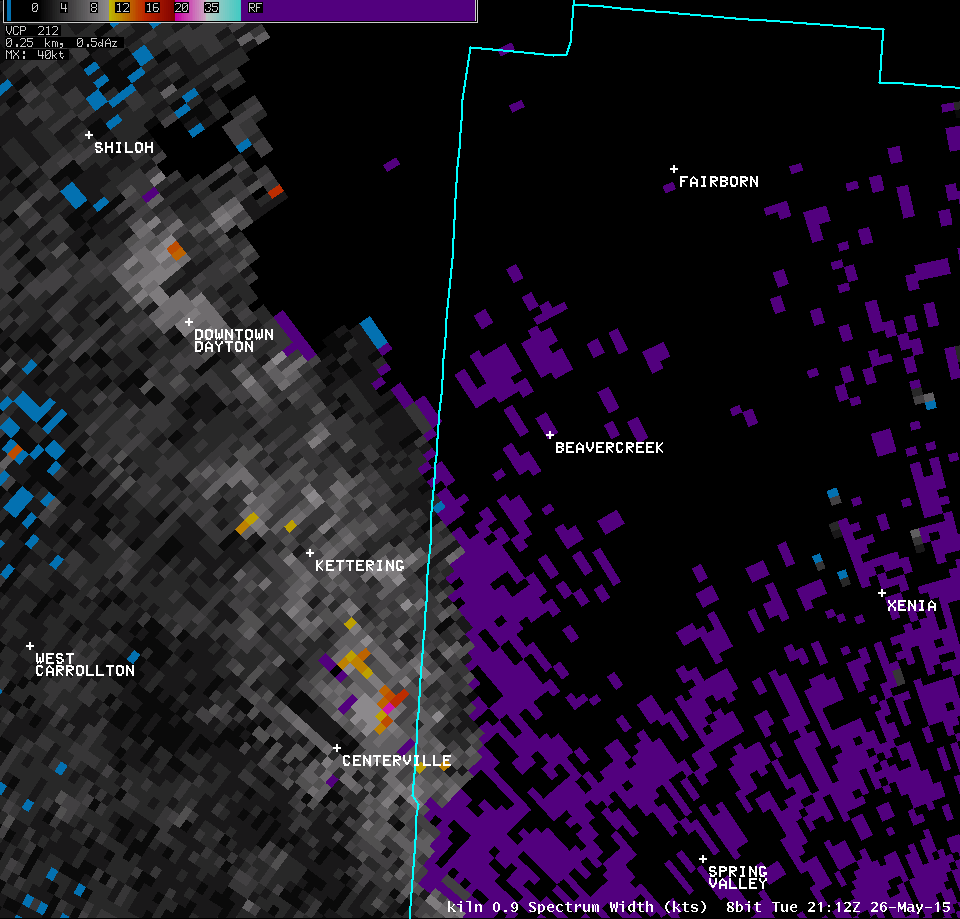
 |
 |
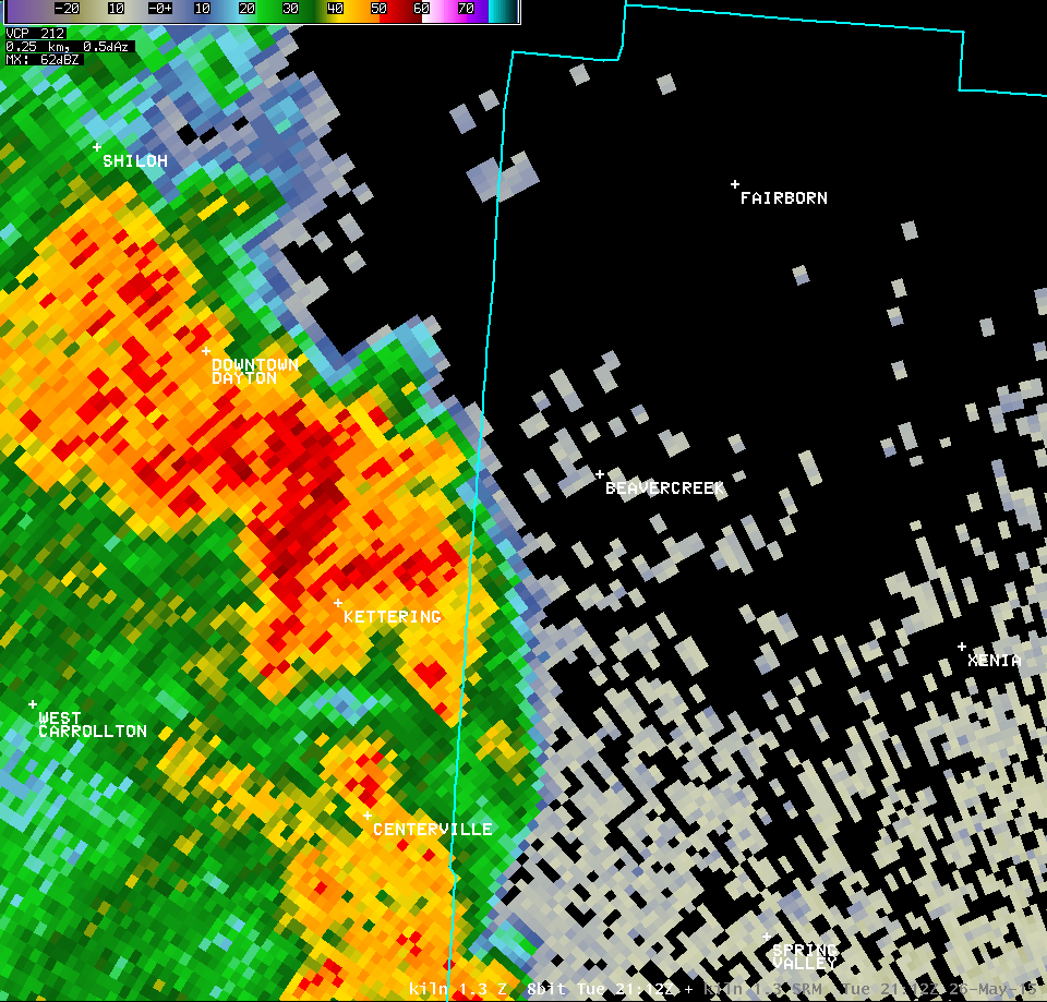
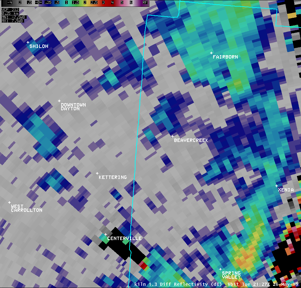
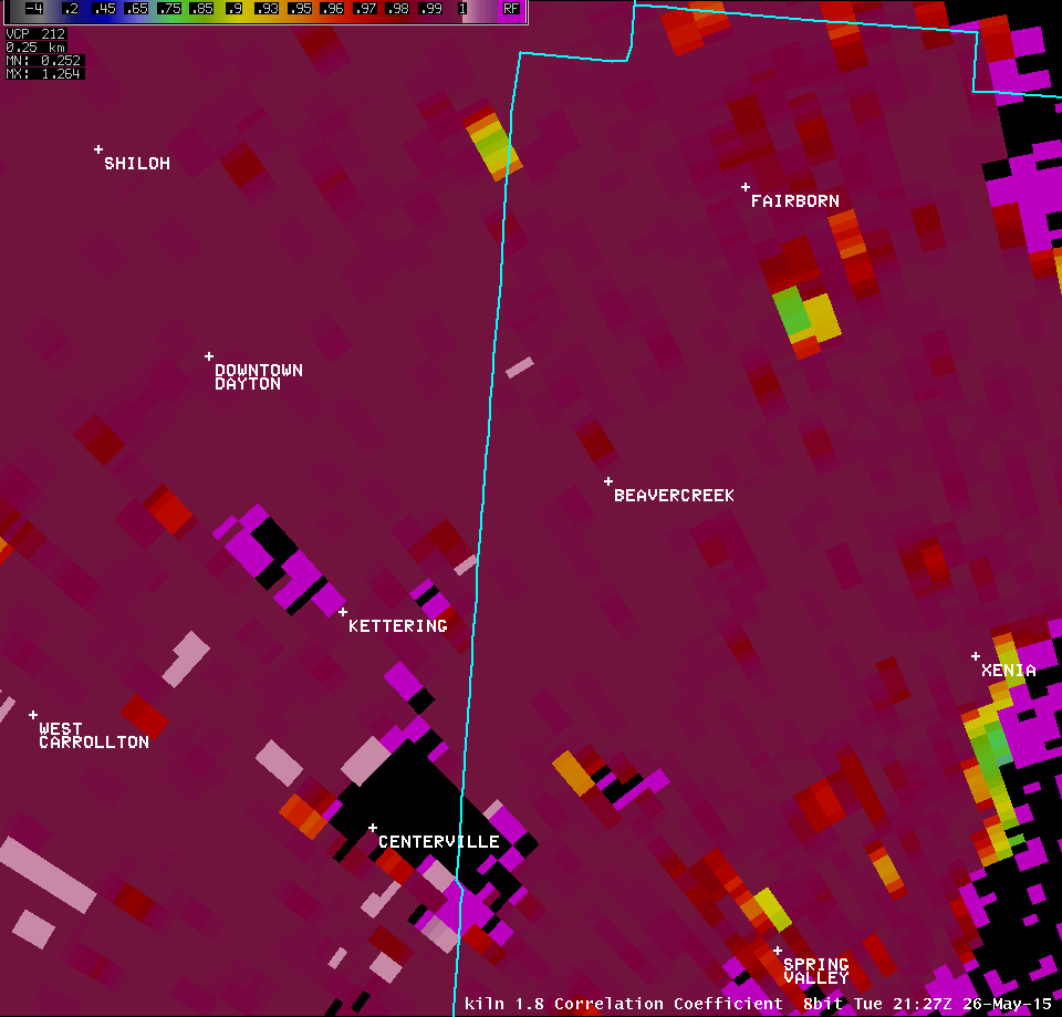
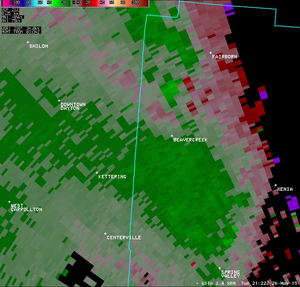
| 1.3° Z -- 5:22 PM | 1.3° SRM -- 5:22 PM | 1.3° CC -- 5:22 PM | 1.3° SW -- 5:22 PM |
 |
 |
 |
 |
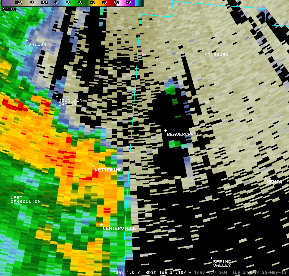
| Dayton Terminal Doppler Weather Radar (TDAY) | ||
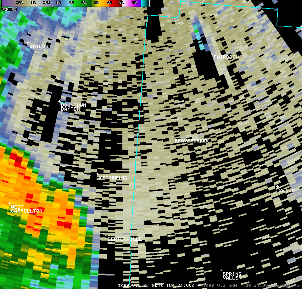
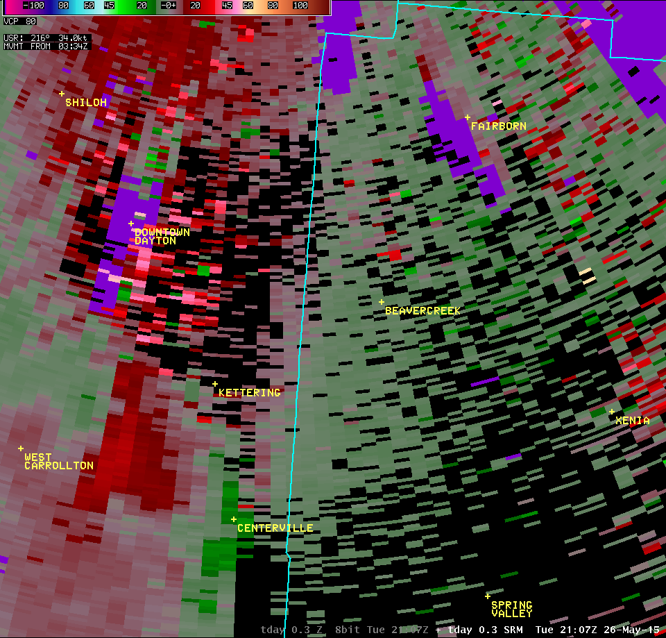
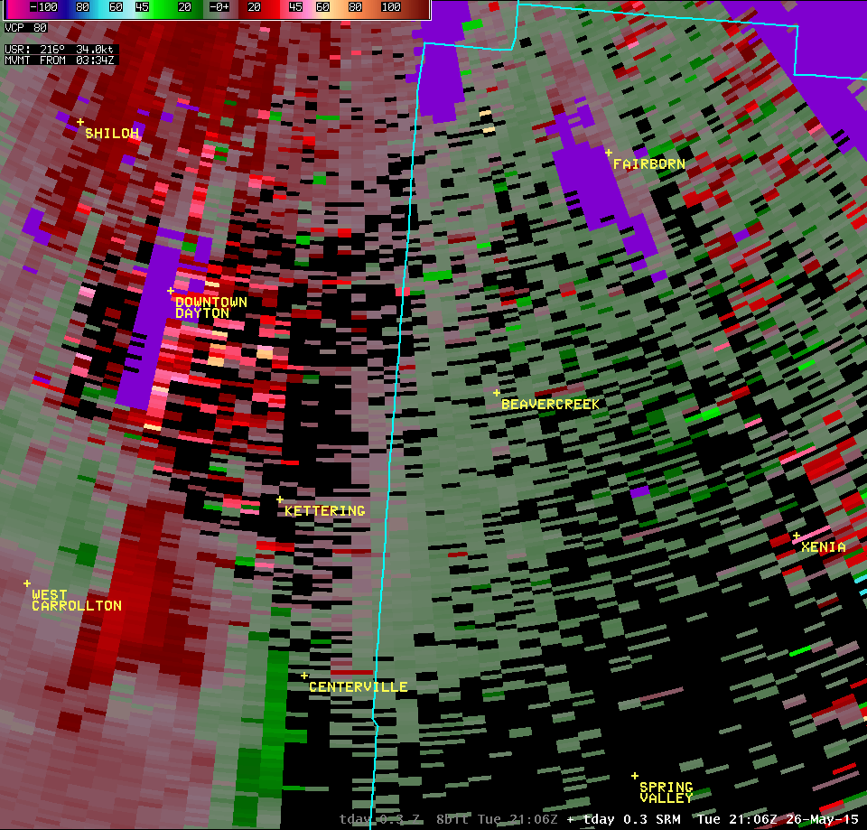
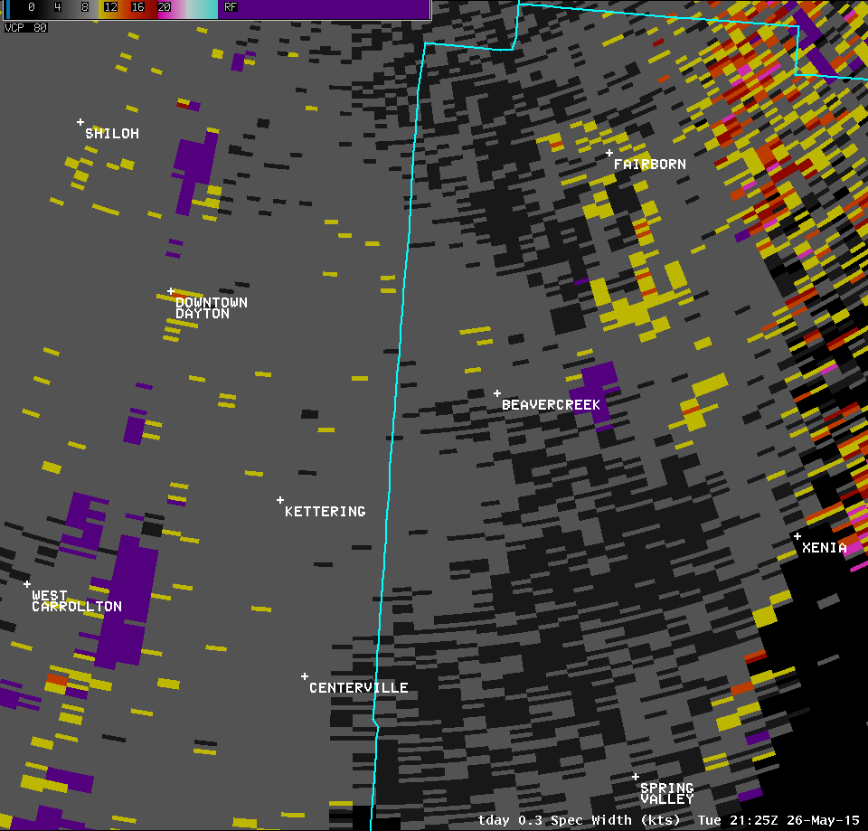
| 0.3° Z -- 5:15 PM | 0.3° SRM -- 5:15 PM | 0.3° SW -- 5:15 PM |
 |
 |
 |
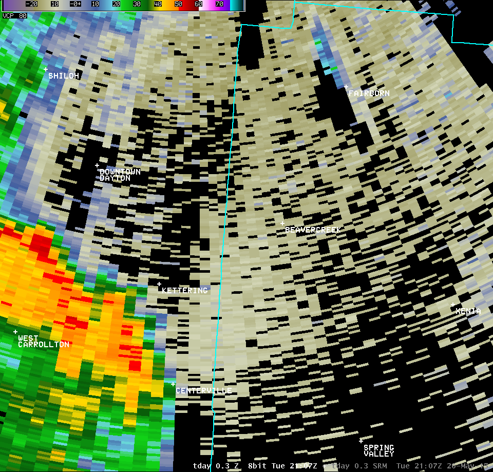
| 0.3° Z -- 5:16 PM | 0.3° SRM -- 5:16 PM | 0.3° SW -- 5:16 PM |
 |
 |
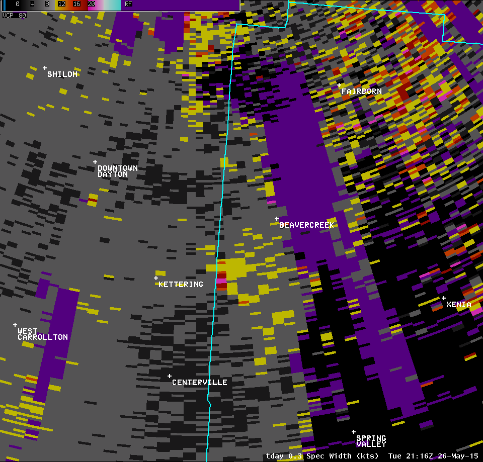 |
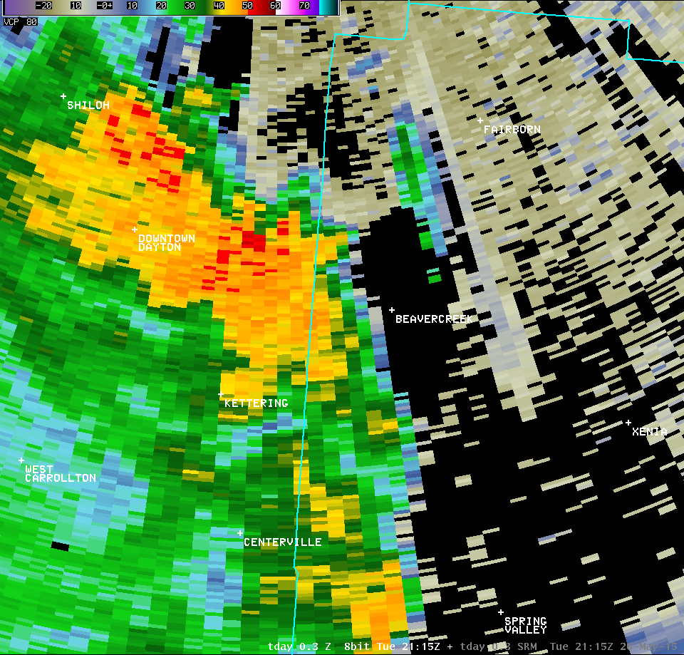
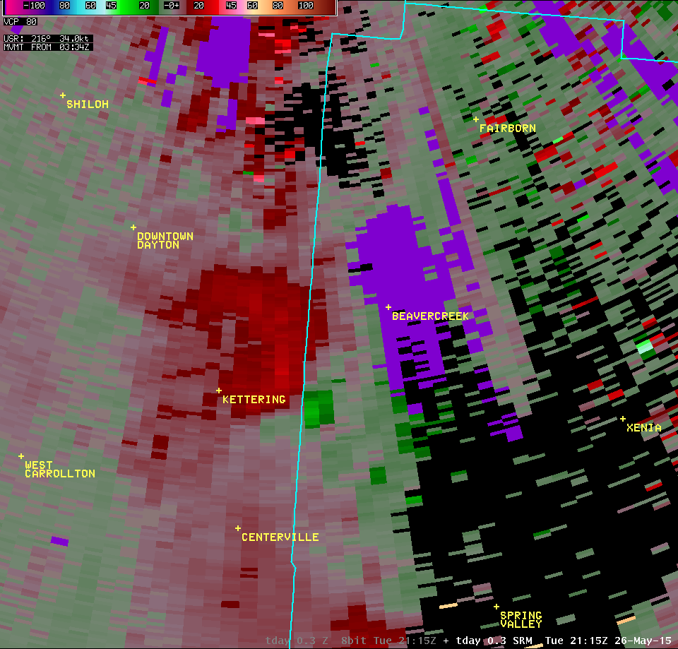
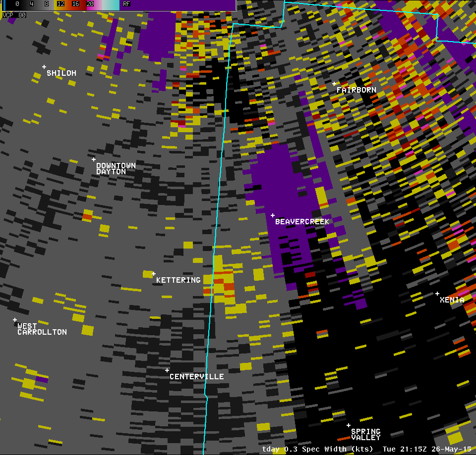
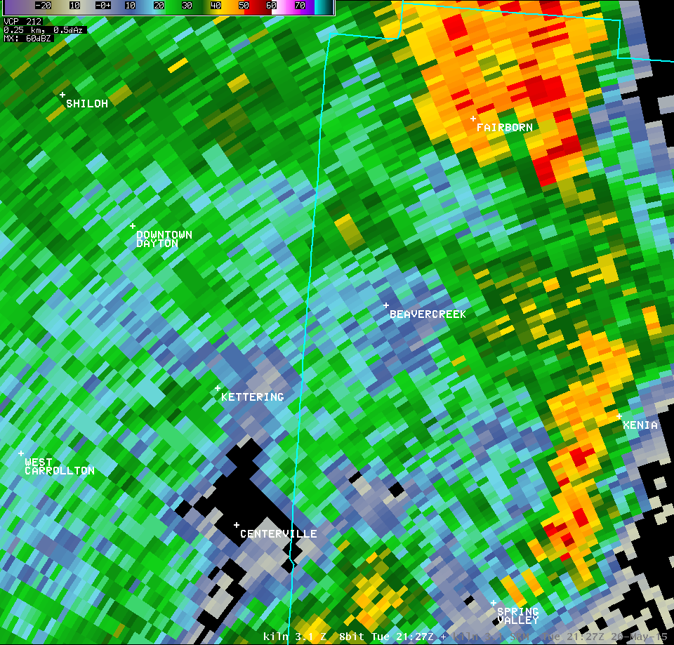
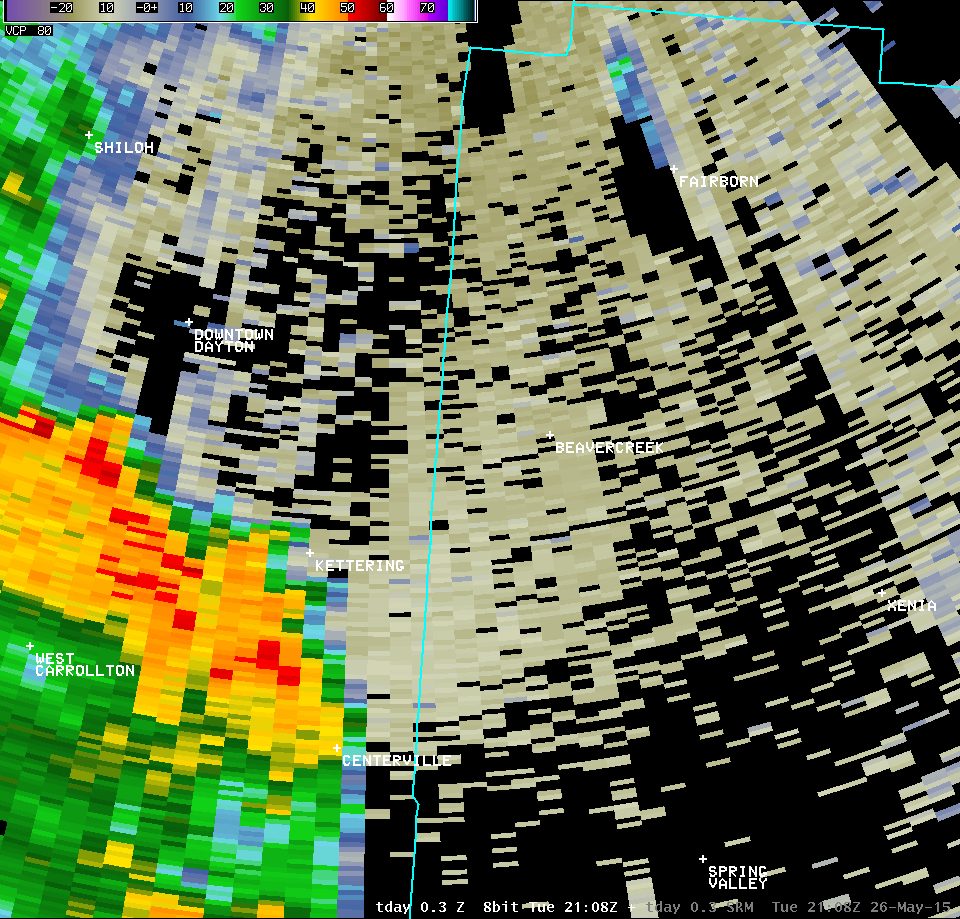
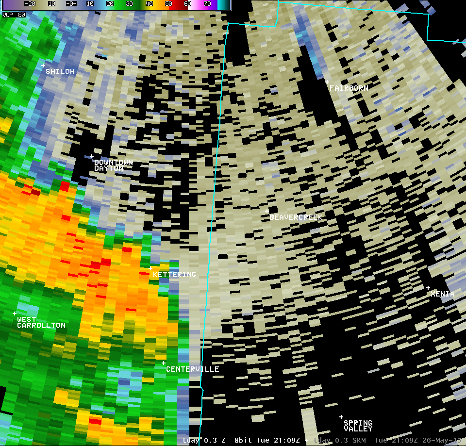
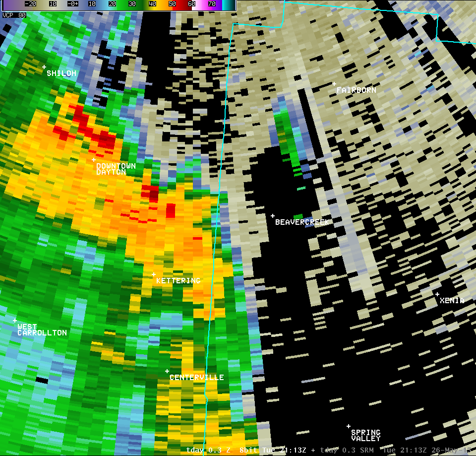
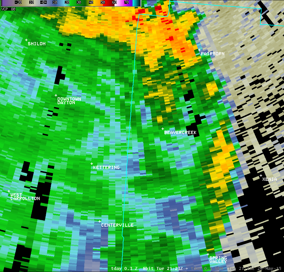
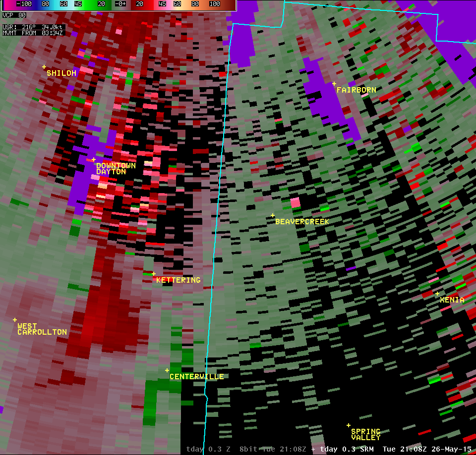
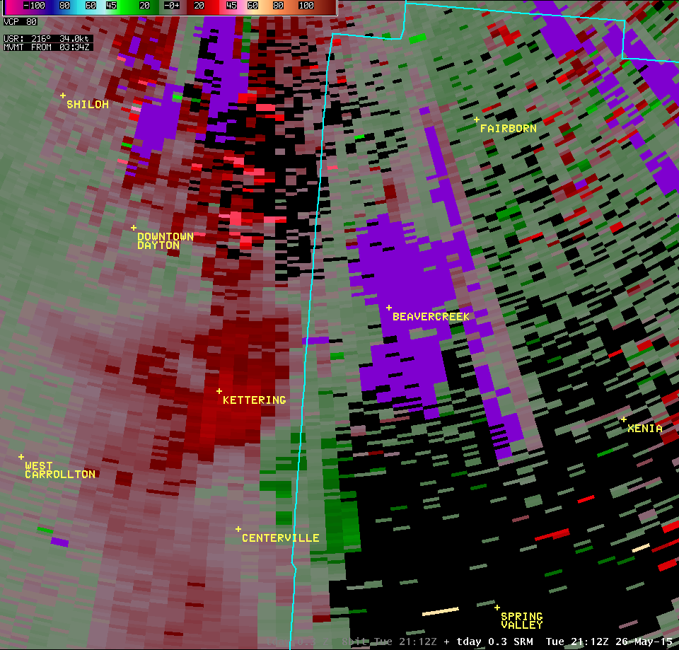
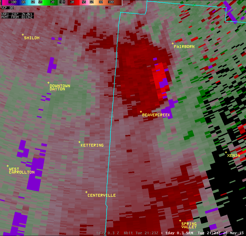
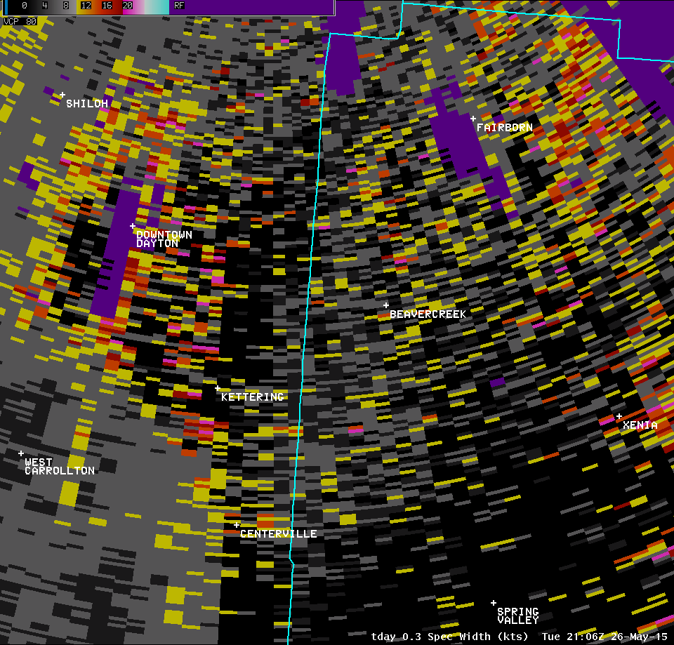
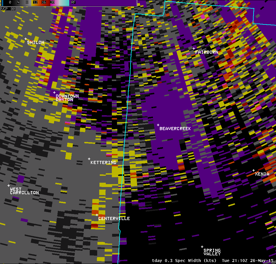
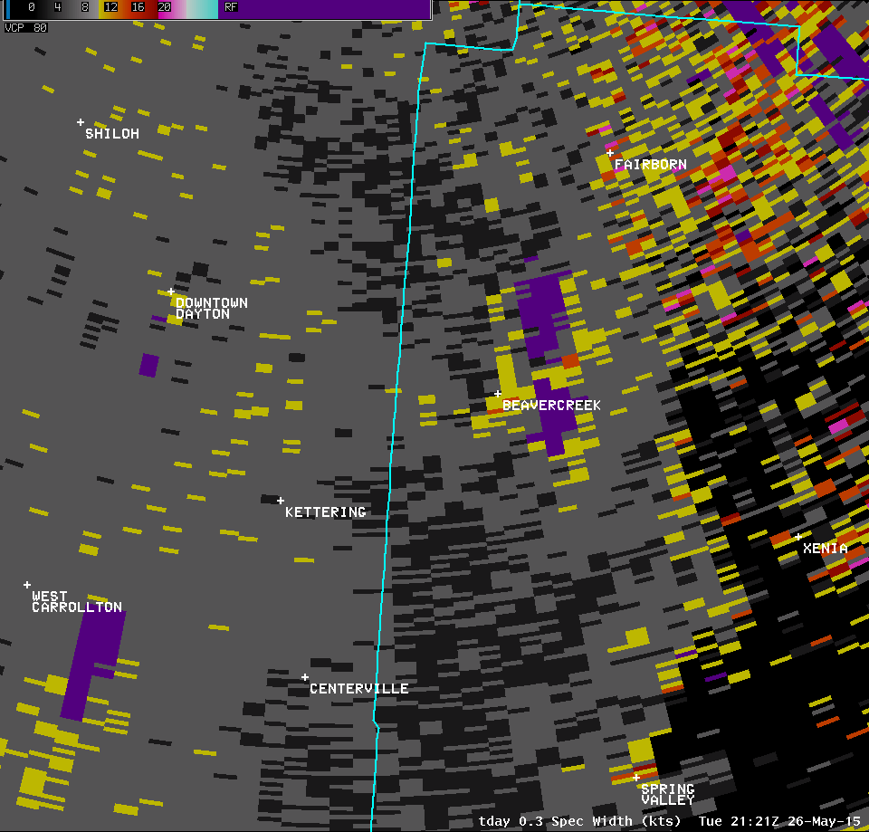
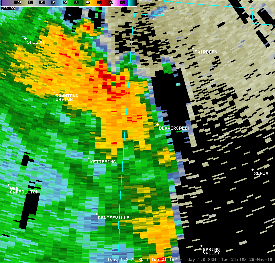
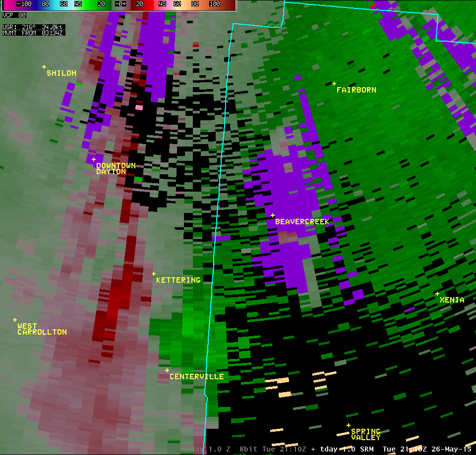
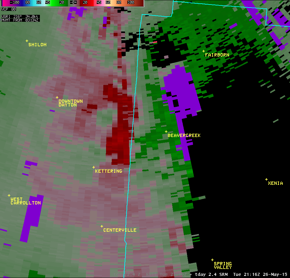
| 0.3° Z -- 5:17 PM | 0.3° SRM -- 5:17 PM | 0.3° SW -- 5:17 PM |
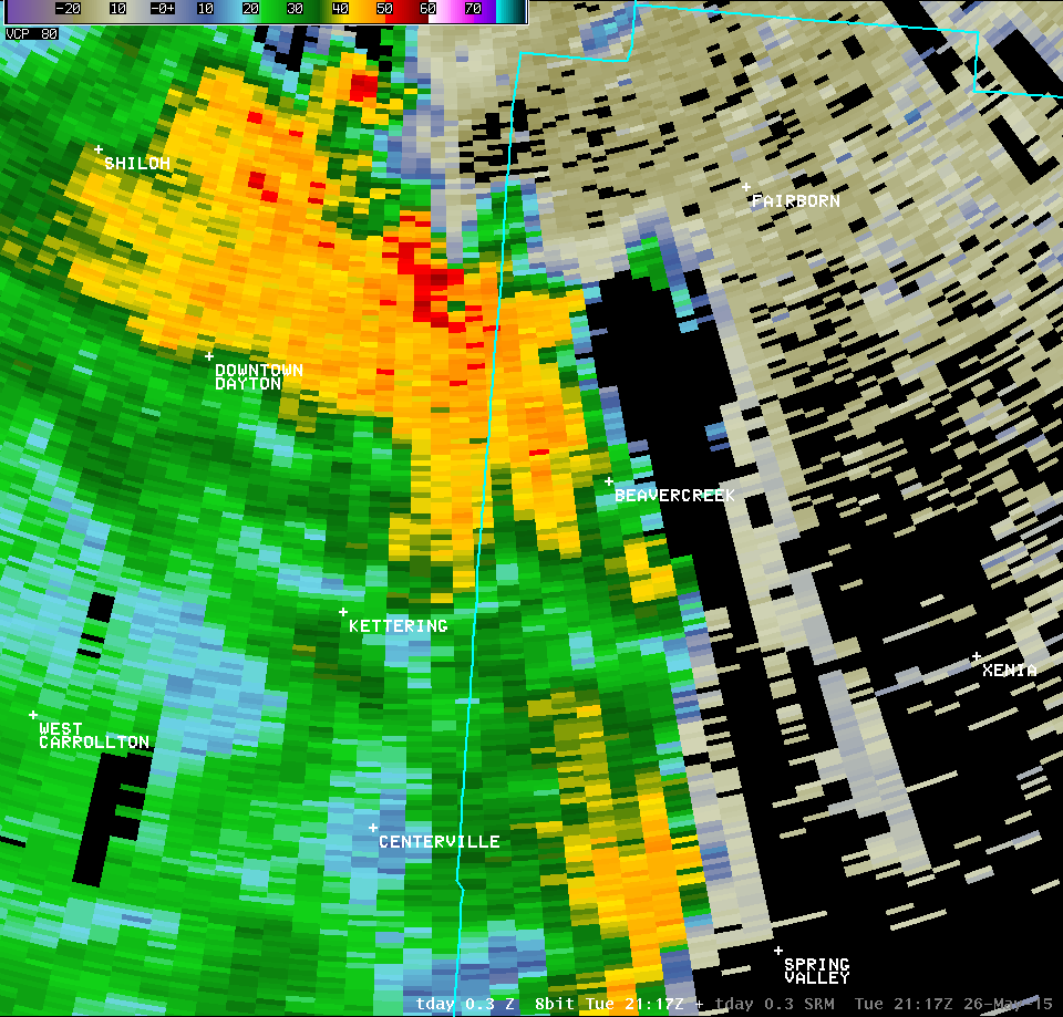 |
 |
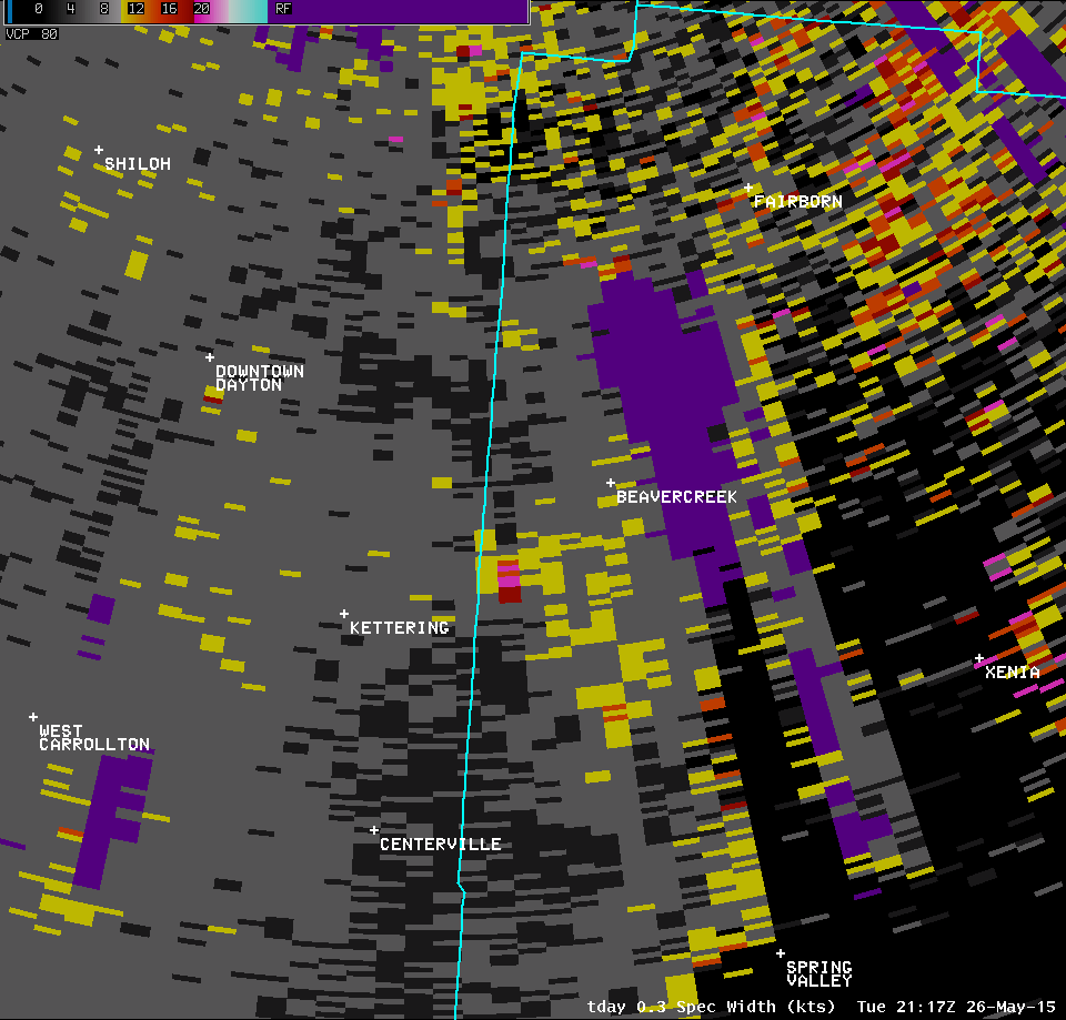 |
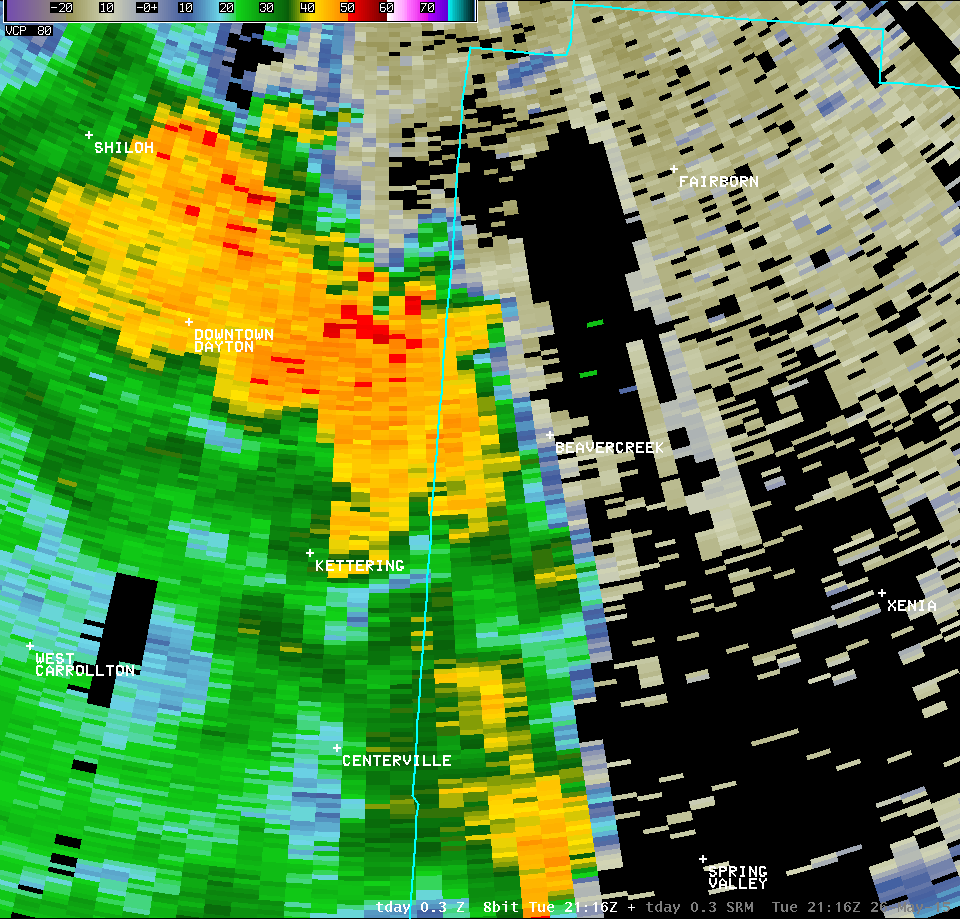
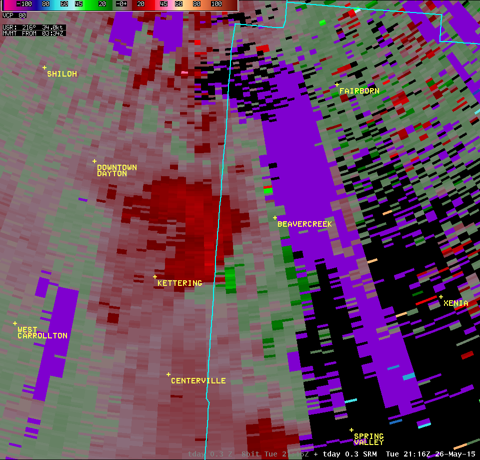
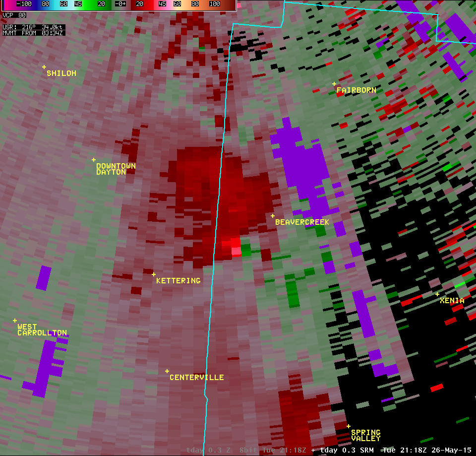
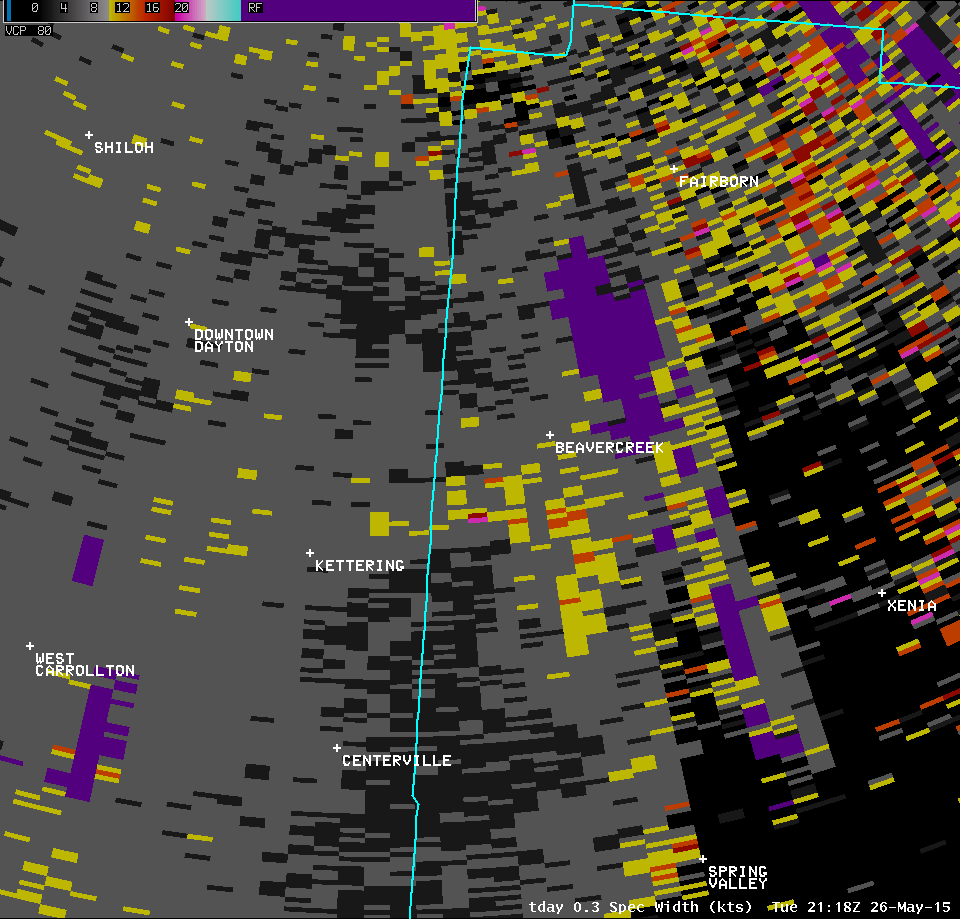
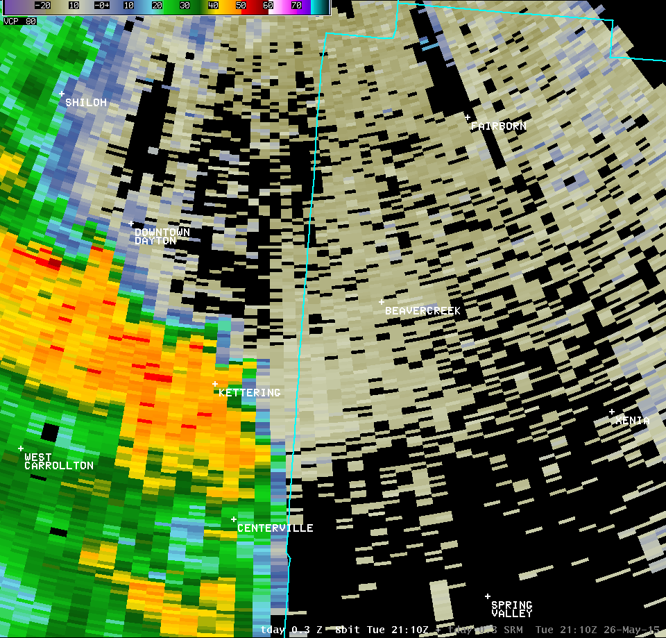
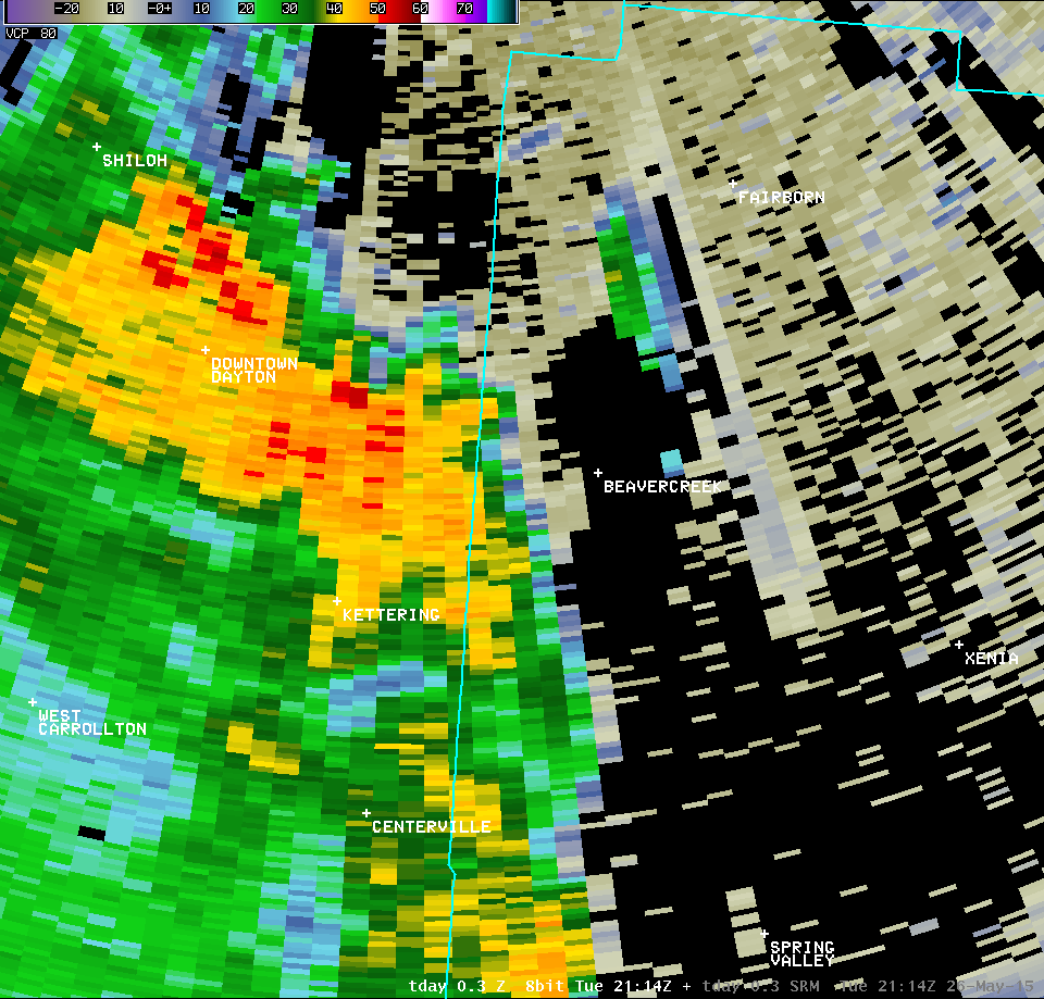
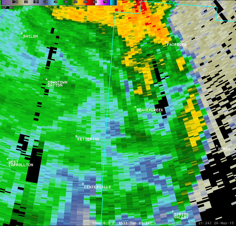
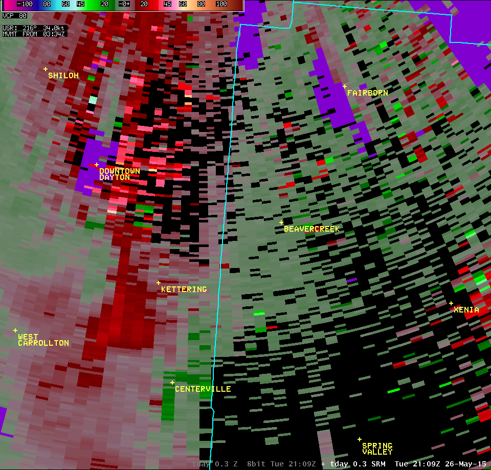
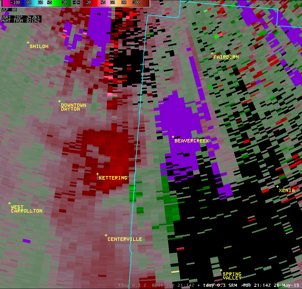
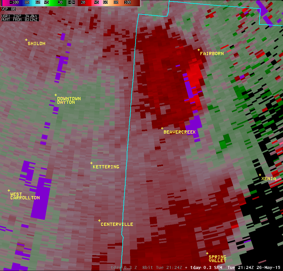
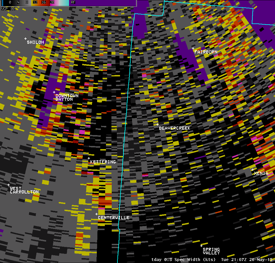
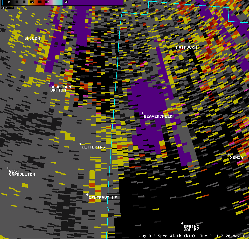
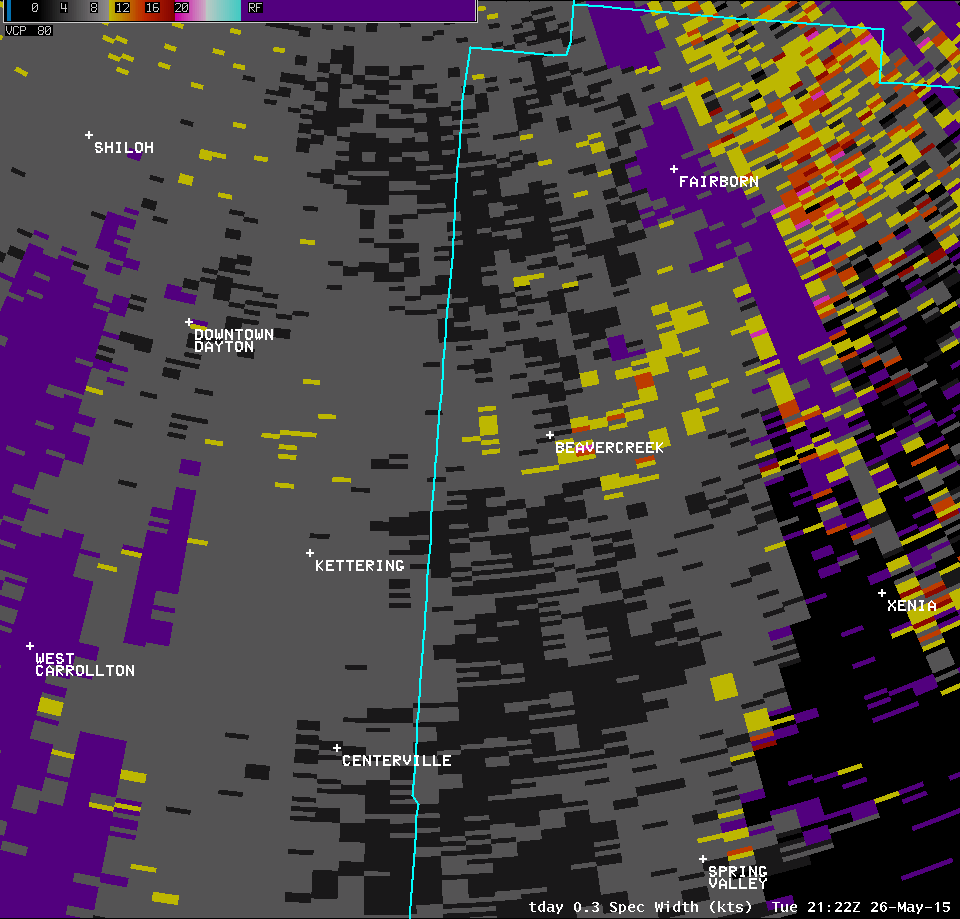
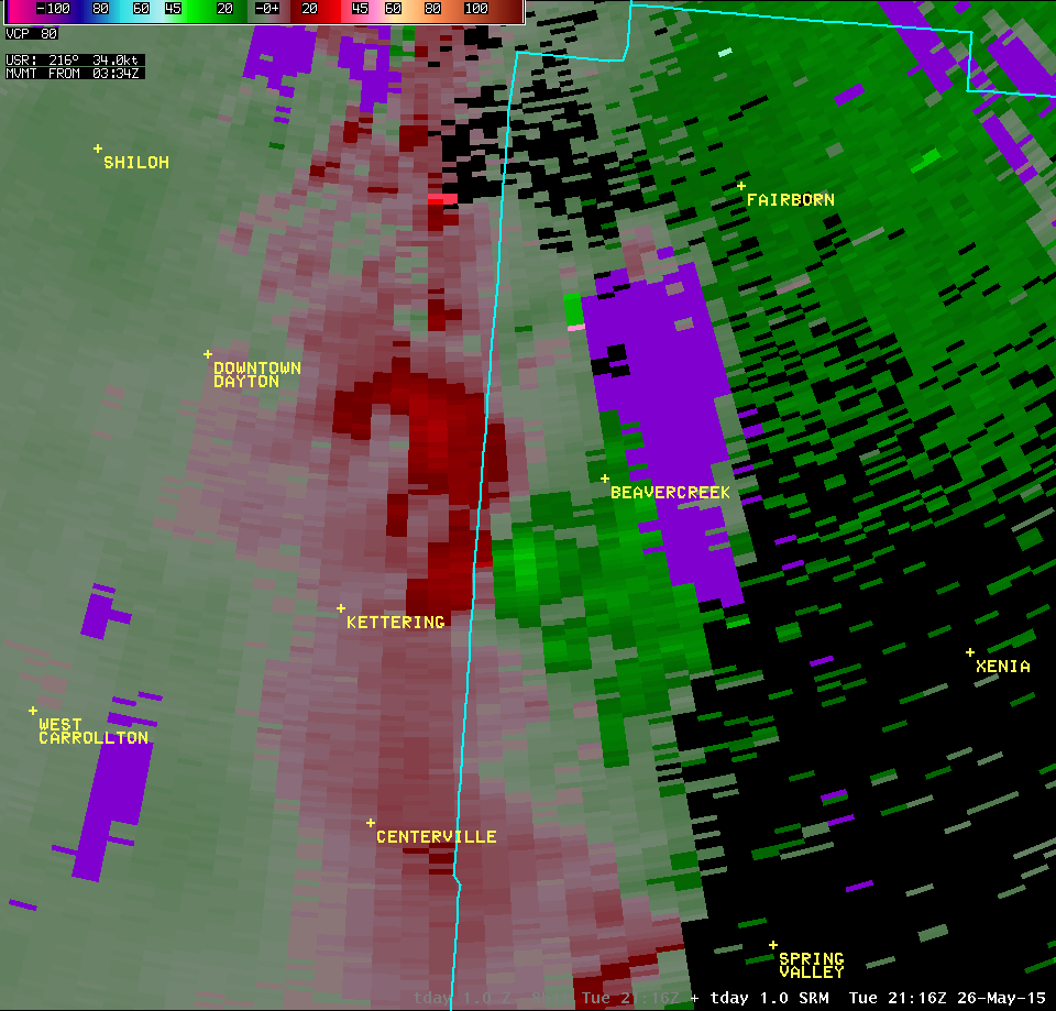
| 0.3° Z -- 5:18 PM | 0.3° SRM -- 5:18 PM | 0.3° SW -- 5:18 PM |
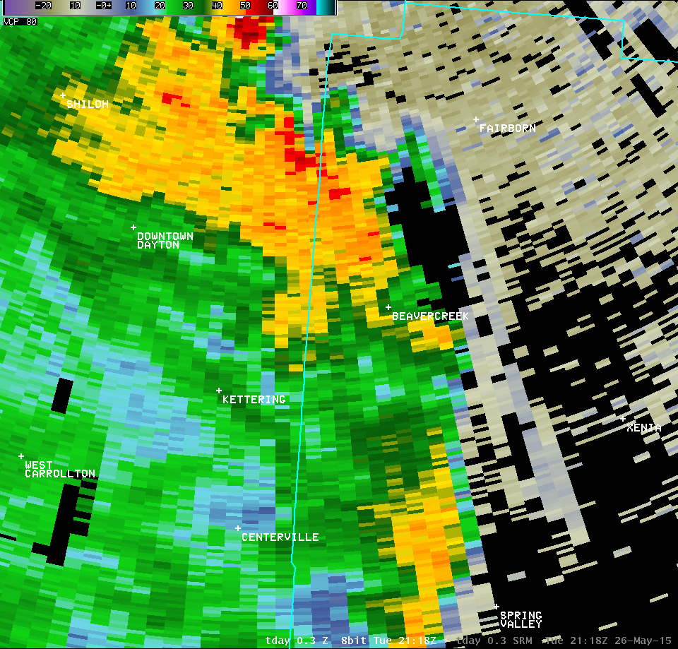 |
 |
 |
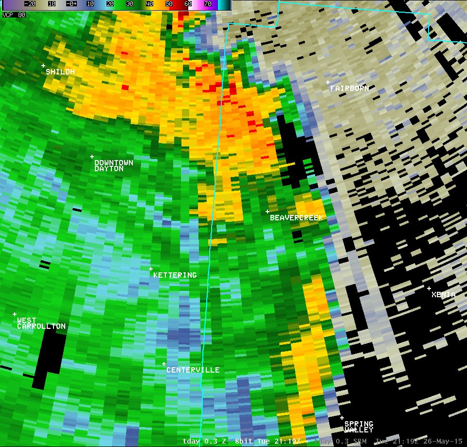
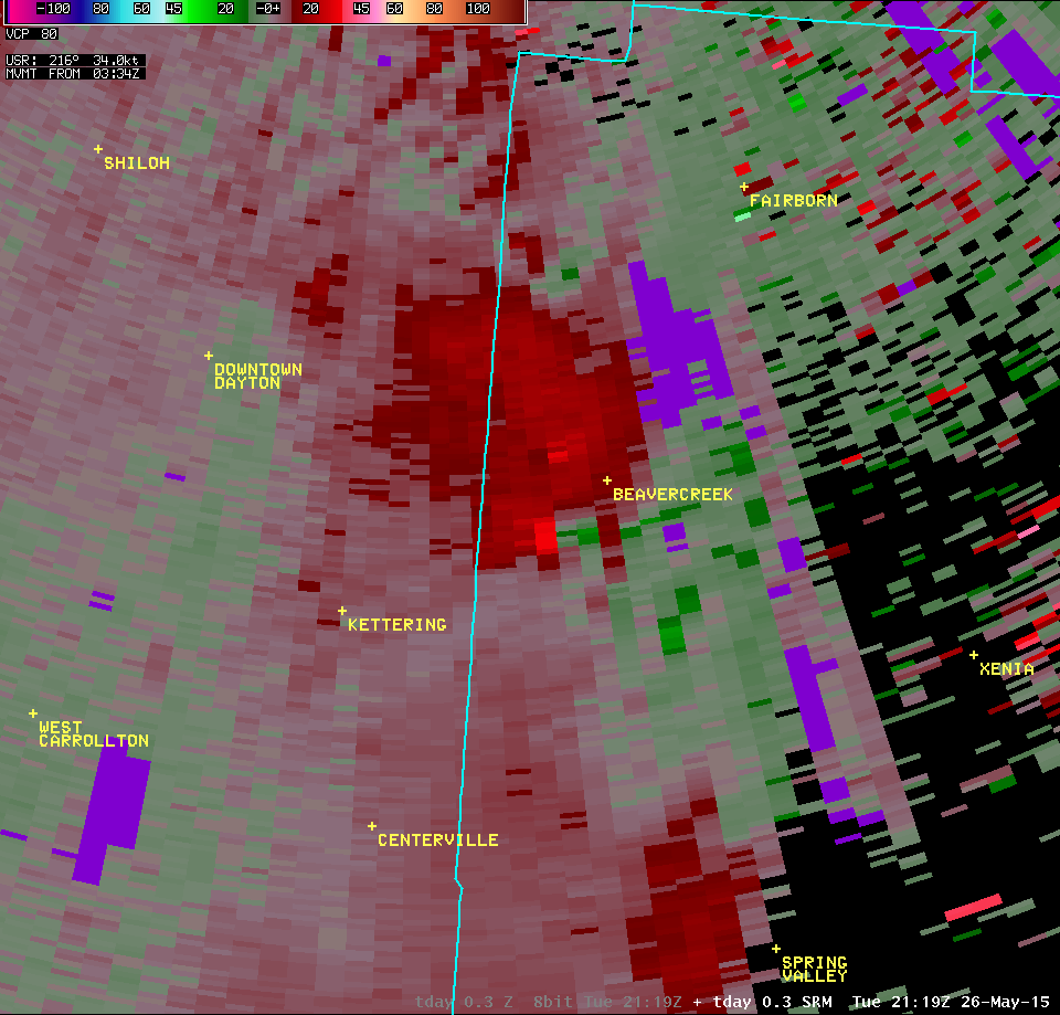
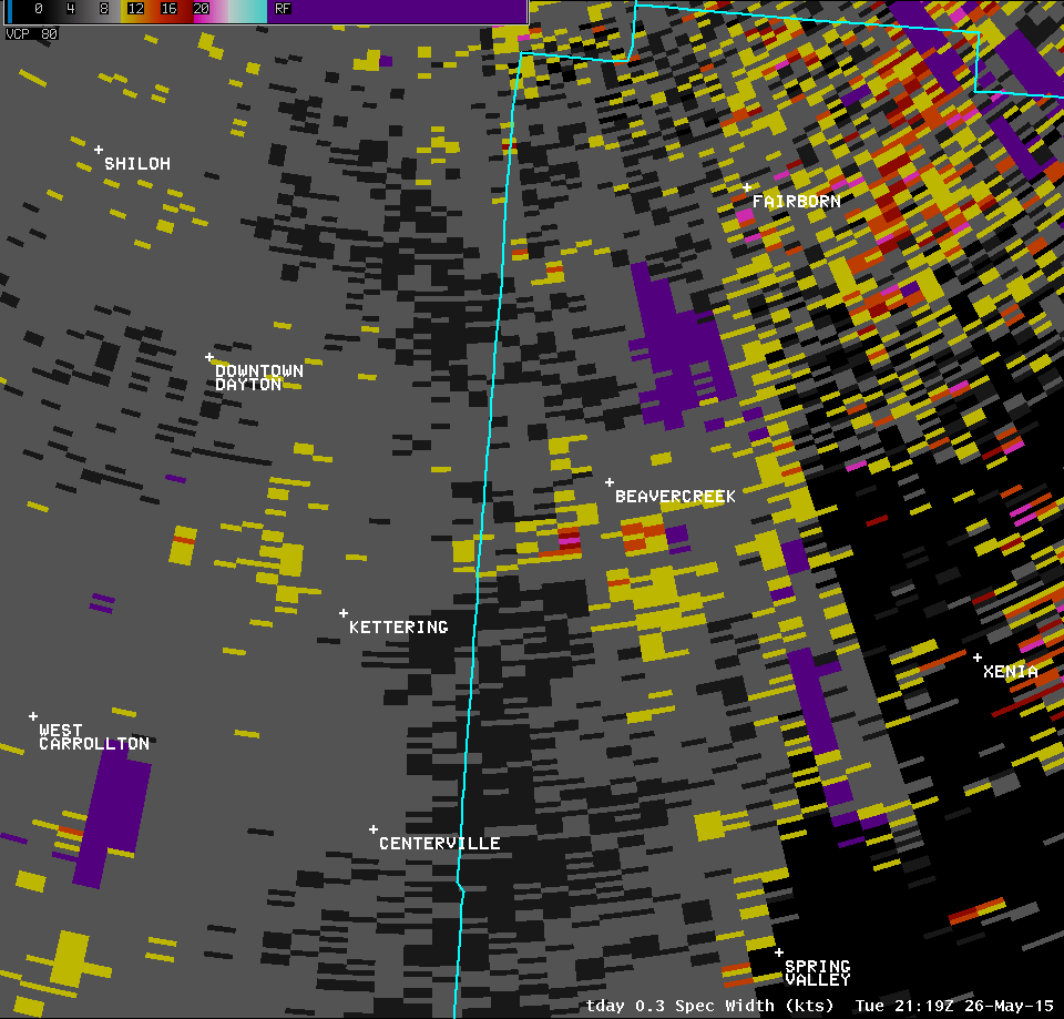
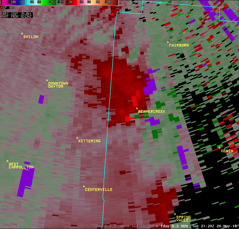
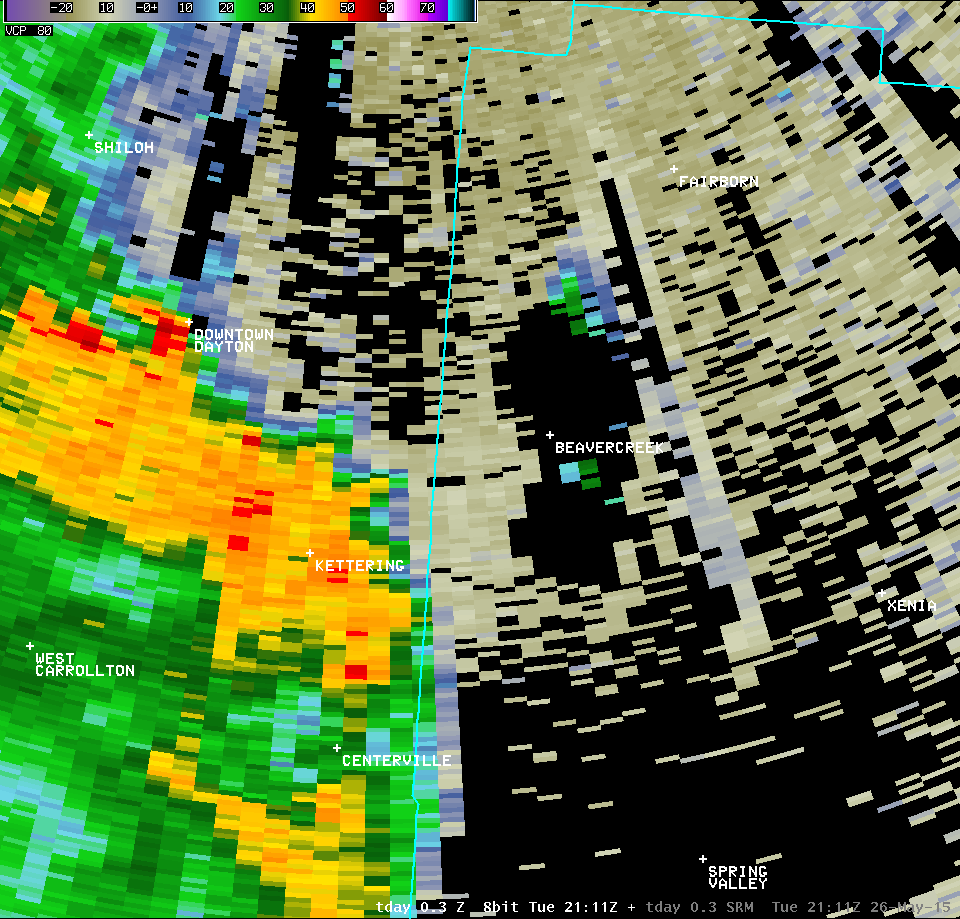
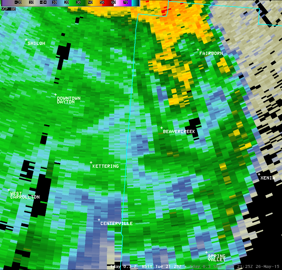
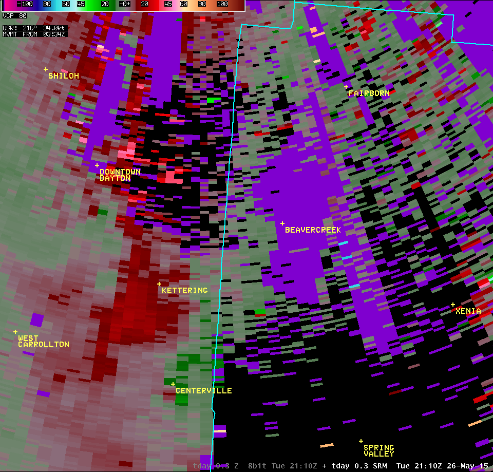
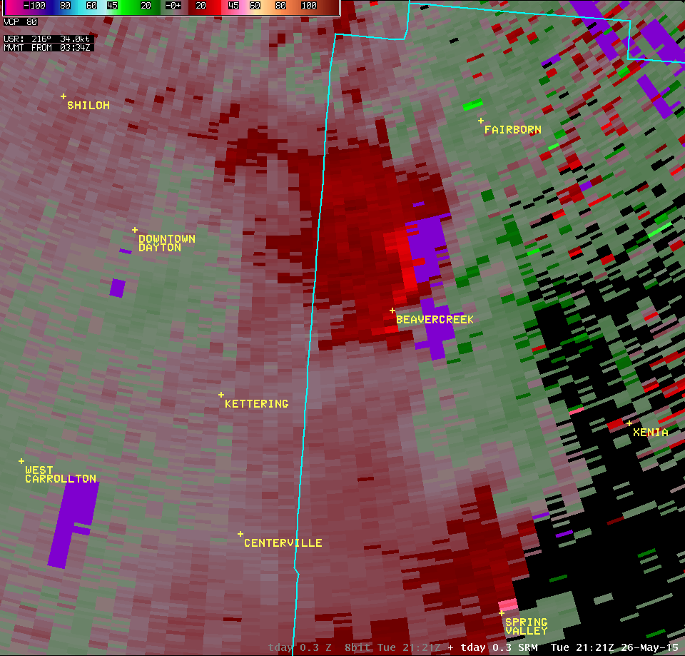
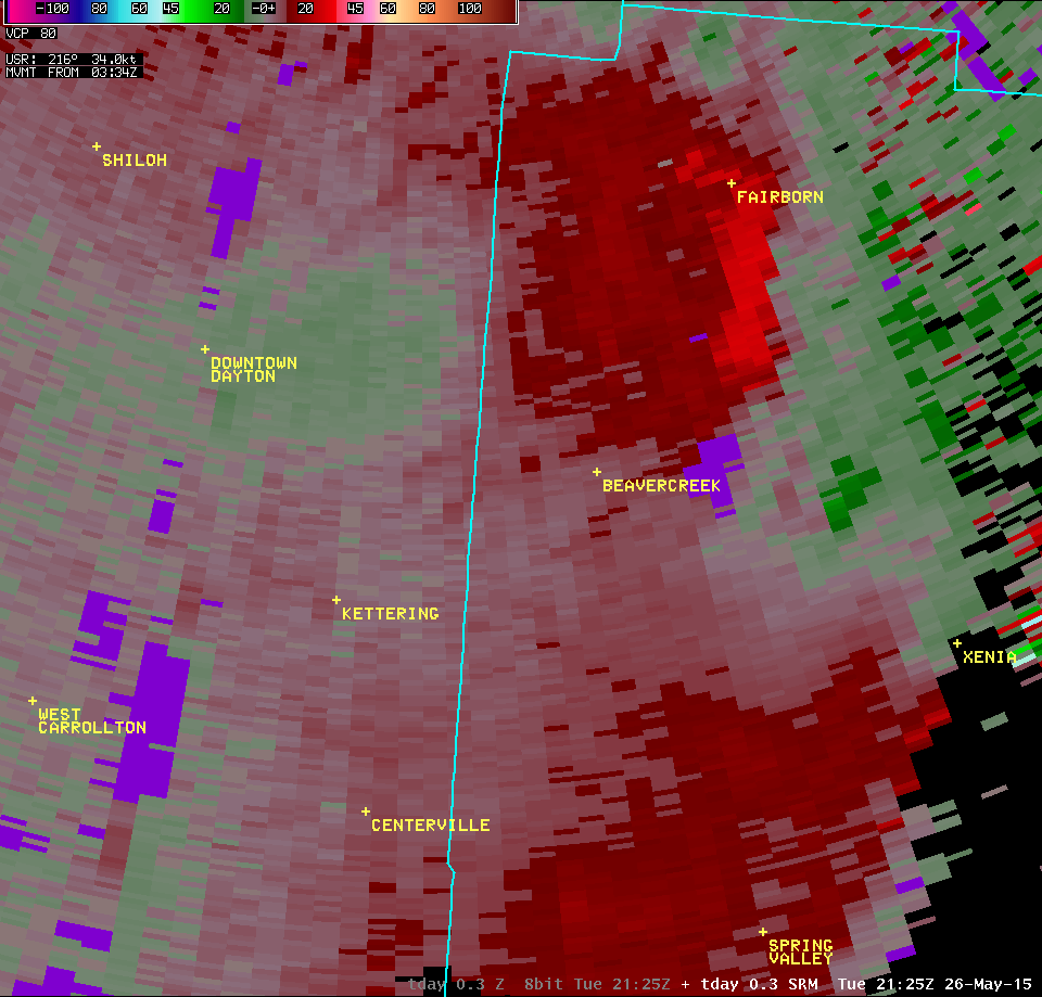
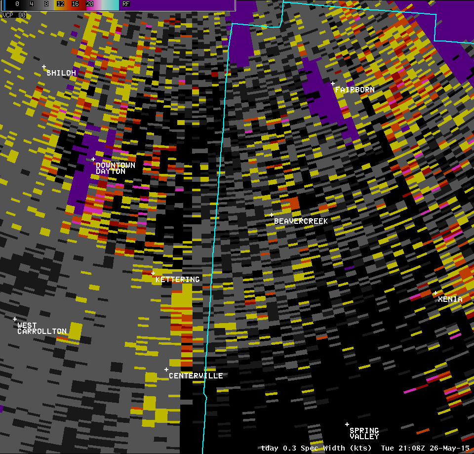
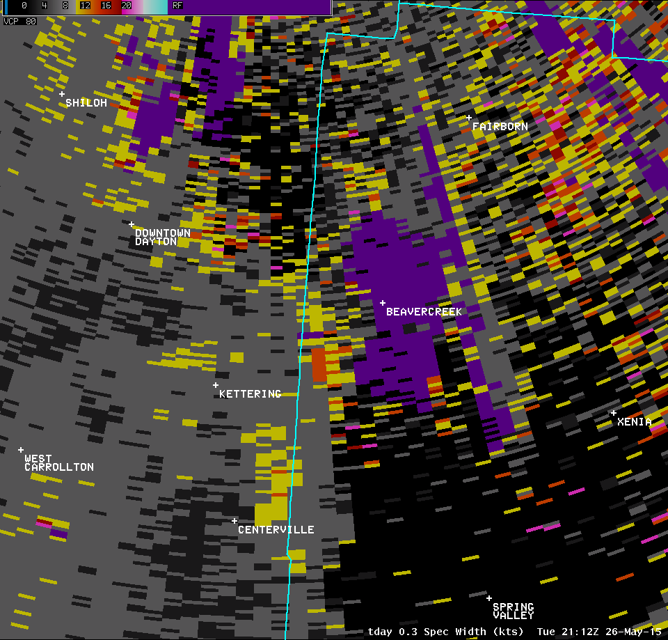
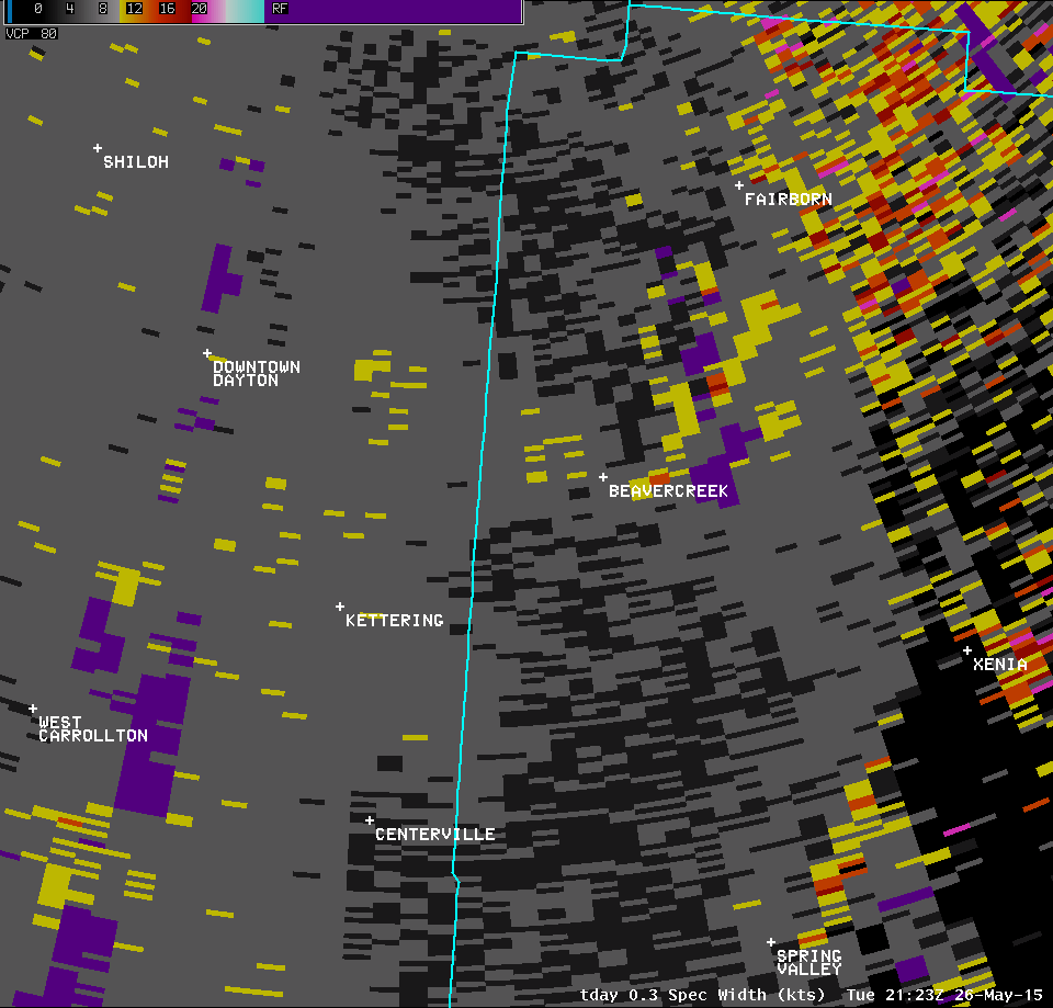
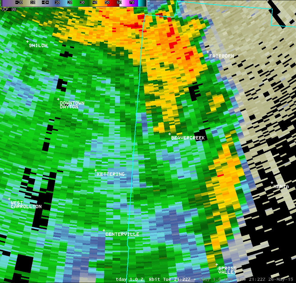
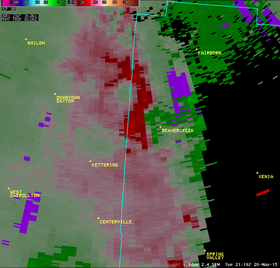
| 0.3° Z -- 5:19 PM | 0.3° SRM -- 5:19 PM | 0.3° SW -- 5:19 PM |
 |
 |
 |
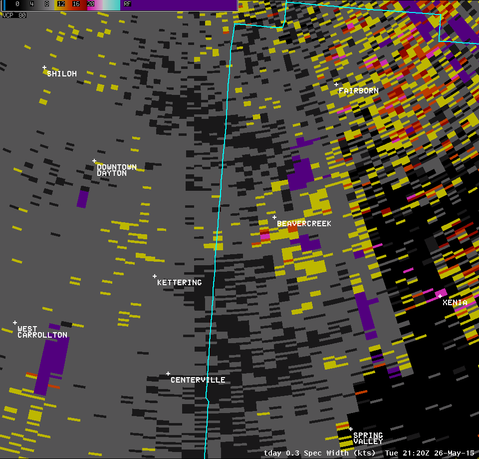
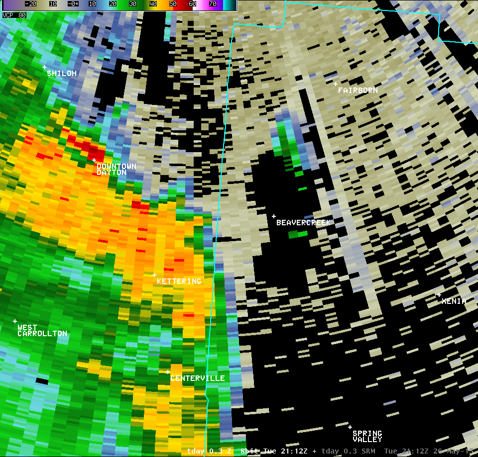
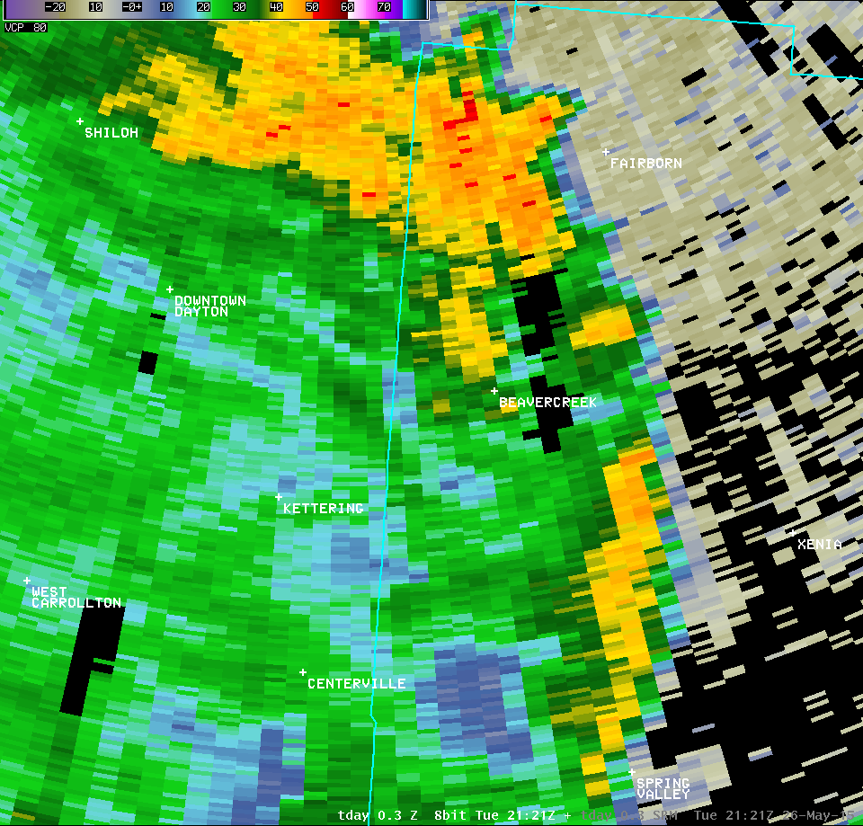
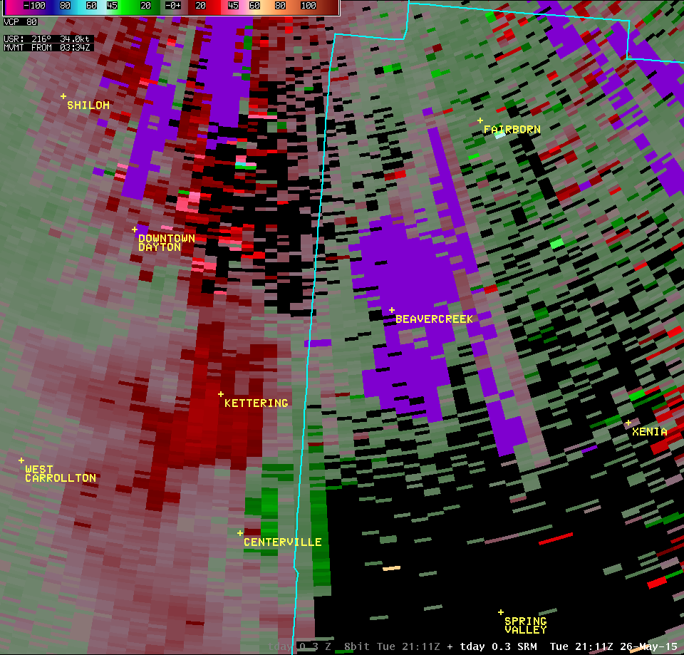
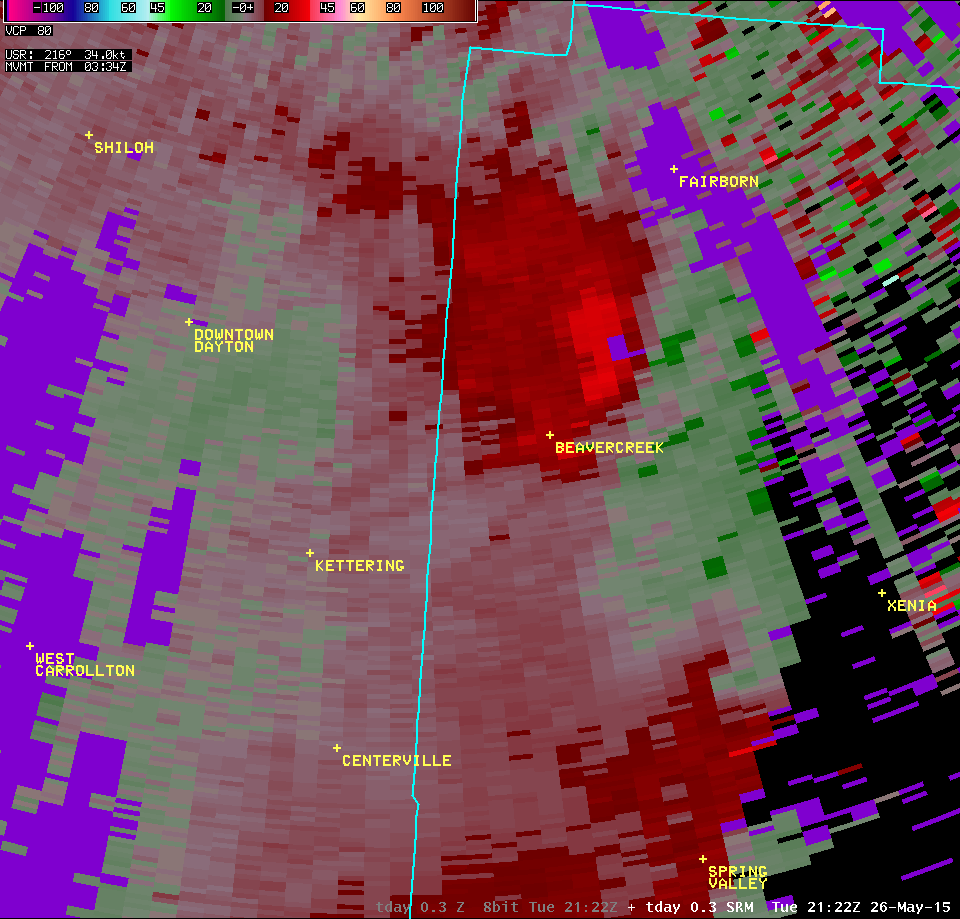
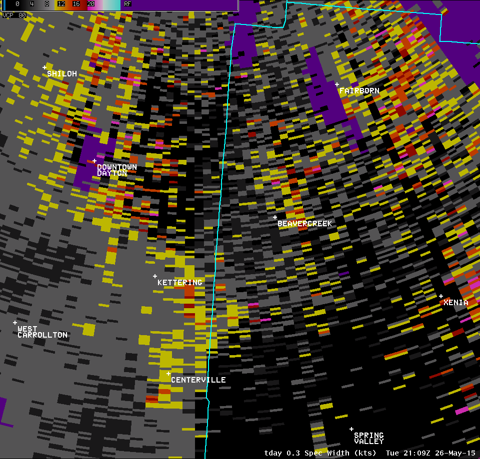
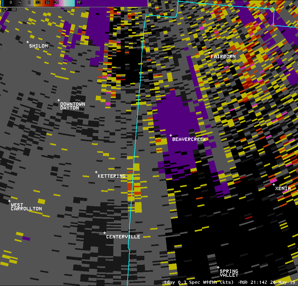
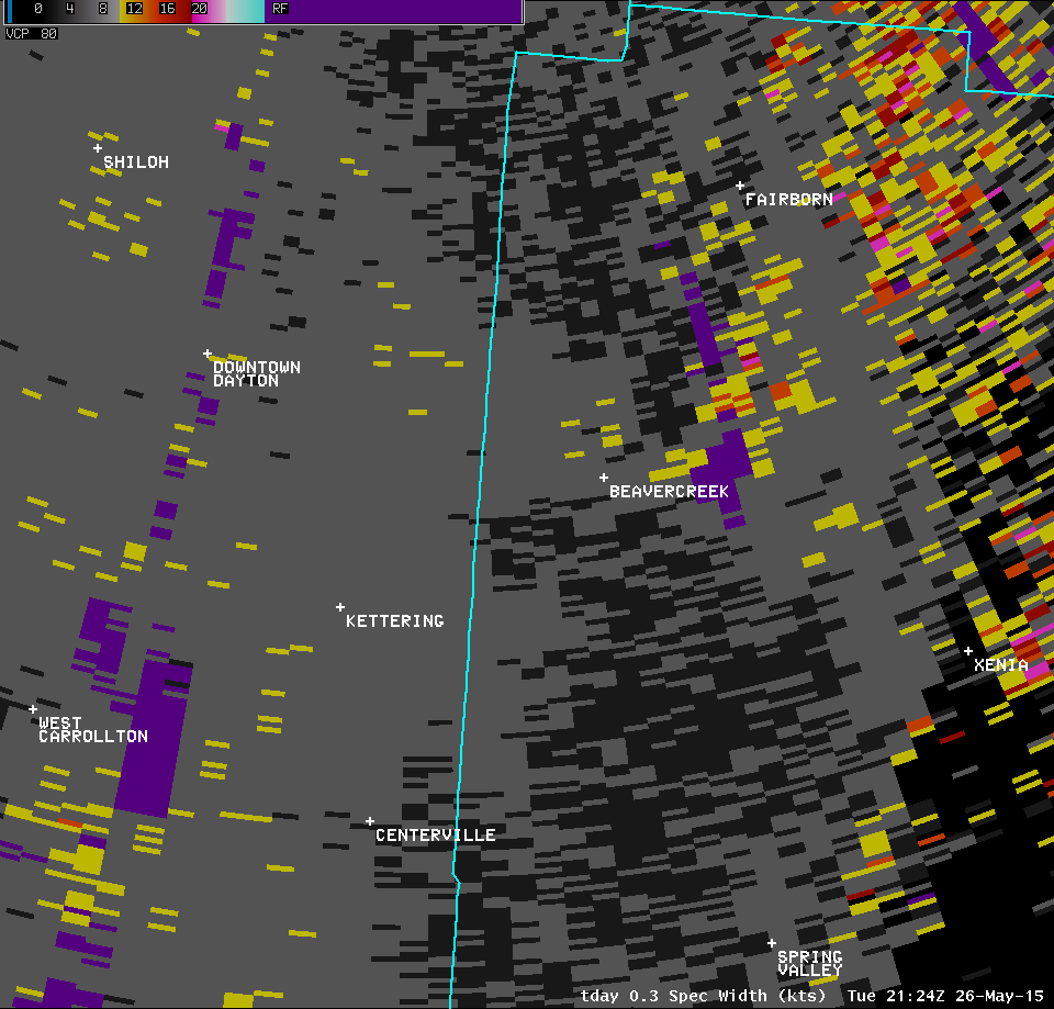
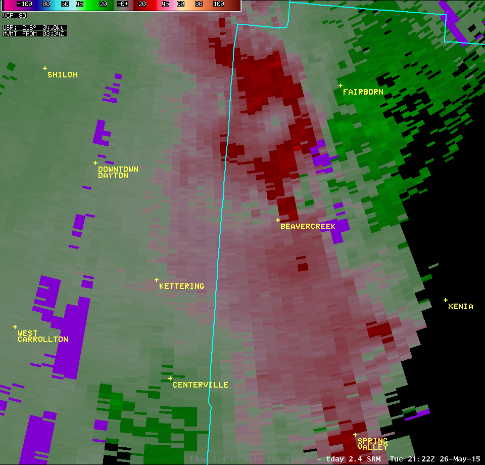
| 0.3° Z -- 5:20 PM | 0.3° SRM -- 5:20 PM | 0.3° SW -- 5:20 PM |
 |
 |
 |
| Full Radar Loops from the NWS Wilmington Ohio Radar (5:04 PM - 5:30 PM) | |
| KILN 0.5° Reflectivity (1600-1700 feet AGL) | KILN 0.5° Storm-Relative Motion (1600-1700 feet AGL) |
| 1 2 3 4 5 6 7 8 9 10 11 | Anim | 1 2 3 4 5 6 7 8 9 10 11 | Anim |
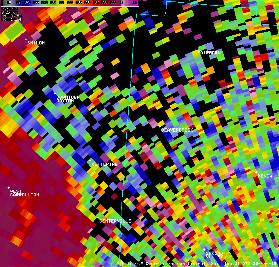
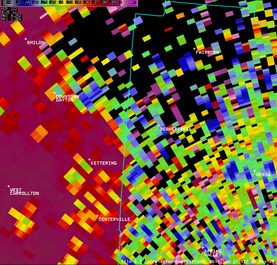
| KILN 0.5° Correlation Coefficient (1600-1700 feet AGL) | KILN 0.5° Differential Reflectivity (1600-1700 feet AGL) |
| 1 2 3 4 5 | 1 2 3 4 5 |
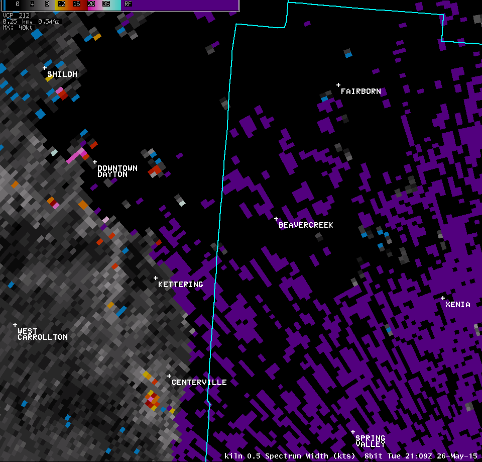
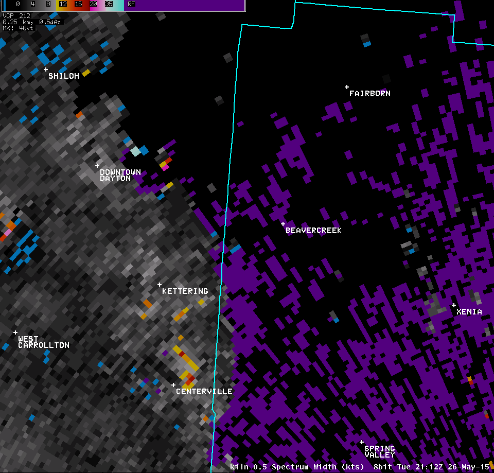
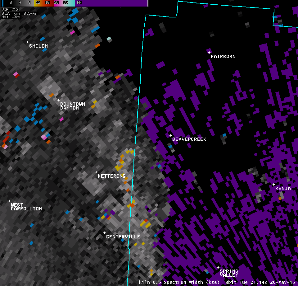
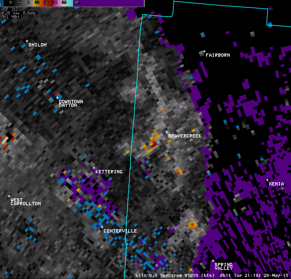
| KILN 0.5° Spectrum Width (1600-1700 feet AGL) | |
| 1 2 3 4 5 6 7 8 9 10 11 | |
| KILN 0.9° Reflectivity (2400-2600 feet AGL) | KILN 0.9° Storm-Relative Motion (2400-2600 feet AGL) |
| 1 2 3 4 5 | 1 2 3 4 5 |
| KILN 0.9° Correlation Coefficient (2400-2600 feet AGL) | KILN 0.9° Differential Reflectivity (2400-2600 feet AGL) |
| 1 2 3 4 5 | 1 2 3 4 5 |
| KILN 0.9° Spectrum Width (2400-2600 feet AGL) | |
| 1 2 3 4 5 | |
| KILN 1.3° Reflectivity (3400-3600 feet AGL) | KILN 1.3° Storm-Relative Motion (3400-3600 feet AGL) |
| 1 2 3 4 5 | 1 2 3 4 5 |
| KILN 1.3° Correlation Coefficient (3400-3600 feet AGL) | KILN 1.3° Differential Reflectivity (3400-3600 feet AGL) |
| 1 2 3 4 5 | 1 2 3 4 5 |
| KILN 1.3° Spectrum Width (3400-3600 feet AGL) | |
| 1 2 3 4 5 | |
| KILN 1.8° Reflectivity (4600-4800 feet AGL) | KILN 1.8° Storm-Relative Motion (4600-4800 feet AGL) |
| 1 2 3 4 5 | 1 2 3 4 5 |
| KILN 1.8° Correlation Coefficient (4600-4800 feet AGL) | |
| 1 2 3 4 5 | |
| KILN 2.4° Reflectivity (6000-6200 feet AGL) | KILN 2.4° Storm-Relative Motion (6000-6200 feet AGL) |
| 1 2 3 4 5 | 1 2 3 4 5 |
| KILN 2.4° Correlation Coefficient (6000-6200 feet AGL) | |
| 1 2 3 4 5 | |
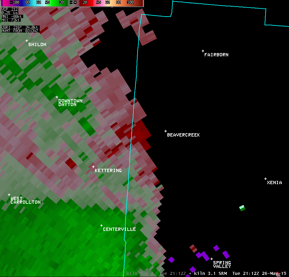
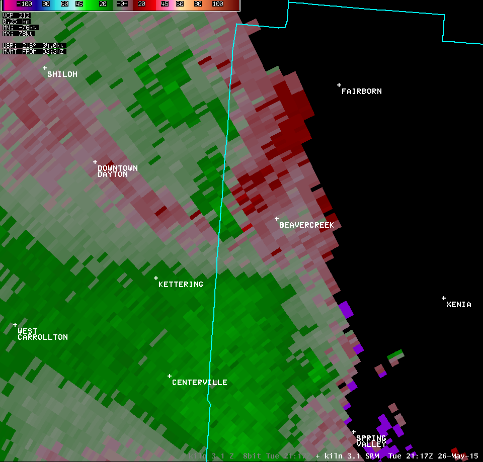
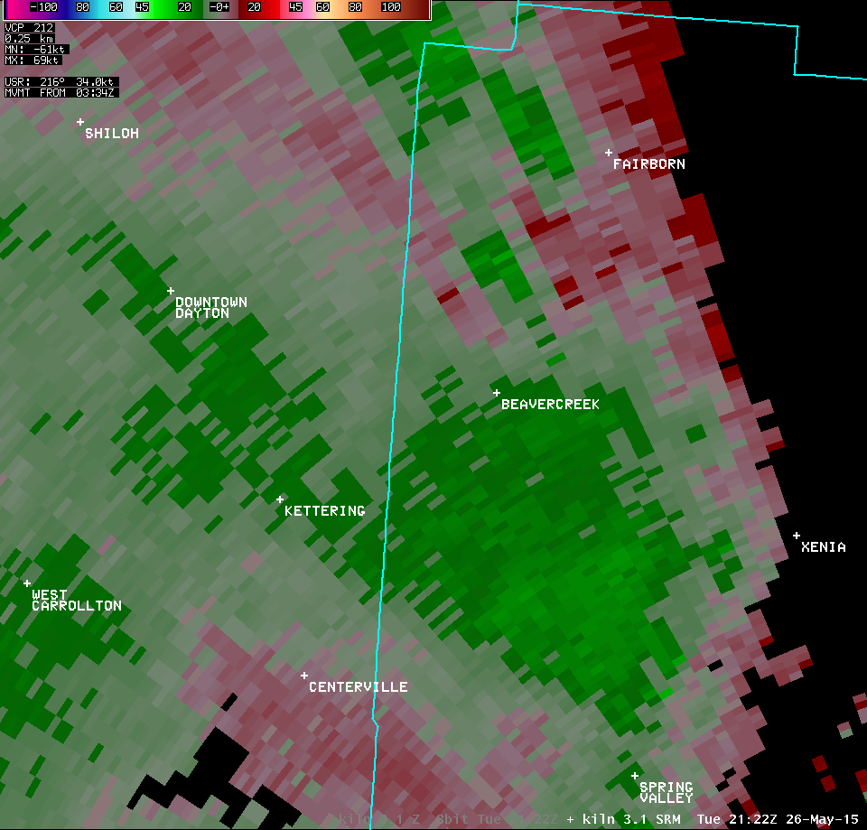
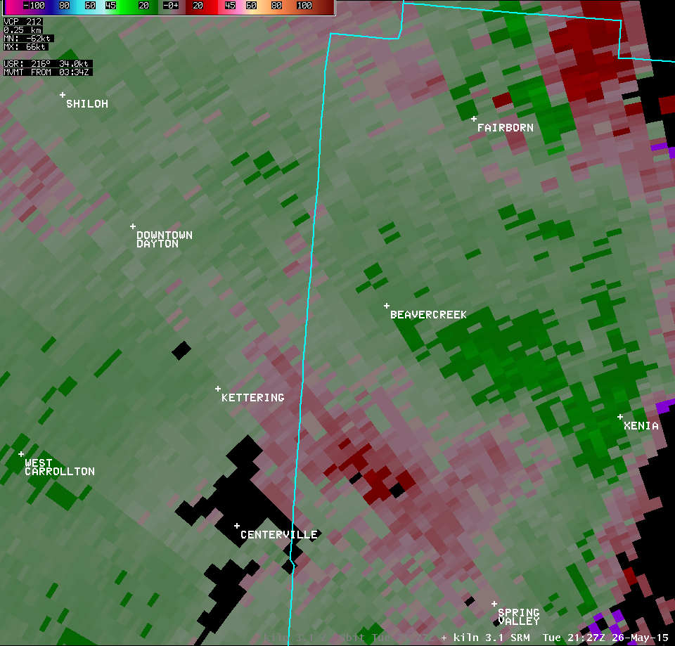
| KILN 3.1° Reflectivity (7600-7800 feet AGL) | KILN 3.1° Storm-Relative Motion (7600-7800 feet AGL) |
| 1 2 3 4 5 | 1 2 3 4 5 |
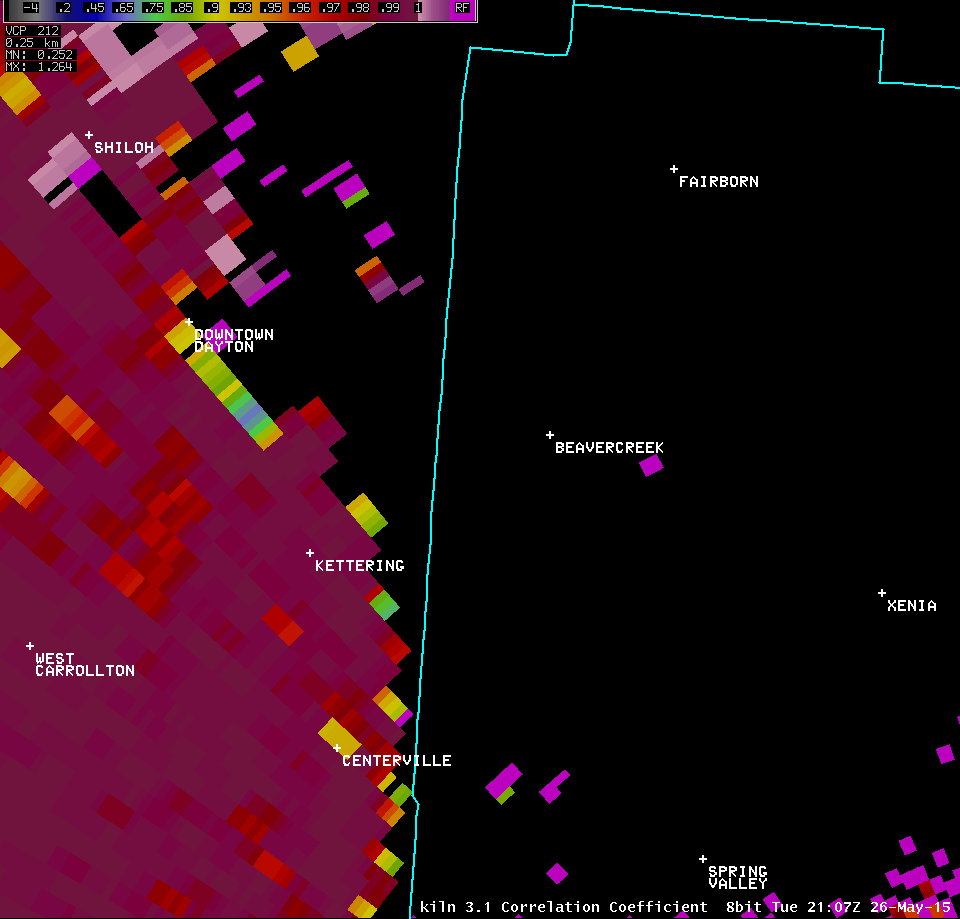
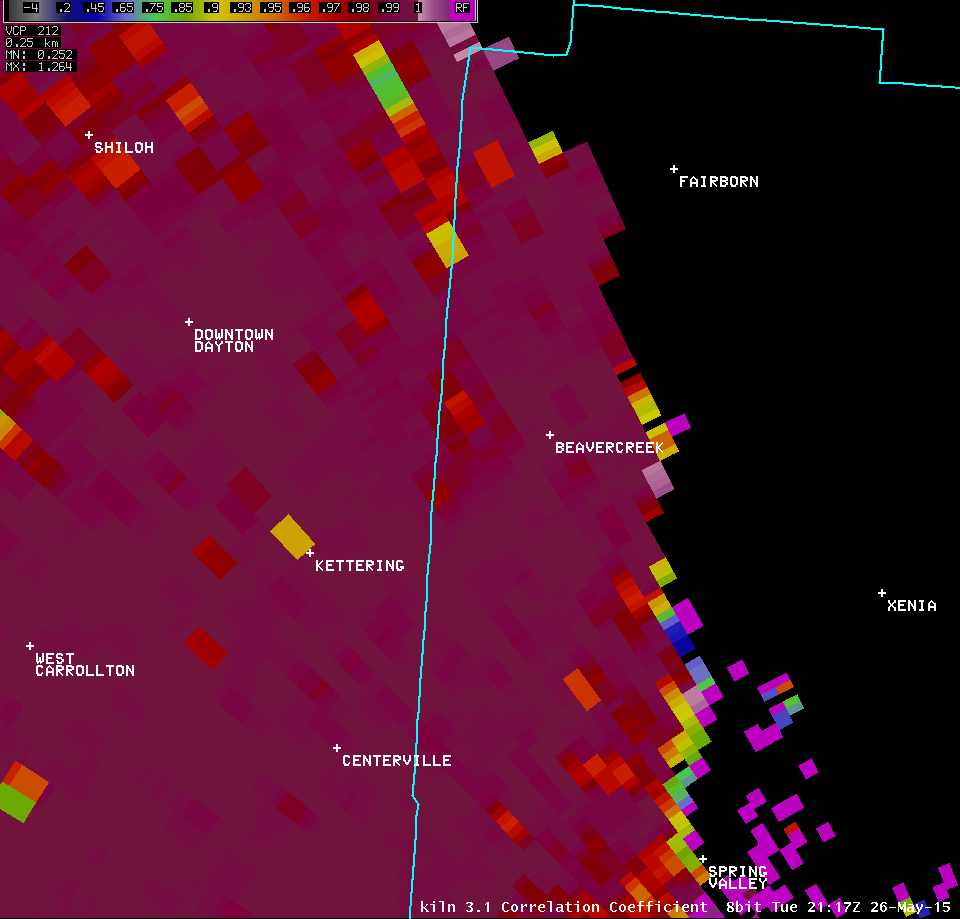
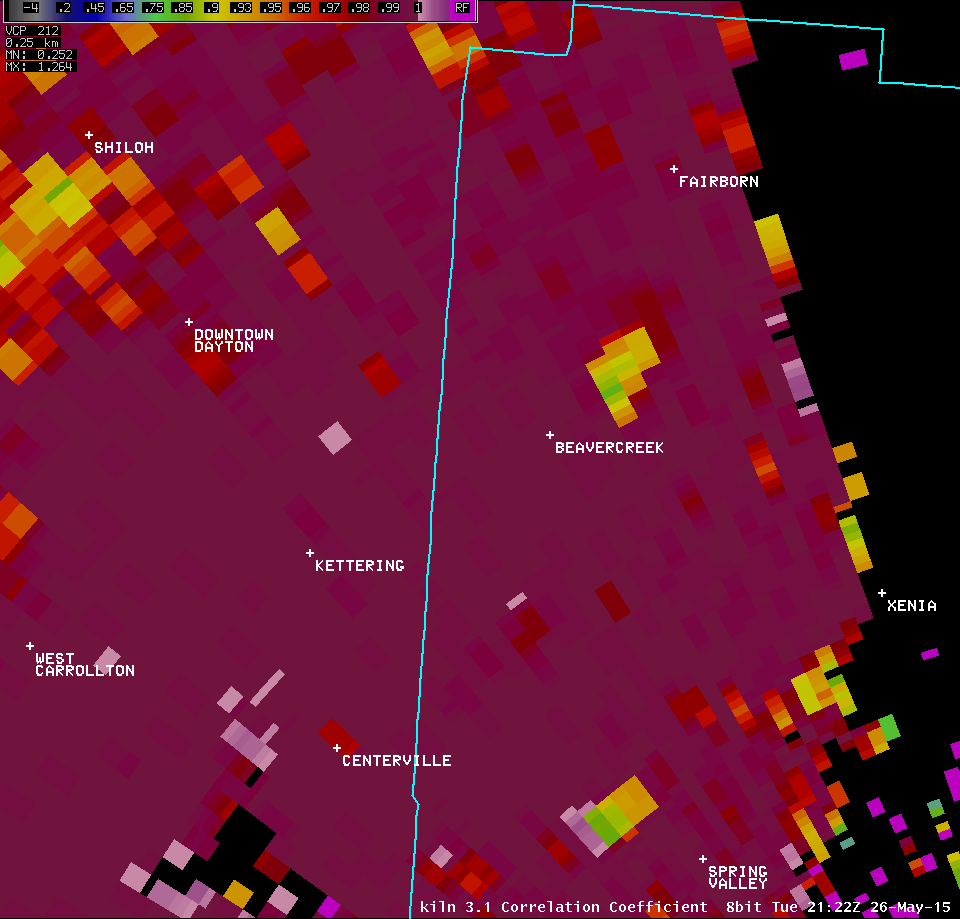
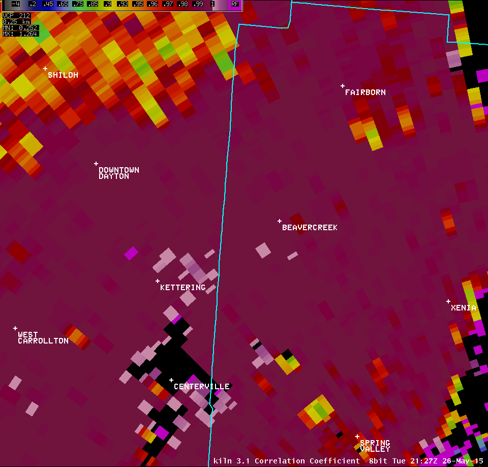
| KILN 3.1° Correlation Coefficient (7600-7800 feet AGL) | |
| 1 2 3 4 5 | |
| KILN 4.0° Reflectivity (9700-10000 feet AGL) | KILN 4.0° Storm-Relative Motion (9700-10000 feet AGL) |
| 1 2 3 4 5 | 1 2 3 4 5 |
| KILN 4.0° Correlation Coefficient (9700-10000 feet AGL) | |
| 1 2 3 4 5 | |
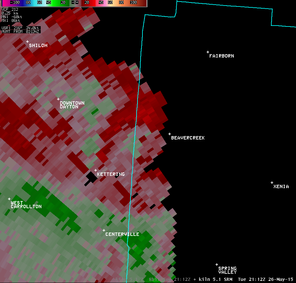
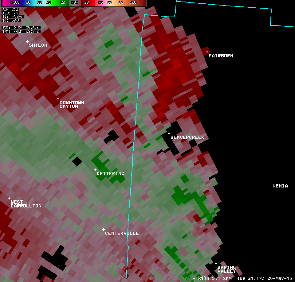
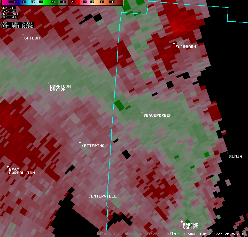
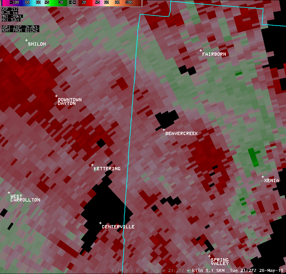
| KILN 5.1° Reflectivity (12300-12700 feet AGL) | KILN 5.1° Storm-Relative Motion (12300-12700 feet AGL) |
| 1 2 3 4 5 | 1 2 3 4 5 |
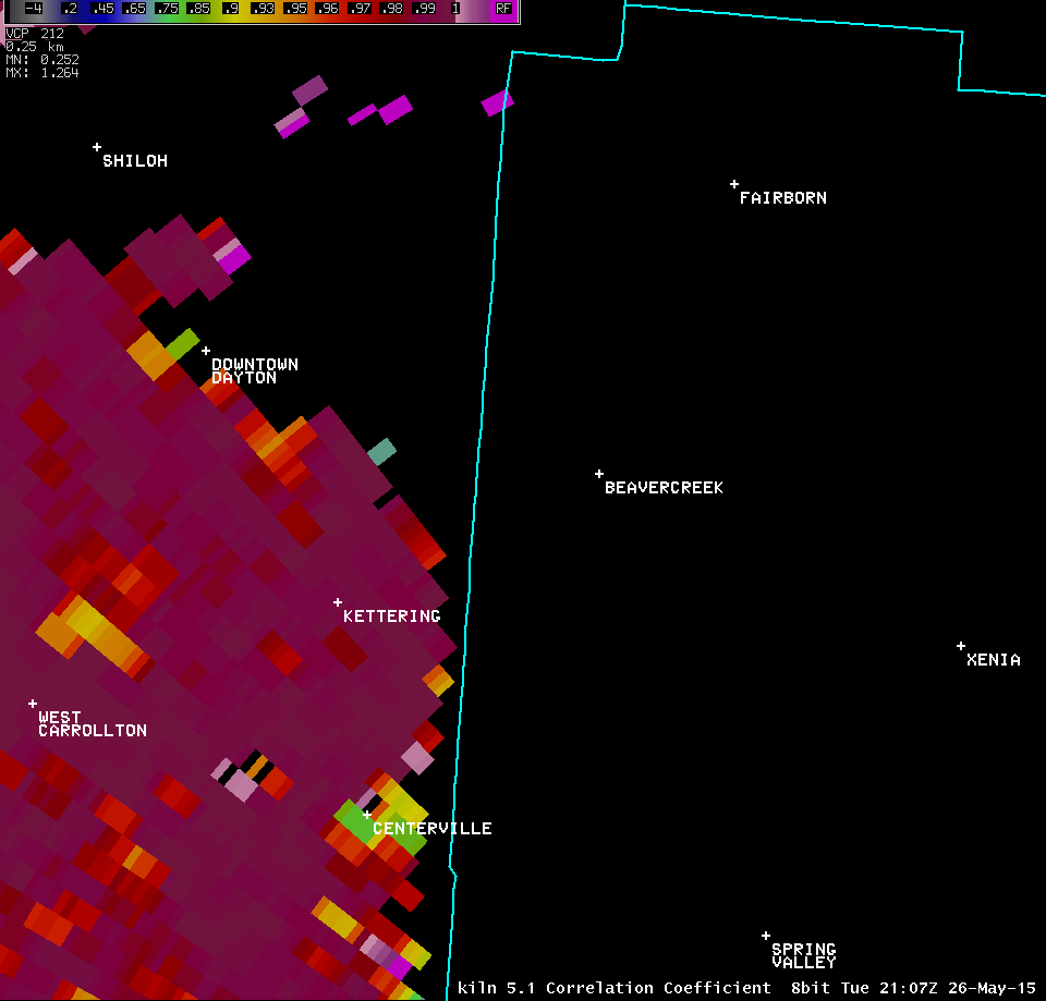
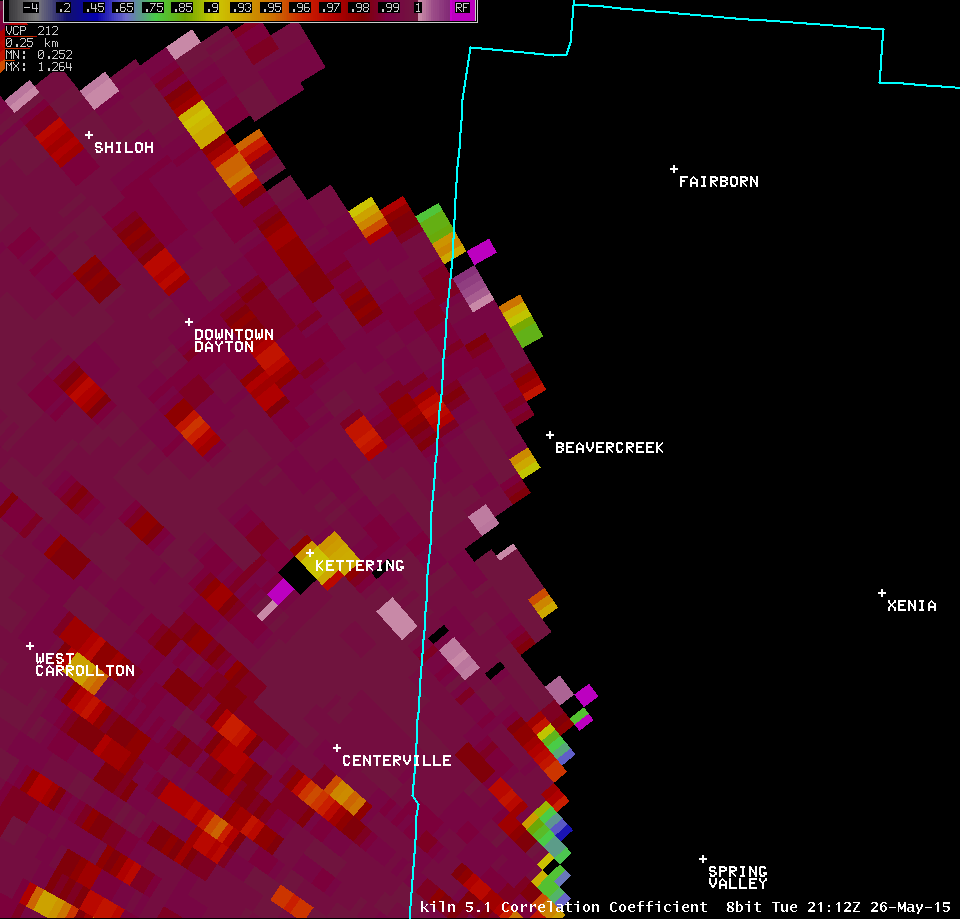
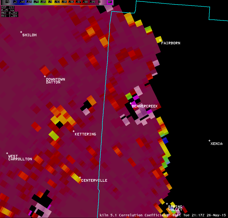
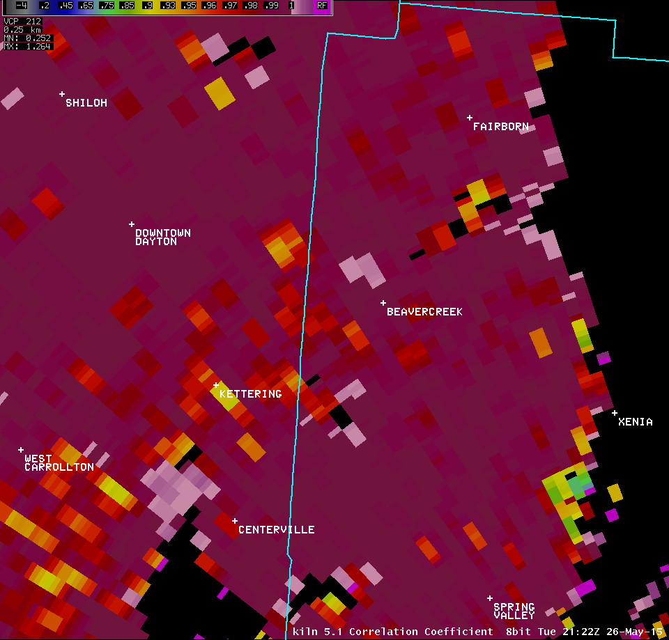
| KILN 5.1° Correlation Coefficient (12300-12700 feet AGL) | |
| 1 2 3 4 5 | |
| Full Radar Loops from the Dayton Terminal Doppler Weather Radar (5:06 PM - 5:25 PM) | |
| TDAY 0.3° Reflectivity (800-900 feet AGL) | TDAY 0.3° Storm-Relative Motion (800-900 feet AGL) |
| 1 2 3 4 5 6 7 8 9 10 11 12 13 14 15 16 17 18 19 20 | Anim | 1 2 3 4 5 6 7 8 9 10 11 12 13 14 15 16 17 18 19 20 | Anim |
| TDAY 0.3° Spectrum Width (800-900 feet AGL) | |
| 1 2 3 4 5 6 7 8 9 10 11 12 13 14 15 16 17 18 19 20 | |
| TDAY 1.0° Reflectivity (2100-2300 feet AGL) | TDAY 1.0° Storm-Relative Motion (2100-2300 feet AGL) |
| 1 2 3 | 1 2 3 |
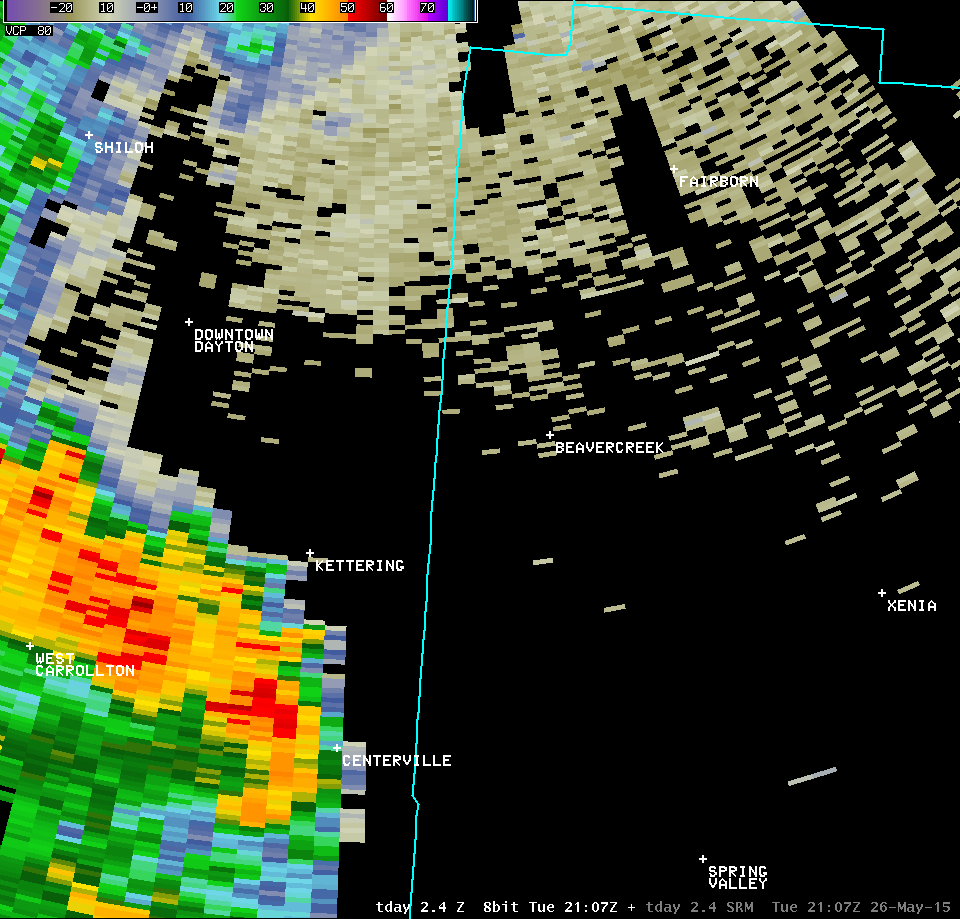
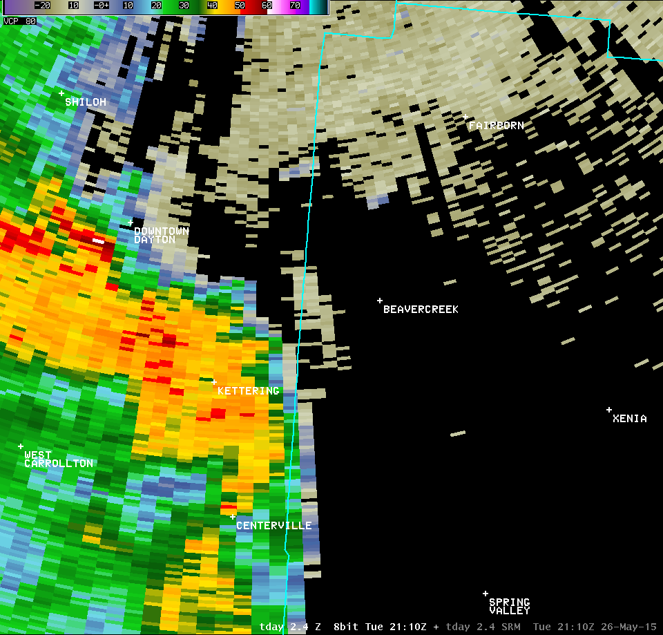
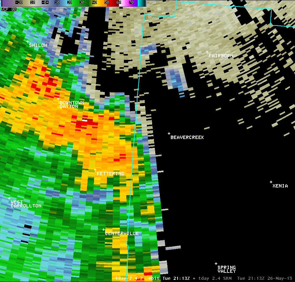
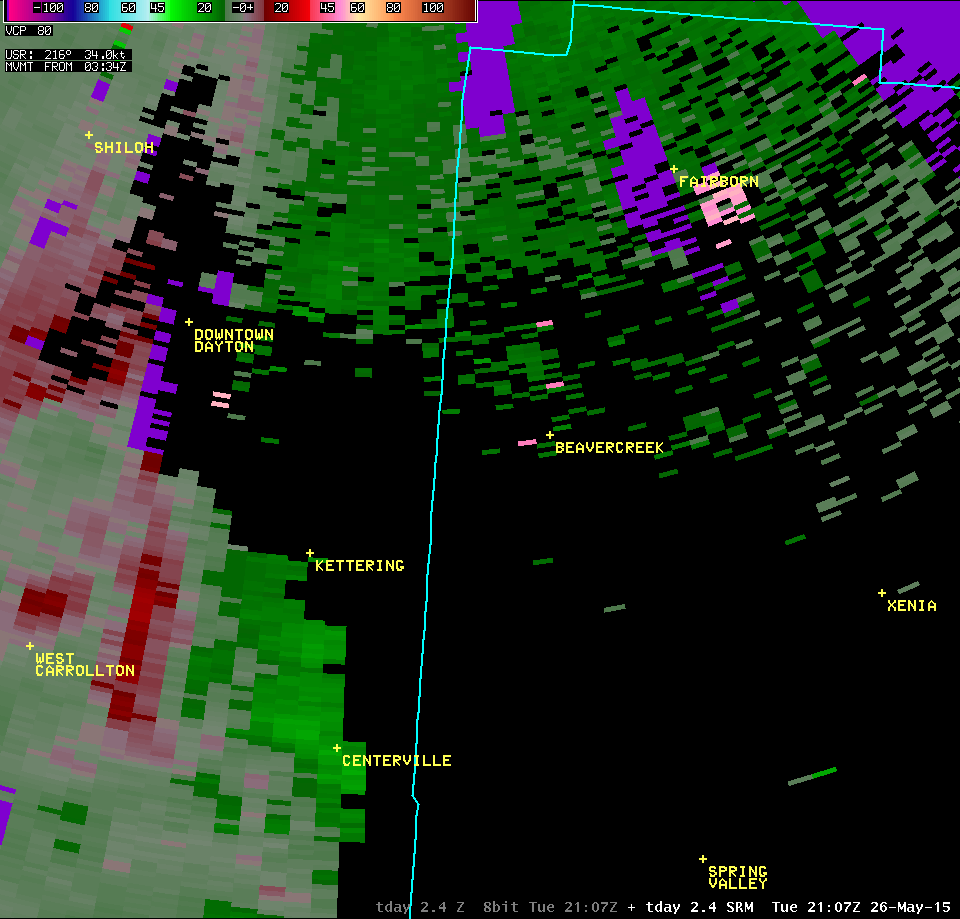
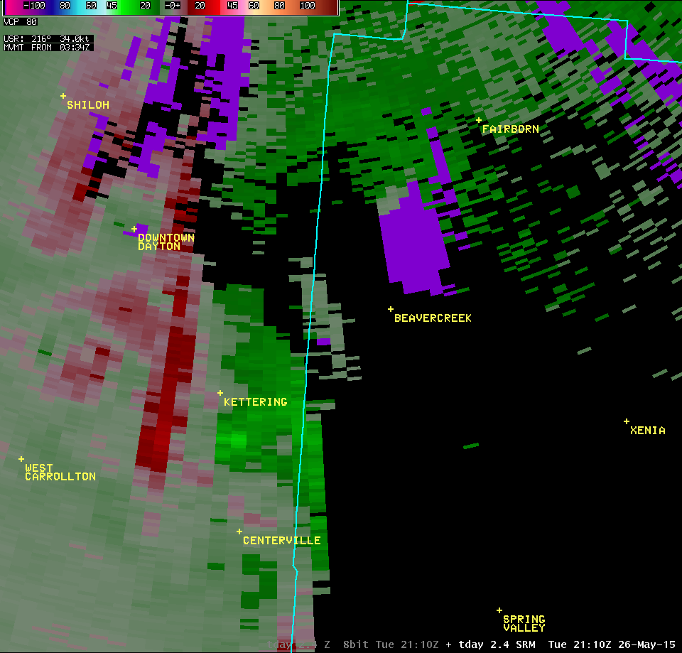
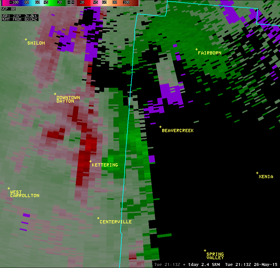
| TDAY 2.4° Reflectivity (4800-5200 feet AGL) | TDAY 2.4° Storm-Relative Motion (4800-5200 feet AGL) |
| 1 2 3 4 5 6 7 | 1 2 3 4 5 6 7 |

