Wilmington, OH
Weather Forecast Office
|
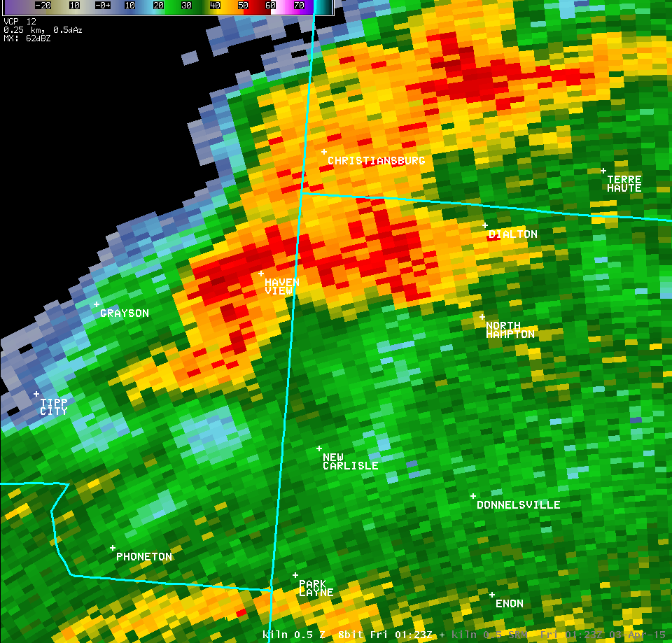
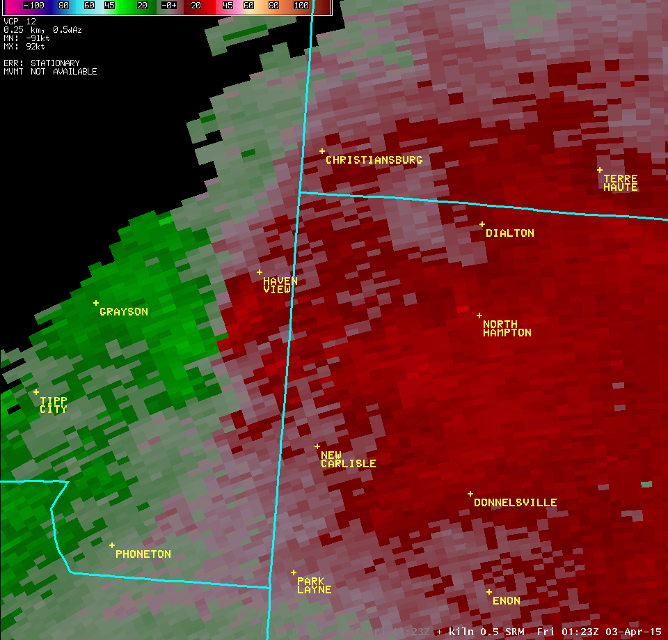
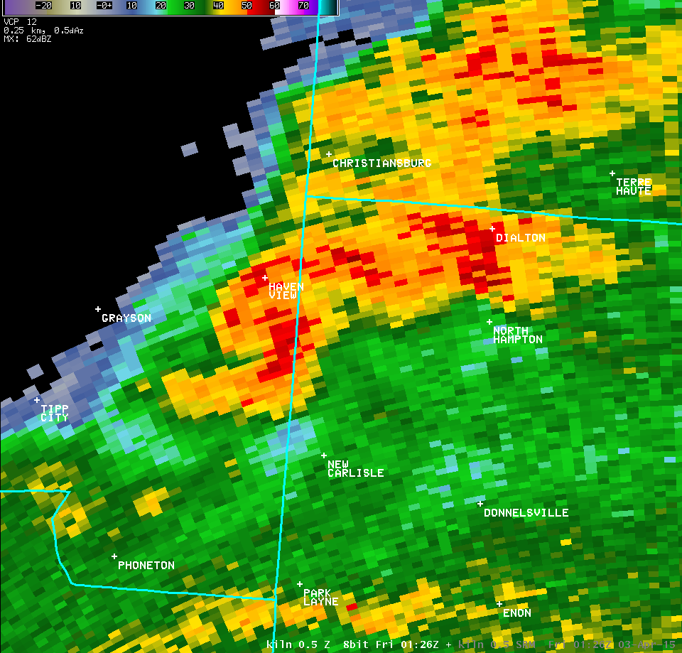
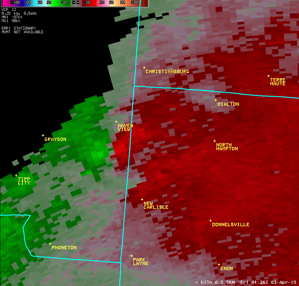
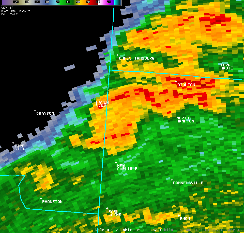
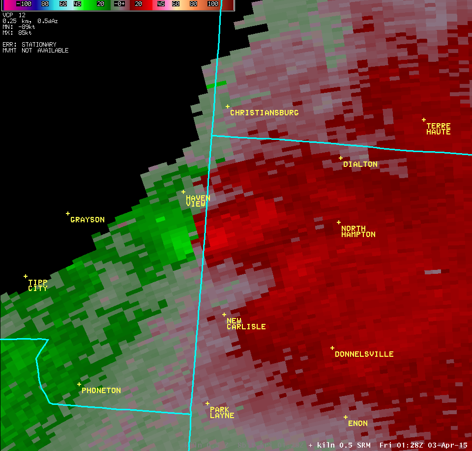
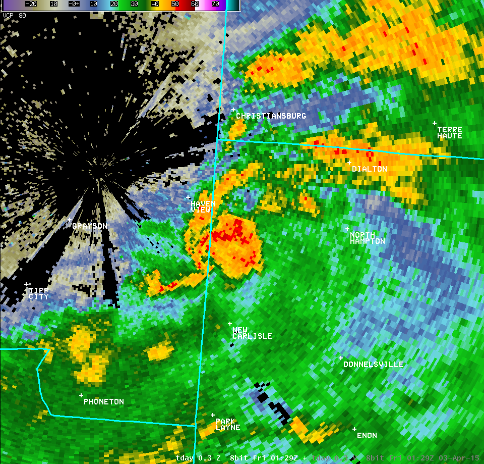
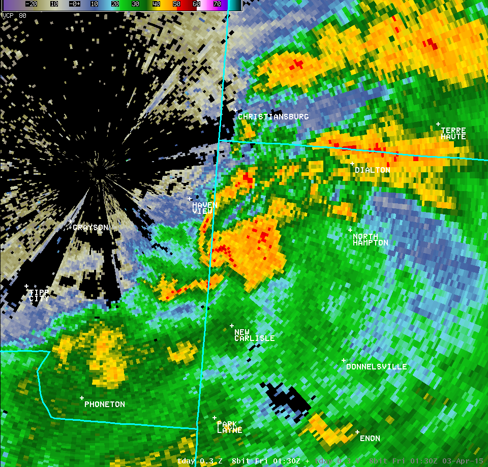
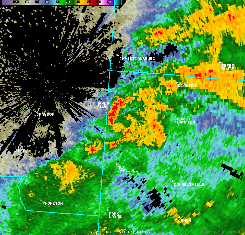
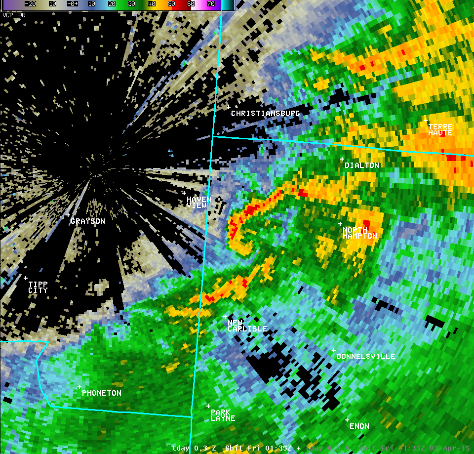
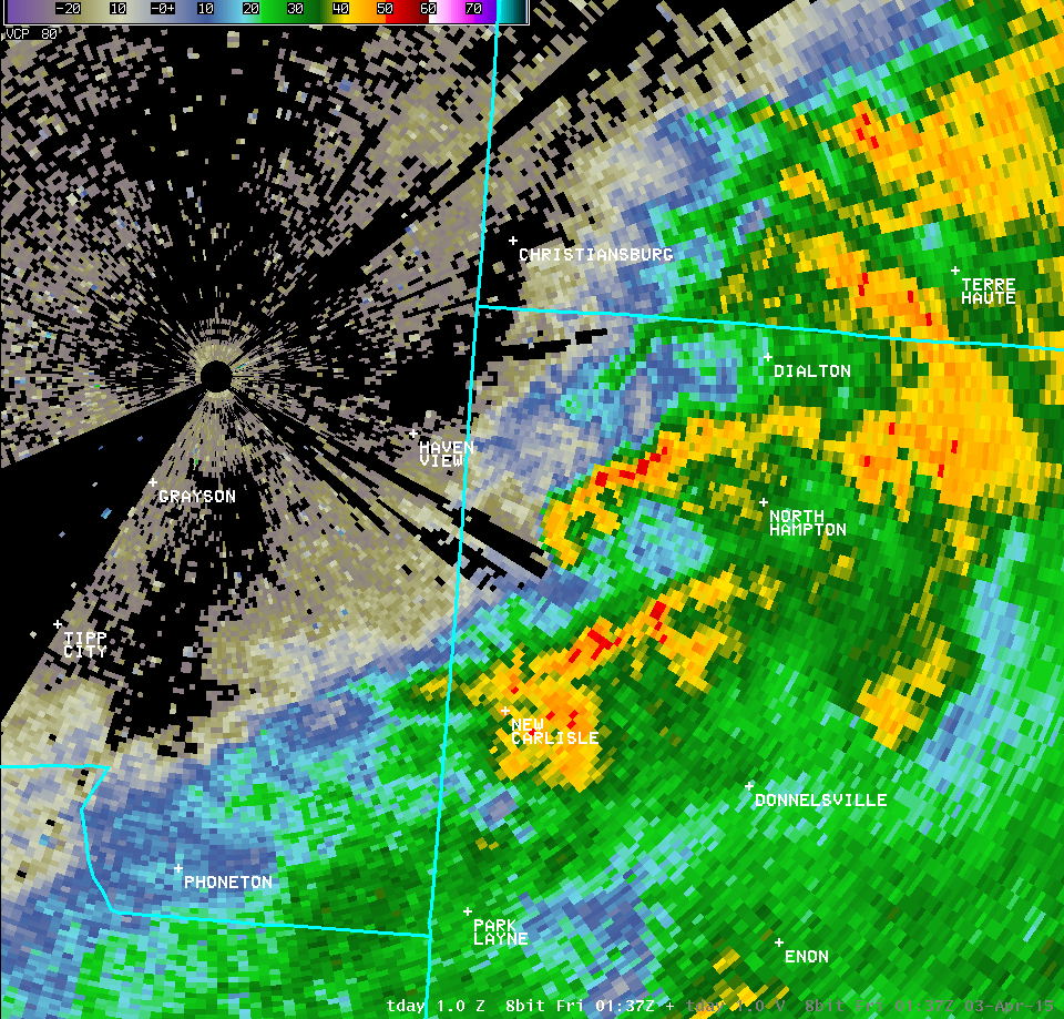
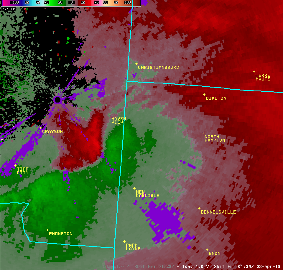
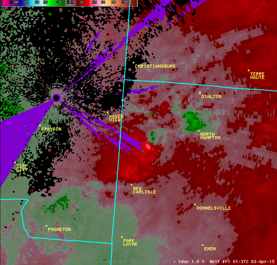
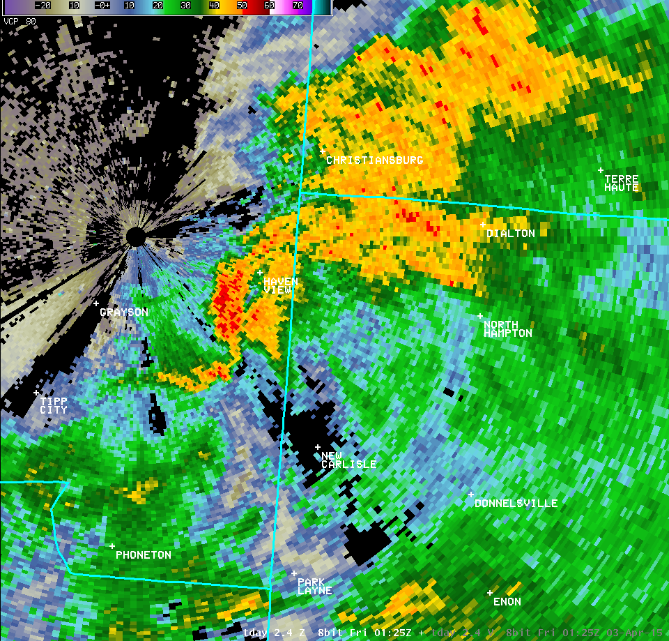
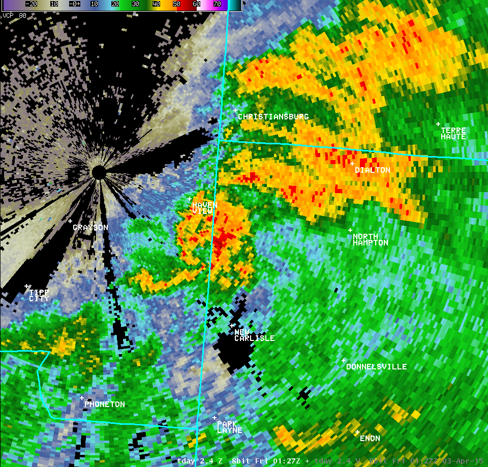
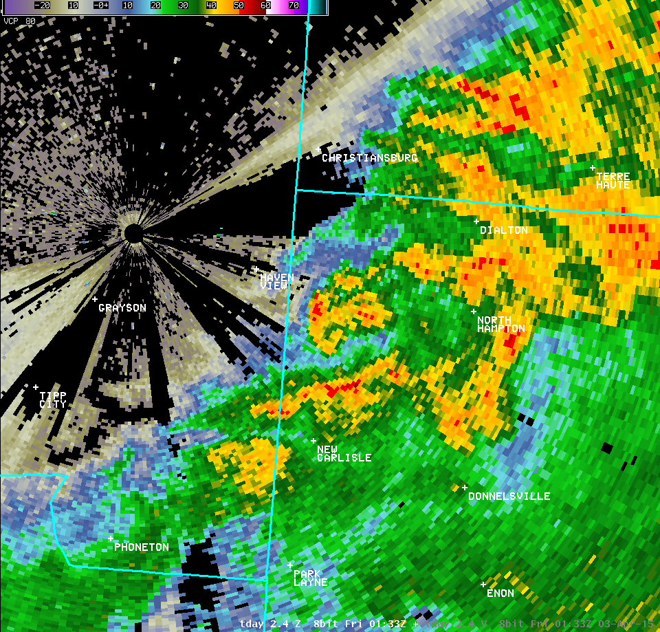
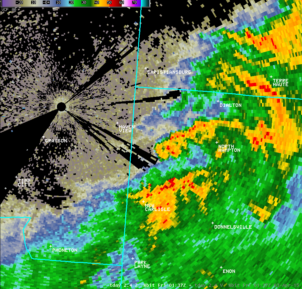
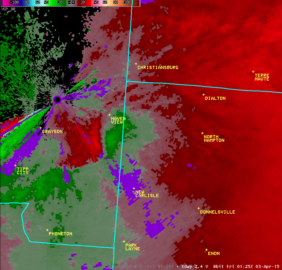
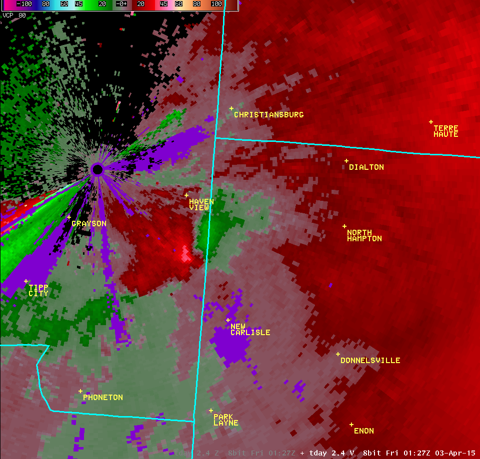
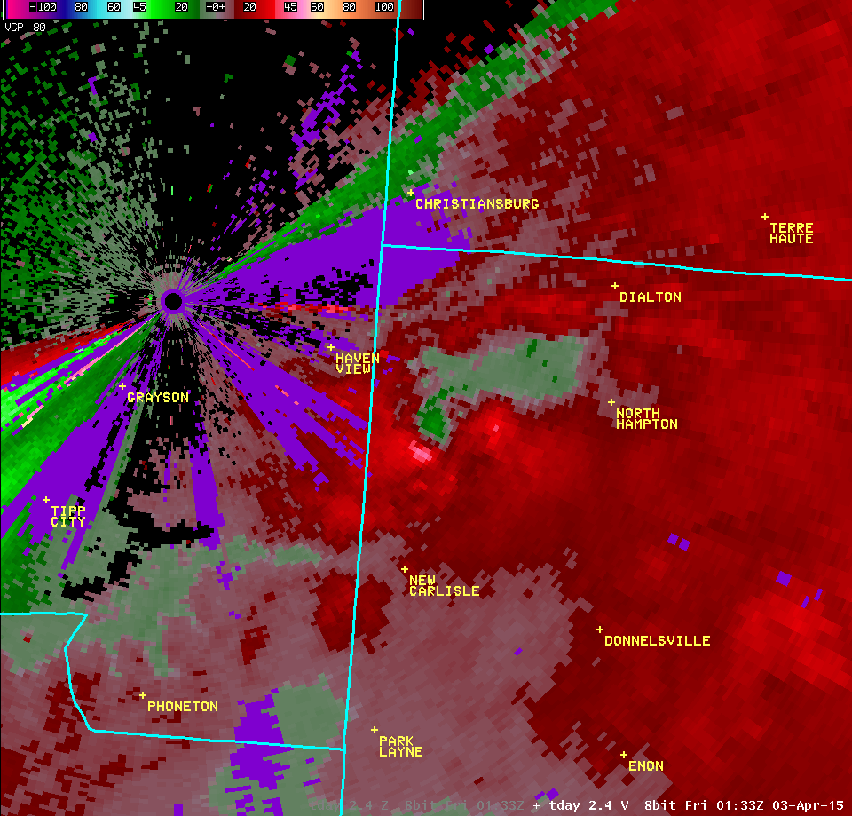
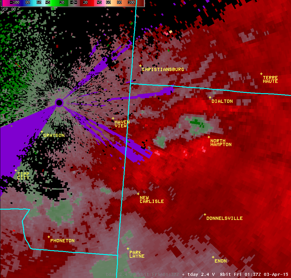
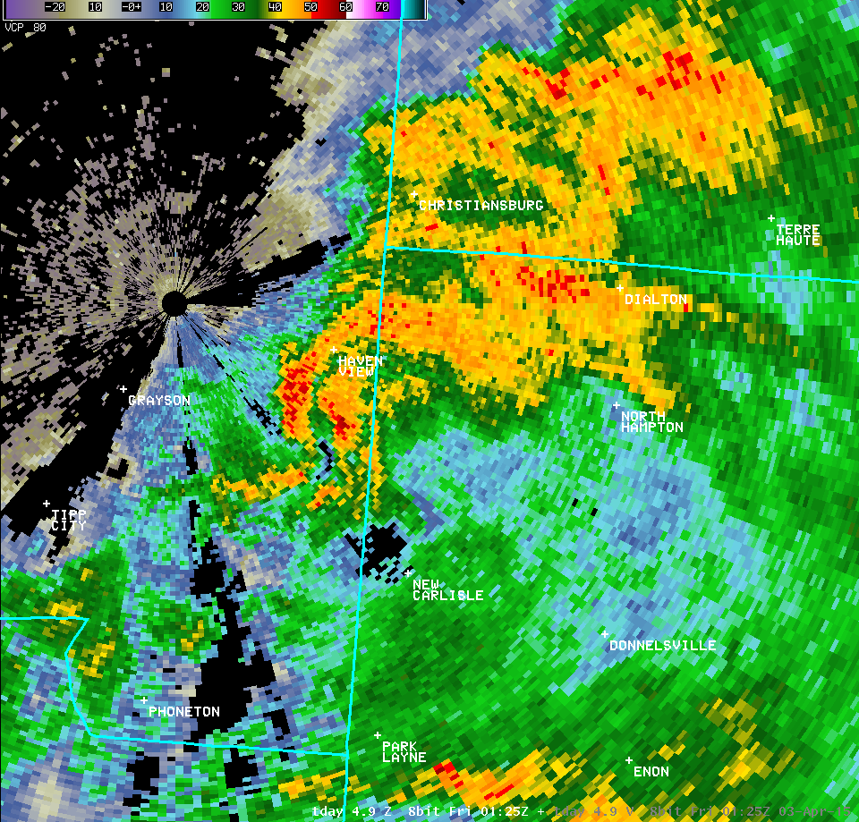
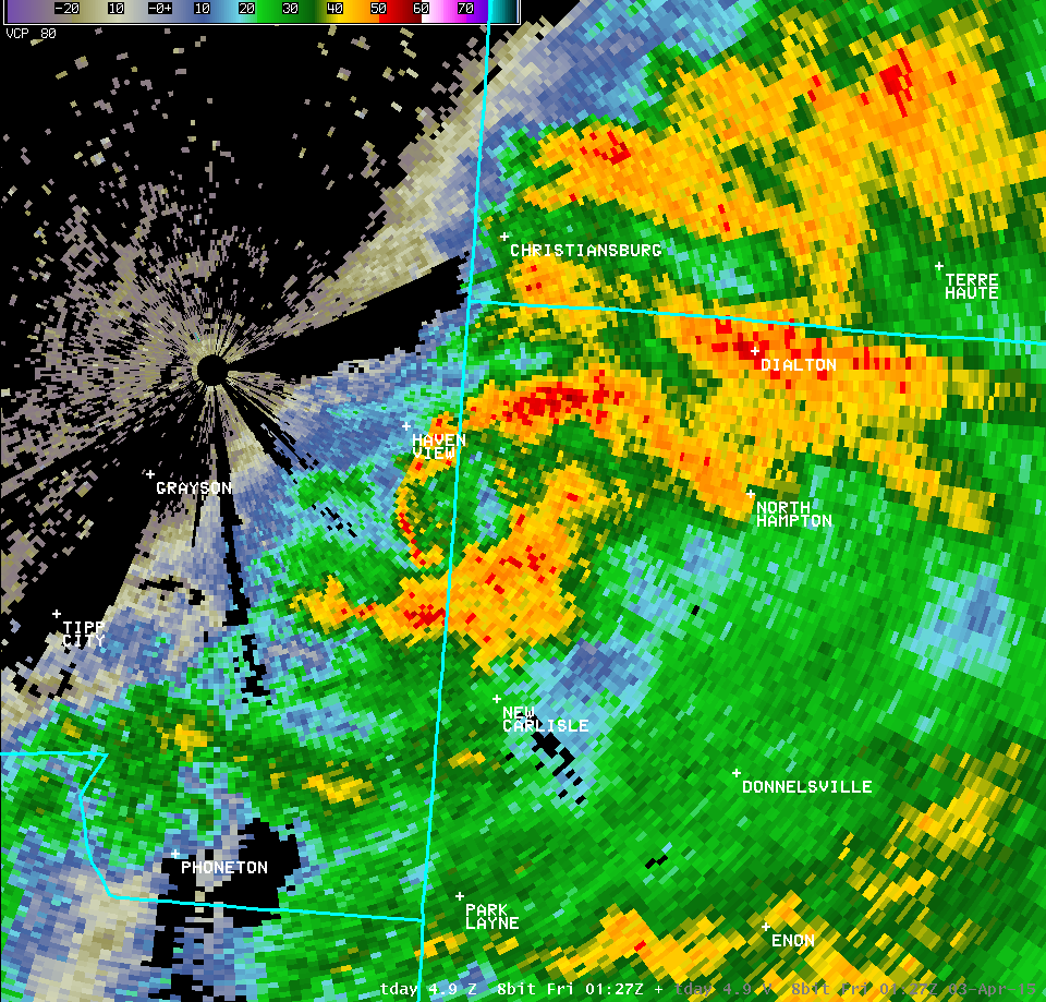
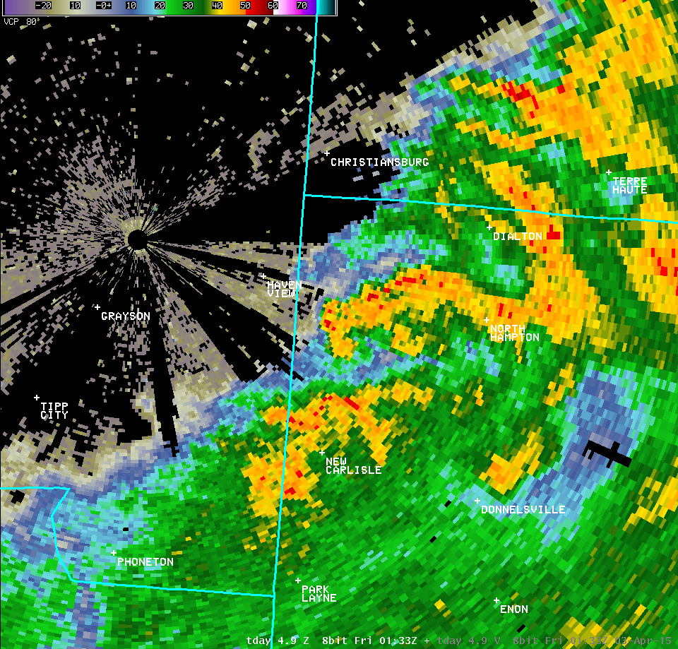
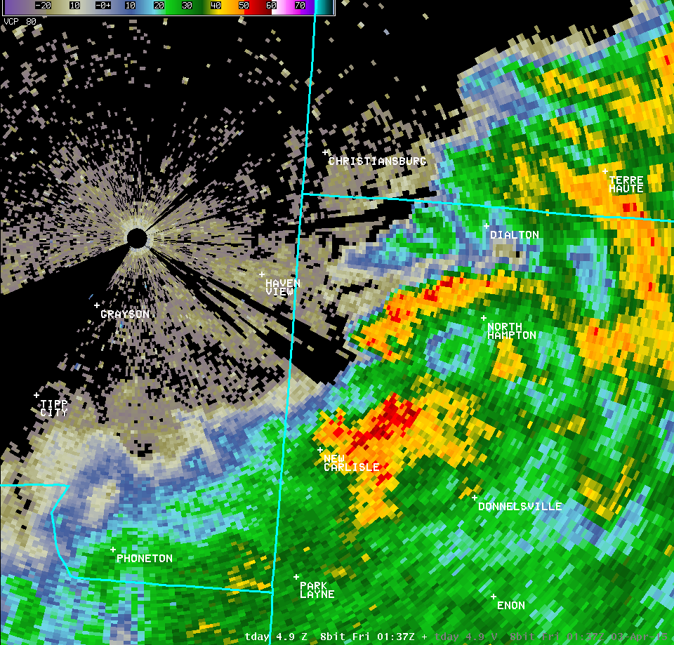
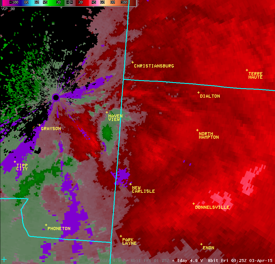
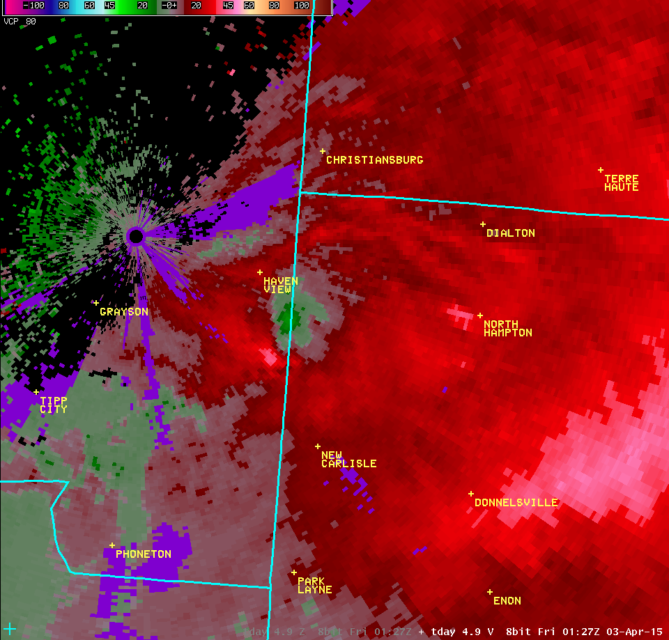
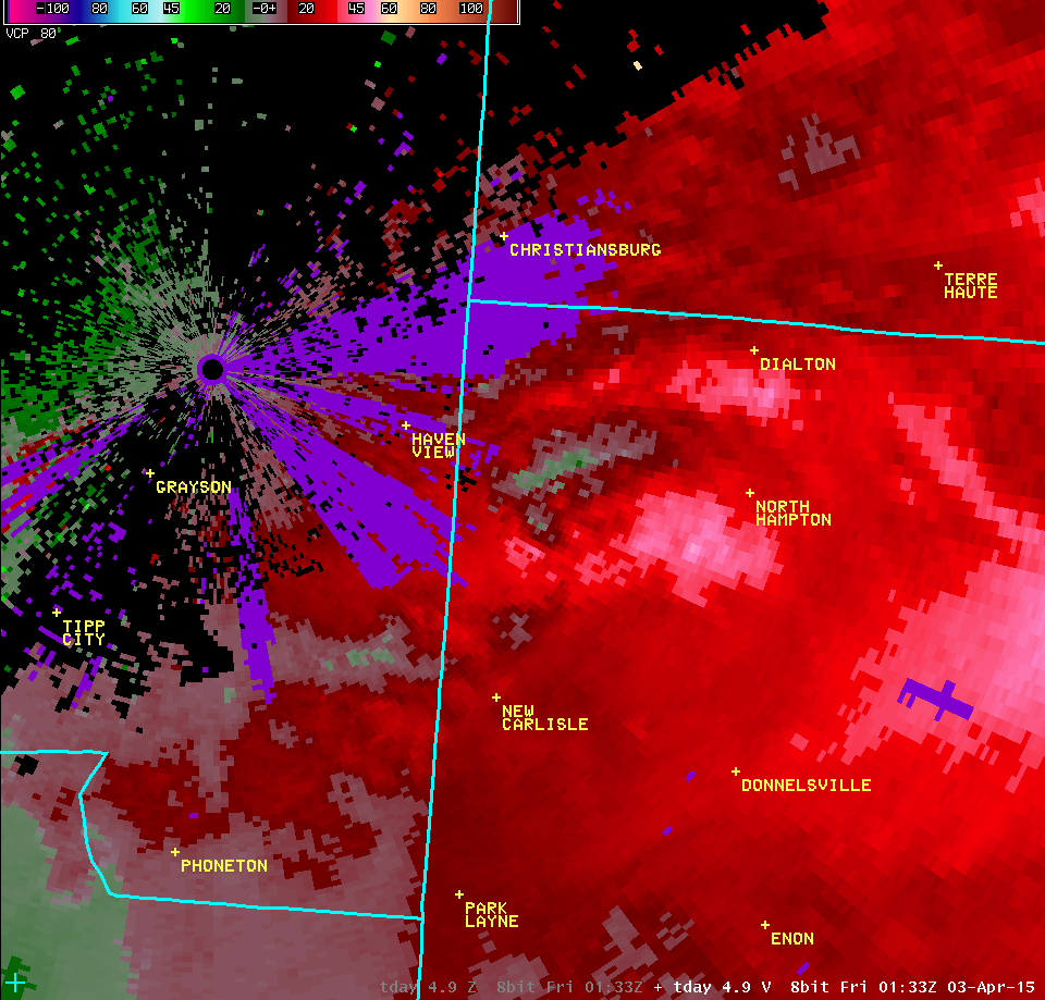
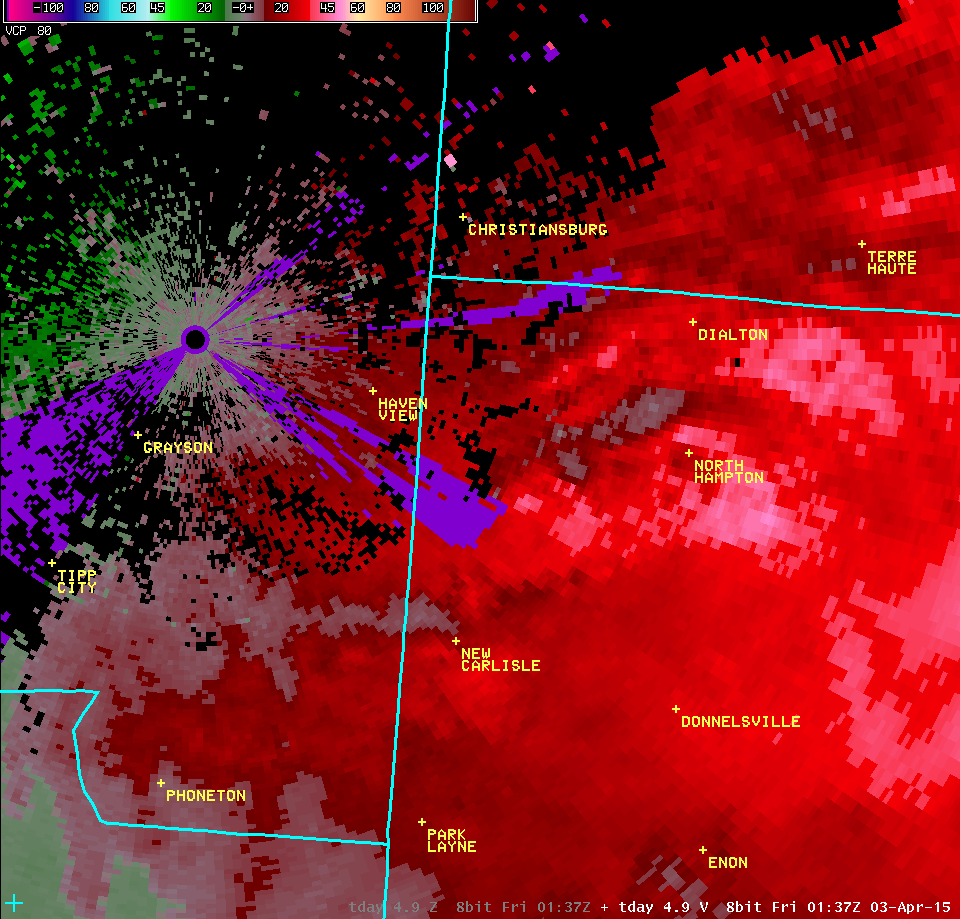
Tornado near New Carlisle, OH |
| NWS Wilmington OH (KILN) | ||
| 0.5° Z -- 9:23 PM | 0.5° SRM -- 9:23 PM | |
 |
 |
|
| 0.5° Z -- 9:26 PM | 0.5° SRM -- 9:26 PM | |
 |
 |
|
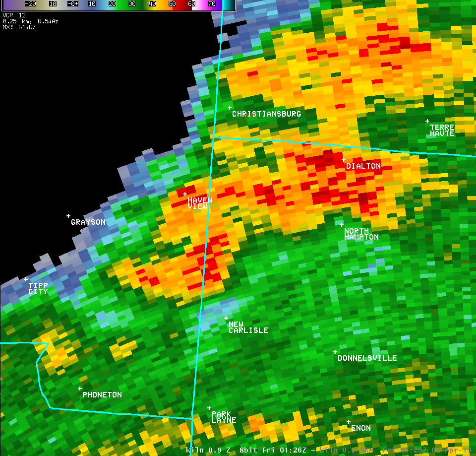
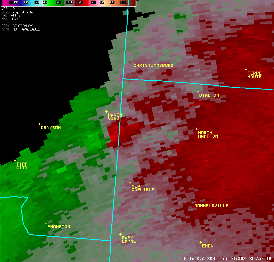
| 0.5° Z -- 9:28 PM | 0.5° SRM -- 9:28 PM | |
 |
 |
|
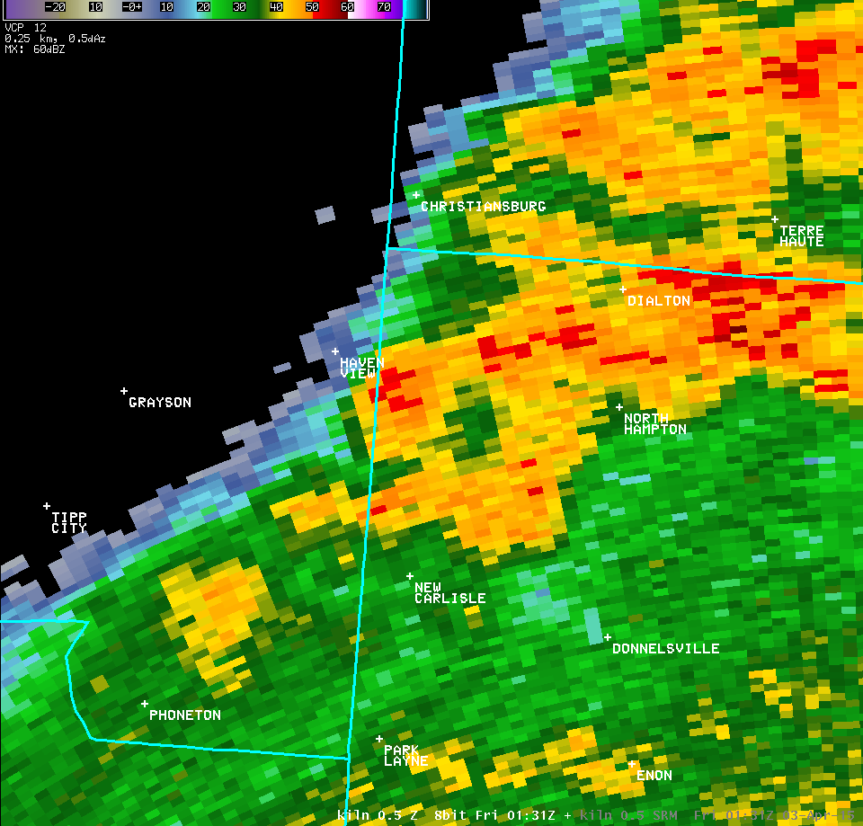
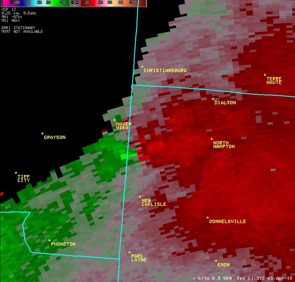
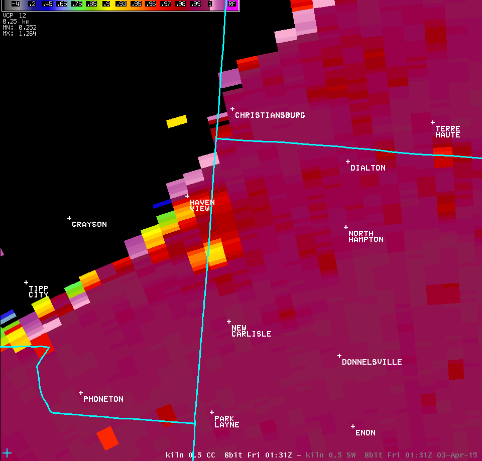
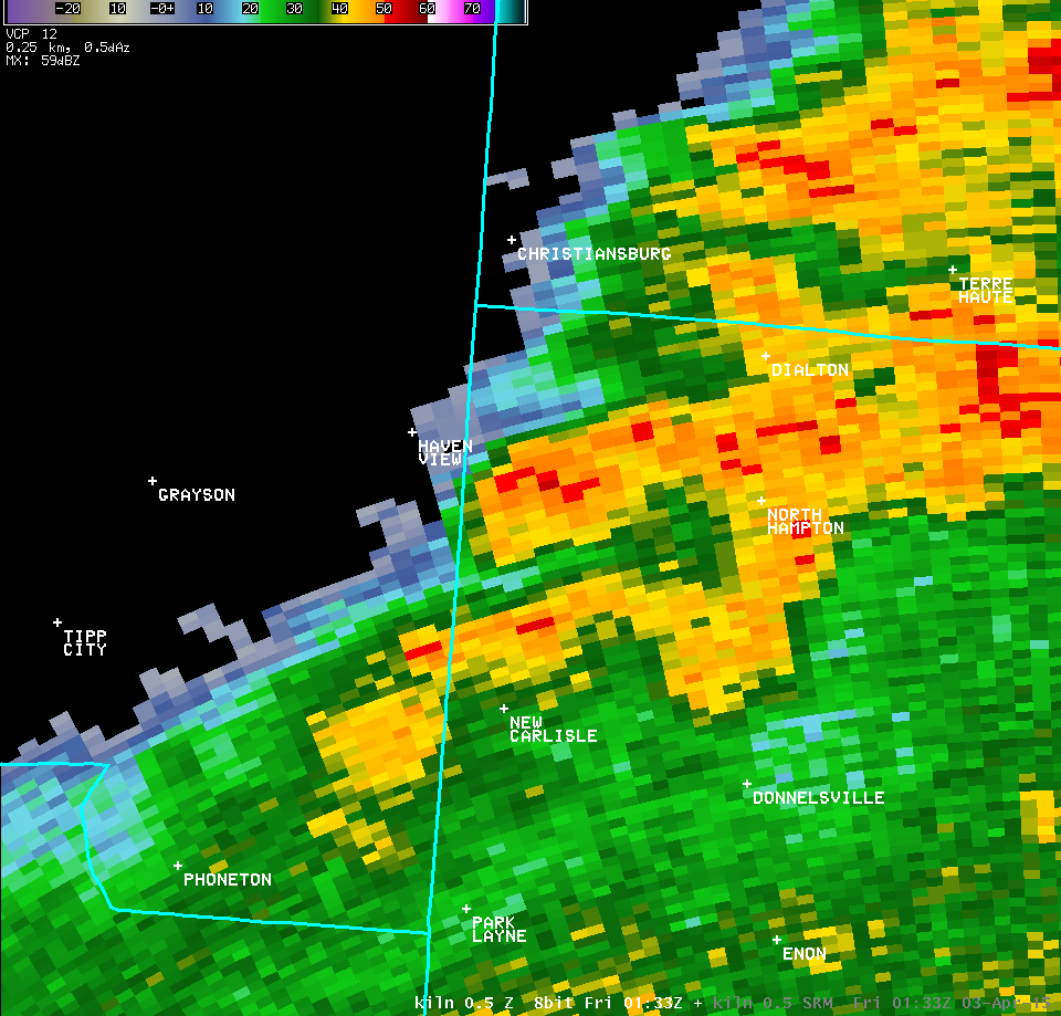
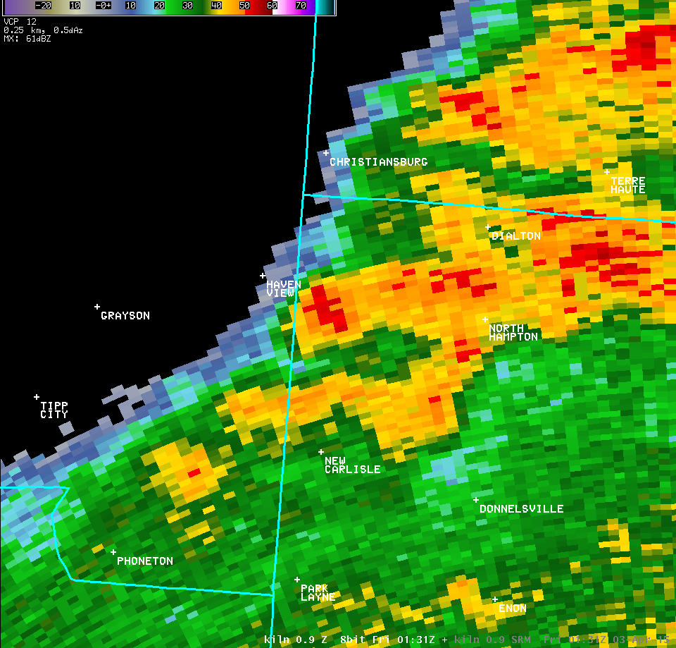
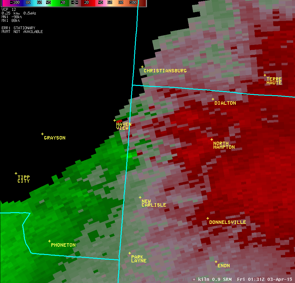
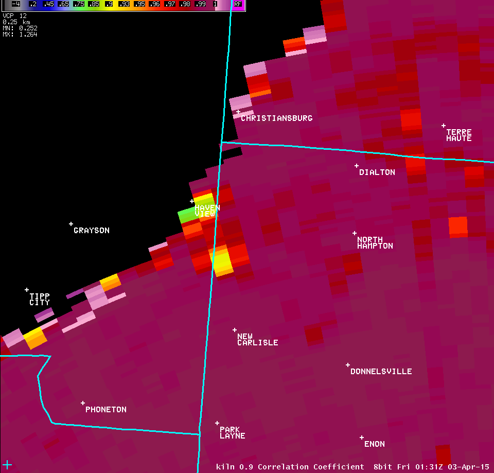
| 0.5° Z -- 9:31 PM | 0.5° SRM -- 9:31 PM | 0.5° CC -- 9:31 PM |
 |
 |
 |
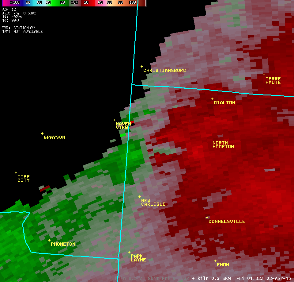
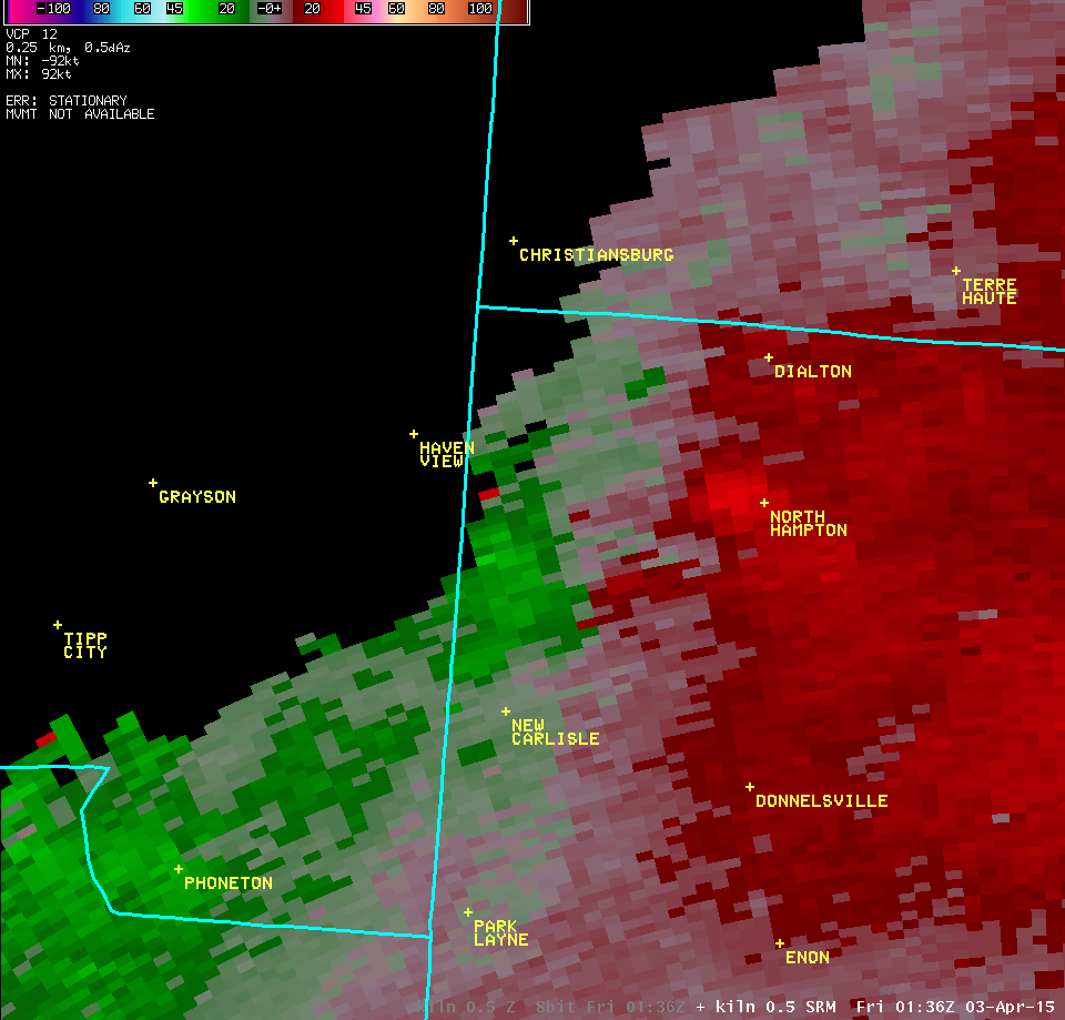
| 0.5° Z -- 9:33 PM | 0.5° SRM -- 9:33 PM | |
 |
 |
|
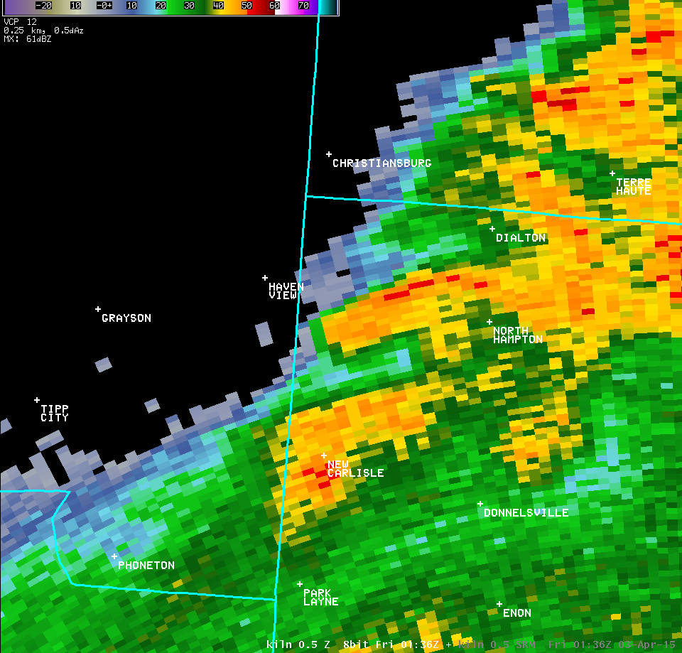
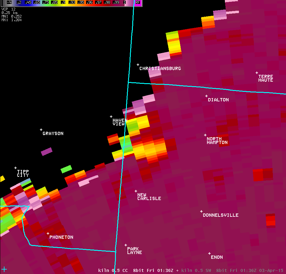
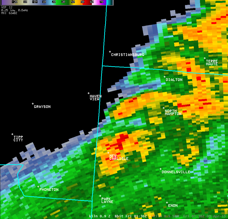
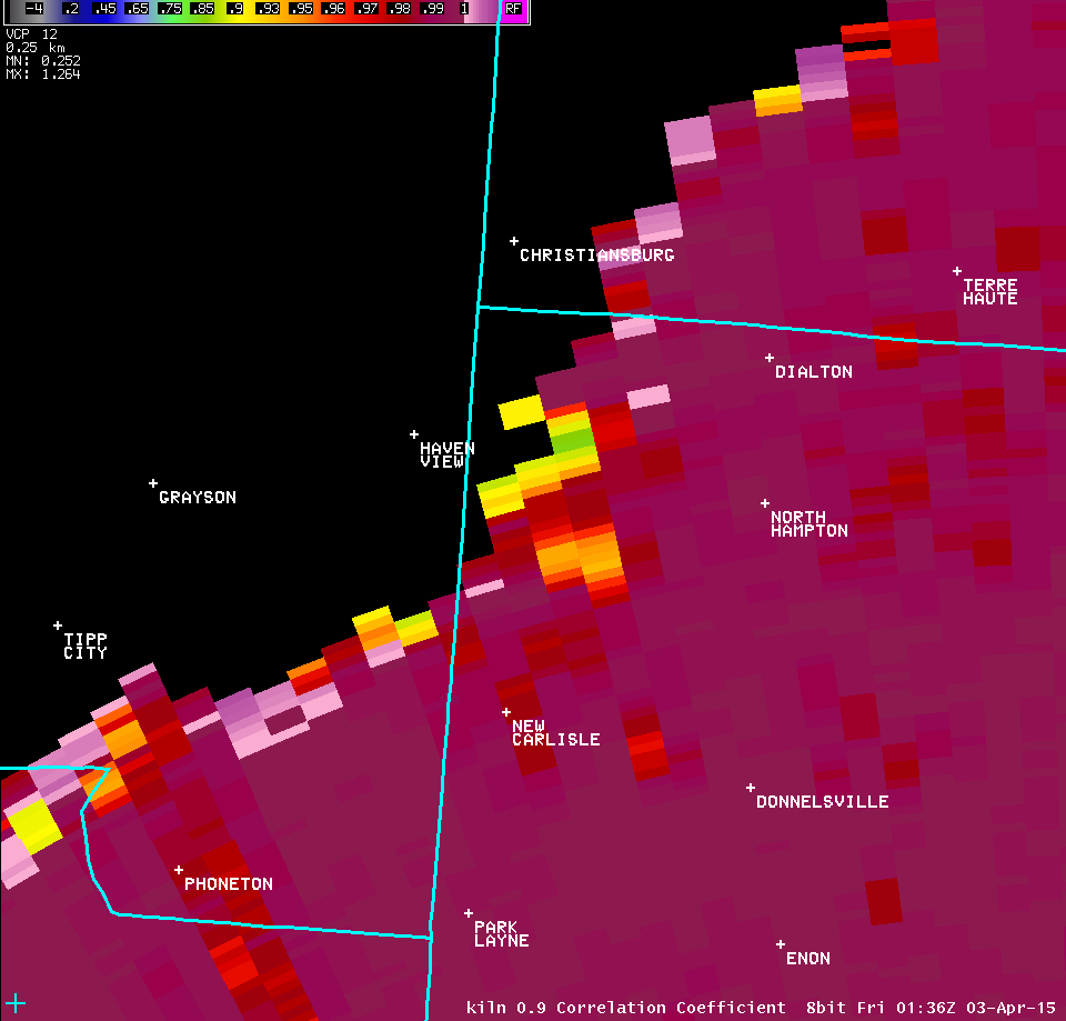
| 0.5° Z -- 9:36 PM | 0.5° SRM -- 9:36 PM | 0.5° CC -- 9:36 PM |
 |
 |
 |
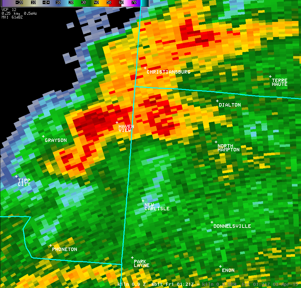
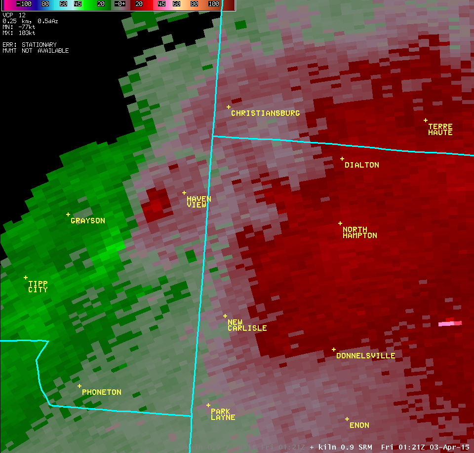
| 0.9° Z -- 9:21 PM | 0.9° SRM -- 9:21 PM | |
 |
 |
|
| 0.9° Z -- 9:26 PM | 0.9° SRM -- 9:26 PM | |
 |
 |
|
| 0.9° Z -- 9:31 PM | 0.9° SRM -- 9:31 PM | 0.9° CC -- 9:31 PM |
 |
 |
 |
| 0.9° Z -- 9:36 PM | 0.9° SRM -- 9:36 PM | 0.9° CC -- 9:36 PM |
 |
 |
 |
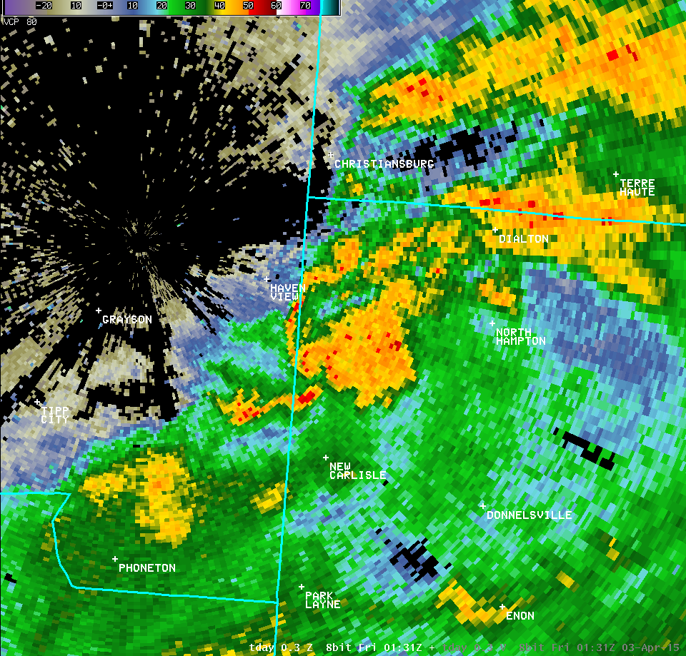
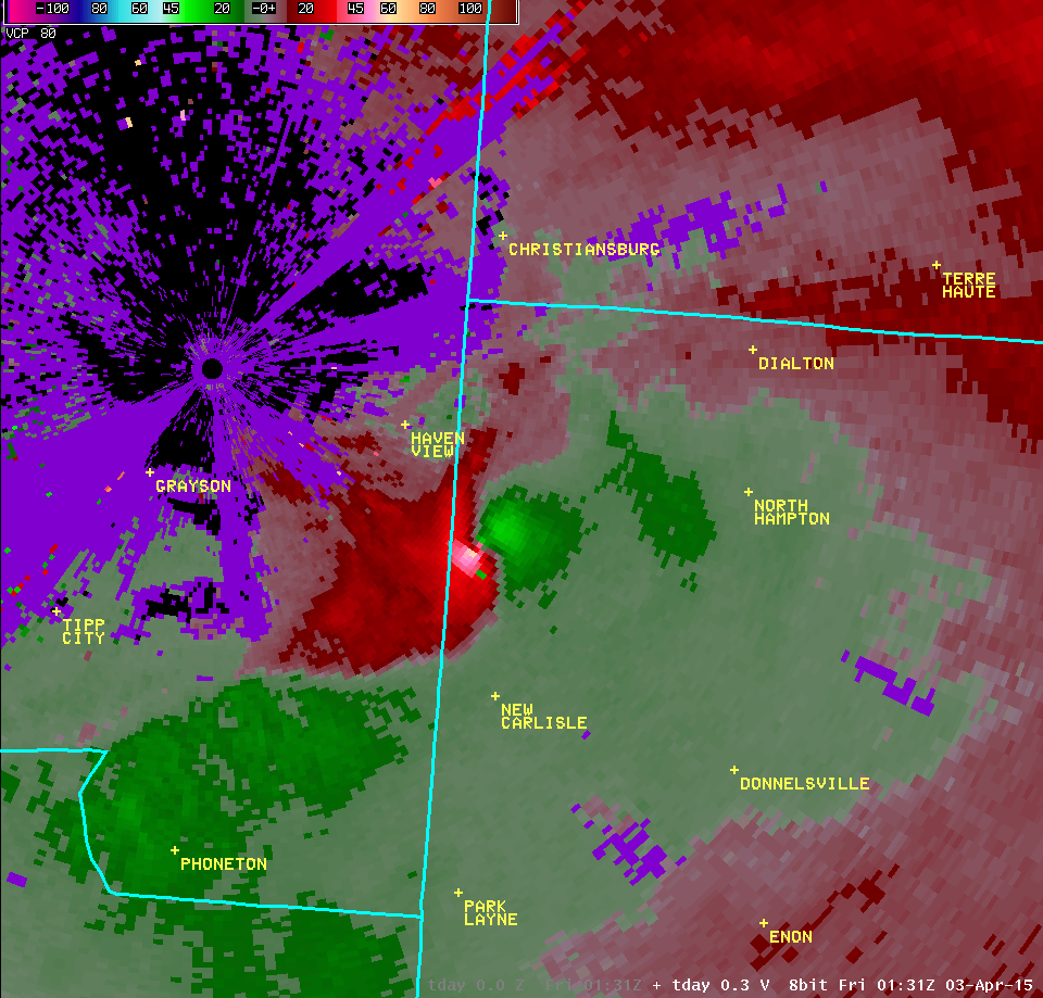
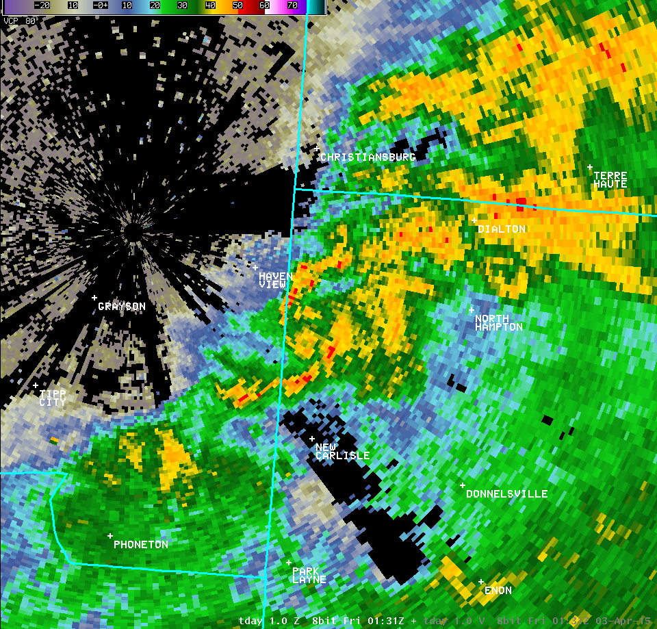
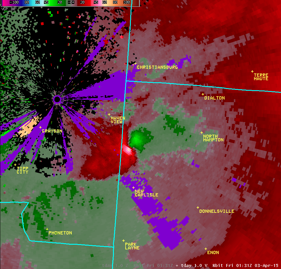
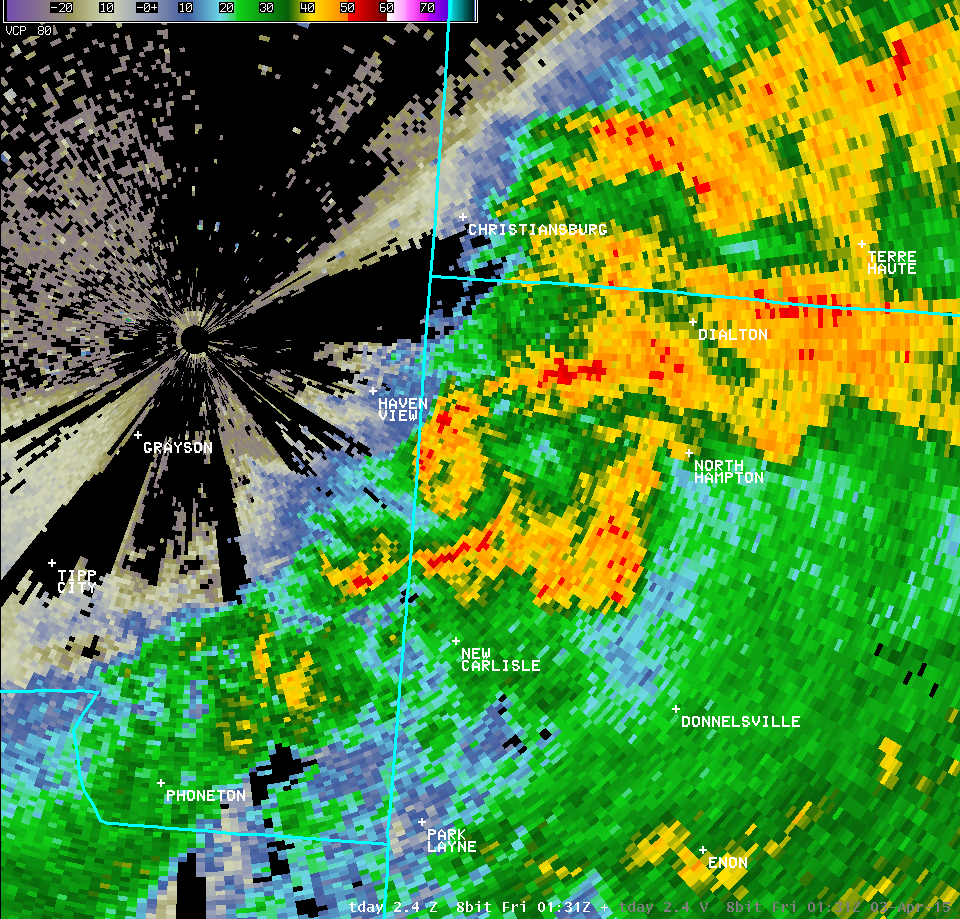
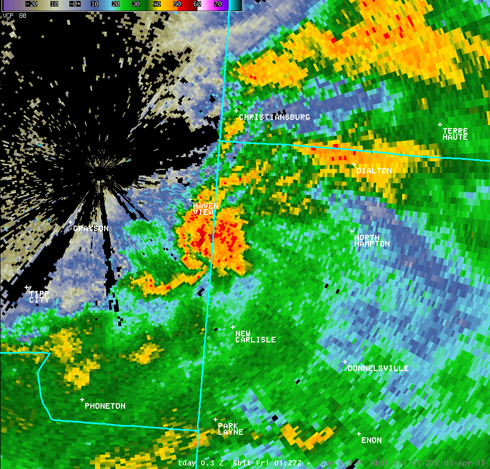
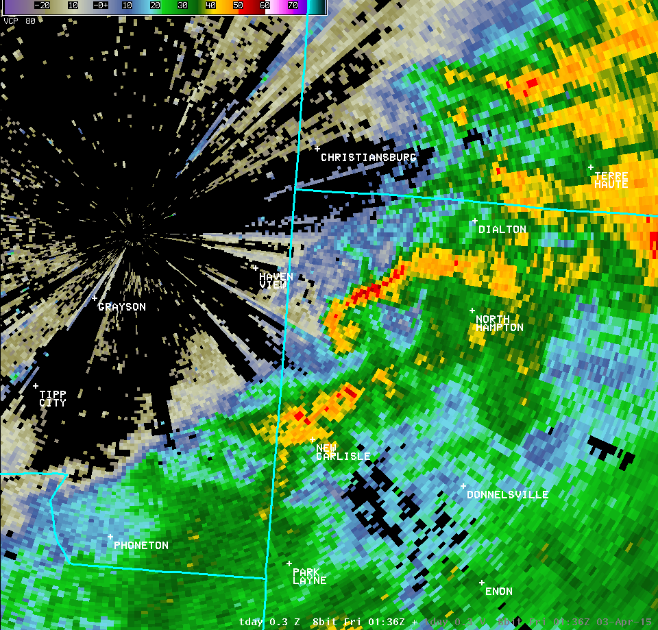
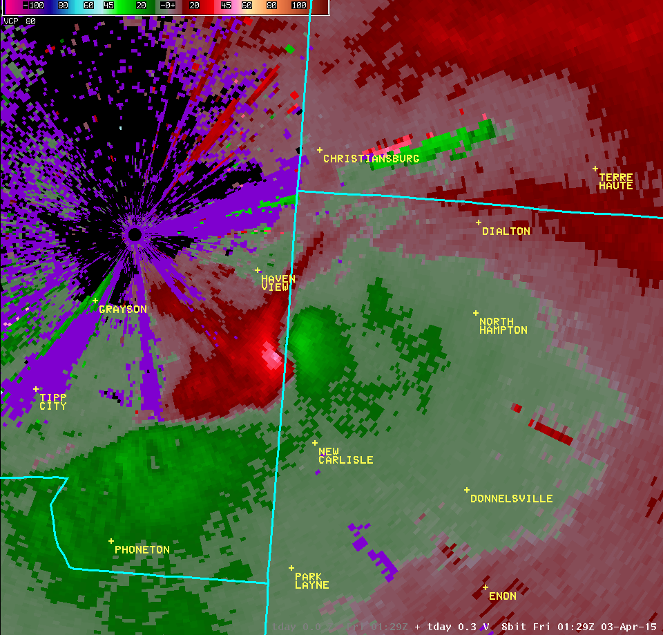
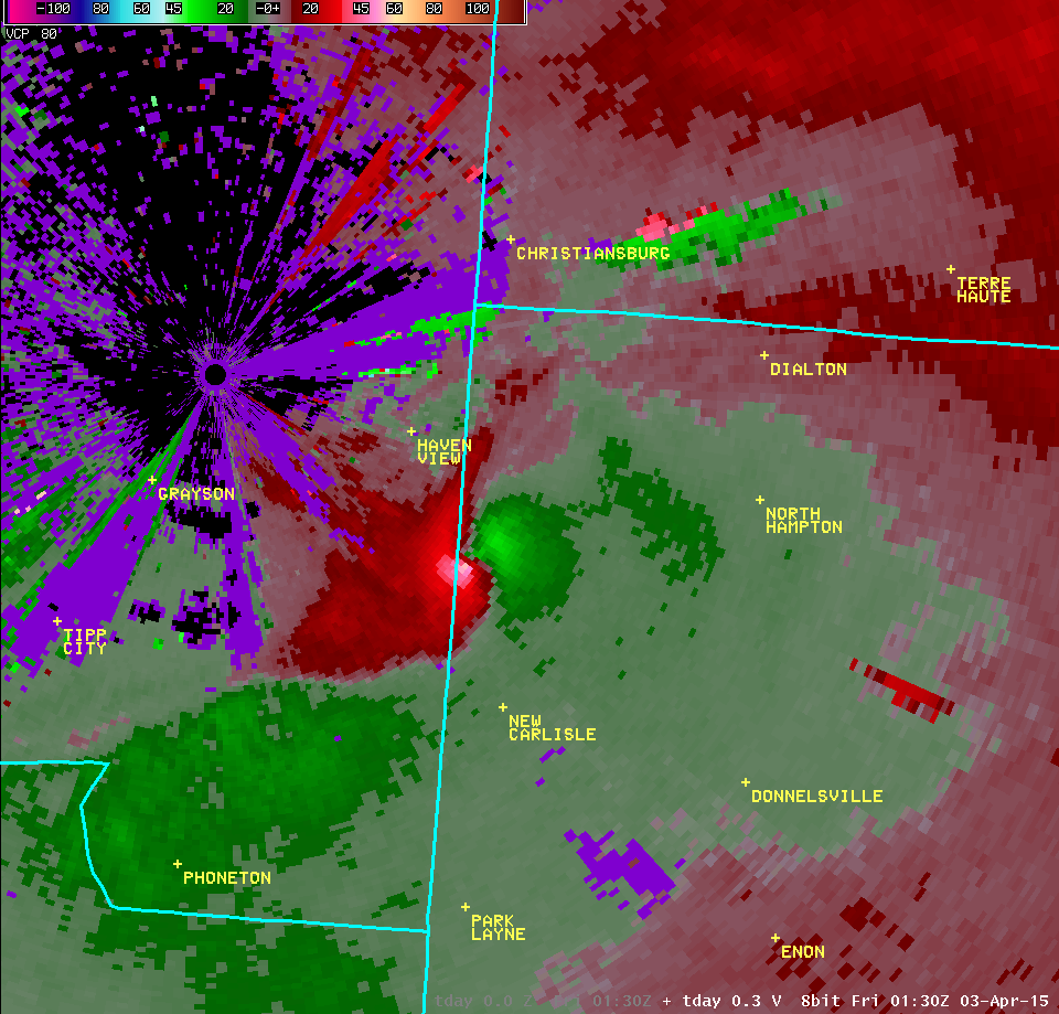
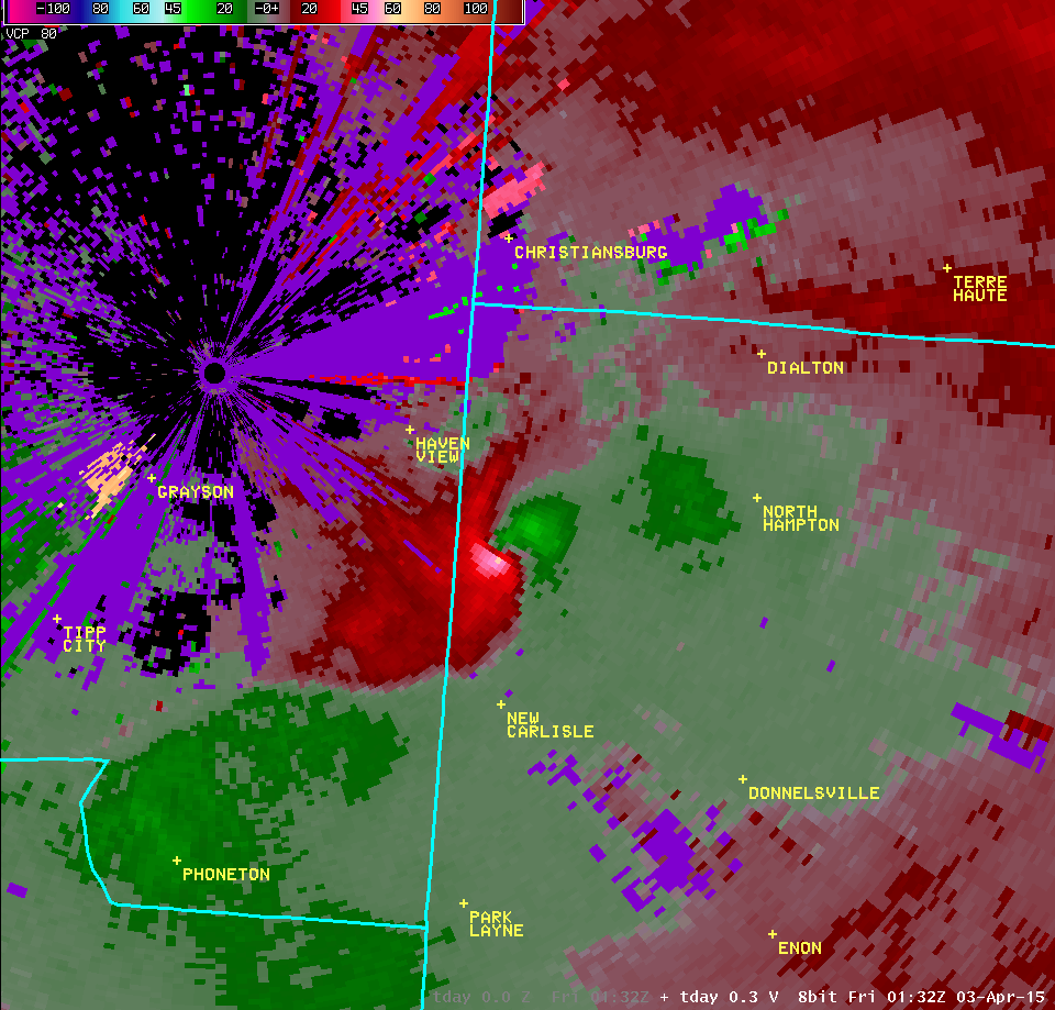
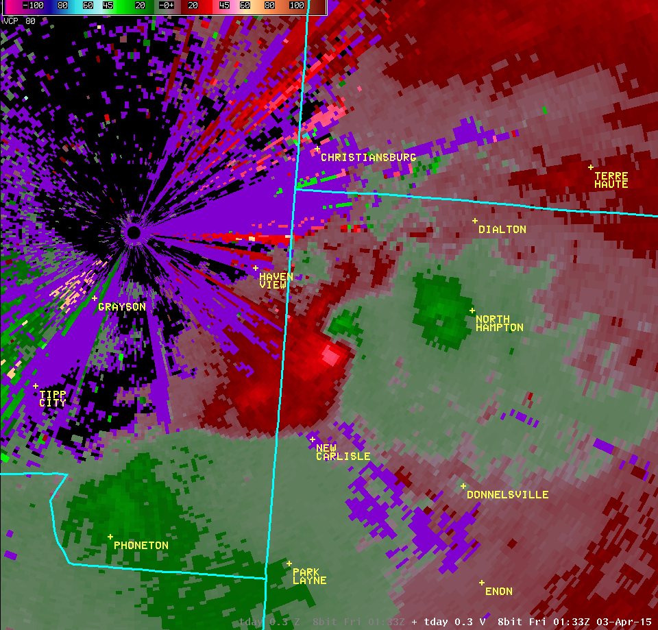
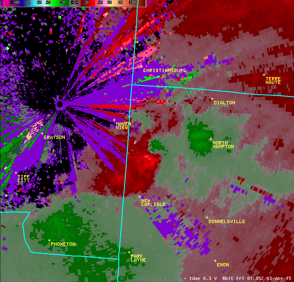
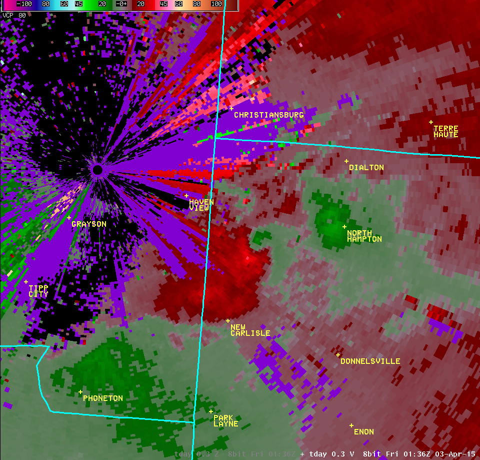
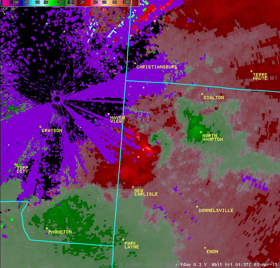
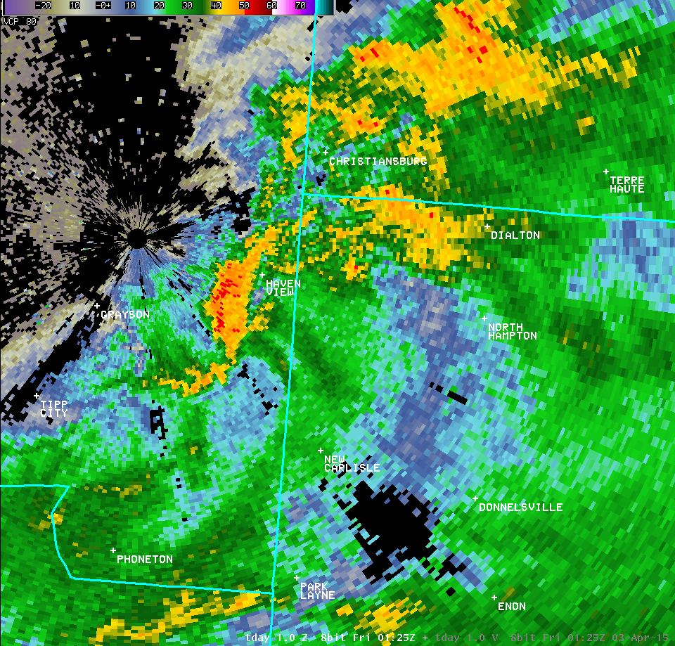
| Vertical Loop of TDAY Radar Imagery (9:31 PM) | |||
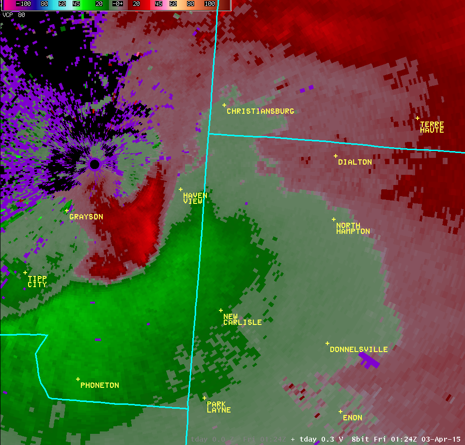
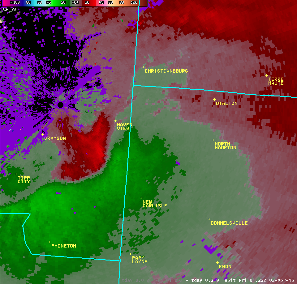
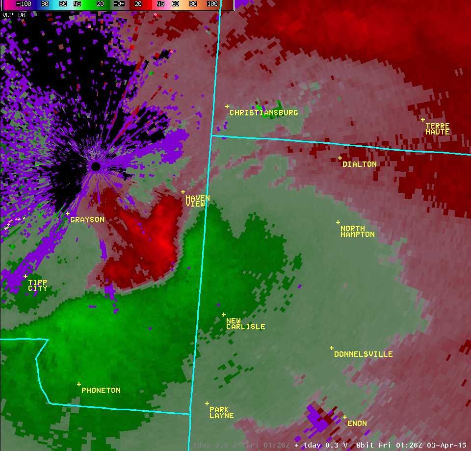
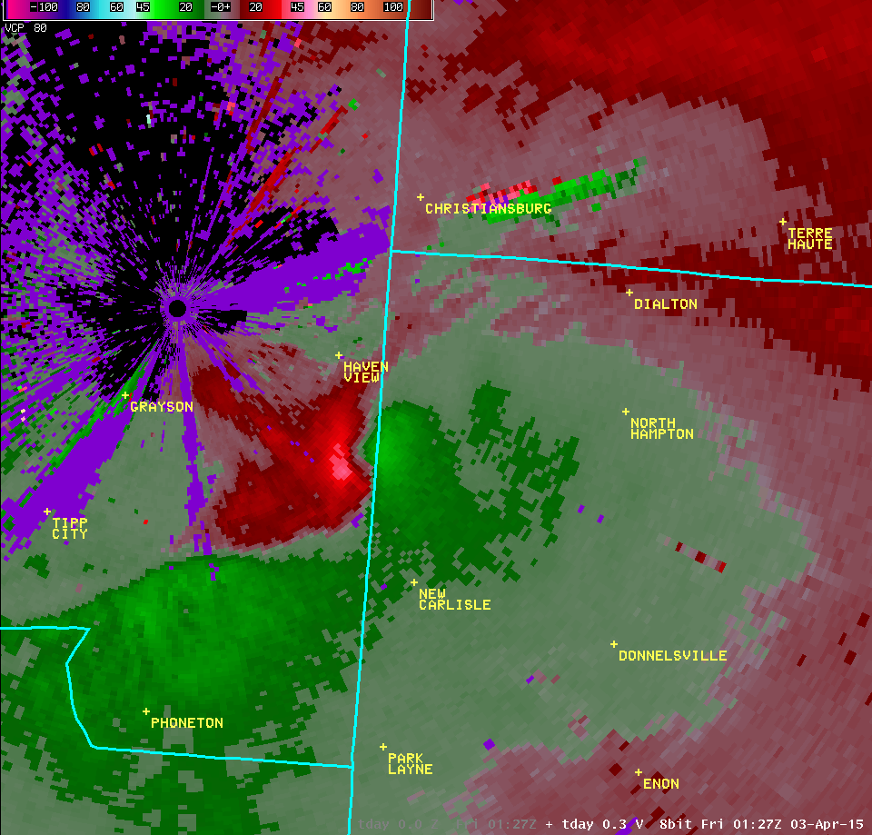
| 0.3° Reflectivity | 0.3° Velocity | ||
 |
 | ||
| 1.0° Reflectivity | 1.0° Velocity | ||
 |
 | ||
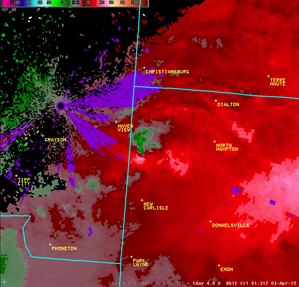
| 2.4° Reflectivity | 2.4° Velocity | ||
 |
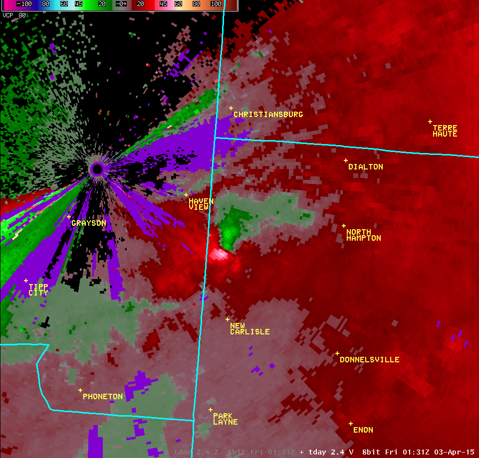 | ||
| 4.9° Reflectivity | 4.9° Velocity | ||
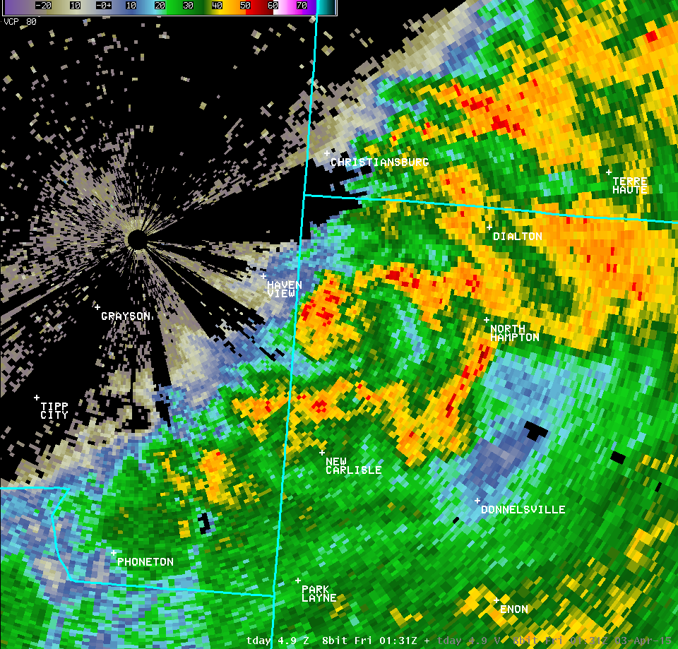 |
 | ||
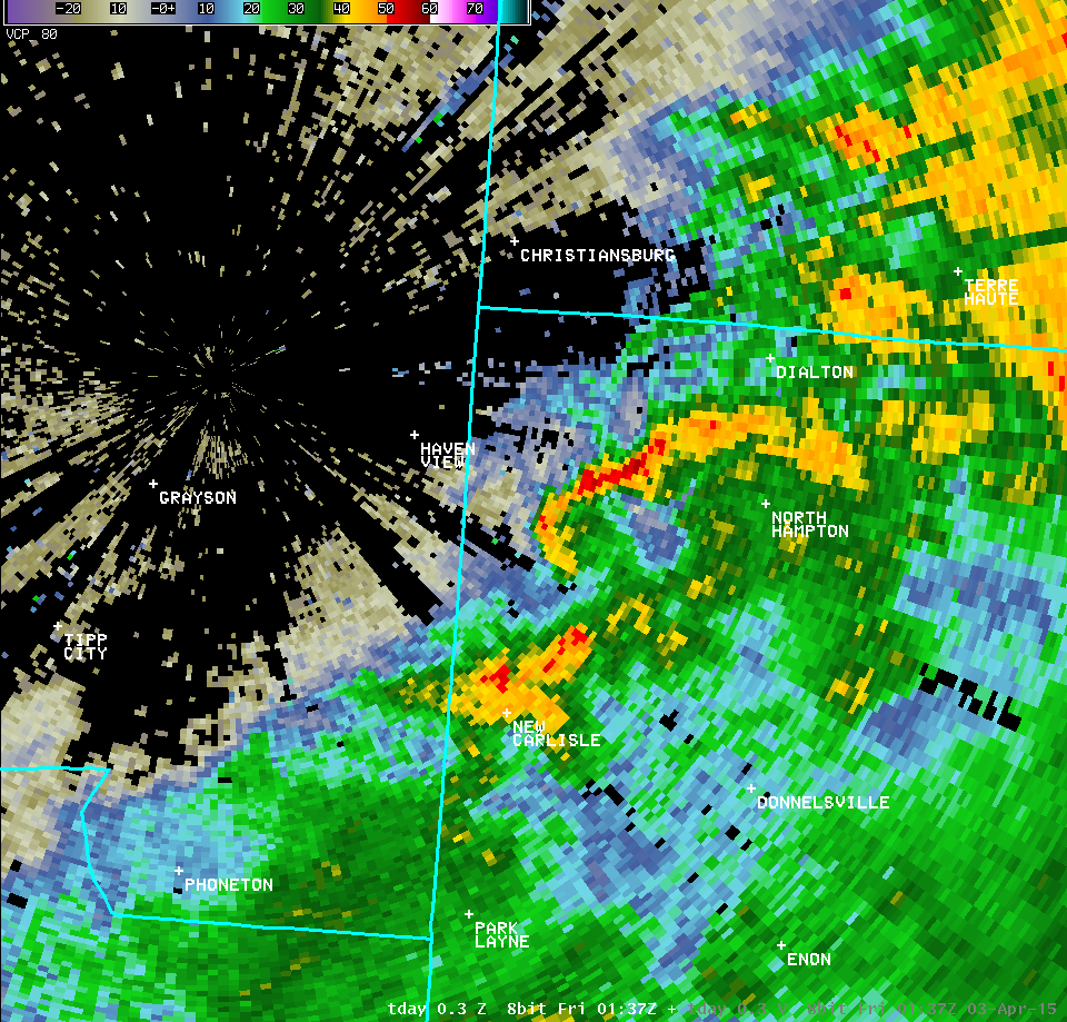
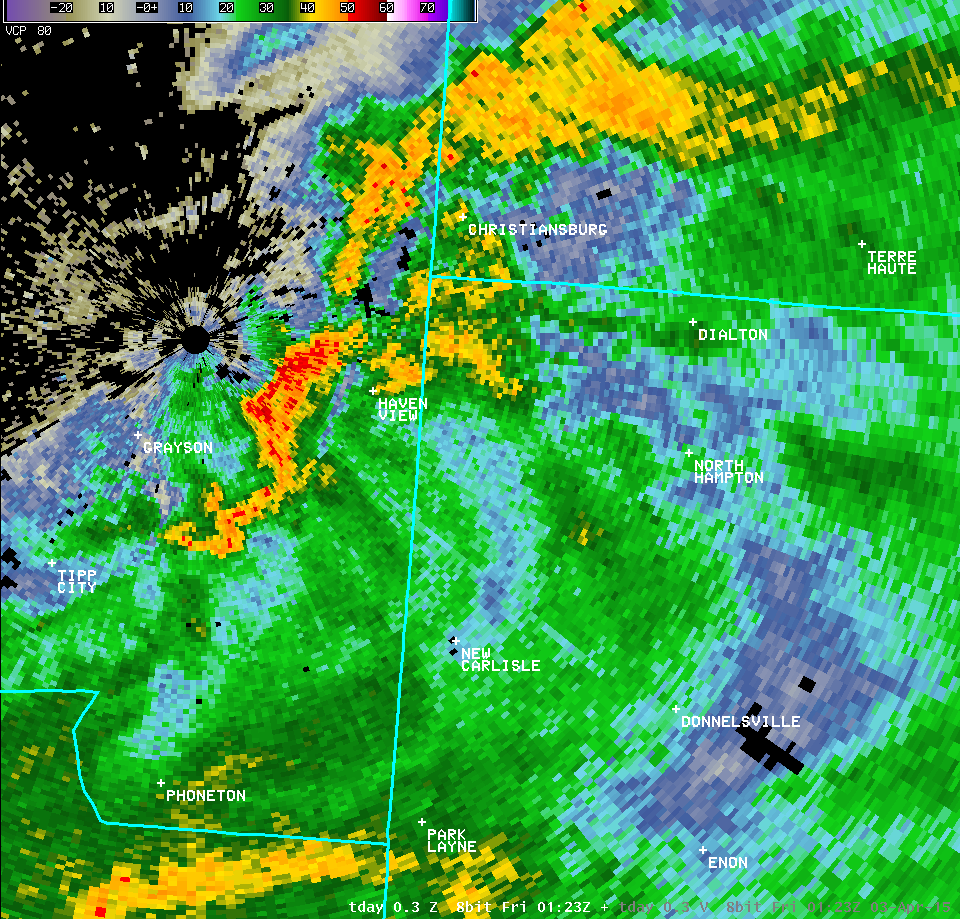
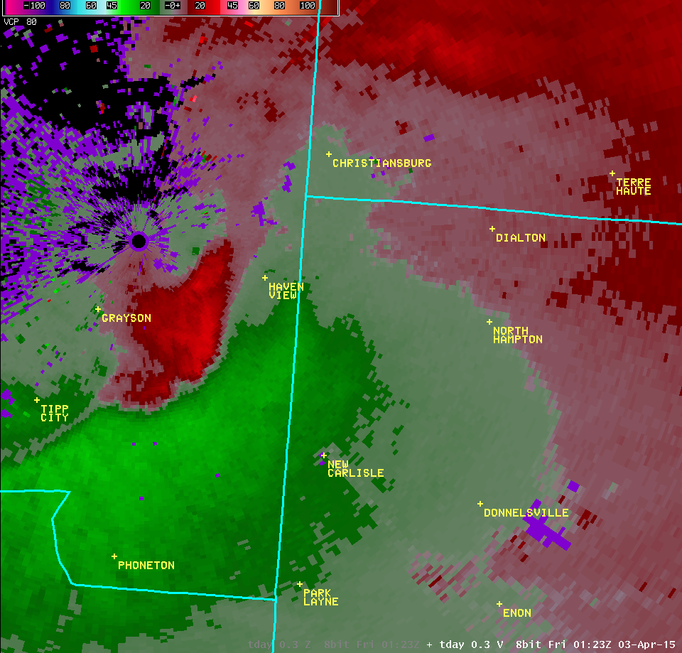
| Full Radar Loops from the Dayton Terminal Doppler Weather Radar (9:23 PM - 9:37 PM) | |
| TDAY 0.3° Reflectivity (200-300 feet AGL) | TDAY 0.3° Velocity (200-300 feet AGL) |
| 1 2 3 4 5 6 7 8 9 10 11 12 13 | Animation | 1 2 3 4 5 6 7 8 9 10 11 12 13 | Animation |
| TDAY 1.0° Reflectivity (600-800 feet AGL) | TDAY 1.0° Velocity (600-800 feet AGL) |
| 1 2 3 | 1 2 3 |
| TDAY 2.4° Reflectivity (1300-1600 feet AGL) | TDAY 2.4° Velocity (1300-1600 feet AGL) |
| 1 2 3 4 5 | 1 2 3 4 5 |
| TDAY 4.9° Reflectivity (2400-3000 feet AGL) | TDAY 4.9° Velocity (2400-3000 feet AGL) |
| 1 2 3 4 5 | 1 2 3 4 5 |
FORECASTS
Hourly Weather Graph
Graphical Forecast
Area Forecast Graphics
Area Forecast Discussion
River Forecasts and Obs
WEATHER HISTORY
Past Observed Weather
Local Climate Graphs
Local Event Summaries
OH / ILN Tornado Climatology
This Day in Weather History
NATIONAL CENTERS
Storm Prediction Center
National Hurricane Center
Weather Prediction Center
Aviation Weather Center
Climate Prediction Center
NCEI
US Dept of Commerce
National Oceanic and Atmospheric Administration
National Weather Service
Wilmington, OH
1901 South State Route 134
Wilmington, OH 45177
937-383-0031
Comments? Questions? Please Contact Us.

