|
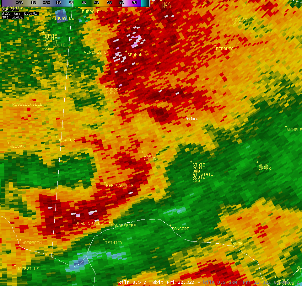
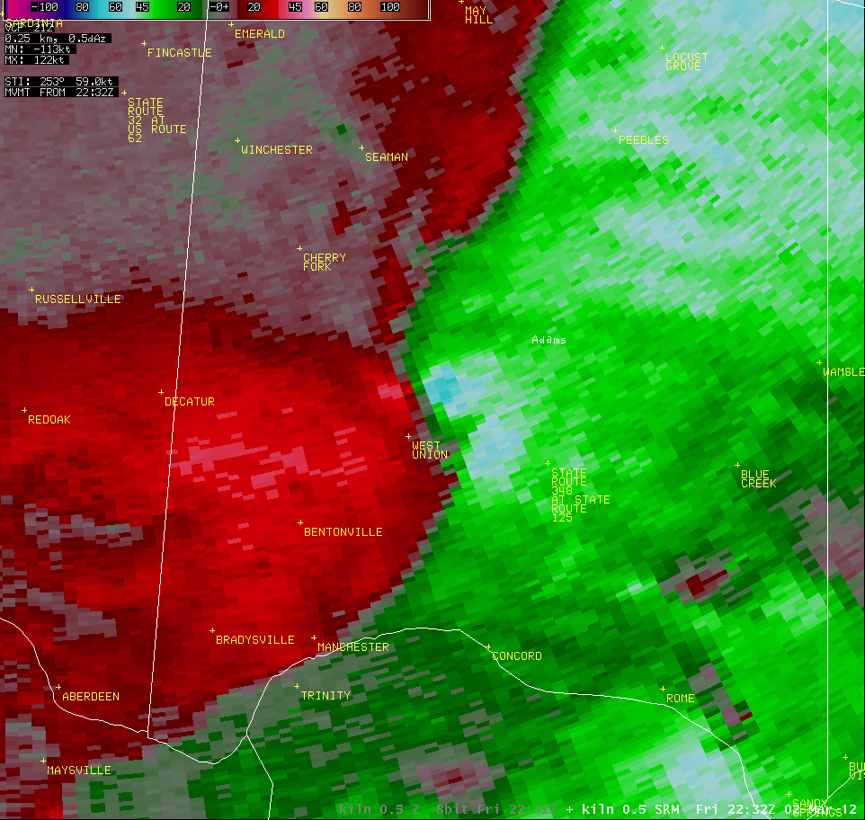
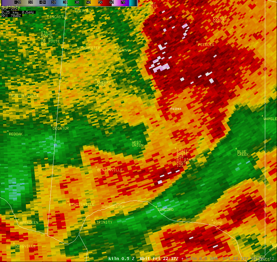
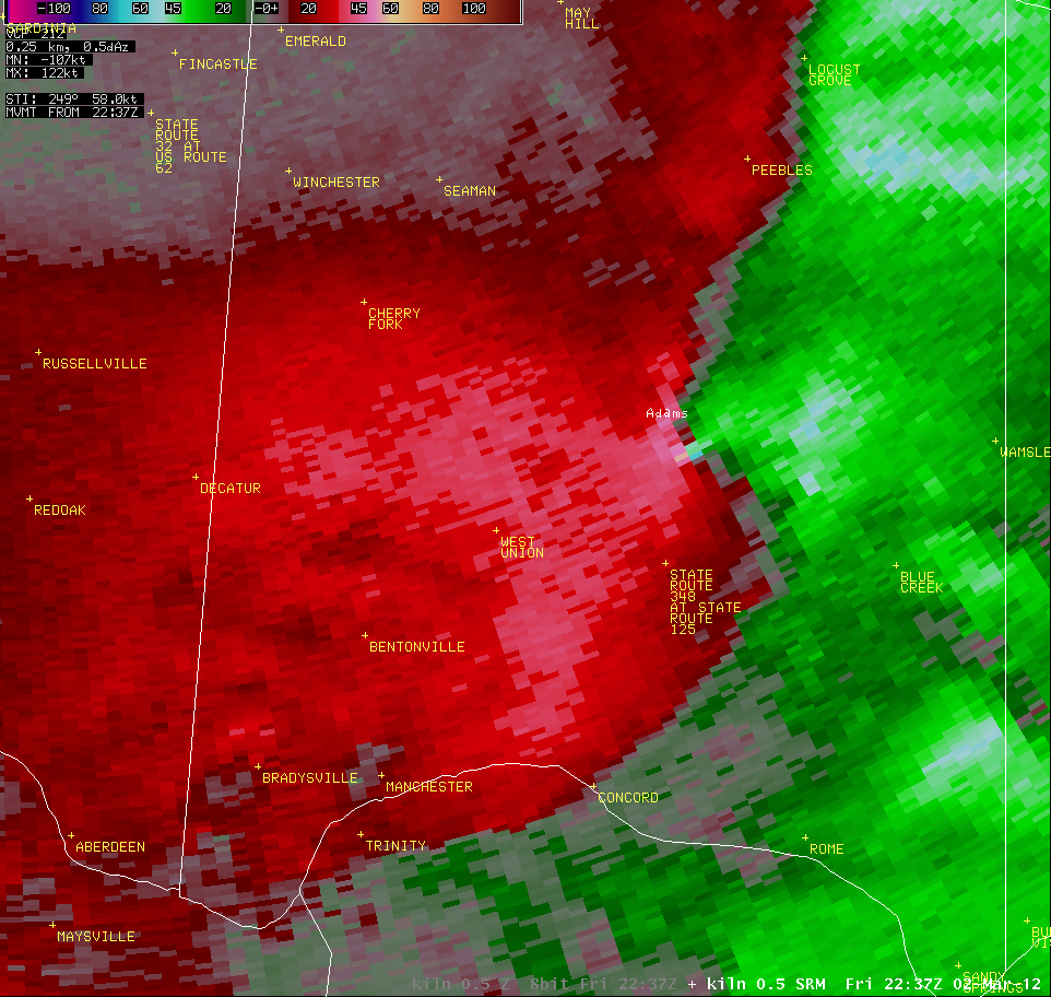
Tornado NE of West Union, OH
|
PUBLIC INFORMATION STATEMENT
NATIONAL WEATHER SERVICE WILMINGTON OH
725 PM EST SAT MAR 3 2012

...TORNADO CONFIRMED NEAR 2NE WEST UNION IN ADAMS COUNTY OHIO...

LOCATION...2NE WEST UNION IN ADAMS COUNTY OHIO
DATE...03/02/2012
ESTIMATED TIME...533 PM EST
MAXIMUM EF-SCALE RATING...EF2
ESTIMATED MAXIMUM WIND SPEED...125 MPH
MAXIMUM PATH WIDTH...0.25 MILES
PATH LENGTH...11 MILES
BEGINNING LAT/LON...38.8110N / -83.5182W
ENDING LAT/LON...38.8417N -83.3163W
* FATALITIES...0
* INJURIES...3

* THE INFORMATION IN THIS STATEMENT IS PRELIMINARY AND SUBJECT TO
CHANGE PENDING FINAL REVIEW OF THE EVENT(S) AND PUBLICATION IN NWS
STORM DATA.

...SUMMARY...
THE NATIONAL WEATHER SERVICE IN WILMINGTON OH HAS CONFIRMED A
TORNADO NEAR 2NE WEST UNION IN ADAMS COUNTY OHIO ON 03/02/2012.

TORNADO TRACK WAS ABOUT 11 MILES WITH TORANDO RANGING IN STRENGTH
FROM EF0 TO EF2. AT LEAST 5 MOBILE HOMES DESTROYED...2 HOMES DAMAGED...
1 BRICK HOME DAMAGED...A DOZEN CATTLE KILLED AND MAJOR POWER
TRANSMISSION POLES KNOCKED OVER.

FOR REFERENCE...THE ENHANCED FUJITA SCALE CLASSIFIES TORNADOES INTO
THE FOLLOWING CATEGORIES:

EF0...WIND SPEEDS 65 TO 85 MPH.
EF1...WIND SPEEDS 86 TO 110 MPH.
EF2...WIND SPEEDS 111 TO 135 MPH.
EF3...WIND SPEEDS 136 TO 165 MPH.
EF4...WIND SPEEDS 166 TO 200 MPH.
EF5...WIND SPEEDS GREATER THAN 200 MPH.

$$
Note: after the above statement was published, the NWS learned of one fatality as a result of this tornado. |
| KILN 0.5° Z -- 5:32 PM | KILN 0.5° SRM -- 5:32 PM |
 |
 |
| KILN 0.5° Z -- 5:37 PM | KILN 0.5° SRM -- 5:37 PM |
 |
 |

