|
Remnants of Hurricane Katrina Remnants of Hurricane Katrina moved through the Ohio Valley during the day and evening of Tuesday, August 30. Katrina brought generally 2 to 3 inches of beneficial rains to the region which helped to improve on the late summer moderate to severe drought. The only flooding reports came from the Cincinnati and Columbus metro areas, where 3 to 4 inches of rain caused ponding of water in some fields and several reports of high water on roadways. The only severe weather that Katrina produced in the region was a brief tornado (F0) touchdown just south of Morrow in Warren county. |
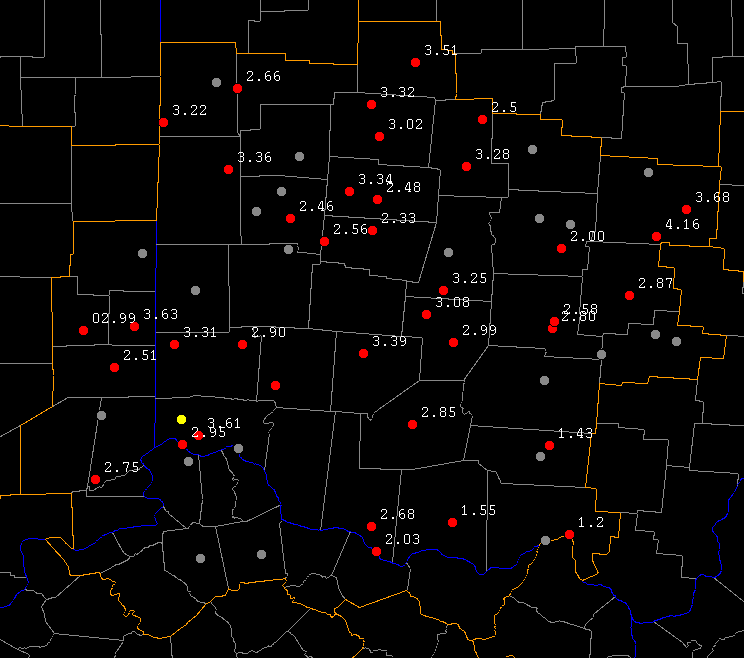
| Measured Rainfall Map: | |||
|
Measured 24 hour rainfall from our Cooperative Observer network. | ||
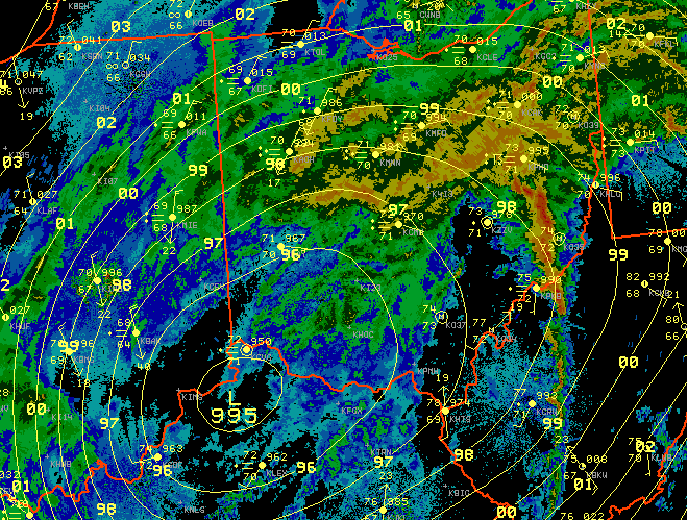
| Radar Images: | |||
|
Image shows surface low (remnants of Katrina) near Cincinnati. The image also shows surface observations from the region as well as a surface analysis for 9 pm (01Z) Tuesday (08-30-05). | ||
|
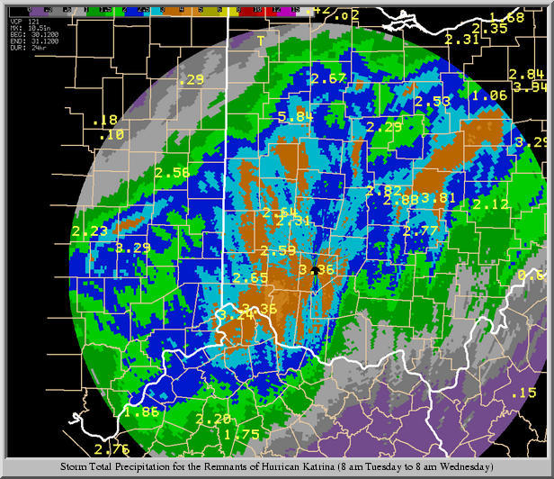
Image shows a radar estimation of how much rain had fallen for the 24 hours between 8 am Tuesday to 8 am Wednesday. The values displayed on the image are actual measured rainfall amounts. Most folks saw 2 to 3 inches of rainfall with a few areas seeing up to 4 inches. Northeast Kentucky and South Central Ohio saw the least amount of rainfall with only around an inch being recorded. | ||
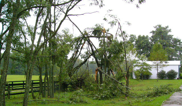
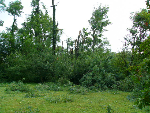
| Tornado Damage Pictures: | |||
|

|
|
|
| Trees Down from an F0 Tornado that touched down near Morrow in Warren county. For further information, see the Public Information Statements below. | |||
PUBLIC INFORMATION STATEMENT NATIONAL WEATHER SERVICE WILMINGTON OH 1157 AM EDT WED AUG 31 2005 ...CONFIRMED TORNADO IN WARREN COUNTY... DAMAGE JUST SOUTH OF MORROW IN WARREN COUNTY HAS BEEN DETERMINED TO BE AN F0 ON THE FUJITA SCALE. THE TORNADO OCCURRED APPROXIMATELY AT 545 PM ON TUESDAY. TORNADOES WITH AN F0 RATING CONTAIN WINDS OF LESS THAN 73 MPH. ADDITIONAL INFORMATION MAY BE SENT LATER THIS AFTERNOON. $$ TIPTON |
PUBLIC INFORMATION STATEMENT NATIONAL WEATHER SERVICE WILMINGTON OH 240 PM EDT WED AUG 31 2005 ...CONFIRMED TORNADO IN WARREN COUNTY...ADDITIONAL INFORMATION... A DAMAGE SURVEY HAS BEEN COMPLETED IN WARREN COUNTY. BASED ON INFORMATION WE CURRENTLY HAVE...AN F0 TORNADO OCCURRED AT APPROXIMATELY 545 PM EDT ON TUESDAY...AUGUST 30 2005. THE TORNADO TOUCHED DOWN ABOUT 2 MILES SOUTH SOUTHEAST OF MORROW AND MOVED INTO THE CITY OF MORROW BEFORE DISSIPATING. THE TORNADO SKIPPED ALONG THIS PATH WHICH EXTENDED FOR ABOUT 2 MILES AND WAS ABOUT 300 TO 400 YARDS WIDE AT THE WIDEST POINT. INDICATIONS ARE THAT THIS TORNADO HAD WINDS ON THE HIGH END OF THE F0 RATING OR UP TO 72 MPH. THE DAMAGE INCLUDED STRUCTURAL DAMAGE TO AN ENCLOSED PATIO AND ROOF DAMAGE TO A HOME. SOME TREES WERE UPROOTED AND SOME TREES AND BRANCHES WERE TWISTED OFF. THE NATIONAL WEATHER SERVICE WOULD LIKE TO THANK THE WARREN COUNTY EMERGENCY MANAGEMENT DIRECTOR AND OTHER LOCAL OFFICIALS FOR THEIR ASSISTANCE WITH THIS SURVEY. $$ PARKER |

