Wait! Are you in the right place???
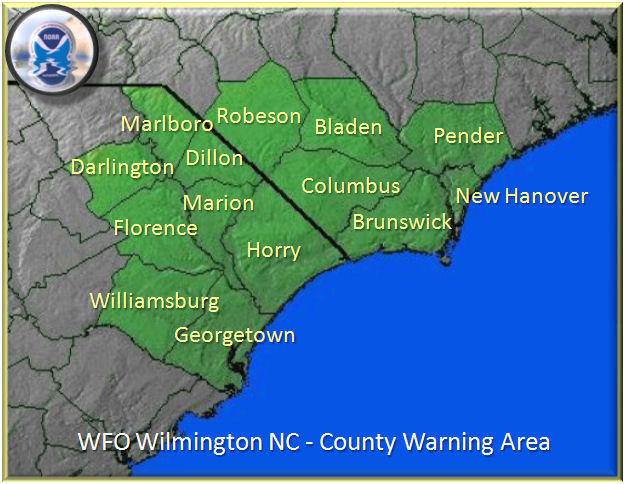
These instructions are only intended for reporting significant weather across northeast South Carolina and southeast North Carolina in the counties shown on the map below. To be sure that you're reporting to the right place, click on this link and enter your location to find your local NWS office. Our neighboring offices include: Charleston, SC | Columbia, SC | Raleigh, NC | Newport/Morehead City, NC
Why Your Report Matters:
Despite having many types of observations at our disposal, we cannot see exactly what's happening everywhere at all times. Thus, you can help be our "eyes and ears" in the field to assist us with forecast verification, and more importantly, warnings for hazardous weather. Although we'd like to hear of any significant weather phenomena that you observe, we're particularly interested in reports of severe weather such as tornadoes/waterspouts, 1" (quarter size) or larger hail, damaging winds and/or flash flooding. Refer to the tabs below for more details regarding these hazards as well as other phenomena.
How To Report:
See below for the various ways of contacting us. Feel free to let us know if you are a trained SKYWARN storm spotter and/or your affiliation (e.g., ham radio operator, law enforcement). After quality controlling your report, we may use it to issue a Local Storm Report (LSR).

- Social Media:
- X/Twitter (try to include the following hashtags to help us find your report: #wxreport, #ncwx, #scwx, and/or #nwsILM)
- Facebook
- Instagram
- Phone:
- #800-697-3901 (for storm reports only; leave message if no answer)
- E-mail:
- Mobile App:
What To Report:
See below for the information you should include in your reports. You can use the "T-E-L" (T=Time / E=Event / L=Location) method for reporting.
- Time (and duration)
- Event Type (e.g., tornado, funnel cloud, strong winds, hail, flooding)
- Location
- Latitude/longitude (*preferred*)
- City/street and/or zip code
- Distance/direction from nearest city (e.g., 4 NE Florence, SC)
- Type of Damage (e.g., downed trees/power lines, structural damage)
- Pictures/videos, especially for tornado reports
- Contact info so we can reach back out if needed
Click on the tabs below for more detailed information on what to report. You can also refer to the Weather Spotter's Field Guide.
Thanks for your reports and for helping us help you!!
Tornado: A violently rotating column of air extending from the base of a thunderstorm cloud to the ground. If a tornado is over water it is classified as a waterspout. The Enhanced Fujita (EF) Tornado Intensity Scale (seen below) is used to categorize the strength of tornadoes. We assign these ratings after we go out and survey the damage. More information about the EF scale and damage indicators are located here.
Enhanced Fujita (EF) Tornado Intensity Scale
| EF Rating |
3 Second Gust (mph) |
| 0 |
65-85 |
| 1 |
86-110 |
| 2 |
111-135 |
| 3 |
136-165 |
| 4 |
166-200 |
| 5 |
Over 200 |
Funnel Cloud: A condensation funnel extending from the base of a towering cumulus or cumulonimbus cloud, associated with a rotating column of air that is not in contact with the ground/water surface. Not all funnel clouds will become tornadoes. A condensation funnel only becomes a tornado if either a) it becomes in contact with the ground/water surface or b) a debris cloud or dust whirl is visible beneath it.
What kind of damage did the wind cause?
- Small limbs down (less than 2" in diameter)?
- Large limbs/branches down (more than 2" in diameter)?
- Trees snapped or uprooted?
- Power lines down (DO NOT TOUCH!)?
- Structural damage and/or roof damage?
- Did you measure wind gusts of 40 mph or greater?
| Size Description |
Diameter (inches) |
| Pea |
1/4 |
| Penny |
3/4 |
| Nickel |
7/8 |
| Quarter |
1.00* |
| Half Dollar |
1.25* |
| Ping Pong Ball |
1.50* |
| Golf Ball |
1.75* |
| Hen Egg |
2.00* |
| Tennis Ball |
2.50* |
| Baseball |
2.75* |
| Grapefruit |
4.00* |
| Softball |
4.50* |
*Any hail size at or above a quarter (1.00 inches) is considered to be a severe thunderstorm.
Flooding
What kind of flooding was observed?
- Minor street flooding?
- Low water crossings flooded?
- Widespread flooding?
- Homes or businesses flooded?
- Creeks, streams, or rivers flowing out of their banks?
- Roads closed?
- Water flowing or standing still? How deep is it (DO NOT ENTER FLOOD WATERS...just give an approximation)?
Heavy Rain
- How much rain fell (e.g., 1.50")?
- What period of time did the rain fall (e.g., 1 hour)?
- Was the rainfall measurement estimated or measured with equipment?
- Click here for details on measuring snowfall
- How much snow fell (to the nearest tenth of an inch (e.g., 1.5")?
- When did the snow begin/end?
- When did the snow amount first reach 2 inches?
- Was the snowfall estimated or measured with equipment?
- How are the road conditions? Are there any roads closed?
- Click here for details on measuring ice accumulation
- How much icing was observed (to the nearest tenth of an inch (e.g., 0.5")?
- How long did the ice accumulate (e.g., 2 hours)?
- How are the road conditions? Are there any roads closed?
- Any downed trees or power lines due to significant icing?
- Visibilities reduced to one half mile or less (over land or water)


 Coastal Flood