Overview
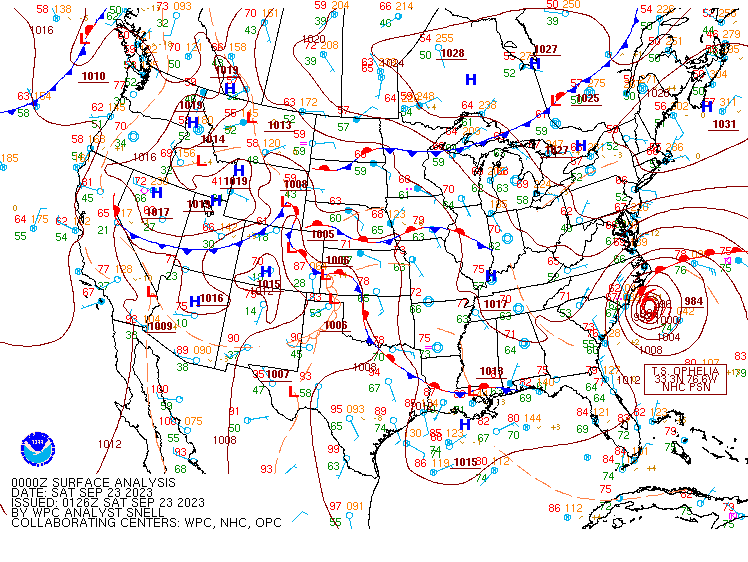
Tropical Storm Ophelia developed from a non-tropical low off the Southeast U.S. coast and moved northward off the coasts of northeast SC and southeast NC before making landfall at Emerald Isle, NC during the early morning of September 23, 2023. The main impacts were felt across Pender and New Hanover Counties in southeast NC where some minor wind damage and coastal flooding occurred. |
|
|
|
 |
|
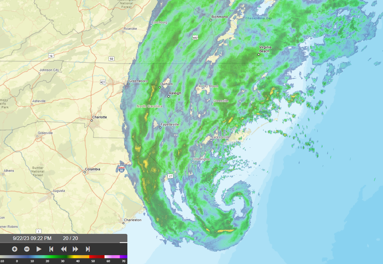
NWS doppler radar image of Tropical Storm Ophelia on September 22, 2023 at 922 PM EDT |
Weather Prediction Center surface analysis on September 23, 2023 at 00 UTC (8 PM EDT). |
Although wind gusts reached near minimal hurricane strength (>=64 kt/74 mph) offshore, gusts inland reached tropical storm force (>=34 kt/39 mph) across north coastal SC into southeast NC. Some select wind observations are included in the table below. Pender and New Hanover Counties in NC reported some minor wind impacts, mainly from downed trees.
| Location | Peak Wind Gust (mph) | Peak Wind Gust (kt) |
| Wrightsville Beach Offshore Buoy (41037) | 71 | |
| Frying Pan Shoals Buoy (41013) | 62 | |
| Wrightsville Beach Nearshore Buoy (41038) | 53 | |
| Federal Point, NC (Weatherflow - 50 ft) | 52 | |
| Wrightsville Beach, NC (NOS-Johnnie Mercers Pier) | 47 | |
| Sunset Beach Nearshore Buoy (41024) | 45 | |
| Oak Island, NC (Weatherflow) | 41 | |
| Lockwoods Folly Inlet (Weatherflow) | 40 | |
| Wilmington Airport, NC (KILM) | 56 | |
| Southport, NC (KSUT) | 45 | |
| Myrtle Beach, SC (KMYR) | 44 | |
| N Myrtle Beach, SC (KCRE) | 41 | |
| Elizabethtown, NC (KEYF) | 40 |
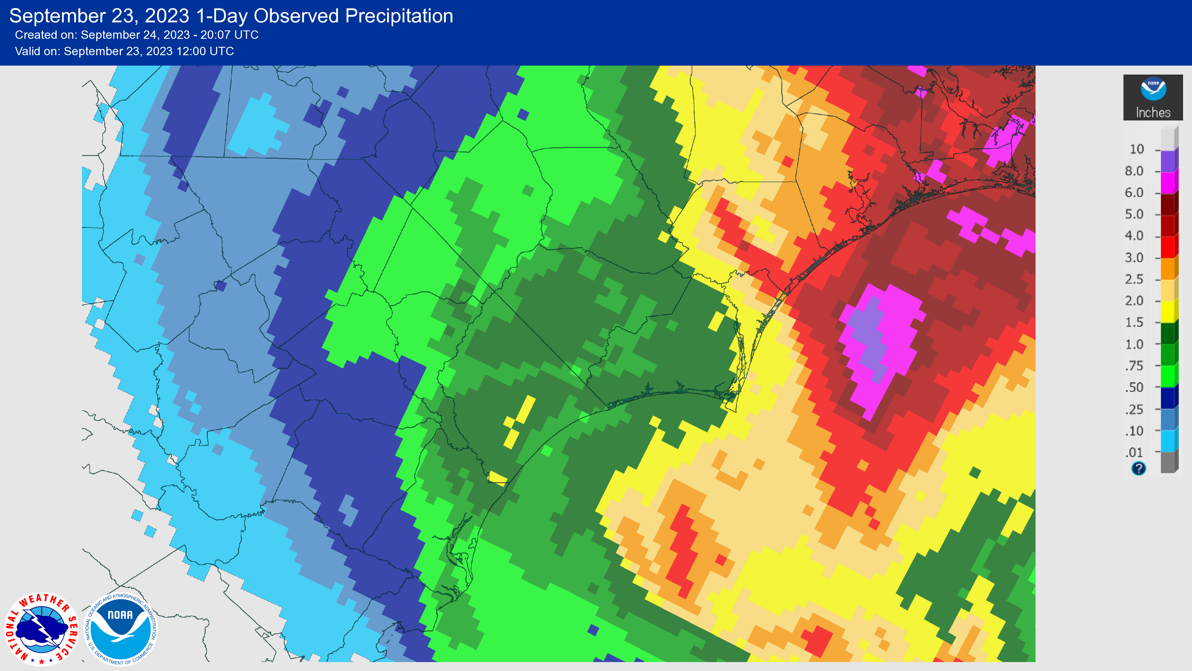
The storm produced up to ~4 inches of rain, especially across southeastern NC. The table below includes select rainfall totals from 12 UTC (8 AM EDT) September 22 through 12 UTC (8 AM EDT) September 23, 2023.
| Location | Rainfall (inches) |
| Porters Neck, NC | 4.04 |
| Watha, NC (3S) | 3.73 |
| Burgaw, NC (0.3 NE) | 3.52 |
| Back Island, NC | 3.33 |
| Surf City, NC (2.5 NW) | 3.25 |
| Hampstead, NC (4.1 WNW) | 3.24 |
| Ogden, NC | 3.22 |
| Southport, NC (St James) | 3.22 |
| Surf City, NC (Saltwater Landing) | 3.16 |
| Wilmington (6.7 NE) | 3.15 |
|
|
|
Wilmington, NC doppler radar (KLTX) precipitation estimate from 12 UTC September 22 to 12 UTC September 23, 2023. However, some rain from the storm also fell prior to and after this period. |
Tides running higher than normal caused minor coastal flooding along the southeastern NC coast.
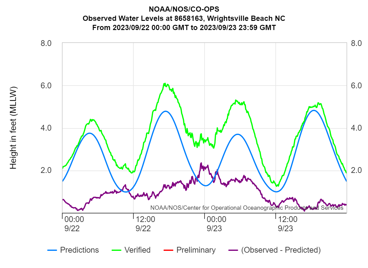 |
| Water level observations (ft above MLLW) at the NOAA/NOS tide gage at Johnnie Mercer's Pier on Wrightsville Beach, NC. The highest tide level was 6.1 ft MLLW (1.61 ft MHHW) at 1718 UTC on 9/22/23. Minor coastal flooding typically begins at 6.0 ft MLLW (1.52 ft MHHW). |
Tornadoes
No tornadoes were recorded.
Additional Info
Page Author: Bob Bright
Page Created: May 3, 2024


 Coastal Flood