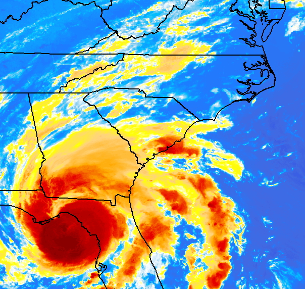
After making landfall in the Big Bend area of Florida as a Category 3 hurricane on August 30, Idalia weakened to a tropical storm as it moved across southeastern Georgia. The storm then moved off the northern South Carolina coast and just off the southeastern North Carolina coast early on August 31 causing flooding from heavy rain and storm surge, tropical storm-force wind gusts and 5 tornadoes.
|
IR satellite loop of Tropical Storm Idalia tracking through the Southeast U.S. on August 30-31, 2023 |
Tropical storm force wind gusts occurred across much of southeast NC and northeast SC with the highest gusts mainly near the coast and offshore. The combination of gusty winds and heavy rain led to some downed trees and power lines.
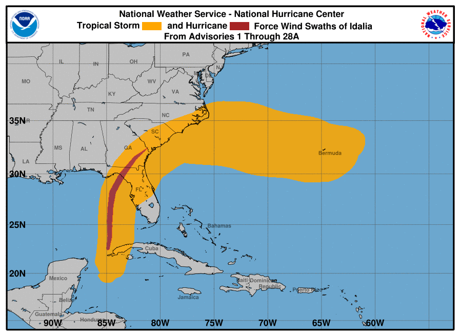 NHC Tropical Storm and Hurricane Force Wind Swaths of Idalia |
|
Widespread heavy rain fell across southeastern NC and northeastern SC with localized amounts over 10 inches which led to flash flooding, especially in Horry County, SC and Columbus County, NC.
|
NWS radar mosaic showing Idalia moving northeast across the Southeast U.S. from 0830 UTC (0430 EDT) on August 30, 2023 through 0830 UTC (0430 EDT) on August 31, 2023. |
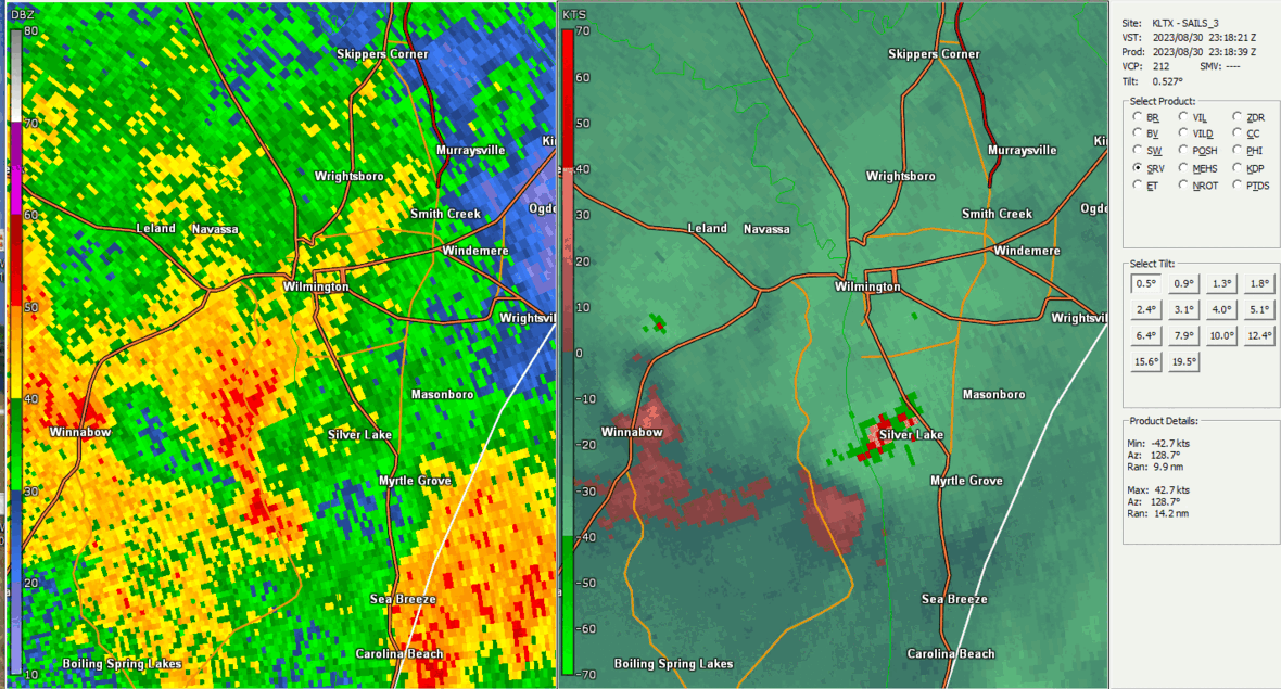
5 tornadoes were confirmed: Horry County, SC (1 EF-0), Brunswick County, NC (1 EF-1 and 2 EF-0), New Hanover County, NC (1 EF-1).
 |
|
NWS Wilmington, NC doppler radar reflectivity (left) and storm-relative velocity (right) showing 2 tornadoes touching down just south of Wilmington, NC. |
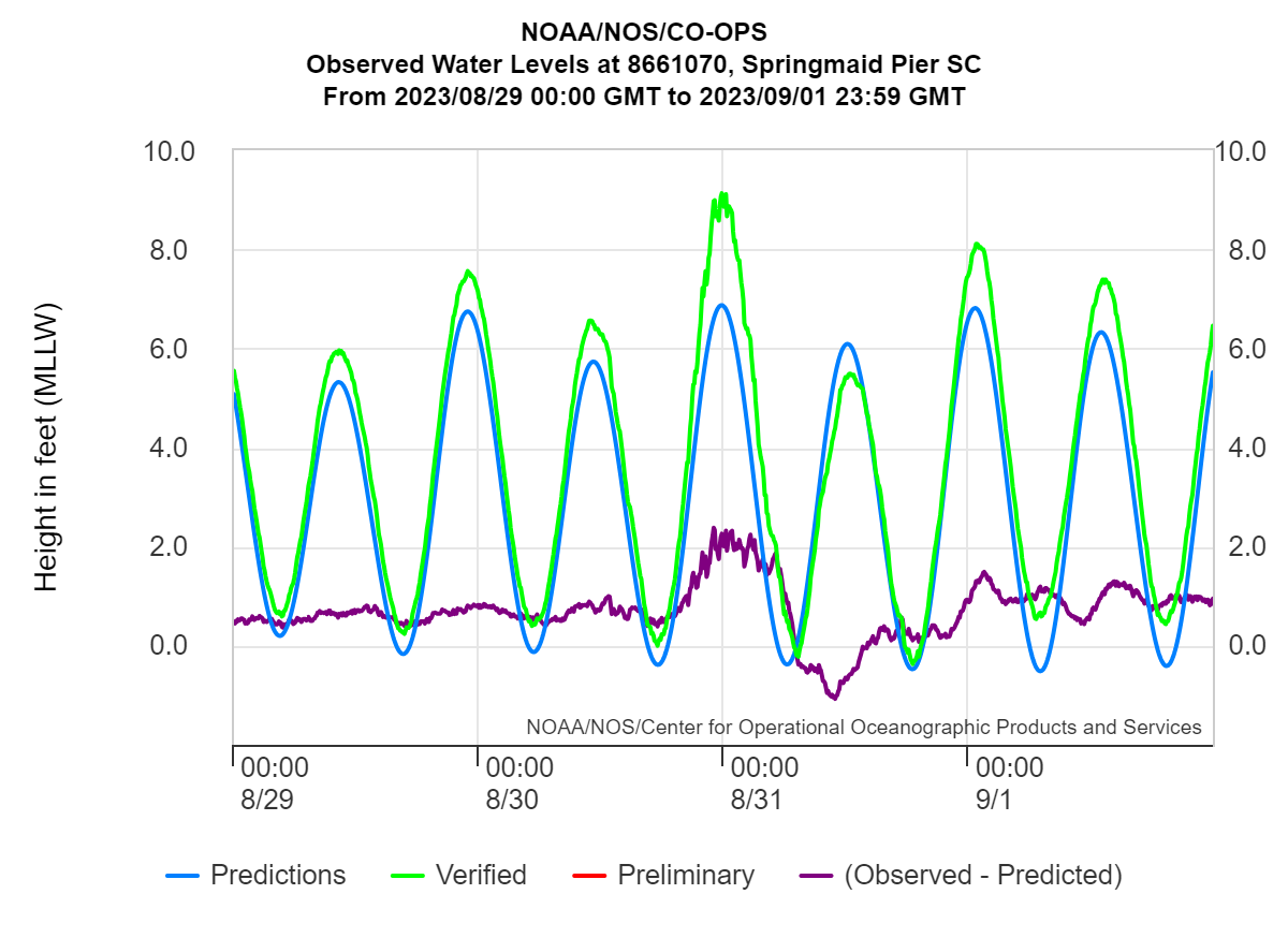
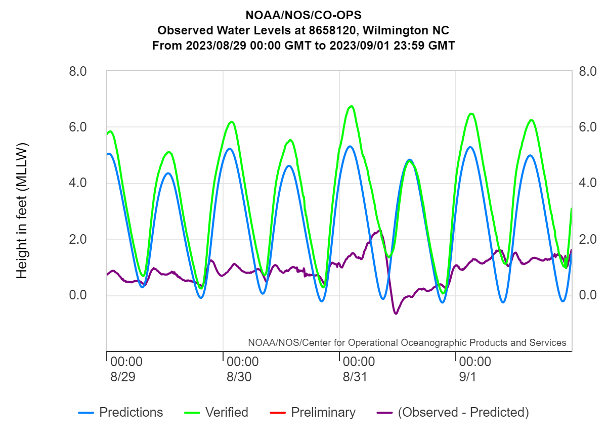
High tides led to several rounds of minor to moderate coastal flooding along the northern SC and southern NC coasts. Notice that the greatest anomalies (i.e., surge) occurred closer to a high tide at Myrtle Beach, SC which led to higher water levels compared to Wrightsville Beach/Wilmington, NC.
 |
 |
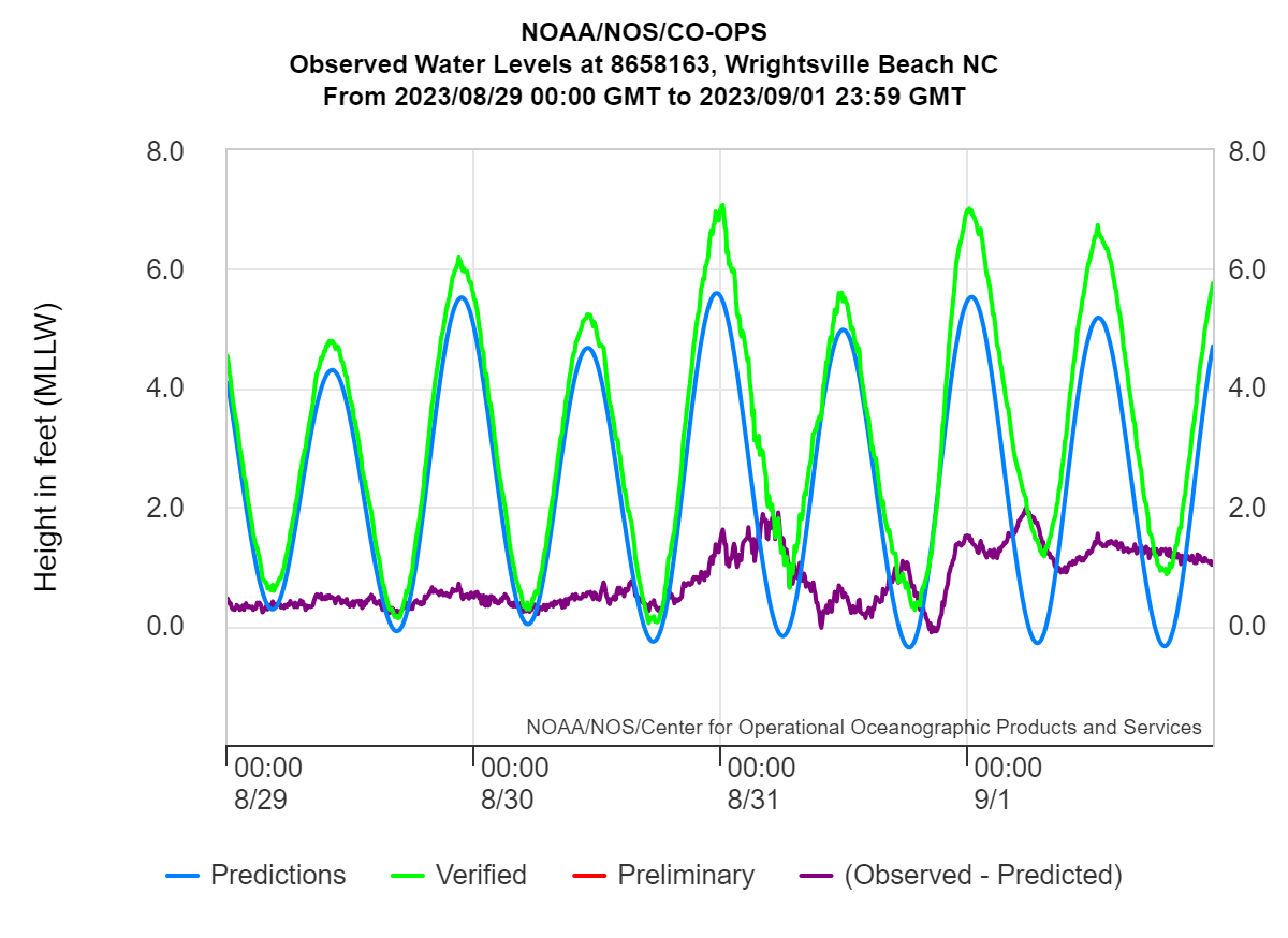 |
| Water level observations (ft above MLLW) at the NOAA/NOS tide gage at Myrtle Beach, SC. The peak tide was 9.13 ft MLLW (3.53 ft MHHW) at 2348 UTC on 8/30/23. | Water level observations (ft above MLLW) at the NOAA/NOS tide gage at Wilmington, NC. The peak tide was 6.74 ft MLLW (2.05 ft MHHW) at 0224 UTC on 8/31/23. | Water level observations (ft above MLLW) at the NOAA/NOS tide gage at Wrightsville Beach, NC. The peak tide was 7.08 ft MLLW (2.6 ft MHHW) at 0012 UTC on 8/31/23. |
Page Author: Bob Bright
Last Updated: May 4, 2024


 Coastal Flood