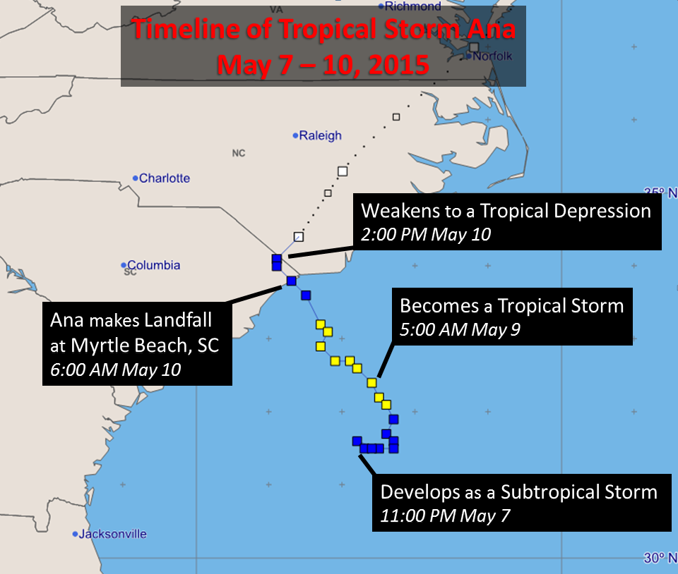
 Tropical Storm Ana was an out-of-season tropical cyclone that impacted coastal South and North Carolina on May 9-10, 2015. Ana initially developed as a subtropical storm north of the Bahamas during the evening of May 7th. In this case the subtropical designation was used because Ana developed out of an upper level low which contained unusually cold temperatures aloft. As Ana meandered over the warm Gulf Stream waters on May 8th it gradually strengthened and acquired tropical characteristics. By the morning of May 9th Ana was designated a Tropical Storm. At its peak intensity, Ana had winds near 60 mph while still well away from shore.
Ana made landfall near Myrtle Beach, SC around 6:00 am on Sunday May 10, 2015. At the time maximum sustained winds had decreased to 45 mph with a central pressure of 1002 millibars or 29.59 inches Hg. The storm then steadily weakened as it dumped over six inches of rain across from North Myrtle Beach, SC to Oak Island and Southport, NC.
 |
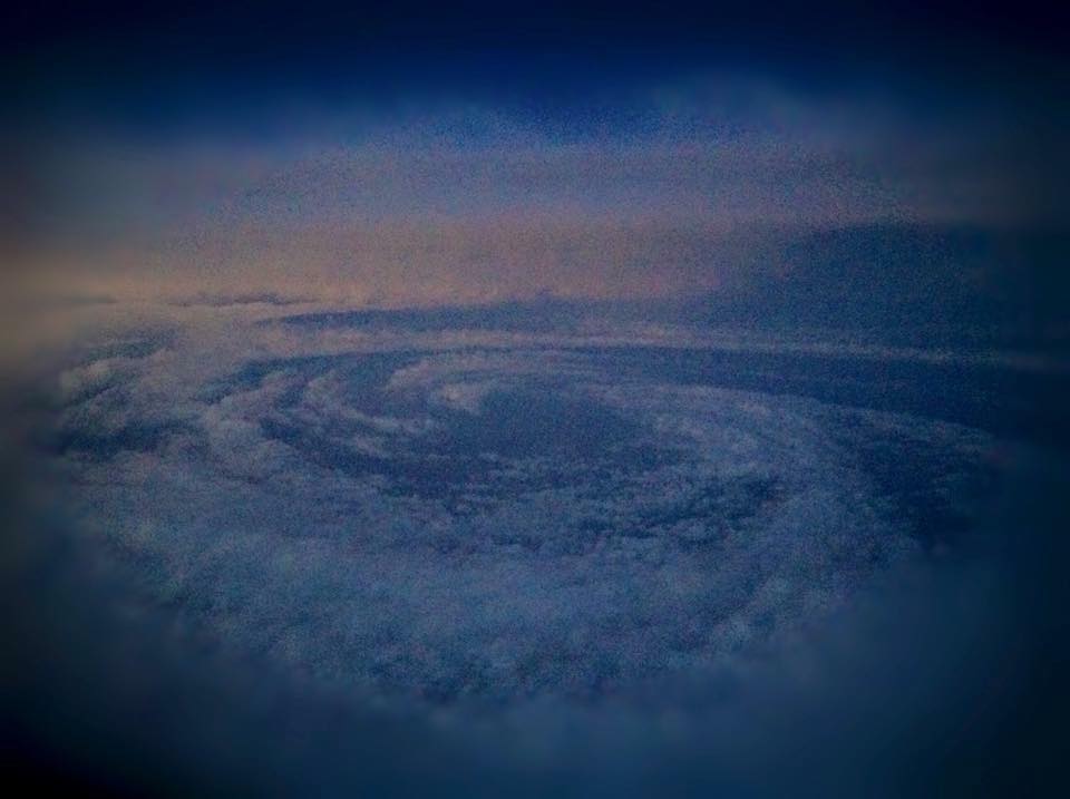
| The center of developing subtropical storm Ana as viewed from a jet flying at an altitude of 39,500 feet east of the South Carolina/Georgia coast. Anonymous source who agreed to its use here. |
Ana was the second earliest landfalling tropical cyclone on record for the United States, surpassed only by the Groundhog Day tropical storm which struck Florida on February 3, 1952. Multiple tropical storms and even a couple of hurricanes (Hurricane Two, 1908; Hurricane One, 1938) have developed earlier in the season than Ana. Hurricane Alice formed in December 1954 and was still a hurricane on January 2, 1955 in the Caribbean Sea.
Ana's highest wind gusts on land reached 50 to 60 mph from Little River and Cherry Grove Beach eastward across the state line to Sunset Beach, Calabash, Ocean Isle Beach, to Oak Island. These winds created large surf which caused moderate to severe beach erosion along parts of the North and South Carolina coast. Beach communities particularly hard hit with erosion included Kure Beach, North Myrtle Beach, and Cherry Grove Beach. In Surf City, NC enough sand eroded to reveal a portion of the William H. Sumner, a three-masted wooden sailing ship shipwrecked near Topsail Inlet in 1919.
Above are satellite loops of visible (left) and infrared (right) imagery showing the development of Ana over several days before the eventual landfall on May 10th. Note how Ana's appearance changed from its large subtropical origin to a more-compact tropical storm before landfall.
Tides along the Carolina coast ranged from 1.4 feet to 2.3 feet above normal due to Ana's storm surge. However this remained just below coastal flooding thresholds at both Myrtle Beach and Wrightsville Beach.
| Highest Wind Gusts from Tropical Storm Ana | |
| Frying Pan Shoals Buoy, offshore NC | 62 mph |
| Southport, NC (mesonet, 85 ft. elevation) | 62 mph |
| Ocean Crest Pier, Oak Island, NC | 60 mph |
| Little River, SC (mesonet) | 53 mph |
| Oak Island, NC (Weatherflow network) | 53 mph |
| Buoy 41038, Offshore NC | 49 mph |
| North Myrtle Beach, SC (airport) | 49 mph |
| Sunny Point Military Terminal, NC | 49 mph |
| Winyah Bay, SC (Weatherflow network) | 48 mph |
| Johnnie Mercer Pier, Wrightsville Beach, NC | 46 mph |
| Wilmington State Port, NC (mesonet) | 45 mph |
| Masonboro Island, NC | 44 mph |
| Springmaid Pier, Myrtle Beach, SC | 43 mph |
| Green Swamp, NC; Nature Conservancy | 41 mph |
| Wrightsville Beach, NC (mesonet) | 40 mph |
| Wilmington, NC (airport) | 40 mph |
| Socastee, SC; Schwartz WWTP (mesonet) | 40 mph |
| Hampstead, NC (mesonet) | 40 mph |
| Myrtle Beach, SC (airport) | 39 mph |
Rainfall from Tropical Storm Ana reached over six inches in locations from Myrtle Beach across Oak Island to Southport. No flooding was reported, and in fact rainfall from Ana was beneficial in what is typically one of the drier periods of the year for the Carolinas.
Additional Information:
National Hurricane Center: Tropical Storm Ana Archive
NWS Wilmington, NC: Post Storm Report, Tropical Storm Ana
NWS Newport/Morehead City, NC: Tropical Storm Ana
USAtoday: Tropical Storm Ana makes landfall at Myrtle Beach
Page Author: Tim Armstrong
Date Created: May 28, 2015
Last Updated: June 1, 2015