The remnant low from Hurricane Delta and a front stalled near the North Carolina/South Carolina border set the stage for a tornado outbreak across eastern South and North Carolina during the afternoon of October 11, 2020. NWS storm surveys confirmed four tornadoes touched down in all -- fortunately with no fatalities. One injury occurred north of Conway, SC.
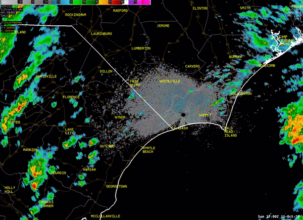
Radar loop for the afternoon of October 11, 2020. Red boxes denote tornado warnings that were issued at the time.
Interstate 95 Tornado near Latta, SC
| Maximum Winds / EF Scale | 105 mph / EF1 |
| Starting Location | 4.4 miles NW of Latta |
| Ending Location | 4.1 miles NW of Latta |
| Maximum Width | 40 yards |
| Path Length | 0.5 miles |
| Injuries | 0 |
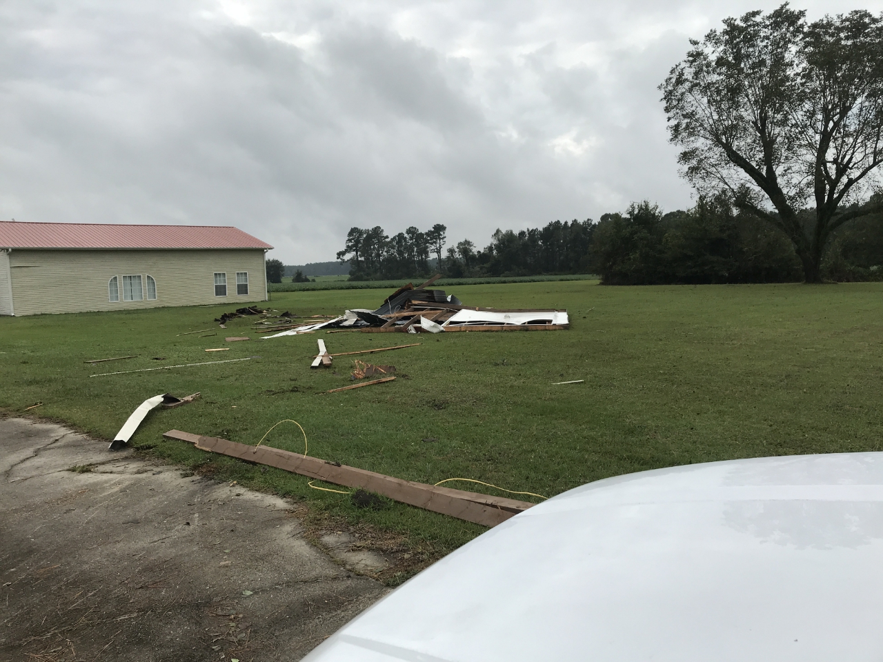
At 3:20 pm a tornado developed just west of Interstate 95 in Dillon County, SC just south of mile marker 184. This is about 4.4 miles northwest of the town of Latta. Snapped pine trees, a damaged billboard, and a destroyed shed marked the beginning of the tornado's track. Based on observed damage wind speeds are estimated to have ranged from 95 to 104 miles per hour at this point.
About one-quarter of a mile to the northeast, the underpinning of a trailer was damaged and metal roofing was blown off a home. The tornado then crossed Interstate 95 near the Catfish Church Road overpass, miraculously injuring no one along this very busy highway. Video widely shared on social media showed metal debris flying across the interstate as the tornado stopped traffic.
After emerging on the east side of Interstate 95, the tornado continued moving northeastward for approximately one-quarter mile, snapping trees as it entered a forested area around 3:21 pm. Based on the size and type of trees destroyed, wind speeds of 100 to 104 miles per hour are estimated here.
|
|
|
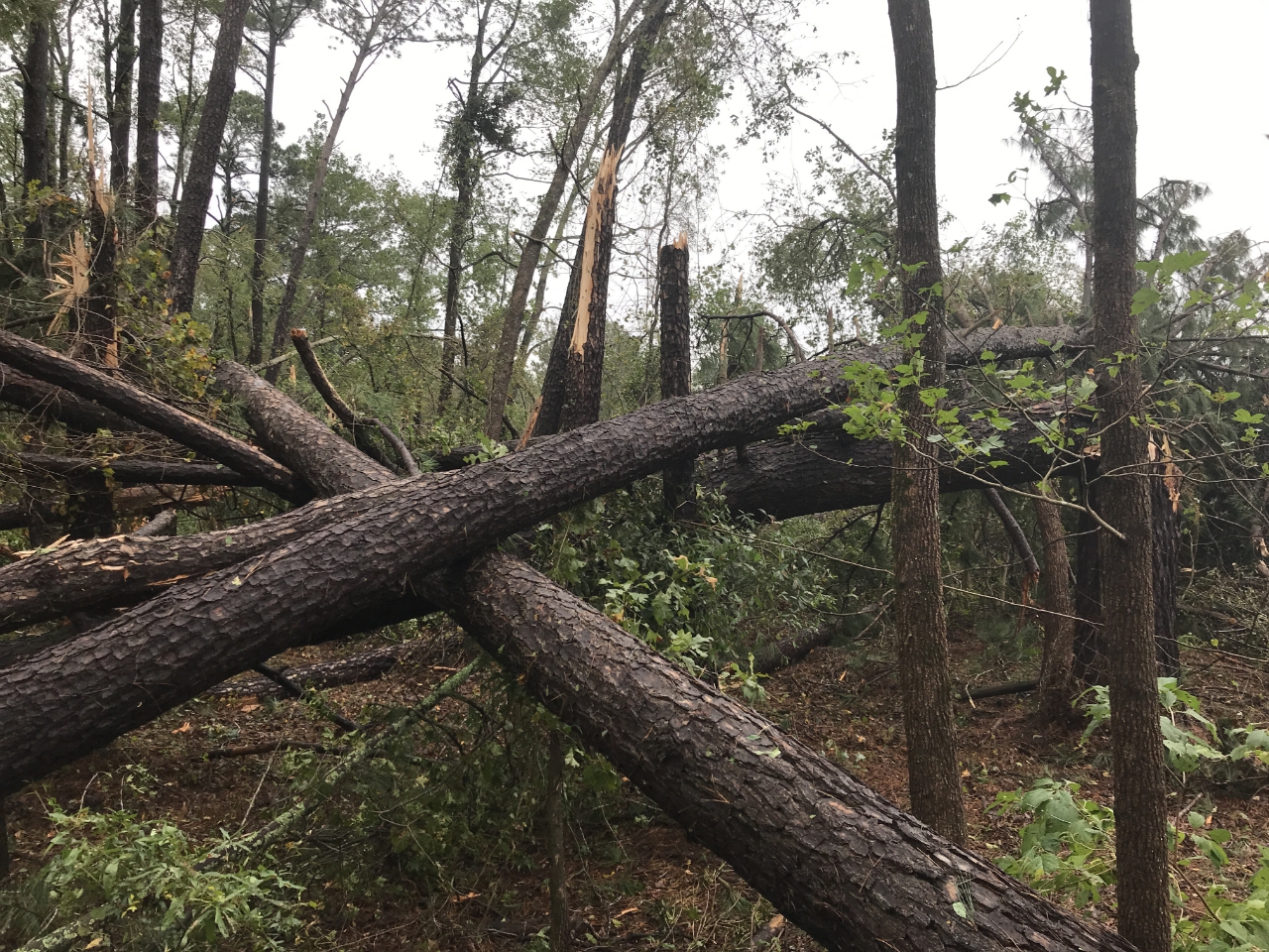
Photo of trees blown down from the Interstate 95 tornado, taken during an NWS Storm Survey on October 12, 2020 |
Tornado North of Conway, SC
| Maximum Winds / EF Scale | 100 mph / EF1 |
| Starting Location | 3 miles NNW of Conway |
| Ending Location | 3 miles NNW of Conway |
| Maximum Width | 30 yards |
| Path Length | 0.3 miles |
| Injuries | 1 |
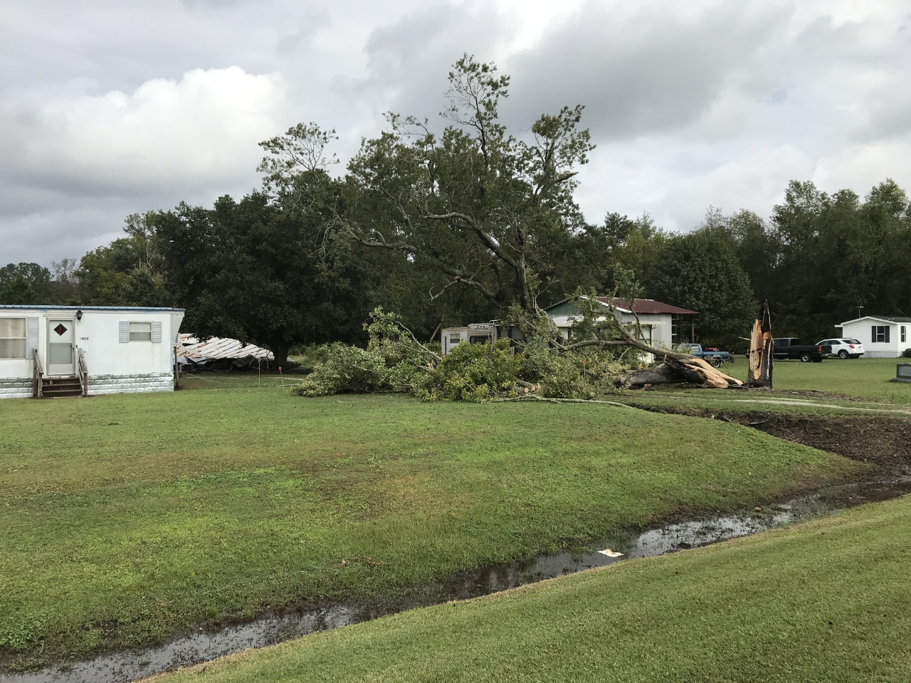
The second tornado of the day developed around 4:19 pm in a field west of Oak Street Extension about 3 miles north of Conway, SC. Based on the damage observed to tree limbs, wind speeds are estimated to have been 60 miles per hour at this location. The tornado then strengthened and moved northeastward, causing significant damage to a home along Oak Street. Observed damage to the home was suggestive of wind speeds around 100 miles per hour. Other structures including another home, a barn, and a storage shed were also damaged nearby. The tornado then weakened slightly as it moved into the woods just south of Brown Swamp. Uprooted trees here indicate wind speeds had fallen to around 76 miles per hour. The tornado then dissipated as it moved deeper into the woods.
|
|
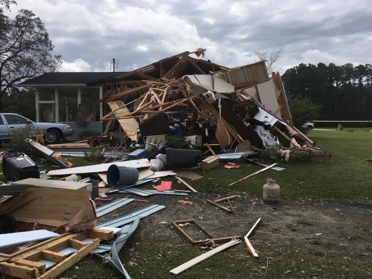
Photo of significant damage from a home from a tornado three miles north of Conway, taken during an NWS Storm Survey on October 12, 2020 |
Tornado southeast of Conway, SC
| Maximum Winds / EF Scale | 80 mph / EF0 |
| Starting Location | 2 miles NNW of Red Hill |
| Ending Location | 3 miles N of Red Hill |
| Maximum Width | 20 yards |
| Path Length | 2.27 miles |
| Injuries | 0 |
A tornado developed at 4:31 pm in the Rabon Crossroads neighborhood several miles southeast of Conway, SC. Large trees limbs were observed to have been blown down near the intersection of Amber Lane and Wedding Lane. A sign was also destroyed along nearby Highway 501. Wind speeds here are estimated to have been near 65 miles per hour. The tornado skipped above the ground northeastward causing no discernible damage along Clay Ridge Road. The tornado descended down to the ground again as it reached Blueridge Circle where tree limbs were blown down. Estimated wind speeds here are around 60 miles per hour.
The tornado crossed Highway 90 and moved across the Bridgewater neighborhood, causing damage to fences, trees, and a manufactured home. Observed damage here support wind speeds of 70 to 75 miles per hour. The tornado then moved into Steritt Swamp and uprooted several trees along Lee's Landing Circle and dissipated less than a minute later.
|
|
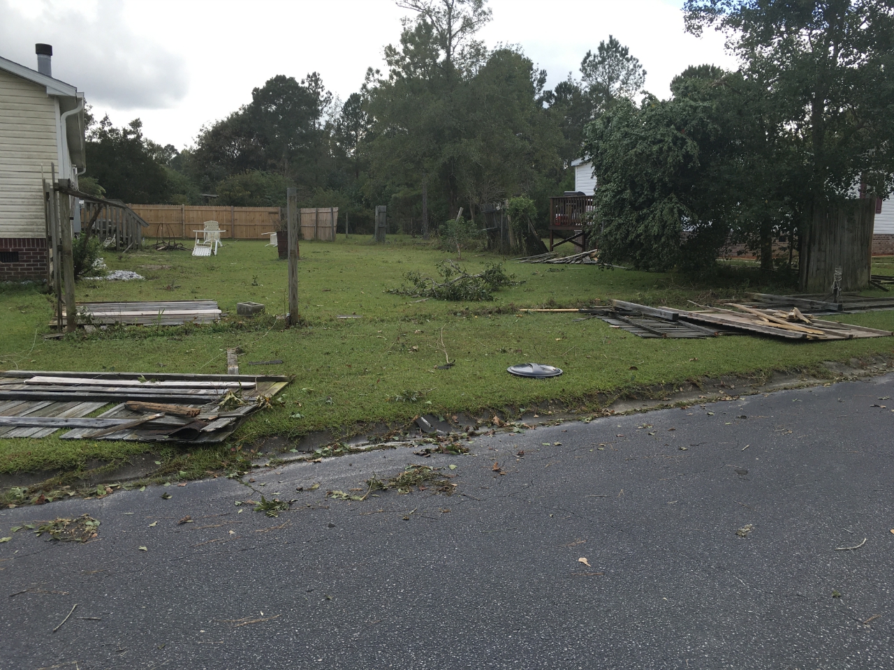
A fence blown down in the Bridgewater neighborhood off Highway 90 east of Florence. Photo taken during an NWS storm survey on October 11, 2020.
Nakina, NC Tornado
| Maximum Winds / EF Scale | 95 mph / EF1 |
| Starting Location | 1 mile SE of Nakina |
| Ending Location | 5 miles NE of Nakina |
| Maximum Width | 30 yards |
| Path Length | 5.76 miles |
| Injuries | 0 |
The final tornado of the event developed near the town of Nakina in southern Columbus County, NC around 5:51 pm. The tornado developed near the intersection of Seven Creeks Highway and Happy Home Road damaging large tree limbs and removing shingles from the roof of a detached garage. Damage was suggestive of wind speeds up to 80 mph in this area. The tornado followed Seven Creeks Highway northward to near the intersection with Walter Ward Road
Turning northeastward, the tornado snapped numerous trees along Smith Road where wind speeds appear to have increased to around 95 miles per hour. Additional large trees were snapped as the tornado crossed Hoover Road. As the tornado crossed Ervin T. Richardson Road, it caused damage to an outbuilding and large trees with estimated wind speeds in the 90 to 95 mile per hour range.
Continuing northeastward, tornado damage continued to be observed as far north as Dock Road just north of its intersection with Big Island Road. Large tree limbs were blown down and one tree was uprooted due to winds estimated to have been 65 to 85 miles per hour. The tornado apparently dissipated as it entered dense woods at Bear Branch and White Marsh surrounding the Waccamaw River.
|
Roof debris was observed along Hoover Road from the Nakina tornado. Photo taken during an NWS Storm Survey on Oct 12, 2020 |
|
A large tree was blown down by the Nakina tornado along Richardson Road. Photo taken during an NWS Storm Survey on Oct 12, 2020 |
Official storm survey text reports on the tornadoes:
NWS Storm Prediction Center severe weather reports for October 11, 2020
WPC high resolution surface map for 5 PM EDT October 11, 2020
Page Author: Tim Armstrong
Last Updated: October 12, 2020


 Coastal Flood
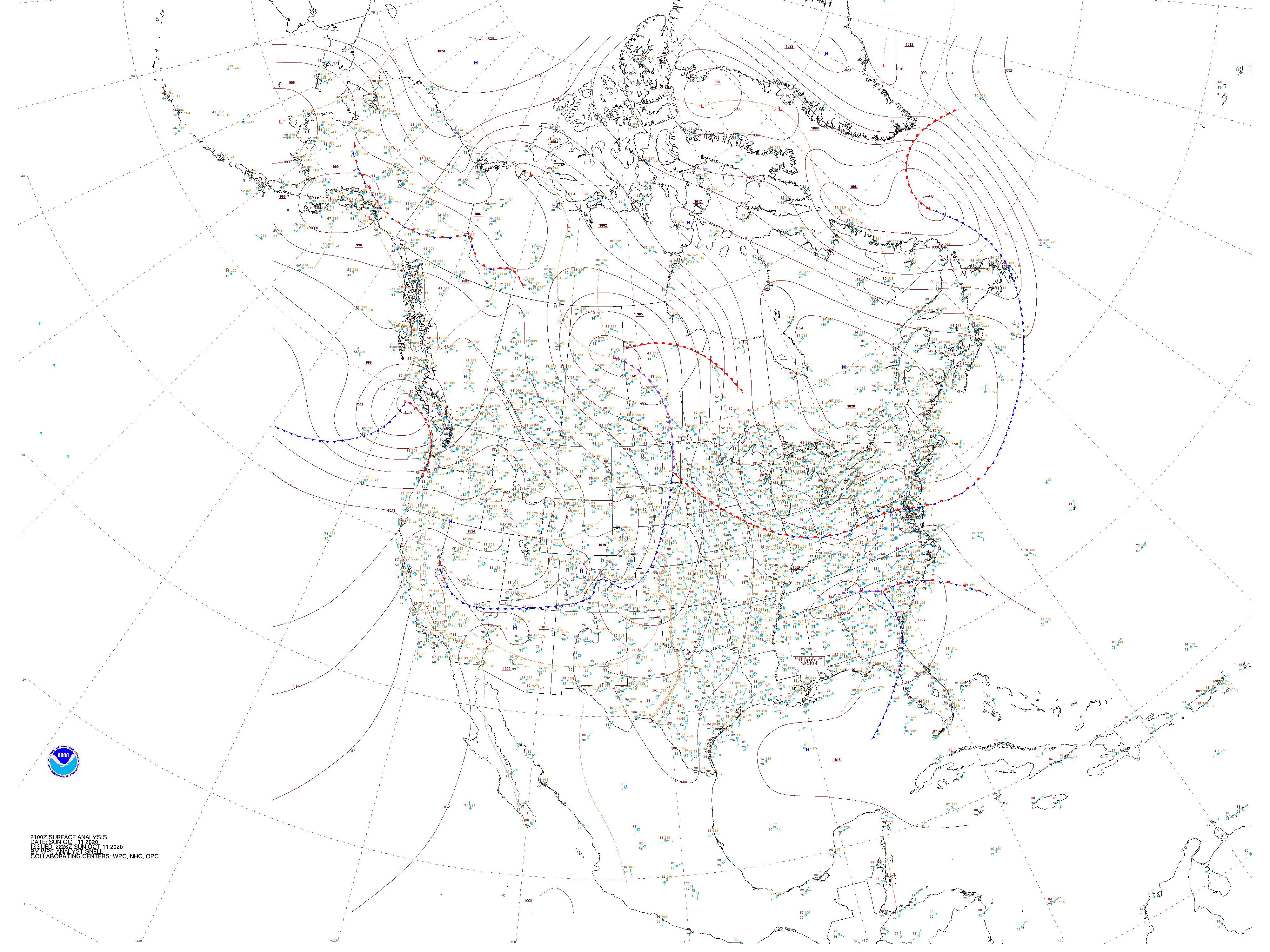