|
Map of snowfall accumulations from the January 3-4, 2018 snowstorm. A list of specific snowfall totals is available at the bottom of this webpage. Map drawn by Carl Morgan. |
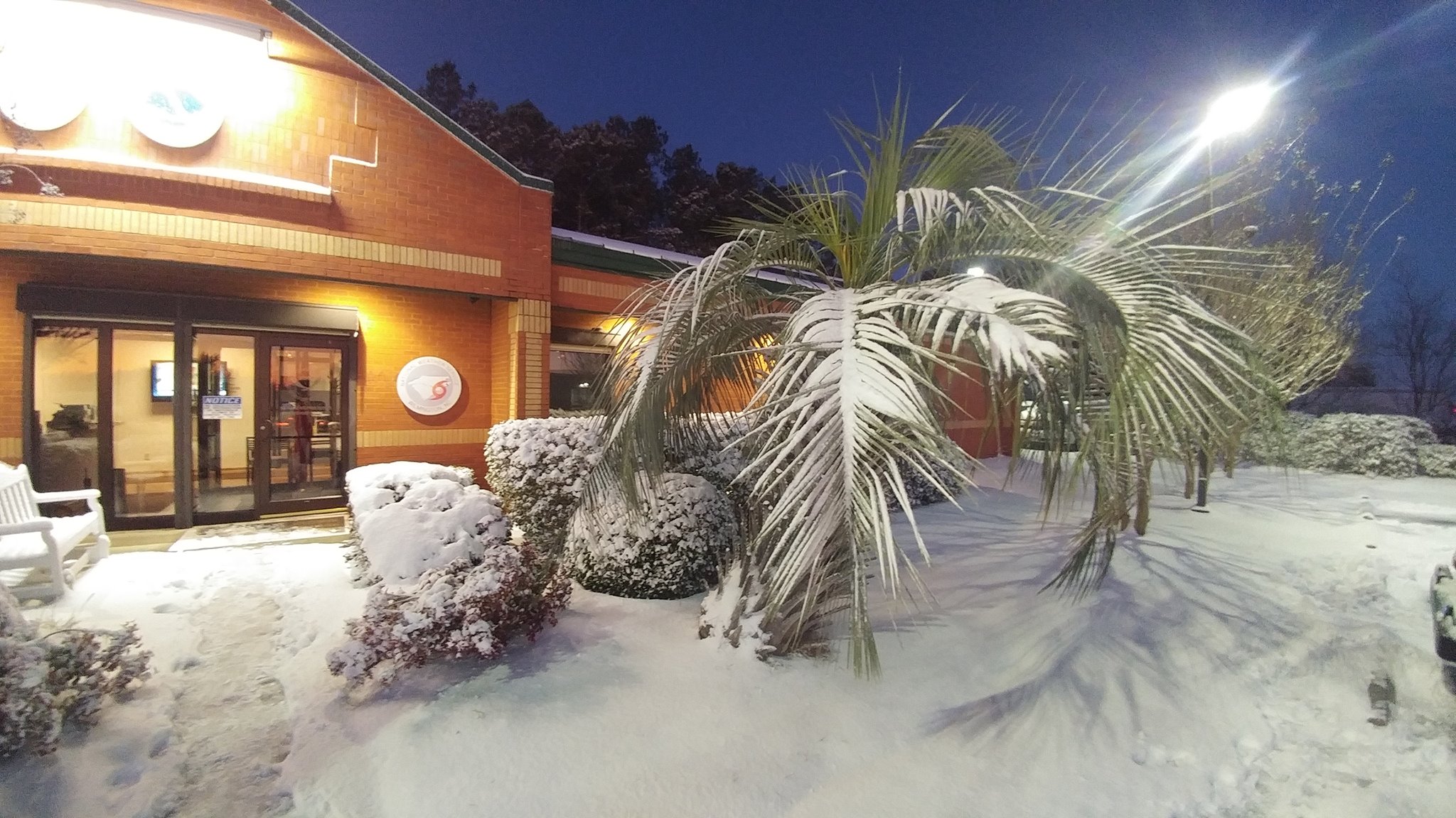
The first week of 2018 was one of the coldest periods on record for most of eastern North and South Carolina. Temperatures fell into the single digits and teens, readings not seen since the freeze events of the 1980s or mid 1990s. What was perhaps more amazing was the persistence of the cold, approaching levels not seen in Wilmington since January 1918. As if the cold itself wasn't enough, strong low pressure developed off the coast and created an ice and snow storm across most of the eastern Carolinas on January 3rd. This storm system met the definition of a meteorological bomb -- the storm's pressure dropped by over 24 millibars in 24 hours with satellite-estimated surface wind speeds over 90 mph well offshore. Local snowfall totals averaged 2 to 5 inches, plus up to a quarter inch of freezing rain from Georgetown to near Myrtle Beach. Small amounts of snow were reported as far south as Tallahassee, Florida.
Local impacts from the cold included a large number of frozen water pipes -- some actually bursting in schools and beneath busy streets. Thick ice formed on local ponds and creeks. Amazingly ice even developed on salt water in tidal creeks and in marshes! Local news reports showed alligators frozen into the ice with only their noses extending upward to breathe. Lake Waccamaw in Columbus County, NC froze over for the first time since the Christmas snowstorm of 1989. Local wildlife rescue groups reported large numbers of frostbitten and starving birds due to the unusual weather. The ocean water temperature at the Cherry Grove Pier in North Myrtle Beach reached 39.3 degrees. At Johnnie Mercer Pier on Wrightsville Beach the ocean water temperature fell to 42.5 degrees, the coldest on record since the NOAA station was established there in 2004.
Wilmington, NC
The temperature fell to 11 degrees in Wilmington January 6th, tied for the 20th coldest reading in history. This was the coldest Wilmington's temperature had dropped since February 5, 1996. Temperature records in Wilmington began in April 1874.
For the period January 1st through 7th, Wilmington's average high temperature was only 33.7 degrees, the fourth coldest in history behind February 1895, February 1899, and January 1918. The average low temperature was 15.7 degrees, the second coldest in history behind January 1918. The average temperature for the first seven days of January was 25.1 degrees, the third coldest in history behind February 1899 and January 1918.
High temperatures January 1st through 7th were 35 degrees or colder each day. This has only occurred one other time in history: December 29, 1917 through January 4, 1918. There were eight consecutive nights, January 1st through 8th, where low temperatures fell to 25 or colder. This has also occurred only one other time in history: January 16 through January 24, 1977. Low temperatures of 12 degrees on January 7th and 14 degrees on January 8th set new daily low temperature records.
Snowfall at the Wilmington International Airport was measured at 3.8 inches, the largest snow since January 10, 2011. In an interesting statistical quirk, three snowstorms since 2010 have measured precisely 3.8 inches at the ILM airport.
Measurable snow remained on the ground for five consecutive days in Wilmington, January 4th through 8th, tied for the third longest stretch in Wilmington's history and exceeded only by the Christmas snowstorm of 1989 and a snow in January of 1973. Official snow depth measurements are taken once a day at 7:00 a.m.
 |
National Weather Service Wilmington office after 3.8 inches of snow! Photo taken January 5, 2018. |
January 2018 Wilmington, NC Climate Data
| Day | High Temp | Low Temp | Avg Temp | Departure from Normal | Precip (in.) | Snowfall (in.) | Snow Depth (in.) |
| 1 | 32 | 19 | 26 | -20 | 0.00 | 0.0 | 0 |
| 2 | 35 | 17 | 26 | -20 | 0.00 | 0.0 | 0 |
| 3 | 35 | 17 | 26 | -20 | 0.67 | 3.4 | 0 |
| 4 | 35 | 24 | 30 | -16 | 0.07 | 0.4 | 4 |
| 5 | 35 | 15 | 25 | -21 | 0.00 | 0.0 | 3 |
| 6 | 31 | 11 | 21 | -25 | 0.00 | 0.0 | 3 |
| 7 | 33 | 12* | 23 | -23 | 0.00 | 0.0 | 2 |
| 8 | 54 | 14* | 34 | -12 | 0.00 | 0.0 | 2 |
* Low temperatures on January 7th and 8th were new daily records
Florence, SC
On the morning of January 7th the temperature in Florence fell to 8 degrees. This is tied for the third coldest temperature in Florence's history and was the coldest recorded since January 21, 1985. Temperature records began in Florence in 1948.
This was the coldest start to a year ever in Florence's history. The first seven days of 2018 had an average temperature of 24.2 degrees, beating the previous coldest start in 2010 by over eight degrees! That average temperature of 24.2 was 20.1 degrees below normal. To overcome this deficit Florence's average temperature needs to run 0.4 degrees above normal for the remainder of the year.
High temperatures for eight straight days (December 31, 2017 through January 7, 2018) failed to reach 40 degrees, becoming the longest streak of cold days in Florence's history. Eight straight nights of low temperatures of 20 or colder also broke the record for consecutive very cold nights. The previous record for consecutive nights with temperatures 20 or colder was four last set in December 1989.
The average low temperature from January 2nd through 8th was 14.6 degrees, the coldest seven day stretch ever recorded in Florence. Judged by average low temperatures, we beat the cold wave experienced during January 1985 by 1.3 degrees. The average high temperature January 1st through 8th was 33.4 degrees, now the new coldest stretch of daily high temperatures in Florence history, beating January 1968 by a degree. Low temperatures of 15 degrees on January 2nd, 10 degrees on January 5th, and 8 degrees on January 7th all set new daily low temperature records.
Snowfall of 2.5 inches in Florence was the largest storm recorded since 3.0 inches fell January 10-11, 2011. The decade of the 2010s now has produced 17.0 inches of snow in Florence and is already the snowiest decade since the 1980s.
January 2018 Florence, SC Climate Data
| Day | High Temp | Low Temp | Avg Temp | Departure from Normal | Precip (in.) | Unofficial Snowfall (in.) | ||||
| 1 | 31 | 20 | 26 | -19 | 0.00 | 0.0 | ||||
| 2 | 35 | 15* | 25 | -20 | 0.00 | 0.0 | ||||
| 3 | 32 | 18 | 25 | -20 | 0.10 | 2.5 | ||||
| 4 | 37 | 18 | 28 | -17 | trace | trace | ||||
| 5 | 35 | 10* | 23 | -21 | 0.00 | 0.0 | ||||
| 6 | 32 | 16 | 24 | -20 | 0.00 | 0.0 | ||||
| 7 | 32 | 8* | 20 | -24 | 0.00 | 0.0 | ||||
| 8 | 54 | 17 | 36 | -8 | 0.00 | 0.0 | ||||
* Low temperatures on January 2nd, 5th, and 7th were new daily records
|
GOES-16 infrared satellite imagery from early in the morning of Sunday, January 7, 2018. Darker blue colors indicate colder surface temperatures which generally occurred over snow. Rivers and the warm ocean show up well, as does the area of slightly warmer bare ground extending from Myrtle Beach and Oak Island up through Whiteville, NC. Coldest observed temperatures included 9° in Elizabethtown, NC; 8° in Florence, SC; 7° in Surf City, NC; 6° in Lumberton, NC; 6° in Dillon, SC; and 2° in Maxton, NC. |
North Myrtle Beach, SC
The low temperature on the morning of January 7th was 16 degrees, the coldest recorded in North Myrtle Beach since February 20, 2015 when the temperature reached 15. Temperatures during this arctic outbreak ran significantly warmer at night in Myrtle Beach than in many other locations across the eastern Carolinas due to a lack of snow cover in the Grand Strand area.
This was the coldest start to a year in Myrtle Beach's history. For January 1st through 7th, the average high temperature was 34.7 degrees, 9 degrees cooler than the second coldest start on record in 2010. The average low temperature for the first seven days of January was 19.4 degrees, three degrees colder than what was recorded in now-second place 2001.
Temperatures over the first seven days of 2018 averaged 18.7 degrees below normal. The remainder of 2018 will need to run almost 0.4 degrees above normal to compensate for this cold anomaly.
From January 1st through 7th North Myrtle Beach had seven consecutive days with highs only in the 30s, the most ever recorded. The previous record was four consecutive days back in January 2000. There were also seven consecutive nights with lows 25 degrees or colder. This is also the most ever and beats the previous record from January 2000. Morning low temperatures of 20 degrees on January 1st; 18 degrees on January 2nd, 5th and 6th; and 16 degrees on January 7th tied or broke daily low temperature records for Myrtle Beach.
January 2018 North Myrtle Beach, SC Climate Data
| Day | High Temp | Low Temp | Avg Temp | Departure from Normal | Precip (in.) | |||||
| 1 | 31 | 20* | 26 | -20 | 0.00 | |||||
| 2 | 35 | 18* | 27 | -19 | 0.00 | |||||
| 3 | 34 | 23 | 29 | -17 | 0.06 | |||||
| 4 | 39 | 23 | 31 | -15 | trace | |||||
| 5 | 38 | 18* | 28 | -18 | 0.00 | |||||
| 6 | 34 | 18* | 26 | -20 | 0.00 | |||||
| 7 | 32 | 16* | 24 | -22 | 0.00 | |||||
| 8 | 53 | 20 | 37 | -9 | 0.00 | |||||
* Low temperatures on January 1st, 2nd, 5th, 6th, and 7th were new daily records
|
Ocean water temperature from Cherry Grove Pier in North Myrtle Beach, SC from January 1 through 11, 2018. The lowest water temperature occurred during the morning of January 8th at 39.3 degrees. |
GOES-16 infrared satellite loop from January 3-4, 2018 showing strong low pressure developing along the U.S. East Coast. Brighter colors indicate higher and colder cloud tops.
|
Snow and Freezing Rain Totals compiled as of 745 AM Friday January 5, 2018
********************STORM TOTAL SNOWFALL********************

LOCATION          STORM TOTAL     TIME/DATE   COMMENTS
                     SNOWFALL           OF
                     /INCHES/   MEASUREMENT

NORTH CAROLINA

...Bladen County...
   9 ESE Jerome           1.3  1105 AM  1/04  Ammon
   Clarkton               1.0  1114 AM  1/04  Emergency Manager

...Brunswick County...
   Leland                 4.8  1202 PM  1/04  Social Media
   2 NNE Sandy Creek      4.0   758 AM  1/04  Trained Spotter
   3 NE Long Beach        2.0  1126 AM  1/04  NC-BR-7
   8 SW Bolivia           1.0  1128 AM  1/04  NC-BR-71
   Southport              0.8   831 AM  1/04  Social Media
   Holden Beach           0.5  1203 PM  1/04  Only a trace of snow
   2 NE Calabash          0.5  1127 AM  1/04  NC-BR-1
   2 WNW Sunset Beach     0.1  1127 AM  1/04  NC-BR-6

...Columbus County...
   Riegelwood             4.0  1140 AM  1/04  Emergency Manager
   Fair Bluff             2.3  1138 AM  1/04  Emergency Manager
   3 WNW Evergreen        1.3  1139 AM  1/04  Town of Boardman
   5 S Whiteville         0.3   923 AM  1/04  Social Media
   6 NW Whiteville        0.1  1128 AM  1/04  NC-CL-25

...New Hanover County...
   Ogden                  4.0   915 AM  1/04  Gordon Rd.
   Castle Hayne           4.0   828 AM  1/04  Social Media
   1 ESE Wrightsboro      3.8   731 AM  1/04  NWS Office
   1 ESE Smith Creek      3.5   852 AM  1/04  Social Media
   Smith Creek            3.0   744 AM  1/04  Kings Grant
   Wilmington             3.0   917 AM  1/04  Greenfield Lake
   6 SSE Wilmington       3.0  1124 AM  1/04  NC-NH-46
   1 NNE Myrtle Grove     2.5  1206 PM  1/04  Co-Op Observer
   2 SW Wilmington        2.3   700 AM  1/04  Trained Spotter
   1 N Carolina Beach     1.5  1124 AM  1/04  SC-NH-62
   1 SSE Myrtle Grove     1.5   833 AM  1/04  NWS Employee
   Kure Beach             1.5  1202 PM  1/04  Social Media
   1 NE Silver Lake       1.5   741 AM  1/04  NWS Employee
   1 NNW Carolina Beach   1.0   921 AM  1/04  Snows Cut
   3 SSW Myrtle Grove     1.0   811 AM  1/04  Media

...Pender County...
   Maple Hill             5.0  1127 AM  1/04  Emergency Manager
   5 WNW Hampstead        4.5   832 AM  1/04  NWS Employee
   Surf City              4.5  1130 AM  1/04  Emergency Manager
   Atkinson               4.0  1128 AM  1/04  Emergency Manager
   Rocky Point            4.0   908 AM  1/04  Social Media
   1 SSW Hampstead        4.0   833 AM  1/04  NWS Employee
   Burgaw                 3.8   845 AM  1/04  Social Media
   2 E Hampstead          3.5  1125 AM  1/04  NC-PD-28
   2 NNW Surf City        3.2   832 AM  1/04  Co-Op Observer
   Hampstead              3.0  1125 AM  1/04  NC-PD-17

...Robeson County...
   Pembroke               5.0  1117 AM  1/04  Emergency Manager
   Red Springs            4.5  1122 AM  1/04  Emergency Manager
   Fairmont               3.5  1123 AM  1/04  Emergency Manager
   3 SE Lumberton         1.5  1207 PM  1/04  Co-Op Observer
   St. Pauls              1.0  1122 AM  1/04  Emergency Manager
   Lumber River SP        1.0  1205 PM  1/04  Co-Op Observer
   9 SSE Lumberton        0.3  1129 AM  1/04  NC-RB-17

SOUTH CAROLINA

...Darlington County...
   5 WSW Hartsville       4.7  1122 AM  1/04  SC-DR-20
   2 NE Hartsville        4.3   710 AM  1/04  Co-Op Observer
   1 NE Clyde             4.0  1203 PM  1/04  Pine Ridge
   Hartsville             3.5   955 AM  1/04  Emergency Manager
   Society Hill           3.0   955 AM  1/04  Emergency Manager
   Darlington             2.5   953 AM  1/04  Emergency Manager
   6 ENE Darlington       2.5   956 AM  1/04  Emergency Manager
   7 SSW Darlington       2.0  1119 AM  1/04  SC-DR-4
   1 W Darlington         2.0  1208 PM  1/04  Co-Op Observer

...Dillon County...
   Floydale               6.0  1008 AM  1/04  Emergency Manager
   Little Rock            6.0  1005 AM  1/04  Emergency Manager
   Dillon                 5.0  1002 AM  1/04  Emergency Manager
   Latta                  5.0  1004 AM  1/04  Emergency Manager
   4 NW Dillon            4.0  1119 AM  1/04  SC-DL-4
   Oak Grove              4.0  1007 AM  1/04  Emergency Manager
   Lake View              3.0  1008 AM  1/04  Emergency Manager

...Florence County...
   Scranton               4.0  1037 AM  1/04  Emergency Manager
   5 W Florence           3.5  1210 PM  1/04  Public
   Effingham              3.0   950 AM  1/04  Emergency Manager
   1 E Lake City          2.8  1204 PM  1/04  Co-Op Observer
   Timmonsville           2.5   950 AM  1/04  Emergency Manager
   Florence               2.0   949 AM  1/04  Emergency Manager

...Georgetown County...
   Andrews                6.0  1044 AM  1/04  Emergency Manager
   10 W Georgetown        4.5   919 AM  1/04  Browns Ferry
   5 ESE Hemingway        4.0  1043 AM  1/04  Near Outland
   1 S Andrews            4.0  1207 PM  1/04  Co-Op Observer
   4 SW Pawley's Island   3.5  1045 AM  1/04  Debordieu Colony
   6 S Georgetown         2.8  1118 AM  1/04  SC-GT-4
   Georgetown             2.5   911 AM  1/04  Social Media
   Pawley's Island        1.0  1043 AM  1/04  Emergency Manager
   Murrells Inlet         0.5  1135 AM  1/04  Emergency Manager

...Horry County...
   1 SE Bucksport         3.0   830 AM  1/04  Social Media
   3 SSW Conway           2.5  1133 AM  1/04  Pitch Landing
   Aynor                  2.5  1135 AM  1/04  Emergency Manager
   1 N Green Sea          0.8  1133 AM  1/04  Emergency Manager
   5 WNW Myrtle Beach     0.2  1117 AM  1/04  SC-HR-73
   7 NNW Myrtle Beach     0.2  1115 AM  1/04  SC-HR-75
   5 SW Myrtle Beach      0.2  1117 AM  1/04  SC-HR-73

...Marion County...
   1 SSE Mullins          4.0   717 AM  1/04  Co-Op Observer
   Gresham                4.0   959 AM  1/04  Emergency Manager
   Marion                 3.0   959 AM  1/04  Emergency Manager
   Sellers                2.5  1041 AM  1/04  Emergency Manager
   Nichols                2.5  1041 AM  1/04  Emergency Manager

...Marlboro County...
   Clio                   5.0   952 AM  1/04  Emergency Manager
   Wallace                4.0  1128 AM  1/04  Emergency Manager
   1 SE Bennettsville     4.0  1120 AM  1/04  SC-MB-2
   Bennettsville          4.0   951 AM  1/04  Emergency Manager
   Blenheim               4.0  1141 AM  1/04  Emergency Manager
   McColl                 3.0   952 AM  1/04  Emergency Manager

...Williamsburg County...
   5 WNW Andrews          8.0  1030 AM  1/04  Emergency Manager
   12 SW Andrews          6.0  1035 AM  1/04  Emergency Manager
   Hemingway              5.5  1036 AM  1/04  Emergency Manager
   Greeleyville           5.5  1027 AM  1/04  Emergency Manager
   7 SSW Kingstree        5.0  1034 AM  1/04  Emergency Manager
   Lane                   5.0  1033 AM  1/04  Emergency Manager
   Trio                   5.0  1028 AM  1/04  Emergency Manager
   Stuckey                4.5  1035 AM  1/04  Emergency Manager
   7 S Kingstree          4.5  1032 AM  1/04  Emergency Manager
   4 WNW Cades            4.2   930 AM  1/04  Co-Op Observer
   Cades                  4.0  1032 AM  1/04  Emergency Manager
   Kingstree              4.0  1027 AM  1/04  Emergency Manager
   5 W Hemingway          4.0  1028 AM  1/04  Emergency Manager
   8 NW Kingstree         4.0  1118 AM  1/04  SC-WL-2


***********************STORM TOTAL ICE***********************

LOCATION          STORM TOTAL     TIME/DATE   COMMENTS
                          ICE           OF
                     /INCHES/   MEASUREMENT

NORTH CAROLINA

...New Hanover County...
   Kure Beach            0.25  1202 PM  1/04  Social Media
   1 ESE Wrightsboro     0.13   731 AM  1/04  NWS Office
   2 SW Wilmington       0.10   700 AM  1/04  Trained Spotter
   3 SSW Myrtle Grove    0.10   811 AM  1/04  Media

SOUTH CAROLINA

...Georgetown County...
   10 W Georgetown       0.25  1158 AM  1/04  Browns Ferry
   Murrells Inlet        0.25  1135 AM  1/04  Emergency Manager
   4 SW Pawley's Island  0.10  1045 AM  1/04  Debordieu Colony

...Horry County...
   5 NNE Myrtle Beach    0.25  1135 AM  1/04  Emergency Manager
   Socastee              0.25  1138 AM  1/04  Only a trace of snow
   2 WSW Myrtle Beach    0.13  1125 AM  1/04  Emergency Manager
   1 N Green Sea         0.10  1133 AM  1/04  Emergency Manager
   North Myrtle Beach    0.10  1137 AM  1/04  Only a trace of snow
   3 SSW Conway          0.03  1133 AM  1/04  Pitch Landing
Other Interesting Links about the Event
Page Author: Tim Armstrong
Page Created: January 5, 2018
Last Updated: February 2, 2018


 Coastal Flood