|
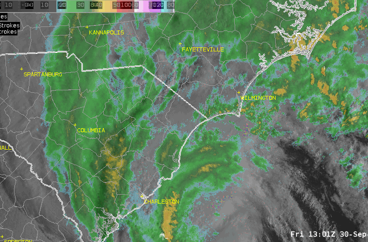
Visible satellite and radar animation of Hurricane Ian making landfall on the South Carolina coastline on September 30, 2022 |
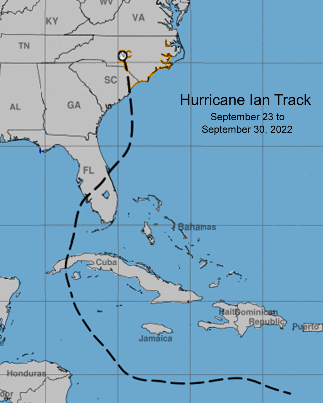
The National Hurricane Center began tracking a tropical disturbance on September 19 located several hundred miles east of the Windward Islands. This disturbance gradually became more organized as it moved westward and became Tropical Depression Nine while over the central Caribbean Sea well southeast of Jamaica.
Tropical Storm Ian formed late on September 23, but only slowly strengthened over the following few days as the storm had a tilted vertical structure. By September 26, Ian attained hurricane strength while located a little over 300 miles south of Cuba. Ian strengthened rapidly prior to striking western Cuba early in the morning of September 27 as a category 3 hurricane with winds as high as 125 mph.
Ian weakened only slightly as it crossed Cuba, then strengthened into a monstrous category 5 storm (upgraded in the post-season) with 160 mph winds. Ian weakened slightly before making its second landfall just south of Punta Gorda, FL on September 28 with 155 mph winds. A catastrophic storm surge struck the west coast of Florida south of Tampa, and over 20 inches of rain caused major flooding across the peninsula all the way to the Atlantic coast. Ian spent many hours slowly crossing Florida and emerged off the east coast as a tropical storm with peak winds around 70 mph during the late morning hours of September 29.
Ian turned northward and re-strengthened to a category 1 hurricane before its third and final landfall on the South Carolina coast near Georgetown on September 30. Maximum sustained winds as high as 80 mph (reduced in the post-season from an initial 85 mph) pushed a 3 to 6 foot storm surge onshore damaging homes and businesses along the coast of northeastern South Carolina and southeastern North Carolina. Wind gusts over hurricane force were measured at a few coastal sites, but the storm's steady movement across the area limited rainfall amounts to less than six inches. As the storm pushed inland, cool air wrapped completely around the storm's center quickly turning Ian into a post-tropical cyclone.
|
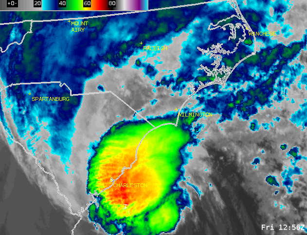
Infrared satellite loop of Hurricane Ian's final landfall on the South Carolina coast on September 30, 2022 |
Track of Hurricane Ian between September 23 and September 30, 2022. Ian struck Cuba and Florida as a major hurricane before reaching the Carolinas as a category 1 storm. |
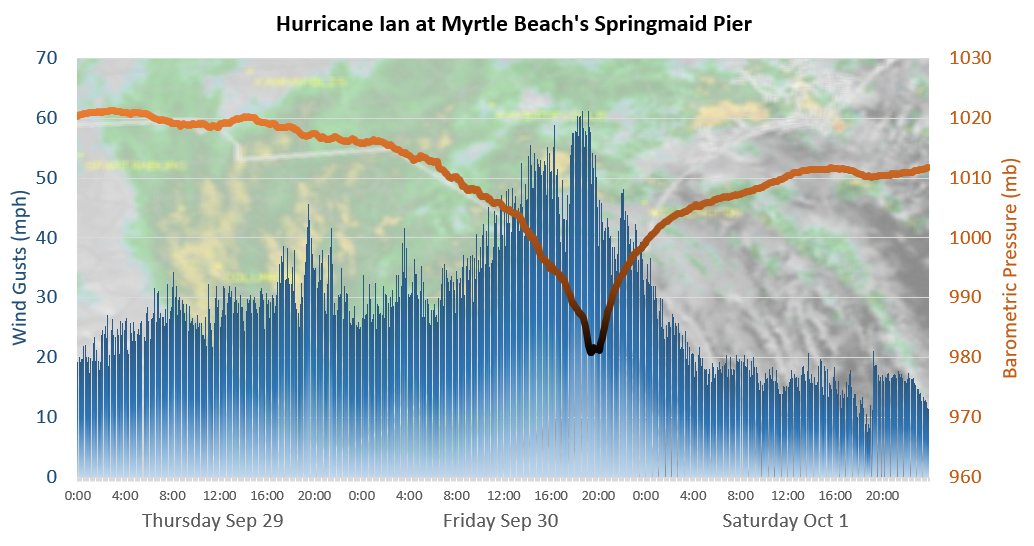
Observed Wind Gusts and Barometric Pressure
 |
|
|
Georgetown County, SC
Ian's final landfall was near the city of Georgetown around 2 pm on Friday September 30. Storm surge flooding affected Front Street and the downtown businesses. An NWS storm survey found evidence for several inches of floodwater inside buildings. Sandbags placed before the storm helped mitigate more significant flooding. Peak water depth in residential areas along Bolick Street was slightly over 2 feet above ground level.
|
|
On Pawleys Island, North Causeway Road was covered in several feet of water with wind-driven waves on top. A public wooden boardwalk at the north end of the island was severely damaged by surge. Both Myrtle Ave and Atlantic Ave on the northern portion of Pawleys Island were flooded, with NWS personnel finding evidence for 3 to 4 feet of water above ground level. Water reached 2 to 3 feet in depth at Town Hall, but exceeded 4 feet above ground level where a nearby mailbox was completely submerged. Water entered the first floors of multiple homes and there was major damage to dunes along the beach. Emergency vehicles were dispatched during the storm to rescue people and pets surrounded by rising storm surge. On the south end of Pawleys Island, storm surge was termed 'catastrophic' in a social media post by local law enforcement. An NWS storm survey found mud lines over 4 feet above ground level along Doyle Avenue, almost 3 feet above ground level on Hazard Street, and slightly over 2 feet above ground level on the south portion of Springs Avenue.
|
|
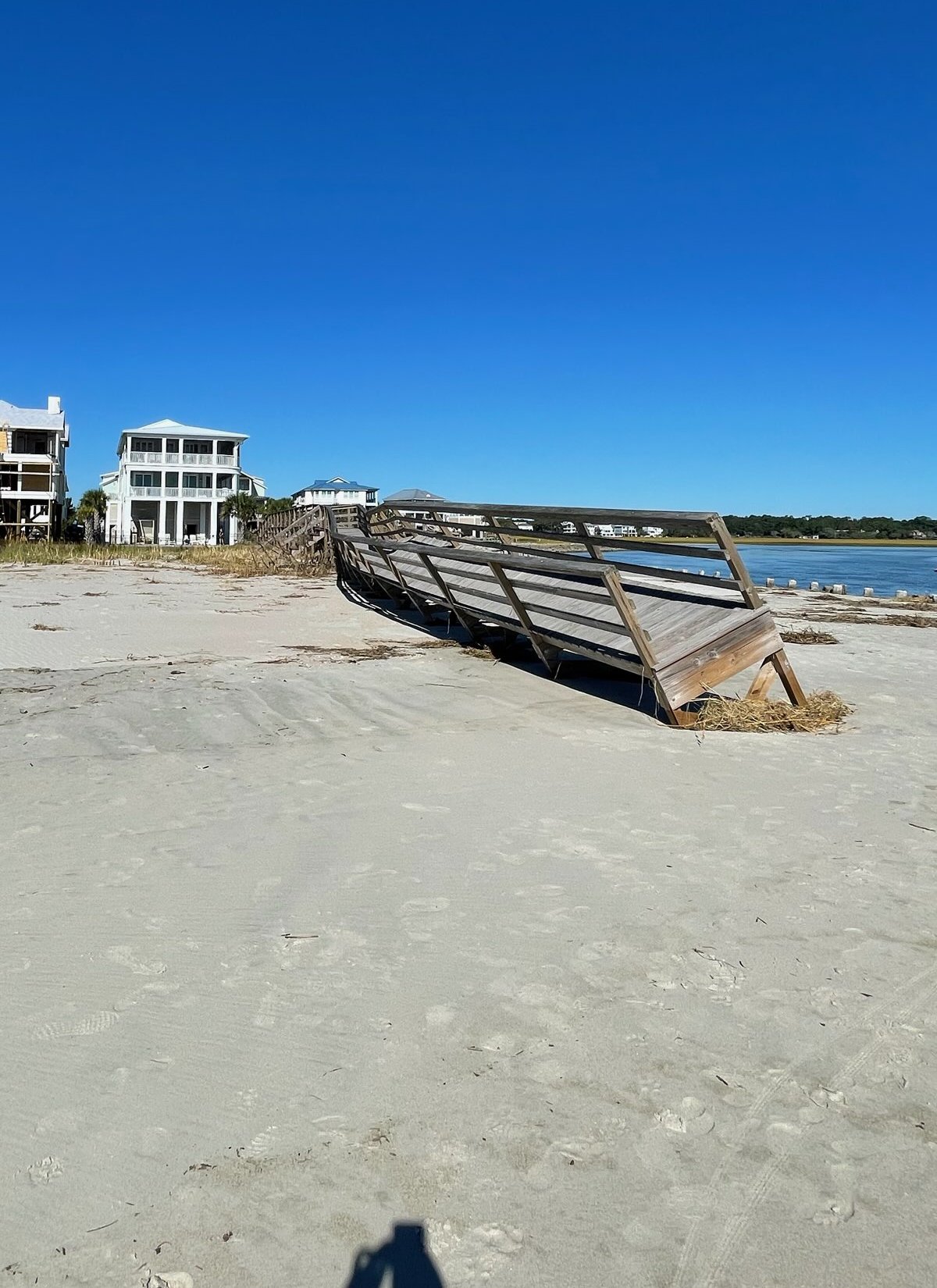
A significant portion of the Pawleys Island Pier collapsed during the storm. Broadcast media reported debris from the damaged pier remained drifting in the ocean.
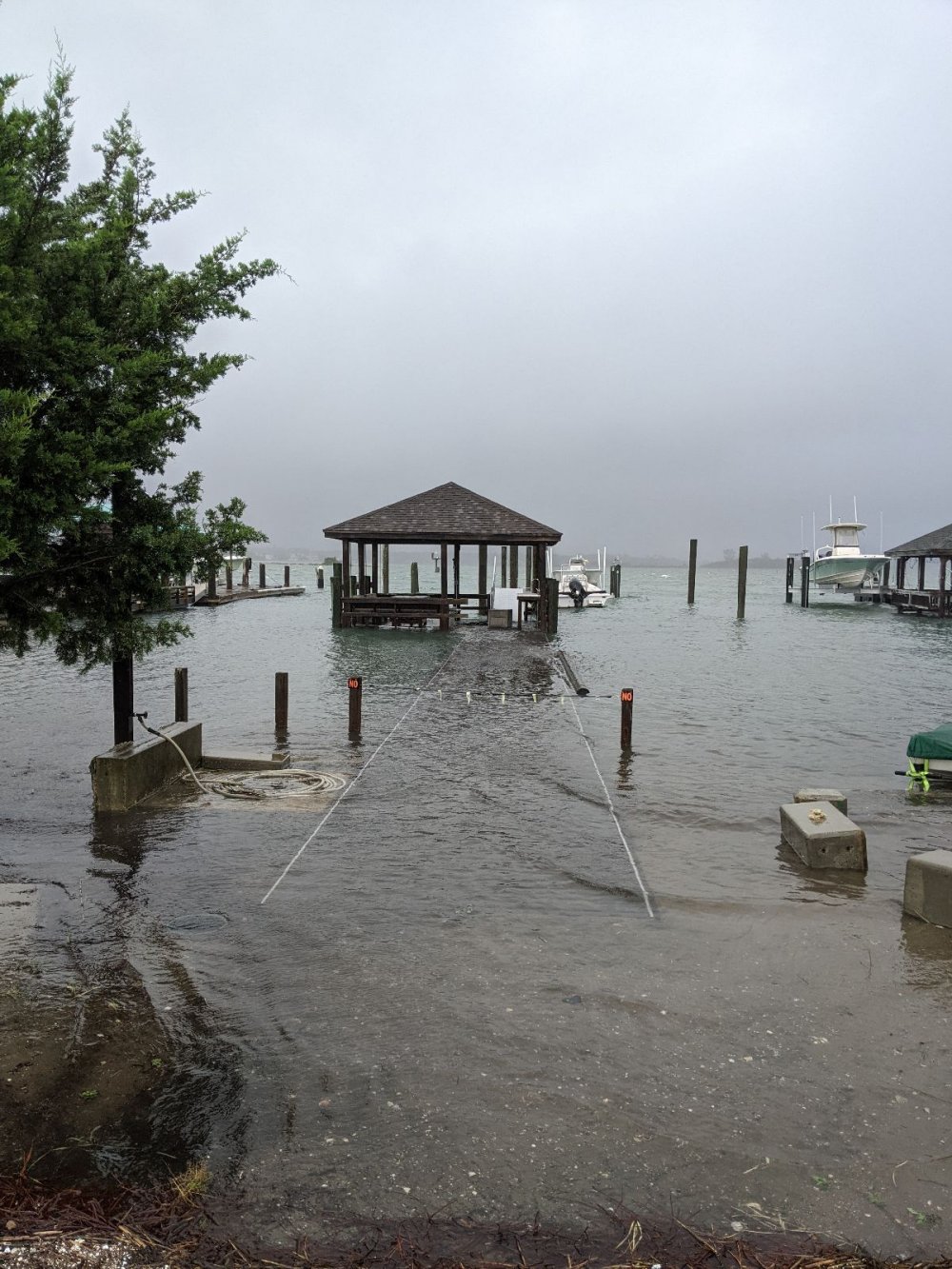
In northern Georgetown County, storm surge flooding in Murrells Inlet flooded the Marshwalk and marina area. Portions of the marshwalk piers were damaged. In Litchfield Beach flooding surrounded the Litchfield Inn hotel during high tide. Severe erosion cut six foot high cliffs into the beaches.
|
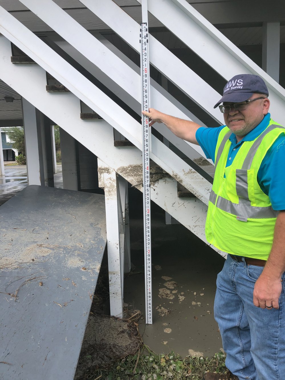
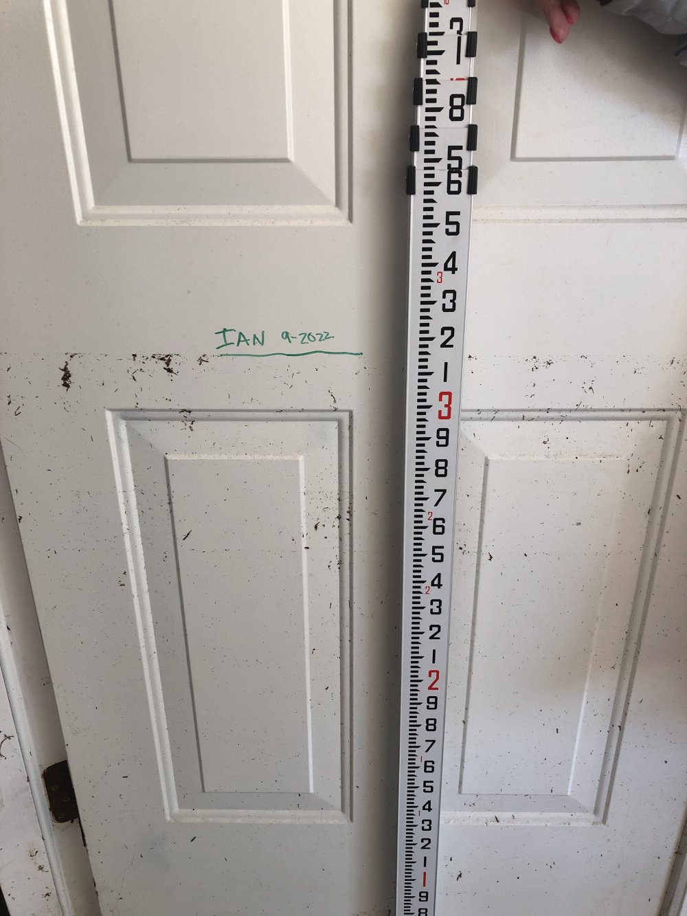
Doyle Avenue on Pawley's Island had storm surge flooding in excess of four feet above ground level at this location. This was near the maximum depth of water observed along this portion of the South Carolina coast. |
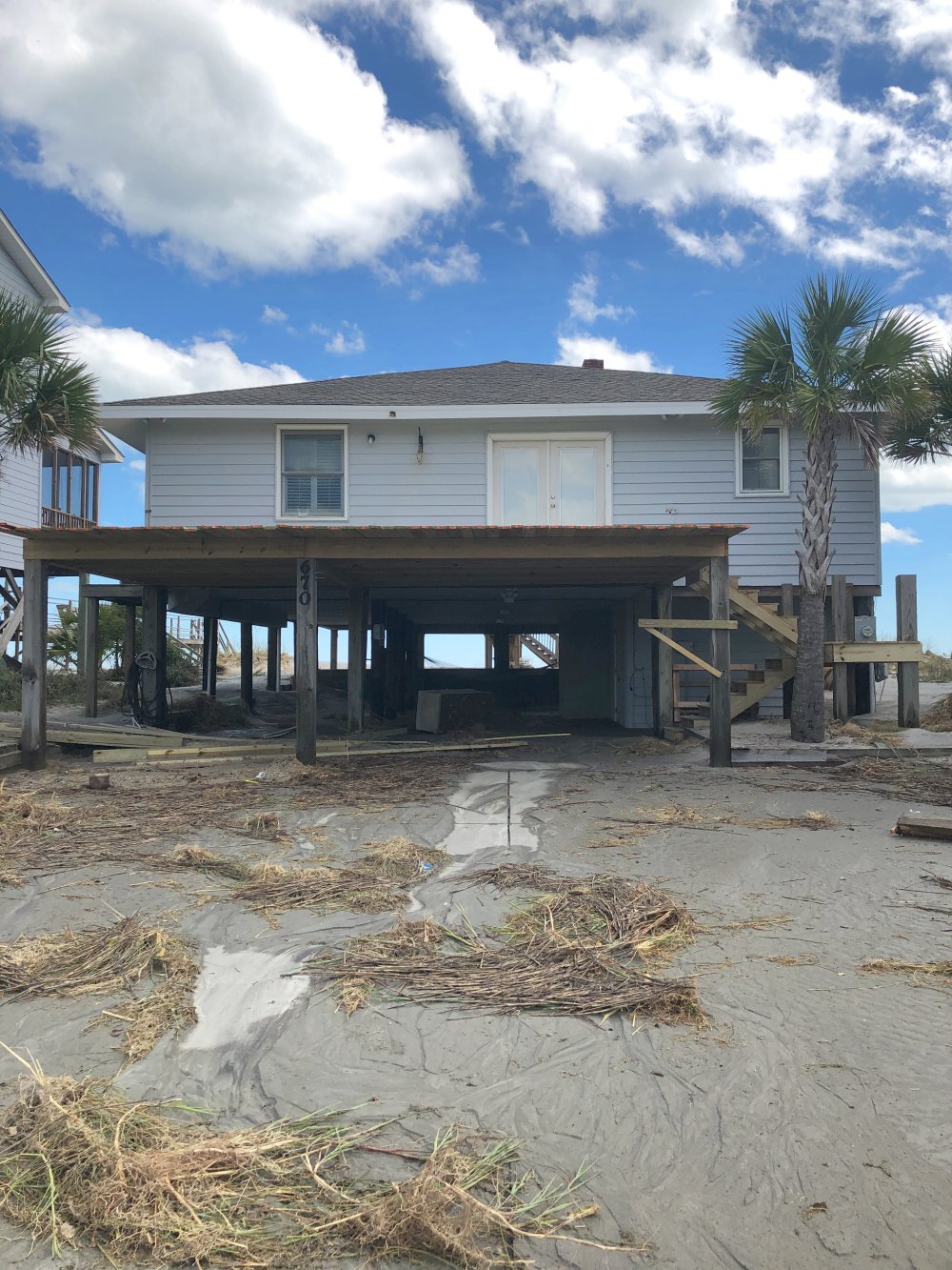
Multiple ocean front homes along Spring Avenue experienced storm surge flooding. Flowing water piled debris against fixed objects, and sand was scoured and redeposited covering roads and driveways. |
|
Garden City Beach area. Photo courtesy of Mark Willis. |
Garden City Beach area. Photo courtesy of Mark Willis. |
Strong winds pushed trees across power lines all across Georgetown County. Some roofs were damaged.
Horry County, SC
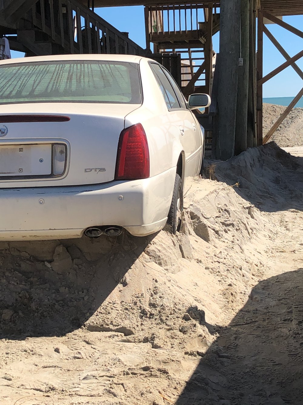
In Garden City Beach, storm surge breached the dunes and flooded parking lots and streets. Video shared on social media showed vehicles flooded by several feet of moving water. Debris lines after the storm were noted approximately four feet above ground level in the first floor of some beachfront homes. Upwards of three feet of sand was deposited onto South Waccamaw Drive in Garden City, entombing parked vehicles.
|
|
Ian's surge removed most sand dunes from the beaches in Garden City and Surfside Beach. Severe erosion was also noted in Myrtle Beach where six foot tall cliffs were eroded into the beach. Storm surge flooding entered a large amusement park in Myrtle Beach. Apache Pier and Second Avenue Pier were both damaged. Upwards of three feet of sand was deposited onto South Waccamaw Drive in Garden City. This sand had originally been part of the beach and dunes which were resurfaced during the storm. The flat elevation profile from the beach to the first row of homes will make damage much more likely to occur during any future coastal storms or floods.
|
At Windy Hill Beach, NWS storm surveys found evidence for widespread 1 to 2 foot water depth above ground level extending from South Ocean Blvd and as far as six blocks inland along Eyerly Street. Sand dunes at Atlantic Beach suffered some erosion but held up against the surge.
Just north of Springmaid Pier photos showed a six foot tall cliff carved into the beach face. Water levels measured at Springmaid Pier in Myrtle Beach reached 10.77 feet above mean lower low water, almost a foot higher than was measured during Hurricane Isaias in August 2020. This was 6.42 feet above the astronomical tide at the time. Two Myrtle Beach piers, Second Avenue Pier, and Apache Pier, were significantly damaged by large waves. Apache Pier was also damaged by Hurricane Isaias back in 2020 but had since been repaired. A commercial shrimp boat, the "Shayna Michelle" from Holden Beach, NC washed ashore at Myrtle Beach during the storm. The boat suffered engine issues offshore and the crew was rescued by Coast Guard personnel via helicopter.
In North Myrtle Beach, portions of Main Street, North Ocean Boulevard, and Sea Mountain Highway were closed due to flooding. Photos showed debris covering portions of North Ocean Blvd.
|
This vehicle was flooded by storm surge, then immobilized by deposited sand. This was on South Waccamaw Drive in Garden City Beach near the Horry-Georgetown county line. |
One of several dozen homes in the Futch Beach section of northern Horry County that experienced storm surge water levels 3 to 4 feet above ground level. |
In Northern Horry County, storm surge flooding affected North Myrtle Beach and Cherry Grove Beach. Photos shared by local media showed neighborhood streets flooded for blocks with water as much as three or four feet deep in some locations. Portions of Main Street, North Ocean Blvd, and Sea Mountain Highway were closed due to flooding.
In Cherry Grove Beach a NWS storm survey found water depth reached 1 to 2 feet above ground level on Lake Drive just inland from Ocean Blvd. Homes along the water on the north end of Ocean Blvd suffered more significant storm surge flooding with mud lines observed 2 to 4 feet above ground level along 48th Ave, 53rd Ave, and Channel Street. Residents stated during interviews that flooding was worse than with Hurricane Isaias in 2020. A section of the Cherry Grove Pier collapsed during the storm.
|
Over 60,000 electrical customers lost power during the storm in Horry County. Wind gusts of 50 to 65 mph knocked down a number of trees across the county. Several beachfront hotels suffered siding, roofing, and facade damage from the winds. The degree of wind damage appeared worse in North Myrtle Beach than at points farther south.
Siding was damaged on a hotel in Myrtle Beach by the winds, while another in North Myrtle Beach suffered extensive roof damage. Observed wind damage actually appeared worse in North Myrtle Beach than at points farther south. Widespread wind damage was observed to most structures along the beaches here.
|
|
Wind damage was also observed inland in Conway and Loris where trees fell on vehicles and homes.
Brunswick County, NC
Sunset Blvd, the only access to Sunset Beach across the marsh, was closed due to flooding during Ian's storm surge. Video shared by local law enforcement showed water swiftly flowing across the road surface. The island's dunes remained intact through the storm, but suffered considerable erosion along their front edge.
Water rose onto neighborhood streets in Ocean Isle Beach during high tide. While social media photos posted around noon suggested the water depth was generally less than one foot as law enforcement vehicles were still able to move about, later photos showed water one to two feet deep entering garages and the first floors of some beachfront homes. An NWS storm survey of Ocean Isle Beach revealed most damage occurred along the sound side where many private docks were damaged. Some garage doors were pushed in.
|
Oak Island suffered mainly shallow flooding along streets and around beach homes. Dunes remained intact, although ocean water poured through beach accesses during high tide.
On Bald Head Island, large waves and storm surge breached a portion of the island's dunes leading to some flooding.
USGS operates three tide gauges in Brunswick County. Gauges in Shallotte and at Lockwoods Folly Inlet recorded water levels 3.5 to 3.7 feet above mean higher high water. A gauge at Calabash recorded water levels almost 5 feet above mean higher high water.
Strong winds measured over 70 mph in gusts blew down a number of trees across Brunswick County. In Southport a large tree fell and knocked out electricity along a section of River Drive east of downtown.
New Hanover County, NC
Storm surge flooding closed roads in Wrightsville Beach and Carolina Beach. Some neighborhood streets east of Greenville Loop Road in Wilmington were covered with water and impassible during the worst of the surge. Flood sensors operated by UNC's Sunny Day Flood Project recorded over three feet of water covered Canal Drive in Carolina Beach, with flooded roads continuing for nine hours at this location.
The NOAA water level gauge at Mercer Pier at Wrightsville Beach peaked at 8.03 feet above mean lower low water during the afternoon of September 30. This is the second highest level measured since the pier was rebuilt in the early 2000s, exceeded only by Hurricane Florence's surge in 2018. Observed water levels were over four feet above the astronomical tide due to Ian's storm surge. A portion of North Lumina Avenue in Wrightsville Beach was closed due to the depth of floodwater. Many of the neighborhood streets east of Greenville Loop Road were covered with water and impassible during the worst of the storm surge.
|
|
Flooded docks on the sound side of Wrightsville Beach. Photo courtesy of Jackson Armstrong |
Ian's storm surge pushed through public beach accesses at Wrightsville Beach. Photo courtesy of Jaime Armstrong. |
Along the Cape Fear River in downtown Wilmington, the tide gauge there reached 7.66 feet above mean lower low water. This is the fifth highest stage recorded since the 1950s, exceeded by Hurricanes Isaias, Florence, and Matthew, and Hazel. Almost two feet of storm surge flooding moved across Water Street in front of the courthouse. Flooding also covered portions of South Front Street near the State Port.
Wind gusts measured as high as 50 mph at the Wilmington airport and 60 mph in Wrightsville Beach blew down a few trees across the county.
Pender County, NC
Surf City Emergency Management reported 80 percent of the beach saw the formation of a 1 to 3 foot tall erosion scarp, with local heights of 5 feet. Ocean overwash occurred in six locations within the city limits. Storm surge flooding was worst on the sound side of the town and affected a number of properties with shallow flooding.
|
Columbus County, NC
Local media reported almost 3,000 customers were without electricity due to power line damage from Hurricane Ian. Numerous trees were blown down across the county, including two that fell on homes. No significant flooding occurred.
Florence County, SC
Wind gusts measured as high as 52 mph at the Florence airport blew scattered trees down across the county, resulting in some power outages. A large oak fell and damaged a vehicle on Gregg Avenue.
|
Elsewhere
Power outages occurred as trees were blown down in scattered areas across many counties in interior southeastern North Carolina and northeastern South Carolina.
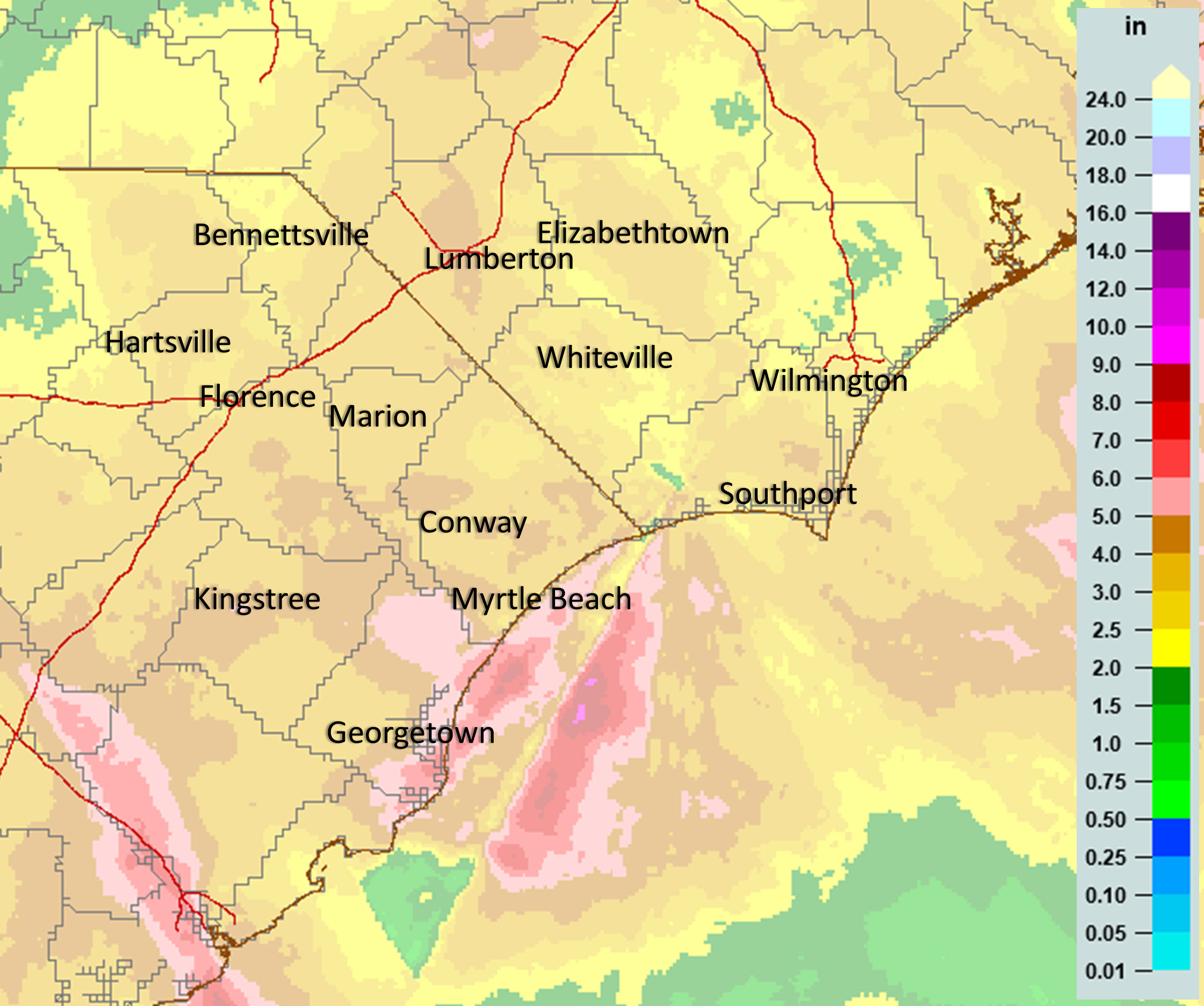
Storm Rainfall Totals
|
Radar-estimated rainfall totals during Hurricane Ian across northeastern South Carolina and southeastern North Carolina. Most areas picked up between 3 and 5 inches of rain. Aside from storm surge, there was very little flooding reported across the area. |
Additional Links
NHC Tropical Cyclone Report on Hurricane Ian: https://www.nhc.noaa.gov/data/tcr/AL092022_Ian.pdf
NOAA Hurricane Ian Post-Storm Overflight Imagery: https://storms.ngs.noaa.gov/storms/ian
NWS Wilmington, NC Post-Storm Hurricane Report on Ian: https://mesonet.agron.iastate.edu/wx/afos/p.php?pil=PSHILM&e=202210260216
National Hurricane Center archive of Hurricane Ian forecast products: https://www.nhc.noaa.gov/archive/2022/IAN.shtml
Other Local NWS Office Ian Summaries: Charleston, SC | Columbia, SC | Raleigh, NC
Page Author: Tim Armstrong
Last Updated: April 6, 2022


 Coastal Flood