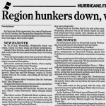
 Hurricane Floyd was the strongest storm of the 1999 Atlantic Hurricane Season, at one point packing winds of 155 mph while approaching the Bahamas. Millions of coastal residents from Florida through North Carolina evacuated ahead of the storm. Floyd’s winds weakened as it approached the Southeast coast on September 15 but torrential rains expanded northward well ahead of the storm. Floyd made landfall near Cape Fear early in the morning of September 16 with maximum sustained winds near 105 mph – category 2 on the Saffir-Simpson hurricane wind scale. Widespread rainfall amounts of 10 to 20 inches led to catastrophic and unprecedented flooding across sections of eastern North and South Carolina northward across the Mid-Atlantic states. Floyd’s death toll reached 36 in North Carolina and 57 across the United States as a whole, with total damage estimates near $6.5 billion.
Floyd was the fourth and final hurricane to directly strike the Cape Fear area during the 1990s. Prior storms included Hurricanes Bertha and Fran, both in 1996, and Hurricane Bonnie in 1998. In Wilmington, Floyd holds the record for the lowest barometric pressure ever measured at 959.7 millibars (28.34 inches Hg) and the largest one-day rainfall at 13.38 inches.
Storm History
The disturbance that would later become Floyd was recognized as a tropical depression on September 7 while over the Atlantic Ocean halfway between Africa and the Leeward Islands. The following day as winds increased to 40 mph the depression was upgraded to tropical storm status and named Floyd. Floyd continued strengthening and became a hurricane on September 10. After passing through a region of unfavorable upper level winds that temporarily weakened the system, Floyd strengthened rapidly into a major hurricane on September 12, then to a category 4 storm on September 13. Passing across the Bahamas on September 14, Floyd then turned northward toward the Carolinas.
Waves of heavy rain began moving across the eastern Carolinas during the day of Tuesday September 14, expanding in coverage that night and continuing into Wednesday September 15. A stationary front lying across the eastern portions of North and South Carolina helped lift the increasingly humid onshore winds, sustaining heavy rainfall rates. By the time tropical storm force gusts began in Wilmington on Wednesday afternoon, over six inches of rain had already fallen. Floyd’s eye turned northward as the storm passed off the east coast of Florida and Georgia during the day Wednesday. This lined the storm up for a direct impact on Cape Fear. Landfall occurred at 2:30 a.m. on Thursday morning September 16, 1999.
|
Infrared satellite loop from GOES-8 of Hurricane Floyd's landfall. Orange and red colors indicate higher, colder clouds. September 14-16, 1999. |
KLTX radar loop of Hurricane Floyd's landfall on the North Carolina coast. September 15-16, 1999. |
|
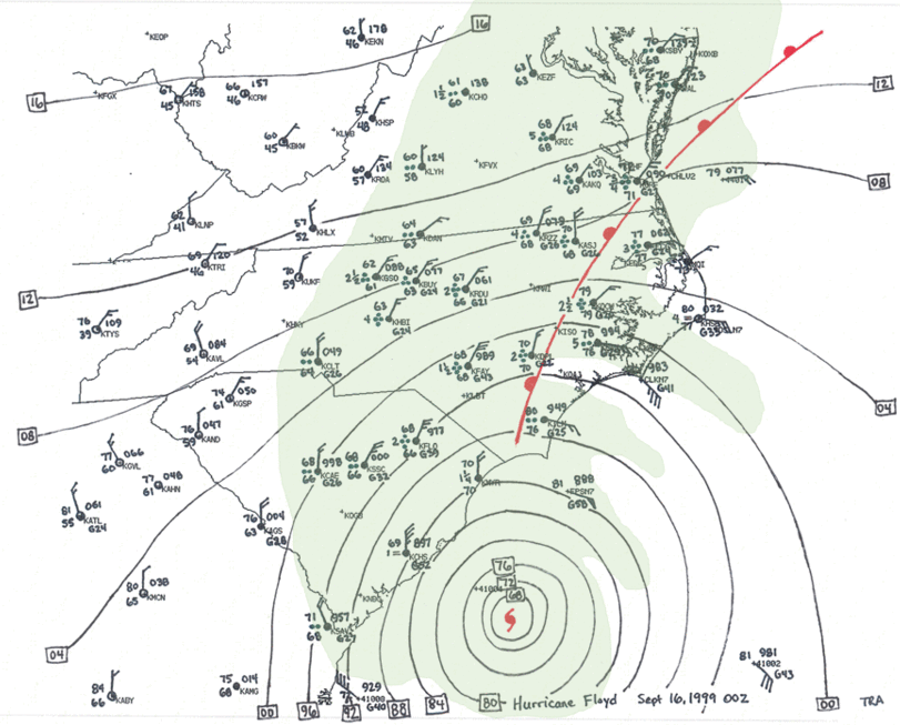
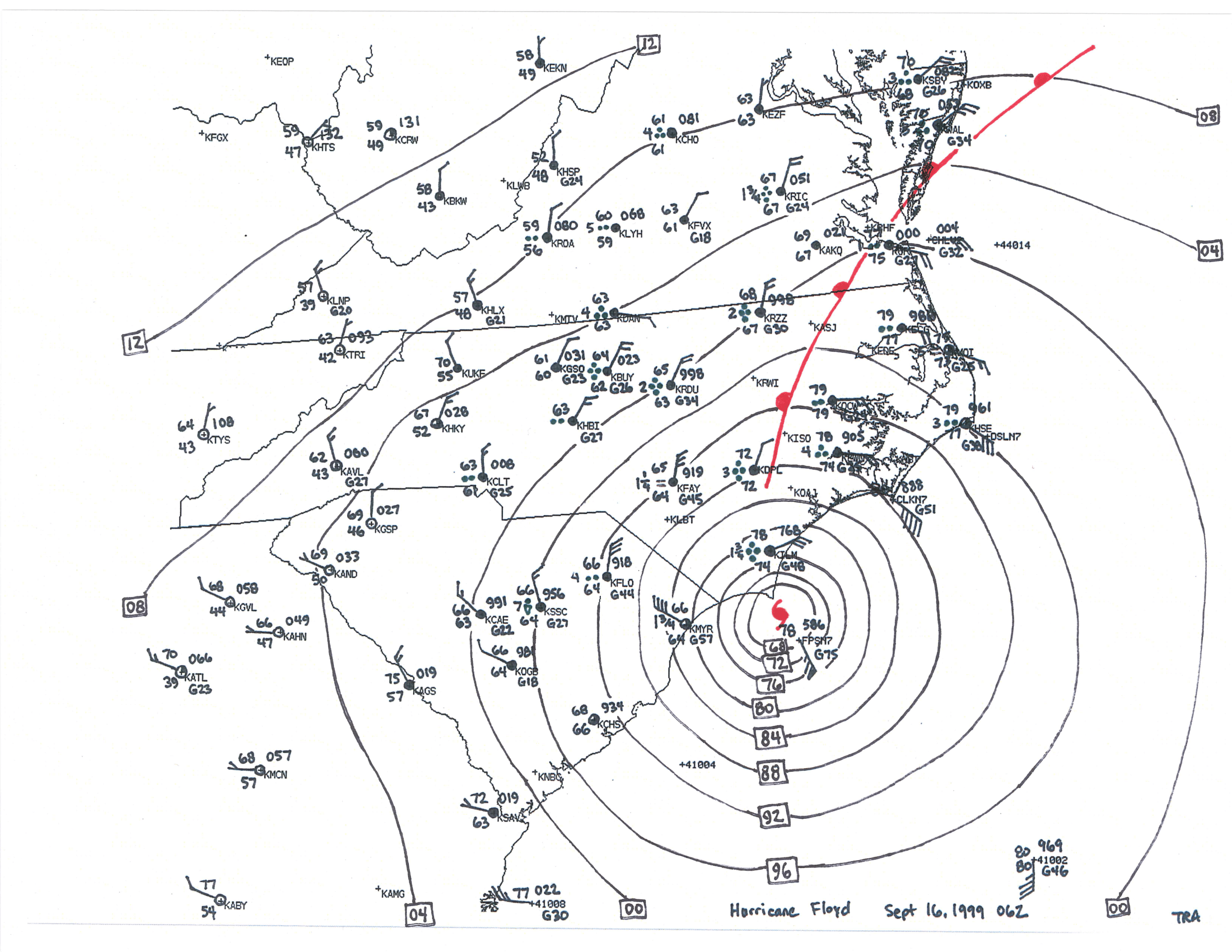
Three-hourly surface analysis maps of Hurricane Floyd making landfall on the North Carolina coast. Sept 15-16, 1999
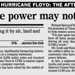
|
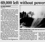
Wind gusts to hurricane force (74 mph or stronger) were experienced in a few spots along the South Carolina coast including downtown Charleston and at Springmaid Pier at Myrtle Beach. Closer to where the center came onshore in North Carolina hurricane force winds were more common. The strongest wind gusts reported locally occurred in the Wilmington area including 120 mph at the New Hanover County Emergency Operations Center, 122 mph on Topsail Beach, and 138 mph measured at a height of eight stories above ground level on a Wrightsville Beach hotel. Frying Pan Tower, located offshore from Cape Fear, reported a peak wind gust of 112 mph. The highest wind gust at the Wilmington International Airport was 86 mph, precisely the same speed measured during Hurricane Fran three years earlier. Floyd produced a storm tide over 10 feet high across the Cape Fear area beaches, destroying many beachfront homes, businesses, and piers, and causing severe beach erosion. In North Carolina, a total of 537,000 homes and businesses lost power during the storm. Carolina Power and Light reported 2,250 power poles were damaged and that 465 miles of power lines were down on their electrical network.
|
USGS produced this composite image showing the tracks taken by Hurricanes Dennis, Floyd, and Irene in 1999. River basins and rivers themselves are overlaid on a NASA satellite image |
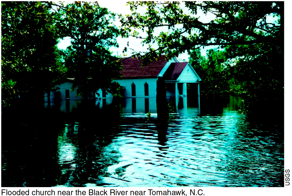
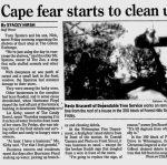
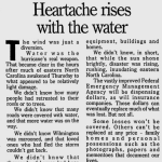
Floyd’s huge rainfall totals and subsequent river flooding were at the time unprecedented in the history of the Carolinas. By the end of the storm, rainfall totals of 12 to 20 inches were reported from Georgetown and Conway, South Carolina, northward across eastern North Carolina and into southeastern Virginia. The Wilmington Morning Star (now the Star-News) said “water reached areas even old-timers had never seen inundated before.” Millions of farm animals were drowned and upward of 80,000 structures were damaged or destroyed. Flooding closed a 100-mile segment of Interstate 95 in northeastern North Carolina into a portion of Virginia. Three sections of Interstate 40 between Wilmington and Benson were also flooded and closed. Both Interstate routes are critical to quick travel through eastern North Carolina. President Bill Clinton declared the eastern half of North Carolina a Disaster Area, and Governor Jim Hunt was quoted “We have seen the worst flooding in anybody’s memory.” The book North Carolina's Hurricane History by Jay Barnes recounts many stories of heroic rescues from Hurricane Floyd's floodwaters across eastern North Carolina in the days after landfall.
The highest rainfall amounts occurred in the Cape Fear area including 19.06 inches in Wilmington and 24.06 inches in Southport. NOAA Atlas 14 contains statistical rainfall return periods for points across the United States -- Wilmington’s recorded rainfall of 19.06 inches in three days lies in between the statistical 200 and 500 year rainfall events, while Southport’s 24.06 inch total is near the statistical 1000 year rainfall event. After flash flooding from rainfall subsided, river flooding became the major concern. The Tar River rose to 29.74 feet in Greenville, NC, flooding highly populated areas of the city and destroying portions of the nearby communities of Princeville and Tarboro. The Northeast Cape Fear River at Chinquapin crested at 23.51 feet, a record that stood until flooding associated with Hurricane Florence in 2018. Many rivers across the eastern Carolinas and Virginia reached major flood stage or record flood stage, and most of Hurricane Floyd’s fatalities were directly due to flooding.
An environmental disaster unfolded in the days and weeks after Floyd as hog farm waste, sewage from overwhelmed municipal systems, and chemicals from homes and vehicles flowed into swollen rivers. The Morning Star reported that North Carolina’s Natural Resources Department conducted aerial surveys on Sunday September 19 and found oil slicks and flooded animal waste lagoons across Brunswick, Columbus, Bladen, and Duplin counties. The newspaper also quoted a state official as saying water supplies were at risk across Edgecombe and Pitt counties as well. State agricultural officials estimated 2.4 million chickens, 100,000 hogs, and 500,000 turkeys were killed by Floyd’s flooding. The state ordered portable incinerators from out of state to destroy the animal carcasses before hatching flies began to spread harmful bacteria to people from the contaminated flood water.
Floyd’s winds weakened as the center accelerated northeastward across eastern North Carolina and eastern Virginia, however heavy rainfall and additional flooding continued along the storm’s path from eastern Virginia, Maryland, and into New Jersey.
Specific Impacts by County
|
Observed Hurricane Floyd Storm Surge Heights from a joint study by the US Army Corps of Engineers and FEMA. |
Brunswick County, NC – Mandatory evacuation of the beach communities was ordered, and a countywide curfew was put into effect at 10 pm Wednesday September 15. Coast Guard staff evacuated the Oak Island station on Wednesday. Immediately after the storm Brunswick Electric Membership Corporation reported 55,000 of its customers were without power. One-third of the roof (approximately 20,000 square feet) at Brunswick Community Hospital blew away, damaging most of the rooms and collapsing some of the interior ceilings. Flooding was severe across many sections of the county. The Morning Star reported “one family in Leland was literally jumping out windows to avoid being swamped in their home.” The County Emergency Manager reported that water had also entered homes in Shallotte. U.S. Highway 17, and NC Highways 211 and 133 were closed for a time due to high water. Significant flooding was reported along Town Creek. Brunswick Community College was damaged by mud and water covering the first floor classrooms in the science building.
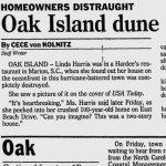
Along the Brunswick County beaches, a 10 foot storm tide severely damaged hundreds of coastal homes and businesses. The Morning Star reported that beach walkways were swept away on Oak Island, and septic tanks for some coastal homes were excavated by beach erosion. Most of the primary dunes along the beach were wiped out by storm surge and crashing waves. Ocean Crest Pier and Long Beach Pier were both destroyed. The Morning Star reported that pilings from Long Beach Pier were found two miles away, and that it took until November for storm debris to get fully cleared off Oak Island’s streets. One Oak Island resident was quoted as saying looters were observed entering damaged beachfront homes. Bald Head Island at the tip of Cape Fear also experienced storm surge flooding that transported up to four feet of sand onto roads. Sand dunes along the south-facing shore line were largely removed by the storm. The island’s mayor was quoted, “We lost approximately 80 feet of beach in some areas.” Fortunately for the town’s residents, the mayor reported no homes were destroyed.
In Sunset Beach, the end of the island’s pier was destroyed along with around three-quarters of the town’s 12-foot tall sand dunes. An officer with the town’s police department was quoted in the Morning Star as crediting a beach renourishment project the prior year for preventing worse damage from occurring.
|
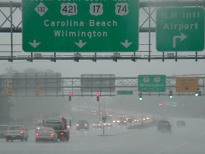
Evacuation traffic lined up to leave Wilmington during heavy rain before Hurricane Floyd's arrival. (photo credit: FEMA) |
New Hanover County, NC - Coast Guard staff evacuated the Wrightsville Beach station on Wednesday. Carolina Power & Light reported 73,000 customers were without power in the Wilmington area at the height of the storm. Fallen trees covered many roads and neighborhood streets across the county. Coupled with significant flash flooding, it was impossible to move about the area due to all the road blockages.
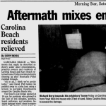
The Cotton Exchange, a popular shopping building in downtown Wilmington, lost a portion of its roof allowing heavy rain to flood some of the shops. Snow’s Cut Bridge which connects Carolina Beach to the rest of New Hanover County closed before the storm and didn’t reopen for the public until Saturday, September 18. Total storm tide reached 10.3 feet at Masonboro Island and 10 feet in Carolina Beach. The storm surge heavily eroded the beaches and transported up to three feet of sand into some homes in low lying portions of Carolina Beach. Up to four feet of sand had to be excavated off Carolina Beach Avenue North. Homes near Carolina Beach Lake are elevated and did not directly suffer flood damage from the five feet of water that flowed beneath them. The town eventually used pumps to remove water from this area.
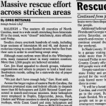
The National Guard was called upon to rescue at least 15 people in flooded vehicles in New Hanover and Brunswick counties. Flooding also damaged a railline and caused flooding of industrial wastewater storage ponds at a chemical plant just north of Wilmington. New Hanover County’s schools suffered an estimated $1.5 to 2 million in damage from Floyd including storm surge flooding at Wrightsville Beach Elementary, broken windows at Gregory Elementary and Williston Middle Schools, and roof damage at Laney High. Schools closed in New Hanover County prior to Floyd’s landfall and didn’t reopen until Tuesday, September 21. UNC-Wilmington’s classes were also canceled prior to the storm to allow for safe evacuation from the area, and didn’t resume until September 21.
Pender County, NC – A mandatory evacuation order was in place for the beach communities of Pender County prior to the storm.
Topsail Island experienced significant beach erosion and structural damage to homes and businesses. Up to four feet of sand was transported by the ocean into the first floor of some homes and condos. New River Inlet Road was overwashed and scoured out by storm surge in multiple locations. Underground water and sewer pipes were exposed near the beach. The Morning Star reported a new inlet was opened at Myrtle Drive in Surf City. Most of the island’s protective sand dunes were washed away. NC Sea Grant Coastal Engineer Spencer Rogers was quoted, “They didn’t lose any buildings during Floyd, but 180 during Fran,” alluding to the fact three years earlier Hurricane Fran destroyed many vulnerable coastal homes, leaving fewer remaining in Floyd’s path.
The Morning Star quoted a member of the Pender County rescue squad “Most people around here know what to do when they’re flooded, but we’ve got places getting flooded that have never been flooded before…” Two people were killed by flood water including one who drove off I-40 into a flooded ditch, and another in a vehicle along Coras Grove Road near Burgaw. Pender County Emergency Management reported that 350-400 people were rescued from floodwaters in their homes.
Severe flooding along the Northeast Cape Fear River inundated large sections of Pender County including most of NC Highway 53 from Maple Hill down to Burgaw. A Morning Star article on September 20 interviewed a farmer in that section of the county who was forced to shoot 35 goats on his farm rather than let them drown. “Even if they could swim, there isn’t anywhere for them to land.” Long-time residents of the area had never experienced flooding even close to the magnitude that Floyd brought. One resident being evacuated from flooded Whitestocking Road along the west bank of the Northeast Cape Fear River told a Morning Star reporter he “saw cows, pigs, and a horse fighting for space on the front porch of a home on NC 53…”
Horry County, SC - Local officials enacted at curfew at 3 p.m. on September 15. Floyd’s storm surge reached three feet at the beaches, but it was heavy rainfall that led to flash flooding across large sections of the county. Reports of chest-deep water were received from two locations around the Pine Lakes County Club in Myrtle Beach. Up to four feet of water entered the Azalea Lakes apartments. Days after the flash flooding subsided, some of the worst freshwater flooding in local history developed along the Waccamaw River in Conway, flooding hundreds of homes collectively worth millions of dollars. Areas significantly affected included Downtown Conway and the river neighborhoods of Jackson Bluff, Pitch Landing, Savannah Bluff, and Lees Landing. Floods of even greater magnitude have occurred in more recent years including during Hurricanes Matthew in 2016, and Florence in 2018. Ten days after Floyd’s landfall the Waccamaw River gauge reached a peak of 17.61 feet, over six feet above flood stage.
Columbus County, NC – A State of Emergency was declared on Wednesday September 15. Flooding displaced residents in the Riegelwood, Acme, and Delco communities in eastern Columbus County. Even several days after the storm, Columbus County emergency management reported water was still rising in those communities, forcing new evacuations. One motorist was killed in Columbus County when he drove his car into deep water. Storm chaser video showed deep water racing across a highway near Hallsboro, nearly sweeping a car off the road.
Bladen County, NC – The County Emergency Manager reported significant flash flooding with closures along almost every highway in the county. The business district in Bladenboro was flooded two feet deep, and in East Arcadia deep floodwater entered numerous homes and rose above the height of first floor windows. Portions of State Highways 210, 87, and 11 were reportedly washed out.
|
photo credit: NC Div. of Emergency Management |
photo credit: NC Div. of Emergency Management |
photo credit: US Geological Survey |
Elsewhere across the eastern Carolinas:
In the Charleston, SC area high winds knocked out power to around 200,000 people. A New York Times article on September 16, 1999 mentioned that 65 percent of Charleston’s population evacuated to inland areas ahead of the storm.
|
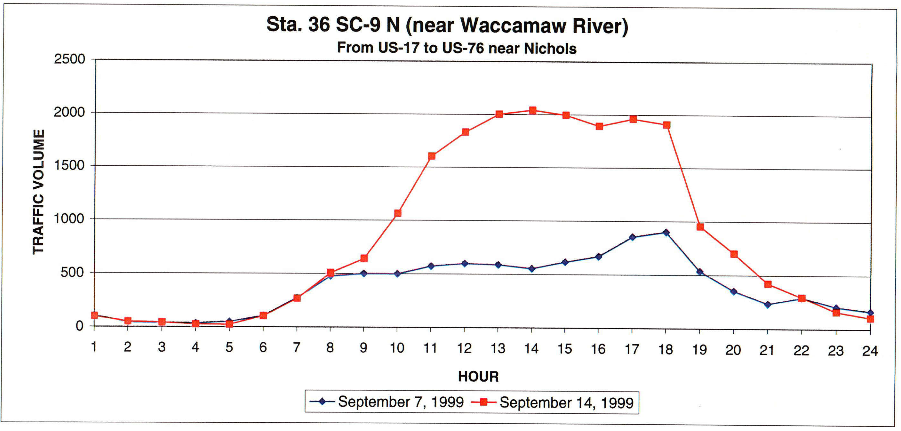
Observed (red) hourly traffic counts on SC Highway 9 during Hurricane Floyd's evacuation versus normal traffic counts (blue) one week earlier. From a joint study by USACE and FEMA. |
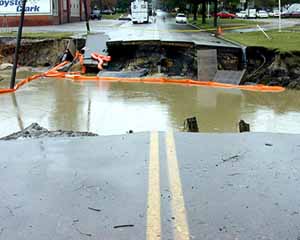
Three people in Duplin County were killed attempting to drive across flooded roads. Newspaper reports stated around 60 square miles of Duplin County was underwater. At the Jesse Lanier Farm in Duplin County, flooding forced an estimated 2.1 million gallons of hog waste into Rockfish Creek, a tributary of the Northeast Cape Fear River. Newspaper reports on September 18 also stated that “millions of gallons” of hog waste was flowing from the Batchelor Sow Farm, also in Duplin County. Hog farms in Sampson and Pitt Counties also lost control of their waste lagoons due to the exceptional rainfall amounts. About 15 feet of U.S. Highway 421 washed out next to the Black River bridge between the Sampson County towns of Delway and Clinton.
In Nash County, North Carolina, the National Guard rescued residents of the town of Nashville using helicopters and jet skis. Around 400 people were rescued from rising flood water in Edgecombe County.
A State DOT employee was swept away by flood waters and killed in Jones County while attempting to rescue a stranded driver.
In the Pinetops community of Edgecombe County, six people lost their lives when a boat being used to rescue 11 people capsized on Town Creek.
|
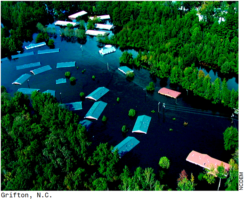
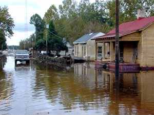
Flooding devastated Princeville, NC (photo credit: FEMA) |
Volunteers with the Southern Baptist Convention served meals to flood victims in Tarboro, NC (photo credit: FEMA) |
Washed out road in Tarboro, NC (photo credit: FEMA) |
In the final report from the Newport/Morehead City, NC weather office, the storm surge was reported to have reached six to eight feet along the south-facing beaches of Onslow and Carteret Counties. In the Pamlico and Neuse Rivers tides were six to eight feet above normal with the highest water observed in the Core Creek area. Along Highway 12 on Ocracoke Island the dunes were breached in ten locations, however overall beach erosion was minor. Ten tornado touchdowns were reported across eastern North Carolina including tornadoes in Emerald Isle, Atlantic Beach, Lake Phelps, Bayboro, and in Hobucken where a church and a school were both damaged.
According to the National Weather Service in Wakefield, Virginia, Floyd’s wind-driven storm tide on the Albermarle Sound reached five to six feet, flooding a portion of downtown Elizabeth City and Edenton. The Chesapeake Bay’s storm tide reached five to seven feet, inundating sections of Accomack County, VA, and Dorchester and Somerset Counties in Maryland, and flooding some coastal homes. Significant flooding developed over the next couple of days along the Meherrin and Nottoway Rivers in southeastern Virginia. The Blackwater River near Franklin, VA crested at 25.11 feet several days after Floyd, estimated to have been a 500 year flood event. Trees and power lines knocked down by Floyd’s winds cut power to 225,000 customers in the Hampton Roads area. U.S. Highways 460 near Wakefield and 58 near Emporia and Franklin were closed due to flooding, as was Interstate 95 between Petersburg and Emporia. A tornado touchdown in the Perquimans County community of Durants Neck destroyed two homes and damaged several others.
Three aircraft carriers and around 80 other ships based in Norfolk, VA evacuated out to sea with around 30,000 sailors. Aircraft were also flown to safer locations away from Langley Air Force Base and Oceana Naval Air Station.
Wind Gusts, Lowest Barometric Pressure, Rainfall Totals
| Location | Peak Wind (kt) | Peak Wind (mph) | Pressure (mb) | Pressure (in Hg) | Rainfall |
| FLORIDA | |||||
| Daytona Beach | 60 | 69 | 991.8 | 29.29 | 1.23 |
| Melbourne (airport) | 59 | 68 | 989.1 | 29.21 | 1.35 |
| GEORGIA | |||||
| St. Simon's Island | 40 | 46 | 993.2 | 29.33 | |
| SOUTH CAROLINA | |||||
| Charleston (downtown) | 74 | 85 | 4.16 | ||
| Myrtle Beach (Springmaid Pier) | 68 | 78 | |||
| Folly Beach | 62 | 71 | |||
| Myrtle Beach (airport) | 62 | 71 | 979.7 | 28.93 | |
| Charleston (airport) | 58 | 67 | 989.5 | 29.22 | 4.06 |
| North Myrtle Beach | 57* | 66* | 977.0 | 28.85 | 16.06 |
| Florence (airport) | 54 | 62 | 991.2 | 29.27 | 4.04 |
| Edisto Beach | 47 | 54 | |||
| Myrtle Beach | 16.80 | ||||
| Brookgreen Gardens | 14.71 | ||||
| Loris | 14.18 | ||||
| Georgetown (2 miles east) | 13.84 | ||||
| Conway | 13.05 | ||||
| McClellanville | 10.60 | ||||
| Andrews | 9.20 | ||||
| McColl | 5.80 | ||||
| Dillon | 5.63 | ||||
| Kingstree | 5.30 | ||||
| NORTH CAROLINA | |||||
| Wrightsville Beach (8 stories) | 120 | 138 | |||
| Topsail Beach | 106 | 122 | |||
| Castle Hayne (3 miles SW) | 104 | 120 | |||
| Wilmington (EOC) | 104 | 120 | |||
| Federal Point | 97 | 112 | |||
| Frying Pan Shoals Light Tower | 97 | 112 | 958.7 | 28.31 | |
| Myrtle Grove | 89 | 102 | |||
| Wilmington (Corning plant) | 89 | 102 | |||
| Duck | 83 | 96 | 977.0 | 28.85 | |
| Diamond Shoals Light Tower | 82 | 94 | 985.8 | 29.11 | |
| Castle Hayne (2 miles E) | 81 | 93 | |||
| Flemington | 80 | 92 | |||
| Cape Lookout | 79 | 91 | 974.9 | 28.79 | |
| Wilmington (NWS/airport) | 75 | 86 | 959.7 | 28.34 | 19.06 |
| Cherry Point MCAS | 71 | 82 | 961.4 | 28.39 | 3.27 |
| Wilmington (Morning Star, S 17th St.) | 70 | 80 | |||
| Oak Island | 69 | 79 | |||
| New River | 68 | 78 | 959.0 | 28.32 | 8.26 |
| Holden Beach | 64 | 74 | |||
| Frisco | 61 | 70 | 983.8 | 29.05 | 0.34 |
| Beaufort | 58 | 67 | 976.0 | 28.82 | 5.56 |
| New Bern | 58 | 67 | 961.1 | 28.38 | 5.51 |
| Elizabeth City | 56 | 64 | 968.5 | 28.60 | 2.65 |
| Southport (5 miles north) | 24.06 | ||||
| Wilmington (7 miles north) | 19.26 | ||||
| Lewiston | 18.13 | ||||
| Rocky Mount (8 miles east-southeast) | 18.00 | ||||
| Longwood | 16.54 | ||||
| Snow Hill (2 miles southwest) | 16.12 | ||||
| Washington (4 miles west) | 15.48 | ||||
| Warsaw (5 miles east) | 15.45 | ||||
| Rocky Mount (airport) | 15.15 | ||||
| Trenton | 15.13 | ||||
| Whiteville (5 miles south) | 15.07 | ||||
| Greenville | 14.24 | ||||
| Elizabethtown | 14.21 | ||||
| Scotland Neck | 13.99 | ||||
| Willard (4 miles southwest) | 13.23 | ||||
| Kinston | 13.20 | ||||
| Goldsboro | 12.70 | ||||
| Clinton (2 miles northeast) | 11.50 | ||||
| Zebulon (3 miles southwest) | 9.35 | ||||
| Smithfield | 9.27 | ||||
| Lumberton (airport) | 8.48 | ||||
| Dunn | 7.65 | ||||
| Roanoke Rapids (airport) | 7.24 | ||||
| Fayetteville (airport) | 6.81 | ||||
| Raleigh (airport) | 6.55 | ||||
| Laurinburg (airport) | 5.40 | ||||
| Roxboro | 5.18 | ||||
| Morehead City (2 miles west-northwest) | 4.33 | ||||
| Cape Hatteras | 0.24 | ||||
| VIRGINIA | |||||
| Portsmouth | 52 | 60 | 978.3 | 28.89 | 10.10 |
| Newport News | 44 | 51 | 983.4 | 29.04 | 16.57 |
| Richmond | 44 | 51 | 991.9 | 29.29 | 6.54 |
| Norfolk (airport) | 40 | 46 | 977.1 | 28.85 | 6.81 |
| Fort Eustis | 37 | 43 | 985.2 | 29.09 | |
| Williamsburg (2 miles north) | 16.98 | ||||
| Wakefield (NWS) | 12.73 | ||||
| Smithfield | 12.50 | ||||
| Langley AFB | 9.47 | ||||
| Emporia | 8.34 | ||||
| Hopewell | 8.01 | ||||
| Wallops Island | 5.40 | ||||
* North Myrtle Beach Airport's anemometer failed around 3:00 a.m. September 16, 1999
Local Newspaper Articles - Hurricane Floyd
The Wilmington Morning Star (now called the Star News) published dozens of articles in the days and weeks after Floyd, documenting how the storm affected the people, neighborhoods, and landscapes of the Cape Fear region. Archives of the Morning Star in the 1990s are freely available in Google's newspaper archive.
Videos
|
Jim Leonard documented Floyd's impact on Wilmington. The second half of the video shows a car nearly swept away by floodwater at Hallsboro Middle School east of Whiteville in Columbus County, NC. |
HurricaneTrack.com video of Floyd showing the storm surge in Wrightsville Beach, NC; damage to the beaches; and flooded roads in the area. |
|
WHFL TV produced this 15 minute feature showing flooding in the city of Goldsboro, NC and relief efforts provided to area residents after the storm. |
Storm chaser Scott McPartland shares his account of his trip into Hurricane Floyd in Conway, SC. |
|
South Carolina Department of Transportation aerial and ground-level video of flooding in Conway, SC. |
Associated Press (AP) video of Floyd's flooding in Wilmington and damage in Charleston, SC. Video also includes clips of the National Hurricane Center and Presidential briefings on the storm. |
Links to Additional Studies and Data
National Hurricane Center report on Hurricane Floyd - https://www.nhc.noaa.gov/data/tcr/AL081999_Floyd.pdf
NWS Raleigh - https://projects.ncsu.edu/atmos_collaboration/nwsfo/storage/cases/19990915/
NWS Newport/Morehead City - https://www.weather.gov/mhx/Sep161999EventReview
UNC Chapel Hill DOCSouth feature on Hurricane Floyd - https://docsouth.unc.edu/highlights/floyd.html
USGS report on Floyd's Historic Rainfall - https://pubs.usgs.gov/wri/wri004093/pdf/rainfall.pdf
U.S. Department of Commerce Service Assessment for Hurricane Floyd - https://www.weather.gov/media/publications/assessments/floyd.pdf
Research and Page Author: Tim Armstrong
Page Created: July 23, 2019
Last Updated: July 24, 2019


 Coastal Flood