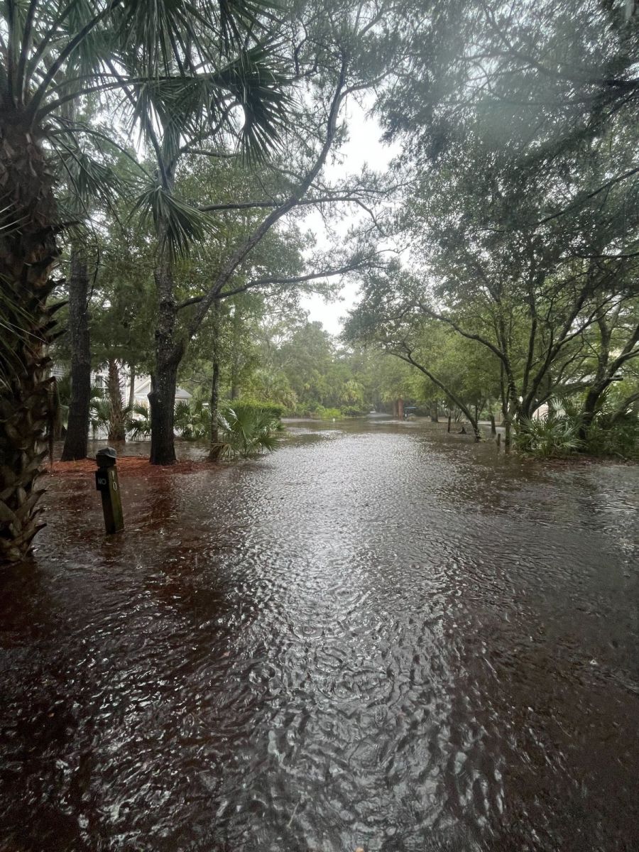
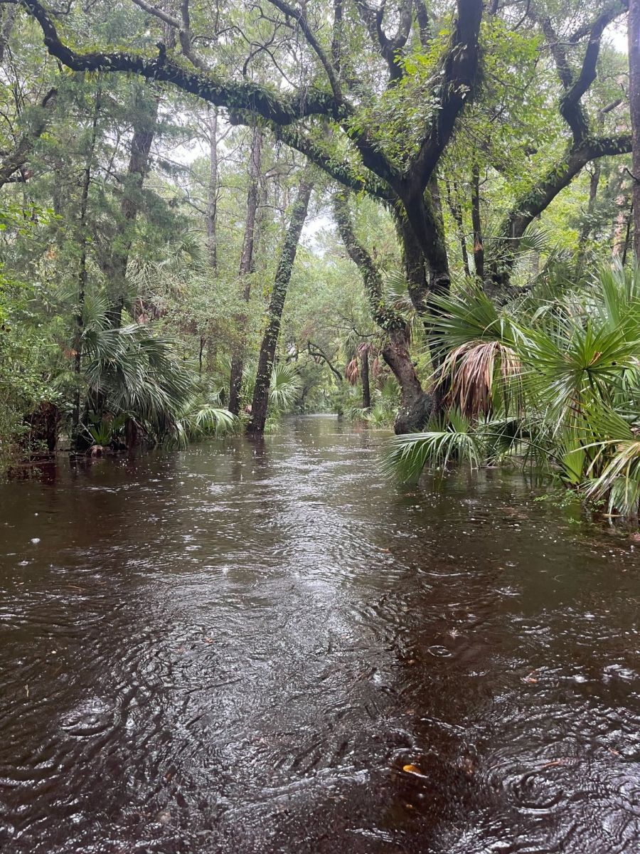
Historic rainfall occurred across the Cape Fear Region of southeastern North Carolina on September 16, 2024. Gauges and automated radar estimates showed that 12 to 20 inches of rain fell in only two days, creating severe flash flooding affecting Carolina Beach, Southport, Bolivia, and Boiling Spring Lakes. Although this system never became a named tropical system, observed weather impacts including strong winds, heavy rain, and flash flooding were similar to tropical storms and hurricanes of the past.
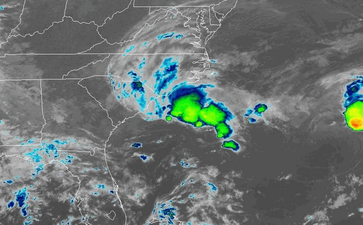
Potential Tropical Cyclone Eight was an area of low pressure that developed off the Carolina Coast on September 13, 2024. While it initially developed along a stalled front, over several days the system began to draw energy from the warm ocean surface. As winds increased, the low was given a "Potential Tropical Cyclone" categorization late in the afternoon of September 15, indicating that conditions could support its evolution into a tropical or subtropical storm. A Tropical Storm Warning was issued for the Carolina coastline for the expectation of these weather conditions.
|
Infrared satellite loop from September 15-16, 2024 showing Potential Tropical Cyclone Eight moving inland |
While the system displayed some tropical characteristics at times, Hurricane Hunter aircraft sent to investigate the storm found it never developed a symmetric wind circulation and it maintained horizontal temperature contrasts not consistent with the structure of tropical storms.
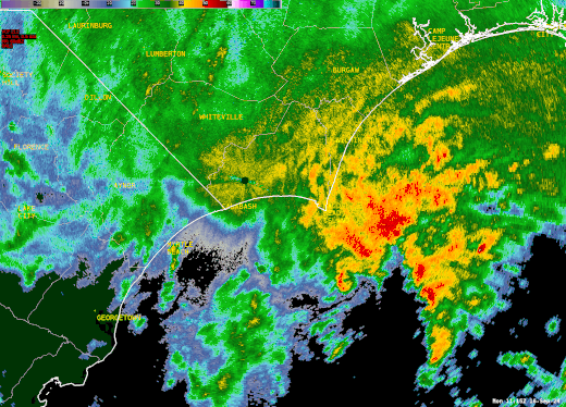
Regardless of the nature of the storm, Potential Tropical Cyclone Eight brought historic rainfall and flash flooding to parts of Brunswick and southern New Hanover counties. Storm total rainfall totals of 12 to 20 inches were recorded within a 25-mile wide stripe running from Carolina Beach and Southport through Bolivia, the Green Swamp, and ending south of the Delco community in eastern Columbus County. The majority of this rain fell within a 12 hour window between 5:00 am and 5:00 pm on Monday, September 16. Flash flooding quickly developed in Carolina Beach during the morning hours, then shifted northwestward following the heaviest rainfall rates as the center of Potential Tropical Cyclone Eight shifted onshore.
|
Radar loop from September 16, 2024 showing Potential Tropical Cyclone Eight moving onshore. Extremely heavy rain developed in a large convergence band on the northern edge of the low, dropping exceptionally heavy rainfall which led to historic flash flooding. |
Gauge-measured rainfall in excess of 12 inches within a 12 hour period is expected to occur, on average, once every 200 years across coastal southeastern North Carolina. A few spots may have had rainfall amounts as large as 18 inches within a 12 hour period, approaching the kind of event expected to occur, on average, once every 1000 years. These estimates are calculated in NOAA Atlas 14, a reference document that shows the climatological recurrence of heavy rainfall events.
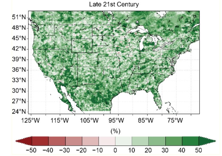
A study conducted at the North Carolina Institute for Climate Studies predicts increased frequency of future heavy rainfall events as a consequence of climate change. Warmer air holds more moisture, therefore a warming climate can support heavier rainfall. By the year 2075, extreme rainfall events could become 25% heavier due to climate change.
|
Changes in the frequency of extreme precipitation events between 2016 and the late 21st century. From the North Carolina Institute of Climate Change study "Incorporation of the Effects of Future Anthropogenically Forced Climate Change in Intensity-Duration-Frequency |
Current rainfall recurrence statistics for a location near Southport, NC
Rainfall recurrence projections in the year 2075 assuming a warmer climate
|
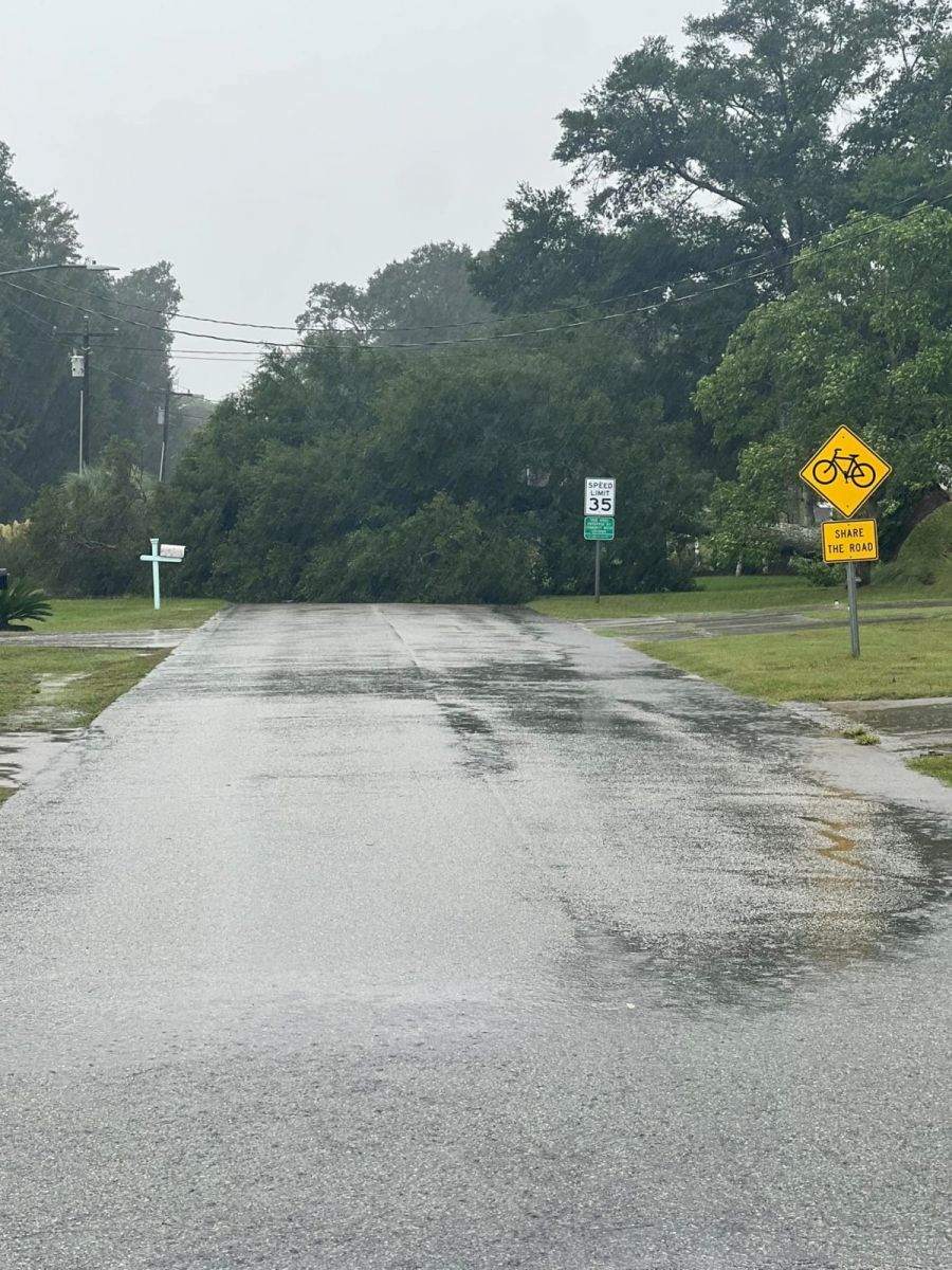
Multiple roads were closed due to floodwaters and some roads were physically washed out by the immense volume of floodwater. Some major highways that were closed included:
|
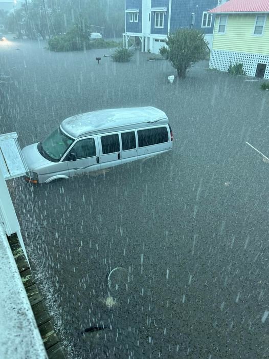
Widespread flooding across Carolina Beach. Video provided by Sharon Carlson.
 Flooding along Fort Fisher Blvd in Kure Beach. Photo by Lee Snead. Flooding along Fort Fisher Blvd in Kure Beach. Photo by Lee Snead. |
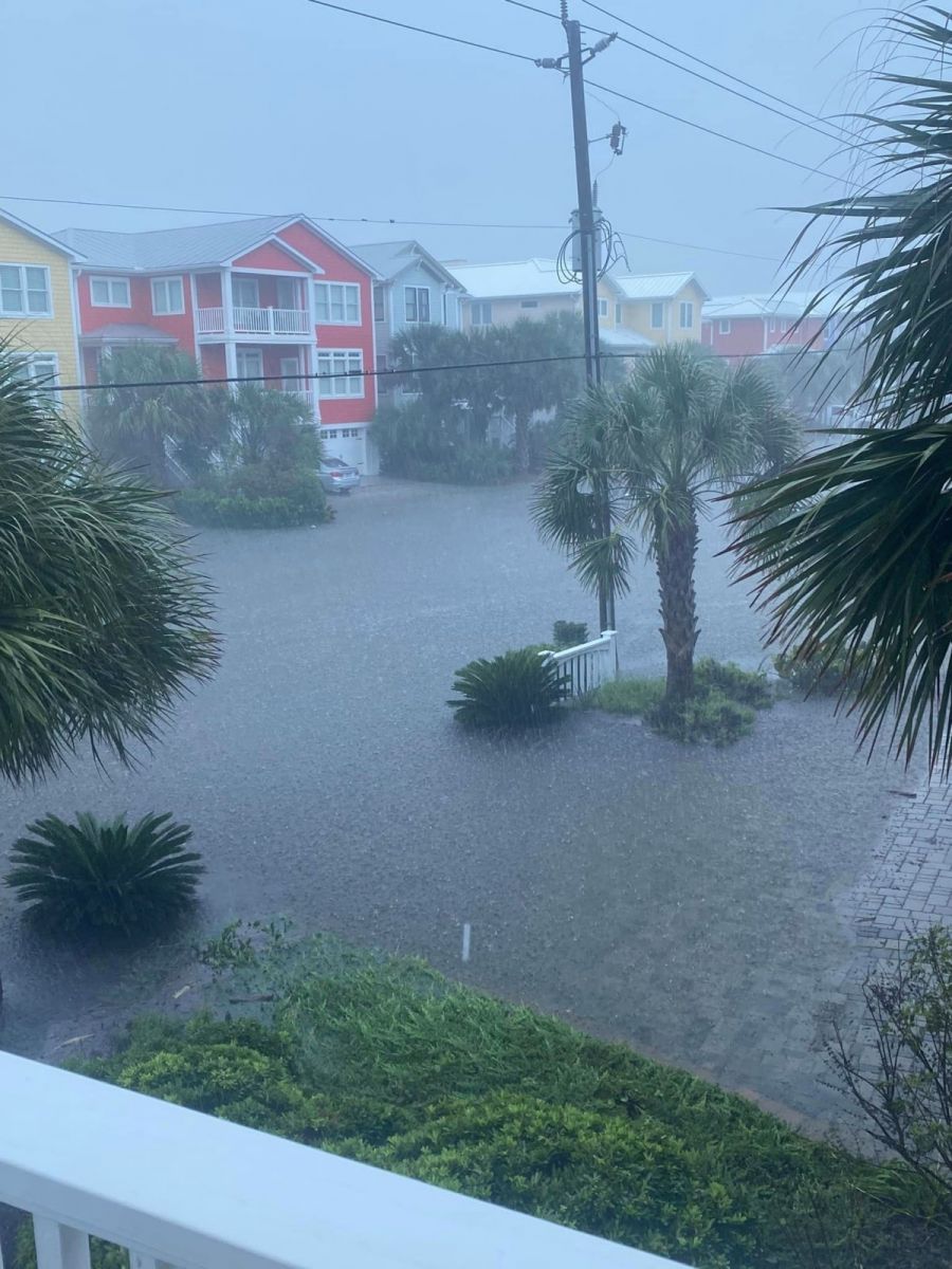
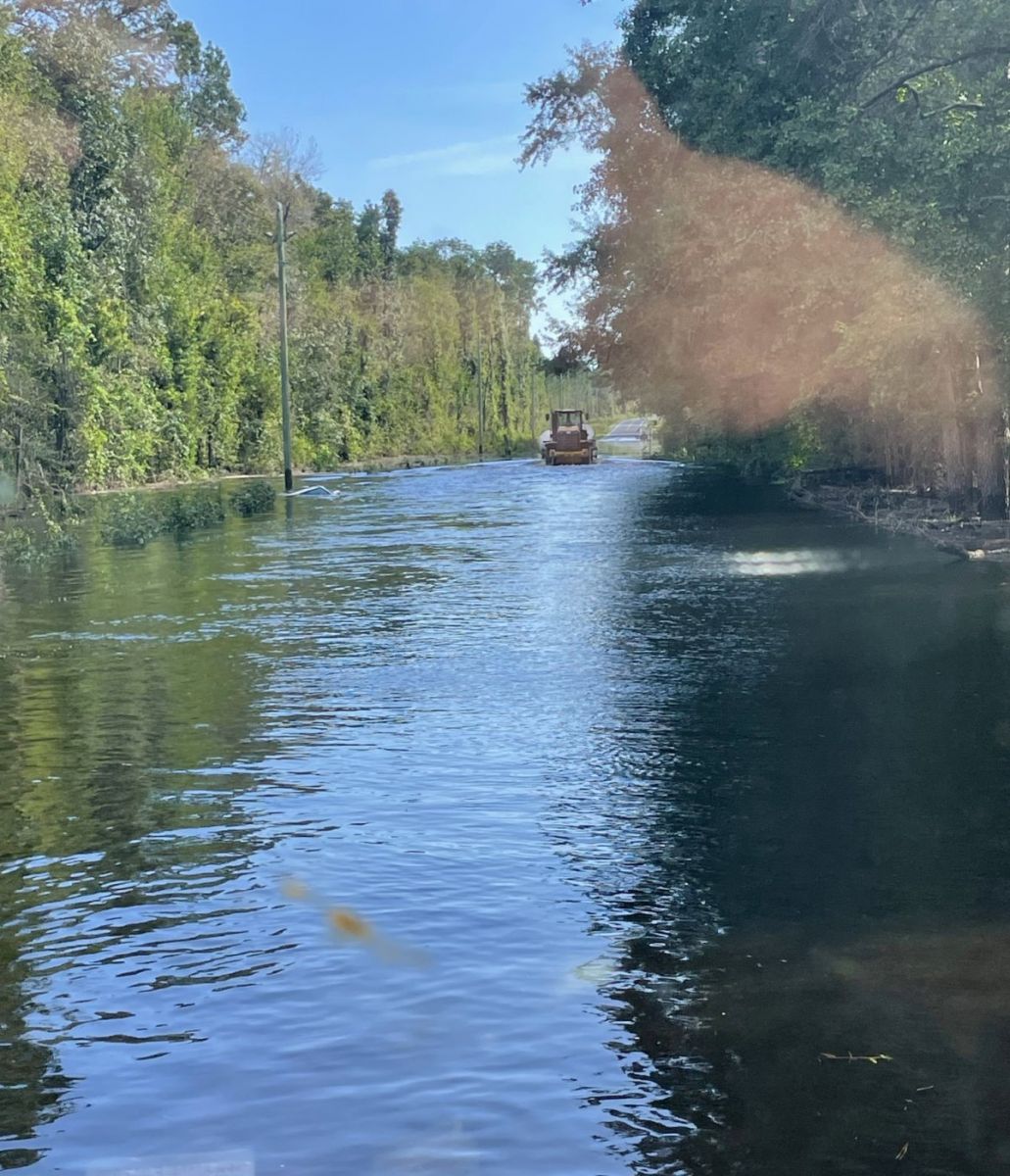
 Over three feet of floodwater in Carolina Beach. Photo by Ashley MacBride Over three feet of floodwater in Carolina Beach. Photo by Ashley MacBride |
| Carolina Beach, NC | 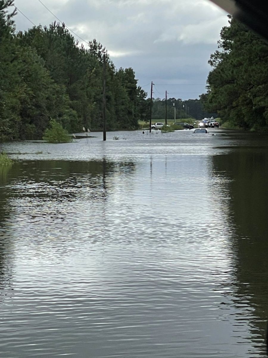 Flooding on Danford Road at NC Highway 87, east of Bolivia, NC. Photo provided by the Brunswick County Sheriff's Office Flooding on Danford Road at NC Highway 87, east of Bolivia, NC. Photo provided by the Brunswick County Sheriff's Office |
|
Flooding on Bald Head Island, NC. Photo provided by Ethan Clark. |
Flooding on Bald Head Island, NC. Photo provided by Ethan Clark. |
Rainfall Totals
|
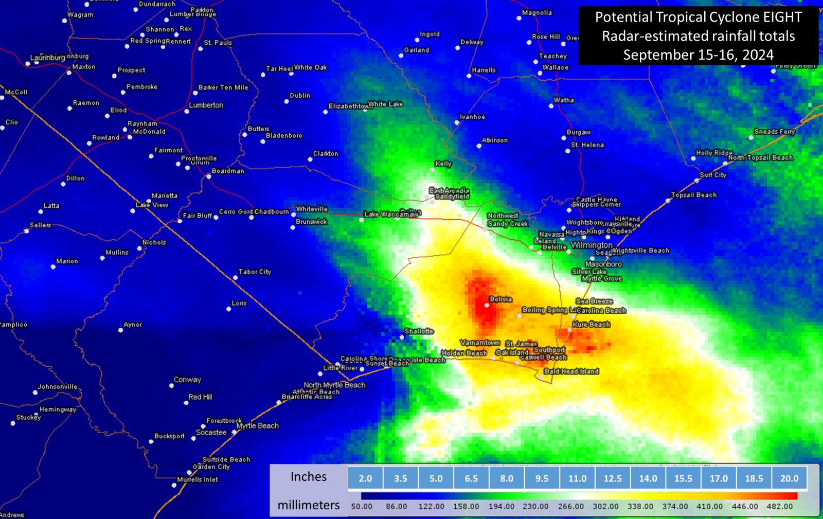
MRMS rainfall estimates for Sept 15-16, 2024 shows 12 to 20 inches of rain likely fell across parts of the Cape Fear area. |
Gauge-measured totals across southeastern North Carolina and northeastern South Carolina. These originate from a variety of networks including NWS ASOS, FAA AWOS, CoCoRaHS, NWS cooperative observers, CWOP, and Weather Underground.
| Location | County | Rainfall | Location | County | Rainfall | |
| Carolina Beach Ocean Blvd | New Hanover NC | 20.81 | Galivants Ferry Landing | Horry SC | 5.51 | |
| Southport 6.9 W | Brunswick NC | 19.13 | Aynor 7.9 ENE | Horry SC | 5.40 | |
| St James - Harborwalk | Brunswick NC | 18.65 | Mullins Coop | Marion SC | 5.32 | |
| Bolivia 7.6 SW | Brunswick NC | 17.85 | Elizabethtown | Bladen NC | 5.19 | |
| Southport - Abbington Oaks | Brunswick NC | 16.97 | Galivants Ferry 7.6 E | Horry SC | 5.11 | |
| Oak Island (Long Beach) | Brunswick NC | 16.61 | Sunset Harbor | Brunswick NC | 5.09 | |
| Carolina Beach 1 S Bridge | New Hanover NC | 16.51 | Burgaw 0.3 NE | Pender NC | 5.08 | |
| Boiling Spring Lakes | Brunswick NC | 16.34 | Hampstead 4.1 WNW | Pender NC | 4.76 | |
| River Rd 1 N of Snows Cut | New Hanover NC | 15.85 | Leland | Brunswick NC | 4.73 | |
| Sunny Point | Brunswick NC | 15.42 | Marion RAWS | Marion SC | 4.61 | |
| Southport 5.7 W | Brunswick NC | 14.96 | Longwood | Brunswick NC | 4.55 | |
| Green Swamp | Brunswick NC | 14.57 | Florence 6.2 NE | Florence SC | 4.54 | |
| Southport - Ruark Dr SE | Brunswick NC | 11.13 | Darlington County Airport | Darlington SC | 4.52 | |
| 1 N Kure Beach Pier | New Hanover NC | 10.91 | Horry County RAWS | Horry SC | 4.39 | |
| Green Swamp | Brunswick NC | 9.80 | Burgaw 5.3 WSW | Pender NC | 4.26 | |
| Monkey Junction 1 W | New Hanover NC | 9.12 | Wilmington Airport | New Hanover NC | 4.16 | |
| Near Ashley High School | New Hanover NC | 9.04 | Latta 0.3 NNE | Dillon SC | 4.14 | |
| Wilmington 7 SE | New Hanover NC | 8.78 | Loris | Horry SC | 3.97 | |
| 1 W Holden Beach | Brunswick NC | 8.70 | 2 WSW Wilmington | New Hanover NC | 3.94 | |
| Southport | Brunswick NC | 8.50 | 7 S Aynor | Horry SC | 3.94 | |
| Myrtle Grove Sound | New Hanover NC | 8.28 | Florence | Florence SC | 3.93 | |
| Elizabethtown 4.5 ENE | Bladen NC | 7.32 | St. Pauls | Robeson NC | 3.81 | |
| Wilmington 1.3 W | New Hanover NC | 6.82 | Darlington | Darlington SC | 3.81 | |
| Bolivia | Brunswick NC | 6.73 | Saltwater Landing | Pender NC | 3.80 | |
| Turnbull Creek | Bladen NC | 6.34 | 3 NNE Conway | Horry SC | 3.79 | |
| Whiteville RAWS | Columbus NC | 6.31 | Wilmington 6.5 NE | New Hanover NC | 3.78 | |
| Shallotte Fire Station | Brunswick NC | 6.19 | 1 SSW Aynor | Horry SC | 3.77 | |
| Shallotte | Brunswick NC | 6.00 | Florence 1.2 NNE | Florence SC | 3.76 | |
| Wilmington 5.6 ENE | New Hanover NC | 6.00 | Ocean Isle Beach | Brunswick NC | 3.74 | |
| West End Holden Beach | Brunswick NC | 5.81 | West Lakes (Florence) | Florence SC | 3.71 |
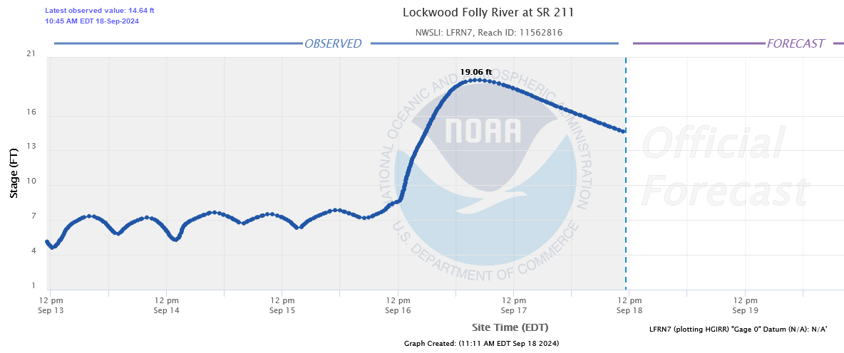
Extreme flooding developed across portions of Brunswick County and lasted for days. A river gauge installed at the Lockwood Folly River at NC Highway 211 recorded its second highest stage on record, 19.06 feet, only 1.7 feet below the record set back in 2018 during Hurricane Florence.
|
River gauge on the Lockwood Folly River at NC Highway 211 |
|
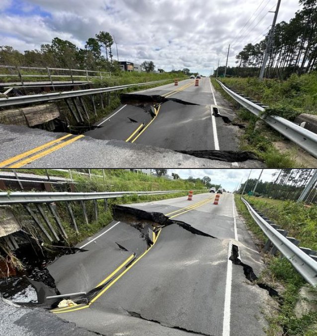
A bridge on NC Highway 211 washed out near Southport. Photo provided by the Brunswick County Sheriff's Office |
Flooding along Daws Creek Road in the Funston, NC community in Brunswick County. From Brunswick County Sheriff's Office |
|
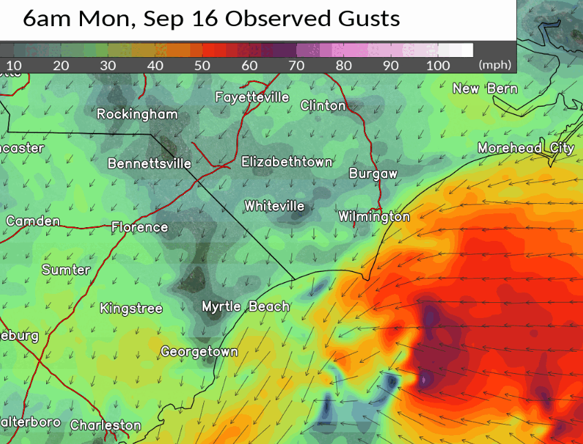
Winds
Even though this system never became a full-fledged tropical cyclone, wind gusts over 50 mph were recorded in a number of locations. While most of these higher winds occurred near the Cape Fear coastline in association with the heavy rain squalls racing onshore, a second area of strong northerly winds gusting to 45-50 mph developed during the afternoon well inland from Lumberton to Dillon to Florence. This appears to be as cool, dry air was pulled into the western periphery of the storm's circulation, promoting mixing of stronger winds down from aloft.
|
HRRR wind gusts for the morning of September 16, 2024 |
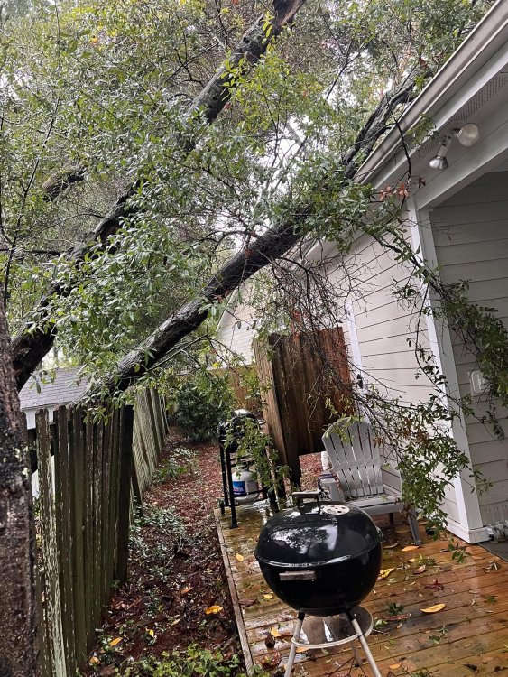
Scattered reports of wind damage were received, mostly to trees and power lines.
 Tree blown down across Shoreline Drive East in Sunset Beach. Photo provided by the Sunset Beach Police Department Tree blown down across Shoreline Drive East in Sunset Beach. Photo provided by the Sunset Beach Police Department |
Tree blown down on a house in Carolina Beach, shared by Dorothy Pagan |
Page Author: Tim Armstrong
Last Updated: September 19, 2024


 Coastal Flood