|
SPC Severe Weather Reports for April 5, 2022 |
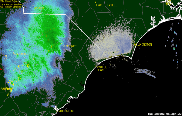
A compact area of low pressure moved across the Southeast on Tuesday April 5, 2022, producing a swath of severe thunderstorms and tornadoes from Mississippi to the Carolinas.
Across northeastern South Carolina, rain began falling between 2 and 4 pm Tuesday afternoon. Embedded thunderstorms soon developed and became severe shortly before 6 pm with damage reported to trees in the Oats community of Darlington County.
Thunderstorms organized into a line and produced strong winds with multiple reports of damage to trees across the Pee Dee and Grand Strand regions. A tornado developed in southeastern Marion County, causing damage to trees and a few structures along Bay Road east of Highway 908. The tornado tracked across the county line into Horry County near Gallivants Ferry, lifting the roof of a porch and damaging a parked vehicle. Along the coast wind gusts were measured as high as 59 mph in Little River, SC; 64 mph in Federal Point, NC; and 73 mph at the entrance to Winyah Bay, SC.
Storms exited the Cape Fear area by 11 pm, but not before dropping widespread rainfall totals in excess of one inch -- welcome rain as moderate drought conditions continue near the coast. Localized rainfall totals reached 3 inches near Darlington, SC.
Detailed List of Rainfall Amounts for April 5, 2022
|
Radar reflectivity loop for the afternoon and evening of April 5, 2022. Tornado warnings are shown as red polygons; severe thunderstorm warnings as yellow; and special marine warnings as blue. |
Infrared satellite loop for the afternoon and evening of April 5, 2022. Thunderstorms are associated with the higher, colder clouds shown by yellow and orange. Lightning strikes are indicated as white. |
Below are storm reports gathered by the National Weather Service in Wilmington, NC. For storm damage information from other portions of South Carolina, please check the latest information from offices in Charleston, Columbia, and Greenville-Spartanburg.
| Time EDT | Location | County, State | Report |
| 5:49 pm | 2 mi. NNW Oats | Darlington, SC | Tree down at Indian Branch Rd and Wesley Chapel Rd. |
| 7:55 pm | 11 mi. NW Conway | Horry, SC | Trees down on Pee Dee Rd near Clay Hill Rd, and Juniper Bay Rd near Dog Bluff |
| 7:55 pm | 8 mi. S Gallivants Ferry | Horry, SC | A tornado blew the roof of a porch off onto nearby parked vehicle on Gunters Island Rd. |
| 8:10 pm | 7 mi. E Cades | Williamsburg, SC | Tree down on Bradley Bay Rd. and Dewey Cox Rd. |
| 8:24 pm | Springmaid Pier in Myrtle Beach | Horry, SC | Measured wind gust to 41 mph |
| 8:30 pm | 1 mi. E Gresham | Marion, SC | Tree down on Highway 9 at Snow Ct. |
| 8:49 pm | Winyah Bay Entrance | Georgetown, SC | Measured wind gust to 73 mph at 50 foot elevation |
| 9:00 pm | 3 mi. SSW Socastee | Horry, SC | Tree down at Knollwood Dr. and Edgewood Dr. |
| 9:25 pm | Little River | Horry, SC | Measured wind gust to 59 mph |
| 10:18 pm | Federal Point | New Hanover, NC | Measured wind gust to 64 mph at 50 foot elevation |
| 10:30 pm | Frying Pan Shoals Buoy | offshore | Measured wind gust to 51 mph |
Last Updated: 10:19 pm Wed April 6, 2022


 Coastal Flood