Historical Rainfall Event for the Cape Fear Region
Overview | Surface Analysis | Water Vapor Imagery | Radar Imagery | Rainfall Totals Map | Event Summaries
MONDAY | TUESDAY | WEDNESDAY | THURSDAY
Tuesday, September 28th
| Tuesday was "the calm between the storms" as a brief respite to the heavy rain occurred across the area. This break was due to a combination of several factors. The upper low was rotating off to the north and east pushing the moisture conveyor offshore. At the same time, the stationary boundary hovered far enough east that the surface impulses and heavy rain were focused over the waters. | |
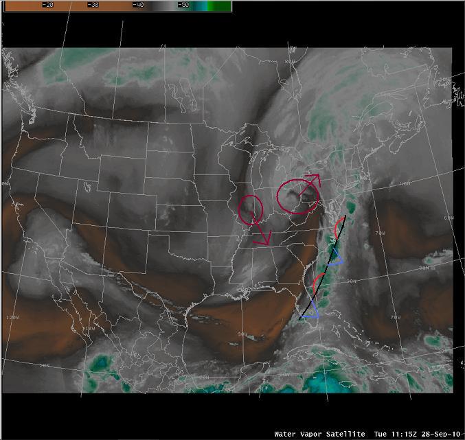 Water Vapor Imagery at 12z Tuesday Water Vapor Imagery at 12z Tuesday |
|
| However late Tuesday night, a second upper low began to develop and move SE behind the original low. This low, shown in red in the above image with the SE pointing arrow, would move into a very similar position as the first one over TN. This acted to pull the stationary boundary and moisture conveyor back to the west and again begin to focus the heavy rain across the Cape Fear region. In addition, significant tropical moisture began to develop into a tropical depression which would become TS Nicole on Wednesday. | |
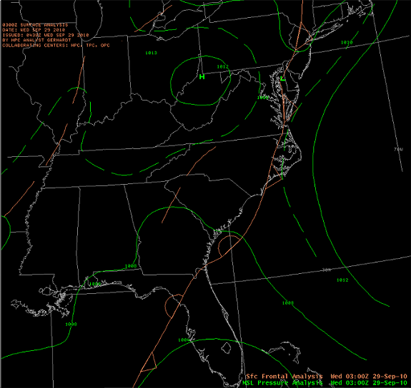 Surface Analysis at 03z Wednesday |
|
| With the quiet(er) conditions on Tuesday, the ILM WFO was able to put together 2 summary Public Information Statements highlighting the major rainfall totals up to that point.
|


 Coastal Flood