NWS Wilmington, NC
Weather Forecast Office
Severe Weather Outbreak from Dynamic Mid-Latitude Storm System on March 15th and 16th, 2008
 |
 |
 |
 |
|
Public Information Statement detailing the damage |
Damage from the Sardis Community in South Carolina from the EF1 tornado | A 2x4 driven into a destroyed mobil home northeast of Trio in Williamsburg County South Carolina from an EF1 tornado | Summary of Local Storm Reports |
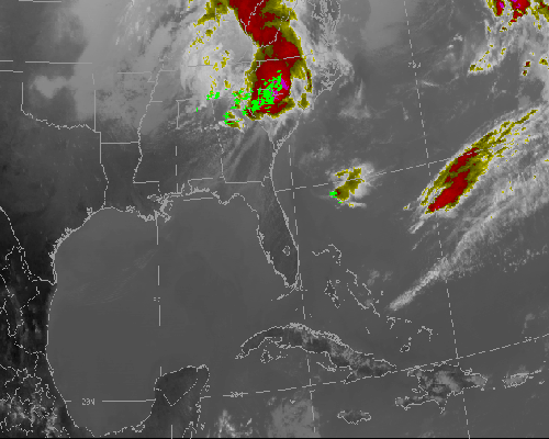
Loops of Satellite and Radar Images
 |
 |
 |
 |
| Infrared Satellite Loop | Water Vapor Satellite Loop | Radar Reflectivity Loop | Radar Velocity Loop |
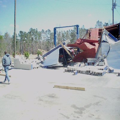
Damage Photos
 |
 |
 |
 |
| Steeple down on a church between Latta and Temperance Hill in Dillon County South Carolina. | Damage in Latta from an EF-0 tornado | Damage near Cartersville South Carolina | Workshop destroyed east of Cartersville South Carolina. |
 |
 |
 |
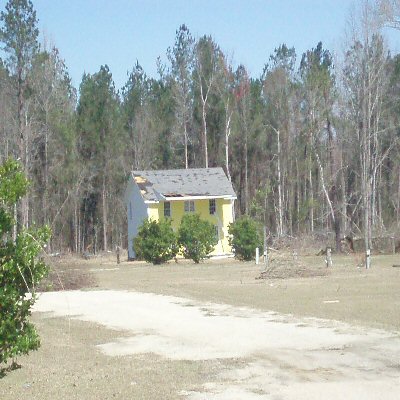 |
| Workshop destroyed east of Cartersville South Carolina. | Damage at an Exxon gas station from an EF1 as well...on I-95 exit 150 | More damage at the Exxon Station near Sardis in South Carolina on I-95 exit 150 | Building damage near Sardis South Carolina. |
Maps of Tornado Tracks and Damage
 |
 |
 |
 |
| Map of Tornado Path and Damage across Columbus County, NC | Map of Tornado Path and Damage across Pender County, NC | Map of Tornado Path and Damage across Dillon County, SC | Map of Tornado Path and Damage across Florence County, SC |
 |
 |
 |
| Map of Tornado Path and Damage across Horry County, SC | Map of Tornado Path and Damage across Williamsburg County, SC | Map of Tornado Path and Damage across Williamsburg County, SC |
Forecasts
Local Forecasts
Marine
Tropical
Graphical
Aviation
Rain and Rivers
Fire Weather
Discussion
Beach, Rip Current and Surf
Rip Current Risk
Surf Forecast
Coastal Flood
Weather Activity Planner
Forecast Graph/Tab/Text
Model Guidance
Hazards
Mobile Weather
Briefing Page
Local Hazards
Hazardous Weather Outlook
Latest Briefing
Social Media Feeds
EM Briefing
NOAA Weather Radio
Submit Storm Report
Current Conditions
Marine Obs (List)
Observations Map
Satellite
Marine Obs (Map)
Local Observations (List)
Regional Temps and Precipitation
Daily Temp and Precip Summary
Radar
NWS Wilmington Radar
Southeast Regional Radar
Enhanced National Radar
National Radar
Past Weather and Hydrology
Local Climate Records
Climate Plots
Local Hydro Information
Rainfall and Rivers
Past Significant Events
Weather History Calendar
US Dept of Commerce
National Oceanic and Atmospheric Administration
National Weather Service
NWS Wilmington, NC
2015 Gardner Drive
Wilmington, NC 28405
(910) 762-4289
Comments? Questions? Please Contact Us.


 Coastal Flood