A Dynamic mid-latitude storm system moved across the area on Tuesday March 4, 2008 and off to the northeast through the early morning hours of Wednesday March 5, 2008.
Shortly after 8 pm, Things started to get going with a Special Marine Warning for the waters off of Cape Fear. The storm offshore was approaching Brunswick County just before 9pm at which time a severe thunderstorm warning was issued for Brunswick county. The activity diminished in intensity around 10 pm for a bit. Then another strong storm developed over the coastal waters in AMZ270 by 10:15 pm and a Special Marine Warning was issued for AMZ270. Another storm intensified over the waters east of Brunswick County and another Special Marine Warning is issued for AMZ252 and AMZ254 shortly before 11 pm. As this occurred...and considering the storms were moving at a crisp 45 miles per hour to the north...northeast a severe thunderstorm warning was issued for Brunswick County. At 11 pm, the warnings continued for the coastal waters and Brunswick County. The last severe thunderstorm warning of the evening was issued, for portions of Bladen and Robeson counties at 11:05 PM.
Activity also began to focus farther inland with a severe thunderstorm warning for Florence and Darlington Counties issued shortly after 11 pm. The intense storms inland prompted a severe thunderstorm warning for Dillon and Marlboro counties at 10:23 pm. A tornado warning was also issued for Pender County as well as another special marine warning. The last special marine warning of the evening was issued for the outer waters at 12:34 AM.
 |
 |
 |
 |
|
GFS Model showing Surface Pressure and Precipitation depicting cold front. The cold front was forecast to move into the western counties of the Wilmington NWS area of responsibility late Tuesday and off the coast by Wednesday morning. |
Radar Reflectivity loop showing storms with warnings overlaid. |
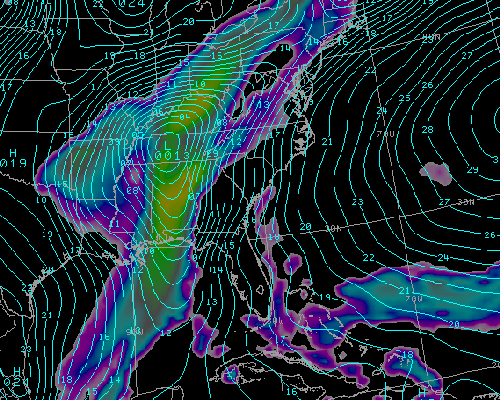
GFS Model winds at 925 mb. Strong winds were a primary concern with this system. This image shows 925 millibar winds...which are approximately 3000 feet above the surface. The winds were forecast to intensify to around 60 knots by Tuesday evening as they moved over the Cape Fear Region. |
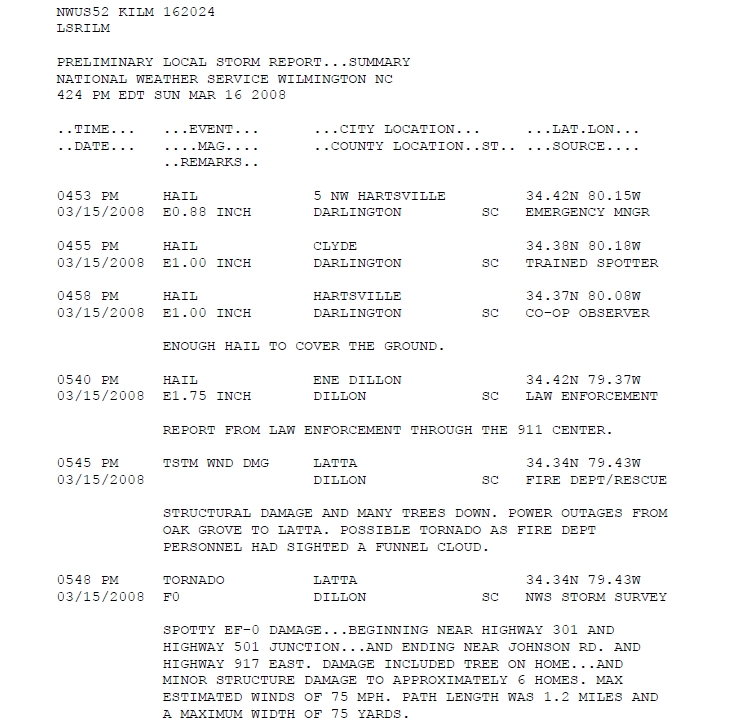
Summary of Local Storm Reports |


 Coastal Flood