Tornado in Mollie community of Columbus County, North Carolina
Strong straight-line winds confirmed in Loris, South Carolina
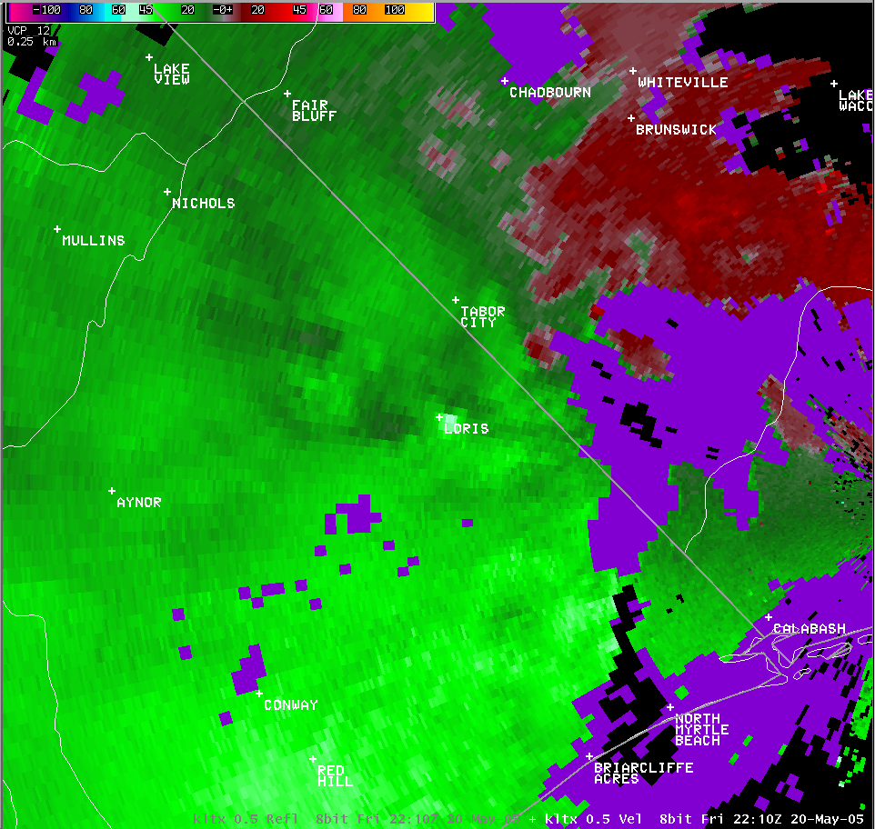
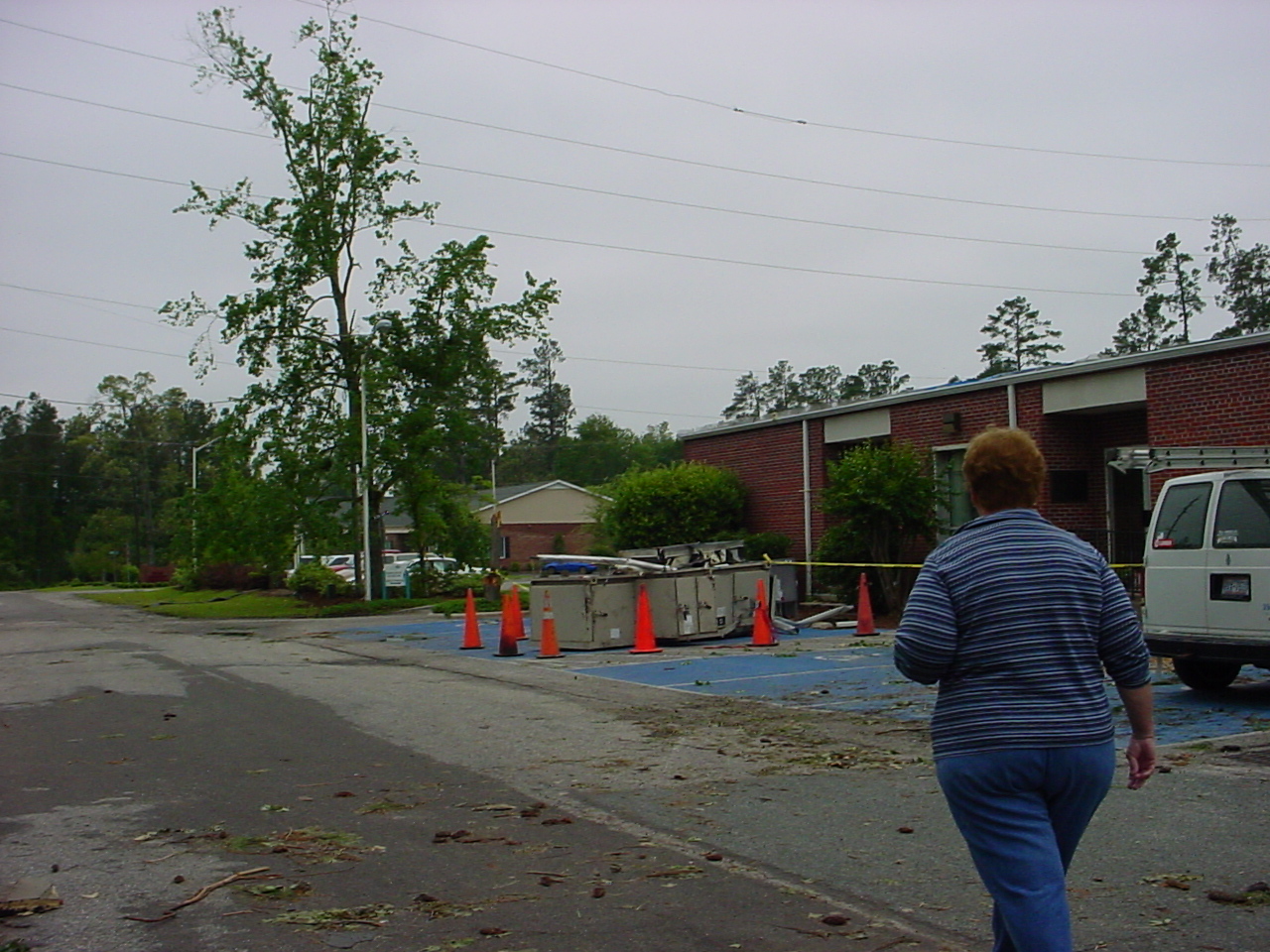
 Between 6:00 and 6:05 pm, a downburst of strong straight-line winds impacted the town of Loris in northwestern Horry County causing damage estimated at just under a million dollars to the Loris Community Hospital. Additional damage occurred to some surrounding buildings and vehicles with. Based on damage observed peak wind speeds reached an estimated 90 mph in the vicinity of the hospital. The strong winds from the downburst traveled approximately one mile through town toward the north-northeast. The roof was torn off the old Loris town jail and metal sheet roofing was removed from other buildings in town. Away from the hospital, winds were estimated to have peaked at around 60 mph. An unofficial television station-operated weather station located at the town police department only recorded a peak wind of 39 mph however.
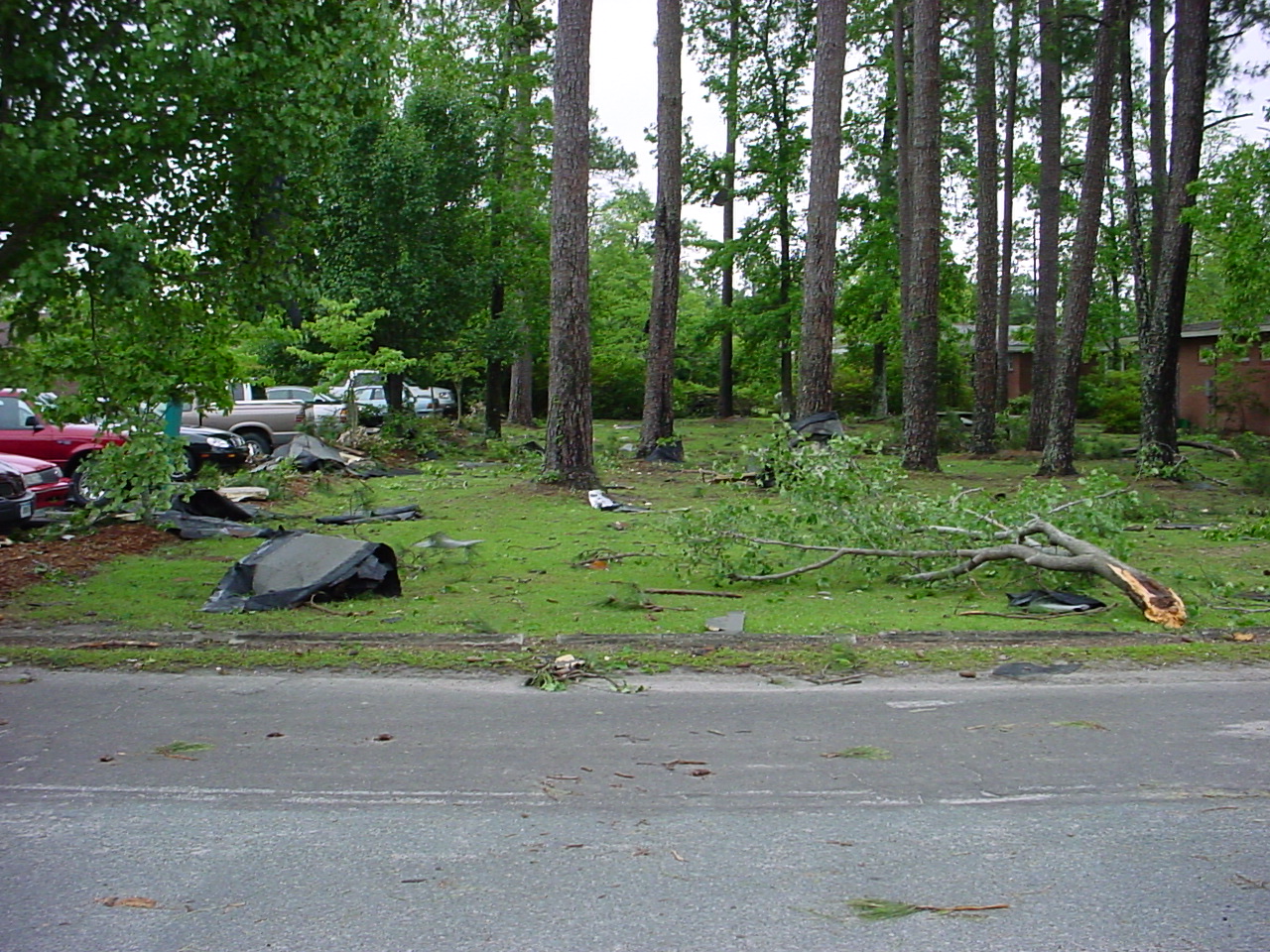
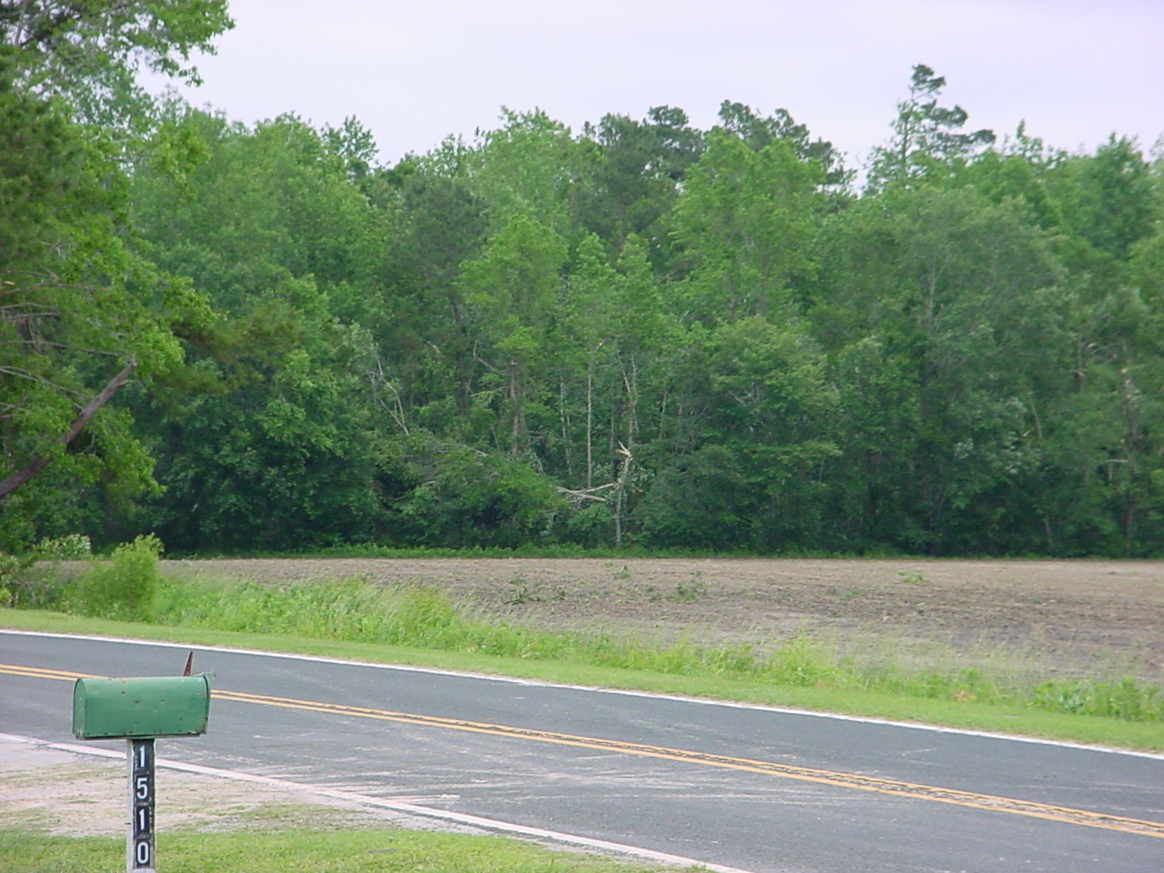
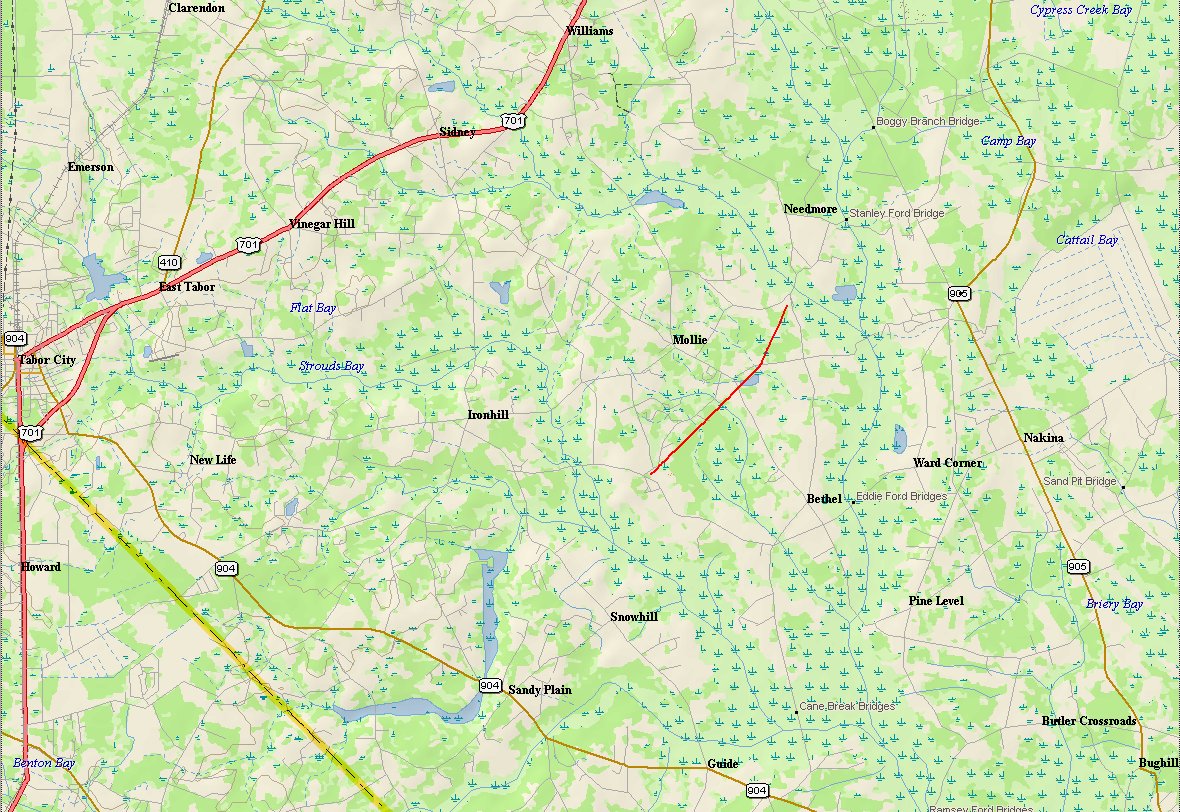 As the storm moved north and crossed into North Carolina, it produced a tornado which touched down in the Mollie community, approximately 6 miles east of Tabor City. Eyewitness reports indicate the tornado was on the ground for several minutes between 6:10 and 6:15 pm. This tornado tracked generally north-northeastward and cut a path 2 2/3 miles in length with a width of around 50 yards, crossing several county roads, farm fields, and wooded areas. The tornado produced three spots of F1 damage along its path, with winds estimated between 73 and 112 mph. Damage occurred to several homes, vehicles, outbuildings, and sheds, and to a large number of trees. An aerial survey was conducted over the area which was tremendously helpful in establishing the linear extent of the damage and identifying additional areas where F1 damage occurred deep in the woods.
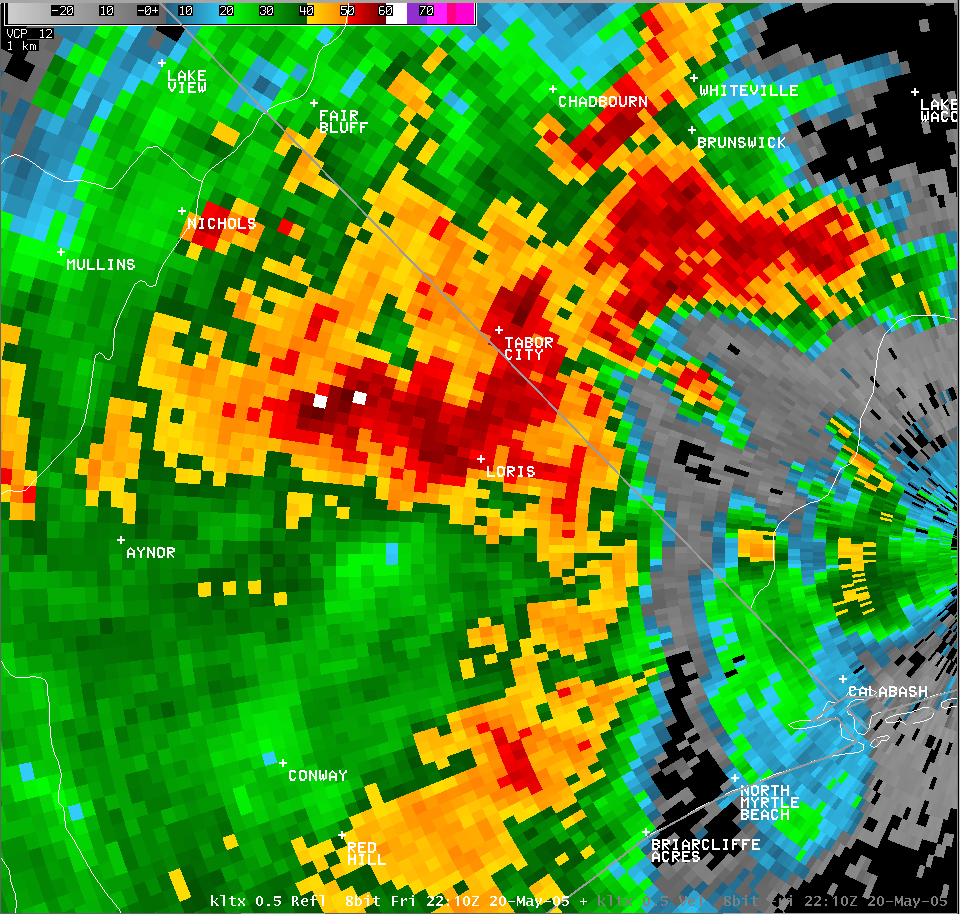


 Coastal Flood