NWS Wilmington, NC
Weather Forecast Office
|
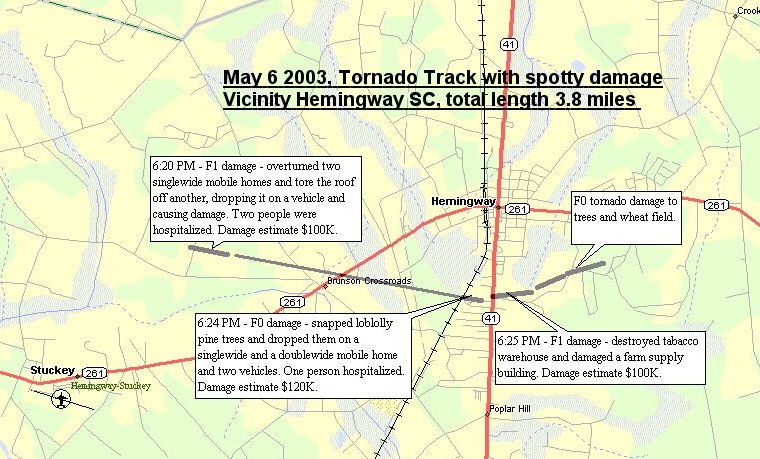
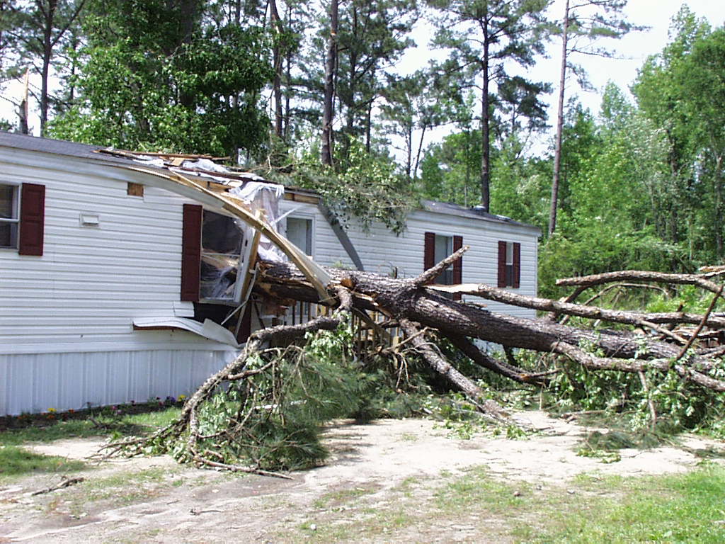
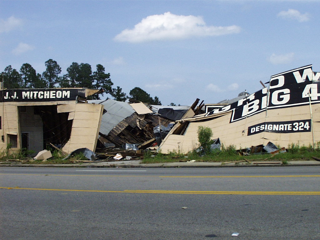
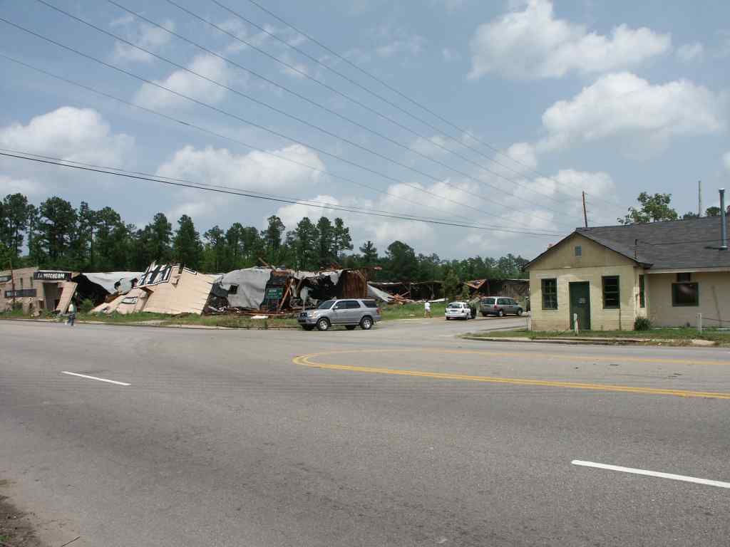
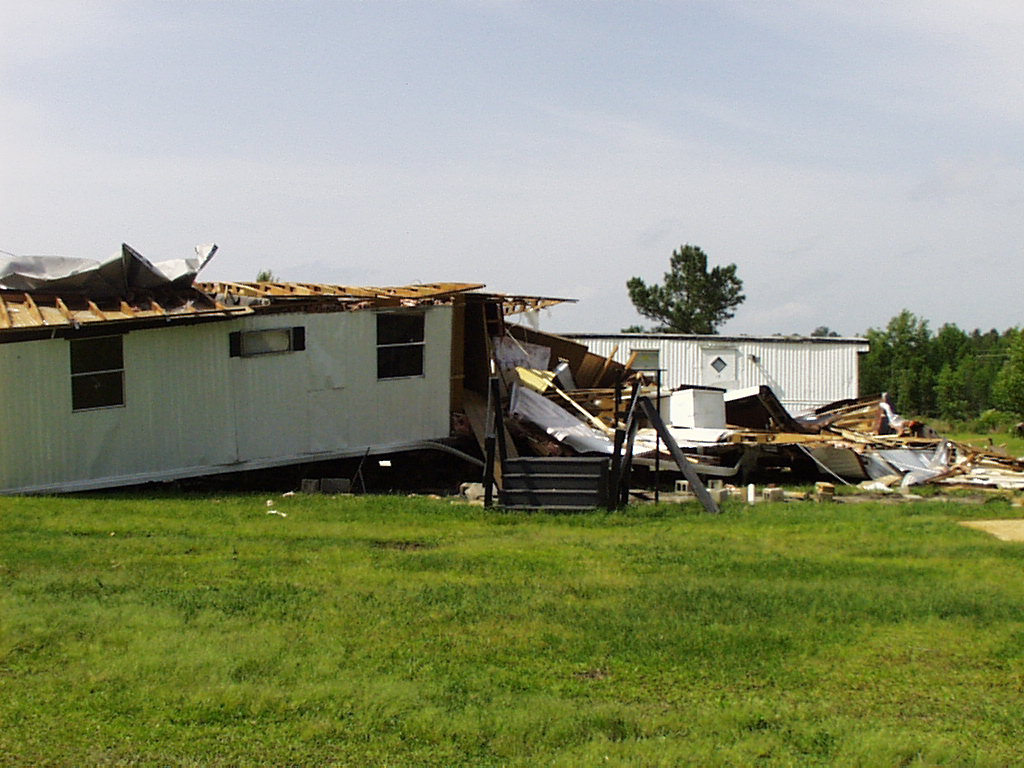
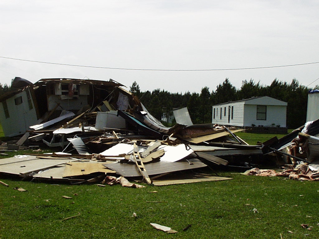
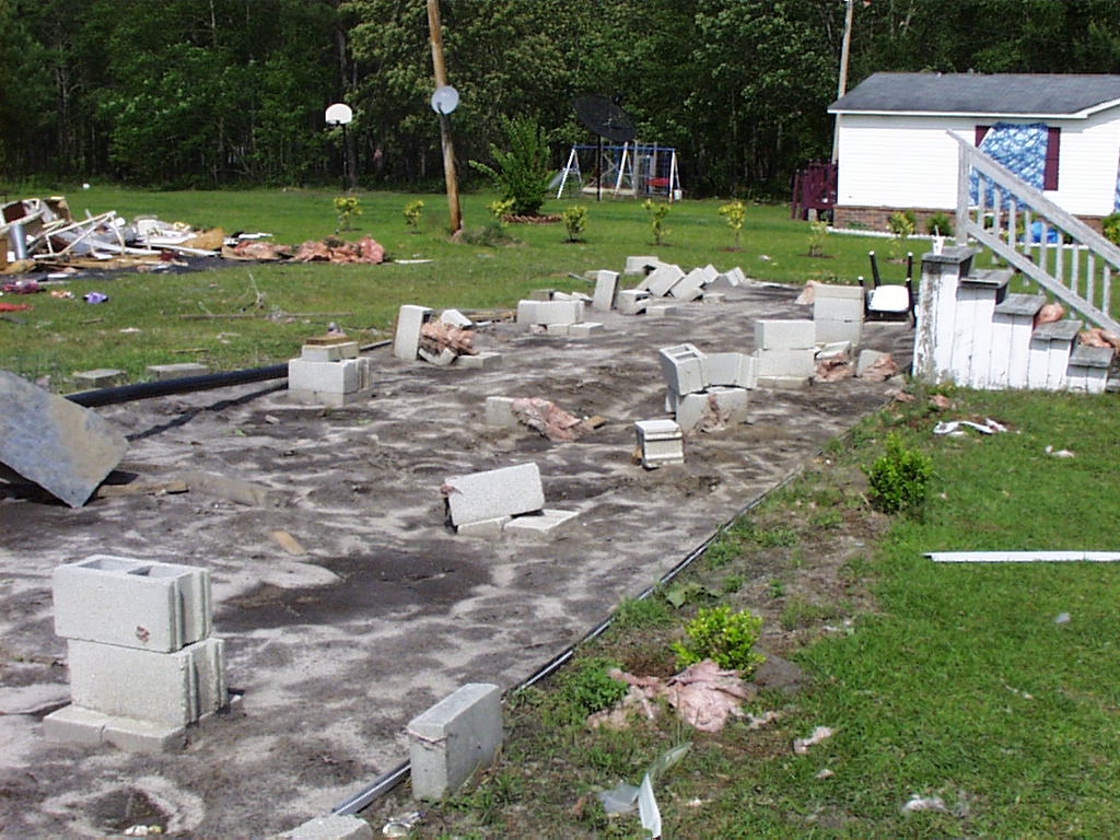
During the afternoon of May 6, 2003, a Mesoscale Convective System (MCS) developed and strengthened over Northern Georgia and moved east at roughly 40 knots. The combination of a convective outflow boundary, an upper level disturbance, an unstable airmass provided the necessary ingredients for supercell thunderstorm development over South Carolina.
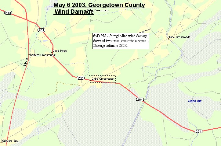
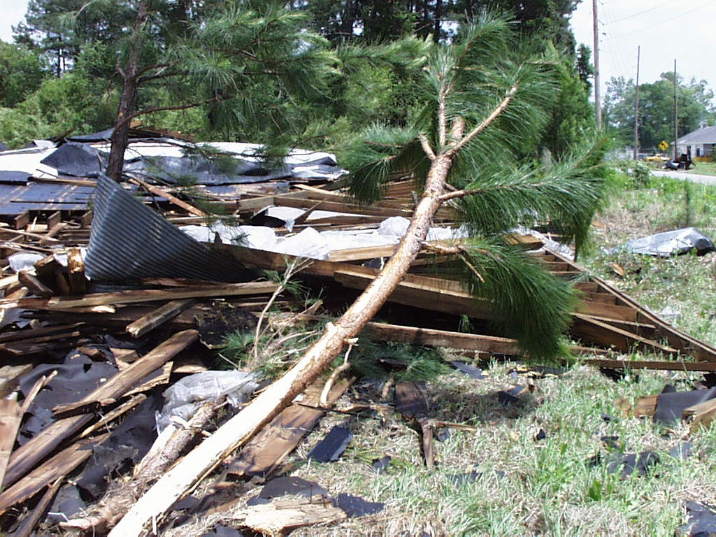
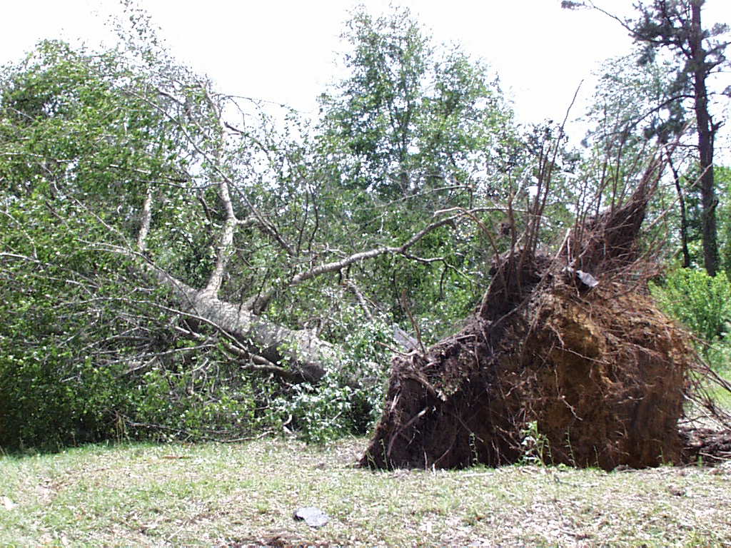
An F1 Tornado touched down in Williamsburg County, and there was wind damage in parts of Georgetown and Horry Counties. Click on the maps below for details about the event
|
Forecasts
Local Forecasts
Marine
Tropical
Graphical
Aviation
Rain and Rivers
Fire Weather
Discussion
Beach, Rip Current and Surf
Rip Current Risk
Surf Forecast
Coastal Flood
Weather Activity Planner
Forecast Graph/Tab/Text
Model Guidance
Hazards
Mobile Weather
Briefing Page
Local Hazards
Hazardous Weather Outlook
Latest Briefing
Social Media Feeds
EM Briefing
NOAA Weather Radio
Submit Storm Report
Current Conditions
Marine Obs (List)
Observations Map
Satellite
Marine Obs (Map)
Local Observations (List)
Regional Temps and Precipitation
Daily Temp and Precip Summary
Radar
NWS Wilmington Radar
Southeast Regional Radar
Enhanced National Radar
National Radar
Past Weather and Hydrology
Local Climate Records
Climate Plots
Local Hydro Information
Rainfall and Rivers
Past Significant Events
Weather History Calendar
US Dept of Commerce
National Oceanic and Atmospheric Administration
National Weather Service
NWS Wilmington, NC
2015 Gardner Drive
Wilmington, NC 28405
(910) 762-4289
Comments? Questions? Please Contact Us.


 Coastal Flood