National Weather Service United States Department of Commerce

Winter Storm to Track From the West Coast Across the Upper Midwest & Northeast Through this Weekend

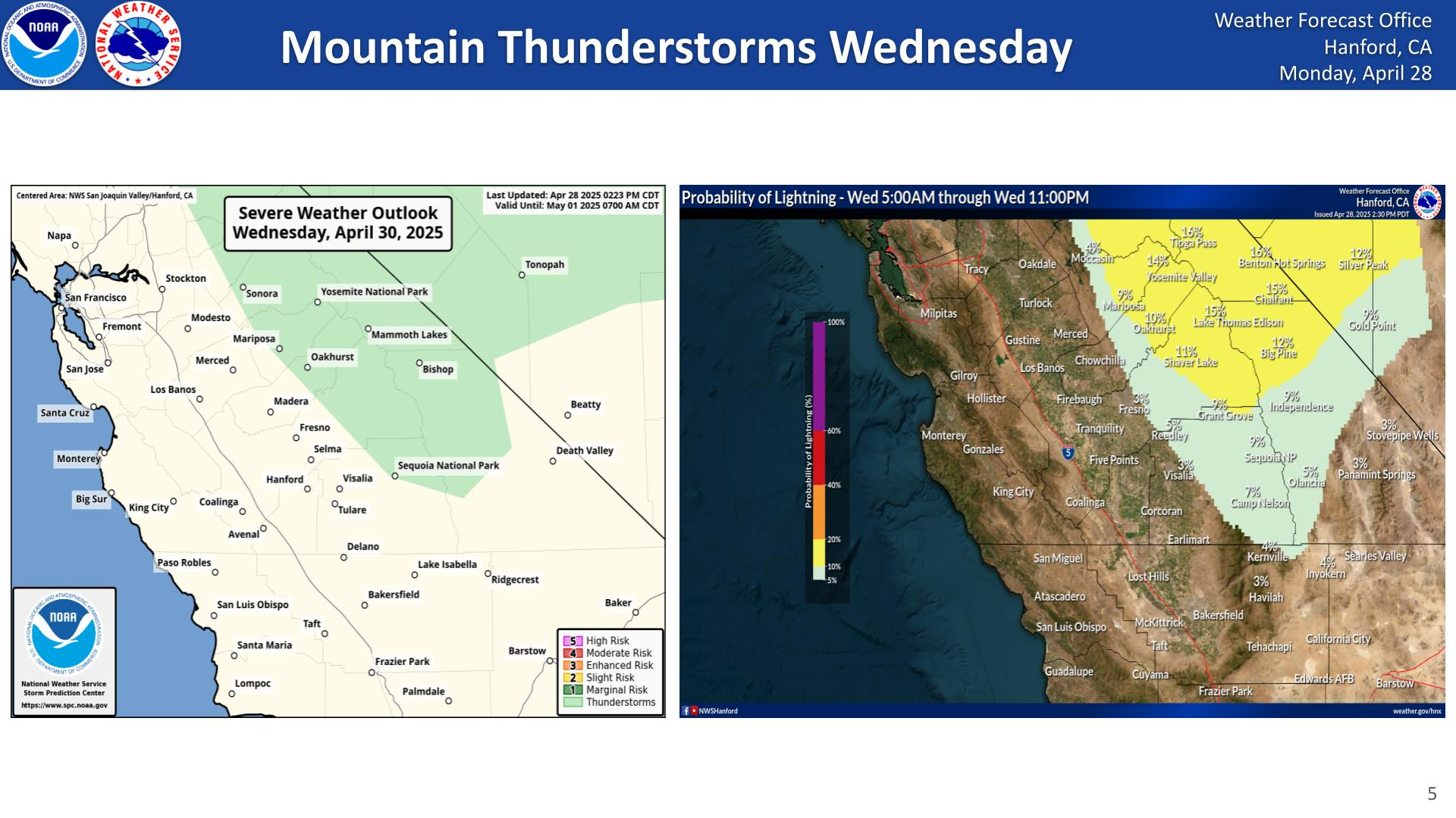
A Pacific storm will bring strong winds, heavy rain, and mountain snow from the Sierras to Rockies on Friday. The storm will then track east through the Midwest producing heavy snow from the Dakotas to the Great Lakes on Saturday. An icy wintry mix is expected across the northern Mid-Atlantic states Saturday night. Heavy snow will likely impact the Northeast Saturday night into Sunday. Read More >

Click a location below for detailed forecast.

Last Map Update: Sat, Feb 8, 2025 at 5:50:41 am PST

Temperatures are expected to drop below the freezing mark across rural locations in the San Joaquin Valley on Sunday morning. A Freeze Warning is in effect for the San Joaquin Valley from 100 AM PST Sunday until 900 AM PST Sunday.
Temperatures are likely to drop below the freezing mark across rural locations in the San Joaquin Valley again on Monday morning.
How cold it gets at night and the duration those minimum temperatures stay has a impact on what product is issued. As temperatures reach the freezing mark, frost will begin to occur over the landscape. If temperatures are able to drop to the freezing mark and below, a freeze will occur. The severity of the freeze will depend on the duration of temperatures at or below 32 degrees.
A potentially strong winter storm is expected to impact central California between Wednesday and Friday. This is anticipated to be a cold storm with low snow levels and has the potential to impact travel in the Sierra foothills and along the major Kern County passes. The map above shows the probability of an inch or more of liquid precipitation between 400 AM PST Wednesday and 400 AM PST Friday.


Text Product Selector (Selected product opens in current window)