National Weather Service United States Department of Commerce


Winter Weather Information

Storm Total Snowfall Forecast

Storm Total Ice Forecast

Click for Latest Observed Snowfall Map  
Click image for full resolution forecast.
Storm Total Snow
Click image for full resolution forecast.
Storm Total Ice Accumulation
Active Watches/Warnings/Statements


Forecast Information for Preparation and Planning

 
Graphical Forecast
NDFD Forecast
 
National Forecast Maps
WPC Winter Forecast
 
Winter Weather Maps
WPC Winter Forecast
* For point specific forecasts, please return to the main page and see the map there.

Narrative Discussions
Area Forecast Discussion - Portland | Caribou | Boston | Burlington

National Forecast Discussions (national in scope)

Text Forecast Products
Point Forecast for selected Cities - Portland | Caribou | Boston | Burlington
Area Forecast for selected Zones (tabular) - Portland | Caribou | Boston | Burlington

Current Conditions and Information for Ongoing Storms

 
Northeast Radar
Northeast Radar
 
Satellite Imagery
Satellite Image
 
Current Observations Map
Satellite Image


Most Recent Storm Reports - PNS Product
Rain, Snow and Ice Reports - Portland | Caribou | Boston | Burlington

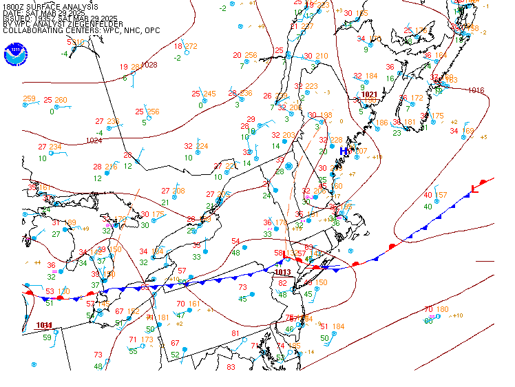
Most Recent Storm Reports - LSR Product
Rain, Snow and Ice Reports - Portland | Caribou | Boston | Burlington

Local/Regional Satellite
Eastern U.S. GOES Satellite Imagery - NOAA NESDIS
New England Sector GOES Satellite Imagery - NOAA NESDIS
Polar Orbit Imagery - NASA (not always available for NE U.S.)

Local/Regional Radar
Boston,MA Radar - NWS
Caribou, Maine Radar - NWS
Portland, Maine Radar - NWS
Northeast Regional Radar - NWS

Surface Analysis Maps
New England Surface Analysis (fronts and pressure) - NWS
Other U.S. Surface Analysis Maps (with help pages on symbols) - NWS

Upper Level Analysis Maps and Data
Portland Weather Balloon Data Plot (00 and 12 UTC only) - NWS
Caribou Weather Balloon Data Plot (00 and 12 UTC only) - NWS
Other U.S. Weather Balloon Data Plot - UCAR

Weather Calculators
Wind Chill Calculator and Information

Post Event Information

 
Latest Observed Snowfall
Latest Observed Storm Total Snow
 
Regional Maps
Storm Total Snow Forecast
 
National Maps
Storm Total Snow Forecast
Local Data...

Most Recent Storm Reports
Rain, Snow and Ice Reports - Portland | Caribou | Boston | Burlington
Storm Damage and Impact Reports - Portland | Caribou | Boston | Burlington
CoCoRaHS Daily Precipitation Summary - Portland
Daily Hydrologic Observations - Portland | Caribou | Boston | Burlington

*Local Storm Reports and Public Information Statements will contain a summary information for short period of time after a storm.

 
Observed Precipitation and Snowfall Graphics

Local Archive Maps and Text Products

Northeast Current 24-hour Snowfall Map (Updated Daily)
Northeast One Week Archive of Daily Snowfall Maps (Updated Daily)
Northeast Current Snow Depth Map (Updated Daily)
Northeast One Week Archive of Daily Snow Depth Maps (Updated Daily)

Liquid or Liquid Equivalent Precipitation Graphics
Northeast Current 24-hour Liquid Precipitation Map (Updated Daily)
Northeast One Week Archive of Liquid Precipitation Map (Updated Daily)
Northeast Current Snow Depth Map (Updated Daily)
Northeast One Week Archive of Daily Snow Depth Maps (Updated Daily)
 

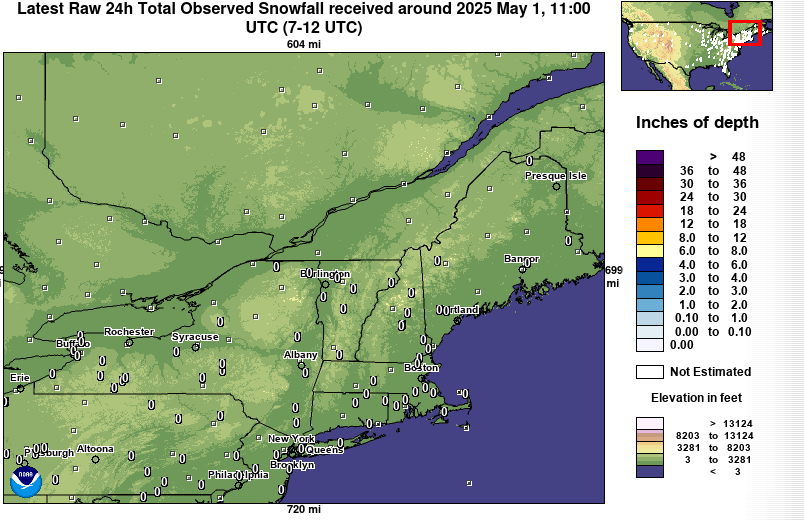
Other Data and Graphics
National Operational Hydrologic Remote Sensing Center (NOHRSC) -site for archive data
National Climatic Data Center Snowfall Maps