|
|
|
Rhinelander METAR |
|
|
|
|
|
LAMP Probabilities and Thresholds for Flight Categories
|
|
|
Rhinelander Surface-20,000 Ft Wind Forecast for the Next 18 Hours |
|
| This graphic displays forecast vertical wind profiles over the selected location from the surface to 20,000 feet AGL. Forecast winds are displayed at 1-hour intervals out through 18 hours. The graphics is updated based on the latest run of the model. Wind speeds are color-coded with wind speeds 28-37kt displayed in blue, 38-47kt in pink and winds greater than 47kt in red. Wind direction is indicated by the staff using a 360° compass, where 180° indicates a south wind and 360° a north wind. The solid red line indicates the highest freezing level over time. | |
|
|
|
||
 |
 |
||
|
|
  Infrared - Band 13 Infrared - Band 13(click for larger image) |
|
|
|
|
|
||
|
|
Click image for bigger view & interactive page |
||
|
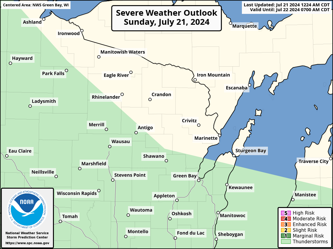
Today's Severe Thunderstorm Potential |
Today's Excessive Rainfall Potential |
||
|
Day 2 Severe Thunderstorm Potential |
Day 2 Excessive Rainfall Potential Click image for full WPC outlook and discussion |
||
Day 3 Severe Thunderstorm Potential Click image for full SPC outlook and discussion Click image for full SPC outlook and discussion |
Day 3 Excessive Rainfall Potential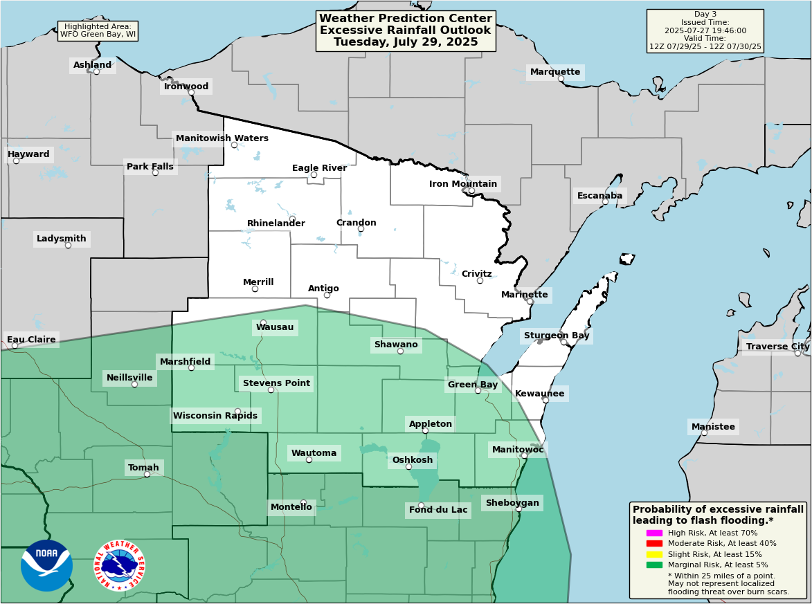 Click image for full WPC outlook and discussion |
||
Aviation Weather
Rhinelander METAR
Rhinelander TAF
Rhinelander Impacts METAR Board
Current and Previous 72 hours of Surface Observations
Forecast Maps
Aviation Forecast Discussions
More Aviation Weather Information
Aviation Weather Center
General Weather and Forecasts for Rhinelander
Latest Weather and 24-hr Summary
Narrative 7-Day Forecast
Hourly Forecast - Graphical
LAMP Model Graphical Forecast
Severe Weather Potential
Hazardous Weather Outlook - For Northeast Wisconsin
Special Weather Statements - For Northeast Wisconsin (issued as needed)
More Severe Weather Information
Satellite Imagery
Visible Satellite Loop
Infrared Satellite Loop
Nighttime Fog and Low Clouds
Midwest and U.S. Satellite Images
GOES Satellite Imagery
Radar Imagery
Regional Radar
Other Area Radars
Additional Information
NWS Green Bay Facebook
NWS Green Bay X