Thunderstorms, some severe, may produce heavy to excessive rainfall over portions of the Central/Southern Plains, Mississippi Valley and Southeast. Dry and windy conditions will pose an elevated fire weather risk over parts of western Florida. Read More >
Heat and Possible Thunderstorms This Afternoon
| Current Watches, Warnings, and Advisories | Current Radar Image - Click for loop of NE Wisc radar |
 |
 |
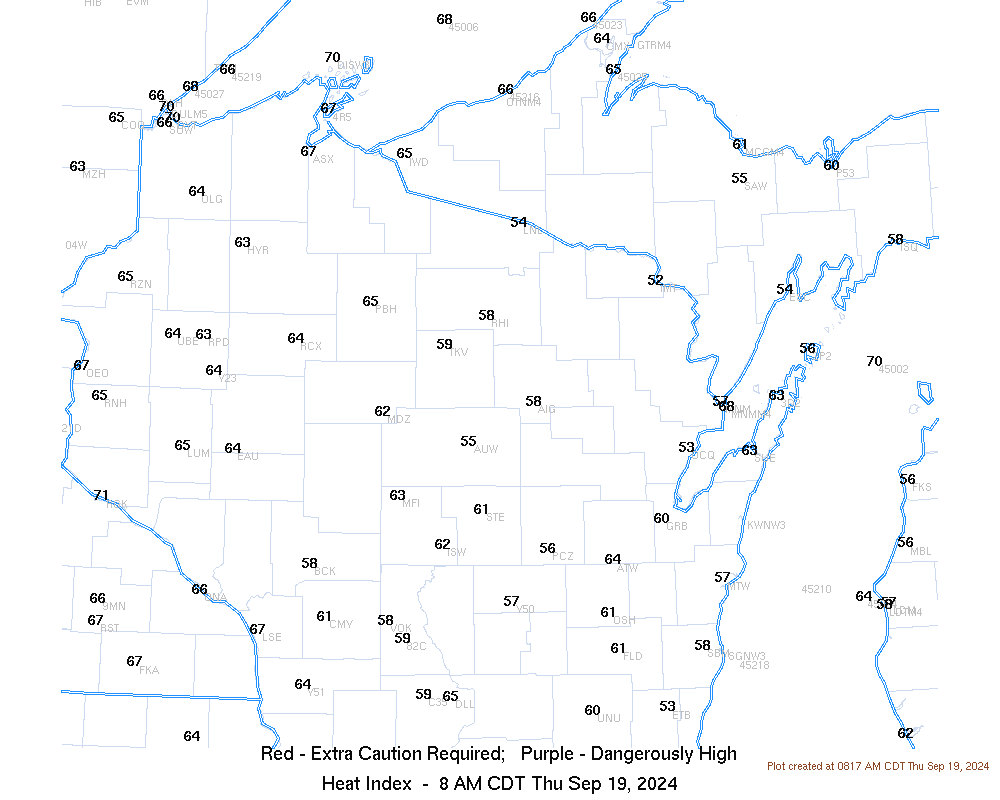
High temperatures this afternoon in the middle 80s to lower 90s will combine with high humidity to result in heat index values ranging from 90ºF to 100ºF. Stay cool, especially during the afternoon hours when temperatures will be at their peak.
| Current Heat Index Values - Click for larger image |
 |
HEAT SAFETY TIPS:
| Heat Exhaustion | Heat Stroke | |
IF YOU EXPERIENCE ANY OF THESE SYMPTOMS, MOVE INSIDE WHERE IT IS COOL AND SEEK MEDICAL ATTENTION IS NEEDED |
IF YOU EXPERIENCE ANY OF THESE SYMPTOMS, SEEK IIMMEDIATE MEDICAL ATTENTION! |
|
In addition to the heat, there is the possibility of strong thunderstorms this afternoon and evening as a cold front slides across the state. If you plan on being outdoors this afternoon or evening make sure to keep up to date on the weather and have a plan if severe thunderstorms do develop!
| Severe Weather Outlook for Today Click map for more information |
|
|
Here are some additional links to help monitor the weather: