Green Bay, WI
Weather Forecast Office
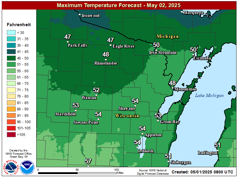
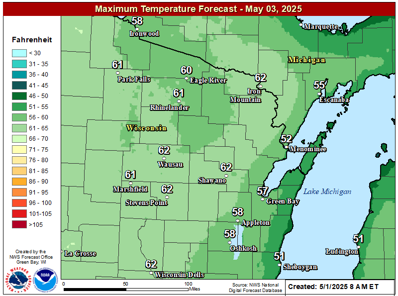
Another unseasonably warm day is expected across much of central, northeast and east-central Wisconsin today with high temperatures well into the 80s. A few record high temperatures are possible this afternoon, especially across northeast Wisconsin. It will be somewhat cooler across north-central Wisconsin due to more cloud cover and the chance for showers and thunderstorms during the afternoon hours. On Tuesday, there will be a wide range of temperatures as a cold front moves slowly eastward across the area. The front will bring a chance of showers and thunderstorms to the area. On Wednesday, temperatures will be close to normal. Even cooler weather is expected on Friday behind another cold front. Frost may be possible across the north Saturday morning.
Click on the image below for a closer look at high temperatures in your area.
| High Temps | Highs Temps | High Temps |
| Today | Tuesday | Wednesday |
 |
 |
 |
US Dept of Commerce
National Oceanic and Atmospheric Administration
National Weather Service
Green Bay, WI
2485 South Point Road
Green Bay, WI 54313-5522
920-494-2363
Comments? Questions? Please Contact Us.

